
lovethailand home >North Travel Attractions >Nan Travel Attractions > 50 Best Places to Visit in Nan Northern Thailand
TL;DR: 50 Best Places to Visit in Nan Northern Thailand, open Daily Opening Hours: 08:00 – 18:00.

50 Best Places to Visit in Nan Northern Thailand
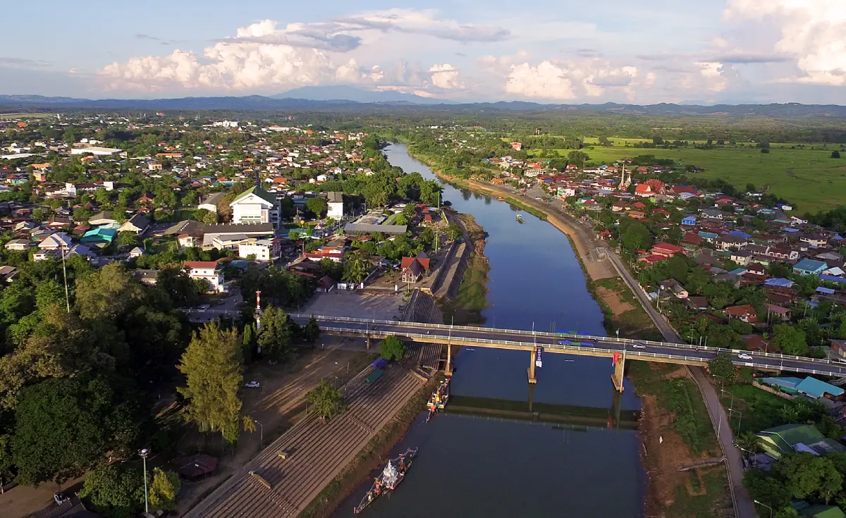
50 Best Places to Visit in Nan: Must-See Attractions in Northern Thailand Nan is one of northern Thailand’s most distinctive travel destinations, known for its compact old town, Lanna–Tai Lue temples and mural paintings, high mountains, watershed forests, winding mountain roads, ancient salt wells, villages tucked into valleys, and local communities that continue to preserve their cultural identity. If you have only 1 day, begin with Wat Phumin, Nan National Museum, Wat Phra That Chang Kham Worawihan, and Wat Phra That Khao Noi. With 2–3 days, add Wat Phra That Chae Haeng, Pua District, Doi Phu Kha National Park, and Bo Kluea. Travelers with 4–5 days or more should extend the journey to Si Nan National Park, Na Noi District, the Bo Kluea–Sapan route, and the province’s more remote natural areas to experience Nan through its history, art and culture, nature, and mountain-community life.
Nan Province lies in the eastern part of northern Thailand and shares a border with the Lao People’s Democratic Republic. Most of the province consists of complex mountain ranges, while the Nan River has long served as the principal waterway supporting settlements and agricultural land. This geography has given Nan a distinctive combination of an old town in a river basin, watershed forests on high mountains, villages in narrow valleys, and travel routes that connect nature and culture in an unusually close way.
Nan’s history is closely associated with the Phu Kha dynasty, Pua, Woranakhon, and the later city of Nan before the region became connected with the wider political network of the Lanna Kingdom. Its location as a relatively isolated frontier city surrounded by mountains allowed Nan to develop its own artistic and cultural identity while absorbing influences from Lanna, Tai Lue, Sukhothai, and ethnic communities living in the highlands.
Central Nan is particularly suitable for exploring on foot or by bicycle because Wat Phumin, Wat Phra That Chang Kham Worawihan, Wat Ming Mueang, Nan National Museum, and the Khuang Mueang area are located close to one another. Travelers can spend half a day to a full day understanding the city’s history through temples, mural paintings, former royal residences, historic architecture, and everyday life in the old quarter.
Mural painting is one of the artistic legacies for which Nan is best known, particularly the celebrated “Pu Man Ya Man” or “Whisper of Love” mural inside Wat Phumin. Beyond their artistic beauty, murals in Nan’s temples function almost like visual records of past society, depicting clothing, relationships between men and women, markets, houses, trade, and the cultures of different ethnic communities.
Outside the city, Nan’s character shifts from temples and historic neighborhoods to high mountains. One of the province’s most popular scenic drives is the Pua–Doi Phu Kha–Bo Kluea route, where winding roads cross forested mountains, viewpoints, and highland communities before descending into Bo Kluea District, where the traditional craft of boiling mountain rock salt is still practiced.
Na Noi District and Si Nan National Park are another area that should not be overlooked. The region includes Doi Samer Dao, Pha Chu, the Nan River, and the distinctive Sao Din geological formations. Travelers who enjoy camping, stargazing, and sunrise viewpoints can make this part of Nan a major destination in its own right, especially during the cool season when temperatures are lower and visibility is often clearer.
Nan is also rich in community traditions and local craftsmanship, including Nam Lai woven textiles, Tai Lue fabrics, basketry, silverwork, mountain rock salt, and northern Thai cuisine with its straightforward but distinctive flavors. Local dishes include khao soi, nam prik ong, gaeng hung lay, sai ua, khanom jeen nam ngiao, and seasonal regional foods.
Geographically, Nan can be divided into several practical travel zones: Nan town and Phu Phiang for the old city, temples, and museums; Pua–Doi Phu Kha for mountains and Tai Lue culture; Bo Kluea–Sapan for valley communities, waterfalls, and mountain salt; Na Noi–Si Nan for Doi Samer Dao and the Sao Din formations; and Tha Wang Pha–Song Khwae–Chaloem Phra Kiat for communities, border landscapes, and the natural attractions of northern Nan.
Nan therefore appeals to many different kinds of travelers, including those interested in history, art, culture, nature, mountain road trips, photography, and Slow Travel. The province is not at its best when visitors rush from attraction to attraction simply to collect as many stops as possible. Nan is better experienced by spending enough time in each zone to understand the atmosphere, landscapes, and communities that give the province its distinctive character.

1. Wat Phumin is located in Nai Wiang Subdistrict, Mueang Nan District, within Nan’s historic old town. It is one of the province’s most important landmarks, celebrated for its cruciform viharn, historic mural paintings, and the famous “Pu Man Ya Man” or “Whisper of Love” mural, which has become one of the most recognizable cultural images associated with Nan.
Highlights: The cruciform viharn, 2 large Naga serpents, Tai Lue mural paintings, the Pu Man Ya Man mural, scenes of traditional Nan life, and a central old-town location from which several other attractions can easily be reached on foot.
Wat Phumin was originally known as “Wat Phrommin,” named after Chao Chetabut Phrommin, the ruler of Nan who commissioned the temple in 1596 (B.E. 2139). The name gradually evolved into Wat Phumin. Its status as a royal temple and its location near the heart of the old city demonstrate the important role it once played in the urban structure of Nan.
The temple’s viharn is highly unusual. It was constructed in a cruciform plan in which the viharn and ordination hall share the same building. The structure appears to rest on the backs of 2 enormous Naga serpents whose bodies extend along the stairways on either side, giving the temple an architectural form unlike most other Lanna temples.
The murals inside are one of the temple’s essential highlights. In addition to Buddhist stories and Jataka tales, the paintings portray everyday people, traditional clothing, houses, courtship, trade, and relationships among different ethnic communities. The walls can therefore be read almost as a social document recording life in Nan during an earlier period.
The celebrated Pu Man Ya Man painting depicts a Tai Lue man leaning toward a young woman as if whispering into her ear. The expressions, gestures, and clothing are rendered with exceptional character. The image has been widely interpreted as a romantic scene and has become a contemporary symbol of Nan, although visitors seeing the original should also observe how it relates to the surrounding murals and the larger visual narrative of the viharn.
Wat Phumin is suitable for virtually every type of traveler, especially visitors interested in history, art, culture, and photography. From the temple, it is easy to continue on foot to Nan National Museum, Wat Phra That Chang Kham Worawihan, Wat Ming Mueang, and the Khuang Mueang area without needing a vehicle.
Open Days: Daily Opening Hours: 08:00 – 18:00
Getting There: Wat Phumin is located in the heart of Nan’s old town in Nai Wiang Subdistrict. Visitors can arrive by car, motorcycle, local taxi, bicycle, or simply walk from Nan National Museum and Khuang Mueang.
Map (GPS):Open Google Maps – Wat Phumin

2. Wat Phra That Chae Haeng is located in Muang Tuet Subdistrict, Phu Phiang District, on a hill east of the Nan River. It is a royal temple, one of Nan’s most important sacred sites, and the zodiac relic temple traditionally associated with people born in the Year of the Rabbit.
Highlights: The golden Phra That Chae Haeng relic pagoda, its association with the Year of the Rabbit, Naga stairways, the main viharn, Thong Changko gilding, Lanna–Nan art, and the Hok Peng festival held in worship of Phra Maha That Chao Phu Phiang Chae Haeng.
The temple stands in Phu Phiang, an area directly associated with the historical relocation of Nan’s political center from Pua to the Nan River basin. The district is therefore much more than a modern suburban area; it forms part of the historical foundation of early Nan.
The principal relic pagoda takes the form of a bell-shaped chedi influenced by Lanna architectural traditions. Its exterior is covered with Thong Changko metalwork, creating a brilliant golden appearance when sunlight strikes the surface. Around the base and other elements of the chedi are finely executed details that reflect the craftsmanship for which Nan is known.
The approach to the temple is marked by Naga figures extending along the staircase. Once visitors reach the upper area, the relic pagoda becomes the visual and spiritual center of the complex. The arrangement of the buildings and the elevation of the site reinforce the prominence of the chedi both as a religious monument and as part of the surrounding landscape.
One of the temple’s most important traditions is the Hok Peng festival honoring Phra Maha That Chao Phu Phiang Chae Haeng. This major Nan merit-making event brings together worship, religious ceremonies, and community activities, demonstrating the continuing relationship between the sacred monument and the living Buddhist traditions of local residents.
Wat Phra That Chae Haeng is ideal for travelers who want to make merit, study Buddhist architecture, and learn about Nan’s history. It can easily be combined in a 1-day itinerary with Wat Phumin, Nan National Museum, and Wat Phra That Khao Noi.
Open Days: Daily Opening Hours: 06:00 – 18:00
Getting There: From Nan town, cross the Nan River into Phu Phiang District and continue toward Muang Tuet Subdistrict following the signs for Wat Phra That Chae Haeng. The journey from the city center is relatively short.
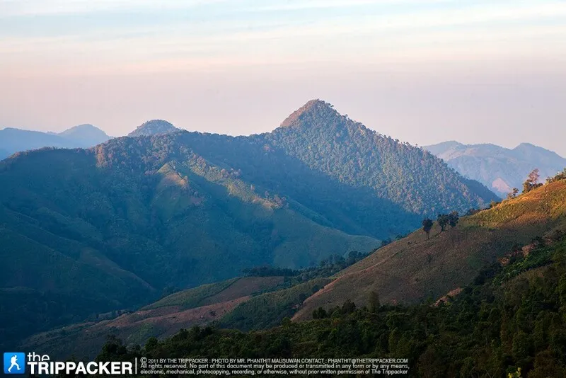
3. Doi Phu Kha National Park is one of the largest and most important national parks in Nan Province, covering mountainous areas across several districts. The Pua–Bo Kluea road passes through some of the park’s most accessible areas. Major attractions include highland forests, rare plant species, scenic viewpoints, trekking routes, waterfalls, caves, and highly diverse watershed ecosystems.
Highlights: Chomphu Phu Kha, Viewpoint 1715, hill evergreen forest, natural pine forest, nature trails, Doi Phu Wae, waterfalls and caves, and Highway 1256 connecting Pua and Bo Kluea through spectacular mountain scenery.
The park covers approximately 1,065,000 rai, or around 1,704 square kilometers, across several districts of Nan. This makes it one of northern Thailand’s major mountain forest areas. Vegetation ranges from hill evergreen and dry evergreen forest to mixed deciduous forest, dry dipterocarp forest, pine forest, and grassland.
The plant most closely associated with the park is the rare “Chomphu Phu Kha” tree, an important conservation species. Its pink flowers generally attract considerable attention early in the year, although the exact blooming period changes according to seasonal weather conditions.
Viewpoint 1715 is one of the easiest major viewpoints to reach because it is located along Highway 1256. Visitors can see layers of mountain ranges and, under suitable conditions, drifting clouds or mist. Deeper inside the park are additional nature trails where travelers can explore local plant species and highland vegetation.
Travelers planning long-distance treks to Doi Phu Wae, waterfalls, caves, or more remote areas should contact park officers and plan in advance. Some routes require significantly more time, equipment, and preparation than simply stopping at roadside viewpoints.
Doi Phu Kha National Park is suitable for nature lovers, photographers, birdwatchers, hikers, and travelers who enjoy driving through mountain landscapes. It can be conveniently combined with Bo Kluea District, the Bo Kluea Rock Salt Wells, and Khun Nan National Park.
Getting There: From Nan town, take Highway 1080 to Pua District, then continue on Highway 1256 toward Doi Phu Kha National Park. The road contains numerous curves, steep climbs, and descents, so travelers should check their vehicle and the weather before setting out.
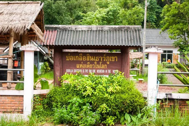
4. Bo Kluea Rock Salt Wells are located in Bo Kluea District amid the Luang Prabang mountain range. They are among Thailand’s best-known mountain salt-producing sites and remain closely connected with a traditional salt-boiling practice that continues to form part of everyday community life.
Highlights: Natural brine wells, traditional salt boiling, salt furnaces, mountain-community life, locally produced salt products, and the scenic route linking Doi Phu Kha, Bo Kluea, and Sapan.
What makes Bo Kluea remarkable is the presence of naturally salty groundwater high in the mountains, far from the sea. Local residents draw brine from the wells and boil it until the water evaporates, leaving salt crystals that can be used for cooking or processed into other products.
Salt was once one of Nan’s most important resources because it was essential both for cooking and food preservation. Historic salt-trading routes therefore connected communities in the mountains with towns, merchants, and surrounding regions across northern Thailand and neighboring territories.
Walking around the wells and salt-boiling sheds allows visitors to observe the production process directly, from drawing the brine to heating it until concentrated and finally collecting salt crystals from the pans. The method may appear simple, but it depends on practical experience and careful control of the heat.
Shops around the community sell cooking salt, herbal salt, spa products, and locally made souvenirs. Buying directly from community producers helps return tourism income to local residents.
The salt wells can be combined with Doi Phu Kha National Park, Khun Nan National Park, and Sapan Village. Travelers who want to experience the atmosphere of the mountain district without rushing should consider staying at least 1 night.
Open Days: Open during the tourism and salt-production season; salt production may pause during Buddhist Lent and the rainy season Opening Hours: Approximately 08:00 – 17:00
Getting There: From Pua District, follow Highway 1256 through Doi Phu Kha National Park to Bo Kluea District, or use Highway 1081 depending on your planned route. The roads are mountainous and winding, so allow sufficient travel time and avoid driving too fast.

5. Si Nan National Park lies in the southern part of Nan Province and covers mountains, forests, and areas along the Nan River. Well-known attractions include Doi Samer Dao, Pha Chu, Pha Hua Sing, and Sao Din Na Noi, making the park one of Nan’s major destinations for camping, stargazing, sea-of-mist views, and sunrise watching.
Highlights: Doi Samer Dao, Pha Chu, Pha Hua Sing, sea of mist, night skies, the Nan River, seasonal forest colors, and nature routes around Na Noi District.
Doi Samer Dao is largely responsible for the national park’s popularity. Its camping ground occupies an open mountain ridge with expansive views, making it ideal for watching sunset in the evening, observing stars on clear nights, and seeing sunrise and mist the following morning.
Pha Hua Sing features a rock formation that, from certain angles, resembles a lion’s head and has become one of the recognizable images of Doi Samer Dao. Pha Chu is another important viewpoint with wide views over the surrounding mountains and the Nan River.
The national park also protects important forest ecosystems and sections of the Nan River, so a visit need not be limited to camping. Travelers can explore natural landscapes and continue to the unusual Sao Din Na Noi and Khok Suea geological formations.
The cool season is the most popular period, particularly on weekends and public holidays when camping areas can become busy. Travelers should prepare warm clothing and check current camping or accommodation conditions before visiting.
Visitors who do not stay overnight can still come in the morning or evening for the views. However, spending a night at Doi Samer Dao allows travelers to experience sunset, stars, and sunrise as part of the same trip.
Open Days: Daily Opening Hours: Approximately 05:00 – 20:00
Getting There: From Nan town, travel south toward Wiang Sa and Na Noi districts, then continue toward Si Saket Subdistrict following signs for Si Nan National Park and Doi Samer Dao. Allow additional time for the final mountain-road section.
Map (GPS):Open Google Maps – Si Nan National Park

6. Nan National Museum is located on Phakong Road in Nai Wiang Subdistrict at the heart of Nan’s old town. The building was originally the Ho Kham, or residence of Nan’s ruler, and today houses collections relating to the province’s history, art, ethnic communities, and cultural heritage.
Highlights: The historic Ho Kham building, antiquities, Lanna artworks, objects associated with Nan’s former rulers, ethnic clothing and cultural collections, and the Black Elephant Tusk, one of the city’s notable historical objects.
The museum occupies a 2-story masonry building that combines Western architectural influence with local details. Its design reflects a period when the residences of regional rulers were being shaped by social and architectural changes during the later Rattanakosin era.
The exhibitions provide a structured introduction to Nan’s past, covering its rulers, religion, art, tools, household objects, and the ethnic groups whose communities contributed to the identity of the province.
Many of the museum’s important objects add useful context to later visits to temples and communities because travelers can connect artifacts seen here with mural paintings, religious buildings, houses, textiles, and forms of dress that remain visible elsewhere in the province.
In front of the museum is a well-known avenue of frangipani trees, a popular photography spot where branches and shade form a natural corridor. Visitors should nevertheless allow enough time for the exhibitions inside rather than treating the grounds only as a photo stop.
The museum stands opposite Wat Phra That Chang Kham Worawihan and close to Wat Phumin, making it especially convenient as part of a half-day walking route through Nan’s old town.
Open Days: Wednesday – Sunday Opening Hours: 09:00 – 16:00
Getting There: The museum is located on Phakong Road in Nai Wiang Subdistrict. Visitors can walk from Wat Phumin, Wat Phra That Chang Kham Worawihan, and Khuang Mueang. It is also easily reached by car or bicycle.
Map (GPS):Open Google Maps – Nan National Museum

7. Wat Phra That Khao Noi stands on the summit of Khao Noi hill in Chaiyasathan Subdistrict, Mueang Nan District, west of Nan city. It serves both as a sacred temple and as one of the city’s most important viewpoints, offering broad views across Nan town, the Nan River, and the mountains surrounding the Nan basin.
Highlights: The hilltop relic pagoda, Phra Buddha Maha Udom Mongkol Nantaburi Sri Nan, panoramic views of Nan city, the Naga staircase, and sunrise views over the urban basin.
The temple was founded during the reign of Chao Pu Khaeng in 1487 (B.E. 2030). Its principal chedi is constructed of brick and plaster and combines Burmese and Lanna artistic influences. Sacred hair relics of the Buddha are enshrined within the chedi, making it an important place of worship for local residents.
At the main viewpoint stands a large Buddha image in a blessing posture, facing down toward Nan city. The combination of the sacred image and the expansive landscape creates one of the province’s most distinctive compositions linking religion with geography.
Morning is an excellent time to visit because the light is soft and mist may occasionally linger over the basin. Late afternoon is also attractive as the changing light falls across the city and surrounding mountain ranges.
Visitors can drive up close to the upper temple area or choose to climb the staircase from below for a more traditional approach to the sacred hilltop site. Elderly visitors should choose the access method most suitable for their physical condition.
Because the temple is not far from the city center, it can easily be combined with Wat Phumin, Nan National Museum, Wat Phra That Chae Haeng, and Wat Phra That Chang Kham Worawihan in a single day.
Open Days: Daily Opening Hours: Open all day
Getting There: From central Nan, travel toward Chaiyasathan Subdistrict and follow the road up Khao Noi hill. Vehicles can reach an area close to the viewpoint, while visitors may alternatively climb the staircase from the lower entrance.
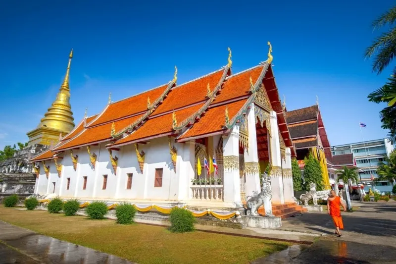
8. Wat Phra That Chang Kham Worawihan is located on Suriyapong Road in Nai Wiang Subdistrict, directly opposite Nan National Museum. Formerly known as “Wat Luang” or “Wat Luang Klang Wiang,” it was an important temple associated with the royal court of the former Nan principality.
Highlights: The relic chedi supported visually by 24 elephant figures, the main viharn, important Buddha images, Lanna art, and its location in the heart of Nan’s old town.
The temple was founded during the reign of Chao Pu Khaeng in 1406 (B.E. 1949) and historically played roles in both religion and governance. Important city ceremonies were once performed here, reflecting the temple’s status as both a spiritual and political center of the former principality.
The relic chedi is the temple’s most distinctive feature. Around its base are 24 half-bodied elephant sculptures that appear to support the structure, giving rise to the name “Chang Kham,” meaning “elephants supporting.” The design creates a powerful visual effect unlike that of more conventional Lanna chedis.
Within Buddhist and northern Thai cultural symbolism, elephants represent strength, stability, and the support of Buddhism. Their use around the base of the chedi therefore carries both artistic value and symbolic religious meaning.
The temple complex also contains a viharn and significant Buddha images that deserve attention alongside the chedi. Travelers interested in architecture can compare its artistic forms with Wat Phumin and Wat Phra That Chae Haeng during the same day.
Its central location makes the temple ideal for a walking route through Nan’s old town. Visitors can simply cross the road to Nan National Museum and continue on foot to Wat Phumin.
Open Days: Daily Opening Hours: 06:00 – 18:00
Getting There: The temple is located on Suriyapong Road in central Nan, directly opposite Nan National Museum. It is easily reached on foot, by bicycle, or by vehicle from accommodations in the city.

9. Khun Nan National Park is located in Bo Kluea District and protects mountain ranges, watershed forests, and highland community areas. It is particularly suitable for travelers who want to combine Bo Kluea, Sapan Village, waterfalls, and forest scenery within the same mountain itinerary.
Highlights: Sapan Waterfall, Huai Ha Waterfall, watershed forests, the Phu Fa Range, Khun Nam Wa Noi Range, Nam Wa Klang Range, Phi Pan Nam Range, and nature routes around Bo Kluea District.
The national park lies within a mountainous forest system connected with Doi Phu Kha. Several complex ranges cross the area at different elevations. Phi Pan Nam Peak in Dong Phaya Subdistrict rises to approximately 1,745 meters above sea level, creating highland climatic and ecological conditions in the upper sections of the park.
The park’s forests are particularly important as watershed areas. Numerous streams flow down from the mountains to surrounding communities, forming several waterfalls that carry water throughout much of the year. Sapan Waterfall is among the most popular of these natural sites.
Sapan Waterfall is located near Sapan Village and can be reached from the community without an especially long approach. The combination of forest and flowing water makes it particularly convenient for travelers staying overnight in the village.
Khun Nan National Park is best suited to travelers who prefer slower nature-based journeys. Rather than simply driving through the district, visitors can divide their time among Bo Kluea, waterfalls, local communities, and mountain roads.
During the rainy season the forest becomes especially green and waterfalls carry more water, although some routes may become slippery or subject to restrictions. The cool season is generally more comfortable for road trips and overnight stays. Visitors should check current park announcements before traveling.
Open Days: Daily Opening Hours: Approximately 08:00 – 16:30
Getting There: From Bo Kluea junction, follow Highway 1081 toward the national park area and Dong Phaya communities. A private car is the most practical option because attractions within the zone are dispersed along mountain roads.

10. Nan Riverside Art Gallery is located at kilometer 20 on the Nan–Tha Wang Pha Road in Bo Subdistrict, Mueang Nan District. Founded by Nan-born artist Winai Prabripoo, the private gallery has become one of the province’s most important spaces for contemporary art.
Highlights: Contemporary painting and sculpture, works by Thai and Nan artists, more than 13 rai of grounds, exhibition buildings surrounded by nature, and a peaceful setting beside the Nan River.
The gallery was designed so that art and nature are experienced together. Visitors do not simply move through enclosed exhibition rooms; they can walk between buildings, gardens, lawns, trees, and riverside spaces, creating an atmosphere very different from a conventional urban museum.
Exhibitions include works by Winai Prabripoo as well as numerous contemporary Thai artists. Works by local artists also explore ideas, memories, and identities connected with Nan Province.
The establishment of Nan Riverside Art Gallery contributed to Nan’s growing reputation as a city of art. It created a place where artists, audiences, students, and travelers could encounter one another outside the traditional context of temples and archaeological monuments.
The overall atmosphere is calm and unhurried, making the gallery particularly suitable for art lovers, photographers, design enthusiasts, and travelers looking for a quiet break from temple or mountain itineraries.
The gallery lies along the route from Nan town to Tha Wang Pha and Pua, so it is convenient to stop here before continuing north toward Pua and Doi Phu Kha, or while returning to Nan town.
Open Days: Thursday – Tuesday and public holidays; closed every Wednesday Opening Hours: 09:00 – 17:00
Getting There: From Nan town, follow the Nan–Tha Wang Pha road north for approximately 20 kilometers. The gallery is located beside the main road in Bo Subdistrict and is most easily reached by car or rental vehicle.

11. Wat Nong Bua is located in Ban Nong Bua, Pa Kha Subdistrict, Tha Wang Pha District, Nan Province. It is an important historic Tai Lue temple with outstanding artistic, historical, and cultural value, particularly for the mural paintings inside its viharn, which are considered among the most important examples of mural art in Nan.
Highlights: Tai Lue-style viharn, Panyasa Jataka mural paintings, depictions of everyday life in the past, Lanna Buddha images, an old busabok, and the Heuan Tai Lue Ma Kao traditional house, which helps preserve and explain the cultural heritage of the local community.
Wat Nong Bua stands within a Tai Lue community that continues to preserve a strong cultural identity. According to local oral history, the temple dates to around 1862 during the reign of King Rama IV and has developed alongside Ban Nong Bua community ever since.
The mural paintings inside the viharn are the temple’s most important artistic feature. They illustrate stories from the Panyasa Jataka together with detailed scenes of everyday life, including clothing, houses, transportation, weapons, and activities of local people. The paintings are therefore valuable not only as works of art but also as historical evidence of society in Nan during an earlier period.
The murals also reveal cultural links among Nan, Tai Lue, Lao Phuan, Lanna, and communities of the Mekong region. Details such as Nam Lai-patterned skirts and Tin Chok textiles provide a visual record of weaving traditions that remain an important part of Tai Lue cultural identity today.
Beyond the viharn, the temple compound includes Heuan Tai Lue Ma Kao, a traditional Tai Lue house displaying tools, household objects, and items associated with traditional occupations. This gives visitors a more concrete understanding of community life and makes Wat Nong Bua particularly rewarding for those interested in art, history, culture, and community-based travel.
Open Days: Daily Opening Hours: 07:00 – 18:00
Getting There: From Nan town, follow Highway 1080 toward Tha Wang Pha District. Near kilometer marker 40, turn left, cross the bridge, and continue for approximately 3 kilometers into Ban Nong Bua.
Map (GPS):Open Google Maps – Wat Nong Bua

12. Wat Phra That Beng Sakat is located in Moo 5, Ban Kaem, Woranakhon Subdistrict, Pua District. This historic temple is closely connected with the history of Pua, formerly known as Woranakhon, and is one of the important religious sites in northern Nan.
Highlights: Phra That Beng Sakat, a low Tai Lue-style viharn, teakwood shingle roofing, a Lan Xang-style entrance arch, and an elevated location overlooking the surrounding community and rice fields.
The temple’s history is associated with legends of Phaya Phu Kha and the establishment of Woranakhon, the historical foundation of present-day Pua District. Wat Phra That Beng Sakat therefore has significance beyond religion and forms part of the historical story of settlement in northern Nan.
The relic stupa is the spiritual center of the temple, while the viharn is designed in a traditional Tai Lue form known locally as the low “Tia Jae” style. Its two-level, two-tier roof and low, broad proportions are well adapted to the local climate and clearly demonstrate the practical architectural knowledge of local craftsmen.
The principal Buddha image is enshrined inside the viharn on a raised altar, surrounded by decorative elements reflecting a combination of Lanna, Tai Lue, and Lan Xang artistic influences. This makes Wat Phra That Beng Sakat particularly valuable for visitors interested in Nan’s vernacular religious architecture.
The temple stands on elevated ground with views across the agricultural landscape of Pua. During the rainy season, when the rice fields below become intensely green, the surrounding scenery is especially attractive. The temple can conveniently be combined with other cultural attractions in Pua District.
Open Days: Daily Opening Hours: 09:00 – 17:00
Getting There: Follow Highway 1256 into Pua District. Enter via the road opposite Woranakhon School, continue for approximately 200 meters, then turn left and travel another 200 meters to reach the temple.

13. Wat Ton Laeng is located in Moo 2, Chai Watthana Subdistrict, Pua District. The temple is especially notable for its Tai Lue architecture and is an important destination for travelers interested in the traditional viharn design found in Nan.
Highlights: Historic Tai Lue viharn, low multi-tiered roof, timber structure, wooden shingles, and architectural features developed in response to the climate and traditional lifestyle of local communities.
The viharn is distinguished by its low proportions and deeply sloping roof, arranged in multiple tiers. This form provides protection from rain and sunlight while creating the characteristic silhouette associated with Tai Lue religious architecture in Pua.
The interior has a quiet atmosphere, with relatively small openings and windows allowing only soft natural light to enter. Visitors interested in traditional craftsmanship should pay close attention to the timber structure, columns, roof framing, gables, and decorative elements surrounding the building.
Wat Ton Laeng is important both as a functioning community temple and as evidence of vernacular architectural knowledge. Its scale and design differ significantly from the monumental temples in Nan town, giving visitors an opportunity to understand another side of Buddhist architecture in the province.
A visit can easily be combined with Wat Phra That Beng Sakat, other attractions in Pua District, and the route toward Doi Phu Kha National Park, making the temple well suited to a 1-day Tai Lue cultural itinerary.
Open Days: Daily Opening Hours: 08:00 – 17:00
Getting There: From central Pua, travel toward Chai Watthana Subdistrict and Moo 2 using local roads. The temple is accessible by car or motorcycle.
Map (GPS):Open Google Maps – Wat Ton Laeng

14. Wat Hua Khuang is located in Nai Wiang Subdistrict, Mueang Nan District. It is an important historic temple within Nan’s old town and can easily be explored on foot together with Wat Phumin, Nan National Museum, and Wat Phra That Chang Kham Worawihan.
Highlights: Nan-style Lanna architecture, an old scripture hall, a castle-style stupa, historic Buddha images, and a convenient location within the historic core of Nan.
Wat Hua Khuang forms part of the group of temples and historic sites in Nan’s old town. Its location close to the city’s former royal center makes it particularly useful for understanding how temples, communities, royal buildings, and civic spaces once related to one another.
The religious architecture reflects the craftsmanship of Nan artisans, which developed from wider Lanna traditions while retaining a distinctive local character. Travelers interested in architecture should examine the carved wooden gables, roof structures, decorative doorways, windows, and other details closely.
The old scripture hall, or Ho Trai, is one of the temple’s important architectural features. Its form combines Lanna and Burmese artistic influences and was built as a place for preserving Buddhist texts, reflecting the temple’s historical role in religious learning.
The temple also contains a Lanna-style castle stupa and historic Buddha images that illustrate the artistic development of Nan. Together, these structures make the temple more significant than its relatively compact size might suggest.
One of Wat Hua Khuang’s greatest advantages is its central location. Visitors can walk from the temple to Nan National Museum, Wat Phra That Chang Kham Worawihan, Wat Phumin, and other major cultural landmarks without needing a vehicle.
Open Days: Daily Opening Hours: 06:00 – 18:00
Getting There: Wat Hua Khuang is located in Nan’s old town near Nan National Museum. Travelers staying in the historic center can reach the temple easily on foot, by bicycle, car, or local transport.
Map (GPS):Open Google Maps – Wat Hua Khuang

15. Doi Tee Duu is located around Ban Song Khwae, Sanian Subdistrict, Mueang Nan District. This highland viewpoint near Nan town became known for mountain panoramas, cool weather, morning mist, and a bamboo skywalk overlooking the surrounding valleys.
Highlights: Mountain views, sea of mist, a bamboo skywalk, elevated scenery, cool highland atmosphere, and a relatively short journey from Nan town.
Doi Tee Duu lies at an elevation of roughly 700 meters above sea level and offers broad views over the surrounding mountains and valleys. The landscape clearly demonstrates the basin-and-mountain geography that defines much of Nan Province.
The name “Tee Duu” is associated with a highland-community expression meaning “close to the horizon,” reflecting the elevated setting and expansive views from the site.
Morning is traditionally the most attractive time for viewing mist and soft light over the mountains, while late rainy season and the cool season provide green scenery and more comfortable temperatures.
Current Status: The site is awaiting reopening. Travelers should check the latest status before making a special journey to Doi Tee Duu.
Getting There: From Nan town, follow Highway 1091 on the Nan–Ban Luang route for approximately 28 kilometers. The access road is located along the right-hand side of the main route.
Map (GPS):Open Google Maps – Doi Tee Duu

16. Tham Pha Tub Forest Park is a natural attraction located close to Nan town and is well suited to travelers interested in limestone mountains, caves, forest trails, viewpoints, and ecosystems that differ from the rice fields and urban landscapes found elsewhere around the city.
Highlights: Limestone mountains, natural caves, forest trails, sacred water sources, viewpoints, and a location that can be reached from Nan town without a long journey.
The landscape consists primarily of limestone hills surrounded by forest, where numerous caves and natural cavities have developed. The area is useful for understanding local geology as well as the forest ecosystem associated with limestone terrain.
Several caves contain naturally formed stalactites and stalagmites shaped over very long periods of time. Some areas also have religious significance for local communities, showing the close relationship among mountains, caves, Buddhism, and local beliefs.
Visitors exploring the forest park should wear footwear suitable for natural surfaces because sections of the trails may include rocks, slopes, and slippery areas, especially after rain.
Its location near Nan town makes Tham Pha Tub Forest Park convenient for travelers with limited time. Visitors can spend half a day exploring the natural environment and return to the city to continue visiting temples and the old town.
Travelers should avoid touching or damaging stalactites and stalagmites, keep the area clean, and follow conservation regulations to help protect the caves and surrounding forest.
Open Days: Daily Opening Hours: Approximately 08:00 – 17:00
Getting There: From Nan town, take Highway 1080 on the Nan–Pua–Thung Chang route for approximately 12 kilometers. The entrance is around kilometer markers 9–10.

17. Khun Sathan National Park is a high-mountain natural area in Nan Province known for its cool weather, sea of mist, layered mountain scenery, and peaceful atmosphere. It is particularly suitable for travelers who want to escape the city and spend more time in nature.
Highlights: Mountain viewpoints, morning mist, cool temperatures, camping areas, pine and evergreen forests, waterfalls, caves, and nature routes across the highlands of Na Noi District.
The national park consists of complex mountain ridges and valleys. During the cool season, temperatures can fall considerably and morning mist is common, making the area one of Nan’s appealing destinations for overnight stays in the mountains.
Late rainy season and early winter are especially attractive because the forests and mountains remain lush while the air begins to cool. Travelers hoping to see a sea of mist should consider staying overnight and waking before sunrise.
The park also contains several natural attractions, including viewpoints, waterfalls, caves, and forest areas. In the cool season, Himalayan cherry blossoms may bloom in parts of the Khun Sathan area, adding another seasonal highlight.
The road into the park contains numerous curves and steep gradients. Drivers should check brakes, tires, fuel, and weather conditions before traveling, particularly during the rainy season or periods of heavy fog.
Khun Sathan National Park is most rewarding when visited at a slower pace, with time for scenery, photography, camping, and quiet enjoyment of the mountain landscape rather than as a rushed day trip.
Open Days: Daily Opening Hours: Approximately 08:00 – 16:30
Getting There: From Nan town, take Highway 101 to Wiang Sa District, Highway 1026 to Na Noi District, and then Highway 1216 into the national park area.

18. Mae Charim National Park is one of Nan’s important destinations for nature and adventure travel, particularly for whitewater rafting on the Wa River as it passes through forested mountains, rocky rapids, rural communities, and remote natural landscapes.
Highlights: Wa River whitewater rafting, mountain forests, riverside nature routes, trekking, mountain biking, bamboo rafting, and outdoor activities suitable for adventure-oriented travelers.
The Wa River is one of the important waterways of Nan Province. As it passes through mountainous terrain, numerous rapids form along the river. Their intensity changes according to season and water level, so rafting activities must always take current conditions and official safety guidance into account.
Mae Charim National Park covers extensive mountain and watershed forest and contains hill evergreen, dry dipterocarp, and mixed deciduous forest. Travelers can therefore visit for nature and landscape experiences even if they do not participate in rafting.
Those planning to raft should prepare quick-drying clothing, secure footwear, waterproof protection for phones and cameras, drinking water, and sun protection. Safety instructions from park staff or experienced rafting operators should be followed carefully.
The best rafting conditions vary with rainfall and river levels. During and shortly after the rainy season, stronger currents can make the route more adventurous, while lower-water periods may provide a calmer river experience. Conditions should always be checked before traveling.
Beyond adventure activities, the park offers a quieter mountain environment suitable for riverside relaxation, forest walks, camping, and experiencing a less developed side of Nan Province.
Open Days: Daily Opening Hours: Approximately 08:00 – 16:30
Getting There: From Nan town, follow Highways 1168 and 1243 toward Mae Charim District. The distance is approximately 42–60 kilometers depending on the route selected.

19. Huai Hat Waterfall is located in Ban Yot, Yot Subdistrict, Song Khwae District. This natural waterfall lies amid forest and mountains and consists of 3 levels, making it suitable for travelers looking for a quiet natural attraction with a strong rural atmosphere.
Highlights: A 3-level waterfall, natural pools, shaded mountain forest, a short walking trail, and the peaceful environment of Ban Yot community.
The first level is the largest and most prominent section of the waterfall, where water flows over a natural rock face into a pool below. Trees and forest vegetation around the falls provide shade and help create a cool environment during the day.
The final approach to the waterfall requires a walk of approximately 700 meters through a shaded forest trail. Visitors should therefore wear suitable footwear, particularly during the rainy season when the trail and rocks can become wet and slippery.
The waterfall is especially attractive when water levels are high and the surrounding forest is lush. However, visitors should always assess the strength of the current before entering the water and avoid slippery rocks or areas with fast-moving water.
Huai Hat Waterfall is a good option for travelers wanting to explore Song Khwae District beyond the principal tourism routes. It can also be combined with the scenic Highway 1148, a mountain road known for views across northern Nan.
Open Days: Daily Opening Hours: 08:00 – 17:00
Getting There: From Nan town, follow Highway 1080 toward Tha Wang Pha District, then continue on Highway 1148 through Song Khwae District. Near kilometer marker 47, turn toward Ban Yot for approximately 3.7 kilometers, then walk around 700 meters to the waterfall.
Map (GPS):Open Google Maps – Huai Hat Waterfall

20. Phu Fa Waterfall is a large waterfall within Doi Phu Kha National Park. Approximately 140 meters high and divided into 12 levels, it is a destination for experienced hikers who want to explore the mountain forests of Nan in a more demanding and immersive way.
Highlights: Approximately 140 meters in height, 12 waterfall levels, hill evergreen forest, long-distance trekking, and relatively pristine natural surroundings within Doi Phu Kha National Park.
Phu Fa Waterfall differs significantly from roadside waterfalls because reaching it requires a long forest trek. The journey allows hikers to experience the landscape of Doi Phu Kha continuously, including forest ridges, streams, large trees, and remote mountain terrain.
A typical round-trip journey requires approximately 3 days and 2 nights, so the route is more suitable for travelers with trekking experience and sufficient physical fitness. Food, drinking water, camping equipment, trekking gear, and rain protection should be prepared carefully.
The rainy season brings stronger water flow and very lush forest, although trails become more slippery and difficult. Late rainy season through the cool season generally provides more comfortable conditions for trekking while still retaining attractive forest scenery.
Because this is a remote multi-day route, visitors should contact Doi Phu Kha National Park officials before every trip and should not attempt the trek independently without current route information or knowledgeable local support.
Open Days: Daily Opening Hours: 08:00 – 17:00
Getting There: Travel to Doi Phu Kha National Park and contact park officers to arrange and plan the trekking route to Phu Fa Waterfall. The journey normally requires approximately 3 days and 2 nights.
Map (GPS):Open Google Maps – Phu Fa Waterfall
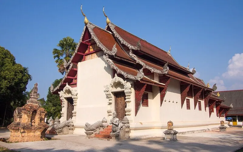
21. Wat Phaya Wat is located in Ban Phaya Wat, Du Tai Subdistrict, Mueang Nan District. This ancient temple is an important place for understanding the historical development of Nan, particularly the period when settlement expanded to the western bank of the Nan River. Its religious art also demonstrates a distinctive combination of Sukhothai and Lanna influences.
Highlights: A 5-tier laterite chedi with niches, standing Buddha images, Phra Chao Fon Saen Ha, and an intricately carved wooden pulpit made by local Nan craftsmen.
The temple’s chedi is its most distinctive feature. Built primarily of laterite, the structure consists of several superimposed square tiers. Niches around the different levels contain standing Buddha images, creating an architectural form that is relatively unusual in Nan and demonstrating artistic relationships between Nan and other regions of northern Thailand.
The standing Buddha images show artistic characteristics associated with Sukhothai, while parts of the chedi structure and later restoration work reflect Lanna influence. For travelers interested in Buddhist art history, Wat Phaya Wat provides an opportunity to observe how different artistic traditions were absorbed and adapted within Nan.
Inside the ordination hall is Phra Chao Fon Saen Ha, also known as Phra Chao Sai Fon, an important Buddha image traditionally associated with local rainmaking beliefs. This connection reflects the close relationship among Buddhism, agriculture, seasonal rainfall, and traditional community beliefs in Nan.
Another important artistic object is the carved wooden pulpit, decorated with detailed patterns produced by local craftsmen. Wat Phaya Wat is therefore suitable both for Buddhist worship and for travelers seeking to understand Nan’s historical and artistic heritage beyond the best-known temples in the old town.
Open Days: Daily Opening Hours: 07:00 – 17:00
Getting There: From Nan town, follow Highway 101. Near the bridge approaching the city, turn onto Highway 1025 and continue for approximately 300 meters. The temple is located on the left-hand side.
Map (GPS):Open Google Maps – Wat Phaya Wat
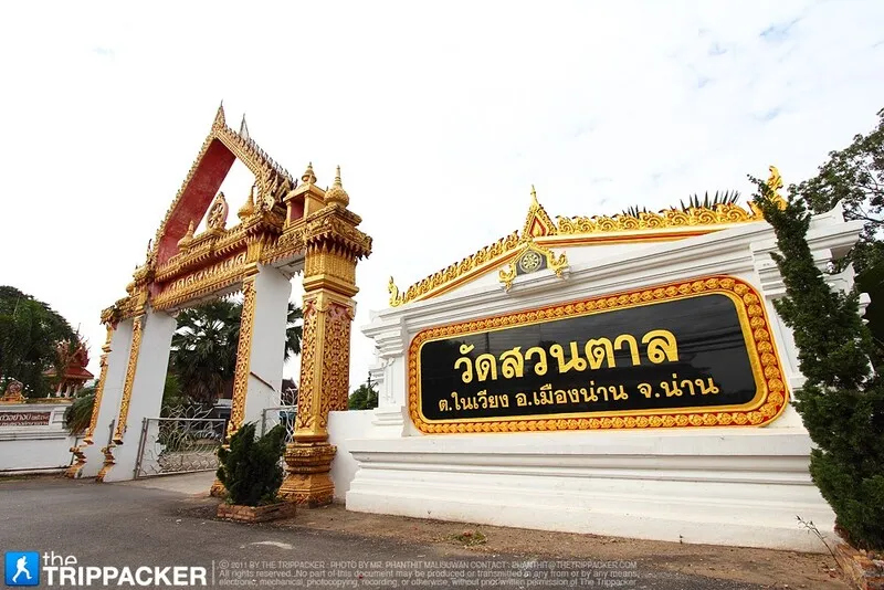
22. Wat Suan Tan is located on Mahayot Road in Nai Wiang Subdistrict, Mueang Nan District. This historic temple has long been associated with the development of Nan city and is home to Phra Chao Thong Thip, an important Buddha image revered by local residents.
Highlights: Phra Chao Thong Thip, Wat Suan Tan chedi, long-standing connections with Nan history, and the annual Songkran worship and bathing ceremony dedicated to the sacred Buddha image.
The name “Suan Tan” is connected with the former landscape of the area, which was once a palm grove outside the northern side of Nan’s old city wall. The temple therefore preserves not only religious history but also a memory of the city’s earlier geography and urban expansion.
Phra Chao Thong Thip is one of the temple’s most important sacred objects and is deeply respected by the people of Nan. During the Songkran period, a traditional worship and bathing ceremony is held, demonstrating that Wat Suan Tan continues to function as a living religious center rather than merely a historical monument.
The temple’s chedi historically displayed architectural elements influenced by Sukhothai art, particularly features associated with lotus-bud or Phum Khao Bin forms. These elements provide evidence of artistic exchange between Nan and important cities farther south.
Wat Suan Tan can be easily combined with Wat Phumin, Nan National Museum, Wat Ming Mueang, and other sites within Nan city. It is a worthwhile addition for travelers who want to explore historic temples beyond the immediate Khuang Mueang area.
Open Days: Daily Opening Hours: Open All Day
Getting There: Wat Suan Tan is located on Mahayot Road in central Nan. From the Wat Phumin and Nan National Museum area, follow Phakong Road or Suriyaphong Road toward Mahayot Road. The temple is accessible by car, bicycle, motorcycle, or local transport.
Map (GPS):Open Google Maps – Wat Suan Tan

23. Sila Phet Waterfall is a natural attraction in Pua District, where several streams flow together before descending across natural rock formations in multiple levels. Surrounded by forest and rural scenery, the waterfall offers a refreshing contrast to the temples and rice fields for which Pua is also known.
Highlights: Multi-level cascades, natural streams, rocky formations, small pools, shaded forest surroundings, and a convenient location for combining nature with Tai Lue cultural attractions in Pua District.
The waterfall is formed as water descends over a series of natural rock shelves and boulders, creating different cascades and pools along the stream. Visitors can stop at several points to enjoy the scenery, although swimming should be limited to areas where water conditions are clearly safe.
Trees and vegetation around the waterfall provide considerable shade, creating a cooler environment than the exposed rice fields and village areas nearby. This makes Sila Phet Waterfall a useful nature stop during a wider exploration of Pua.
The rainy season and early cool season generally produce stronger water flow and lush green forest. However, rocks near the stream can become extremely slippery, so visitors should wear appropriate footwear and avoid areas with strong currents.
The waterfall is also connected with the local community economy, as villagers along the travel route may sell food, agricultural products, and local handicrafts. Visitors can therefore combine nature sightseeing with support for community-based businesses.
Sila Phet Waterfall can be included in a 1-day itinerary with Wat Phra That Beng Sakat, Wat Ton Laeng, Pua town, and nearby Tai Lue communities before continuing toward Doi Phu Kha National Park.
Open Days: Daily Opening Hours: 08:00 – 17:00
Getting There: Travel through Pua District toward the waterfall using local roads. A private car or motorcycle is the most convenient option. Extra caution is recommended during the rainy season because sections of the road and walking areas may be wet or slippery.
Map (GPS):Open Google Maps – Sila Phet Waterfall

24. Ban Pak Nai Fisherman Village is located in Na Tha Nung Subdistrict and is a fishing community on the reservoir above Sirikit Dam. Surrounded by broad water views and mountain scenery, it offers a very different side of Nan from the province’s temples and highland forests.
Highlights: Sirikit Dam Reservoir scenery, fishing-community lifestyle, floating raft restaurants, freshwater fish dishes, boat trips, and mountain views surrounding a vast lake-like landscape.
The area was originally associated with communities along the Nan River. After the construction of Sirikit Dam transformed the landscape into a vast reservoir, local livelihoods gradually adapted, and freshwater fishing became increasingly important to the community.
One of the most memorable experiences is eating at floating raft restaurants, where local freshwater fish are prepared in a variety of dishes while visitors look across the reservoir toward the surrounding mountains.
Pak Nai is especially suitable for slow travel. Morning and late afternoon offer softer light and a more comfortable atmosphere, while boat services may provide additional opportunities to explore the reservoir depending on current local conditions.
The village provides a useful perspective on how communities adapt to major changes in their environment. It is therefore valuable not only as a scenic destination but also as a place to understand the relationship between the Nan River, Sirikit Dam Reservoir, freshwater fisheries, and community livelihoods.
Travelers visiting southern Nan can combine Ban Pak Nai with Na Muen District, Si Nan National Park, Doi Samer Dao, and other attractions in the reservoir region.
Open Days: Daily Opening Hours: Restaurants and floating raft services are available throughout the day
Getting There: Travel by private car or rental vehicle toward Na Tha Nung Subdistrict and continue to Ban Pak Nai and the pier area. Visitors planning boat trips or overnight stays should check directly with local service providers in advance.

25. Wat Bun Yuen Royal Temple is located in Klang Wiang Subdistrict, Wiang Sa District. This historic royal temple is closely connected with the development of Wiang Sa and the rulers of Nan. Its most distinctive sacred object is a large standing Buddha image enshrined inside the viharn, which is also connected with the origin of the temple’s present name.
Highlights: A large standing Buddha image, historic viharn, the history of Wiang Po and Wiang Sa, and the temple’s status as an important royal Buddhist site in southern Nan.
The temple was founded in 1786 and was originally associated with the settlement known as Wiang Po, which later developed into Wiang Sa. Its earlier history included the name Wat Bun Na before the temple was relocated and developed further in later periods.
During the reign of Chao Fa Atthawarapanyo, an important viharn and standing Buddha image were constructed. The large Buddha image faces north and became the principal sacred image of the temple as well as an important object of devotion for residents of Wiang Sa.
The standing Buddha image is associated with a posture expressing compassion and teaching. The name “Bun Yuen” can therefore be understood as symbolizing enduring merit, lasting virtue, and stable faith.
Wat Bun Yuen is valuable for travelers interested in Nan history beyond the provincial capital. Visiting Wiang Sa reveals how settlements along the Nan River developed their own important temples and religious centers while remaining closely connected with the wider history of the former Nan principality.
The temple remains active today and holds the status of a third-class royal temple under the Mahanikaya Buddhist order.
Open Days: Daily Opening Hours: Open during regular temple visiting hours
Getting There: From Nan town, travel south to Wiang Sa District and continue to Klang Wiang Subdistrict. A private car, rental vehicle, or local hired transport is recommended.

26. Wang Pian Waterfall is located in Ban Huai Sai Khao, Moo 7, Huai Kon Subdistrict, Chaloem Phra Kiat District. Also known locally as Huai Kon Waterfall, it is a 6-level natural waterfall surrounded by mountain forest in the far north of Nan Province.
Highlights: A 6-level waterfall, high rock faces, natural pools, forest scenery, and a peaceful setting within Nan’s northern border region.
Each level has its own character. The first waterfall is approximately 30 meters high and descends into a natural pool, while the second reaches approximately 50 meters and is considered one of the most visually impressive sections of the waterfall.
The different levels are traditionally associated with local names such as Tat Man, Pha Khan Thai, Pha Chom, Tat Ling, and Tat Mok. These names reflect the relationship between local communities and the distinctive physical features of individual sections of the waterfall.
The surrounding landscape retains considerable forest cover and a quiet atmosphere, making the waterfall suitable for travelers who want to explore Chaloem Phra Kiat District beyond the border checkpoint and market.
The rainy season brings stronger water flow and especially lush forest, but visitors should be cautious because rocks and walking surfaces can become slippery. Swimming should be avoided wherever the current is strong or water levels appear unsafe.
Wang Pian Waterfall can be combined with Ban Huai Kon Border Market and the Ban Huai Kon Old Battlefield Memorial to create a varied itinerary covering nature, border-community life, and modern history.
Open Days: Daily Opening Hours: 08:00 – 17:00
Getting There: From the center of Chaloem Phra Kiat District, travel approximately 11 kilometers to Ban Huai Sai Khao, Moo 7, Huai Kon Subdistrict. A private car or motorcycle is recommended, with extra caution during the rainy season.
Map (GPS):Open Google Maps – Wang Pian Waterfall

27. Ban Huai Kon Border Market is located near the Ban Huai Kon Border Checkpoint in Chaloem Phra Kiat District. Facing Muang Ngeun in Xayaburi Province, Laos, the area represents both an international border crossing and a community marketplace reflecting long-standing economic and cultural links between people on both sides of the frontier.
Highlights: Thai–Lao border trade, Tai Lue woven textiles, agricultural products, local goods, a mountain-border atmosphere, and an opportunity to observe everyday economic exchange between neighboring communities.
The market has developed around the geographical relationship between Huai Kon in Thailand and Muang Ngeun in Laos. The border has long functioned not merely as a political boundary but also as a point of exchange for food, agricultural products, household goods, textiles, and locally produced items.
The attraction is therefore not simply shopping. Visitors can observe an authentic border-market environment and understand how communities separated by an international boundary remain economically and culturally connected.
The market operates primarily on Saturday mornings until around noon, while the permanent border checkpoint operates daily according to official checkpoint hours. Travelers intending to cross into Laos should always check the latest immigration requirements, travel documents, and border regulations before departure.
Ban Huai Kon Border Market can be combined with Wang Pian Waterfall and the Ban Huai Kon Old Battlefield Memorial, allowing visitors to experience the natural environment, trade, and modern history of Nan’s northern border area during the same trip.
Open Days: Border market every Saturday / Border checkpoint daily Opening Hours: Market from morning until around noon / Border checkpoint 08:00 – 17:00
Getting There: From Nan town, follow Highway 1080 through Tha Wang Pha and continue north toward Chaloem Phra Kiat District and Ban Huai Kon. The journey is approximately 138 kilometers and passes through extensive mountain terrain.

28. Ang Kep Nam Liap, also known as Liap Reservoir, is located in Ban Don Thaen, Moo 3, Chiang Khan Subdistrict, Chiang Klang District. This community reservoir supports agriculture, freshwater fish conservation, and local recreation while retaining a quiet rural atmosphere surrounded by village forest.
Highlights: Reservoir scenery, village forest, a freshwater fish conservation area, peaceful countryside, and a landscape shaped by the relationship between water resources and community life.
The reservoir was developed as an agricultural water-storage area and continues to support farming activities in surrounding communities. It is therefore not simply a scenic lake but a working part of local water management.
Another important function is freshwater fish conservation. Protecting fish populations within the reservoir helps maintain the local aquatic ecosystem and reflects community efforts to manage shared natural resources responsibly.
The village forest around the reservoir helps conserve moisture and provides habitat for plants and animals. Together, the reservoir, forest, and farmland create a landscape that demonstrates the interdependence of water, agriculture, and rural community life.
Morning and late afternoon are particularly pleasant times to visit because temperatures are cooler and light over the water is softer. Visitors can relax, take photographs, and experience the slower pace of Chiang Klang District.
Travelers should avoid disturbing the fish conservation area, refrain from littering, and respect surrounding agricultural land because the reservoir continues to serve local community needs.
Open Days: Daily Opening Hours: Open All Day
Getting There: From Nan town, travel north toward Chiang Klang District, then continue to Chiang Khan Subdistrict and Ban Don Thaen, Moo 3, using local roads. A private car or motorcycle is the most convenient option.
Map (GPS):Open Google Maps – Ang Kep Nam Liap

29. Khun Sathan Watershed Research Station is located in Santha Subdistrict, Na Noi District. It functions both as a watershed research and ecological restoration site and as a highland nature destination known for its cool climate, mountain scenery, montane forest, and seasonal wild Himalayan cherry blossoms.
Highlights: Wild Himalayan cherry blossoms, cool mountain weather, watershed forest, panoramic mountain scenery, ecological restoration work, and a location close to Khun Sathan National Park.
The station occupies hilly and mountainous terrain with relatively cool conditions for much of the year. This makes it suitable for travelers seeking mountain views and a peaceful natural environment, particularly during the cool season when fog may develop over the surrounding landscape.
The attraction for which the area is best known is the blooming of wild Himalayan cherry trees, often referred to as Thailand’s sakura. Depending on annual weather conditions, pink blossoms appear during the cool season and transform parts of the station and mountain road into popular photography locations.
The station also has considerable ecological importance. Parts of the surrounding highlands were previously affected by land use, leading to research and restoration programs involving reforestation and watershed management. Visitors can therefore see how forest rehabilitation contributes to water conservation, biodiversity, and long-term environmental recovery.
The surrounding vegetation includes montane forest species, pines, wild magnolia, oak species, and other highland plants. This gives the station value not only as a seasonal flower destination but also as a year-round environmental learning area.
Visitors can combine the station with Khun Sathan National Park, located only a short distance farther along the mountain road. During the cool season, it is advisable to check current blossom conditions and accommodation availability before traveling because peak flowering periods can attract many visitors.
Open Days: Daily Opening Hours: Advance contact is recommended before visiting
Getting There: From Nan town, travel toward Na Noi District and continue along Highway 1216 toward Khun Sathan. The station is approximately 45 kilometers from Na Noi District and about 4 kilometers before Khun Sathan National Park. The road contains steep and winding mountain sections.

30. Ban Huai Kon Old Battlefield Memorial is located in Huai Kon Subdistrict, Chaloem Phra Kiat District. This historical learning site preserves evidence of a former military base and battlefield connected with conflict in Thailand’s border regions during the Cold War era.
Highlights: Original battlefield terrain, trenches, defensive positions, military-base remains, strategic mountain geography, and the history of Thai soldiers who fought and died in the area.
The most important event associated with the site took place on April 9, 1975, when communist insurgents attacked a Thai military base at Ban Huai Kon. Soldiers stationed at the base defended the position during a major armed confrontation.
The area continues to preserve physical traces of military activity, including trenches, defensive lines, former weapons-storage areas, and strategic positions. These remains allow visitors to understand the characteristics of an actual battlefield rather than learning about the event only through written records.
The conflict resulted in the deaths of 17 Thai soldiers, and the site was later developed as a memorial and historical learning area honoring those who served in the battle.
The mountain landscape around Huai Kon also helps explain why this part of Nan was strategically important. Its location close to the Thai–Lao border and its rugged terrain made control of routes and elevated positions particularly significant during periods of political and military tension.
The memorial has a quiet and reflective atmosphere. Visitors should treat the site respectfully, avoid climbing on or damaging surviving military structures, and recognize that the area commemorates real people and events.
A visit can be combined with Ban Huai Kon Border Market and Wang Pian Waterfall, creating a route that connects history, border-community life, and natural scenery in far northern Nan.
Open Days: Daily Opening Hours: Approximately 08:00 – 17:00
Getting There: From Nan town, travel approximately 130 kilometers toward Chaloem Phra Kiat District and Ban Huai Kon. The journey takes roughly 2.5–3 hours and passes through extensive mountain roads, so careful driving is recommended, particularly during rain or fog.

31. Pha Lak Cave is located in Moo 2, Ban Nam Phu, Namtok Subdistrict, Na Noi District, Nan Province. This natural cave contains stalactites, stalagmites, and several chambers, while the surrounding landscape remains mountainous and forested. It is an appealing destination for travelers who enjoy nature and quieter areas of Na Noi.
Highlights: Stalactites and stalagmites, multiple cave chambers, traces of ancient water channels inside the cave, a naturally cool and humid atmosphere, and Pha Lak Monastery at the foot of the mountain.
Pha Lak Cave is a long-established natural cave that was officially discovered in 1997. Its interior resembles an ancient water passage through the mountain, where long-term mineral deposition has created stalactites, stalagmites, and unusual rock surfaces in many different forms.
Several smaller chambers can be found inside the cave. Some areas are humid and uneven, so visitors should carry a flashlight, wear shoes with good grip, and avoid touching stalactites and stalagmites because these formations require extremely long periods of time to develop.
Pha Lak Monastery is located near the base of the mountain. The peaceful and shaded environment allows visitors to combine a nature visit with quiet time at a local Buddhist site.
Pha Lak Cave can be included in a Na Noi itinerary together with Sao Din Na Noi, Si Nan National Park, and Doi Samer Dao, making it suitable for travelers who want to explore beyond the district’s best-known viewpoints.
Open Days: Daily Opening Hours: 08:00 – 17:00
Getting There: From Na Noi District, travel toward Ban Nam Phu in Namtok Subdistrict and continue to Pha Lak Monastery and the cave entrance. During the rainy season, travelers should check road and trail conditions before visiting.
Map (GPS):Open Google Maps – Pha Lak Cave

32. Tad Thong Waterfall is located in Ban Pang Hai, Moo 7, Na Rai Luang Subdistrict, Nan Province. This peaceful natural waterfall lies close to the local community and is surrounded by forest and rocky mountain terrain, making it suitable for a relaxing nature stop in northern Nan.
Highlights: A mountain stream flowing over natural rock formations, shaded forest, a peaceful local atmosphere, and relatively convenient access from Ban Pang Hai.
The waterfall is formed by a stream flowing across natural rock levels, creating small cascades along the forested terrain. Trees and vegetation provide shade around the water and help keep the area cooler than more exposed landscapes.
Late rainy season through early cool season is particularly attractive because the forest remains green and water levels are generally higher. Visitors should nevertheless be cautious around wet rocks and slippery surfaces, especially immediately after rainfall.
Tad Thong Waterfall is suitable for travelers looking for a small, quiet natural attraction without the crowds found at larger tourism sites. Its community setting also gives visitors an opportunity to experience a less commercialized side of rural Nan.
The waterfall can be included in a route through Na Rai Luang and nearby mountain communities, adding a nature stop to a journey that might otherwise focus mainly on temples and cultural attractions.
Open Days: Daily Opening Hours: 08:00 – 17:00
Getting There: Travel to Ban Pang Hai, Moo 7, Na Rai Luang Subdistrict. The route includes approximately 3 kilometers of paved road followed by around 300 meters of unpaved road before reaching the waterfall area.
Map (GPS):Open Google Maps – Tad Thong Waterfall

33. Tad Man Waterfall is located in Ban Wang Thong, Moo 3, Phra Phutthabat Subdistrict, Chiang Klang District. Surrounded by fertile watershed forest, this natural waterfall has flowing water throughout the year and offers a peaceful setting for travelers exploring northern Nan.
Highlights: A 6-level waterfall, layered natural rock formations, a natural pool, year-round water supplied by Huai Hui Stream, and a lush watershed forest environment.
The waterfall receives water from Huai Hui Stream, whose watershed lies toward Song Khwae District. This continuing water supply helps maintain the surrounding vegetation and gives the waterfall flowing water during much of the year.
Natural rock layers form approximately 6 cascading levels, with water flowing gradually down the slope. A larger natural pool below part of the falls provides an attractive area for relaxing and enjoying the sound of the mountain stream.
The surrounding forest is an important watershed ecosystem. It helps retain moisture and supports streams used by nearby communities, giving Tad Man Waterfall environmental value beyond its role as a tourist destination.
During the rainy season, water flow becomes stronger and the forest is particularly green, but wet rocks and trails can be slippery. The cool season provides more comfortable temperatures for walking and nature sightseeing.
Open Days: Daily Opening Hours: 08:00 – 17:00
Getting There: From Chiang Klang District, travel toward Ban Wang Thong, Moo 3, Phra Phutthabat Subdistrict. Cars and motorcycles can reach the area, although extra caution is recommended during the rainy season.
Map (GPS):Open Google Maps – Tad Man Waterfall

34. Haeng Reservoir, also known as Nam Haeng Reservoir, is located in Ban Na Udom, Moo 9, Na Noi Subdistrict, Na Noi District. This community reservoir serves both agricultural purposes and local recreation, offering quiet waterside scenery surrounded by the rural landscape of southern Nan.
Highlights: A broad reservoir, countryside and mountain views, peaceful surroundings, year-round water, and a convenient location close to Na Noi town.
Haeng Reservoir is an important agricultural water source for surrounding communities. In addition to storing water for local farming, its waterside setting has become a relaxing place for residents and travelers looking for quiet scenery.
Morning and late afternoon are particularly pleasant times to visit. Reflections on the water, distant mountain scenery, and soft light create an uncomplicated but attractive rural atmosphere.
The reservoir is well suited to a stop between Sao Din Na Noi and other attractions around Na Noi District, especially for travelers who enjoy peaceful places that have not been heavily developed for tourism.
Visitors should help maintain the cleanliness of the reservoir and avoid disturbing surrounding agricultural land because the water remains an important working resource for local communities.
Open Days: Daily Opening Hours: Open All Day
Getting There: From Na Noi District, travel toward Ban Na Udom, Moo 9. The reservoir is approximately 5 kilometers from Na Noi District Office and can be reached by private car or motorcycle.
Map (GPS):Open Google Maps – Haeng Reservoir

35. Huai Haet Reservoir is located north of Ban Na Haen village and is a community water resource developed for local use, recreation, and simple outdoor activities. Its calm setting makes it suitable for travelers interested in quiet rural scenery.
Highlights: Peaceful reservoir views, floating rafts, fishing areas, community recreation space, and a relaxed countryside atmosphere.
The reservoir demonstrates how local water resources can serve several purposes at the same time, including supporting community needs while providing a simple recreational space where residents and visitors can relax by the water.
The area remains relatively undeveloped compared with major commercial attractions. This simplicity is part of its appeal, especially for travelers who want to experience ordinary rural landscapes and quiet local spaces rather than crowded tourism sites.
Morning and late afternoon provide cooler temperatures and more attractive light for photography. Visitors can relax beside the reservoir or use the floating rafts according to current local arrangements.
Because the reservoir remains part of a working community landscape, visitors should keep the area clean, avoid disturbing fishing and water-management activities, and respect nearby farmland and residents.
Open Days: Daily Opening Hours: Open All Day
Getting There: Travel to Ban Na Haen village and continue north along local roads toward the reservoir. A private car or motorcycle is the most practical transport. First-time visitors can ask local residents for the most convenient access route.
Map (GPS):Open Google Maps – Huai Haet Reservoir

36. Nam Kian Reservoir is an important community reservoir in Nan Province. Developed under a royal initiative, it supports agricultural water storage while also functioning as a freshwater fish conservation area and peaceful countryside recreation site.
Highlights: Agricultural water storage, freshwater fish conservation, forested surroundings, open reservoir scenery, and quiet rural landscapes.
The reservoir plays a direct role in local agriculture by storing water for surrounding farmland and communities. This makes it both an environmental resource and an important component of the local rural economy.
Another significant function is freshwater fish conservation. A variety of fish species live within the reservoir, and community conservation efforts help maintain the aquatic ecosystem and encourage sustainable use of local water resources.
For travelers, the main attraction is the peaceful open landscape. The reservoir is suitable for short visits, nature photography, and slow travel rather than intensive recreational activities.
Visitors should avoid fishing or entering conservation areas without permission and should help preserve water quality by keeping the surroundings clean.
Open Days: Daily Opening Hours: 24 Hours
Getting There: Travel from Nan town toward the Nam Kian area and continue along local roads to the reservoir. Private cars and motorcycles are suitable for the route.
Map (GPS):Open Google Maps – Nam Kian Reservoir

37. Wat Na Wai Folk Museum is located within Wat Na Wai in Ban Na Wai, Bo Kaeo Subdistrict, Na Muen District. The museum preserves tools, manuscripts, religious objects, and cultural materials associated with local community life, helping visitors understand the heritage of southern Nan.
Highlights: Palm-leaf manuscripts, old traditional documents, Buddha images, agricultural tools, household objects, local wisdom, and a temple-based community museum environment.
The museum was created through the collection of objects connected with everyday life in the community, including occupational tools, household equipment, manuscripts, and objects related to local religious beliefs and traditions. Together they provide a picture of life in Na Muen before modern conveniences became widespread.
The value of the museum lies not only in individual artifacts but also in their relationship with the community. Many objects reflect the connections among agriculture, forests, water, religion, craftsmanship, and rural life.
Because the museum is located within a temple, cultural learning is directly connected with the community’s religious center. Visitors can explore the museum, make merit, and observe the atmosphere and architecture of Wat Na Wai during the same visit.
Wat Na Wai Folk Museum is particularly suitable for travelers who want to understand Nan at a community level, especially Na Muen District, where cultural attractions and natural landscapes provide a different experience from the more frequently visited northern districts.
Open Days: Daily Opening Hours: 08:00 – 17:00
Getting There: From Nan town, travel approximately 80 kilometers toward Na Muen District. Wat Na Wai is around 600 meters east of Na Muen District Office and is easily accessible by private car.

38. Ban Bo Suak Kiln Site and Glazed Ceramics is located in Ban Bo Suak Phatthana, Moo 10, Bo Suak Subdistrict, Mueang Nan District. This important archaeological site demonstrates that historic Nan once had a significant tradition of pottery and glazed ceramic production.
Highlights: Ancient ceramic kilns, Bo Suak glazed ceramics, archaeological remains, pottery fragments, a community museum, and knowledge about traditional ceramic production in Nan.
The discovery of numerous kilns and glazed ceramics in the Bo Suak area provides important evidence for understanding the economy and production technology of historic Nan. The site demonstrates that this was once much more than an ordinary rural settlement.
The kilns reveal sophisticated knowledge of heat management and ceramic firing. Pottery recovered from the area includes various types of functional vessels and glazed objects, demonstrating both practical production and changing aesthetic preferences.
Research suggests that Bo Suak ceramic production developed during a prosperous period of Nan and was influenced by wider Lanna ceramic traditions, including kiln technologies associated with San Kamphaeng and Kalong.
Today the area serves as a community archaeological learning site where visitors can study original kiln remains and understand Nan’s ceramic traditions within the actual landscape where production once took place.
The site is particularly suitable for travelers interested in history, archaeology, handicrafts, pottery, and community tourism. It can be visited as a half-day trip from Nan town without requiring a long journey.
Open Days: Daily Opening Hours: 08:00 – 17:00
Getting There: Ban Bo Suak is approximately 17 kilometers from Nan town. It can be reached by private car, rental car, or local chartered transport.

39. Pak Li Fishing Village is located in Moo 8, Ping Luang Subdistrict, Na Muen District. This small fishing community is surrounded by the natural landscapes of southern Nan and is known for freshwater fish, rural life, forests, clear waterways, and a peaceful environment.
Highlights: Traditional fishing-community life, freshwater fish, local dishes, mountain and water scenery, and a quiet natural setting described locally through the idea of “beautiful forests and clear water.”
The lives of local residents remain closely connected with the water and freshwater fisheries. Fishing is therefore not simply an occupation but also part of the community’s food culture and practical knowledge of local natural resources.
Visitors can experience the quiet community atmosphere, eat dishes prepared from freshwater fish, and enjoy waterside scenery without the heavy tourism development found at larger destinations.
The route to Pak Li passes through the mountain landscapes and rural areas of Na Muen District, making the journey particularly suitable for travelers who enjoy road trips and want to explore southern Nan in greater depth.
Visitors are encouraged to support community restaurants and local services while keeping the area clean so that tourism contributes to local income without placing unnecessary pressure on natural resources.
Open Days: Daily Opening Hours: Visitors can explore the village and local restaurants throughout the day
Getting There: Travel by private car or rental vehicle to Na Muen District, then continue toward Ping Luang Subdistrict and Pak Li Village. Several sections of the route pass through mountainous terrain, so travelers should check weather conditions during the rainy season.

40. Doi Suan Ya Luang is located in Ban San Charoen, Moo 6, Pha Thong Subdistrict, Tha Wang Pha District. This highland viewpoint offers extensive views across the surrounding mountain ranges and valleys and is especially attractive for sunrise and sea-of-mist scenery during the cool season.
Highlights: Sea of mist, sunrise views, layered mountain scenery, cool weather, and the atmosphere of a highland agricultural community.
The viewpoint occupies one of the higher areas of Pha Thong Subdistrict, providing a wide panorama over the mountains and valleys of Tha Wang Pha. Under suitable weather conditions, morning mist can collect in the lower valleys and form an impressive sea of clouds.
The cool season, particularly from approximately November to February, is the most popular period because temperatures are lower and the probability of morning mist is higher. Travelers hoping to see sunrise should reach the viewpoint before dawn.
The surrounding landscape also reflects the lifestyle of mountain communities and highland agriculture. The journey therefore offers more than a viewpoint alone and provides insight into rural life in the mountainous areas of Nan.
Wind and temperatures at the summit can be considerably cooler than in lowland areas. Warm clothing is recommended for early-morning or overnight visits, particularly during winter.
Visitors should help preserve the natural environment, avoid littering, and respect local community areas so that the viewpoint retains its quiet and relatively undeveloped character.
Open Days: Daily Opening Hours: Accessible Throughout The Day
Getting There: From Nan town, travel toward Tha Wang Pha District, then continue to Pha Thong Subdistrict and Ban San Charoen, Moo 6. The route climbs through scenic mountain landscapes and can be reached by private vehicle.
Map (GPS):Open Google Maps – Doi Suan Ya Luang

41. Wat Maha Pho is located in Nai Wiang Subdistrict, Mueang Nan District. This historic temple is closely connected with the development and relocation of Nan city. Its most important sacred object is a carved and gilded wooden standing Buddha image in the Pang Perd Lok, or “Opening the World,” posture, which is deeply revered by local residents.
Highlights: A sacred carved wooden standing Buddha image in the Opening the World posture, approximately 2.83 meters tall, historical connections with Wiang Nuea, Ban Maha Pho community, and the remarkable story of the Buddha image surviving a major fire.
The history of Wat Maha Pho is associated with the period when Nan city was relocated because of severe flooding. During the early Rattanakosin era, the area around Ban Maha Pho and nearby communities formed part of a settlement known as Wiang Nuea, or the Northern City. The temple therefore provides another important historical reference point for understanding how Nan developed beyond the old-town area seen today.
The temple’s most important object is the standing wooden Buddha image, carved, lacquered, and gilded in the Opening the World posture. According to the temple’s history, the image survived a destructive fire that damaged the former viharn. Its survival strengthened local belief in the sacred power of the image and made it an important symbol of faith for the surrounding community.
The image is also significant as a work of traditional craftsmanship. Its carved wooden body, gilding, proportions, and elaborate decorative treatment differ considerably from the bronze Buddha images commonly seen in major temples in Nan, giving visitors an opportunity to study another important form of local Buddhist art.
Wat Maha Pho retains the quiet atmosphere of a community temple and is less crowded than many of Nan’s better-known attractions. It is therefore particularly suitable for travelers interested in the deeper historical development of Nan and in religious heritage beyond the principal old-town route.
Open Days: Daily Opening Hours: 08:00 – 17:00
Getting There: Wat Maha Pho is located within Mueang Nan District and can be reached easily by private car, motorcycle, bicycle, or local transport. It is relatively close to Nan Airport and other attractions in the city area.
Map (GPS):Open Google Maps – Wat Maha Pho

42. Wat Lai Nan is located in Ban Lai Nan, Village No. 1, Lai Nan Subdistrict, Wiang Sa District. The temple stands on the eastern side of the Nan River and has long served as an important Buddhist, cultural, and community center for local residents.
Highlights: A historic community temple in Wiang Sa, its relationship with settlements along the Nan River, traditional Buddhist activities, community cultural learning, and the continuing religious traditions of Ban Lai Nan.
Wat Lai Nan was established in 1868 and later received its official consecrated boundary in 1914. Its history is closely connected with settlement along the Nan River, which has played a major role in transportation, agriculture, and community development throughout the province.
The name “Lai Nan” refers to the area across the Nan River. In earlier times, residents from Ban Bun Yuen crossed the river to cultivate fields and gardens on the fertile eastern bank. As settlement expanded, the area developed into a permanent village with Wat Lai Nan at its spiritual center.
The temple continues to play an active role in community life. Local residents gather here for merit-making, Buddhist holy days, annual religious ceremonies, and activities that preserve traditional customs and strengthen relationships among different generations.
Wat Lai Nan is particularly suitable for travelers who want to understand how Buddhist temples function within everyday rural communities. A visit offers a contrast to heavily visited historic temples in central Nan and reveals the importance of local temples as centers of education, culture, and social life.
The temple can be included in a Wiang Sa cultural route together with Wat Bun Yuen and other communities along the Nan River, allowing travelers to see how settlements developed around agriculture, waterways, and Buddhist institutions.
Open Days: Daily Opening Hours: Open During Regular Temple Visiting Hours
Getting There: From Nan town, travel south toward Wiang Sa District, then continue to Lai Nan Subdistrict and Ban Lai Nan. The temple is approximately 7 kilometers from Wiang Sa District Office and can be reached by private car, rental car, or local transport.
Map (GPS):Open Google Maps – Wat Lai Nan
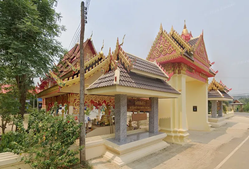
43. Wat Phong is located in Ban Pong, Moo 4, Bo Kaeo Subdistrict, Na Muen District. This historic community temple is closely associated with several surrounding villages and with Phra That Chom Chaeng, a sacred local stupa that remains an important center of faith in southern Nan.
Highlights: Phra That Chom Chaeng, the history of Wat Phong and the surrounding villages, annual stupa worship ceremonies, and the peaceful cultural landscape of Na Muen District.
The early history of the temple began with a small monastic center serving several communities in the area. As settlements expanded and residents moved between villages, the temple was relocated more than once before reaching its present site in Ban Pong.
The temple was originally known as Wat Pong. Local stories connect the name with ponds and wetlands in the area. It was later changed to Wat Phong to reduce confusion in official correspondence with other temples bearing similar names.
Phra That Chom Chaeng is one of the most important sacred landmarks associated with the temple. Local oral tradition connects the stupa with a wandering monk who arrived in the area around dawn and experienced a sacred vision. The name “Chom Chaeng” is therefore associated with dawn, light, and auspicious spiritual meaning.
The annual Phra That Chom Chaeng worship ceremony, traditionally held around Makha Bucha Day, combines Buddhist merit-making with local Lanna culture. Activities may include alms-giving, meditation, candlelight processions, traditional music, ceremonial processions, rockets, fireworks, and traditional lanterns.
Wat Phong is particularly valuable for cultural travelers because its significance comes not from monumental architecture alone but from its continuing relationship with surrounding communities, local oral history, sacred geography, and living religious traditions.
Open Days: Daily Opening Hours: Open During Regular Temple Hours
Getting There: From Nan city, travel south through Wiang Sa, Na Noi, and Na Muen districts, then continue into Bo Kaeo Subdistrict and Ban Pong. A private car is the most practical option for exploring this part of southern Nan.
Map (GPS):Open Google Maps – Wat Phong
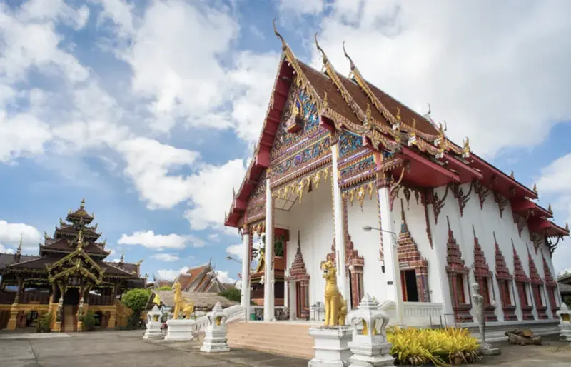
44. Wat Si Bun Rueang is located in Muang Tuet Subdistrict, Phu Phiang District. This ancient temple has close historical connections with Phra That Chae Haeng and the Buddhist community on the eastern side of the Nan River.
Highlights: A historic temple in Muang Tuet, links with the restoration history of Phra That Chae Haeng, the mondop dedicated to Phra Khru Phutthamonth Chotikun, and the continuing religious traditions of the surrounding community.
Although the precise date of the temple’s original construction is not clearly recorded, historical references indicate that Wat Si Bun Rueang already existed before 1561. Records associated with the restoration of Phra That Chae Haeng mention Maha Sami Chao Kanlayano of Wat Si Bun Rueang, demonstrating the temple’s long-standing importance.
The temple compound contains a viharn, sermon hall, monks’ residences, and a mondop dedicated to Phra Khru Phutthamonth Chotikun. The mondop combines traditional and contemporary architectural elements and contains relics together with a life-sized wax figure of the revered monk.
Wat Si Bun Rueang continues to function as a religious center for local communities in Muang Tuet and surrounding villages. Its importance lies in both its historic connections and its continuing role in Buddhist ceremonies and local religious life.
Because the temple is located in Phu Phiang District, it can be combined conveniently with Wat Phra That Chae Haeng and other cultural attractions on the eastern side of the Nan River, making it suitable for a half-day cultural route from Nan town.
Open Days: Daily Opening Hours: 08:00 – 17:00
Getting There: From Nan town, cross the Nan River into Phu Phiang District and continue toward Muang Tuet Subdistrict. The temple is accessible by private car, motorcycle, or local transport.
Map (GPS):Open Google Maps – Wat Si Bun Rueang
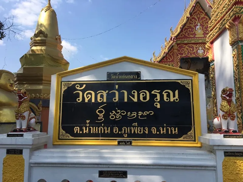
45. Wat Sawang Arun is located in Ban Nam Kaen Klang, Village No. 2, Nam Kaen Subdistrict, Phu Phiang District. This historic community temple reflects the relationship between Buddhism, village life, local memory, and cultural identity in the rural area east of Nan city.
Highlights: A long-established community temple, an old sacred Bodhi tree, traditional Buddhist activities, village religious life, and a quiet setting in Nam Kaen Subdistrict.
Wat Sawang Arun is closely connected with the establishment and development of Ban Nam Kaen Klang. The temple is believed to have served the community for several centuries and has remained a central place for worship, merit-making, and local traditions.
One of the temple’s most meaningful landmarks is an old Bodhi tree that has stood alongside the temple and community for generations. Sacred trees such as this are important in Buddhist culture because of the association between the Bodhi tree and the enlightenment of the Buddha.
The temple continues to serve as a center for Buddhist ceremonies and community activities. Local residents gather here during important religious dates and village traditions, helping preserve relationships between Buddhism and everyday rural life.
For travelers, the main appeal lies in its quiet and authentic atmosphere. Wat Sawang Arun provides an opportunity to experience a functioning local temple rather than a site developed primarily for tourism.
The surrounding Nam Kaen area combines villages, agricultural land, and mountain scenery, allowing the temple to be included in a wider exploration of Phu Phiang District and rural communities near Nan town.
Open Days: Daily Opening Hours: 08:00 – 17:00
Getting There: From Nan town, cross the Nan River into Phu Phiang District and continue toward Nam Kaen Subdistrict and Ban Nam Kaen Klang, Village No. 2. The temple can be reached by private car, rental vehicle, motorcycle, or local hired transport.
Map (GPS):Open Google Maps – Wat Sawang Arun

46. Wat Mai Wang Khian is located in Ban Mai Wang Khian, Village No. 2, Chiang Khan Subdistrict, Chiang Klang District. This active Mahanikaya Buddhist temple continues to serve as an important religious and cultural center for its surrounding agricultural community.
Highlights: A community viharn, monks’ residence, sermon hall, bell-and-drum tower, Lanna Buddhist traditions, and a rich annual cycle of community merit-making ceremonies.
The temple received permission for construction on July 25, 1977, and was officially proclaimed as a Buddhist temple on December 9, 1983. Although younger than many of Nan’s historic temples, it provides an excellent example of how Buddhist institutions continue to develop alongside modern rural communities.
The compound contains a viharn, monks’ residence, sermon hall, and bell-and-drum tower. These structures support both monastic life and community gatherings, demonstrating the continuing practical role of temples in rural northern Thailand.
Wat Mai Wang Khian is especially notable for its annual religious traditions. During Songkran, villagers make merit, build sand pagodas, and bathe Buddha images. Other ceremonies include blessings for elders, Buddhist Lent observances, rice-blessing rituals, Yi Peng activities, offerings of newly harvested rice, and annual temple anniversary merit-making.
These traditions reflect the close relationship among Buddhism, agriculture, seasonal cycles, and community identity. Visitors interested in living culture may therefore find Wat Mai Wang Khian particularly meaningful despite its relatively modest appearance.
The temple can be included in a Chiang Klang cultural route before continuing north toward Pua or other attractions along Highway 1080.
Open Days: Daily Opening Hours: 08:00 – 17:00
Getting There: From Nan town, take Highway 1080 toward Chiang Klang District, then continue along the Chiang Klang–Ngaeng (Pua) route to Ban Mai Wang Khian in Chiang Khan Subdistrict.
Map (GPS):Open Google Maps – Wat Mai Wang Khian

47. Wat Nam Lom is located in Nai Wiang Subdistrict, Mueang Nan District. Founded around the 18th century, this historic community temple has a distinctive name associated with the original landscape, when the temple stood on land surrounded by water like a small island.
Highlights: An old Lanna community temple, a name derived from its former water-surrounded landscape, historic religious architecture, and the atmosphere of an old residential community within Nan city.
According to local oral history, the temple area was originally surrounded by water on all 4 sides, creating an island-like setting. Villagers established a simple monastic site here around 1757, using timber and thatch before more permanent structures were constructed.
The name “Nam Lom” literally reflects this former geography, meaning a place surrounded by water. Although the original ponds and waterways have largely disappeared as the city developed, the name preserves a memory of Nan’s earlier landscape.
During the late 19th century, the temple was further developed and a viharn was constructed. Palm-leaf manuscripts and traditional decorative objects associated with the temple provide additional evidence of its role within Nan’s Buddhist and cultural history.
Wat Nam Lom remains an active community temple. Visitors can make merit, observe religious architecture, and experience a quieter residential part of Nan beyond the major old-town attractions.
The temple is suitable for travelers interested in exploring lesser-known urban temples and understanding how Nan’s historical neighborhoods contain numerous Buddhist sites beyond Wat Phumin and the main Khuang Mueang area.
Open Days: Daily Opening Hours: 08:00 – 17:00
Getting There: Wat Nam Lom is located in Nai Wiang Subdistrict, Mueang Nan District. It can be reached easily from the old town by private car, motorcycle, bicycle, or local transport.
Map (GPS):Open Google Maps – Wat Nam Lom

48. Wat Don Mun is located in Ban Don Mun, Na Thanung Subdistrict, Na Muen District. This historic community temple is notable for its Eastern Lanna architecture, traditional wooden structures, and continuing role as a religious and cultural center for communities in southern Nan.
Highlights: An Eastern Lanna-style viharn more than a century old, a traditional wooden kuti, fine woodcarving, local construction techniques, and a community museum preserving objects from everyday rural life.
The temple began as a small monks’ residence in the former Ban Khang Oi community. As the village expanded and community organization changed, Ban Don Mun developed as a separate settlement and the temple eventually became known by its present name.
Wat Don Mun was officially established in 1901. Its important viharn was built in 1914 through the combined efforts of the abbot and local residents. The structure uses brick and mortar together with a traditional roof covered in wooden shingles, reflecting architectural knowledge adapted to the climate of northern Thailand.
Detailed woodcarving can be seen around the gables and structural elements of the viharn. These decorations demonstrate the skill of local craftsmen and preserve an Eastern Lanna architectural character that has survived for more than a century.
An old monastic residence built in 1948 also survives within the temple compound. Its combination of masonry columns, wooden floors and walls, and teak-shingle roofing provides further evidence of traditional local construction methods.
The temple also maintains a community museum containing traditional tools, religious objects, and household items. These collections help visitors understand agricultural life, Buddhist traditions, and everyday culture in Na Muen District.
Wat Don Mun remains a living temple where local residents continue to participate in Buddhist ceremonies and community events. It is therefore both a historical site and an active cultural institution.
Open Days: Daily Opening Hours: Open During Regular Temple Hours
Getting There: From Nan city, travel south through Wiang Sa and Na Noi districts to Na Muen District, then continue to Na Thanung Subdistrict and Ban Don Mun. The temple is located along a main local road and is easily reached by private car.
Map (GPS):Open Google Maps – Wat Don Mun

49. Kaeng Sama Kao Bang is located in Ban Tuet, Village No. 10, Phra Phutthabat Subdistrict. This natural attraction along the Nan River is formed by rocky outcrops, small islands, and rapids created as the river flows through numerous stone formations.
Highlights: Natural rapids along the Nan River, rocky islands, river scenery, a large community forest, watershed ecosystems, photography, and seasonal rafting activities.
The rapids were created by the Nan River flowing through extensive rock formations of different sizes and elevations. These natural obstacles divide the current into several channels and create small rocky islands, producing a distinctive riverscape.
Water levels change significantly according to the season. During periods of higher flow, some rocks become submerged and the current becomes stronger, while the dry season exposes more of the rocky formations and makes the physical structure of the rapids easier to observe.
The surrounding area includes a long-established community forest that serves as an important watershed. Small streams flowing from the forest eventually join the Nan River, demonstrating the ecological connection between mountain forests and the province’s principal river system.
Visitors can relax beside the river, enjoy the scenery, and take photographs. Where rafting or other water activities are available, travelers should use experienced local operators and confirm current river conditions before entering the water.
The rainy season and early cool season provide especially green scenery and stronger water flow, although safety becomes more important during periods of heavy rain or rapidly rising river levels.
Kaeng Sama Kao Bang offers another perspective on Nan by emphasizing the Nan River and its watershed landscape rather than the temples, rice fields, and high mountains that dominate many conventional itineraries.
Open Days: Daily Opening Hours: Open All Day
Getting There: Travel from Nan city toward Ban Tuet, Village No. 10, Phra Phutthabat Subdistrict. Most of the route is paved and accessible by private car or rental vehicle.
Map (GPS):Open Google Maps – Kaeng Sama Kao Bang

50. Huai Si Phan Reservoir is a small community reservoir in Nan Province with peaceful scenery, green surroundings, and convenient roadside access. It functions both as a local water resource and as an important fish-breeding area while providing a quiet place for travelers to stop and relax.
Highlights: Calm reservoir scenery, green surroundings, agricultural landscapes, a community fish-breeding area, and convenient access only a short distance from the main road.
The reservoir plays an important role in local water management and provides habitat for freshwater fish. Its value therefore extends beyond recreation because it also supports local environmental and community needs.
The surrounding landscape includes trees, agricultural land, and distant mountain scenery. Morning and evening are especially pleasant because the water reflects the sky and surrounding vegetation under softer natural light.
From the rainy season through early winter, the surrounding landscape is particularly green and the reservoir generally contains more water. During the cool season, lower temperatures make the area suitable for stopping, relaxing, and enjoying the scenery.
Huai Si Phan Reservoir is not a heavily commercialized destination. Its appeal lies in its simplicity, peaceful atmosphere, and connection with the surrounding community rather than in large-scale tourism facilities.
Visitors should keep the reservoir area clean, avoid disturbing fish-breeding zones, and respect any agricultural or community-use areas around the water.
Open Days: Daily Opening Hours: Open All Day
Getting There: The reservoir is located approximately 100 meters from the main road and can be reached easily by private car. It is suitable as a short stop while traveling through the surrounding area.
| Rank | Attraction | Area | Highlights |
| 1 | Wat Phumin | Mueang Nan | Pu Man Ya Man mural paintings and distinctive cruciform viharn |
| 2 | Wat Phra That Chae Haeng | Phu Phiang | Sacred relic pagoda of Nan and zodiac temple for the Year of the Rabbit |
| 3 | Doi Phu Kha National Park | Pua–Bo Kluea | High mountains, watershed forests, viewpoints, rare plants, and nature trails |
| 4 | Bo Kluea Rock Salt Wells | Bo Kluea | Traditional mountain salt wells and generations-old salt-boiling knowledge |
| 5 | Si Nan National Park | Na Noi | Doi Samer Dao, Pha Chu, mountains, camping, stars, and sea of mist |
| 6 | Nan National Museum | Mueang Nan | Nan history, art collections, former royal residence, and the Black Elephant Tusk |
| 7 | Wat Phra That Khao Noi | Mueang Nan | Hilltop Buddha image, sacred chedi, sunrise, and panoramic Nan city views |
| 8 | Wat Phra That Chang Kham Worawihan | Mueang Nan | Elephant-supported chedi and important Lanna religious art |
| 9 | Khun Nan National Park | Bo Kluea | Watershed forests, mountain ranges, waterfalls, and remote natural landscapes |
| 10 | Nan Riverside Art Gallery | Mueang Nan | Contemporary art exhibitions and a peaceful riverside setting |
| 11 | Wat Nong Bua | Tha Wang Pha | Tai Lue murals, traditional viharn, textiles, and community heritage |
| 12 | Wat Phra That Beng Sakat | Pua | Sacred stupa, Tai Lue viharn, and the history of Woranakhon |
| 13 | Wat Ton Laeng | Pua | Traditional low Tai Lue viharn and vernacular timber architecture |
| 14 | Wat Hua Khuang | Mueang Nan | Historic temple and architecture in Nan’s old-town district |
| 15 | Doi Tee Duu | Mueang Nan | Mountain scenery, morning mist, and highland viewpoints |
| 16 | Tham Pha Tub Forest Park | Mueang Nan | Limestone mountains, caves, forest trails, and viewpoints |
| 17 | Khun Sathan National Park | Na Noi | High mountains, cool weather, mist, forests, and camping |
| 18 | Mae Charim National Park | Mae Charim | Wa River whitewater rafting and outdoor adventure activities |
| 19 | Huai Hat Waterfall | Song Khwae | Three-level waterfall, natural pools, and forest walking trail |
| 20 | Phu Fa Waterfall | Doi Phu Kha | Large multi-level waterfall and challenging long-distance forest trek |
| 21 | Wat Phaya Wat | Mueang Nan | Laterite chedi, standing Buddha images, and Phra Chao Fon Saen Ha |
| 22 | Wat Suan Tan | Mueang Nan | Phra Chao Thong Thip and historic connections with Nan city |
| 23 | Sila Phet Waterfall | Pua | Multi-level cascades, streams, natural pools, and shaded forest |
| 24 | Ban Pak Nai Fisherman Village | Na Muen | Fishing-community life, raft restaurants, freshwater fish, and reservoir scenery |
| 25 | Wat Bun Yuen Royal Temple | Wiang Sa | Large standing Buddha image and history of Wiang Sa |
| 26 | Wang Pian Waterfall | Chaloem Phra Kiat | Six-level waterfall in the forested northern border region |
| 27 | Ban Huai Kon Border Market | Chaloem Phra Kiat | Thai–Lao border trade, local products, and cross-border community life |
| 28 | Ang Kep Nam Liap | Chiang Klang | Community reservoir and freshwater fish conservation area |
| 29 | Khun Sathan Watershed Research Station | Na Noi | Wild Himalayan cherry blossoms, watershed forest, and cool highland scenery |
| 30 | Ban Huai Kon Old Battlefield Memorial | Chaloem Phra Kiat | Historic battlefield, trenches, defensive positions, and Cold War history |
| 31 | Pha Lak Cave | Na Noi | Stalactites, stalagmites, cave chambers, and mountain forest |
| 32 | Tad Thong Waterfall | Song Khwae Area | Mountain stream, natural rock formations, and shaded forest |
| 33 | Tad Man Waterfall | Chiang Klang | Six-level waterfall and watershed forest |
| 34 | Haeng Reservoir | Na Noi | Reservoir scenery, countryside landscapes, and mountain views |
| 35 | Huai Haet Reservoir | Ban Na Haen Area | Community reservoir and peaceful local recreation area |
| 36 | Nam Kian Reservoir | Phu Phiang Area | Agricultural water source and freshwater fish conservation |
| 37 | Wat Na Wai Folk Museum | Na Muen | Traditional tools, manuscripts, religious objects, and community wisdom |
| 38 | Ban Bo Suak Kiln Site and Glazed Ceramics | Mueang Nan | Ancient kilns, archaeological remains, and historic Nan ceramics |
| 39 | Pak Li Fishing Village | Na Muen | Fishing-community life, freshwater fish dishes, forests, and waterside scenery |
| 40 | Doi Suan Ya Luang | Tha Wang Pha | Sea of mist, sunrise, cool weather, and layered mountain scenery |
| 41 | Wat Maha Pho | Mueang Nan | Carved wooden Buddha image in the Opening the World posture and Wiang Nuea history |
| 42 | Wat Lai Nan | Wiang Sa | Community temple and Buddhist life along the Nan River |
| 43 | Wat Phong | Na Muen | Phra That Chom Chaeng and traditional community merit-making |
| 44 | Wat Si Bun Rueang | Phu Phiang | Historic temple with links to Phra That Chae Haeng and Muang Tuet community |
| 45 | Wat Sawang Arun | Phu Phiang | Community temple, sacred Bodhi tree, and rural Buddhist traditions |
| 46 | Wat Mai Wang Khian | Chiang Klang | Community temple and living Lanna Buddhist traditions |
| 47 | Wat Nam Lom | Mueang Nan | Historic Lanna temple and name derived from its former water-surrounded landscape |
| 48 | Wat Don Mun | Na Muen | Eastern Lanna architecture, traditional wooden buildings, and community museum |
| 49 | Kaeng Sama Kao Bang | Northern Nan | Natural rocky rapids and watershed landscapes along the Nan River |
| 50 | Huai Si Phan Reservoir | Ban Luang | Community reservoir, freshwater fish habitat, and peaceful natural scenery |
Recommended 5-Day, 4-Night Nan Itinerary
Day 1 – Nan Old Town: Begin at Wat Phumin to see the celebrated Pu Man Ya Man mural paintings, then walk to Nan National Museum, Wat Phra That Chang Kham Worawihan, and Wat Hua Khuang. Continue to Wat Phaya Wat or Wat Suan Tan before heading to Wat Phra That Khao Noi in the late afternoon for panoramic views over Nan city. Travelers with additional time can also visit Wat Maha Pho, Wat Nam Lom, or Nan Riverside Art Gallery.
Day 2 – Tha Wang Pha and Pua: Leave Nan town and travel north to Tha Wang Pha District. Visit Wat Nong Bua to see its important mural paintings and learn about Tai Lue culture, then continue to Pua. Explore Wat Phra That Beng Sakat, Wat Ton Laeng, and Sila Phet Waterfall. Travelers who want additional mountain scenery can include Doi Suan Ya Luang, although sufficient travel time should be allowed and weather conditions should be checked before entering highland areas.
Day 3 – Doi Phu Kha and Bo Kluea: Travel from Pua into Doi Phu Kha National Park. Stop at viewpoints along the mountain road before continuing to the Bo Kluea Rock Salt Wells to observe the traditional production of mountain salt. Travelers with additional time and an interest in nature can continue toward Khun Nan National Park. Phu Fa Waterfall should only be included by experienced trekkers who have sufficient time and have coordinated the multi-day route with park officials.
Day 4 – Na Noi and Khun Sathan: Head south to Na Noi District and explore Si Nan National Park and Doi Samer Dao. Continue to Haeng Reservoir or Pha Lak Cave. During the cool season, travelers can extend the journey to Khun Sathan Watershed Research Station and Khun Sathan National Park for cooler temperatures, mountain scenery, mist, and seasonal wild Himalayan cherry blossoms.
Day 5 – Choose a Route Based on Your Interests: For history and border culture, travel north to Chaloem Phra Kiat District to visit Ban Huai Kon Old Battlefield Memorial, Ban Huai Kon Border Market, and Wang Pian Waterfall. For community culture and southern Nan, choose the Wiang Sa–Na Muen route and visit Wat Bun Yuen Royal Temple, Wat Na Wai Folk Museum, Wat Don Mun, Pak Li Fishing Village, or Ban Pak Nai Fisherman Village.
Frequently Asked Questions (FAQ)
Q: How many days should I spend in Nan?
A: If you want to visit only Nan town, Pua, and Bo Kluea, a 3-day, 2-night trip is possible. However, travelers who want to include Na Noi, Khun Sathan, Huai Kon, Na Muen, or more remote natural areas should allow at least 4–5 days.
Q: What are the must-see attractions in Nan for first-time visitors?
A: Wat Phumin, Wat Phra That Chae Haeng, Doi Phu Kha National Park, Bo Kluea Rock Salt Wells, Si Nan National Park, Nan National Museum, Wat Phra That Khao Noi, and Wat Nong Bua are among the best choices for a first visit because together they represent Nan’s history, religion, art, Tai Lue culture, mountains, and traditional community life.
Q: What is the best time of year to visit Nan?
A: Late rainy season through the cool season, approximately October to February, is one of the most popular periods because the forests and mountains remain green while temperatures become cooler and many highland areas have a better chance of morning mist. Travelers primarily interested in waterfalls may prefer the rainy season through early winter, depending on annual rainfall and local conditions.
Q: Is it convenient to travel around Nan by private car?
A: Yes. A private or rental car is one of the most practical ways to explore Nan because attractions are spread across many districts and mountain areas. Drivers should check brakes, tires, fuel, and weather conditions before using mountain roads, especially the Pua–Bo Kluea route, Khun Sathan, and remote border areas.
Q: Can Pua and Bo Kluea be visited in one day?
A: Yes, if you select only the major attractions and leave early. However, the route crosses mountainous terrain with many viewpoints and scenic stops. Staying at least 1 night in Pua or Bo Kluea allows a much more relaxed experience and reduces the need to rush through the mountain roads.
Q: Can I explore Nan town without a car?
A: Yes. Several major old-town attractions are within walking or cycling distance of one another, including Wat Phumin, Nan National Museum, Wat Phra That Chang Kham Worawihan, and Wat Hua Khuang. Attractions outside the city are much easier to reach by private car, rental vehicle, or hired local transport.
Q: Which attractions are best for travelers interested in culture and history?
A: Wat Phumin, Wat Nong Bua, Wat Phra That Beng Sakat, Wat Ton Laeng, Nan National Museum, Wat Na Wai Folk Museum, and Ban Bo Suak Kiln Site and Glazed Ceramics are excellent choices for learning about Nan’s history, Buddhist art, Tai Lue heritage, archaeology, textiles, and traditional community life.
Q: Which places in Nan are best for nature lovers?
A: Doi Phu Kha National Park, Si Nan National Park, Khun Sathan National Park, Khun Nan National Park, Mae Charim National Park, Sila Phet Waterfall, Wang Pian Waterfall, and Doi Suan Ya Luang provide a broad combination of mountains, forests, waterfalls, viewpoints, trekking, and outdoor activities.
Q: Does Nan have attractions near the Thai–Lao border?
A: Yes. Chaloem Phra Kiat District is the principal border-tourism zone. Visitors can explore Ban Huai Kon Border Market, Ban Huai Kon Old Battlefield Memorial, and Wang Pian Waterfall. Anyone planning to cross into Laos should check the latest immigration requirements, travel-document rules, and current border-opening status before departure.
Q: Are there quiet and less crowded places to visit in Nan?
A: Yes. Haeng Reservoir, Ang Kep Nam Liap, Huai Si Phan Reservoir, Huai Haet Reservoir, Wat Phong, Wat Lai Nan, and Pak Li Fishing Village are examples of quieter destinations suitable for travelers who prefer rural communities, local landscapes, and a slower pace.
Q: Which attractions are suitable for children or elderly travelers?
A: Easily accessible attractions such as Wat Phumin, Nan National Museum, Wat Phra That Chang Kham Worawihan, Wat Hua Khuang, Wat Phra That Chae Haeng, and Ban Bo Suak Kiln Site are generally more convenient. Mountain trekking routes, remote waterfalls, and steep highland attractions should be assessed according to each traveler’s physical condition.
Q: If I have only 1 day in Nan town, where should I go?
A: Begin at Wat Phumin, continue to Nan National Museum, Wat Phra That Chang Kham Worawihan, and Wat Hua Khuang, then finish the afternoon at Wat Phra That Khao Noi. This route combines Buddhist art, history, architecture, and a panoramic view of Nan city within a single day.
Q: What should I be careful about when driving on mountain roads in Nan?
A: Check the braking system and tires before departure, reduce speed before curves, maintain a safe following distance, avoid high speeds during rain or fog, and make sure there is enough fuel before entering remote mountain areas. Night driving should be avoided on unfamiliar mountain roads whenever possible.
Q: Do I need to visit all 50 attractions in one trip?
A: No. Nan is a large province and its attractions are spread across many districts. It is more practical to select attractions according to your interests and divide the trip into geographical zones such as Nan town, Pua–Bo Kluea, Na Noi–Khun Sathan, northern Nan, and southern Nan. This reduces unnecessary driving and allows more time to experience each area properly.
 Category: ●Travel Articles, Recipes
 Group: ●Travel Review, Food Review
Last Update : 2 WeekAgo
 Last Update : 2 WeekAgo
Recommend

 Art, Culture and Heritage
 Landmarks and Memorials(6)
 Art, Craft Centres, Tradition(6)
 Museums(4)
 Historic Homes and Cities(1)
 Art Gallery(1)
 Educational Places
 Educational Gardens, Farm(1)
 Places of Worship
 Temple(68)
 Church(1)
 Other Sacred Sites(19)
 Research and Development
 Royal Project(2)
 Suburban Living
 Village, Community(13)
 Local Market(1)
 Nature and Wildlife
 National Parks and Marine Reserves(9)
 Mountain (Doi)(6)
 Dam, Reservoir, Lake(16)
 Waterfalls(28)
 Hot Springs(1)
 Caves(11)
 River, Canal(5)
 Other natural attractions(10)
 Entertainment and Agricultural
 Farms, Parks and Ecotourism(4)
 Outdoor and Adventure Activities(2)
Travel Review, Food Review(1)


