
lovethailand home >North Travel Attractions >Nan Travel Attractions >Song Kwar >Yot > Huai Hat Waterfall
TL;DR: Huai Hat Waterfall is located at Ban Yot, Moo 2, Yot Subdistrict, Song Khwae District, Nan Province, hours 08.00 - 17.00. Highlights include 3-level waterfall with natural swimming pools and peaceful mountain scenery.

Huai Hat Waterfall

Opening days: Daily
Opening hours: 08.00 - 17.00
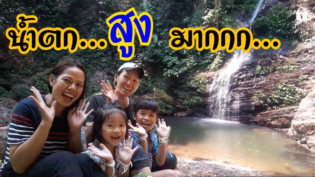
Huai Hat Waterfall is a medium-sized natural waterfall located in Ban Yot, Moo 2, Yot Subdistrict, Song Khwae District, Nan Province. Surrounded by rich mountain forests and lush vegetation, the waterfall offers a peaceful atmosphere ideal for travelers seeking relaxation and nature experiences away from crowded tourist destinations. During the rainy season and early winter, the waterfall becomes especially beautiful as the water flow increases and the surrounding forest turns vibrant green.
Huai Hat Waterfall has 3 levels, each featuring water flowing over natural rock cliffs. The first level is the largest and most impressive, with a height of approximately 35 meters and a width of around 15 meters. At the base of the waterfall is a natural pool with clear water about 1 to 1.5 meters deep, making it suitable for swimming and relaxing in a safe environment during many periods of the year.
The atmosphere around the waterfall is filled with the sounds of flowing water, birds, and forest winds. The cool air and the scent of the forest create a refreshing environment for visitors. Many travelers come here to relax beside the stream, enjoy nature photography, and explore the surrounding forest ecosystem.
The walking route to Huai Hat Waterfall is considered relatively easy compared to many forest waterfalls in Nan Province. After reaching Ban Yot Village, visitors need to walk approximately 700 meters through a shaded forest trail with gentle slopes. Along the route, the sound of the waterfall can already be heard, adding excitement and a strong connection to nature.
Ban Yot Village near the waterfall is a small rural community that still maintains a simple traditional lifestyle. Travelers can stay in local homestays surrounded by streams and mountain scenery. Villagers continue traditional agricultural practices and local textile weaving, allowing visitors to experience authentic local culture, traditional food, and community activities.
Although Huai Hat Waterfall is not yet widely known on a national tourism level, its natural beauty, peaceful atmosphere, and authentic forest surroundings make it one of the hidden gems of Nan Province. Travelers visiting the waterfall often describe the area as a perfect place to relax both physically and mentally.
The best period to visit Huai Hat Waterfall is during the rainy season and early winter when the waterfall has the strongest flow and the surrounding forest is most beautiful. Visitors should still be careful on slippery rocks and wet paths near the waterfall, especially after rainfall.
Getting There is possible by traveling from Nan City via Highway 1080 toward Tha Wang Pha District, then continuing onto Highway 1148 through Song Khwae District. At kilometer marker 47, turn right toward Ban Yot Village for approximately 3.7 kilometers, then continue on foot for about 700 meters to reach the waterfall.
Visitors are encouraged to help preserve the natural environment by avoiding littering, respecting the peaceful atmosphere of the forest, and supporting local community conservation efforts.
| Name | Huai Hat Waterfall |
| Location | Ban Yot, Moo 2, Yot Subdistrict, Song Khwae District, Nan Province |
| Coordinates | 19.4418, 100.9652 |
| Type | Waterfall and natural attraction |
| Highlights | 3-level waterfall with natural swimming pools and peaceful mountain scenery |
| Waterfall Details | The first level is approximately 35 meters high and 15 meters wide with a natural pool 1–1.5 meters deep |
| Distinctive Features | Natural waterfall flowing through forest cliffs and rich mountain landscapes |
| Travel Information | Accessible via Highways 1080 and 1148, followed by a 700-meter forest walk |
| Current Status | Open as a community natural attraction |
| Facilities | Nature trail, swimming area, and streamside relaxation spots |
| Managed By | Ban Yot community and local administrative organizations |
| Nearby Tourist Attractions | 1. Ban Yot Village, about 1 km 2. Song Khwae District, about 12 km 3. Highway 1148 Scenic Route, about 10 km 4. Nan Mountain Viewpoints, about 15 km 5. Huai Hin Fon Waterfall, about 18 km |
| Nearby Restaurants | 1. Ban Yot Community Restaurant, about 1 km 2. Song Khwae Local Restaurant, about 12 km 3. Community Coffee Shop, about 10 km 4. Highway 1148 Restaurants, about 10 km 5. Nan Local Food Restaurant, about 20 km |
| Nearby Accommodations | 1. Ban Yot Homestay, about 1 km 2. Song Khwae Community Accommodation, about 12 km 3. Riverside Homestay, about 3 km 4. Nature Resort Nan Province, about 20 km 5. Accommodation along Highway 1148, about 10 km |
Frequently Asked Questions (FAQ)
Q: Where is Huai Hat Waterfall located?
A: It is located in Ban Yot, Moo 2, Yot Subdistrict, Song Khwae District, Nan Province.
Q: How many levels does Huai Hat Waterfall have?
A: The waterfall has 3 levels, with the first level being the largest.
Q: Can visitors swim at the waterfall?
A: Yes, visitors can swim in the natural pool at the first level, which is about 1–1.5 meters deep.
Q: Is the walking trail difficult?
A: No, the trail is relatively easy and only about 700 meters long through a shaded forest path.
Q: When is the best time to visit?
A: The rainy season and early winter are the best times because the waterfall has more water and the forest is lush green.
Q: Who is Huai Hat Waterfall suitable for?
A: It is suitable for nature lovers, families, eco-tourism travelers, and visitors seeking peaceful forest scenery.
 Category: ●Nature and Wildlife
 Group: ●Waterfalls
Last Update : 6 MonthAgo
 Last Update : 6 MonthAgo
 Click to Access the Navigation Map GPS
Huai Hat Waterfall Map
Recommend

 Art, Culture and Heritage
 Landmarks and Memorials(6)
 Art, Craft Centres, Tradition(6)
 Museums(4)
 Historic Homes and Cities(1)
 Art Gallery(1)
 Educational Places
 Educational Gardens, Farm(1)
 Places of Worship
 Temple(68)
 Church(1)
 Other Sacred Sites(19)
 Research and Development
 Royal Project(2)
 Suburban Living
 Village, Community(13)
 Local Market(1)
 National Parks and Marine Reserves(9)
 Mountain (Doi)(6)
 Dam, Reservoir, Lake(16)
Waterfalls(28)
 Hot Springs(1)
 Caves(11)
 River, Canal(5)
 Other natural attractions(10)
 Entertainment and Agricultural
 Farms, Parks and Ecotourism(4)
 Outdoor and Adventure Activities(2)
 Travel Articles, Recipes
 Travel Review, Food Review(1)


