
lovethailand home >Northeastern Travel Attractions >Buri Ram Travel Attractions > 20 Must-Visit Attractions in Buriram
TL;DR: 20 Must-Visit Attractions in Buriram. Buriram is one of the most important provinces in Lower Northeastern Thailand, bringing together attractions from many different periods in.
20 Must-Visit Attractions in Buriram
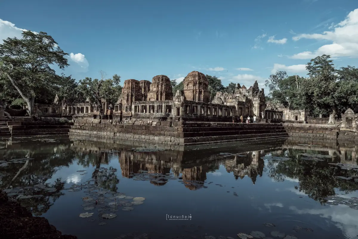
20 Must-Visit Attractions in Buriram Buriram is one of the most important provinces in Lower Northeastern Thailand, bringing together attractions from many different periods in a single destination. Travelers can explore Khmer stone sanctuaries built on extinct volcanoes, important Buddhist temples and religious art, volcanic landscapes, wetlands and birdwatching areas, as well as an international-standard football stadium and a strong sports culture that has become part of the province’s modern identity. Buriram is therefore suitable for history enthusiasts, cultural travelers, nature lovers, photographers, families, sports fans, and visitors who want to understand Lower Isan beyond a quick stop at a single landmark.
For travelers visiting Buriram for the first time, the two most important places to prioritize are Phanom Rung Historical Park and Prasat Hin Mueang Tam, as they most clearly represent the prosperity of ancient Khmer civilization in the region. Khao Kradong Forest Park should then be added for its extinct volcanic landscape and elevated views over the city. Visitors interested in modern Buriram should stop at Chang Arena, while Wat Khao Angkhan, Na Pho Silk Weaving Village, the ancient kiln sites of Ban Kruat, and the wetlands around Huai Talat Reservoir reveal the province’s religious, handicraft, archaeological, and ecological dimensions.
Buriram’s landscape is distinctive for its gently undulating plateau and the remains of several ancient volcanoes, especially Khao Kradong, Phanom Rung, and Khao Angkhan. Today, these extinct volcanoes serve as tourist attractions, viewpoints, sacred places, and important geological evidence. Volcanic activity also influenced the quality of agricultural soils in parts of the province and helped create a landscape that differs from many other areas of Northeastern Thailand.
Historically, Buriram contains evidence of settlement dating back to prehistoric times, followed by the Dvaravati period and later the flourishing of Khmer culture across Lower Isan. Important remains are scattered throughout the province, including stone sanctuaries, sacred complexes, hermit shrines, ancient kilns, ceramics, and settlements located along former routes connecting the Khorat Plateau with Angkor. This makes Buriram one of Thailand’s strongest destinations for travelers interested in tracing the cultural landscape of ancient Khmer civilization.
Phanom Rung Historical Park is the clearest symbol of this heritage. The sanctuary stands on the summit of an extinct volcano and was designed according to the concept of Mount Kailash, the sacred residence of Shiva. Prasat Hin Mueang Tam, located on the plain below, features a carefully planned sanctuary complex, 4 L-shaped ponds, and beautifully carved 5-headed naga balustrades. Visiting both sites on the same day helps travelers understand the relationship between a mountaintop sacred complex, the communities below, and the wider cultural landscape.
Buriram’s culture developed through the coexistence of several communities, especially Isan and Northern Khmer populations. This diversity can be seen in language, food, rituals, music, beliefs, and religious art. The province is also renowned for mudmee silk and the distinctive red-hemmed pha sin known as pha sin tin daeng, particularly in Na Pho District, where traditional weaving techniques are still preserved and developed into nationally recognized cultural products.
Local Buriram cuisine includes familiar Isan dishes such as larb, som tam, jaew dipping sauces, and grilled foods, alongside traditional dishes influenced by Northern Khmer communities. One particularly famous local snack is “standing meatballs,” or luk chin yuen kin, which has become strongly associated with central Buriram. Popular souvenirs include Na Pho silk, mudmee textiles, red-hemmed pha sin, community handicrafts, and locally produced food products.
One of Buriram’s most important cultural events is the Phanom Rung Festival, which combines the ancient sanctuary, cultural performances, and the phenomenon of sunlight passing directly through the aligned doorways of the sanctuary at certain times of the year. The province also celebrates Buddhist and community festivals following traditional Isan customs, while major national and international sporting events bring a very different atmosphere to the city during competition periods.
For trip planning, Buriram can be divided into several useful zones. Mueang Buriram is ideal for Khao Kradong, Chang Arena, Huai Talat Reservoir, the bird park, and Wat Pa Khao Noi. Chaloem Phra Kiat–Prakhon Chai is best for Phanom Rung, Mueang Tam, and Wat Khao Angkhan. Ban Kruat is suitable for archaeological routes and ancient kiln sites, while Na Pho is the main area for learning about silk weaving and community craftsmanship. Traveling by zone reduces unnecessary driving and gives each day a clearer theme.
If you have only 1 day, choose either the Phanom Rung–Mueang Tam route or a city itinerary combining Khao Kradong, Chang Arena, and nearby wetlands. With 2–3 days, it is possible to include the temple zone, the city, and Wat Khao Angkhan. A 4–5 day trip should add Na Pho, Ban Kruat, and lesser-known nature attractions to experience Buriram through Khmer civilization, volcanic landscapes, community culture, sports, and local ecosystems in greater depth.
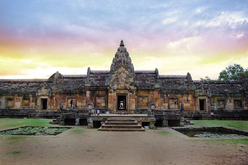
1. Phanom Rung Historical Park is located at Ban Ta Pek, Ta Pek Subdistrict, Chaloem Phra Kiat District. It is one of Buriram’s most important landmarks and one of the best-preserved Khmer sanctuaries in Thailand. The complex stands on the summit of an extinct volcano approximately 350 meters above sea level, giving it exceptional architectural, archaeological, religious, and landscape significance.
Highlight: The main sandstone sanctuary, ceremonial walkway, naga bridges, galleries, the famous reclining Vishnu lintel, carvings of Hindu deities, and the precisely aligned doorways that create the phenomenon of sunlight passing through the sanctuary at certain times of the year.
The name “Phanom Rung” is associated with an ancient Khmer term meaning “great mountain.” The sanctuary was dedicated to Shiva in Shaivite Hinduism. Its location on the summit of an extinct volcano reflects the concept of Mount Kailash, the sacred home of Shiva. Walking from the lower approach toward the main tower symbolically represents a journey from the human world into a sacred cosmic space.
The architectural elements are arranged clearly along a central axis, beginning with the staircase, processional walkway, rows of stone posts, naga bridges, gateways, and galleries before reaching the main sanctuary. Following the original route provides a much clearer understanding of the site’s design than viewing only the structures at the summit.
The artistic details at Phanom Rung are exceptionally refined, particularly the pediments and lintels depicting Hindu deities and religious mythology. Many architectural components are made from pink sandstone and have been scientifically restored, allowing visitors to appreciate the sanctuary’s original composition and craftsmanship.
Another popular time to visit is during the Phanom Rung Festival and the periods when sunlight passes directly through the aligned doorways. These events highlight the sanctuary’s relationship with astronomy, architecture, and contemporary cultural traditions. Travelers hoping to witness the phenomenon should check the exact dates and times for each year in advance.
The site is suitable for history enthusiasts, photographers, families, students, and anyone interested in Khmer architecture. Allow at least 2 hours and bring a hat, drinking water, and comfortable footwear for the stairs. Prasat Hin Mueang Tam, approximately 8 kilometers away, can easily be visited on the same day.
Getting There: Phanom Rung Historical Park is located at Ban Ta Pek, Ta Pek Subdistrict, Chaloem Phra Kiat District. From Nang Rong District, take Highway 24 and turn onto the road leading to Phanom Rung. A private vehicle is the most convenient option. Open daily from 06.00–18.00.
Map (GPS): https://www.google.com/maps/dir/?api=1&destination=14.532122,102.942356&travelmode=driving
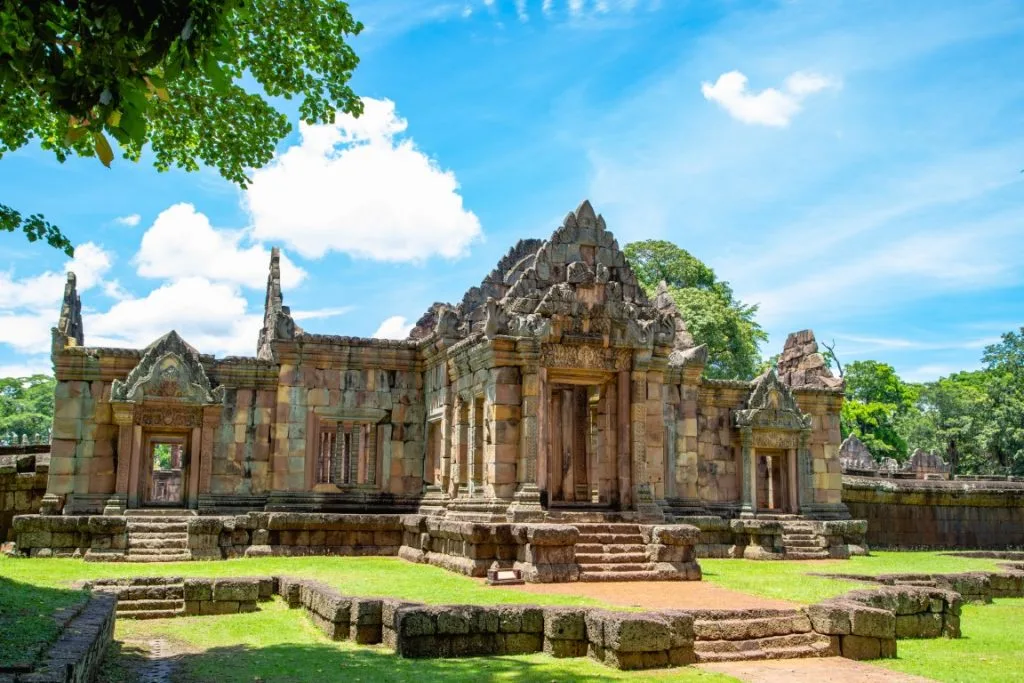
2. Prasat Hin Mueang Tam is located at Ban Khok Mueang, Chorakhe Mak Subdistrict, Prakhon Chai District, approximately 8 kilometers from Phanom Rung. This Khmer sanctuary on the plain is especially notable for its symmetrical plan, 4 L-shaped ponds, and elegant 5-headed naga balustrades surrounding the sacred area.
Highlight: A group of 5 brick towers, galleries, sandstone gateways, 4 corner ponds with naga-lined edges and 5-headed naga figures, as well as lintels and Hindu carvings in the Khleang and Baphuon artistic styles.
Prasat Mueang Tam was constructed around the 10th–12th centuries CE and was associated with the ancient communities at the foot of Phanom Rung. Although no inscription directly identifies the exact construction date or founder, the style of the architecture allows archaeologists to date the complex with reasonable confidence.
One feature that distinguishes Mueang Tam from many other Khmer sanctuaries is its 4 L-shaped ponds, located within the enclosure and bordered by naga balustrades. These ponds create a striking architectural balance while also carrying symbolic meaning within Hindu cosmology.
The brick towers stand on a shared base. The principal tower originally occupied the center of the front row, although parts of the structure have been lost over time. Surviving lintels, pediments, and decorative elements still provide excellent examples of Khmer craftsmanship.
The site is generally easier to explore than Phanom Rung because it is located on flat ground. It is therefore suitable for families, older travelers who are comfortable walking, and visitors who want to photograph Khmer architecture without climbing steep stairs. Morning and late afternoon provide the best light.
Mueang Tam should ideally be visited on the same day as Phanom Rung. Because the two sites are close together, seeing both provides a more complete understanding of the relationship between major sacred monuments and the ancient communities that occupied the surrounding landscape.
Getting There: The sanctuary is located at Ban Khok Mueang, Chorakhe Mak Subdistrict, Prakhon Chai District, about 8 kilometers from Phanom Rung. A private vehicle is the most convenient option. Open daily from 07.00–18.00.
Map (GPS): https://www.google.com/maps/dir/?api=1&destination=14.496421,102.982480&travelmode=driving

3. Khao Kradong Forest Park is located in Samet Subdistrict, Mueang Buriram District. This extinct volcano close to the city combines nature, geology, religion, panoramic viewpoints, and local culture in one destination.
Highlight: An ancient volcanic crater, Phra Suphatthara Bophit, a large Buddha image overlooking the city, a replica Buddha footprint, the Khao Kradong stone sanctuary, a suspension bridge, and nature trails through dry dipterocarp forest.
The name Khao Kradong is believed to have developed from the expression “Phanom Kradong.” “Phanom” means mountain, while “Kradong” refers to a turtle shell, reflecting the mountain’s shell-like appearance. Over time, the pronunciation evolved into the present name Khao Kradong.
The volcanic crater is an important geological learning point in Buriram. Visitors can observe landforms created by ancient volcanic activity and follow nature trails through dry dipterocarp forest, local vegetation, and ecological learning areas.
At the summit stands Phra Suphatthara Bophit, a large Buddha image visible from many parts of the city. The area functions both as a place of worship and a viewpoint with broad views over Buriram and the surrounding countryside.
On the full moon of the 5th lunar month each year, the traditional Khao Kradong pilgrimage takes place. This annual event reflects the close relationship between the natural landscape and local religious belief, making Khao Kradong both a geological attraction and a living cultural site.
The forest park is suitable for families, students, nature lovers, merit-making visitors, and photographers. Chang Arena, Wat Pa Khao Noi, and the Huai Talat wetland area can all be visited on the same day because they are located within the Mueang Buriram zone.
Getting There: Khao Kradong Forest Park is located in Samet Subdistrict, Mueang Buriram District, only a short drive from central Buriram. Vehicles can travel up to the upper area. Open daily from 08.00–18.00.
Map (GPS): https://www.google.com/maps/dir/?api=1&destination=14.940496,103.094234&travelmode=driving

4. Chang Arena, known to long-time football fans by its former name i-Mobile Stadium, is located in Isan Subdistrict, Mueang Buriram District. It is the home stadium of Buriram United and one of the most important symbols of Buriram’s transformation from a province known mainly for history into one of Thailand’s leading sports cities.
Highlight: An international-standard football stadium with a capacity of approximately 32,600 spectators, stands positioned close to the pitch, the intense match-day atmosphere created by “Thunder Castle” supporters, club merchandise shops, and a broader sports-tourism zone around the stadium.
The stadium was previously known as New I-Mobile Stadium, I-Mobile Stadium, and Thunder Castle Stadium before adopting the name Chang Arena. The construction of a football-specific stadium represented an important milestone in the development of professional club football in Thailand.
One of the stadium’s main strengths is the proximity of the stands to the playing field, creating a more intense atmosphere than in a typical multi-purpose stadium. This is especially noticeable during major Buriram United matches, when supporters travel from across Thailand to attend.
Even when there is no match, the area around the stadium remains popular for photography, purchasing club merchandise, and exploring Buriram’s sports district. Travelers interested in entering the stadium interior should check current visitor access with the club because schedules change according to matches and special events.
Chang Arena is suitable for football fans, families, children, young travelers, and anyone interested in sports tourism. It can easily be combined with Khao Kradong and other nearby sports attractions because the sites are located close together.
If visiting on a match day, arrive early and allow extra time for traffic, parking, and ticket or security checks, particularly for major fixtures that attract large crowds.
Getting There: Chang Arena is located in Isan Subdistrict, Mueang Buriram District and is easily reached by private vehicle from central Buriram. Access to the stadium interior depends on match schedules and events, so current opening arrangements should be checked in advance.
Map (GPS): https://www.google.com/maps/dir/?api=1&destination=14.965843,103.094266&travelmode=driving
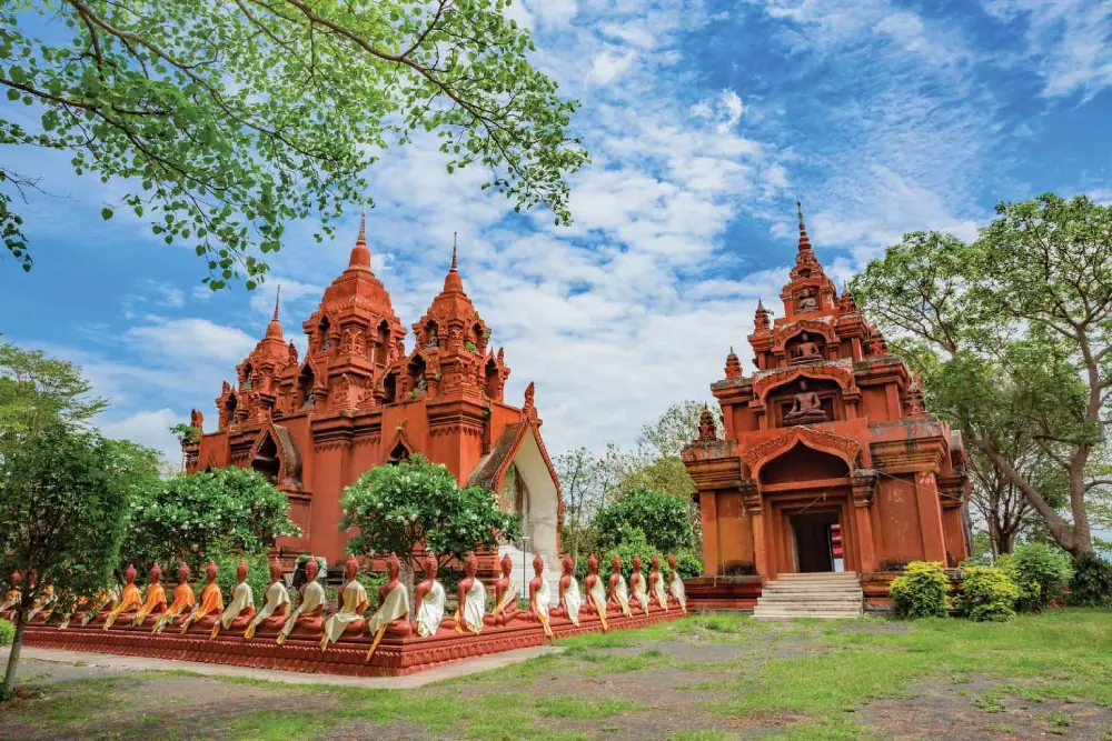
5. Wat Khao Angkhan, also known as Wat Khao Phra Angkhan, is located at Ban Charoen Suk, Charoen Suk Subdistrict, Chaloem Phra Kiat District. The temple stands on the summit of Khao Angkhan, an extinct volcano, and combines Buddhist art, archaeology, geology, and elevated scenery in one destination.
Highlight: An adapted architectural-style ordination hall, Buddhist Jataka murals, rows of Buddha images surrounding the building, a reclining Buddha, and Dvaravati-period basalt sema stones that indicate the site was used as a Buddhist religious area long before the present temple was established.
Khao Angkhan is an ancient extinct volcano rising prominently above the surrounding plains. Its terrain and basalt rock formations give the temple a landscape unlike most Buddhist sites in Northeastern Thailand and make the area important both religiously and geologically.
The sema stones found around the temple are associated with Dvaravati culture and indicate that the summit of Khao Angkhan had religious significance before the construction of the modern temple. The site therefore helps connect Buriram’s history from the Dvaravati period through the Khmer era and into contemporary Buddhist communities.
The temple architecture combines several artistic influences and uses distinctive colors, forms, and sculptures around the ordination hall. These features make Wat Khao Angkhan particularly popular with photographers, especially in the morning and late afternoon.
Travelers visiting Phanom Rung can add Wat Khao Angkhan to the same itinerary because the two are approximately 20 kilometers apart. Combining them allows visitors to experience Khmer heritage, Buddhist art, and extinct volcanic landscapes in a single day.
The temple is suitable for merit-making travelers, history enthusiasts, older visitors traveling by car, and photographers. Visitors should dress modestly and maintain respectful behavior within the religious grounds.
Getting There: Wat Khao Angkhan is located at Ban Charoen Suk, Charoen Suk Subdistrict, Chaloem Phra Kiat District and can be conveniently reached from Phanom Rung. Open daily from 08.00–18.00.
Map (GPS): https://www.google.com/maps/dir/?api=1&destination=14.534320,102.834492&travelmode=driving
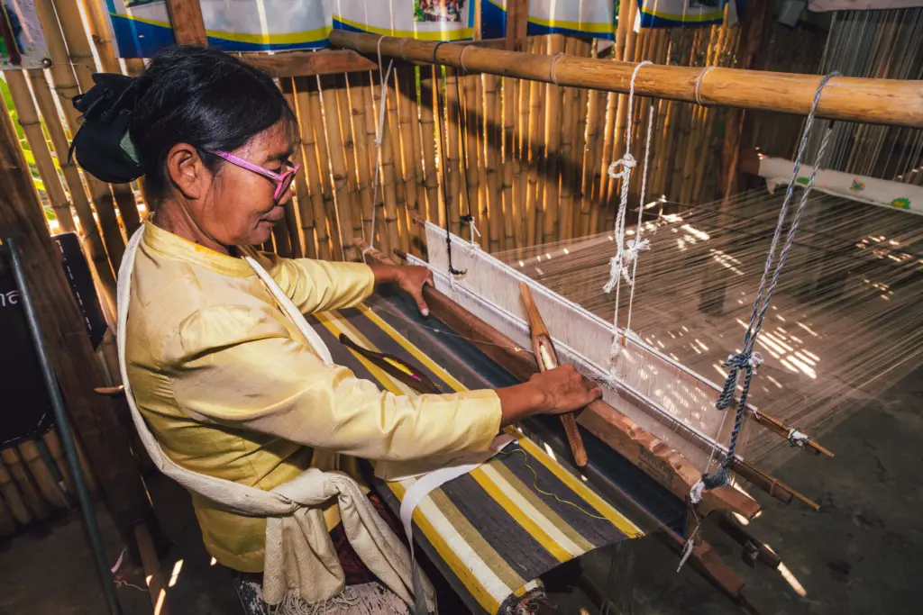
6. Na Pho Silk Weaving Village is an important center for traditional textile knowledge in Buriram, especially mudmee silk and the distinctive red-hemmed pha sin known as pha sin tin daeng. These textiles have become cultural signatures of communities in Na Pho District and nearby areas.
Highlight: Mudmee silk, red-hemmed pha sin, weaving on traditional looms, tying silk threads to create patterns before dyeing, and silk products that can be purchased directly from community producers.
The silk-weaving traditions of Na Pho have been passed down through generations and continuously developed in terms of patterns, production techniques, and color use. As a result, the textiles have value not only as clothing but also as works of art and cultural products.
The mudmee process begins with preparing the silk threads, designing the pattern, tying sections of the threads according to the intended motif, dyeing them, and finally weaving the colored silk on a loom. Every step requires accuracy and experience, giving each finished textile its own distinctive character.
The red-hemmed pha sin is another important local identity. Its lower section features a striking red band combined with regional mudmee patterns, creating a style strongly associated with Na Pho and Phutthaisong.
The village is suitable for travelers interested in culture, Thai textiles, design, education, and locally produced souvenirs. Groups or visitors wishing to see a detailed weaving demonstration should make arrangements with the community in advance.
Na Pho can be combined with nearby temples and communities to create a full-day route focused on handicrafts, local lifestyles, and regional food.
Getting There: The weaving village is located in Na Pho District, Buriram Province. A private vehicle is the most convenient option. Open daily from 09.00–16.00, and advance contact is recommended for group visits.
Map (GPS): https://www.google.com/maps/dir/?api=1&destination=15.645338,102.950472&travelmode=driving
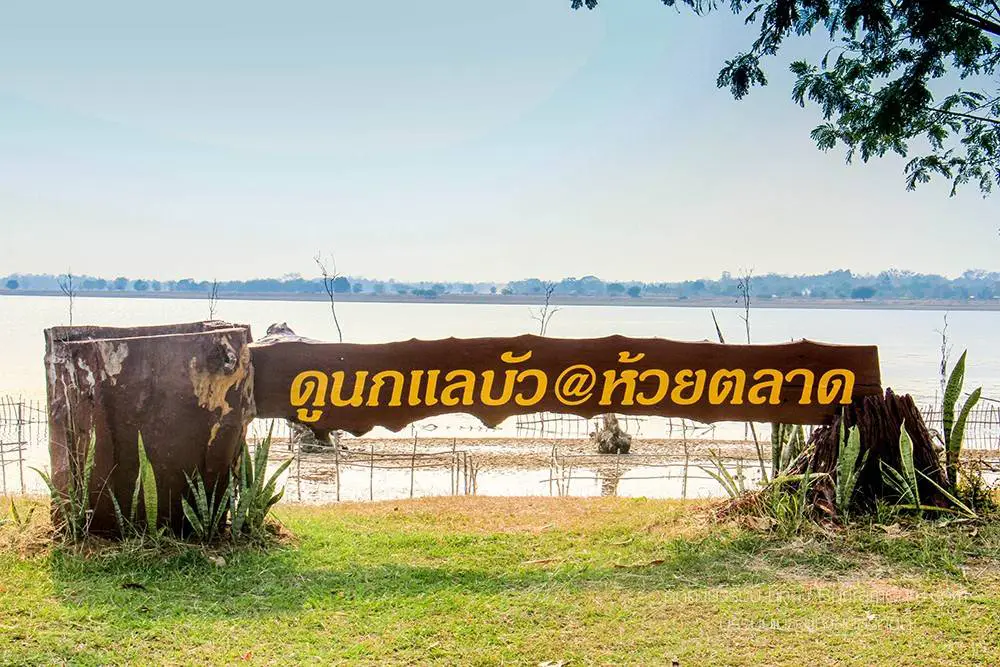
7. Huai Talat Reservoir lies around Sakae Sam Subdistrict and the adjoining area of Samet Subdistrict in Mueang Buriram District. This large body of water near the city plays an important role in local ecology, wildlife conservation, recreation, and birdwatching tourism.
Highlight: A broad reservoir, wetland habitats, aquatic vegetation, sunset viewpoints, and more than 100 species of waterbirds, resident birds, and migratory birds, particularly during the drier period from November to April.
Huai Talat Reservoir is closely connected with nearby wildlife and bird conservation areas, giving it ecological value beyond its role as a community water source. The surrounding ecosystem includes open water, mudflats, aquatic plants, grasslands, and trees that provide food and resting areas for many bird species.
November–April is especially suitable for birdwatching because lower water levels expose feeding areas for waterbirds and migratory species. In the evening, large flocks can often be seen returning to their roosts, creating one of the most impressive nature scenes close to Buriram city.
Visitors can walk, relax, take photographs, or observe birds with binoculars. Late afternoon is the best time for both temperature and light, but visitors should avoid approaching nests or making loud noises that could disturb wildlife.
The reservoir is suitable for families, couples, birdwatchers, and nature photographers. It can be combined with Buriram Bird Park, Khao Kradong, and Wat Pa Khao Noi in a single day.
Getting There: Huai Talat Reservoir is located in Sakae Sam Subdistrict, Mueang Buriram District, approximately 10–12 kilometers from the city via the Buriram–Prakhon Chai route. Open daily from 09.00–18.00.
Map (GPS): https://www.google.com/maps/dir/?api=1&destination=14.887763,103.081953&travelmode=driving
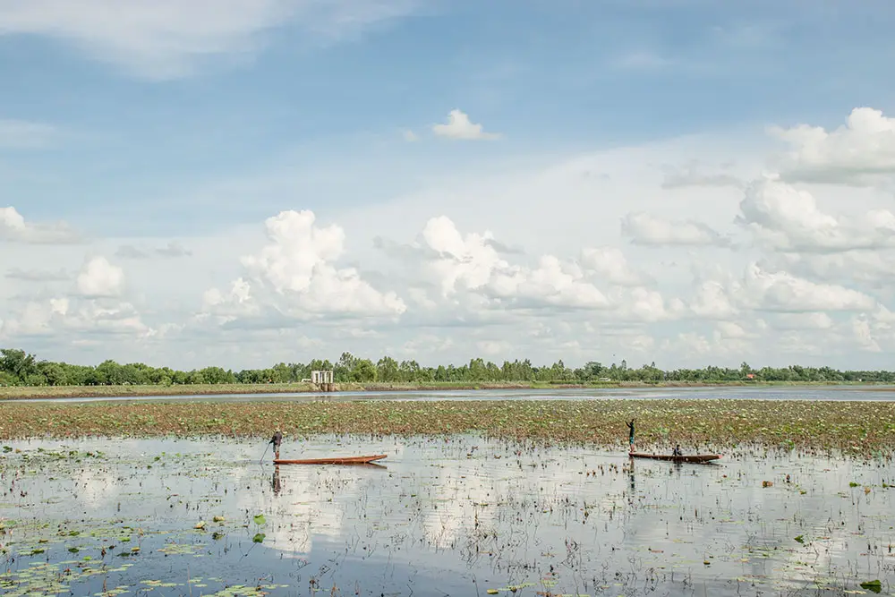
8. Buriram Bird Park is located around Huai Talat Reservoir in Sakae Sam Subdistrict, Mueang Buriram District. This important wetland and birdwatching area is only a short distance from the city and is ideal for travelers looking for a peaceful nature experience after exploring Buriram’s stone sanctuaries.
Highlight: More than 100 bird species, including waterbirds, migratory birds, and resident species. Between approximately 17.00–18.00, large flocks can often be seen returning to roost over the water and surrounding trees.
The area has been designated as a non-hunting zone since 1992 and forms an important part of the wetland ecosystem surrounding Huai Talat Reservoir. It serves as a seasonal feeding ground, resting area, and nesting habitat for numerous bird species.
November–April is the best season for birdwatching because both resident and migratory species use the area in large numbers. Birdwatchers should bring binoculars or telephoto lenses so they can observe behavior without approaching wildlife too closely.
Late afternoon is particularly rewarding as egrets and other birds gradually return to their roosts. The sight of large flocks crossing the reservoir in warm evening light makes this one of Buriram’s most appealing locations for nature photography.
Visitors should keep a respectful distance from wildlife, avoid feeding birds, keep noise levels low, and refrain from flying drones near bird flocks without permission. Conservation is the central purpose of the site.
Buriram Bird Park can be combined with Huai Talat Reservoir, Khao Kradong Forest Park, and Wat Pa Khao Noi in one day, making it suitable for a nature-focused itinerary around Mueang Buriram.
Getting There: The bird park is located in Sakae Sam Subdistrict, Mueang Buriram District. From the city, take the Buriram–Prakhon Chai route for approximately 12 kilometers. The area is accessible daily, with approximately 17.00–18.00 recommended for viewing returning bird flocks.
Map (GPS): https://www.google.com/maps/dir/?api=1&destination=14.887105,103.079749&travelmode=driving
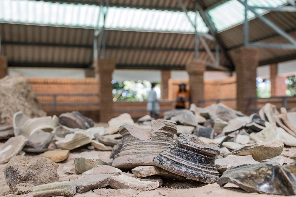
9. Ban Kruat Ancient Kiln Sites are located in Ban Kruat District. Important learning points can be found around Ban Kruat Wittayakhan School and nearby ancient kiln clusters. The remains provide major evidence that Ban Kruat was once an important production center for ancient Khmer ceramics in Lower Isan.
Highlight: Ancient kiln remains, Sawai Kiln, Nai Jian Kiln, high-fired stoneware, brown- and green-glazed ceramics, and evidence of the production of bowls, jars, pots, and other objects distributed through Khmer cultural networks.
The kiln sites in the Ban Kruat area date broadly from around the 9th–14th centuries CE, with important phases connected to the expansion of Khmer culture across Lower Isan. The large number of kiln remains shows that this was not simply an agricultural settlement but a significant ceramic-production area.
Products made here included brown-glazed ware, green-glazed ceramics, and several forms of high-fired stoneware. These artifacts help explain ancient economic systems, trade, and household use in the Khmer period beyond what can be learned from temple architecture alone.
Visiting Ban Kruat therefore provides an opportunity to understand Khmer civilization through everyday life and production technology, not only through religious monuments. Students and archaeology enthusiasts can see the relationship between raw materials, kiln technology, finished products, and distribution routes.
The site is suitable for history enthusiasts, archaeology travelers, students, and visitors looking for lesser-known attractions in Buriram. It can be combined with other archaeological sites in Ban Kruat District for a full-day route.
Getting There: One of the main learning areas is around Ban Kruat Wittayakhan School between kilometer markers 21–22 on Highway 2075, Ban Kruat District, approximately 66 kilometers from central Buriram. Open Monday–Friday from 08.30–16.30.
Map (GPS): https://www.google.com/maps/dir/?api=1&destination=14.445497,103.158901&travelmode=driving
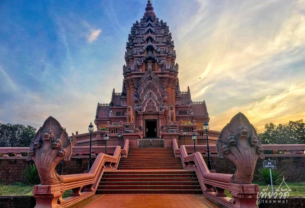
10. Wat Pa Khao Noi is located in Samet Subdistrict, Mueang Buriram District, close to Khao Kradong Forest Park. It is a forest meditation temple with a quiet and shaded atmosphere and is important to Thailand’s meditation tradition. Phra Borommathat Chedi Si Suwat Khun Anuson serves as the main spiritual landmark within the temple grounds.
Highlight: Phra Borommathat Chedi Si Suwat Khun Anuson, sacred Buddha relics, a natural forest-monastery atmosphere, and connections with Luang Pu Suwat Suvaco, a meditation master in the lineage of Luang Pu Mun Bhuridatta.
The chedi was constructed through the faith and support of disciples to enshrine Buddha relics and commemorate Luang Pu Suwat Suvaco. As a result, the temple is an important destination for followers of the Thai forest meditation tradition and for visitors wishing to pay respect to sacred relics.
The temple retains the principles of a forest monastery, emphasizing simplicity, tranquility, and closeness to nature. Entering the grounds feels very different from visiting a conventional tourist attraction, even though the temple is located only a short distance from Buriram city and Khao Kradong.
Visitors interested in meditation can use the temple as a place to learn about mindfulness, concentration, and the Thai forest tradition. Silence should be maintained, and temple rules should be followed carefully.
Wat Pa Khao Noi is suitable for merit-making travelers, older visitors, meditation practitioners, and anyone looking for a quiet break from the city. Allow at least 1 hour for worship and walking around the grounds, or longer if you wish to sit quietly and reflect.
The temple is particularly convenient to visit after Khao Kradong Forest Park because both are in the same area. The itinerary can then continue to Huai Talat Reservoir or Buriram Bird Park in the late afternoon.
Getting There: Wat Pa Khao Noi is located in Samet Subdistrict, Mueang Buriram District, close to Khao Kradong. A private vehicle is convenient. Open daily from 08.00–17.00. Visitors should dress modestly and maintain a quiet atmosphere within the temple.
Map (GPS): https://www.google.com/maps/dir/?api=1&destination=14.927740,103.094831&travelmode=driving
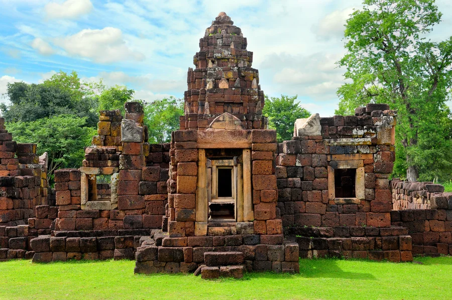
11. Kuti Ruesi Ban Khok Mueang, also known as Kuti Ruesi Mueang Tam, is located at Ban Khok Mueang, Chorakhe Mak Subdistrict, Prakhon Chai District. This compact Khmer archaeological site is important for understanding the wider cultural landscape around Prasat Mueang Tam and Phanom Rung because it was connected not only with religion but also with the ancient system of Arokayasala hospitals, water management, and transportation routes.
Highlight: A laterite sanctuary tower, library building, enclosure wall, eastern gateway, ancient reservoir, and architectural fragments including lintels, naga figures, makara disgorging naga, and lotus-petal decorations.
The site developed from approximately the 11th–12th centuries CE and was later adapted for use as an Arokayasala, or religious complex associated with a hospital, during the 13th century under the Mahayana Buddhist tradition of King Jayavarman VII.
Arokayasala hospitals were among the major public works established during the reign of King Jayavarman VII. Hospitals and associated shrines were constructed along important settlements and transportation routes throughout the Khmer Empire. The presence of Kuti Ruesi at Ban Khok Mueang therefore demonstrates that the foothill area around Phanom Rung contained interconnected religious sites, communities, water sources, and public infrastructure.
The archaeological structures are relatively small and can be explored in a short time, but history enthusiasts should pay close attention to the site plan and reservoir, as these are common elements found at many Arokayasala complexes constructed during the reign of Jayavarman VII.
Kuti Ruesi Ban Khok Mueang is only about 1 kilometer from Prasat Mueang Tam, making it an excellent additional stop after visiting the larger sanctuary. The extra travel time is minimal, yet the site adds considerable depth to an understanding of the ancient community system.
The attraction is suitable for history enthusiasts, archaeology travelers, students, and visitors interested in exploring Khmer civilization in greater detail. Avoid climbing the archaeological structures or unnecessarily touching ancient stone elements.
Getting There: The site is located at Moo 6, Ban Khok Mueang, Chorakhe Mak Subdistrict, Prakhon Chai District, approximately 1 kilometer from Prasat Mueang Tam. Open daily from 06.00–18.00.
Map (GPS): https://www.google.com/maps/dir/?api=1&destination=14.501161,102.976508&travelmode=driving
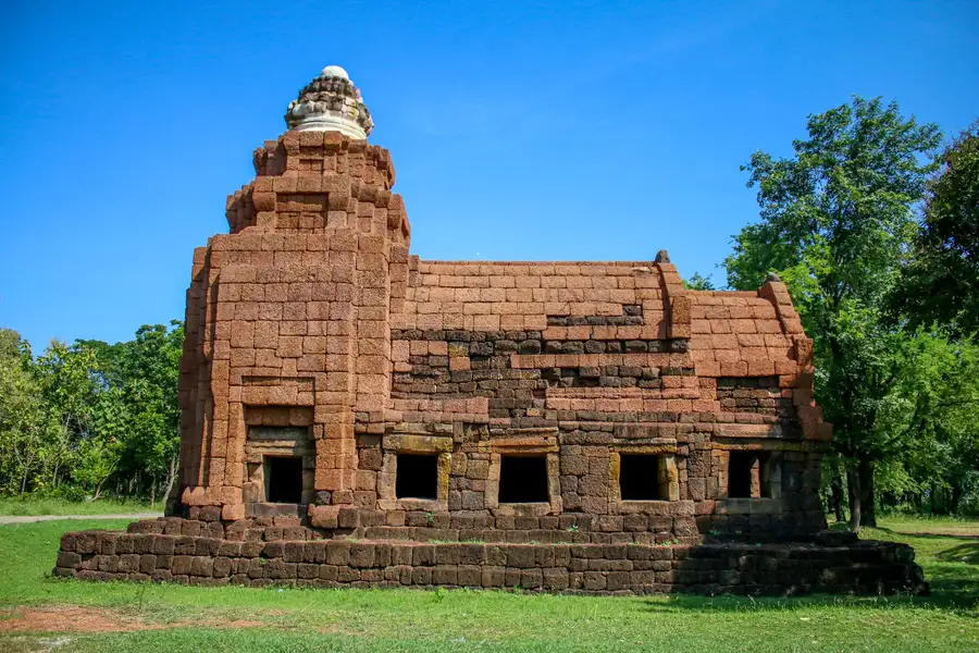
12. Prasat Ban Bu, also known as Kuti Ruesi Ban Bu, is located within Ban Bu Wittayasan School at Ban Bu, Chorakhe Mak Subdistrict, Prakhon Chai District. This small Khmer archaeological site is highly significant as evidence of the ancient transportation network and accommodation system developed during the reign of King Jayavarman VII.
Highlight: A rectangular laterite building believed to have functioned as a “Vahni Griha,” or rest house for travelers along an ancient route, together with a lintel fragment depicting a seated Buddha within an ornamental arch, reflecting Mahayana Buddhist beliefs.
Prasat Ban Bu demonstrates that the Khmer cultural network consisted of much more than monumental sanctuaries. Rest houses were also distributed along important routes linking Angkor with Lower Isan and Phimai, supporting long-distance travel across the empire.
During the reign of King Jayavarman VII, many forms of public infrastructure were developed, including Arokayasala hospitals, bridges, roads, and traveler rest houses. Prasat Ban Bu is therefore valuable evidence of transportation policy and mobility during this period.
The site stands beside Highway 2221 on the same general route as Prasat Mueang Tam and Phanom Rung, making it easy to add to a historical itinerary without a major detour.
Although the archaeological remains are modest in scale, their plan and original function make the site especially interesting for travelers who have already visited major Khmer sanctuaries and want to understand the supporting infrastructure of ancient society.
Getting There: Prasat Ban Bu is located within Ban Bu Wittayasan School, Ban Bu, Moo 5, Chorakhe Mak Subdistrict, Prakhon Chai District, beside Highway 2221. Daytime visits during the school’s normal operating hours are recommended.
Map (GPS): https://www.google.com/maps/dir/?api=1&destination=14.533783,102.979234&travelmode=driving

13. Lam Nang Rong Dam is located in Non Din Daeng Subdistrict, Non Din Daeng District. This large earth dam and natural recreation area plays an important role in water storage, agriculture, local livelihoods, and leisure around the reservoir.
Highlight: A broad reservoir, paved road along the dam crest, Lam Nang Rong Beach, waterside restaurants, mountain and water views, and sunset viewpoints ideal for relaxing in the late afternoon.
Lam Nang Rong Dam is part of a development project established to support security and local development under a royal initiative. It provides water for agriculture and communities in Non Din Daeng District and surrounding areas, giving it both economic and water-management importance.
The road along the dam crest is convenient for scenic driving. From the upper area, visitors can enjoy wide views of the reservoir and surrounding landscape. Late afternoon and evening provide attractive light, cooler temperatures, and good conditions for photography and dining beside the water.
The area known as Lam Nang Rong Beach is another popular recreation spot for local residents. Its freshwater shoreline creates a relaxed atmosphere suitable for families and groups of friends who prefer a leisurely outing rather than hiking or archaeological sightseeing.
Lam Nang Rong Dam can be combined with the Rao Su Monument nearby, creating a Non Din Daeng itinerary that includes contemporary history, nature, and reservoir scenery in one day.
Getting There: The dam is located in Non Din Daeng Subdistrict, Non Din Daeng District. A private vehicle is the most convenient option. Open daily from 08.00–17.00.
Map (GPS): https://www.google.com/maps/dir/?api=1&destination=14.298724,102.757397&travelmode=driving
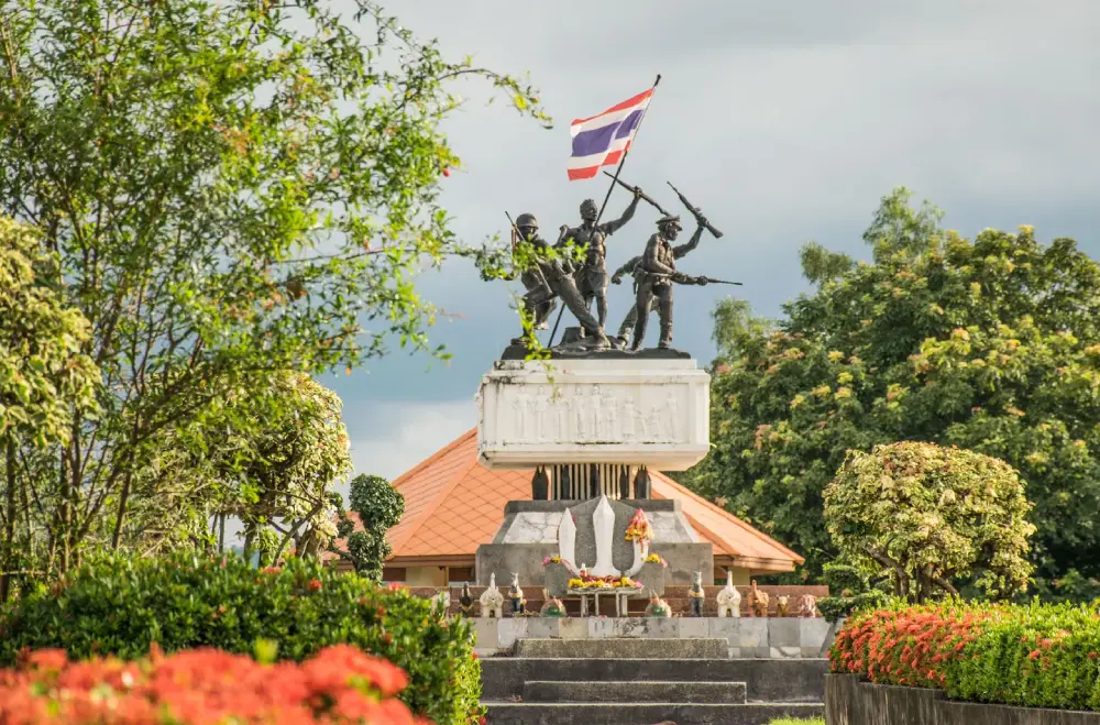
14. Rao Su Monument is located beside Highway 348 in Non Din Daeng District. This important memorial was created to honor civilians, government officials, police officers, soldiers, volunteers, and others who sacrificed their lives during periods of unrest in the border area.
Highlight: A group of dark-colored free-standing sculptures mounted on a high base, depicting civilians and officials fighting together and symbolizing unity, sacrifice, and the historical memory of the Non Din Daeng community.
Non Din Daeng was historically a strategically important border area and experienced periods of security-related conflict. The monument therefore represents a significant chapter of Buriram’s modern history beyond the province’s better-known Khmer monuments and archaeological sites.
The monument depicts people from several groups standing and struggling together on the same base, emphasizing that the defense of the community depended on cooperation between local residents and government personnel rather than a single organization.
The site is suitable for travelers interested in contemporary history, students, and those passing along the Non Din Daeng–Ta Phraya route. A visit generally takes around 20–30 minutes.
Rao Su Monument is best combined with Lam Nang Rong Dam, as both are located in the same general area. Together they offer an itinerary combining historical learning with relaxation beside the reservoir.
Getting There: The monument is located in Non Din Daeng Subdistrict, Non Din Daeng District, beside Highway 348 on the Lahan Sai–Ta Phraya route. It is an outdoor site accessible daily, 24 hours a day.
Map (GPS): https://www.google.com/maps/dir/?api=1&destination=14.299497,102.743909&travelmode=driving

15. Old Airport Reservoir is located in Prakhon Chai District. This large wetland includes open water, shallow-water zones, grasslands, waterside vegetation, rice fields, and surrounding communities. It provides habitat for waterbirds, resident species, and migratory birds.
Highlight: A broad wetland landscape, one of Prakhon Chai District’s notable birdwatching areas, open-water views, grasslands, and an ecosystem very different from Buriram’s better-known image of Khmer stone sanctuaries and sports venues.
The Old Airport Reservoir reveals another side of Buriram through the relationship between wetland ecology, agriculture, and community life. Shallow-water areas and aquatic vegetation provide important feeding grounds for many bird species.
The cool season and periods when migratory birds are present are particularly suitable for birdwatching. Binoculars or a telephoto lens are recommended so visitors can observe birds without approaching their feeding and resting areas.
The reservoir is suitable for birdwatchers, families, photographers, and travelers who prefer quiet destinations. Morning and late afternoon generally provide better light and cooler conditions than midday.
The site can be combined with Prasat Mueang Tam, Kuti Ruesi Ban Khok Mueang, and other attractions in Prakhon Chai District to add a natural component to an archaeology-focused itinerary.
Getting There: The Old Airport Reservoir is located in Prakhon Chai District, Buriram Province. A private vehicle is the most convenient option. Open daily from 08.00–17.00.
Map (GPS): https://www.google.com/maps/dir/?api=1&destination=14.639721,103.069197&travelmode=driving
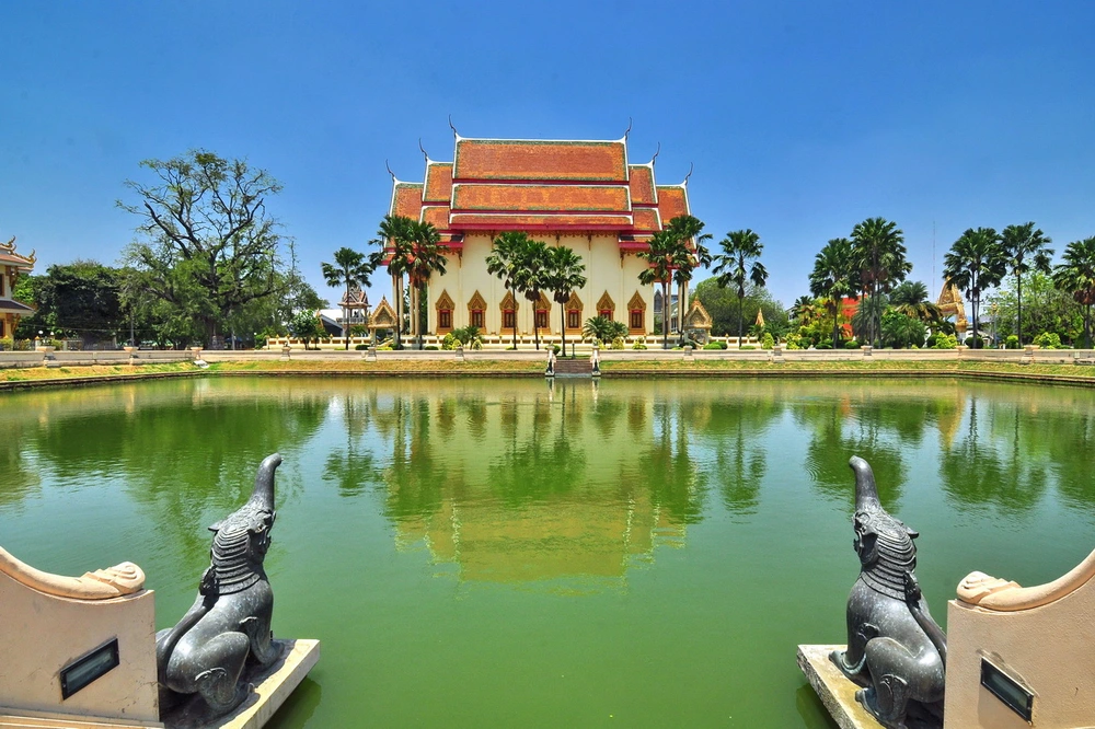
16. Wat Klang Phra Aram Luang is located on Lak Mueang Road in Nai Mueang Subdistrict, Mueang Buriram District. This historic temple is closely associated with the development of Buriram city and holds the status of a third-class royal temple of the Maha Nikaya order. It is important for religion, local history, and community memory.
Highlight: A royal temple in the heart of Buriram, a sacred pond, historical connections with the Thonburi period, important religious buildings, and a convenient location close to the City Pillar Shrine, old market areas, and central Buriram.
The temple’s history is associated with accounts of the military campaign led by Chao Phraya Maha Kasatsuek, who later became King Rama I. The area around the temple is said to have served as a military resting point, while its pond functioned as an important water source.
The pond inside the temple has long been regarded as one of the province’s sacred water sources and has been associated with important royal ceremonies. This gives Wat Klang significance at the provincial level beyond its role as an ordinary community temple.
Because the temple is located in central Buriram, it is particularly convenient for travelers with limited time or those planning a walking route through the old city. Visitors can pay respect at the temple and continue to the City Pillar Shrine and Khlong La Lom nearby.
The temple is suitable for merit-making travelers, older visitors, families, and anyone interested in the history of Buriram city. Visitors should dress modestly and avoid making unnecessary noise in areas used for religious ceremonies.
Getting There: Wat Klang is located on Lak Mueang Road, Nai Mueang Subdistrict, Mueang Buriram District, close to the Buriram City Pillar Shrine. Open daily from 06.00–18.00.
Map (GPS): https://www.google.com/maps/dir/?api=1&destination=14.996244,103.112674&travelmode=driving
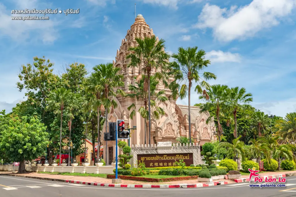
17. Buriram City Pillar Shrine, known locally as the Chao Pho Lak Mueang Shrine, is located in the heart of Buriram on Lak Mueang Road. It is an important spiritual center combining the city pillar and a Chinese shrine within the same complex.
Highlight: Architecture inspired by Khmer sanctuaries and Phanom Rung, the city pillar, sacred figures associated with the city, and a Chinese shrine reflecting the coexistence of several cultural traditions.
Buriram residents commonly visit the shrine to pray for success in work, stability, safe travel, family well-being, and general good fortune. Many travelers also choose to pay respect here before beginning a wider journey through the province.
The architecture is inspired by Khmer artistic forms that are strongly associated with Buriram’s identity. This gives the shrine an appearance different from many other provincial city pillar shrines and connects the visual language of ancient architecture with a contemporary urban religious space.
The same complex also includes a Chinese shrine respected by Buriram’s Thai-Chinese community. The site therefore illustrates the coexistence and blending of several belief systems within the city.
The shrine is suitable for merit-making travelers, families, and visitors staying in central Buriram. It can easily be combined with Wat Klang, Khlong La Lom, old markets, and other attractions in the city center without significant travel time.
Getting There: The shrine is located on Lak Mueang Road, Nai Mueang Subdistrict, Mueang Buriram District, close to Wat Klang. Open daily from 06.00–17.00.
Map (GPS): https://www.google.com/maps/dir/?api=1&destination=14.995941,103.113795&travelmode=driving
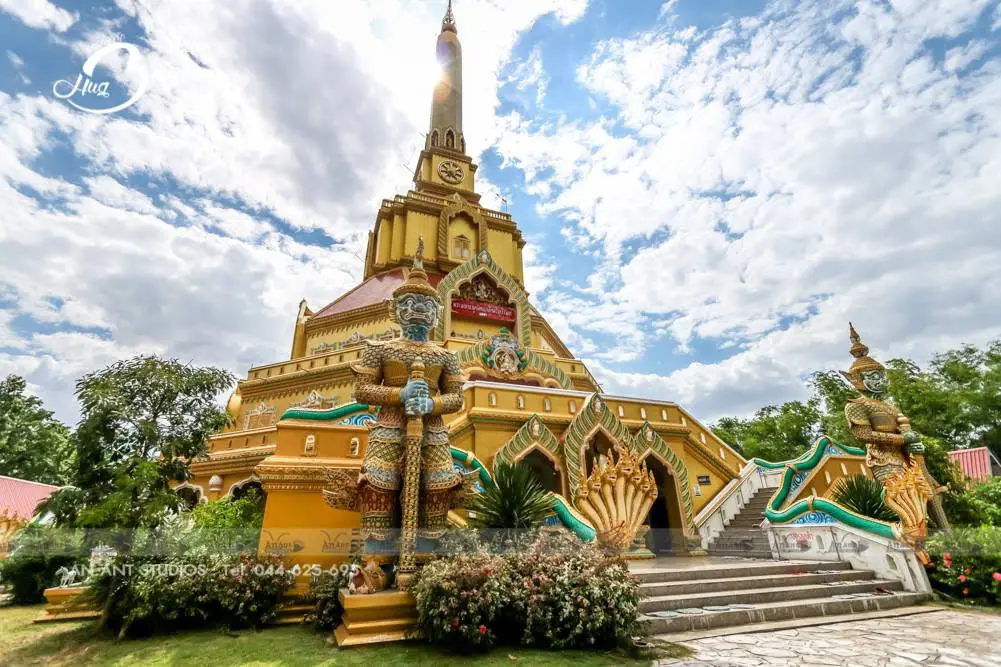
18. Wat Rahan (Ko Kaeo Thudongkhasathan) is located in Ban Dan Subdistrict, Ban Dan District. This well-known meditation temple in Buriram houses Phra Maha That Rattana Chedi Si Buriram and is suitable for visitors who wish to worship, make merit, and spend time in a peaceful temple environment.
Highlight: Phra Maha That Rattana Chedi Si Buriram, sacred Buddha relics, a forest-meditation atmosphere, and a close association with Luang Pu Chan Raem Khemasiri, a highly respected monk among Buriram Buddhists.
The temple was founded in 1993 and was officially established as a Buddhist temple on September 29, 2000. From a relatively small meditation area, it gradually developed into one of the most important spiritual centers in Ban Dan District.
Phra Maha That Rattana Chedi Si Buriram is the temple’s principal landmark, both architecturally and spiritually. The chedi is associated with the enshrinement of sacred Buddha relics and other revered Buddhist objects.
The term “Thudongkhasathan” reflects the temple’s role as a place for mental discipline, mindfulness, and meditation. Visitors should therefore maintain a quiet atmosphere and avoid treating the site merely as a location for photography.
The temple is suitable for merit-making travelers, older visitors, people interested in Thai forest meditation, and anyone seeking a calm break from Buriram’s busier attractions. Allow at least 1 hour to pay respect and walk around the grounds.
Getting There: Wat Rahan is located at Moo 18, Ban Dan Subdistrict, Ban Dan District, Buriram Province. Open daily from 08.00–17.00.
Map (GPS): https://www.google.com/maps/dir/?api=1&destination=15.135326,103.190551&travelmode=driving
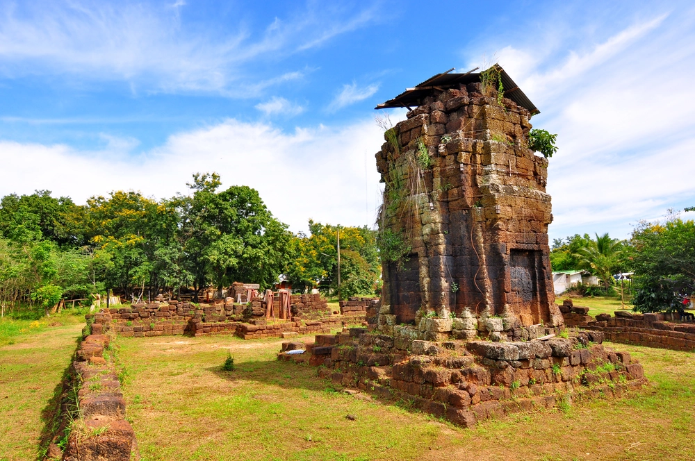
19. Ban Khok Ngio Sanctuary, also known as Prasat Khok Ngio, is located within Wat Khok Ngio in Pakham Subdistrict, Pakham District. It was an Arokayasala, or religious sanctuary associated with a hospital, constructed according to Mahayana Buddhist beliefs during the reign of King Jayavarman VII in the 13th century CE.
Highlight: The main sanctuary, viharn or library structure, enclosure wall, gateway, ritual pond, and important finds including an inscription on a bronze plate, images associated with Bhaisajyaguru and Avalokitesvara, and a lintel depicting Gajalakshmi.
Ban Khok Ngio Sanctuary reveals another dimension of Khmer civilization because it was not created primarily as a monumental temple. Instead, the complex was connected with healing and public welfare under the Mahayana Buddhist policies of King Jayavarman VII.
Bhaisajyaguru, the Medicine Buddha, is associated with healing in Mahayana Buddhism. Archaeological evidence related to this figure at Arokayasala sites helps explain the relationship between religion, ritual practice, and medical care during the Khmer period.
The sanctuary has a rectangular plan facing east and contains architectural elements similar to other Arokayasala complexes found across Lower Isan, making it an important site for archaeological comparison.
The attraction is suitable for visitors interested in history, Khmer architecture, and lesser-known archaeological destinations. It can be conveniently visited while traveling along the Nang Rong–Pakham route.
Getting There: The sanctuary is located within Wat Khok Ngio at Ban Khok Ngio, Pakham Subdistrict, Pakham District, along Highway 348 on the Nang Rong–Pakham route, approximately 3 kilometers before Pakham District. It is open daily, with daytime visits recommended.
Map (GPS): https://www.google.com/maps/dir/?api=1&destination=14.463443,102.727723&travelmode=driving
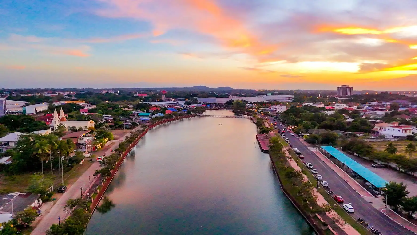
20. Ancient Moat (Khlong La Lom) is located in the heart of Buriram Municipality. This oval-shaped ancient moat once surrounded the old settlement and provides important evidence of Buriram’s urban development before the emergence of the modern city. Today, the 6 sections of Khlong La Lom continue to function as waterways, green spaces, walking and exercise areas, and open-air historical learning spaces.
Highlight: 6 sections of ancient moat approximately 1,800 years old, an enclosed urban water system, public spaces along the canals, and evidence associated with the old settlement known as Mueang Pae, which preceded the development of present-day Buriram.
Archaeological evidence from the old city area indicates that Buriram was inhabited from the prehistoric Iron Age before developing through the Dvaravati period and later receiving strong Khmer cultural influence.
Khlong La Lom was therefore not simply an ornamental canal. It was connected with city planning, water storage, community defense, and everyday life. The moat system shows that ancient communities organized urban space and managed water resources in a systematic way.
Today, the landscape has been improved for recreation and exercise, allowing history to remain integrated with the everyday lives of Buriram residents. It is an example of an archaeological landscape that has not been isolated from the modern city but continues to serve public functions.
Late afternoon and evening are pleasant times to walk along the canals and enjoy the city atmosphere. The moat can easily be combined with the Buriram City Pillar Shrine, Wat Klang, markets, and restaurants in central Buriram.
The ancient moat was officially registered as an archaeological site on June 4, 1980. Visitors should help keep the area clean and avoid any activity that could damage the historical landscape.
Getting There: Khlong La Lom is located in central Buriram Municipality, Nai Mueang Subdistrict, Mueang Buriram District. It is an outdoor public area accessible daily throughout the day.
Map (GPS): https://www.google.com/maps/dir/?api=1&destination=14.993963,103.113852&travelmode=driving
| Topic | Details |
| Province Overview | Buriram is a major province in Lower Northeastern Thailand with a distinctive combination of Khmer civilization, extinct volcanoes, Buddhist heritage, silk-weaving communities, wetlands, sports tourism, and natural attractions. It can be explored as a 1-day trip or over 4–5 days by dividing the itinerary into geographic zones. |
| Top 10 Highlights | 1. Phanom Rung Historical Park 2. Prasat Hin Mueang Tam 3. Khao Kradong Forest Park 4. Chang Arena 5. Wat Khao Angkhan 6. Na Pho Silk Weaving Village 7. Huai Talat Reservoir 8. Buriram Bird Park 9. Ban Kruat Ancient Kiln Sites 10. Wat Pa Khao Noi |
| Mueang Buriram Zone | 1. Khao Kradong Forest Park 2. Chang Arena 3. Huai Talat Reservoir 4. Buriram Bird Park 5. Wat Pa Khao Noi 6. Wat Klang Phra Aram Luang 7. Buriram City Pillar Shrine 8. Ancient Moat (Khlong La Lom) This zone is ideal for a 1-day itinerary and for travelers staying in the city because it combines nature, religion, urban history, and sports tourism. |
| Phanom Rung–Mueang Tam Zone | 1. Phanom Rung Historical Park 2. Prasat Hin Mueang Tam 3. Wat Khao Angkhan 4. Kuti Ruesi Ban Khok Mueang 5. Prasat Ban Bu This is the most important zone for travelers interested in Khmer civilization, ancient religious architecture, extinct volcanoes, and historical transportation routes. |
| Ban Kruat Zone | 1. Ban Kruat Ancient Kiln Sites Best for visitors interested in ancient ceramic technology, Khmer stoneware, and production systems within Lower Isan archaeological communities. |
| Na Pho Zone | 1. Na Pho Silk Weaving Village Ideal for learning about mudmee silk, red-hemmed pha sin, traditional weaving, and purchasing locally made textiles directly from community artisans. |
| Non Din Daeng Zone | 1. Lam Nang Rong Dam 2. Rao Su Monument Suitable for travelers who want to combine reservoir scenery and relaxation with an introduction to the modern border history of the area. |
| Prakhon Chai Zone | 1. Prasat Hin Mueang Tam 2. Kuti Ruesi Ban Khok Mueang 3. Prasat Ban Bu 4. Old Airport Reservoir This route combines Khmer archaeology with wetlands, birdwatching, and quiet natural scenery. |
| Ban Dan Zone | 1. Wat Rahan (Ko Kaeo Thudongkhasathan) Recommended for merit-making travelers, meditation visitors, and those wishing to pay respect to sacred Buddha relics in a peaceful temple environment. |
| Pakham Zone | 1. Ban Khok Ngio Sanctuary Best for visitors interested in Arokayasala hospitals, Mahayana Buddhism, Bhaisajyaguru, and public-welfare policies during the reign of King Jayavarman VII. |
| Khmer Civilization and Archaeology | 1. Phanom Rung Historical Park 2. Prasat Hin Mueang Tam 3. Kuti Ruesi Ban Khok Mueang 4. Prasat Ban Bu 5. Ban Kruat Ancient Kiln Sites 6. Ban Khok Ngio Sanctuary 7. Wat Khao Angkhan, where Dvaravati sema stones help connect the region’s history before the Khmer period |
| Volcanoes and Geology | 1. Phanom Rung 2. Khao Kradong Forest Park 3. Khao Angkhan All 3 are extinct ancient volcanoes that have shaped Buriram’s landscape, religious sites, and tourism identity. |
| Merit-Making and Spiritual Travel | 1. Wat Khao Angkhan 2. Wat Pa Khao Noi 3. Wat Klang Phra Aram Luang 4. Buriram City Pillar Shrine 5. Wat Rahan (Ko Kaeo Thudongkhasathan) 6. Phra Suphatthara Bophit at Khao Kradong |
| Nature and Birdwatching | 1. Khao Kradong Forest Park 2. Huai Talat Reservoir 3. Buriram Bird Park 4. Old Airport Reservoir 5. Lam Nang Rong Dam |
| Culture and Handicrafts | Na Pho Silk Weaving Village is the province’s key destination for mudmee silk and red-hemmed pha sin. Visitors can learn about the weaving process and purchase textiles directly from local producers. |
| Sports and Sports Tourism | Chang Arena is one of the major landmarks of modern Buriram and the home stadium of Buriram United. It is suitable for football fans, families, and travelers interested in experiencing Thailand’s leading sports-city atmosphere. |
| Best for Families | 1. Prasat Hin Mueang Tam 2. Khao Kradong Forest Park 3. Chang Arena 4. Huai Talat Reservoir 5. Buriram Bird Park 6. Lam Nang Rong Dam 7. Buriram City Pillar Shrine 8. Ancient Moat (Khlong La Lom) |
| Best for Older Travelers | 1. Prasat Hin Mueang Tam 2. Chang Arena 3. Wat Khao Angkhan 4. Wat Klang Phra Aram Luang 5. Buriram City Pillar Shrine 6. Wat Rahan 7. Lam Nang Rong Dam Phanom Rung and Khao Kradong require more consideration for visitors with limited mobility because of stairs and sloping terrain. |
| Best for Photography | 1. Phanom Rung Historical Park 2. Prasat Hin Mueang Tam 3. Khao Kradong Forest Park 4. Chang Arena 5. Wat Khao Angkhan 6. Huai Talat Reservoir 7. Lam Nang Rong Dam 8. Buriram City Pillar Shrine |
| Local Food | Buriram offers classic Isan dishes such as larb, som tam, jaew dipping sauces, and grilled foods, together with dishes influenced by Northern Khmer communities. One of the city’s best-known foods is “standing meatballs,” or luk chin yuen kin, especially around the railway-station area. |
| Souvenirs | 1. Na Pho mudmee silk 2. Red-hemmed pha sin 3. Handwoven silk 4. Community handicrafts 5. Locally produced food products |
| Important Traditions | The Phanom Rung Festival is one of Buriram’s most prominent annual events, combining the ancient sanctuary, cultural performances, and the phenomenon of sunlight passing through the sanctuary doorways. Khao Kradong also has an annual pilgrimage on the full moon of the 5th lunar month, alongside traditional Isan merit-making festivals throughout the province. |
| 1-Day Khmer Heritage Route | Morning: Phanom Rung Historical Park Late Morning to Noon: Prasat Hin Mueang Tam Afternoon: Kuti Ruesi Ban Khok Mueang – Prasat Ban Bu Evening: Wat Khao Angkhan |
| 1-Day City Route | Morning: Khao Kradong Forest Park – Wat Pa Khao Noi Late Morning: Chang Arena Afternoon: Wat Klang – Buriram City Pillar Shrine Evening: Khlong La Lom or Huai Talat Reservoir |
| 2 Days, 1 Night | Day 1: Phanom Rung – Mueang Tam – Kuti Ruesi Ban Khok Mueang – Wat Khao Angkhan Day 2: Khao Kradong – Chang Arena – Wat Pa Khao Noi – City Pillar Shrine – Khlong La Lom |
| 3 Days, 2 Nights | Day 1: Phanom Rung and Mueang Tam route Day 2: Central Buriram and Khao Kradong Day 3: Choose Na Pho for silk weaving or Non Din Daeng for Lam Nang Rong Dam and Rao Su Monument |
| 4–5 Day Itinerary | Add Ban Kruat Ancient Kiln Sites, Old Airport Reservoir, Wat Rahan, Ban Khok Ngio Sanctuary, and Na Pho Silk Weaving Village for a more complete trip covering archaeology, nature, religion, sports, and community culture. |
| Best Time to Visit | Buriram can be visited throughout the year, but the cool season from approximately November–February is best for exploring stone sanctuaries and outdoor attractions. Birdwatching is particularly good from the cool season into early summer. Travelers hoping to see sunlight pass through the doorways at Phanom Rung should check the annual phenomenon dates in advance. |
| Getting Around the Province | A private car or rental vehicle is the most practical option for visiting several zones because Buriram’s attractions are spread across many districts. Plan by geographic clusters such as Mueang Buriram, Phanom Rung–Prakhon Chai, Ban Kruat, Na Pho, and Non Din Daeng. |
| Safety | Carry drinking water and sun protection when visiting stone sanctuaries and mountains. Watch for slippery surfaces during the rainy season, dress modestly at temples, do not climb archaeological structures, avoid unnecessary contact with carvings and artifacts, and keep a respectful distance from birds and wildlife in wetland areas. |
| Responsible Travel | Do not write on or climb archaeological monuments, remove stones or artifacts, disturb birds in wetland areas, or create unnecessary noise in temples. Buying textiles and handicrafts directly from local communities helps distribute tourism income more effectively. |
Frequently Asked Questions (FAQ)
Q: What are the must-visit attractions in Buriram?
A: Essential attractions include Phanom Rung Historical Park, Prasat Hin Mueang Tam, Khao Kradong Forest Park, Chang Arena, Wat Khao Angkhan, Huai Talat Reservoir, and Na Pho Silk Weaving Village because together they cover history, nature, sports, religion, and community culture.
Q: Where should I go if I have only 1 day in Buriram?
A: For a first visit focused on history, choose Phanom Rung, Mueang Tam, Kuti Ruesi Ban Khok Mueang, and Wat Khao Angkhan. If you prefer attractions close to the city, choose Khao Kradong, Chang Arena, Wat Pa Khao Noi, the City Pillar Shrine, and Khlong La Lom.
Q: How many days should I spend in Buriram?
A: 2 days and 1 night are enough for Phanom Rung, Mueang Tam, and central Buriram. If you also want to visit Na Pho, Ban Kruat, Non Din Daeng, or lesser-known archaeological sites, plan 3–5 days.
Q: Can Phanom Rung and Prasat Mueang Tam be visited on the same day?
A: Yes. They are approximately 8 kilometers apart and are the best pair of attractions to combine. Start at Phanom Rung in the morning, then continue to Mueang Tam, Kuti Ruesi Ban Khok Mueang, and Prasat Ban Bu.
Q: What is special about Phanom Rung Historical Park?
A: Its highlights include a Khmer sanctuary on an extinct volcano, a ceremonial walkway, naga bridges, the reclining Vishnu lintel, and the annual phenomenon of sunlight passing through the aligned sanctuary doorways.
Q: Which natural attractions should I visit in Buriram?
A: Recommended nature destinations include Khao Kradong Forest Park, Huai Talat Reservoir, Buriram Bird Park, Old Airport Reservoir, and Lam Nang Rong Dam. They are suitable for nature walks, birdwatching, photography, and relaxation.
Q: Does Buriram really have extinct volcanoes?
A: Yes. Important extinct volcanic landscapes include Khao Kradong, Phanom Rung, and Khao Angkhan. Today these sites serve as tourist attractions, religious areas, and geological learning destinations.
Q: Which places are best for merit-making in Buriram?
A: Recommended places include Wat Khao Angkhan, Wat Pa Khao Noi, Wat Klang Phra Aram Luang, Buriram City Pillar Shrine, Wat Rahan, and Phra Suphatthara Bophit at Khao Kradong.
Q: Where can I learn about Khmer civilization in Buriram?
A: Start with Phanom Rung and Prasat Mueang Tam, then add Kuti Ruesi Ban Khok Mueang, Prasat Ban Bu, Ban Khok Ngio Sanctuary, and the Ban Kruat Ancient Kiln Sites. Together they reveal religious architecture, hospitals, traveler rest houses, and ancient ceramic production.
Q: Where can I buy Buriram silk?
A: Na Pho District is one of the province’s best areas for mudmee silk and red-hemmed pha sin. Visitors can purchase products directly from community weavers and local producers.
Q: Is Buriram suitable for families with children?
A: Yes. Family-friendly options include Prasat Mueang Tam, Khao Kradong, Chang Arena, Huai Talat Reservoir, Buriram Bird Park, Lam Nang Rong Dam, the City Pillar Shrine, and Khlong La Lom.
Q: When is the best time for birdwatching in Buriram?
A: Approximately November–April is a good period for birdwatching around Huai Talat Reservoir and other wetland areas because both resident and migratory birds are present in greater numbers.
Q: What is the best season to visit Buriram?
A: The cool season from approximately November–February is the most comfortable period for visiting stone sanctuaries and outdoor attractions. Travelers wishing to see the sunlight phenomenon at Phanom Rung should check the exact annual dates separately.
Q: Can I travel around Buriram without a private car?
A: Central Buriram can be explored using local transport, but a private car, rental vehicle, or hired car with a driver is much more convenient for visiting Phanom Rung, Mueang Tam, Ban Kruat, Na Pho, and Non Din Daeng.
Q: What food and souvenirs is Buriram known for?
A: A famous city snack is luk chin yuen kin, or standing meatballs. Traditional food also includes larb, som tam, jaew dipping sauces, grilled dishes, and foods influenced by Northern Khmer communities. Popular souvenirs include mudmee silk, red-hemmed pha sin, handwoven textiles, and community products.
 Category: ●Travel Articles, Recipes
 Group: ●Travel Review, Food Review
Last Update : 3 WeekAgo
 Last Update : 3 WeekAgo
Recommend

 Art, Culture and Heritage
 Historical Sites and Monuments(14)
 Landmarks and Memorials(2)
 Art, Craft Centres, Tradition(6)
 Museums(3)
 Educational Places
 Museum for Study(1)
 Places of Worship
 Temple(74)
 Other Sacred Sites(5)
 Research and Development
 Royal Project(1)
 Suburban Living
 Village, Community(3)
 Nature and Wildlife
 National Parks and Marine Reserves(2)
 Mountain (Doi)(1)
 Dam, Reservoir, Lake(14)
 River, Canal(1)
 Bays and Beaches(1)
 Other natural attractions(2)
 Entertainment and Agricultural
 Animal camps and shows(1)
 Stadium(2)
 Farms, Parks and Ecotourism(2)
 Waterpark(2)
Travel Review, Food Review(1)


