
lovethailand home >South Travel Attractions >Satun Travel Attractions > 20 Best Places to Visit in Satun Popular Attractio..
TL;DR: 20 Best Places to Visit in Satun Popular Attractions.
20 Best Places to Visit in Satun Popular Attractions
20 Best Places to Visit in Satun: Popular Attractions in Southern Thailand Satun is a province on Thailand’s lower Andaman coast with a remarkable combination of world-class islands, coral reefs, limestone mountains, caves, waterfalls, tropical rainforest, mangrove forests, old-town heritage, and multicultural communities where Thai Buddhists, Thai Muslims, and sea people have lived together for generations. The province is far more than Koh Lipe alone. Tarutao National Park, Thale Ban National Park, Phu Pha Phet Cave, Satun UNESCO Global Geopark, ancient fossil sites, and border communities all contribute to Satun’s distinctive identity.
For first-time visitors, the main highlights include Koh Lipe, Tarutao National Park, Koh Khai, Koh Hin Ngam, Thale Ban National Park, Phu Pha Phet Cave, Wang Sai Thong Waterfall, Satun UNESCO Global Geopark, Pak Bara Beach, and Satun National Museum at Kuden Mansion. Travelers with 3–5 days should ideally devote at least 2 days to the sea and islands, then add a Thung Wa–Manang route or a Satun Town heritage route to experience the province’s nature, history, and culture more completely.
Satun has highly varied geography. The eastern side of the province is dominated by mountains and forests connected with the Banthat Range and the Malaysian border. Central areas contain lowlands, agricultural communities, and small towns, while the western side opens toward the Andaman Sea with coastlines, estuaries, mangrove forests, and numerous islands extending from Pak Bara toward the Tarutao and Adang–Rawi island groups.
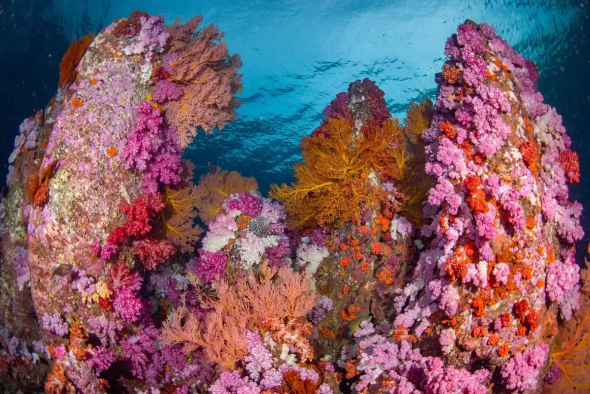
Satun’s sea is renowned for clear blue water, pale sandy beaches, coral reefs, and diverse marine ecosystems, particularly within Tarutao National Park. Inland areas are equally distinctive, with limestone mountains, caves, waterfalls, and fossil sites that give the province geological significance far beyond conventional beach tourism.
One of Satun’s most important features is Satun UNESCO Global Geopark, the first UNESCO Global Geopark in Thailand. Rather than being a single enclosed attraction, the geopark encompasses geological sites, caves, limestone mountains, fossils, waterfalls, beaches, islands, and communities, especially across Thung Wa, La-ngu, Manang, and surrounding areas.
Satun’s history has long been connected with the Malay world and the Malay Peninsula. The town once had close ties with Kedah and developed as a border settlement linked by both land and maritime routes. The name “Satun” is associated with the Malay word “Setoi,” referring to santol fruit and recalling the lush vegetation that once characterized the area.
The development of the town can still be seen through Kuden Mansion, historic buildings, Buri Wanit Road, mosques, and Buddhist temples located close to one another. Their architecture reflects Thai, Malay, Islamic, Chinese, and Western influences and gives Satun Town considerable heritage value beyond its role as a gateway to the islands.
Satun’s culture and traditions are strongly rooted in Thai Muslim communities, which form a major part of the province’s population. Islamic traditions influence clothing, food, family life, religious practice, and major celebrations such as Hari Raya. At the same time, Buddhist communities maintain their own temples and traditions, creating a long-established multicultural environment.
Another important cultural element is the way of life of the Urak Lawoi sea people around Koh Lipe and nearby islands. Their communities have maintained close relationships with the sea, fishing, boats, and seasonal cycles for generations. One of their best-known traditions is the Loy Ruea ceremony, a ritual associated with ancestral remembrance, removing misfortune, and bringing good fortune to the community.
Thung Wa and the Satun UNESCO Global Geopark area also preserve community traditions closely connected with caves, fossils, mangrove forests, and agriculture. Travel in Satun can therefore combine natural history with human stories through cave expeditions, fossil learning, community visits, and walks through historic neighborhoods.
Satun’s local food reflects strong Malay, Muslim, and Southern Thai influences. Important ingredients include fish, shrimp, crab, squid, and other Andaman seafood. Common dishes include coconut-based fish curries, massaman curry, Southern Thai curries, biryani-style rice dishes, roti, noodle dishes, and chili pastes served with local vegetables.
Travelers in Satun Town and La-ngu District will find many halal restaurants, while Pak Bara has numerous seafood restaurants and local eateries serving travelers before and after island trips. Food is therefore one of the best ways to understand the connection between Malay culture, Islam, and the marine resources of the Andaman coast.
This guide selects 20 attractions covering the major dimensions of Satun. The Top 10 focus on essential places for first-time visitors, while attractions 11–20 expand the journey into mosques, temples, old-town streets, geological caves, waterfalls, viewpoints, and inland nature routes to show how diverse Satun is beyond its beaches and islands.
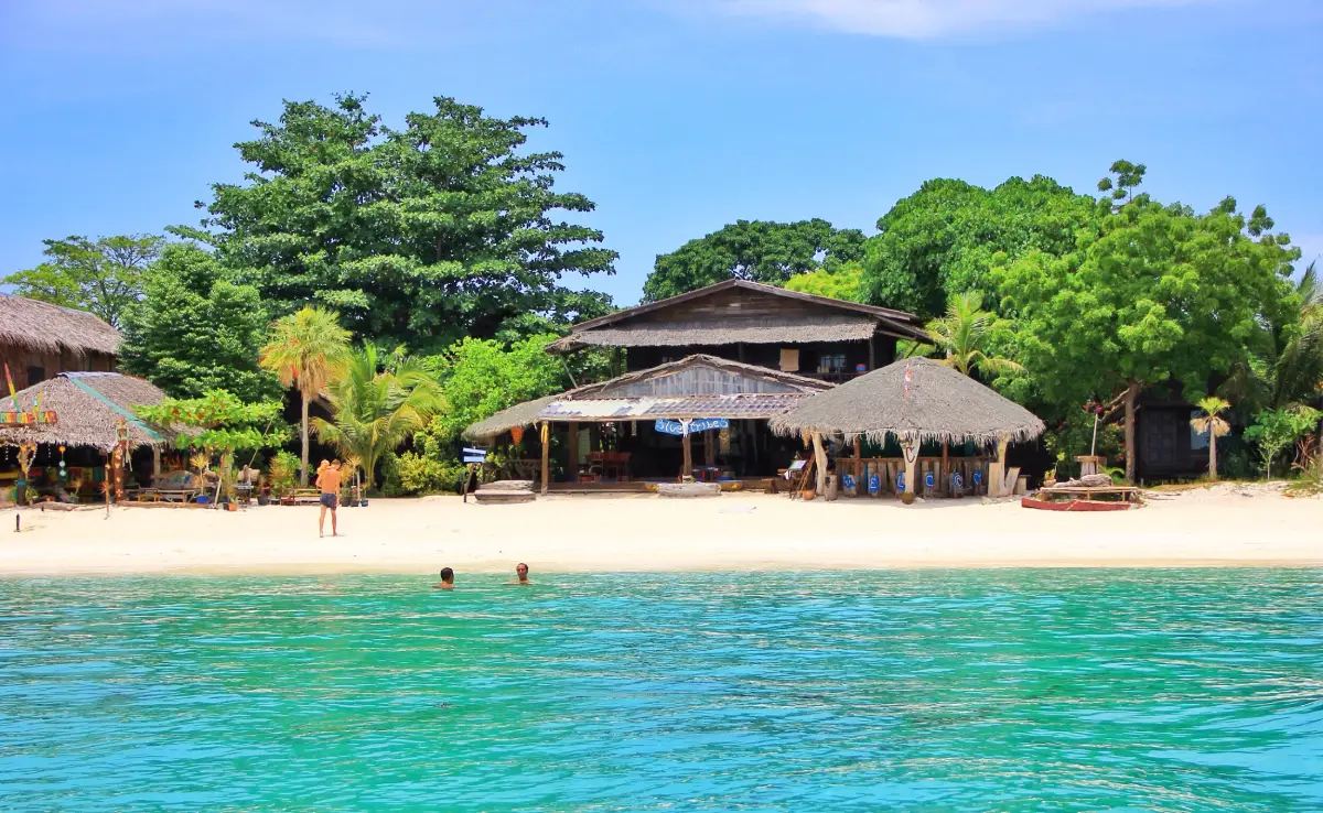
1. Koh Sipe (Koh Lipe) is one of the most famous island destinations in Satun. Located in Ko Sarai Subdistrict, Mueang Satun District, in the southern Andaman Sea, the island is known for fine white sand, clear water, coral reefs, and its position close to the Adang–Rawi island group, making it an excellent base for island-hopping and snorkeling trips.
The island has several important beaches, each with a different atmosphere. Some areas are ideal for sunrise views, others have restaurants and accommodation, while western parts of the island are popular for sunset watching. This variety allows visitors to spend several days on Koh Lipe without needing to take a boat trip every day.
Another important aspect of Koh Lipe is its Urak Lawoi community, which has lived on the island for generations. Traditional fishing, beliefs connected with the sea, and the Loy Ruea ceremony remain important parts of the island’s cultural identity. Koh Lipe should therefore be understood not only as a resort island but also as a living community with its own history and traditions.
The most suitable period for sea travel is generally around November to April. During the monsoon season, travelers should check waves, wind, national park announcements, and boat schedules carefully. Visitors should avoid stepping on coral, removing marine life, or leaving waste on beaches and should choose marine activities that follow responsible environmental practices.
Getting There: Travel from Satun Town or Hat Yai Airport to Pak Bara Pier in La-ngu District, then continue by speedboat or passenger boat according to the operating schedule. Travel time varies depending on the type of boat, intermediate stops, and sea conditions.
Map (GPS): https://maps.app.goo.gl/ZmHiCwUu82tvwxUN8
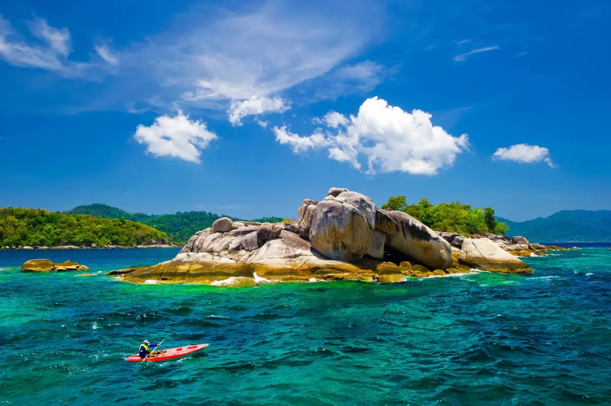
2. Tarutao National Park was Thailand’s first marine national park and remains one of the most important protected areas in the southern Andaman Sea. Covering approximately 1,490 square kilometers, it includes numerous islands divided broadly between the Tarutao group and the Adang–Rawi group.
The park contains mountains, tropical rainforest, mangrove forest, sandy beaches, bays, coral reefs, and rich marine ecosystems. Ko Tarutao, the largest island in the park, has several important bays including Ao Phante Malaka, Ao Talo Wao, and Ao Talo Udang, each offering different opportunities for relaxation, hiking, paddling, and nature exploration.
Tarutao also has major historical significance because the island was once used as a detention and penal settlement. As a result, visiting Ko Tarutao is not only about beaches and scenery but also about exploring sites connected with this unusual chapter of Thai history.
Access to islands and park areas is subject to annual opening and closing schedules, weather, and sea conditions. During the monsoon season, some routes or activities may be restricted for safety and ecosystem recovery, so travelers should always check current park announcements before departure.
Getting There: The main visitor access point is Pak Bara Pier in La-ngu District. From the pier, boats operate to Ko Tarutao and other islands according to seasonal routes and current park conditions.
Map (GPS): https://maps.app.goo.gl/5RX81tB4L69RPeQE8
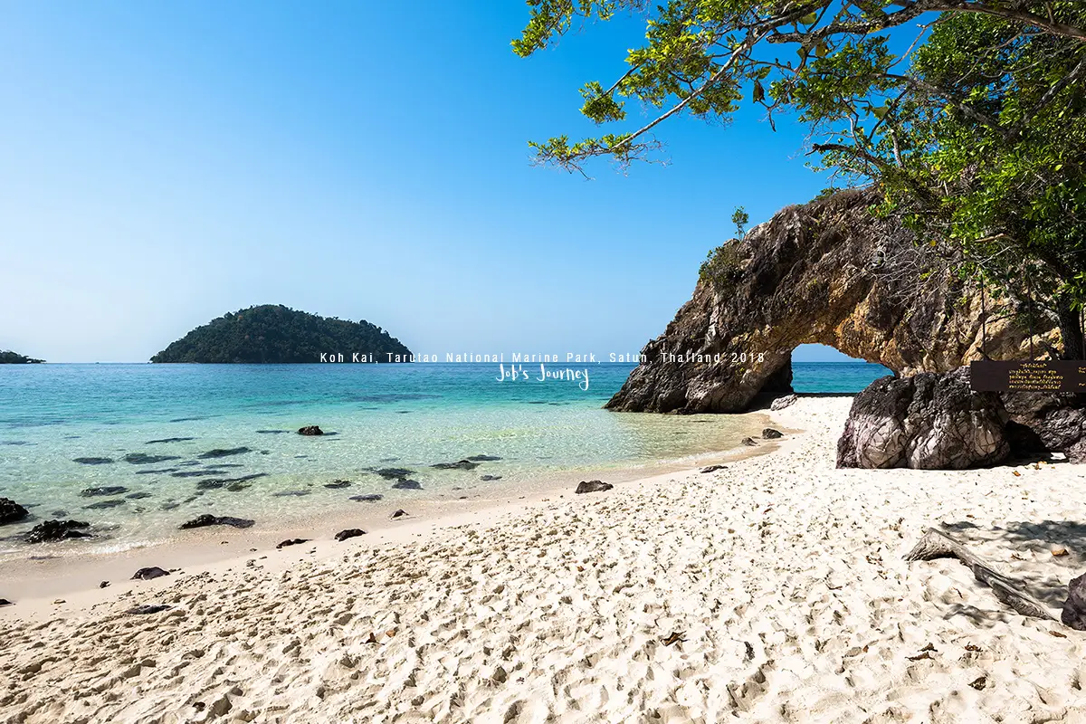
3. Koh Khai is a small island within Tarutao National Park, situated between Ko Tarutao and the Adang–Rawi island group. It is one of Satun’s most recognizable marine landmarks because of the natural stone arch standing beside the beach.
The arch was formed gradually by wave, wind, and seawater erosion, creating an opening through the coastal rock. Viewed from the beach, the natural stone frame opens toward the blue sea and sky, making it one of the most photographed locations on boat routes between Pak Bara and Koh Lipe.
The island is small and is not a destination for overnight stays. Most visitors stop briefly to walk on the beach, take photographs, observe the geological formation, and swim when conditions are safe. Whether boats can stop depends on tide levels, waves, weather, and the route being operated that day.
Visitors should avoid climbing on or damaging the stone arch and should never remove rocks, sand, shells, or other natural materials from the national park.
Getting There: Koh Khai is accessible only by boat. Travelers can reach it from Pak Bara Pier or as part of selected boat programs from Koh Lipe. It is commonly included as a stop between the mainland and the Adang–Rawi island group.
Map (GPS): https://maps.app.goo.gl/uBW76NJoQCsR73Ka7
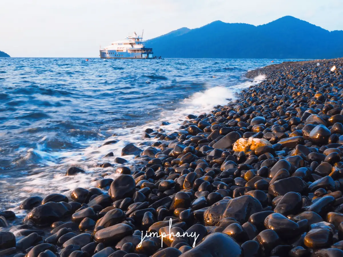
4. Koh Hin Ngam is a small island in the Adang–Rawi group with a shoreline very different from conventional tropical beaches. Instead of pale sand, much of the coast is covered with smooth black stones shaped and polished naturally by the movement of the sea.
When wet, the dark stones develop a glossy appearance that contrasts strikingly with the blue-green water. The island therefore offers both a distinctive photographic landscape and an opportunity to observe how coastal processes gradually shape rocks over long periods.
The most important rule is not to remove any stones from the island. The rocks are an essential part of the landscape and lie within a protected area. Visitors should also avoid rearranging large numbers of stones simply for photographs and should walk carefully because wet stones can become slippery.
Koh Hin Ngam is commonly included in the same boat programs as Jabang Channel, Koh Yang, Ko Rawi, and Ko Adang, depending on the route and sea conditions on the day of travel.
Getting There: Travel by long-tail boat or island-hopping program from Koh Lipe. The length of the stop and access to the island depend on weather, sea conditions, and announcements from Tarutao National Park.
Map (GPS): https://maps.app.goo.gl/dWtdgKegm4FRWkYY9
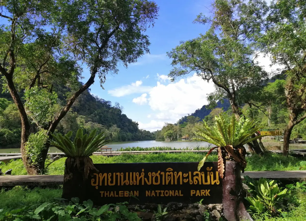
5. Thale Ban National Park is located around Ban Wang Prachan in Wang Prachan Subdistrict, Khuan Don District, close to the Thailand–Malaysia border. It is one of Satun’s most important inland natural attractions and reveals a very different side of the province from its Andaman islands.
The park protects tropical rainforest, limestone mountains, streams, waterfalls, caves, and wetlands. One of its most recognizable features is Thale Ban Lake, surrounded by forested mountains and habitats suitable for observing birds, wildlife, and tropical plant species.
Several nature trails and visitor areas are available within the park. Travelers interested in hiking and rainforest environments can spend half a day or longer here, although longer trails should be selected according to physical ability and current advice from park staff.
Thale Ban can be combined with the Wang Prachan border area and other sites in Khuan Don District. It is particularly suitable for travelers who want to experience the forests and border landscape of eastern Satun, which contrasts strongly with the province’s coastal scenery.
Getting There: From Satun Town, travel toward Khuan Don District and Wang Prachan Subdistrict, continuing toward the Thailand–Malaysia border. The park is approximately 40 kilometers from central Satun, and a private or rental car is the most convenient option.
Map (GPS): https://maps.app.goo.gl/8yRCu3PMVQ7HFSHD7
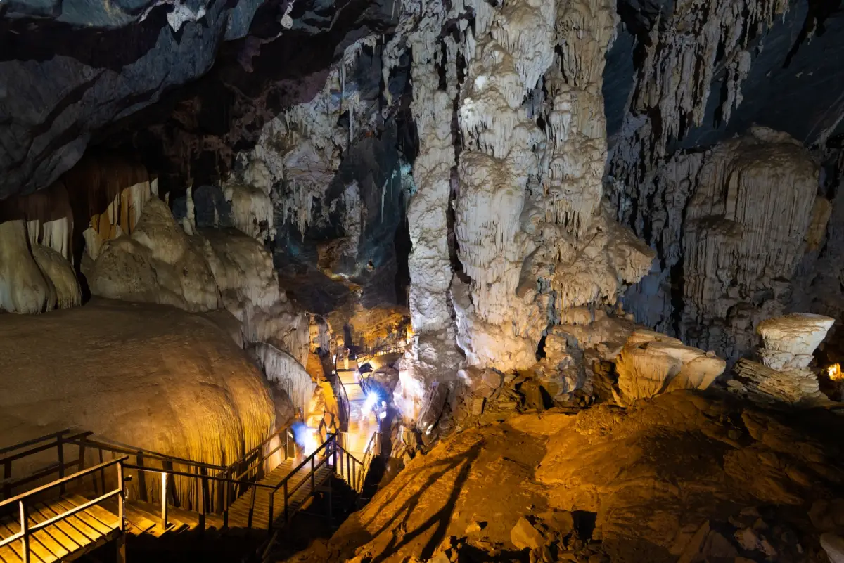
6. Phu Pha Phet Cave is located around Moo 9 in the Ban Pa Phon–Ban Khuan Din Dam area of Palm Phatthana Subdistrict, Manang District. It is a vast limestone cave and one of Satun’s most important geological attractions, containing large chambers, stalactites, stalagmites, and formations created through natural processes over extremely long periods.
The name “Phu Pha Phet” refers to sparkling mineral surfaces inside the cave. Under certain lighting conditions, parts of the rock reflect light with a jewel-like appearance. Natural openings also allow daylight to enter some chambers, creating dramatic contrasts between light and shadow.
Visiting requires climbing stairs and walking through areas where surfaces may be damp or slippery, so footwear with good grip is recommended. Older visitors or anyone with mobility limitations should consider the physical requirements carefully, and cave formations should not be touched unnecessarily.
Phu Pha Phet Cave can be combined with Chet Khot Cave, Wang Sai Thong Waterfall, and other natural attractions around Manang and La-ngu, making the area suitable for a full-day inland nature itinerary.
Getting There: From Satun Town or La-ngu District, travel toward Manang District and Palm Phatthana Subdistrict, then follow local signs to Phu Pha Phet Cave. The final section enters a mountainous area, so weather conditions should be checked during the rainy season.
Map (GPS): https://maps.app.goo.gl/iu6CPVv4Tcj4o174A
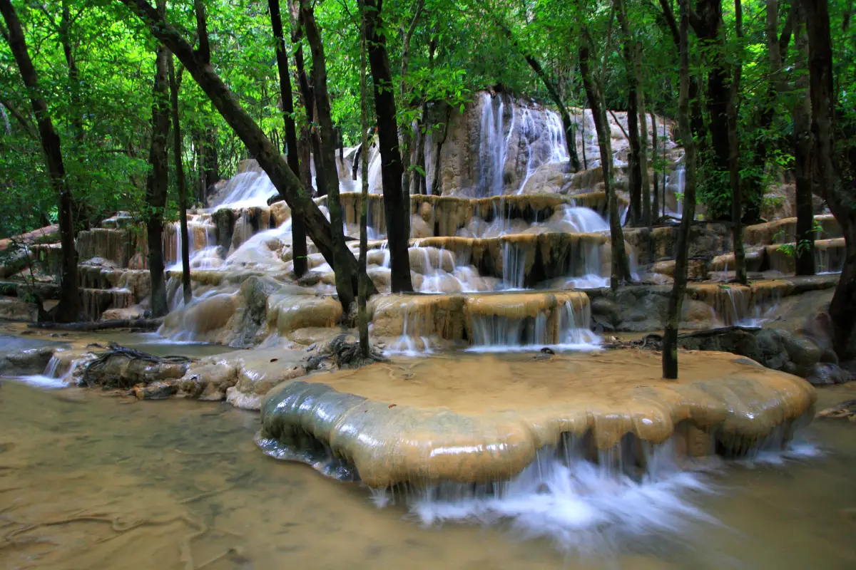
7. Wang Sai Thong Waterfall is located at Ban Wang Na Nai, Moo 10, Nam Phut Subdistrict, La-ngu District, within the wider Khao Banthat wildlife area. It is a distinctive limestone waterfall where water flows across a series of broad rock terraces and natural pools surrounded by shaded forest.
The limestone formations spread the water into multiple streams and curtains rather than a single high vertical drop. Different levels include pools, resting areas, and places where visitors can observe the waterfall at close range, giving the site a character quite different from cliff-type waterfalls.
Although some sections may be suitable for entering the water, visitors should always check depth and current conditions first. Wet limestone can be slippery, and water levels may rise rapidly after heavy rainfall, so local safety guidance should be followed.
The waterfall can be combined with Wang Sai Thong rafting activities, Chet Khot Cave, and other natural attractions around Nam Phut and Palm Phatthana, making this zone particularly suitable for outdoor and nature-focused travelers.
Getting There: From La-ngu District, continue toward Nam Phut Subdistrict and Ban Wang Na Nai, following signs to Wang Sai Thong Waterfall. A private or rental car is the most practical option, and road conditions should be checked after heavy rainfall.
Map (GPS): https://maps.app.goo.gl/yBwtesYyVphsBFa68
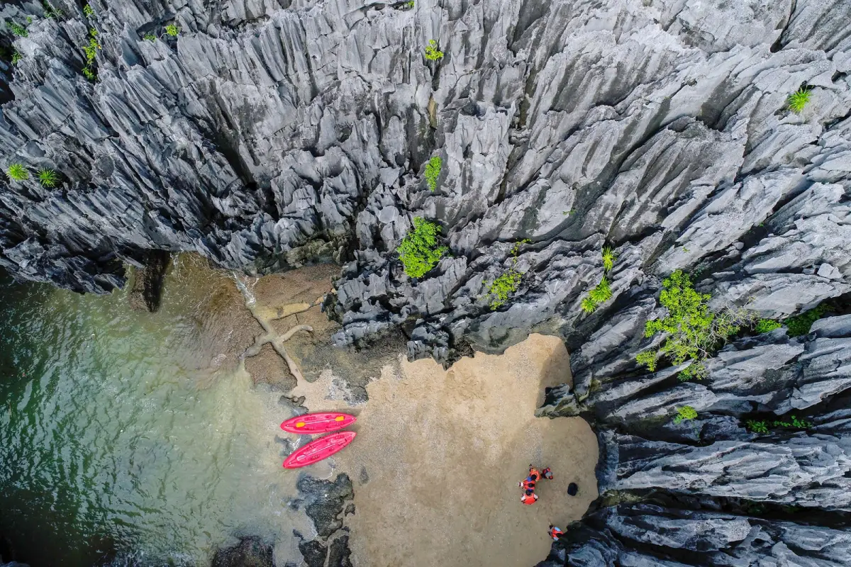
8. Satun UNESCO Global Geopark is Thailand’s first UNESCO Global Geopark and one of the province’s most important destinations for educational and nature-based travel. The geopark encompasses geological formations, fossils, caves, limestone mountains, waterfalls, mangrove forests, coastlines, islands, and communities across several districts.
Its global significance comes from geological evidence showing that parts of present-day Satun were once beneath an ancient sea hundreds of millions of years ago. Rock layers and fossils found throughout the area help illustrate the long geological evolution of the region and the planet itself.
Important sites within the geopark network include Tham Le Stegodon, Phu Pha Phet Cave, fossil localities, limestone waterfalls, mangrove environments, and communities in Thung Wa, La-ngu, and Manang. Travelers should therefore plan the geopark as a network of destinations rather than expecting a single enclosed attraction.
The core principle of geopark tourism is learning combined with conservation. Fossils, rocks, and natural materials should never be removed, and visitors should use local guides or community services where access requires specialist knowledge or controlled entry.
Getting There: Thung Wa District is one of the main starting points for exploring the geopark. From Satun Town, follow the main road toward La-ngu and Thung Wa, then continue to individual museums, caves, communities, and geological sites according to the planned route.
Map (GPS): https://maps.app.goo.gl/mpoaoeXjtVc3z8cy5
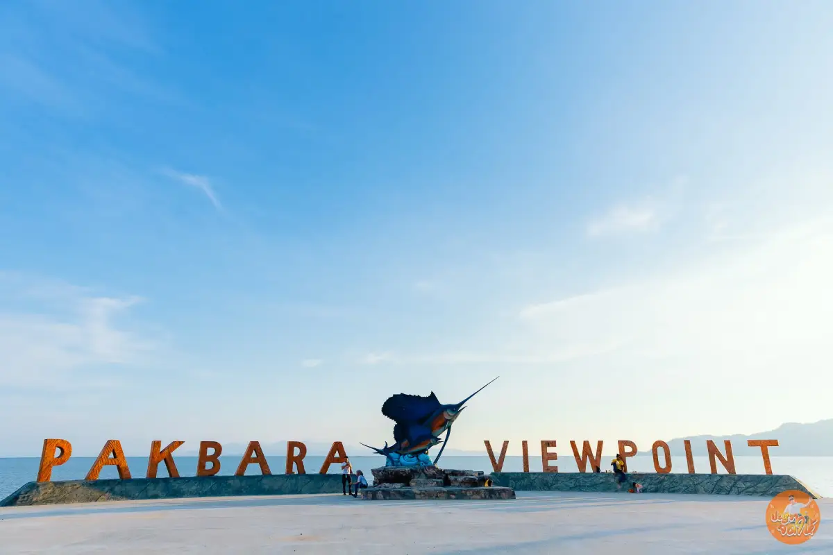
9. Pak Bara Beach is located at Ban Pak Bara in Pak Nam Subdistrict, La-ngu District. It is an important coastal stop before reaching Pak Bara Pier and is closely connected with travel to Satun’s offshore islands.
The coastal area includes viewpoints, restaurants, accommodation, and places to stop before boarding boats. It is particularly convenient for travelers who arrive in Pak Bara the day before an island departure or those returning from the islands who want to eat and rest before continuing their journey.
Late afternoon is one of the best times to visit because the beach faces toward the Andaman Sea and offers attractive sunset views. On clear days, offshore islands and mountain silhouettes can be seen along the horizon, creating excellent conditions for walking and photography.
Swimming conditions should be evaluated on the day of the visit because some parts of the coast have boat activity, coastal structures, or water conditions that may not be suitable for swimming. Pak Bara is therefore better known as a scenic and relaxing coastal stop than as Satun’s main swimming beach.
Getting There: From Satun Town, travel toward La-ngu District and Pak Nam Subdistrict in the direction of Pak Bara Pier. The beach is located before the main pier and Tarutao National Park visitor-service area and can be reached by private car, rental vehicle, or local transport.
Map (GPS): https://maps.app.goo.gl/DnTYZiEigSGBYNsc7
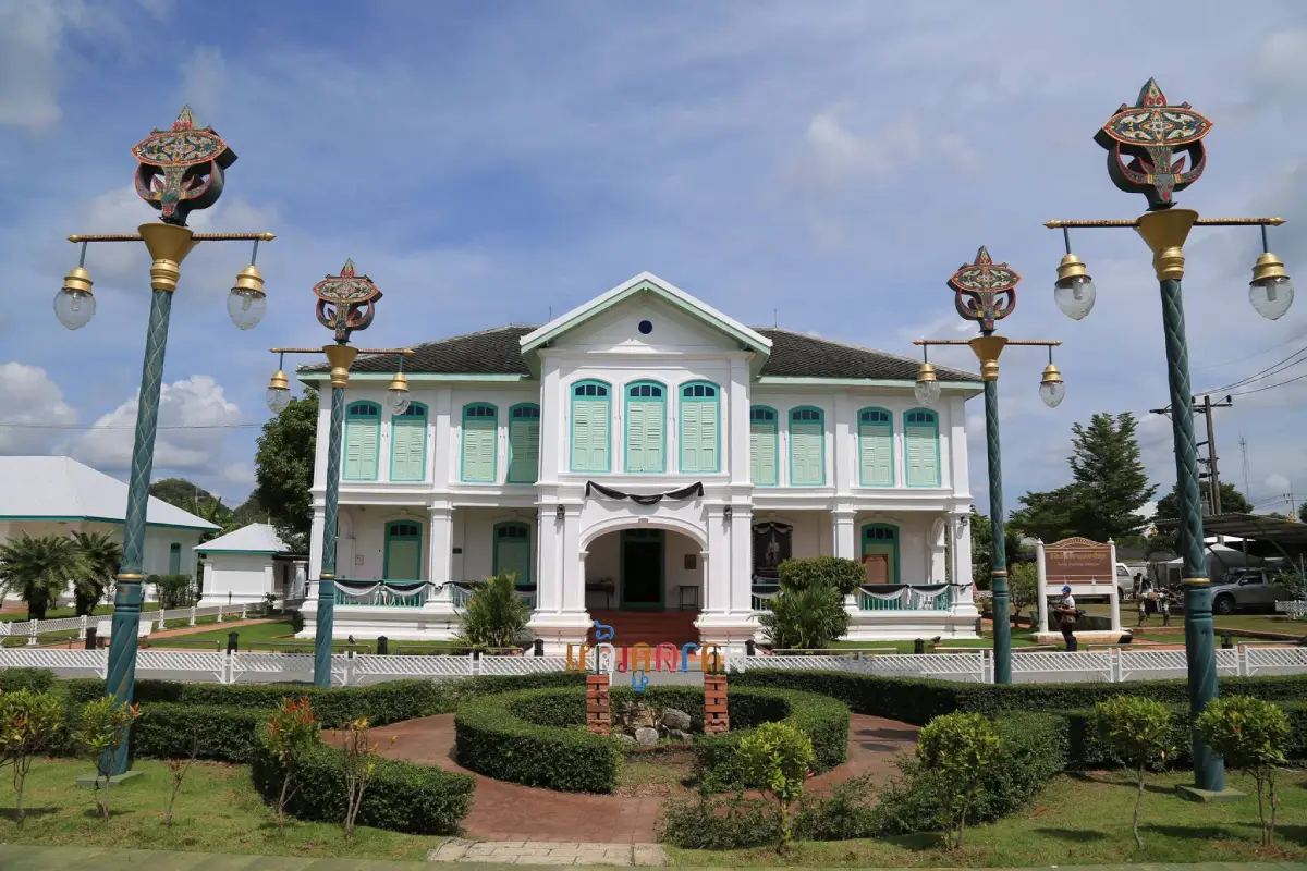
10. Satun National Museum, Kuden Mansion is located on Satun Thani Road, Soi 5, Phiman Subdistrict, Mueang Satun District. It is one of the province’s most important historic buildings and an excellent place to begin learning about Satun before traveling to other parts of the province.
Kuden Mansion was built by Phraya Phuminat Phakdi, also known as Kuden bin Kumae, a former governor of Satun during the reign of King Rama V. Construction began in 1898 and was completed in 1916. The building combines Western architectural influence with local context and has been preserved as a significant historic monument.
Exhibitions inside cover the history of Satun, local ways of life, arts and culture, communities, and the province’s natural environment. Together they help visitors understand the relationship between Satun, the Malay world, religion, trade, and the Andaman Sea in a structured way.
The museum is located close to Buri Wanit Road, Satun Central Mosque, Wat Chanathip Chaloem, and other parts of the old town. This makes it easy to create a half-day heritage walk before continuing to Thale Ban National Park, Pak Bara, or other destinations around the province.
Getting There: From central Satun, follow Satun Thani Road to Soi 5 in Phiman Subdistrict. The museum is easily accessible by car, motorcycle, or hired transport.
Map (GPS): https://maps.app.goo.gl/gzQ1hrUu9jqMFiz67
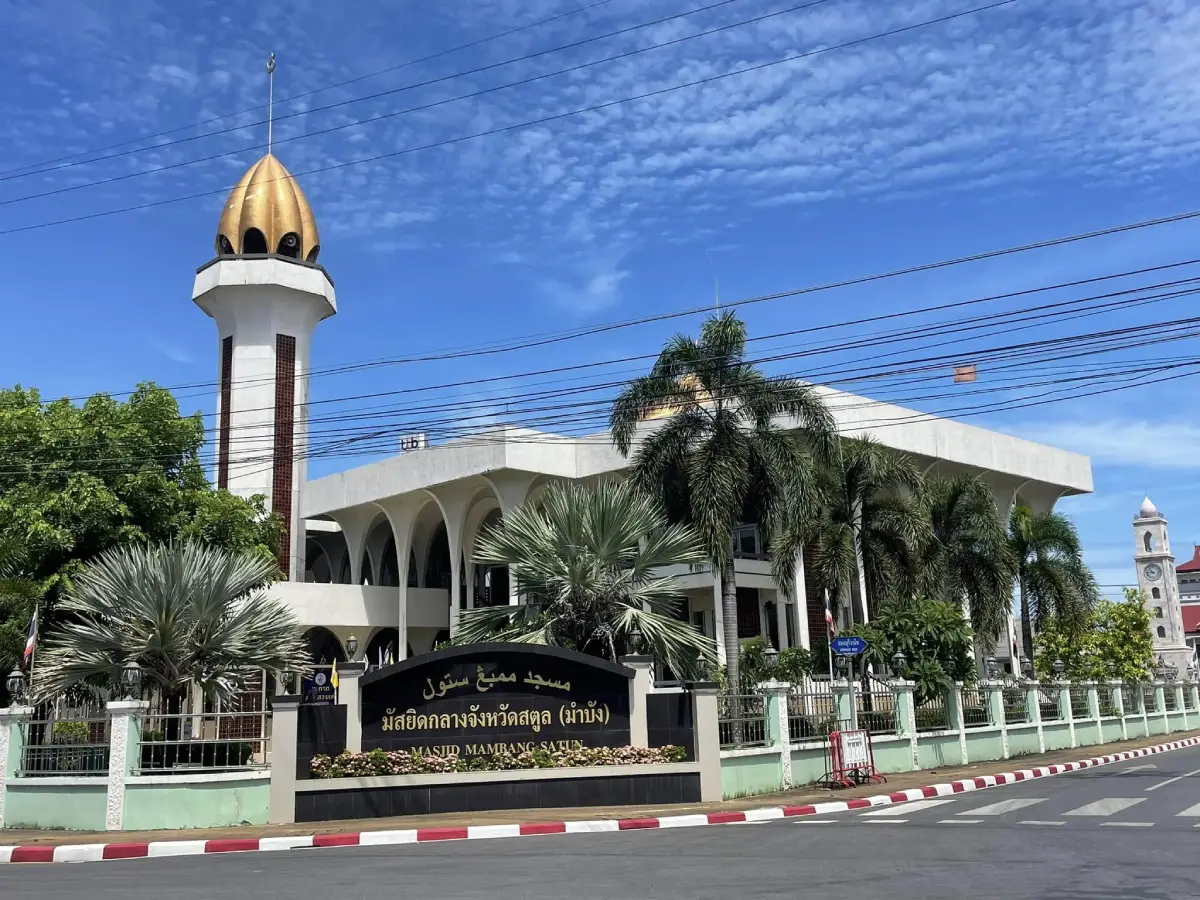
11. Satun Central Mosque (Mambang Mosque) is located at the corner of Buri Wanit Road and Satun Thani Road in Phiman Subdistrict, Mueang Satun District. It is one of the province’s most important religious landmarks and one of the clearest architectural symbols of Satun Town. The white building, golden dome, and prominent minaret make the mosque recognizable from several parts of the urban area.
The name “Mambang” is closely connected with Satun’s historical identity and the former name of the town, Mambang Nakara. The mosque therefore carries significance beyond its religious function, linking present-day Satun with the Malay cultural world and the historical development of the town.
The original mosque dates back to the era of Satun’s former governors, while the present building was later reconstructed on the same site. Its modern structure incorporates Islamic architectural elements through the use of domes, minarets, arches, and geometric forms and continues to serve as an important center of Muslim religious life in the province.
Non-Muslim visitors should dress modestly, avoid entering during prayer times, remain quiet, and ask permission before photographing interior religious spaces. The mosque is conveniently located near Buri Wanit Road, Kuden Mansion, and the old-town district, making it easy to include in a cultural walking route.
Getting There: The mosque is located in central Satun at the intersection of Buri Wanit Road and Satun Thani Road in Phiman Subdistrict. It can be reached easily by car, motorcycle, local transport, or on foot from the old-town area.
Map (GPS): https://maps.app.goo.gl/Dn9WosDizvURU4Tv7
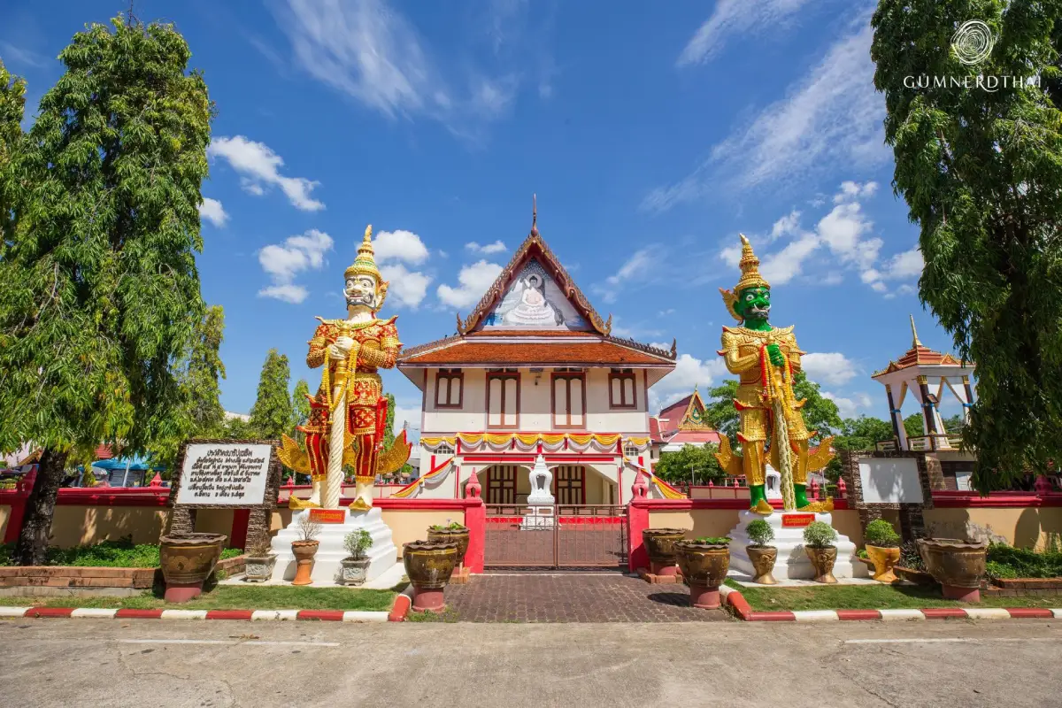
12. Wat Chanathip Chaloem is an important Buddhist temple in Satun Town and has long served the local Buddhist community. Its location not far from Satun Central Mosque and the historic urban district provides a clear example of the multicultural character of the province.
The temple grounds contain religious buildings, Buddha images, and architectural elements associated with Southern Thai Buddhist temples. Visitors can come to pay respect, make merit, and learn about the role of Buddhist communities in a province where Islam is also deeply rooted in local life.
The temple remains an important venue for Buddhist religious activities and community events on significant Buddhist days. Visitors should dress appropriately, remain quiet, and avoid disturbing monks or local worshippers during ceremonies.
Wat Chanathip Chaloem can be combined easily with Kuden Mansion, Mambang Mosque, Buri Wanit Road, and Khao To Phaya Wang Public Park, creating a compact urban route covering religion, history, architecture, and daily life.
Getting There: The temple is located within Satun Municipality and can be reached easily from the town center by private car, motorcycle, or local transport. It is close to the main cluster of old-town attractions.
Map (GPS): https://maps.app.goo.gl/szD6gztbozzTbge86
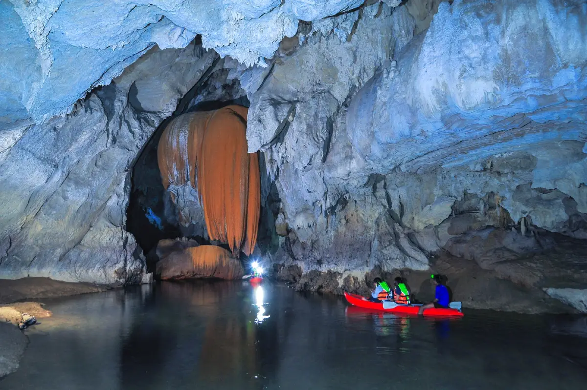
13. Tham Le Stegodon is located at Ban Khiri Wong, Moo 7, Thung Wa Subdistrict, Thung Wa District. It is one of the most important attractions within Satun UNESCO Global Geopark, combining an underground water route with discoveries of prehistoric animal fossils that have given the cave major scientific importance.
The name “Stegodon” comes from fossils of the ancient Stegodon elephant genus discovered in the cave. This makes the site more than a scenic limestone cave. It is also an important place for understanding natural history, prehistoric life, and the long geological development of Satun.
Visiting is a controlled adventure activity. Travelers normally need to join scheduled trips and coordinate with local operators or community guides in advance. Parts of the route require boats and appropriate safety equipment, while the duration and accessibility depend strongly on water levels inside the cave.
After leaving the cave, the route can continue through tidal waterways and mangrove forest toward the Tha Oi area. A single trip can therefore reveal underground limestone systems, mangrove ecosystems, fossils, and coastal community life, making it one of the best examples of integrated geopark tourism in Satun.
Getting There: From Satun Town, travel through La-ngu District toward Thung Wa District, then continue to Ban Khiri Wong in Thung Wa Subdistrict. Advance booking with the local operator or community is recommended because entry must be arranged according to water levels and safety conditions.
Map (GPS): https://maps.app.goo.gl/pEEgqTYK8eUjt1AT9
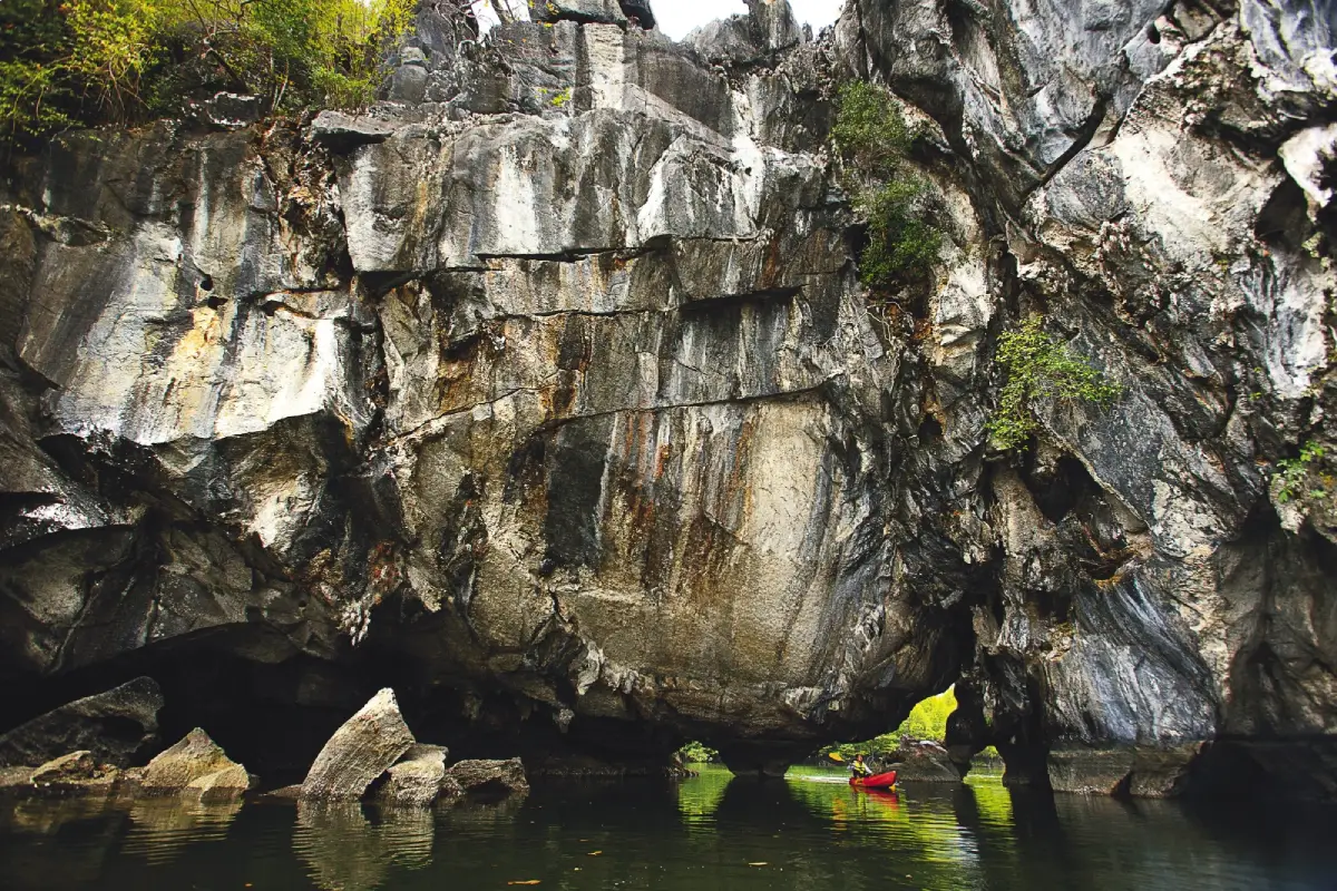
14. Tham Lod Puyu is located in Puyu Subdistrict, Mueang Satun District. This natural limestone pass-through cave is reached by long-tail boat through waterways and mangrove forest before entering a cave passage that resembles a natural tunnel through the limestone landscape.
The attraction is not limited to the cave itself. The boat journey passes limestone hills, mangrove ecosystems, brackish waterways, and coastal communities, providing a clear view of how inland limestone terrain connects with the marine environment.
Inside and around the cave are steep rock walls, natural formations, and openings created by long-term erosion. Visitors should travel during suitable tides and weather conditions and use local boat operators who understand the route well.
Puyu is also home to Muslim coastal communities and traditional fishing activities. Travelers should dress appropriately, respect local life, and avoid entering private community areas or photographing residents without permission.
Getting There: From Satun Town, travel toward Puyu Subdistrict and continue to the local community boat point. From there, take a long-tail boat through waterways and mangrove forest to the cave. Advance coordination with a local boat operator and checking tide conditions are recommended.
Map (GPS): https://maps.app.goo.gl/ntAfFs8eRDoakeLD8
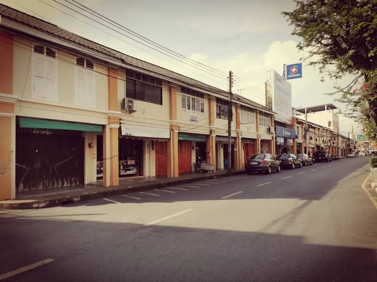
15. Shophouses on Buriwanich Road form one of the most distinctive historic commercial streets in central Satun. Stretching for approximately 600 meters, the road preserves rows of two-storey masonry shophouses, older buildings, active shops, and urban details that create an atmosphere very different from modern commercial districts.
The significance of Buriwanich Road lies in the relationship between architecture and the old urban economy. The area developed as an important commercial street close to religious buildings and administrative sites, allowing visitors to understand how central Satun was organized in earlier periods.
Travelers can walk along the street to photograph historic architecture, local shops, and urban art before continuing to Satun Central Mosque, Kuden Mansion, and Wat Chanathip Chaloem within the same route.
Morning and late afternoon are generally more comfortable for walking and photography than the middle of the day. Visitors should remain aware that the street is still actively used by vehicles and local businesses and should avoid blocking shop entrances or private property.
Getting There: Buriwanich Road is located in central Satun Municipality and is within short distance of Kuden Mansion and Satun Central Mosque. A practical option is to park nearby and explore several old-town attractions on foot.
Map (GPS): https://maps.app.goo.gl/nugHre5nrQ7wWsGy8
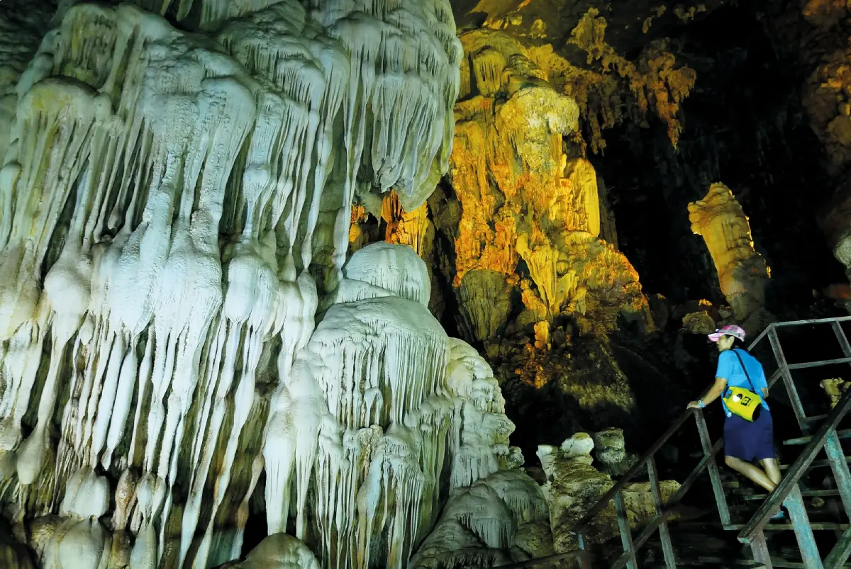
16. Chet Khot Cave is located at Moo 5, Palm Phatthana Subdistrict, Manang District. It is a stream cave where water flows through a limestone mountain, and the winding route passes through several distinct cave sections, giving the site both natural beauty and an adventurous character.
Inside the cave are large chambers, stalactites, stalagmites, sandy sections, and limestone walls that change in appearance along the route. Water passages and natural openings create different environments as visitors move through the cave.
The activity depends heavily on water levels and weather conditions. During the rainy season, water can rise quickly, so visitors should use local guides or authorized operators and wear the required safety equipment.
Chet Khot Cave can be combined with Phu Pha Phet Cave, Wang Sai Thong Waterfall, and other natural attractions around Manang. This makes the area particularly suitable for travelers who want a full day focused on caves, limestone mountains, and waterfalls rather than the sea.
Getting There: From La-ngu or Manang District, continue to Palm Phatthana Subdistrict, Moo 5, and then to the cave service point. Visitors should contact local operators in advance to confirm water levels and route conditions before entering.
Map (GPS): https://maps.app.goo.gl/JVpf1Z2ZC2quuFt18
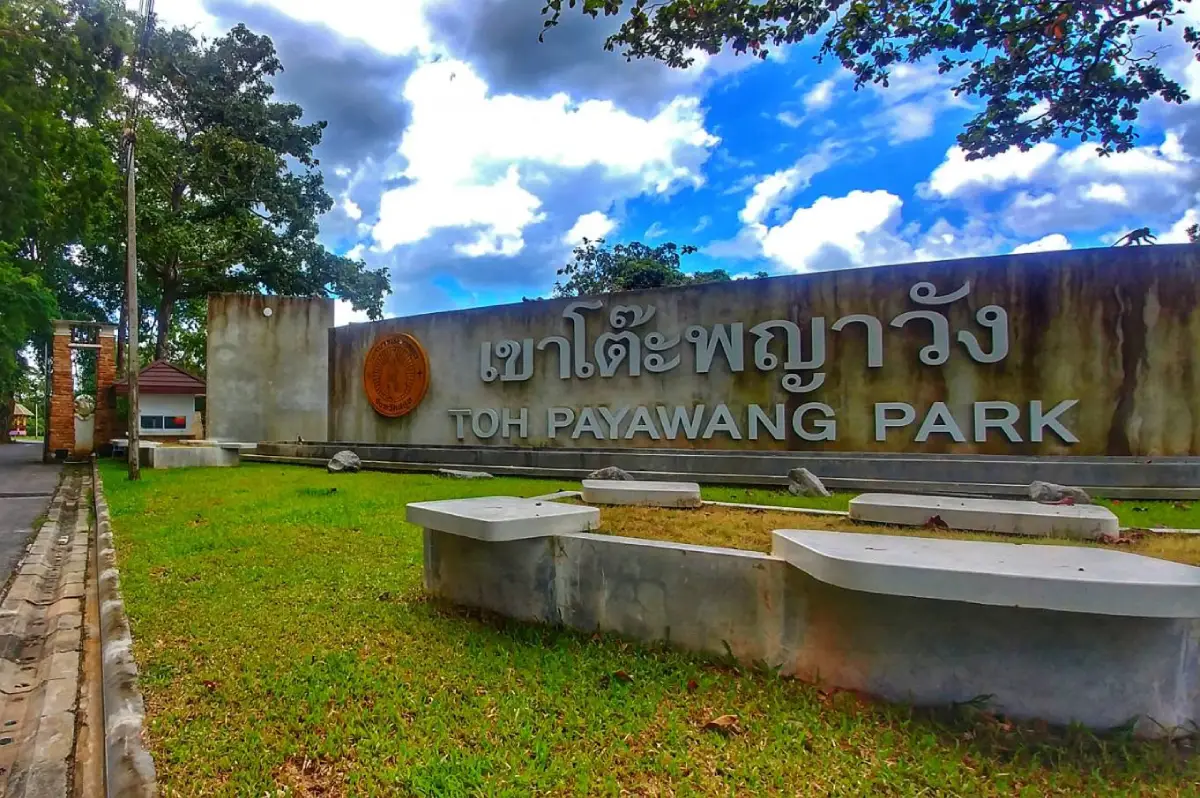
17. Khao To Phaya Wang Public Park is located along Khuha Prawet Road within Satun Municipality. It is one of the main green spaces in the town and combines an urban public park with a small limestone hill, making it an easy place to experience nature without leaving central Satun.
The area is characterized by limestone cliffs, mature trees, shaded resting areas, and natural scenery within the town. The hill also offers a simple introduction to the limestone landscapes that are widespread across Satun and closely connected with the province’s wider geopark environment.
Local residents use the park for exercise and relaxation, especially in the morning and evening. Travelers can use it as a convenient stop between Kuden Mansion, Mambang Mosque, Wat Chanathip Chaloem, and other old-town attractions.
Rocky and hillside areas can become slippery after rain. Visitors should remain on appropriate paths and avoid climbing into areas that are not intended for public access.
Getting There: The park is located on Khuha Prawet Road within Satun Municipality and is easily accessible from the town center by private car, motorcycle, or local transport.
Map (GPS): https://maps.app.goo.gl/ZYamXLDmLUuGamwDA
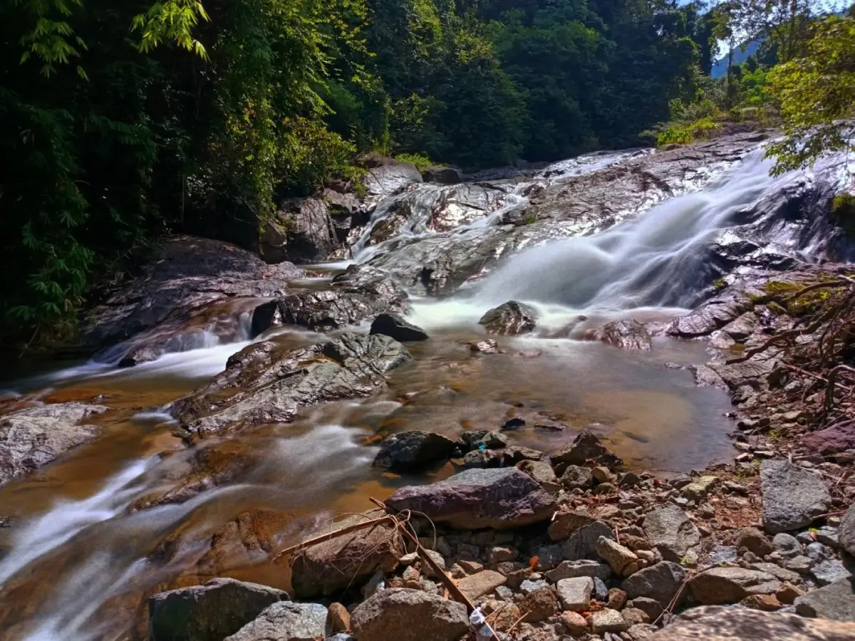
18. Panan Waterfall is located at Moo 5, Thung Nui Subdistrict, Khuan Kalong District. It is a community-based waterfall surrounded by forested hills and offers a quieter natural setting than many of Satun’s better-known tourist attractions.
The stream flows from forested highlands through rocks and natural pools. The surrounding vegetation keeps the area humid and green, particularly after rainfall when water levels increase and the forest becomes especially lush.
Visitors should be careful on wet rocks and pay attention to changes in current and water level after heavy rain. Swimming should be avoided when the water becomes unusually muddy or fast-flowing, and the site should be kept clean because it is a natural area shared with the local community.
Panan Waterfall can be combined with other attractions around Khuan Kalong, including Namtok Thara Sawan Forest Park, creating a full-day route focused on forest, waterfalls, and rural Satun rather than the coastal islands.
Getting There: From Satun Town, travel toward Khuan Kalong District, then continue into Thung Nui Subdistrict, Moo 5, following local signs toward Panan Waterfall. A private or rental car is the most convenient option.
Map (GPS): https://maps.app.goo.gl/7sGDuCcT3o8Pp1mLA
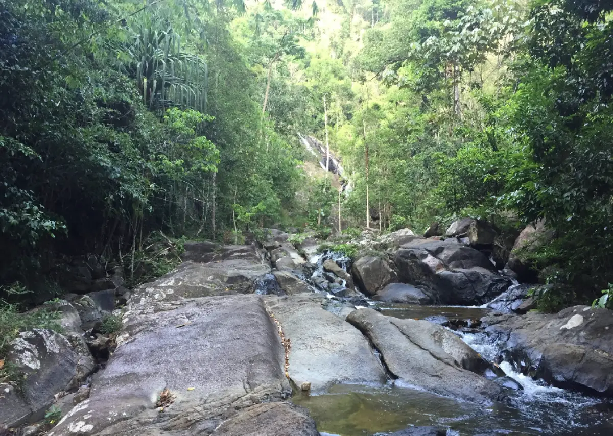
19. Namtok Thara Sawan Forest Park is a natural forest area in Khuan Kalong District that was officially established as a forest park in 1996. Its main attractions are tropical forest, streams, and a multi-level waterfall surrounded by peaceful greenery.
The waterfall has approximately 3 levels, each with different pools and rock formations. Large trees and humid forest create a cool atmosphere suitable for relaxation, short nature walks, and escaping the heat during the day.
Water volume changes with the seasons. After rainfall, the waterfall is generally more impressive, but trails and rocks may become slippery and there may be a risk of sudden increases in water flow. Travelers should check weather conditions and follow local safety advice.
The forest park combines well with Panan Waterfall and other natural attractions in Khuan Kalong, providing another option for visitors who want to explore Satun away from the islands and beaches.
Getting There: From Satun Town, travel toward Khuan Kalong District and continue along the local route to Namtok Thara Sawan Forest Park. A private or rental vehicle is recommended, particularly if combining several nature attractions in one day.
Map (GPS): https://maps.app.goo.gl/DhvgMfnHVM2fmUcn8
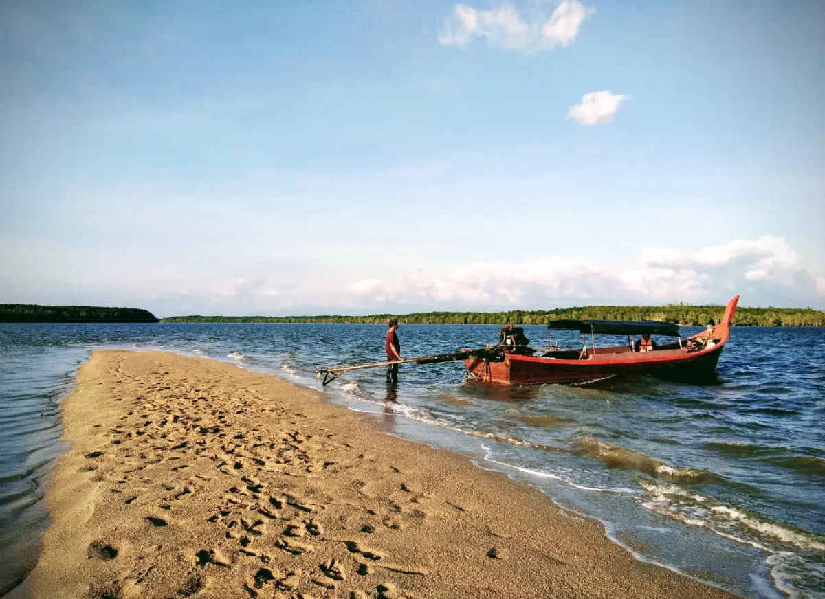
20. Tha Oi Viewpoint is located at Ban Tha Oi, Moo 1, Thung Wa Subdistrict, Thung Wa District. It is a quiet waterside recreation area surrounded by mangrove forest and fishing-community scenery. The site includes a riverside walkway, viewing structures, and a peaceful coastal atmosphere.
The viewpoint is directly connected with the Tham Le Stegodon travel route. After exiting the cave, visitors can continue by boat through waterways and mangrove forest toward the Tha Oi area, allowing a single journey to show the transition from an underground limestone environment to a coastal mangrove ecosystem.
The mangrove forest surrounding the waterway provides important nursery habitat for aquatic life and supports local fishing livelihoods. Visitors can observe traditional fishing boats, piers, and everyday community activity and should avoid interfering with working areas.
Morning and late afternoon are particularly suitable for sightseeing and photography. Tha Oi can be combined with Tham Le Stegodon, Satun Geopark learning sites, Thara Plio Waterfall, and the historic Thung Wa area, creating a route that combines geology, mangrove ecology, and local ways of life.
Getting There: From Thung Wa Municipality, follow the local road to Ban Tha Oi for approximately 2 kilometers. The viewpoint can be reached by car, motorcycle, or local transport. From Satun Town, follow the main route toward Thung Wa District and then enter the municipal area.
Map (GPS): https://maps.app.goo.gl/PGidFnhnJ14vvjG5A
| Topic | Details |
| Province | Satun is a province on the lower Andaman coast of Southern Thailand, combining islands, beaches, mangrove forests, limestone mountains, caves, waterfalls, tropical rainforest, historic urban areas, and the Thailand–Malaysia border region. |
| Travel Highlights | World-class islands and marine scenery, Tarutao National Park, Koh Lipe, Satun UNESCO Global Geopark, fossil sites, limestone caves, waterfalls, mangrove ecosystems, historic Satun Town, and multicultural communities. |
| Top 10 Attractions | 1. Koh Lipe 2. Tarutao National Park 3. Koh Khai 4. Koh Hin Ngam 5. Thale Ban National Park 6. Phu Pha Phet Cave 7. Wang Sai Thong Waterfall 8. Satun UNESCO Global Geopark 9. Pak Bara Beach 10. Satun National Museum, Kuden Mansion |
| Sea and Islands | Koh Lipe, Koh Khai, Koh Hin Ngam, and the islands within Tarutao National Park are the main choices for island-hopping, snorkeling, coral viewing, and relaxing by the Andaman Sea. |
| National Parks | Tarutao National Park focuses on marine and island ecosystems, while Thale Ban National Park features tropical rainforest, wetlands, limestone mountains, and nature along the Thailand–Malaysia border. |
| UNESCO Global Geopark | Satun UNESCO Global Geopark is Thailand’s first UNESCO Global Geopark and includes fossils, caves, limestone landscapes, waterfalls, coastal areas, islands, and local communities across several districts. |
| Notable Caves | Phu Pha Phet Cave, Tham Le Stegodon, Tham Lod Puyu, and Chet Khot Cave offer a mix of vast limestone chambers, fossil discoveries, underground waterways, and adventure-style cave exploration. |
| Notable Waterfalls | Wang Sai Thong Waterfall, Panan Waterfall, and Namtok Thara Sawan Forest Park are good options for travelers who want to explore inland forests and waterfalls. |
| History and Old Town | Satun National Museum at Kuden Mansion and the shophouses along Buriwanich Road help explain the historical development of Satun, its relationship with the Malay world, and the architectural character of the old town. |
| Religious Sites | Satun Central Mosque, also known as Mambang Mosque, is an important center of Islam in the province, while Wat Chanathip Chaloem is a major Buddhist temple in Satun Town, together reflecting the province’s multicultural society. |
| Important Culture | Thai Muslim traditions, Malay cultural influences, the Urak Lawoi sea people, the Loy Ruea ceremony, Hari Raya, and coastal community traditions are important parts of Satun’s cultural identity. |
| Local Food | Fresh seafood, biryani-style rice dishes, roti, massaman curry, coconut-based fish curries, Southern Thai dishes, halal food, and dishes using spices and coconut milk are among the province’s characteristic foods. |
| Mueang Satun District | 1. Koh Lipe 2. Tarutao National Park 3. Koh Khai 4. Koh Hin Ngam 5. Satun National Museum, Kuden Mansion 6. Satun Central Mosque 7. Wat Chanathip Chaloem 8. Tham Lod Puyu 9. Shophouses on Buriwanich Road 10. Khao To Phaya Wang Public Park |
| La-ngu District | 1. Wang Sai Thong Waterfall 2. Pak Bara Beach This district connects the coast, Pak Bara gateway, waterfalls, and routes leading toward Satun’s inland natural attractions. |
| Manang District | 1. Phu Pha Phet Cave 2. Chet Khot Cave The district is particularly important for limestone mountains, caves, and nature-based activities within the wider Satun Geopark landscape. |
| Thung Wa District | 1. Satun UNESCO Global Geopark 2. Tham Le Stegodon 3. Tha Oi Viewpoint This is one of the province’s most important areas for fossils, geology, mangrove ecosystems, and community-based tourism. |
| Khuan Don District | Thale Ban National Park is a key destination for tropical rainforest, wetlands, limestone mountains, and border nature near Malaysia. |
| Khuan Kalong District | 1. Panan Waterfall 2. Namtok Thara Sawan Forest Park The district is suitable for forest, waterfall, and inland nature trips away from the main island routes. |
| Top Activities | Snorkeling, scuba diving, island-hopping, swimming, sunset watching, boat trips, cave exploration, hiking, waterfall visits, fossil learning, mangrove trips, community visits, and old-town walks. |
| Best For | Couples, families, groups of friends, divers, nature travelers, history enthusiasts, cultural travelers, adventure travelers, and visitors interested in geology. |
| Getting to Satun | Satun does not have a major commercial airport within the province. Air travelers commonly fly to Hat Yai Airport and continue by road to Satun Town, La-ngu District, or Pak Bara Pier depending on their itinerary. |
| Getting Around Satun | A private or rental car is convenient for mainland attractions. Koh Lipe, Koh Khai, Koh Hin Ngam, and other offshore islands require boat transport from Pak Bara Pier or other designated marine access points. |
| 1-Day Itinerary | Morning: Kuden Mansion – Mambang Mosque – Wat Chanathip Chaloem Late Morning: Buriwanich Road – Khao To Phaya Wang Public Park Afternoon: Travel toward Pak Bara Evening: Sunset at Pak Bara Beach |
| 2-Day Itinerary | Day 1: Satun Town – Old Town – Mambang Mosque – Kuden Mansion – Pak Bara Day 2: Koh Lipe or a seasonal Koh Khai–Koh Hin Ngam–Adang–Rawi island program |
| 3-Day Itinerary | Day 1: Satun Town and Pak Bara Day 2: Koh Lipe and the Adang–Rawi islands Day 3: Phu Pha Phet Cave – Wang Sai Thong Waterfall – Chet Khot Cave, or a Satun UNESCO Global Geopark route |
| 4–5 Day Itinerary | Add Tham Le Stegodon, Tha Oi Viewpoint, Thale Ban National Park, Panan Waterfall, and Namtok Thara Sawan Forest Park for a more complete trip covering the sea, geology, mangroves, waterfalls, and urban culture. |
| For Sea Lovers | Koh Lipe, Tarutao National Park, Koh Khai, Koh Hin Ngam, and Pak Bara Beach. |
| For Nature Lovers | Thale Ban National Park, Phu Pha Phet Cave, Wang Sai Thong Waterfall, Chet Khot Cave, Panan Waterfall, and Namtok Thara Sawan Forest Park. |
| For Geology Lovers | Satun UNESCO Global Geopark, Tham Le Stegodon, Phu Pha Phet Cave, Chet Khot Cave, and the wider Thung Wa area are particularly suitable for travelers interested in fossils, limestone, and landscape evolution. |
| For History and Culture | Kuden Mansion, Mambang Mosque, Wat Chanathip Chaloem, and the shophouses on Buriwanich Road are suitable for learning about Satun’s history, architecture, and multicultural society. |
| For Adventure Travelers | Tham Le Stegodon, Chet Khot Cave, Tham Lod Puyu, and nature routes around Manang and Thung Wa are suitable for cave trips, water-based activities, and outdoor exploration. |
| Best Season for Sea Travel | Generally, November through April is more suitable for island trips, snorkeling, diving, and other marine activities, but travelers should always check national park announcements and sea conditions before departure. |
| Travel During the Monsoon | Consider focusing on Satun Town, geopark sites, caves, and waterfalls according to local weather conditions, as some islands and marine routes may close temporarily or operate with reduced boat services. |
| Safety Notes | Check park announcements before island trips, do not remove coral, rocks, fossils, or wildlife from protected areas, watch for flash floods and slippery surfaces in caves and waterfalls, and use qualified local guides for cave activities that depend on water levels. |
| Cultural Etiquette | Dress modestly when visiting temples and mosques, avoid visiting mosques during prayer times, ask permission before photographing people or religious activities, and respect the traditions of Muslim communities and the Urak Lawoi sea people. |
| Responsible Travel | Do not leave waste in the sea, caves, waterfalls, or mangrove forests, do not step on coral, do not remove stones from Koh Hin Ngam, do not collect fossils from geopark sites, and support local community services when appropriate. |
Frequently Asked Questions (FAQ)
Q: Where should first-time visitors start when traveling to Satun?
A: If the main focus is the sea, start with Koh Lipe, Tarutao National Park, Koh Khai, and Koh Hin Ngam. With additional time, add Kuden Mansion, Satun UNESCO Global Geopark, Phu Pha Phet Cave, and Thale Ban National Park to experience both Satun’s natural and cultural attractions.
Q: How many days are recommended for a Satun trip?
A: At least 3 days works well: 1 day for Satun Town and Pak Bara, 1 day for the islands or an overnight stay on Koh Lipe, and 1 day for caves, waterfalls, or geopark attractions. A 4–5 day trip is better for exploring several districts.
Q: What are the best non-beach attractions in Satun?
A: Recommended options include Thale Ban National Park, Phu Pha Phet Cave, Wang Sai Thong Waterfall, Satun UNESCO Global Geopark, Tham Le Stegodon, Chet Khot Cave, Panan Waterfall, Namtok Thara Sawan Forest Park, Kuden Mansion, and Satun’s historic town area.
Q: What is Satun UNESCO Global Geopark?
A: Satun UNESCO Global Geopark is a geological heritage area of global significance and Thailand’s first UNESCO Global Geopark. It includes rock formations, fossils, caves, waterfalls, coastal landscapes, islands, and communities across several locations rather than being a single attraction.
Q: What is the best time to visit Koh Lipe?
A: Generally, November through April is more suitable for marine travel because sea conditions are often more favorable than during the monsoon season. Travelers should still check national park announcements, weather forecasts, and boat schedules before departure.
Q: How do travelers get to Koh Lipe?
A: The main route is to travel to Pak Bara Pier in La-ngu District and continue by speedboat or passenger boat to Koh Lipe. Air travelers commonly fly to Hat Yai Airport and continue by road to Pak Bara.
Q: Is Satun suitable for a family trip?
A: Yes. Family-friendly options include Kuden Mansion, Pak Bara Beach, Khao To Phaya Wang Public Park, and Thale Ban National Park. Cave trips, boat journeys, snorkeling, and diving should be selected according to children’s ages, physical readiness, and weather conditions.
Q: How should visitors behave at Satun Central Mosque?
A: Dress modestly, avoid prayer times, remain quiet, and ask permission before entering active worship areas or taking photographs inside. This helps respect both the mosque and people who are there for religious purposes.
 Category: ●Travel Articles, Recipes
 Group: ●Travel Review, Food Review
Last Update : 3 WeekAgo
 Last Update : 3 WeekAgo
Recommend

 Art, Culture and Heritage
 Historical Sites and Monuments(1)
 Landmarks and Memorials(1)
 Art, Craft Centres, Tradition(5)
 Museums(3)
 Places of Worship
 Temple(3)
 Mosque(27)
 Other Sacred Sites(1)
 Suburban Living
 Village, Community(1)
 Local Market(2)
 Nature and Wildlife
 National Parks and Marine Reserves(7)
 Mountain (Doi)(1)
 Dam, Reservoir, Lake(2)
 Waterfalls(9)
 Hot Springs(1)
 Caves(9)
 Bays and Beaches(10)
 Islands(16)
 Other natural attractions(5)
 Entertainment and Agricultural
 Zoos and Aquariums(1)
 Farms, Parks and Ecotourism(4)
 Outdoor and Adventure Activities(1)
Travel Review, Food Review(1)


