
lovethailand home >South Travel Attractions >Nakhon Si Thammarat Travel Attractions > 40 Places to Visit in Nakhon Si Thammarat Explore ..
TL;DR: 40 Places to Visit in Nakhon Si Thammarat Explore Southern Thailand.

40 Places to Visit in Nakhon Si Thammarat Explore Southern Thailand
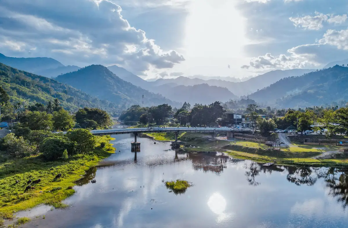
40 Places to Visit in Nakhon Si Thammarat – Explore Southern Thailand Nakhon Si Thammarat is one of the most diverse travel destinations in Southern Thailand, offering an exceptional combination of an ancient city, a major center of Buddhism, traditional local arts and culture, high mountain ranges, tropical rainforest, waterfalls, communities nestled among valleys, a long Gulf of Thailand coastline, and fishing villages that continue to preserve their distinctive local way of life. The province is therefore not only ideal for Buddhist pilgrims and travelers interested in history, but also for nature lovers, hikers, families, photographers, food travelers, and visitors who want to discover Southern Thailand through cultures and traditions that remain very much alive.
Nakhon Si Thammarat can be divided into several fascinating travel zones. Mueang Nakhon Si Thammarat District is the historical and spiritual heart of the province, home to Wat Phra Mahathat Woramahawihan, the old city wall, the City Pillar Shrine, museums, and Ban Nang Talung Suchart Subsin. The Lan Saka–Phrom Khiri zone lies along the foothills of Khao Luang and includes Ban Khiriwong, Karom Waterfall, Phrom Lok Waterfall, and fruit-growing communities. Nopphitam is known for Krung Ching Waterfall and Krung Ching Hot Spring. The Sichon–Khanom coastal zone features beaches, mountains rising beside the sea, caves, bays, and marine nature routes, while Pak Phanang–Hua Sai offers the distinctive lifestyle of a river basin, traditional fishing communities, and coastal areas with important historical significance to the province.
Nakhon Si Thammarat is also particularly well known for its local cuisine. Southern Thai food here is characteristically rich, intensely flavored, spicy, and heavily seasoned with herbs. Common dishes include gaeng lueang or southern sour curry, khua kling, gaeng tai pla, stir-fried stink beans, shrimp-paste chili dip, salted fish, and seafood from the Gulf of Thailand, especially from Pak Phanang, Hua Sai, Sichon, and Khanom. The province is also known for traditional sweets closely connected with local customs, including khanom la, khanom phong, khanom ba, khanom kong, and khanom di sam, all of which play important roles in the Sat Duan Sip or Tenth Lunar Month Festival. Lan Saka and the foothills of Khao Luang are major fruit-growing areas, producing mangosteen, durian, longkong, rambutan, and crops from traditional Suan Som Rom mixed orchards, where several plant species are cultivated together according to local agricultural wisdom.
In terms of traditions and culture, Nakhon Si Thammarat has an especially strong identity. The Hae Pha Khuen That tradition is one of the province's most important expressions of Buddhist faith and is closely associated with the Great Relic Stupa at Wat Phra Mahathat Woramahawihan. Devotees join together in carrying Phra Bot cloth or ceremonial cloth for the sacred relic in procession to the temple, where it is offered and wrapped around the Great Relic Stupa. The Sat Duan Sip Festival is another important merit-making tradition that reflects gratitude toward ancestors and beliefs surrounding the dedication of merit to deceased family members. Nakhon Si Thammarat is also one of the major centers of southern performing arts, particularly Nora dance and Nang Talung shadow puppetry, as well as the renowned local craft of Nakhon Si Thammarat Niello ware, which reflects both the extraordinary precision of local artisans and the long history of the city.
Another defining attraction of Nakhon Si Thammarat is the natural environment of the Nakhon Si Thammarat mountain range, with Khao Luang serving as an important watershed and one of the major high mountains of Southern Thailand. The fertile tropical rainforest gives rise to numerous waterfalls, including Phrom Lok Waterfall, Karom Waterfall, Krung Ching Waterfall, and Ai Khiao Waterfall. Meanwhile, the eastern side of the province opens onto the Gulf of Thailand and includes the coastal areas of Khanom, Sichon, Pak Phanang, and Laem Talumphuk. This striking contrast between mountains and sea allows travelers to combine forest, waterfalls, communities, temples, and beaches within the same province without feeling that the activities are repetitive.
If you have around 3 days, it is best to focus on Nakhon Si Thammarat city, Ban Khiriwong, and the natural attractions around Lan Saka or Phrom Khiri, then add either Sichon or Khanom as one coastal zone. Travelers with 4–5 days or more can extend the journey to Nopphitam, Pak Phanang, Hua Sai, Thung Song, Chawang, or Cha-uat. This makes it possible to experience a much broader side of Nakhon Si Thammarat beyond its familiar image as the “City of the Great Relic,” while gaining a more complete understanding of its religion, history, forests, mountains, coast, food, and community lifestyles.
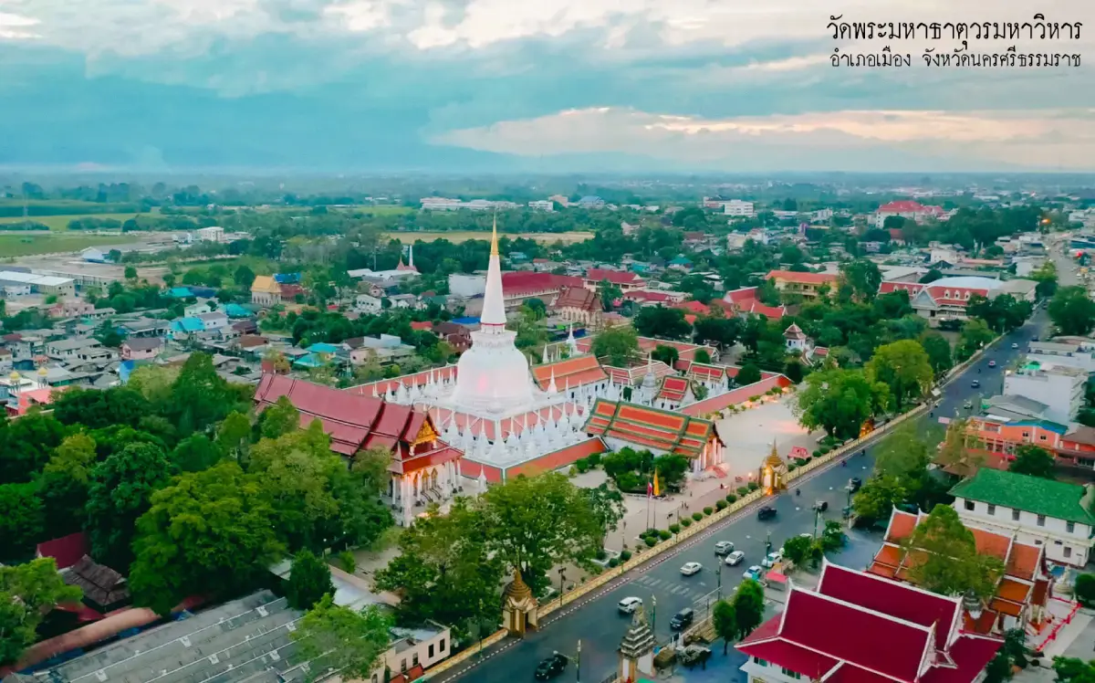
1. Wat Phra Mahathat Woramahawihan is located on Ratchadamnoen Road in Nai Mueang Subdistrict, Mueang Nakhon Si Thammarat District. It is one of the most important religious sites in Southern Thailand and has served as a spiritual center for the people of Nakhon Si Thammarat for generations. Its most prominent feature is the Great Relic Stupa, which enshrines sacred relics of the Buddha and played an important role in establishing Nakhon Si Thammarat as a major center of Buddhism on the southern peninsula from ancient times. The temple complex also contains historic halls, Buddha images, works of religious art, and evidence from several historical periods that clearly reflects the prosperity and long cultural development of the city.
The Great Relic Stupa is architecturally associated with Sri Lankan Buddhist traditions and has undergone restoration during several different periods. The upper section of the stupa is so distinctive that it has become one of the most recognizable symbols of Nakhon Si Thammarat Province. Around the main stupa are galleries and numerous smaller stupas. Walking through the temple reveals that the faith of local people is expressed not only through architecture, but also through the continuing practices of worshipping the relic, offering ceremonial cloth, making merit, and participating in important religious ceremonies. For this reason, visitors should allow enough time to explore the temple without rushing.
The temple's most famous tradition is the Hae Pha Khuen That Festival, which is held in connection with important Buddhist occasions. During the ceremony, devotees join a procession carrying Phra Bot cloth to the temple before presenting it as an offering to the Great Relic Stupa. Other traditions include Suat Dan recitation, almsgiving with incense and candles, and additional Buddhist ceremonies that continue to reflect the temple's role as a cultural and spiritual center of the city. Visitors should dress respectfully, avoid loud noise, and take care not to disturb religious ceremonies or people who are praying and paying respect.
Getting There: The temple is located on Ratchadamnoen Road in the heart of Nakhon Si Thammarat city. It is easy to reach from Nakhon Si Thammarat Airport, the railway station, or the bus terminal. A city itinerary can conveniently combine the temple with the Nakhon Si Thammarat City Wall, City Pillar Shrine, Phra Buddha Sihing, and Ban Nang Talung Suchart Subsin within the same day.
Map (GPS): https://maps.app.goo.gl/dxCJUhcotuj1SH9U8
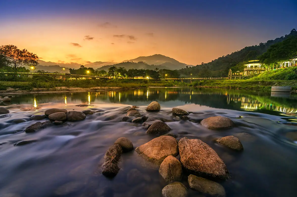
2. Ban Khiriwong is located in Kam Lon Subdistrict, Lan Saka District and is one of the most famous mountain communities in Nakhon Si Thammarat. The village lies at the foot of Khao Luang, with Khlong Tha Di flowing through the middle of the community and mountains, fruit orchards, and watershed forest surrounding the settlement. The atmosphere is noticeably different from the provincial capital. Its appeal lies not only in the cool air or the views of bridges and streams, but also in the lifestyle of a community that has developed tourism around genuine local resources rather than transforming itself into a large-scale tourist destination.
The people of Khiriwong are known for the traditional Suan Som Rom mixed-orchard system, in which many different types of fruit and plants are grown together on the same land. These include mangosteen, durian, longkong, rambutan, stink beans, and local plant species. This creates orchard structures that resemble natural forest and helps farmers distribute agricultural risk instead of relying on a single crop. Local occupational groups have also developed community resources into products such as naturally dyed textiles, herbal products, and handicrafts, allowing visitors to learn how residents create income from local resources without having to transform the area into a large commercial tourism complex.
Suitable activities in Khiriwong include walking or cycling through the community, relaxing beside the stream, visiting fruit orchards, tasting local food, and staying in a homestay to experience the quieter atmosphere of the village in the early morning and evening. After heavy rain or during periods of high water, the stream can become stronger than usual, so visitors should be cautious about entering the water. Ban Khiriwong can conveniently be combined with Karom Waterfall, Khao Luang National Park, and other attractions in Lan Saka District.
Getting There: From Nakhon Si Thammarat city, take the route toward Lan Saka District, then continue into Kam Lon Subdistrict and Ban Khiriwong. The village is approximately 25–30 kilometers from the city and is most convenient to reach by private car, rental car, or local hired transport.
Map (GPS): https://maps.app.goo.gl/XRmDGRbq8BiCn4wK9
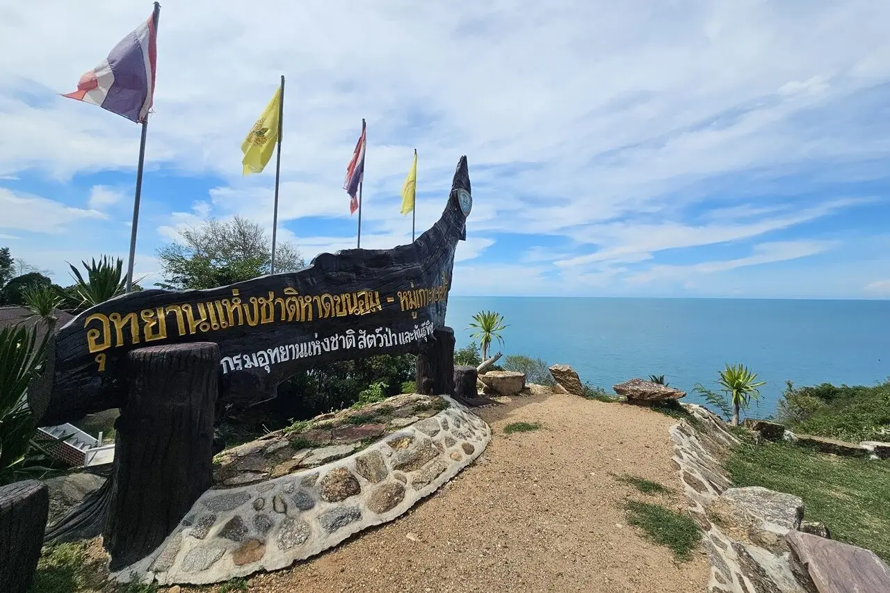
3. Hat Khanom-Mu Ko Thale Tai National Park is an important marine and coastal conservation area in Khanom District. It encompasses beaches, coastal mountains, forest, islands, and many different types of shoreline. The park is therefore the principal natural area for marine tourism in Khanom and offers much more than a long sandy beach. Its landscapes also include small bays, rocky islands, limestone coastal mountains, and natural formations created through long-term marine erosion.
One of the most popular activities is taking a nature boat trip around Ao Taled and Laem Prathap. Boat routes can connect several attractions, including Khao Hin Phap Pha, the Freshwater Well On The Seaside near Ko Nui, and Ko Tha Rai, as well as waters where visitors may have the opportunity to encounter pink dolphins living naturally in the area. However, dolphin sightings depend on sea conditions, time, and the natural movement of the animals, so sightings cannot be guaranteed on every boat trip. Travelers should choose operators that maintain an appropriate distance from dolphins and do not chase or surround the animals.
The national park is also suitable for beach visits, nature walks, and exploring different types of coastal geography. Access to some areas or participation in certain marine activities may depend on weather, wave conditions, and national park announcements. Travelers should therefore check current information before visiting, particularly during periods when the Gulf of Thailand is affected by monsoon conditions or high waves.
Getting There: Travel into Khanom District from the main Nakhon Si Thammarat–Surat Thani road, then continue toward the relevant coastal area depending on your itinerary, such as Khanom Beach, Ao Taled, Laem Prathap, or the boat departure point specified by the operator.
Map (GPS): https://maps.app.goo.gl/AG1AHA412Jmn7Hnj6
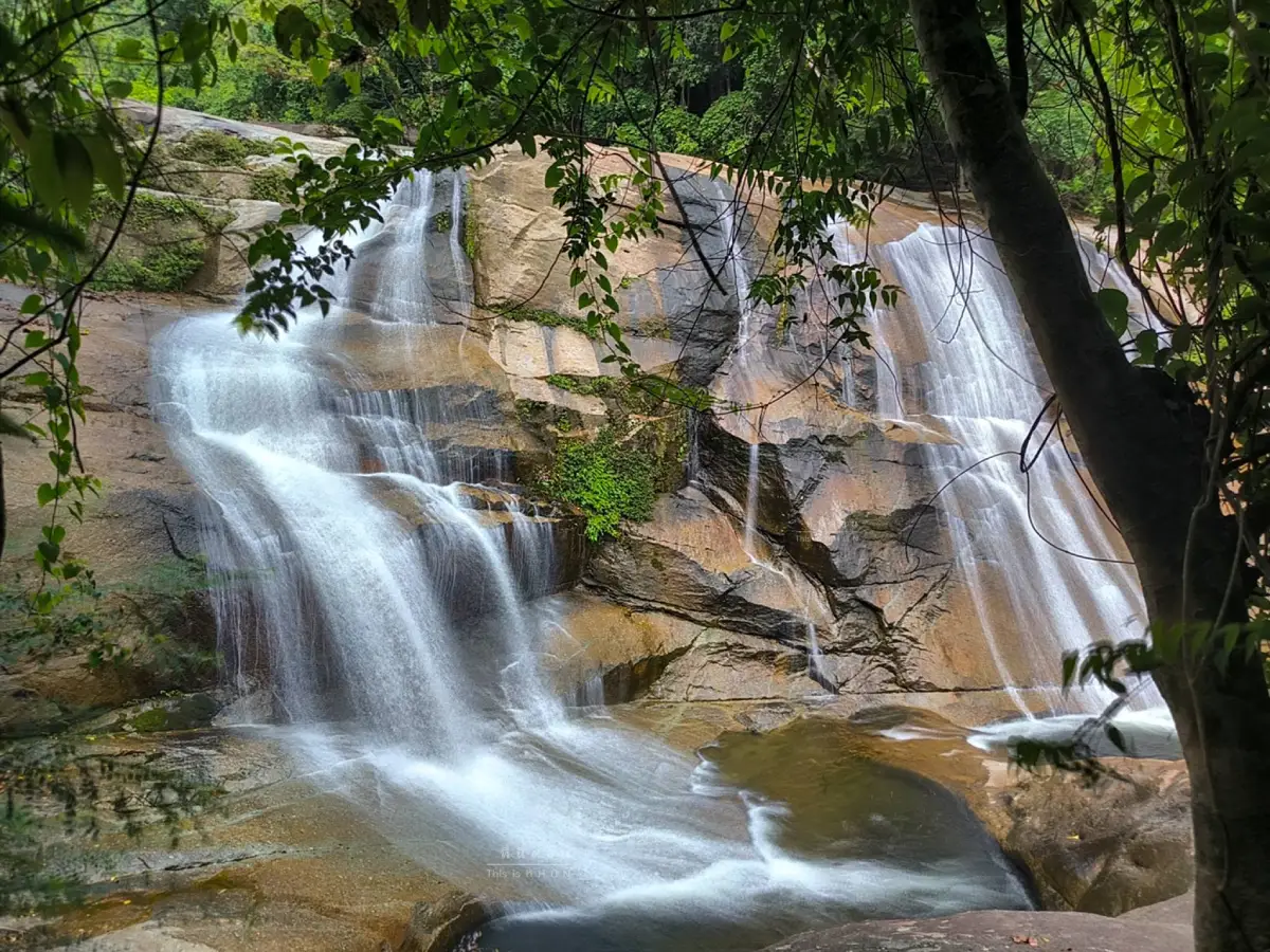
4. Phrom Lok Waterfall is located within Khao Luang National Park in Phrom Khiri District and is one of the best-known waterfalls in Nakhon Si Thammarat. Its water originates in the Nakhon Si Thammarat mountain range and descends through numerous rocky levels before flowing toward the communities below. The lower section of the waterfall is relatively easy to access and includes rock platforms, streams, and natural pools, while the higher and deeper sections are surrounded by denser forest and require greater caution.
Phrom Lok Waterfall is distinguished by the fertile tropical rainforest surrounding it and by the amount of water associated with the Khao Luang watershed. Under normal weather conditions, the stream is clear, while the high humidity of the surrounding forest supports large numbers of ferns, mosses, and tropical plant species. The area is therefore suitable for visitors who want to swim in permitted areas, enjoy nature, take photographs, or begin learning about the watershed ecosystem of Nakhon Si Thammarat.
Although the waterfall is normally open to visitors during regular operating periods, safety should be the highest priority during the rainy season. Water descending from Khao Luang can rise very quickly after heavy rainfall in upstream areas, even when there is no rain at the lower waterfall. Visitors should always follow ranger warnings and avoid entering the water whenever flash-flood warnings have been issued or unusual currents are observed.
Getting There: From Nakhon Si Thammarat city, travel toward Phrom Khiri District, then follow the route into Khao Luang National Park and Phrom Lok Waterfall. The waterfall can be combined with Wat Khao Khun Phanom, Ai Khiao Waterfall, and communities around the mountain foothills in the same trip.
Map (GPS): https://maps.app.goo.gl/Y3SVdCS7n9S3poHC8
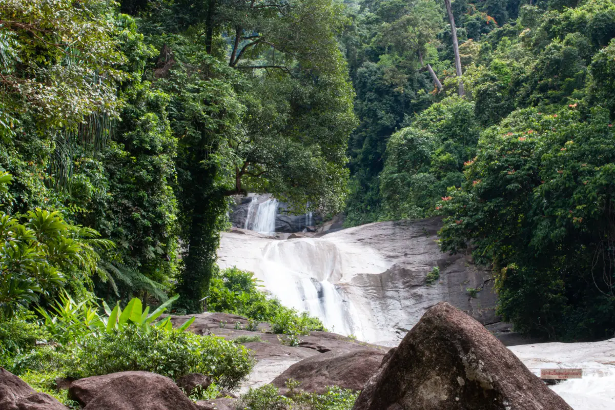
5. Khao Luang National Park covers part of the Nakhon Si Thammarat mountain range and protects one of the most important tropical rainforest areas in Southern Thailand. One of its most significant high points is Khao Luang Peak, the highest mountain in the province and the source of numerous streams and waterfalls. The forest of Khao Luang supports an exceptionally high level of biodiversity, including endemic plants, ferns, orchids, wildlife, and ecosystems that change according to elevation.
General visitors can experience the park through the Karom Waterfall area, nature trails, and visitor zones that are accessible without climbing to the summit. Travelers who want to undertake long-distance trekking or climb Khao Luang need considerably more preparation because the trails are humid, long, and subject to rapidly changing weather. Summit trekking should therefore take place only in accordance with national park regulations and seasonal opening periods, and may require park staff or guides depending on current conditions and requirements.
Visiting Khao Luang reveals another side of Nakhon Si Thammarat that is clearly different from its historic city and coastal landscapes. The forested mountain range serves as a watershed for many communities, including Lan Saka, Phrom Khiri, and eastern river-basin areas. Travelers should therefore focus on responsible nature tourism: do not leave rubbish, do not remove plants or animals from the forest, and always check seasonal trail-opening information before traveling.
Getting There: The main visitor facilities and tourism areas of the park can be reached from Lan Saka District by following the route toward Khao Kaeo Subdistrict and Karom Waterfall. Long-distance trekking routes should be coordinated with the national park in advance.
Map (GPS): https://maps.app.goo.gl/PeeereLYT8QSS8dM6
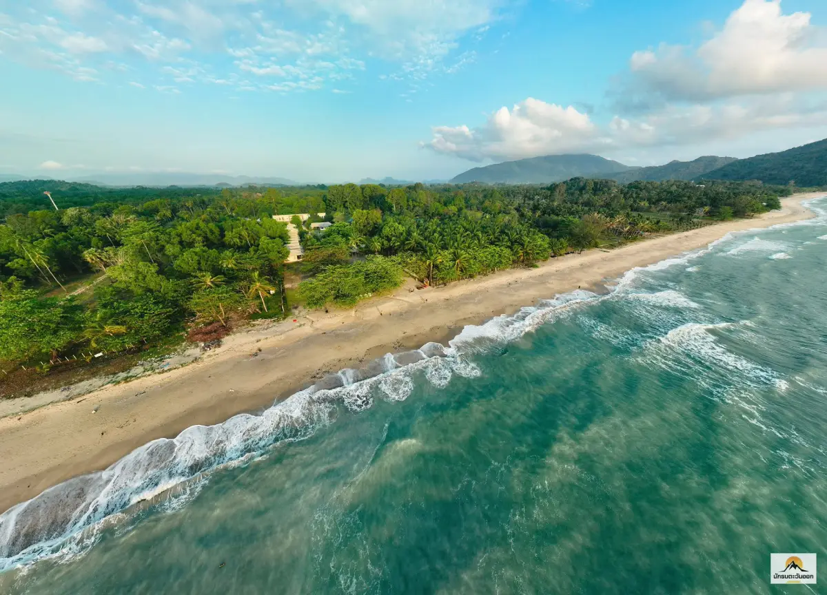
6. Ao Khanom is a large bay in Khanom District that includes several continuous beach sections and is one of the most important coastal tourism zones in Nakhon Si Thammarat. The landscape includes long sandy beaches, mountain ranges surrounding parts of the bay, local communities, restaurants, accommodation, and coastal roads. This makes the area suitable both for seaside relaxation and as a base for visiting other natural attractions around Khanom.
Different sections of the Ao Khanom coastline have their own character. Na Dan Beach is convenient and functions as one of the main centers for accommodation and seaside recreation, while Nai Phlao Beach lies toward the southern end of the bay with mountains forming an impressive natural backdrop. From the Ao Khanom area, travelers can continue to Ao Thong Yi, Khao Phlai Dam, Hin Lat Waterfall, and the Sichon–Khanom coastal road. Staying in the Ao Khanom zone therefore makes it possible to explore several types of coastal attractions without having to change accommodation every day.
Popular activities include walking along the beach, swimming on days when the sea is calm, watching the sunrise, enjoying local seafood, and using the area as a connecting point to piers for marine excursions around Khanom. Travelers should always check wave and wind conditions before entering the sea, particularly during periods when the Gulf of Thailand experiences strong winds or continuous rainfall.
Getting There: From Khanom town, several roads provide access to the Ao Khanom coastline, including routes to Na Dan Beach, Nai Phlao Beach, and accommodation areas along the bay. Cars and motorcycles are the most convenient forms of transportation for exploring the coastline.
Map (GPS): https://maps.app.goo.gl/fvD7kMWJJqgSdetS8
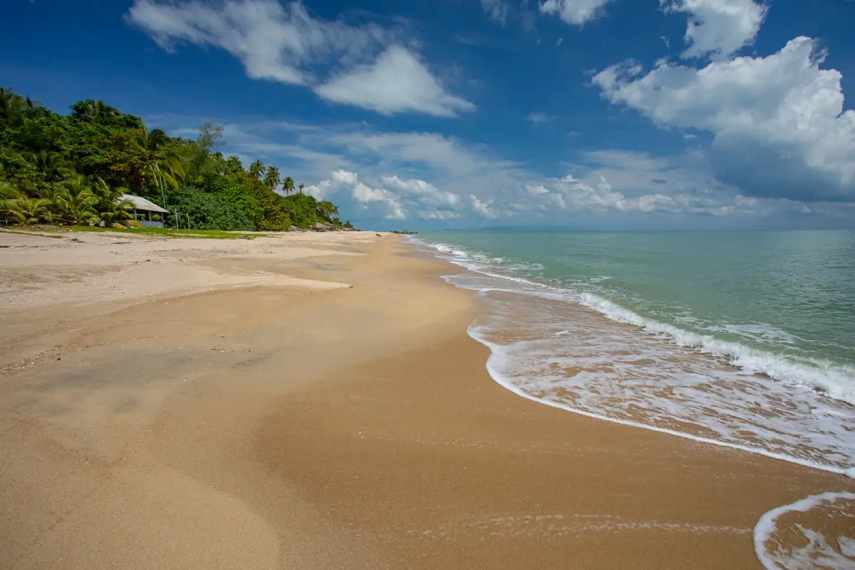
7. Ao Thong Yi is located in Moo 8, Khanom Subdistrict, Khanom District. It is a relatively small bay with a quiet atmosphere and a greater sense of privacy than the main beaches of Khanom. Mountains and green areas surround the beach, creating the impression of a hidden seaside cove nestled between the hills. On days when the sea is calm, the water can be relatively clear and the bay is well suited to peaceful seaside relaxation.
What makes Ao Thong Yi particularly appealing is its sense of tranquility and separation from urban areas and major roads. Visitors can walk along the beach, sit and rest, take photographs, and enjoy views of the mountains and sea without needing a large number of organized activities. The bay is therefore especially suitable for travelers who genuinely want to relax rather than seek entertainment facilities or heavily commercialized tourism.
From Ao Thong Yi, travelers can continue to Nai Phlao Beach, Khao Phlai Dam, Ao Thong Ching, and natural areas around the boundary between Khanom and Sichon. During the monsoon season, additional caution should be taken with waves and currents, and swimming should be avoided whenever the sea is rough or official weather warnings are in effect.
Getting There: From Khanom town, travel toward Nai Phlao Beach and continue along local roads toward Ao Thong Yi. A private vehicle is recommended, and traveling during daylight hours is preferable for greater convenience.
Map (GPS): https://maps.app.goo.gl/6sJhLqPZbpinotPg7
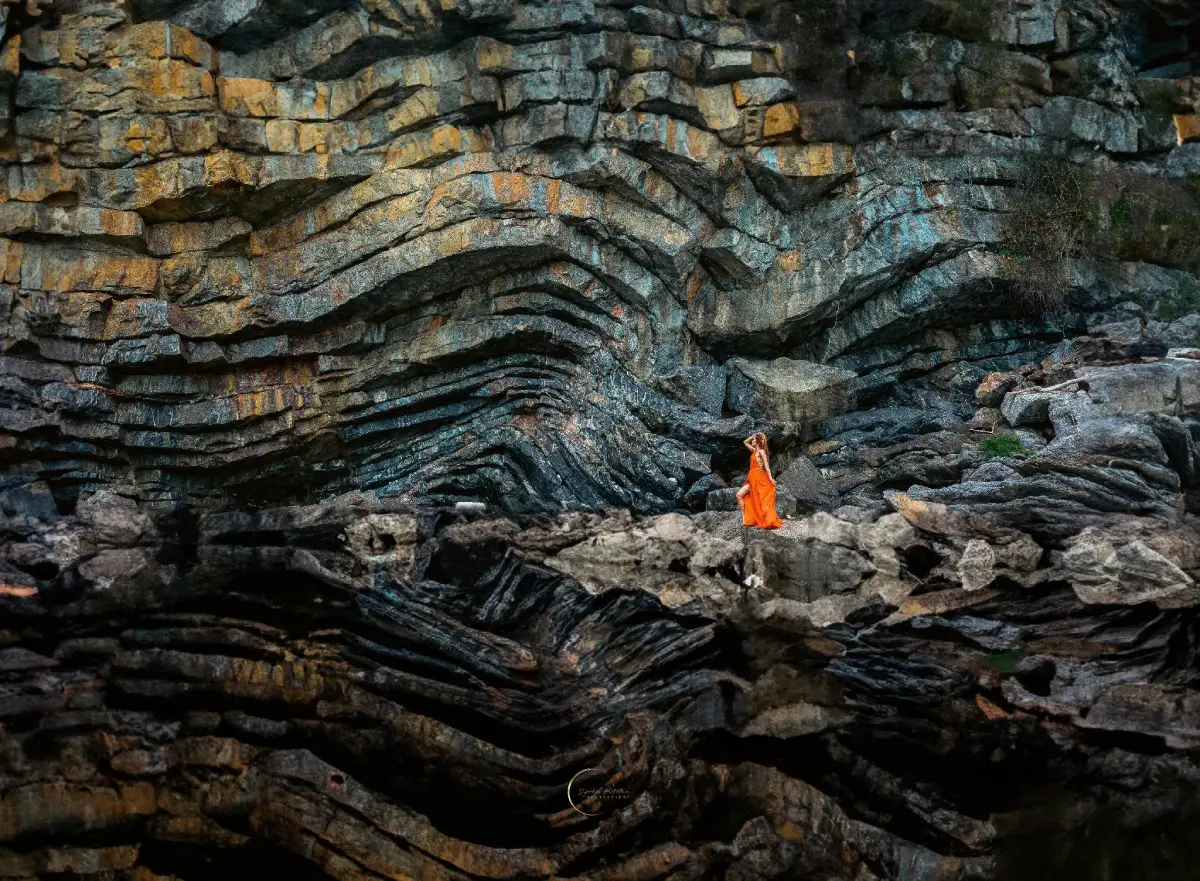
8. Khao Hin Phap Pha is located in the Khanom Sea off Ao Taled in Thong Nian Subdistrict and is one of the most distinctive geological landscapes in Nakhon Si Thammarat. The coastal cliffs reveal layers of rock that overlap and curve continuously. When viewed from a boat, the pattern resembles folded or stacked fabric, which gave rise to the Thai name “Khao Hin Phap Pha,” meaning a mountain of folded rock, and made the site one of the signature attractions on Khanom's marine sightseeing route.
The rock layers were formed through geological processes that took place over a very long period of time, including deposition, compression, uplift, and erosion by sea waves. These processes created clearly visible bands within the coastal rock faces. Visitors therefore gain both dramatic marine scenery and an opportunity to observe geological structures at the same time. The formation should be viewed from a boat at a safe distance because parts of the cliff are steep and there is no general landing area for ordinary visitors.
Khao Hin Phap Pha is often included in the same boat program as Laem Prathap, Ao Taled, the Freshwater Well On The Seaside, and other natural attractions around Khanom. Actual routes depend on sea conditions on the day of travel. If waves are strong or rain is heavy, boat operators may adjust the itinerary or cancel individual stops for safety.
Getting There: Travel to Laem Prathap or Ao Taled in Thong Nian Subdistrict, then take a community tourism boat or use a local operator to travel out to Khao Hin Phap Pha and view the rock formation from the sea.
Map (GPS): https://maps.app.goo.gl/XCi827rjkEYmMaGPA
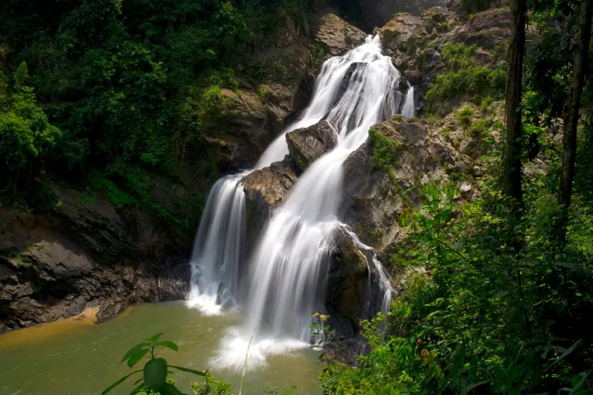
9. Krung Ching Waterfall is located in Krung Ching Subdistrict, Nopphitam District, within Khao Luang National Park. It is a rainforest waterfall famous for its high cascades and trekking route through a section of tropical forest that remains highly fertile. The waterfall has several levels, and its most recognizable image is the tall stream of water dropping from a high cliff surrounded by dense green forest. This makes it particularly suitable for travelers who enjoy trekking and want a more immersive nature experience than simply stopping at a roadside waterfall.
The route to the main waterfall viewpoint requires walking through forest. The distance and trail conditions mean that visitors should prepare footwear suitable for soil and humid conditions, drinking water, and rain protection. The area contains tropical evergreen plants, ferns, mosses, and signs of wildlife. Walking quietly and remaining on designated trails helps reduce disturbance to the ecosystem and increases the opportunity to experience the forest in a more authentic way.
Krung Ching is also interesting from the perspective of local history because the area was once associated with political events and conflict before later being developed as a nature-based tourism destination. Today, it can be combined with Krung Ching Hot Spring and communities in Nopphitam. Travelers should nevertheless check national park trail-opening periods and current rainfall conditions before visiting.
Getting There: From Nakhon Si Thammarat city, travel to Nopphitam District and Krung Ching Subdistrict, then enter the national park ranger-unit area and continue on foot along the designated nature trail to the waterfall viewpoint.
Map (GPS): https://maps.app.goo.gl/1979NTNwdPytCi9Z6
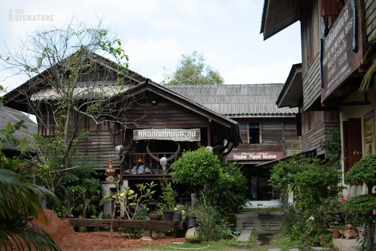
10. Ban Nang Talung Suchart Subsin is located in Soi Si Thammasok 3, Nai Mueang Subdistrict, Mueang Nakhon Si Thammarat District. It is an important learning center dedicated to preserving Nang Talung, the traditional shadow-puppet art of Southern Thailand. The collection includes shadow puppets, tools, the process of making puppet figures, and knowledge about performance traditions passed down through families and local artists. Nang Talung in Nakhon Si Thammarat is not simply a form of entertainment; it is an art that combines storytelling, music, language, humor, belief, and social commentary.
Traditional shadow puppets are made from animal hide, which must be carefully prepared before being carved into intricate patterns, painted, and attached to wooden rods for manipulation. Each puppet has a different personality and function, ranging from heroes and heroines to comic characters, hermits, and distinctive local figures. The production process requires both precision and an understanding of art and performance, so visiting Ban Nang Talung allows travelers to see the craftsmanship behind shadow puppetry rather than experiencing only the final stage performance.
Ban Nang Talung also plays an important role as a center for passing knowledge to younger generations, including puppet carving, puppet manipulation, vocal techniques, and the history of local performers. Travelers interested in Southern Thai culture should therefore allow enough time for a meaningful visit. The site can be combined with Wat Phra Mahathat Woramahawihan, the Nakhon Si Thammarat City Wall, City Pillar Shrine, and museums in the city within the same day.
Getting There: From Ratchadamnoen Road in central Nakhon Si Thammarat, enter Soi Si Thammasok 3. The site can be reached conveniently by car, motorcycle, or local hired transport.
Map (GPS): https://maps.app.goo.gl/6dgC1kijH9AdGvej7
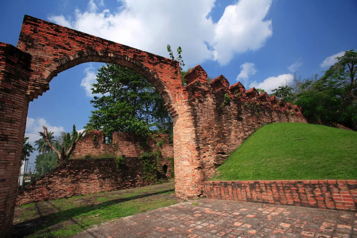
11. Nakhon Si Thammarat City Wall is located along Ratchadamnoen Road near Sanam Na Mueang, Khlong Na Mueang, and Nakhon Noi Bridge in Nai Mueang Subdistrict, Mueang Nakhon Si Thammarat District. It is one of the archaeological and historical landmarks that most clearly reveals Nakhon Si Thammarat's identity as an ancient city. The surviving wall reflects the city's former defensive system, which once consisted of walls, a moat, gateways, and fortifications. The old city itself developed in a long, narrow form along a natural sand ridge running from north to south, corresponding closely with the geography of the historic settlement and the principles of urban planning used in earlier periods.
The most prominent sections of the city wall visible today are associated with a major phase of construction and restoration during the reign of King Narai the Great of Ayutthaya, around 1686. During that period, knowledge of fortress and defensive-wall design was adapted for use in Nakhon Si Thammarat. The structure consisted of brick-and-mortar walls built on an earthen embankment, with upper architectural features and other elements related to the city's defense system. Although many sections of the original walls have changed or disappeared as the city expanded, the northern side near Sanam Na Mueang remains one of the best places to observe the relationship between the wall, moat, and original city plan.
The area is particularly suitable for walking and photography in the morning or late afternoon. Visitors can easily continue to the Nakhon Si Thammarat City Pillar Shrine, Sanam Na Mueang, Phra Buddha Sihing, and Wat Phra Mahathat Woramahawihan. Exploring several attractions within the same district helps visitors understand the structure of the old city more clearly than viewing each archaeological site separately, especially along Ratchadamnoen Road, which connects important historical, religious, and administrative landmarks throughout the traditional urban area.
Getting There: From central Nakhon Si Thammarat, follow Ratchadamnoen Road toward Sanam Na Mueang. The city wall is located beside Khlong Na Mueang near Nakhon Noi Bridge and can be reached conveniently by car, motorcycle, or local hired transport.
Map (GPS): https://maps.app.goo.gl/3VeRA11nbmgs6sX7A
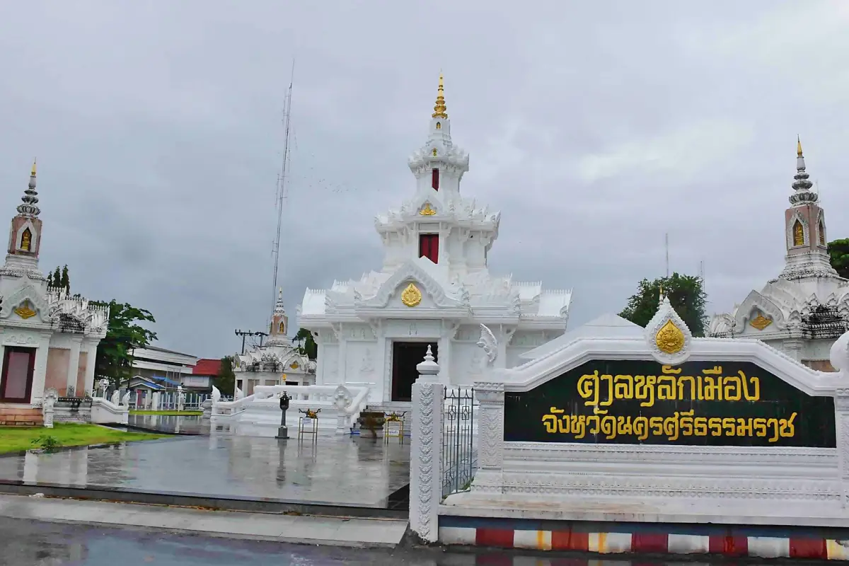
12. Nakhon Si Thammarat City Pillar Shrine is located on the northern side of Sanam Na Mueang in Khlang Subdistrict, Mueang Nakhon Si Thammarat District. It is a sacred landmark deeply respected by local people and is one of the key stops on a historic-city itinerary. The shrine complex consists of several buildings, with the central structure housing the city pillar. The surrounding buildings create a balanced layout with a distinctive architectural character.
The city pillar is significant as a symbol of auspiciousness, stability, and protection for the city. Local residents and visitors come to pay respect and pray for blessings related to life, work, family, and smooth progress in everyday affairs. A visit should be understood not only in terms of spiritual belief, but also as part of the historic urban landscape of central Nakhon Si Thammarat, because the shrine stands close to Sanam Na Mueang, the City Wall, Khlong Na Mueang, and Ratchadamnoen Road, which forms an important axis of the old city.
Visitors should dress respectfully, speak quietly, and follow the rules of the shrine, especially in areas where people are praying or participating in ceremonies. The City Pillar Shrine can be used as the first stop on a city itinerary before continuing to the City Wall, Phra Buddha Sihing, museums, and Wat Phra Mahathat Woramahawihan. This allows a single day of sightseeing to cover local beliefs, history, architecture, and culture in a coherent route.
Getting There: The City Pillar Shrine is located on the northern side of Sanam Na Mueang and can be reached directly from Ratchadamnoen Road. It lies within the central city area and is convenient to access by car, motorcycle, or local transport.
Map (GPS): https://maps.app.goo.gl/S6e9aaqFuEcudtPj9
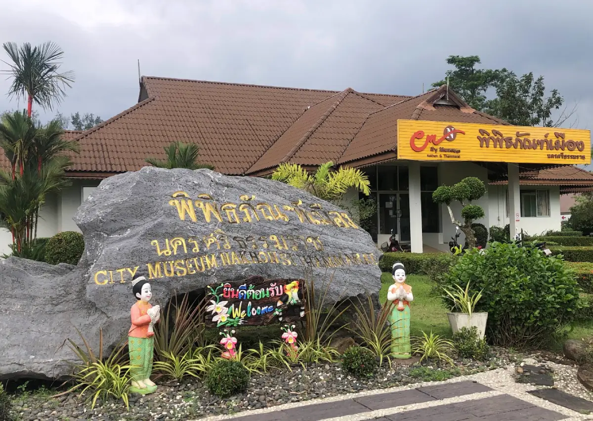
13. Nakhon Si Thammarat City Museum is located inside Somdet Phra Srinagarindra 84 Park, also known as Thung Tha Lat, in Na Khian Subdistrict, Mueang Nakhon Si Thammarat District. It is an excellent learning center for gaining an overall understanding of Nakhon Si Thammarat before visiting the city's historic attractions in person. One of the museum's strengths is its use of mixed media, including photographs, maps, models, sand tables, audiovisual presentations, and exhibitions, making complex historical subjects easier to understand than through written documents alone.
The exhibitions cover a wide range of subjects, including geography, prehistoric settlement, the development of ancient communities, trade routes, the role of Buddhism, the traditional Twelve Zodiac Cities system, important historical figures, arts and culture, local traditions, and contemporary events in the province. The displays demonstrate that Nakhon Si Thammarat did not develop solely as a religious city, but also as a trading port, an administrative center, and an important cultural hub that maintained connections with other regions of the peninsula for a very long period.
The museum also helps visitors connect the historical background with places they may visit later, including Wat Phra Mahathat Woramahawihan, the City Wall, the City Pillar Shrine, Ban Nang Talung Suchart Subsin, and the National Museum. Visiting the museum either before or after exploring the old city can significantly improve understanding of the province as a whole, particularly for families, students, and travelers interested in history who do not want to begin with a large amount of academic reading.
Getting There: From central Nakhon Si Thammarat, travel to Somdet Phra Srinagarindra 84 Park, or Thung Tha Lat, in Na Khian Subdistrict. The museum is located within the park and can be reached conveniently by private car.
Map (GPS): https://maps.app.goo.gl/R7JU3Ruh9KhAnYQcA
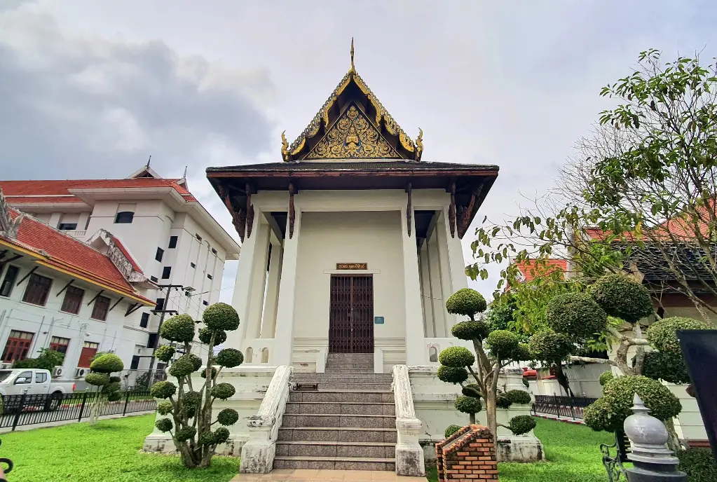
14. Phra Buddha Sihing is an important Buddha image of Nakhon Si Thammarat and is enshrined in the Phra Buddha Sihing Hall between the Provincial Hall and the Nakhon Si Thammarat Provincial Court in Mueang Nakhon Si Thammarat District. Phra Buddha Sihing is one of the most highly revered Buddha images in Thai culture and is associated with the history of Buddhism in several important cities. Its presence in Nakhon Si Thammarat reflects the city's status as a major religious and cultural center of Southern Thailand.
The image depicts the Buddha seated in meditation and is distinguished by its notable artistic characteristics. According to local tradition, Phra Buddha Sihing is brought out for a ceremonial water-pouring ritual during the Songkran Festival. Local residents and visitors regularly come to pay respect and seek auspicious blessings. Those entering the hall should behave respectfully, avoid disturbing people who are praying or worshipping, and dress modestly in the same manner expected when visiting other important religious sites.
The location of the Phra Buddha Sihing Hall makes it easy to combine with the City Pillar Shrine, City Wall, Sanam Na Mueang, and Wat Phra Mahathat Woramahawihan. It is therefore particularly suitable for travelers following a faith-and-history route through the city center without needing to drive long distances between individual attractions. Following such a route also helps visitors see how religion, administration, and the historical urban plan of Nakhon Si Thammarat are closely related.
Getting There: The Phra Buddha Sihing Hall is located in the former government-center area of the city, between the Provincial Hall and the Nakhon Si Thammarat Provincial Court. It can be reached conveniently from Sanam Na Mueang and Ratchadamnoen Road.
Map (GPS): https://maps.app.goo.gl/TzK4e3dcJbjCeao86
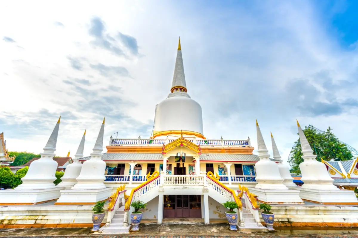
15. Wat That Noi (Wat Phra That Noi) is located in Lak Chang Subdistrict, Chang Klang District. It is an important temple closely associated with Phor Than Klai Wajasit, a highly revered Buddhist monk in Southern Thailand. The temple contains Phra That Noi Chedi, which was built to enshrine sacred Buddha relics as well as the preserved remains of Phor Than Klai. This has made the temple one of the major spiritual centers regularly visited by devotees from Nakhon Si Thammarat and many other provinces.
Phor Than Klai Wajasit became famous for his monastic conduct and for words that devotees believed carried auspicious power. His story remains deeply connected with local communities and religious faith throughout Southern Thailand. Visiting Wat That Noi is therefore not only about paying respect to sacred objects, but also provides an opportunity to understand the culture of devotion toward highly respected monks and the continuing role of Buddhist temples in the daily life of rural communities in Nakhon Si Thammarat.
The temple grounds include the chedi, worship buildings, and areas associated with Phor Than Klai. Visitors should dress respectfully and maintain a peaceful atmosphere, particularly during important Buddhist occasions or days when large numbers of devotees come to make merit. Wat That Noi can be included in a Chang Klang–Chawang–Lan Saka route, adding a religious dimension to a journey otherwise focused on natural attractions and fruit-growing landscapes in the central part of the province.
Getting There: From Nakhon Si Thammarat city, follow the route toward Chang Klang District and Lak Chang Subdistrict. The temple can be reached conveniently by private car, and directional signs in the area are relatively clear.
Map (GPS): https://maps.app.goo.gl/Cgtdw5W7Dncsu6kP6
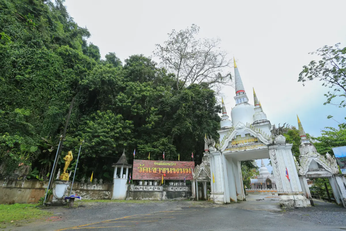
16. Wat Khao Khun Phanom is located in Moo 3, Ban Ko Subdistrict, Phrom Khiri District. The temple combines religious, historical, and natural dimensions because it stands beside a rocky mountain and includes caves as well as traces of several older sites. Local stories associated with Khao Khun Phanom have made the temple a popular stop for people interested in local history, while visitors can also pay respect to Buddha images and experience the natural environment along the foothills of Khao Luang.
The appeal of Wat Khao Khun Phanom comes from its peaceful atmosphere and the way religious architecture blends with the natural mountain environment. Some parts of the temple require visitors to climb stairs or follow sloping paths to reach caves and religious sites. Suitable footwear is therefore recommended, and additional care should be taken after rainfall when surfaces may become damp. Elderly visitors or people with mobility limitations may choose to explore only the lower sections according to their comfort and physical condition.
Wat Khao Khun Phanom can be conveniently combined with Phrom Lok Waterfall, Ai Khiao Waterfall, and fruit-growing communities in Phrom Khiri District. Because these attractions are located within the same general mountain zone, a one-day itinerary can include Buddhist worship, local history, fruit orchards, and relaxation beside streams without requiring excessive backtracking.
Getting There: From Nakhon Si Thammarat city, travel toward Phrom Khiri District and continue into Ban Ko Subdistrict along local roads. The temple is located near the foothills and can be reached by private car.
Map (GPS): https://maps.app.goo.gl/Ny93YNVeUqjqvxb5A
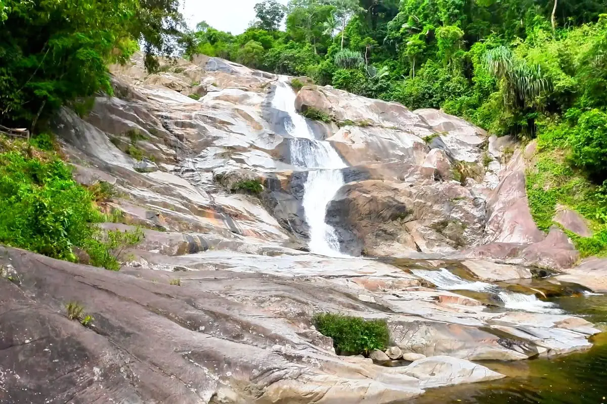
17. Karom Waterfall is located within Khao Luang National Park in Moo 4, Khao Kaeo Subdistrict, Lan Saka District. It is an important waterfall that is easier to access than the deeper forest areas of Khao Luang. Water descends over several rocky levels surrounded by fertile tropical rainforest, making the area both a recreational destination and an excellent place to learn about the watershed ecosystem of the Nakhon Si Thammarat mountain range.
The waterfall has several levels. Lower tiers are easier to reach and are suitable for general visitors, while higher levels require walking along natural trails. Visitors should check with park staff to confirm which areas are open on the day of travel. The environment around the waterfall includes ferns, mosses, tropical evergreen plants, and humid streams, creating a noticeably cooler atmosphere than the surrounding lowlands and making the morning a particularly pleasant time for nature walks.
Swimming should be limited to areas approved by park staff, and visitors should take additional care during the rainy season because water descending from higher elevations can rise quickly. If flash-flood warnings are issued or heavy rain occurs, entering the water should be avoided. Karom Waterfall can easily be combined with Ban Khiriwong and other destinations around Lan Saka, making it especially suitable for itineraries focused on mountains, forest, and community-based tourism.
Getting There: From Nakhon Si Thammarat city, travel toward Lan Saka District and Khao Kaeo Subdistrict, then follow signs to Khao Luang National Park and Karom Waterfall. The lower visitor area can be reached by car.
Map (GPS): https://maps.app.goo.gl/vSiLL1dQkdjugq1z5
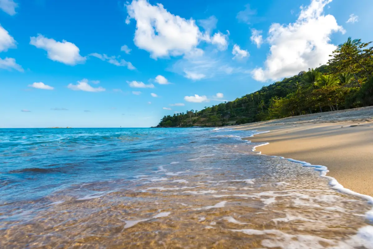
18. Khao Phlai Dam is located in Thung Sai Subdistrict, Sichon District and is one of the most distinctive coastal-mountain areas along the Sichon–Khanom route. It is a place where forest, mountain, and the Gulf of Thailand lie remarkably close together. This unusual landscape allows visitors to experience viewpoints, nature trails, small beaches, and areas where birds, butterflies, and coastal plants can be observed within the same journey.
The area around the mountain includes several natural attractions such as Thong Yang Beach, Hin Ngam Rang That Beach, and stretches of coastline that are quieter than the main Sichon beach area. It is therefore particularly suitable for travelers who prefer a scenic coastal drive with a number of smaller stops rather than traveling to only one beach. From some elevated areas, visitors can clearly see the continuous curve of the coastline and the contrast between mountain landscapes and the sea.
Because some sections involve mountainous terrain and natural routes, travelers should check road and weather conditions before visiting, particularly after rainfall. Isolated routes should not be entered near nightfall, and all rubbish should be taken out of the area. Khao Phlai Dam can be combined with Sichon Beach, Hin Ngam Beach, Ao Thong Yi, and Khanom to create a full-day coastal itinerary.
Getting There: From Sichon District, travel toward Thung Sai Subdistrict and follow the coastal road in the direction of Khanom. Khao Phlai Dam lies along the natural route between the two districts and is most conveniently reached by private car.
Map (GPS): https://maps.app.goo.gl/PbqoAjDFeR13amC89

19. Sichon Beach (Hua Hin Sichon) is located in Sichon Subdistrict, Sichon District. It is the district's best-known main beach and a convenient seaside destination. The coastline forms a gentle curve with both sandy sections and rocky outcrops. Some areas are suitable for swimming when sea conditions are calm, while seafood restaurants, accommodation, and coastal roads make it easy to connect the beach with other attractions around Sichon.
Sichon Beach has a slightly different atmosphere from the beaches of Khanom because local coastal lifestyles and traditional fishing activities remain clearly visible close to the tourism area. Visitors can walk along the beach, photograph the rocky coastline, enjoy seafood, or continue by road to Hin Ngam Beach and Kho Khao Beach within a relatively short time. Morning is suitable for walking and photography, while the late afternoon is particularly pleasant for relaxing and dining beside the sea.
Swimming should always be based on actual sea conditions on the day of the visit because the Gulf of Thailand coast can experience strong waves during the monsoon season. Children should remain under adult supervision at all times, and climbing on wet rocks or rocks exposed to breaking waves should be avoided. Sichon Beach can also be used as a base for visiting Wat Chedi and the Ai Khai shrine, Khao Phlai Dam, Ban Plai Thon Beach, and other natural attractions in Sichon District.
Getting There: From Nakhon Si Thammarat city, follow Highway 401 toward Sichon District for approximately 70 kilometers. From the district center, turn toward Ban Pak Nam and continue for around 3 kilometers to reach Sichon Beach.
Map (GPS): https://maps.app.goo.gl/xVKnrZtpXUjVmJnT6
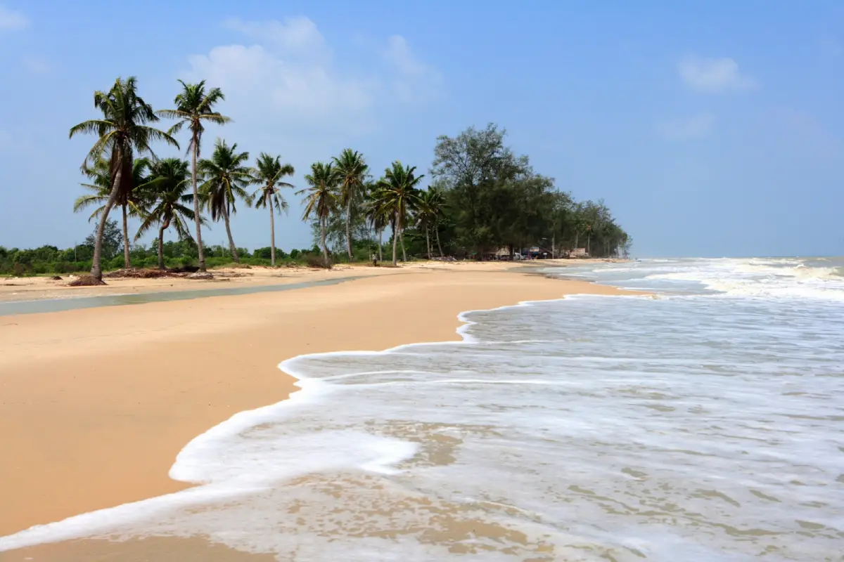
20. Pak Phanang Coast and Laem Talumphuk are located in Laem Talumphuk Subdistrict, Pak Phanang District. This coastal area has important natural, historical, and community value. Its most distinctive feature is a long, narrow sand spit shaped somewhat like a crescent, extending out into the sea with one side facing Pak Phanang Bay and the other opening directly onto the Gulf of Thailand. The beach stretches for several kilometers and is lined in places with rows of casuarina trees, allowing visitors to drive along the cape while enjoying coastal views and observing local fishing-community life.
Laem Talumphuk holds a significant place in Thailand's collective memory because of the 1962 storm disaster, when Tropical Storm Harriet struck the area and caused severe destruction to coastal communities. As a result, the site is more than simply a scenic seaside destination. It is also a historical landscape that reflects the vulnerability of coastal communities to natural disasters. Visitors therefore encounter both the peaceful coastline seen today and a place whose past remains deeply meaningful within Thailand's modern history.
Suitable activities include driving along the cape, walking on the beach in safe areas, enjoying the sea breeze, photographing the rows of casuarina trees, learning about Tropical Storm Harriet, and eating seafood from local communities. With more time, visitors can continue to Pak Phanang town, Ban Rang Nok, the Pak Phanang River, and the Utokvibha Prasit Floodgate. Together, these attractions reveal the relationship between the sea, river mouth, fisheries, water-management systems, and the history of the Pak Phanang River Basin.
Getting There: From Nakhon Si Thammarat city, follow Highway 4013 toward Pak Phanang District, then continue to Laem Talumphuk Subdistrict and drive along the coastal road toward the end of the cape. A private car is the most practical means of transportation.
Map (GPS): https://maps.app.goo.gl/13anSRE682VYX8tZA
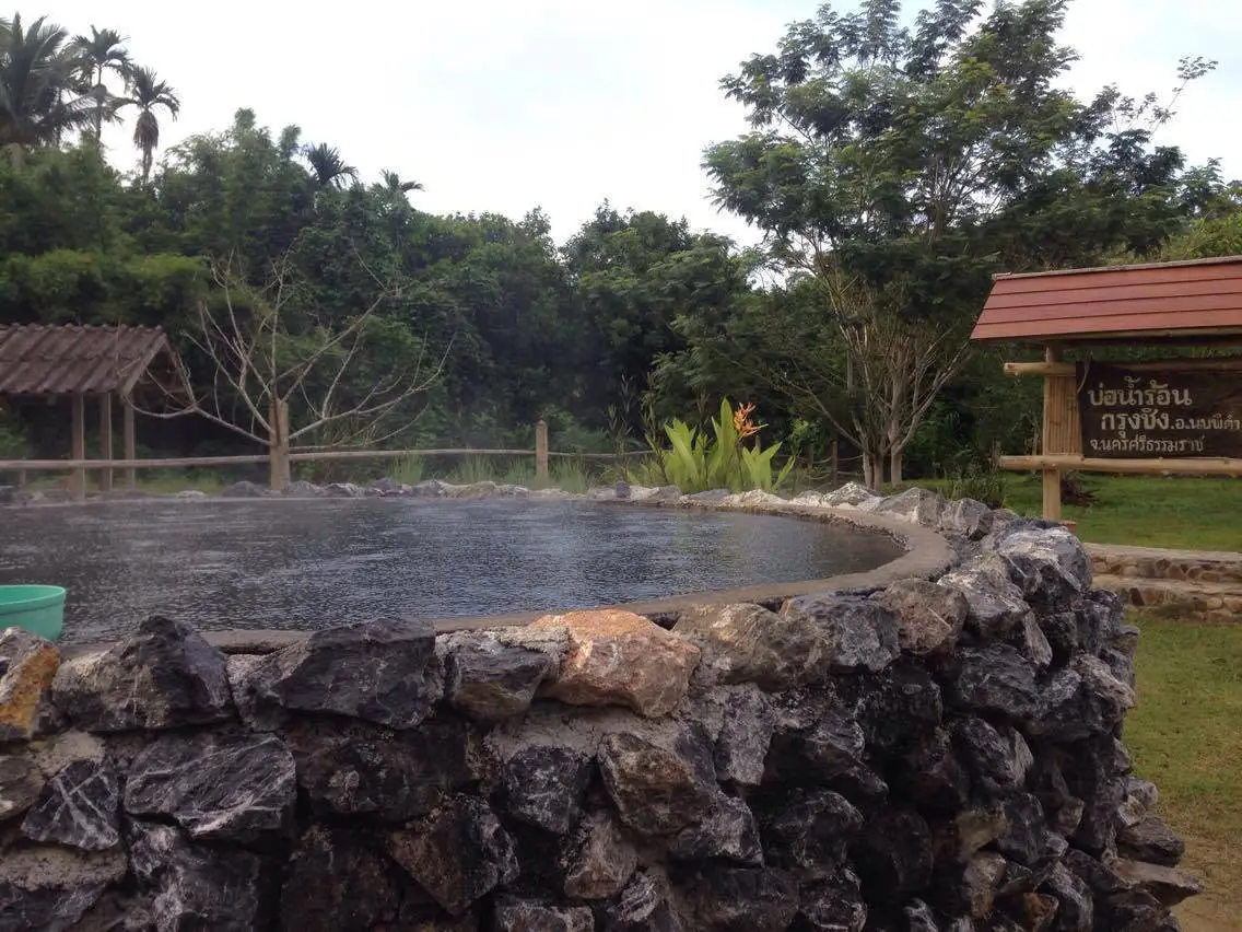
21. Krung Ching Hot Spring is located near Bo Nam Ron Wanaram Monastery in Moo 3, Krung Ching Subdistrict, Nopphitam District. It is a natural hot spring surrounded by the forest and mountainous landscape of Krung Ching. One of its main attractions is the opportunity to relax in naturally heated water after spending the day exploring waterfalls, forest trails, or other outdoor attractions in Nopphitam. The underground geothermal water gives the site a character completely different from nearby Krung Ching Waterfall, even though both attractions lie within the same broader nature zone.
Visitors can soak in the warm water to relax muscles and rest after physical activity. It is advisable to test the water temperature before entering and to avoid staying in hot water continuously for too long. Drinking enough water is also important. Elderly visitors and people with heart conditions, high or low blood pressure, or other medical conditions should take extra care. Anyone who feels dizzy, experiences palpitations, or becomes uncomfortable should leave the water immediately. The suitability of soaking in hot water depends more on each individual's physical condition than on remaining in the water for as long as possible.
One of the advantages of Krung Ching Hot Spring is that it can be included as a relaxing final stop after visiting other natural attractions in Nopphitam, such as Krung Ching Waterfall, viewpoints in the Krung Ching area, Khlong Klai Rafting, or nearby communities. This makes it possible to spend a full day combining forest walks, mountains, river activities, and a warm-water soak before returning to accommodation. Published information indicates that the site is generally open daily from approximately 08.00 to 19.00.
Getting There: From Nakhon Si Thammarat city, travel toward Nopphitam District and continue into Krung Ching Subdistrict. Follow the local route to Bo Nam Ron Wanaram Monastery in Moo 3. A private car is recommended, particularly for travelers planning to visit several attractions in the same zone.
Map (GPS): https://maps.app.goo.gl/S5s1CofdYNJ1GYat6
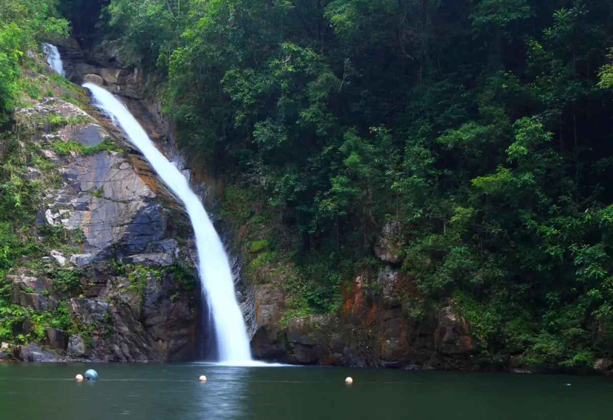
22. Namtok Yong National Park is located in Tham Yai Subdistrict, Thung Song District. The park protects a mountainous landscape of complex ridges and tropical rainforest, with numerous streams and waterfalls scattered throughout the protected area. It is important both for conservation and as a watershed for Southern Thailand. The attraction of the park is not limited to one waterfall; it is the wider ecosystem connecting mountains, forest, streams, waterfalls, and nature trails that makes the area especially valuable.
There are several attractions within the park and surrounding area, including Yong Waterfall, Plio Waterfall, Wang Pring Waterfall, Nan Tak Pha Waterfall, and mountain areas such as Khao Ram Rom. Accessibility differs significantly from one site to another. Some locations are suitable for general visitors and short nature walks, while others require longer trekking and greater physical fitness. Asking park staff about current trail conditions before setting out is therefore the best way to choose an itinerary appropriate to the time available and the traveler's physical condition.
Weather is an important factor when visiting because the tropical rainforest around Thung Song receives frequent rainfall and trails can become slippery after rain. Visitors should wear footwear with good traction, carry drinking water, prepare rain protection, and avoid leaving designated routes. If flash-flood warnings are issued or heavy rainfall occurs in the upper watershed, swimming and entering streams should be avoided. The park is generally open to visitors according to the operating hours and regulations announced for individual areas.
Getting There: From Thung Song town, travel toward Tham Yai Subdistrict and follow signs to Namtok Yong National Park. The main visitor areas can be reached by private vehicle, while travelers planning to enter nature trails should check current conditions with park staff before beginning the walk.
Map (GPS): https://maps.app.goo.gl/k7PPozuJungi3Dmu7

23. Namtok Si Khit National Park is a protected area covering forest and mountain landscapes around Sichon District and nearby zones. The park is notable for limestone waterfalls, naturally green streams, caves, and forest trails that remain relatively quiet compared with the more heavily visited coastal attractions nearby. The limestone terrain gives the streams, rock formations, pools, and cave systems their distinctive forms, making the park suitable both for recreation and for learning about natural landscapes.
Important attractions within and around the park include Si Khit Waterfall, Phai Tong Waterfall, Wang Daeng Waterfall, Khao Phap Pha Cave, and Suan Prang Cave. Some sites can be reached by short walks and are suitable for ordinary visitors, while others require longer trekking or cave exploration. Travelers interested in the more remote routes should check trail status, cave accessibility, rainfall, and current park announcements before entering.
Namtok Si Khit National Park can be combined effectively with a Sichon coastal itinerary. Visitors can begin the day with forest, streams, and waterfalls before continuing to Sichon Beach or Hin Ngam Beach in the afternoon. Swimming should be avoided whenever currents are strong, and visitors should follow national park regulations to protect the limestone-stream environment and surrounding forest. This combination makes Sichon one of the districts where mountain and coastal travel can be experienced within the same day.
Getting There: From Sichon District, travel toward Si Khit Subdistrict and the Khlong Tha Khok area, then follow signs to the national park. A private car is the most convenient form of transportation because the park lies away from the main coastal tourism route.
Map (GPS): https://maps.app.goo.gl/oMBngndFwQsxwRgX8
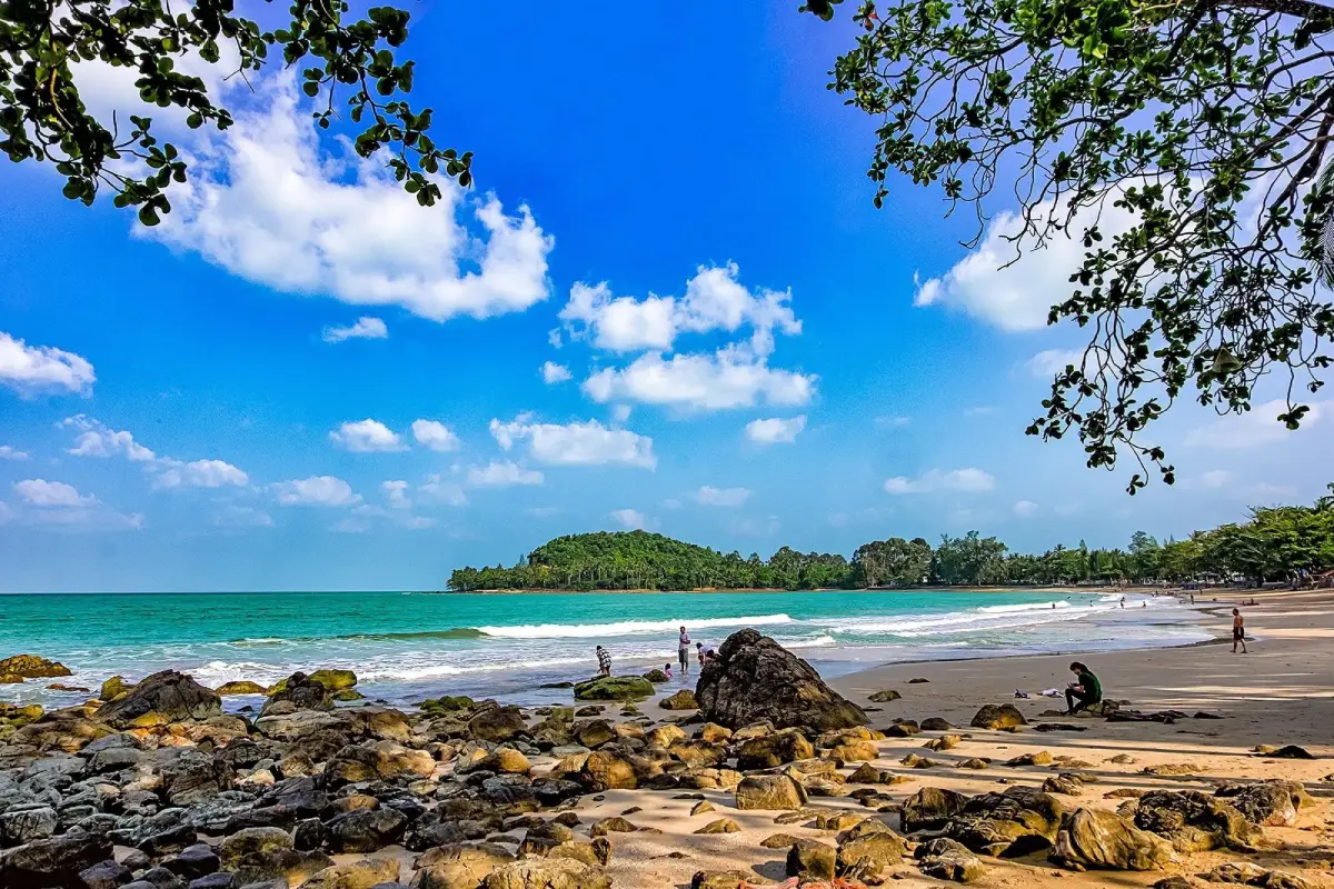
24. Hin Ngam Beach is located in Sichon Subdistrict, Sichon District. It has a character quite different from an ordinary sandy beach because the shoreline contains large numbers of smooth rounded stones and rocky formations. These stones have been shaped and polished by waves over a long period of time, creating a distinctive coastal landscape that is better suited to walking, photography, and observing natural geology than to focusing solely on swimming.
The stones vary in shape, color, pattern, and size. When covered by seawater and illuminated by sunlight, their colors become more vivid and the patterns in the rock are easier to see. During low tide, a larger section of the rocky shore is exposed, allowing visitors to walk farther and observe the stones more easily. However, wet rocks and algae can make surfaces extremely slippery, so care should be taken, particularly around areas directly exposed to waves.
Hin Ngam Beach lies close to Sichon Beach and can be combined with Kho Khao Beach, Piti Beach, and Khao Phlai Dam in the same coastal route. The area is ideal for travelers who prefer to drive slowly along the coast and stop at several different beaches rather than staying in one place. Visitors should leave all stones and natural objects where they are and should not collect them as souvenirs, because the identity of the beach depends on the natural accumulation of these coastal stones.
Getting There: From Sichon Beach, drive along the coastal road for approximately 1–2 kilometers to reach Hin Ngam Beach. The route is suitable for both cars and motorcycles.
Map (GPS): https://maps.app.goo.gl/N9JeSCWsDyeQjW2p7
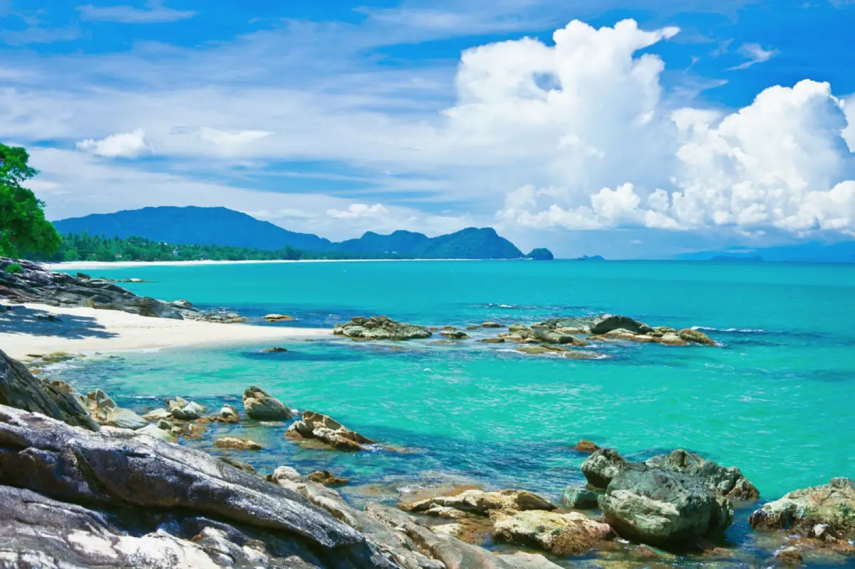
25. Nai Phlao Beach is located toward the southern end of Ao Khanom in Khanom Subdistrict, Khanom District. The beach lies between the sea and nearby mountains, creating a peaceful setting that feels more natural than some of the busier sections of the bay. Coconut trees line parts of the coastline, while the mountain backdrop gives the beach a distinctive enclosed landscape and makes it one of the attractive seaside areas of southern Khanom.
Nai Phlao Beach is particularly suitable for travelers who want a quieter seaside atmosphere than Na Dan Beach while still having access to accommodation and restaurants in the surrounding area. Early morning is a good time to watch the sunrise and walk along the beach, while calm days are suitable for swimming. However, because the coastline opens directly onto the Gulf of Thailand, visitors should check wave conditions before entering the sea, especially during the monsoon season or periods of strong wind.
From Nai Phlao Beach, visitors can continue to Ao Thong Yi, Khao Phlai Dam, and the coastal road connecting Khanom with Sichon. This makes the area a useful overnight base for travelers who want to explore several coastal landscapes while remaining close to mountain and forest attractions. A longer stay around this part of Khanom allows visitors to combine beach relaxation with scenic driving and nature excursions without needing to change accommodation every day.
Getting There: From Khanom town, follow the road toward Ao Khanom and continue south to Nai Phlao Beach. The beach is easily reached by private car or motorcycle.
Map (GPS): https://maps.app.goo.gl/YYiayFPFscbRQhQk6
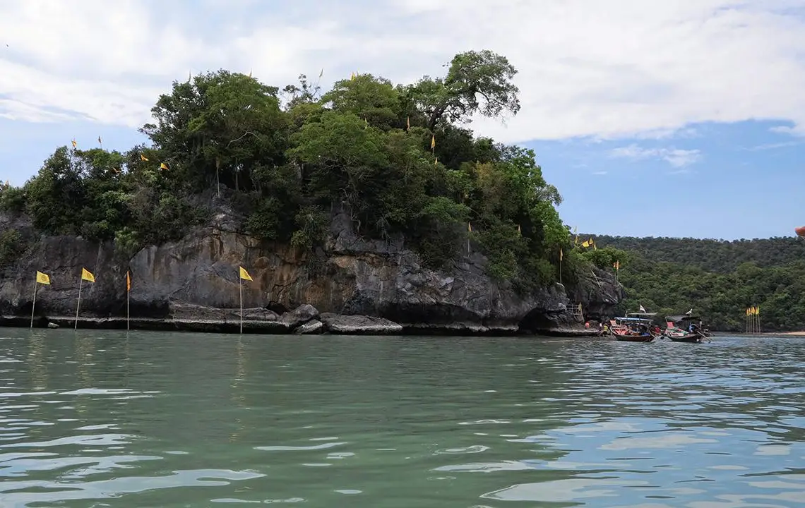
26. Freshwater Well On The Seaside is located on Ko Nui, opposite Ko Tha Rai near the mouth of Ao Taled in Thong Nian Subdistrict, Khanom District. It is one of the most unusual natural attractions on the Khanom marine route. The main feature is a rock hollow on the island where freshwater appears despite the surrounding marine environment. This unusual natural phenomenon gives the site both geological interest and spiritual significance for local residents and visitors.
Ko Nui is also associated with local beliefs concerning Luang Pu Thuat and a footprint-like mark found in the rock. Visiting the island therefore involves more than observing a natural formation; it also introduces visitors to local religious beliefs and coastal cultural traditions. The freshwater feature is generally easier to observe during lower tides, when more of the rock surface becomes exposed. Visibility and access therefore depend on tide levels as well as sea conditions on the day of travel.
Boat trips commonly combine the Freshwater Well On The Seaside with Khao Hin Phap Pha, Ko Tha Rai, and other attractions around Ao Taled. This creates a marine itinerary that includes geology, local belief, fishing-community life, and natural coastal scenery within the same journey. Visitors should use community boats or established local operators familiar with local tides and sea conditions, and should avoid climbing slippery rocks or leaving areas recommended by guides.
Getting There: Travel to Laem Prathap or Ao Taled in Thong Nian Subdistrict, then continue by tourism boat to Ko Nui and the Freshwater Well On The Seaside.
Map (GPS): https://maps.app.goo.gl/8KyGPuwWVy1oCiweA
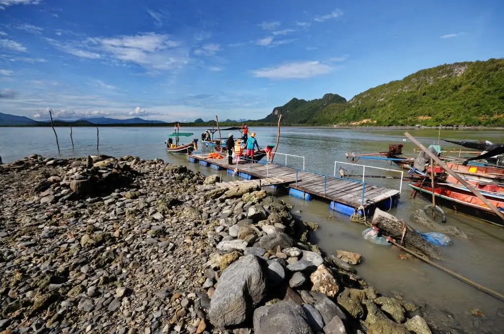
27. Laem Prathap is located in Thong Nian Subdistrict, Khanom District. It is a traditional coastal fishing community and one of the main departure points for marine tourism in Khanom. Travelers planning to take boats to Ao Taled, Ko Nui, Khao Hin Phap Pha, Ko Tha Rai, or offshore areas where pink dolphins may sometimes be seen often begin their trip from Laem Prathap.
The attraction of Laem Prathap is not limited to its role as a pier. Fishing boats, village houses, seafood, community products, and the everyday work of local residents create a genuine coastal atmosphere. Visitors can observe the relationship between traditional fishing and tourism in the same community. Early morning is usually one of the best periods for boat trips because sea conditions are often calmer and travelers can visit several attractions before the midday heat becomes intense.
Boat programs from Laem Prathap often combine several attractions, such as the Freshwater Well On The Seaside on Ko Nui, Khao Hin Phap Pha, Ko Tha Rai, and offshore areas where pink dolphins may be encountered. Actual routes depend on sea conditions and the operator's itinerary. Travelers should select boats equipped with sufficient life jackets and avoid supporting operators that chase or approach marine wildlife too closely. Responsible tourism helps protect natural resources while supporting the long-term income of local communities.
Getting There: From Khanom town, travel toward Thong Nian Subdistrict and follow local signs to Ban Laem Prathap. Travelers planning to take a boat should contact a local operator or community tourism group in advance, especially on weekends and during peak travel periods.
Map (GPS): https://maps.app.goo.gl/b9ic6Skas4E7UvP37
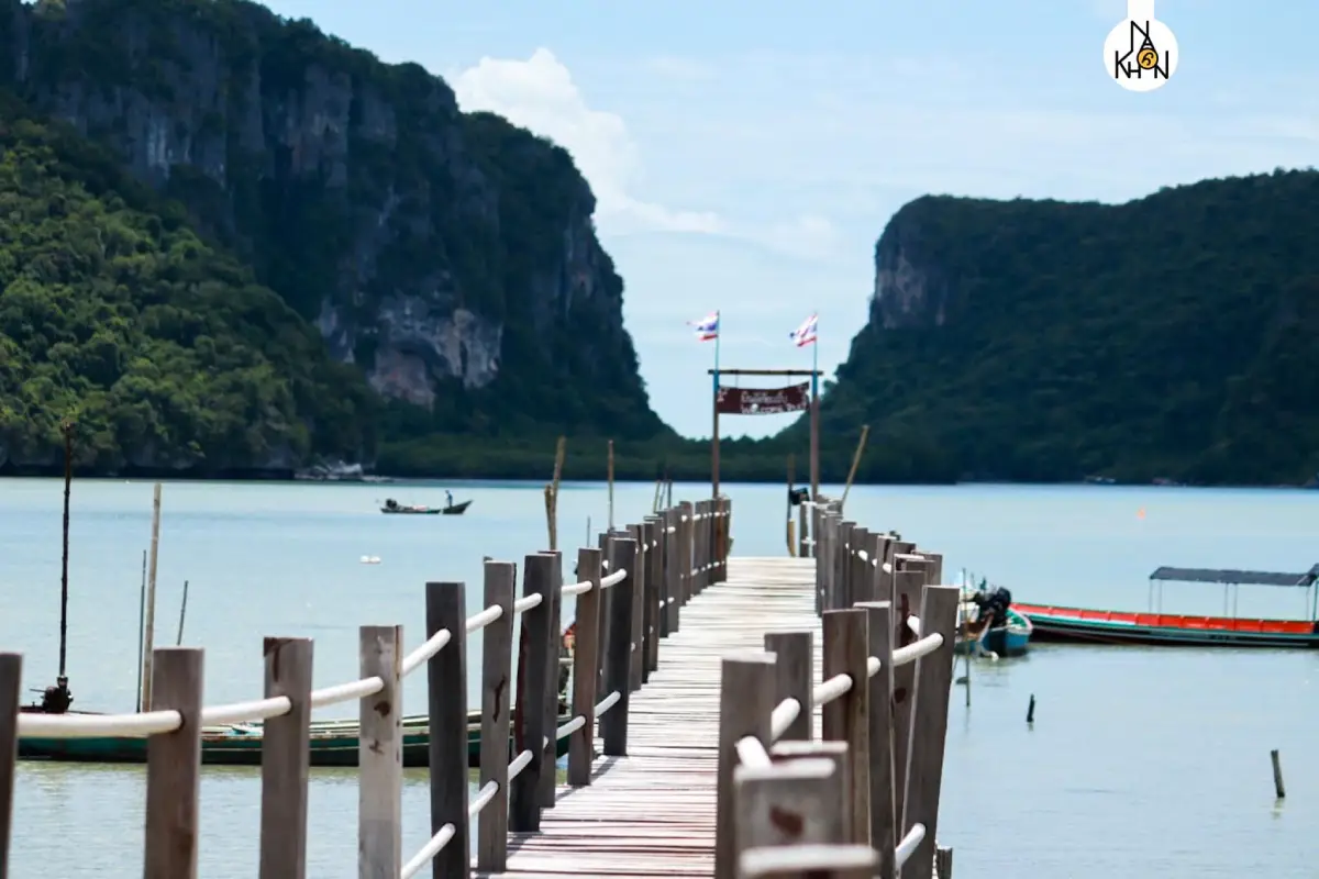
28. Ao Taled is located in Thong Nian Subdistrict, Khanom District. It is a natural bay that plays an important role in Khanom's marine-tourism routes while still retaining a strong fishing-community atmosphere. One of its most recognizable features is the wooden pier extending out into the bay, allowing visitors to enjoy an open view of mountains, coastline, fishing boats, and the sea within the same landscape.
Ao Taled is also an important connection point to several natural attractions, including Khao Hin Phap Pha, Ko Tha Rai, Ko Nui, the Freshwater Well On The Seaside, and Ao Lak Sor. Visitors can therefore come simply to walk along the bay and pier without taking a boat, or use it as the starting point for a wider marine excursion. Morning is a good time to observe the fishing-community atmosphere and local boats, while late afternoon provides attractive light for photography and a cooler sea breeze.
Visitors should respect the working spaces used by local fishermen and avoid parking vehicles in areas used for boat access or unloading seafood. Travelers planning to go out to sea should check wind and wave conditions before departure, because the sheltered appearance of the inner bay does not necessarily reflect conditions farther offshore in the open Gulf of Thailand.
Getting There: From Khanom town, travel toward Thong Nian Subdistrict and follow local roads to Ao Taled. Vehicles can reach the community and pier area directly.
Map (GPS): https://maps.app.goo.gl/EoM55jHRXoaC9ZkdA

29. Utokvibha Prasit Floodgate is located in Hu Long Subdistrict, Pak Phanang District. It is a major structure within the Pak Phanang River Basin development project and an important place for understanding the water-management challenges of the area. The Pak Phanang Basin includes agricultural land, communities, freshwater environments, brackish-water zones, and strong marine influence. Effective water management therefore needs to address water levels, drainage, freshwater supply, and saltwater intrusion at the same time.
The name “Utokvibha Prasit” reflects the structure's role in effectively dividing and controlling water. The floodgate forms only one component of a wider management system connecting canals, rivers, agricultural land, and communities. Visiting the site therefore provides more than a view of a large engineering structure; it helps travelers understand why water management is essential for local agriculture, settlements, livelihoods, and ecosystems throughout the Pak Phanang River Basin.
The floodgate can be combined with the Royal Commemorative Museum for Pak Phanang Basin Development, Ban Rang Nok, Pak Phanang town, and Laem Talumphuk. Together, these attractions reveal the relationship between water management, the history of a river-port town, local trade, agriculture, fisheries, and coastal geography. Travelers with a full day in Pak Phanang can therefore explore the district as a learning-oriented community destination rather than simply stopping at one landmark for photographs.
Getting There: From Nakhon Si Thammarat city, follow Highway 4013 toward Pak Phanang District, then continue into Hu Long Subdistrict and follow signs to the Pak Phanang River Basin development project and Utokvibha Prasit Floodgate.
Map (GPS): https://maps.app.goo.gl/7PFPPDiWK4uKqwdXA
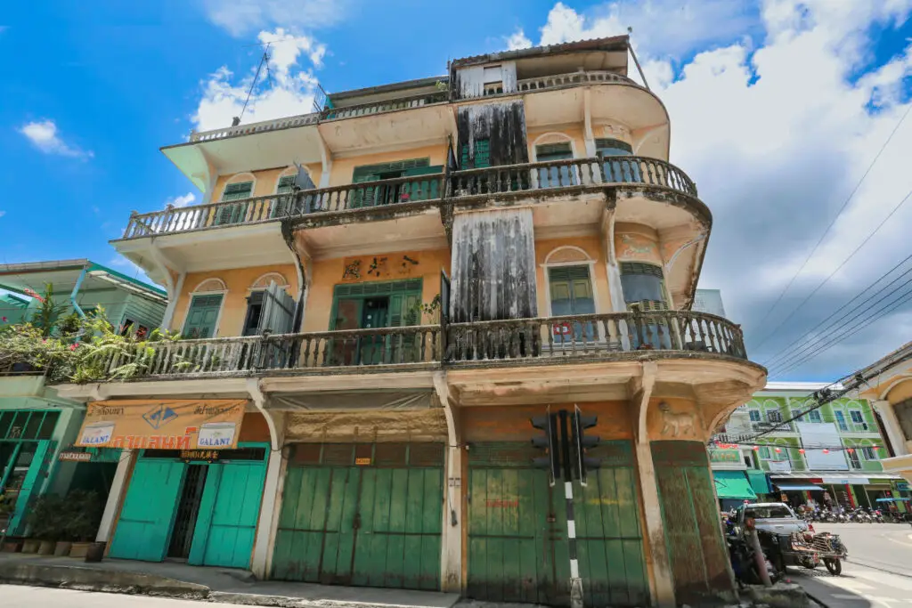
30. Ban Rang Nok is located in Pak Phanang town and is one of the area's most unusual urban features. Edible-nest swiftlets have adapted to living and nesting inside houses and shophouses, leading many buildings to be modified specifically to provide suitable conditions for the birds. The resulting concentration of swiftlet houses gives Pak Phanang a distinctive urban appearance and reflects an economy that has developed around a valuable natural resource.
Buildings designed for swiftlets generally contain entry openings that allow the birds to fly in and out, while the interior environment is managed to control light, temperature, humidity, and ventilation. Sound systems may also be used to create conditions attractive to the birds. Operating a swiftlet house requires knowledge, long-term experience, and careful environmental management because the birds remain free-flying wildlife rather than being kept in cages like conventional livestock.
Visitors should focus on observing Ban Rang Nok from public areas and learning about the wider context of Pak Phanang. Private buildings should not be entered without permission, and the birds should not be disturbed. The swiftlet-house area can be combined with Pak Phanang River, local markets, Utokvibha Prasit Floodgate, the Royal Commemorative Museum for Pak Phanang Basin Development, and Laem Talumphuk. Together, these attractions provide a broader understanding of Pak Phanang's economy, river culture, trade, fisheries, and coastal environment.
Getting There: From Nakhon Si Thammarat city, follow Highway 4013 into Pak Phanang town. Swiftlet buildings are distributed throughout several parts of the urban area and should be viewed from public spaces unless explicit permission has been given to enter private property.
Map (GPS): https://maps.app.goo.gl/UNNRvYgpdAWJN6fB9

31. Khlong Klai Rafting is located in Moo 3, Krung Ching Subdistrict, Nopphitam District. This nature-based activity adds an adventurous dimension to the Krung Ching area, which is otherwise best known for waterfalls and tropical rainforest. Visitors travel along Khlong Klai by inflatable raft or kayak through a landscape of rocky river channels, tropical forest, and mountain scenery. The experience therefore combines the excitement of moving water with a close look at the watershed environment of Nopphitam.
Several rafting distances are available. One popular shorter route runs from the Pak Khlong Phitam area to Lan Hin Dan for approximately 2.5 kilometers and usually takes around 1.5 hours. A longer route continues toward Ban Thung Nai for approximately 6 kilometers and may take around 3 hours. The rapids are generally around Class 1–3, so the route includes both calm sections where participants can enjoy the surrounding scenery and faster stretches where everyone in the raft needs to work together to control direction and pass through rocky channels safely.
Rafting should be arranged with an experienced local operator or community group that provides proper safety equipment. Participants should wear life jackets throughout the activity and follow the instructions of guides or raft leaders at all times. Water levels vary according to season and rainfall, so travelers should confirm current conditions before visiting, particularly after prolonged heavy rain. Khlong Klai Rafting can be combined with Krung Ching Waterfall, Krung Ching Hot Spring, and other natural attractions in Nopphitam, making the area suitable for a 1–2 day trip focused on both adventure and rainforest relaxation.
Getting There: From Nakhon Si Thammarat city, follow Highway 401 to Na Reng Junction, then turn onto Highway 4140 toward Nopphitam District. Continue into the Krung Ching and Phitam community area. Travelers should contact the rafting operator in advance to confirm the exact meeting point, launching location, water conditions, and activity schedule.
Map (GPS): https://maps.app.goo.gl/GqL9Fo6ej62mPFjf6
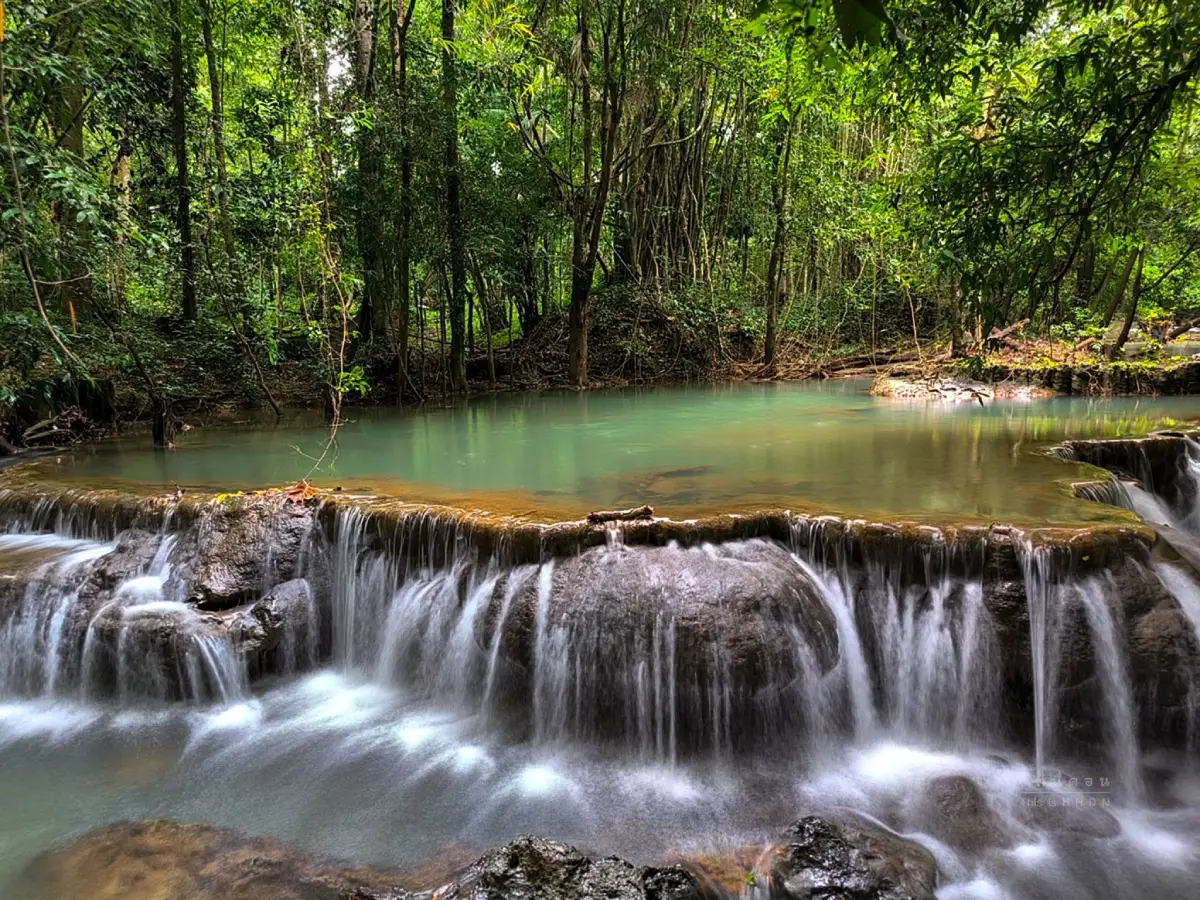
32. Si Khit Waterfall is located along Khlong Tha Khok in Moo 2, Si Khit Subdistrict, Sichon District, within Namtok Si Khit National Park. It is a limestone waterfall with characteristics quite different from waterfalls flowing over granite. Water moves through natural limestone terraces, rock shelves, and pools surrounded by humid tropical forest, creating a distinctive landscape of green-toned water and pale limestone formations.
The first major level features water falling from a limestone cliff before continuing through a series of natural pools and stream sections. Because the stream flows over limestone, the shapes of the pools, rock surfaces, and channels differ noticeably from waterfalls found elsewhere in the province. Some sections may appear less covered with algae than other waterfalls, but wet limestone can still be slippery, so visitors should walk carefully and avoid running across exposed rock surfaces.
The surrounding forest forms part of an important watershed ecosystem and supports large trees, ferns, mosses, riverside vegetation, and various wildlife species. Visitors should swim only in areas permitted by park staff and should pay close attention to safety warnings during the rainy season because water levels can rise quickly. Si Khit Waterfall can be combined with caves and nature trails within the national park or with Sichon coastal attractions later in the day, allowing travelers to experience both mountain forest and the Gulf of Thailand within a single itinerary.
Getting There: From Sichon District, travel toward Si Khit Subdistrict and Moo 2, Ban Si Khit, then follow signs to Namtok Si Khit National Park and the waterfall area. Travelers should check current park announcements before visiting, especially during periods of heavy rain or seasonal conservation closures.
Map (GPS): https://maps.app.goo.gl/oMBngndFwQsxwRgX8
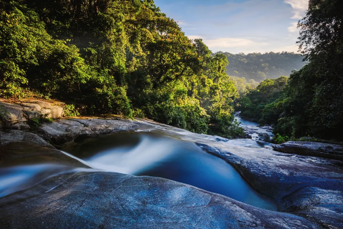
33. Ai Khiao Waterfall (Nai Khiao) is located in Thon Hong Subdistrict, Phrom Khiri District, within Khao Luang National Park. It is a large waterfall fed by the Khao Luang mountain range and is especially known for its moss-covered rocks, green vegetation, and humid tropical-forest atmosphere. Moss, algae, and small plants cover many of the rocks, giving parts of the waterfall a naturally green appearance and contributing to the local name “Nai Khiao.”
The waterfall area includes streams, natural pools, rocky levels, and sections suitable for short nature walks. Ferns, mosses, large rainforest trees, and moisture-loving plants thrive throughout the surrounding forest. After rainfall the vegetation becomes particularly lush and attractive, but visitors should also take greater care at such times because wet rocks are slippery and water levels may change quickly.
One of the advantages of Ai Khiao Waterfall is that it is not far from Nakhon Si Thammarat city and can easily be combined with Phrom Lok Waterfall, Wat Khao Khun Phanom, and fruit-growing communities in Phrom Khiri District. Travelers planning to walk around the waterfall should wear footwear suitable for wet surfaces and bring a change of clothes if they intend to enter the water. Swimming should only take place when water levels are normal and no flash-flood or heavy-rain warnings are in effect.
Getting There: From Nakhon Si Thammarat city, follow Highway 4016 toward Phrom Khiri District. Continue along the same general route used for Phrom Lok Waterfall, then take local roads into Thon Hong Subdistrict and follow signs toward Ai Khiao Waterfall.
Map (GPS): https://maps.app.goo.gl/5ek2EDf2h1F8Hvsd8
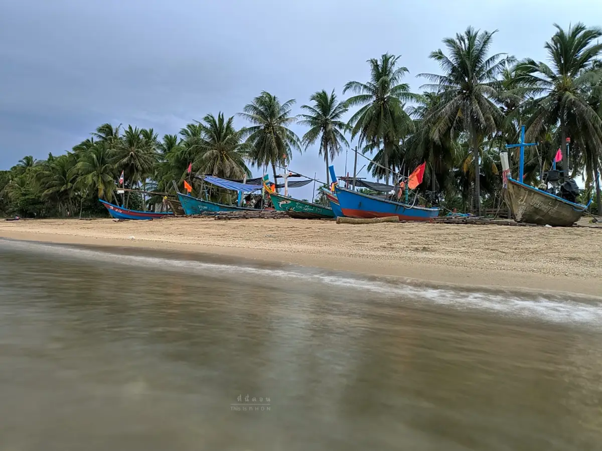
34. Ban Plai Thon Beach is located in Moo 7, Ban Plai Thon, Thung Prang Subdistrict, Sichon District. It is a community beach whose appeal comes from the close relationship between the sea, local fishing, markets, and the everyday lives of coastal residents. The sandy shoreline, peaceful atmosphere, coconut trees, and traditional fishing boats create a very different experience from beaches developed primarily around resorts and commercial tourism.
Early morning is one of the most interesting times to visit because travelers may see fishing boats returning to shore, seafood being unloaded, and local residents buying and selling fish, shrimp, crabs, and other seasonal catches. There are also local food stalls and breakfast options around the community. Buddhist and Muslim residents live within the broader area, contributing to a diverse local food culture that includes fresh seafood, roti, spiced curries, and traditional southern Thai dishes.
Visitors should remember that Ban Plai Thon is a working community rather than simply a tourist beach. Vehicles should not be parked in areas used for unloading seafood or boat access, private property should be respected, and permission should be requested before taking close photographs of local residents. Ban Plai Thon Beach can be combined with Sichon Beach, Hin Ngam Beach, and other coastal attractions in Sichon District, making it particularly suitable for travelers who want to understand coastal community life as well as enjoy the scenery.
Getting There: From Nakhon Si Thammarat city, follow Highway 401 toward Sichon District, then continue into Thung Prang Subdistrict and Moo 7, Ban Plai Thon. A private car or rental vehicle is the most convenient option.
Map (GPS): https://maps.app.goo.gl/3oAb5Cur7cETFWoQA
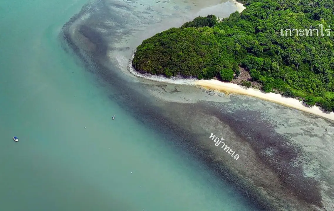
35. Ko Tha Rai is located in the northern part of the Khanom marine area in Thong Nian Subdistrict, Khanom District, within Hat Khanom-Mu Ko Thale Tai National Park. Although the island is relatively small, it is interesting for its layered coastal rocks, seagrass ecosystem, and connection with marine tourism routes from Laem Prathap. Its most recognizable natural features include exposed rock layers, folded formations, and a natural rock shelter created through geological processes and long-term marine erosion.
One section of the island contains a natural stone platform beneath a rock overhang known locally as the “Phumphuang Stage.” The surrounding layers resemble the folded-rock formations found at Khao Hin Phap Pha. Some strata rise steeply while others curve and overlap as a result of geological pressure and later erosion by waves and wind. This makes Ko Tha Rai particularly interesting for travelers who enjoy coastal geology and photography rather than simply visiting islands for swimming.
The waters surrounding Ko Tha Rai also contain seagrass beds that are important to the local marine ecosystem. Seagrass provides food and nursery habitat for young fish, shrimp, crabs, and other small marine organisms. Visitors should avoid stepping on seagrass, collecting marine life, or removing rocks from the island. Ko Tha Rai is commonly included in boat programs together with Ko Nui, the Freshwater Well On The Seaside, and Khao Hin Phap Pha, allowing travelers to experience several different forms of Khanom's coastal environment within a single excursion.
Getting There: Travel to Laem Prathap or another local boat departure point in Thong Nian Subdistrict, Khanom District, then continue by tourism boat to Ko Tha Rai. Boat access depends on wave conditions, weather, and conservation-area announcements.
Map (GPS): https://maps.app.goo.gl/kbkr1q3ni4DrMaKGA
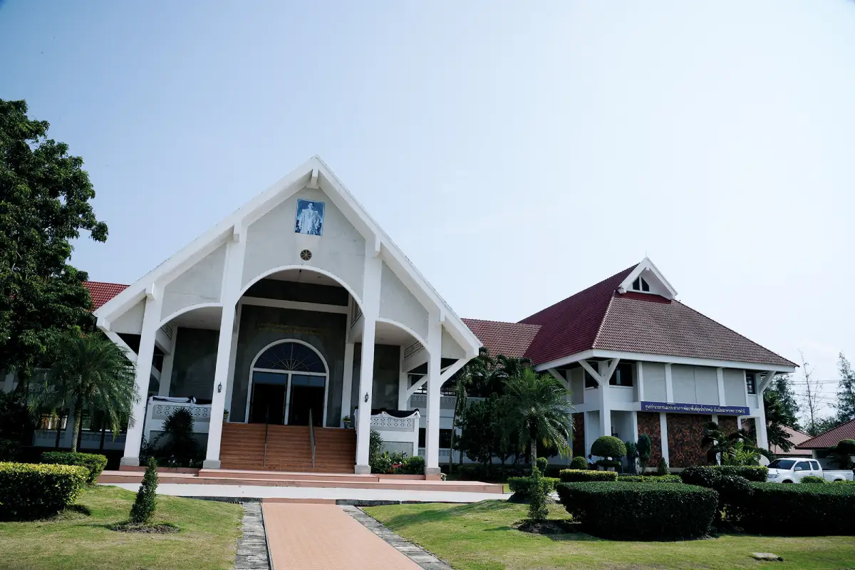
36. Royal Commemorative Museum for Pak Phanang Basin Development is located in Moo 5, Hu Song Subdistrict, Pak Phanang District, within the Pak Phanang River Basin development project area. It is an educational center that presents the Pak Phanang Basin in a systematic way, beginning with the period when Pak Phanang played an important role as a port and commercial town and continuing through environmental and water-management problems that emerged as economic activities and land use changed.
The exhibitions explain major problems affecting the river basin, including saltwater intrusion, flooding, insufficient freshwater, acid soils, saline soils, and their effects on agriculture. These challenges are then connected with development approaches and water-management projects introduced to improve conditions in the area. This helps visitors understand why infrastructure such as the Utokvibha Prasit Floodgate is important not only to agriculture but also to local communities and the wider river-basin ecosystem.
The museum includes exhibition rooms, areas connected with royal development work, and information about the Pak Phanang Basin development project. It is particularly suitable for families, students, travelers interested in community development, and visitors who want to understand Pak Phanang before exploring the district in person. The museum can be combined with the floodgate, Ban Rang Nok, Pak Phanang town, and Laem Talumphuk to create a coherent itinerary covering history, economy, community life, and water management.
Getting There: From Nakhon Si Thammarat city, follow Highway 4013 toward Pak Phanang District, then continue to Hu Song Subdistrict and the Pak Phanang River Basin development project area. Visitors should check current opening days and hours before traveling.
Map (GPS): https://maps.app.goo.gl/bx5GdSd5c1Zbu28V9
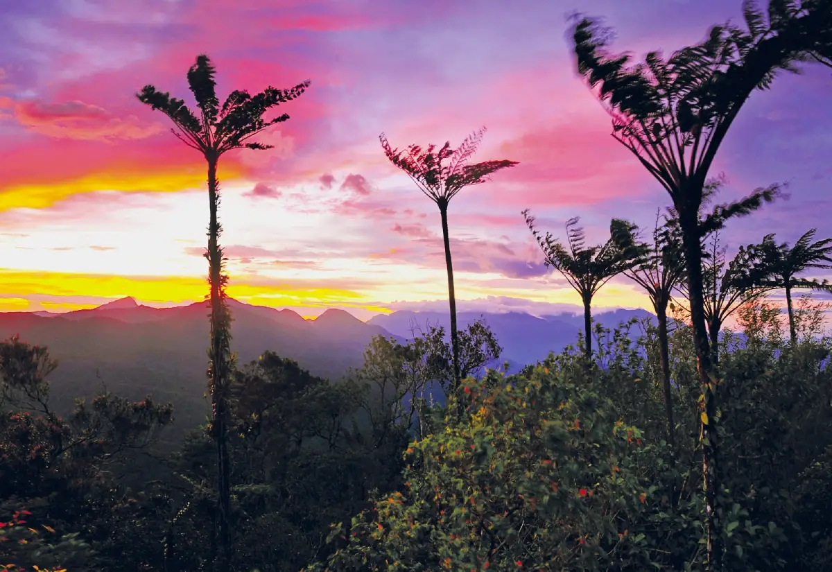
37. Khao Ram Rom is located in the Ron Phibun District area within Namtok Yong National Park. Rising to approximately 986 meters above sea level, it is one of the notable mountain viewpoints in Nakhon Si Thammarat. From the upper area, visitors can look across surrounding mountain ranges, lowland districts, and communities. In clear weather, views can extend toward Ron Phibun, Thung Song, Phra Phrom, Chian Yai, and areas in the direction of the Gulf coast.
On some mornings, mist forms over lower-lying areas and creates a sea-of-mist landscape, while sunrise produces attractive light across overlapping mountain ridges. A road reaches the upper area, where communication facilities are also located, but the route is steep and weather conditions can change quickly. Fog, heavy rain, and strong wind can reduce visibility and make driving more difficult, so current conditions should always be checked before attempting the ascent.
Because Khao Ram Rom lies within Namtok Yong National Park, access depends on current park announcements, road conditions, and weather. Travelers planning to visit should contact park staff in advance, particularly during the rainy season or periods when natural areas are being restored. If weather conditions are unsuitable, the ascent should be postponed rather than attempted in poor visibility, and travelers can instead explore lower-elevation attractions within the national park.
Getting There: Travel toward Ron Phibun District and contact Namtok Yong National Park staff before proceeding to Khao Ram Rom. Confirm road conditions, weather, and whether the upper area is open on the day of travel.
Map (GPS): https://maps.app.goo.gl/Nmwk9reZYQoZqtXj9
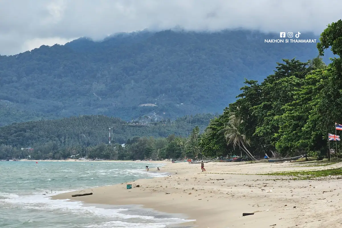
38. Na Dan Beach is located in the central section of Ao Khanom in Khanom Subdistrict, Khanom District. It is one of the main beaches of Khanom and is known for its long sandy shoreline, relatively fine sand, broad beach area, and distant mountain views. Accommodation, restaurants, and cafés are available around the area, making it practical both for short visits and as a base for travelers staying overnight and exploring other parts of Khanom.
Na Dan Beach is interesting not only for its natural setting but also for its history as part of a coastal trade and port area in Khanom. The surrounding area was once associated with local commerce and Chinese communities before its role gradually changed, particularly after the major storm disaster of 1962. Today, Na Dan is primarily a tourism and residential beach, but this historical background adds another layer to the area's identity as part of an evolving coastal community.
Suitable activities include walking along the beach, swimming when the sea is calm, watching the sunrise, enjoying seafood, and using the area as a base for traveling to Nai Pret Beach, Nai Phlao Beach, Ao Thong Yi, or marine boat trips departing from Laem Prathap. Visitors should always assess wave conditions before entering the water and should supervise children carefully, even in areas where the beach slope appears relatively gentle.
Getting There: From Highway 401, turn onto Highway 4014 at Khlong Leng Junction toward Khanom. Continue through the town area and follow the local road toward the coast for approximately 1–2 kilometers to reach Na Dan Beach.
Map (GPS): https://maps.app.goo.gl/vYLLH36uuMJRxiNW7
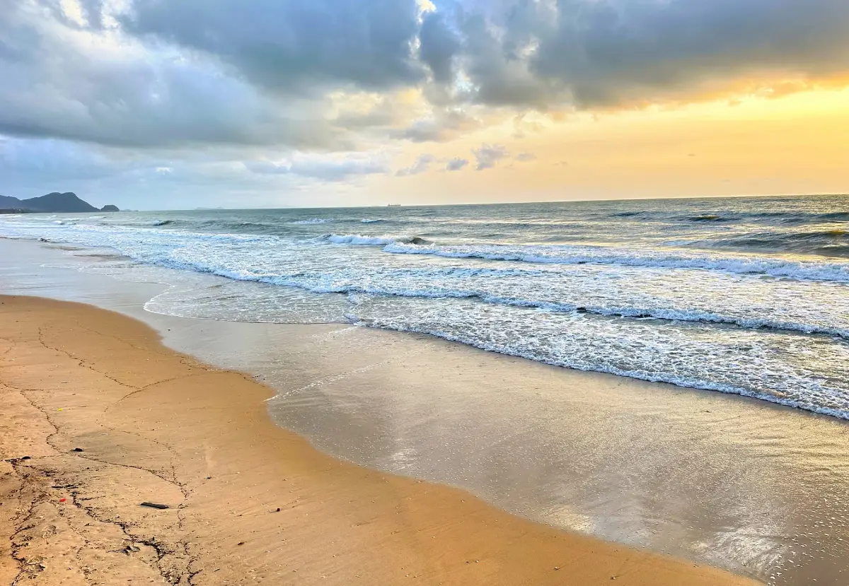
39. Nai Pret Beach is located in Khanom Subdistrict, Khanom District, between Na Dan Beach and Nai Phlao Beach. It offers a quieter coastal atmosphere and is particularly suitable for travelers who want to relax by the sea without staying in one of the more developed parts of Ao Khanom. The gently curving sandy shoreline becomes broader at low tide, making it suitable for walking, photography, and peaceful seaside relaxation.
Coconut groves behind the beach help preserve the classic coastal landscape associated with Khanom. Toward the southern end, rocky formations create a natural transition toward Nai Phlao Beach, allowing visitors to experience sandy shoreline, a curving bay, coconut trees, and rocky coast within one area. Morning is suitable for sunrise views and walking, while late afternoon is comfortable for relaxing in cooler temperatures and enjoying the quieter atmosphere of the bay.
Nai Pret Beach works particularly well as part of a coastal route beginning at Na Dan Beach and continuing south through Nai Pret and Nai Phlao before reaching Ao Thong Yi or Khao Phlai Dam. Swimming should only take place when the sea is calm, and visitors should avoid climbing wet rocks during periods of strong waves because surfaces can be slippery and exposed to sudden wave action.
Getting There: From Khanom town, follow the coastal road through Na Dan Beach toward Nai Phlao Beach. Nai Pret Beach lies between these two well-known sections of Ao Khanom and can be reached easily by private car or motorcycle.
Map (GPS): https://maps.app.goo.gl/t1zR6sms5egw8jH99
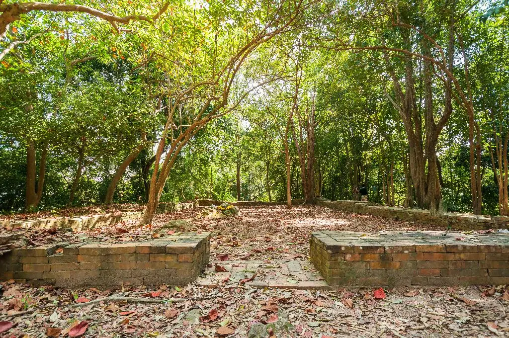
40. Khao Kha Archaeological Site is located at Ban Khao Kha, Moo 11, Sao Phao Subdistrict, Sichon District. It is an important archaeological site that reveals another dimension of Nakhon Si Thammarat's history by preserving evidence of Hindu Shaivism on the southern peninsula more than 1,000 years ago. The archaeological complex is situated on a mountain running roughly north to south, and the mountain itself was used as sacred space according to Hindu cosmological concepts, symbolically associated with Mount Meru or Mount Kailash.
Archaeological evidence found at the site includes yoni bases, Shiva lingams, ritual drainage channels, remains of religious structures, ancient reservoirs, and archaeological features positioned along the ridge. These discoveries demonstrate that the Nakhon Si Thammarat region had important connections with Indian cultural influence and maritime trade networks before and during the period in which Buddhism later became a defining feature of the city. Khao Kha therefore provides important context for understanding the history of Southern Thailand before the development of Nakhon Si Thammarat in the form most familiar today.
The site includes an interpretation area and walking routes through the archaeological remains. Visitors should remain on designated paths, avoid climbing on ancient foundations, never move stones or archaeological fragments, and refrain from writing or marking any surface. Allowing approximately 1–2 hours provides enough time to read the interpretation material, walk through the site, and gain a clearer understanding of the religious concepts and archaeological evidence represented here.
After visiting Khao Kha Archaeological Site, travelers can continue to other attractions in Sichon, including Wat Chedi and the Ai Khai shrine area, Sichon Beach, Hin Ngam Beach, and Ban Plai Thon Beach. Combining these locations creates an itinerary that balances ancient history, religious belief, community life, and Gulf of Thailand coastal scenery within the same district.
Getting There: From Sichon District, travel toward Sao Phao Subdistrict and Ban Khao Kha, Moo 11. A private car or rental vehicle is recommended because public transportation to the archaeological site is limited.
Map (GPS): https://maps.app.goo.gl/gEYVv296B83j4C7Y6
| Topic | Details |
| Province | Nakhon Si Thammarat, Southern Thailand |
| Main Characteristics | A historic city and major center of Buddhism in Southern Thailand, with temples and archaeological sites, traditional performing arts, tropical rainforest, mountains, waterfalls, caves, hot springs, communities surrounded by valleys, beaches, islands, fishing villages, the Pak Phanang River Basin, and important agricultural landscapes. |
| Top 10 Attractions | 1. Wat Phra Mahathat Woramahawihan 2. Ban Khiriwong 3. Hat Khanom-Mu Ko Thale Tai National Park 4. Phrom Lok Waterfall 5. Khao Luang National Park 6. Ao Khanom 7. Ao Thong Yi 8. Khao Hin Phap Pha 9. Krung Ching Waterfall 10. Ban Nang Talung Suchart Subsin |
| Mueang Nakhon Si Thammarat Zone | 1. Wat Phra Mahathat Woramahawihan 2. Ban Nang Talung Suchart Subsin 3. Nakhon Si Thammarat City Wall 4. Nakhon Si Thammarat City Pillar Shrine 5. Nakhon Si Thammarat City Museum 6. Phra Buddha Sihing |
| Lan Saka Zone | 1. Ban Khiriwong 2. Khao Luang National Park 3. Karom Waterfall |
| Phrom Khiri Zone | 1. Phrom Lok Waterfall 2. Wat Khao Khun Phanom 3. Ai Khiao Waterfall (Nai Khiao) |
| Nopphitam Zone | 1. Krung Ching Waterfall 2. Krung Ching Hot Spring 3. Khlong Klai Rafting |
| Sichon Zone | 1. Sichon Beach (Hua Hin Sichon) 2. Khao Phlai Dam 3. Namtok Si Khit National Park 4. Si Khit Waterfall 5. Hin Ngam Beach 6. Ban Plai Thon Beach 7. Khao Kha Archaeological Site |
| Khanom Zone | 1. Hat Khanom-Mu Ko Thale Tai National Park 2. Ao Khanom 3. Ao Thong Yi 4. Khao Hin Phap Pha 5. Nai Phlao Beach 6. Freshwater Well On The Seaside 7. Laem Prathap 8. Ao Taled 9. Ko Tha Rai 10. Na Dan Beach 11. Nai Pret Beach |
| Pak Phanang Zone | 1. Pak Phanang Coast and Laem Talumphuk 2. Utokvibha Prasit Floodgate 3. Ban Rang Nok 4. Royal Commemorative Museum for Pak Phanang Basin Development |
| Thung Song Zone | 1. Namtok Yong National Park |
| Ron Phibun Zone | 1. Khao Ram Rom |
| Chang Klang Zone | 1. Wat That Noi (Wat Phra That Noi) |
| Temples, Religion and Faith | 1. Wat Phra Mahathat Woramahawihan 2. Phra Buddha Sihing 3. Wat That Noi (Wat Phra That Noi) 4. Wat Khao Khun Phanom 5. Nakhon Si Thammarat City Pillar Shrine 6. Freshwater Well On The Seaside and local beliefs associated with Ko Nui |
| History and Archaeology | 1. Nakhon Si Thammarat City Wall 2. Nakhon Si Thammarat City Museum 3. Ban Nang Talung Suchart Subsin 4. Khao Kha Archaeological Site 5. Pak Phanang Coast and Laem Talumphuk 6. Royal Commemorative Museum for Pak Phanang Basin Development |
| Sea, Beaches and Islands | 1. Hat Khanom-Mu Ko Thale Tai National Park 2. Ao Khanom 3. Ao Thong Yi 4. Khao Hin Phap Pha 5. Sichon Beach 6. Hin Ngam Beach 7. Nai Phlao Beach 8. Freshwater Well On The Seaside 9. Laem Prathap 10. Ao Taled 11. Ko Tha Rai 12. Na Dan Beach 13. Nai Pret Beach 14. Ban Plai Thon Beach 15. Laem Talumphuk |
| Forests, Mountains and Waterfalls | 1. Khao Luang National Park 2. Phrom Lok Waterfall 3. Karom Waterfall 4. Krung Ching Waterfall 5. Ai Khiao Waterfall 6. Namtok Yong National Park 7. Namtok Si Khit National Park 8. Si Khit Waterfall 9. Khao Phlai Dam 10. Khao Ram Rom |
| Communities and Local Lifestyles | 1. Ban Khiriwong 2. Ban Rang Nok in Pak Phanang 3. Ban Plai Thon Beach community 4. Laem Prathap fishing community 5. Ao Taled fishing community 6. Pak Phanang and Laem Talumphuk coastal communities |
| Adventure and Outdoor Activities | 1. Khlong Klai Rafting 2. Trekking to Krung Ching Waterfall 3. Nature trails in Khao Luang National Park 4. Khao Ram Rom mountain viewpoint 5. Khanom marine boat trips 6. Ko Tha Rai and Ko Nui excursions 7. Nature routes around Khao Phlai Dam |
| Local Food | Southern sour curry or gaeng som tai, khua kling, gaeng tai pla, stir-fried stink beans, shrimp-paste chili dip, salted fish, and fresh seafood from the Gulf of Thailand. Seafood is particularly associated with coastal areas such as Sichon, Khanom, Pak Phanang, and Hua Sai, while the province's cuisine is generally known for strong flavors, aromatic herbs, and pronounced spiciness. |
| Traditional Sweets and Local Produce | Khanom la, khanom phong, khanom ba, khanom kong, and khanom di sam are especially associated with the Sat Duan Sip tradition. Important local agricultural products include mangosteen, durian, longkong, rambutan, stink beans, and other produce from traditional Suan Som Rom mixed orchards in Lan Saka and the foothills of Khao Luang. |
| Important Traditions and Culture | Important traditions include Hae Pha Khuen That at Wat Phra Mahathat Woramahawihan and the Sat Duan Sip or Tenth Lunar Month Festival. Nakhon Si Thammarat is also strongly associated with Nora dance, Nang Talung shadow puppetry, Buddhist community traditions, and the renowned craft of Nakhon Si Thammarat Niello ware. |
| Recommended For | Buddhist pilgrims, travelers interested in history and archaeology, hikers, nature lovers, photographers, families, couples, beach travelers, cultural travelers, food enthusiasts, community-tourism visitors, and travelers interested in traditional southern Thai lifestyles. |
| Getting Around the Province | A private car or rental car is the most convenient way to travel because Nakhon Si Thammarat is a large province and attractions are spread across many districts. Marine attractions such as Ko Tha Rai, Ko Nui, and Khao Hin Phap Pha require boat transfers. Khao Ram Rom may require checking current road conditions, while rafting and trekking activities should be arranged with experienced local operators, communities, or national park staff. |
| Suggested 2–3 Day Itinerary | Day 1: explore central Nakhon Si Thammarat, including Wat Phra Mahathat Woramahawihan, the City Wall, City Pillar Shrine, and Ban Nang Talung Suchart Subsin. Day 2: visit Ban Khiriwong and choose either Karom Waterfall or Phrom Lok Waterfall. Day 3: select either the Sichon or Khanom coastal zone depending on your preferred travel style. |
| Suggested 4–5 Day Itinerary | Add Nopphitam for Krung Ching Waterfall, Krung Ching Hot Spring, and Khlong Klai Rafting, or add Pak Phanang for Utokvibha Prasit Floodgate, Ban Rang Nok, the Royal Commemorative Museum for Pak Phanang Basin Development, and Laem Talumphuk. A longer itinerary makes it possible to experience the historic city, mountains, rainforest, communities, water-management landscapes, and coastline in greater depth. |
| Before You Travel | Check current weather and wave conditions before boat trips, national park opening and closure announcements, trail conditions, river and waterfall levels, flash-flood warnings, mountain-road conditions, museum opening days, and advance booking requirements for community tourism, rafting, trekking, homestays, or marine excursions. |
Frequently Asked Questions (FAQ
Q: What attractions are there in Nakhon Si Thammarat?
A: Nakhon Si Thammarat offers a wide range of attractions, including historic and religious landmarks such as Wat Phra Mahathat Woramahawihan, the Nakhon Si Thammarat City Wall, the City Pillar Shrine, and Ban Nang Talung Suchart Subsin; natural attractions such as Ban Khiriwong, Khao Luang National Park, Phrom Lok Waterfall, Krung Ching Waterfall, Karom Waterfall, and Si Khit Waterfall; as well as coastal destinations including Sichon, Khanom, Khao Hin Phap Pha, Ko Tha Rai, Ao Taled, and Laem Talumphuk. This variety makes it possible to plan trips focused on culture, nature, communities, or the sea within the same province.
Q: Where should first-time visitors go in Nakhon Si Thammarat?
A: First-time visitors should begin with Wat Phra Mahathat Woramahawihan and the old city area, then continue to Ban Khiriwong and choose either Karom Waterfall or Phrom Lok Waterfall. Another day can be devoted to either Sichon or Khanom. If more time is available, Nopphitam and Pak Phanang provide a broader understanding of the province through rainforest, rafting, river-basin landscapes, community life, and coastal history.
Q: What are the main nature attractions in Nakhon Si Thammarat?
A: Major natural attractions include Khao Luang National Park, Phrom Lok Waterfall, Karom Waterfall, Krung Ching Waterfall, Ai Khiao Waterfall, Namtok Yong National Park, Namtok Si Khit National Park, Si Khit Waterfall, Khao Ram Rom, and Khao Phlai Dam. Each destination has a different level of accessibility, ranging from easy waterfall visits to longer forest walks and mountain routes.
Q: Which coastal area should visitors choose in Nakhon Si Thammarat?
A: Sichon is a good choice for travelers who want accessible beaches, rocky coastal scenery, local fishing communities, and scenic driving routes. Khanom is suitable for travelers who want both beaches and marine activities, with attractions such as Na Dan Beach, Nai Pret Beach, Nai Phlao Beach, Ao Thong Yi, Ao Taled, Khao Hin Phap Pha, Ko Nui, and Ko Tha Rai. Pak Phanang and Laem Talumphuk offer a different coastal experience focused more strongly on fishing communities, river-basin history, and local livelihoods.
Q: What can visitors do in Ban Khiriwong?
A: Visitors can walk or cycle through the village, relax beside Khlong Tha Di, visit traditional Suan Som Rom mixed orchards, taste seasonal fruit and local food, learn about naturally dyed textiles and community products, and stay in a homestay to experience the quieter early-morning and evening atmosphere. Ban Khiriwong can also be combined conveniently with Karom Waterfall and Khao Luang National Park.
Q: Are there adventure activities in Nakhon Si Thammarat?
A: Yes. Adventure and outdoor activities include Khlong Klai Rafting, trekking to Krung Ching Waterfall, walking nature trails in Khao Luang National Park, traveling to the Khao Ram Rom viewpoint, exploring forest routes in Namtok Si Khit National Park, and taking marine excursions around Khanom. These activities depend heavily on weather and natural conditions, so current safety information should always be checked before departure.
Q: What important tradition is associated with Wat Phra Mahathat Woramahawihan?
A: One of the most important traditions is Hae Pha Khuen That. Devotees join a procession carrying Phra Bot cloth or ceremonial cloth to Wat Phra Mahathat Woramahawihan and offer it at the Great Relic Stupa. The tradition reflects the long-standing faith of the people of Nakhon Si Thammarat in the sacred relic and remains one of the province's most important Buddhist cultural practices.
Q: Why is the Sat Duan Sip Festival important?
A: Sat Duan Sip, or the Tenth Lunar Month Festival, is an important southern Thai merit-making tradition connected with dedicating merit to deceased ancestors. Families prepare food and symbolic traditional sweets such as khanom la, khanom phong, khanom ba, khanom kong, and khanom di sam. The festival therefore represents both religious belief and the preservation of Nakhon Si Thammarat's traditional food culture.
Q: What local food should visitors try in Nakhon Si Thammarat?
A: Recommended dishes include southern sour curry, khua kling, gaeng tai pla, stir-fried stink beans, shrimp-paste chili dip, salted fish, and fresh seafood from coastal areas such as Sichon, Khanom, Pak Phanang, and Hua Sai. Travelers should also try traditional sweets associated with local festivals and seasonal fruit from the Suan Som Rom orchards around Lan Saka and the Khao Luang foothills.
Q: Where can visitors take a boat to look for pink dolphins in Khanom?
A: Boat trips commonly depart from Laem Prathap or the Ao Taled area in Thong Nian Subdistrict. Routes may also include Khao Hin Phap Pha, Ko Nui, the Freshwater Well On The Seaside, and Ko Tha Rai. Pink dolphins live naturally in the area, so sightings depend on the animals' movements, sea conditions, time of day, and other environmental factors and cannot be guaranteed on every trip.
Q: How many days should visitors spend in Nakhon Si Thammarat?
A: Around 3 days is suitable for travelers who want to see the old city, Ban Khiriwong, one waterfall area, and one coastal zone. Travelers who want to explore several districts and include history, rainforest, waterfalls, community tourism, Pak Phanang, Sichon, and Khanom should allow at least 4–5 days. A longer trip provides a much more complete view of the province.
Q: Can Nakhon Si Thammarat be explored without a private car?
A: The province can be reached by plane, train, and interprovincial bus, and local transport is available within the city. However, attractions are widely dispersed across different districts. A rental car or private vehicle is significantly more convenient for traveling to Ban Khiriwong, Phrom Khiri, Nopphitam, Sichon, Khanom, Pak Phanang, Thung Song, and other outlying areas. Marine attractions require additional boat transfers.
Q: What should travelers check before visiting national parks, waterfalls, and islands?
A: Travelers should check the latest weather forecast, national park opening and closure announcements, current trail conditions, river and waterfall levels, flash-flood warnings, and wave and wind conditions before marine trips. Boat travel and swimming should be avoided when waves are strong or official safety warnings are in effect. Mountain roads and remote routes should also be checked in advance during periods of heavy rain.
 Category: ●Travel Articles, Recipes
 Group: ●Travel Review, Food Review
Last Update : 2 DayAgo
 Last Update : 2 DayAgo
Recommend

 Art, Culture and Heritage
 Historical Sites and Monuments(9)
 Landmarks and Memorials(9)
 Royal Palace(1)
 Art, Craft Centres, Tradition(12)
 Museums(5)
 Educational Places
 Educational Gardens, Farm(2)
 Places of Worship
 Temple(44)
 Mosque(2)
 Other Sacred Sites(17)
 Research and Development
 Royal Project(2)
 Suburban Living
 Village, Community(8)
 Local Market(1)
 Floating Market(1)
 Nature and Wildlife
 National Parks and Marine Reserves(6)
 Mountain (Doi)(11)
 Dam, Reservoir, Lake(10)
 Waterfalls(43)
 Hot Springs(1)
 Caves(13)
 River, Canal(3)
 Bays and Beaches(29)
 Islands(2)
 Other natural attractions(3)
 Entertainment and Agricultural
 Farms, Parks and Ecotourism(3)
 Outdoor and Adventure Activities(4)
Travel Review, Food Review(5)
 Southern Food Menu, Southern Food Recipes(18)


