
lovethailand home >Northeastern Travel Attractions >Chaiyaphum Travel Attractions > 20 Must-Visit Attractions in Chaiyaphum
TL;DR: 20 Must-Visit Attractions in Chaiyaphum. Chaiyaphum is one of the most distinctive nature destinations in Northeastern Thailand, with high mountain ranges, watershed forests.

20 Must-Visit Attractions in Chaiyaphum
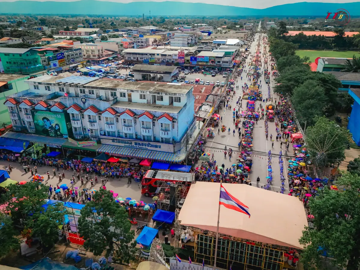
20 Must-Visit Attractions in Chaiyaphum Chaiyaphum is one of the most distinctive nature destinations in Northeastern Thailand, with high mountain ranges, watershed forests, cliffs, rock fields, sandstone pillars, waterfalls, and seasonal wildflower fields spread across several districts. The province is especially popular during the rainy season, when Siam tulips bloom amid mist and lush green forests, transforming Chaiyaphum into one of Isan’s most memorable destinations for travelers who want to experience a side of the Northeast that goes far beyond broad plains and rice fields.
If you are visiting Chaiyaphum for the first time, the places to prioritize include Tat Ton National Park for its waterfall and watershed forest, Mo Hin Khao for its distinctive sandstone formations, Pa Hin Ngam National Park and Sai Thong National Park for their rainy-season Siam tulip fields, and Phu Laen Kha National Park for mountain routes, cliffs, and viewpoints. Travelers who want to add history and culture can also visit Phraya Phakdi Chumphon Monument, Prang Ku, Wat Phra That Nong Sam Muen, Ban Khwao Silk Village, and Bueng Lahan when planning a multi-day trip.
Part of Chaiyaphum lies along the Phetchabun mountain range and the Phu Laen Kha range, creating complex highland terrain and several important watershed areas. The province is closely connected with the Chi River, which has long supported local communities, agriculture, and the ecology of Northeastern Thailand. Mountain areas contain dry dipterocarp forest, mixed deciduous forest, dry evergreen forest, sandstone plateaus, and high cliffs, allowing visitors to enjoy activities ranging from light hiking and scenic viewpoints to camping, stargazing, and seasonal wildflower viewing.
One of Chaiyaphum’s greatest attractions is the way its landscape changes through the seasons. The rainy months from approximately June–August bring the Siam tulip fields of Pa Hin Ngam National Park and Sai Thong National Park to life. Forests become bright green and many waterfalls carry more water. The late rainy season and early cool season are ideal for misty viewpoints and cliff walks, while the cool season is particularly suitable for camping and exploring highland areas in comfortable temperatures.
Historically, Chaiyaphum preserves evidence of settlement and cultural development from several periods, including ancient communities, sema stones, religious sites, and Khmer influence. Prang Ku in central Chaiyaphum is an important example of an Arogayasala associated with King Jayavarman VII, while Phra That Nong Sam Muen in Phu Khiao District displays artistic influences combining Lanna, Lan Xang, and Ayutthaya traditions. Traveling through Chaiyaphum can therefore combine nature with archaeology, religion, and historical learning.
The history of Chaiyaphum is also closely connected with Phraya Phakdi Chumphon, commonly known as Chao Pho Phaya Lae, who is honored as the first governor and founder of the city. His monument in central Chaiyaphum remains an important spiritual center where many local residents come to pay respect before traveling or beginning significant activities. It is also a useful starting point for visitors who want to understand local history before exploring the province’s different districts.
Chaiyaphum is also renowned for its silk-weaving heritage, especially Ban Khwao silk. Local knowledge has been passed down through mulberry cultivation, silkworm raising, silk reeling, dyeing, mudmee tying, and weaving on traditional looms. Patterns and colors have continuously evolved, making silk one of the province’s signature souvenirs. Visiting Ban Khwao is therefore not only about buying fabric, but also about understanding the connection between handicrafts, family life, merit-making traditions, and the rural economy of Isan.
Local food includes familiar Isan dishes such as som tam, larb, jaew dipping sauces, grilled foods, fish, and seasonal dishes made from locally available ingredients. Communities near wetlands, dams, and natural water sources also maintain traditional freshwater fishing practices that contribute to the variety of local cuisine. In addition to silk, popular souvenirs include community-made products, woven crafts, basketry, and processed local foods from different districts.
To make a Chaiyaphum trip more efficient, it is best to divide the province into travel zones. The Mueang Chaiyaphum–Tat Ton–Phu Laen Kha zone is ideal for Mo Hin Khao, Tat Ton, Phu Laen Kha, Prang Ku, and Phraya Phakdi Chumphon Monument. The Thep Sathit zone is best for Pa Hin Ngam National Park, while the Nong Bua Rawe zone is suitable for Sai Thong National Park. The Phu Khiao zone is centered on Wat Phra That Nong Sam Muen, the Ban Khwao zone focuses on silk and community life, and the Chatturat zone is best for Bueng Lahan. Traveling by zone reduces unnecessary backtracking and gives each day a clearer theme.
If you have only 1 day and are staying in Chaiyaphum city, choose either Tat Ton National Park–Mo Hin Khao or Phraya Phakdi Chumphon Monument–Prang Ku–Tat Ton. With 2–3 days, add Pa Hin Ngam National Park or Sai Thong National Park, especially during Siam tulip season. A 4–5 day trip can be extended to Phu Khiao, Ban Khwao, and Chatturat, allowing travelers to experience Chaiyaphum through mountains, waterfalls, wildflowers, religion, history, handicrafts, and wetlands.
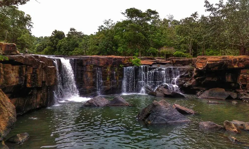
1. Tat Ton National Park is located in Na Fai Subdistrict and surrounding areas of Mueang Chaiyaphum District. It is one of the province’s most important natural attractions and is easily accessible from the city. Its main features include the watershed forests of the Phu Laen Kha range, waterfalls, sandstone terraces, streams, nature trails, and recreation areas suitable for families and travelers who want to enjoy nature without strenuous trekking.
Highlight: Tat Ton Waterfall, approximately 50 meters wide and around 6 meters high, broad rock terraces above the waterfall, shaded streams, Tat Fa Waterfall, Pha Iang Waterfall, a suspension bridge, nature trails, camping areas, and stargazing zones within the national park.
Tat Ton Waterfall differs from waterfalls that drop from a high vertical cliff. Here, water spreads across a broad rock terrace before falling into the pool below. During periods of high water, white water covers much of the waterfall face, while the upper section contains rock platforms and several sections of stream that visitors can explore. It is therefore a place for relaxing and spending time in nature rather than simply stopping for a quick photograph.
Tat Ton National Park was officially declared a national park on December 31, 1980, becoming Thailand’s 23rd national park. It covers approximately 217 square kilometers and plays an important role in protecting watershed forests and stream ecosystems connected with the Chi River basin.
The rainy season through the beginning of the cool season is the most beautiful period because the waterfall has more water and the surrounding forest becomes lush and green. Visitors should nevertheless follow park safety instructions carefully, avoid swimming in areas with strong currents, and stay away from slippery rock surfaces after heavy rain.
The park is also suitable for overnight stays, with camping areas and visitor facilities available at designated service points. Travelers can use Tat Ton as a base for continuing to Mo Hin Khao, Phu Laen Kha National Park, Phra That Chaiyaphum, and attractions in central Chaiyaphum.
Tat Ton is suitable for families, groups of friends, couples, nature lovers, and travelers looking for an easy day trip from the city. Families with children or older visitors should use the designated recreation and swimming areas recommended by park officers.
Getting There: Tat Ton National Park is located in Na Fai Subdistrict, Mueang Chaiyaphum District. From central Chaiyaphum, follow the Chaiyaphum–Tat Ton Waterfall route. A private vehicle is the most convenient option. Open daily from 08.00–18.00. Check park announcements before traveling during periods of heavy rain.
Map (GPS): https://www.google.com/maps/dir/?api=1&destination=15.979775,102.026095&travelmode=driving
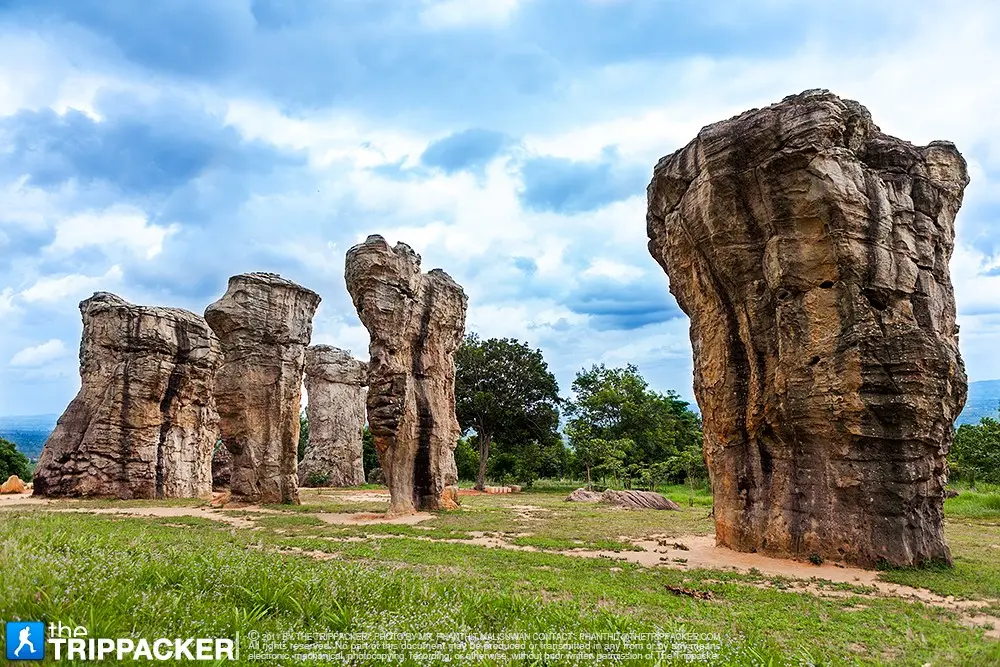
2. Mo Hin Khao is located at Ban Wang Kham Khaen, Moo 9, Tha Hin Ngom Subdistrict, Mueang Chaiyaphum District, within Phu Laen Kha National Park. It is one of Chaiyaphum’s most recognizable natural landmarks, famous for massive pale sandstone pillars rising from open grassland and woodland, earning it the nickname “Thailand’s Stonehenge.”
Highlight: 5 giant stone pillars, the Khong Chang rock group, broad rock fields and platforms, Pha Hua Nak, scenic viewpoints, pine areas, camping grounds, and sandstone landscapes shaped by long-term natural erosion.
The local word “mo” refers to a hill or elevated area, while “hin khao” means white stone, referring to the pale sandstone exposed among the grasslands. The rock surfaces appear even more distinctive under strong sunlight or after rainfall, and the name reflects the physical landscape recognized by local communities.
The pillars and rock formations at Mo Hin Khao were created from sandstone layers that underwent fracturing, weathering, and erosion over an extremely long period. Harder sections resisted erosion and remained standing as large stone columns. The formations seen today can be regarded as natural sculptures created gradually by geological processes.
Beyond the famous group of 5 stone pillars, travelers should allow time for the Khong Chang rock group and Pha Hua Nak because each zone offers a different atmosphere, ranging from open rock fields and scenic viewpoints to cliffs overlooking the Phu Laen Kha mountain range and surrounding lowlands.
Morning and late afternoon provide the best conditions for photography because the light is softer and the temperature is cooler than at midday. The rainy season and the transition into the cool season bring green landscapes and occasional mist, but visitors should be cautious of slippery rock surfaces and rapidly changing weather at higher elevations.
Mo Hin Khao can be visited as a half-day trip from Chaiyaphum city or combined with Pha Hua Nak, Tat Ton, and Phra That Chaiyaphum for a full-day itinerary. Visitors planning to watch sunrise or stay overnight should check current camping arrangements and national park regulations in advance.
Getting There: From Chaiyaphum city, take Highway 2051 toward Tat Ton, then continue onto the route leading to Mo Hin Khao. The attraction is around 40 kilometers from central Chaiyaphum. It is accessible daily, with 06.00–18.00 recommended as the main visiting period.
Map (GPS): https://www.google.com/maps/dir/?api=1&destination=16.064039,101.966448&travelmode=driving
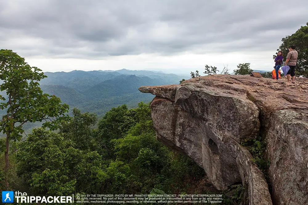
3. Pa Hin Ngam National Park is located in Thep Sathit District along the Phang Hoei mountain range. It is one of the destinations that has helped establish Chaiyaphum as Thailand’s famous land of Siam tulips. During the rainy season, forests and grasslands become filled with pinkish-purple Siam tulips among morning mist and cool mountain air.
Highlight: Siam Tulip Field, Lan Hin Ngam Rock Field, Pha Sut Phaen Din viewpoint, unusual rock formations, seasonal wildflowers, Thep Phana Waterfall, Thep Prathan Waterfall, and nature trails across the Phang Hoei range.
The park lies at elevations of approximately 300–846 meters above sea level and contains hills, cliffs, sandstone fields, dry dipterocarp forest, dry evergreen forest, and mixed deciduous forest. These varied environments occur within a relatively compact area and support a diverse range of wild plants.
The Siam tulip field is the park’s most popular attraction. The main blooming season is generally from June–August, when the flowers gradually emerge from the floor of dry dipterocarp forests and grasslands. Combined with morning mist, the scene has become one of the best-known images of tourism in Chaiyaphum.
Lan Hin Ngam is another essential stop. Large sandstone formations have been shaped by long-term erosion into a variety of unusual forms. Visitors can walk along designated routes to see rocks that have been given names based on their shapes and the imagination of local observers.
Pha Sut Phaen Din is a viewpoint on the edge of the Phang Hoei range, offering broad views across the plains below. Morning visits may bring mist, while late afternoon provides attractive light over the mountain landscape. Visitors should remain behind safety barriers and take particular care near cliff edges.
The park is suitable for couples, families, photographers, nature lovers, and travelers specifically visiting for seasonal wildflowers. Weekday visits during Siam tulip season are generally less crowded. Check national park announcements regarding routes, shuttle services, and weather conditions before traveling.
Getting There: Pa Hin Ngam National Park is located around Ban Rai Subdistrict, Thep Sathit District, Chaiyaphum Province. A private vehicle is the most convenient option. Open daily from 06.00–18.00. During Siam tulip season, arrive early to enjoy the flowers and morning mist in cooler conditions.
Map (GPS): https://www.google.com/maps/dir/?api=1&destination=15.631624,101.393893&travelmode=driving
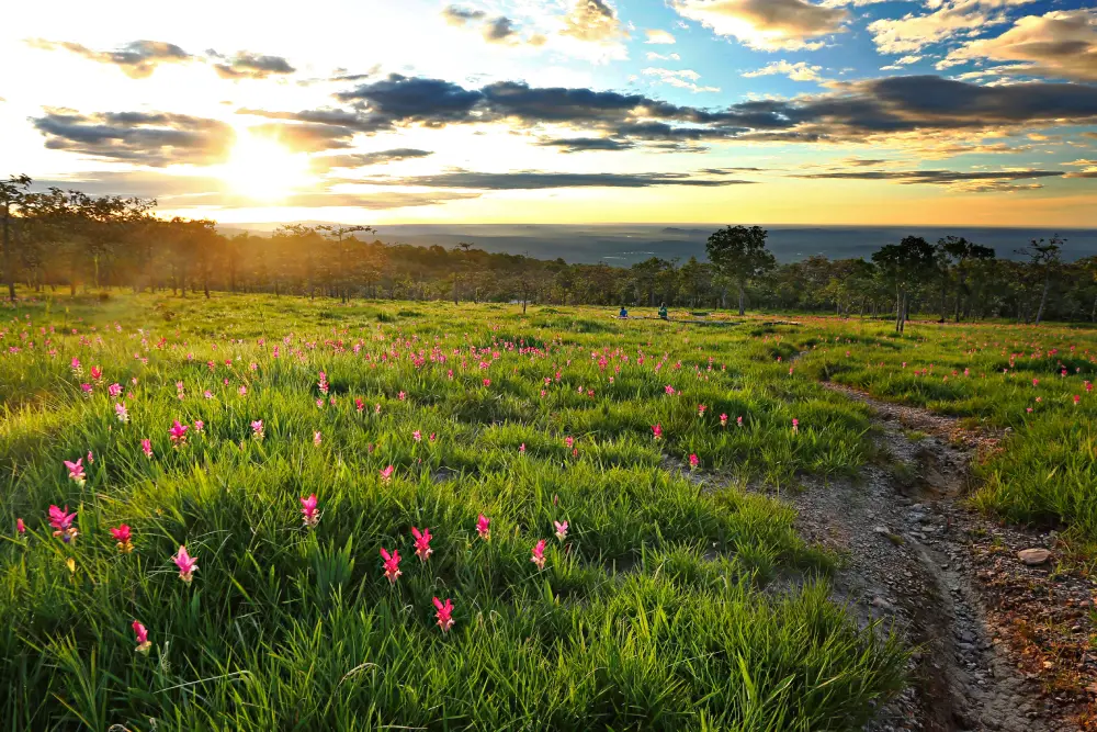
4. Sai Thong National Park is located around Wang Takhe Subdistrict, Nong Bua Rawe District, and covers extensive forest along the Phang Hoei mountain range. The park combines Siam tulip fields, waterfalls, watershed forests, nature trails, and famous cliff viewpoints within a single protected area.
Highlight: Thung Bua Sawan or Sai Thong Siam Tulip Field, Pha Ham Hot, Pha Pho Mueang, Pha Phloen Chai, Pha Athit Atsadong, Sai Thong Waterfall, and highland nature trails.
Thung Bua Sawan is the park’s main rainy-season attraction. Siam tulips bloom across grasslands and open woodland, with the most popular period generally extending from late June to mid-August. Early mornings are usually humid, and mist may cover the ridges on some days.
Another iconic attraction is Pha Ham Hot, a cliff viewpoint projecting dramatically above the landscape below. Extra caution is essential here. Visitors should remain within safe areas and avoid risky photography, especially in strong wind or rainy conditions.
Sai Thong Waterfall adds another dimension to the park. Travelers can begin around the waterfall zone before continuing toward the flower fields and cliff areas according to routes currently opened by park authorities. The park is therefore best suited to visitors who can devote at least half a day or a full day to exploring nature.
The park is also an important watershed forest for streams that eventually flow into the Chi River. Tourism should therefore focus on conservation: do not pick flowers, leave designated trails, or discard rubbish along walking routes.
Sai Thong is suitable for nature enthusiasts, photographers, groups of friends, and travelers who enjoy walking along mountain cliffs. Visitors coming specifically for Siam tulips should check current route openings and flower conditions before traveling because bloom intensity varies with rainfall each year.
Getting There: Sai Thong National Park is located in Wang Takhe Subdistrict, Nong Bua Rawe District, Chaiyaphum Province. A private vehicle is the most convenient option. The park operates daily during the official tourism and overnight-stay season from 08.00–16.30. Check the latest park announcements before traveling.
Map (GPS): https://www.google.com/maps/dir/?api=1&destination=15.875015,101.509770&travelmode=driving

5. Phu Laen Kha National Park is a large natural area extending across Mueang Chaiyaphum, Ban Khwao, Nong Bua Daeng, and Kaset Sombun districts. The terrain consists of complex mountain ranges, cliffs, rock fields, forests, and unusual stone formations, creating a wide variety of attractions throughout the park.
Highlight: Mo Hin Khao, Pha Hua Nak, Lan Hin Taek, Pratu Khlong, Pha Kluai Mai, Siam tulip fields, Phu Khi, Phu Kaset, ancient cycad forest, Hin Prasat, and nature trails.
The park covers approximately 177 square kilometers and forms part of the Phu Laen Kha mountain range. Some sections contain open dry dipterocarp forest, while others consist of dry evergreen forest and more humid forest at higher elevations. These environmental differences support a wide range of plant and animal species.
Phu Laen Kha is important to Chaiyaphum’s water system because it forms a watershed for many streams connected with the Chi River basin. Its forests and mountain slopes therefore provide value far beyond tourism by storing water, retaining moisture, and reducing soil erosion.
Mo Hin Khao is the park’s best-known attraction, but travelers with more than half a day should extend their journey to Pha Hua Nak and other viewpoints to experience a different side of Phu Laen Kha beyond the famous stone pillars. Morning and the transition from the rainy season into the cool season offer particularly good opportunities for misty views.
Some areas are more suitable for nature walks and overnight stays than quick sightseeing stops. Visitors should therefore select zones according to available time and check trail conditions, especially during the rainy season when access to certain locations may be limited for safety and conservation reasons.
Phu Laen Kha is suitable for photographers, stargazers, hikers, groups of friends, couples, and travelers who enjoy camping. It can be combined with Mo Hin Khao, Tat Ton, and Phra That Chaiyaphum to create a nature-and-faith route north of Chaiyaphum city.
Getting There: The park headquarters is located in Huai Ton Subdistrict, Mueang Chaiyaphum District. Traveling by private vehicle is the most convenient option. Open daily during the official travel season from 08.00–18.00. Check which park areas are open before traveling.
Map (GPS): https://www.google.com/maps/dir/?api=1&destination=16.008443,101.897457&travelmode=driving
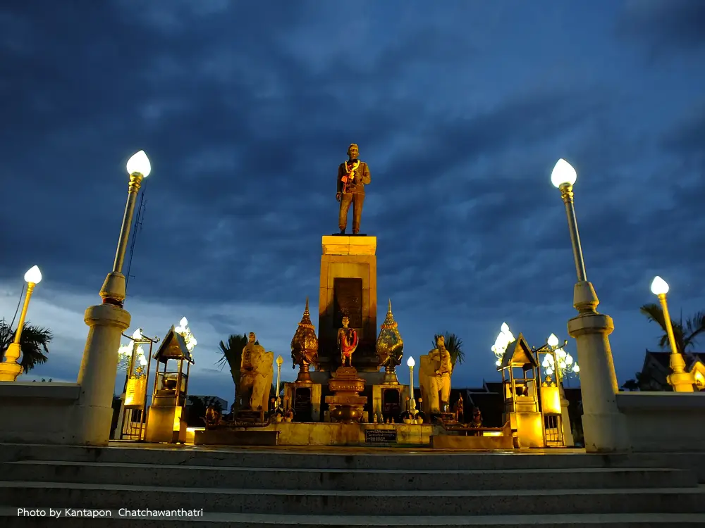
6. Phraya Phakdi Chumphon (Lae) Monument, also known as Chao Pho Phaya Lae Monument, stands at the government-center roundabout in central Chaiyaphum. It is one of the province’s most important symbols and a major spiritual center where local residents regularly come to pay respect and pray for good fortune.
Highlight: A monument honoring the figure regarded as Chaiyaphum’s first governor, a central-city worship site, an important ceremonial area, and a convenient starting point for visiting archaeological sites, temples, markets, and other attractions in Chaiyaphum city.
Phraya Phakdi Chumphon, also known as Lae, played a major role in the establishment of Chaiyaphum and remains deeply respected by local people. Stories of his sacrifice and loyalty have made his name an enduring part of the province’s identity and collective memory.
The monument is much more than a photo stop. Local residents visit the site to pay respect on important occasions, and many people come before beginning a journey or starting a new undertaking. Visiting the monument therefore provides insight into the continuing relationship between local history and contemporary belief.
During annual ceremonies and cultural events connected with Chao Pho Phaya Lae, the surrounding area becomes especially lively as people gather for worship and community activities. This is one of the best times to experience the depth of local devotion.
Because the monument is located in the city center, it is particularly convenient for travelers who have just arrived in Chaiyaphum. After paying respect, visitors can continue to Prang Ku, central markets, Tat Ton National Park, or Mo Hin Khao.
The site is suitable for travelers of all ages, requires relatively little time to visit, and can easily be included on the first or final day of a Chaiyaphum trip.
Getting There: The monument is located at the government-center roundabout in Nai Mueang Subdistrict, Mueang Chaiyaphum District. It is easily reached from the bus terminal and central city areas. Visitors can pay respect daily, with the stated service period from 09.00–16.00.
Map (GPS): https://www.google.com/maps/dir/?api=1&destination=15.806862,102.031520&travelmode=driving
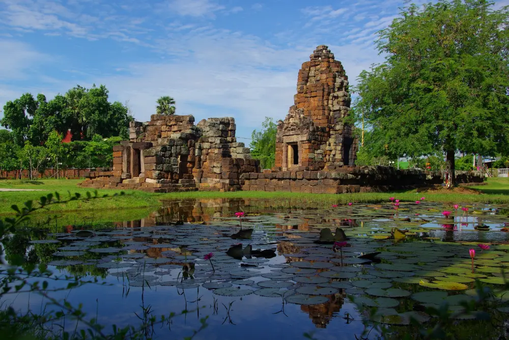
7. Prang Ku Chaiyaphum is located at Ban Nong Bua on Bannakarn Road in Nai Mueang Subdistrict, Mueang Chaiyaphum District. This important Khmer-period archaeological site lies close to the city center and is easy to visit. Its most significant feature is its Arogayasala layout, representing a religious sanctuary associated with a hospital during the reign of King Jayavarman VII.
Highlight: A main sanctuary built from laterite and sandstone, library building, gopura, enclosure wall, ritual pond, sandstone lintels, and artistic details associated with Bayon-period Mahayana Buddhist beliefs.
Prang Ku was constructed around the 18th Buddhist century, during the Bayon period of Khmer culture, and is associated with the reign of King Jayavarman VII, when Arogayasala complexes were established throughout important settlements and travel routes of the empire.
The layout consists of the main sanctuary, a library or auxiliary building, enclosure wall, gateway, and a pond to the northeast. These elements help explain that an Arogayasala was not simply a medical facility but a complex in which religion and Mahayana Buddhist ritual also played an important role.
The main sanctuary faces east, with one real entrance and false doors on the other sides. Construction using laterite and sandstone reflects techniques found at many Khmer-period monuments of the same era throughout Northeastern Thailand.
A local merit-making ceremony associated with Prang Ku is traditionally held around the 5th lunar month, or approximately April. This continuing tradition shows that the archaeological site remains connected with contemporary local faith rather than existing only as an isolated ruin.
Prang Ku is suitable for history enthusiasts, students, families, and travelers with limited time because it is close to central Chaiyaphum. It can easily be combined with Phraya Phakdi Chumphon Monument before continuing to Tat Ton or other attractions.
Getting There: From central Chaiyaphum, take Highway 202 for approximately 1 kilometer, then continue onto Highway 2158 for another 2 kilometers. The archaeological site is located at Ban Nong Bua, Nai Mueang Subdistrict. It is open to visitors daily.
Map (GPS): https://www.google.com/maps/dir/?api=1&destination=15.806629,102.044545&travelmode=driving
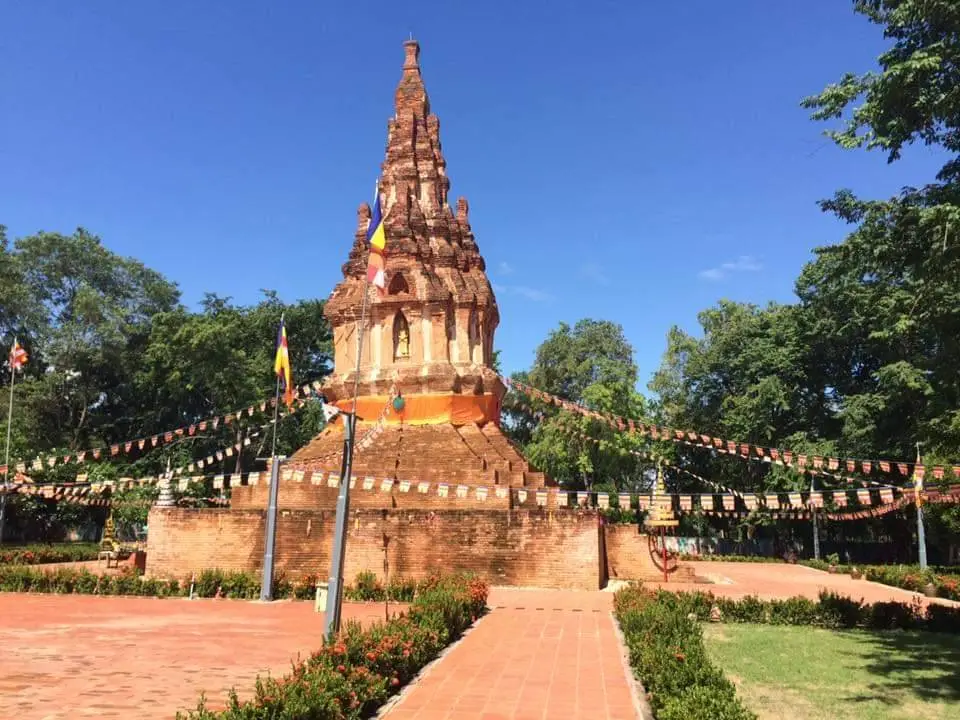
8. Wat Phra That Nong Sam Muen is located at Moo 1, Ban Kaeng, Ban Kaeng Subdistrict, Phu Khiao District. It is an important temple, religious site, and archaeological area reflecting several periods of history in the Phu Khiao region. Phra That Nong Sam Muen is distinguished by its unique architecture and is regarded as one of Chaiyaphum’s important sacred stupas.
Highlight: A twelve-indented-corner stupa, architectural influences blending Lanna, Lan Xang, and Ayutthaya traditions, an ancient settlement area, moat and earthworks, sandstone sema stones, and archaeological evidence from several periods.
The name of the stupa is associated with a large pond northwest of the temple known as Nong Sam Muen. The pond, temple, and Ban Kaeng community have been connected for generations, with the wetland serving as an important local resource and the sacred stupa acting as the spiritual center of the community.
The architecture is particularly interesting because it combines artistic styles from several regions, suggesting that the Phu Khiao area lay along routes of travel and cultural exchange connecting communities in the Mekong basin, Chi River basin, and Central Thailand.
The temple surroundings also preserve remains of an ancient settlement and sandstone sema stones, allowing a religious visit to become an opportunity to learn about local archaeology. History enthusiasts should spend time exploring the area around the stupa rather than viewing only the main monument.
The temple remains a center for Buddhist activities within the community and continues to play an important role in merit-making, worship, and the shared memory of generations of people in Phu Khiao.
Wat Phra That Nong Sam Muen is suitable for merit-making travelers, history enthusiasts, families, older visitors, and people interested in Thai art and architecture. It can serve as the main destination of a Phu Khiao itinerary combined with nearby temples or communities.
Getting There: The temple is located at Moo 1, Ban Kaeng, Ban Kaeng Subdistrict, Phu Khiao District, Chaiyaphum Province. A private vehicle is the most convenient option. Open daily from 08.00–17.00. Visitors should dress modestly and maintain a respectful atmosphere within the temple.
Map (GPS): https://www.google.com/maps/dir/?api=1&destination=16.379159,102.041440&travelmode=driving
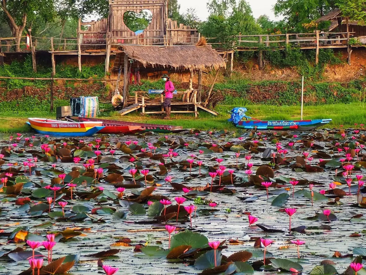
9. Bueng Lahan is located in Chatturat District and extends across several subdistricts, including Lahan, Nong Bua Yai, Nong Bua Ban, and Ban Kok. This large natural freshwater wetland has important ecological, fishing, conservation, and nature-tourism value.
Highlight: A vast freshwater lake, wetlands, waterbirds, traditional fishing, walking paths and viewpoints, wooden bridges, seasonal lotus-viewing boat trips, and Chao Pho Han Kham Shrine, which is respected by local communities.
The appeal of Bueng Lahan lies in the close relationship between nature and local life. Visitors can see fishing boats, aquatic plants, waterbirds, and communities that continue to depend on the wetland’s resources. This gives the lake a living cultural character unlike reservoirs built primarily for irrigation.
During certain periods of the year, large numbers of lotus flowers appear across parts of the lake. Early morning is especially attractive because the flowers are open and the light is soft. Taking a boat trip through the lotus area or photographing the scenery from wooden walkways suits travelers who enjoy slower, community-based tourism.
The wetland also plays an important role in fish breeding and freshwater ecosystems. It provides livelihoods for local residents and contributes to local food security. Visitors should therefore respect traditional fishing activities and avoid disturbing conservation zones or fishing equipment.
Morning and late afternoon are the best times to visit because the weather is cooler and reflections on the water are more attractive. Visitors can relax beside the lake, take photographs, or watch the sunset from community viewing areas.
Bueng Lahan is suitable for families, couples, photographers, birdwatchers, and travelers interested in waterside life in Isan. It can be combined with attractions and communities in Chatturat District for a half-day itinerary.
Getting There: Bueng Lahan is located in Chatturat District, Chaiyaphum Province. A private vehicle is the most convenient option. Open daily from 06.00–18.00. Travelers interested in boat trips should check community services on the day of their visit.
Map (GPS): https://www.google.com/maps/dir/?api=1&destination=15.615822,101.888477&travelmode=driving
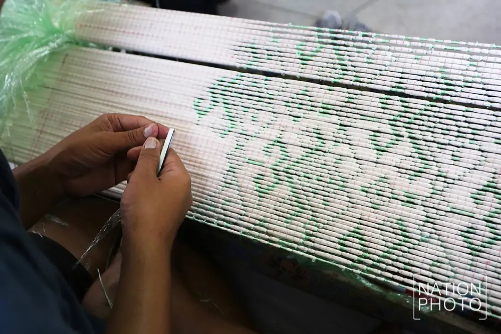
10. Ban Khwao Silk Village is located in Ban Khwao District and includes communities with long-standing expertise in mulberry cultivation, silkworm raising, silk reeling, dyeing, mudmee tying, weaving, and silk sales. It is one of Chaiyaphum’s best-known handicraft areas and is ideal for travelers who want to understand the province through local knowledge and craftsmanship.
Highlight: Mudmee silk, plain silk, silk reeling, thread dyeing, mudmee pattern-making, weaving on traditional looms, local silk shops, and contemporary silk products available directly from community producers.
Ban Khwao silk knowledge began with household production for everyday use and important community occasions such as ordinations, weddings, merit-making ceremonies, and traditional festivals. Over time, weaving developed into a handicraft that generated income and recognition for the district. Silk production is therefore inseparable from local ways of life and remains part of family identity and community memory.
Creating mudmee silk requires many stages. Artisans prepare silk threads, design patterns, tie sections that should resist dye, dye the yarn, remove the ties, and repeat the process for additional colors before weaving the prepared silk on a loom. Seeing the process firsthand makes it clear that every piece requires precision, patience, and accumulated weaving experience.
Ban Khwao communities include silk reelers, dyers, mudmee specialists, weavers, and many local shops. Visitors can browse traditional silk lengths as well as scarves, clothing, and contemporary products that adapt local patterns to modern designs.
Purchasing silk directly from the community gives travelers a clearer understanding of where the textile was made and the story behind each product. It also helps tourism income circulate directly among local artisans and families.
Ban Khwao Silk Village is suitable for families, students, designers, people interested in fashion and culture, and travelers searching for high-quality local souvenirs. Visitors who want to see detailed demonstrations of silk reeling or weaving should contact the community in advance so activities can be arranged.
Getting There: Silk-producing communities are spread across Ban Khwao District. Ban Khwao Silk Promotion Center is open Monday–Friday from 08.30–16.30, while local silk shops operate according to their own schedules. Advance contact is recommended for groups or travelers wishing to see organized demonstrations.
Map (GPS): https://www.google.com/maps/dir/?api=1&destination=15.782710,101.903852&travelmode=driving
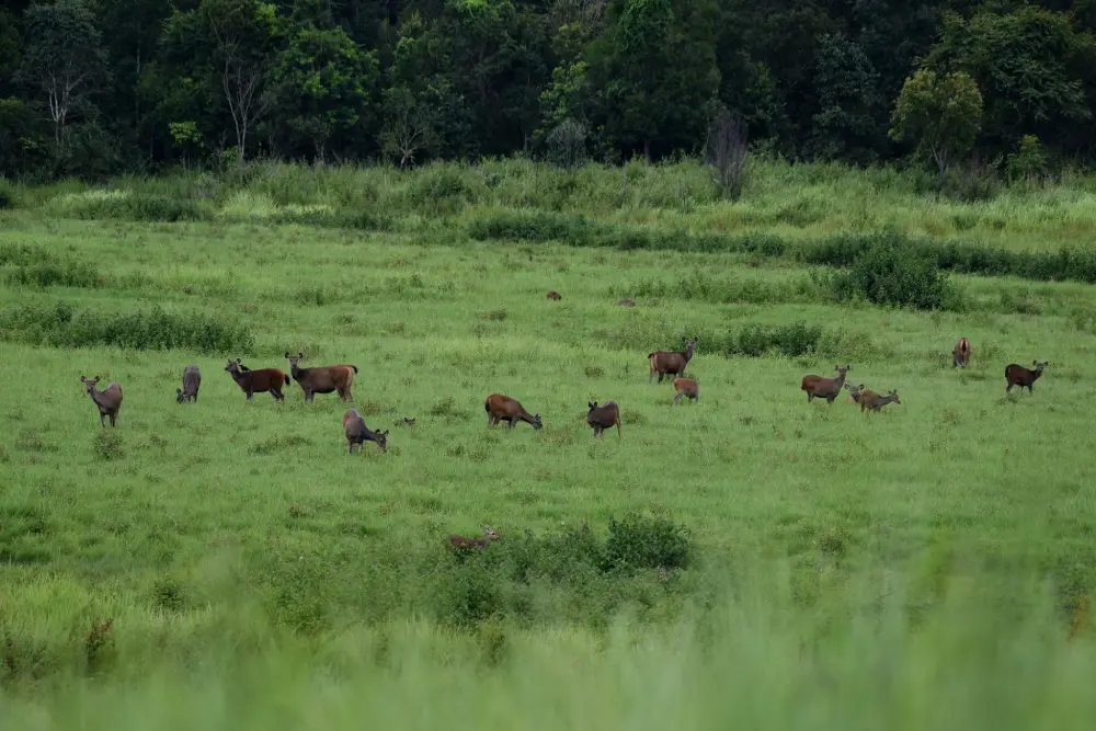
11. Phu Khiao Wildlife Sanctuary–Thung Kamang is located around Thung Luilai Subdistrict, Khon San District, with continuous forest extending into Kaset Sombun and Nong Bua Daeng districts. It is one of the most important protected forest areas in Northeastern Thailand and still preserves a highly complete ecosystem of forest, mountains, streams, grasslands, and wildlife habitats.
Highlight: Thung Kamang, a broad grassland in the middle of the forest, opportunities to observe deer, barking deer, Eld’s deer, forest birds, and other wildlife in their natural habitat, together with sandstone mountains, montane forest, streams, and important watershed areas.
Thung Kamang is an open grassland surrounded by forest and functions as an important feeding ground and gathering area for several herbivorous species. The sight of wildlife feeding in open grassland against a backdrop of forest has made this one of the most notable wildlife-viewing areas in Northeastern Thailand.
Phu Khiao Wildlife Sanctuary differs from a typical national park because its primary purpose is the protection of wildlife and natural habitats rather than accommodating large numbers of tourists. Visitors must therefore follow staff regulations strictly, keep noise to a minimum, never feed wildlife, and remain within designated areas and routes.
The Phu Khiao forest is also connected with several large protected areas in western Isan. It serves as a watershed, wildlife habitat, and ecological corridor that allows animals to move naturally between forest zones. Its conservation value therefore extends far beyond wildlife viewing alone.
The sanctuary is suitable for birdwatchers, wildlife photographers, students, researchers, and travelers interested in conservation tourism. Binoculars and telephoto lenses are recommended instead of approaching animals, and visitors should avoid any sound or activity that disturbs wildlife.
It can be combined with Chulabhorn Dam, Phu Khing, Nam Phut Na Lao, and Nam Phut Na Wong Duean in a northern Chaiyaphum itinerary covering forest, wildlife, mountains, water sources, and community landscapes.
Getting There: The access area is in Thung Luilai Subdistrict, Khon San District, Chaiyaphum Province. A private vehicle is the most practical option. Open daily from 08.00–16.00. Visitors should check current access regulations and areas open for nature study with sanctuary staff before traveling.
Map (GPS): https://www.google.com/maps/dir/?api=1&destination=16.162483,101.659950&travelmode=driving
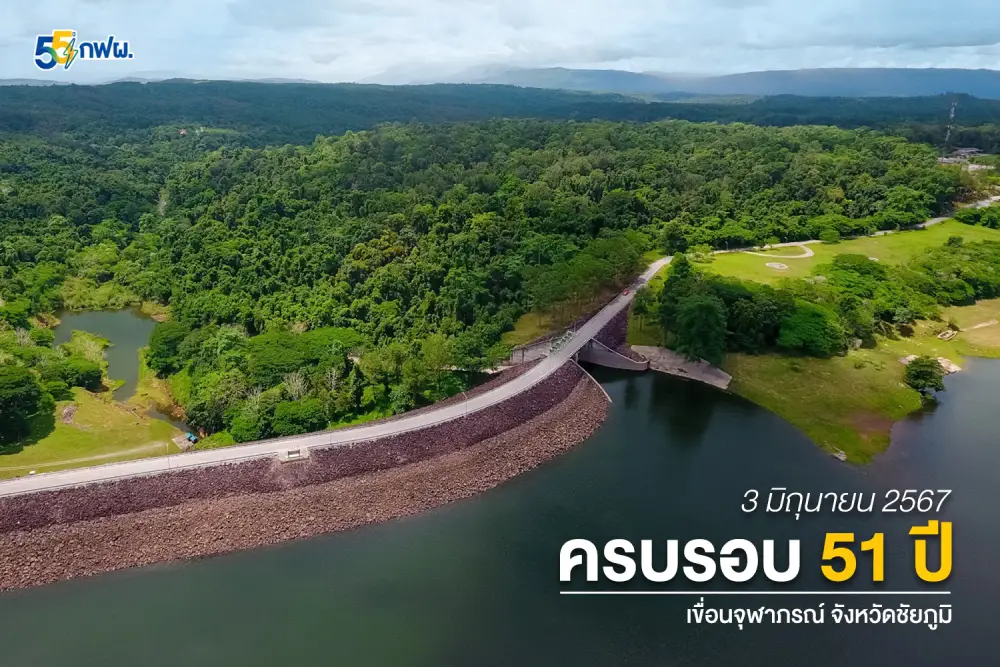
12. Chulabhorn Dam (Nam Phrom Dam) is located in Thung Phra Subdistrict, Khon San District. This multipurpose highland dam is surrounded by mountains, forests, and a large reservoir. The cooler climate compared with the lowlands makes it both an important energy facility and a relaxing scenic destination in northern Chaiyaphum.
Highlight: A dam crest approximately 700 meters long, a highland reservoir, mountain scenery, landscaped recreation areas, viewpoints, opportunities to learn about hydroelectric power, and a cool atmosphere especially pleasant in the morning and late afternoon.
Chulabhorn Dam was originally known as Nam Phrom Dam. It was constructed across the Nam Phrom River in the Khun Phai mountain range around Phu Yuak. Construction began in 1970, and commercial power generation started in 1972 before the dam was later granted the name Chulabhorn Dam.
The structure is a rock-fill dam with a clay core. It is used for hydroelectric power generation, water storage, agricultural support, and improving water security for surrounding communities. A visit therefore offers opportunities to learn about engineering, renewable energy, and water-resource management while enjoying the natural scenery.
One of the dam’s greatest attractions is its reservoir landscape stretching between mountain ranges. On clear days, the dark blue water contrasts strongly with green forest and open sky. The late rainy season, early cool season, and winter months are especially suitable for enjoying the scenery because temperatures are cooler and the atmosphere is fresh.
The dam is suitable for families, couples, older travelers, and photographers because good views can be enjoyed without strenuous hiking. Visitors interested in specific activities such as boat trips or entering operational electricity-authority areas should check current services and regulations in advance.
Chulabhorn Dam can be combined with Phu Khiao Wildlife Sanctuary–Thung Kamang, Nam Phut Na Lao, Nam Phut Na Wong Duean, and Wat Phra That Kaeng Koi as part of a well-rounded Khon San itinerary.
Getting There: The dam is located in Thung Phra Subdistrict, Khon San District, Chaiyaphum Province. A private vehicle is the most convenient option. Open daily from 08.30–16.30.
Map (GPS): https://www.google.com/maps/dir/?api=1&destination=16.536270,101.650039&travelmode=driving
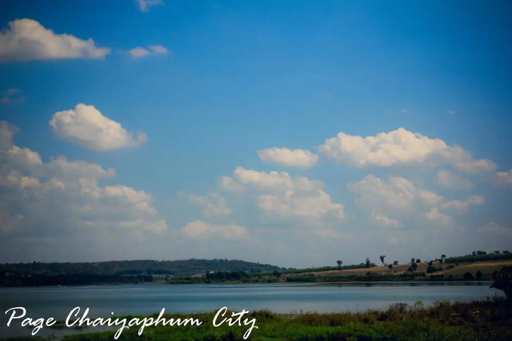
13. Lam Pa Thao Dam is located at Ban Lup Chang Phlai, Kao Ya Di Subdistrict, Kaeng Khro District. This earth dam and major water source lies among mountains, forest, and agricultural communities, serving important roles in energy, farming, water supply, and recreation.
Highlight: A large reservoir, surrounding mountain ranges, sunset viewpoints, roads along the reservoir, waterside recreation areas, and panoramic views where mountains appear to surround the water.
The Lam Pa Thao dam system consists of upper and lower dams that store and manage water within the mountain area. Water from the system is important for power generation, agriculture, and provincial water supply, and is also connected with the hydrological system around Tat Ton.
The reservoir has a generally peaceful atmosphere, especially in the morning and evening when temperatures are lower. Reflections of the mountains and sky across the water create attractive scenery for relaxing, photography, or slow scenic drives.
Some sections of the reservoir shoreline slope gently toward the water and can resemble a freshwater beach depending on seasonal water levels. This gives the area a different atmosphere from reservoirs dominated only by concrete structures and a dam crest.
Lam Pa Thao Dam is suitable for families, couples, groups of friends, and photographers looking for a quiet destination. During the rainy season, extra care should be taken on wet roads and at shoreline areas where water levels may change.
The dam can be combined with Lam Pa Thao Waterfall and other natural attractions in Kaeng Khro District for a half-day or full-day itinerary.
Getting There: Lam Pa Thao Dam is located at Ban Lup Chang Phlai, Kao Ya Di Subdistrict, Kaeng Khro District, Chaiyaphum Province. A private vehicle is the most convenient option. Open daily from 07.00–18.00.
Map (GPS): https://www.google.com/maps/dir/?api=1&destination=16.248399,102.111666&travelmode=driving
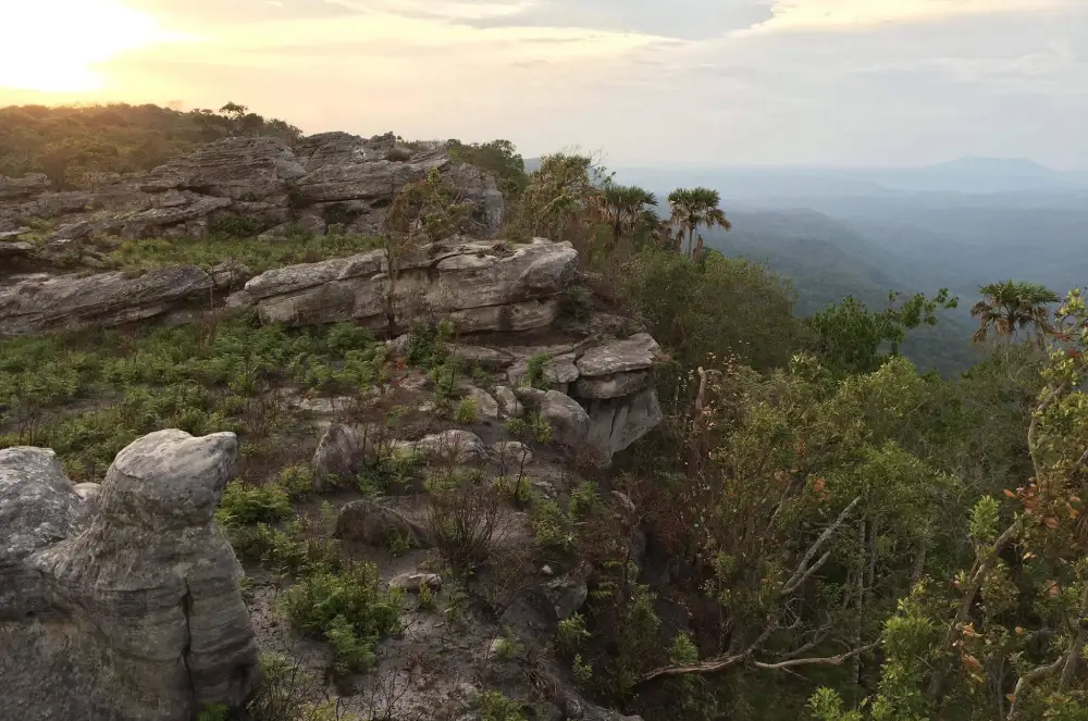
14. Phu Khing is located around Ban Non Nong Hai, Non Thong Subdistrict, Kaset Sombun District, on the Khao Khiao mountain range within Phu Khiao Wildlife Sanctuary. Rising approximately 1,167 meters above sea level, it is one of Chaiyaphum’s notable trekking destinations.
Highlight: Highland grasslands, steep cliffs, rock plateaus, wild orchids, seasonal flowers, forest waterfalls, sea-of-mist views, and panoramas that can include Phu Kradueng, Phu Laen Kha, Huai Kum Dam, and the Nam Phrom river system on clear days.
Phu Khing is not a viewpoint that can be reached directly by car. Reaching the summit requires hiking and proper preparation, making it more suitable for experienced trekkers or travelers who are ready to follow the instructions of officials and local guides carefully.
The appeal of Phu Khing lies as much in the forest journey as in the summit views. Along the route, travelers may encounter wild plants, orchids, rock fields, and landscapes that change with elevation, making the hike a complete nature experience rather than simply a route to one viewpoint.
The late rainy season, early cool season, and winter months are particularly suitable for misty views and cooler temperatures. Trail conditions, however, depend on rainfall and regulations within the protected area, so current information should always be checked before traveling.
Phu Khing is suitable for hikers, adventure travelers, nature photographers, and groups with good physical fitness. It is not suited to quick sightseeing stops or visitors who require full tourist facilities.
The mountain can be included in a longer Kaset Sombun itinerary or a multi-day nature trip combined with Phu Khiao and Khon San, but it is best to dedicate a separate day to the hike to avoid making the schedule too demanding.
Getting There: The starting point is around Ban Non Nong Hai, Non Thong Subdistrict, Kaset Sombun District. Hiking requires advance permission and coordination with officials or local guides before entering the area.
Map (GPS): https://www.google.com/maps/dir/?api=1&destination=16.337869,101.547119&travelmode=driving

15. Nam Phut Na Lao is located in Thung Na Lao Subdistrict, Khon San District. This natural spring is formed by groundwater emerging at the surface and gathering into clear pools and streams. The water remains relatively cool and flows throughout the year, making the site both a recreation area and an important local water resource.
Highlight: Natural spring sources, several clear pools, small streams, cool water, shade from surrounding trees, and a simple agricultural-community atmosphere that preserves the area’s natural character.
Nam Phut Na Lao is neither a waterfall nor a large reservoir. Its charm comes from seeing the source of water at close range as groundwater gradually emerges from below the surface, passes through soil, tree roots, and waterside plants, and then spreads into the surrounding landscape.
The spring is important to the community because it supports agricultural land and local livelihoods. Visitors should keep the area clean, avoid chemicals or substances that could contaminate the water, and respect spaces shared and used by local residents.
The overall atmosphere is suitable for relaxing, swimming in safe designated areas, and photography. The cool spring water is especially refreshing on hot days.
Nam Phut Na Lao is suitable for families, children, groups of friends, and travelers who want an easy natural attraction without long walks. Visitors can spend 1–2 hours here before continuing to Nam Phut Na Wong Duean or Chulabhorn Dam.
Getting There: Nam Phut Na Lao is located in Thung Na Lao Subdistrict, Khon San District, near the route behind Khon San Witthaya School. A private vehicle is convenient. Open daily from 08.00–18.00.
Map (GPS): https://www.google.com/maps/dir/?api=1&destination=16.592998,101.896502&travelmode=driving

16. Nam Phut Na Wong Duean is located at Ban Na Wong Duean, Moo 8, Thung Na Lao Subdistrict, Khon San District. This large natural spring is continuously fed by groundwater rising to the surface, creating clear pools and streams surrounded by farmland and a peaceful rural community.
Highlight: A large natural spring, clear cool water, broad pools, streams flowing away from the source, and the quiet atmosphere of Ban Na Wong Duean.
The most interesting feature of Nam Phut Na Wong Duean is the opportunity to observe a groundwater system directly. The water does not descend from a mountain like a waterfall but rises from below the ground and gathers into a natural spring that supports the surrounding landscape.
The water is clear enough in some areas to see the bottom and remains cool and pleasant for recreation. The surroundings retain a simple local atmosphere and have not been heavily commercialized, helping preserve the character of the community.
The spring is directly connected with local agriculture and daily life. Visitors should help protect water quality by avoiding litter and any substances that could contaminate the spring.
Nam Phut Na Wong Duean is suitable for families, groups of friends, and travelers who enjoy natural freshwater attractions. It can easily be combined with Nam Phut Na Lao because both are in the same zone, followed by a trip to Chulabhorn Dam.
Getting There: The spring is located at Ban Na Wong Duean, Moo 8, Thung Na Lao Subdistrict, Khon San District. From the road toward Chulabhorn Dam, turn into Ban Na Wong Duean for approximately 1 kilometer. Open daily from 07.00–18.00.
Map (GPS): https://www.google.com/maps/dir/?api=1&destination=16.574404,101.898922&travelmode=driving
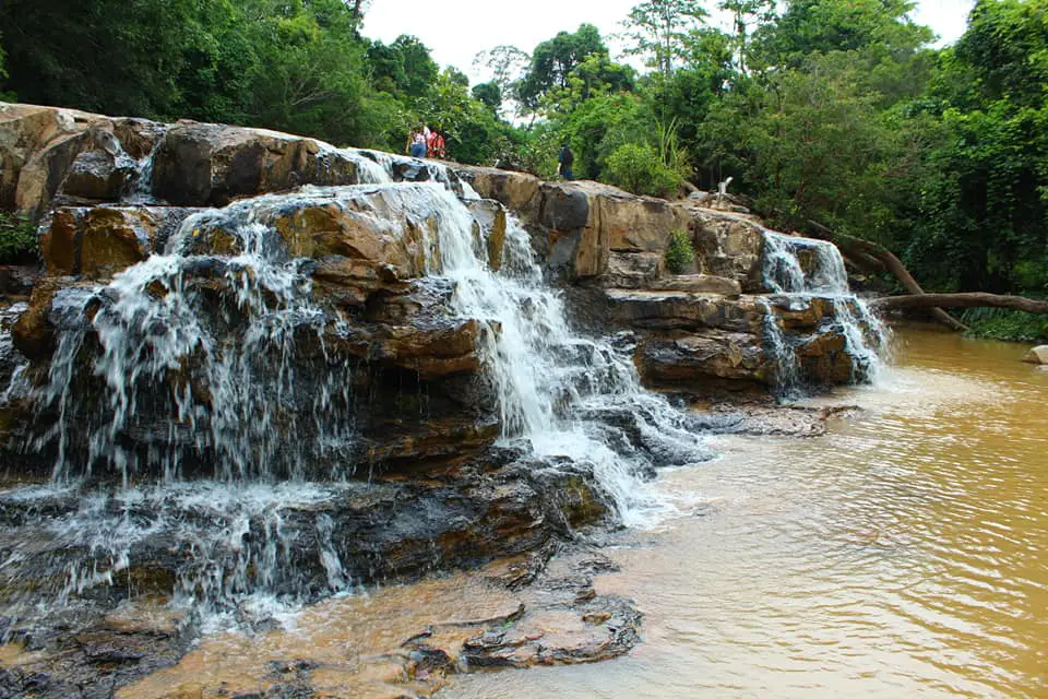
17. Thep Phana Waterfall is located in Thep Sathit District near Pa Hin Ngam National Park. This medium-sized waterfall is formed by Huai Krachon flowing over 3 natural rock levels and is a convenient nature stop for travelers visiting the Siam tulip route.
Highlight: A 3-tier waterfall, with the upper and second levels around 2–3 meters high and the final tier approximately 6 meters high, together with rock terraces, pools, and refreshing forest scenery during the rainy season.
Thep Phana Waterfall is strongly seasonal. During the rainy season, Huai Krachon carries enough water to create continuous flows over the rock levels, making the landscape more dramatic and especially suitable for photography.
The waterfall does not plunge from a very high cliff. Instead, the water descends across a sequence of rock steps, allowing visitors to observe the relationship between flowing water and natural rock formations at relatively close range. Wet rocks can nevertheless become extremely slippery and require extra caution.
The site is ideal for visitors already traveling to Pa Hin Ngam who want to add another natural attraction without a long detour. It can be visited before or after the Siam tulip field, Lan Hin Ngam, and Pha Sut Phaen Din.
The waterfall is suitable for nature lovers, families, and photographers. It is best visited during periods with sufficient water, and visitors should avoid swimming where currents are strong. During heavy rain, stay away from the water’s edge and check route conditions before traveling.
Getting There: The waterfall is located approximately 7 kilometers east of the Pa Hin Ngam National Park headquarters in Thep Sathit District. Open daily from 08.00–17.00. The rainy season is the best time to visit.
Map (GPS): https://www.google.com/maps/dir/?api=1&destination=15.647028,101.428239&travelmode=driving

18. Thep Prathan Waterfall is located in Ban Rai Subdistrict, Thep Sathit District, approximately 7 kilometers before reaching the headquarters of Pa Hin Ngam National Park. This natural waterfall is distinguished by its broad rock terrace and water that flows gently across a series of low rock steps rather than plunging from a high cliff.
Highlight: A large rock terrace, broad sheets of flowing water, shallow pools, natural rock formations, and a shaded atmosphere suitable for a peaceful stop on the way to Pa Hin Ngam National Park.
The form of Thep Prathan Waterfall makes it easy to observe how water flows across the rock surface. In some sections, thin sheets of water spread across the stone, while in others the flow gathers into pools and descends over short steps. This gives it a different character from Thep Phana Waterfall, where individual waterfall tiers are more clearly defined.
The rainy season is the most attractive time to visit. With more water, the flow spreads across a larger area of the rock terrace and the surrounding forest becomes bright green. Wet rock, however, can be extremely slippery, so visitors should remain in safe areas and avoid strong currents.
Because the waterfall is located in the same zone as Pa Hin Ngam, it works well as a rest stop before continuing to the Siam tulip field, Lan Hin Ngam, or Pha Sut Phaen Din.
The attraction is suitable for families, couples, groups of friends, and photographers who prefer a quiet natural atmosphere rather than heavily crowded destinations.
Getting There: Thep Prathan Waterfall is located in Ban Rai Subdistrict, Thep Sathit District, approximately 7 kilometers before Pa Hin Ngam National Park headquarters. Open daily from 08.00–17.00.
Map (GPS): https://www.google.com/maps/dir/?api=1&destination=15.631605,101.393862&travelmode=driving
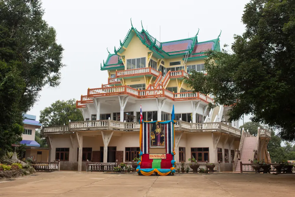
19. Wat Khao Pratu Chumphon is located at Ban Sap Salete, Moo 2, Ban Rai Subdistrict, Thep Sathit District. This forest temple combines religious spaces with mixed deciduous forest, rock terraces, and natural sandstone formations, making it a peaceful place to worship and rest while traveling toward Pa Hin Ngam National Park.
Highlight: Pratu Chumphon rock gateway, meditation pavilion, bell tower, rock terraces, a natural rock garden, and sandstone formations with openings and cavities resembling a series of gates.
The temple was established in 1992. The name “Pratu Chumphon” is associated with the rock formations within the temple grounds, where natural gaps and sandstone openings resemble gateways. The geological landscape has therefore become an important part of the temple’s name and identity.
The temple stands amid the forested mountain environment of the Phang Hoei range. Its quiet setting and mountain breezes make it suitable for resting, meditation, and walking through nature without requiring the longer hikes found in national park trails.
Visitors commonly walk through the Pratu Chumphon gateway for good fortune before paying respect to Buddha images and exploring the temple grounds. This practice illustrates how natural landforms have been incorporated into local faith and religious traditions.
Wat Khao Pratu Chumphon can be visited before or after Pa Hin Ngam National Park, Thep Phana Waterfall, and Thep Prathan Waterfall, giving the Thep Sathit route a balance between natural attractions and religious sites.
The temple is suitable for merit-making travelers, older visitors, families, and those seeking a peaceful stop. Visitors should dress modestly and keep noise to a minimum around meditation areas.
Getting There: The temple is located at Ban Sap Salete, Moo 2, Ban Rai Subdistrict, Thep Sathit District, near the route to Pa Hin Ngam National Park. Open daily, with daytime visits recommended.
Map (GPS): https://www.google.com/maps/dir/?api=1&destination=15.625083,101.384082&travelmode=driving
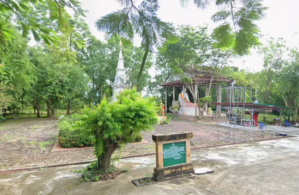
20. Wat Phra That Kaeng Koi is located at Moo 1, Ban Non Khun, Non Khun Subdistrict, Khon San District. This historic temple is centered on Phra That Kaeng Koi, an important sacred monument for the local community and notable evidence of Lan Xang artistic influence in northern Chaiyaphum.
Highlight: Phra That Kaeng Koi in Lan Xang style, a three-level indented square lotus-shaped stupa dating to around the 17th–18th centuries CE, an annual Songkran stupa-washing tradition, and an old religious site closely connected with the Ban Non Khun community.
The stupa is constructed from brick and mortar and covered with plaster. It stands approximately 9.50 meters high and about 5.40 meters wide. Its artistic style reflects Khon San’s historical connection with Mekong-basin culture and the spread of Lan Xang influence into Northeastern Thailand.
The area surrounding the main stupa also preserves traces of earlier religious structures, including the remains of a viharn to the east and smaller reliquary stupas. These features give the site broader historical value beyond that of a single isolated monument.
The annual stupa-washing ceremony during Songkran is an important community tradition. Local people return to make merit, pour scented water over the sacred monument, and express respect for the stupa. This is one of the clearest periods for seeing the close relationship between the religious site and the surrounding community.
Wat Phra That Kaeng Koi is suitable for merit-making travelers, visitors interested in Lan Xang art and local history, and older travelers because the site is relatively easy to access and does not require long-distance walking.
The temple can be combined with Chulabhorn Dam, Nam Phut Na Lao, Nam Phut Na Wong Duean, and Phu Khiao Wildlife Sanctuary–Thung Kamang, allowing a Khon San itinerary to include religion, nature, and conservation areas in the same trip.
Getting There: Wat Phra That Kaeng Koi is located at Moo 1, Ban Non Khun, Non Khun Subdistrict, Khon San District, Chaiyaphum Province. A private vehicle provides convenient access. Open daily from 08.00–17.00.
Map (GPS): https://www.google.com/maps/dir/?api=1&destination=16.508261,102.036755&travelmode=driving
| Topic | Details |
| Province Overview | Chaiyaphum is one of Northeastern Thailand’s major nature destinations, known for its national parks, Siam tulip fields, waterfalls, cliffs, mountain ranges, unusual sandstone formations, wildlife sanctuaries, natural springs, temples, archaeological sites, and silk-weaving communities. It is suitable for trips ranging from a single day to 4–5 days or longer. |
| Top 10 Highlights | 1. Tat Ton National Park 2. Mo Hin Khao 3. Pa Hin Ngam National Park 4. Sai Thong National Park 5. Phu Laen Kha National Park 6. Phraya Phakdi Chumphon (Lae) Monument 7. Prang Ku Chaiyaphum 8. Wat Phra That Nong Sam Muen 9. Bueng Lahan 10. Ban Khwao Silk Village |
| Mueang Chaiyaphum–Tat Ton–Phu Laen Kha Zone | 1. Tat Ton National Park 2. Mo Hin Khao 3. Phu Laen Kha National Park 4. Phraya Phakdi Chumphon (Lae) Monument 5. Prang Ku Chaiyaphum This is the best zone for first-time visitors because it combines nature, local history, spiritual landmarks, and some of the province’s most famous attractions close to Chaiyaphum city. |
| Thep Sathit Zone | 1. Pa Hin Ngam National Park 2. Thep Phana Waterfall 3. Thep Prathan Waterfall 4. Wat Khao Pratu Chumphon This zone is especially attractive during the rainy season and Siam tulip season, combining wildflowers, waterfalls, cliffs, rock formations, and a forest temple in one route. |
| Nong Bua Rawe Zone | 1. Sai Thong National Park Ideal for travelers who want to see natural Siam tulip fields, walk along mountain viewpoints, and explore the Phang Hoei mountain landscape. |
| Khon San Zone | 1. Phu Khiao Wildlife Sanctuary–Thung Kamang 2. Chulabhorn Dam 3. Nam Phut Na Lao 4. Nam Phut Na Wong Duean 5. Wat Phra That Kaeng Koi This is one of the province’s most diverse zones, combining forest, wildlife, a mountain reservoir, natural springs, and an important historic religious site. It is suitable for a 1–2 day trip. |
| Kaset Sombun Zone | 1. Phu Khing Best suited to trekking and adventure travelers who want high-mountain scenery, forest landscapes, sea-of-mist views, and a more demanding outdoor experience. Advance coordination with officials or local guides is required. |
| Kaeng Khro Zone | 1. Lam Pa Thao Dam Suitable for reservoir scenery, mountain views, sunsets, and quiet relaxation. It can be combined with Lam Pa Thao Waterfall and other natural attractions in the surrounding area. |
| Phu Khiao Zone | 1. Wat Phra That Nong Sam Muen Recommended for merit-making travelers and visitors interested in archaeology, Lanna, Lan Xang, and Ayutthaya artistic influences, as well as the remains of ancient communities around Phu Khiao. |
| Ban Khwao Zone | 1. Ban Khwao Silk Village Ideal for learning about mulberry cultivation, silkworm raising, silk reeling, mudmee tying, dyeing, weaving, and purchasing silk directly from community producers. |
| Chatturat Zone | 1. Bueng Lahan Suitable for wetland scenery, birdwatching, traditional fishing, seasonal lotus fields, and sunrise or sunset views beside the lake. |
| Siam Tulip Fields | 1. Pa Hin Ngam National Park 2. Sai Thong National Park The main flowering season is generally from June–August, with July often being especially popular. Actual bloom conditions vary according to rainfall and weather each year. |
| Waterfalls and Water Attractions | 1. Tat Ton Waterfall 2. Thep Phana Waterfall 3. Thep Prathan Waterfall 4. Nam Phut Na Lao 5. Nam Phut Na Wong Duean 6. Chulabhorn Dam 7. Lam Pa Thao Dam 8. Bueng Lahan |
| Mountains, Cliffs and Viewpoints | 1. Mo Hin Khao 2. Phu Laen Kha National Park 3. Pa Hin Ngam National Park 4. Sai Thong National Park 5. Phu Khing These destinations are suitable for sunrise and sunset viewing, sea-of-mist photography, nature walks, and camping in designated areas. |
| Wildlife and Conservation Tourism | Phu Khiao Wildlife Sanctuary–Thung Kamang is the province’s key destination for wildlife study, birdwatching, and ecosystem learning. Visitors must strictly follow conservation regulations, never feed wildlife, keep noise to a minimum, and remain within designated areas. |
| History and Archaeology | 1. Prang Ku Chaiyaphum 2. Phraya Phakdi Chumphon (Lae) Monument 3. Wat Phra That Nong Sam Muen 4. Wat Phra That Kaeng Koi Together, these places cover Khmer culture under King Jayavarman VII, Lan Xang influence, and the historical development of Chaiyaphum city. |
| Merit-Making and Spiritual Travel | 1. Phraya Phakdi Chumphon (Lae) Monument 2. Wat Phra That Nong Sam Muen 3. Wat Khao Pratu Chumphon 4. Wat Phra That Kaeng Koi 5. Prang Ku Chaiyaphum, which remains connected with local merit-making traditions |
| Culture and Handicrafts | Ban Khwao Silk Village is the main destination for learning about Chaiyaphum silk, including silkworm raising, silk reeling, mudmee tying, dyeing, and traditional loom weaving. It is especially suitable for travelers interested in Thai textiles, design, and community tourism. |
| Best for Families | 1. Tat Ton National Park 2. Mo Hin Khao 3. Phraya Phakdi Chumphon Monument 4. Prang Ku Chaiyaphum 5. Wat Phra That Nong Sam Muen 6. Bueng Lahan 7. Ban Khwao Silk Village 8. Chulabhorn Dam 9. Nam Phut Na Lao 10. Nam Phut Na Wong Duean |
| Best for Older Travelers | 1. Phraya Phakdi Chumphon Monument 2. Prang Ku Chaiyaphum 3. Wat Phra That Nong Sam Muen 4. Bueng Lahan 5. Ban Khwao Silk Village 6. Chulabhorn Dam 7. Wat Phra That Kaeng Koi Phu Khing, cliff viewpoints, and some nature trails require greater physical fitness and should be considered carefully. |
| Best for Photography | 1. Mo Hin Khao 2. Pa Hin Ngam National Park 3. Sai Thong National Park 4. Phu Laen Kha National Park 5. Tat Ton National Park 6. Phu Khing 7. Chulabhorn Dam 8. Lam Pa Thao Dam 9. Bueng Lahan 10. Thung Kamang |
| Best for Adventure Travelers | 1. Phu Khing 2. Sai Thong National Park 3. Phu Laen Kha National Park 4. Pa Hin Ngam National Park Prepare proper hiking shoes, drinking water, rain protection, sun protection, and check trail conditions before traveling. |
| Local Food | Chaiyaphum offers classic Isan dishes including som tam, larb, jaew dipping sauces, grilled foods, freshwater fish, and seasonal dishes using locally available ingredients. Communities near wetlands, reservoirs, and natural water sources also have cuisine connected with traditional freshwater fishing. |
| Souvenirs | 1. Ban Khwao silk 2. Mudmee silk 3. Contemporary products made from local textiles 4. Basketry and community handicrafts 5. Local food and processed products |
| Important Festivals and Traditions | The Siam Tulip Festival from approximately June–August is one of Chaiyaphum’s most important tourism events. Other notable traditions include the Chao Pho Phaya Lae Festival, Bun Bang Fai rocket festivals, local merit-making events, and the annual Songkran stupa-washing ceremony at Phra That Kaeng Koi. |
| 1-Day City and Nature Route | Morning: Phraya Phakdi Chumphon Monument – Prang Ku Late Morning to Afternoon: Tat Ton National Park Late Afternoon: Mo Hin Khao Evening: Phu Laen Kha viewpoint or return to Chaiyaphum city |
| 1-Day Thep Sathit Route | Morning: Pa Hin Ngam National Park – Siam Tulip Field Late Morning: Lan Hin Ngam – Pha Sut Phaen Din Afternoon: Thep Prathan Waterfall – Thep Phana Waterfall Evening: Wat Khao Pratu Chumphon |
| 2 Days, 1 Night | Day 1: Phraya Phakdi Chumphon Monument – Prang Ku – Tat Ton – Mo Hin Khao Day 2: Pa Hin Ngam National Park – Thep Prathan Waterfall – Thep Phana Waterfall – Wat Khao Pratu Chumphon |
| 3 Days, 2 Nights | Day 1: Chaiyaphum city – Tat Ton – Mo Hin Khao Day 2: Pa Hin Ngam – Thep Sathit Day 3: Choose Sai Thong National Park or Ban Khwao–Bueng Lahan depending on your interests |
| 4–5 Day Itinerary | Add the Khon San zone, including Phu Khiao Wildlife Sanctuary–Thung Kamang, Chulabhorn Dam, Nam Phut Na Lao, Nam Phut Na Wong Duean, and Wat Phra That Kaeng Koi. Serious nature travelers can also add Phu Khing and Lam Pa Thao Dam. |
| Best Time to Visit | Chaiyaphum can be visited throughout the year. June–August is best for Siam tulips, green forests, and waterfalls. October–February is ideal for mountain scenery, sea-of-mist viewpoints, camping, and cooler weather. Natural springs, temples, and cultural attractions can be visited year-round. |
| Getting Around the Province | A private car or rental vehicle is the most practical option because major attractions are spread across several districts and many are located in mountain areas. Plan by zones such as Mueang Chaiyaphum–Phu Laen Kha, Thep Sathit, Sai Thong, Khon San, Ban Khwao, Phu Khiao, and Chatturat. |
| Safety | During the rainy season, watch for slippery surfaces, flash floods, strong currents, thick mist, and mountain-road conditions. Wear footwear with good grip, remain within designated cliff and trail boundaries, and check national park or protected-area announcements before every trip. |
| Responsible Travel | Do not pick Siam tulips, remove rocks or plants, feed wildlife, make unnecessary noise in wildlife sanctuaries, or leave rubbish in natural water sources. Supporting community products such as Ban Khwao silk helps tourism income circulate directly within local communities. |
Frequently Asked Questions (FAQ)
Q: What are the must-visit attractions in Chaiyaphum?
A: The main attractions include Tat Ton National Park, Mo Hin Khao, Pa Hin Ngam National Park, Sai Thong National Park, Phu Laen Kha National Park, Phraya Phakdi Chumphon Monument, Prang Ku, and Wat Phra That Nong Sam Muen because together they represent the best of Chaiyaphum’s nature, history, and culture.
Q: Where should I go if I have only 1 day in Chaiyaphum?
A: If you are staying in the city, a good route is Phraya Phakdi Chumphon Monument – Prang Ku – Tat Ton National Park – Mo Hin Khao. During Siam tulip season, you can instead spend the full day at Pa Hin Ngam National Park.
Q: How many days should I spend in Chaiyaphum?
A: At least 3 days and 2 nights are recommended for Tat Ton, Mo Hin Khao, Pa Hin Ngam, and central Chaiyaphum. To include Sai Thong, Khon San, Ban Khwao, Phu Khiao, or Phu Khing, plan 4–5 days or longer.
Q: When do Siam tulips bloom in Chaiyaphum?
A: The main Siam tulip season generally runs from June–August, with July often being the most popular month. Actual blooming conditions depend on rainfall and weather in each year.
Q: What is the difference between Pa Hin Ngam and Sai Thong National Park?
A: Pa Hin Ngam is known for its Siam tulip field, Lan Hin Ngam rock formations, and Pha Sut Phaen Din viewpoint, with relatively convenient access. Sai Thong offers a more natural mountain atmosphere, Thung Bua Sawan, Pha Ham Hot, and several cliff viewpoints, making it suitable for visitors who enjoy walking and mountain scenery.
Q: What is the best time of day to visit Mo Hin Khao?
A: Early morning and late afternoon are best because temperatures are cooler and the softer light gives the sandstone pillars more depth in photographs. The late rainy season and early cool season may also bring mist and lush green scenery.
Q: Are there adventure attractions in Chaiyaphum?
A: Yes. Phu Khing, Sai Thong National Park, Phu Laen Kha National Park, and several national park nature trails are suitable for adventure travelers. Phu Khing requires advance coordination with officials or local guides and is best for travelers with good physical fitness.
Q: Which attractions are best for merit-making in Chaiyaphum?
A: Recommended places include Wat Phra That Nong Sam Muen, Wat Phra That Kaeng Koi, Wat Khao Pratu Chumphon, Phraya Phakdi Chumphon Monument, and Prang Ku. Each combines spiritual significance with local history or culture.
Q: Where can I see wildlife in Chaiyaphum?
A: Phu Khiao Wildlife Sanctuary–Thung Kamang is the province’s most important wildlife-viewing area. Visitors may see herbivores and many forest bird species, but all visits must follow conservation regulations and maintain a safe distance from wildlife.
Q: When should I visit Nam Phut Na Lao and Nam Phut Na Wong Duean?
A: Both natural springs can be visited throughout the year because they are supplied by groundwater. The water is generally clear and cool, making them good stops on a Khon San itinerary. Visitors should help protect water quality and avoid using substances that could contaminate the springs.
Q: Who is Chulabhorn Dam suitable for?
A: Chulabhorn Dam is suitable for families, older travelers, couples, and photographers because visitors can enjoy reservoir and mountain scenery without strenuous hiking. It is also a useful place to learn about hydroelectric power and water-resource management.
Q: Where can I buy silk in Chaiyaphum?
A: Ban Khwao District is Chaiyaphum’s best-known silk-producing area, particularly for mudmee silk. Visitors can purchase textiles directly from community producers and learn about the weaving process.
Q: Is Chaiyaphum suitable for families with children and older travelers?
A: Yes. Accessible attractions include Tat Ton National Park, Mo Hin Khao, Prang Ku, Wat Phra That Nong Sam Muen, Bueng Lahan, Ban Khwao Silk Village, Chulabhorn Dam, and the natural springs. Phu Khing and some cliff or trekking routes require greater physical fitness.
Q: What is the best season to visit Chaiyaphum?
A: June–August is best for Siam tulips, waterfalls, and green forests, while October–February is ideal for mountain scenery, sea-of-mist viewpoints, camping, and cooler weather. Temples, cultural attractions, and natural springs can be visited year-round.
Q: Can I travel around Chaiyaphum without a private car?
A: You can reach Chaiyaphum city by public transport, but visiting national parks, mountains, dams, Khon San, Thep Sathit, and other attractions outside the city is much easier with a private car, rental vehicle, or hired car with a driver.
 Category: ●Travel Articles, Recipes
 Group: ●Travel Review, Food Review
Last Update : 3 WeekAgo
 Last Update : 3 WeekAgo
Recommend

 Art, Culture and Heritage
 Historical Sites and Monuments(1)
 Landmarks and Memorials(3)
 Royal Palace(1)
 Art, Craft Centres, Tradition(3)
 Educational Places
 Educational Gardens, Farm(1)
 Places of Worship
 Temple(141)
 Other Sacred Sites(8)
 Suburban Living
 Village, Community(4)
 Nature and Wildlife
 National Parks and Marine Reserves(7)
 Mountain (Doi)(5)
 Dam, Reservoir, Lake(10)
 Waterfalls(15)
 Caves(5)
 River, Canal(4)
 Other natural attractions(1)
 Entertainment and Agricultural
 Farms, Parks and Ecotourism(2)
 Waterpark(2)
Travel Review, Food Review(1)


