
lovethailand home >South Travel Attractions >Nakhon Si Thammarat Travel Attractions > 39 National Park Destinations in Southern Thailand
TL;DR: 39 National Park Destinations in Southern Thailand.
39 National Park Destinations in Southern Thailand
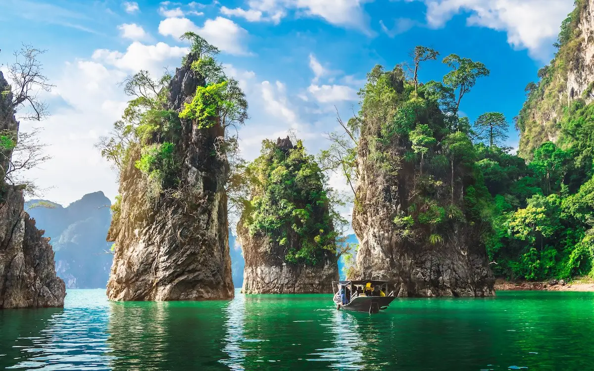
39 National Park Destinations in Southern Thailand — Southern Thailand has some of the country’s most spectacular protected landscapes, from tropical rainforests and high mountain watersheds to limestone caves, waterfalls, secluded beaches and offshore archipelagos. This guide brings together 39 national park destinations and related protected areas across all 14 southern provinces, from Chumphon and Ranong in the north to Satun, Yala and Narathiwat in the far south.
The region includes both marine national parks and inland forest parks. Visitors can discover the turquoise waters and coral reefs of the Andaman Sea, explore island groups in the Gulf of Thailand, trek through humid evergreen forest or take a boat across a lake ringed by limestone cliffs. Each landscape offers a distinct experience and requires different travel arrangements.
Among the best-known destinations are Khao Sok in Surat Thani, whose rainforest and Cheow Lan Lake are framed by limestone mountains; the Similan and Surin Islands in Phang Nga, internationally recognized for snorkeling and diving; Mu Ko Ang Thong in the Gulf of Thailand; Tarutao in Satun; Mu Ko Lanta in Krabi; and Hat Chao Mai in Trang. Each protects ecosystems that are also central to the appeal of southern Thailand as a travel destination.
Southern Thailand is a long peninsula with the Andaman Sea and Indian Ocean to the west and the Gulf of Thailand to the east. Mountain systems, including the Phuket, Nakhon Si Thammarat and Sankalakhiri ranges, support evergreen forests and important river headwaters. Monsoon patterns differ between the two coasts, which means that a good month to visit one beach or island is not necessarily ideal for another.
The Andaman marine parks are renowned for white beaches, clear water, granite boulders and limestone islands. The Similan Islands are especially recognizable for Sail Rock, while the Surin Islands offer shallow coral reefs and the cultural heritage of the Moken community. Tarutao and Lanta add secluded coves, local island life and historical places to the experience.
The Gulf of Thailand offers a different coastal setting. Mu Ko Ang Thong features numerous limestone islands and an inland lagoon, while Mu Ko Chumphon contains coral habitats and island groups closer to shore. Mangrove forests, sandy beaches and long-established fishing communities add an important cultural and ecological dimension to both coasts.
Inland national parks are equally rewarding. Khao Sok is known for rainforests, caves and the reservoir behind Ratchaprapha Dam; Khao Luang protects some of the south’s highest mountains and major watersheds; and Thale Ban shelters a distinctive freshwater wetland near the Malaysian border. Ranong’s extremely wet forests, meanwhile, support waterfalls, river systems and dense evergreen vegetation.
Tropical evergreen forest plays an essential ecological role. Tall canopy trees, palms, ferns, orchids and other moisture-loving plants support birds, mammals, reptiles and amphibians. Forested watersheds sustain rivers and streams used by nearby communities, while limestone forest supports plants and animals adapted to specialized habitats.
Marine biodiversity is another reason these protected areas matter. Coral reefs, seagrass beds, sea turtles, dugongs, fish and many other species depend on healthy coastal environments. Responsible tourism helps protect their habitats by reducing litter, avoiding coral contact and respecting wildlife.
For the Andaman coast, many travelers prefer the calmer months from approximately November to April, although marine national parks often set their own seasonal opening dates and access restrictions. Gulf of Thailand conditions follow a different monsoon pattern. Rainforest waterfalls can be impressive during wet periods, but heavy rainfall increases the risks of flash flooding, slippery trails and cave flooding.
First-time visitors can use Surat Thani, Phang Nga, Krabi or Phuket as convenient bases. Surat Thani connects to Khao Sok and Ang Thong; Phang Nga offers access to the Similan and Surin Islands; Krabi is well placed for Lanta and limestone coastlines; and Trang and Satun offer a rich mix of islands, beaches and inland nature.
For road trips, it is sensible to group stops by geography. The Andaman route runs through Ranong, Phang Nga, Phuket, Krabi, Trang and Satun, while the Gulf side connects Chumphon, Surat Thani and Nakhon Si Thammarat before continuing south. Remote forest trails, boat trips and mountain roads each have different practical requirements.
Many parks also have historical or cultural value. The Moken community in the Surin Islands, fishing communities in Phang Nga Bay and around Lanta, the former penal settlement on Tarutao and historic tunnels in Songkhla all demonstrate how people and nature have interacted over time.
These 39 destinations offer options for families, divers, hikers, photographers and travelers interested in wildlife, geology or local history. The list includes several areas proposed for national park status, so it should not be interpreted as a register of 39 legally gazetted national parks. Always observe park rules, check the latest access notices and leave natural places as undisturbed as possible.
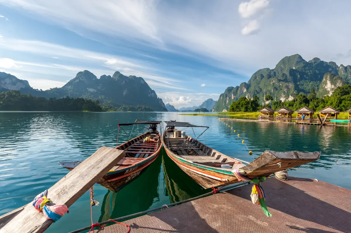
1. Khao Sok National Park is a protected nature destination in Surat Thani, southern Thailand. Its scenery and visitor experiences range from the most accessible attractions to quieter natural environments where access depends on season, weather and conservation management. The forested mountains rise above the green waters of Cheow Lan Lake, where long-tail boats pass limestone towers and secluded inlets. Visitors who prefer land-based activities can explore the Khlong Sok trails, waterfalls and rare rainforest plants.
Main Highlights: Cheow Lan Lake, Ratchaprapha Dam, Khao Sam Kloe limestone formations, Khlong Sok, Rafflesia and forest waterfalls.
Landscape and Natural Features: The forested mountains rise above the green waters of Cheow Lan Lake, where long-tail boats pass limestone towers and secluded inlets. Visitors who prefer land-based activities can explore the Khlong Sok trails, waterfalls and rare rainforest plants. The setting illustrates the close connections between local geology, plant communities, watercourses and wildlife. Different parts of the park may have different conditions and visitor facilities, especially where the area extends across mountains, coastlines or offshore islands.
Ecology and Conservation: This protected landscape contributes to the conservation of southern Thailand’s forests, watersheds, shorelines or marine habitats as relevant to the area. Visitors should stay on designated trails or boat routes, avoid disturbing wildlife and vegetation, take rubbish away and follow the rules of the responsible conservation authority. Fragile cave formations, seagrass beds and coral reefs must not be touched or damaged.
Things to Do: Explore the principal attractions listed above, enjoy nature photography and use the authorized walking, sightseeing or boat routes appropriate to the destination. Activities involving caves, offshore islands, strong currents or remote forests should be undertaken only where permitted and with suitable local guidance. Weather can change quickly in southern Thailand, particularly during monsoon periods.
Getting There: The lake and rainforest visitor zones have separate access points: travel toward Ratchaprapha Dam for boat trips, or toward Khlong Sok for the park headquarters and forest trails. Confirm current opening dates, local transport connections and any seasonal closures before departure.
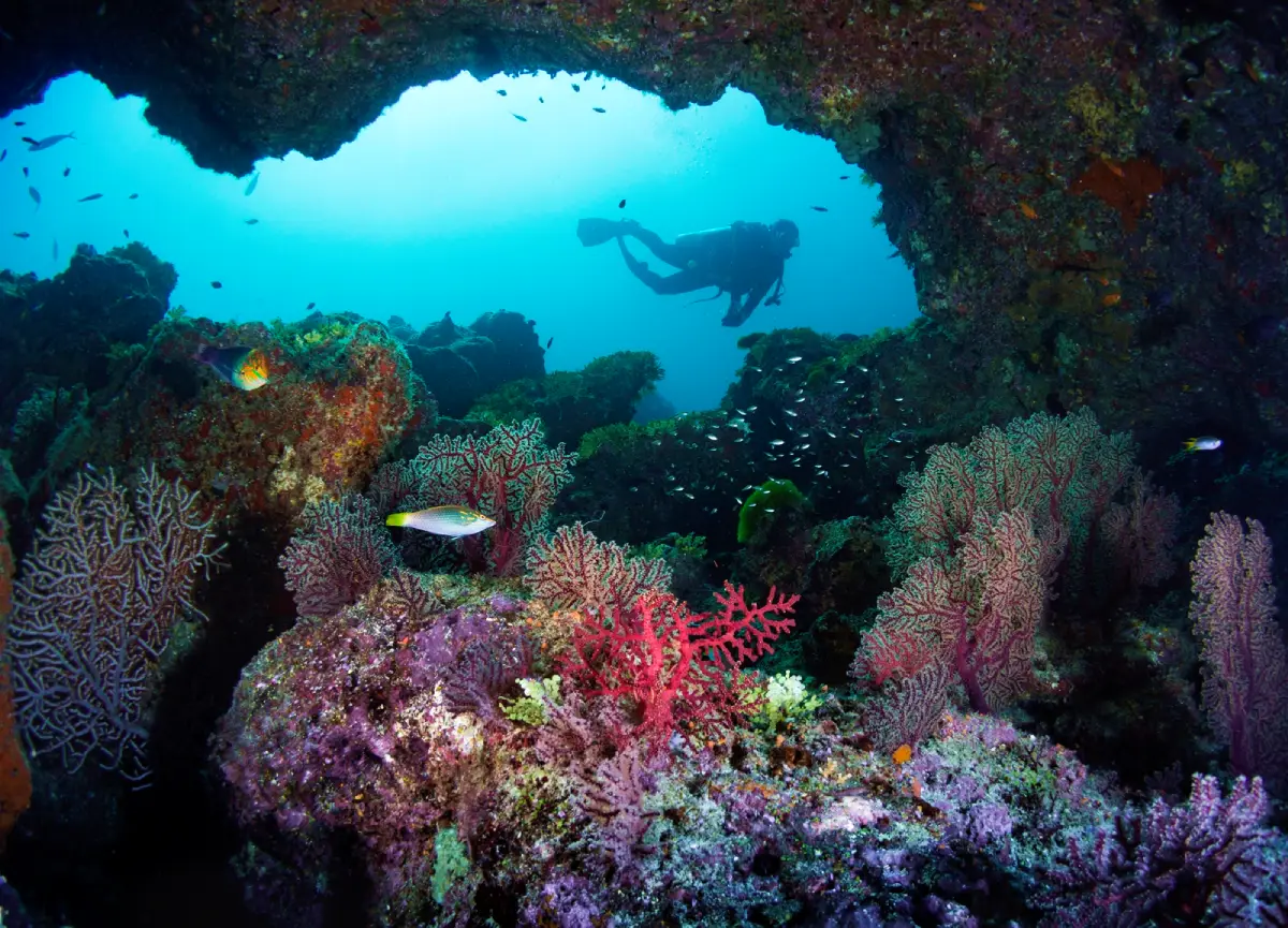
2. Mu Ko Similan National Park is a protected nature destination in Phang Nga, southern Thailand. Its scenery and visitor experiences range from the most accessible attractions to quieter natural environments where access depends on season, weather and conservation management. Granite boulders distinguish these islands from the limestone scenery found elsewhere on the Andaman coast. Sail Rock provides the best-known viewpoint, while beaches and offshore reefs support snorkeling and experienced diving.
Main Highlights: Sail Rock viewpoint, Ko Similan (Island 8), Ko Miang (Island 4), Princess Beach and coral reefs.
Landscape and Natural Features: Granite boulders distinguish these islands from the limestone scenery found elsewhere on the Andaman coast. Sail Rock provides the best-known viewpoint, while beaches and offshore reefs support snorkeling and experienced diving. The setting illustrates the close connections between local geology, plant communities, watercourses and wildlife. Different parts of the park may have different conditions and visitor facilities, especially where the area extends across mountains, coastlines or offshore islands.
Ecology and Conservation: This protected landscape contributes to the conservation of southern Thailand’s forests, watersheds, shorelines or marine habitats as relevant to the area. Visitors should stay on designated trails or boat routes, avoid disturbing wildlife and vegetation, take rubbish away and follow the rules of the responsible conservation authority. Fragile cave formations, seagrass beds and coral reefs must not be touched or damaged.
Things to Do: Explore the principal attractions listed above, enjoy nature photography and use the authorized walking, sightseeing or boat routes appropriate to the destination. Activities involving caves, offshore islands, strong currents or remote forests should be undertaken only where permitted and with suitable local guidance. Weather can change quickly in southern Thailand, particularly during monsoon periods.
Getting There: Boats commonly depart from Thap Lamu Pier near Khao Lak. The marine park closes during part of the southwest monsoon season and access is restricted to designated islands. Confirm current opening dates, local transport connections and any seasonal closures before departure.
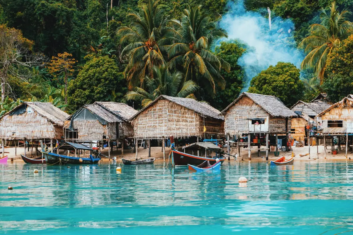
3. Mu Ko Surin National Park is a protected nature destination in Phang Nga, southern Thailand. Its scenery and visitor experiences range from the most accessible attractions to quieter natural environments where access depends on season, weather and conservation management. The Surin Islands are especially valued for coral reefs that can be appreciated while snorkeling. Quiet bays sit below forested hills, and the Moken community has a long cultural relationship with navigation, fishing and island life.
Main Highlights: Ko Surin Nuea, Ko Surin Tai, Ao Mai Ngam, Ao Chong Khat, shallow reefs and the Moken community.
Landscape and Natural Features: The Surin Islands are especially valued for coral reefs that can be appreciated while snorkeling. Quiet bays sit below forested hills, and the Moken community has a long cultural relationship with navigation, fishing and island life. The setting illustrates the close connections between local geology, plant communities, watercourses and wildlife. Different parts of the park may have different conditions and visitor facilities, especially where the area extends across mountains, coastlines or offshore islands.
Ecology and Conservation: This protected landscape contributes to the conservation of southern Thailand’s forests, watersheds, shorelines or marine habitats as relevant to the area. Visitors should stay on designated trails or boat routes, avoid disturbing wildlife and vegetation, take rubbish away and follow the rules of the responsible conservation authority. Fragile cave formations, seagrass beds and coral reefs must not be touched or damaged.
Things to Do: Explore the principal attractions listed above, enjoy nature photography and use the authorized walking, sightseeing or boat routes appropriate to the destination. Activities involving caves, offshore islands, strong currents or remote forests should be undertaken only where permitted and with suitable local guidance. Weather can change quickly in southern Thailand, particularly during monsoon periods.
Getting There: Travel to Khura Buri in Phang Nga and take an authorized boat during the designated marine tourism season. Respect community privacy and follow coral-protection rules. Confirm current opening dates, local transport connections and any seasonal closures before departure.
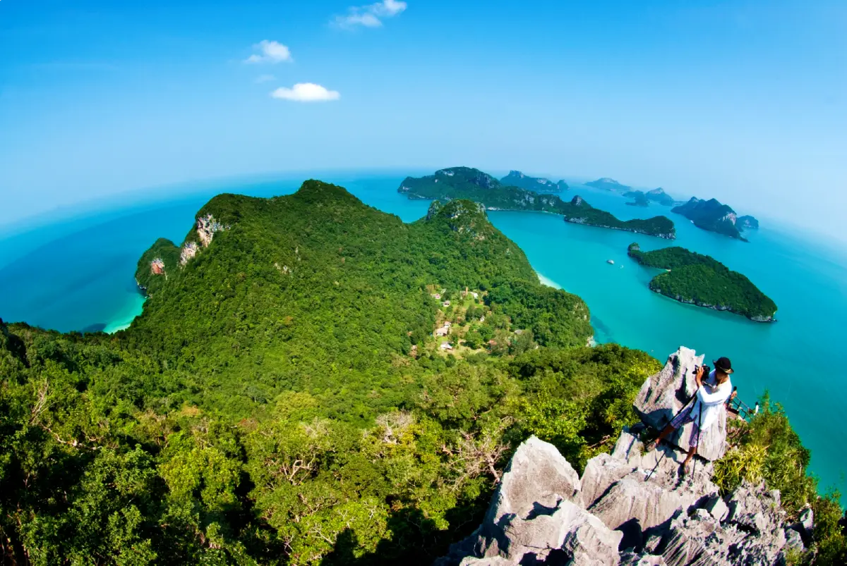
4. Mu Ko Ang Thong National Park is a protected nature destination in Surat Thani, southern Thailand. Its scenery and visitor experiences range from the most accessible attractions to quieter natural environments where access depends on season, weather and conservation management. Dozens of limestone islands rise above the Gulf of Thailand. The climb on Ko Wua Ta Lap reveals a panorama of the archipelago, while Ko Mae Ko contains the distinctive inland lagoon known as Thale Nai.
Main Highlights: Ko Wua Ta Lap, Pha Chan Charat viewpoint, Ko Mae Ko, the inland saltwater lagoon and sea kayaking.
Landscape and Natural Features: Dozens of limestone islands rise above the Gulf of Thailand. The climb on Ko Wua Ta Lap reveals a panorama of the archipelago, while Ko Mae Ko contains the distinctive inland lagoon known as Thale Nai. The setting illustrates the close connections between local geology, plant communities, watercourses and wildlife. Different parts of the park may have different conditions and visitor facilities, especially where the area extends across mountains, coastlines or offshore islands.
Ecology and Conservation: This protected landscape contributes to the conservation of southern Thailand’s forests, watersheds, shorelines or marine habitats as relevant to the area. Visitors should stay on designated trails or boat routes, avoid disturbing wildlife and vegetation, take rubbish away and follow the rules of the responsible conservation authority. Fragile cave formations, seagrass beds and coral reefs must not be touched or damaged.
Things to Do: Explore the principal attractions listed above, enjoy nature photography and use the authorized walking, sightseeing or boat routes appropriate to the destination. Activities involving caves, offshore islands, strong currents or remote forests should be undertaken only where permitted and with suitable local guidance. Weather can change quickly in southern Thailand, particularly during monsoon periods.
Getting There: Day cruises generally operate from Ko Samui or Surat Thani coastal departure points. Access to individual islands depends on sea conditions and park regulations. Confirm current opening dates, local transport connections and any seasonal closures before departure.
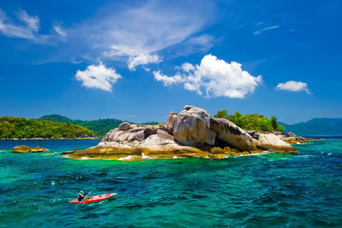
5. Tarutao National Park is a protected nature destination in Satun, southern Thailand. Its scenery and visitor experiences range from the most accessible attractions to quieter natural environments where access depends on season, weather and conservation management. Tarutao combines beaches and coral habitats with an unusual historical legacy. Ao Talo Wao preserves the memory of the island’s former penal settlement, while the more southerly islands offer forest viewpoints and clear tropical seas.
Main Highlights: Tarutao Island, Ao Phante Malaka, Ao Talo Wao, Ko Adang, Ko Rawi and Ko Lipe.
Landscape and Natural Features: Tarutao combines beaches and coral habitats with an unusual historical legacy. Ao Talo Wao preserves the memory of the island’s former penal settlement, while the more southerly islands offer forest viewpoints and clear tropical seas. The setting illustrates the close connections between local geology, plant communities, watercourses and wildlife. Different parts of the park may have different conditions and visitor facilities, especially where the area extends across mountains, coastlines or offshore islands.
Ecology and Conservation: This protected landscape contributes to the conservation of southern Thailand’s forests, watersheds, shorelines or marine habitats as relevant to the area. Visitors should stay on designated trails or boat routes, avoid disturbing wildlife and vegetation, take rubbish away and follow the rules of the responsible conservation authority. Fragile cave formations, seagrass beds and coral reefs must not be touched or damaged.
Things to Do: Explore the principal attractions listed above, enjoy nature photography and use the authorized walking, sightseeing or boat routes appropriate to the destination. Activities involving caves, offshore islands, strong currents or remote forests should be undertaken only where permitted and with suitable local guidance. Weather can change quickly in southern Thailand, particularly during monsoon periods.
Getting There: Pak Bara Pier in La-ngu District is a principal departure point. Check seasonal boat routes and the status of the specific island you intend to visit. Confirm current opening dates, local transport connections and any seasonal closures before departure.
Map (GPS):Open Directions to Tarutao National Park
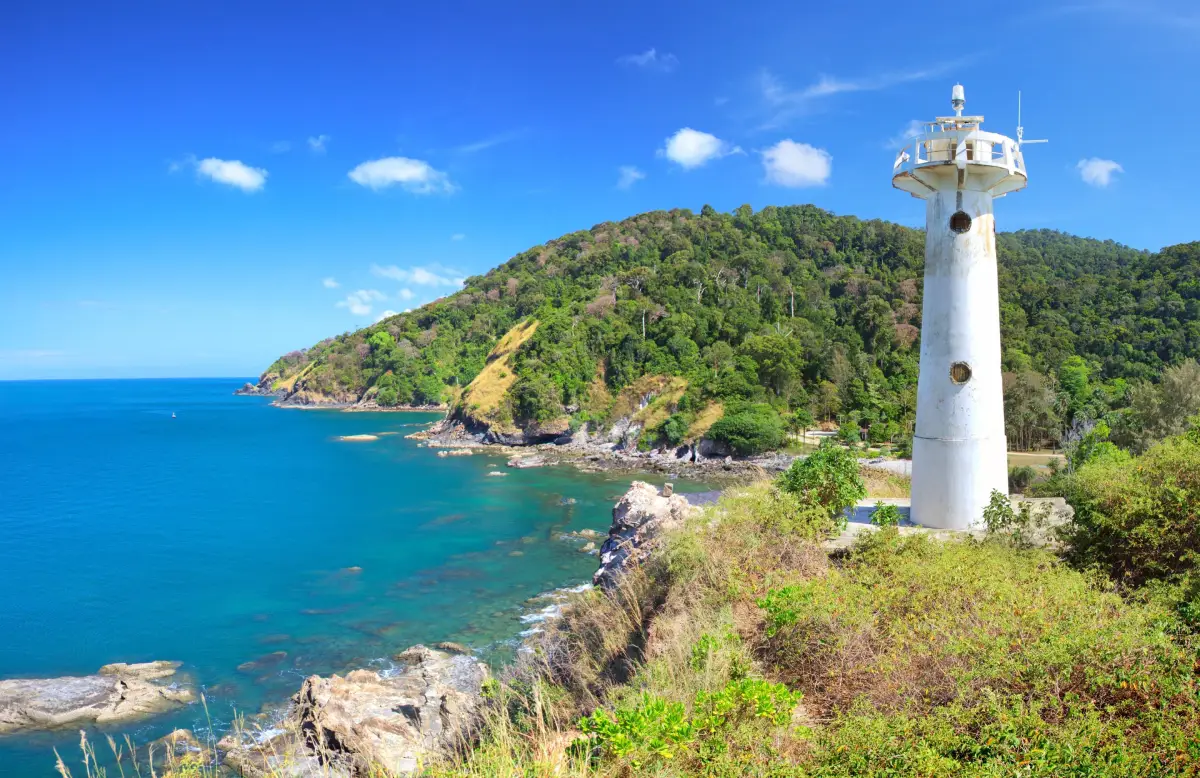
6. Mu Ko Lanta National Park is a protected nature destination in Krabi, southern Thailand. Its scenery and visitor experiences range from the most accessible attractions to quieter natural environments where access depends on season, weather and conservation management. The lighthouse at the southern tip of Ko Lanta Yai looks over rocky headlands and the Andaman Sea. Offshore Ko Rok is prized for white sand and shallow reefs; villages on Ko Lanta add fishing traditions and local culture.
Main Highlights: Laem Tanod lighthouse, Ko Lanta Yai, Ko Rok Nok, Ko Rok Nai, Ko Ngai and snorkeling reefs.
Landscape and Natural Features: The lighthouse at the southern tip of Ko Lanta Yai looks over rocky headlands and the Andaman Sea. Offshore Ko Rok is prized for white sand and shallow reefs; villages on Ko Lanta add fishing traditions and local culture. The setting illustrates the close connections between local geology, plant communities, watercourses and wildlife. Different parts of the park may have different conditions and visitor facilities, especially where the area extends across mountains, coastlines or offshore islands.
Ecology and Conservation: This protected landscape contributes to the conservation of southern Thailand’s forests, watersheds, shorelines or marine habitats as relevant to the area. Visitors should stay on designated trails or boat routes, avoid disturbing wildlife and vegetation, take rubbish away and follow the rules of the responsible conservation authority. Fragile cave formations, seagrass beds and coral reefs must not be touched or damaged.
Things to Do: Explore the principal attractions listed above, enjoy nature photography and use the authorized walking, sightseeing or boat routes appropriate to the destination. Activities involving caves, offshore islands, strong currents or remote forests should be undertaken only where permitted and with suitable local guidance. Weather can change quickly in southern Thailand, particularly during monsoon periods.
Getting There: Reach Ko Lanta Yai by road and vehicle ferry; use licensed boat services for Ko Rok and other outlying islands, which have seasonal access rules. Confirm current opening dates, local transport connections and any seasonal closures before departure.
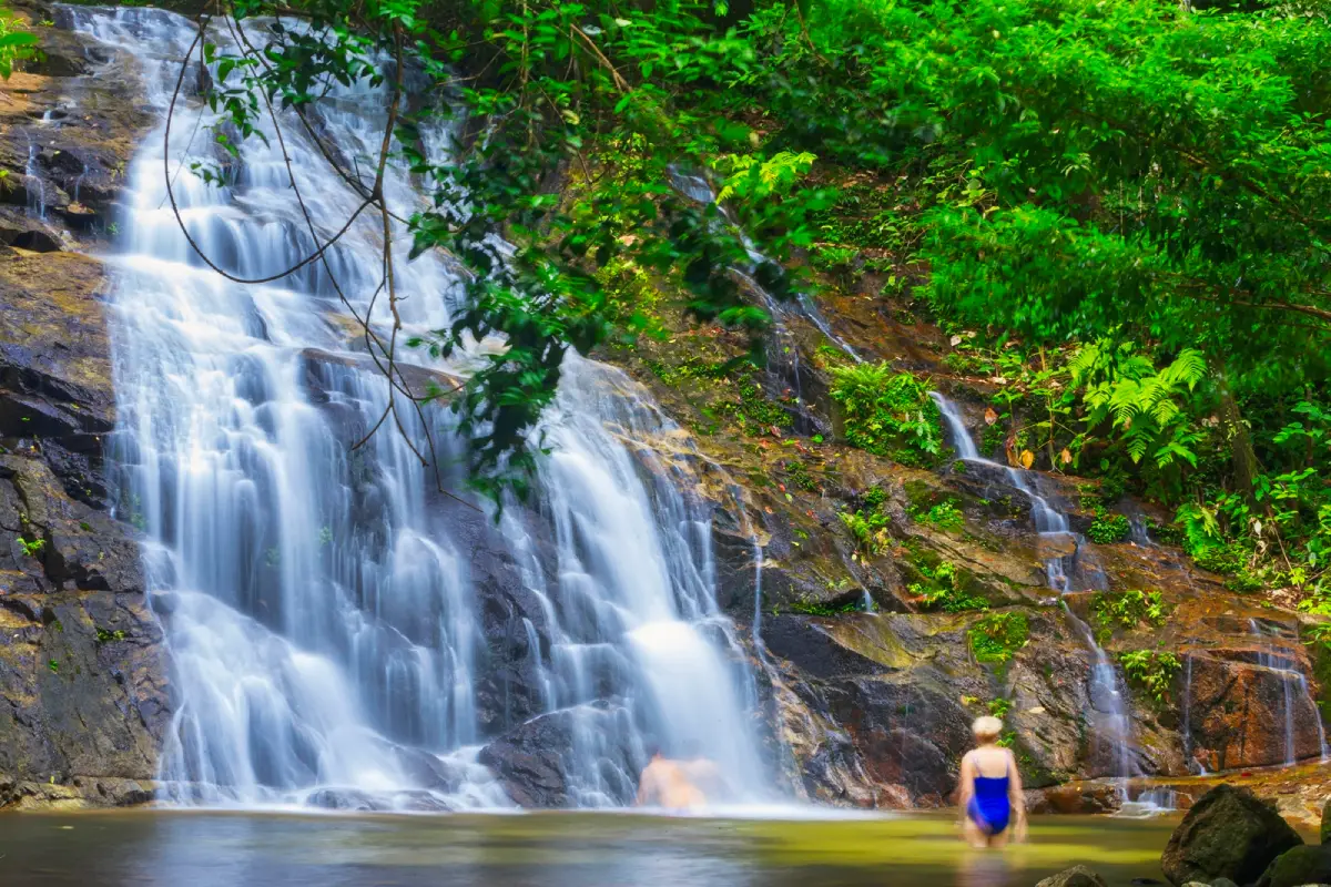
7. Khao Lak–Lam Ru National Park is a protected nature destination in Phang Nga, southern Thailand. Its scenery and visitor experiences range from the most accessible attractions to quieter natural environments where access depends on season, weather and conservation management. This park brings together two seemingly different landscapes: rainforest-covered hills and a rocky stretch of Andaman shoreline. A forest trail leads to Small Beach, while inland waterfalls provide a cooler experience.
Main Highlights: Small Beach, Lam Ru Waterfall, Ton Chong Fa Waterfall, rainforest and coastal trails.
Landscape and Natural Features: This park brings together two seemingly different landscapes: rainforest-covered hills and a rocky stretch of Andaman shoreline. A forest trail leads to Small Beach, while inland waterfalls provide a cooler experience. The setting illustrates the close connections between local geology, plant communities, watercourses and wildlife. Different parts of the park may have different conditions and visitor facilities, especially where the area extends across mountains, coastlines or offshore islands.
Ecology and Conservation: This protected landscape contributes to the conservation of southern Thailand’s forests, watersheds, shorelines or marine habitats as relevant to the area. Visitors should stay on designated trails or boat routes, avoid disturbing wildlife and vegetation, take rubbish away and follow the rules of the responsible conservation authority. Fragile cave formations, seagrass beds and coral reefs must not be touched or damaged.
Things to Do: Explore the principal attractions listed above, enjoy nature photography and use the authorized walking, sightseeing or boat routes appropriate to the destination. Activities involving caves, offshore islands, strong currents or remote forests should be undertaken only where permitted and with suitable local guidance. Weather can change quickly in southern Thailand, particularly during monsoon periods.
Getting There: Follow Highway 4 through the Khao Lak area. Coastal headquarters and inland waterfall entrances are separate, so choose the right access point before leaving. Confirm current opening dates, local transport connections and any seasonal closures before departure.
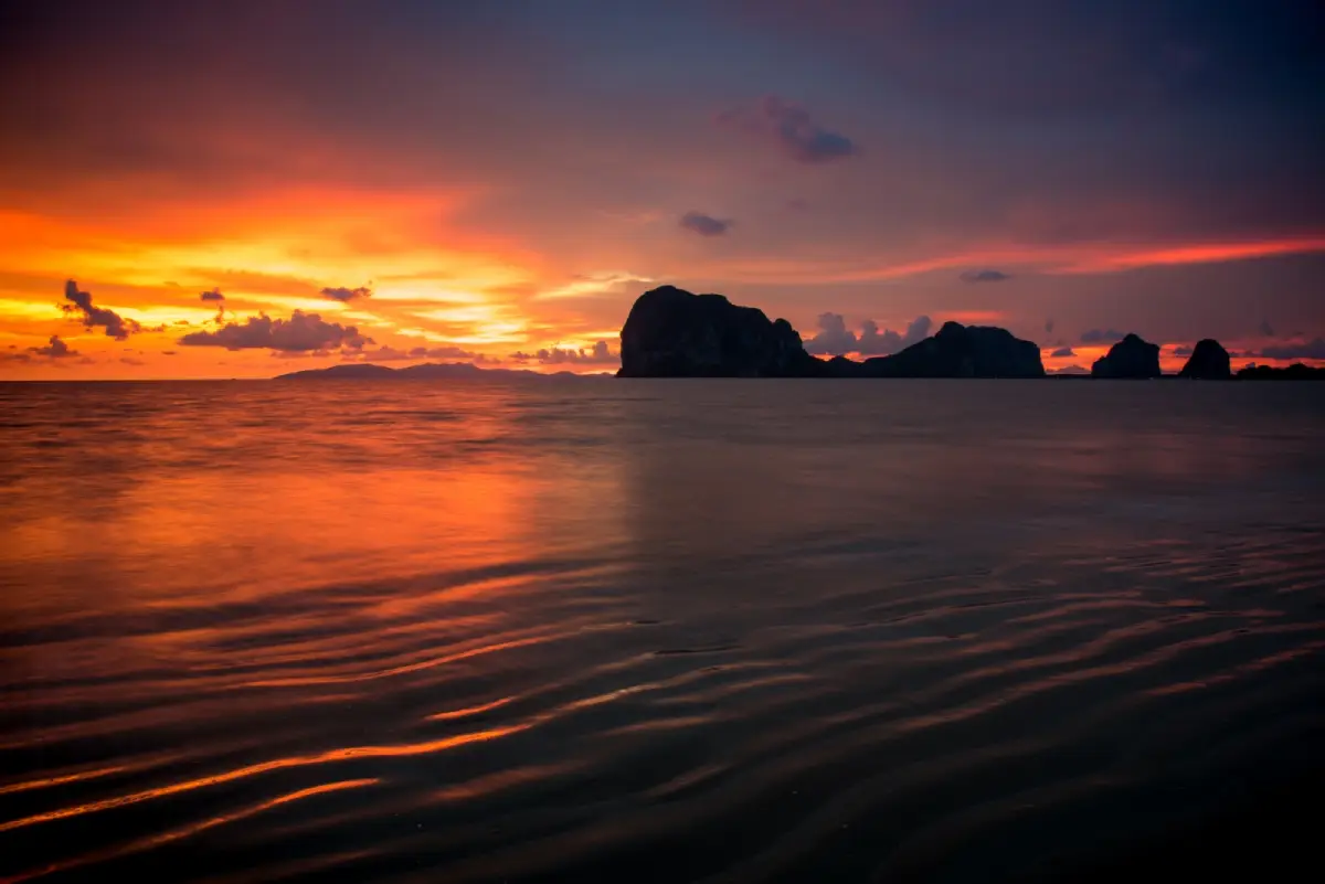
8. Hat Chao Mai National Park is a protected nature destination in Trang, southern Thailand. Its scenery and visitor experiences range from the most accessible attractions to quieter natural environments where access depends on season, weather and conservation management. Trang’s coast combines limestone islands, sandy beaches and seagrass meadows that are essential to dugongs. The Emerald Cave on Ko Muk can only be entered under suitable tidal and sea conditions.
Main Highlights: Hat Chao Mai, Pak Meng Beach, Chang Lang Beach, Ko Muk, Emerald Cave, Ko Kradan and seagrass beds.
Landscape and Natural Features: Trang’s coast combines limestone islands, sandy beaches and seagrass meadows that are essential to dugongs. The Emerald Cave on Ko Muk can only be entered under suitable tidal and sea conditions. The setting illustrates the close connections between local geology, plant communities, watercourses and wildlife. Different parts of the park may have different conditions and visitor facilities, especially where the area extends across mountains, coastlines or offshore islands.
Ecology and Conservation: This protected landscape contributes to the conservation of southern Thailand’s forests, watersheds, shorelines or marine habitats as relevant to the area. Visitors should stay on designated trails or boat routes, avoid disturbing wildlife and vegetation, take rubbish away and follow the rules of the responsible conservation authority. Fragile cave formations, seagrass beds and coral reefs must not be touched or damaged.
Things to Do: Explore the principal attractions listed above, enjoy nature photography and use the authorized walking, sightseeing or boat routes appropriate to the destination. Activities involving caves, offshore islands, strong currents or remote forests should be undertaken only where permitted and with suitable local guidance. Weather can change quickly in southern Thailand, particularly during monsoon periods.
Getting There: Roads reach the mainland beaches, while Ko Muk and Ko Kradan require boat travel. Use an experienced local operator for Emerald Cave. Confirm current opening dates, local transport connections and any seasonal closures before departure.
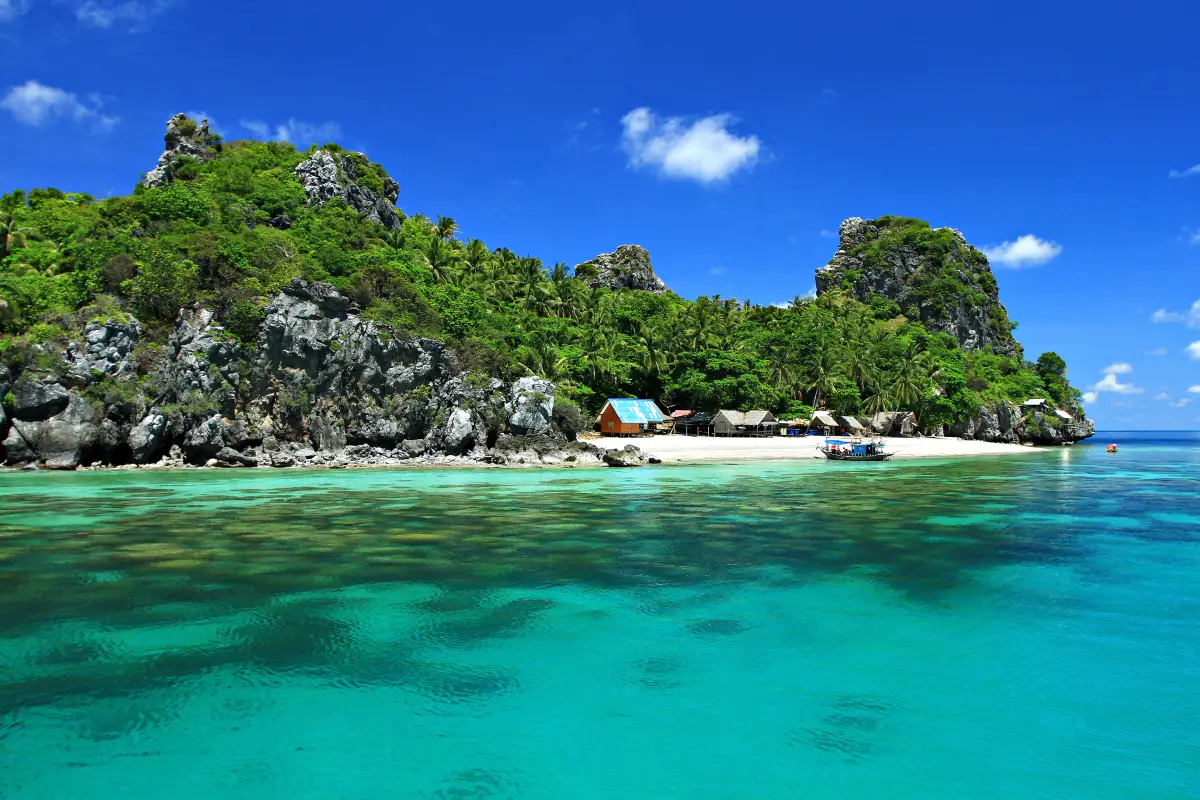
9. Mu Ko Chumphon National Park is a protected nature destination in Chumphon, southern Thailand. Its scenery and visitor experiences range from the most accessible attractions to quieter natural environments where access depends on season, weather and conservation management. Chumphon’s protected islands include steep rocky islets, nesting sites for seabirds and snorkeling areas. The shallow coastal zone also contains mangrove habitats that link the islands to local fishing communities.
Main Highlights: Ko Ngam Yai, Ko Ngam Noi, Ko Mattra, Ko Rang Ka Chio and coral reefs.
Landscape and Natural Features: Chumphon’s protected islands include steep rocky islets, nesting sites for seabirds and snorkeling areas. The shallow coastal zone also contains mangrove habitats that link the islands to local fishing communities. The setting illustrates the close connections between local geology, plant communities, watercourses and wildlife. Different parts of the park may have different conditions and visitor facilities, especially where the area extends across mountains, coastlines or offshore islands.
Ecology and Conservation: This protected landscape contributes to the conservation of southern Thailand’s forests, watersheds, shorelines or marine habitats as relevant to the area. Visitors should stay on designated trails or boat routes, avoid disturbing wildlife and vegetation, take rubbish away and follow the rules of the responsible conservation authority. Fragile cave formations, seagrass beds and coral reefs must not be touched or damaged.
Things to Do: Explore the principal attractions listed above, enjoy nature photography and use the authorized walking, sightseeing or boat routes appropriate to the destination. Activities involving caves, offshore islands, strong currents or remote forests should be undertaken only where permitted and with suitable local guidance. Weather can change quickly in southern Thailand, particularly during monsoon periods.
Getting There: Take a local boat from the Chumphon coast in suitable weather. Some islands have restricted landing because of wildlife or environmental protection. Confirm current opening dates, local transport connections and any seasonal closures before departure.
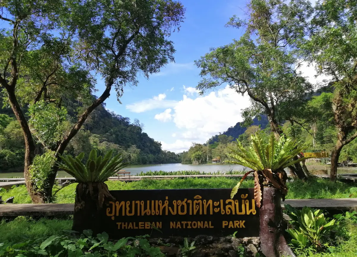
10. Thale Ban National Park is a protected nature destination in Satun, southern Thailand. Its scenery and visitor experiences range from the most accessible attractions to quieter natural environments where access depends on season, weather and conservation management. Unlike Satun’s famous island parks, Thale Ban is centered on a freshwater lake enclosed by rainforest-covered mountains near the Malaysian border. Wetland life and the calls of local amphibians are part of its identity.
Main Highlights: Bueng Thale Ban freshwater lake, Khao Wang Pra, forest trails, wetland wildlife and calling frogs.
Landscape and Natural Features: Unlike Satun’s famous island parks, Thale Ban is centered on a freshwater lake enclosed by rainforest-covered mountains near the Malaysian border. Wetland life and the calls of local amphibians are part of its identity. The setting illustrates the close connections between local geology, plant communities, watercourses and wildlife. Different parts of the park may have different conditions and visitor facilities, especially where the area extends across mountains, coastlines or offshore islands.
Ecology and Conservation: This protected landscape contributes to the conservation of southern Thailand’s forests, watersheds, shorelines or marine habitats as relevant to the area. Visitors should stay on designated trails or boat routes, avoid disturbing wildlife and vegetation, take rubbish away and follow the rules of the responsible conservation authority. Fragile cave formations, seagrass beds and coral reefs must not be touched or damaged.
Things to Do: Explore the principal attractions listed above, enjoy nature photography and use the authorized walking, sightseeing or boat routes appropriate to the destination. Activities involving caves, offshore islands, strong currents or remote forests should be undertaken only where permitted and with suitable local guidance. Weather can change quickly in southern Thailand, particularly during monsoon periods.
Getting There: From Satun, drive toward Khuan Don and the Wang Prachan border route. Nature walks and lake viewing are suited to visitors who prefer gentle forest activities. Confirm current opening dates, local transport connections and any seasonal closures before departure.
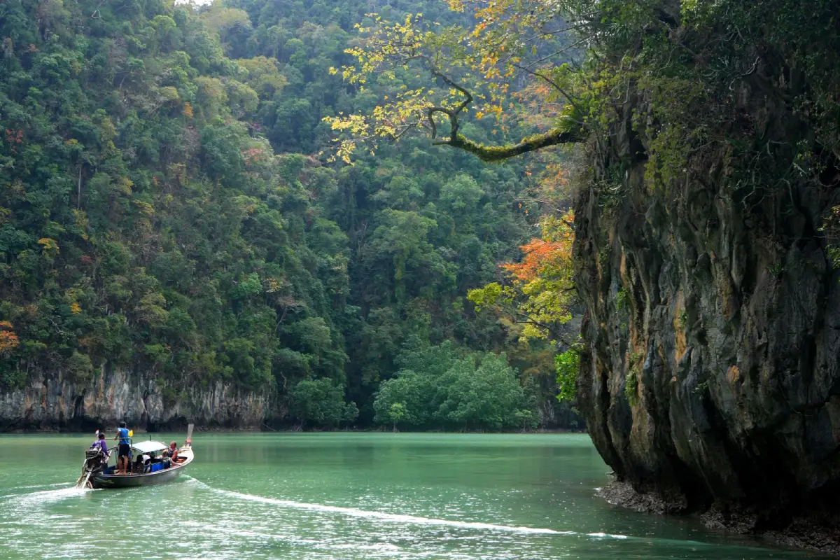
11. Than Bok Khorani National Park is a protected nature destination in Krabi, southern Thailand. Its scenery and visitor experiences range from the most accessible attractions to quieter natural environments where access depends on season, weather and conservation management. Clear freshwater flows through shaded pools and limestone outcrops near Ao Luek. Offshore areas include Ko Hong and smaller islands, while Phi Hua To Cave preserves prehistoric painted figures on the rock walls.
Main Highlights: Than Bok Khorani stream, Phi Hua To Cave, prehistoric cave paintings, Khao Karos and Ko Hong.
Landscape and Natural Features: Clear freshwater flows through shaded pools and limestone outcrops near Ao Luek. Offshore areas include Ko Hong and smaller islands, while Phi Hua To Cave preserves prehistoric painted figures on the rock walls. The setting illustrates the close connections between local geology, plant communities, watercourses and wildlife. Different parts of the park may have different conditions and visitor facilities, especially where the area extends across mountains, coastlines or offshore islands.
Ecology and Conservation: This protected landscape contributes to the conservation of southern Thailand’s forests, watersheds, shorelines or marine habitats as relevant to the area. Visitors should stay on designated trails or boat routes, avoid disturbing wildlife and vegetation, take rubbish away and follow the rules of the responsible conservation authority. Fragile cave formations, seagrass beds and coral reefs must not be touched or damaged.
Things to Do: Explore the principal attractions listed above, enjoy nature photography and use the authorized walking, sightseeing or boat routes appropriate to the destination. Activities involving caves, offshore islands, strong currents or remote forests should be undertaken only where permitted and with suitable local guidance. Weather can change quickly in southern Thailand, particularly during monsoon periods.
Getting There: Drive to Ao Luek for the freshwater visitor area. Cave exploration and island excursions begin at separate boat departure points. Confirm current opening dates, local transport connections and any seasonal closures before departure.
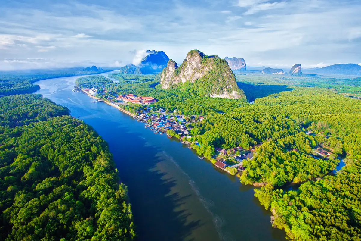
12. Ao Phang Nga National Park is a protected nature destination in Phang Nga, southern Thailand. Its scenery and visitor experiences range from the most accessible attractions to quieter natural environments where access depends on season, weather and conservation management. Phang Nga Bay’s limestone towers emerge from shallow coastal waters. Boat trips connect the famous needle-shaped Khao Tapu with the stilt-house community of Ko Panyi and mangrove channels around sea caves.
Main Highlights: James Bond Island, Khao Phing Kan, Ko Panyi, sea caves, prehistoric paintings and mangroves.
Landscape and Natural Features: Phang Nga Bay’s limestone towers emerge from shallow coastal waters. Boat trips connect the famous needle-shaped Khao Tapu with the stilt-house community of Ko Panyi and mangrove channels around sea caves. The setting illustrates the close connections between local geology, plant communities, watercourses and wildlife. Different parts of the park may have different conditions and visitor facilities, especially where the area extends across mountains, coastlines or offshore islands.
Ecology and Conservation: This protected landscape contributes to the conservation of southern Thailand’s forests, watersheds, shorelines or marine habitats as relevant to the area. Visitors should stay on designated trails or boat routes, avoid disturbing wildlife and vegetation, take rubbish away and follow the rules of the responsible conservation authority. Fragile cave formations, seagrass beds and coral reefs must not be touched or damaged.
Things to Do: Explore the principal attractions listed above, enjoy nature photography and use the authorized walking, sightseeing or boat routes appropriate to the destination. Activities involving caves, offshore islands, strong currents or remote forests should be undertaken only where permitted and with suitable local guidance. Weather can change quickly in southern Thailand, particularly during monsoon periods.
Getting There: Most itineraries begin from a bay-side pier in Phang Nga. Canoeing through caves is influenced by tides, so rely on local boat crews and park guidance. Confirm current opening dates, local transport connections and any seasonal closures before departure.
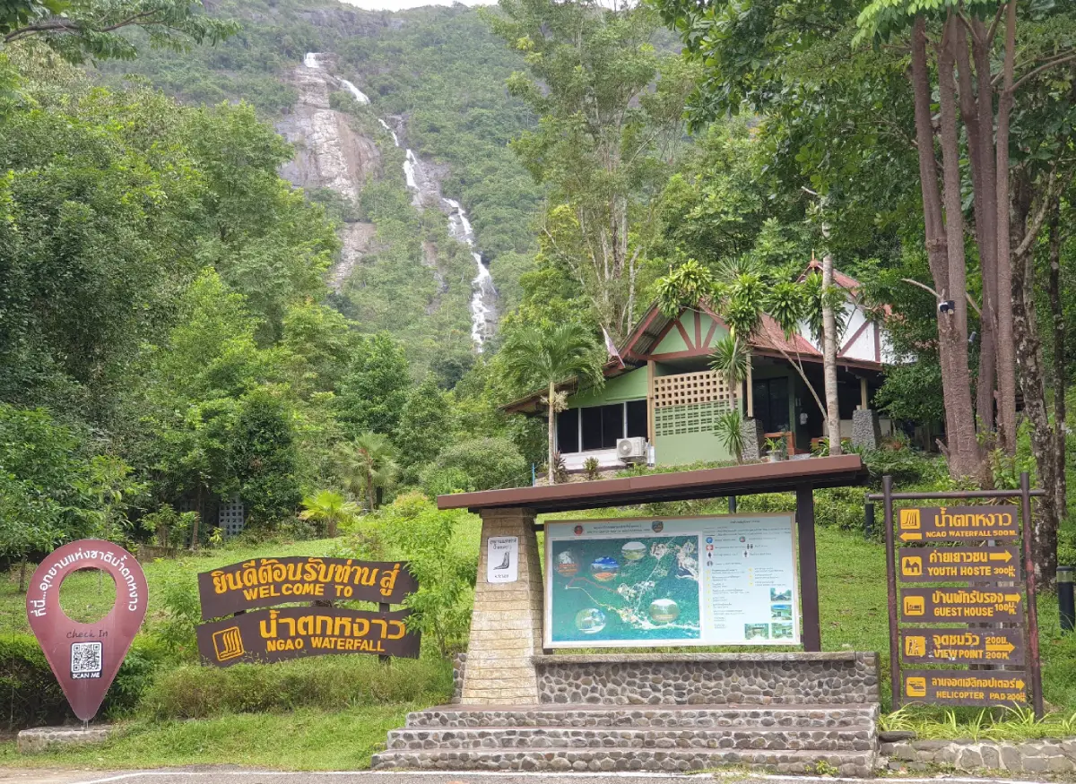
13. Namtok Ngao National Park is a protected nature destination in Ranong, southern Thailand. Its scenery and visitor experiences range from the most accessible attractions to quieter natural environments where access depends on season, weather and conservation management. The tall white ribbon of Ngao Waterfall is visible against green mountains near Ranong. Streams and damp forest support rich plant life, and the nearby hot springs offer a contrasting geological attraction.
Main Highlights: Ngao Waterfall, Ban Phra Rang Hot Springs and southern rainforest.
Landscape and Natural Features: The tall white ribbon of Ngao Waterfall is visible against green mountains near Ranong. Streams and damp forest support rich plant life, and the nearby hot springs offer a contrasting geological attraction. The setting illustrates the close connections between local geology, plant communities, watercourses and wildlife. Different parts of the park may have different conditions and visitor facilities, especially where the area extends across mountains, coastlines or offshore islands.
Ecology and Conservation: This protected landscape contributes to the conservation of southern Thailand’s forests, watersheds, shorelines or marine habitats as relevant to the area. Visitors should stay on designated trails or boat routes, avoid disturbing wildlife and vegetation, take rubbish away and follow the rules of the responsible conservation authority. Fragile cave formations, seagrass beds and coral reefs must not be touched or damaged.
Things to Do: Explore the principal attractions listed above, enjoy nature photography and use the authorized walking, sightseeing or boat routes appropriate to the destination. Activities involving caves, offshore islands, strong currents or remote forests should be undertaken only where permitted and with suitable local guidance. Weather can change quickly in southern Thailand, particularly during monsoon periods.
Getting There: Drive south from Ranong town on Highway 4 and follow signs to the waterfall. Trails may become slippery after heavy rain. Confirm current opening dates, local transport connections and any seasonal closures before departure.
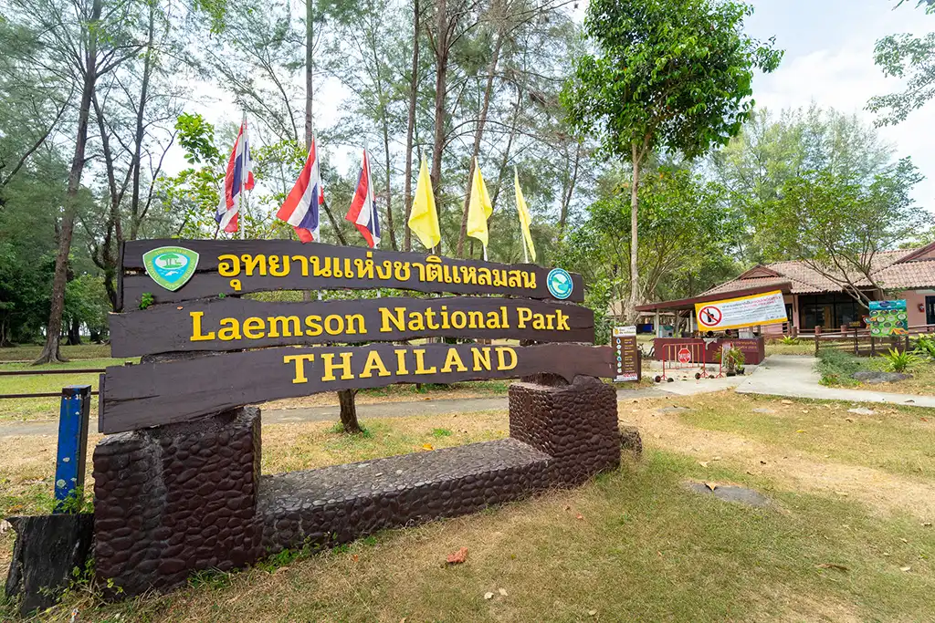
14. Laem Son National Park is a protected nature destination in Ranong and Phang Nga, southern Thailand. Its scenery and visitor experiences range from the most accessible attractions to quieter natural environments where access depends on season, weather and conservation management. Long beaches backed by sea pines meet mangroves and islands on the northern Andaman shore. Ko Kam Tok is particularly known for its curved Ao Khao Khwai beach and tranquil sea views.
Main Highlights: Bang Ben Beach, Ko Kam Tok, Ko Khang Khao, Ko Kam Yai and coastal pine forest.
Landscape and Natural Features: Long beaches backed by sea pines meet mangroves and islands on the northern Andaman shore. Ko Kam Tok is particularly known for its curved Ao Khao Khwai beach and tranquil sea views. The setting illustrates the close connections between local geology, plant communities, watercourses and wildlife. Different parts of the park may have different conditions and visitor facilities, especially where the area extends across mountains, coastlines or offshore islands.
Ecology and Conservation: This protected landscape contributes to the conservation of southern Thailand’s forests, watersheds, shorelines or marine habitats as relevant to the area. Visitors should stay on designated trails or boat routes, avoid disturbing wildlife and vegetation, take rubbish away and follow the rules of the responsible conservation authority. Fragile cave formations, seagrass beds and coral reefs must not be touched or damaged.
Things to Do: Explore the principal attractions listed above, enjoy nature photography and use the authorized walking, sightseeing or boat routes appropriate to the destination. Activities involving caves, offshore islands, strong currents or remote forests should be undertaken only where permitted and with suitable local guidance. Weather can change quickly in southern Thailand, particularly during monsoon periods.
Getting There: From Ranong, head toward Kapoe and Bang Ben Beach. Outlying island trips depend on licensed boat services and the marine season. Confirm current opening dates, local transport connections and any seasonal closures before departure.
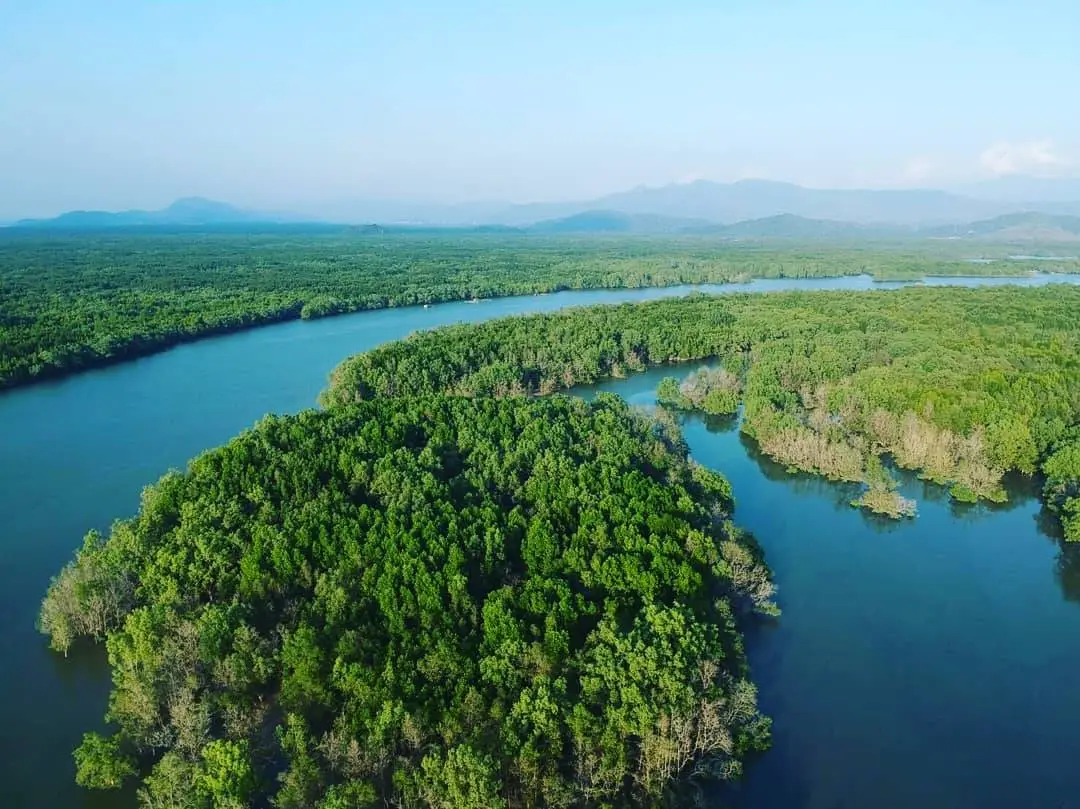
15. Mu Ko Ranong National Park is a protected nature destination in Ranong, southern Thailand. Its scenery and visitor experiences range from the most accessible attractions to quieter natural environments where access depends on season, weather and conservation management. The park protects a network of Ranong islands and coastal habitats. Ko Phayam offers broad beaches, curved bays and established island communities, while nearby Ko Chang has a quieter local atmosphere.
Main Highlights: Ko Phayam, Ko Chang in Ranong, Ao Yai, Ao Khao Khwai and mangroves.
Landscape and Natural Features: The park protects a network of Ranong islands and coastal habitats. Ko Phayam offers broad beaches, curved bays and established island communities, while nearby Ko Chang has a quieter local atmosphere. The setting illustrates the close connections between local geology, plant communities, watercourses and wildlife. Different parts of the park may have different conditions and visitor facilities, especially where the area extends across mountains, coastlines or offshore islands.
Ecology and Conservation: This protected landscape contributes to the conservation of southern Thailand’s forests, watersheds, shorelines or marine habitats as relevant to the area. Visitors should stay on designated trails or boat routes, avoid disturbing wildlife and vegetation, take rubbish away and follow the rules of the responsible conservation authority. Fragile cave formations, seagrass beds and coral reefs must not be touched or damaged.
Things to Do: Explore the principal attractions listed above, enjoy nature photography and use the authorized walking, sightseeing or boat routes appropriate to the destination. Activities involving caves, offshore islands, strong currents or remote forests should be undertaken only where permitted and with suitable local guidance. Weather can change quickly in southern Thailand, particularly during monsoon periods.
Getting There: Use scheduled boats from Ranong to the specific island. Check departure times, weather and local rules before setting off. Confirm current opening dates, local transport connections and any seasonal closures before departure.
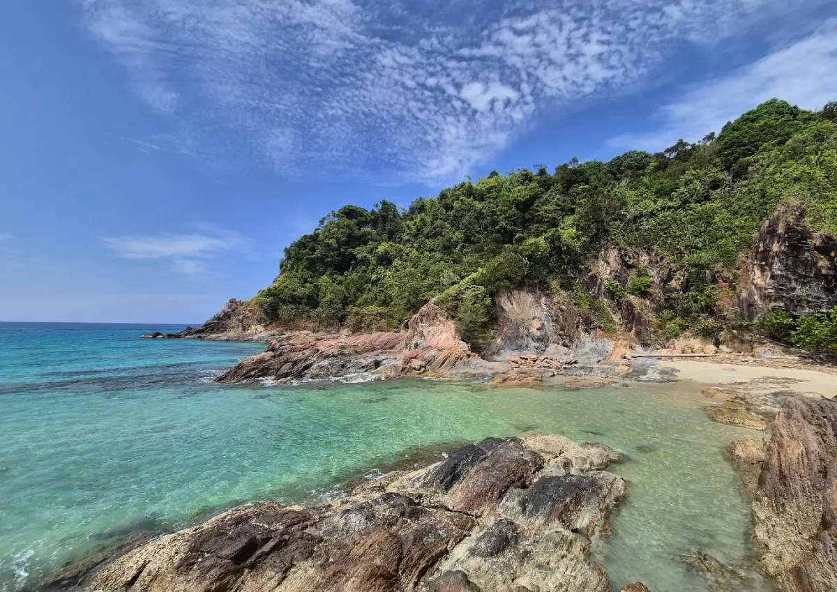
16. Khao Lampi–Hat Thai Mueang National Park is a protected nature destination in Phang Nga, southern Thailand. Its scenery and visitor experiences range from the most accessible attractions to quieter natural environments where access depends on season, weather and conservation management. Forest-covered hills descend toward a long protected Andaman beach. Lam Pi Waterfall has multiple tiers, while Thai Mueang Beach is significant for nesting sea turtles and coastal habitat protection.
Main Highlights: Thai Mueang Beach, Lam Pi Waterfall, Ton Phrai Waterfall, white melaleuca forest and sea turtle conservation.
Landscape and Natural Features: Forest-covered hills descend toward a long protected Andaman beach. Lam Pi Waterfall has multiple tiers, while Thai Mueang Beach is significant for nesting sea turtles and coastal habitat protection. The setting illustrates the close connections between local geology, plant communities, watercourses and wildlife. Different parts of the park may have different conditions and visitor facilities, especially where the area extends across mountains, coastlines or offshore islands.
Ecology and Conservation: This protected landscape contributes to the conservation of southern Thailand’s forests, watersheds, shorelines or marine habitats as relevant to the area. Visitors should stay on designated trails or boat routes, avoid disturbing wildlife and vegetation, take rubbish away and follow the rules of the responsible conservation authority. Fragile cave formations, seagrass beds and coral reefs must not be touched or damaged.
Things to Do: Explore the principal attractions listed above, enjoy nature photography and use the authorized walking, sightseeing or boat routes appropriate to the destination. Activities involving caves, offshore islands, strong currents or remote forests should be undertaken only where permitted and with suitable local guidance. Weather can change quickly in southern Thailand, particularly during monsoon periods.
Getting There: Travel by Highway 4 to Thai Mueang District and choose separate roads for the beach or waterfalls. Respect seasonal turtle nesting restrictions. Confirm current opening dates, local transport connections and any seasonal closures before departure.
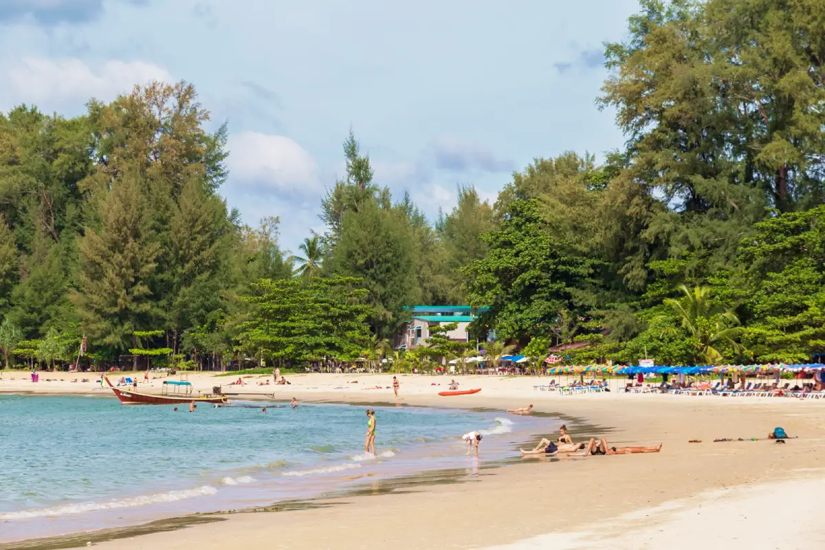
17. Sirinat National Park is a protected nature destination in Phuket, southern Thailand. Its scenery and visitor experiences range from the most accessible attractions to quieter natural environments where access depends on season, weather and conservation management. At Phuket’s northwestern edge, Sirinat protects some of the island’s long sandy beaches and remaining coastal vegetation. The beach near the airport is well known, but visitor access must remain outside aviation-restricted areas.
Main Highlights: Nai Yang Beach, Mai Khao Beach, Nai Thon, coastal pines and mangrove habitats.
Landscape and Natural Features: At Phuket’s northwestern edge, Sirinat protects some of the island’s long sandy beaches and remaining coastal vegetation. The beach near the airport is well known, but visitor access must remain outside aviation-restricted areas. The setting illustrates the close connections between local geology, plant communities, watercourses and wildlife. Different parts of the park may have different conditions and visitor facilities, especially where the area extends across mountains, coastlines or offshore islands.
Ecology and Conservation: This protected landscape contributes to the conservation of southern Thailand’s forests, watersheds, shorelines or marine habitats as relevant to the area. Visitors should stay on designated trails or boat routes, avoid disturbing wildlife and vegetation, take rubbish away and follow the rules of the responsible conservation authority. Fragile cave formations, seagrass beds and coral reefs must not be touched or damaged.
Things to Do: Explore the principal attractions listed above, enjoy nature photography and use the authorized walking, sightseeing or boat routes appropriate to the destination. Activities involving caves, offshore islands, strong currents or remote forests should be undertaken only where permitted and with suitable local guidance. Weather can change quickly in southern Thailand, particularly during monsoon periods.
Getting There: Follow the airport road toward Nai Yang or continue north toward Mai Khao. Observe beach flags and warnings about dangerous monsoon surf. Confirm current opening dates, local transport connections and any seasonal closures before departure.
Map (GPS):Open Directions to Sirinat National Park
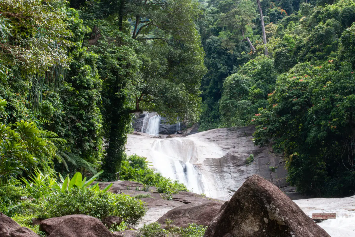
18. Khao Luang National Park is a protected nature destination in Nakhon Si Thammarat, southern Thailand. Its scenery and visitor experiences range from the most accessible attractions to quieter natural environments where access depends on season, weather and conservation management. Khao Luang is the highest mountain in southern Thailand, rising to approximately 1,835 metres. Its rainforest, steep valleys and waterfalls protect major watersheds and mountain wildlife habitats.
Main Highlights: Khao Luang summit, Krung Ching Waterfall, Karom Waterfall, Phrom Lok Waterfall and montane forest.
Landscape and Natural Features: Khao Luang is the highest mountain in southern Thailand, rising to approximately 1,835 metres. Its rainforest, steep valleys and waterfalls protect major watersheds and mountain wildlife habitats. The setting illustrates the close connections between local geology, plant communities, watercourses and wildlife. Different parts of the park may have different conditions and visitor facilities, especially where the area extends across mountains, coastlines or offshore islands.
Ecology and Conservation: This protected landscape contributes to the conservation of southern Thailand’s forests, watersheds, shorelines or marine habitats as relevant to the area. Visitors should stay on designated trails or boat routes, avoid disturbing wildlife and vegetation, take rubbish away and follow the rules of the responsible conservation authority. Fragile cave formations, seagrass beds and coral reefs must not be touched or damaged.
Things to Do: Explore the principal attractions listed above, enjoy nature photography and use the authorized walking, sightseeing or boat routes appropriate to the destination. Activities involving caves, offshore islands, strong currents or remote forests should be undertaken only where permitted and with suitable local guidance. Weather can change quickly in southern Thailand, particularly during monsoon periods.
Getting There: Waterfalls are reached from different districts of Nakhon Si Thammarat. Summit treks require dedicated preparation and may need guides or permits. Confirm current opening dates, local transport connections and any seasonal closures before departure.
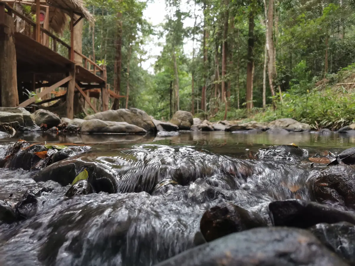
19. Khao Nam Khang National Park is a protected nature destination in Songkhla, southern Thailand. Its scenery and visitor experiences range from the most accessible attractions to quieter natural environments where access depends on season, weather and conservation management. The mountains near Na Thawi combine dense tropical forest with sites linked to the history of the Malayan communist movement. The underground tunnel system provides an unusual insight into life in the forest during that period.
Main Highlights: Khao Nam Khang historical tunnels, Piyamit 5 village, rainforest and border mountains.
Landscape and Natural Features: The mountains near Na Thawi combine dense tropical forest with sites linked to the history of the Malayan communist movement. The underground tunnel system provides an unusual insight into life in the forest during that period. The setting illustrates the close connections between local geology, plant communities, watercourses and wildlife. Different parts of the park may have different conditions and visitor facilities, especially where the area extends across mountains, coastlines or offshore islands.
Ecology and Conservation: This protected landscape contributes to the conservation of southern Thailand’s forests, watersheds, shorelines or marine habitats as relevant to the area. Visitors should stay on designated trails or boat routes, avoid disturbing wildlife and vegetation, take rubbish away and follow the rules of the responsible conservation authority. Fragile cave formations, seagrass beds and coral reefs must not be touched or damaged.
Things to Do: Explore the principal attractions listed above, enjoy nature photography and use the authorized walking, sightseeing or boat routes appropriate to the destination. Activities involving caves, offshore islands, strong currents or remote forests should be undertaken only where permitted and with suitable local guidance. Weather can change quickly in southern Thailand, particularly during monsoon periods.
Getting There: Reach the mountain district from Songkhla via Na Thawi. Check access arrangements and security guidance for routes near the border. Confirm current opening dates, local transport connections and any seasonal closures before departure.
20. Khao Phanom Bencha National Park is a protected nature destination in Krabi, southern Thailand. Its scenery and visitor experiences range from the most accessible attractions to quieter natural environments where access depends on season, weather and conservation management. This mountain park inland from Krabi protects forested slopes, streams and caves. Huai To Waterfall cascades through several levels, while the cave formations reveal the area’s limestone geology.
Main Highlights: Huai To Waterfall, Huai Sade Waterfall, Khao Phueng Cave and Khao Phanom Bencha rainforest.
Landscape and Natural Features: This mountain park inland from Krabi protects forested slopes, streams and caves. Huai To Waterfall cascades through several levels, while the cave formations reveal the area’s limestone geology. The setting illustrates the close connections between local geology, plant communities, watercourses and wildlife. Different parts of the park may have different conditions and visitor facilities, especially where the area extends across mountains, coastlines or offshore islands.
Ecology and Conservation: This protected landscape contributes to the conservation of southern Thailand’s forests, watersheds, shorelines or marine habitats as relevant to the area. Visitors should stay on designated trails or boat routes, avoid disturbing wildlife and vegetation, take rubbish away and follow the rules of the responsible conservation authority. Fragile cave formations, seagrass beds and coral reefs must not be touched or damaged.
Things to Do: Explore the principal attractions listed above, enjoy nature photography and use the authorized walking, sightseeing or boat routes appropriate to the destination. Activities involving caves, offshore islands, strong currents or remote forests should be undertaken only where permitted and with suitable local guidance. Weather can change quickly in southern Thailand, particularly during monsoon periods.
Getting There: Travel inland from Krabi town toward the park’s waterfall visitor area. Some forest and cave routes require more preparation than the main waterfall path. Confirm current opening dates, local transport connections and any seasonal closures before departure.

21. Tai Rom Yen National Park is a protected nature destination in Surat Thani, southern Thailand. Its scenery and visitor experiences range from the most accessible attractions to quieter natural environments where access depends on season, weather and conservation management. Tai Rom Yen preserves a wet tropical forest landscape with high waterfalls and an unusual historical connection to Thailand’s twentieth-century political conflicts. Camp 180 recalls part of that past.
Main Highlights: Dat Fa Waterfall, Mueang Thuat Waterfall, rainforest and the historical Camp 180 area.
Landscape and Natural Features: Tai Rom Yen preserves a wet tropical forest landscape with high waterfalls and an unusual historical connection to Thailand’s twentieth-century political conflicts. Camp 180 recalls part of that past. The setting illustrates the close connections between local geology, plant communities, watercourses and wildlife. Different parts of the park may have different conditions and visitor facilities, especially where the area extends across mountains, coastlines or offshore islands.
Ecology and Conservation: This protected landscape contributes to the conservation of southern Thailand’s forests, watersheds, shorelines or marine habitats as relevant to the area. Visitors should stay on designated trails or boat routes, avoid disturbing wildlife and vegetation, take rubbish away and follow the rules of the responsible conservation authority. Fragile cave formations, seagrass beds and coral reefs must not be touched or damaged.
Things to Do: Explore the principal attractions listed above, enjoy nature photography and use the authorized walking, sightseeing or boat routes appropriate to the destination. Activities involving caves, offshore islands, strong currents or remote forests should be undertaken only where permitted and with suitable local guidance. Weather can change quickly in southern Thailand, particularly during monsoon periods.
Getting There: Approach through Ban Na San or other relevant districts of Surat Thani; waterfalls have distinct entrances and access conditions. Confirm current opening dates, local transport connections and any seasonal closures before departure.
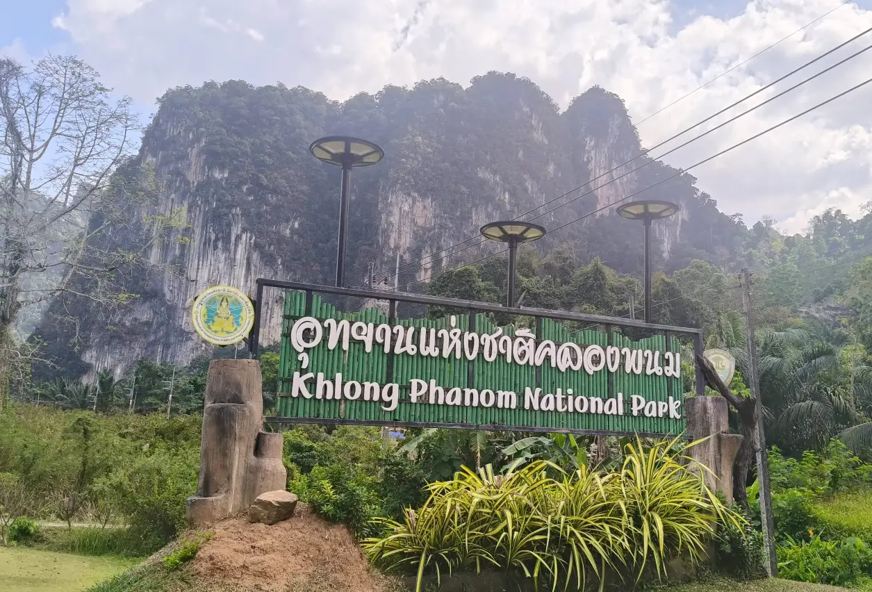
22. Khlong Phanom National Park is a protected nature destination in Surat Thani, southern Thailand. Its scenery and visitor experiences range from the most accessible attractions to quieter natural environments where access depends on season, weather and conservation management. Steep limestone cliffs and hidden caves characterize this quieter forest park near Khao Sok. Watercourses have carved underground passages, while rainforest trails lead to streams and waterfalls.
Main Highlights: limestone caves, Kaeo Cave, Nam Lot Cave, Ton Chan Waterfall and Khlong Phanom forests.
Landscape and Natural Features: Steep limestone cliffs and hidden caves characterize this quieter forest park near Khao Sok. Watercourses have carved underground passages, while rainforest trails lead to streams and waterfalls. The setting illustrates the close connections between local geology, plant communities, watercourses and wildlife. Different parts of the park may have different conditions and visitor facilities, especially where the area extends across mountains, coastlines or offshore islands.
Ecology and Conservation: This protected landscape contributes to the conservation of southern Thailand’s forests, watersheds, shorelines or marine habitats as relevant to the area. Visitors should stay on designated trails or boat routes, avoid disturbing wildlife and vegetation, take rubbish away and follow the rules of the responsible conservation authority. Fragile cave formations, seagrass beds and coral reefs must not be touched or damaged.
Things to Do: Explore the principal attractions listed above, enjoy nature photography and use the authorized walking, sightseeing or boat routes appropriate to the destination. Activities involving caves, offshore islands, strong currents or remote forests should be undertaken only where permitted and with suitable local guidance. Weather can change quickly in southern Thailand, particularly during monsoon periods.
Getting There: Drive from Surat Thani toward Phanom District on Highway 401. Avoid cave routes in heavy rain because of flash-flood risk. Confirm current opening dates, local transport connections and any seasonal closures before departure.
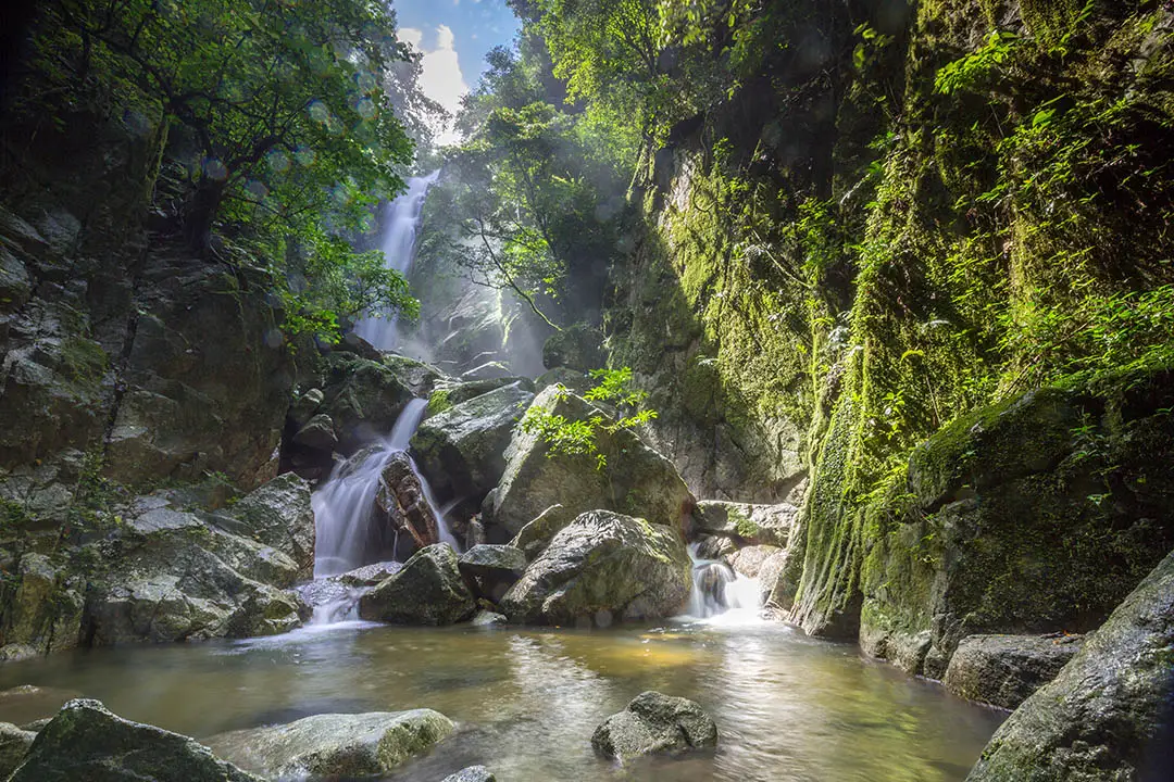
23. Namtok Sai Khao National Park is a protected nature destination in Pattani, southern Thailand. Its scenery and visitor experiences range from the most accessible attractions to quieter natural environments where access depends on season, weather and conservation management. One of Pattani’s signature natural attractions, Sai Khao Waterfall drops down a forested rock face. The surrounding watershed forest links Pattani with the mountains and streams of Thailand’s far south.
Main Highlights: Sai Khao Waterfall, Phong Phong Waterfall, rainforest and Sankalakhiri foothills.
Landscape and Natural Features: One of Pattani’s signature natural attractions, Sai Khao Waterfall drops down a forested rock face. The surrounding watershed forest links Pattani with the mountains and streams of Thailand’s far south. The setting illustrates the close connections between local geology, plant communities, watercourses and wildlife. Different parts of the park may have different conditions and visitor facilities, especially where the area extends across mountains, coastlines or offshore islands.
Ecology and Conservation: This protected landscape contributes to the conservation of southern Thailand’s forests, watersheds, shorelines or marine habitats as relevant to the area. Visitors should stay on designated trails or boat routes, avoid disturbing wildlife and vegetation, take rubbish away and follow the rules of the responsible conservation authority. Fragile cave formations, seagrass beds and coral reefs must not be touched or damaged.
Things to Do: Explore the principal attractions listed above, enjoy nature photography and use the authorized walking, sightseeing or boat routes appropriate to the destination. Activities involving caves, offshore islands, strong currents or remote forests should be undertaken only where permitted and with suitable local guidance. Weather can change quickly in southern Thailand, particularly during monsoon periods.
Getting There: Travel toward Khok Pho District and Sai Khao Subdistrict. Stay within open visitor areas and be cautious around slippery waterfall rocks. Confirm current opening dates, local transport connections and any seasonal closures before departure.
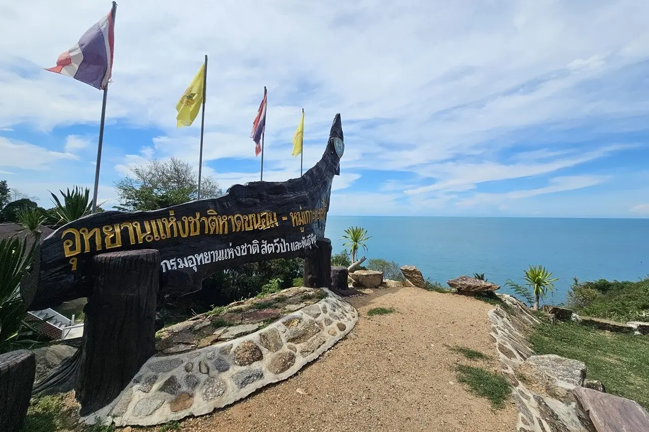
24. Hat Khanom–Mu Ko Thale Tai (Proposed National Park) is a protected nature destination in Nakhon Si Thammarat and Surat Thani, southern Thailand. Its scenery and visitor experiences range from the most accessible attractions to quieter natural environments where access depends on season, weather and conservation management. The Khanom coast is known for quiet beaches, green hills above the Gulf of Thailand and occasional sightings of humpback dolphins whose adult coloration may appear pink. The protected-area proposal includes coastal and marine habitats.
Main Highlights: Nai Phlao Beach, Khanom coastline, Laem Prathap and Indo-Pacific humpback dolphins.
Landscape and Natural Features: The Khanom coast is known for quiet beaches, green hills above the Gulf of Thailand and occasional sightings of humpback dolphins whose adult coloration may appear pink. The protected-area proposal includes coastal and marine habitats. The setting illustrates the close connections between local geology, plant communities, watercourses and wildlife. Different parts of the park may have different conditions and visitor facilities, especially where the area extends across mountains, coastlines or offshore islands.
Ecology and Conservation: This protected landscape contributes to the conservation of southern Thailand’s forests, watersheds, shorelines or marine habitats as relevant to the area. Visitors should stay on designated trails or boat routes, avoid disturbing wildlife and vegetation, take rubbish away and follow the rules of the responsible conservation authority. Fragile cave formations, seagrass beds and coral reefs must not be touched or damaged.
Things to Do: Explore the principal attractions listed above, enjoy nature photography and use the authorized walking, sightseeing or boat routes appropriate to the destination. Activities involving caves, offshore islands, strong currents or remote forests should be undertaken only where permitted and with suitable local guidance. Weather can change quickly in southern Thailand, particularly during monsoon periods.
Getting There: Drive to Khanom District and use responsible local boat operators for dolphin watching. This destination is part of an area under national park establishment procedures. Confirm current opening dates, local transport connections and any seasonal closures before departure.
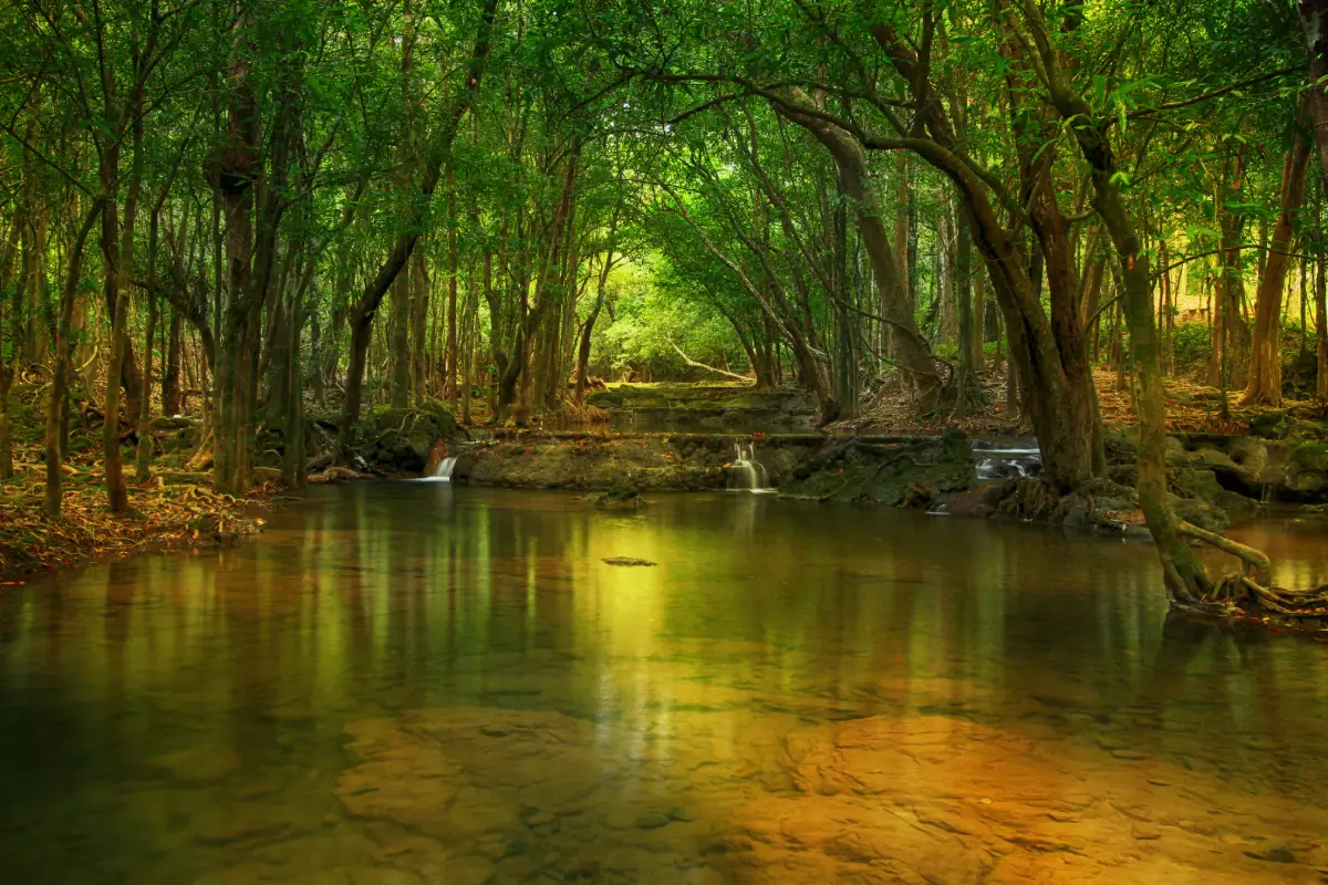
25. Namtok Si Khit National Park is a protected nature destination in Nakhon Si Thammarat and Surat Thani, southern Thailand. Its scenery and visitor experiences range from the most accessible attractions to quieter natural environments where access depends on season, weather and conservation management. Streams flow over limestone terraces into natural pools in the hills inland from Sichon. Dense vegetation shelters the watercourse and supports an important watershed landscape.
Main Highlights: Si Khit Waterfall, limestone streams, clear pools and tropical forest.
Landscape and Natural Features: Streams flow over limestone terraces into natural pools in the hills inland from Sichon. Dense vegetation shelters the watercourse and supports an important watershed landscape. The setting illustrates the close connections between local geology, plant communities, watercourses and wildlife. Different parts of the park may have different conditions and visitor facilities, especially where the area extends across mountains, coastlines or offshore islands.
Ecology and Conservation: This protected landscape contributes to the conservation of southern Thailand’s forests, watersheds, shorelines or marine habitats as relevant to the area. Visitors should stay on designated trails or boat routes, avoid disturbing wildlife and vegetation, take rubbish away and follow the rules of the responsible conservation authority. Fragile cave formations, seagrass beds and coral reefs must not be touched or damaged.
Things to Do: Explore the principal attractions listed above, enjoy nature photography and use the authorized walking, sightseeing or boat routes appropriate to the destination. Activities involving caves, offshore islands, strong currents or remote forests should be undertaken only where permitted and with suitable local guidance. Weather can change quickly in southern Thailand, particularly during monsoon periods.
Getting There: Travel through Sichon District toward Si Khit Subdistrict and follow the waterfall signs. Avoid water entry when levels rise after storms. Confirm current opening dates, local transport connections and any seasonal closures before departure.
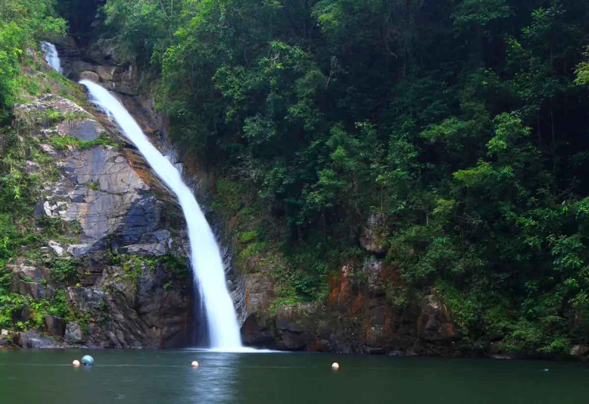
26. Namtok Yong National Park is a protected nature destination in Nakhon Si Thammarat, southern Thailand. Its scenery and visitor experiences range from the most accessible attractions to quieter natural environments where access depends on season, weather and conservation management. Near Thung Song, this park preserves waterfalls and rainforest within a mountain watershed. Yong Waterfall is the best-known feature, with flowing water over rocky steps framed by tropical vegetation.
Main Highlights: Yong Waterfall, Pliu Waterfall, mountain streams and Thung Song forest.
Landscape and Natural Features: Near Thung Song, this park preserves waterfalls and rainforest within a mountain watershed. Yong Waterfall is the best-known feature, with flowing water over rocky steps framed by tropical vegetation. The setting illustrates the close connections between local geology, plant communities, watercourses and wildlife. Different parts of the park may have different conditions and visitor facilities, especially where the area extends across mountains, coastlines or offshore islands.
Ecology and Conservation: This protected landscape contributes to the conservation of southern Thailand’s forests, watersheds, shorelines or marine habitats as relevant to the area. Visitors should stay on designated trails or boat routes, avoid disturbing wildlife and vegetation, take rubbish away and follow the rules of the responsible conservation authority. Fragile cave formations, seagrass beds and coral reefs must not be touched or damaged.
Things to Do: Explore the principal attractions listed above, enjoy nature photography and use the authorized walking, sightseeing or boat routes appropriate to the destination. Activities involving caves, offshore islands, strong currents or remote forests should be undertaken only where permitted and with suitable local guidance. Weather can change quickly in southern Thailand, particularly during monsoon periods.
Getting There: Approach from Thung Song and continue toward Tham Yai Subdistrict and the waterfall entrance. Confirm current opening dates, local transport connections and any seasonal closures before departure.
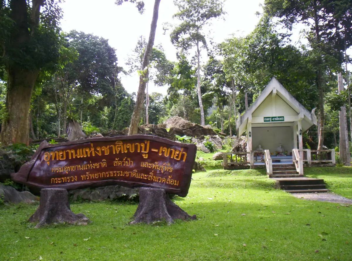
27. Khao Pu–Khao Ya National Park is a protected nature destination in Phatthalung, Nakhon Si Thammarat and Trang, southern Thailand. Its scenery and visitor experiences range from the most accessible attractions to quieter natural environments where access depends on season, weather and conservation management. The forested Banthat Range links several southern provinces. Limestone caves, fish-filled streams and birdwatching opportunities make Khao Pu–Khao Ya a destination for visitors interested in terrestrial biodiversity.
Main Highlights: Khao Pu, Khao Ya, Matcha Pla Won Cave, limestone caves and Banthat Mountain Range rainforest.
Landscape and Natural Features: The forested Banthat Range links several southern provinces. Limestone caves, fish-filled streams and birdwatching opportunities make Khao Pu–Khao Ya a destination for visitors interested in terrestrial biodiversity. The setting illustrates the close connections between local geology, plant communities, watercourses and wildlife. Different parts of the park may have different conditions and visitor facilities, especially where the area extends across mountains, coastlines or offshore islands.
Ecology and Conservation: This protected landscape contributes to the conservation of southern Thailand’s forests, watersheds, shorelines or marine habitats as relevant to the area. Visitors should stay on designated trails or boat routes, avoid disturbing wildlife and vegetation, take rubbish away and follow the rules of the responsible conservation authority. Fragile cave formations, seagrass beds and coral reefs must not be touched or damaged.
Things to Do: Explore the principal attractions listed above, enjoy nature photography and use the authorized walking, sightseeing or boat routes appropriate to the destination. Activities involving caves, offshore islands, strong currents or remote forests should be undertaken only where permitted and with suitable local guidance. Weather can change quickly in southern Thailand, particularly during monsoon periods.
Getting There: Travel from Phatthalung toward Si Banphot District and the designated entrance; cave routes should be checked in advance. Confirm current opening dates, local transport connections and any seasonal closures before departure.
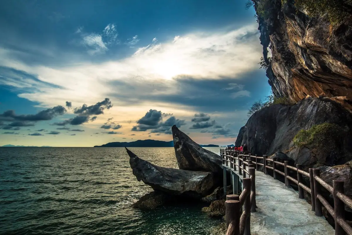
28. Mu Ko Phetra National Park is a protected nature destination in Satun and Trang, southern Thailand. Its scenery and visitor experiences range from the most accessible attractions to quieter natural environments where access depends on season, weather and conservation management. Jagged limestone islets rise from the Andaman Sea off Satun and Trang. The Ao Nun mainland visitor area provides dramatic views without requiring a long offshore journey, while remote islands have more restricted access.
Main Highlights: Ao Nun, Ko Phetra, Ko Lao Liang, Ko Lidi and limestone sea cliffs.
Landscape and Natural Features: Jagged limestone islets rise from the Andaman Sea off Satun and Trang. The Ao Nun mainland visitor area provides dramatic views without requiring a long offshore journey, while remote islands have more restricted access. The setting illustrates the close connections between local geology, plant communities, watercourses and wildlife. Different parts of the park may have different conditions and visitor facilities, especially where the area extends across mountains, coastlines or offshore islands.
Ecology and Conservation: This protected landscape contributes to the conservation of southern Thailand’s forests, watersheds, shorelines or marine habitats as relevant to the area. Visitors should stay on designated trails or boat routes, avoid disturbing wildlife and vegetation, take rubbish away and follow the rules of the responsible conservation authority. Fragile cave formations, seagrass beds and coral reefs must not be touched or damaged.
Things to Do: Explore the principal attractions listed above, enjoy nature photography and use the authorized walking, sightseeing or boat routes appropriate to the destination. Activities involving caves, offshore islands, strong currents or remote forests should be undertaken only where permitted and with suitable local guidance. Weather can change quickly in southern Thailand, particularly during monsoon periods.
Getting There: From Satun, drive toward La-ngu and Pak Nam for Ao Nun; use authorized boat services for island visits. Confirm current opening dates, local transport connections and any seasonal closures before departure.
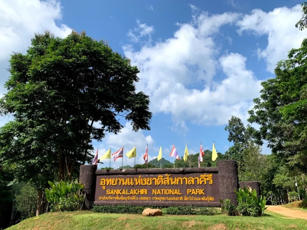
29. San Kala Khiri National Park is a protected nature destination in Songkhla, southern Thailand. Its scenery and visitor experiences range from the most accessible attractions to quieter natural environments where access depends on season, weather and conservation management. The park protects rugged rainforest near the Thai–Malaysian border in Songkhla. Watershed streams, limestone terrain and nearby mountain communities are central to its character.
Main Highlights: Sankalakhiri mountain forest, Thepha River headwaters, Ban Si Hui and limestone caves.
Landscape and Natural Features: The park protects rugged rainforest near the Thai–Malaysian border in Songkhla. Watershed streams, limestone terrain and nearby mountain communities are central to its character. The setting illustrates the close connections between local geology, plant communities, watercourses and wildlife. Different parts of the park may have different conditions and visitor facilities, especially where the area extends across mountains, coastlines or offshore islands.
Ecology and Conservation: This protected landscape contributes to the conservation of southern Thailand’s forests, watersheds, shorelines or marine habitats as relevant to the area. Visitors should stay on designated trails or boat routes, avoid disturbing wildlife and vegetation, take rubbish away and follow the rules of the responsible conservation authority. Fragile cave formations, seagrass beds and coral reefs must not be touched or damaged.
Things to Do: Explore the principal attractions listed above, enjoy nature photography and use the authorized walking, sightseeing or boat routes appropriate to the destination. Activities involving caves, offshore islands, strong currents or remote forests should be undertaken only where permitted and with suitable local guidance. Weather can change quickly in southern Thailand, particularly during monsoon periods.
Getting There: Travel through Saba Yoi District toward the designated park area. Some interior and border trails require official access arrangements. Confirm current opening dates, local transport connections and any seasonal closures before departure.
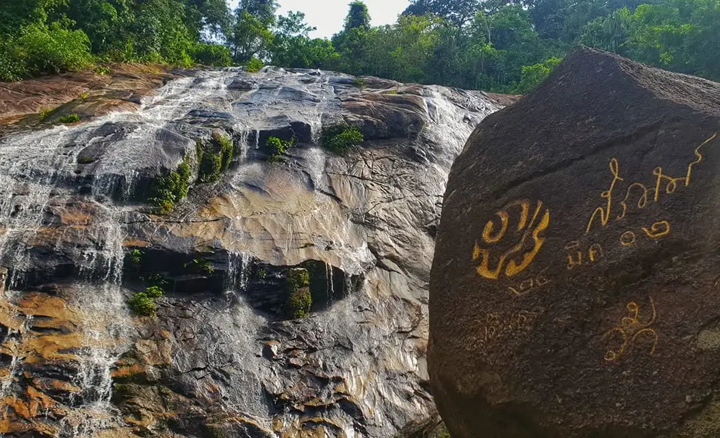
30. Budo–Su-ngai Padi National Park is a protected nature destination in Narathiwat, Yala and Pattani, southern Thailand. Its scenery and visitor experiences range from the most accessible attractions to quieter natural environments where access depends on season, weather and conservation management. The Budo–Su-ngai Padi range forms an important southern rainforest refuge spanning three border provinces. Pajo Waterfall is a prominent public attraction surrounded by forest and local history.
Main Highlights: Pajo Waterfall, Chatwarin Waterfall, Budo Mountains and tropical forest wildlife.
Landscape and Natural Features: The Budo–Su-ngai Padi range forms an important southern rainforest refuge spanning three border provinces. Pajo Waterfall is a prominent public attraction surrounded by forest and local history. The setting illustrates the close connections between local geology, plant communities, watercourses and wildlife. Different parts of the park may have different conditions and visitor facilities, especially where the area extends across mountains, coastlines or offshore islands.
Ecology and Conservation: This protected landscape contributes to the conservation of southern Thailand’s forests, watersheds, shorelines or marine habitats as relevant to the area. Visitors should stay on designated trails or boat routes, avoid disturbing wildlife and vegetation, take rubbish away and follow the rules of the responsible conservation authority. Fragile cave formations, seagrass beds and coral reefs must not be touched or damaged.
Things to Do: Explore the principal attractions listed above, enjoy nature photography and use the authorized walking, sightseeing or boat routes appropriate to the destination. Activities involving caves, offshore islands, strong currents or remote forests should be undertaken only where permitted and with suitable local guidance. Weather can change quickly in southern Thailand, particularly during monsoon periods.
Getting There: For Pajo Waterfall, travel from Narathiwat toward Bacho District. Other zones lie much farther away and may have separate security and access rules. Confirm current opening dates, local transport connections and any seasonal closures before departure.
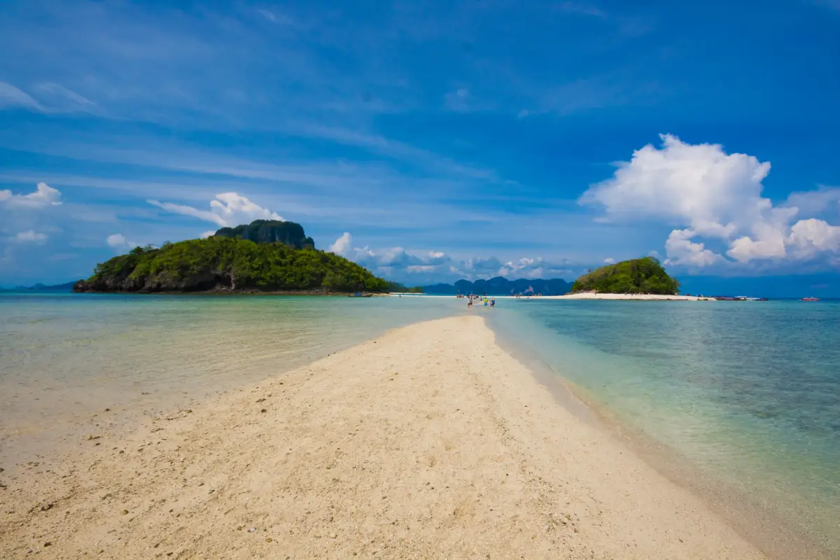
31. Hat Noppharat Thara–Mu Ko Phi Phi National Park is a protected nature destination in Krabi, southern Thailand. Its scenery and visitor experiences range from the most accessible attractions to quieter natural environments where access depends on season, weather and conservation management. This famous Krabi marine park combines mainland beaches with spectacular limestone islands. Maya Bay requires careful visitor management, while Phi Phi Don serves as a busy base for island excursions.
Main Highlights: Noppharat Thara Beach, Ko Phi Phi Don, Ko Phi Phi Le, Maya Bay and Pileh Lagoon.
Landscape and Natural Features: This famous Krabi marine park combines mainland beaches with spectacular limestone islands. Maya Bay requires careful visitor management, while Phi Phi Don serves as a busy base for island excursions. The setting illustrates the close connections between local geology, plant communities, watercourses and wildlife. Different parts of the park may have different conditions and visitor facilities, especially where the area extends across mountains, coastlines or offshore islands.
Ecology and Conservation: This protected landscape contributes to the conservation of southern Thailand’s forests, watersheds, shorelines or marine habitats as relevant to the area. Visitors should stay on designated trails or boat routes, avoid disturbing wildlife and vegetation, take rubbish away and follow the rules of the responsible conservation authority. Fragile cave formations, seagrass beds and coral reefs must not be touched or damaged.
Things to Do: Explore the principal attractions listed above, enjoy nature photography and use the authorized walking, sightseeing or boat routes appropriate to the destination. Activities involving caves, offshore islands, strong currents or remote forests should be undertaken only where permitted and with suitable local guidance. Weather can change quickly in southern Thailand, particularly during monsoon periods.
Getting There: Drive from Krabi to Ao Nang or Noppharat Thara, and use boats for Phi Phi. Observe limits on landing, swimming and access to protected bays. Confirm current opening dates, local transport connections and any seasonal closures before departure.
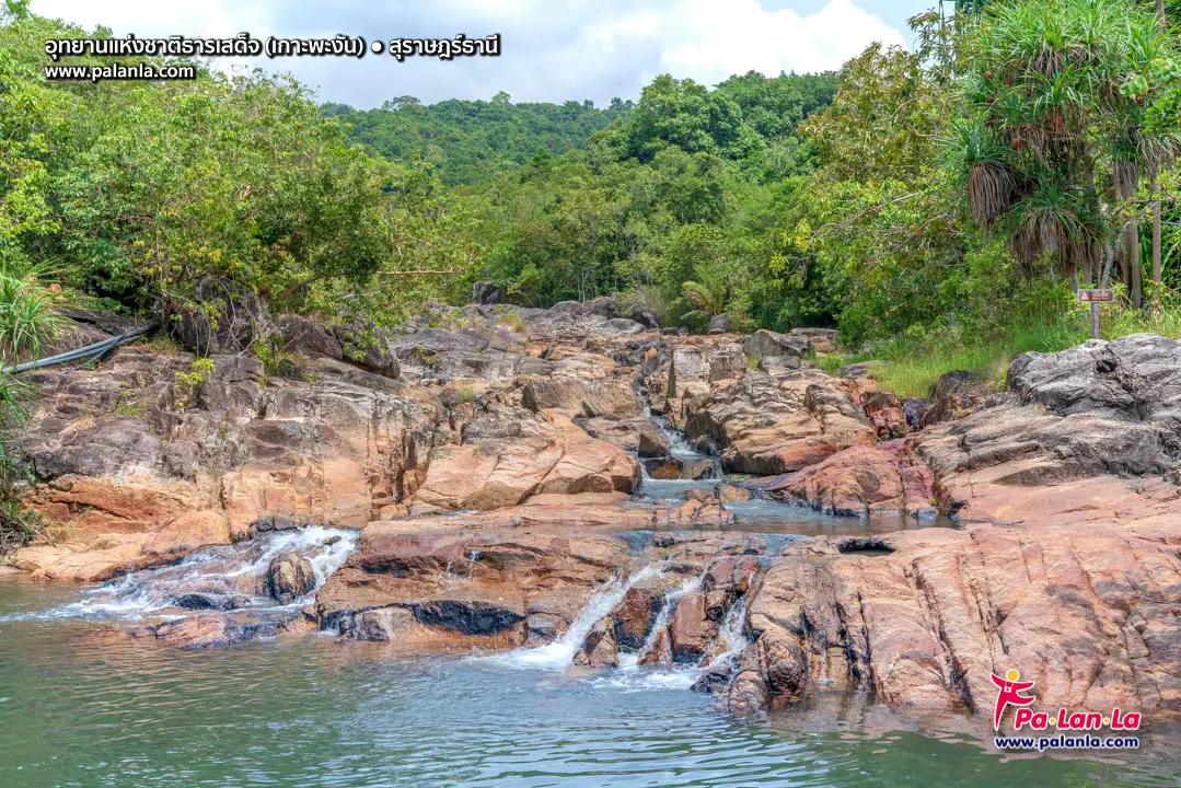
32. Than Sadet–Ko Pha-ngan National Park is a protected nature destination in Surat Thani, southern Thailand. Its scenery and visitor experiences range from the most accessible attractions to quieter natural environments where access depends on season, weather and conservation management. On Ko Pha-ngan, shaded mountain streams flow over granite boulders toward the sea. Than Sadet has historical associations with royal visits, and inland viewpoints reveal a different side of the island beyond its beaches.
Main Highlights: Than Sadet Waterfall, Phaeng Waterfall, Dom Sila viewpoint and Ko Pha-ngan watershed forest.
Landscape and Natural Features: On Ko Pha-ngan, shaded mountain streams flow over granite boulders toward the sea. Than Sadet has historical associations with royal visits, and inland viewpoints reveal a different side of the island beyond its beaches. The setting illustrates the close connections between local geology, plant communities, watercourses and wildlife. Different parts of the park may have different conditions and visitor facilities, especially where the area extends across mountains, coastlines or offshore islands.
Ecology and Conservation: This protected landscape contributes to the conservation of southern Thailand’s forests, watersheds, shorelines or marine habitats as relevant to the area. Visitors should stay on designated trails or boat routes, avoid disturbing wildlife and vegetation, take rubbish away and follow the rules of the responsible conservation authority. Fragile cave formations, seagrass beds and coral reefs must not be touched or damaged.
Things to Do: Explore the principal attractions listed above, enjoy nature photography and use the authorized walking, sightseeing or boat routes appropriate to the destination. Activities involving caves, offshore islands, strong currents or remote forests should be undertaken only where permitted and with suitable local guidance. Weather can change quickly in southern Thailand, particularly during monsoon periods.
Getting There: Take a ferry to Ko Pha-ngan, then travel from Thong Sala to the relevant waterfall or forest trail. Confirm current opening dates, local transport connections and any seasonal closures before departure.
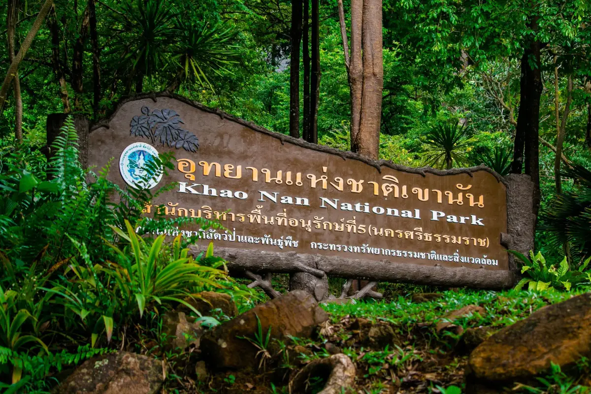
33. Khao Nan National Park is a protected nature destination in Nakhon Si Thammarat, southern Thailand. Its scenery and visitor experiences range from the most accessible attractions to quieter natural environments where access depends on season, weather and conservation management. Khao Nan protects a section of the Nakhon Si Thammarat mountain system. Its elevated forests, caves and waterfalls shelter varied plant species and important stream headwaters.
Main Highlights: Sunanta Waterfall, Hong Cave, Khlong Kaeo Waterfall, highland forest and rare ferns.
Landscape and Natural Features: Khao Nan protects a section of the Nakhon Si Thammarat mountain system. Its elevated forests, caves and waterfalls shelter varied plant species and important stream headwaters. The setting illustrates the close connections between local geology, plant communities, watercourses and wildlife. Different parts of the park may have different conditions and visitor facilities, especially where the area extends across mountains, coastlines or offshore islands.
Ecology and Conservation: This protected landscape contributes to the conservation of southern Thailand’s forests, watersheds, shorelines or marine habitats as relevant to the area. Visitors should stay on designated trails or boat routes, avoid disturbing wildlife and vegetation, take rubbish away and follow the rules of the responsible conservation authority. Fragile cave formations, seagrass beds and coral reefs must not be touched or damaged.
Things to Do: Explore the principal attractions listed above, enjoy nature photography and use the authorized walking, sightseeing or boat routes appropriate to the destination. Activities involving caves, offshore islands, strong currents or remote forests should be undertaken only where permitted and with suitable local guidance. Weather can change quickly in southern Thailand, particularly during monsoon periods.
Getting There: Travel from Nakhon Si Thammarat through Tha Sala or Nopphitam, selecting the access road for the particular attraction. Confirm current opening dates, local transport connections and any seasonal closures before departure.
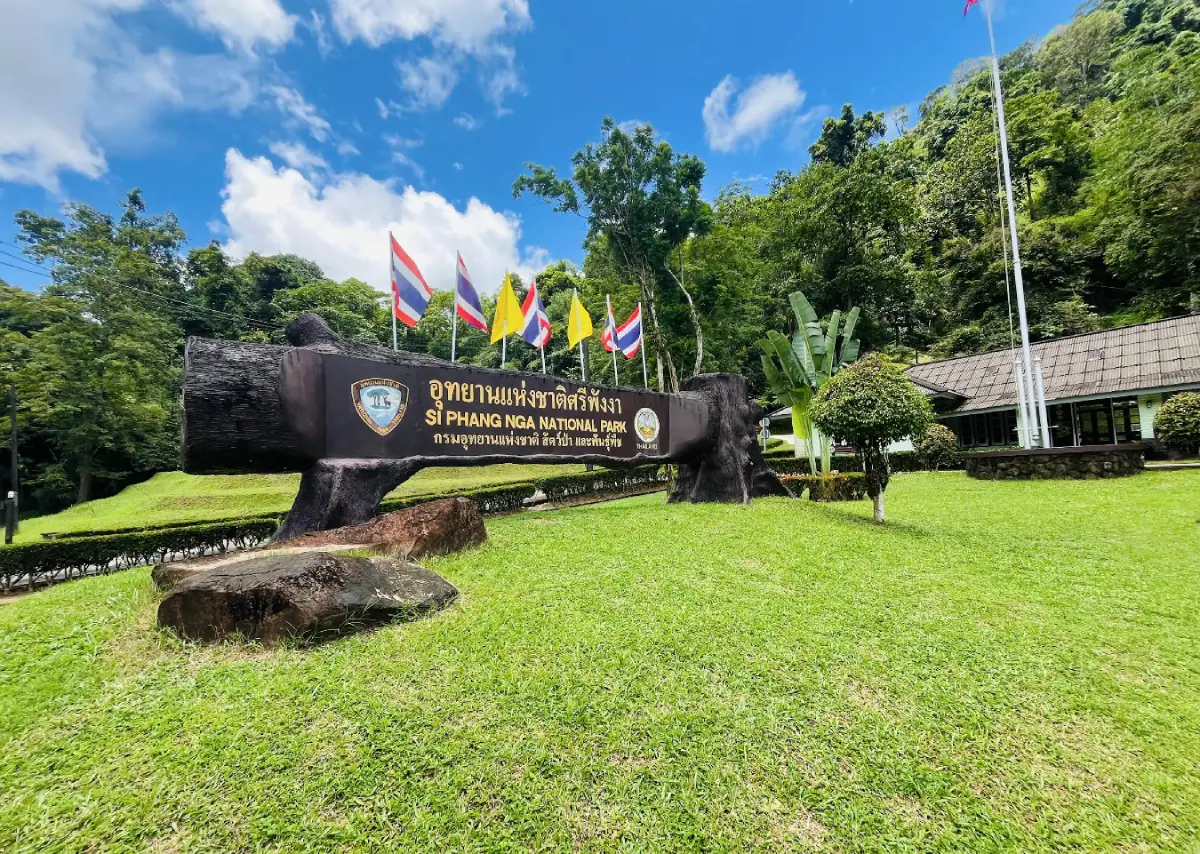
34. Si Phang Nga National Park is a protected nature destination in Phang Nga, southern Thailand. Its scenery and visitor experiences range from the most accessible attractions to quieter natural environments where access depends on season, weather and conservation management. Si Phang Nga is a quieter rainforest destination inland from the busy Andaman coast. Tam Nang Waterfall provides a relatively accessible introduction, while deeper forest routes reveal large trees and wildlife habitats.
Main Highlights: Tam Nang Waterfall, Ton Ton Toei Waterfall, rainforest, hornbills and clear forest streams.
Landscape and Natural Features: Si Phang Nga is a quieter rainforest destination inland from the busy Andaman coast. Tam Nang Waterfall provides a relatively accessible introduction, while deeper forest routes reveal large trees and wildlife habitats. The setting illustrates the close connections between local geology, plant communities, watercourses and wildlife. Different parts of the park may have different conditions and visitor facilities, especially where the area extends across mountains, coastlines or offshore islands.
Ecology and Conservation: This protected landscape contributes to the conservation of southern Thailand’s forests, watersheds, shorelines or marine habitats as relevant to the area. Visitors should stay on designated trails or boat routes, avoid disturbing wildlife and vegetation, take rubbish away and follow the rules of the responsible conservation authority. Fragile cave formations, seagrass beds and coral reefs must not be touched or damaged.
Things to Do: Explore the principal attractions listed above, enjoy nature photography and use the authorized walking, sightseeing or boat routes appropriate to the destination. Activities involving caves, offshore islands, strong currents or remote forests should be undertaken only where permitted and with suitable local guidance. Weather can change quickly in southern Thailand, particularly during monsoon periods.
Getting There: Follow Highway 4 toward Khura Buri and turn toward the Tam Nang visitor area. More remote trails require arrangements with park staff. Confirm current opening dates, local transport connections and any seasonal closures before departure.
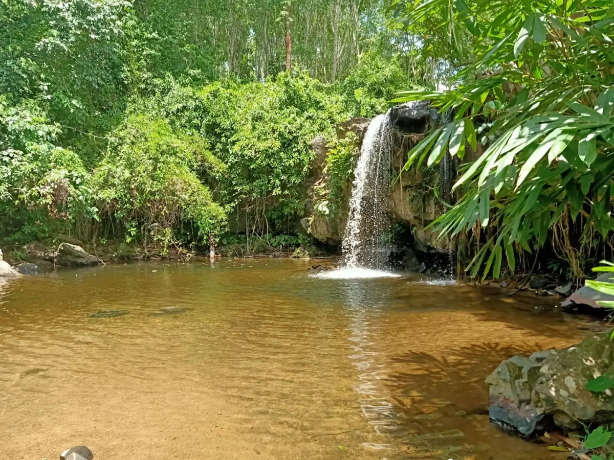
35. Lam Nam Kra Buri National Park is a protected nature destination in Ranong, southern Thailand. Its scenery and visitor experiences range from the most accessible attractions to quieter natural environments where access depends on season, weather and conservation management. The Kra Buri waterway runs along the Thailand–Myanmar frontier. The wider landscape combines estuarine mangrove habitats and inland rainforest streams, supporting wildlife and coastal fishing communities.
Main Highlights: Kra Buri River, border mangroves, brackish-water habitats and Ton Mai Pak Waterfall.
Landscape and Natural Features: The Kra Buri waterway runs along the Thailand–Myanmar frontier. The wider landscape combines estuarine mangrove habitats and inland rainforest streams, supporting wildlife and coastal fishing communities. The setting illustrates the close connections between local geology, plant communities, watercourses and wildlife. Different parts of the park may have different conditions and visitor facilities, especially where the area extends across mountains, coastlines or offshore islands.
Ecology and Conservation: This protected landscape contributes to the conservation of southern Thailand’s forests, watersheds, shorelines or marine habitats as relevant to the area. Visitors should stay on designated trails or boat routes, avoid disturbing wildlife and vegetation, take rubbish away and follow the rules of the responsible conservation authority. Fragile cave formations, seagrass beds and coral reefs must not be touched or damaged.
Things to Do: Explore the principal attractions listed above, enjoy nature photography and use the authorized walking, sightseeing or boat routes appropriate to the destination. Activities involving caves, offshore islands, strong currents or remote forests should be undertaken only where permitted and with suitable local guidance. Weather can change quickly in southern Thailand, particularly during monsoon periods.
Getting There: From Ranong, drive toward Kra Buri for the river landscape or toward La-un for Ton Mai Pak Waterfall. These are separate access areas. Confirm current opening dates, local transport connections and any seasonal closures before departure.
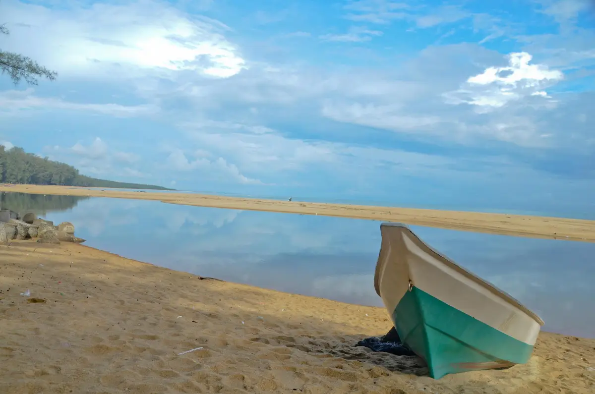
36. Ao Manao–Khao Tanyong (Proposed National Park) is a protected nature destination in Narathiwat, southern Thailand. Its scenery and visitor experiences range from the most accessible attractions to quieter natural environments where access depends on season, weather and conservation management. Ao Manao is a curved beach backed by green hills near Narathiwat town. Its coastal vegetation supports wildlife and helps stabilize the shore, while the surrounding landscape provides a peaceful nature stop.
Main Highlights: Ao Manao beach, Khao Tanyong headland, coastal forest and Gulf of Thailand scenery.
Landscape and Natural Features: Ao Manao is a curved beach backed by green hills near Narathiwat town. Its coastal vegetation supports wildlife and helps stabilize the shore, while the surrounding landscape provides a peaceful nature stop. The setting illustrates the close connections between local geology, plant communities, watercourses and wildlife. Different parts of the park may have different conditions and visitor facilities, especially where the area extends across mountains, coastlines or offshore islands.
Ecology and Conservation: This protected landscape contributes to the conservation of southern Thailand’s forests, watersheds, shorelines or marine habitats as relevant to the area. Visitors should stay on designated trails or boat routes, avoid disturbing wildlife and vegetation, take rubbish away and follow the rules of the responsible conservation authority. Fragile cave formations, seagrass beds and coral reefs must not be touched or damaged.
Things to Do: Explore the principal attractions listed above, enjoy nature photography and use the authorized walking, sightseeing or boat routes appropriate to the destination. Activities involving caves, offshore islands, strong currents or remote forests should be undertaken only where permitted and with suitable local guidance. Weather can change quickly in southern Thailand, particularly during monsoon periods.
Getting There: Travel from Narathiwat to Kaluwo Nuea and the Ao Manao visitor area. The protected-area proposal should not be confused with a fully gazetted national park. Confirm current opening dates, local transport connections and any seasonal closures before departure.
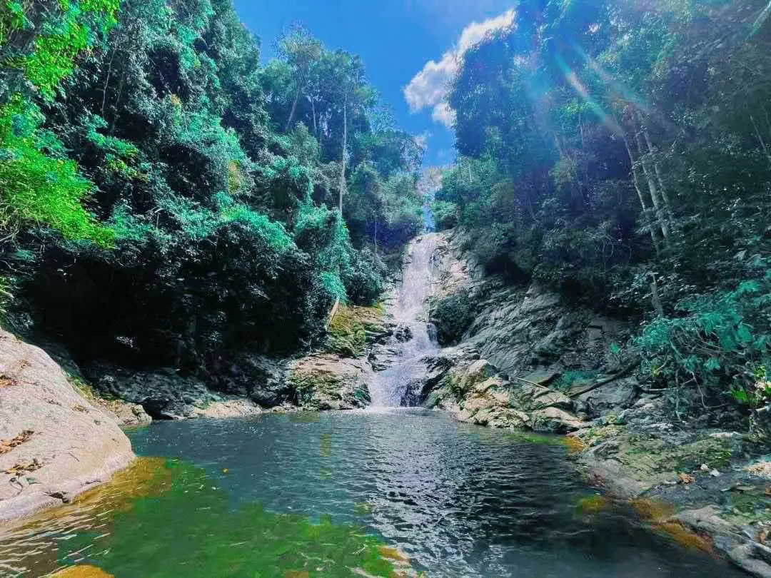
37. Bang Lang National Park is a protected nature destination in Yala, southern Thailand. Its scenery and visitor experiences range from the most accessible attractions to quieter natural environments where access depends on season, weather and conservation management. Bang Lang lies in the mountainous interior of Yala, where rainforest watersheds feed the Pattani River system. Cascading waterfalls and the large reservoir offer contrasting views of the same landscape.
Main Highlights: Than To Waterfall, La-ong Rung Waterfall, Bang Lang Dam and tropical mountain forest.
Landscape and Natural Features: Bang Lang lies in the mountainous interior of Yala, where rainforest watersheds feed the Pattani River system. Cascading waterfalls and the large reservoir offer contrasting views of the same landscape. The setting illustrates the close connections between local geology, plant communities, watercourses and wildlife. Different parts of the park may have different conditions and visitor facilities, especially where the area extends across mountains, coastlines or offshore islands.
Ecology and Conservation: This protected landscape contributes to the conservation of southern Thailand’s forests, watersheds, shorelines or marine habitats as relevant to the area. Visitors should stay on designated trails or boat routes, avoid disturbing wildlife and vegetation, take rubbish away and follow the rules of the responsible conservation authority. Fragile cave formations, seagrass beds and coral reefs must not be touched or damaged.
Things to Do: Explore the principal attractions listed above, enjoy nature photography and use the authorized walking, sightseeing or boat routes appropriate to the destination. Activities involving caves, offshore islands, strong currents or remote forests should be undertaken only where permitted and with suitable local guidance. Weather can change quickly in southern Thailand, particularly during monsoon periods.
Getting There: Follow Highway 410 from Yala toward Bannang Sata and Than To. Waterfalls and dam viewpoints require different turns. Confirm current opening dates, local transport connections and any seasonal closures before departure.
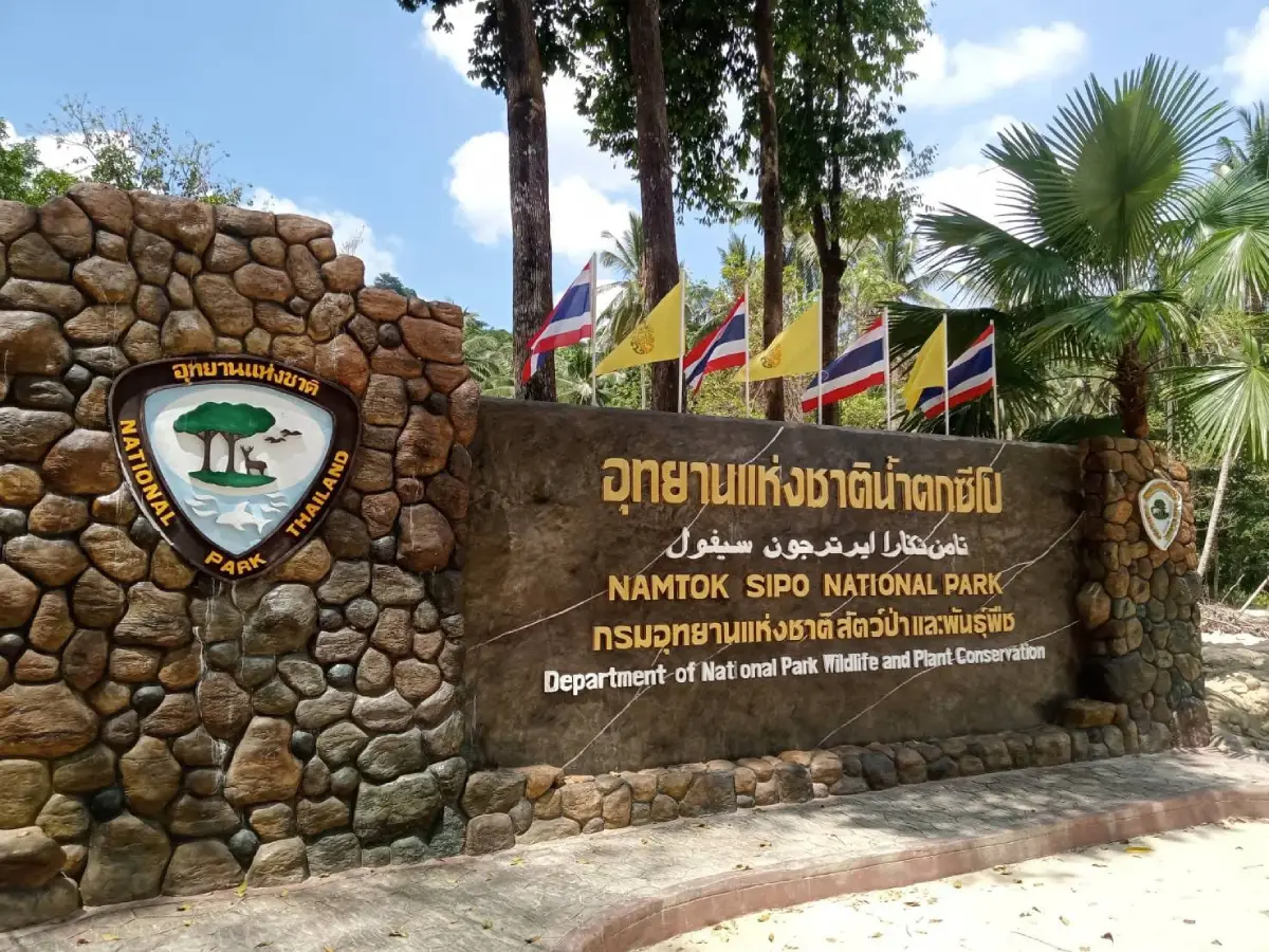
38. Namtok Sipo (Proposed National Park) is a protected nature destination in Narathiwat, southern Thailand. Its scenery and visitor experiences range from the most accessible attractions to quieter natural environments where access depends on season, weather and conservation management. Sipo is known for forest streams that cascade over successive rock shelves near Ra-ngae. The surrounding community is associated with Sipo longkong fruit and the agricultural landscape of southern Thailand.
Main Highlights: Sipo Waterfall, tiered pools, hillside forest and the Sipo longkong-growing community.
Landscape and Natural Features: Sipo is known for forest streams that cascade over successive rock shelves near Ra-ngae. The surrounding community is associated with Sipo longkong fruit and the agricultural landscape of southern Thailand. The setting illustrates the close connections between local geology, plant communities, watercourses and wildlife. Different parts of the park may have different conditions and visitor facilities, especially where the area extends across mountains, coastlines or offshore islands.
Ecology and Conservation: This protected landscape contributes to the conservation of southern Thailand’s forests, watersheds, shorelines or marine habitats as relevant to the area. Visitors should stay on designated trails or boat routes, avoid disturbing wildlife and vegetation, take rubbish away and follow the rules of the responsible conservation authority. Fragile cave formations, seagrass beds and coral reefs must not be touched or damaged.
Things to Do: Explore the principal attractions listed above, enjoy nature photography and use the authorized walking, sightseeing or boat routes appropriate to the destination. Activities involving caves, offshore islands, strong currents or remote forests should be undertaken only where permitted and with suitable local guidance. Weather can change quickly in southern Thailand, particularly during monsoon periods.
Getting There: Travel from Narathiwat toward Ra-ngae and Ban Sipo. The waterfall area has been included in national park establishment processes rather than being treated here as a fully gazetted park. Confirm current opening dates, local transport connections and any seasonal closures before departure.
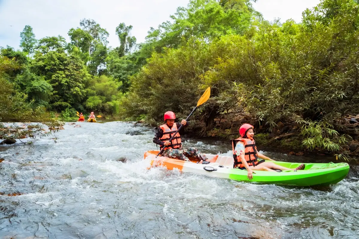
39. Kaeng Krung National Park is a protected nature destination in Surat Thani, southern Thailand. Its scenery and visitor experiences range from the most accessible attractions to quieter natural environments where access depends on season, weather and conservation management. The Kaeng Krung forest area in Surat Thani is associated with mountain streams and river rafting. Seasonal water levels shape the rafting experience, while surrounding rainforest helps protect important upstream catchments.
Main Highlights: Khlong Yan rafting, Ban Bang Cham Waterfall, Kok Kak Waterfall and rainforest watershed.
Landscape and Natural Features: The Kaeng Krung forest area in Surat Thani is associated with mountain streams and river rafting. Seasonal water levels shape the rafting experience, while surrounding rainforest helps protect important upstream catchments. The setting illustrates the close connections between local geology, plant communities, watercourses and wildlife. Different parts of the park may have different conditions and visitor facilities, especially where the area extends across mountains, coastlines or offshore islands.
Ecology and Conservation: This protected landscape contributes to the conservation of southern Thailand’s forests, watersheds, shorelines or marine habitats as relevant to the area. Visitors should stay on designated trails or boat routes, avoid disturbing wildlife and vegetation, take rubbish away and follow the rules of the responsible conservation authority. Fragile cave formations, seagrass beds and coral reefs must not be touched or damaged.
Things to Do: Explore the principal attractions listed above, enjoy nature photography and use the authorized walking, sightseeing or boat routes appropriate to the destination. Activities involving caves, offshore islands, strong currents or remote forests should be undertaken only where permitted and with suitable local guidance. Weather can change quickly in southern Thailand, particularly during monsoon periods.
Getting There: Travel toward Vibhavadi District and Khlong Yan rafting access points. Arrange water activities with experienced operators and use proper safety equipment. Confirm current opening dates, local transport connections and any seasonal closures before departure.
| Article Title | 39 National Park Destinations in Southern Thailand: Islands, Beaches, Rainforests and Waterfalls |
| Number of Destinations | 39 selected national park and related protected nature destinations, including proposed national park areas |
| Region | Southern Thailand: the Andaman coast, the Gulf of Thailand and inland mountain ranges |
| Provinces | Chumphon, Ranong, Surat Thani, Nakhon Si Thammarat, Phang Nga, Phuket, Krabi, Trang, Phatthalung, Satun, Songkhla, Pattani, Yala and Narathiwat |
| Types of Attractions | Marine national parks, forest parks, beaches, archipelagos, waterfalls, mountains, caves, mangroves, wetlands and cultural landscapes |
| Popular Activities | Boat trips, snorkeling, scuba diving, hiking, waterfall visits, birdwatching, kayaking, nature photography and ecological learning |
| Travel Season | The Andaman coast is generally favored during calmer months around November–April, subject to each park’s seasonal announcements; Gulf coast and rainforest conditions vary |
| Getting Around | Car or local transport for mainland parks; licensed ferries and boats for islands; guides for certain caves and forest trails |
| Conservation Authority | Department of National Parks, Wildlife and Plant Conservation, and relevant management bodies for areas under establishment procedures |
| All 39 Destinations | |
| 1. Khao Sok National Park | Surat Thani — Cheow Lan Lake, Ratchaprapha Dam, Khao Sam Kloe limestone formations, Khlong Sok, Rafflesia and forest waterfalls |
| 2. Mu Ko Similan National Park | Phang Nga — Sail Rock viewpoint, Ko Similan (Island 8), Ko Miang (Island 4), Princess Beach and coral reefs |
| 3. Mu Ko Surin National Park | Phang Nga — Ko Surin Nuea, Ko Surin Tai, Ao Mai Ngam, Ao Chong Khat, shallow reefs and the Moken community |
| 4. Mu Ko Ang Thong National Park | Surat Thani — Ko Wua Ta Lap, Pha Chan Charat viewpoint, Ko Mae Ko, the inland saltwater lagoon and sea kayaking |
| 5. Tarutao National Park | Satun — Tarutao Island, Ao Phante Malaka, Ao Talo Wao, Ko Adang, Ko Rawi and Ko Lipe |
| 6. Mu Ko Lanta National Park | Krabi — Laem Tanod lighthouse, Ko Lanta Yai, Ko Rok Nok, Ko Rok Nai, Ko Ngai and snorkeling reefs |
| 7. Khao Lak–Lam Ru National Park | Phang Nga — Small Beach, Lam Ru Waterfall, Ton Chong Fa Waterfall, rainforest and coastal trails |
| 8. Hat Chao Mai National Park | Trang — Hat Chao Mai, Pak Meng Beach, Chang Lang Beach, Ko Muk, Emerald Cave, Ko Kradan and seagrass beds |
| 9. Mu Ko Chumphon National Park | Chumphon — Ko Ngam Yai, Ko Ngam Noi, Ko Mattra, Ko Rang Ka Chio and coral reefs |
| 10. Thale Ban National Park | Satun — Bueng Thale Ban freshwater lake, Khao Wang Pra, forest trails, wetland wildlife and calling frogs |
| 11. Than Bok Khorani National Park | Krabi — Than Bok Khorani stream, Phi Hua To Cave, prehistoric cave paintings, Khao Karos and Ko Hong |
| 12. Ao Phang Nga National Park | Phang Nga — James Bond Island, Khao Phing Kan, Ko Panyi, sea caves, prehistoric paintings and mangroves |
| 13. Namtok Ngao National Park | Ranong — Ngao Waterfall, Ban Phra Rang Hot Springs and southern rainforest |
| 14. Laem Son National Park | Ranong and Phang Nga — Bang Ben Beach, Ko Kam Tok, Ko Khang Khao, Ko Kam Yai and coastal pine forest |
| 15. Mu Ko Ranong National Park | Ranong — Ko Phayam, Ko Chang in Ranong, Ao Yai, Ao Khao Khwai and mangroves |
| 16. Khao Lampi–Hat Thai Mueang National Park | Phang Nga — Thai Mueang Beach, Lam Pi Waterfall, Ton Phrai Waterfall, white melaleuca forest and sea turtle conservation |
| 17. Sirinat National Park | Phuket — Nai Yang Beach, Mai Khao Beach, Nai Thon, coastal pines and mangrove habitats |
| 18. Khao Luang National Park | Nakhon Si Thammarat — Khao Luang summit, Krung Ching Waterfall, Karom Waterfall, Phrom Lok Waterfall and montane forest |
| 19. Khao Nam Khang National Park | Songkhla — Khao Nam Khang historical tunnels, Piyamit 5 village, rainforest and border mountains |
| 20. Khao Phanom Bencha National Park | Krabi — Huai To Waterfall, Huai Sade Waterfall, Khao Phueng Cave and Khao Phanom Bencha rainforest |
| 21. Tai Rom Yen National Park | Surat Thani — Dat Fa Waterfall, Mueang Thuat Waterfall, rainforest and the historical Camp 180 area |
| 22. Khlong Phanom National Park | Surat Thani — limestone caves, Kaeo Cave, Nam Lot Cave, Ton Chan Waterfall and Khlong Phanom forests |
| 23. Namtok Sai Khao National Park | Pattani — Sai Khao Waterfall, Phong Phong Waterfall, rainforest and Sankalakhiri foothills |
| 24. Hat Khanom–Mu Ko Thale Tai (Proposed National Park) | Nakhon Si Thammarat and Surat Thani — Nai Phlao Beach, Khanom coastline, Laem Prathap and Indo-Pacific humpback dolphins |
| 25. Namtok Si Khit National Park | Nakhon Si Thammarat and Surat Thani — Si Khit Waterfall, limestone streams, clear pools and tropical forest |
| 26. Namtok Yong National Park | Nakhon Si Thammarat — Yong Waterfall, Pliu Waterfall, mountain streams and Thung Song forest |
| 27. Khao Pu–Khao Ya National Park | Phatthalung, Nakhon Si Thammarat and Trang — Khao Pu, Khao Ya, Matcha Pla Won Cave, limestone caves and Banthat Mountain Range rainforest |
| 28. Mu Ko Phetra National Park | Satun and Trang — Ao Nun, Ko Phetra, Ko Lao Liang, Ko Lidi and limestone sea cliffs |
| 29. San Kala Khiri National Park | Songkhla — Sankalakhiri mountain forest, Thepha River headwaters, Ban Si Hui and limestone caves |
| 30. Budo–Su-ngai Padi National Park | Narathiwat, Yala and Pattani — Pajo Waterfall, Chatwarin Waterfall, Budo Mountains and tropical forest wildlife |
| 31. Hat Noppharat Thara–Mu Ko Phi Phi National Park | Krabi — Noppharat Thara Beach, Ko Phi Phi Don, Ko Phi Phi Le, Maya Bay and Pileh Lagoon |
| 32. Than Sadet–Ko Pha-ngan National Park | Surat Thani — Than Sadet Waterfall, Phaeng Waterfall, Dom Sila viewpoint and Ko Pha-ngan watershed forest |
| 33. Khao Nan National Park | Nakhon Si Thammarat — Sunanta Waterfall, Hong Cave, Khlong Kaeo Waterfall, highland forest and rare ferns |
| 34. Si Phang Nga National Park | Phang Nga — Tam Nang Waterfall, Ton Ton Toei Waterfall, rainforest, hornbills and clear forest streams |
| 35. Lam Nam Kra Buri National Park | Ranong — Kra Buri River, border mangroves, brackish-water habitats and Ton Mai Pak Waterfall |
| 36. Ao Manao–Khao Tanyong (Proposed National Park) | Narathiwat — Ao Manao beach, Khao Tanyong headland, coastal forest and Gulf of Thailand scenery |
| 37. Bang Lang National Park | Yala — Than To Waterfall, La-ong Rung Waterfall, Bang Lang Dam and tropical mountain forest |
| 38. Namtok Sipo (Proposed National Park) | Narathiwat — Sipo Waterfall, tiered pools, hillside forest and the Sipo longkong-growing community |
| 39. Kaeng Krung National Park | Surat Thani — Khlong Yan rafting, Ban Bang Cham Waterfall, Kok Kak Waterfall and rainforest watershed |
| Best for Islands and Beaches | 1. Mu Ko Similan National Park; 2. Mu Ko Surin National Park; 3. Mu Ko Ang Thong National Park; 4. Tarutao National Park; 5. Mu Ko Lanta National Park; 6. Hat Noppharat Thara–Mu Ko Phi Phi National Park |
| Best for Rainforest and Waterfalls | 1. Khao Sok; 2. Khao Luang; 3. Khao Nan; 4. Namtok Ngao; 5. Namtok Yong; 6. Tai Rom Yen; 7. Si Phang Nga |
| Best for Families | 1. Sirinat coast; 2. Bang Ben Beach; 3. Than Bok Khorani; 4. Noppharat Thara Beach; 5. Accessible visitor areas at Namtok Yong |
| History and Community | 1. Tarutao historic penal settlement; 2. Prehistoric cave paintings at Phi Hua To; 3. Khao Nam Khang tunnels; 4. Royal visit history at Than Sadet; 5. Moken community in the Surin Islands |
| Suggested Trip: 2 Days | Khao Sok forest trails on Day 1, followed by Cheow Lan Lake and Ratchaprapha Dam on Day 2 |
| Suggested Trip: 3 Days | Trang mainland coastline on Day 1, Mu Ko Phetra coast in Satun on Day 2, and Thale Ban rainforest on Day 3 |
| Suggested Trip: 5 Days | Ranong waterfalls, Laem Son coast, travel to Khura Buri, Si Phang Nga rainforest and Khao Lak–Lam Ru |
| Responsible Travel | Check official opening notices; stay on marked trails; do not feed wildlife or stand on coral; follow cave, swimming and border-area safety advice |
Frequently Asked Questions (FAQ)
Q: Are there exactly 39 officially declared national parks in Southern Thailand?
A: No. This guide covers 39 selected national park and related protected-area destinations. Some places, including Hat Khanom–Mu Ko Thale Tai, Ao Manao–Khao Tanyong and Namtok Sipo, are discussed as areas proposed for national park establishment.
Q: Which southern national parks are best for first-time visitors?
A: Khao Sok is ideal for rainforest scenery and Cheow Lan Lake. The Similan and Surin Islands are best known for their marine landscapes, while Sirinat and Than Bok Khorani are more accessible mainland options.
Q: Which parks have the most attractive beaches and islands?
A: Popular choices include the Similan Islands, Surin Islands, Ang Thong, Tarutao, Mu Ko Lanta and the Phi Phi Islands. Each has a distinct landscape and different access requirements.
Q: Where can I go hiking in southern Thailand?
A: Consider Khao Sok, Khao Luang, Khao Nan, Si Phang Nga, Tai Rom Yen and Khao Pu–Khao Ya. More demanding routes may need prior authorization or a guide.
Q: Which national parks are best for waterfalls?
A: Namtok Ngao, Namtok Yong, Khao Luang, Namtok Si Khit, Namtok Sai Khao and Tai Rom Yen have notable waterfall landscapes.
Q: When is the best time to visit the Andaman Sea national parks?
A: Many visitors plan around November to April, when seas are often calmer, but marine parks enforce individual seasonal opening dates. Check official announcements before buying tickets.
Q: Do the Andaman Sea and Gulf of Thailand have the same travel season?
A: No. Different monsoon patterns affect the two coasts, so check the forecast and marine conditions for the exact destination.
Q: What can I see in two or three days?
A: For two days, combine Khao Sok’s forest trails with Cheow Lan Lake. For a marine break, base yourself in Khao Lak and choose one permitted island excursion, leaving time for weather changes.
Q: Which parks are suitable for families?
A: Accessible parts of Sirinat, Than Bok Khorani, Laem Son and Noppharat Thara are useful options. Choose activities according to the age and swimming ability of children.
Q: Can I visit without a rental car?
A: Some destinations can be reached by public transport, local taxis or organized excursions. Remote mountain parks and scattered waterfall entrances usually require more planning.
Q: Do I need to book entry in advance?
A: Certain marine parks, overnight stays, guided cave trips and long-distance treks may require reservations or permits. Requirements vary by destination and date.
Q: Can I visit national parks during the rainy season?
A: Some visitor zones remain open, but seasonal marine closures and temporary waterfall, cave or trekking restrictions are common when conditions become unsafe.
Q: Which places combine nature with history?
A: Tarutao, Phi Hua To Cave in Than Bok Khorani, Khao Nam Khang and Than Sadet are notable for historical associations in addition to their scenery.
Q: What rules should visitors follow?
A: Stay in authorized areas, leave no litter, do not collect plants or animals, never feed wildlife, avoid touching coral and follow the instructions of park staff.
 Category: ●Travel Articles, Recipes
 Group: ●Travel Review, Food Review
Last Update : 1 DayAgo
 Last Update : 1 DayAgo
Recommend

 Art, Culture and Heritage
 Historical Sites and Monuments(9)
 Landmarks and Memorials(9)
 Royal Palace(1)
 Art, Craft Centres, Tradition(12)
 Museums(5)
 Educational Places
 Educational Gardens, Farm(2)
 Places of Worship
 Temple(44)
 Mosque(2)
 Other Sacred Sites(17)
 Research and Development
 Royal Project(2)
 Suburban Living
 Village, Community(8)
 Local Market(1)
 Floating Market(1)
 Nature and Wildlife
 National Parks and Marine Reserves(6)
 Mountain (Doi)(11)
 Dam, Reservoir, Lake(10)
 Waterfalls(43)
 Hot Springs(1)
 Caves(13)
 River, Canal(3)
 Bays and Beaches(29)
 Islands(2)
 Other natural attractions(3)
 Entertainment and Agricultural
 Farms, Parks and Ecotourism(3)
 Outdoor and Adventure Activities(4)
Travel Review, Food Review(5)
 Southern Food Menu, Southern Food Recipes(18)


