
lovethailand home >South Travel Attractions >Nakhon Si Thammarat Travel Attractions > Southern Thailand Map All 14 Provinces Travel Info..
TL;DR: Southern Thailand Map All 14 Provinces Travel Information and Geography.
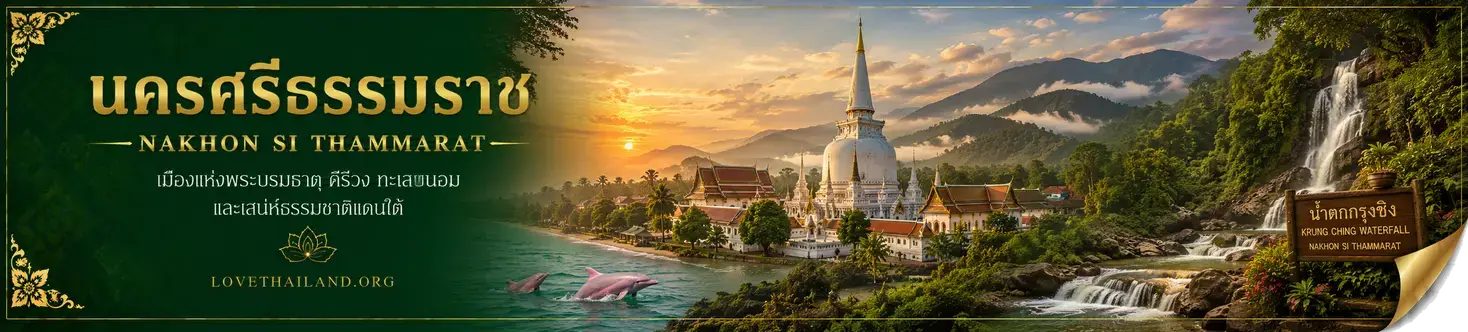
Southern Thailand Map All 14 Provinces Travel Information and Geography
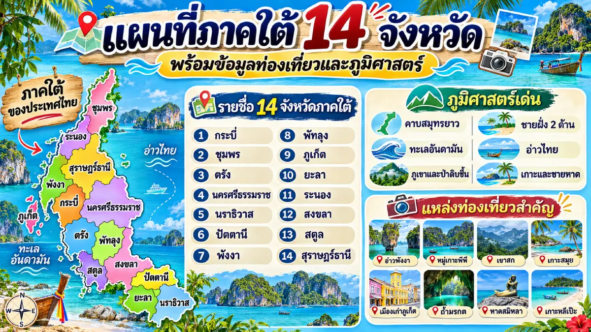
Southern Thailand Map: All 14 Provinces, Travel Information and Geography is a guide to understanding this region of Thailand, from Chumphon and Ranong in the north to Narathiwat and Yala near the Malaysian border. Southern Thailand stretches along a peninsula bordered by the Gulf of Thailand to the east and the Andaman Sea to the west. Its varied landscapes include beaches, islands, mountain ranges, watershed forests, limestone caves, lakes, and historic towns that developed through maritime trade. Reading the map alongside the provincial list helps visitors understand where each area is situated and plan their journeys systematically, whether their interests lie in nature, history, religion, food, or local culture.
How many provinces are there in Southern Thailand? Under Thailand's six-region geographical classification, the South comprises 14 provinces: Krabi, Chumphon, Trang, Nakhon Si Thammarat, Narathiwat, Pattani, Phang Nga, Phatthalung, Phuket, Ranong, Satun, Songkhla, Surat Thani, and Yala. The provinces are listed in this order for easy reference throughout the article. Six of them directly border the Andaman Sea: Ranong, Phang Nga, Phuket, Krabi, Trang, and Satun. Chumphon, Surat Thani, Nakhon Si Thammarat, Songkhla, Pattani, and Narathiwat have coastlines on the Gulf of Thailand. Phatthalung lies within the Songkhla Lake Basin, while Yala is an inland province; neither has a direct coastline on the open sea.
A map of Southern Thailand reveals mountain ranges running lengthwise along the peninsula, with coastal plains extending between the mountains and the sea. The Tenasserim, Phuket, Nakhon Si Thammarat, and Sankalakhiri ranges are important features of the region's topography and drainage systems. Sections of these mountains contain important headwaters and biologically diverse forests. Meanwhile, coastal lowlands and river estuaries have supported human settlements, fishing, rice cultivation, and trade for centuries.
The Andaman coastline is deeply indented, with numerous bays, islands, and limestone cliffs, creating the distinctive scenery seen in Phang Nga, Krabi, Trang, and Satun. The Gulf of Thailand coast, by contrast, includes extensive coastal plains and long stretches of beach, as well as major island groups belonging to Surat Thani Province, including Koh Samui, Koh Phangan, and Koh Tao. The differences between these two coastlines shape tourism activities and marine transport routes. Travelers should therefore plan their visits around the monsoon season and local sea conditions rather than treating the entire region as having the same beach season.
Southern Thailand's climate is influenced by monsoon winds from two directions. The Andaman coast generally experiences substantial rainfall during the southwest monsoon, while many areas along the Gulf of Thailand may receive particularly heavy rain during the northeast monsoon. A single seasonal travel recommendation is therefore not appropriate for every southern province. Before visiting islands, marine national parks, or attractions requiring boat transfers, travelers should check notices issued by the relevant authorities, weather forecasts, wave and wind conditions, and the operational status of boat services.
Southern Thailand has a long history as a maritime link between the Indian Ocean and other parts of Southeast Asia. This position encouraged the development of port towns and merchant communities, along with exchanges of religion, language, architecture, and cuisine. Nakhon Si Thammarat has long been an important center of Buddhism and peninsular history. Phuket Old Town reflects the heritage of tin trading and Thai-Chinese communities, while Pattani, Narathiwat, and Yala preserve important elements of Malay language, art, and culture.
Beyond beaches and the sea, Southern Thailand offers wetlands, rainforests, and caves. Examples include Thale Noi in Phatthalung, forested areas around Khao Sok and the Nakhon Si Thammarat mountain range, and the limestone landscapes of Phang Nga and Krabi. These attractions demonstrate why itineraries should be based on geographical diversity rather than limited to provinces famous for seaside resorts. Visitors interested in culture can also experience the traditional Nora performing art, shadow puppetry, the Sart Duean Sip merit-making festival, Chak Phra processions, and the many distinctive forms of Southern Thai cuisine.
Using a map of Southern Thailand for travel planning becomes easier when destinations are grouped geographically. An Andaman coast route can run from Ranong through Phang Nga, Phuket, Krabi, Trang, and Satun. A Gulf coast journey can begin in Chumphon and continue through Surat Thani and Nakhon Si Thammarat toward Songkhla, Pattani, and Narathiwat. Inland itineraries can include Phatthalung and Yala. Because crossing the peninsula often involves mountain roads and connecting highways, travelers should consider actual driving distances, journey times, ferry connections, and safety before finalizing their schedules.
The following table lists all 14 provinces of Southern Thailand in Thai and English, together with their key geographical characteristics and examples of important tourist attractions. It provides a reference for readers before they explore each province in greater detail and plan travel routes using the map.
| Province (Thai Name) | Geography and Major Tourist Attractions |
| 1. Krabi (Krabi) | An Andaman Sea province with limestone mountains, beaches and islands — Ao Nang, the Phi Phi Islands, Thale Waek and the Emerald Pool. |
| 2. Chumphon (Chumphon) | Northern Gulf of Thailand coastline with beaches and islands — Thung Wua Laen Beach, Sai Ri Beach and Mu Ko Chumphon. |
| 3. Trang (Trang) | Andaman coast with islands, sea caves and historic trading communities — Koh Mook, Emerald Cave, Koh Kradan and Pak Meng Beach. |
| 4. Nakhon Si Thammarat (Nakhon Si Thammarat) | A historic Gulf coast city and the Nakhon Si Thammarat mountain range — Wat Phra Mahathat, Ban Khiri Wong and Khao Luang. |
| 5. Narathiwat (Narathiwat) | Gulf coast and Malaysian border areas, with peat swamps and Malay cultural heritage — Ao Manao and Talo Mano Mosque. |
| 6. Pattani (Pattani) | A historic Gulf coast town with multicultural communities — Pattani Central Mosque, Krue Se Mosque and Wat Chang Hai. |
| 7. Phang Nga (Phang Nga) | Andaman coast with limestone bays, mangroves and island groups — Phang Nga Bay, Khao Tapu, Khao Lak and the Surin Islands. |
| 8. Phatthalung (Phatthalung) | An inland eastern province connected to Songkhla Lake and wetlands — Thale Noi, Khao Ok Thalu and Pak Pra. |
| 9. Phuket (Phuket) | An Andaman island province with beaches and a historic trading town — Phuket Old Town, Patong Beach and Promthep Cape. |
| 10. Ranong (Ranong) | Upper Andaman coast bordering Myanmar, with rainforests and peaceful islands — Koh Phayam, Ngao Waterfall and hot springs. |
| 11. Satun (Satun) | Lower Andaman coast with islands and limestone landscapes — Koh Lipe, Tarutao National Park and the Adang–Rawi Islands. |
| 12. Songkhla (Songkhla) | A Gulf coast city and the Songkhla Lake Basin, with major commercial centers — Songkhla Old Town, Samila Beach and Koh Yo. |
| 13. Surat Thani (Surat Thani) | Gulf coast province with islands and mountain forests — Koh Samui, Koh Phangan, Ratchaprapha Dam and Khao Sok. |
| 14. Yala (Yala) | An inland province bordering Malaysia, with mountains and Betong town — Aiyerweng mist viewpoints, Khao Microwave and the Piyamit Tunnel. |
Reading the provincial descriptions alongside this table shows that Southern Thailand offers much more than one type of destination. Its experiences range from historic towns and temples to coastal ecosystems, rainforests, islands, and culturally diverse communities. Understanding each province's location and character makes it easier to choose destinations that fit the purpose and timing of a trip.
Krabi Province is located on the Andaman Sea along the western coast of Southern Thailand. Its defining landscapes include limestone mountains, towering cliffs, mangrove forests, sandy beaches, and numerous islands. Limestone formations shaped over long periods by water and wind erosion have produced the dramatic scenery found across the province's bays and archipelagos. Krabi also has inland watershed forests and natural freshwater attractions, offering visitors both coastal landscapes and rainforest environments for a wide range of travel experiences.
One of Krabi's most important tourist destinations is Ao Nang in Mueang Krabi District. This beach area serves as a major departure point for boat trips to destinations such as Railay Beach and nearby islands. Its combination of beaches and limestone cliffs has made Krabi popular with visitors interested in natural scenery, boat excursions, snorkeling, and outdoor activities. Ao Nang also offers restaurants, accommodation, and a variety of tourism services, making it a convenient base from which to explore the Andaman coast.
The Phi Phi Islands are another of Krabi's best-known attractions, celebrated for their clear waters and dramatic limestone mountains. The Thale Waek sandbar phenomenon, meanwhile, occurs when falling sea levels reveal sandbanks linking parts of certain islands. Inland Krabi features natural attractions different from its beaches, including the Emerald Pool and Khlong Thom Hot Springs Waterfall. Travelers can therefore combine sea excursions, forests, and thermal waters within one province. Nevertheless, activities should be planned with attention to conservation-area restrictions and seasonal conditions affecting boat travel.
Krabi can be reached by road or by air through Krabi International Airport. From the provincial town, travelers can continue to Ao Nang and the piers used for island excursions. Visitors planning to see the Phi Phi Islands or join snorkeling trips should always check national park access, boat schedules, and sea conditions beforehand. Those with only one day available should choose a compact group of nearby attractions. Anyone wishing to explore Ao Nang, offshore islands, and inland natural sites should allow more time to avoid unnecessary backtracking.
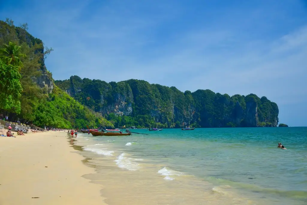
Ao Nang, Krabi Province
Chumphon Province is situated in the northern part of Southern Thailand on the Gulf of Thailand coast, forming a geographical connection between Central Thailand and the southern peninsula. Its landscape includes western mountain ranges and coastal plains extending along the sea to the east. Chumphon has bays, sandy beaches, and islands of various sizes, together with fishing communities whose ways of life have been connected to the Gulf of Thailand for generations.
Thung Wua Laen Beach in Pathio District is one of the province's most famous beaches, known for its long stretch of sand and a setting well suited to seaside relaxation. Chumphon's coast also serves as a departure area for some island and diving excursions, where underwater ecosystems are a major attraction. Travelers should choose swimming areas and marine activities according to weather conditions and recommendations from local beach authorities.
In addition to Thung Wua Laen Beach, Chumphon offers Sai Ri Beach, a place connected to the history of Prince Chumphon Khet Udomsak, as well as attractions within Mu Ko Chumphon National Park and coastal viewpoints in different districts. Inland areas contain fruit orchards and agricultural land, reflecting the importance of commercial crops and regional foods in the northern part of Southern Thailand.
Chumphon is accessible by road, rail, or air, depending on available services. The province is an important stopping point for those traveling farther south and for visitors exploring the Gulf of Thailand coast. Anyone planning island excursions or diving should choose operators with appropriate safety standards and check wave and wind conditions. Several beaches can also be combined in a one-day route from the provincial town toward Pathio District or other nearby coastal areas.
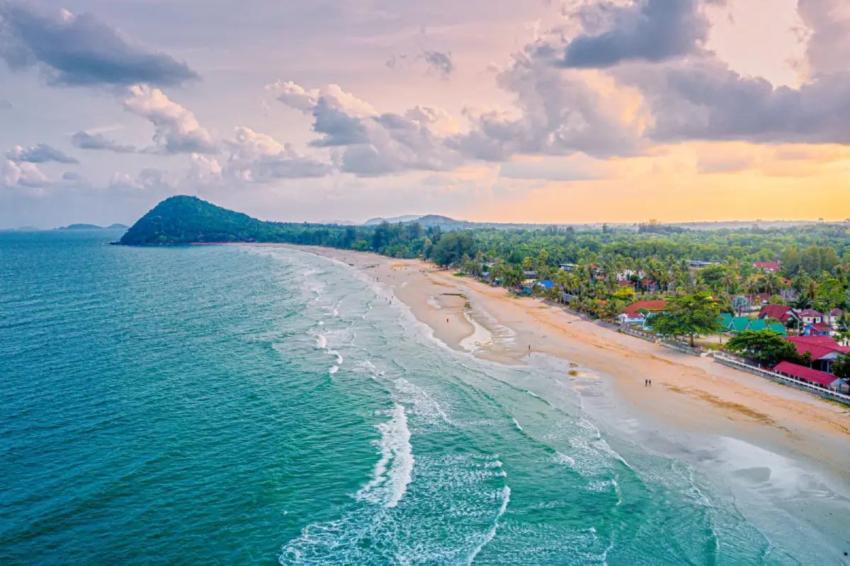
Thung Wua Laen Beach, Chumphon Province
Trang Province lies along the Andaman Sea and has a landscape of plains, rolling hills, limestone mountains, mangrove forests, and islands of different sizes. Its history is closely linked to maritime trade and the port town of Kantang, as well as the development of agriculture and rubber cultivation farther inland. Trang therefore offers both natural tourism attractions and the cultural heritage of historic urban communities, each worth exploring as part of the same journey.
Among Trang's most distinctive attractions are Koh Mook and Emerald Cave, destinations renowned for a sea-cave entrance leading to a hidden beach inside the island. Access depends on tidal levels and sea conditions, so travelers should use experienced boat operators and guides and follow all safety procedures carefully. The site is an excellent example of limestone landscapes transformed by natural erosion into caves and unusually enclosed coastal spaces.
Trang is also home to Koh Kradan, known for its beaches and coral reefs, and Pak Meng Beach, a popular place to relax by the sea. Historic neighborhoods in Trang town and Kantang provide further opportunities to explore the province's past. Local specialties, including Trang-style roast pork and the tradition of eating dim sum, are an important part of the visitor experience and offer an insight into daily life beyond marine attractions.
Travelers can reach Trang by road, rail, or air. Visiting Koh Mook and other islands requires using piers and boat services that operate according to the season and sailing schedule. It is advisable to dedicate separate days to sea excursions and to exploring the historic town and its local food, allowing sufficient time for both. Travelers should also check announcements concerning marine national parks before booking excursions.
Additional information about this important attraction: Koh Mook–Emerald Cave
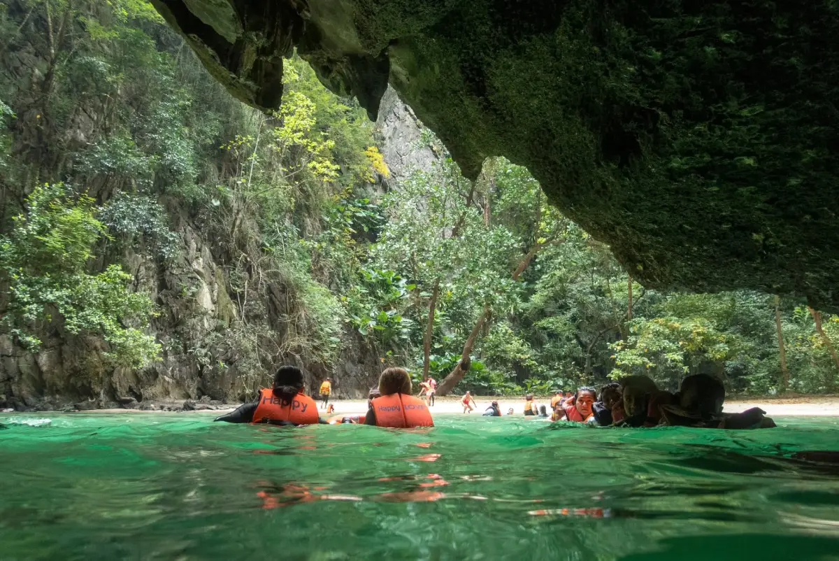
Koh Mook–Emerald Cave, Trang Province
Nakhon Si Thammarat Province is located on the Gulf of Thailand side of the southern peninsula. Its geography combines coastal plains with the Nakhon Si Thammarat mountain range, which extends through the province's inland areas. For many centuries, Nakhon Si Thammarat has been an important center of history, Buddhism, art, and culture in Southern Thailand. Local communities continue to preserve traditional knowledge of handicrafts, cuisine, and performing arts, passing these skills down to new generations.
One of the province's most important landmarks is Wat Phra Mahathat Woramahawihan in Mueang Nakhon Si Thammarat District. This major Buddhist religious site is a symbol of the city and an important place of worship. Its principal reliquary chedi and surrounding temple complex reflect the historical development of Buddhism and artistic traditions in Southern Thailand. Visitors should dress respectfully, observe the needs of people taking part in religious ceremonies, and appreciate the meaning of the traditions associated with the sacred relics.
Nakhon Si Thammarat also offers the community of Ban Khiri Wong, situated at the foot of Khao Luang and well known among travelers interested in nature and local ways of life. Khao Luang National Park is important for conserving watershed forests and biodiversity. The province is also associated with the Sart Duean Sip merit-making tradition and the Nora performing art, both integral parts of local identity. Together, these attractions and traditions give the province religious, historical, natural, and cultural significance.
Nakhon Si Thammarat can be reached by road, rail, or air using its principal transport connections. Visitors focusing on temples and historic neighborhoods can use the provincial city as their base. Those interested in Ban Khiri Wong and natural sites around Khao Luang should allow extra time for routes through mountainous terrain. During the rainy season, weather conditions and the safety of nature trails should be checked before entering forested areas.
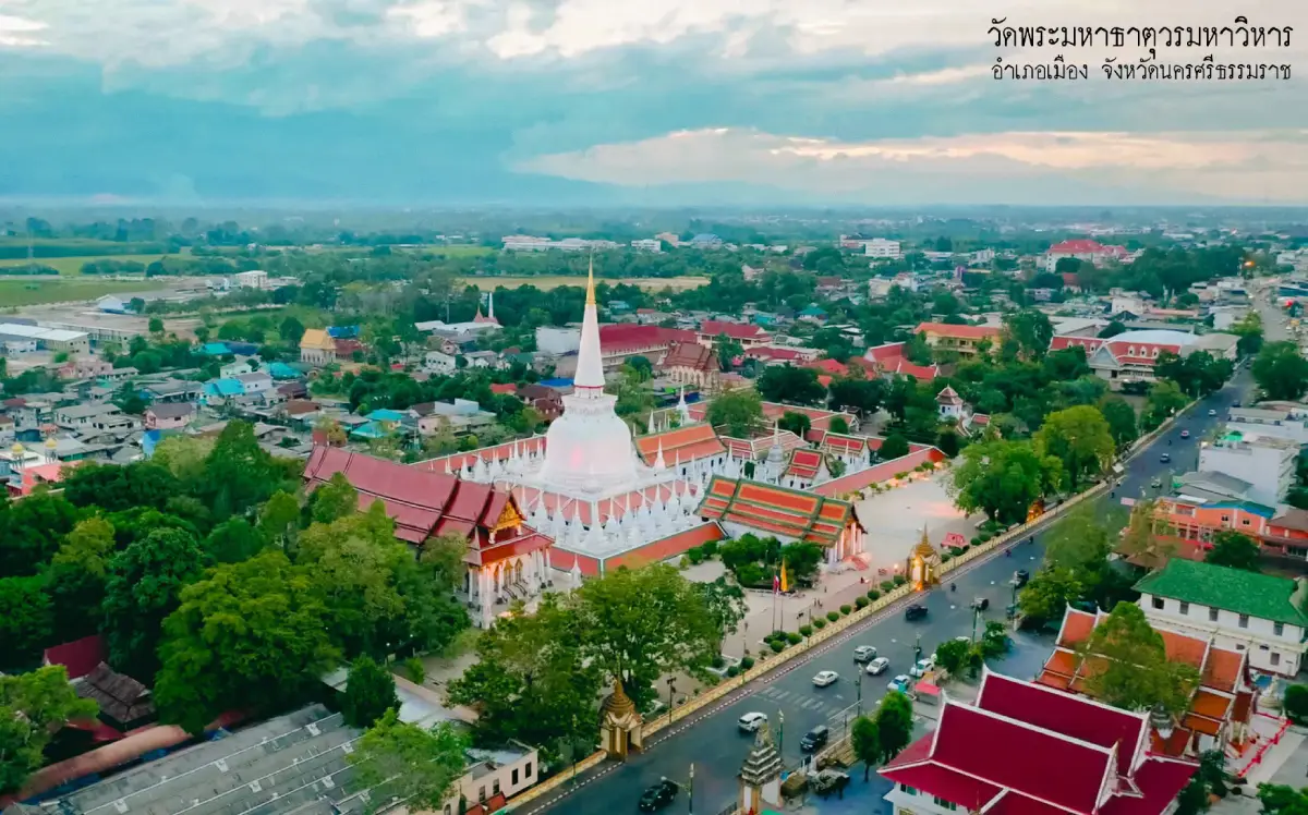
Wat Phra Mahathat Woramahawihan, Nakhon Si Thammarat Province
Narathiwat Province is located near the southern end of Thailand, with a coastline on the Gulf of Thailand to the east and a border with Malaysia to the south. Its landscape includes coastal plains, rivers, peat-swamp forests, and inland hills. The province has a diverse Malay cultural heritage and community traditions reflected in its languages, architecture, cuisine, and important places of worship.
Ao Manao Forest Park in Mueang Narathiwat District is a well-known coastal natural attraction and recreational area. Its scenery includes beaches, rows of trees, and natural surroundings suitable for enjoying views of the coast. Visitors should consider sea conditions, keep the area clean, and follow conservation rules, as coastal ecosystems are sensitive to environmental change.
Narathiwat also has Wadi Al-Hussein Mosque, known locally as Talo Mano Mosque, a noteworthy example of traditional wooden architecture with religious and cultural value. Fishing and agricultural communities along the coast offer additional insights into local livelihoods. Cultural visits should respect community practices and dress requirements at places of worship so that encounters with local traditions remain appropriate and informative.
Narathiwat is accessible through road networks and interprovincial travel services, subject to their current operation. Before traveling, visitors should check local conditions, advice from local authorities, and attraction operating hours, especially for border areas or remote natural destinations. Choosing suitable routes and confirming arrangements with local operators will help travelers plan more carefully.
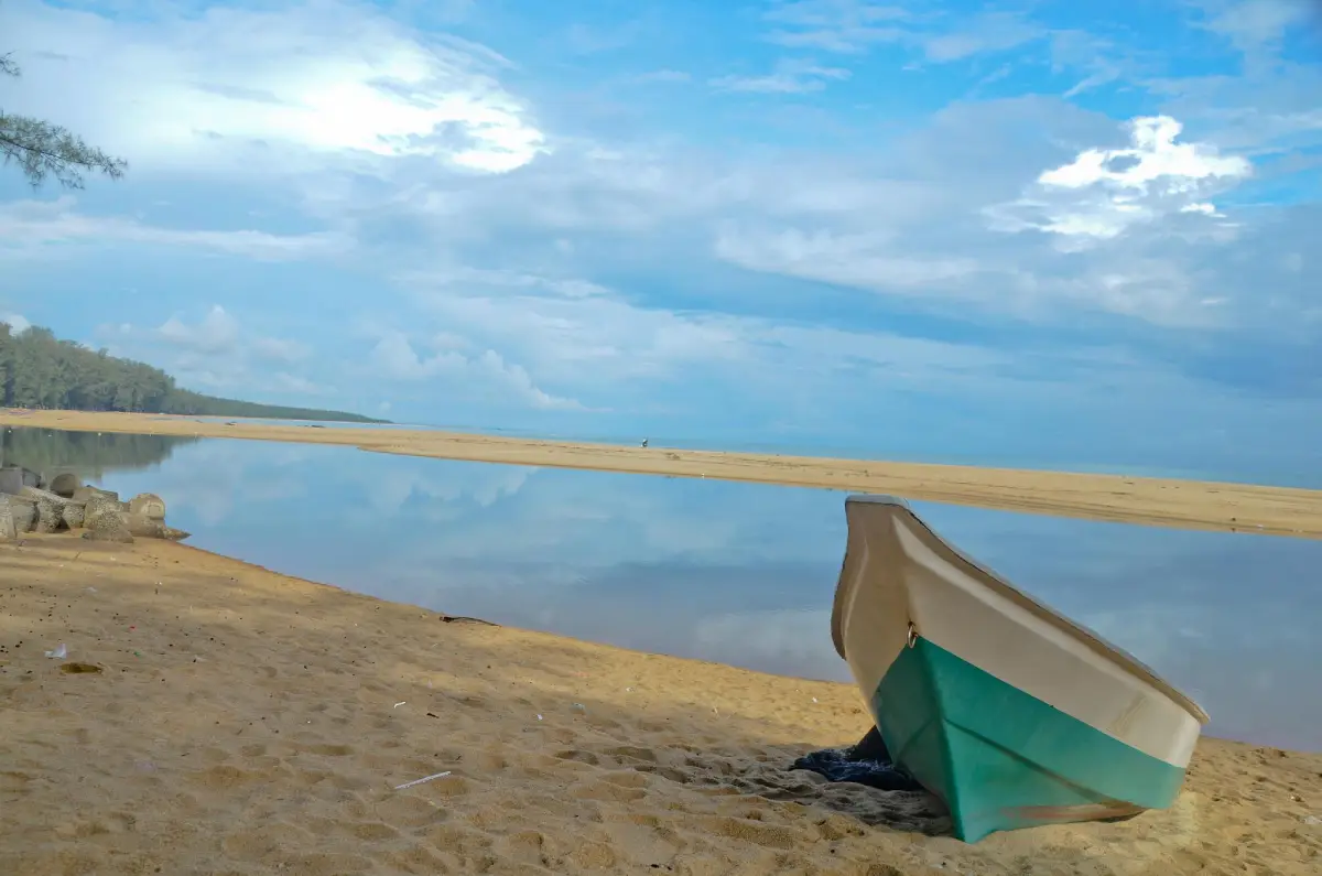
Ao Manao Forest Park, Narathiwat Province
Pattani Province is located along the Gulf of Thailand and is historically significant as the site of longstanding communities and port towns on the Malay Peninsula. Its coastal plains and the Pattani River Basin encouraged settlement and trade in earlier periods. The province's identity is strongly reflected in Malay culture, religious buildings, local cuisine, and historic urban remains that demonstrate cultural relationships among different communities.
Pattani Central Mosque is an important place of worship and one of the province's most recognizable landmarks. Its architecture features prominent domes and elements inspired by Islamic artistic traditions. Visitors should take prayer times and mosque rules into account and ask permission before taking photographs or entering restricted areas, thereby showing respect for an active religious site.
Other important historical and cultural attractions include Krue Se Mosque, valued for its architecture and local stories, and Wat Chang Hai Rat Buranaram, an important destination for Buddhist worshippers. Pattani's food reflects both Malay culture and Thai Buddhist communities, with dishes such as khao yam rice salad, traditional sweets, and seafood. Exploring its towns and neighborhoods offers a richer understanding of the cultural diversity of Southern Thailand than visiting only popular photo stops.
Pattani is connected to Songkhla, Yala, and Narathiwat by major road networks. Travelers planning to explore historic districts or religious sites should check the schedules of activities at each location, dress appropriately, and follow travel advice issued by local authorities for the period of their visit.
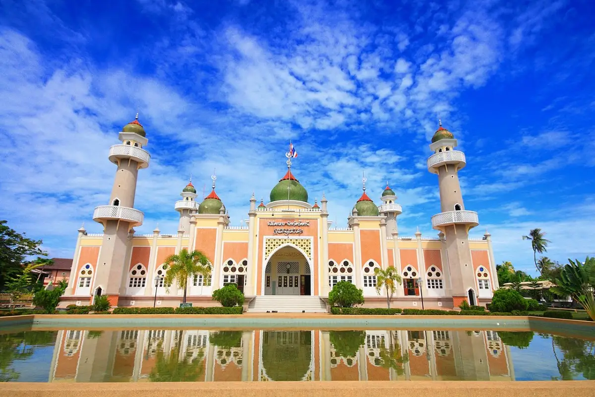
Pattani Central Mosque, Pattani Province
Phang Nga Province lies along the Andaman Sea and features limestone mountains, tropical rainforests, mangrove forests, and bays filled with rocky islands. Its deeply indented coast and remarkable limestone towers rising from the sea are the results of geological processes operating over very long periods. These formations give Phang Nga a landscape that differs considerably from the long, open beaches found in several other southern provinces.
Ao Phang Nga National Park protects a distinctive combination of limestone islands, mangrove ecosystems, and tidal waterways. Visitors commonly take boat trips to admire the scenery inside the bay, with Khao Tapu, Khao Phing Kan, and Koh Panyee among its well-known destinations. Boat excursions should be arranged through licensed operators, and activities that could disturb natural habitats should be avoided.
Beyond Phang Nga Bay, the province offers Khao Lak, a popular coastal retreat, and the Surin Islands, an important marine destination with valuable ecosystems. Access to marine national parks may be subject to seasonal closures or changing conservation requirements. Travelers should therefore check official opening status and notices issued by the relevant park authorities before each visit.
Phang Nga can be reached by road along routes connecting it with Phuket, Krabi, and Surat Thani. Those focusing on Phang Nga Bay should plan their trip around operating piers within the province. Travel to the Surin Islands requires separate arrangements for boats and the appropriate visiting season. Attractions situated far apart should not be forced into a single-day itinerary simply because they belong to the same province.
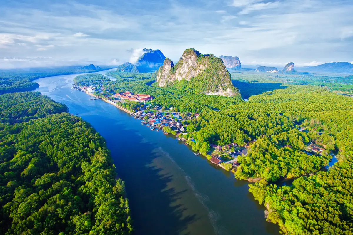
Ao Phang Nga National Park, Phang Nga Province
Phatthalung Province lies inland on the eastern side of the southern peninsula. It is connected to the Songkhla Lake system and bordered to the west by the Banthat mountain range. Its landscape includes agricultural plains, wetlands, limestone hills, and communities whose livelihoods depend heavily on water resources. Phatthalung is therefore a clear example of a southern province without a direct open-sea coastline but with outstanding lake and wetland attractions.
Thale Noi in Khuan Khanun District is a celebrated natural destination known for waterbirds, lotus flowers, peatland habitats, and traditional communities around the wetlands. The Thale Noi Non-Hunting Area plays an important role in ecosystem conservation. Within it, the Khuan Khi Sian peat swamp was designated as Thailand's first Ramsar wetland site. Early-morning visitors often enjoy boat trips to observe aquatic vegetation, waterbirds, and the distinctive wetland scenery.
Another important landmark is Khao Ok Thalu, the hill widely recognized as a symbol of Phatthalung. Routes along the lakeshore and the Pak Pra community are notable for traditional fishing and handicrafts made from krajood sedge. The province's cultural heritage is also closely connected with Nora performance and shadow puppetry, which have been passed down through generations across Southern Thailand. Visitors can therefore explore both natural environments and traditional knowledge within the same trip.
Visitors generally reach Thale Noi by driving to Khuan Khanun District and continuing to one of the operating boat piers. Morning is usually a good time to observe lotus flowers and waterbirds, although the best conditions depend on the season and water levels. With more time available, travelers can combine Thale Noi with Phatthalung town and communities around the lake, allowing for the journey between boat piers and land-based attractions.
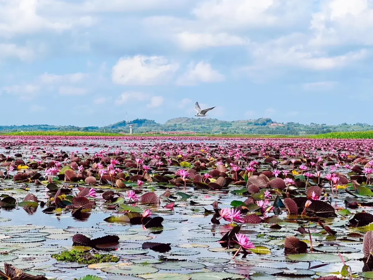
Thale Noi, Phatthalung Province
Phuket Province occupies a large island in the Andaman Sea and is connected to the mainland in neighboring Phang Nga Province by bridges. Its geography includes hills, beaches, bays, and urban areas that developed through trading and tin-mining activities. Phuket is now a major transportation and tourism hub for the Andaman coast, while retaining important architectural heritage and the distinctive cultural traditions of its historic town communities.
The Sino-Portuguese historic buildings of Phuket Old Town illustrate the commercial relationships that developed among people of different cultural backgrounds. Traditional shophouses combine Chinese influences with Western architectural features, reflecting the histories of merchants, communities, and families involved in the city's growth. Exploring the streets of the old town allows visitors to appreciate Phuket's historical and cultural identity beyond its better-known beaches.
Famous seaside attractions include Patong Beach, Kata Beach, Karon Beach, and Promthep Cape, a popular viewpoint overlooking the coast. Phuket is also a major departure center for boat excursions to islands and diving destinations in the Andaman Sea. Local Phuket cuisine and the traditions of Thai-Chinese communities are another significant part of the province's cultural tourism and deserve time in any well-rounded itinerary.
Phuket can be reached by air or by road across the bridges linking the island with Phang Nga. Once there, visitors should plan old-town sightseeing and beach visits separately because they take place in different parts of the island, and should allow for traffic at busy times of the year. Those heading to offshore islands should choose piers and sailing times that suit their destinations and monitor marine forecasts before departure.
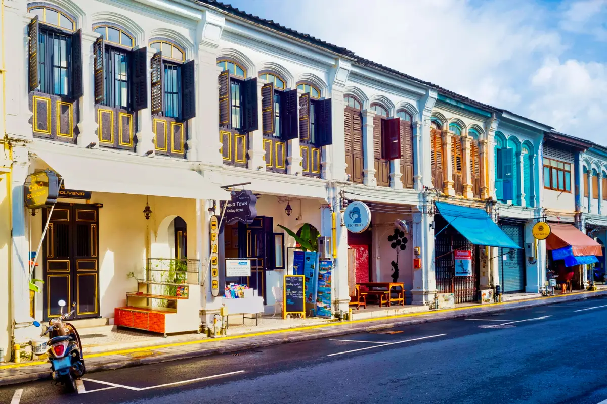
Sino-Portuguese Historic Buildings of Phuket Old Town, Phuket Province
Ranong Province lies on the upper Andaman coast and shares part of its border with Myanmar. Its landscape includes mountains, rainforests, rivers, and a coastline scattered with islands. Ranong experiences high rainfall and humidity during much of the year, contributing to its green forest landscapes. These natural features are complemented by coastal community life and a town with a history of maritime transportation and commerce.
Koh Phayam is one of Ranong's major tourist destinations, known for its beaches, bays, and local communities in an atmosphere quite different from that of larger resort cities. The island is well suited to relaxation, nature appreciation, and learning about island life. Access is by boat from the Ranong mainland, so visitors should check the relevant seasonal operating schedules.
In addition to Koh Phayam, Ranong offers Namtok Ngao National Park, hot springs around the provincial town, and nature trails associated with rainforest streams. The province therefore lends itself to trips combining island relaxation with forested mountain environments rather than focusing exclusively on beaches.
Ranong can be reached on major roads connecting it with Chumphon and other Andaman-coast provinces. Travelers heading for Koh Phayam should time their journey around boat departures and check sea-condition notices, particularly during periods of heavy rainfall. Those focusing on inland natural attractions should allow extra time for mountain roads and confirm the access status of any national parks they plan to visit.
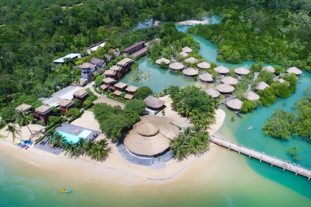
Koh Phayam, Ranong Province
Satun Province is located on the lower Andaman coast, with a coastline, numerous islands, limestone mountains, and areas bordering Malaysia. Its geography is especially important for geological heritage and marine ecosystems, giving Satun an exceptional variety of coastal attractions, caves, forests, and islands. Culturally, Satun's communities reflect the linguistic, religious, and culinary diversity of the Malay Peninsula.
Koh Lipe is one of Satun's best-known marine destinations. Its beaches and clear waters attract visitors interested in relaxation and snorkeling. The island belongs to the broader geographical setting of the Tarutao and Adang–Rawi island groups, making the conservation of marine ecosystems and local community life especially important. Visitors should follow local regulations and choose activities that minimize damage to coral reefs and marine wildlife.
In addition to Koh Lipe, Satun has Tarutao National Park, the Adang–Rawi Islands, and geological attractions that reveal the long history of the region's rocks and landforms. Exploring Satun is therefore suitable for people interested in nature both above and below the sea, as well as learning about geoparks and the livelihoods of coastal communities.
Most journeys to Koh Lipe begin at Pak Bara Pier in Satun Province, followed by a scheduled boat service. Travelers should check the dates when tourism areas within national parks are open, ferry conditions, and wave forecasts before booking accommodation or snorkeling activities. Those planning trips to several islands should allow spare time in case changing sea conditions affect boat routes.
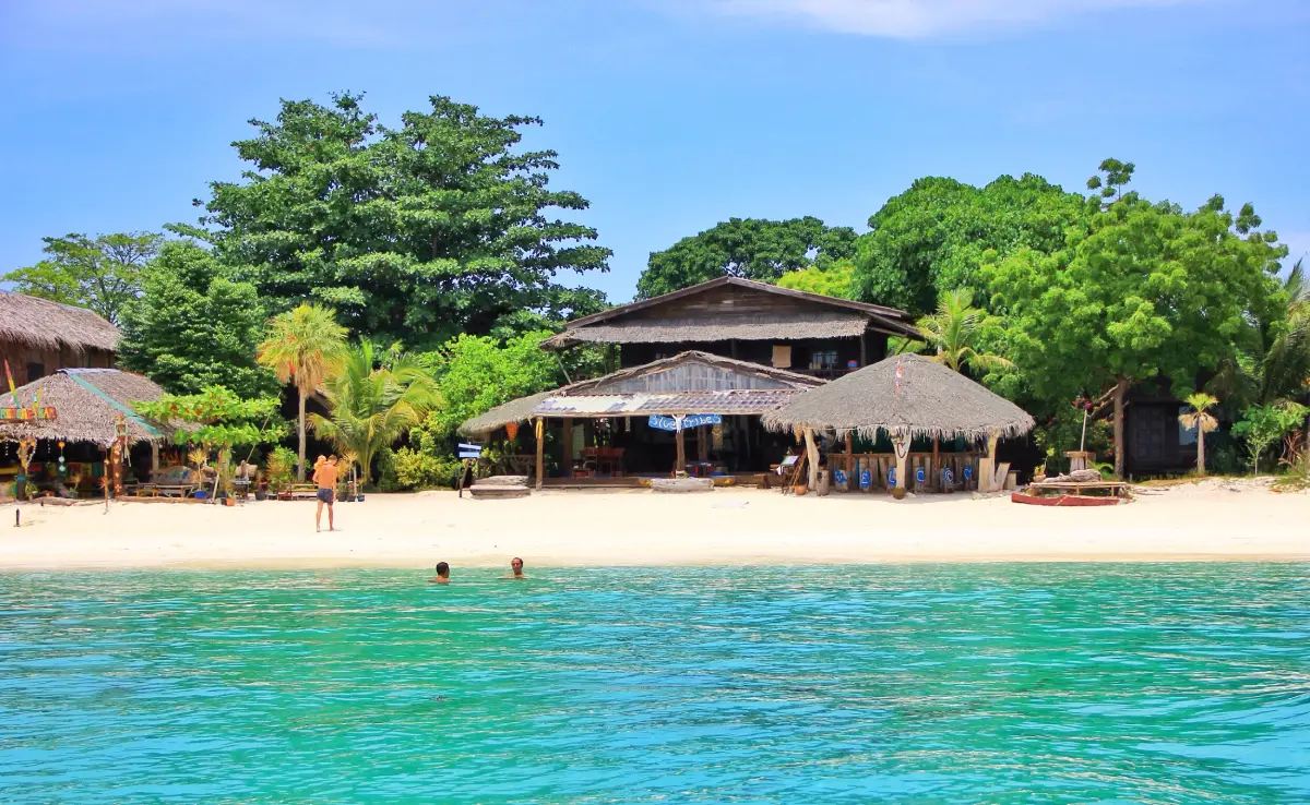
Koh Lipe, Satun Province
Songkhla Province is situated along the lower Gulf of Thailand coast and is closely connected with the extensive Songkhla Lake system. It is an important center of the economy, education, and transportation in lower Southern Thailand. Hat Yai, in particular, connects major railway routes, highways, and international travel networks. Songkhla's geographical and cultural diversity includes coastal landscapes, historic towns, fishing communities, and a multicultural urban heritage.
Songkhla Old Town preserves historic buildings, streets, shops, and communities that reflect maritime trade and settlement by people of different backgrounds. Some buildings feature Chinese and Western architectural influences adapted to the local environment. Walking through the old town helps visitors understand Songkhla's development as a historically important port long before the expansion of modern commercial centers.
Other notable attractions include Samila Beach, a recognizable symbol of the city's tourism; Koh Yo, where community life is closely linked to Songkhla Lake; and Khao Tang Kuan, a viewpoint overlooking the city and coast. Hat Yai also offers markets and shopping centers popular with both Thai and international visitors. Songkhla is therefore well suited to itineraries combining historic neighborhoods, local food, and nearby natural landscapes.
Songkhla can be reached by road, rail, or air through Hat Yai International Airport, depending on available services. Visitors interested in Songkhla Old Town and Samila Beach should allow time in Songkhla city separately from market activities in Hat Yai. Routes around Songkhla Lake should also be checked when traveling to Koh Yo or onward to Phatthalung Province.
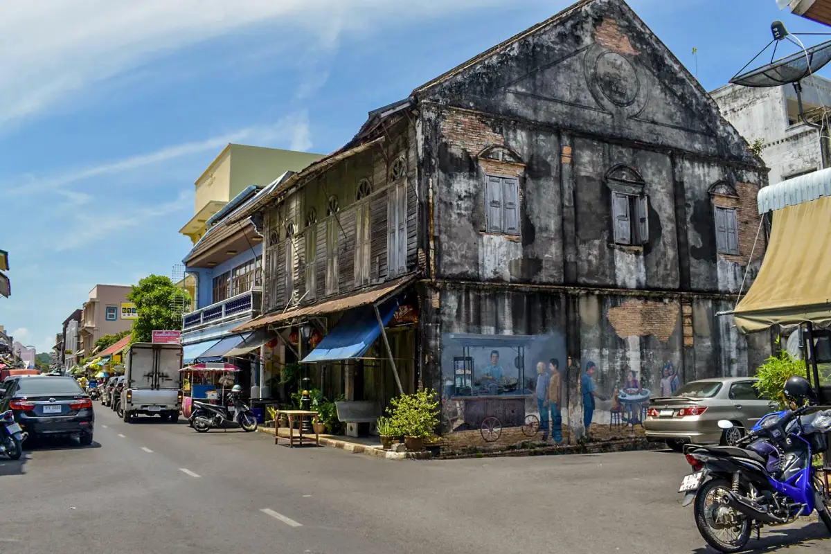
Songkhla Old Town, Songkhla Province
Surat Thani Province is a major province on the Gulf of Thailand, with a diverse landscape of coastline, islands, limestone mountains, rainforests, and inland river basins. It serves as an important gateway to the Gulf islands as well as natural attractions in mountainous areas. Travelers can therefore plan very different journeys here, ranging from seaside holidays to exploring watershed forests and limestone landscapes.
Ratchaprapha Dam, also known as Chieo Lan Dam, is one of Surat Thani's most important tourist destinations. Located in Ban Ta Khun District in an area associated with Khao Sok National Park, it is famous for its expansive reservoir and steep limestone mountains rising above the water, creating scenery quite unlike that of the coast. Exploring the reservoir involves boat transportation and visiting natural areas, so journeys should be carefully planned and relevant safety rules followed.
Surat Thani's coastal and island areas include Koh Samui, Koh Phangan, and Koh Tao, major destinations for beaches, diving, and relaxation. Inland, Khao Sok National Park protects forest environments with high biodiversity. Exploring both coastal and forest destinations within the province reveals the geographical contrasts of Southern Thailand, where islands in the Gulf of Thailand and extensive rainforests can be found within the same administrative area.
Surat Thani can be reached by road, rail, or air. Travelers can continue to the ferry piers serving its islands or travel inland toward Ban Ta Khun and Khao Sok. Island trips and reservoir excursions should be planned separately because they involve routes in different directions. Weather conditions, ferry schedules, and national park access should all be checked before setting travel dates.
Additional information about this important attraction: Ratchaprapha Dam (Chieo Lan Dam)

Ratchaprapha Dam (Chieo Lan Dam), Surat Thani Province
Yala Province is an inland province in the southernmost part of Thailand, sharing a border with Malaysia but having no direct open-sea coastline. Much of its landscape consists of mountains and forests, especially around Betong and Than To districts. Yala has a cultural heritage shaped by the coexistence of different communities, reflected in languages, religions, food, and cross-border trade. Its distinctive character makes it a very different destination from the peninsula's coastal provinces.
The Aiyerweng area of Betong District is known for its misty viewpoints and mountain scenery. Khao Microwave is one viewpoint associated with this highland landscape. Visitors often travel there early in the morning in the hope of seeing a sea of mist when conditions are suitable, but its appearance cannot be guaranteed every day. Mountain-road conditions should be considered, and the operating status of viewpoints checked before departure.
Yala also includes the border town of Betong, known for its distinctive cuisine and community life, together with attractions such as the Piyamit Tunnel and Betong Hot Springs. These places are associated with local history and natural resources. Travelers can learn about borderland geography and local culture while combining nature-based activities with relaxation.
Travel to Yala is possible via road networks and transport services connecting it with neighboring provinces. Visitors heading to Betong should allow sufficient time for mountain roads, some of which have numerous bends, and follow travel guidance from local authorities before entering remote or border areas. Those wishing to see the sea of mist may find it convenient to stay nearby overnight so they can begin their journey early in the morning.
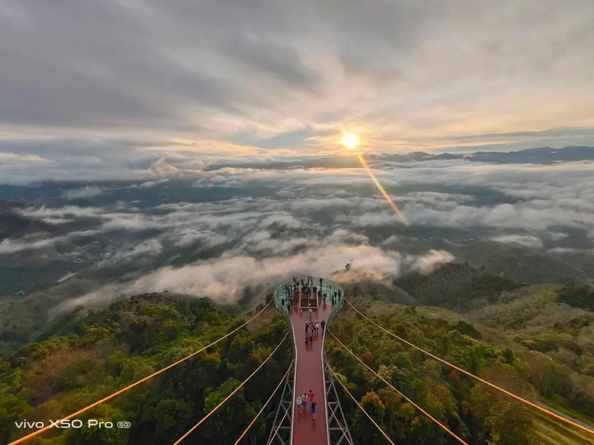
Khao Microwave, Yala Province
Reading the list of all 14 provinces alongside a map makes it clear that Southern Thailand is not simply a collection of seaside destinations offering the same experiences. It is a region of considerable natural, historical, and social diversity. The Andaman provinces feature distinctive limestone landscapes and island groups, while the Gulf of Thailand provinces have their own coastal towns and important islands. Phatthalung and Yala reveal the attractions of inland lakes, mountains, and peninsular communities. Studying the map and provincial information therefore helps readers understand how geography influences settlement patterns, occupations, food, and tourist activities.
When planning a journey, travelers should first choose groups of neighboring provinces and then select attractions that match their interests. Island trips require checking piers and seasonal sea conditions. History and culture enthusiasts should allow suitable time for historic towns, temples, and mosques. Those interested in mountain landscapes or wetlands should check national park access and safety recommendations. Using a map of Southern Thailand together with the names of all 14 provinces is therefore a valuable way to create coherent itineraries, experience the region's diversity, and respect the distinctive heritage of each community.
Frequently Asked Questions (FAQ)
Q: How many provinces are there in Southern Thailand, and what are their names?
A: Southern Thailand has 14 provinces: Krabi, Chumphon, Trang, Nakhon Si Thammarat, Narathiwat, Pattani, Phang Nga, Phatthalung, Phuket, Ranong, Satun, Songkhla, Surat Thani, and Yala, according to Thailand's six-region geographical classification.
Q: Which seas lie to the west and east of Southern Thailand?
A: The Andaman Sea lies to the west of the southern peninsula, while the Gulf of Thailand lies to the east. The two coasts differ in their landscapes and monsoon seasons.
Q: Which Southern Thai provinces are on the Andaman coast?
A: Six provinces have direct coastlines on the Andaman Sea: Ranong, Phang Nga, Phuket, Krabi, Trang, and Satun. Many areas are characterized by islands, beaches, and limestone landscapes.
Q: Which Southern Thai provinces have coastlines on the Gulf of Thailand?
A: The provinces with direct Gulf of Thailand coastlines are Chumphon, Surat Thani, Nakhon Si Thammarat, Songkhla, Pattani, and Narathiwat. They include beaches, port towns, and coastal communities.
Q: Do Phatthalung and Yala have sea coastlines?
A: Phatthalung is connected with Songkhla Lake and its wetlands but has no direct open-sea coastline. Yala is an inland province bordering Malaysia and has no coastline.
Q: Which Southern Thai provinces are best for island and beach trips?
A: Examples of provinces suited to island trips include Krabi, Phang Nga, Phuket, Trang, Satun, Surat Thani, Ranong, and Chumphon. Visitors should choose destinations and travel seasons according to wave and wind conditions.
Q: Which provinces stand out for historical and cultural attractions?
A: Nakhon Si Thammarat is known for Wat Phra Mahathat Woramahawihan; Phuket for its Old Town; Songkhla for historic streets and neighborhoods; and Pattani for important mosques. Narathiwat and Yala also preserve distinctive Malay cultural heritage and local communities.
Q: Are there natural attractions in Southern Thailand beyond beaches and islands?
A: Yes. Examples include Thale Noi in Phatthalung, Khao Sok National Park in Surat Thani, the Khao Luang area of Nakhon Si Thammarat, Ngao Waterfall in Ranong, and sea-of-mist viewpoints in Betong District, Yala.
Q: What is the best time of year to visit Southern Thailand?
A: There is no single ideal time for the whole region because the Andaman and Gulf of Thailand coasts experience the effects of the monsoon at different times. Travelers should check seasonal access for islands and national parks and review marine forecasts shortly before departure.
Q: How can travelers get around Southern Thailand?
A: Depending on available routes, travelers can use cars, trains, airplanes, and passenger boats. Island destinations require checking ferry departure points, sailing schedules, and conservation-area regulations before travel.
Q: What are important cultural traditions of Southern Thailand?
A: Important examples include Nora performing arts, shadow puppetry, the Sart Duean Sip festival, Chak Phra processions, and the traditions of coastal and Malay communities, whose religious practices, languages, and cuisines vary by locality.
Q: How can travelers use the Southern Thailand map to plan a convenient itinerary?
A: Group destinations geographically, such as Ranong–Phang Nga–Phuket–Krabi for an Andaman coast journey or Chumphon–Surat Thani–Nakhon Si Thammarat for a Gulf coast route. Phatthalung–Songkhla–Yala can be planned separately according to interests. Always check actual road travel times.
 Category: ●Travel Articles, Recipes
 Group: ●Travel Review, Food Review
Last Update : 1 DayAgo
 Last Update : 1 DayAgo
Recommend

 Art, Culture and Heritage
 Historical Sites and Monuments(9)
 Landmarks and Memorials(9)
 Royal Palace(1)
 Art, Craft Centres, Tradition(12)
 Museums(5)
 Educational Places
 Educational Gardens, Farm(2)
 University
 Public university(1)
 Autonomous Universities(3)
 Rajamangala University of Technology(2)
 Rajabhat University(1)
 Private University(1)
 Places of Worship
 Temple(44)
 Mosque(2)
 Other Sacred Sites(17)
 Research and Development
 Royal Project(2)
 Suburban Living
 Village, Community(8)
 Local Market(1)
 Floating Market(1)
 Nature and Wildlife
 National Parks and Marine Reserves(6)
 Mountain (Doi)(11)
 Dam, Reservoir, Lake(10)
 Waterfalls(43)
 Hot Springs(1)
 Caves(13)
 River, Canal(3)
 Bays and Beaches(29)
 Islands(2)
 Other natural attractions(3)
 Entertainment and Agricultural
 Farms, Parks and Ecotourism(3)
 Outdoor and Adventure Activities(4)
Travel Review, Food Review(6)
 Southern Food Menu, Southern Food Recipes(18)


