
lovethailand home >Northeastern Travel Attractions >Kalasin Travel Attractions > 20 Best Places to Visit in Kalasin
TL;DR: 20 Best Places to Visit in Kalasin. Kalasin is a distinctive province in Northeastern Thailand where the prehistoric world of dinosaurs meets Dvaravati civilization, Phu Thai.
20 Best Places to Visit in Kalasin
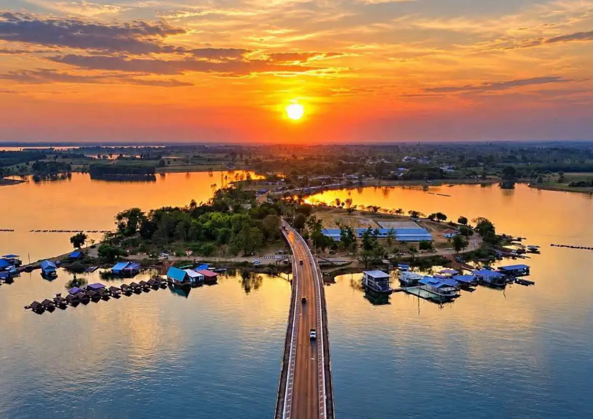
20 Best Places to Visit in Kalasin Kalasin is a distinctive province in Northeastern Thailand where the prehistoric world of dinosaurs meets Dvaravati civilization, Phu Thai culture, Phrae Wa silk, mountains, forests, and the vast waters of Lam Pao Reservoir. This makes the province especially suitable for travelers who want to experience nature, history, science, religion, culture, and community life in a single Isan destination. Sahatsakhan District is particularly important as the center of Kalasin’s dinosaur tourism, while Kamalasai District is home to the ancient city of Fa Daet Song Yang, one of the most important archaeological sites connected with early civilization in the Chi River basin.
For travelers visiting Kalasin for the first time, the best starting points are Sirindhorn Museum and the Phu Kum Khao Dinosaur Excavation Site. Together, they explain why Kalasin has become widely recognized as one of Thailand’s major dinosaur destinations. From there, visitors can continue to Phu Sing Buddhist Sanctuary for panoramic views over Sahatsakhan and Lam Pao Reservoir, visit Wat Phuttha Nimit at Phu Khao, cross the long Thepsuda Bridge, and end the day around Lam Pao Dam. With 2–3 days, add Phra That Ya Khu, Phu Faek Forest Park, and Ban Phon Phrae Wa Silk Weaving Group to experience paleontology, Dvaravati heritage, natural landscapes, and Phu Thai culture in greater depth.
Kalasin’s landscape includes lowlands, agricultural plains, mountain areas connected with the Phu Phan range, dry dipterocarp forest, mixed deciduous forest, streams, and large reservoirs. The northern and eastern parts of the province become increasingly mountainous and forested, while the central and southern areas are closely connected with the Chi River and Lam Pao River basins. These waterways supported agricultural settlements and ancient communities for generations. This geographical diversity gives Kalasin a broad range of attractions, from mountains and forests to fossil sites, reservoirs, archaeological areas, and traditional craft communities.
What clearly distinguishes Kalasin from many other destinations in Isan is its extraordinary evidence of dinosaurs and prehistoric life. Phu Kum Khao in Sahatsakhan District is one of Thailand’s most important dinosaur-bone discovery sites, where numerous herbivorous dinosaur fossils have been found in the Sao Khua Formation, dating to around 130 million years ago. Meanwhile, Phu Faek Forest Park in Na Khu District preserves carnivorous dinosaur footprints on a sandstone surface estimated to be around 140 million years old. Together, these 2 sites allow travelers to connect tourism with a direct understanding of Thailand’s prehistoric past.
In terms of human history, Kalasin is home to the ancient city of Fa Daet Song Yang in Kamalasai District, one of the province’s most important historical areas. The city was surrounded by moats and earthen embankments and has yielded extensive evidence of Dvaravati-period Buddhism, including sandstone sema stones, Jataka reliefs, religious foundations, and archaeological artifacts. Phra That Ya Khu, located within the ancient city, remains both a center of faith and an important landmark showing the development of local religious architecture from the Dvaravati period through the Ayutthaya and Rattanakosin eras.
Another defining part of Kalasin is the culture of the Phu Thai people, particularly in Kham Muang District and Ban Phon community, which is renowned for Phrae Wa silk weaving. Phrae Wa silk is often referred to as the “Queen of Thai Silk” because of its intricate supplementary-weft and multicolored decorative techniques. The patterns woven into each textile are not simply ornamental; they reflect knowledge, belief, traditional dress, and the cultural identity of Phu Thai women passed down through generations.
Music and traditional performance are equally important to Kalasin’s identity, especially the Pong Lang, an Isan percussion instrument that has become one of the province’s best-known cultural symbols. It is closely associated with the annual Pong Lang and Phrae Wa Silk Festival, when visitors can experience Pong Lang music, traditional dance, Phrae Wa clothing, and community products together in one celebration.
Kalasin cuisine maintains strong Isan roots, with dishes such as larb, koi, som tam, jaew dipping sauces, grilled foods, and freshwater fish. Communities around Lam Pao Dam depend heavily on freshwater fisheries, so grilled fish, fried fish, fish soups, and other local fish dishes are common throughout the area. Besides Phrae Wa silk, popular souvenirs include Phu Thai textiles, handicrafts, processed foods, and community-made products from different districts.
For efficient trip planning, Kalasin can be divided into several travel zones. The Sahatsakhan–Lam Pao Zone includes Sirindhorn Museum, Phu Kum Khao, Phu Sing Buddhist Sanctuary, Wat Phuttha Nimit, Thepsuda Bridge, and Lam Pao Dam. The Kamalasai Zone focuses on Fa Daet Song Yang Ancient City and Phra That Ya Khu. The Na Khu Zone is best for Phu Faek Forest Park and dinosaur footprints, while the Kham Muang Zone is ideal for Phrae Wa silk and Phu Thai culture. Around Lam Pao Dam, the Lam Pao Wildlife Conservation Promotion and Development Station is another worthwhile stop for families and nature enthusiasts.
If you have only 1 day, a good Sahatsakhan itinerary begins at Sirindhorn Museum, continues to Phu Kum Khao Dinosaur Excavation Site, Phu Sing Buddhist Sanctuary, Wat Phuttha Nimit, and Thepsuda Bridge, and ends with the atmosphere of Lam Pao Reservoir. With 2–3 days, add Phra That Ya Khu and Ban Phon. A 4–5 day trip can be extended to Phu Faek Forest Park, Lam Pao wildlife conservation areas, and attractions in other districts, allowing visitors to experience Kalasin as a dinosaur destination, a Dvaravati heritage center, a Phrae Wa silk province, and a land shaped by life around the Lam Pao River.
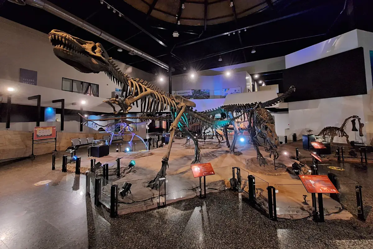
1. Sirindhorn Museum is located at 200 Moo 11, Non Buri Subdistrict, Sahatsakhan District. It is one of Thailand’s most important dinosaur museums and fossil-learning centers. Its greatest strength is the way it connects a real dinosaur excavation site with exhibitions on geology, paleontology, the evolution of life, and modern museum technology. For this reason, it should be one of the first places visited in Kalasin, particularly for families, children, students, and anyone interested in dinosaurs.
Highlight: Exhibitions arranged chronologically from the origin of the universe and formation of the Earth to early life, the age of dinosaurs, extinction events, the evolution of mammals, and human development. Visitors can also see dinosaur skeletons, genuine fossils, life-size models, multimedia displays, and the nearby Phu Kum Khao Dinosaur Excavation Site.
The museum developed directly from major dinosaur discoveries at Phu Kum Khao, a hill near Wat Sakkawan. After numerous large bones were discovered and the area was recognized as an exceptionally important fossil site, systematic scientific studies were carried out and the site gradually developed into a major paleontological learning center.
The exhibitions do not begin immediately with dinosaurs. Instead, visitors are taken back to the birth of the universe, the solar system, and the Earth before learning about geological change, the emergence of life, and evolution through different eras. This chronological storytelling allows visitors without a scientific background to understand the broader history of the planet more easily.
One of the site’s major scientific highlights is the discovery of numerous herbivorous sauropod dinosaurs, particularly fossils associated with Phuwiangosaurus sirindhornae. Seeing the skeletons and scientific information close to the original discovery site creates an experience very different from an ordinary museum, because visitors can immediately connect the objects inside the exhibition halls with the real landscape outside.
Visitors should allow at least 2–3 hours for the museum. Families traveling with children may want even more time because of the models, learning stations, and interactive educational content. Arriving in the morning also makes it easier to continue to Phu Kum Khao and Phu Sing Buddhist Sanctuary on the same day.
Sirindhorn Museum is also the best starting point for travelers who want to understand the “Kalasin Dinosaur City” route before continuing to Phu Kum Khao and Phu Faek Forest Park. The museum provides useful background on dinosaur species, geological formations, fossilization, and excavation methods, making later visits to real fossil sites much more meaningful.
Getting There: The museum is located in Non Buri Subdistrict, Sahatsakhan District. From Kalasin city, take Highway 227 along the Kalasin–Sahatsakhan route for approximately 25–30 kilometers. Open Tuesday–Sunday from 09.30–16.30 and closed on Monday.
Map (GPS): https://www.google.com/maps/dir/?api=1&destination=16.692339,103.523922&travelmode=driving
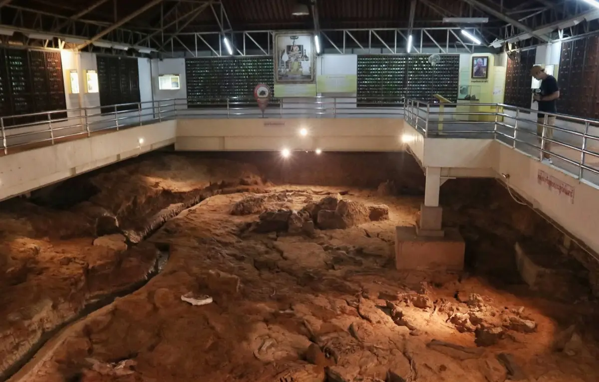
2. Phu Kum Khao Dinosaur Excavation Site is located at the foot of Phu Kum Khao within the grounds of Wat Sakkawan, Non Buri Subdistrict, Sahatsakhan District, close to Sirindhorn Museum. It is one of Thailand’s most important dinosaur fossil excavation sites and lies at the heart of the story that established Kalasin as a major dinosaur destination.
Highlight: A genuine fossil excavation pit, numerous herbivorous dinosaur bones found in the approximately 130-million-year-old Sao Khua Formation, opportunities to learn about fossil excavation and conservation, and a close connection with Sirindhorn Museum and Wat Sakkawan in the same area.
Phu Kum Khao began attracting serious attention after large bones were discovered near Wat Sakkawan. Scientific investigation later confirmed that many of the remains belonged to dinosaurs, particularly long-necked herbivorous species. The finds include bones from several parts of the skeleton preserved within geological layers that allow paleontologists to study the environment of the past.
The significance of the site is not limited to the number of fossils discovered. Visitors can also observe the actual place where the bones were found. Unlike a museum where specimens are removed and displayed in showcases, Phu Kum Khao allows travelers to see how dinosaur bones occur within rock layers and understand how careful and time-consuming excavation work can be.
The Sao Khua Formation exposed in this area is one of the most important fossil-bearing geological formations in Northeastern Thailand. Studies of Phu Kum Khao fossils have contributed to knowledge of prehistoric life and the regional environment during the Early Cretaceous period, giving the site national importance in tourism, education, and scientific research.
Sirindhorn Museum and Phu Kum Khao should be visited together because they are extremely close to one another. Seeing the museum first provides the terminology and scientific background, while the excavation site then allows visitors to connect that knowledge with real geological evidence. This sequence works especially well for both children and adults.
Wat Sakkawan also contains active religious areas and sacred objects respected by the local community. Visitors should therefore dress modestly and maintain a respectful atmosphere. The coexistence of a Buddhist temple and a major paleontological site is one of the qualities that makes Phu Kum Khao unusual among dinosaur attractions.
Getting There: The excavation site is located at Wat Sakkawan, Non Buri Subdistrict, Sahatsakhan District. From Kalasin city, follow Highway 227 for approximately 25–28 kilometers. Open Tuesday–Sunday from 09.30–16.30 and closed on Monday, except when special public-holiday arrangements are announced.
Map (GPS): https://www.google.com/maps/dir/?api=1&destination=16.694504,103.524743&travelmode=driving
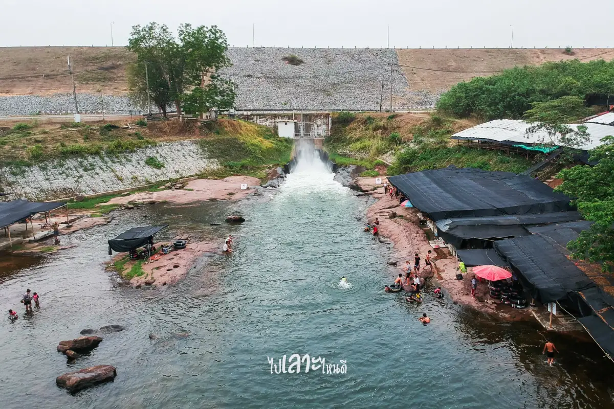
3. Lam Pao Dam is a large earth dam and one of Kalasin’s most important landmarks. The reservoir extends across several districts, including Mueang Kalasin, Yang Talat, Nong Kung Si, and Sahatsakhan. It plays important roles in irrigation, flood control, freshwater fisheries, and tourism, while the vast open water has made it a popular recreational area for local residents and visitors.
Highlight: The dam crest and large reservoir, sunset scenery, Dok Ket Beach with its freshwater-beach atmosphere, Lam Pao Wildlife Conservation Promotion and Development Station, Thepsuda Bridge, and scenic routes connecting Sahatsakhan with communities around the reservoir.
Construction of the Lam Pao Dam project began in 1963 and was completed in 1968. Its main purpose was to manage water from the Lam Pao and Huai Yang waterways, reduce flooding during the rainy season, and store water for agricultural use during the dry season. The creation of such a large reservoir significantly changed both the landscape and the local economy.
In addition to irrigation, Lam Pao Dam has become an important freshwater fishing area. Communities around the reservoir earn income from fishing, aquaculture, and restaurants that use local aquatic products. Visiting the dam can therefore be combined with tasting grilled fish, fried fish, soups, and other freshwater dishes linked directly with local fishing traditions.
Dok Ket Beach is especially popular during hot weather. It is an open reservoir-side recreation area where families can enjoy the scenery and breeze. Late afternoon is an excellent time to visit because sunset over the reservoir is one of the characteristic views associated with traveling in Kalasin.
Roads around the reservoir also connect with Thepsuda Bridge, Phu Sing Buddhist Sanctuary, Sirindhorn Museum, and Phu Kum Khao Dinosaur Excavation Site. This makes Lam Pao Dam a natural centerpiece for a Sahatsakhan itinerary without requiring excessive backtracking.
The destination is suitable for families, couples, groups of friends, photographers, and travelers who prefer relaxed sightseeing. Visitors spending time beside the water should pay attention to changing water levels and avoid swimming in areas without designated safety zones.
Getting There: The main dam area is in Lam Pao Subdistrict, Mueang Kalasin District, while the reservoir extends into several surrounding districts. A private vehicle is the most convenient option. The main dam service area is open daily from 08.30–16.30.
Map (GPS): https://www.google.com/maps/dir/?api=1&destination=16.602372,103.440868&travelmode=driving
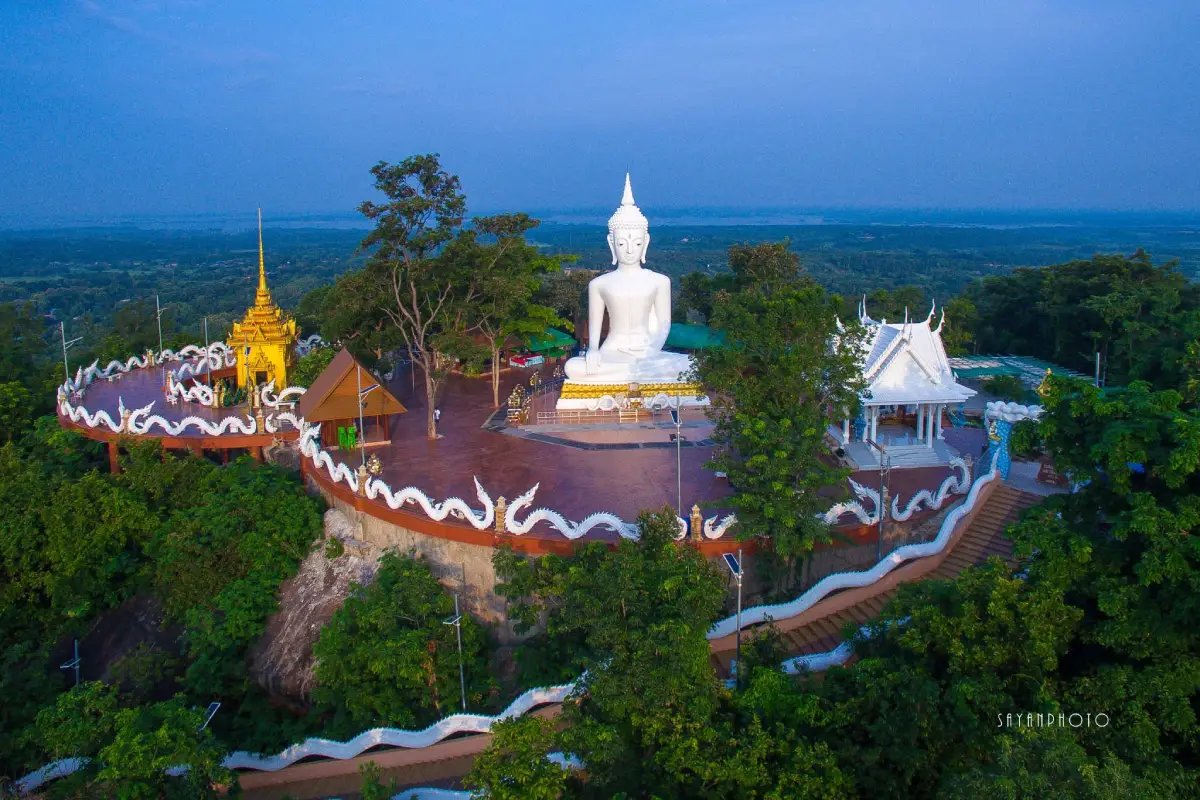
4. Phu Sing Buddhist Sanctuary, also known as Wat Phutthawat Phu Sing, is located on the summit of Phu Sing in Phu Sing Subdistrict, Sahatsakhan District. It combines Buddhist art, merit-making, and panoramic highland scenery in one destination. Its most prominent landmark is Phra Phrom Phumipalo, a large white Buddha image in the Mara-Vijaya posture standing prominently on the hilltop.
Highlight: Phra Phrom Phumipalo with a lap width of approximately 10.5 meters and a height of around 17.80 meters, a summit viewpoint approximately 346 meters above sea level, a 417-step stairway, and panoramic views of Phu Kum Khao, Phu Khao, Phu Po, Sahatsakhan communities, and Lam Pao Reservoir.
There are 2 main ways to reach the summit. The western route is a winding paved road approximately 3 kilometers long and is suitable for cars and older visitors. The eastern route consists of 417 steps and is more appropriate for those who prefer to climb on foot and experience the journey as a form of pilgrimage.
From the summit, the landscape opens dramatically compared with the plains below. Visitors can see several hills around Sahatsakhan as well as the broad Lam Pao Reservoir. Phu Sing is therefore one of the best places for understanding the geography of central and northern Kalasin from above.
Phra Phrom Phumipalo forms the spiritual center of the summit. Visitors commonly pay respect, make merit, and walk around the Buddha platform to enjoy the views. Morning and late afternoon are particularly pleasant because temperatures are lower and the light is better for photography.
Phu Sing should be combined with Sirindhorn Museum, Phu Kum Khao, and Wat Phuttha Nimit Phu Khao because all are located in Sahatsakhan District and can be linked into a single full-day route combining science, natural scenery, and religion.
The site is suitable for merit-making travelers, families, older visitors, photographers, and those who want a mountain viewpoint without a long trek. Anyone choosing the stairway should carry drinking water and rest when necessary, especially during hot weather.
Getting There: Phu Sing is located in Phu Sing Subdistrict, Sahatsakhan District, approximately 34 kilometers from Kalasin city via Highway 227. Vehicles can drive directly to the summit. Open daily from 06.00–18.00.
Map (GPS): https://www.google.com/maps/dir/?api=1&destination=16.716127,103.513991&travelmode=driving
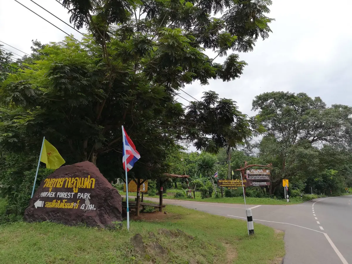
5. Phu Faek Forest Park (Dinosaur Footprints) is located at Moo 6, Ban Nam Kham, Phu Laen Chang Subdistrict, Na Khu District. It is one of Kalasin’s most important geological attractions because carnivorous dinosaur footprints estimated to be around 140 million years old are preserved on a rock platform along a stream at the foot of Phu Faek.
Highlight: Genuine dinosaur footprints preserved in sandstone, a streamside rock platform, dry dipterocarp forest, nature trails, and Phu Phan landscapes that connect geology, forest ecology, and prehistoric life.
The footprints were formed when dinosaurs walked across wet sediment in the distant past. New layers of sediment later covered the impressions and eventually hardened into rock. Over millions of years, erosion exposed the original layer again, revealing tracks that had been preserved beneath the surface.
Phu Faek is important in a different way from Phu Kum Khao. Phu Kum Khao is known primarily for dinosaur bones, while Phu Faek preserves evidence of dinosaur movement. Visiting both allows travelers to understand dinosaurs through 2 very different types of evidence: skeletons and footprints.
The surrounding area is dry dipterocarp forest with native tree species such as teng, rang, pradu, and makha mong, together with smaller wildlife and many bird species. This makes the forest park suitable for visitors who want to combine geological learning with nature and forest ecology.
Parts of the trail to the footprints remain natural and can be affected by rain, stream levels, and trail conditions. Visitors should wear footwear suitable for slippery surfaces and should avoid climbing on or unnecessarily touching the footprints in order to protect the geological evidence.
The site is suitable for light-adventure travelers, students, amateur geology enthusiasts, families with children old enough to walk on nature trails, and photographers. It should generally be planned separately from the Sahatsakhan zone because Na Khu District requires additional travel time.
Getting There: Phu Faek Forest Park is located at Moo 6, Ban Nam Kham, Phu Laen Chang Subdistrict, Na Khu District, Kalasin Province. Visitors should contact the responsible authority before traveling to confirm current access and trail conditions because entry depends on natural-area conditions.
Map (GPS): https://www.google.com/maps/dir/?api=1&destination=16.675093,103.963351&travelmode=driving
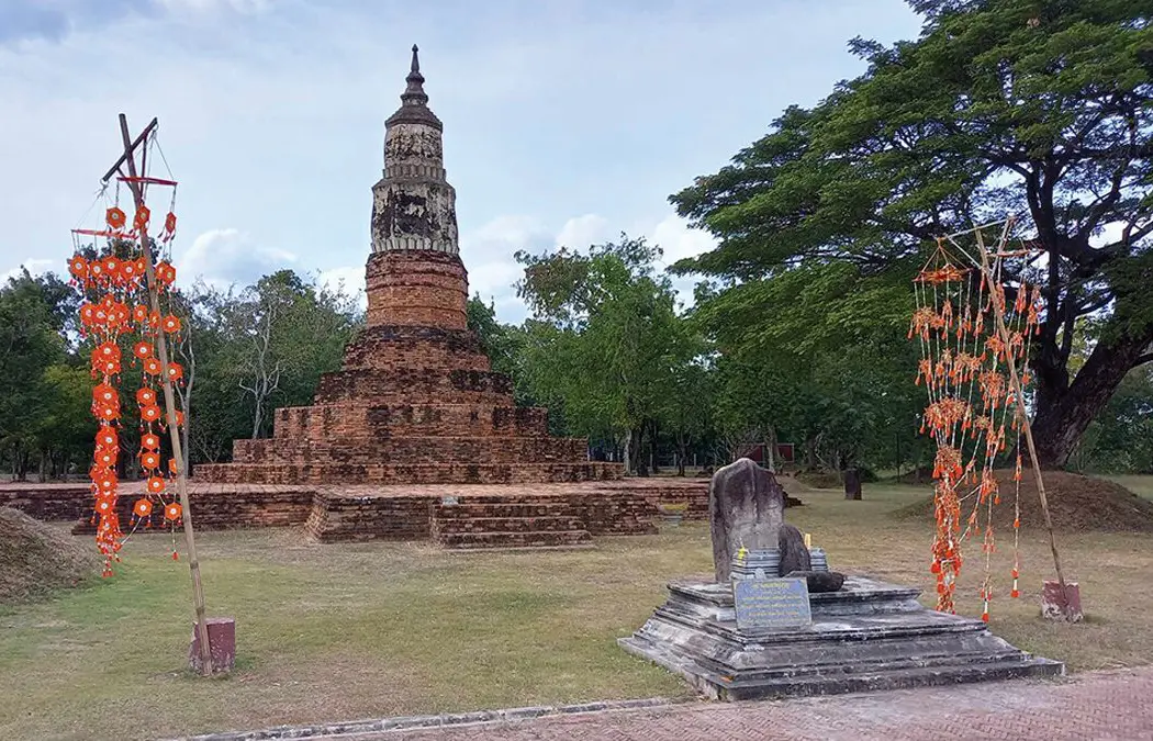
6. Phra That Ya Khu, also known as Phra That Yai, is located within the ancient city of Fa Daet Song Yang at Ban Sema, Nong Paen Subdistrict, Kamalasai District. It is one of Kalasin’s most important archaeological monuments and the largest ancient chedi in the Fa Daet Song Yang complex, reflecting a long continuity of Buddhist faith and architectural development.
Highlight: An octagonal brick chedi, indented base, stairways on all 4 sides, traces of Dvaravati stucco decoration, sandstone sema stones carved with scenes from the Buddha’s life and Jataka stories, and the wider setting of an ancient moated city.
Phra That Ya Khu is particularly significant because archaeological evidence indicates construction and restoration across 3 major periods: Dvaravati, Ayutthaya, and Rattanakosin. The monument therefore functions almost like an architectural record of continuous sacred use even as political and cultural systems changed over time.
Fa Daet Song Yang was a substantial ancient settlement surrounded by moats and earthen embankments. Archaeological remains include brick mounds, religious foundations, pottery fragments, and large numbers of sema stones. Many of the sema carry low-relief scenes from Buddhist Jataka stories and the Buddha’s life, making them important evidence of Dvaravati Buddhism in Northeastern Thailand.
The open archaeological landscape allows the chedi to stand prominently against the surrounding countryside. Morning and late afternoon are particularly suitable for walking and photography. History enthusiasts should allow time to study interpretive information and the surrounding site rather than visiting only for a brief act of worship.
Phra That Ya Khu remains a center of local devotion, meaning the archaeological site is still closely connected with modern community life. Religious ceremonies and annual traditions continue to reinforce the relationship between local people and the ancient monument.
The site is suitable for history enthusiasts, merit-making travelers, families, students, and photographers. It can serve as the main stop in a Kamalasai itinerary and be combined with Wat Pho Chai Semaram, which preserves important Dvaravati sema stones from the same cultural landscape.
Getting There: Phra That Ya Khu is located within Fa Daet Song Yang Ancient City at Ban Sema, Nong Paen Subdistrict, Kamalasai District, Kalasin Province. A private vehicle is the most convenient option. Open daily from 08.30–16.30.
Map (GPS): https://www.google.com/maps/dir/?api=1&destination=16.319119,103.520213&travelmode=driving
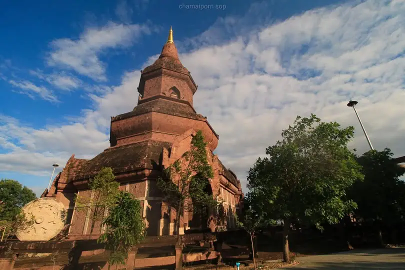
7. Wat Phuttha Nimit (Phu Khao) is located at Ban Na Si Nuan, Sahatsakhan Subdistrict, Sahatsakhan District. This important temple combines ancient sacred objects, Buddhist art, woodcarving, and distinctive architecture. Its most unusual feature is a reclining Buddha image lying on its left side, a posture rarely seen among reclining Buddha images in Thailand.
Highlight: A left-side reclining Buddha approximately 2 meters long and 50 centimeters wide, without a ketumala, enshrined near a cave mouth on Phu Khao; an intricately carved wooden ordination hall; Sangha Nimit Hall; a large sandstone pagoda; and a peaceful hill-temple atmosphere.
The name “Phu Khao” is linked with the Isan word “khao,” meaning rope, because the long shape of the hill resembles a stretched rope. The place name therefore reflects the way local people historically described natural landforms through language and everyday observation.
The reclining Buddha is the spiritual heart of the temple. Its left-side posture and lack of a ketumala distinguish it from most reclining Buddha images in Thailand. Local people have worshipped the image for generations, and it remains one of the most important sacred objects in Sahatsakhan.
The wooden ordination hall is another area worth exploring carefully. Its carved details and craftsmanship demonstrate the refinement of contemporary Buddhist woodwork, while the Sangha Nimit Hall preserves a variety of Buddha images and sacred religious objects.
The temple is located close to Phu Sing Buddhist Sanctuary and the Sirindhorn Museum area, making it ideal for a full-day Sahatsakhan itinerary. Travelers can begin with dinosaurs in the morning, continue to Phu Sing, and visit Wat Phuttha Nimit before heading toward Thepsuda Bridge.
Wat Phuttha Nimit is suitable for merit-making travelers, older visitors, photographers, people interested in woodcarving, and anyone looking for a quiet religious atmosphere. Visitors should dress modestly, remain respectful, and avoid unnecessary contact with ancient sacred objects.
Getting There: The temple is located at Ban Na Si Nuan, Sahatsakhan Subdistrict, Sahatsakhan District, approximately 7 kilometers from the district center and around 4 kilometers from Phu Sing. Open daily from 08.30–16.30.
Map (GPS): https://www.google.com/maps/dir/?api=1&destination=16.726472,103.569125&travelmode=driving
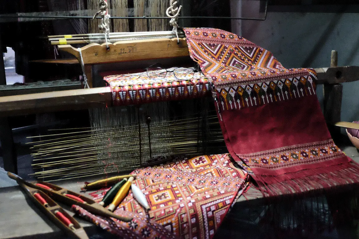
8. Ban Phon Phrae Wa Silk Weaving Group is located in Phon Subdistrict, Kham Muang District. It is one of Thailand’s most important centers for Phrae Wa silk craftsmanship and provides an excellent opportunity to understand the cultural identity of Kalasin’s Phu Thai people through traditional dress, language, customs, and weaving knowledge.
Highlight: Handwoven Phrae Wa silk, supplementary-weft and multicolored decorative techniques, traditional main and border motifs, classic lac-dyed red backgrounds, weaving demonstrations, and silk products available directly from community producers.
Phrae Wa silk has been described as the “Queen of Thai Silk” because of the complexity of its patterns and weaving methods. Traditionally, the fabric was used as a shoulder cloth or sash worn by Phu Thai women during merit-making ceremonies and important community events. Each textile therefore represents more than a commercial product; it is part of Phu Thai dress and ethnic identity.
The name “Phrae Wa” is associated with the character of the textile itself. “Phrae” refers to a beautiful woven cloth, while “wa” refers to a traditional measure of length. Creating the patterns requires the weaver to lift and select specific threads and add colored silk into the fabric, demanding accuracy and close attention throughout the weaving process.
Traditional Phrae Wa often uses deep red backgrounds created with lac dye, but modern artisans have developed a wider variety of colors and designs, including cream, pink, purple, and contemporary tones. These textiles are now adapted into clothing, scarves, bags, decorative objects, and modern fashion products while retaining traditional motif structures.
Ban Phon is also notable for preserving wider Phu Thai culture. The community continues to maintain language, dress, ritual practices, and beliefs associated with Phrae Wa textiles. Visiting therefore provides the opportunity to learn directly from cultural practitioners rather than simply purchasing products from a souvenir shop.
The community is suitable for families, students, designers, fashion enthusiasts, Thai textile lovers, and travelers looking for meaningful local souvenirs. Purchasing directly from local weaving groups also helps return tourism income to artisans and supports the continuation of traditional weaving knowledge.
Getting There: Ban Phon is located in Phon Subdistrict, Kham Muang District, approximately 70 kilometers from Kalasin city via Highway 227. Open daily from 08.30–17.00. Groups or visitors wishing to see detailed weaving demonstrations should coordinate with the community in advance.
Map (GPS): https://www.google.com/maps/dir/?api=1&destination=16.867310,103.617207&travelmode=driving
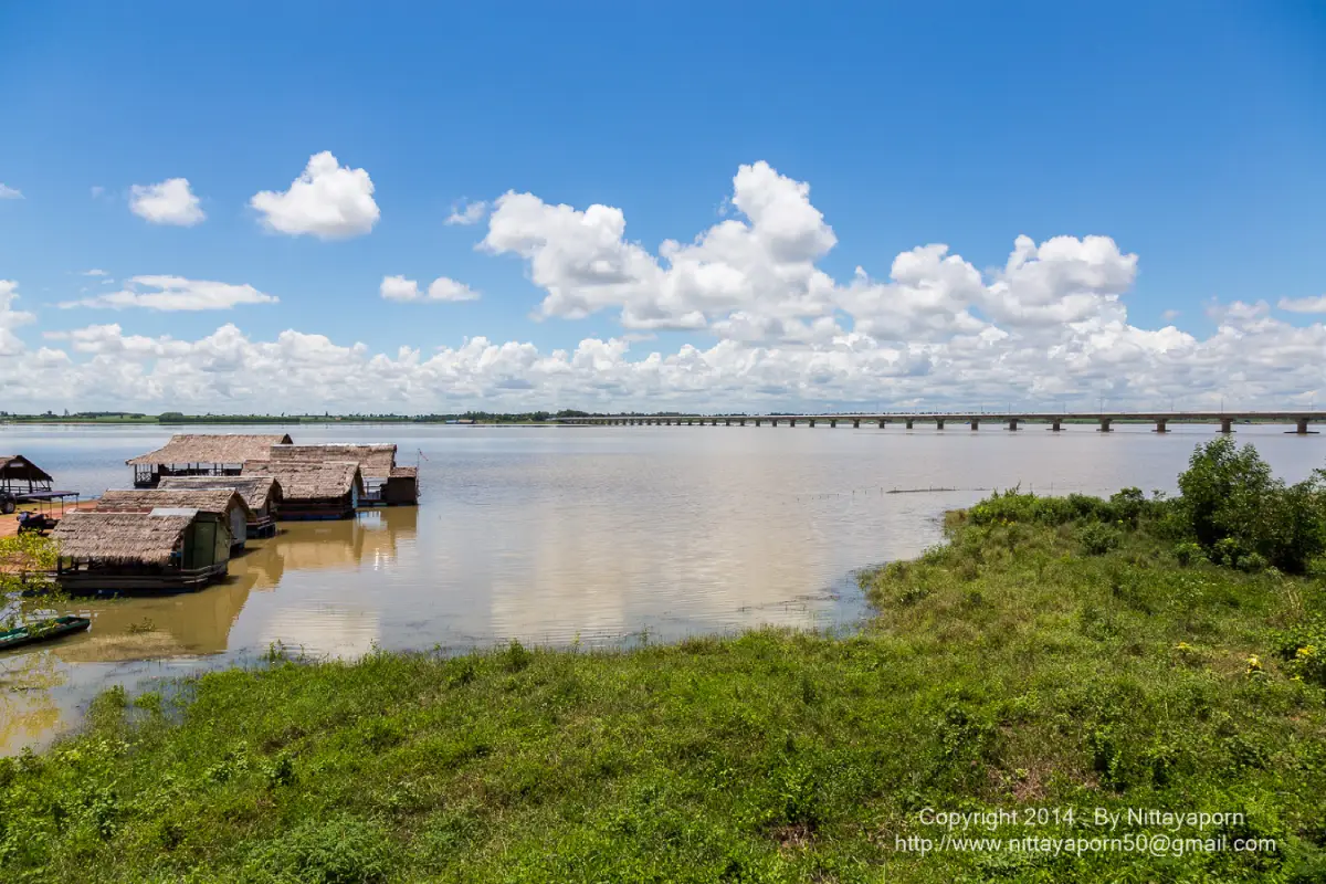
9. Thepsuda Bridge (Sirintorn Bridge) crosses Lam Pao Reservoir and connects Laem Non Wiset in Non Buri Subdistrict, Sahatsakhan District, with Nong Bua Subdistrict in Nong Kung Si District. It functions both as an important transport link and as one of Kalasin’s major landmarks, providing broad views across the reservoir.
Highlight: A 2-lane reinforced-concrete bridge approximately 2,040 meters long, wide reservoir views on both sides, sunrise and sunset scenery, and a major role in making travel between Sahatsakhan and Nong Kung Si significantly more convenient.
Before the bridge was built, communities on opposite sides of Lam Pao Reservoir had to travel along much longer routes. This increased travel times and transportation costs for agricultural products. The bridge shortened these journeys and created a more direct economic connection between communities around the reservoir.
The name “Thepsuda Bridge” was royally bestowed on April 22, 2010. Beyond its transport function, the bridge has become part of Kalasin’s visual identity because of its long line stretching across the reservoir and the broad open-water landscape visible from either side.
Morning provides a quieter atmosphere and cooler temperatures, while late afternoon is especially suitable for sunset. Changing light across the sky and reservoir makes the bridge popular with photographers and travelers driving around Lam Pao.
Thepsuda Bridge fits naturally into the same route as Sirindhorn Museum, Phu Kum Khao, Phu Sing, and Lam Pao Dam. It allows travelers to create a loop rather than returning along the same road and adds a scenic stop without requiring much walking.
Visitors should remember that this is an active public road. Vehicles should not stop in unsafe positions or obstruct traffic. Anyone wishing to take photographs should use safe parking or designated viewpoints near the bridge approaches.
Getting There: The bridge connects Laem Non Wiset, Non Buri Subdistrict, Sahatsakhan District, with Nong Bua Subdistrict, Nong Kung Si District. It is accessible 24 hours a day because it is a public road.
Map (GPS): https://www.google.com/maps/dir/?api=1&destination=16.713022,103.459930&travelmode=driving
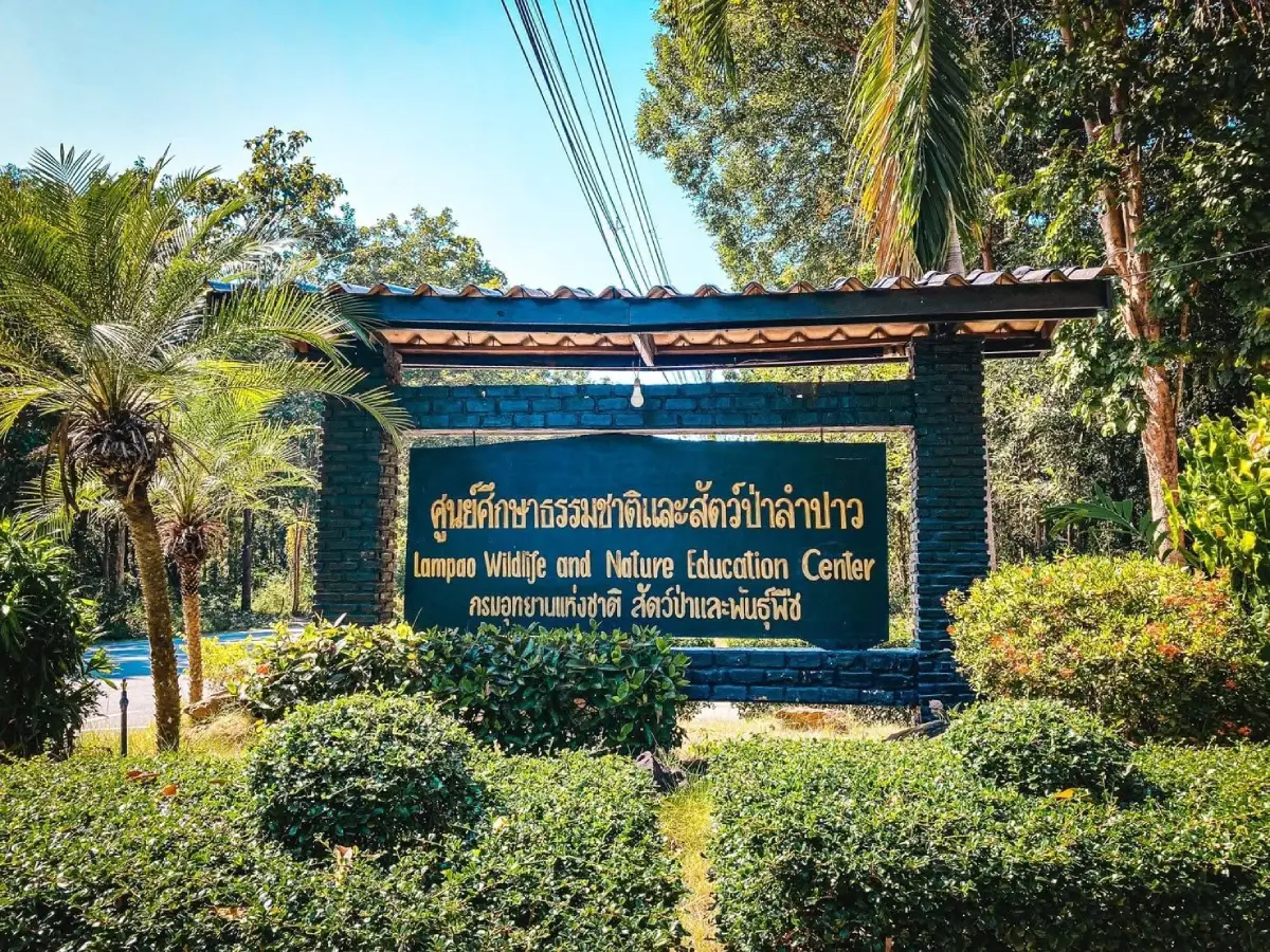
10. Lam Pao Wildlife Conservation Promotion and Development Station, also known as “Suan Sa-on,” is located on the eastern side of Lam Pao Dam Reservoir in Lam Pao Subdistrict, Mueang Kalasin District. This wildlife and ecosystem learning center is particularly suitable for families. Covering around 1,420 rai, the station preserves a substantial area of dry dipterocarp forest, locally known as pa teng rang or pa daeng.
Highlight: More than 130 banteng, an open wildlife area, dry dipterocarp forest, nature-study trails, birdwatching areas, camping grounds, recreation spaces, and a landscape directly connected with Lam Pao Reservoir.
Banteng are the animals most strongly associated with Suan Sa-on. These large wild cattle have reddish-brown bodies, lighter-colored legs, and strong curved horns. Observing banteng in an open natural setting allows children and other visitors to learn about Thailand’s native wildlife without entering remote forest areas.
The dry dipterocarp forest itself is an important part of the experience. Although this forest type can appear open and relatively dry during certain seasons, it provides food and habitat for many animals. Native trees such as teng and rang are well adapted to seasonal drought and natural fire cycles, making the area a useful outdoor classroom for understanding northeastern Thai ecosystems.
Beyond banteng viewing, visitors can follow nature trails, watch birds, and learn about wildlife conservation. The station is particularly suitable for schools and families looking for outdoor educational activities, as well as nature photographers who want accessible wildlife experiences without long-distance trekking.
Suan Sa-on can easily be combined with Lam Pao Dam because both are located in the same general area. Travelers can begin with the conservation station in the morning, continue to the dam, or drive north toward Sahatsakhan to visit Sirindhorn Museum and Phu Sing.
Visitors should maintain a safe distance from wildlife, never feed animals, keep noise to a minimum, and avoid approaching banteng or other animals beyond the limits established by staff. The primary purpose of the site is conservation and education rather than direct animal interaction.
Getting There: The station is located on the eastern side of Lam Pao Dam Reservoir, Lam Pao Subdistrict, Mueang Kalasin District. A private vehicle is the most convenient option. Open daily from 07.00–18.00.
Map (GPS): https://www.google.com/maps/dir/?api=1&destination=16.605085,103.468095&travelmode=driving
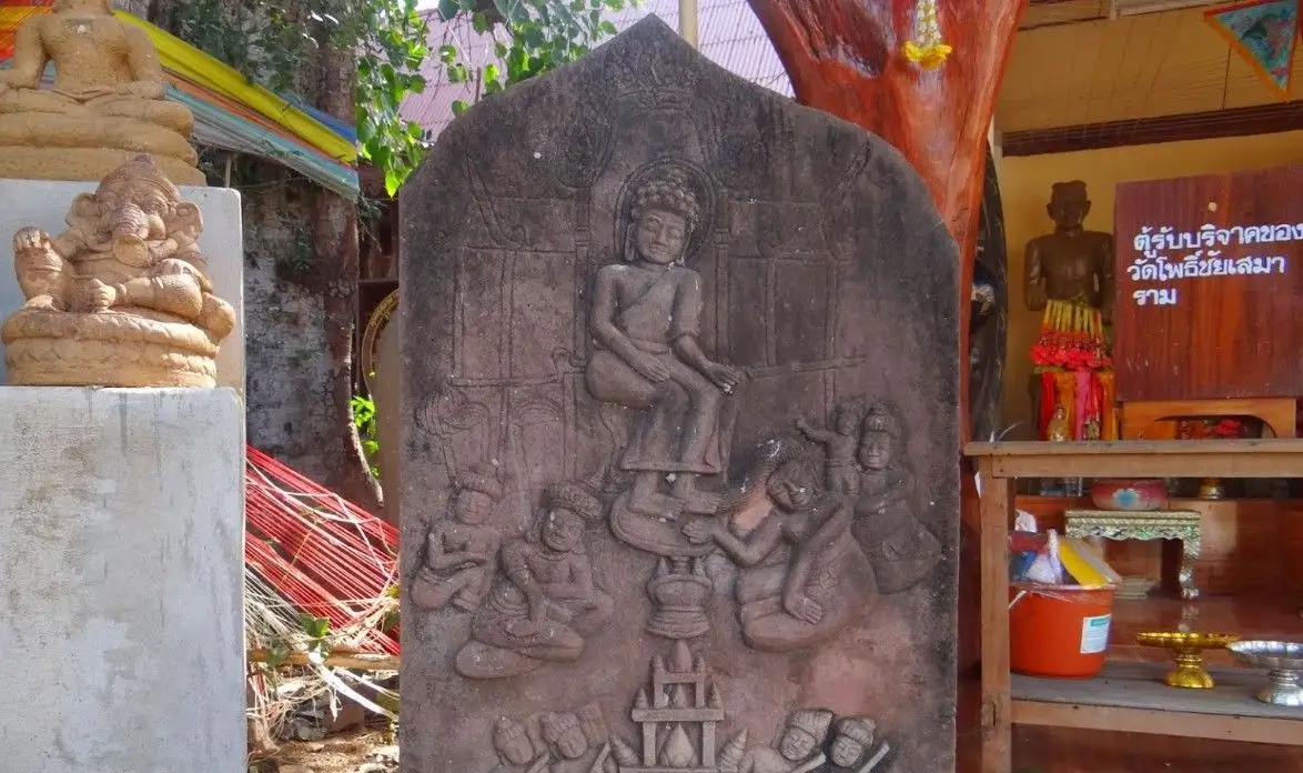
11. Wat Pho Chai Semaram (Wat Ban Kom) is located at Ban Sema, Nong Paen Subdistrict, Kamalasai District, opposite the entrance to the ancient city of Fa Daet Song Yang. This important temple allows visitors to see the continuity between living Buddhist practice and the Dvaravati artistic heritage that once flourished across southern Kalasin.
Highlight: A large collection of sandstone sema stones from Fa Daet Song Yang, including plain boundary stones and stones carved in low relief with scenes from the Buddha’s life, Jataka stories, and Buddhist symbolism. The temple has the atmosphere of an open-air museum of Dvaravati art.
Sema stones are an important feature of Buddhist culture in Northeastern Thailand and were traditionally used to mark sacred ritual boundaries. What makes the sema stones of Fa Daet Song Yang particularly remarkable is their size, variety, and carved imagery, which provide valuable evidence of religious belief and artistic development during the Dvaravati period.
Many of the stones were moved to the temple for protection after being discovered throughout the ancient-city area. Walking from one sema stone to another is therefore similar to reading stories carved into stone. History enthusiasts can look closely at representations of people, celestial beings, architecture, and Buddhist motifs preserved on their surfaces.
Wat Pho Chai Semaram should be visited together with Phra That Ya Khu because both belong to the same ancient cultural landscape. Phra That Ya Khu reveals the scale and architectural development of a major religious monument, while Wat Ban Kom provides a closer look at sema stones and detailed Dvaravati artistic traditions.
The temple is particularly suitable for students, archaeology enthusiasts, history travelers, and visitors who want to understand Fa Daet Song Yang beyond a quick photo stop. Visitors should avoid touching or leaning against the ancient sandstone sema stones in order to protect their carved surfaces.
Morning and late afternoon are more comfortable for exploring than midday because much of the area is outdoors and exposed to strong sunlight. Travelers can spend half a day in the Fa Daet Song Yang zone and continue to other attractions in Kamalasai District.
Getting There: Wat Pho Chai Semaram is located at Ban Sema, Nong Paen Subdistrict, Kamalasai District, Kalasin Province, opposite the entrance to Fa Daet Song Yang Ancient City. Open daily from 08.00–17.00.
Map (GPS): https://www.google.com/maps/dir/?api=1&destination=16.315070,103.518697&travelmode=driving
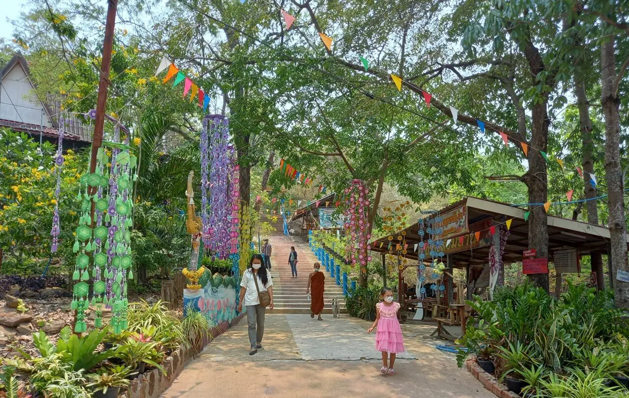
12. Phutthasathan Phu Po is located in Phu Po Subdistrict, Mueang Kalasin District, within Wat Inthra Prathan Phon, also known as Wat Phu Po. This sandstone-hill Buddhist sanctuary is notable for 2 ancient reclining Buddha images carved directly into natural cliffs and for its peaceful forested mountain surroundings, making it suitable for both worship and historical sightseeing.
Highlight: 2 cliff-carved reclining Buddha images on different levels of Phu Po. The lower image lies beneath a rock shelter near the lower slope, while the upper image is located farther uphill along a mountain trail, accompanied by viewpoints and natural scenery.
The Buddha images at Phu Po are different from conventional reclining Buddha statues because they were carved directly into natural sandstone rather than created as free-standing sculptures. This makes the mountain and the sacred images appear inseparable, creating a distinctive spiritual atmosphere where stone, cliff, forest, and Buddhist faith come together.
Phu Po is a sandstone hill extending roughly east–west, with its summit rising to around 336 meters above sea level. Forest and walking routes surround the hill, and the trail to the upper reclining Buddha gives visitors an opportunity for light exercise while making merit.
Both reclining Buddha images have long been revered by local communities and reflect the use of natural landscapes as sacred spaces in earlier periods. Visitors should remain respectful, avoid climbing on the rock surfaces, and refrain from touching the carved images unnecessarily.
The destination is suitable for merit-making travelers, history enthusiasts, lovers of ancient Buddhist art, photographers, and those who enjoy temples surrounded by natural mountain scenery. Visitors walking to the upper image should carry drinking water and wear suitable footwear.
Phu Po can be combined with attractions in Mueang Kalasin or continued north toward Sahatsakhan. Its atmosphere differs from Phu Sing Buddhist Sanctuary, which is better known for its large hilltop Buddha image and panoramic views over Lam Pao Reservoir.
Getting There: Phutthasathan Phu Po is located in Phu Po Subdistrict, Mueang Kalasin District, approximately 28 kilometers north of Kalasin city. Follow Highway 213 and continue onto local roads toward the temple. Open daily from 08.00–17.00.
Map (GPS): https://www.google.com/maps/dir/?api=1&destination=16.625141,103.623570&travelmode=driving

13. Laem Non Wiset is located in Non Buri Subdistrict, Sahatsakhan District. This promontory extends into Lam Pao Reservoir and provides wide-open views across the water, Thepsuda Bridge, and the distant horizon. It is one of the best places in the Sahatsakhan area for relaxation and sunset viewing.
Highlight: Panoramic views of Lam Pao Reservoir, sunset scenery, views toward Thepsuda Bridge, reservoir-side recreation areas, and a peaceful atmosphere suitable for photography and relaxing in the breeze.
The charm of Laem Non Wiset does not come from a major monument or large structure. Instead, it comes from the geography of the land itself, which projects into the reservoir and provides a more open perspective than an ordinary shoreline. When reservoir levels are high, the promontory can feel almost like a small peninsula surrounded by a freshwater lake.
Late afternoon is the most popular time to visit. As the sun drops toward the water, golden reflections appear across the reservoir, while the long line of Thepsuda Bridge helps create attractive compositions for landscape photography.
The area is also connected with travel routes used by communities around Lam Pao Reservoir, allowing visitors to observe both the recreational landscape and the daily lives of people who depend on one of Kalasin’s largest water resources.
Laem Non Wiset is best combined with Thepsuda Bridge, Sirindhorn Museum, Phu Kum Khao, and Phu Sing. It works especially well as the final stop of a Sahatsakhan itinerary, allowing travelers to watch sunset after a full day of sightseeing.
The location is suitable for couples, families, groups of friends, photographers, and travelers looking for an easy scenic stop without much walking. Visitors should remain cautious near the water and remember that reservoir levels change seasonally.
Getting There: Laem Non Wiset is located in Non Buri Subdistrict, Sahatsakhan District, approximately 6 kilometers from Sahatsakhan town. Open daily from 06.30–20.00.
Map (GPS): https://www.google.com/maps/dir/?api=1&destination=16.709360,103.466095&travelmode=driving
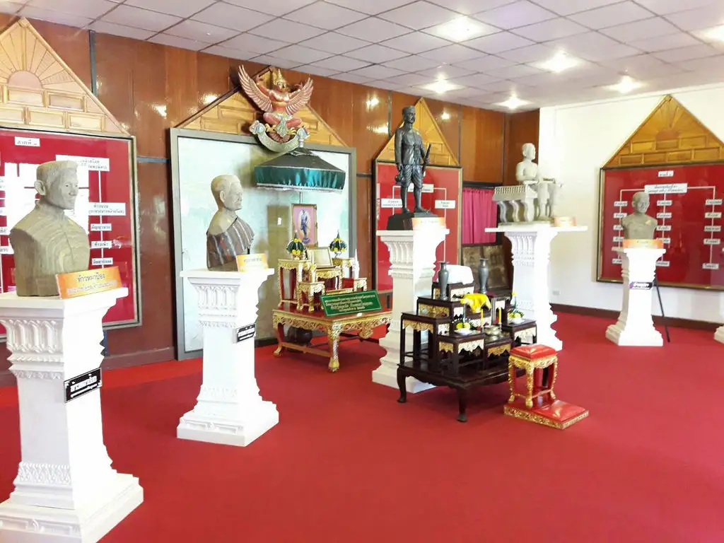
14. Mueang Kalasin Museum is located inside the former Kalasin Provincial Hall on Kalasin Road in the city center. It is a cultural learning center that brings together local history, religion, important figures, everyday life, Phrae Wa silk, Phu Thai culture, art, and the wider identity of Kalasin Province within a single building.
Highlight: Exhibitions on the history of Kalasin, former governors, religion, Phu Thai culture, Phrae Wa silk, local wisdom, traditional arts, and notable people who contributed to the development of the province.
The building itself has historical value because it once served as the provincial hall and administrative center of Kalasin before being transformed into a public cultural space. Exploring the museum therefore combines the experience of an old government building with the stories presented in its exhibitions.
The museum provides a broad introduction to Kalasin, covering geography, settlement patterns, water systems, agriculture, Buddhism, local administration, ethnic communities, handicrafts, and the development of the province. It is therefore particularly useful for first-time visitors before they travel to specialized attractions in other districts.
Displays relating to Phrae Wa silk and Phu Thai culture provide useful context before visiting Ban Phon, while sections on local history and Buddhist art help visitors better understand Fa Daet Song Yang, Phra That Ya Khu, and temples preserving Dvaravati sema stones.
The museum is suitable for families, students, travelers with limited time, and anyone who wants a structured introduction to Kalasin. A typical visit takes around 1–2 hours before continuing to other cultural attractions within the city.
Because it is located in central Kalasin, the museum can easily be combined with Pong Lang Circle, city temples, markets, and restaurant areas. It is also a good option during hot or rainy weather because most exhibitions are indoors.
Getting There: Mueang Kalasin Museum is located inside the former Kalasin Provincial Hall on Kalasin Road, Kalasin Subdistrict, Mueang Kalasin District. Open Tuesday–Sunday from 09.00–16.00.
Map (GPS): https://www.google.com/maps/dir/?api=1&destination=16.432163,103.506945&travelmode=driving
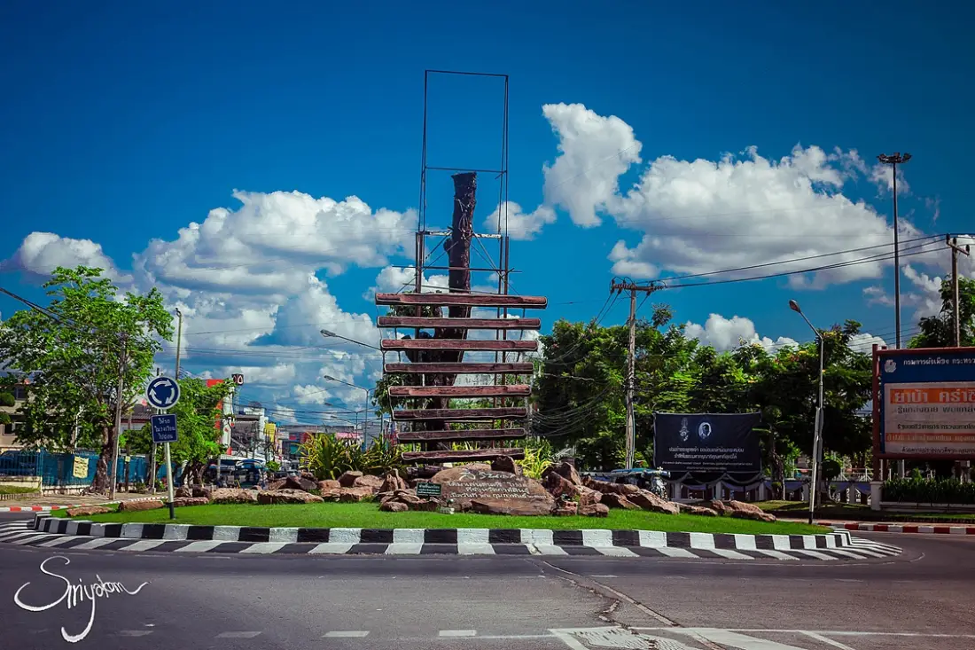
15. Pong Lang Circle is located at the intersection of Kalasin Road and Chai Sunthon Road in the city center. This landmark represents the province’s musical identity through a large sculpture of the pong lang, a traditional Isan percussion instrument closely associated with Kalasin.
Highlight: A large pong lang sculpture in the center of the roundabout, an easily recognizable city photo spot, and the story of how the pong lang developed from a local percussion instrument into a major musical symbol and performance tradition associated with Kalasin.
The pong lang is a percussion instrument made from wooden bars arranged according to pitch and suspended vertically. Musicians strike the bars with beaters to create melody and rhythm. Its resonant and lively sound has made the pong lang one of the most important instruments in modern Isan folk ensembles.
Kalasin played an important role in the development of the pong lang, particularly through the work of Kru Plueang Chaiyaratsami, a National Artist in Performing Arts. He contributed significantly to the development of the instrument, its tuning system, performance techniques, and the transmission of knowledge that helped establish the pong lang as a widely recognized symbol of Isan music.
The roundabout is therefore more than a traffic feature. It functions as a cultural monument telling travelers that they are in a city deeply associated with pong lang music. This identity becomes especially visible during the annual Pong Lang and Phrae Wa Silk Festival, when music, dance, textiles, and local culture are presented together.
Pong Lang Circle is suitable for a short photography stop while exploring central Kalasin and can easily be combined with Mueang Kalasin Museum, Wat Klang, and nearby restaurant areas.
Because the landmark stands within an active traffic roundabout, visitors should take photographs only from safe sidewalks or roadside areas and should never enter the traffic lanes or obstruct vehicles.
Getting There: Pong Lang Circle is located at the intersection of Kalasin Road and Chai Sunthon Road in Kalasin Subdistrict, Mueang Kalasin District. It is a public roadside landmark visible 24 hours a day.
Map (GPS): https://www.google.com/maps/dir/?api=1&destination=16.433597,103.508427&travelmode=driving
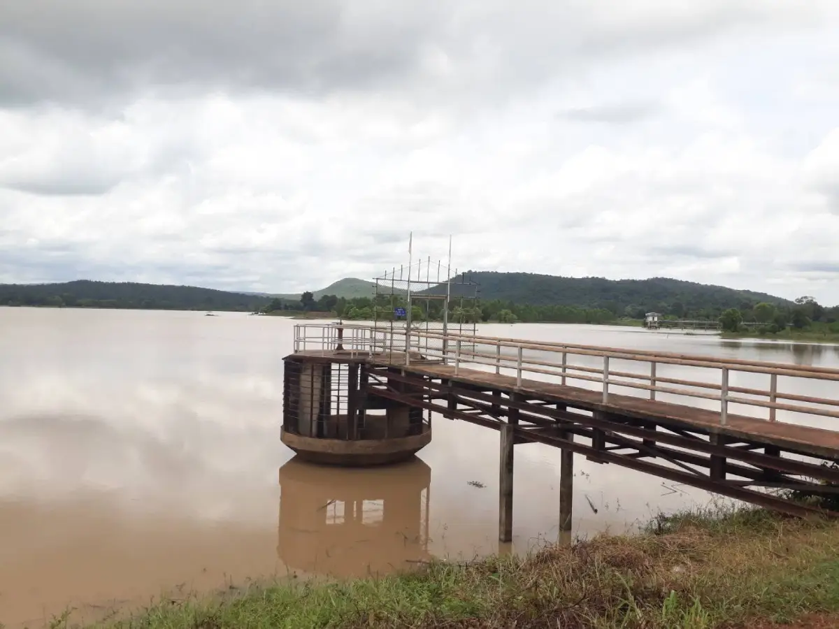
16. Huai Chum Chang Reservoir, also known as Wang Mon Reservoir, is located at Ban Wang Mon, Kut Wa Subdistrict, Kuchinarai District. This irrigation reservoir is surrounded by hills, open woodland, and agricultural land, offering a peaceful rural side of Kalasin that contrasts with the province’s dinosaur and archaeological tourism zones.
Highlight: Broad water views, surrounding hills and forests, reservoir-side recreation, nature photography, locally available boat activities, and traditional fishing and agricultural life around Ban Wang Mon.
The reservoir was constructed to store water and support agricultural areas around Kut Wa Subdistrict. Its normal storage capacity is approximately 7.38 million cubic meters, and it also serves as a water source for local fishing and community use.
The surrounding terrain combines lowland areas and hills. From the reservoir edge, visitors can see water stretching toward forest and agricultural land, providing a clear picture of the relationship between irrigation systems and rural life in Kuchinarai.
Morning and late afternoon are the most pleasant times to visit because temperatures are lower and the light is softer. These periods are suitable for relaxing beside the reservoir, photography, and observing how local communities use the water resource.
The destination is suitable for families, couples, groups of friends, and photographers looking for a quiet recreational area. Visitors interested in boating or water activities should check local availability and weather conditions on the day of travel.
Huai Chum Chang Reservoir can be included in a Kuchinarai itinerary and combined with the Phu Si Than area or nearby Phu Thai cultural communities, creating a route that covers both nature and local ways of life.
Getting There: The reservoir is located at Ban Wang Mon, Kut Wa Subdistrict, Kuchinarai District, Kalasin Province. A private vehicle is the most convenient option. Open daily from 08.00–17.00.
Map (GPS): https://www.google.com/maps/dir/?api=1&destination=16.532310,104.148057&travelmode=driving
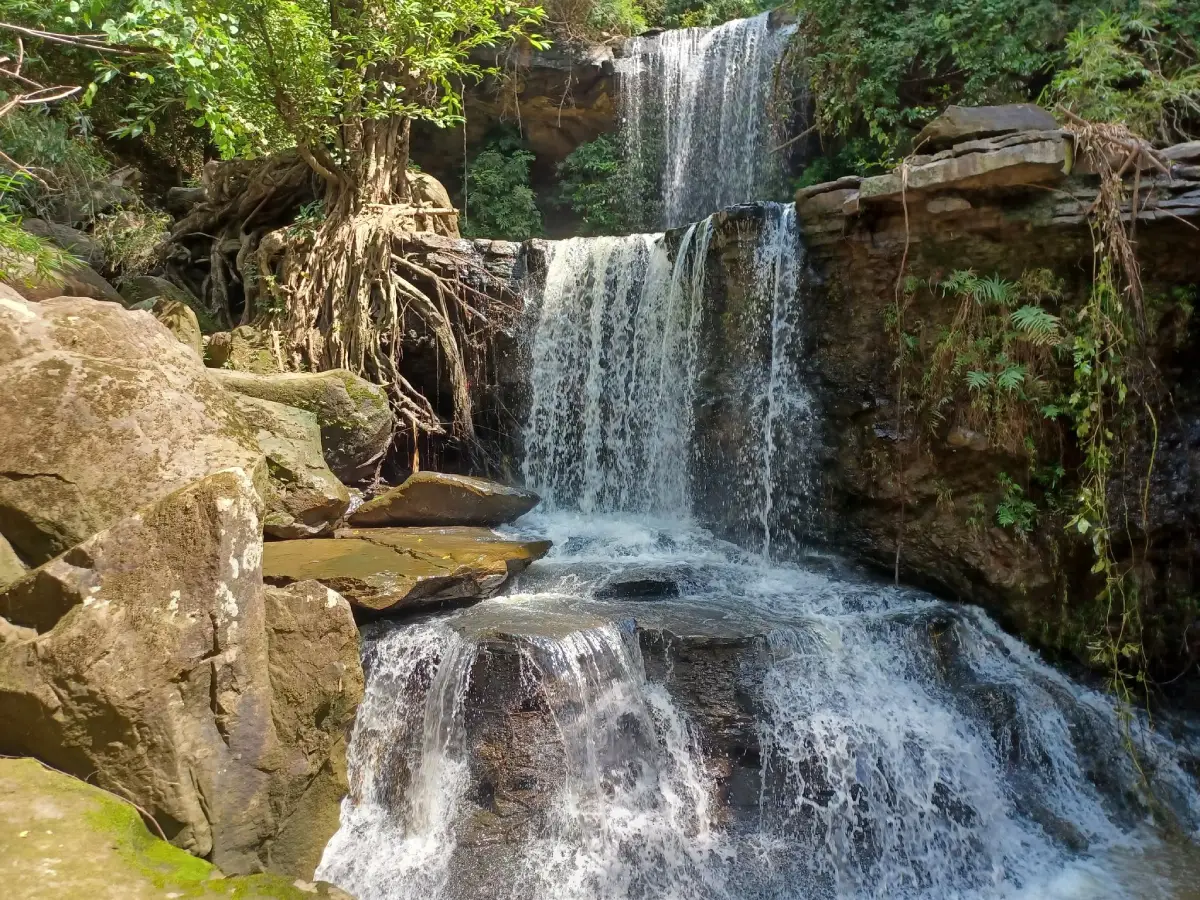
17. Tad Chiang Tha Waterfall is located at Moo 8, Ban Na Kham, Non Na Chan Subdistrict, Na Khu District. This natural waterfall in the Phu Faek mountain area retains a quiet forest and mountain atmosphere and is characterized by seasonal water flowing across a rocky cliff or “tad” during the rainy season.
Highlight: A seasonal waterfall, natural rock terraces, lush forest during the rainy season, nature trails, and the peaceful Phu Faek landscape for travelers seeking a less crowded natural destination.
The word “tad” is used in many parts of Isan and Laos to refer to a waterfall or a section of stream flowing over a rocky cliff. Tad Chiang Tha is therefore characterized more by water flowing across natural rock layers and cliff surfaces than by a single high vertical drop.
The waterfall changes significantly with the seasons. From the rainy season into the beginning of the cool season, there is a better chance of seeing fuller water flow and lush green forest. During the dry season, water levels may fall considerably, so travelers should plan according to seasonal conditions.
Parts of the access route pass through forest and areas away from villages. Visitors should wear footwear suitable for soil and wet rocks, carry drinking water, and avoid traveling alone if they are unfamiliar with the route.
Tad Chiang Tha is suitable for nature lovers, groups of friends, photographers, and travelers looking for light adventure. It can be included in the same route as Phu Faek Forest Park and other attractions in Na Khu District.
During periods of heavy rain, visitors should check road conditions and water levels before entering the area because mountain waterfalls can change quickly. Avoid swimming in areas with strong currents.
Getting There: The waterfall is located at Moo 8, Ban Na Kham, Non Na Chan Subdistrict, Na Khu District, approximately 6 kilometers from the village. Daytime visits are recommended, and travelers should ask locally about road conditions before visiting, especially during the rainy season.
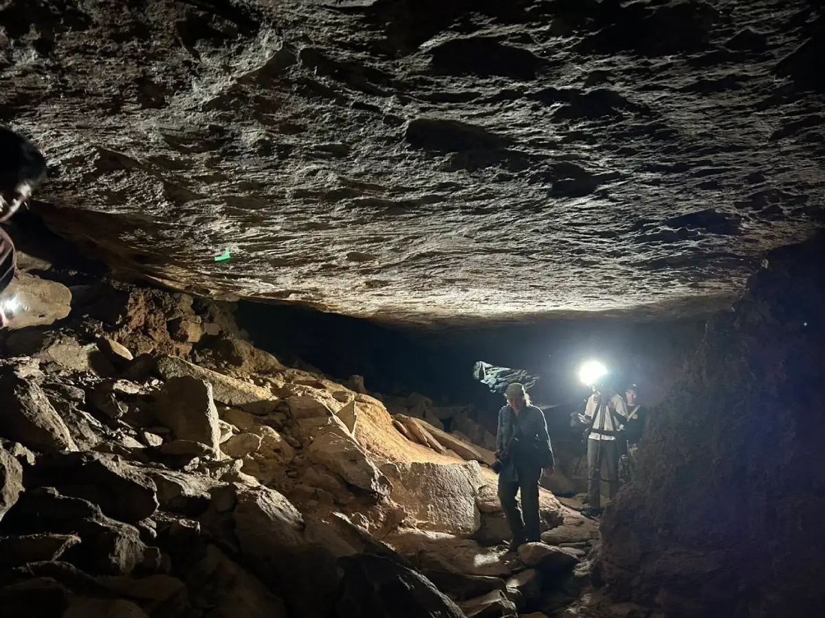
18. Tham Seri Thai is located around Ban Chat in Na Khu District along the Phu Phan mountain range. This attraction combines a natural cave, forest scenery, and local history associated with the Seri Thai or Free Thai movement during World War II.
Highlight: A natural cave in the Phu Phan range, local stories connected with the Free Thai movement, the Ban Chat area, Pha Ra Ngaeng, natural stone-bridge formations, waterfalls, and forest landscapes once associated with concealment and movement through the mountains.
Local accounts connect the cave and surrounding forest with the use of the Phu Phan mountains as hiding places, supply-storage areas, or support zones for movement during World War II. The mountainous and heavily forested terrain of upper Isan provided conditions suitable for avoiding major roads and remaining concealed.
The cave itself is not especially large, but the value of the destination lies more in its historical context and surrounding landscape than in the size of the cave. Visitors should therefore understand the wider area as a learning route connecting community history, Phu Phan forest, and wartime memory.
The Ban Chat area is also associated with local stories of a Free Thai airfield and other natural locations in the Phu Phan range, giving the area potential as a local-history route combined with nature walking.
The destination is suitable for students, history enthusiasts, hikers, and travelers interested in Thailand during World War II. Clothing suitable for forest conditions and footwear with good grip are recommended.
Extra caution is required during the rainy season because forest paths and rocks can become slippery. Visitors should remain on routes recommended by local communities or responsible authorities to avoid becoming lost.
Getting There: Tham Seri Thai is located around Ban Chat, Na Khu District, Kalasin Province. A private vehicle is the most convenient option. Daytime visits are recommended, and local authorities or community contacts should be consulted before entering deeper forest areas.
Map (GPS): https://www.google.com/maps/dir/?api=1&destination=17.112372,103.981501&travelmode=driving
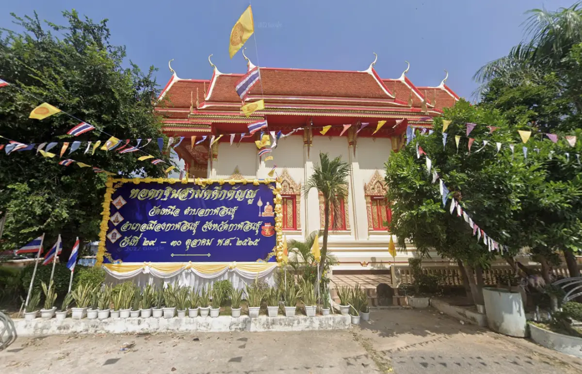
19. Wat Si Bun Rueang, also known locally as Wat Nuea, is an old temple in central Kalasin located around Anakkanak Road. It is an important stop for travelers who want to study Dvaravati art without leaving the city because the temple preserves several sandstone sema stones originally associated with Fa Daet Song Yang.
Highlight: Plain and carved sandstone sema stones, especially a notable stone depicting celestial figures above a palace-like structure, an ornamental arch, and human figures below, all providing valuable examples of detailed Dvaravati-period art.
Moving sema stones from Fa Daet Song Yang to the temple helped protect them and made them available for study by later generations. Visitors can therefore observe the carved surfaces at close range within the environment of an active Buddhist temple.
The artwork on the sema stones reflects Buddhist beliefs and artistic traditions in ancient Northeastern Thailand. Images of people, palaces, celestial beings, and decorative elements demonstrate that artists of the period worked with a sophisticated visual language and considerable carving skill.
Wat Si Bun Rueang forms a useful link between sightseeing in central Kalasin and a later visit to Phra That Ya Khu and Fa Daet Song Yang. Travelers can first study sema stones in the city and then visit the original cultural landscape in Kamalasai District.
The temple is suitable for merit-making travelers, students, art and history enthusiasts, and visitors with limited time who want to add a cultural attraction to a city itinerary. Visitors should dress modestly and avoid touching the sema surfaces unnecessarily.
Wat Si Bun Rueang can be combined with Mueang Kalasin Museum, Pong Lang Circle, Wat Klang, and the old-town area for a half-day cultural route through Kalasin city.
Getting There: Wat Si Bun Rueang is located around Anakkanak Road in Mueang Kalasin District. Open daily from 08.00–17.00.
Map (GPS): https://www.google.com/maps/dir/?api=1&destination=16.607649,103.358518&travelmode=driving
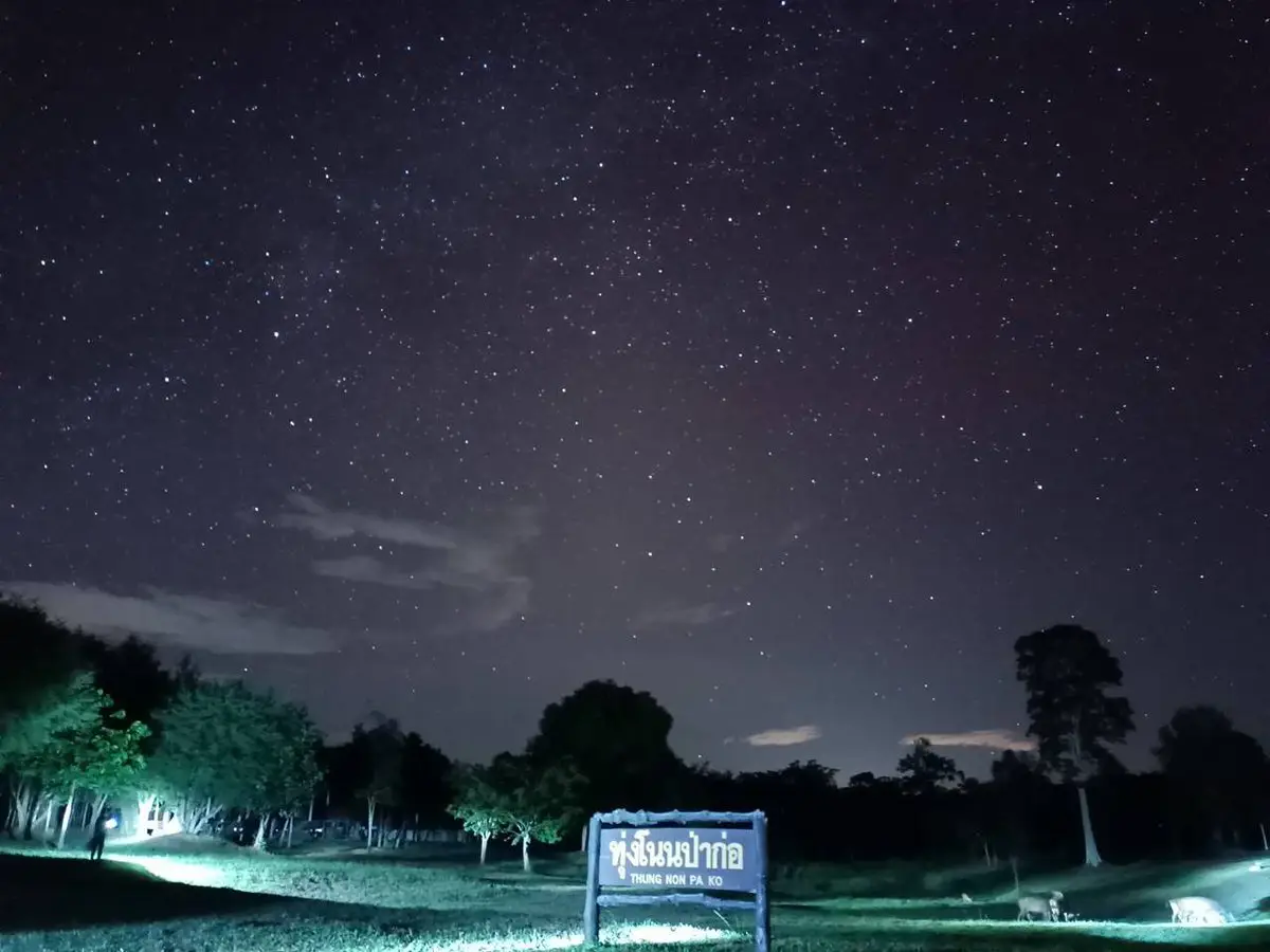
20. Huai Muang Reservoir at Phu Si Than Wildlife Sanctuary is located near Ban Huai Muang, Nong Hang Subdistrict, Kuchinarai District. The area combines Huai Muang Reservoir, the forested landscape of Phu Si Than, and wildlife-conservation land within a single setting, making it suitable for travelers looking for a quieter side of Kalasin focused on natural ecosystems.
Highlight: Huai Muang Reservoir, lower Phu Phan forest landscapes, the Phu Si Than Wildlife Sanctuary environment, views of mountains and water, and opportunities to learn about the relationship between forest, watersheds, wildlife, and communities surrounding the protected area.
Huai Muang Reservoir provides water for local communities and agricultural areas, while the forested Phu Si Than landscape behind it functions as an important watershed and wildlife habitat. The scenery therefore demonstrates clearly how natural ecosystems and local livelihoods depend on one another.
Phu Si Than Wildlife Sanctuary covers a substantial forest area and exists primarily for wildlife conservation. Access to some zones is therefore different from visiting an ordinary tourist attraction. Travelers must contact sanctuary staff and follow all current regulations before entering protected areas.
The reservoir surroundings are suitable for scenic viewing, photography, birdwatching, and nature study, particularly in the morning when the weather is cooler and the atmosphere is quiet. After rainfall, the surrounding forests and hills become noticeably greener.
The destination is suitable for nature travelers, birdwatchers, students, and photographers. Loud activities and approaching wildlife should be avoided, and visitors should never leave areas permitted by sanctuary staff.
Huai Muang Reservoir can be combined with Huai Chum Chang Reservoir and other places in Kuchinarai District, adding a nature-focused eastern zone to a Kalasin itinerary beyond the better-known Sahatsakhan and city attractions.
Getting There: The reservoir is located near Ban Huai Muang, Nong Hang Subdistrict, Kuchinarai District, Kalasin Province. Visitors must contact Phu Si Than Wildlife Sanctuary before traveling and before entering protected areas.
Map (GPS): https://www.google.com/maps/dir/?api=1&destination=16.583304,104.142487&travelmode=driving
| Topic | Details |
| Province Overview | Kalasin is one of Northeastern Thailand’s most distinctive travel destinations, combining dinosaur and fossil sites, Dvaravati archaeological heritage, Phrae Wa silk, Phu Thai culture, Pong Lang music, temples and Buddhist sanctuaries, reservoirs, mountains, forests, and wildlife conservation areas. It is suitable for trips ranging from a single day to 4–5 days or longer. |
| Top 10 Highlights | 1. Sirindhorn Museum 2. Phu Kum Khao Dinosaur Excavation Site 3. Lam Pao Dam 4. Phu Sing Buddhist Sanctuary 5. Phu Faek Forest Park 6. Phra That Ya Khu 7. Wat Phuttha Nimit (Phu Khao) 8. Ban Phon Phrae Wa Silk Weaving Group 9. Thepsuda Bridge 10. Lam Pao Wildlife Conservation Promotion and Development Station |
| Sahatsakhan–Lam Pao Zone | 1. Sirindhorn Museum 2. Phu Kum Khao Dinosaur Excavation Site 3. Phu Sing Buddhist Sanctuary 4. Wat Phuttha Nimit (Phu Khao) 5. Thepsuda Bridge 6. Laem Non Wiset 7. Lam Pao Dam 8. Lam Pao Wildlife Conservation Promotion and Development Station This is the best zone for first-time visitors because it combines dinosaurs, religion, viewpoints, reservoir scenery, and nature in one practical route. |
| Kamalasai–Fa Daet Song Yang Zone | 1. Phra That Ya Khu 2. Wat Pho Chai Semaram (Wat Ban Kom) Ideal for travelers interested in Dvaravati cities, sandstone sema stones, Buddhist art, archaeology, and the development of ancient communities in the Chi River basin. |
| Na Khu–Phu Faek Zone | 1. Phu Faek Forest Park 2. Tad Chiang Tha Waterfall 3. Tham Seri Thai Best for nature lovers, history enthusiasts, and travelers who want to experience Kalasin through mountains, forest, dinosaur footprints, waterfalls, and local World War II history. |
| Kham Muang Zone | 1. Ban Phon Phrae Wa Silk Weaving Group The main destination for learning about Phu Thai culture and Phrae Wa silk, from silk preparation and decorative weaving techniques to buying textiles directly from community producers. |
| Kalasin City Zone | 1. Mueang Kalasin Museum 2. Pong Lang Circle 3. Wat Si Bun Rueang Suitable for a half-day cultural itinerary focused on local history, Pong Lang music, Dvaravati art, and the identity of Kalasin without traveling far from the city center. |
| Phu Po Zone | 1. Phutthasathan Phu Po Recommended for merit-making travelers, ancient Buddhist art enthusiasts, and visitors who enjoy temples on sandstone hills. The main highlights are 2 reclining Buddha images carved directly into the rock at different levels of the mountain. |
| Kuchinarai Zone | 1. Huai Chum Chang Reservoir 2. Huai Muang Reservoir at Phu Si Than Wildlife Sanctuary Suitable for reservoir scenery, mountain views, birdwatching, and learning about forests, water, wildlife, and local communities. Access to wildlife-sanctuary zones should be coordinated with officials in advance. |
| Dinosaurs and Fossils | 1. Sirindhorn Museum 2. Phu Kum Khao Dinosaur Excavation Site 3. Phu Faek Forest Park Sirindhorn Museum and Phu Kum Khao are especially important for dinosaur skeletons and fossils, while Phu Faek is known for dinosaur footprints preserved in real sandstone. Together, the 3 sites form the province’s most complete paleontology route. |
| History and Archaeology | 1. Phra That Ya Khu 2. Wat Pho Chai Semaram 3. Wat Si Bun Rueang 4. Tham Seri Thai These attractions cover Dvaravati civilization, sandstone sema stones, the evolution of Buddhist art, and local history associated with Thailand during World War II. |
| Phu Thai Culture and Phrae Wa Silk | Ban Phon Phrae Wa Silk Weaving Group is the key destination for learning about Phrae Wa silk, often called the Queen of Thai Silk, as well as Phu Thai language, traditional clothing, customs, weaving techniques, and ethnic identity. |
| Pong Lang and Folk Music | Pong Lang Circle is a city landmark representing Kalasin’s major role in the development of Pong Lang music. The annual Pong Lang and Phrae Wa Silk Festival is one of the best opportunities to experience local music, traditional dance, Phrae Wa clothing, and cultural performances together. |
| Merit-Making and Spiritual Travel | 1. Phu Sing Buddhist Sanctuary 2. Phra That Ya Khu 3. Wat Phuttha Nimit (Phu Khao) 4. Phutthasathan Phu Po 5. Wat Pho Chai Semaram 6. Wat Si Bun Rueang |
| Nature and Water Attractions | 1. Lam Pao Dam 2. Laem Non Wiset 3. Huai Chum Chang Reservoir 4. Huai Muang Reservoir at Phu Si Than Wildlife Sanctuary 5. Tad Chiang Tha Waterfall 6. Thepsuda Bridge |
| Wildlife and Conservation Tourism | 1. Lam Pao Wildlife Conservation Promotion and Development Station 2. Huai Muang Reservoir at Phu Si Than Wildlife Sanctuary Suitable for learning about wildlife, dry dipterocarp forest, ecosystems, birdwatching, and conservation. Visitors must follow official regulations and avoid disturbing wildlife. |
| Best for Families | 1. Sirindhorn Museum 2. Phu Kum Khao 3. Lam Pao Dam 4. Phu Sing 5. Thepsuda Bridge 6. Suan Sa-on Wildlife Station 7. Mueang Kalasin Museum 8. Laem Non Wiset 9. Ban Phon 10. Phra That Ya Khu |
| Best for Children | Sirindhorn Museum is the best choice because its dinosaur exhibitions and learning media are easy to understand. Continue to Phu Kum Khao and Lam Pao Wildlife Conservation Promotion and Development Station for additional fossil, nature, and wildlife experiences. |
| Best for Older Travelers | 1. Sirindhorn Museum 2. Lam Pao Dam 3. Phu Sing Buddhist Sanctuary using the road to the summit 4. Phra That Ya Khu 5. Wat Phuttha Nimit 6. Ban Phon 7. Mueang Kalasin Museum 8. Laem Non Wiset |
| Best for Photography | 1. Thepsuda Bridge 2. Laem Non Wiset 3. Lam Pao Dam 4. Phu Sing Buddhist Sanctuary 5. Phra That Ya Khu 6. Wat Phuttha Nimit (Phu Khao) 7. Phutthasathan Phu Po 8. Huai Chum Chang Reservoir |
| Best for Adventure Travelers | 1. Phu Faek Forest Park 2. Tad Chiang Tha Waterfall 3. Tham Seri Thai 4. The upper route at Phutthasathan Phu Po Wear footwear with good grip, carry drinking water and sun protection, and check trail conditions before traveling during the rainy season. |
| Local Food | Kalasin cuisine retains classic Isan flavors, including som tam, larb, koi, jaew dipping sauces, grilled dishes, and freshwater fish. Around Lam Pao Reservoir, travelers can find grilled fish, fried fish, fish soups, and other dishes connected with the reservoir’s local fishing communities. |
| Souvenirs | 1. Phrae Wa silk 2. Phu Thai textile products 3. Clothing and bags made from Phrae Wa fabric 4. Community handicrafts 5. Processed foods and fish products from communities around Lam Pao |
| Important Festivals and Traditions | The Pong Lang and Phrae Wa Silk Festival is one of Kalasin’s major cultural events, bringing together Pong Lang music, traditional dance, Phrae Wa textiles, and Phu Thai culture. Phra That Ya Khu and the Fa Daet Song Yang area also host Buddhist and community traditions that continue the connection between local people and ancient heritage. |
| 1-Day Sahatsakhan Route | Morning: Sirindhorn Museum – Phu Kum Khao Dinosaur Excavation Site Late Morning to Noon: Phu Sing Buddhist Sanctuary Afternoon: Wat Phuttha Nimit (Phu Khao) Evening: Thepsuda Bridge – Laem Non Wiset – sunset beside Lam Pao Reservoir |
| 1-Day History Route | Morning: Phra That Ya Khu – Fa Daet Song Yang Ancient City Late Morning: Wat Pho Chai Semaram Afternoon: Return to Kalasin city – Mueang Kalasin Museum – Wat Si Bun Rueang Evening: Pong Lang Circle and local dining areas |
| 2 Days, 1 Night | Day 1: Sirindhorn Museum – Phu Kum Khao – Phu Sing – Wat Phuttha Nimit – Thepsuda Bridge Day 2: Phra That Ya Khu – Wat Pho Chai Semaram – Mueang Kalasin Museum – Pong Lang Circle |
| 3 Days, 2 Nights | Day 1: Sahatsakhan – Dinosaurs – Lam Pao Day 2: Fa Daet Song Yang – Kalasin city Day 3: Ban Phon or the Phu Faek–Na Khu route depending on your interests |
| 4–5 Day Itinerary | Add Ban Phon, Phutthasathan Phu Po, Phu Faek Forest Park, Tad Chiang Tha Waterfall, Tham Seri Thai, Huai Chum Chang Reservoir, and the Phu Si Than area to experience Kalasin through dinosaurs, history, religion, Phu Thai culture, nature, and conservation. |
| Best Time to Visit | Kalasin can be visited throughout the year. November–February is especially comfortable for outdoor sightseeing and mountain areas because temperatures are cooler. The rainy season is best for waterfalls and green forest landscapes such as Tad Chiang Tha and Phu Faek. Museums, temples, historic sites, and silk communities can be visited year-round. |
| Getting Around the Province | A private car or rental vehicle is the most practical option because attractions are spread across several districts. Organize the trip by zones such as Kalasin city–Lam Pao–Sahatsakhan, Kamalasai, Na Khu, Kham Muang, and Kuchinarai to reduce unnecessary backtracking. |
| Safety | Check weather and road conditions before visiting natural and mountain areas, especially Phu Faek, Tad Chiang Tha Waterfall, and Tham Seri Thai. At fossil sites, sema stones, and archaeological areas, avoid touching, climbing, or doing anything that could damage the evidence or monuments. |
| Responsible Travel | Do not remove fossils, rocks, or natural materials from protected sites. Avoid unnecessary contact with sema stones and dinosaur footprints, never feed wildlife, keep noise to a minimum in conservation areas, and support Phrae Wa silk and other products directly from community artisans whenever possible. |
Frequently Asked Questions (FAQ)
Q: What are the must-visit attractions in Kalasin?
A: The main highlights include Sirindhorn Museum, Phu Kum Khao Dinosaur Excavation Site, Lam Pao Dam, Phu Sing Buddhist Sanctuary, Phra That Ya Khu, Wat Phuttha Nimit, Thepsuda Bridge, and Ban Phon. Together, they represent the best of Kalasin’s dinosaurs, nature, history, religion, and local culture.
Q: Where should I go if I have only 1 day in Kalasin?
A: For a first visit, the best route is Sirindhorn Museum – Phu Kum Khao – Phu Sing Buddhist Sanctuary – Wat Phuttha Nimit – Thepsuda Bridge – Laem Non Wiset. This itinerary covers the major attractions of the Sahatsakhan area in one day.
Q: How many days should I spend in Kalasin?
A: 2 days and 1 night are enough for Sahatsakhan and the Fa Daet Song Yang historical zone. If you also want to visit Ban Phon, Phu Faek, Na Khu, Kuchinarai, or Phutthasathan Phu Po, allow 3–5 days.
Q: What is the difference between Sirindhorn Museum and Phu Kum Khao?
A: Sirindhorn Museum is an indoor learning center explaining the origin of the Earth, dinosaurs, fossils, and evolution through exhibitions, skeletons, and educational media. Phu Kum Khao is the real excavation area where visitors can see geological layers and fossil evidence in the original discovery context.
Q: Where can I see dinosaur footprints in Kalasin?
A: Dinosaur footprints can be seen at Phu Faek Forest Park in Na Khu District. The site preserves carnivorous dinosaur footprints in sandstone estimated to be around 140 million years old. Visitors should check access and trail conditions before traveling.
Q: What is interesting about Fa Daet Song Yang Ancient City?
A: Major highlights include Phra That Ya Khu, ancient moats and earthworks, and sandstone sema stones carved with scenes from Buddhist stories and Jataka tales. Some important sema stones are preserved at Wat Pho Chai Semaram and Wat Si Bun Rueang.
Q: Where should I buy Phrae Wa silk in Kalasin?
A: Ban Phon in Kham Muang District is one of Kalasin’s most important Phrae Wa silk communities. Visitors can observe weaving, learn about supplementary-weft and multicolored techniques, and purchase textiles directly from local producers.
Q: Where are the best sunset spots in Kalasin?
A: Laem Non Wiset, Lam Pao Dam, and the areas near the approaches to Thepsuda Bridge are among the best sunset locations because they provide broad views across the reservoir and open sky.
Q: Can I drive to the top of Phu Sing?
A: Yes. A paved road on the western side reaches the summit, making Phu Sing suitable for families and older travelers. Visitors who prefer to walk can use the approximately 417-step stairway on the eastern side.
Q: What nature attractions are there in Kalasin?
A: Kalasin has Lam Pao Dam, Phu Faek Forest Park, Tad Chiang Tha Waterfall, Laem Non Wiset, Huai Chum Chang Reservoir, and Huai Muang Reservoir in the Phu Si Than Wildlife Sanctuary area, together with mountain and forest landscapes around Na Khu and Kuchinarai.
Q: Which Kalasin attractions are best for children?
A: Sirindhorn Museum is the best choice for children because of its dinosaur displays and easy-to-understand educational exhibits. It can be combined with Phu Kum Khao, Suan Sa-on Wildlife Station, and Lam Pao Dam for additional nature and wildlife experiences.
Q: What is the best time to visit Kalasin?
A: November–February is especially comfortable for outdoor sightseeing because temperatures are cooler. The rainy season is better for waterfalls and green forest landscapes, while museums, temples, historical attractions, and silk communities can be visited throughout the year.
Q: Can I travel around Kalasin without a private car?
A: Public transport can take you to Kalasin city, but major attractions such as Sahatsakhan, Phu Faek, Ban Phon, and Kuchinarai are spread across several districts. Renting a car or hiring a vehicle with a driver is considerably more convenient.
Q: Which places are best for merit-making in Kalasin?
A: Recommended places include Phu Sing Buddhist Sanctuary, Phra That Ya Khu, Wat Phuttha Nimit, Phutthasathan Phu Po, Wat Pho Chai Semaram, and Wat Si Bun Rueang. Each combines spiritual significance with artistic or historical value.
Q: What are the most famous souvenirs from Kalasin?
A: Phrae Wa silk and products made from Phrae Wa textiles are the province’s signature souvenirs. Other options include Phu Thai textile products, local handicrafts, and processed foods made from fish and other regional ingredients.
 Category: ●Travel Articles, Recipes
 Group: ●Travel Review, Food Review
Last Update : 3 WeekAgo
 Last Update : 3 WeekAgo

 Art, Culture and Heritage
 Historical Sites and Monuments(2)
 Landmarks and Memorials(3)
 Art, Craft Centres, Tradition(4)
 Museums(3)
 Art Gallery(1)
 Educational Places
 Educational Gardens, Farm(1)
 Places of Worship
 Temple(21)
 Other Sacred Sites(7)
 Suburban Living
 Village, Community(3)
 Nature and Wildlife
 National Parks and Marine Reserves(3)
 Mountain (Doi)(2)
 Dam, Reservoir, Lake(5)
 Waterfalls(4)
 Caves(2)
 River, Canal(3)
 Bays and Beaches(1)
 Other natural attractions(2)
 Entertainment and Agricultural
 Animal camps and shows(1)
 Farms, Parks and Ecotourism(2)
Travel Review, Food Review(1)


