
lovethailand home >Northeastern Travel Attractions >Amnat Charoen Travel Attractions > 24 National Parks to Visit in Northeastern Thailan..
TL;DR: 24 National Parks to Visit in Northeastern Thailand, open The main hiking season generally runs from October 1 to May 31, with the summit.

24 National Parks to Visit in Northeastern Thailand
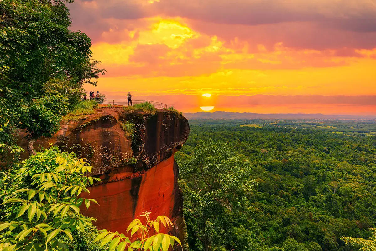
24 National Parks to Visit in Northeastern Thailand: The Complete Isan Travel Guide Northeastern Thailand, widely known as Isan, offers an extraordinary variety of national parks and protected landscapes. Its natural attractions range from sandstone plateaus, pine forests, mountain grasslands and seasonal wildflower fields to waterfalls, dramatic cliffs, caves and forests along Thailand's international borders. Although Isan is often associated with its expansive plateau and agricultural communities, the region is also shaped by significant mountain ranges, including the Phetchabun Mountains, Phu Phan Mountains and Phanom Dong Rak Mountains. These landscapes support important watersheds and some of Thailand's most valuable forest ecosystems.
For travelers searching for the best national parks in Northeastern Thailand, several destinations stand out. Phu Kradueng National Park in Loei is celebrated for its challenging mountain trek and spectacular sunset viewpoints. Phu Ruea National Park offers cool weather and memorable sunrise scenery. Pa Hin Ngam and Sai Thong National Parks in Chaiyaphum are famous for their seasonal Siam tulip fields, while Phu Chong–Na Yoi National Park in Ubon Ratchathani protects a remarkable border forest and the impressive Huai Luang Waterfall.
One of the most fascinating aspects of Isan's national parks is the diversity of their landscapes. Loei is characterized by high mountains, cool temperatures and forest trails, making it ideal for hiking and camping. Chaiyaphum is known for its wildflower meadows, waterfalls and unusual sandstone formations. Ubon Ratchathani features scenic landscapes along the Mun and Mekong Rivers, as well as protected border forests. Nong Bua Lamphu and Khon Kaen are home to Phu Kao–Phu Phan Kham National Park, where sandstone mountains overlook the Ubol Ratana Reservoir.
Beyond their scenic beauty, many of these parks have considerable geological, archaeological and historical significance. Much of Isan's sandstone landscape developed through the accumulation of ancient sediments followed by geological uplift, weathering and erosion over millions of years. These processes created dramatic cliffs, rock platforms and distinctive formations such as Mo Hin Khao in Phu Laen Kha National Park, the unusual rock sculptures of Pa Hin Ngam, and the elevated sandstone plateau of Phu Kradueng. Exploring these places is therefore an opportunity to discover both natural beauty and the geological history of Thailand.
Choosing the right season is essential when planning a national park trip in Isan. The rainy season brings lush forests, flowing waterfalls and blooming Siam tulips, particularly in Chaiyaphum. The transition from the rainy season into the cooler months is ideal for hiking, mountain scenery and occasional seas of mist. Winter is particularly popular in the highlands of Loei, where temperatures can become surprisingly cold. During summer, shaded forests and accessible waterfalls may offer welcome relief from the heat, although exposed rock platforms can become extremely hot in the afternoon.
Travelers with only one day can choose easily accessible destinations such as Tat Ton National Park in Chaiyaphum or Phu Ruea National Park in Loei. With two or three days, it is possible to combine several parks in the same province, such as Pa Hin Ngam, Sai Thong and Phu Laen Kha in Chaiyaphum. Those planning a longer mountain trek should allow at least three days and two nights for Phu Kradueng, giving enough time to reach the plateau, explore the forest trails and enjoy its famous sunrise and sunset viewpoints without rushing.
Responsible travel is particularly important in protected natural areas. Visitors should remain on designated trails, avoid collecting plants or rocks, never feed wildlife, carry out their rubbish and follow park regulations. Special attention is needed in border areas, on high cliffs, around waterfalls and on trails that open only during certain seasons. Checking the latest announcements from the park authorities before departure will help travelers plan a safer and more enjoyable visit.
This guide introduces 24 major national parks and natural destinations in Northeastern Thailand and adjoining regions. It covers their locations, highlights, outdoor activities, ecosystems, recommended travel seasons, transportation options and GPS navigation links. Whether you are planning a family holiday, a photography trip, a challenging hike or a journey through the natural and cultural heritage of Isan, these destinations provide a wide range of experiences.
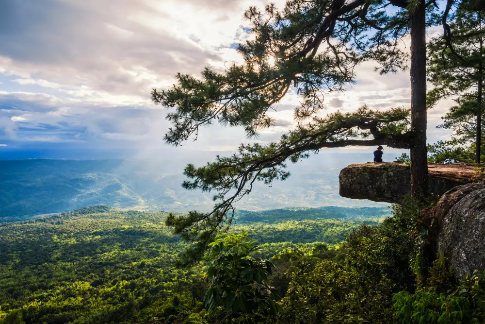
1. Phu Kradueng National Park, Loei Province is one of Thailand's most celebrated national parks. Located in Phu Kradueng District, it is distinguished by a vast, flat-topped sandstone mountain surrounded by forests and dramatic cliffs. The summit plateau contains pine forests, grasslands, waterfalls, natural ponds and panoramic viewpoints. Phu Kradueng is especially popular among travelers who want to challenge themselves with a mountain trek and experience overnight camping in a remarkable highland environment.
The journey to the summit is an essential part of the Phu Kradueng experience. The trail begins near the park headquarters and passes a series of rest stops traditionally known as sam. After climbing the steeper slopes and reaching Lang Pae, hikers continue across the plateau toward Wang Kwang Visitor Center, the main camping and accommodation area. Along the way, the landscape changes from humid foothill forests to open pine woods and mountain grasslands, creating a memorable transition between different natural environments.
Highlights: Pha Nok Aen, Pha Lom Sak, Pha Mak Duk, highland pine forests, Sa Anodat Pond, Wang Kwang Waterfall, Phen Phop Mai Waterfall and Tham Yai Waterfall. Pha Nok Aen is a favorite sunrise viewpoint, while Pha Lom Sak is famous for its rock ledge and solitary pine tree, forming one of Thailand's most recognizable sunset scenes. Travelers heading to the more distant cliffs should carry a flashlight and allow sufficient time for the return journey.
Beyond the spectacular cliffs, the summit offers an extensive network of forest trails connecting waterfalls and natural landmarks. Tham Yai Waterfall is particularly admired for its atmospheric forest setting and seasonal maple leaves. Sa Anodat Pond is another peaceful attraction, providing a different perspective on the plateau's natural environment. Exploring the trails between waterfalls, pine forests and cliff viewpoints is one of the most rewarding aspects of a longer stay.
The park supports several forest ecosystems, including dry dipterocarp forest, evergreen forest, pine woodland and grasslands. These habitats shelter a variety of wildlife and native plants. Deer may occasionally be seen around the camping area, but visitors should maintain a safe distance, avoid feeding animals and never interfere with their natural behavior.
Phu Kradueng is best suited to visitors who are comfortable walking long distances. Essential equipment includes sturdy hiking shoes, warm clothing, rain protection, drinking water, a flashlight and personal medication. Overnight visitors should arrange their camping space or accommodation according to park regulations and check seasonal entry procedures before traveling.
Open Days: The main hiking season generally runs from October 1 to May 31, with the summit closed for ecological recovery from June 1 to September 30. Opening Hours: The visitor center generally operates from 7:00 AM to 4:00 PM, while the usual latest permitted time to begin the ascent is 1:00 PM. Check the current seasonal announcement before visiting.
Getting There: Travel to Phu Kradueng District in Loei Province by private car or public transport. Travelers arriving near Ban Pha Nok Khao or the main Phu Kradueng junction can connect to local transport serving the park headquarters. Drivers can use Highway 201 and the connecting road to the park entrance before starting the mountain ascent on foot.
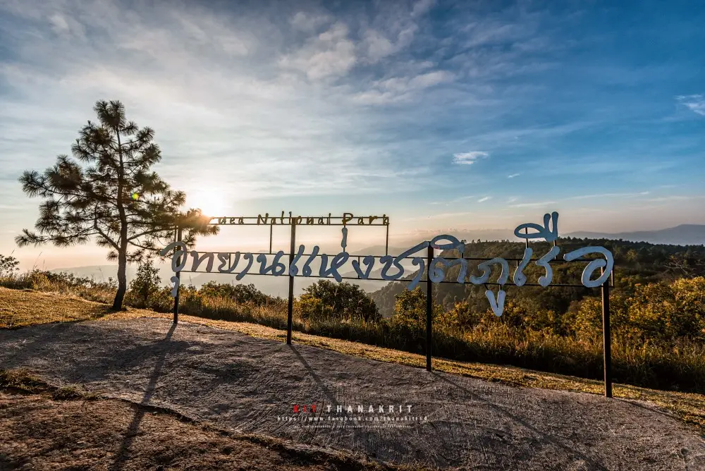
2. Phu Ruea National Park, Loei Province is a well-known mountain destination celebrated for its cool climate, impressive scenery and sunrise viewpoints. Located in Phu Ruea District, the park is particularly popular during winter, when low temperatures and occasional mist transform its highland landscapes into one of Northeastern Thailand's most atmospheric natural attractions.
The name Phu Ruea is associated with the mountain's resemblance to a large boat. Its terrain includes ridges, cliffs and extensive mountain forests. The summit provides broad views across distant mountains and valleys, making early morning one of the most rewarding times to visit. On suitable days, low clouds and mist settle between the surrounding hills as the first sunlight reaches the landscape.
Highlights: Phu Ruea Summit, sunrise viewpoints, mist-covered valleys, pine forests and highland vegetation. Unlike some mountain destinations that require strenuous multi-hour climbs, Phu Ruea allows visitors to approach its main sightseeing areas relatively conveniently by road and established visitor routes.
The scenery changes throughout the year. Rainy-season landscapes are lush and green, while the transition into winter often brings cooler air and mist. Winter is the most popular season for visitors hoping to experience crisp mountain mornings, although temperatures and visibility vary from day to day. Warm clothing is particularly useful for early starts.
The national park also protects important mountain forests and watershed areas. Vegetation changes according to elevation and moisture, providing habitats for birds and other wildlife. Nature enthusiasts can learn about the park's forest ecology through the accessible trails and viewpoints that are open to visitors.
Phu Ruea is suitable for families, couples, photographers and travelers with limited time. A visit can be combined with local agricultural attractions, flower gardens and nearby communities. Travelers interested in local history and culture may continue to Dan Sai District and Phra That Si Song Rak, one of Loei's important religious landmarks.
Getting There: Travel to Phu Ruea District in Loei Province and follow the signs to Phu Ruea National Park. A private car or rental vehicle is convenient for reaching the mountain and nearby attractions. Those planning to watch the sunrise should leave early and drive carefully on mountain roads, particularly when visibility is reduced by fog.
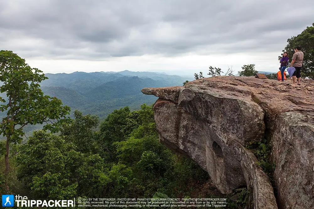
3. Pa Hin Ngam National Park, Chaiyaphum Province is famous for its seasonal fields of pink-purple Siam tulips and extraordinary natural rock formations. Located in Thep Sathit District, the park becomes especially beautiful during the rainy season, when its mountain grasslands turn bright green and native wildflowers emerge across the landscape.
The Siam tulip fields, known locally as Thung Dok Krachiao, are the park's signature attraction. These flowers belong to the ginger family and grow naturally in open grasslands and lightly wooded areas. As seasonal rainfall increases moisture in the soil, the flowers appear among the grasses, creating a colorful landscape that is especially attractive in the misty morning light.
Highlights: Siam Tulip Fields, Lan Hin Ngam and Sut Phaen Din Viewpoint. Lan Hin Ngam features sandstone formations weathered into unusual shapes, while Sut Phaen Din is a scenic cliff-edge viewpoint overlooking the mountains and lower landscapes beyond. These attractions make the park particularly appealing to photographers and visitors interested in geology.
The rock formations provide an excellent introduction to the geological history of Isan. Over long periods, wind, water and changes in temperature gradually weathered the sandstone layers, producing sculpted rocks and exposed platforms. Walking through this landscape offers visitors an opportunity to appreciate the slow natural processes that continue to shape the region.
Visitors to the flower fields should stay on designated walkways and avoid stepping into the vegetation. The seasonal plants are sensitive to disturbance, and protecting their habitat helps ensure that the fields can recover and bloom in future years. Non-slip shoes and rain protection are advisable because paths may become wet and slippery during the flowering season.
Pa Hin Ngam is ideal for families, nature photographers and visitors who enjoy wildflowers. It can be combined with a trip to Sai Thong National Park, where similar seasonal flowers grow in a different mountain setting. Because flowering periods depend on rainfall and local conditions, visitors should check current bloom updates before traveling.
Getting There: Drive to Thep Sathit District in Chaiyaphum Province and follow signs to Pa Hin Ngam National Park. Private transport is the most convenient option, particularly for visiting several attractions in one trip. During the flowering festival, check whether shuttle services are operating within the park.
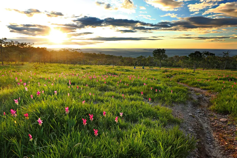
4. Sai Thong National Park, Chaiyaphum Province is another outstanding destination for seasonal Siam tulips, mountain viewpoints and waterfalls. Its landscape is composed of sandstone mountains, forests, grasslands, streams and dramatic cliffs. The park's best-known attractions include Thung Bua Sawan, Pha Ham Hot and Sai Thong Waterfall.
Thung Bua Sawan is a highland meadow where Siam tulips bloom naturally during the rainy season. Pink-purple flowers emerge among the grasses, contrasting beautifully with the green mountain forests. Morning mist can make the scenery particularly atmospheric, creating excellent opportunities for landscape and flower photography.
Highlights: Thung Bua Sawan, Pha Ham Hot and Sai Thong Waterfall. Pha Ham Hot is renowned for its projecting sandstone ledge overlooking forested valleys and distant mountains. The viewpoint is visually impressive, but visitors must remain within permitted areas and exercise particular caution when the rocks are wet.
Sai Thong Waterfall adds another dimension to the park. Water flows across natural rock layers through a forested setting, with seasonal changes influencing the waterfall's appearance and volume. During the rainy season, the waterfall can be especially impressive, although slippery surfaces and strong currents require care.
The park protects mountain forests, grasslands and stream ecosystems that support native plants and wildlife. The seasonal wildflower meadows are particularly sensitive to disturbance. Visitors should follow established paths, avoid picking flowers and respect any conservation restrictions in place.
Sai Thong is well suited to travelers who enjoy wildflowers, photography and scenic walks. A two-day trip combining Sai Thong with Pa Hin Ngam is a popular way to experience Chaiyaphum's flowering landscapes. Some attractions are located away from the main park office and may require authorized local transport or designated shuttle services.
Getting There: Travel to Nong Bua Rawe District in Chaiyaphum Province and follow the signs to Sai Thong National Park. Check transportation arrangements for the higher flower fields and cliff viewpoints before setting out, particularly during the rainy season and popular flowering periods.

5. Phu Laen Kha National Park, Chaiyaphum Province is celebrated for its remarkable sandstone formations, scenic cliffs and mountainous forests. Its most recognizable attractions are Mo Hin Khao, a collection of large natural stone pillars, and Pha Hua Nak, a panoramic viewpoint overlooking the surrounding mountain ranges.
Mo Hin Khao is a striking landscape of towering sandstone formations rising from an open highland setting. The pillars vary in size and shape and were created through geological weathering and erosion over long periods. Their unusual appearance has made the site one of Chaiyaphum's best-known natural landmarks and a favorite destination for landscape photographers.
Highlights: Mo Hin Khao, Pha Hua Nak, natural sandstone formations and mountain viewpoints. Pha Hua Nak offers sweeping views of forested ridges and the lowlands below. On suitable days, the viewpoint is an attractive place to appreciate the changing light at sunrise or sunset, subject to the park's access regulations.
The park's geological landscape reflects the history of sandstone deposition, uplift and erosion. These processes formed hills, exposed rock platforms and striking formations across the terrain. Forests and grasslands surrounding the rocks add ecological interest, making Phu Laen Kha valuable for both outdoor recreation and environmental education.
Its major attractions are spread across different areas rather than concentrated at a single site. Travelers who wish to visit Mo Hin Khao and Pha Hua Nak in one day should plan the driving route carefully, allow sufficient travel time and check road conditions, especially during the rainy season.
Phu Laen Kha is an excellent destination for families, photographers and travelers interested in geology. Its landscape provides a different experience from Chaiyaphum's waterfalls and flower fields, making it a worthwhile addition to a longer itinerary through the province.
Getting There: Travel from Chaiyaphum town toward the area of Phu Laen Kha National Park, selecting the access route according to the attraction you intend to visit. A private vehicle is recommended, and visitors should check which viewpoints and roads are currently open.
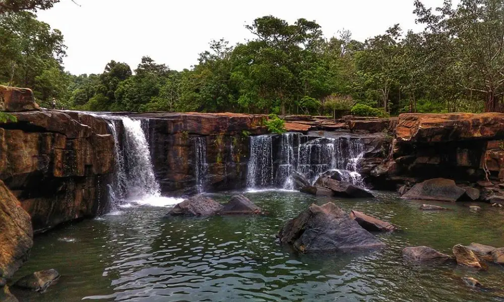
6. Tat Ton National Park, Chaiyaphum Province is one of the most accessible natural attractions near Chaiyaphum town. The park is best known for Tat Ton Waterfall, where water flows across broad rock terraces surrounded by shady forest. Its proximity to the provincial capital makes it a convenient destination for families and travelers seeking an enjoyable day trip without a demanding hike.
Tat Ton Waterfall is characterized by a wide rocky streambed and flowing water descending over natural stone layers. Its appearance changes with the seasons. During the rainy season, the volume of water increases and the waterfall can be particularly impressive, although stronger currents may make certain areas unsafe for swimming or walking.
Highlights: Tat Ton Waterfall, expansive rock terraces, shaded streams, peaceful picnic areas and nature trails. Visitors can enjoy the waterfall scenery, take photographs and learn about the forest watershed ecosystem through accessible areas within the park.
The forests surrounding Tat Ton are important for maintaining local watersheds. Vegetation helps protect soil moisture, regulate water flow and provide habitats for native wildlife. The park therefore has ecological value beyond its popular waterfall and offers opportunities for nature education.
Morning and cooler parts of the day are particularly pleasant for visiting. Sturdy footwear with good grip is recommended because rocks can become slippery, especially after heavy rain. Families with children or older visitors should use accessible viewing areas and avoid approaching fast-moving water.
A visit to Tat Ton can easily be combined with cultural sites in Chaiyaphum town or other nearby natural attractions. It is particularly suitable for travelers who have limited time but still wish to enjoy the province's forests and waterfalls.
Open Days: Daily. Opening Hours: Generally 8:00 AM–6:00 PM; check current park notices before visiting.
Getting There: From Chaiyaphum town, follow Highway 2051 toward Na Fai Subdistrict and Tat Ton National Park. The journey is convenient by private car or rental vehicle. During the rainy season, check local warnings concerning water levels and trail conditions.
Map (GPS):Open Google Maps – Tat Ton National Park
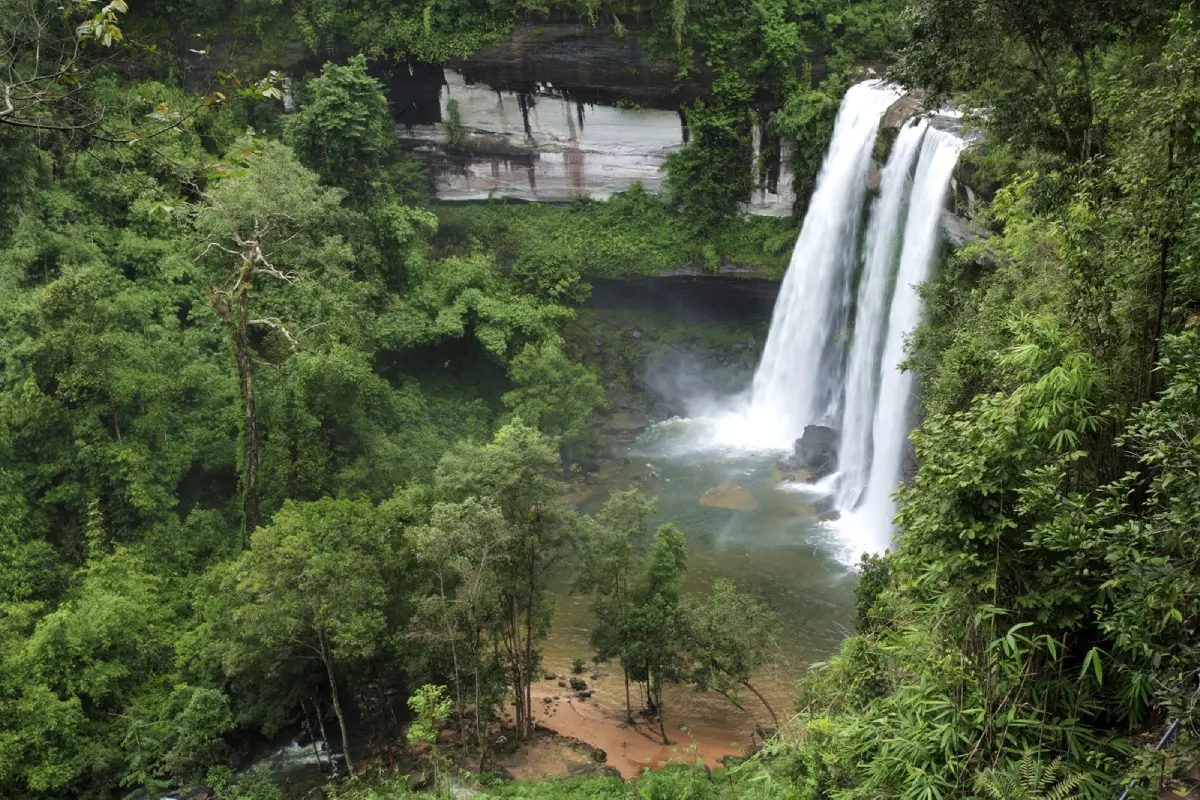
7. Phu Chong–Na Yoi National Park, Ubon Ratchathani Province protects an important forest landscape near Thailand's southeastern border. Located in Ubon Ratchathani, the park is known for its extensive woodlands, mountains, waterfalls and biodiversity. Huai Luang Waterfall is one of its most famous attractions and an important destination for visitors who wish to experience the natural beauty of this remote region.
The park forms part of the forested landscape near the borders of Thailand, Laos and Cambodia, a wider area often associated with the Emerald Triangle. Its protected forests provide habitats for wildlife and maintain important watershed systems. The combination of mountains, streams and dense vegetation creates a natural setting very different from the region's major towns.
Highlights: Huai Luang Waterfall, border forest ecosystems, mountain scenery and nature trails. Huai Luang Waterfall descends from a prominent rock cliff into a natural basin surrounded by forest, creating one of the most impressive waterfall landscapes in Ubon Ratchathani.
The forests contain different ecological communities shaped by altitude, terrain and moisture. They support native plants and wildlife and help protect the wider watershed. The park is therefore important both as a destination for nature-based tourism and as a conservation area for the border region.
Visitors can explore permitted nature trails and waterfall viewpoints, although access may vary according to weather conditions and safety regulations. During the rainy season, waterfalls and streams can become powerful. Travelers must also respect restrictions relating to border areas and should not enter controlled forest zones without authorization.
Phu Chong–Na Yoi appeals to travelers who enjoy forests, waterfalls and relatively quiet natural settings. Because the park is some distance from Ubon Ratchathani town, it is advisable to allow enough time for both the journey and exploration of the accessible attractions.
Getting There: Travel from Ubon Ratchathani town toward Na Chaluai District and follow the designated route to Phu Chong–Na Yoi National Park. Private transport is recommended. Check current park and border-area access announcements before departure.
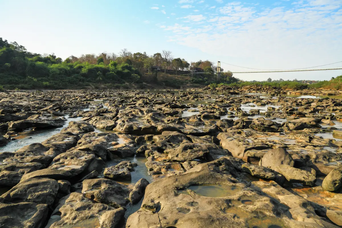
8. Kaeng Tana National Park, Ubon Ratchathani Province is distinguished by its rocky river landscape along the Mun River. Located around Sirindhorn and Khong Chiam districts, it includes natural rapids, a suspension bridge, river islands and forest trails. Unlike mountain parks whose principal attractions are high peaks or waterfalls, Kaeng Tana offers an experience closely connected to one of Northeastern Thailand's major rivers.
Kaeng Tana is a section of the Mun River where water flows around large rock formations and natural channels. The appearance of the rapids changes significantly with the seasons. When water levels are lower, more of the exposed rock formations become visible. During periods of high rainfall, the river can be much deeper and faster, making it essential to remain within safe viewing areas.
Highlights: Kaeng Tana Rapids, the suspension bridge, Don Tana Island, Tham Phra Cave and Mun River viewpoints. The suspension bridge provides an elevated perspective over the river landscape, while Don Tana offers an opportunity to appreciate the river's natural vegetation and island ecology.
Established as a national park on July 13, 1981, Kaeng Tana protects important sandstone terrain and river ecosystems. The landscape includes forests, rocky platforms, low hills and islands in the Mun River. Together, these features demonstrate how river flow and geological processes continually shape the surrounding environment.
The park also offers an introduction to the relationship between local communities and the Mun River. For generations, the river has served as a source of food, transportation and livelihood. Traveling through the area allows visitors to appreciate both the natural setting and the cultural traditions associated with riverside communities.
Kaeng Tana is suitable for families, photographers and visitors interested in river landscapes. It can be combined with attractions around Khong Chiam, including Pha Taem National Park and viewpoints overlooking the Mekong River. Travelers should avoid swimming or entering strong currents near the rapids.
Open Days: Daily. Opening Hours: Generally 8:00 AM–4:30 PM, subject to park announcements.
Getting There: From Ubon Ratchathani town, follow Highway 217 toward Phibun Mangsahan and Sirindhorn districts, then follow signs to Kaeng Tana National Park. Alternative access routes are available from the Khong Chiam area depending on the attraction being visited.
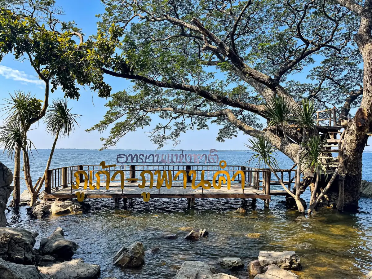
9. Phu Kao–Phu Phan Kham National Park, Nong Bua Lamphu and Khon Kaen Provinces protects a landscape of sandstone mountains, forests and scenic terrain near the Ubol Ratana Reservoir. The park is divided into the Phu Kao and Phu Phan Kham areas, which offer different landscapes and attractions.
Phu Kao is characterized by sandstone mountain ridges, complex terrain and extensive forest. Phu Phan Kham, meanwhile, is associated with elevated viewpoints overlooking the Ubol Ratana Reservoir. Together, these landscapes provide opportunities to experience both mountain forests and wide reservoir scenery.
Highlights: Sandstone mountains, viewpoints overlooking Ubol Ratana Reservoir, protected forests and archaeological remains associated with ancient human occupation. The park's combination of natural features and historical evidence makes it particularly interesting for visitors who enjoy geology and local history.
Long-term geological processes shaped the sandstone ridges, cliffs and slopes. Weathering and erosion created the distinctive mountain terrain visible today, while the surrounding forests provide habitats for native plants and animals. These different environments contribute to the park's conservation value.
The Phu Kao area also contains evidence of past human activity. Mountain shelters, caves and the availability of natural resources influenced how people used the landscape in earlier periods. This connection between geography and human settlement adds an important cultural dimension to the park.
Travelers should plan their visit according to the specific section of the park they wish to explore. Phu Kao and Phu Phan Kham are not located at the same visitor entrance, and travel distances between attractions should be considered. Some viewpoints can be combined with a visit to the Ubol Ratana Dam area.
Getting There: To explore Phu Kao, travel toward Non Sang District in Nong Bua Lamphu Province. For the Phu Phan Kham area, choose the appropriate approach from Khon Kaen Province. A private car is recommended because the park's attractions are spread across different locations.
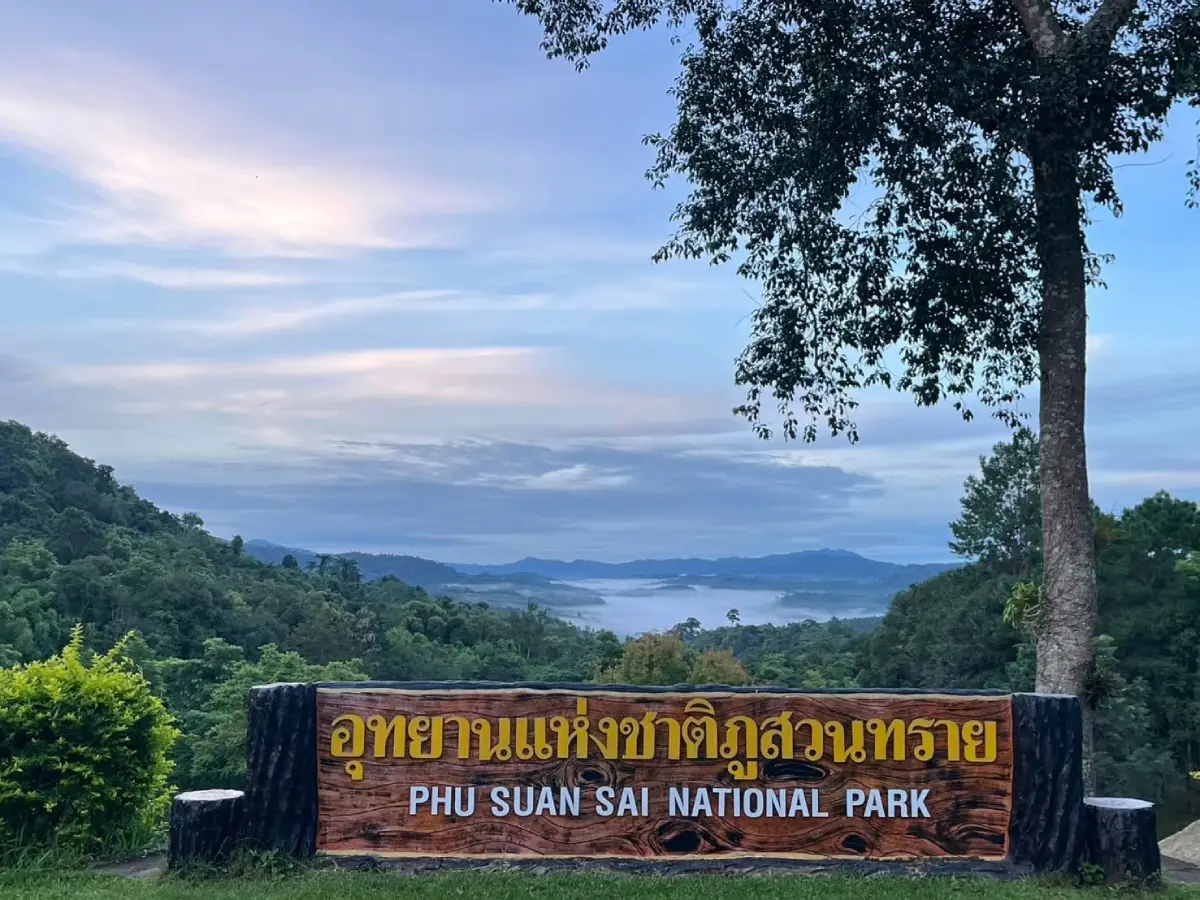
10. Phu Suan Sai National Park, Loei Province is a peaceful mountain forest destination in Na Haeo District, close to the Thai–Lao border. The park is characterized by rugged ridges, forested slopes and cooler highland environments. It is especially appealing to travelers seeking a quieter alternative to more heavily visited national parks.
Formerly known as Na Haeo National Park, Phu Suan Sai protects mountain forests and watershed ecosystems along the border region. The vegetation includes evergreen forests, dry evergreen forest, bamboo communities and other plants adapted to different elevations and moisture conditions.
Highlights: Phu Hua Hom Viewpoint, Hin Si Thit, the 1,408-meter hill, Tat Hueang Waterfall, Khing Waterfall and nature trails. Hin Si Thit features distinctive natural sandstone formations, while Phu Hua Hom is an attractive viewpoint for observing mountain scenery and, when conditions allow, mist-filled valleys.
One of Phu Suan Sai's greatest attractions is its peaceful forest setting. Visitors can enjoy cool mountain air, panoramic views and nature trails that reveal the biodiversity of the area. Some routes are suitable for birdwatching and plant observation, although more remote trails may require permission or guidance from park staff.
The park is also an appealing destination for camping and observing the night sky in designated areas. Its relatively remote setting offers a different atmosphere from urban travel destinations. Overnight visitors should prepare appropriate camping equipment, warm clothing and sufficient supplies, and check which camping areas are currently operating.
Na Haeo District also has cultural attractions and rural communities that can be included in a longer trip. Wat Si Pho Chai and nearby villages provide opportunities to learn about local traditions and the relationship between forest landscapes and border communities.
Phu Suan Sai is best enjoyed without rushing. Allowing at least one night in the area creates more opportunities to experience early morning scenery and quiet forest surroundings. Road conditions may vary with rain, fog and seasonal weather, so travelers should prepare carefully.
Getting There: Travel from Loei town through Dan Sai District toward Na Haeo District, then follow the route through Saeng Pha Subdistrict to Phu Suan Sai National Park. A private car or rental vehicle is recommended. Check mountain road conditions and fuel availability before departure.
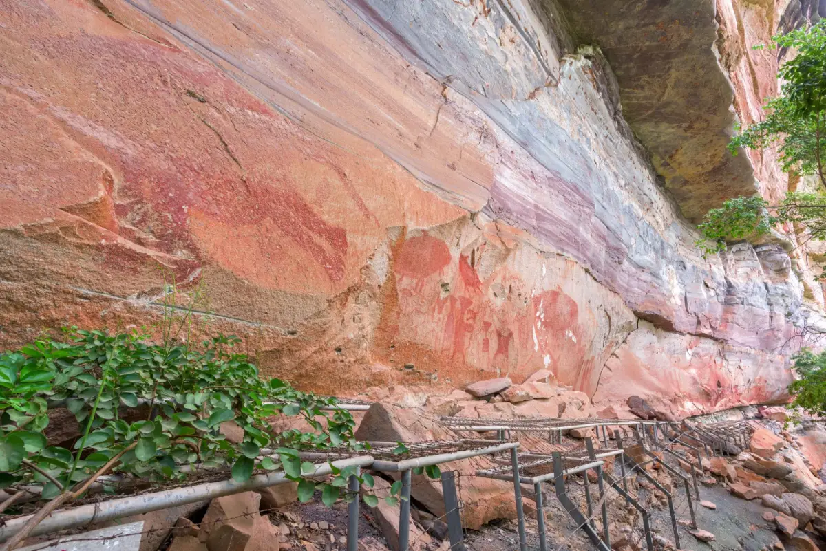
11. Pha Taem National Park, Ubon Ratchathani Province is one of Thailand's most important destinations for combining natural scenery with prehistoric archaeology. Located in Khong Chiam, Si Mueang Mai and Pho Sai districts, the park features dramatic sandstone cliffs overlooking the Mekong River and neighboring Laos. Its elevated position makes it a celebrated sunrise destination, particularly for visitors interested in watching the first light of day illuminate the river and distant mountains.
Pha Taem is internationally interesting because of its prehistoric rock paintings, preserved on sandstone cliff faces. Dating back several thousand years, the paintings depict human figures, animals, handprints and other symbols associated with ancient life in the Mekong Basin. Visitors can follow designated trails to observe the artwork and learn about the people who occupied this landscape long before modern settlements developed.
Highlights: Pha Taem Rock Paintings, Sao Chaliang sandstone formations, Pha Chanadai, Saeng Chan Waterfall, Soi Sawan Waterfall, seasonal wildflowers and Mekong River sunrise viewpoints. Sao Chaliang features mushroom-shaped sandstone pillars formed by differential erosion, while Pha Chanadai is another notable viewpoint for watching sunrise over the eastern landscape.
Saeng Chan Waterfall, sometimes called the waterfall through a hole, is a particularly unusual natural attraction. Water passes through an opening in the rock before falling into the space below. Soi Sawan Waterfall is another scenic destination, especially during the rainy season when the surrounding vegetation is lush and seasonal wildflowers may appear.
The park also protects dry dipterocarp forests, rocky grasslands and specialized plant communities adapted to exposed sandstone surfaces. These environments are ecologically sensitive. Visitors should use designated trails, avoid trampling small plants and never touch or mark the ancient rock paintings.
A one-day itinerary can begin with sunrise at the main Pha Taem viewpoint, followed by a walk to the prehistoric paintings and Sao Chaliang formations. Travelers with two or three days can add Saeng Chan Waterfall, Soi Sawan Waterfall and Pha Chanadai, subject to seasonal road and trail access.
Getting There: Travel from Ubon Ratchathani town to Khong Chiam District, then use Highways 2134 and 2112 to reach Pha Taem National Park. Private transport is convenient because the main attractions are spread over a considerable area.
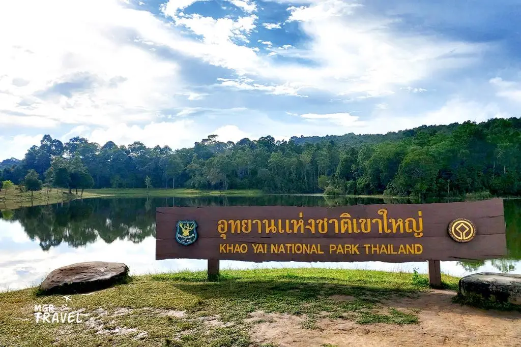
12. Khao Yai National Park, Nakhon Ratchasima Province was Thailand's first national park, established on September 18, 1962. It extends across parts of Nakhon Ratchasima, Prachin Buri, Nakhon Nayok and Saraburi provinces. The Pak Chong entrance in Nakhon Ratchasima is particularly popular with travelers arriving from Bangkok. Khao Yai is renowned for its expansive forests, waterfalls, grasslands, panoramic viewpoints and exceptional wildlife diversity. It forms part of the UNESCO-listed Dong Phayayen–Khao Yai Forest Complex.
The park's landscape includes mountain ranges, tropical evergreen forest, hill evergreen forest, dry evergreen forest, mixed deciduous woodland and open grasslands. This variety of habitats supports elephants, gaur, deer, muntjacs, gibbons, hornbills and numerous other wildlife species. Visiting Khao Yai offers an opportunity to discover the biodiversity of Thailand's tropical forests in a protected setting.
Highlights: Haew Suwat Waterfall, Haew Narok Waterfall, Pha Kluai Mai Waterfall, Pha Diao Dai Viewpoint, Pha Trom Jai Viewpoint, Nong Phak Chi Grassland and nature trails. Haew Suwat is famous for its dramatic cascade, while Pha Diao Dai offers panoramic views over forested mountain ridges.
Popular activities include nature walks, birdwatching, wildlife photography, camping and ranger-organized wildlife observation. Visitors should follow all wildlife safety regulations. Feeding wild animals is prohibited, and drivers must not block roads to photograph animals. Particular care is required when encountering wild elephants or other large mammals.
Khao Yai's forests also provide important watershed services, supporting river systems beyond the park boundaries. Protecting these forests helps maintain biodiversity, water resources and ecological connections throughout the wider landscape. The park is therefore important both for recreation and for national conservation efforts.
Travelers can visit Khao Yai on a day trip from Pak Chong or stay overnight to explore more trails and enjoy the forest's early morning atmosphere. Some hiking routes and organized nighttime activities require arrangements with park staff, so it is advisable to contact the visitor center before planning specialized activities.
Open Days: Daily. Opening Hours: General park entry is usually permitted from 6:00 AM to 6:00 PM, with separate conditions for certain facilities and activities.
Getting There: From Bangkok, follow Mittraphap Road toward Pak Chong District in Nakhon Ratchasima, then take Thanarat Road through Mu Si to the main park entrance. Another approach is available through the Noen Hom entrance on the Nakhon Nayok–Prachin Buri side. Private transport is recommended because attractions within the park are widely separated.
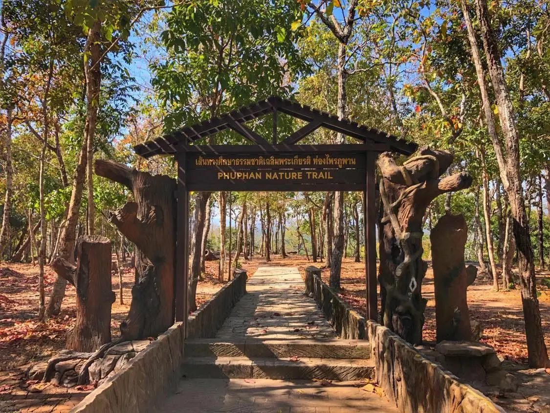
13. Phu Phan National Park, Sakon Nakhon Province protects an important section of the Phu Phan Mountains, extending across parts of Sakon Nakhon and Kalasin provinces. The park is characterized by sandstone ridges, forests, waterfalls, scenic cliffs and places associated with local history. It plays a significant role in forest conservation, watershed protection and nature-based tourism in upper Northeastern Thailand.
The Phu Phan mountain range shapes much of Sakon Nakhon's natural environment. Its forests include dry dipterocarp woodland, mixed deciduous forest and dry evergreen forest, providing habitats for native plants and wildlife. Driving through the mountains reveals the gradual transition from lower agricultural landscapes to cooler and more heavily forested slopes.
Highlights: Pha Nang Moen, Pha Sawoey, Kham Hom Waterfall, Seri Thai Cave and scenic forest routes. Pha Sawoey is known for its historical associations and viewpoints, while Seri Thai Cave is connected to the Free Thai movement during World War II. These attractions give the park an appealing combination of natural and historical interest.
Sandstone layers throughout the mountains have been shaped by geological processes into cliffs, rock platforms and distinctive outcrops. Certain viewpoints offer extensive views across forests and nearby valleys. The park is therefore an appealing place for visitors interested in geology, landscapes and environmental education.
Phu Phan National Park suits travelers who enjoy scenic mountain drives, photography, forest walks and historical exploration. It can be combined with other attractions around Sakon Nakhon, including Wat Tham Pha Daen and Phu Phan Ratchaniwet Palace, subject to their respective visitor access rules.
Getting There: From Sakon Nakhon town, follow Highway 213 toward Kalasin and into the Phu Phan Mountains. The road includes winding and sloping sections, so drivers should proceed carefully, particularly during rain or reduced visibility.
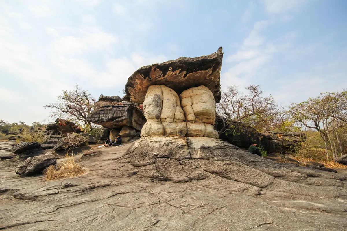
14. Phu Pha Thoep National Park, Mukdahan Province is famous for its unusual sandstone formations and expansive natural rock platforms. Located in parts of Mueang Mukdahan and Don Tan districts, it was formerly known as Mukdahan National Park before adopting the name Phu Pha Thoep, reflecting the distinctive rock formations that have become its most recognizable attraction.
The Hin Thoep formations are a remarkable example of natural sandstone erosion. Over long periods, weathering shaped large rock masses into unusual stacked forms. Some resemble mushrooms, animals or everyday objects, inviting visitors to interpret the natural shapes through their imagination.
Highlights: Hin Thoep Rock Formations, Lan Mutcharin, seasonal wildflower areas, Phu Tham Phra and scenic viewpoints overlooking Mukdahan. The main rock formations are the park's most popular photographic attraction, while surrounding stone platforms support small plants and seasonal flowers.
The park offers an accessible introduction to sandstone geology. Rock layers of different hardness weather at different rates, gradually creating columns, overhangs and balanced-looking formations. These features illustrate how natural forces continually reshape the Earth's surface.
Forest patches and specialized vegetation also occur around the exposed rock platforms. Plants growing in shallow soils must tolerate seasonal dryness and strong sunlight. Visitors should stay on marked routes, avoid trampling fragile vegetation and refrain from climbing restricted rock formations.
Phu Pha Thoep is suitable for families, photographers and travelers interested in unusual landscapes. It can be combined with attractions around Mukdahan town, including Ho Kaeo Mukdahan, Wat Roi Phra Phutthabat Phu Manorom and Mekong River viewpoints. Morning or late afternoon visits are often more comfortable because the exposed rock platforms can become hot in direct sunlight.
Getting There: Travel from Mukdahan town toward Don Tan District and follow signs to Phu Pha Thoep National Park. A private car is convenient, and the visit can be incorporated into a half-day or full-day itinerary around Mukdahan.

15. Phu Wiang National Park, Khon Kaen Province is one of Thailand's most important destinations for geology and paleontology. Located in Khon Kaen, the park is renowned for the discovery of dinosaur fossils and other evidence of prehistoric life. The discoveries at Phu Wiang have played a significant role in advancing the study of dinosaurs and ancient ecosystems in Thailand.
The park's landscape consists of sandstone mountains surrounding a central basin. Geological layers in this area preserve fossils and other evidence dating back many millions of years. These discoveries allow scientists to investigate ancient animals, environmental conditions and the geological evolution of the region.
Highlights: Dinosaur excavation sites, fossil displays, the Hin Lat Pa Chat dinosaur footprint site, Tat Fa Waterfall, Pha Chom Tawan and nature trails. One of the best-known dinosaurs associated with Phu Wiang is Phuwiangosaurus sirindhornae, a large herbivorous dinosaur that is significant to Thai paleontological research.
Beyond its fossil heritage, Phu Wiang National Park protects dry dipterocarp and mixed deciduous forests. These habitats support native wildlife and plants, while the mountain landscape provides opportunities to understand the relationship between geology and present-day ecosystems.
The park is particularly well suited to educational family trips. Children and adults can learn about dinosaurs, geological time and natural history by exploring real fossil discovery areas. A visit can be combined with Phu Wiang Dinosaur Museum and other attractions around Khon Kaen.
Visitors interested in the excavation sites should obtain current information from the visitor center before exploring. Fossils and rocks must not be collected or disturbed because they form part of the area's protected scientific heritage.
Getting There: From Khon Kaen town, follow Highway 12 toward Chum Phae, then turn onto Highway 2038 toward Phu Wiang and Wiang Kao districts. Continue along the signposted route to Phu Wiang National Park.
16. Phu Pha Yon National Park, Sakon Nakhon Province protects a large mountainous forest landscape within the Phu Phan range, extending across parts of Sakon Nakhon, Nakhon Phanom and Mukdahan provinces. Its natural features include sandstone mountains, forests, waterfalls, cliffs, reservoirs and exposed rock platforms. The park is valuable for its biodiversity, historical sites and opportunities for nature-based recreation.
Phu Pha Yon is an important forest and watershed conservation area. Its ridges, valleys and streams support different forest types, including dry dipterocarp, mixed deciduous and dry evergreen forests. Natural water sources and reservoirs also contribute to the surrounding communities and ecosystems.
Highlights: Huai Huat Reservoir, ancient Phu Pha Yon rock carvings, Pha Phaya Tao Ngoi, Kham Nam Sang Waterfall, Lan Dusita and nature trails. The historic carvings provide evidence of past human activity, while Huai Huat Reservoir is a scenic setting for relaxation and landscape photography.
Lan Dusita is an exposed rock platform where seasonal plants and small wildflowers may grow. Its shallow soil and rocky terrain create an unusual ecological environment in which vegetation must adapt to changing moisture levels and temperatures. Visitors should remain on established trails to protect these delicate plant communities.
The park is suitable for forest walks, birdwatching, stargazing and camping in designated areas. Visitors who wish to explore more remote trails or attractions should contact park officials in advance to confirm access requirements, trail conditions and any need for a local guide.
Phu Pha Yon can be combined with other destinations in Sakon Nakhon, including Wat Tham Pha Daen and attractions around Tao Ngoi District. Staying overnight in the region allows more time to appreciate the atmosphere of the forest and reservoir.
Getting There: Travel from Sakon Nakhon town toward Tao Ngoi District, then follow signs to Phu Pha Yon National Park. Highway 2339 provides access to parts of the surrounding area. Because the park covers an extensive landscape, visitors should verify the exact destination before departure.
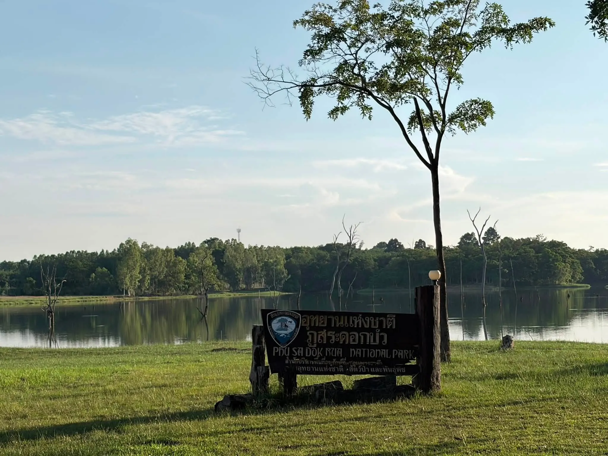
17. Phu Sa Dok Bua National Park, Amnat Charoen, Mukdahan and Yasothon Provinces is a protected mountain landscape near the meeting point of three Northeastern provinces. The park is characterized by sandstone hills, forests and extensive rocky platforms. Its name is associated with natural water-filled depressions on a mountain summit where small lotus plants grow, creating a distinctive local landmark.
The park is significant for its natural landscapes, geological features and archaeological heritage. Much of its terrain consists of mountain ridges and forest communities, including dry dipterocarp, mixed deciduous and dry evergreen forests. Exposed rock platforms provide specialized habitats for small plants and seasonal wildflowers.
Highlights: Phu Sa Dok Bua, Phu Pha Taem, Pha Makluea, Phu Pha Hom, sandstone platforms and prehistoric rock paintings. The Phu Pha Taem area within this park contains painted figures and handprints associated with ancient human activity, while Phu Pha Hom is valued for its mountain views.
The park's sandstone terrain illustrates the effects of weathering and erosion. Small hollows in the rock surfaces can hold rainwater, providing moisture for plants that are adapted to shallow soils and exposed conditions. These unusual habitats offer opportunities to study the relationship between geology, water and vegetation.
Phu Sa Dok Bua also has historical importance because of evidence of past human use of the landscape. Visitors interested in archaeology can explore permitted sites containing ancient markings and cultural traces. Rock paintings should never be touched, scratched or altered.
The national park is suited to travelers seeking quiet natural settings, forest exploration and sandstone landscapes. Anyone planning longer hikes or visits to remote summits should obtain updated trail information and any necessary permission from park staff before setting out.
Getting There: Use Highway 2277 between Loeng Nok Tha and Don Tan districts. The park headquarters access route is near the 24–26 kilometer section of the highway. A private vehicle is recommended because the protected area extends across several provinces.

18. Nam Phong National Park, Khon Kaen Province is an important forest and watershed conservation area in central Northeastern Thailand. Extending across parts of Khon Kaen and Chaiyaphum provinces, it is characterized by forested mountains, dry dipterocarp woodland, sandstone cliffs and viewpoints overlooking the Ubol Ratana Reservoir.
Hin Chang Si is among the park's best-known attractions. This scenic sandstone area provides sweeping views of the reservoir and surrounding mountain landscape. Its rocky surfaces and elevated setting make it particularly appealing for photography, especially in the softer light of early morning or late afternoon.
Highlights: Hin Chang Si Viewpoint, natural sandstone platforms, the forests surrounding Ubol Ratana Reservoir and nature trails. The unusual rock formations are interesting examples of sandstone weathering, while the viewpoints reveal the relationship between the mountain terrain and the large reservoir below.
Nam Phong National Park helps protect the ecosystems associated with the Nam Phong watershed. Its dry dipterocarp and evergreen forest communities support native wildlife and vegetation. The forests also contribute to soil conservation and the regulation of water resources in the surrounding region.
The park is well suited to photography, scenic walks and day trips from Khon Kaen town. A visit may be combined with Ubol Ratana Dam and Wat Phra Bat Phu Phan Kham, depending on the available time. Anyone hoping to enjoy the late afternoon scenery should check park closing times before planning the return journey.
Getting There: From Khon Kaen town, travel toward Ubol Ratana District and follow the signs to Nam Phong National Park. For Hin Chang Si Viewpoint, use the designated approach route recommended by park officials. Private transport is convenient.
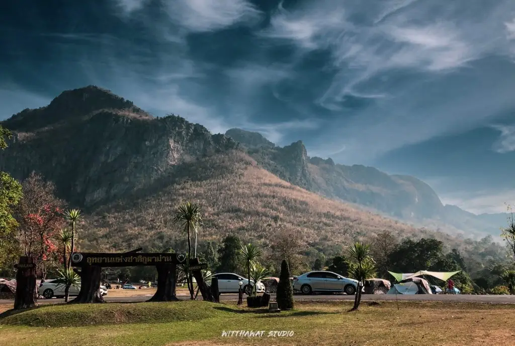
19. Phu Pha Man National Park, Khon Kaen Province is distinguished by imposing limestone mountains and steep cliffs that resemble a long curtain of rock. Located around Phu Pha Man District and adjoining areas, the park offers a landscape quite different from the sandstone mountains commonly associated with Isan. Its limestone formations, caves and forest ecosystems make it an excellent destination for visitors interested in geology and natural history.
The mountain cliffs rise dramatically above surrounding farmland and communities. Limestone forms from ancient sedimentary deposits, often associated with marine environments. Over geological time, uplift and weathering produced the steep cliffs, caves and rugged mountain forms visible today.
Highlights: Phu Pha Man limestone cliffs, bat caves, natural cave formations, Tat Yai Waterfall and mountain scenery. One particularly memorable experience is watching large groups of bats emerge from caves in the evening, a natural phenomenon that highlights the importance of underground habitats and wildlife behavior.
The park's ecosystems include limestone forest, mixed deciduous woodland and caves that provide shelter for bats and other species. Bats play an important ecological role, and some species help regulate insect populations. Protecting these habitats is essential for the wider balance of the surrounding environment.
Visitors wishing to explore caves or more demanding trails should contact park staff in advance. Some areas are dark, humid and slippery, and certain routes may require a knowledgeable guide. Avoid disturbing bats or using bright lights unnecessarily inside wildlife habitats.
Phu Pha Man is suitable for families, photographers and travelers interested in limestone geology. It can be combined with other attractions around Phu Pha Man and Chum Phae districts, with at least half a day recommended for appreciating the area's main scenery.
Getting There: From Khon Kaen town, take Highway 12 toward Chum Phae, then continue toward Phu Pha Man District following the local signs. Private transport is recommended because natural attractions are distributed along the mountain landscape.

20. Phu Langka National Park, Nakhon Phanom and Bueng Kan Provinces protects an important forested mountain landscape within the Phu Langka range. Extending across parts of Nakhon Phanom and Bueng Kan, it features sandstone mountains, forests, waterfalls, caves and natural cliffs. Nakee Cave is a particularly popular attraction, drawing visitors who are interested in both geology and local beliefs associated with the mythical naga serpent.
The park is an important protected watershed and forest ecosystem in upper Northeastern Thailand. Weathering and erosion have shaped its sandstone ridges into caves, rock shelters and distinctive formations. Nature trails lead visitors through a landscape of mountain vegetation and geological features.
Highlights: Nakee Cave, Tat Pho Waterfall, Tat Kham Waterfall, forest trails and panoramic mountain scenery. Some natural rock formations around Nakee Cave are associated with local naga beliefs, giving the landscape cultural significance alongside its geological interest.
Tat Pho and Tat Kham Waterfalls are important natural attractions around Ban Phaeng District in Nakhon Phanom. Their streams descend across rocky terrain through forested surroundings. Water volume changes with the seasons, and paths may become slippery during heavy rainfall.
The hike to Nakee Cave requires appropriate physical preparation and footwear. Travelers should carry water and basic supplies, follow the designated route and comply with instructions from park officials. Visitor numbers or access arrangements may be regulated during busy periods and adverse weather conditions.
Phu Langka is an appealing destination for hikers, waterfall enthusiasts and travelers interested in the natural and cultural associations of the region. A longer trip can include nearby attractions in Ban Phaeng District or other destinations in Nakhon Phanom and Bueng Kan.
Getting There: From Nakhon Phanom town, travel toward Ban Phaeng District and follow signs to Phu Langka National Park. Visitors planning to hike to Nakee Cave should confirm the designated registration point, available routes and current visitor requirements.

21. Thap Lan National Park, Nakhon Ratchasima and Prachin Buri Provinces is one of Thailand's major forest conservation areas. Extending across Nakhon Ratchasima and Prachin Buri, the park is especially significant for its natural fan palm forests, as well as its mountains, waterfalls, viewpoints and diverse forest ecosystems.
Thap Lan forms part of the UNESCO World Heritage-listed Dong Phayayen–Khao Yai Forest Complex. Its forests play an essential role in maintaining habitats and ecological connections between several protected areas. These connected landscapes are important for wildlife movement and long-term biodiversity conservation.
Highlights: Natural fan palm forests, Pha Kep Tawan Viewpoint, Wang Nam Khiao scenery, Huai Yai Waterfall, Man Fa Waterfall and World Heritage forest landscapes. Pha Kep Tawan is a popular viewpoint in the Wang Nam Khiao area, offering expansive views of forested mountains, especially in the late afternoon.
The fan palm is an important plant in the park's forest ecosystem. Preserving naturally occurring palm communities supports the diversity of local vegetation and wildlife habitats. Palm leaves also have cultural significance in Thailand, where palm-leaf manuscripts were historically used to preserve religious texts and other important writings.
Thap Lan is suitable for scenic drives, forest photography and camping in permitted areas. The Wang Nam Khiao region is particularly attractive during the cooler months and provides opportunities to combine protected forest scenery with local community attractions, restaurants and accommodation.
Because the park is extensive and its attractions are distributed across different sections, travelers should plan their route carefully. Some waterfalls and forest trails may have seasonal restrictions, particularly after heavy rainfall. Contacting the relevant park unit before visiting is advisable.
Getting There: From Nakhon Ratchasima, use Highway 304 toward Wang Nam Khiao or the designated park attraction. Travelers from Prachin Buri can approach through Na Di District. Select the correct route for the particular viewpoint, waterfall or park unit you intend to visit.

22. Ta Phraya National Park, Sa Kaeo and Buri Ram Provinces protects an important forest landscape along the Thai–Cambodian border. Spanning parts of Sa Kaeo and Buri Ram, the park contains forested ridges and natural habitats connected to the wider Dong Phayayen–Khao Yai ecosystem. Its main importance lies in border forest conservation and the protection of wildlife habitats.
The landscape includes dry evergreen forest, mixed deciduous woodland and dry dipterocarp forest, depending on local terrain and soil conditions. These forests help preserve ecological continuity between protected areas and provide important habitats for native animals and plants.
Highlights: Border forest ecosystems, natural mountain ridges, forest study routes and historical landscapes. Unlike parks developed primarily around major waterfalls or accessible viewpoints, Ta Phraya is especially significant for its relatively extensive forest habitat and ecological connections.
Ta Phraya forms part of the Dong Phayayen–Khao Yai Forest Complex, recognized internationally for its biodiversity. Maintaining connected forest habitats supports wildlife movement and the survival of species that depend on large areas of protected woodland.
Parts of the park are close to the international border and may be subject to strict access controls. Visitors must check current regulations, remain on authorized routes and never enter restricted forest or security areas without permission.
Ta Phraya is best suited to travelers interested in forest ecology, conservation and borderland geography. Anyone planning to enter the park should contact the responsible authorities to confirm which areas are open and whether special arrangements are required.
Getting There: Travel toward Ta Phraya District in Sa Kaeo Province and follow the designated route to the national park headquarters. Visitors approaching from the Buri Ram side should seek current guidance from park officials regarding permitted entrances and accessible attractions.
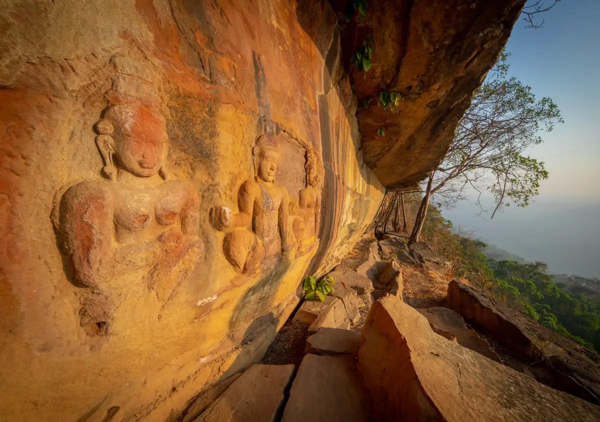
23. Khao Phra Wihan National Park, Si Sa Ket and Ubon Ratchathani Provinces protects a landscape of sandstone mountains, high cliffs, rock platforms and forests along the Phanom Dong Rak range near the Thai–Cambodian border. The park is particularly associated with Pha Mo I Daeng, one of Si Sa Ket's best-known scenic viewpoints, and with historical landscapes connected to ancient Khmer civilization.
Visitor Access: The park's main tourism area, particularly Pha Mo I Daeng, was subject to a temporary closure announced from May 29, 2025, because of border security measures. Visitors should not assume that the area has reopened. Check the latest official announcements and obtain confirmation from the responsible authorities before planning a visit.
Highlights: Pha Mo I Daeng, panoramic views of the Phanom Dong Rak Mountains, ancient bas-relief carvings, sandstone platforms and historical landscapes along the border. When access is permitted, Pha Mo I Daeng is known for its expansive views toward Cambodia and opportunities to watch the sunrise over the mountain landscape.
The park has considerable historical significance because of its association with ancient Khmer civilization and heritage sites along the Phanom Dong Rak range. Its cliffs and mountain passes influenced movement, settlement and cultural connections across the border region in earlier centuries.
Forest ecosystems within the park include dry dipterocarp, mixed deciduous and dry evergreen woodland. These habitats support local biodiversity, while the exposed sandstone cliffs and rock layers illustrate the region's complex geological development.
Safety is the primary consideration when discussing travel to Khao Phra Wihan. Access restrictions may apply to roads, viewpoints and other areas near the international border. Travelers must not attempt to enter closed sites or bypass security controls.
Getting There: The usual route from Si Sa Ket town leads toward Kantharalak District and Highway 221, continuing toward Sao Thong Chai Subdistrict and the national park area. However, travel to the main visitor attractions must not be planned until official authorities have confirmed that access is permitted.
24. Phu Hin Rong Kla National Park, Phitsanulok, Phetchabun and Loei Provinces is a remarkable mountain destination known for its combination of natural scenery, geological formations and modern Thai history. Located across the boundaries of Phitsanulok, Phetchabun and Loei provinces, the park contains sandstone plateaus, pine forests, evergreen mountain forests, cliffs, waterfalls and historically significant sites.
Its high elevation creates cool conditions during much of the year, particularly in winter when mist may cover the mountain landscape. Weathering and erosion have shaped the sandstone into extraordinary surfaces, including rounded rock formations and deep natural cracks that have become some of the park's best-known landmarks.
Highlights: Lan Hin Pum, Lan Hin Taek, Pha Chu Thong, the Third World Trail, the former political and military school, Rom Klao–Pharadon Waterfalls and mountain pine forests. Lan Hin Pum is distinguished by numerous rounded stone protrusions, while Lan Hin Taek features striking fractures in the sandstone surface.
Phu Hin Rong Kla also has considerable historical significance. During a period of political conflict in modern Thailand, the mountain area served as a base for the Communist Party of Thailand. Several former facilities and sites associated with that era remain as places of historical interpretation, including the political and military school.
Beyond its history, the park protects mountain forests and diverse plant communities. Pine forests and evergreen woodland create attractive landscapes for photography and nature walks. During rainy periods, wet sandstone surfaces can become extremely slippery, so visitors should wear appropriate footwear and stay on marked trails.
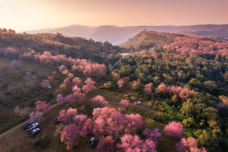
Parts of the wider mountain landscape connect with Phu Lom Lo near Dan Sai District in Loei Province, which is known for seasonal Himalayan cherry blossoms. Travelers approaching from the Kok Sathon community can arrange authorized local transportation to Phu Lom Lo during the flowering season.
Phu Hin Rong Kla is suitable for travelers interested in natural landscapes, modern history, geology and photography. A longer itinerary can include Phu Thap Boek, Phu Lom Lo and other mountain attractions in the three-province border region, provided that sufficient time is allowed for winding mountain roads.
Getting There: Access is available from Phitsanulok through Nakhon Thai District or from Phetchabun through Lom Kao and Phu Thap Boek. Travelers wishing to visit Phu Lom Lo from the Loei side can approach through Dan Sai District and Kok Sathon, following authorized local routes.
Which National Parks in Northeastern Thailand Should You Visit? The national parks of Northeastern Thailand offer very different experiences depending on their landscapes and ecosystems. Adventurous travelers who enjoy mountain hiking and overnight camping should consider Phu Kradueng National Park in Loei. Visitors who prefer cool weather, sunrise scenery and accessible mountain viewpoints may find Phu Ruea more suitable. For those interested in seasonal flowers, Pa Hin Ngam and Sai Thong National Parks in Chaiyaphum are outstanding destinations during the rainy season.
Nature lovers interested in waterfalls, forests and biodiversity can explore Khao Yai, Tat Ton or Phu Chong–Na Yoi National Parks. Travelers attracted to sandstone landscapes and unusual rock formations may prefer Phu Laen Kha, Phu Pha Thoep and Pha Taem, where geological features are among the main attractions.
For history and archaeology, Pha Taem provides an opportunity to see prehistoric rock paintings, while Phu Wiang is renowned for its dinosaur fossil discoveries. Phu Hin Rong Kla offers a combination of extraordinary rock landscapes and sites associated with a significant period of modern Thai political history.
When planning a trip involving several national parks, it is best to group destinations by province or geographical area rather than follow the numerical order in this guide. Some parks are several hours apart, particularly where mountain roads or interprovincial travel are involved. Selecting nearby destinations allows more time to enjoy the attractions and reduces unnecessary driving.
| Number of Destinations | 24 national parks featured in this guide, including parks within Northeastern Thailand and selected parks extending into adjoining regions |
| Types of Attractions | Mountains, forests, waterfalls, seasonal wildflower fields, cliffs, misty valleys, caves, archaeological sites and geological formations |
| Loei Area | 1. Phu Kradueng National Park 2. Phu Ruea National Park 3. Phu Suan Sai National Park 4. Phu Hin Rong Kla National Park – Bordering Loei, Phitsanulok and Phetchabun |
| Chaiyaphum Area | 1. Pa Hin Ngam National Park 2. Sai Thong National Park 3. Phu Laen Kha National Park 4. Tat Ton National Park |
| Ubon Ratchathani Area | 1. Pha Taem National Park 2. Kaeng Tana National Park 3. Phu Chong–Na Yoi National Park 4. Khao Phra Wihan National Park – Bordering Si Sa Ket and Ubon Ratchathani; visitor access is subject to security restrictions |
| Khon Kaen and Nong Bua Lamphu | 1. Phu Kao–Phu Phan Kham National Park 2. Phu Wiang National Park 3. Nam Phong National Park 4. Phu Pha Man National Park |
| Sakon Nakhon, Nakhon Phanom, Mukdahan and Amnat Charoen | 1. Phu Phan National Park 2. Phu Pha Yon National Park 3. Phu Pha Thoep National Park 4. Phu Sa Dok Bua National Park 5. Phu Langka National Park |
| Nakhon Ratchasima and Adjoining Areas | 1. Khao Yai National Park 2. Thap Lan National Park 3. Ta Phraya National Park – Bordering Buri Ram and Sa Kaeo |
| Best for Hiking | 1. Phu Kradueng 2. Phu Langka 3. Phu Suan Sai 4. Phu Hin Rong Kla 5. Khao Yai |
| Best for Families and Children | 1. Tat Ton 2. Phu Ruea 3. Phu Wiang 4. Phu Pha Thoep 5. Kaeng Tana Choose accessible visitor areas appropriate for the age and physical ability of each traveler. |
| Best for Photography | 1. Pha Taem – Sunrise and Mekong River cliffs 2. Phu Kradueng – Pha Lom Sak and Pha Nok Aen 3. Pa Hin Ngam – Siam tulip fields 4. Sai Thong – Thung Bua Sawan 5. Phu Laen Kha – Mo Hin Khao 6. Nam Phong – Hin Chang Si 7. Phu Pha Man – Limestone mountains |
| Best for History and Natural Heritage | 1. Pha Taem – Prehistoric rock paintings 2. Phu Wiang – Dinosaur fossils 3. Phu Hin Rong Kla – Modern Thai political history 4. Phu Phan – Seri Thai Cave 5. Phu Pha Yon – Ancient rock carvings |
| Best for Waterfalls | 1. Tat Ton 2. Khao Yai 3. Phu Chong–Na Yoi 4. Sai Thong 5. Phu Pha Yon 6. Phu Langka 7. Phu Kradueng |
| Best for Cool Weather and Misty Scenery | 1. Phu Ruea 2. Phu Kradueng 3. Phu Suan Sai 4. Phu Hin Rong Kla 5. Phu Langka Mist depends on daily weather conditions and is not guaranteed. |
| Rainy Season | Ideal for seasonal Siam tulips in Pa Hin Ngam and Sai Thong, as well as waterfalls that remain safely accessible. Always check rainfall, water levels and trail closures. |
| Cool Season | Popular for Phu Kradueng, Phu Ruea, Phu Suan Sai, Phu Hin Rong Kla and nature walks in national parks that are open to visitors. |
| Recommended Transportation | Private car or rental vehicle for trips involving several parks. Mountain trails, remote areas and camping sites may require transport or arrangements specified by park authorities. |
| Important Travel Precautions | Check seasonal closures, weather forecasts, border security restrictions, visitor registration, hiking requirements and camping regulations before traveling. |
Suggested National Park Itineraries in Northeastern Thailand When planning a national park road trip, it is most efficient to choose destinations within the same province or nearby geographical areas. Travel time, road conditions and the physical demands of each activity should all be considered. Strenuous mountain hikes are best scheduled separately from full days of driving so that travelers have enough time to rest and enjoy the scenery.
One-Day Itinerary: Chaiyaphum Begin the morning at Tat Ton National Park, where you can admire the waterfall and explore the surrounding forest. Return toward Chaiyaphum town around midday. If time allows, continue to an accessible attraction in Phu Laen Kha National Park during the afternoon. This route is suitable for travelers staying in Chaiyaphum town who want a convenient day of natural sightseeing.
One-Day Itinerary: Loei Make Phu Ruea National Park the main destination, leaving early to enjoy sunrise and mountain scenery. Later, explore agricultural attractions or nearby places around Phu Ruea District. Continue toward Dan Sai District to experience local culture and visit Phra That Si Song Rak, allowing time for the return journey.
One-Day Itinerary: Ubon Ratchathani Start at Pha Taem National Park to enjoy the Mekong River scenery and prehistoric rock paintings. Continue to Khong Chiam for a look at the riverside community. If time remains, visit Kaeng Tana National Park during the afternoon. This route combines natural landscapes, archaeology and the distinctive river geography of eastern Isan.
Two Days and One Night: Chaiyaphum On the first day, explore Pa Hin Ngam National Park in Thep Sathit District, visiting the Siam tulip fields, Lan Hin Ngam and Sut Phaen Din Viewpoint. Stay overnight around Thep Sathit or another convenient location. On the second day, visit Sai Thong National Park to experience Thung Bua Sawan, Pha Ham Hot and Sai Thong Waterfall, depending on access conditions. This itinerary is particularly attractive during the rainy-season flowering period.
Three Days and Two Nights: Phu Kradueng, Loei This itinerary is designed for hikers. On the first day, begin the ascent from the national park headquarters, reach the summit plateau and continue to Wang Kwang Visitor Center. On the second day, watch sunrise from Pha Nok Aen and explore forest trails, waterfalls and pine woodlands before visiting Pha Lom Sak for sunset, according to your fitness and available time. On the third day, descend the mountain and return to your starting point. Always confirm seasonal entry rules and camping arrangements in advance.
Three Days and Two Nights: Khon Kaen On the first day, visit Nam Phong National Park and Hin Chang Si Viewpoint, combining the trip with Ubol Ratana Dam. On the second day, explore the dinosaur fossil heritage of Phu Wiang National Park, then stay around Phu Wiang or Chum Phae. On the third day, continue to Phu Pha Man National Park to enjoy its limestone mountains and accessible natural attractions. This route is especially suitable for families and travelers interested in natural history.
Four Days and Three Nights: Sakon Nakhon, Nakhon Phanom and Mukdahan Begin with Phu Phan National Park in Sakon Nakhon to enjoy mountain viewpoints and historical attractions. Spend the second day exploring Phu Pha Yon National Park and Huai Huat Reservoir. On the third day, travel to Ban Phaeng District in Nakhon Phanom to visit Phu Langka National Park, following the current rules for available trails and activities. On the fourth day, continue to Mukdahan to see the unusual sandstone formations at Phu Pha Thoep National Park. Plan overnight stops to minimize unnecessary driving.
Five Days and Four Nights: Southern Isan and Adjoining Areas Begin in Nakhon Ratchasima with a visit to Khao Yai National Park and its accessible natural attractions. Continue to Chaiyaphum for Tat Ton and Phu Laen Kha National Parks, then travel toward Thep Sathit for Pa Hin Ngam and Sai Thong, depending on the season. This route covers considerable distances, so overnight stays should be distributed along the journey and demanding hikes should not be scheduled on consecutive days without adequate rest.
When to Visit and What to Bring Travelers seeking cool temperatures and misty mountain views should consider the transition into winter and the cooler months, particularly around Phu Ruea, Phu Kradueng, Phu Suan Sai and Phu Hin Rong Kla. For Siam tulip fields, visit during the rainy season and follow current flowering reports. Waterfall visits require additional caution because heavy rainfall can cause slippery trails, strong currents and flash flooding.
Recommended equipment includes suitable walking shoes, rain protection, warm clothing for highland destinations, drinking water, a hat, insect protection, personal medication and a phone with offline mapping capability. In remote forests or mountainous areas, carry a power bank and inform someone of your intended route. Trails requiring an official guide should never be attempted independently.
Responsible tourism is essential for preserving Thailand's national parks. Carry rubbish out of protected areas, reduce single-use plastics, avoid loud noises, do not remove rocks or plants and never feed wild animals. Respecting national park regulations helps protect ecosystems and ensures that these natural attractions can continue to be enjoyed by future generations.
Frequently Asked Questions (FAQ)
Q: What are the most famous national parks in Northeastern Thailand?
A: Some of the best-known parks include Phu Kradueng, Phu Ruea, Pa Hin Ngam, Sai Thong, Phu Laen Kha, Tat Ton, Pha Taem, Phu Phan, Phu Wiang and Phu Langka. Each offers different experiences, ranging from mountain hiking and waterfalls to wildflower fields and geological attractions.
Q: What is the best time of year to visit national parks in Isan?
A: The cooler months are generally suitable for hiking, mountain scenery and misty viewpoints. The rainy season is ideal for Siam tulips and certain waterfalls, provided that access conditions are safe. The best period depends on the specific park and activity.
Q: Which national parks in Northeastern Thailand are best for hiking?
A: Phu Kradueng is especially popular for its summit trek and overnight camping. Phu Langka, Phu Suan Sai, Phu Hin Rong Kla and Khao Yai also offer different hiking and nature trail experiences. Visitors should select routes appropriate to their fitness and follow park regulations.
Q: Where can I see Siam tulip fields in Northeastern Thailand?
A: Pa Hin Ngam and Sai Thong National Parks in Chaiyaphum are two of the best-known places to see seasonal Siam tulips during the rainy season. Flowering depends on rainfall and local weather conditions.
Q: Which parks are best for sunrise and misty mountain scenery?
A: Phu Ruea, Phu Kradueng, Pha Taem and Phu Suan Sai are attractive options for sunrise and mountain scenery. Mist formation depends on daily temperature, humidity and weather conditions.
Q: Which national parks are suitable for children and families?
A: Tat Ton, Phu Ruea, Phu Wiang, Phu Pha Thoep and Kaeng Tana can be good choices when visiting accessible areas. Phu Wiang is especially interesting for children who enjoy dinosaurs and natural history.
Q: Which national park in Thailand is famous for dinosaur fossils?
A: Phu Wiang National Park in Khon Kaen Province is an important dinosaur fossil discovery area. It can be visited together with Phu Wiang Dinosaur Museum for a more complete educational experience.
Q: Can I visit several national parks in Isan in one day?
A: Yes, if the destinations are relatively close and travel time is manageable. Examples include Tat Ton with selected attractions in Phu Laen Kha, or Pha Taem with Kaeng Tana. Avoid combining several distant parks or demanding hikes in a single day.
Q: Can I visit national parks in Northeastern Thailand without a car?
A: Public transport can take travelers to major towns or districts near some national parks. From there, local transport, rental vehicles or organized tours may be available. A private car or hired driver is usually more convenient for parks with widely separated attractions.
Q: How many days should I spend at Phu Kradueng National Park?
A: At least three days and two nights are recommended for travelers who want to hike to the summit, camp overnight and explore major attractions such as Pha Nok Aen, Pha Lom Sak, waterfalls and pine forests. Check seasonal opening dates and accommodation arrangements before traveling.
Q: What is special about Pha Taem National Park?
A: Pha Taem is known for prehistoric rock paintings, Sao Chaliang sandstone formations, Mekong River cliffs, sunrise viewpoints, Saeng Chan Waterfall and Soi Sawan Waterfall. It is a particularly rewarding destination for travelers interested in nature, archaeology and photography.
Q: Do national parks in Northeastern Thailand charge admission fees?
A: National parks that charge entrance fees follow the applicable rates announced by Thailand's Department of National Parks, Wildlife and Plant Conservation. Fees may vary by park and visitor category, so check the latest rates before traveling.
Q: Can I camp at every national park in Isan?
A: No. Camping is permitted only in designated areas where the relevant park allows it. Check campsite availability, seasonal closures, booking requirements and park regulations before departure.
Q: Are national parks near Thailand's borders open to visitors?
A: Access depends on current park announcements and security conditions. Khao Phra Wihan, Ta Phraya and certain other border forest areas may have restrictions. Always confirm current access with the responsible authorities before planning a visit.
Q: What should I prepare before visiting national parks in Northeastern Thailand?
A: Check the weather forecast, access routes, opening conditions, accommodation arrangements and specific park regulations. Bring suitable footwear, drinking water, rain protection, warm clothing where necessary and essential personal supplies. Stay on designated trails and avoid disturbing wildlife.
Conclusion The national parks of Northeastern Thailand and adjoining mountain regions offer an exceptional variety of natural and cultural experiences. Their landscapes include sandstone mountains, seasonal wildflower fields, pine forests, waterfalls, prehistoric rock paintings, dinosaur fossil sites and internationally recognized forest ecosystems. Whether planning a short day trip or a multi-day hiking adventure, travelers can choose destinations that match their interests, abilities and available time. Careful preparation, respect for park regulations and responsible behavior are essential for protecting these remarkable natural places for future generations.
 Category: ●Travel Articles, Recipes
 Group: ●Travel Review, Food Review
Last Update : 1 DayAgo
 Last Update : 1 DayAgo

 Art, Culture and Heritage
 Historical Sites and Monuments(1)
 Art, Craft Centres, Tradition(4)
 Museums(1)
 Places of Worship
 Temple(30)
 Other Sacred Sites(8)
 Suburban Living
 Village, Community(4)
 Nature and Wildlife
 National Parks and Marine Reserves(3)
 Mountain (Doi)(6)
 Dam, Reservoir, Lake(5)
 Waterfalls(3)
 Caves(2)
 River, Canal(5)
 Other natural attractions(5)
 Entertainment and Agricultural
 Zoos and Aquariums(1)
 Farms, Parks and Ecotourism(4)
 Shopping
 Shopping and Night Market(1)
Travel Review, Food Review(3)


