
lovethailand home >Northeastern Travel Attractions >Nakhon Phanom Travel Attractions >Ban Phaeng >Phai Lom > Phu Langka National Park
TL;DR: Phu Langka National Park, Nakhon Phanom attractions : Nature and Wildlife, National Parks and Marine Reserves.
Phu Langka National Park
Open Days: Daily, although individual attractions and hiking trails may close temporarily for ecological recovery, severe weather, maintenance, or visitor safety
Opening Hours: 07:00–15:00 for Tham Nakee and Tat Pho Waterfall during the 2026 season; visitors should arrive at the registration point well before the final admission time
Admission Fees: Thai citizens: adults THB 20, children THB 10, and Thai citizens aged 60 or above free of charge; foreign visitors: adults THB 100 and children THB 50; cars THB 30 and motorcycles THB 20. Guide, porter, insurance, camping, and route-specific charges are separate
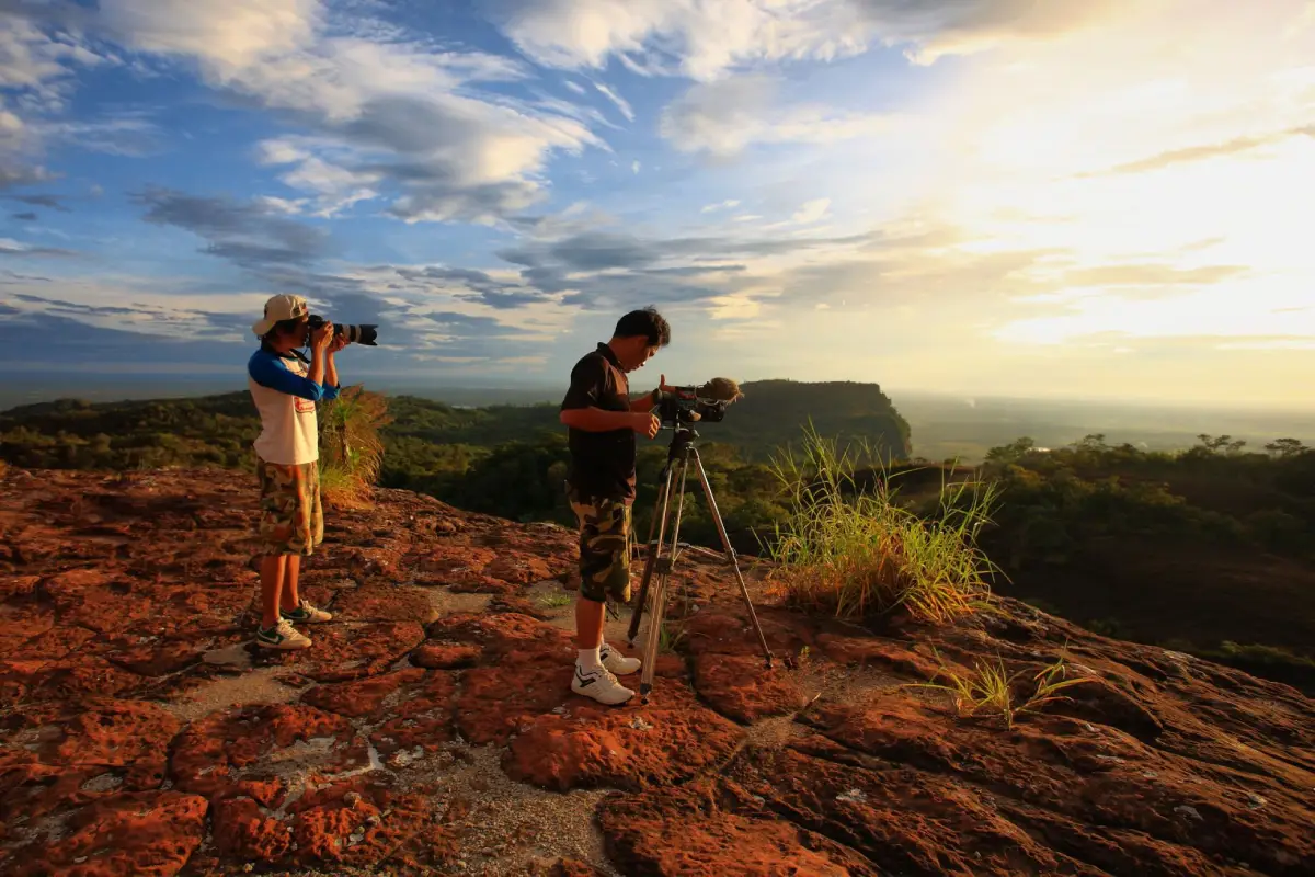
Phu Langka National Park is a protected landscape of sandstone mountains, forest, waterfalls, hiking trails, viewpoints, and spiritually significant rock formations in the upper northeastern region of Thailand. Its principal visitor centre is located in Phai Lom Subdistrict, Ban Phaeng District, Nakhon Phanom Province, while the mountain range continues into Bueng Kan Province. The park covers approximately 31,250 rai, equivalent to about 50 square kilometres. Its terrain consists of three overlapping mountain sections—northern, central, and southern Phu Langka—together with smaller ridges, sandstone cliffs, broad rock terraces, ravines, caves, streams, and forested valleys. Because the mountains run broadly parallel to the Mekong basin, several high points offer expansive views across Ban Phaeng, agricultural plains, the Mekong River, and mountain ranges in the Lao People’s Democratic Republic.
Travelers planning a visit should understand that Phu Langka National Park includes considerably more than Tat Kham and Tat Pho waterfalls. The protected area is connected with Tham Nakee, Pha Ngoi Viewpoint, Kong Khao Si Bun Nao Chedi, the Nakee ritual pool, several nature trails, orchid habitat, and forest viewpoints. On the Bueng Kan side, the same national park includes Tham Naka, Kinnaree Waterfall, and the Dolphin Rock formation. Each zone has its own access route, distance, physical difficulty, registration procedure, seasonal opening schedule, and carrying capacity. Visitors should select destinations according to their fitness, available time, and current park regulations rather than expecting to cover every location in one day.
Older tourism descriptions state that the national park extended into Seka District in Nong Khai Province. Those descriptions were prepared before Bueng Kan became a separate province in 2011. The park should now be described as covering mountain areas along the Nakhon Phanom–Bueng Kan boundary. Attractions on the Nakhon Phanom side are accessed through Ban Phaeng District, while Tham Naka and several related sites are approached from Bueng Khong Long District in Bueng Kan. Choosing the correct entrance is essential. Although the attractions belong to the same national park, the two access points are separated by a substantial road journey and cannot be connected by driving directly across the mountain.
The distinctive scenery of Phu Langka was created by sandstone that has weathered, fractured, and eroded over an immense period. Rock layers with different degrees of hardness have been shaped by water, wind, moisture, plant roots, and temperature changes. The result is a landscape of ledges, cliffs, narrow passages, stacked boulders, overhangs, and patterned surfaces that sometimes resemble the scales or body of a large reptile. These formations are important from both geological and cultural perspectives. Tham Naka and Tham Nakee are widely associated with naga beliefs, while their rock surfaces also provide clear examples of natural sandstone weathering.
The terrain rises from the plains around Ban Phaeng to approximately 563 metres above mean sea level at the highest parts of the range. This elevation is modest compared with major northern Thai mountains, but the combination of heat, humidity, steep gradients, wet rock, exposed ledges, and repeated ascents makes several routes physically demanding. A summit may appear close when viewed from the road, yet the actual trail includes stairs, roots, rock terraces, descents, and uneven surfaces. Distance alone is therefore an unreliable measure of difficulty. Gradient, trail condition, weather, and the time required to return safely must also be considered.
Vegetation within the park includes dry evergreen forest, mixed deciduous forest, dry dipterocarp forest, streamside vegetation, and specialised plant communities on shallow sandstone soils. Humid valleys and stream corridors support dense trees, vines, ferns, mosses, and shade-loving ground plants. Sun-exposed ridges and rock terraces support smaller trees, shrubs, grasses, and species adapted to shallow soil and intense heat. The character of the forest changes continuously as a visitor moves from the foothills to a ridge, making the park valuable for understanding how elevation, moisture, sunlight, and soil influence plant communities.
The variety of habitats supports forest birds, butterflies, insects, amphibians, reptiles, small mammals, and other wildlife. Visitors are more likely to hear birds than see them because most forest animals avoid busy trails. Early morning is generally the most active period for birds and insects, while frogs, snails, and moisture-dependent animals may appear after rain. Wildlife should always be observed from a distance. Feeding, chasing, handling, or using recorded animal calls to attract wildlife interferes with natural feeding patterns, territorial behaviour, and communication.
Phu Langka is an important headwater area. Rain falling on the mountain is absorbed by soil and sandstone fractures before gathering in streams that descend toward lower ground. These streams feed Tat Kham, Tat Pho, and a series of smaller cascades hidden in the forest. Water volume therefore changes dramatically with the seasons. During the rainy season, waterfalls spread across the rock face with considerable force. Toward the dry season, the reduced flow reveals more of the sandstone structure. Both conditions have visual value, but high water brings additional risks from flash floods, slippery surfaces, falling branches, and rapidly changing currents.
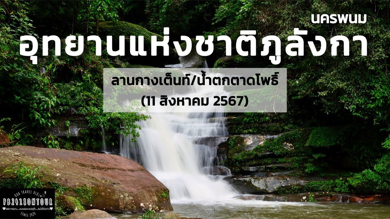
Tat Kham Waterfall is one of the park’s best-known and more accessible natural attractions. The stream descends through approximately four levels of sandstone. The lower section contains rock platforms and a pool that often retains water even when rainfall has declined. The surrounding forest provides shade and a pleasant setting for a short nature visit, photography, and quiet rest. Although the approach is shorter than the mountain trails, visitors must still watch for wet rock, exposed roots, and sudden changes in water level after heavy rain. Children should remain within immediate reach of an adult and must not enter areas closed by park officers.
The character of Tat Kham is created by the interaction of water and layered sandstone. The current divides around grooves and boulders, forming small curtains, channels, and natural pools. Morning tends to be quieter, with sunlight filtering through the canopy in narrow beams. During the rainy season, vegetation surrounding the waterfall becomes especially vivid. Visitors should never cross the lip of the waterfall or climb algae-covered rocks. Even surfaces that appear almost level can become extremely slippery under a thin film of water.
Tat Pho Waterfall originates in streams descending from the Phu Langka range and flows through approximately four principal levels. Each level has a different cliff profile, height, and rock terrace. The second tier reaches approximately 30 metres and is one of the most visually impressive sections. Prolonged rainfall produces a full cascade that may be visible from a considerable distance. The lower tier near the visitor area is suitable for travelers with limited time, while access toward higher levels depends on trail condition and the instructions of park staff. Steeper sections may be closed when water volume, rain, or erosion creates unsafe conditions.
Access to Tat Pho and the Nakhon Phanom visitor centre branches from Highway 212. The local access road continues for approximately 3 kilometres from the main highway, while Tat Pho is roughly 4 kilometres from Tat Kham by road. Navigation should be set specifically for “Phu Langka National Park, Nakhon Phanom,” “Tat Pho Waterfall,” or the Ban Phaeng visitor centre. Thailand has other destinations using the name Phu Langka, including a well-known mountain area in Phayao, while navigation results may also direct visitors toward Tham Naka on the Bueng Kan side.
Tham Nakee is a major nature-and-faith hiking route on the Nakhon Phanom side of the park. Its trail begins near the visitor centre and Tat Pho area before passing through forest, stairs, rock surfaces, damp sections, and groups of naturally weathered sandstone associated with naga imagery. Important points include scale-like rock, formations interpreted as naga heads, Pratu Tao or Turtle Gate, the Nakee ritual pool, and designated places of worship. Visitors must register through the system used by the park, remain on the official trail, and follow the assigned guide or staff. Leaving the marked route or entering closed areas is prohibited.
Tham Nakee can be understood through two complementary perspectives. Geologically, the site displays sandstone joints, water erosion, biological weathering, and patterned rock surfaces. Culturally, the forms are connected with naga traditions, Buddhist belief, and the spiritual landscape of the Mekong region. Visitors can respect local faith while also learning about natural processes. Respect requires more than quiet behaviour. Rock surfaces must not be scraped, painted, rubbed with powder or oil, or covered with objects. Moss, lichens, and microscopic organisms on the stone are easily damaged by touching and repeated trampling.
Tham Naka lies within the same national park but is approached from Bueng Khong Long District in Bueng Kan Province. The route is famous for extensive scale-like sandstone, formations resembling the head and body of a naga, and elevated viewpoints. Many travelers incorrectly assume that Tham Naka and Tham Nakee use the same entrance. In reality, they are on different sides of the range and require a road journey around the mountain. Travelers wishing to experience both should allocate at least two days. Reservation procedures and seasonal regulations for Tham Naka may differ from those on the Nakhon Phanom side.
The Bueng Kan sector also contains Kinnaree Waterfall and Dolphin Rock, another sandstone formation shaped into an animal-like profile. Some trails in this sector are shorter than the full Tham Naka route, but they still require compliance with the park system and, where specified, a registered local guide. These sites fit naturally into a Bueng Kan itinerary. Travelers staying in Ban Phaeng will usually use their time more effectively by focusing on Tham Nakee, Tat Pho, Tat Kham, Pha Ngoi, and other Nakhon Phanom-side attractions.
Traditional descriptions of the park identify three principal nature trails. The first is the Tat Pho Waterfall–Tham Ya route, approximately 1.5 kilometres long and requiring around 1 hour 30 minutes. It passes forest, stream habitat, and sandstone shelters and is suitable for learning about foothill ecology and geology. Its relatively short distance does not remove the need for proper footwear because damp rock and soil may be slippery. Seasonal opening depends on trail inspections and park announcements.
The second route connects Tat Pho with Pha Ngoi Viewpoint. It is approximately 1.8 kilometres long and normally takes 1 hour 30 minutes to 2 hours. Pha Ngoi provides views over Ban Phaeng, the agricultural plain, and the Mekong landscape. The ascent includes slopes and exposed rock. Starting early reduces exposure to afternoon heat and allows sufficient time to descend before the trail closes. Visitors must remain behind safety barriers, avoid unstable edges, and never step backward for a photograph without first checking the ground.
The third route extends from Tat Pho toward Kong Khao Si Bun Nao Chedi and was traditionally organised as a two-day, one-night expedition. Participants need camping equipment, sleeping gear, food, water, and personal supplies, together with advance coordination for officers, guides, and porters. The route passes several forest types, wildflower and orchid habitat, butterfly areas, bird habitat, and sandstone terraces near the summit. Current permission depends on ecological recovery, weather, staffing, and trail condition. Nobody should attempt the route independently using old maps or online tracks.
Kong Khao Si Bun Nao Chedi, also called Phra That Phu Langka, stands on a high sandstone terrace. The name Kong Khao refers to rock forms resembling a heap of harvested rice. The site is significant both as a trekking destination and as a place associated with Buddhist forest meditation. In clear weather, visitors can watch sunrise toward the Mekong basin and evening light across the mountain ridges. Overnight stays require official permission and must use designated areas because summit soils are shallow, vegetation recovers slowly, and repeated trampling causes lasting damage.
Trails described in older guidebooks are not automatically open throughout the year. The national park may close sections for habitat recovery, stair and rope maintenance, wildfire prevention, or hazards associated with storms, flash floods, erosion, and landslides. Current park instructions must take priority over tracks saved in hiking applications or coordinates shared by previous visitors. Navigation can be difficult on extensive sandstone terraces because separate areas may appear very similar and mobile signals are inconsistent.
From May to October, Phu Langka becomes intensely green. Waterfalls carry more water, epiphytic plants flourish, and wild orchids appear in suitable habitats. Seasonal wildflowers may bloom on rock terraces after sustained rainfall. Images of slipper orchids and other forest orchids make the rainy season particularly attractive. Flowering, however, varies according to rainfall, temperature, and local habitat. Plants must never be touched, removed, transplanted, or stepped on. Many orchids grow slowly and are protected by law.
Butterflies and insects often gather at damp mineral-rich ground, along streams, and around forest clearings. Photography should be conducted without pouring sweet liquid or placing bait. Forest birds are most active in the morning, and quiet observation is more effective than loud calls. A nest, young bird, or injured animal should be reported to park staff with an accurate location. Visitors must not capture or relocate wildlife themselves.
The rainy season provides the most powerful waterfalls but also requires constant attention to forecasts. Rain may fall on the summit even when the visitor centre remains dry, creating a flash flood downstream. Warning signs include suddenly muddy water, floating branches, a rapid increase in noise, and a steadily rising water level. When officers order an evacuation, visitors must leave immediately rather than collecting additional photographs or continuing to swim. A route may remain closed on a clear morning if heavy rain has occurred higher on the mountain.
November to February normally offers cooler weather and lower humidity, making forest walks and viewpoints more comfortable. Early mornings may bring mist over valleys, although waterfall flow gradually declines after the rainy season. Strong sunlight remains possible at midday, so water and sun protection are still essential. Holiday periods can be busy. Accommodation should be booked in advance, and travelers should avoid scheduling a tightly timed flight or bus connection immediately after descending from a mountain route.
March and April are generally hotter and drier. Waterfalls may carry less water, trails are exposed to heat, and wildfire risk increases. Hikes should begin early, with additional drinking water and strict avoidance of all fire. The park may restrict access when smoke, air quality, or wildfire conditions create danger. Dry dipterocarp forest can provide wider views after leaf fall, but accumulated leaf litter ignites easily. Cigarettes, incense, candles, and cooking flames must therefore be controlled rigorously.
In 2026, the national park applied a scheduled ecological closure system. Tat Kham Waterfall, Tham Naka, and Kinnaree Waterfall were closed from 1–31 May. Tat Pho Waterfall, Tham Nakee, Zone 1 accommodation, and the Nakhon Phanom campground were closed from 1–30 June. Tham Nakee and Tat Pho reopened on 1 July 2026 with visiting hours of 07:00–15:00. These dates apply to the 2026 programme and should not be treated as a permanent timetable for later years.
The stated hours of 07:00–15:00 represent the announced visitor period, not permission to begin a long hike at 15:00. Final trail admission may end earlier when weather deteriorates, the daily carrying capacity has been reached, or officers determine that insufficient time remains for a safe return. Visitors planning Tham Nakee, Pha Ngoi, or longer routes should arrive early, carry identification, and allow time for registration and the safety briefing.
Basic national park admission is THB 20 for Thai adults and THB 10 for Thai children. Thai citizens aged 60 or above are exempt. Foreign adults pay THB 100 and foreign children THB 50. Vehicle fees are THB 30 for a car and THB 20 for a motorcycle. These charges do not include a local guide, porter, accident insurance, waste deposit, tent rental, bedding, transport, or route-specific services. Additional payments should be made only at authorised points and visitors should request evidence of payment.
Routes requiring a guide must be undertaken with a guide recognised by the park. Visitors should not accept offers to enter through an unofficial path, bypass registration, or begin after permitted hours. A guide controls pace, explains important sites, communicates rules, and helps assess risk, but each participant remains responsible for personal health and essential equipment. Voluntary tips are separate from the agreed service fee. Porter arrangements for an overnight route should specify weight, price, meals, and luggage transfer points before departure.
The park provides a designated campground and a limited supply of rental tents when the camping area is open. Reservations should be made through the Department of National Parks system or directly with the park office. The Nakhon Phanom campground is included in the annual recovery closure. Visitors bringing their own tents must use assigned pitches and may not camp on orchid-bearing rock terraces, beside cliffs, along streams, on wildlife paths, or outside designated zones. Camping, tent, and bedding charges are separate from admission.
Campers should carry a groundsheet, sleeping bag or blanket, rain protection, headlamp, power bank, personal medicine, and sealable waste bags. Night humidity can be high. Although winter temperatures are not as low as on major northern mountains, wind and cold ground can make the campsite feel much cooler. Food must be stored in closed containers, and scraps must never be left outside a tent. Cooking is permitted only in approved locations and under current fire regulations.
Drinking water should never be underestimated. A short walk may require 1–2 litres per person depending on heat and fitness, while an extended route requires a plan agreed with park staff. Stream water should not be consumed untreated even when it appears clear. Suitable trail food is easy to digest, energy-dense, and low in packaging, such as rice, dried fruit, nuts, or food packed in reusable containers. Foam boxes, unnecessary single-use plastic, and strongly scented food that attracts animals should be avoided.
Footwear should cover the toes and heel and provide reliable grip. Flip-flops, smooth-soled shoes, and completely new footwear are unsuitable. Clothing should be breathable while covering enough skin to reduce scratches, insect bites, and sun exposure. A hat, compact rain jacket, personal medicine, and gloves for authorised rope sections are useful. A trekking pole can help experienced users, but equipment should not be so large that it obstructs others. Loose objects hanging from a backpack may catch on branches.
Travelers with heart disease, high blood pressure, diabetes, respiratory illness, serious knee problems, recent surgery, or reduced balance should obtain medical advice and inform the guide. Pregnant travelers and very young children should not attempt steep routes. Chest pain, severe breathlessness, dizziness, persistent cramp, or unusual weakness are reasons to stop and notify the group. Turning back is a responsible safety decision rather than a failure.
Every waterfall presents risks from slippery rock, current, hidden depth, and falling water. Visitors must not jump from boulders, swim directly beneath a cascade, or enter pools and channels closed by officers. Children must remain close enough for immediate adult assistance. Alcohol should never be consumed before or during swimming. Ropes, signs, and barriers apply even when other visitors appear to ignore them. Swimming access can change daily according to water conditions.
Removing stone, orchids, flowers, seeds, wood, insects, animals, or any natural object from a national park is prohibited. A single small item may appear insignificant, but repeated removal by thousands of visitors causes substantial loss. Names must not be carved into stone or trees. Nails, ribbons, cloth, offerings, and decorations should not be attached outside designated worship areas. Objects left behind become litter and may damage rock surfaces, moss, and plants.
Everything carried into the forest must be carried out, including fruit peel, tissue, wet wipes, and items labelled biodegradable. Decomposition is slow in mountain habitats, and food waste changes wildlife behaviour. Each visitor should carry a sealable waste bag and inspect every rest point before leaving. If a waste-deposit system is used, the group must return its waste for inspection at the designated location rather than leaving it in small bins along the trail.
Tham Nakee, Tham Naka, and the summit chedi are places of devotion for many visitors. Clothing and behaviour should be respectful. Loud joking, mockery of ritual, and obstruction of worshippers are inappropriate. Incense, candles, or burning paper may be used only where expressly permitted because fire and smoke threaten the forest and stain rock surfaces. Personal belief does not override conservation regulations.
Photography must be balanced with safety and the rights of others. Visitors should not block a narrow trail, occupy a viewpoint for an excessive period, or climb beyond barriers to obtain a dramatic photograph. Flying a drone inside a national park requires prior authorisation. A clear sky and open landscape do not constitute permission. People engaged in prayer, guides, and park officers should be photographed only with appropriate consent, especially for commercial use.
Families can visit the visitor centre, lower waterfall areas, and selected short routes when children’s actual ability is considered. Carrying a child across wet rock or a steep ascent can destabilise the adult. Children need their own secure shoes, water, hat, and rain protection. A shorter educational visit to forest, water, rock, and wildlife is often more appropriate than forcing a child to reach a high destination while exhausted.
Older travelers have several options that do not require a cave or summit hike. The visitor centre, rest areas, lower waterfall approaches, and roadside mountain views can provide a rewarding experience. Trail distance, steps, handrails, and resting points should be discussed with staff before departure. Walking aids and medication must be carried, and a companion should know relevant medical information.
Solo travelers must register, declare their route, and comply with the guide system. Nobody should separate from a group to explore an unmarked site. Walking far ahead, disappearing behind the group, or stopping for photographs without notifying the guide can trigger an unnecessary search. The park telephone number and itinerary should be shared with family, and a power bank should be carried, but a smartphone must not be treated as the only navigation device.
Phu Langka functions as an outdoor classroom connecting geology, watershed ecology, forest types, biodiversity, Mekong culture, belief, and protected-area management. Schools and universities should coordinate a study visit in advance, specifying participant numbers, ages, objectives, and requested activities. Park staff can then select appropriate routes and safety measures. Scientific sampling and research require formal permission; plants, rock, soil, water, and biological material cannot be collected independently.
A practical one-day itinerary on the Nakhon Phanom side begins with early registration. Fit visitors may choose Tham Nakee as the main activity, allowing several hours for walking, rest, interpretation, and worship. After returning, they can eat and visit the lower section of Tat Pho. Travelers preferring a lighter programme can combine Tat Kham, Tat Pho, and foothill viewpoints. Tham Nakee, Pha Ngoi, and the summit route should not be compressed into the same day.
A two-day, one-night itinerary provides time to experience both nature and Ban Phaeng. Day one can include Tham Nakee and Tat Pho, followed by camping or accommodation near the mountain. Day two can include Tat Kham, the Mekong riverside in Ban Phaeng, and nearby community or religious sites. Travelers adding Tham Naka should allocate a separate day and stay near Bueng Khong Long rather than repeatedly driving around the range.
Anyone intending to visit Kong Khao Si Bun Nao Chedi or camp on an authorised high route should contact the park at least seven days in advance under the traditional planning requirement and wait for explicit confirmation. Officers will provide information on guides, porters, water, food, campsites, equipment, and group size. Travel tickets should not be purchased on the assumption that permission will automatically be granted, because ecological recovery, weather, and conservation duties may close the route.
Getting There from Nakhon Phanom city is straightforward by private car or rental vehicle. Follow Highway 212 toward Ban Phaeng for approximately 105 kilometres. Near Ban Phaeng, follow signs for Phu Langka National Park and Tat Pho Waterfall, then continue along the local access road for approximately 3–6 kilometres depending on the destination. The Nakhon Phanom visitor centre is located near coordinates 17.983831, 104.140379. Main roads are paved and suitable for ordinary cars, although local roads may be affected by pooled water, fallen branches, or minor soil movement during heavy rain.
Travelers arriving from Bueng Kan must first determine whether they are visiting Tham Naka through Bueng Khong Long or Tham Nakee through Ban Phaeng. To reach the Nakhon Phanom visitor centre, use Highway 212 toward Ban Phaeng. From Sakon Nakhon, routes through Akat Amnuai or Na Wa can connect with Ban Phaeng. Navigation shortcuts leading into farm roads or forest-edge tracks should be avoided, especially after rain or at night.
Long-distance buses on the Bangkok–Ban Phaeng route allow passengers to disembark in Ban Phaeng town and hire local transport to the park. The distance from town is approximately 6–10 kilometres depending on the chosen attraction. Fare, pickup point, return time, and the driver’s telephone number should be agreed in advance because public transport does not run into the park at frequent fixed intervals. Anyone intending to register at 07:00 should stay in Ban Phaeng the previous night.
Electric-vehicle users should check charging facilities in Ban Phaeng and maintain a safe reserve. Charging points are not available throughout the park. Some local accommodation and cafés advertise charging, but connector type, power, operating hours, and charges should be confirmed directly. Conventional vehicles should refuel in town before entering the foothill area, particularly when continuing around the mountain toward Bueng Kan.
The head of Phu Langka National Park in 2026 is Mr. Aksorn Manawong. The protected area is administered by Thailand’s Department of National Parks, Wildlife and Plant Conservation. Current information on trails, campsites, closures, group coordination, and safety can be obtained from the park office at +66 42 530 766 during official hours. The official social page is titled “อุทยานแห่งชาติภูลังกา จังหวัดนครพนม – Phulangka National Park Thailand” and is the principal channel for flash-flood warnings, weather closures, seasonal reopening, and special announcements.
An announcement that the national park is open does not mean that every waterfall, cave, campsite, and trail is simultaneously available. Localised rainfall can force officers to close one attraction during the day. Travelers should check updates on the evening before a visit and again on the morning of departure. During storms, heavy rainfall, or official warnings, plans should be postponed rather than pressuring officers to admit visitors. Closures protect both human life and the natural resources of the park.
Restaurants and accommodation are distributed between the foothill area and Ban Phaeng town. Mountain-side cafés may operate mainly during daylight, while the town offers a broader range of food, fuel, markets, and transport. Early hikers should prepare breakfast and drinking water before arriving, while avoiding excessive disposable packaging. Accommodation near the mountain is convenient for early registration; staying in town provides easier access to shops and public transport.
Responsible tourism means accepting the carrying capacity of the park. Visitor limits reduce trampling, crowding, and emergency risk. Registration is not merely administrative; it enables the park to allocate guides, officers, toilets, rest points, and rescue resources. Groups should maintain the instructed pace, avoid overtaking in narrow sections, and give way to people descending from the mountain.
Admission, guide services, accommodation, restaurants, and community businesses contribute to protected-area management and the local economy. Visitors can distribute benefits by staying in Ban Phaeng, using local services, and hiring registered guides. Wild orchids, animals, plants, and objects claimed to have been collected inside the park should never be purchased because such demand encourages illegal removal of natural resources.
Climate change is making rainfall, heat, and waterfall seasons less predictable. Rain may arrive earlier, pause for an extended period, or fall with exceptional intensity over a short time. Park managers consequently adjust access according to actual conditions rather than relying only on traditional seasonal calendars. Travelers should prepare an alternative programme involving Ban Phaeng communities, temples, or Mekong viewpoints if mountain routes close.
Phu Langka National Park serves travelers with different interests and abilities. Easily reached waterfall areas provide an introduction to the forest, while high routes require planning, fitness, and guides. Geology enthusiasts can study sandstone weathering. Plant lovers can observe dry evergreen, mixed deciduous, and dry dipterocarp forest, together with orchids and rock-terrace vegetation. Cultural travelers can explore naga beliefs, Buddhist forest traditions, and the relationship between the Mekong communities and the mountain.
The lasting value of Phu Langka is not measured only by photographs beside unusual rocks or claims of reaching a summit. It lies in walking through the forest without leaving damage, listening to park staff, respecting sacred spaces, and understanding the connection among mountain, waterfall, plant, wildlife, and community. When visitors follow these principles, Tat Kham, Tat Pho, Tham Nakee, Pha Ngoi, and the high terraces of Phu Langka can continue to educate and inspire future generations.
| Name | Phu Langka National Park |
| Thai Name | อุทยานแห่งชาติภูลังกา |
| Location | The Nakhon Phanom visitor centre is in Phai Lom Subdistrict, Ban Phaeng District, Nakhon Phanom Province 48140. The protected mountain range extends along the Nakhon Phanom–Bueng Kan provincial boundary |
| Visitor Centre Coordinates | 17.983831, 104.140379 |
| Area | Approximately 31,250 rai or 50 square kilometres |
| Landscape | Three overlapping sandstone mountain sections with cliffs, rock terraces, forest valleys, streams, waterfalls, caves, and Mekong viewpoints |
| Maximum Elevation | Approximately 563 metres above mean sea level |
| Forest Types | Dry evergreen forest, mixed deciduous forest, dry dipterocarp forest, streamside vegetation, and sandstone-terrace plant communities |
| Highlights | Tat Kham Waterfall, Tat Pho Waterfall, Tham Nakee, Pha Ngoi, Kong Khao Si Bun Nao Chedi, wild orchids, sunrise and sunset views, and sandstone formations |
| Main Areas / Zones | 1. Visitor centre and park office 2. Tat Pho Waterfall Zone 3. Tat Kham Waterfall Zone 4. Tham Nakee and Nakee Ritual Pool Route 5. Tat Pho–Tham Ya Nature Trail 6. Tat Pho–Pha Ngoi Nature Trail 7. Long-Distance Route to Kong Khao Si Bun Nao Chedi 8. Nakhon Phanom Campground 9. Tham Naka, Kinnaree Waterfall, and Dolphin Rock Zone in Bueng Kan |
| Important Nature Trails | Tat Pho–Tham Ya: 1.5 km and about 1 hour 30 minutes; Tat Pho–Pha Ngoi: 1.8 km and about 1 hour 30 minutes–2 hours; Kong Khao Si Bun Nao route: approximately 2 days and 1 night when officially permitted |
| Caretaker | Department of National Parks, Wildlife and Plant Conservation, Thailand |
| Park Superintendent | Mr. Aksorn Manawong |
| Current Status | Open for tourism. Tham Nakee and Tat Pho reopened for the 2026 season on 1 July 2026 after the June ecological closure. Daily access remains subject to weather and safety announcements |
| Open Days | Daily except during annual ecological closures, emergency closures, and temporary trail restrictions |
| Opening Hours | 07:00–15:00 for Tham Nakee and Tat Pho during the 2026 season; final trail admission may end earlier according to weather and carrying capacity |
| Admission Fees | Thai visitors: adults THB 20, children THB 10, Thai citizens aged 60 or above free; foreign visitors: adults THB 100, children THB 50; cars THB 30; motorcycles THB 20 |
| Additional Costs | Guide, porter, accident insurance, waste deposit, tent, bedding, transport, and route-specific services are charged separately |
| 2026 Ecological Closures | 1–31 May: Tat Kham, Tham Naka, and Kinnaree Waterfall; 1–30 June: Tat Pho, Tham Nakee, Zone 1 accommodation, and the Nakhon Phanom campground |
| Best Visiting Period | July–October for waterfalls and green forest; November–February for cooler hiking weather, subject to daily park announcements |
| Camping | A designated campground and rental equipment are available when the camping zone is open. Advance reservation or confirmation is required |
| Facilities | Visitor centre, registration point, officers and guides, parking, toilets, campground, rest areas, and limited seasonal food or retail services |
| Travel Information | Approximately 105 km from Nakhon Phanom city via Highway 212, followed by a 3–6 km local access road; approximately 6–10 km from Ban Phaeng town depending on the attraction |
| Main Contact Number | Phu Langka National Park: +66 42 530 766 |
| Official Page | อุทยานแห่งชาติภูลังกา จังหวัดนครพนม – Phulangka National Park Thailand |
| Nearby Tourist Attractions | 1. Tat Pho Waterfall, approximately 1 km 2. Tham Nakee Trailhead, approximately 1 km 3. Pha Ngoi Route, approximately 2 km by nature trail 4. Tat Kham Waterfall, approximately 4 km 5. Kong Khao Si Bun Nao Chedi, approximately 4 km by mountain trail 6. Ban Phaeng Mekong Viewpoint, approximately 12 km |
| Nearby Restaurants | 1. Langka Paradise, approximately 3 km, Tel. +66 63 787 2882, +66 84 408 8808 2. Caffeine-Phuview, approximately 8 km, Tel. +66 97 939 4744 3. Seoul Chic, approximately 9 km, Tel. +66 91 072 4168 4. IU Café & Bistro, approximately 10 km, Tel. +66 85 168 6886 5. Krua Rim Khong Na Khe, approximately 24 km, Tel. +66 80 744 2345 |
| Nearby Accommodations | 1. Phu Langka National Park Campground, inside the park, Tel. +66 42 530 766 2. Langka Paradise, approximately 3 km, Tel. +66 63 787 2882, +66 84 408 8808 3. Caffeine-Phuview, approximately 8 km, Tel. +66 97 939 4744 4. Khao View Resort Group, approximately 9 km, Tel. +66 89 618 2004 5. JB Place Hotel Ban Phaeng, approximately 10 km, Tel. +66 42 591 797-8 6. Ban Phaeng Phatthana Hotel, approximately 10 km, Tel. +66 42 591 026 |
Frequently Asked Questions (FAQ)
Q: Is Phu Langka National Park open every day?
A: The park is open daily when individual attractions are in season. Annual ecological closures and emergency restrictions may apply during heavy rain, flash-flood risk, wildfire, or unsafe trail conditions. Check the official park announcement before departure.
Q: How much is the entrance fee for Phu Langka National Park?
A: Thai adults pay THB 20 and Thai children THB 10, while Thai citizens aged 60 or above enter free. Foreign adults pay THB 100 and foreign children THB 50. Cars cost THB 30 and motorcycles THB 20. Guide, porter, insurance, camping, and route-specific services are separate.
Q: What is the difference between Tat Kham and Tat Pho waterfalls?
A: Tat Kham has approximately four tiers and a shaded lower area suitable for a shorter visit. Tat Pho also has around four main tiers but includes taller cliffs, with its second tier reaching approximately 30 metres, and serves as the starting area for several nature trails.
Q: Do Tham Naka and Tham Nakee use the same entrance?
A: No. Tham Nakee is accessed through Ban Phaeng District in Nakhon Phanom, while Tham Naka is accessed through Bueng Khong Long District in Bueng Kan. A road journey around the mountain is required, so they should normally be visited on separate days.
Q: Is advance registration or a guide required for Tham Nakee?
A: Visitors must register according to the park’s current system and use an authorised guide where required. Reservation rules, daily limits, and admission times may change by season. Contact +66 42 530 766 and check the official park page before traveling.
Q: What is the best month to visit Phu Langka National Park?
A: July–October is best for fuller waterfalls and green forest, while November–February offers cooler hiking conditions. Heavy rain can produce flash floods and temporary trail closures even during the recommended season.
Q: Can visitors camp in Phu Langka National Park?
A: Camping is allowed only in the designated campground when it is open. Advance reservation or confirmation is required. The Nakhon Phanom campground is included in the annual ecological closure and can fill quickly during holidays.
Q: What should travelers bring for a Phu Langka hike?
A: Bring closed hiking shoes with reliable grip, sufficient drinking water, rain protection, a hat, personal medicine, energy food, a waste bag, a charged phone, and a power bank. Follow all instructions from park staff and guides.
Mobile : 0833482549
 Mobile : 0833482549
 Category: ●Nature and Wildlife
 Group: ●National Parks and Marine Reserves
Last Update : 3 MonthAgo
 Last Update : 3 MonthAgo
 Click to Access the Navigation Map GPS
Phu Langka National Park Map
Recommend

 Art, Culture and Heritage
 Historical Sites and Monuments(3)
 Landmarks and Memorials(2)
 Art, Craft Centres, Tradition(3)
 Museums(3)
 Educational Places
 Library(1)
 Places of Worship
 Temple(23)
 Church(1)
 Other Sacred Sites(11)
 Suburban Living
 Village, Community(5)
National Parks and Marine Reserves(1)
 Dam, Reservoir, Lake(5)
 Waterfalls(2)
 River, Canal(3)
 Bays and Beaches(3)
 Other natural attractions(2)
 Entertainment and Agricultural
 Zoos and Aquariums(1)
 Farms, Parks and Ecotourism(2)
 Shopping
 Shopping and Night Market(1)
 Travel Articles, Recipes
 Travel Review, Food Review(1)


