
lovethailand home >South Travel Attractions >Phuket Travel Attractions > 40 Best Places to Visit in Phuket Southern Thailan..
TL;DR: 40 Best Places to Visit in Phuket Southern Thailand.
40 Best Places to Visit in Phuket Southern Thailand
40 Best Places to Visit in Phuket: Top Attractions in Southern Thailand Phuket is one of Southern Thailand’s most internationally recognized travel destinations, yet the island offers far more than beaches and tropical sea views. Across Phuket, travelers can explore the Andaman coastline, sandy beaches, bays, islands, scenic viewpoints, hills, Buddhist temples, Chinese shrines, Sino-Portuguese architecture, the historic old town, local communities, distinctive cuisine, and traces of the island’s tin-mining era. This diversity makes Phuket suitable for many styles of travel, from swimming, snorkeling, island hopping, and sunset watching to temple visits, heritage walks, local-food exploration, and learning about the Thai-Chinese and Muslim communities that have shaped the island for generations.
If this is your first trip to Phuket, the essential highlights include Patong Beach, Kata Beach, Karon Beach, Promthep Cape, Wat Chalong, Phuket Big Buddha, Phuket Old Town, Nai Harn Beach, Kata Karon Viewpoint, and Sarasin Bridge. Travelers with more time can then continue to quieter northern beaches, offshore islands, scenic viewpoints, Chinese shrines, museums, traditional communities, forests, waterfalls, and other nature attractions around the island.
Phuket is the largest island in Thailand. Its landscape combines mountain ridges, coastal plains, curved bays, headlands, beaches, mangrove areas, and expanding urban communities shaped by the growth of tourism. The western coast contains many of the island’s internationally known beaches, including Patong, Karon, Kata, Kamala, Surin, and Nai Thon, while the eastern side features bays, marinas, mangroves, fishing communities, and a noticeably different atmosphere from Phuket’s resort-oriented west coast.
Phuket’s history has long been connected with maritime travel, international trade, and tin mining. The island historically served as an important stopping point and trading center for merchants from India, China, the Arab world, and Europe. The expansion of tin mining attracted large numbers of Hokkien Chinese workers and merchants, leading to the development of communities, commercial buildings, Chinese shrines, cuisine, and Baba-Peranakan traditions that remain central to Phuket’s identity today.
Another major event in Phuket’s history was the defense of Thalang against the Burmese army in 1785. The event is closely associated with the bravery of Thao Thep Krasattri and Thao Si Sunthon, two heroines whose leadership became an enduring part of local historical memory. Their story continues to be reflected in monuments, place names, cultural traditions, and provincial symbols.
Phuket’s culture reflects a distinctive blend of Thai, Hokkien Chinese, Malay, and maritime trading influences. Phuket Old Town is known for its Sino-Portuguese buildings, historic mansions, Chinese shrines, and local cuisine connected with Baba-Peranakan heritage. The Phuket Vegetarian Festival is one of the island’s best-known traditional events, while Muslim and coastal communities continue to preserve mosques, halal cuisine, fishing traditions, and local ways of life that remain an important part of contemporary Phuket.
Phuket’s local cuisine combines Hokkien Chinese food, Baba-Peranakan dishes, seafood, and Southern Thai flavors. Popular specialties include Hokkien noodles, mee hoon with pork-bone soup, o-tao oyster omelet, lo ba, a-pong pancakes, o-aew shaved-ice dessert, shrimp-paste chili dip, moo hong braised pork, and fresh seafood. The island’s culinary diversity is rich enough to build an entire itinerary around food while combining it with Old Town walks, beaches, markets, and community visits.
This guide selects 40 attractions covering beaches, viewpoints, headlands, bays, islands, temples, Chinese shrines, historic districts, museums, heritage sites, communities, parks, forests, waterfalls, and sea-travel routes. The list is designed for both first-time visitors and returning travelers who want to discover Phuket beyond its most famous resort areas.
1. Patong Beach is one of the most famous beaches in Phuket. Located in Patong Subdistrict, Kathu District, approximately 15 kilometers from Phuket Town, the beach stretches around a broad curved bay on the island’s western coast. Its wide sandy shoreline, attractive Andaman Sea views, and extensive tourism infrastructure make it one of Phuket’s most complete beach destinations.
Patong’s main strength is the sheer variety of activities available in one area. Visitors can relax on the sand, sunbathe, swim when sea conditions are safe, enjoy water activities, or simply walk along the beach. Behind the shoreline are hotels, restaurants, cafés, shopping centers, convenience stores, tour operators, and other visitor services, making Patong especially convenient for travelers who want everything close at hand.
Patong is also one of Phuket’s main nightlife centers, particularly around Bangla Road and the surrounding streets. The atmosphere becomes much livelier after dark, creating a strong contrast with quieter beaches in northern and southern Phuket. Travelers should therefore choose both accommodation location and visiting time according to the kind of experience they prefer.
During the monsoon season, waves along Phuket’s west coast can become rough and rip currents may occur. Visitors should always observe beach-warning flags and follow lifeguard instructions. Although the beachfront itself is publicly accessible throughout the day, swimming is safest during daylight hours when sea conditions can be clearly assessed.
Getting There: Patong can be reached from Phuket Town by private car, rental car, taxi, or local transport. Travel generally takes around 30–45 minutes depending on traffic. Travelers arriving from Phuket International Airport should allow extra time during rush hour and the high season.
Map (GPS): https://maps.app.goo.gl/c79AP7AvLcnGVPd78
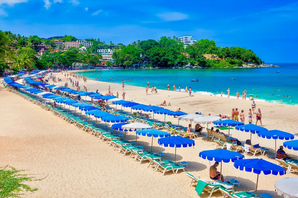
2. Kata Beach is located in Ban Kata, Karon Subdistrict, Mueang Phuket District. It is one of the most popular beaches on Phuket’s west coast and offers a good balance between an active resort atmosphere and a relaxing seaside setting. The beach is known for its curved shoreline, pale sand, attractive water during the favorable season, and views toward Ko Pu just offshore.
The Kata area is commonly discussed together with Kata Yai and Kata Noi. The main Kata Beach has a full range of restaurants, shops, hotels, and tourism services, while smaller Kata Noi generally feels quieter and more secluded. Travelers can therefore choose between the two depending on whether they prefer convenience or a more relaxed atmosphere.
When the sea is calm, Kata Beach is well suited to swimming, relaxing, and sunbathing. During periods with suitable waves, the beach also becomes popular for surfing, attracting both casual beachgoers and water-sports enthusiasts. In the evening, the west-facing shoreline offers attractive sunset views over the Andaman Sea.
Kata Beach lies close to Kata Noi Beach, Karon Beach, and Kata Karon Viewpoint, making it easy to combine several west-coast attractions in a half-day or full-day trip without repeatedly crossing the island.
Getting There: From Phuket Town, take Chao Fa Road toward Chalong, then continue onto Patak Road or Route 4028 toward Kata. The distance is approximately 17 kilometers. Private cars, rental vehicles, taxis, and hired transport are all practical options.
Map (GPS): https://maps.app.goo.gl/Qk3q5oMRsd573Mi56
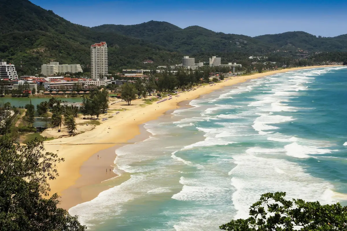
3. Karon Beach is a large beach on Phuket’s western coast in Karon Subdistrict, Mueang Phuket District. Its long shoreline and broad sandy area make it feel more open than many other popular beaches on the island, giving visitors plenty of space for walking, relaxing, and enjoying the sea even during busier travel periods.
The beach is known for its long stretch of sand, blue water during favorable sea conditions, and an atmosphere that is generally less concentrated than Patong. Hotels, restaurants, shops, and tourism services are readily available nearby, making Karon suitable both for longer stays and as a base for exploring Kata, Patong, and southern Phuket.
Mornings are well suited to walking or exercising along the beach, while evenings are popular for sunset watching. However, Phuket’s western coastline can experience strong waves and rip currents during the monsoon season. Visitors should always observe warning flags and avoid swimming whenever local authorities or lifeguards advise against entering the water.
Karon Beach connects easily with Kata Beach, Kata Karon Viewpoint, and the Chalong area, making it a practical stop on a road trip through southern Phuket’s west coast.
Getting There: From Phuket Town, take Chao Fa Road toward Chalong and continue onto Patak Road toward Kata and Karon. Alternatively, travelers coming from Patong can follow the coastal hill road south. Some sections have steep slopes and sharp bends, so careful driving is recommended.
Map (GPS): https://maps.app.goo.gl/WCLdph7oyZmdSrm68
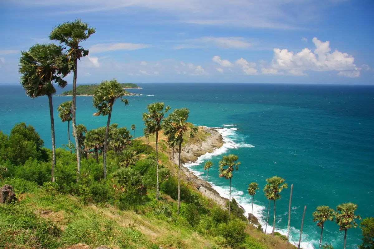
4. Promthep Cape is one of Phuket’s best-known landmarks, located in Rawai Subdistrict, Mueang Phuket District at the southern end of the island. The cape is distinguished by a rocky headland descending toward the Andaman Sea and offers wide views across the water, nearby islands, and the surrounding coastline.
The most popular time to visit is late afternoon before sunset, when large numbers of visitors gather to watch the sun descend over the sea. The site includes a broad viewing area, several photography points, a shrine, the Kanchanaphisek Lighthouse, shops, and resting areas, making it worthwhile to arrive well before sunset rather than treating the cape as a brief photo stop.
Visitors who want a closer view of the natural headland can walk down the ridge toward the tip of the cape. The trail includes steep sections of soil and rock, so suitable footwear is recommended. It is best avoided after heavy rain or close to nightfall, particularly for children, older travelers, and anyone uncomfortable with uneven terrain.
Promthep Cape can be combined easily with Rawai Beach, Ya Nui Beach, Windmill Viewpoint, and Nai Harn Beach. These attractions are all located within the southern part of Phuket and can be linked into a convenient full-day route ending with sunset at the cape.
Getting There: From Chalong Circle, follow Wiset Road or Route 4024 toward Rawai Beach, then continue onto Route 4233 for approximately 2 kilometers beyond Rawai. Roads near the cape include hills and curves, and traffic can become heavy around sunset.
Map (GPS): https://maps.app.goo.gl/MVnWRLR8KyzSp7LC9
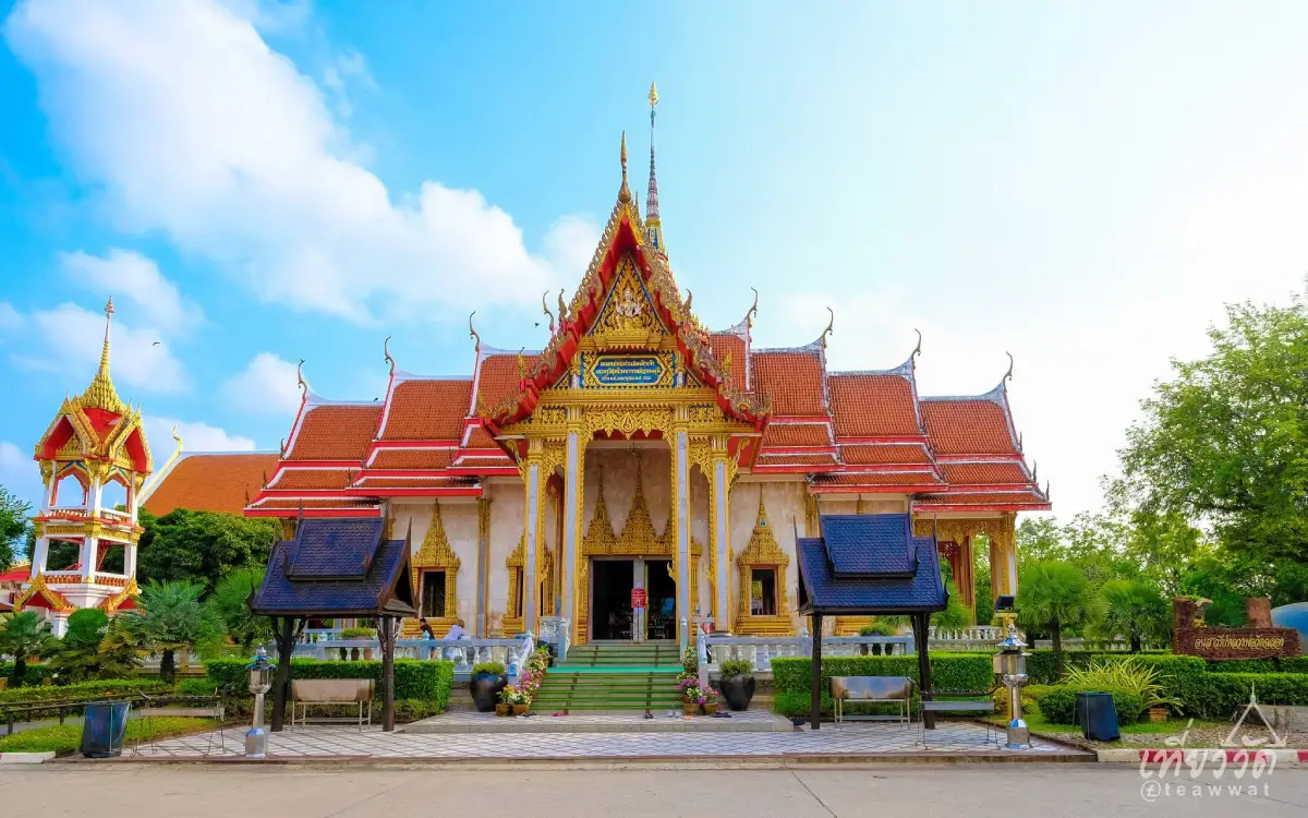
5. Wat Chalong, officially known as Wat Chaiyathararam, is one of the most important and best-known Buddhist temples in Phuket. Located on Chao Fa West Road in Chalong Subdistrict, Mueang Phuket District, the temple is an important center of faith for local residents and a major destination for visitors who come to pay respect to Luang Pho Chaem and Luang Pho Chuang.
One of the temple’s most prominent structures is Phra Mahathat Chedi Phra Chom Thai Barami Prakat. The chedi and surrounding temple buildings feature detailed Buddhist architecture, devotional spaces, Buddha images, and decorative elements that make Wat Chalong both a functioning religious site and an important cultural attraction.
Wat Chalong is also closely connected with Phuket’s local history. Luang Pho Chaem played an important role as a spiritual source of courage for local residents during unrest involving Chinese mine workers in the 19th century. This history gives the temple significance beyond its architectural beauty and explains the strong devotion that continues today.
Visitors should dress respectfully, covering shoulders and avoiding excessively short clothing when entering religious buildings. Quiet behavior is expected around prayer and ceremonial areas. Wat Chalong combines conveniently with Phuket Big Buddha, Chalong Bay, and other attractions in southern Phuket.
Getting There: From Phuket Town, follow Wichit Songkhram Road toward Chao Fa West Road or Route 4021 and continue for approximately 7 kilometers. The temple is located on the left side of the road and is well positioned for continuing toward Chalong and Phuket Big Buddha.
Map (GPS): https://maps.app.goo.gl/f78hKKfSE1PPEZcQ7
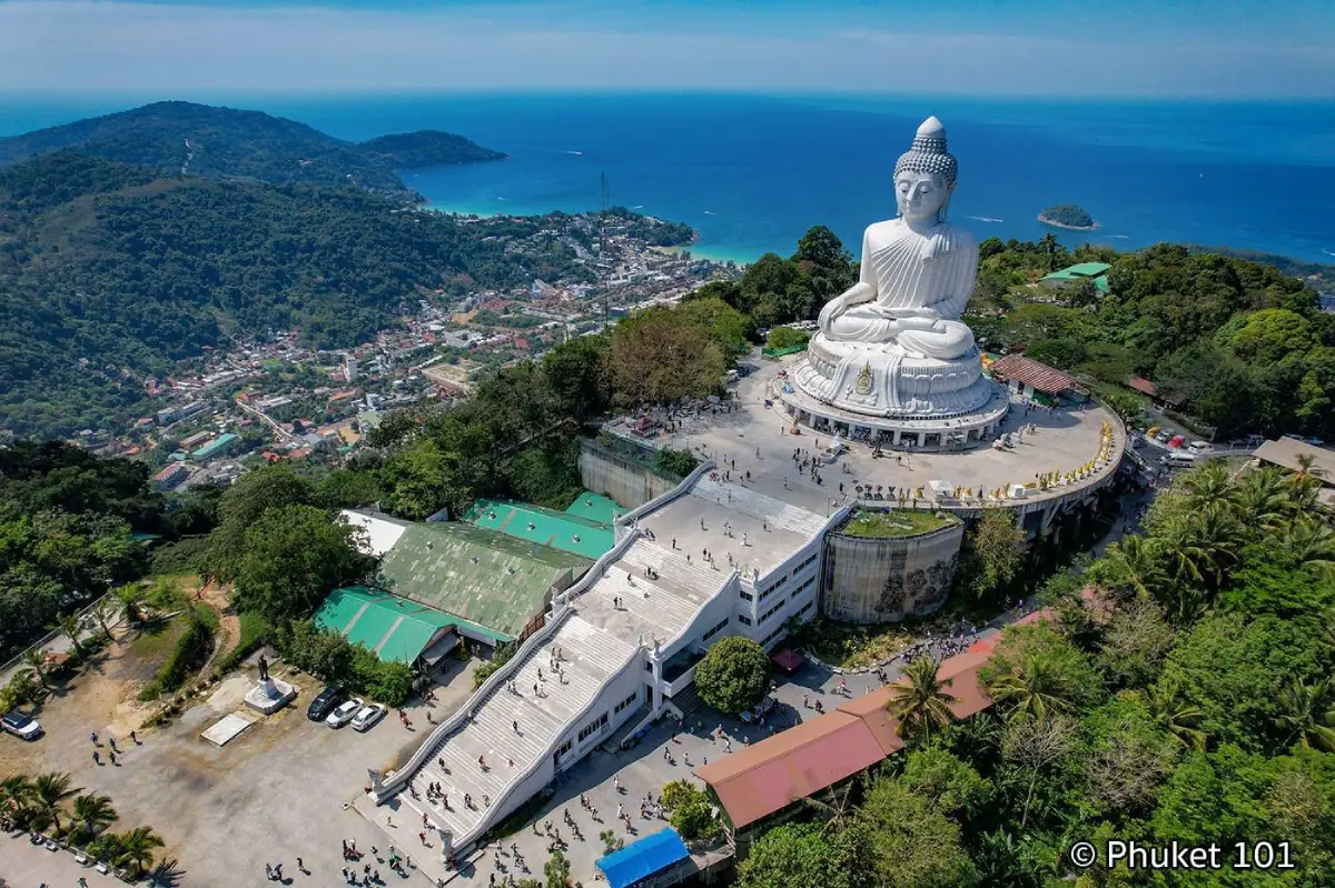
6. Phra Phuttha Ming Mongkol Eknakakiri, or Phuket Big Buddha is a monumental Buddha image on Nakkerd Hill in Karon Subdistrict, Mueang Phuket District. It is one of Phuket’s most recognizable landmarks and can be seen from several areas in the southern part of the island. In addition to the large white Buddha image, the hilltop offers elevated views over Chalong, Kata, Karon, and surrounding landscapes.
The hilltop combines the atmosphere of a Buddhist religious site with that of a scenic viewpoint. Visitors can pay respect to the Buddha image, walk through the surrounding religious areas, and observe Phuket’s geography from above. On clear days, the views extend across hills, urban areas, bays, and the coastline.
After access was closed following a landslide in 2024, the attraction reopened to visitors in 2026 under safety conditions and access controls. Travelers should follow all current signs and local instructions carefully and should not enter areas that remain restricted.
As this is a sacred Buddhist site, visitors should dress modestly and behave respectfully. The road up Nakkerd Hill is steep and winding in several sections, so drivers and motorcyclists should take particular care in wet weather.
Getting There: From Phuket Town, follow Chao Fa West Road toward Wat Chalong, then turn onto Soi Yot Sane and follow signs up Nakkerd Hill. Travelers coming from Kata or Karon can also connect to the hill road from the southern west-coast area.
Map (GPS): https://maps.app.goo.gl/1empkbzFKouPQp9Y7
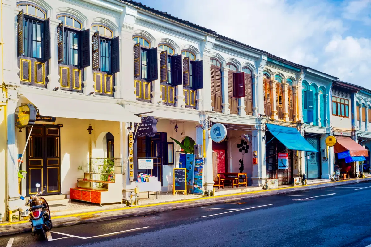
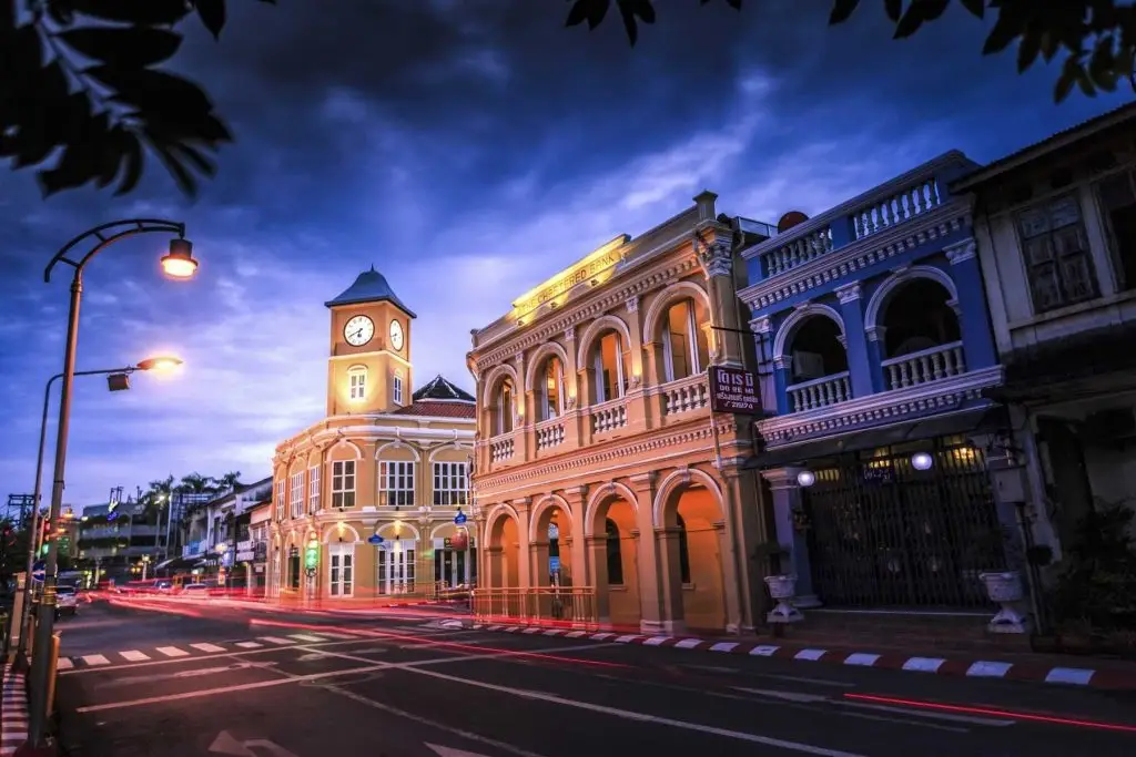
7. Sino-Portuguese Historic Buildings of Phuket Old Town form the architectural heart of central Phuket Town. The historic district includes streets such as Thalang Road, Dibuk Road, Phang Nga Road, Yaowarat Road, and Krabi Road. Its defining feature is the concentration of historic commercial buildings that combine Chinese and European architectural influences, reflecting Phuket’s prosperity during the tin-mining and international-trade era.
Many buildings feature shuttered windows, arched walkways, ventilation openings, decorative plasterwork, and colorful façades. Some have been adapted into cafés, restaurants, hotels, shops, museums, and creative spaces while preserving significant architectural elements, making Phuket Old Town a good example of historic buildings being reused within a living modern city.
The old town is also closely connected with Baba-Peranakan culture, Chinese shrines, Hokkien cuisine, historic merchant mansions, and Phuket’s tin-mining history. Visitors traveling on Sunday can continue to Lard Yai, or Phuket Walking Street, on Thalang Road, where food stalls, handicrafts, souvenirs, and community activities fill the street from late afternoon into the evening.
One of the strengths of Phuket Old Town is that many important sites are within walking distance. Travelers should allow at least half a day to explore the historic façades, museums, shrines, cafés, and local food. Early morning is particularly suitable for architecture photography when the streets are generally quieter.
Getting There: Phuket Old Town is approximately 30 kilometers from Phuket International Airport, with travel generally taking around 40–60 minutes depending on traffic. Visitors arriving by private vehicle should use designated parking areas around the old town and continue on foot, especially on Sunday when parts of Thalang Road are used for the walking street.
Map (GPS): https://maps.app.goo.gl/LiqJwrEVbrzVWFyJA
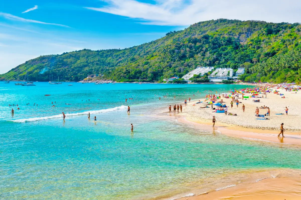
8. Hat Nai Han, commonly known as Nai Harn Beach, is a scenic beach in Rawai Subdistrict, Mueang Phuket District. Located in southern Phuket, it has a moderately sized curved bay, a broad sandy beach, and a setting that generally feels quieter than major resort beaches such as Patong, Kata, and Karon.
During the season when the sea is calm, the water can be particularly attractive and the beach is suitable for swimming, relaxing, and sunbathing. Behind the shoreline is the green area around Nai Harn Lake, where visitors can continue with a walk, light exercise, or a quieter break away from the sand.
Nai Harn Beach also works well as part of a southern Phuket itinerary because it lies close to Windmill Viewpoint, Ya Nui Beach, Promthep Cape, and Rawai Beach. Combining these nearby attractions reduces driving time and makes it easy to finish the day at Promthep Cape around sunset.
During the monsoon season, visitors should check warning flags and sea conditions before swimming. Strong currents can occur along Phuket’s western and southern coastline, and the sea should not be entered whenever red flags are displayed or local authorities advise against swimming.
Getting There: Nai Harn can be reached from the Rawai area either by the route passing Promthep Cape or by a more direct road inland. For a multi-stop route, travelers can combine Nai Harn Beach, Windmill Viewpoint, Ya Nui Beach, and Promthep Cape in a convenient loop.
Map (GPS): https://maps.app.goo.gl/34iaSSwZxUqwWHZi6
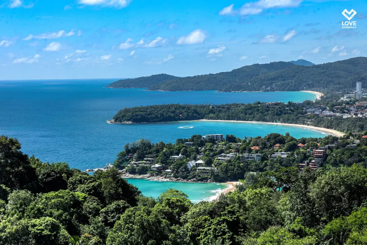
9. Kata Karon Viewpoint, also widely known as Karon Viewpoint, is a roadside viewpoint on the hillside between Kata Noi and Nai Harn. Its signature panorama looks north across three sections of Phuket’s western coastline: Kata Noi, Kata, and Karon, with the Andaman Sea forming the backdrop.
The site includes a viewing terrace, shaded pavilion, and several photography positions. Because it requires very little walking, it is accessible for a wide range of travelers and is one of the easiest scenic stops to include on a road trip around southern Phuket.
Morning often provides clear visibility with fewer visitors, while afternoon and early evening light can give more depth to the coastline and sea. Visitor numbers generally increase later in the day, so photographers looking for an unobstructed view may prefer the morning on a clear-weather day.
The viewpoint combines easily with Kata Beach, Kata Noi Beach, Nai Harn Beach, Windmill Viewpoint, Promthep Cape, and Rawai Beach, making it ideal for a circular driving route through southern Phuket.
Getting There: From Kata Beach, follow Route 4233 uphill past Kata Noi toward Nai Harn. The viewpoint is located directly beside the road. Travelers coming from Nai Harn can follow the same coastal road north toward Kata Noi.
Map (GPS): https://maps.app.goo.gl/pEtaRfdtgstbh2EF6
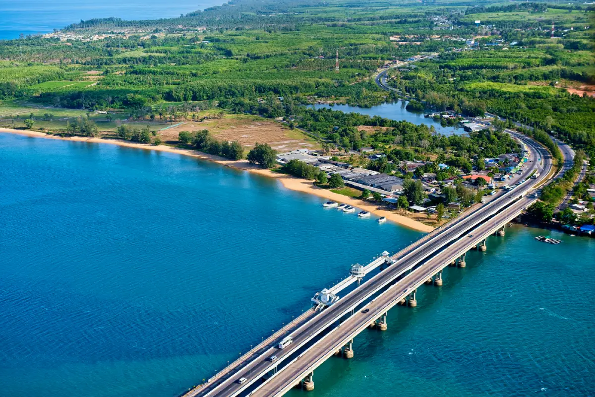
10. Sarasin Bridge is a historic bridge linking Phuket Island with Phang Nga Province across the Pak Phra Channel, between Ban Tha Chatchai in Mai Khao Subdistrict, Thalang District, and Ban Tha Nun in Takua Thung District, Phang Nga. It is historically important as the first permanent bridge to transform road travel between Phuket and the mainland.
Before the bridge was built, crossing the channel depended on boats and vehicle ferries. The opening of Sarasin Bridge made the movement of people, cars, and goods much more efficient and played an important role in Phuket’s later economic and tourism development.
The original bridge has since been adapted into a pedestrian viewing area, including a raised observation point near the center. Visitors can look across the Pak Phra Channel, the sea, and the newer road bridges that now carry vehicle traffic. Late afternoon is an especially pleasant time for walking and watching the changing light.
Sarasin Bridge can be combined with Phuket Gateway, Sai Kaew Beach, Mai Khao Beach, the airplane-viewing area, and Sirinat National Park. Together, these attractions create a useful half-day or full-day itinerary through northern Phuket.
Getting There: From Phuket Town, follow Thepkrasattri Road or Highway 402 north through Thalang District toward Mai Khao. The distance is approximately 35–40 kilometers. From Phuket International Airport, travel generally takes around 15–25 minutes depending on traffic.
Map (GPS): https://maps.app.goo.gl/NFRvqv2M7GTom7gZ8
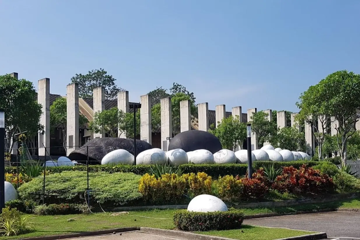
11. Phuket Gateway is located at Ban Tha Chatchai in Mai Khao Subdistrict, Thalang District, close to the road connection between Phang Nga Province and Phuket Island. It serves as a symbolic entrance landmark for travelers arriving in Phuket by road and was designed as a welcoming space that introduces the island’s history and identity before visitors continue farther south.
One of the site’s distinctive features is a series of stone pillars presenting stories about Phuket, including the tin-mining era, agriculture, traditional ways of life, local arts and culture, and the island’s transition into an internationally known tourism destination. The concept therefore goes beyond a simple gateway monument and functions as an introduction to Phuket’s broader development.
The surrounding area also features sculptures and design elements associated with the island’s identity, including themes connected with sea turtles and the natural environment of northern Phuket. It is a useful place to stop, take photographs, and gain some background before beginning a wider road trip around the island.
Phuket Gateway combines easily with Sarasin Bridge, Sai Kaew Beach, Mai Khao Beach, Sirinat National Park, and other attractions around northern Phuket. This makes the area worthwhile as more than just a transit point between the mainland and the island.
Getting There: Travelers arriving from Phang Nga cross the bridge into Phuket and reach the gateway area around Tha Chatchai before continuing onto Thepkrasattri Road. From Phuket International Airport, the drive generally takes around 15–25 minutes, while travel from Phuket Old Town usually takes around 45–60 minutes depending on traffic.
Map (GPS): https://maps.app.goo.gl/GQdTJdKc9tye7fep6
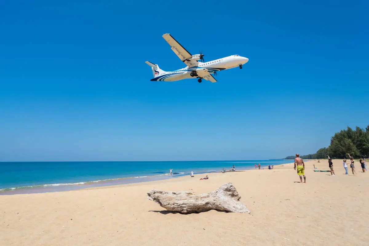
12. Mai Khao Beach is a long natural beach in Mai Khao Subdistrict, Thalang District, in northern Phuket. Located near Phuket International Airport and the protected coastline of Sirinat National Park, it is known for its broad open shoreline, quieter atmosphere, and more natural character compared with the heavily developed beaches farther south.
The beach is well suited to travelers who want to walk, relax, take photographs, and watch the sunset away from dense commercial areas. Although some sections are lined with large resorts, many stretches still feel spacious and relatively undeveloped, creating a strong contrast with Patong, Kata, and Karon.
The area close to the airport runway is particularly famous for watching aircraft approach and depart at low altitude. Visitors must remain in public areas, obey safety signs, and never enter airport-controlled or restricted zones. Photography should always be done from areas where public access is permitted.
Swimming is best attempted only when the sea is calm because some parts of the beach deepen relatively quickly and can experience strong currents during the monsoon season. For this reason, Mai Khao is often better suited to beach walks, relaxation, and photography than to swimming throughout the year.
Getting There: From Phuket Town, follow Thepkrasattri Road or Highway 402 north toward Thalang and Phuket International Airport. From there, choose the local road into Mai Khao according to the section of beach you want to visit, such as the northern beach, resort zone, or airplane-viewing area.
Map (GPS): https://maps.app.goo.gl/z7Na8dcaipSSGTAV6
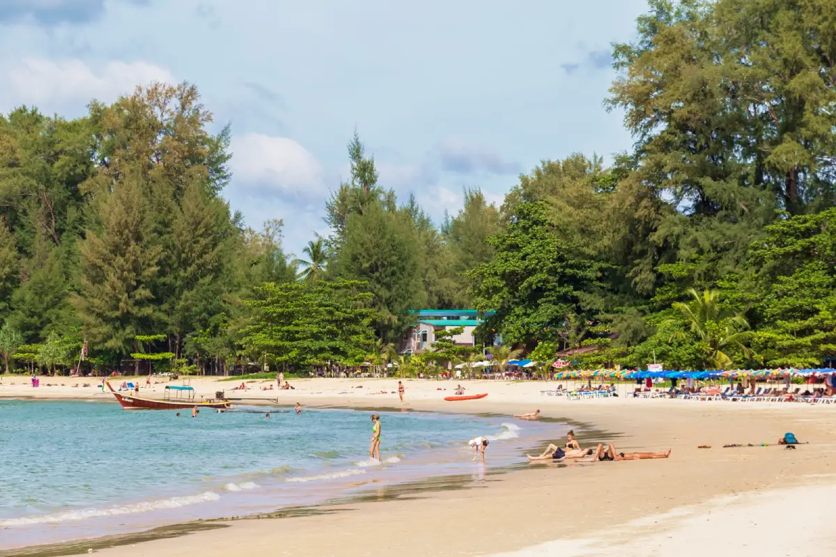
13. Sirinat National Park, including the Nai Yang Beach area, is one of Phuket’s most important marine national parks. Located along the island’s northwestern coastline, it protects approximately 90 square kilometers of coastal and marine environments and includes several major beaches such as Nai Yang, Mai Khao, Sai Kaew, and other coastal areas in northern Phuket.
The park is particularly valuable because it preserves natural coastal ecosystems within a province that has experienced extensive tourism development. Its landscapes include sandy beaches, casuarina groves, mangrove areas, coastal habitats, and marine ecosystems, giving visitors an opportunity to experience a quieter and more conservation-focused side of Phuket.
Nai Yang Beach is one of the best-known areas within the park. Tall coastal trees provide shade, making the beachfront suitable for walking, relaxing, picnicking, and sunset watching. The atmosphere is noticeably calmer than at Phuket’s major resort beaches, while the beach’s proximity to the airport makes it convenient before a departing flight or shortly after arriving on the island.
Because this is a protected national-park area, visitors should keep the beach clean, avoid disturbing wildlife, never remove plants or marine life, and follow current park regulations. Any entrance fees, camping rules, or temporary restrictions should be checked before visiting because park management conditions may change.
Getting There: From Phuket Town, follow Thepkrasattri Road north toward Thalang and Phuket International Airport. Around Sakhu Subdistrict, turn toward Nai Yang Beach and Sirinat National Park. From the airport, the journey is short and can be made by taxi, rental car, or hired transport.
Map (GPS): https://maps.app.goo.gl/TGNMKpxwSJSj7qPR8
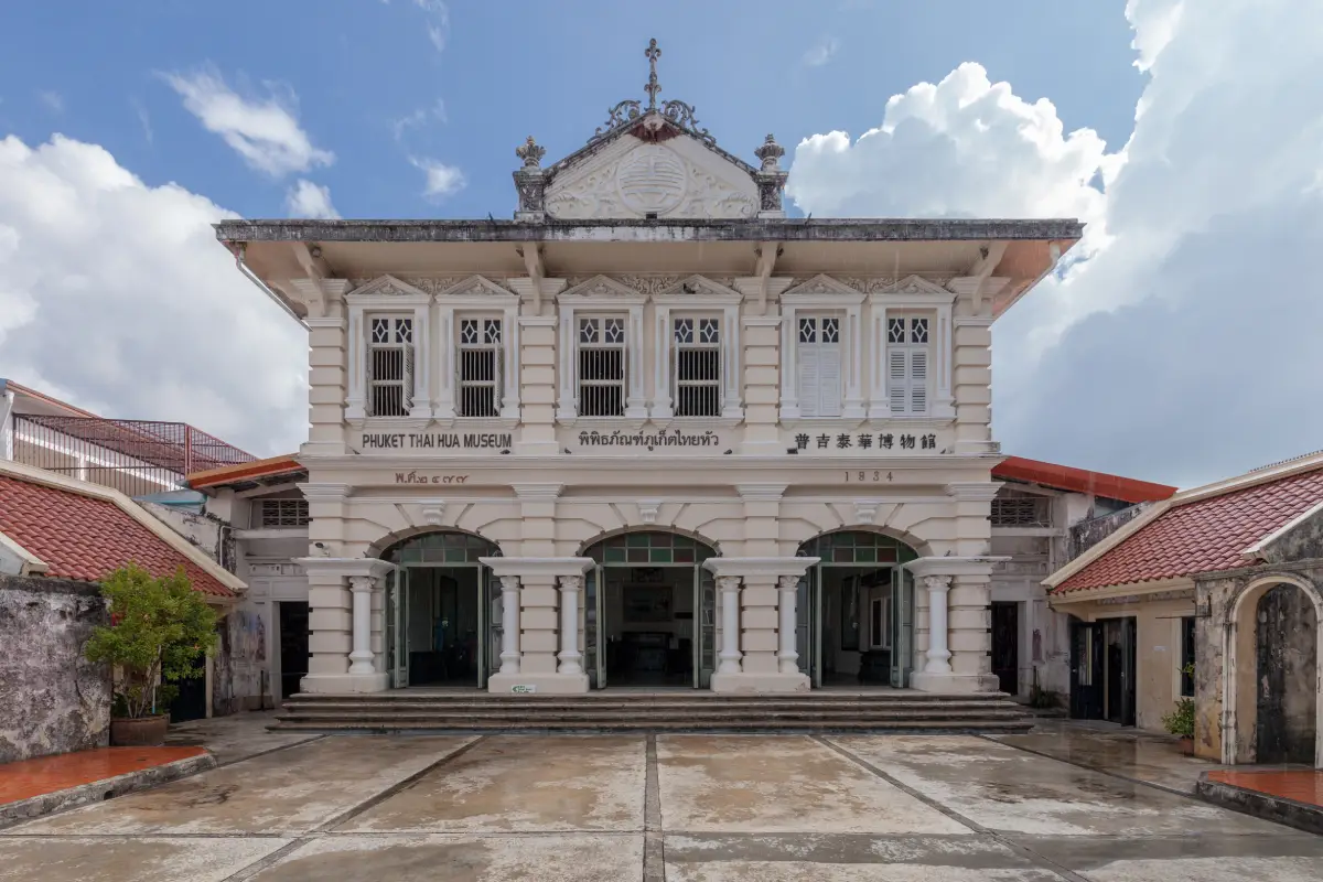
14. Phuket Thai Hua Museum is located at 28 Krabi Road in Phuket Old Town and is one of the island’s most important museums for understanding the historical roots of Phuket Town. The building originally served as a Chinese-language school for the Hokkien Chinese community before being adapted into a museum presenting stories of migration, education, tin mining, and the development of Phuket society.
The two-storey building features Sino-Portuguese architectural elements, including arches, shutters, columns, and decorative plasterwork reflecting both Chinese and European influences. The present building dates from the period before the Second World War and remains an important example of how education became a central institution within Phuket’s Chinese community.
The exhibitions connect many aspects of Phuket’s history, including Hokkien Chinese migration, tin mining, Baba-Yaya family life, cuisine, traditions, shrines, education, and influential local figures. Together, these themes help explain how Phuket became prosperous long before modern tourism through a complex network of trade, mining, and community organization.
For travelers walking through Phuket Old Town, visiting Thai Hua Museum before or during a route along Krabi Road, Thalang Road, and Dibuk Road provides useful context for understanding the buildings, shrines, restaurants, and historic houses found throughout the district.
Getting There: The museum is located on Krabi Road in Phuket Old Town and can be reached on foot from Thalang Road and the central heritage district. Visitors arriving by private vehicle should use permitted parking areas and continue on foot because many old-town streets are narrow and parking can be limited.
Map (GPS): https://maps.app.goo.gl/nwGZ1PYdUJYwQzWQ7
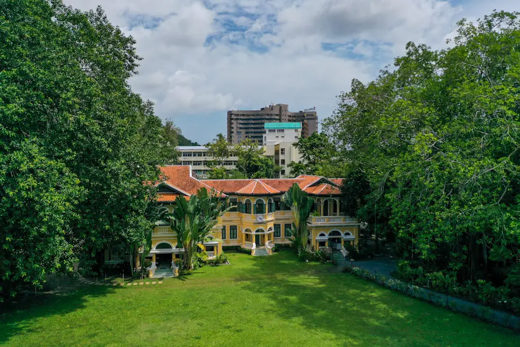
15. Baan Chinpracha is a historic mansion on Krabi Road in Phuket Old Town and one of the island’s best-preserved examples of a Sino-Portuguese residence. The house provides a detailed look at the lifestyle of an affluent Phuket family during the tin-mining era, with many architectural features, furnishings, household objects, and living spaces still preserved.
The mansion combines Chinese and European architectural ideas through its doors, windows, ventilation openings, decorative details, and internal layout. A central open courtyard allows natural light and air to enter the building, a practical design feature suited to Phuket’s tropical climate and characteristic of traditional Baba family homes.
Walking through Baan Chinpracha offers a different perspective from viewing the commercial shophouses on Thalang Road. Here, visitors can see domestic spaces such as reception rooms, dining areas, household objects, kitchenware, decorative pieces, and other features that reveal the social status, taste, and family life of Phuket’s earlier merchant class.
Baan Chinpracha combines particularly well with Phuket Thai Hua Museum, Krabi Road, Thalang Road, and nearby Chinese shrines. Together, these sites tell a connected story about tin mining, Hokkien Chinese settlement, and the development of Baba-Peranakan culture in Phuket.
Getting There: The house is located on Krabi Road in Phuket Old Town and is within walking distance of Phuket Thai Hua Museum and Thalang Road. Visitors arriving by car should plan to park in an appropriate area around the old town and continue on foot.
Map (GPS): https://maps.app.goo.gl/GvRj899hXaG3GHHZ9
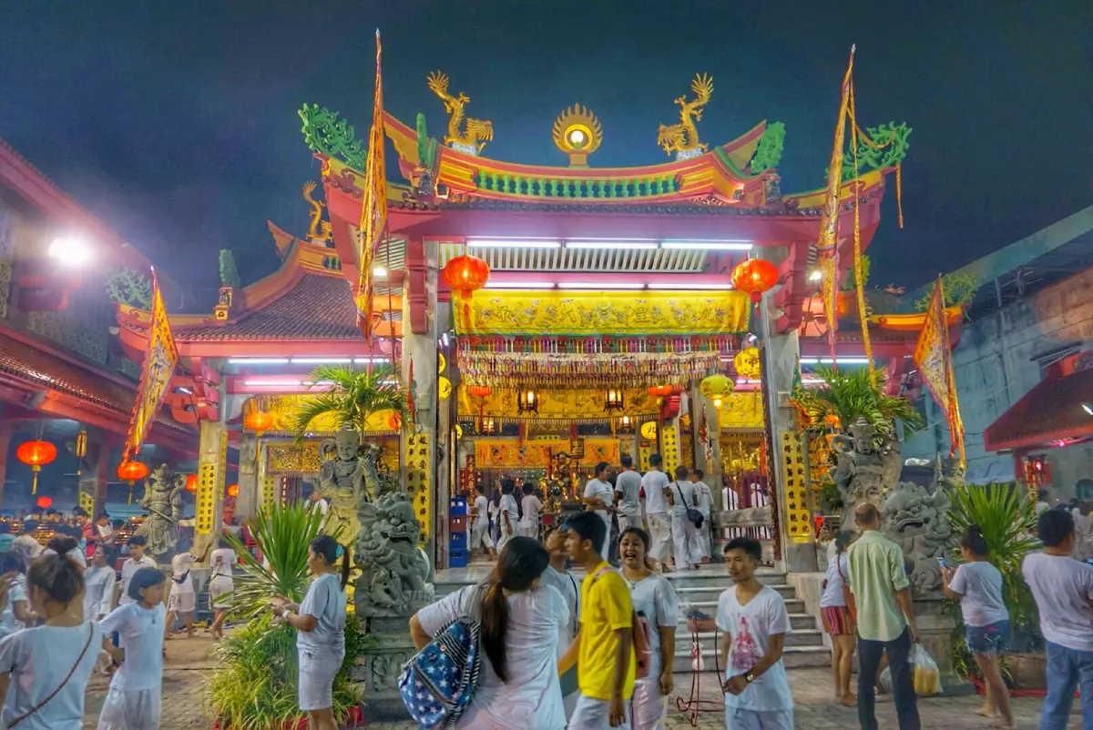
16. Jui Tui Shrine, also known as Jui Tui Tao Bo Keng, is located on Soi Phuthorn off Ranong Road in Talat Nuea Subdistrict, Mueang Phuket District. It is one of Phuket’s most important Chinese shrines and plays a major role in the religious and cultural life of the island’s Thai-Chinese community, particularly during the Phuket Vegetarian Festival.
The shrine is characterized by Chinese architectural details, vivid red and gold decoration, carved elements, deity images, offering tables, and ceremonial areas that continue to be actively used. It is therefore not simply a sightseeing attraction but a living place of worship where local residents come to pray, make offerings, and participate in religious ceremonies throughout the year.
Jui Tui Shrine is especially important in connection with the Phuket Vegetarian Festival, one of the island’s most widely recognized cultural traditions. During the festival, the shrine becomes a major center for ceremonies, processions, devotional activities, and community participation, making it an important place for understanding the religious roots of the event.
The shrine is also close to Put Cho Shrine, Ranong Road Market, and Phuket Old Town, making it possible to build a half-day walking route focused on food, faith, and Chinese community history. Visitors should dress respectfully, avoid disrupting ceremonies, and ask permission before taking photographs during sensitive ritual activities.
Getting There: From the center of Phuket Old Town, visitors can walk toward Ranong Road and Soi Phuthorn in around 10–15 minutes depending on the starting point. Drivers can approach via Ranong Road and continue toward the area near Put Cho Shrine.
Map (GPS): https://maps.app.goo.gl/WdRHn5YnNiyDkU9D8
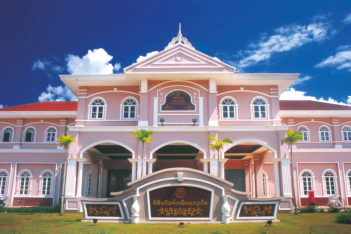
17. Phuket Mining Museum, also known as Kathu Mining Museum, is located at the former Tho Sung mining area along the Kathu–Ko Kaeo road in Kathu District. It is one of Phuket’s most important learning centers for understanding the period when tin was the foundation of the island’s economy before tourism became its dominant industry.
Kathu was once a major mining district where laborers, mine owners, machinery, and entire communities developed around the tin industry. Learning about this period helps explain why Phuket has such a strong Hokkien Chinese heritage, numerous Chinese shrines, distinctive local cuisine, and Sino-Portuguese architecture in the old town.
The museum building incorporates Sino-Portuguese architectural influences and was designed to reflect the character of Phuket’s mining era. Exhibitions extend both indoors and outdoors and cover mining techniques, tools, machinery, models, workers’ lives, market communities, and economic changes associated with the tin industry.
The museum is suitable for families, students, and travelers interested in history. Combining it with Kathu Shrine, Kathu Local Heritage Conservation Center, and Phuket Old Town provides a broader view of Phuket’s transformation from a mining society into a commercial and tourism center.
Getting There: From Phuket Town, follow Wichit Songkhram Road toward Kathu District, then continue along the Kathu–Ko Kaeo road toward the Loch Palm Golf Club area. The museum is approximately 13 kilometers from central Phuket Town and generally takes around 25–35 minutes to reach depending on traffic.
Map (GPS): https://maps.app.goo.gl/wdUZ8p2sYoyNsBYN7
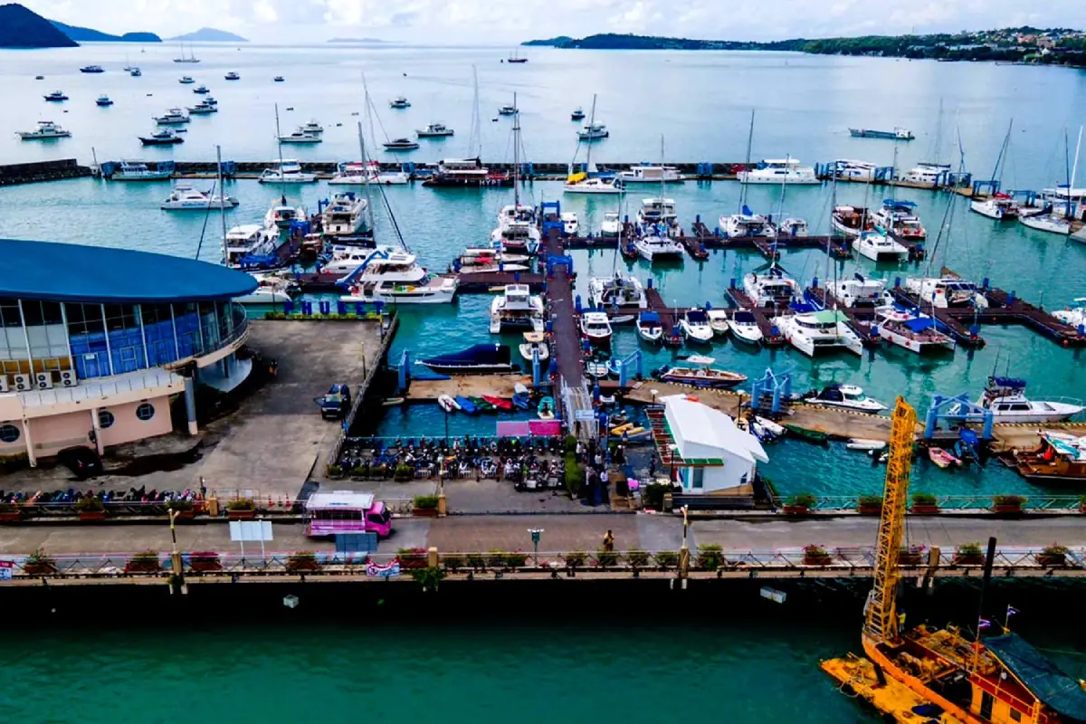
18. Ao Chalong Tourist Pier is one of the main marine-transport centers in southern Phuket, located in Chalong Subdistrict, Mueang Phuket District. It serves as a major departure point for trips to destinations such as Coral Island, Racha Islands, Phi Phi Islands, Maiton Island, as well as diving excursions and yacht trips across the Andaman Sea.
The large number of speedboats, catamarans, yachts, and other vessels anchored throughout Chalong Bay gives the area a distinct maritime-port atmosphere. The pier extends out over the water and includes passenger-service buildings, registration areas, and facilities for numerous tour and boat operators.
Even travelers who are not joining an island trip can stop here to enjoy views of the bay and observe the working harbor. Seafood restaurants, dive shops, accommodation, and marine services are found nearby. Travelers with scheduled boat trips should arrive early enough to check in, collect equipment, and attend safety briefings.
Chalong Bay is conveniently positioned for combining with Wat Chalong, Phuket Big Buddha, Rawai Beach, and Promthep Cape. It can therefore serve as the center of a southern Phuket itinerary, especially on days when travelers take a morning boat trip and explore mainland attractions later in the afternoon.
Getting There: From Phuket Town, travel toward Chalong Subdistrict using Chao Fa Road or other routes connecting with Chalong Circle, then continue to the pier. The distance from central Phuket Town is approximately 15 kilometers. Travelers with scheduled boat departures should allow extra time for traffic around Chalong Circle, particularly in the morning.
Map (GPS): https://maps.app.goo.gl/qQDiRShWy7dKhNjA6
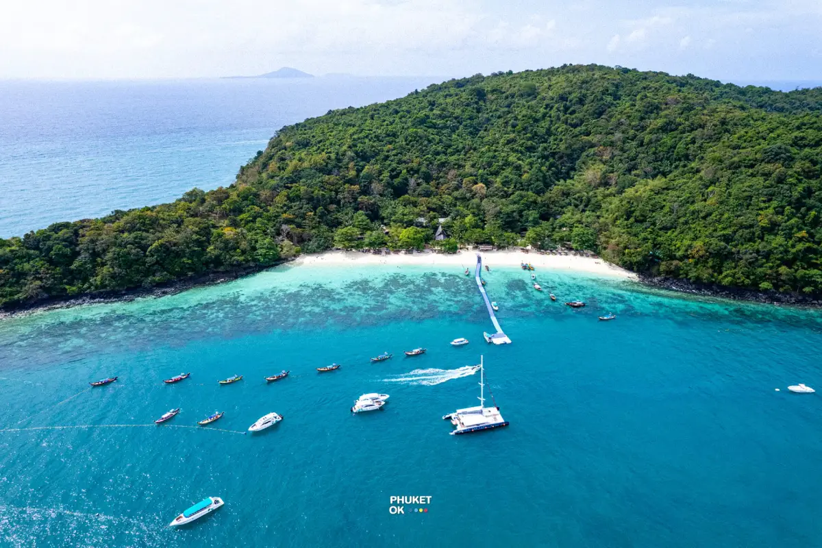
19. Koh Hae (Coral Island) is a popular island destination south of Phuket in Rawai Subdistrict, Mueang Phuket District. One of its main advantages is its proximity to the main island: the boat journey is relatively short while still offering the classic Andaman island experience of pale sandy beaches, attractive sea conditions, and a range of water activities.
The island is suitable for both half-day excursions and full-day trips. Visitors can relax on the beach, swim, snorkel, and participate in marine activities depending on what services are operating. Restaurants and visitor facilities are available on the island, making it convenient for travelers who want an island experience without traveling long distances offshore.
Coral reefs and marine life are among the island’s most valuable natural resources. Visitors should never stand on or step on coral, handle marine animals, or leave waste in the sea. Those joining snorkeling or diving activities should choose operators with appropriate safety equipment and responsible marine practices.
Travel options include long-tail boats, speedboats, and organized packages departing from Chalong Bay or Rawai. Before departure, visitors should check the weather, wave and wind conditions, return schedule, what is included in the tour price, and whether suitable life jackets are provided, particularly during the monsoon season.
Getting There: Boats can depart from either Rawai Beach or Ao Chalong Tourist Pier. Chalong has a more organized concentration of speedboat and tour operators, while Rawai is commonly used for long-tail boats and private boat arrangements depending on local services.
Map (GPS): https://maps.app.goo.gl/ts7pJH7TVVU67DkK8
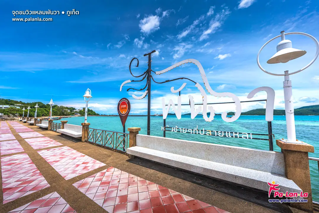
20. Cape Panwa Viewpoint is located near the end of Cape Panwa in Moo 8, Wichit Subdistrict, Mueang Phuket District. This southeastern coastal viewpoint offers a quieter atmosphere than Phuket’s busier western coastline, with a seaside promenade, bay views, small offshore islands, and a lighthouse visible over the water.
The Cape Panwa coastline is shaped more by sheltered bays and calmer waters than by the long exposed beaches of Patong, Kata, or Karon. This makes the area especially suitable for travelers who prefer a slower walk, sea breezes, and relaxed coastal scenery rather than beach activities and crowded resort zones.
The viewpoint is not centered around major commercial attractions. Its appeal lies in photography, quiet observation, and the views of boats, bays, and offshore islands. It provides a useful perspective on Phuket’s eastern and southeastern coastline and its relationship with marine travel routes.
Cape Panwa Viewpoint combines easily with Phuket Aquarium, Makham Bay, Ao Yon, Khao Khad Views Tower, and other attractions in Wichit Subdistrict. These sites can be arranged into a relaxed half-day or full-day itinerary by private car or rental vehicle.
Getting There: From Phuket Town, travel toward Wichit Subdistrict, pass the Makham Bay area, and follow Sakdidej Road toward the end of Cape Panwa. Signs for Phuket Aquarium and Cape Panwa help guide the route.
Map (GPS): https://maps.app.goo.gl/3xPi3hEtzdE4JCwD8
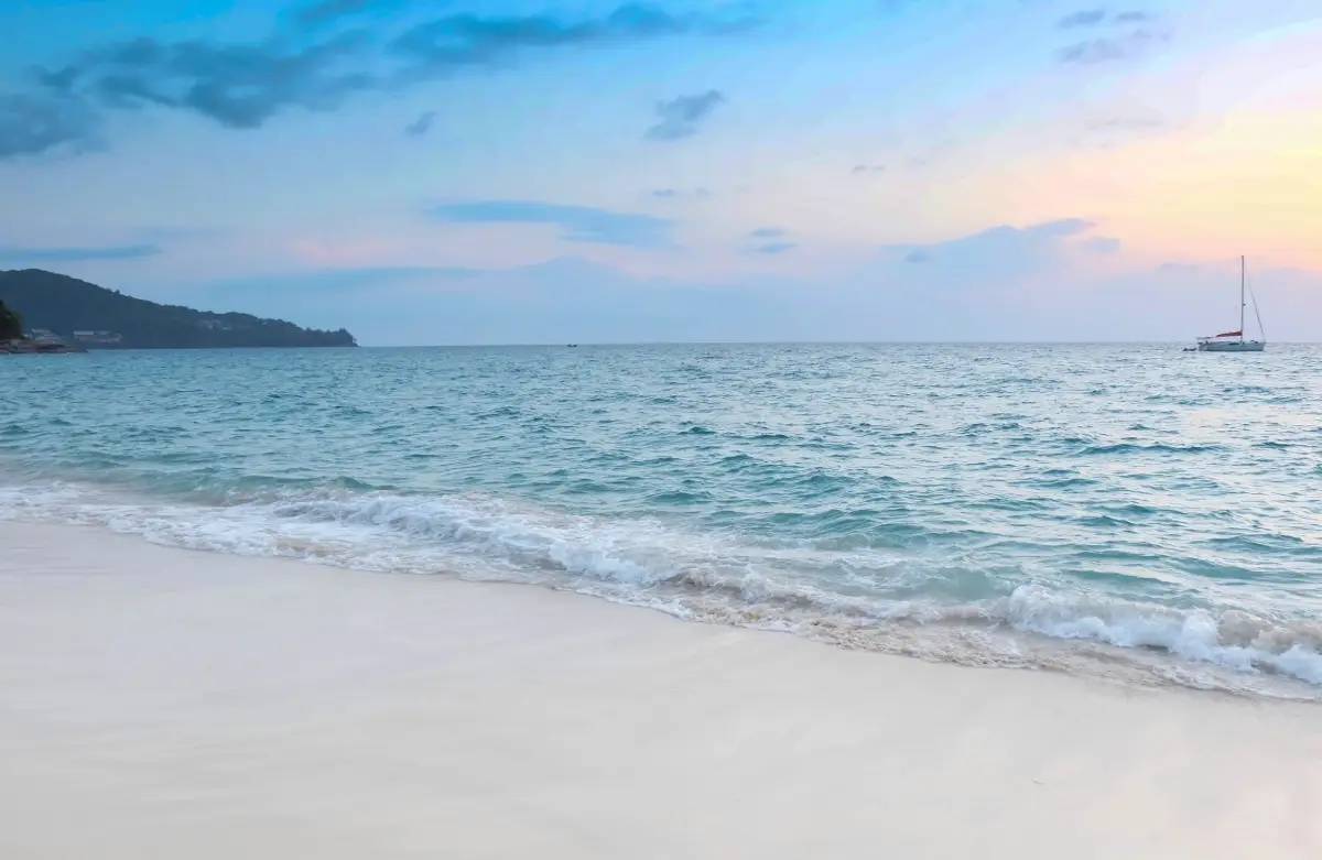
21. Hat Surin, commonly known as Surin Beach, is located in Choeng Thale Subdistrict, Thalang District, between Kamala Beach and Bang Tao Beach on Phuket’s western coast. The beach is known for its pale sand, attractive sea conditions during the favorable season, lines of coastal trees, and a landscape framed by surrounding hills. Its atmosphere is generally more relaxed than Phuket’s largest resort beaches.
The trees behind the beach provide shade and help preserve a more natural coastal character. Morning is particularly pleasant for walking, photography, and relaxing by the sea, while late afternoon is ideal for watching the sun descend over the Andaman Sea.
The shoreline can become relatively steep and the water may deepen more quickly than at some other Phuket beaches. Extra caution is therefore necessary during the monsoon season, generally from around May to October, when strong waves and rip currents can occur. Visitors should never enter the sea when red warning flags are displayed.
Surin Beach combines easily with Bang Tao Beach, Kamala Beach, and the Choeng Thale area. It is suitable for couples, families, photographers, and travelers looking for an attractive west-coast beach without the intensity of Phuket’s busiest tourism zones.
Getting There: From Phuket Town, follow Thepkrasattri Road toward Thalang. Near the Thao Thep Krasattri and Thao Si Sunthon Monument area, turn toward Choeng Thale and Surin. The beach is approximately 24 kilometers from central Phuket Town.
Map (GPS): https://maps.app.goo.gl/gDqXWG16uJB7MmrUA
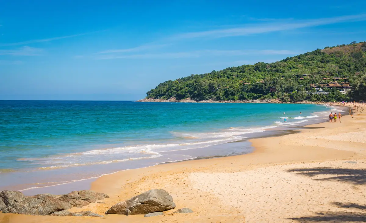
22. Nai Thon Beach is a relatively compact beach at Ban Nai Thon in Sakhu Subdistrict, Thalang District, on the northern section of Phuket’s west coast. Surrounded by hills and green slopes, it feels noticeably quieter and more natural than many of the major resort beaches farther south.
The beach features pale sand, clear water during the dry season, and roadside trees that provide a relaxed setting. It is well suited to swimming when conditions are safe, walking along the sand, resting by the sea, and watching the sunset. Travelers staying around Sakhu or near Phuket International Airport can reach Nai Thon without traveling far.
During the monsoon season, visitors should pay close attention to warning flags and sea conditions because strong waves and rip currents can develop along Phuket’s west coast. Families with children and travelers who are not confident swimmers should enter the water only when conditions are calm and in appropriate areas.
Nai Thon Beach can be combined with Sirinat National Park, Nai Yang Beach, Mai Khao Beach, and Phuket International Airport, making it a convenient stop during a road trip through northern Phuket.
Getting There: From Phuket Town, follow Thepkrasattri Road north toward Thalang and Sakhu, then turn onto the road leading to Nai Thon Beach. Some sections of the approach road pass over hills and include curves, so drivers should proceed carefully.
Map (GPS): https://maps.app.goo.gl/AQBT2d7K5igNYMnu8
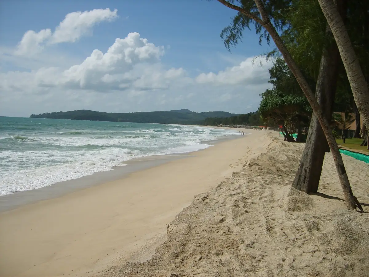
23. Bang Tao Beach is one of Phuket’s longest beaches, located in Choeng Thale Subdistrict, Thalang District. Its broad bay has noticeably different atmospheres along different sections, ranging from resort-oriented areas with extensive tourism services to quieter stretches where the beach feels more open and natural.
The long shoreline is ideal for extended walks, exercise, relaxing by the sea, swimming during calm conditions, and sunset watching. Because the beach covers such a large area, travelers can choose a section that suits their preferences, whether they want restaurants and facilities nearby or a quieter coastal setting.
The wider Choeng Thale area around Bang Tao has become one of Phuket’s major resort and residential districts, with hotels, resorts, restaurants, cafés, local communities, and the Laguna Phuket area all located nearby. This makes Bang Tao a practical base for exploring Surin Beach, Choeng Thale, and northern Phuket.
As with other west-coast beaches, visitors should check waves and warning flags before swimming during the monsoon season. For walking and photography, early morning and late afternoon are generally more comfortable than the hottest part of the day.
Getting There: From Phuket Town, travel north on Thepkrasattri Road toward Thalang, then turn onto Si Sunthon Road toward Choeng Thale. From there, choose the beach access road according to the section you want to visit, such as central Choeng Thale, Laguna, or the northern part of Bang Tao.
Map (GPS): https://maps.app.goo.gl/zQ15HnbzEwUkiUcV6
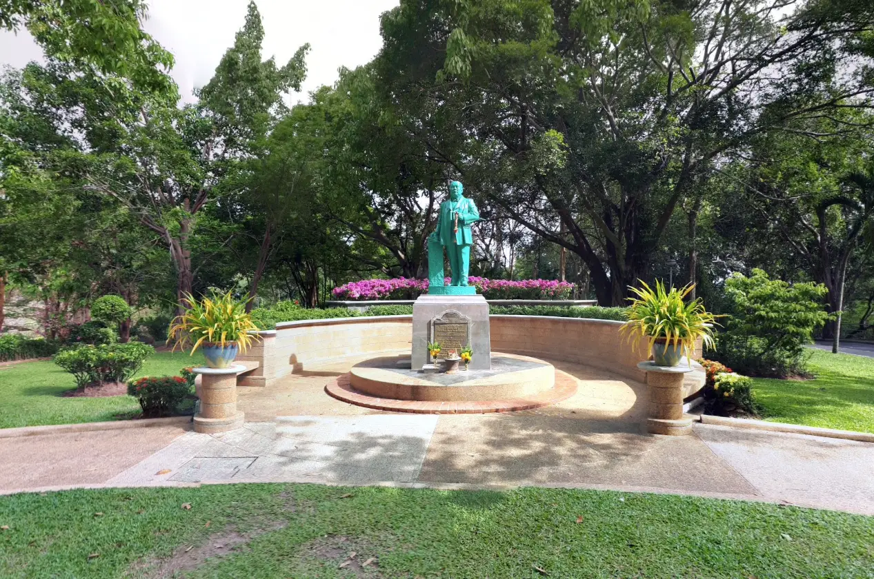
24. Phraya Ratsadanupradit Monument (Kho Simbe Na Ranong) stands in Khao Rang Public Park in Mueang Phuket District and commemorates Phraya Ratsadanupradit Mahison Phakdi, also known as Kho Simbe Na Ranong. He was an important administrative figure who contributed significantly to the modernization and economic development of southern Thailand and Phuket during the late 19th and early 20th centuries.
Phraya Ratsadanupradit played an important role in transportation, administration, agriculture, and economic development. He is also strongly associated with the promotion of rubber cultivation, which later became one of the most important commercial crops in southern Thailand.
The monument’s location on Khao Rang makes it easy to combine history with a scenic stop overlooking Phuket Town. The surrounding public park provides green space for walking and relaxing, while Phuket Old Town, Phuket Thai Hua Museum, Chinpracha House, and other urban attractions are located nearby.
The monument is especially worthwhile for travelers interested in political history, regional development, and the economic transformation of southern Thailand. Combining it with Phuket Mining Museum and Thalang National Museum provides a broader understanding of how Phuket developed before the rise of mass tourism.
Getting There: From Phuket Old Town, follow the road uphill toward Khao Rang Public Park. The site can be reached by private car, motorcycle, taxi, or hired vehicle. The final section includes inclines and bends, so drivers should proceed carefully.
Map (GPS): https://maps.app.goo.gl/BCrGPEA6BD6cUqfy7
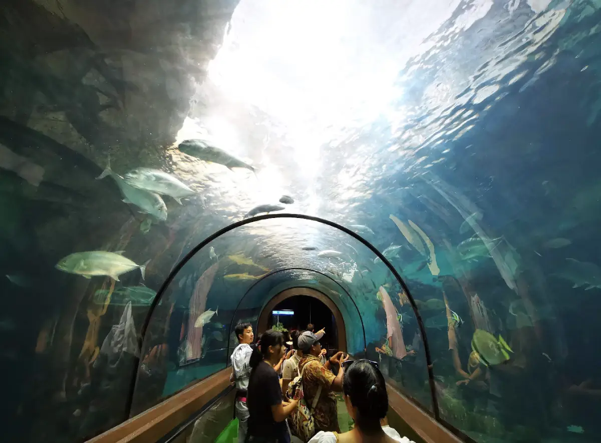
25. Phuket Aquarium is located near the end of Cape Panwa in Wichit Subdistrict, Mueang Phuket District. It is an important public learning attraction focused on marine organisms and the ecosystems of Thailand’s seas, making it particularly suitable for families, children, students, and travelers who want to understand marine life before or after island and snorkeling trips.
The aquarium presents a variety of aquatic species through display tanks and educational areas explaining the relationship between marine animals, coral reefs, coastlines, and broader marine ecosystems. The exhibits help visitors understand that Phuket’s surrounding seas are not only beautiful but also ecologically complex and vulnerable.
Phuket Aquarium is also a useful option on days when weather conditions are unsuitable for boat trips or beach activities. Most of the visit takes place indoors, making it a practical alternative during rain or intense midday heat while still keeping the itinerary connected to Phuket’s marine environment.
The aquarium is located close to Cape Panwa Viewpoint, Makham Bay, Ao Yon, and Khao Khad View Tower. These attractions can be combined into a half-day or full-day route through Wichit and Cape Panwa.
Getting There: From Phuket Town, follow Sakdidej Road toward Wichit and Cape Panwa, then continue toward the end of the cape following signs for Phuket Aquarium. Khao Khad View Tower and Ao Yon can be added as stops along the same route.
Map (GPS): https://maps.app.goo.gl/nLoYouwejUAUsMKx9
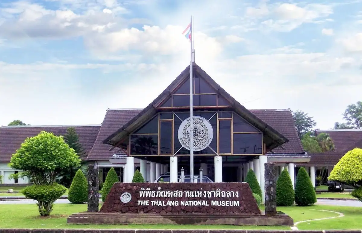
26. Thalang National Museum is one of Phuket’s major historical museums, presenting the archaeology, history, communities, and cultural development of Phuket and the Andaman coast. Located in Thalang District near areas associated with the historic defense of Thalang, the museum is particularly important for understanding the story of Thao Thep Krasattri and Thao Si Sunthon.
Its exhibitions cover subjects ranging from prehistoric evidence and maritime trade to tin mining, settlement by Chinese communities, Chao Lay or sea-community culture, and major historical events in Thalang. This makes the museum a useful starting point for travelers who want historical context before visiting heritage sites around northern Phuket.
The Battle of Thalang is one of the major historical themes. Exhibitions help explain the role of Thao Thep Krasattri and Thao Si Sunthon and the structure of the local Thalang community during that period. Visitors can then connect this history with the Two Heroines Monument, Wat Phra Thong, Wat Phra Nang Sang, and other related heritage sites.
The museum is suitable for families, students, and history enthusiasts, especially those who want to explore a side of Phuket that is not centered on beaches or resort tourism. Spending time here before visiting nearby historical sites makes the broader Thalang landscape easier to understand.
Getting There: From Phuket Town, follow Thepkrasattri Road north toward Thalang District. The museum is located near the Two Heroines Monument area and can be combined easily with temples and historical attractions across Thalang.
Map (GPS): https://maps.app.goo.gl/bnCsFntRhuBA7fPS6
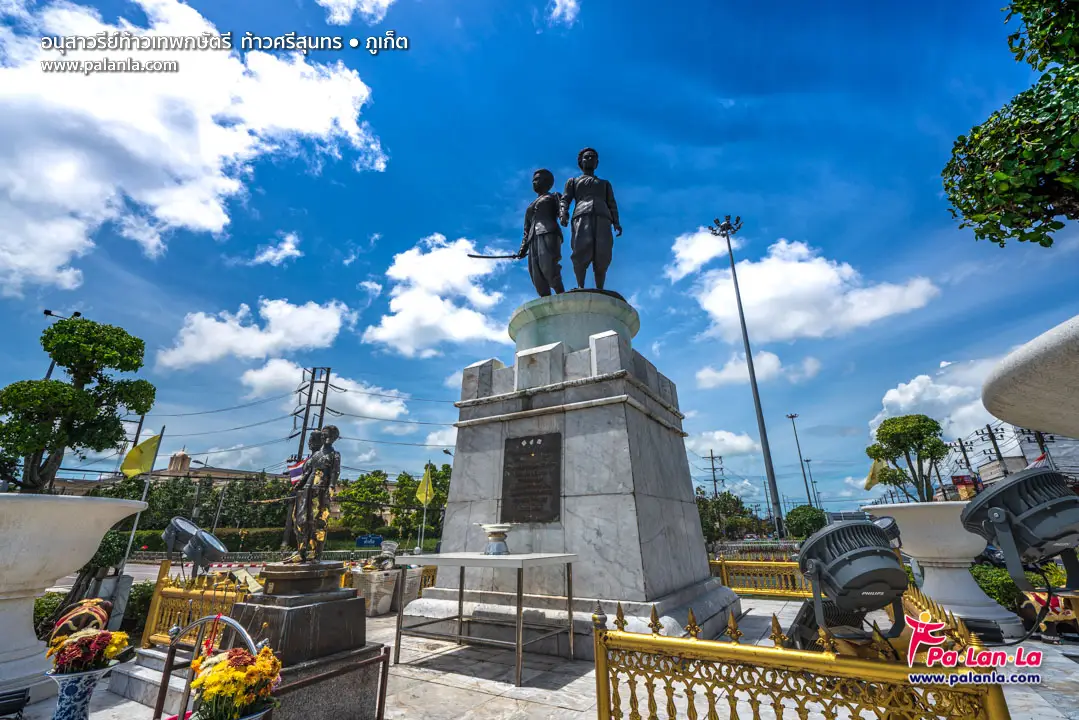
27. Thao Thep Krasattri and Thao Si Sunthon Monument, commonly called the Two Heroines Monument, is one of Phuket’s most important historical landmarks. It commemorates the two sisters associated with the defense of Thalang against the Burmese army in 1785 and has become an enduring symbol of Phuket’s local identity and historical pride.
For local residents, the monument is more than a traffic landmark. It is also a place of respect where people stop to pay tribute and seek blessings, particularly when traveling through Thalang and toward other parts of northern Phuket.
The story of the two heroines is closely connected with Thalang’s temples, historic communities, museums, and other heritage locations. Travelers who want to understand this history in greater depth should combine the monument with Thalang National Museum, Wat Phra Thong, Wat Phra Nang Sang, and other historical sites in the district.
The monument stands at an important road junction, so visitors should use designated areas and remain aware of traffic. Stopping vehicles on active traffic lanes for photography or worship should be avoided.
Getting There: From Phuket Town, follow Thepkrasattri Road or Highway 402 north toward Thalang District. The monument stands on the main route and functions as an important junction for continuing toward Si Sunthon, Choeng Thale, Pa Klok, and northern Phuket.
Map (GPS): https://maps.app.goo.gl/eMKJ33NNyfrKPyVA7
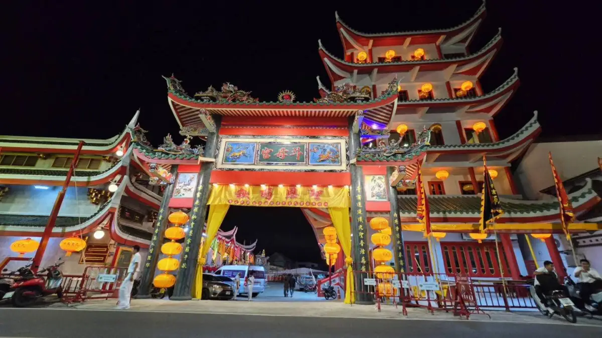
28. Kathu Shrine is a historic Chinese shrine on Wichit Songkhram Road in Kathu Subdistrict, Kathu District. It is closely connected with the history of Phuket’s former tin-mining communities and is especially significant in relation to the Phuket Vegetarian Festival.
Kathu was historically one of the island’s major mining areas and was home to a substantial Hokkien Chinese community. The shrine therefore served not only as a religious center but also as a social and cultural gathering place for workers and families who settled around the mines.
Local tradition closely links Kathu Shrine with the origins of the Vegetarian Festival in Phuket. This connection makes it an important stop for travelers interested in understanding how Chinese religious practices became one of the island’s most internationally recognized cultural traditions.
The shrine contains deity images, offering areas, ceremonial spaces, and traditional Chinese decorative elements. Visitors should dress respectfully and avoid interfering with ceremonies, particularly during the Vegetarian Festival when parts of the shrine may be used intensively for religious activities.
Getting There: From Phuket Town, follow Wichit Songkhram Road toward Kathu District. The shrine is located within the Kathu community and can be combined conveniently with Phuket Mining Museum, Kathu Waterfall, and Kathu Local Heritage Conservation Center.
Map (GPS): https://maps.app.goo.gl/xtV75GKdqcysHnd8A
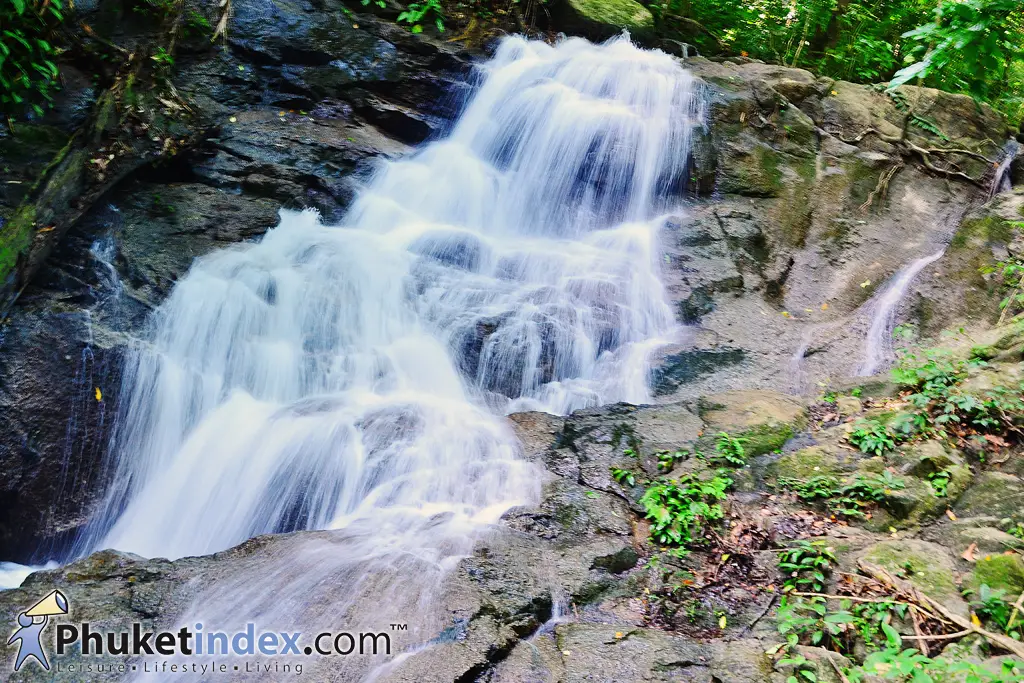
29. Kathu Waterfall is a natural waterfall in Kathu Subdistrict, Kathu District, and one of the attractions that shows Phuket has more to offer than beaches and islands. The waterfall lies among green inland hills, with water flowing over rock formations beneath shaded forest vegetation.
Rather than a single dramatic vertical drop, Kathu Waterfall consists of a series of smaller cascades and pools. Reaching the upper sections requires walking along steps and pathways that can become slippery, especially after rain, so suitable non-slip footwear is recommended.
The rainy season usually brings stronger water flow and greener surroundings, although it also increases the risk of slippery surfaces and rapidly changing stream conditions. During the dry season, water levels may fall considerably, so the character of the waterfall changes throughout the year.
Kathu Waterfall can be combined with Kathu Shrine, Phuket Mining Museum, Bang Wad Dam, and other attractions in Kathu District. Together, these sites create an inland Phuket itinerary that is very different from the island’s beach-focused routes.
Getting There: From Phuket Town, follow Wichit Songkhram Road toward Kathu, then turn onto the local road leading to Kathu Waterfall. The final approach passes through a community area and includes some sloping road sections.
Map (GPS): https://maps.app.goo.gl/fgaP89CA85UYQMYm9
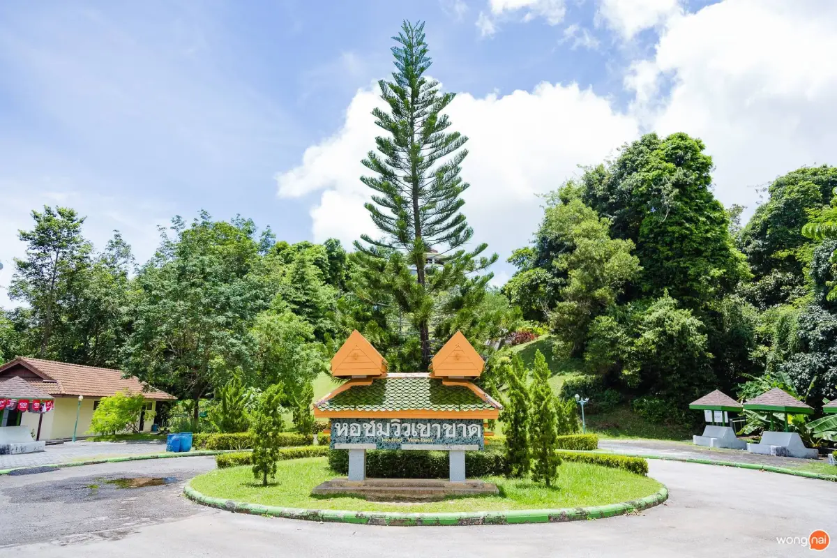
30. Khao Khad View Tower is located in Wichit Subdistrict, Mueang Phuket District, in the Makham Bay area near Cape Panwa. It is one of Phuket’s notable elevated viewpoints and offers broad views in several directions over the sea, bays, mountains, Phuket Town, and offshore islands.
The viewpoint is centered around an octagonal observation tower on the hilltop. Visitors climb a series of steps from the parking area to reach the upper viewing level, where clear-weather views can extend toward Chalong Bay, Cape Panwa, Makham Bay, Ko Sire, Phuket Town, Nakkerd Hill, and parts of the island’s eastern coastline.
One of Khao Khad’s strengths is that it is not limited to a single west-facing sunset panorama. The elevated position helps visitors understand Phuket’s wider geography, including hills, urban areas, mangroves, bays, marinas, and coastal communities.
Morning and late afternoon are generally the most comfortable times to visit because temperatures are lower and the light creates stronger definition across the sea and surrounding hills. Khao Khad View Tower can be combined easily with Ao Yon, Cape Panwa Viewpoint, Phuket Aquarium, and Makham Bay.
Getting There: From Phuket Town, follow Sakdidej Road toward Makham Bay and Cape Panwa. Before reaching the end of the cape, take the turn leading uphill to Khao Khad. The road is steep and winding in places, so drivers and motorcyclists should proceed carefully.
Map (GPS): https://maps.app.goo.gl/sG8s6RByXNnzKFK37
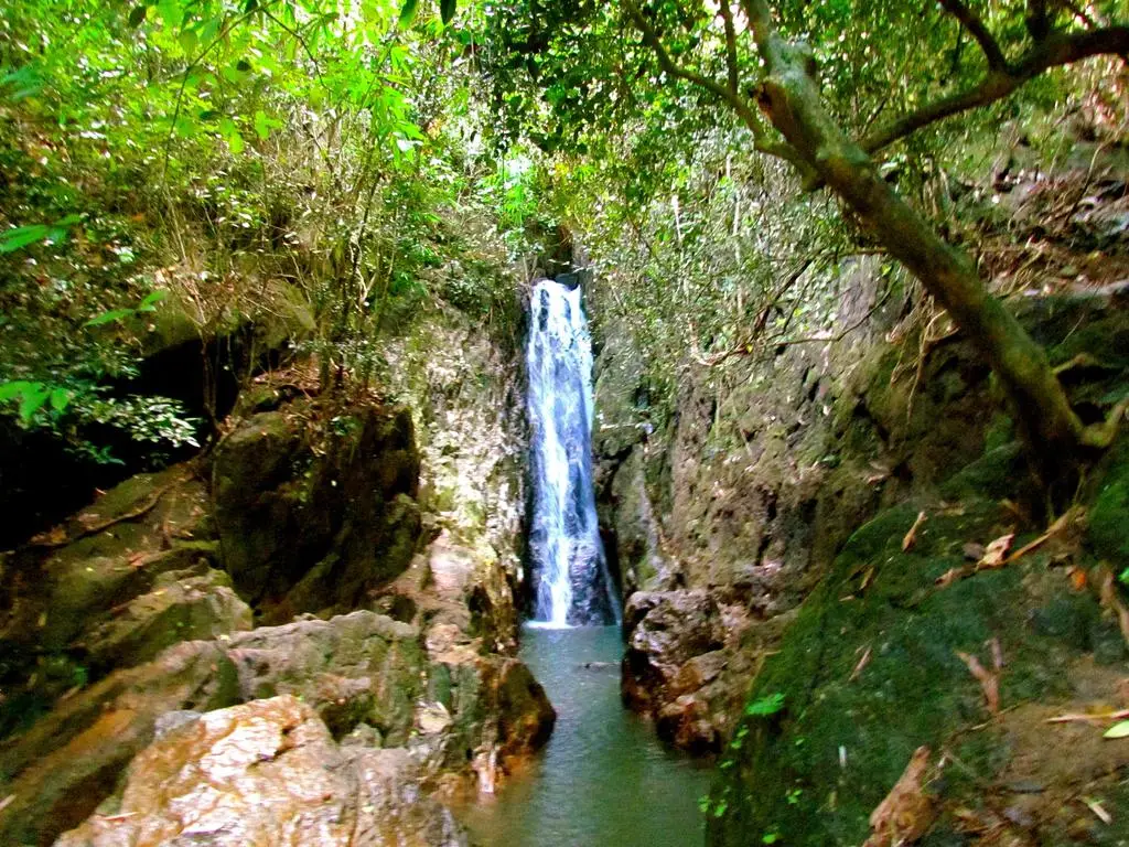
31. Bang Pae Waterfall is a natural waterfall in Pa Klok Subdistrict, Thalang District, within the Khao Phra Thaeo forest area, one of Phuket’s most important remaining natural forest landscapes. Water flows over rocks beneath dense tropical vegetation, showing a very different side of Phuket from its beaches and resort districts.
Bang Pae is not a particularly large waterfall, but its appeal comes from the surrounding rainforest environment and its close relationship with the Khao Phra Thaeo conservation area. Access is relatively straightforward, making it suitable for families and travelers who want to experience Phuket’s inland nature without undertaking a long-distance trek.
The rainy season and the period immediately afterward generally bring greener forest scenery and stronger water flow. However, wet rocks can become very slippery and stream levels may change quickly. Visitors should wear suitable footwear, avoid climbing on wet rocks, and stay away from the water during heavy rain or when currents become unusually strong.
Bang Pae Waterfall can be combined with Khao Phra Thaeo Wildlife Conservation Development and Extension Station, Ton Sai Waterfall, Wat Phra Thong, and other attractions around Pa Klok and Thalang, creating a full-day route focused on nature, history, and local heritage.
Getting There: From Phuket Town, follow Thepkrasattri Road past the Two Heroines Monument, then turn onto Route 4027 toward Pa Klok Subdistrict and follow signs to Bang Pae Waterfall.
Map (GPS): https://maps.app.goo.gl/bGaUreb9ZeLUdgHUA
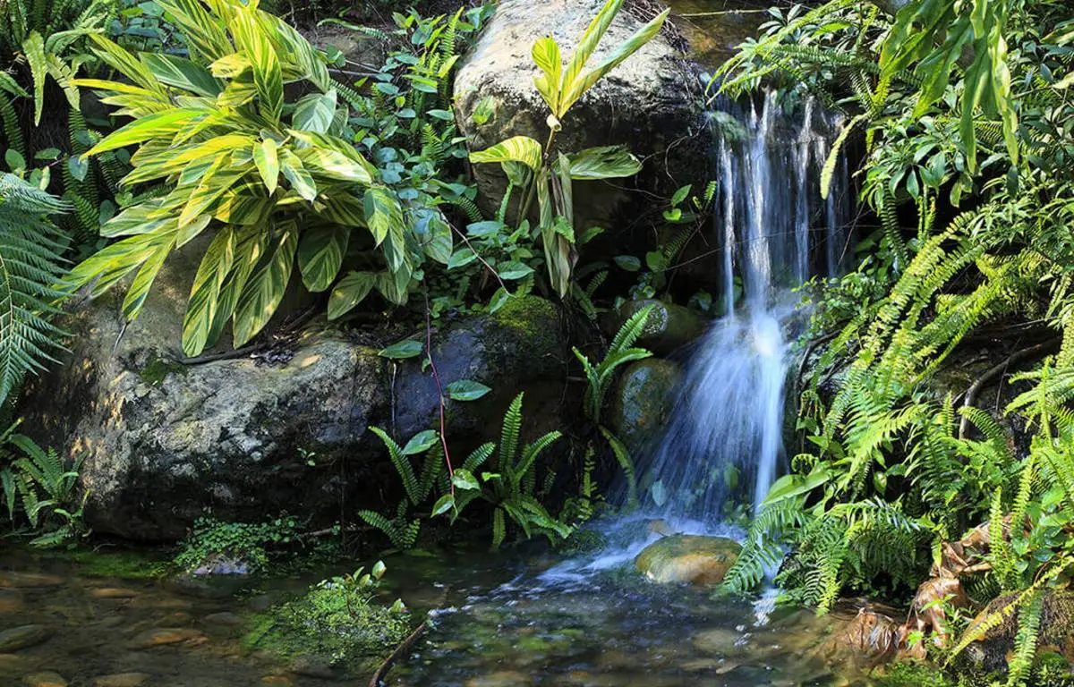
32. Khao Phra Thaeo Wildlife Conservation Development and Extension Station is an important nature-conservation area in Thalang District and forms part of the Khao Phra Thaeo forest, one of Phuket’s most significant remaining natural forest ecosystems. The landscape includes tropical evergreen forest, streams, nature trails, and wildlife habitats.
Khao Phra Thaeo is important as both a watershed and a center of biodiversity conservation. Its forest helps maintain ecological balance on an island where urban development, residential expansion, and tourism have transformed large areas of the natural landscape.
Visitors can learn about forest ecology, wildlife, and conservation through the station and nearby nature areas. Wildlife should be observed quietly without feeding animals, collecting plants, leaving established trails, or creating unnecessary noise.
The conservation area is closely connected with Bang Pae Waterfall and Ton Sai Waterfall, making this one of Phuket’s best zones for travelers who want to experience rainforest, streams, and inland ecology rather than focusing exclusively on beaches and marine activities.
Getting There: From Phuket Town, follow Thepkrasattri Road north toward Thalang District, then continue to the Khao Phra Thaeo area. A visit can be combined with Bang Pae Waterfall, Ton Sai Waterfall, and Wat Phra Thong.
Map (GPS): https://maps.app.goo.gl/EVR4BhjcJt6E8X4o8
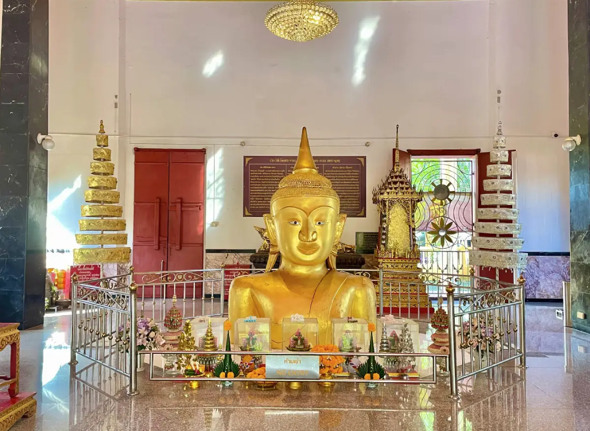
33. Wat Phra Thong, also widely known as Wat Phra Phut, is one of Thalang’s most distinctive Buddhist temples. Its best-known feature is a sacred Buddha image whose head and upper body appear above ground, giving rise to the local name “Phra Phut,” meaning the Emerging Buddha.
Several legends explain the origin of the image, but they share a central theme: attempts to excavate or move the sacred Buddha image were unsuccessful, leading local people to preserve it in its original position and establish the temple around it. Today, it remains one of Phuket’s most revered religious landmarks.
The temple also contains the Wat Phra Thong Museum, where old objects, local household items, and materials connected with traditional Thalang life are preserved. A visit therefore combines Buddhist worship with an opportunity to learn about local history and community heritage.
Wat Phra Thong can be combined with Wat Phra Nang Sang, Thalang National Museum, the Two Heroines Monument, and Khao Phra Thaeo. Together, these attractions create one of the most complete historical and cultural routes in northern Phuket.
Getting There: From Phuket Town, follow Thepkrasattri Road north toward Thalang District. After passing the main Thalang intersection, continue toward the access road for Wat Phra Thong. The temple is approximately 21 kilometers from Phuket Town.
Map (GPS): https://maps.app.goo.gl/RnQLGzoZiAr6CsrP7
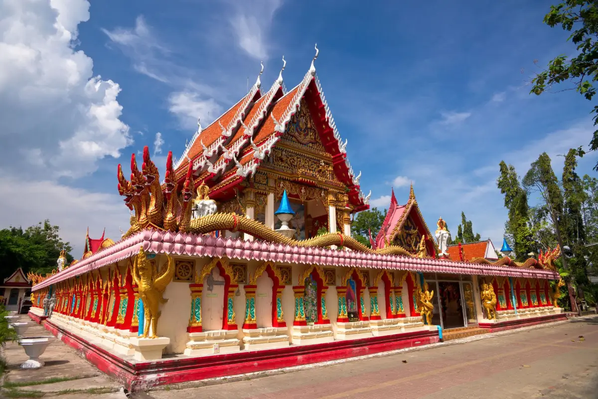
34. Wat Phra Nang Sang is an old Buddhist temple in Thalang District with religious, historical, and local cultural significance. Located close to Thalang’s main road network, the temple is frequently included in routes exploring the history of the Battle of Thalang and the development of communities in northern Phuket.
Local traditions connect the temple with stories about the woman believed to have founded it, as well as old Buddha images and sacred objects preserved within the temple grounds. Architectural elements also reflect the development of Buddhist communities in southern Thailand.
Within the wider historical context of Phuket, Wat Phra Nang Sang is associated with communities that played a role during the Thalang conflict. Visiting the temple therefore provides useful context for understanding the relationship between Buddhist institutions, local society, and the historical events connected with Thao Thep Krasattri and Thao Si Sunthon.
Visitors should dress modestly, remain quiet around religious buildings, and avoid interfering with ceremonies. Wat Phra Thong, Thalang National Museum, and the Two Heroines Monument can all be visited conveniently on the same route.
Getting There: From Phuket Town, follow Thepkrasattri Road toward Thalang District. The temple is approximately 20 kilometers from the city and lies close to the main road near central Thalang.
Map (GPS): https://maps.app.goo.gl/PSFygWzxLeQgFqZn6
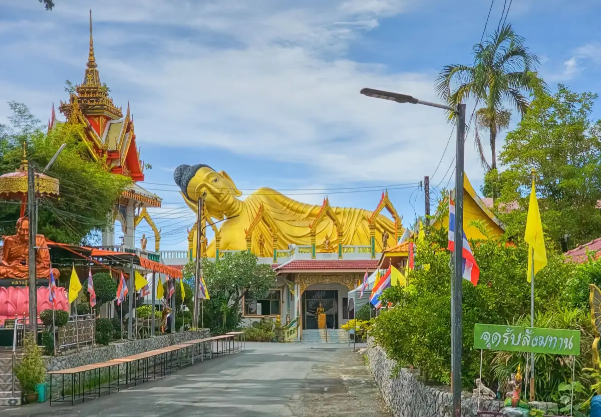
35. Wat Sri Sunthon (Liphon) is located at Ban Liphon, Moo 5, Si Sunthon Subdistrict, Thalang District. It is an important temple on the northern Phuket route and is especially recognizable for its large reclining Buddha image positioned high above one of the temple buildings and clearly visible from the surrounding area.
The reclining Buddha gives the temple a distinctive visual identity. Visitors can pay respect to the image and explore the religious architecture throughout the grounds, while the temple continues to function as an active place of worship for the Si Sunthon community.
Si Sunthon lies along an important road corridor connecting Phuket Town with Thalang, Choeng Thale, Bang Tao, and Pa Klok. The temple therefore works well as a stop between a historical route through Thalang and a beach itinerary along Phuket’s northern west coast.
Visitors should dress appropriately and behave quietly around the ordination hall, viharn, and other religious spaces. Photography should not obstruct worshippers or ceremonies.
Getting There: From Phuket Town, follow Thepkrasattri Road or Highway 402 north toward Thalang. The temple is located in Si Sunthon Subdistrict along the main route and can be combined easily with the Two Heroines Monument and attractions around Choeng Thale.
Map (GPS): https://maps.app.goo.gl/idDNV9wFwqkS5FfW7
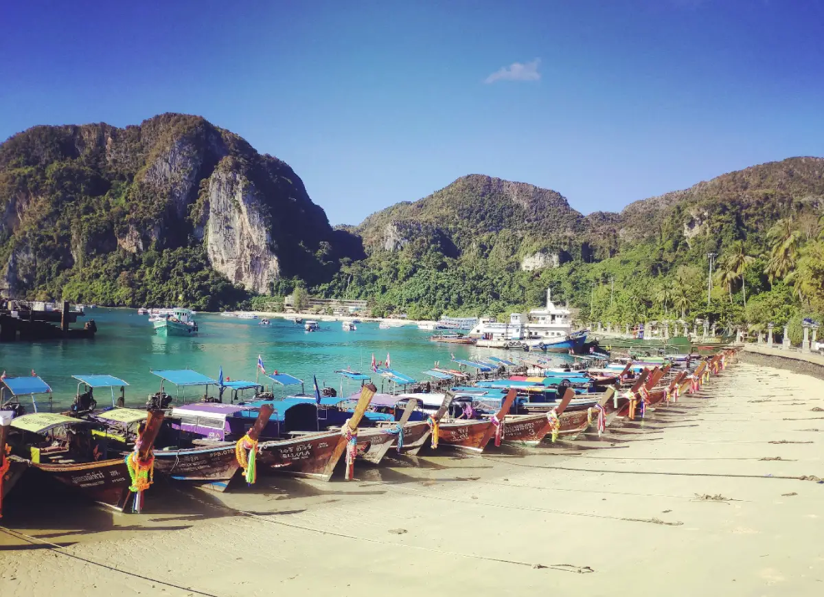
36. Koh Sirey lies in Ratsada Subdistrict, Mueang Phuket District, on the eastern side of Phuket Town. Although it is called an island, it is connected to the main island by road and bridge, allowing visitors to reach it easily by car or motorcycle without taking a boat.
Koh Sirey combines coastal communities, fishing culture, Wat Koh Sirey, viewpoints, and areas associated with Chao Lay communities. It is a useful destination for travelers who want to experience Phuket’s eastern coastline, where daily life is more closely connected with fishing, ports, and local neighborhoods than with large resort beaches.
Wat Koh Sirey, located on a hill, is one of the area’s best-known landmarks and features a reclining Buddha along with elevated views over the surrounding community. Around the island, visitors can also see fishing boats, seafood restaurants, and coastal roads overlooking nearby islands and the sea.
Travelers should respect residential and community areas, particularly around Chao Lay settlements. People should not be photographed without permission, and private property should never be entered simply to obtain photographs.
Getting There: From Phuket Old Town, travel toward Ratsada Subdistrict and Ratsada Pier, then continue across the connecting road and bridge to Koh Sirey. No boat is required.
Map (GPS): https://maps.app.goo.gl/WYTkHduN3SMpYxJN8
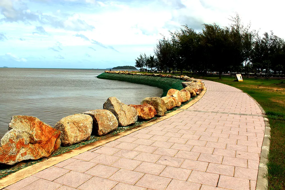
37. Saphan Hin is a seaside public park and one of Phuket Town’s main recreational areas. Located at the southern end of Phuket Road, it provides a green transition between the urban center and the island’s eastern shoreline and is widely used for recreation, exercise, community activities, and public events.
The waterfront includes space for walking, jogging, exercising, relaxing, and enjoying the sea breeze. Local residents gather here in particularly large numbers during the evening, making Saphan Hin a good place for travelers who want to see everyday Phuket life beyond the island’s tourist beaches.
Saphan Hin also has links with Phuket’s tin-mining history. The Mining Monument, commonly associated with the 60th Anniversary Monument, commemorates the industry that once shaped much of the island’s economy and urban development.
The park is easy to visit after exploring Phuket Old Town, museums, or local restaurants. Late afternoon and evening are generally the most pleasant times because temperatures are lower and the waterfront becomes more active with local residents.
Getting There: From Phuket Old Town, follow Phuket Road south toward the eastern shoreline until reaching Saphan Hin. The area can be reached easily by private car, motorcycle, taxi, or local transport.
Map (GPS): https://maps.app.goo.gl/7qTUgNytCzrXuzuL7
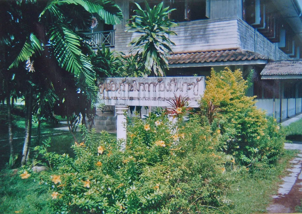
38. Kathu Local Heritage Conservation Center is located within Ban Kathu School in Moo 2, Kathu District. The center preserves stories of the Kathu community, once one of Phuket’s major tin-mining areas, and connects the history of Chinese laborers, mining life, community development, and Kathu’s transformation from a mining settlement into a modern urban and tourism district.
Its strength lies in presenting history at the community level through photographs, objects, tools, and stories about daily life. This provides a useful complement to Phuket Mining Museum, which presents the tin-mining story on a larger and more systematic scale.
Travelers interested in the Phuket Vegetarian Festival can use the center as useful background before visiting Kathu Shrine. Together, the two places explain the relationship between Phuket’s mining communities, Hokkien Chinese migration, religious traditions, and the development of one of the island’s most important annual festivals.
Because the center is located within school grounds, visitors should respect school regulations and visit at appropriate times. Groups may need to coordinate in advance so that visits do not interfere with normal school activities.
Getting There: From Phuket Town, follow Wichit Songkhram Road toward Kathu District and continue to Ban Kathu School. The center can be combined with Kathu Shrine, Phuket Mining Museum, Kathu Waterfall, and Bang Wad Dam.
Map (GPS): https://maps.app.goo.gl/skN2bR8Dbocrcncz7
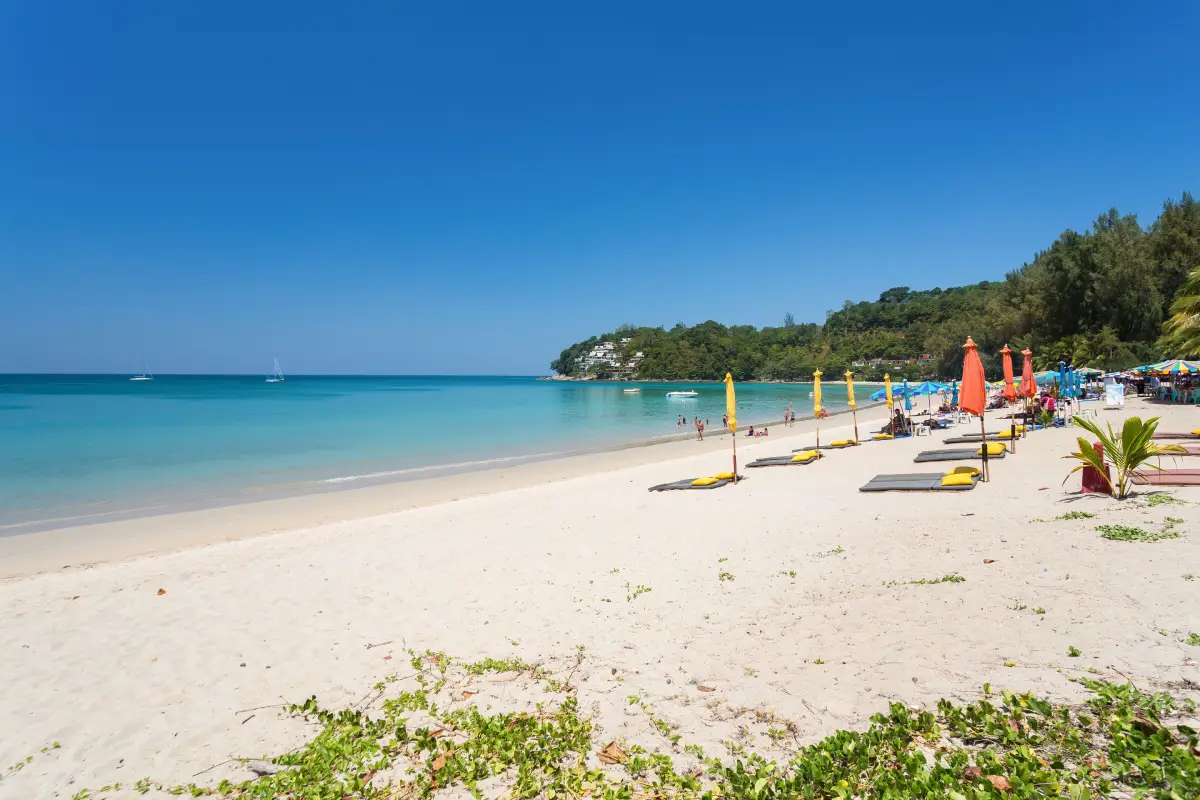
39. Kamala Beach is an important west-coast beach in Kamala Subdistrict, Kathu District, between Patong and Surin Beach. Its long curved shoreline has a local community immediately behind it, creating a setting where resort tourism and everyday community life exist side by side.
Kamala is suitable for walking, relaxing, swimming when sea conditions are safe, and watching the sunset. Restaurants, accommodation, and tourism services are available at several levels, but the overall atmosphere is generally quieter than Patong, making the area popular with families, couples, and travelers who prefer the west coast without a strong nightlife focus.
Kamala is also home to an established Muslim community that forms an important part of the area’s identity. Visitors will see mosques, halal restaurants, traditional neighborhoods, and modern tourism businesses within the same district, reflecting Phuket’s broader cultural diversity.
During the monsoon season, visitors should observe warning flags and avoid swimming when waves are strong. Kamala Beach can be combined conveniently with Surin Beach, Bang Tao Beach, Patong, and other attractions around Kamala.
Getting There: From Patong, follow coastal Route 4030 north toward Kamala. Travelers coming from Choeng Thale and Surin can follow the same road south. Several sections are hilly and winding, so careful driving is recommended.
Map (GPS): https://maps.app.goo.gl/icUbEwLA1at1uhtx6
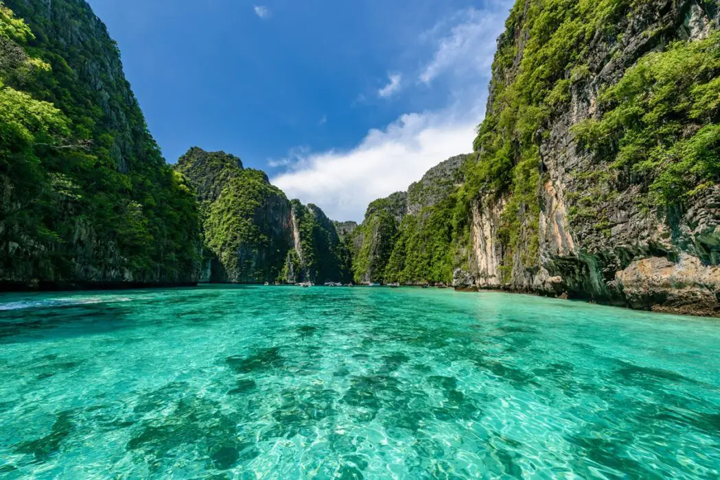
40. Ao Por Beach is located at Ban Ao Por, Moo 6, Pa Klok Subdistrict, Thalang District, on Phuket’s eastern coast. The area offers views of sheltered bays, offshore islands, and numerous boats, creating a landscape that differs markedly from the sandy, wave-facing beaches of Phuket’s western coastline.
Ao Por includes coastal communities, piers, and marina facilities and functions as one of Phuket’s important marine gateways toward Phang Nga Bay and islands east of Phuket. The scenery includes relatively calm water, yachts, excursion boats, and distant limestone islands.
The area is better suited to walking, sightseeing, photography, and experiencing Phuket’s eastern maritime atmosphere than to conventional beach swimming. Travelers interested in marinas and island views will find a very different coastal character here compared with Kata, Karon, or Patong.
Ao Por can be combined with Bang Pae Waterfall, Pa Klok, Khao Phra Thaeo, and historical attractions around Thalang. This creates a varied northeastern Phuket route combining nature, local communities, and coastal scenery.
Getting There: From Phuket Town, follow Thepkrasattri Road toward the Two Heroines Monument, then take Route 4027 through Pa Klok toward Ban Ao Por and the marina area.
Map (GPS): https://maps.app.goo.gl/J7Vdn6KtJX1B2Hxe8
| Topic | Details |
| Province | Phuket, Southern Thailand. Thailand’s largest island combines beaches, mountains, forest, bays, offshore islands, historic communities, and a distinctive multicultural heritage. |
| Travel Overview | Phuket offers beaches, islands, snorkeling, boat trips, viewpoints, sunsets, Buddhist temples, Chinese shrines, Old Town heritage, museums, tin-mining history, rainforest, waterfalls, local communities, and distinctive Southern Thai and Hokkien-influenced cuisine. |
| Top 10 Highlights | 1. Patong Beach 2. Kata Beach 3. Karon Beach 4. Promthep Cape 5. Wat Chalong 6. Phuket Big Buddha 7. Phuket Old Town 8. Nai Harn Beach 9. Kata Karon Viewpoint 10. Sarasin Bridge |
| Recommended Beaches | Patong, Kata, Karon, Nai Harn, Mai Khao, Nai Yang, Surin, Nai Thon, Bang Tao, Kamala, and Ao Por. |
| Sea, Islands and Piers | Koh Hae (Coral Island), Koh Sirey, Ao Chalong Tourist Pier, Ao Por, Cape Panwa, and Phuket’s eastern coastal communities. |
| Viewpoints and Sunsets | Promthep Cape, Kata Karon Viewpoint, Khao Khad View Tower, Cape Panwa Viewpoint, Khao Rang, and many beaches along Phuket’s western coastline. |
| Nature, Forests and Waterfalls | Sirinat National Park, Kathu Waterfall, Bang Pae Waterfall, and Khao Phra Thaeo Wildlife Conservation Development and Extension Station. |
| Temples and Religious Sites | Wat Chalong, Phuket Big Buddha, Wat Phra Thong, Wat Phra Nang Sang, and Wat Sri Sunthon. |
| Chinese Shrines and Heritage | Jui Tui Shrine and Kathu Shrine are key places for understanding Phuket’s Hokkien Chinese religious traditions and the Phuket Vegetarian Festival. |
| Old Town and Architecture | Phuket Old Town, Sino-Portuguese buildings, Baan Chinpracha, Phuket Thai Hua Museum, and historic streets including Thalang Road, Krabi Road, Dibuk Road, and Phang Nga Road. |
| Museums and Learning Centers | Phuket Thai Hua Museum, Phuket Mining Museum, Thalang National Museum, Kathu Local Heritage Conservation Center, and Phuket Aquarium. |
| Historical Themes | The Battle of Thalang and the Two Heroines, Phuket’s tin-mining era, Hokkien Chinese migration, the growth of Phuket Town, and regional development associated with Phraya Ratsadanupradit. |
| Communities and Local Life | Baba-Peranakan communities in Phuket Old Town, former mining communities in Kathu, Muslim communities around Kamala and coastal areas, fishing communities along the eastern coast, and Chao Lay communities around Koh Sirey. |
| Local Food to Try | Hokkien noodles, mee hoon with pork-bone soup, moo hong, o-tao, lo ba, a-pong, o-aew, shrimp-paste chili dip, fresh seafood, and halal cuisine from Phuket’s Muslim communities. |
| Important Cultural Traditions | Baba-Peranakan culture, Hokkien Chinese traditions, the Phuket Vegetarian Festival, Chinese shrine culture, local cuisine, Sino-Portuguese architecture, Muslim community traditions, and Chao Lay coastal culture. |
| Top Activities | Swimming, beach relaxation, snorkeling, island hopping, sunset watching, Old Town walks, local-food exploration, temple visits, Chinese shrine visits, museum trips, light forest walks, and waterfall excursions. |
| Mueang Phuket District | Kata, Karon, Nai Harn, Promthep Cape, Wat Chalong, Phuket Big Buddha, Phuket Old Town, Baan Chinpracha, Phuket Thai Hua Museum, Jui Tui Shrine, Cape Panwa, Khao Khad, Chalong Pier, Coral Island, Koh Sirey, and Saphan Hin. |
| Kathu District | Patong Beach, Kamala Beach, Kathu Waterfall, Kathu Shrine, Phuket Mining Museum, and Kathu Local Heritage Conservation Center. |
| Thalang District | Sarasin Bridge, Phuket Gateway, Mai Khao Beach, Sirinat National Park, Surin Beach, Nai Thon Beach, Bang Tao Beach, Thalang National Museum, Two Heroines Monument, Khao Phra Thaeo, Bang Pae Waterfall, Wat Phra Thong, Wat Phra Nang Sang, Wat Sri Sunthon, and Ao Por. |
| Best For | Families, couples, groups of friends, international travelers, beach lovers, photographers, history and culture travelers, food enthusiasts, road-trip travelers, and visitors who want to experience Phuket beyond its beaches. |
| Getting to Phuket | Phuket can be reached by air through Phuket International Airport, as well as by private car, bus, or van from nearby provinces. Road travelers enter the island across the bridges connecting Phuket with Phang Nga. |
| Getting Around Phuket | A rental car or private vehicle is the most convenient option for covering all 40 attractions because they are spread across the island. Motorcycle riders should be experienced with steep and winding roads. Boat transport is required for Coral Island and other offshore activities. |
| 1-Day Itinerary | Morning: Phuket Old Town – Phuket Thai Hua Museum – Baan Chinpracha Late Morning: Wat Chalong Afternoon: Kata Beach – Kata Karon Viewpoint – Nai Harn Beach Evening: Promthep Cape |
| 2-Day Itinerary | Day 1: Old Town – Wat Chalong – Kata – Karon – Nai Harn – Promthep Cape Day 2: Sarasin Bridge – Phuket Gateway – Mai Khao – Nai Yang – Nai Thon – Surin – Bang Tao |
| 3-Day Itinerary | Day 1: Old Town and cultural attractions Day 2: West-coast beaches and southern Phuket Day 3: Thalang National Museum – Two Heroines Monument – Wat Phra Thong – Khao Phra Thaeo – Bang Pae Waterfall |
| 4–5 Day Itinerary | Add Coral Island, Chalong Pier, Cape Panwa, Khao Khad, Koh Sirey, Saphan Hin, Kathu, Phuket Mining Museum, Kathu Shrine, Kathu Waterfall, and quieter beaches in northern Phuket. |
| For Beach Lovers | Patong, Kata, Karon, Nai Harn, Surin, Bang Tao, Nai Thon, Mai Khao, Nai Yang, Kamala, and Coral Island. |
| For History and Culture | Phuket Old Town, Phuket Thai Hua Museum, Baan Chinpracha, Phuket Mining Museum, Thalang National Museum, Two Heroines Monument, Wat Phra Thong, Jui Tui Shrine, and Kathu Shrine. |
| For Nature Lovers | Khao Phra Thaeo, Bang Pae Waterfall, Kathu Waterfall, Sirinat National Park, Mai Khao Beach, Nai Thon Beach, and Phuket’s quieter northern coastline. |
| For Photographers | Phuket Old Town, Promthep Cape, Kata Karon Viewpoint, Khao Khad View Tower, Cape Panwa, Mai Khao Beach, Surin Beach, and west-coast beaches around sunset. |
| Best Season for Sea Travel | Generally, November through April tends to offer calmer Andaman Sea conditions and is more suitable for beach and boat activities. During the monsoon season, always check rain, wind, waves, and official safety warnings. |
| Beach Safety | Phuket’s western beaches can experience high waves and rip currents, particularly during the monsoon season. Never swim when red flags are displayed, and families with children or weak swimmers should choose supervised areas whenever possible. |
| Before Island Trips | Check the weather, wind, waves, departure pier, boat schedule, life jackets, return time, and what is included in the price. Choose responsible operators that follow marine-safety standards and avoid activities that damage coral reefs. |
| Responsible Travel | Do not litter, step on coral, touch marine animals, feed wildlife, remove natural materials, interfere with ceremonies in temples or shrines, or enter private community areas without permission. Respect local residents and Chao Lay communities when taking photographs. |
Frequently Asked Questions (FAQ)
Q: What are the best places to visit in Phuket for first-time travelers?
A: A first trip should include Patong Beach, Kata Beach, Karon Beach, Promthep Cape, Wat Chalong, Phuket Old Town, and Kata Karon Viewpoint. If time allows, add Thalang’s historical attractions or a day trip to Coral Island.
Q: What is a good one-day Phuket itinerary?
A: Start in Phuket Old Town with Phuket Thai Hua Museum and Baan Chinpracha, continue to Wat Chalong, visit Kata Beach and Kata Karon Viewpoint in the afternoon, stop at Nai Harn Beach, and finish with sunset at Promthep Cape.
Q: How should travelers plan a 3-day Phuket trip?
A: Use the first day for Phuket Old Town and cultural attractions, the second day for the west-coast beaches and southern Phuket, and the third day for Thalang, Khao Phra Thaeo, waterfalls, temples, or an island trip depending on your interests.
Q: Which Phuket beaches are best for travelers who prefer quieter surroundings?
A: Nai Thon, Mai Khao, Surin, Nai Harn, and quieter sections of Bang Tao generally feel more relaxed than Patong. Actual crowd levels vary according to season, weekends, and the section of beach visited.
Q: Are there things to do in Phuket besides beaches?
A: Yes. Phuket Old Town, Phuket Thai Hua Museum, Baan Chinpracha, Phuket Mining Museum, Thalang National Museum, Wat Chalong, Wat Phra Thong, Jui Tui Shrine, Kathu Shrine, Kathu Waterfall, Bang Pae Waterfall, and Khao Phra Thaeo all offer alternatives to beach tourism.
Q: Where are the best places to watch sunset in Phuket?
A: Promthep Cape is the classic sunset viewpoint, while Kata, Karon, Surin, Bang Tao, Kamala, Nai Harn, and many other west-facing beaches also offer excellent evening views.
Q: Is renting a car recommended for Phuket?
A: It is not essential, but it is highly convenient for visiting attractions across the island. The 40 places in this guide stretch from Mai Khao and Thalang in the north to Rawai and Promthep Cape in the south. Motorcycle riders should be confident on steep and winding roads.
Q: What is the best time of year for Phuket beaches and island trips?
A: November through April generally offers calmer Andaman Sea conditions and is usually better for beach and boat activities. Weather can still change quickly, so always check forecasts, wind, waves, warning flags, and local marine advisories before swimming or departing by boat.
 Category: ●Travel Articles, Recipes
 Group: ●Travel Review, Food Review
Last Update : 3 WeekAgo
 Last Update : 3 WeekAgo
Recommend

 Art, Culture and Heritage
 Landmarks and Memorials(7)
 Art, Craft Centres, Tradition(5)
 Museums(4)
 Historic Homes and Cities(1)
 Art Gallery(1)
 Educational Places
 Educational Gardens, Farm(2)
 Places of Worship
 Temple(14)
 Mosque(47)
 Other Sacred Sites(15)
 Suburban Living
 Village, Community(2)
 Floating Market(1)
 Nature and Wildlife
 National Parks and Marine Reserves(2)
 Mountain (Doi)(2)
 Dam, Reservoir, Lake(1)
 Waterfalls(4)
 Bays and Beaches(30)
 Islands(12)
 Other natural attractions(10)
 Entertainment and Agricultural
 Zoos and Aquariums(2)
 Stadium(2)
 Farms, Parks and Ecotourism(4)
 Amusement Park(2)
 Waterpark(6)
 Theater(1)
 Outdoor and Adventure Activities(1)
 Shopping
 Shopping and Night Market(1)
Travel Review, Food Review(1)
 Southern Food Menu, Southern Food Recipes(5)


