
lovethailand home >North Travel Attractions >Uthai Thani Travel Attractions > 20 Best Places to Visit in Uthai Thani Northern Th..
TL;DR: 20 Best Places to Visit in Uthai Thani Northern Thailand, open Daily Opening Hours: 09:00 – 11:30 and 14:00 – 16:00.
20 Best Places to Visit in Uthai Thani Northern Thailand
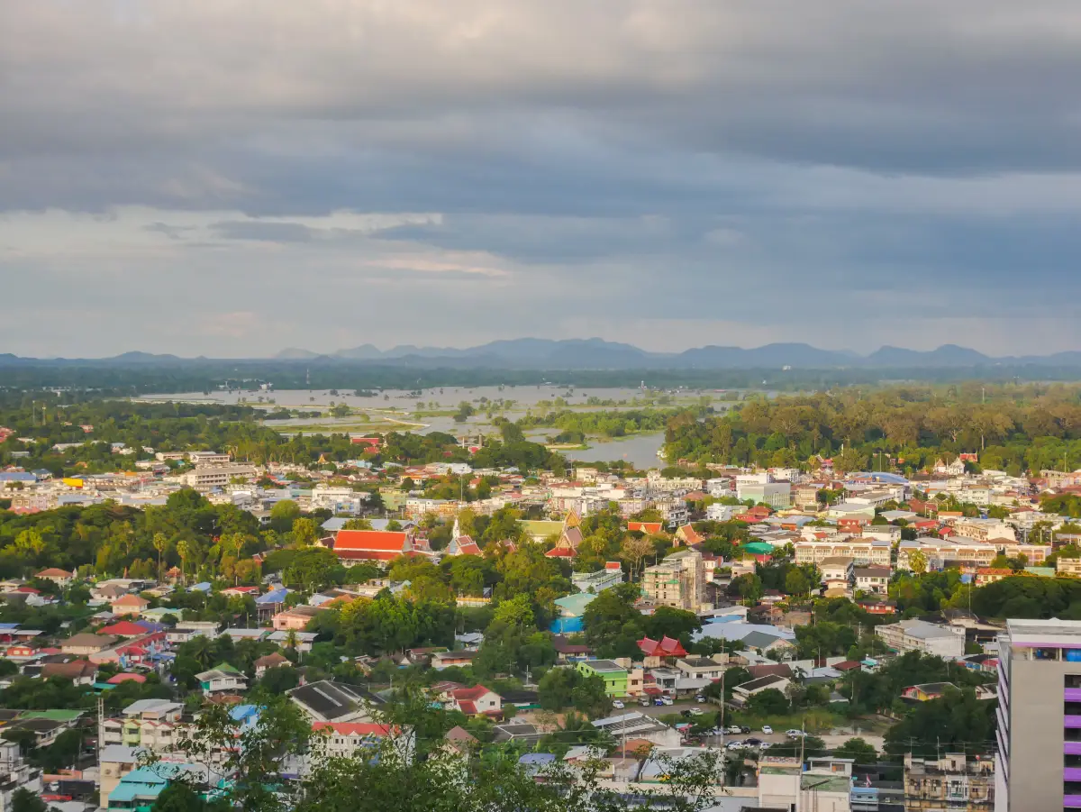
20 Best Places to Visit in Uthai Thani, Northern Thailand Uthai Thani is a relatively small province with a distinctive charm shaped by the peaceful atmosphere of the Sakae Krang River, the vast forests of western Thailand, remarkable Buddhist temples, old communities, agricultural traditions, and landscapes that gradually change from lowlands into mountains, caves, waterfalls, and natural forests toward the west. Travelers with only one day can comfortably explore the town, important temples, and old neighborhoods, while a 2–3 day trip allows time for Lan Sak and Ban Rai, including Hup Pa Tat, Wat Tham Khao Wong, waterfalls, and local communities. Longer journeys can extend deeper into the Huai Kha Khaeng forest landscape and other natural areas in western Uthai Thani.
Uthai Thani lies at the transition between Thailand’s central plains and the mountainous landscape of the lower North. The eastern part of the province consists largely of town areas, fertile lowlands, and communities along the Sakae Krang River, while the western side gradually changes into hills, limestone mountains, mixed deciduous forest, evergreen forest, and the Western Forest Complex extending toward Tak and Kanchanaburi. This geographical diversity allows travelers to experience old markets, temples, floating-house communities, caves, waterfalls, and internationally important conservation areas within the same province.
Uthai Thani is closely connected with the early history of the Chakri Dynasty because the area is associated with Somdet Phra Pathom Borom Maha Chanok, the father of King Rama I. Traces of this historical connection can still be found around Khao Sakae Krang and other important places in the town. The province is also home to several long-established communities, including Thai-Chinese residents, Lao Khrang communities, and agricultural villages that continue to preserve their own food traditions, textiles, language, and local customs.
The Sakae Krang River is at the heart of Uthai Thani town. Riverside communities and floating houses reflect a way of life that has been closely tied to the river for generations. Walking through the old market area, Wat Ubosatharam, and Trok Rong Ya reveals a side of Uthai Thani that is very different from larger tourist cities. Visitors can explore at a slow pace, taste local food, buy products from community shops, and experience the atmosphere of a small provincial town that still retains a strong local identity.
Religious attractions in Uthai Thani are remarkably varied. Wat Chantharam, better known as Wat Tha Sung, is famous for its white architecture, glittering glass interiors, and large Buddhist complex. Wat Sangkat Rattana Khiri is one of the province’s most important temples and is closely associated with Khao Sakae Krang and the Tak Bat Thewo tradition. Wat Ubosatharam preserves important riverside art and architecture, while Wat Tham Khao Wong in Ban Rai is known for its multi-storey Thai wooden building set dramatically against limestone mountains and forest.
Uthai Thani’s natural environment is important at both national and international levels. The Thungyai–Huai Kha Khaeng Wildlife Sanctuaries form part of Thailand’s Western Forest Complex and are recognized as a UNESCO Natural World Heritage Site. This exceptional forest landscape makes Uthai Thani an important destination for travelers interested in wildlife, ecosystems, and conservation. More accessible natural attractions such as Hup Pa Tat, Pha Rom Yen Waterfall, and the limestone landscapes of Lan Sak and Ban Rai make nature travel possible even for visitors who are not experienced trekkers.
Local food reflects both the riverside lifestyle and the multicultural communities of the lower North. Visitors can enjoy freshwater fish, traditional Thai dishes, old-fashioned desserts, and food influenced by the town’s Chinese community. Ban Rai is also known for Lao Khrang community products, handwoven textiles, and agricultural goods that make meaningful souvenirs. Travelers interested in local food should allow time for the morning market in town and Trok Rong Ya Walking Street on Saturday evenings.
First-time visitors with limited time can begin with Wat Tha Sung, the Sakae Krang riverside area, Wat Ubosatharam, Trok Rong Ya, Wat Sangkat Rattana Khiri, and Khao Sakae Krang. This route combines Buddhism, history, old-town culture, local communities, and panoramic scenery in a single day. With additional time, dedicate another day to Lan Sak for Hup Pa Tat and Huai Kha Khaeng, and another day to Ban Rai for Wat Tham Khao Wong, waterfalls, and mountain communities.
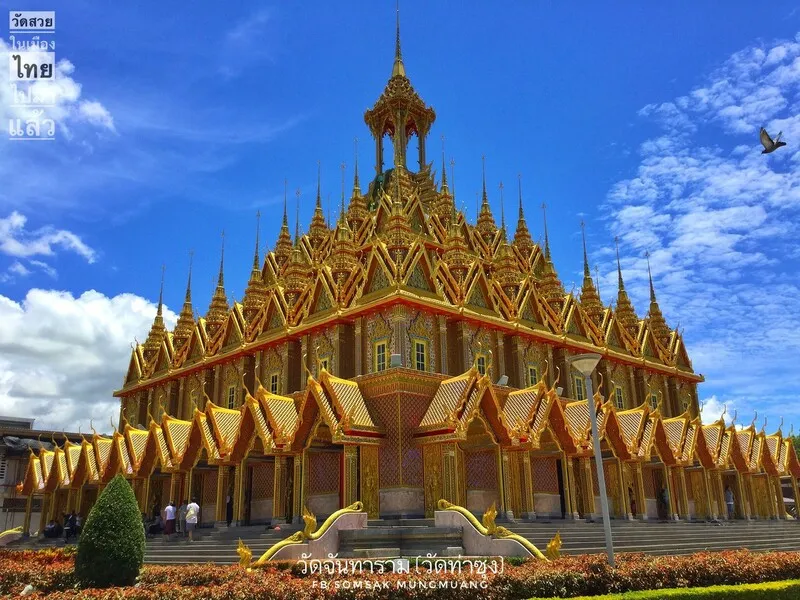
1. Wat Chantharam (Wat Tha Sung) is one of the most important attractions in Uthai Thani Province. Located in Nam Suem Subdistrict, Mueang Uthai Thani District, the temple has roots extending back to the Ayutthaya period, although much of the extraordinary architecture seen today developed under Phra Ratchaphromyan, widely known as Luang Pho Ruesi Ling Dam. His work transformed the temple into a major Buddhist center with architecture unlike almost any other temple complex in the province.
Highlights: The 100-Meter Crystal Hall, Phra Phuttha Chinnarat replica, glass mondop, preserved body of Luang Pho Ruesi Ling Dam, Golden Castle, old ordination hall, folk murals, and extensive Buddhist architecture.
The 100-Meter Crystal Hall is one of the temple’s most memorable spaces. Mirrors and reflective materials cover much of the interior, creating a brilliant glittering effect as light from lamps and windows moves across the hall. A replica of Phra Phuttha Chinnarat is enshrined at the far end, and the hall remains an important place for worship, merit-making, and paying respect to the teachings of Luang Pho Ruesi Ling Dam.
Beyond its modern buildings, Wat Tha Sung also preserves an older ordination hall that reveals the temple’s earlier history. Traditional murals and local artistic details provide a striking contrast with the monumental glass and gold structures created during later development, helping visitors understand that the temple evolved over several different periods.
The complex is extensive, so visitors should allow at least 2 hours and pay attention to the opening periods of major buildings, as some are not continuously accessible throughout the day. Elderly visitors may find transport between different sections more convenient than walking the entire complex. Modest clothing is essential because the temple remains an active religious and meditation center.
After Wat Tha Sung, travelers can continue into Uthai Thani town to visit Wat Ubosatharam, Trok Rong Ya, the riverside market, and Khao Sakae Krang. The temple works particularly well as the first stop of a morning itinerary before entering the old town in the afternoon.
Open Days: Daily Opening Hours: 09:00 – 11:30 and 14:00 – 16:00
Getting There: From Uthai Thani town, take the Uthai Thani–Manorom road or Highway 3265 for approximately 12 kilometers. Visitors can travel by private car, hired local vehicle, or local songthaew on the Uthai Thani–Tha Sung route.
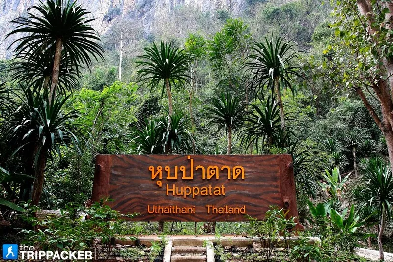
2. Hup Pa Tat is one of Uthai Thani’s most distinctive natural attractions. Located in Thung Na Ngam Subdistrict, Lan Sak District, within Tham Pra Thun Non-Hunting Area, it is a limestone valley hiding a humid forest dominated by large Tat palms. Visitors enter through a dark cave passage before emerging into an enclosed green valley surrounded by high limestone cliffs, creating an atmosphere unlike an ordinary forest trail.
Highlights: Limestone cave passage, Tat palm forest, humid vegetation, natural skylight, limestone cliffs, and a round-trip nature trail of approximately 700 meters.
Tat palms belong to the palm family and are distinguished by their large leaves. Growing densely inside the enclosed valley, they create a scene often compared with a prehistoric forest. High humidity and differences in light levels also support ferns, mosses, and shade-loving plants. Walking through the dark cave and suddenly emerging into the green valley is the defining experience of a visit.
The trail is relatively short and suitable for families, students, photographers, and travelers looking for an accessible nature experience without a strenuous trek. However, the cave section is dark and some areas may be damp or slippery, especially during the rainy season, so footwear with good grip is recommended.
Hup Pa Tat can be combined with Khao Plara and other natural attractions in Lan Sak District. Travelers continuing to Huai Kha Khaeng should allow additional travel time and avoid entering Hup Pa Tat too close to closing time so there is enough time to enjoy the approximately one-hour visit comfortably.
Open Days: Daily Opening Hours: 08:30 – 16:00
Getting There: From Uthai Thani town, take Highway 333 through Nong Chang District, then Highway 3438 on the Nong Chang–Lan Sak route. The entrance to Hup Pa Tat is approximately 1 kilometer before Khao Plara.
Map (GPS):Directions to Hup Pa Tat
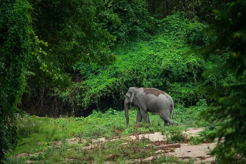
3. Thungyai–Huai Kha Khaeng Wildlife Sanctuaries form one of the largest protected forest landscapes in western Thailand and Thailand’s first Natural World Heritage Site. The World Heritage property extends across Uthai Thani, Tak, and Kanchanaburi provinces. In Uthai Thani, the Huai Kha Khaeng service area in Lan Sak District is the most important public-access point for conservation education and nature study.
Highlights: UNESCO Natural World Heritage status, the Western Forest Complex, exceptional biodiversity, rare wildlife, nature education facilities, the Seub Nakhasathien Memorial, and one of Thailand’s most important conservation landscapes.
The forest contains a wide variety of ecosystems, including hill evergreen forest, dry evergreen forest, mixed deciduous forest, dry dipterocarp forest, grasslands, streams, and watershed areas. The continuity of this vast forest allows wildlife to survive and move across large territories, giving the area ecological importance far beyond that of a conventional nature attraction.
Visitors cannot freely access every part of the wildlife sanctuaries. Conservation is the primary purpose of the area, so general visitors must remain within approved service zones, nature education areas, and officially opened trails. Entering deep forest independently or searching for wildlife outside designated areas is not permitted.
The Seub Nakhasathien Memorial adds another important dimension to a visit, connecting the forest with the modern history of nature conservation in Thailand. The memorial helps visitors understand that protecting a forest of this scale requires scientific research, ranger patrols, policy, long-term public awareness, and the dedication of conservationists.
Huai Kha Khaeng is especially suitable for students, naturalists, conservation-minded families, and documentary photographers. A full-day Lan Sak itinerary can begin at Hup Pa Tat in the morning before continuing to the Huai Kha Khaeng visitor service zone later in the day.
Open Days: Daily Opening Hours: Entry to the service area is permitted from 08:00 – 15:30, and visitors must leave before 17:00
Getting There: The main Huai Kha Khaeng visitor service area is in Rabam Subdistrict, Lan Sak District. A private car is the most practical option from Uthai Thani town, and travelers should allow sufficient driving time because the final approach is well outside the urban area.

4. Wat Sangkat Rattana Khiri stands at the foot of Khao Sakae Krang in Nam Suem Subdistrict, Mueang Uthai Thani District. It is one of the province’s most important temples and is closely connected with local Buddhist faith, Khao Sakae Krang, and the annual Tak Bat Thewo tradition. Its principal sacred image is Phra Phuttha Mongkhon Saksit, a revered bronze Buddha image in the meditation posture.
Highlights: Phra Phuttha Mongkhon Saksit, the 449-step staircase, Buddha footprint replica mondop, large bronze bell, Thai-Chinese religious architecture, panoramic viewpoints, and the Tak Bat Thewo tradition after the end of Buddhist Lent.
The viharn of Phra Phuttha Mongkhon Saksit stands near the foot of the hill and is usually the first place visitors worship before walking or driving toward the summit. The layout naturally connects religious spaces near town with sacred sites higher on Khao Sakae Krang.
The 449-step staircase becomes especially important during Tak Bat Thewo, when monks descend from Khao Sakae Krang after the end of Buddhist Lent while large crowds gather below to offer alms. The ceremony has become one of the defining cultural images of Uthai Thani.
Visitors who do not wish to climb the stairs can drive to the hilltop. Those walking should bring drinking water and avoid the hottest part of the day. The summit includes a Buddha footprint replica, large bell, royal monument, and city viewpoints, so 1–2 hours should be allowed for both the temple and the hill.
The temple can be combined easily with Khao Sakae Krang, Trok Rong Ya, Wat Ubosatharam, and the Sakae Krang riverside market because all are located in or near Uthai Thani town.
Open Days: Daily Opening Hours: 08:00 – 16:30
Getting There: From central Uthai Thani, follow Tha Chang Road toward the foot of Khao Sakae Krang. Visitors can park near the temple and either climb the 449 steps or drive up the hill.
Map (GPS):Directions to Wat Sangkat Rattana Khiri
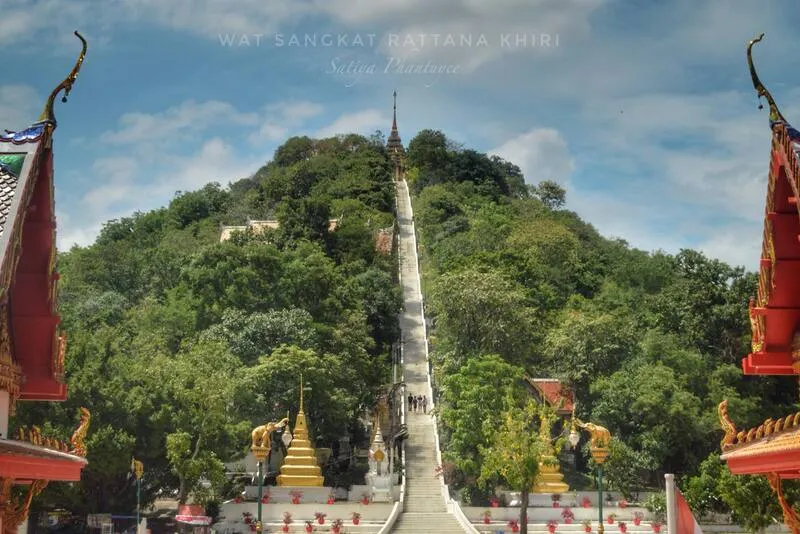
5. Khao Sakae Krang is a small hill immediately beside Uthai Thani town, yet it carries major religious, historical, and scenic importance. Its location makes it particularly convenient for visitors who want panoramic views without traveling far from the old town or riverside areas.
Highlights: Panoramic views over Uthai Thani town, Buddha footprint replica mondop, large bronze bell, monument to Somdet Phra Pathom Borom Maha Chanok Nat, the 449-step staircase, and elevated views across the town and surrounding countryside.
From the summit, visitors can see Uthai Thani’s compact urban area, old neighborhoods, temples, the Sakae Krang River, and agricultural land around the town. This viewpoint makes it easier to understand the geography of Uthai Thani as a small riverside town located almost directly beside a sacred hill.
The monument to Somdet Phra Pathom Borom Maha Chanok Nat connects the hill with the early history of the Chakri Dynasty. At the same time, the Buddha footprint replica and sacred bell reinforce the hill’s role as a religious landscape rather than simply a viewpoint.
Morning and late afternoon generally provide more comfortable temperatures and softer light for photography. During Tak Bat Thewo, parking and access become much busier, so travelers should allow extra time.
Open Days: Daily Opening Hours: 08:00 – 16:30
Getting There: Khao Sakae Krang is directly connected with Wat Sangkat Rattana Khiri and can be reached either by the staircase from the temple or by road to the summit.
Map (GPS):Directions to Khao Sakae Krang
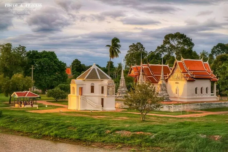
6. Wat Ubosatharam (Wat Bot Manorom) is an old temple beside the Sakae Krang River with outstanding historical, architectural, artistic, and community value. Formerly known as Wat Bot Manorom and commonly called Wat Bot by local residents, its riverside position makes it one of the defining cultural sights of Uthai Thani old town.
Highlights: Murals in the ordination hall and viharn, octagonal mondop, old chedis, scripture cabinets, mother-of-pearl alms bowl, floating ordination hall, and the peaceful Sakae Krang riverside atmosphere.
The murals are among the temple’s most important artistic features, depicting Buddhist stories and reflecting artistic traditions of the Rattanakosin period. Religious buildings and historic objects around the temple also demonstrate its long relationship with the surrounding riverside community.
The floating ordination hall and riverside structures give Wat Ubosatharam a character closely associated with Uthai Thani. Visitors can walk across from the market and old-town side, naturally connecting the experience of market, community, river, and temple.
The temple is especially rewarding for travelers interested in Thai art, history, and architectural photography. Visitors should explore quietly, avoid using flash where inappropriate, and never touch mural paintings or fragile historic objects.
Open Days: Daily Opening Hours: Generally open throughout the day
Getting There: From Uthai Thani Municipal Market or the old-town area, visitors can walk across the bridge over the Sakae Krang River directly to the temple. Private cars, local transport, and motorcycle taxis are also convenient.
Map (GPS):Directions to Wat Ubosatharam

7. Trok Rong Ya is an old community lane in central Uthai Thani that vividly reflects the history of Chinese immigration, trade, wooden houses, and local food. Located near the old market and Sakae Krang River, it is easy to explore on foot together with Wat Ubosatharam and the riverside district.
Highlights: Historic wooden houses, Saturday Walking Street, Chinese community history, local food, traditional snacks, souvenirs, handicrafts, small shops, and Uthai Thani old-town atmosphere.
The name Trok Rong Ya is connected with the lane’s past, when the area was associated with a legally operated opium house during an earlier period of Thai social history. After legal and social conditions changed, the neighborhood became quieter before later being revived as a community-based cultural walking street.
The charm of Trok Rong Ya lies in its small scale. Visitors walk past old wooden houses, long-established shops, local residents, and food prepared within the community itself. Saturday evening is the liveliest time, when the Walking Street provides an excellent opportunity for dinner and souvenir shopping.
The old lane can still be explored on other days, although shops and activities are less concentrated than on Saturday. Travelers seeking the fullest experience should therefore plan to visit on a Saturday evening when possible.
Open Days: The community area can be visited daily / Walking Street opens every Saturday Opening Hours: Walking Street 16:00 – 20:00
Getting There: Trok Rong Ya is around Maharat Road and Rat Uthit Lane in Uthai Mai Subdistrict, central Uthai Thani. It is within walking distance of the municipal market and the Sakae Krang riverside area.
Map (GPS):Directions to Trok Rong Ya

8. Wat Tham Khao Wong in Ban Rai District is a Buddhist temple set among limestone mountains and forest. Its most distinctive feature is a multi-storey Thai-style wooden building built against the mountain, with a pond in front and landscaped surroundings that make it one of Uthai Thani’s most recognizable photography locations.
Highlights: Multi-storey Thai-style wooden architecture, pond, limestone mountains, natural caves, stalactites and stalagmites, meditation areas, and the peaceful rural environment of Ban Rai.
The wooden building against the mountain gives Wat Tham Khao Wong the appearance of a secluded monastery hidden within a valley. Much of the architecture uses wood and adapted traditional Thai design, creating a very different atmosphere from large concrete temple complexes.
Paths also lead toward caves and meditation zones. Visitors should keep noise to a minimum, respect areas used for meditation, dress modestly, and wear suitable footwear if exploring natural cave sections.
Wat Tham Khao Wong fits naturally into a Ban Rai itinerary with the Giant Tree of Ban Sanam, Pha Rom Yen Waterfall, Pang Sawan Weir, and local textile communities. Travelers coming from Uthai Thani town should dedicate at least one full day to the Ban Rai area.
Open Days: Daily Opening Hours: Weekdays 07:00 – 17:00 / Saturday–Sunday 07:00 – 18:00
Getting There: The temple is in Moo 3, Ban Rai Subdistrict, Ban Rai District, approximately 12 kilometers from Ban Rai town. A private car is the most practical option for continuing to other attractions in the district.
Map (GPS):Directions to Wat Tham Khao Wong

9. Pha Rom Yen Waterfall is a natural waterfall in Chao Wat Subdistrict, Ban Rai District. Its defining feature is water flowing down a high cliff in fine streams that break into mist, creating the appearance of a curtain of rain. Mosses, ferns, and moisture-loving plants cover much of the cliff surface, giving the area a cool and intensely green atmosphere.
Highlights: Fine curtain-like waterfall, high cliff, mosses and ferns, shaded forest, relatively short walking route, and one of Ban Rai’s most distinctive natural photography locations.
Pha Rom Yen differs from waterfalls known for large pools. Its beauty comes from the shape of the water and the cliff itself. As water descends from above and strikes the rock surface, it breaks into fine streams and mist that keep the cliff vegetation constantly humid.
The walk from the parking area is approximately 400 meters and usually takes around 20 minutes. Although not a long trail, footwear suitable for damp conditions is recommended, especially during the rainy season. Visitors should be careful on slippery rocks and avoid areas with strong water flow.
The waterfall is most impressive when water levels are sufficient. A Ban Rai itinerary can combine Wat Tham Khao Wong in the morning with Pha Rom Yen Waterfall and nearby community attractions later in the day.
Open Days: Daily Opening Hours: 08:30 – 17:00
Getting There: From Ban Rai District, take Highway 3011 toward Phu Bon and continue toward Ban Mai Rom Yen. Turn into the local access road for approximately 2 kilometers, then walk around 400 meters from the trail entrance to the waterfall.
Map (GPS):Directions to Pha Rom Yen Waterfall
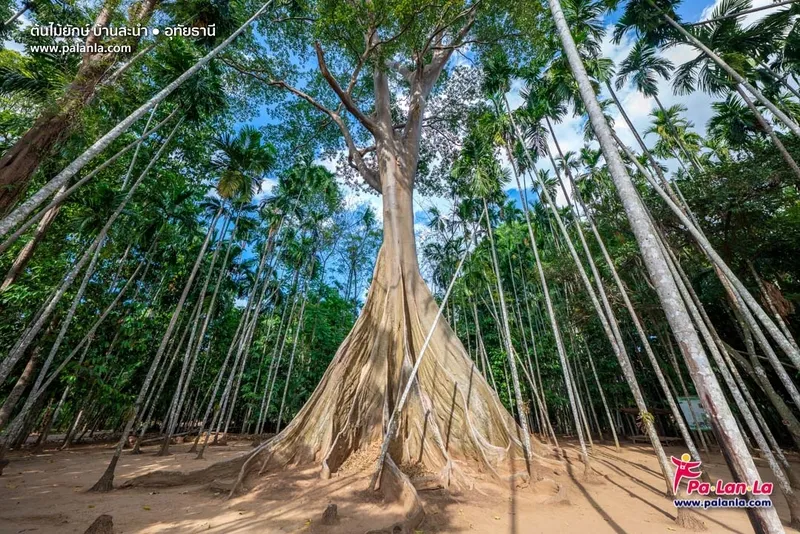
10. Giant Tree of Ban Sanam, locally known as the giant Siang tree or the Bee Tree, is a natural attraction in Ban Sanam, Ban Rai District. The ancient tree is more than 400 years old, with a massive trunk and dramatic buttress roots spreading through a peaceful betel nut grove belonging to the Lao Khrang community.
Highlights: A Siang or Bee Tree more than 400 years old, enormous buttress roots, betel nut grove, Lao Khrang community, weekend Giant Tree Market, and a shaded community forest atmosphere.
The immense size of the tree gives visitors a physical sense of the centuries it has spent growing alongside the community. Its buttress roots spread from the trunk like natural walls, while the canopy rises above the surrounding vegetation. The tree is also known as the Bee Tree because bees have traditionally lived around it, reflecting the ecological richness of the area.
The approach passes through community betel nut groves, so the visit includes both natural heritage and the agricultural landscape of Ban Sanam. Visitors should remain on the designated path, avoid climbing on roots, never carve the trunk, and avoid disturbing wildlife or bees.
The community market near the entrance is especially active on Saturdays and Sundays, offering local food, handmade products, and Ban Rai specialties. The Giant Tree can be combined with Wat Tham Khao Wong, Sao Hai Market, and other attractions around Ban Rai.
Open Days: Daily Opening Hours: Daylight hours are recommended
Getting There: Travel into Ban Rai District and continue toward Ban Sanam. Park near the community and Giant Tree Market area, then walk through the betel nut grove to reach the tree.

11. Pang Sawan Weir is located at Ban Pang Sawan in Khok Khwai Subdistrict, Ban Rai District. Originally constructed as a community water-control structure, the weir has become a popular nature stop because overflowing water forms a broad curtain across the concrete crest, creating the appearance of a small waterfall in the middle of a rural landscape.
Highlights: Curtain-like water flow, rural Ban Pang Sawan scenery, waterside photography, streamside relaxation, and the green countryside of Ban Rai. The appearance of the water curtain depends strongly on seasonal water levels.
The attraction is simple rather than monumental. When the water rises above the crest, it spreads evenly across the weir and drops in a broad white sheet. Visitors often photograph the structure from below or enjoy the water in safe sections when conditions allow.
Higher water levels generally create the most dramatic effect, but stronger currents also increase risk. Visitors should check recent weather and water conditions, avoid strong-flow areas, and take particular care around slippery concrete after heavy rain.
Pang Sawan Weir is suitable for families, groups of friends, and photographers and can be combined with Pha Rom Yen Waterfall, Wat Tham Khao Wong, the Giant Tree of Ban Sanam, and other Ban Rai attractions.
Open Days: Daily Opening Hours: 08:30 – 18:00
Getting There: From Ban Rai town, travel toward Khok Khwai Subdistrict and Ban Pang Sawan, Moo 11. A private car is the most convenient way to visit and continue onward to other natural attractions.
Map (GPS):Directions to Pang Sawan Weir

12. Cyber Waterfall, also known locally as Hin Lat Waterfall, is a natural waterfall in Huai Khot District near Ban Cyber or Ban Sap Mae Bue. It is under the care of the Cyber Forest Protection Unit and is connected ecologically with the Huai Kha Khaeng forest landscape. Water from Huai Loi Joi descends through forest and rocks to create a series of cascades.
Highlights: Multi-tiered waterfall, Hin Lat cascade, Loi Joi Waterfall, natural pools, rattan forest, mixed deciduous forest, nature trails, and a relatively wild atmosphere requiring more preparation than an ordinary roadside attraction.
The name Hin Lat describes sections where water flows across sloping rock surfaces before collecting in natural pools. Upper sections are associated with Loi Joi Waterfall, named after the stream that feeds the system, creating a combination of smaller cascades, sloping rock sections, and forest stream scenery.
Late rainy season to early cool season, particularly around September to early November, often brings stronger water flow and greener forest conditions. However, access becomes more difficult because the final road sections may be unpaved, rocky, and crossed by streams.
Travelers should check road conditions before departure. Pickup trucks or vehicles suited to rough roads are generally more practical during wet periods. The final approach may also require a walk of approximately 900 meters, so hiking shoes, drinking water, and enough daylight for the return journey are important.
Cyber Waterfall is best suited to groups of friends, hikers, and travelers looking for a more adventurous nature experience in western Uthai Thani. It can be combined with Pang Sawan Weir and other attractions around Huai Khot, but too many remote sites should not be packed into one day.
Getting There: From Uthai Thani town, travel approximately 86 kilometers toward Huai Khot District and Ban Sap Mae Bue, then continue toward the Cyber Forest Protection Unit. The final road is partly unpaved and should be checked with local authorities or staff during the rainy season.
Map (GPS):Directions to Cyber Waterfall
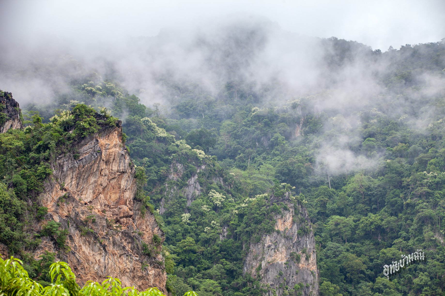
13. Khao Plara is both a natural and archaeological attraction near the boundary between Lan Sak and Nong Chang districts. Its most important feature is a group of prehistoric rock paintings on the western cliff, estimated to be around 3,000 years old. The hike therefore combines mountain scenery with direct evidence of early human activity in the area.
Highlights: Prehistoric rock paintings around 3,000 years old, steep limestone mountain, viewpoints, natural forest, and a physically demanding hiking route.
Khao Plara rises to approximately 598 meters above mean sea level. The route to the important archaeological area is around 900 meters, but because of steep slopes and natural surfaces of soil, rock, and roots, the climb takes roughly 2 hours and is much more demanding than the distance alone suggests.
The rock paintings are extremely important archaeological evidence, showing that humans were using the mountain landscape thousands of years ago. Visitors must never touch, mark, or approach the paintings beyond designated boundaries.
Khao Plara is not suitable for travelers seeking an easy walk. Bring drinking water, sturdy shoes, a hat, and only necessary equipment. Avoid starting late in the day and do not attempt the climb in rain or when the trail is slippery.
The mountain can be combined with Hup Pa Tat because the sites are relatively close, although a full Khao Plara hike should remain the main activity of the day rather than being rushed between multiple nature trails.
Open Days: Daily Opening Hours: 08:30 – 13:30
Getting There: Khao Plara lies between Ban Huai Sok in Lan Sak District and Khao Bang Kraek Subdistrict in Nong Chang District. It is approached using the same general route as Hup Pa Tat before continuing to the designated trailhead.
Map (GPS):Directions to Khao Plara
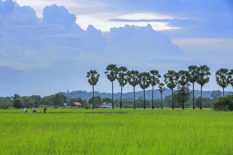
14. Ko Thepho is a large freshwater island in Mueang Uthai Thani District characterized by rivers, fruit orchards, rice fields, bamboo groves, villages, and farmland. It is best experienced slowly, particularly by bicycle, allowing travelers to explore a rural side of Uthai Thani that contrasts with the temples and old-town attractions nearby.
Highlights: Approximately 33-kilometer cycling circuit, pomelo orchards, mafai orchards, cornfields, rice fields, bamboo groves, Ban Tha Din Daeng, lamphaen mat weaving, Wat Phumtham, and local community products.
Historically, the area was originally a peninsula lying between the Chao Phraya and Sakae Krang rivers. A canal was later dug across the northern section to improve water management, creating a complete freshwater island. Ko Thepho therefore reflects both natural geography and the long history of local water management.
Cycling is an ideal way to explore the island because visitors can stop at orchards, villages, and riverside areas at their own pace. Those who do not want to complete the full 33-kilometer circuit can explore only a shorter section after crossing from the Wat Ubosatharam side.
Cyclists should wear helmets, keep to the left, and watch for local vehicles, animals, and entrances to homes and orchards. Agricultural land and private gardens should never be entered without permission because Ko Thepho remains a working residential and farming community.
Ko Thepho is suitable for families, cyclists, photographers, and slow-travel visitors and combines naturally with Wat Ubosatharam, Uthai Thani Municipal Market, Trok Rong Ya, and the Sakae Krang riverside district.
Getting There: Start from central Uthai Thani using Wat Ubosatharam or the municipal market as reference points, then cross the bridge into Ko Thepho. Visitors can explore by car, motorcycle, or bicycle.
Map (GPS):Directions to Ko Thepho
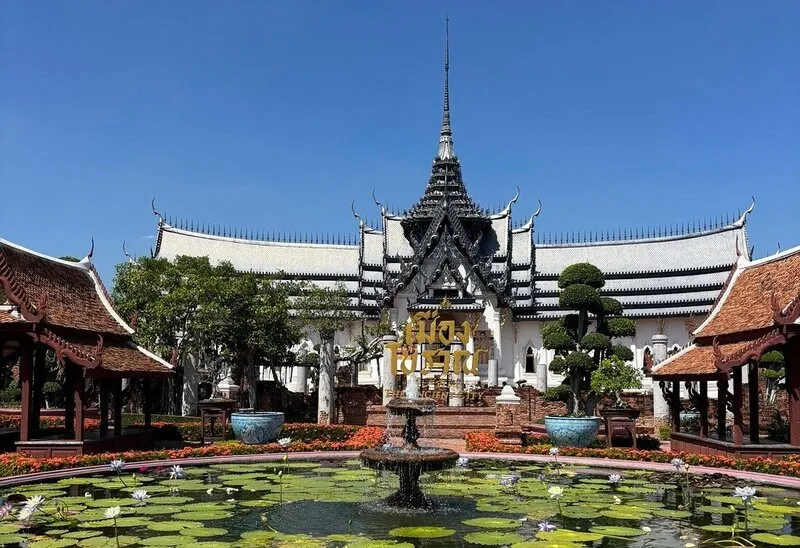
15. Ban Karung Ancient Town in Wang Hin Subdistrict, Ban Rai District, preserves traces of an ancient settlement including its town plan, moat, earthen embankments, and archaeological evidence. The site demonstrates that western Uthai Thani was important not only for forests and mountains but also for organized settlement and community development in the past.
Highlights: Oval town plan approximately 800 meters across, moat around 20 meters wide, earthen defensive embankments, Chao Mae Karung Shrine, and archaeological finds including a stone bell, Buddha image, pottery fragments, stone tools, ornaments, and stupa remains.
The moat and earthen embankment system reveals how the ancient community organized and protected its settlement. Rather than focusing only on monumental structures, visitors should look at the broader landscape and understand how the town itself was planned.
Objects discovered in the area include tools, pottery, ornaments, religious objects, and architectural remains, indicating a community with established domestic, religious, and social activities. Ban Karung Ancient Town was officially registered as an ancient monument on 8 March 1935.
Chao Mae Karung Shrine in front of the moat shows the continuation of local belief from the ancient landscape into the present community. Visitors should never remove objects or disturb archaeological features around the moat and embankments.
Ban Karung Ancient Town is suitable for history and archaeology enthusiasts and works well as a stop on the road from Uthai Thani town toward Ban Rai before continuing to Wat Khao Tham Taphap, Wat Tham Khao Wong, or other Ban Rai attractions.
Getting There: Take Highway 333 on the Nong Chang–Ban Rai route, passing Ban Thung Na and Khao Taphap junction. The ancient town is located on a left-hand curve about 10 kilometers before Ban Rai, with Chao Mae Karung Shrine serving as a useful landmark.
Map (GPS):Directions to Ban Karung Ancient Town
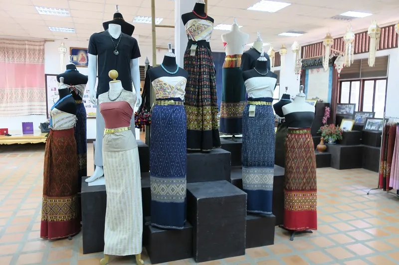
16. Local Weaving Exhibition and Demonstration Centre is a community textile learning center in Ban Rai District operated by the Paichit Weaving Group. Located behind Wat Ban Rai near Ban Na Fai Bueng Ta Pho School, it preserves traditional cotton weaving, yarn preparation, natural dyeing, and historic local patterns.
Highlights: Traditional loom weaving, natural dyes, old textile patterns, cotton-yarn preparation, community handicrafts, and locally woven products available as meaningful Ban Rai souvenirs.
The value of the Paichit Weaving Group lies in showing that a finished cloth requires many stages beyond simply weaving threads together. The process begins with selecting and preparing cotton, dyeing yarn, setting up the loom, arranging patterns, weaving, and finishing details. Every stage requires experience, accuracy, and patience.
Natural dyes and traditional patterns make the textiles much more than commercial products. They record local knowledge, aesthetics, and cultural identity within the fabric itself. Visitors interested in design, fashion, craft, or community heritage will appreciate the detail behind each piece.
The center is suitable for families, students, and cultural travelers, especially those looking for locally made souvenirs connected directly with producers. It can be combined with Wat Tham Khao Wong, the Giant Tree of Ban Sanam, and other Ban Rai attractions.
Open Days: Daily Opening Hours: 08:00 – 17:00
Getting There: The center is behind Wat Ban Rai beside Ban Na Fai Bueng Ta Pho School. Turn into the lane beside the school and continue for approximately 700 meters.

17. Wat Mani Sathit Kapittharam, also known locally as Wat Thung Kaeo, is a third-class royal temple in central Uthai Thani near the clock tower, market, and old-town district. It is both an important place of worship and an architectural attraction, particularly because of its distinctive five-spired prang.
Highlights: Five-spired prang with an approximately 8-meter-wide base and 16-meter height, built in 1909; sacred holy-water pond; ordination hall; viharn; sermon hall; and peaceful temple grounds in central Uthai Thani.
The local name Wat Thung Kaeo has been familiar to Uthai Thani residents for generations and relates to the landscape that once surrounded the temple before urban development expanded around it. Despite its central location today, the temple grounds retain open courtyards, trees, and a sense of calm.
The five-spired prang is the most eye-catching architectural element and gives the temple a distinct identity. Beyond its architecture, Wat Mani Sathit Kapittharam remains an active spiritual center for local residents and continues to host Buddhist activities.
The temple is well suited to an old-town walking route and can be combined with Trok Rong Ya, Hok Sae Tung, the riverside morning market, Wat Ubosatharam, and Wat Sangkat Rattana Khiri.
Open Days: Daily Opening Hours: 08:00 – 17:00
Getting There: The temple is around Sunthon Sathit Road and Mani Sathit Road in Uthai Mai Subdistrict near the clock-tower roundabout and is easily reached from the market and Trok Rong Ya.

18. Wat Khao Tham Taphap is a cave temple in Wang Hin Subdistrict, Ban Rai District, surrounded by limestone hills and quiet countryside. Its principal attractions include a natural cave, passages behind the cave, rock formations resembling a softshell turtle, Buddha images, and a peaceful environment suited to worship and contemplation.
Highlights: Limestone cave, natural tunnel, turtle-shaped rock formations, Buddha images inside the cave area, hill scenery, and a quiet rural temple atmosphere.
The temple combines Buddhist faith directly with the natural landscape. Instead of monumental modern architecture, its character comes from mountain terrain, caves, forest shade, birdsong, and the cool air of the cave interior.
Visitors should walk carefully inside cave areas because some surfaces may be damp or uneven. Closed shoes and a small flashlight can be useful in darker sections, and cave formations should never be touched unnecessarily.
Wat Khao Tham Taphap is suitable for Buddhist travelers, cave enthusiasts, and visitors seeking a quiet stop on the route to Ban Rai. It can be combined with Ban Karung Ancient Town, Wat Tham Khao Wong, and other Ban Rai attractions.
Open Days: Daily Opening Hours: Daylight hours are recommended
Getting There: The temple is in Wang Hin Subdistrict, Ban Rai District, near the route from Ban Karung Ancient Town toward Ban Rai. A private car is recommended for combining it with other attractions.
Map (GPS):Directions to Wat Khao Tham Taphap

19. Dong Tao Waterfall is a natural waterfall in Kaen Makrut Subdistrict, Ban Rai District, hidden within the forested highlands of western Uthai Thani. Its clear, cool water originates from mountain springs and descends through natural rock layers beneath tall trees and dense forest.
Highlights: Medium-sized natural waterfall, clear spring-fed water, layered rocks, small natural pools, shaded Dong Tao Forest, and the cool highland atmosphere of Kaen Makrut.
The waterfall has little commercial development. Its appeal lies in its natural setting, with water flowing across several rock levels and through small pools. During the rainy season, stronger flows create additional mist and movement around the rocks.
Rainy season through early cool season usually brings greener forest and stronger water flow, but safety becomes more important. Visitors should avoid entering the water when currents are strong or immediately after heavy rain and should wear footwear suitable for wet rock and soil.
The final access route can change with seasonal conditions. Some sections may be better suited to higher-clearance vehicles, and travelers may need to continue on foot from the parking area. Checking conditions locally is recommended before visiting, especially during wet weather.
Dong Tao Waterfall is suitable for travelers exploring Kaen Makrut who want a quieter nature experience away from more developed attractions. It can be combined with highland community areas and other natural attractions around Ban Rai.
Getting There: From Ban Rai town, travel toward Kaen Makrut Subdistrict. The main road is paved, but the final approach to the waterfall may include natural tracks depending on seasonal conditions. A suitable vehicle is recommended.
Map (GPS):Directions to Dong Tao Waterfall
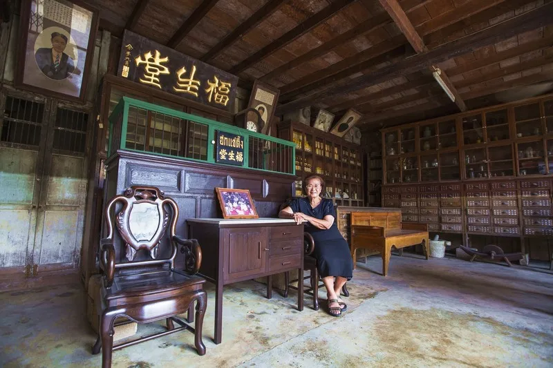
20. Hok Sae Tung stands at 427 Si Uthai Road in Uthai Mai Subdistrict, central Uthai Thani. This Chinese-style teakwood house is more than 100 years old and preserves stories of the Chinese community, commerce, traditional Chinese medicine, and Vegetarian Festival culture in the Sakae Krang riverside town.
Highlights: Historic Chinese teakwood house, traditional medicine shelves, Chinese musical instruments, antique household objects, pharmacy equipment, and objects connected with Vegetarian Festival traditions and Uthai Thani’s Chinese community.
The building reveals everyday life within the old Chinese community through objects that were genuinely used in the past, including commercial spaces, medicine shelves, tools, musical instruments, and domestic architectural details. Walking through the house feels like entering an earlier period when Chinese merchant families played an important role in the economy of the Sakae Krang riverside district.
The stories of Chinese medicine and Vegetarian Festival traditions give Hok Sae Tung significance beyond its architecture. They reflect health practices, religious belief, ritual, food, and community organization, allowing a relatively compact building to communicate several layers of social history.
Hok Sae Tung is especially suitable for travelers interested in old towns, wooden architecture, Chinese community history, and detail photography. It is easy to combine with Trok Rong Ya, Wat Mani Sathit Kapittharam, the riverside morning market, and Wat Ubosatharam.
Visitors should treat the building and antique objects with care. Many items form part of the community’s cultural history and should not be moved, handled, or used without permission.
Open Days: Daily Opening Hours: 08:00 – 17:00
Getting There: Hok Sae Tung is located at 427 Si Uthai Road, Uthai Mai Subdistrict, Mueang Uthai Thani District, within the old-town area and close to Trok Rong Ya, the market, and Wat Mani Sathit Kapittharam.
Map (GPS):Directions to Hok Sae Tung
| By Zone / District | 1. Mueang Uthai Thani: Wat Chantharam (Wat Tha Sung), Wat Sangkat Rattana Khiri, Khao Sakae Krang, Wat Ubosatharam, Trok Rong Ya, Ko Thepho, Wat Mani Sathit Kapittharam, Hok Sae Tung 2. Lan Sak / Nearby Areas: Hup Pa Tat, Thungyai–Huai Kha Khaeng Wildlife Sanctuaries, Khao Plara 3. Ban Rai: Wat Tham Khao Wong, Pha Rom Yen Waterfall, Giant Tree of Ban Sanam, Pang Sawan Weir, Ban Karung Ancient Town, Local Weaving Exhibition and Demonstration Centre, Wat Khao Tham Taphap, Dong Tao Waterfall 4. Huai Khot: Cyber Waterfall |
| Top Highlights | 1. Wat Chantharam (Wat Tha Sung) – 100-Meter Crystal Hall and iconic Buddhist architecture 2. Hup Pa Tat – Walk through a cave into a hidden Tat palm forest 3. Thungyai–Huai Kha Khaeng Wildlife Sanctuaries – UNESCO Natural World Heritage forest 4. Wat Sangkat Rattana Khiri and Khao Sakae Krang – Faith, Tak Bat Thewo, and city views 5. Wat Tham Khao Wong – Wooden Thai architecture set against mountains 6. Trok Rong Ya – Old community, local food, and Saturday Walking Street |
| Best for Families | 1. Wat Chantharam (Wat Tha Sung) 2. Hup Pa Tat 3. Wat Sangkat Rattana Khiri 4. Khao Sakae Krang 5. Trok Rong Ya 6. Ko Thepho 7. Giant Tree of Ban Sanam |
| Best for History Lovers | 1. Wat Ubosatharam 2. Ban Karung Ancient Town 3. Khao Plara 4. Hok Sae Tung 5. Wat Mani Sathit Kapittharam 6. Khao Sakae Krang |
| Best for Buddhist Pilgrimage | 1. Wat Chantharam (Wat Tha Sung) 2. Wat Sangkat Rattana Khiri 3. Wat Ubosatharam 4. Wat Tham Khao Wong 5. Wat Mani Sathit Kapittharam 6. Wat Khao Tham Taphap |
| Best for Nature Lovers | 1. Hup Pa Tat 2. Thungyai–Huai Kha Khaeng Wildlife Sanctuaries 3. Pha Rom Yen Waterfall 4. Cyber Waterfall 5. Khao Plara 6. Pang Sawan Weir 7. Dong Tao Waterfall 8. Giant Tree of Ban Sanam |
| Best for Culture and Community Travel | 1. Trok Rong Ya 2. Hok Sae Tung 3. Ko Thepho 4. Local Weaving Exhibition and Demonstration Centre 5. Wat Ubosatharam 6. Giant Tree of Ban Sanam and the Ban Sanam community |
| Best for Photography | 1. Wat Tha Sung – Crystal Hall and Golden Castle 2. Hup Pa Tat – Tat palms, caves, and filtered light 3. Khao Sakae Krang – Panoramic views of Uthai Thani town 4. Wat Tham Khao Wong – Wooden temple building against mountains 5. Pha Rom Yen Waterfall – Curtain-like waterfall 6. Pang Sawan Weir – Broad water curtain over the weir 7. Ko Thepho – Rice fields, orchards, and rural life |
| Adventure / Outdoor | 1. Walk the Hup Pa Tat nature trail 2. Hike Khao Plara 3. Visit Cyber Waterfall 4. Explore Dong Tao Waterfall 5. Cycle around Ko Thepho 6. Visit nature-study areas at Huai Kha Khaeng |
| Food and Souvenirs | 1. Sakae Krang River fish and traditional Thai dishes 2. Food and snacks at Trok Rong Ya 3. Ko Thepho community products 4. Ban Rai handwoven textiles 5. Lao Khrang community products 6. Local agricultural products and Ban Rai food |
| Important Traditions | 1. Tak Bat Thewo at Wat Sangkat Rattana Khiri and Khao Sakae Krang 2. Buddhist merit-making and religious events at Wat Tha Sung 3. Vegetarian Festival traditions and Chinese community culture in the old town 4. Local festivals and community activities in Ban Rai and Lao Khrang communities |
| Recommended Areas to Stay | 1. Uthai Thani Town: Best for first-time visitors, temples, markets, and old-town sightseeing 2. Ban Rai: Best for mountain scenery, Wat Tham Khao Wong, communities, and waterfalls 3. Lan Sak: Best for Hup Pa Tat, Khao Plara, and Huai Kha Khaeng 4. Kaen Makrut / Ban Rai Highlands: Best for cooler weather and nature |
| 1-Day Itinerary – Uthai Thani Town | 1. Wat Chantharam (Wat Tha Sung) 2. Wat Ubosatharam 3. Hok Sae Tung 4. Wat Mani Sathit Kapittharam 5. Wat Sangkat Rattana Khiri 6. Khao Sakae Krang 7. Trok Rong Ya in the evening if visiting on Saturday |
| 1-Day Itinerary – Lan Sak | 1. Hup Pa Tat in the morning 2. Khao Plara for physically prepared hikers, or nearby easier nature areas 3. Huai Kha Khaeng visitor service and education area in the afternoon |
| 1-Day Itinerary – Ban Rai | 1. Ban Karung Ancient Town 2. Wat Tham Khao Wong 3. Local Weaving Exhibition and Demonstration Centre 4. Giant Tree of Ban Sanam 5. Pha Rom Yen Waterfall or Pang Sawan Weir in the afternoon |
| 2 Days 1 Night | Day 1 – Uthai Thani Town: 1. Wat Tha Sung 2. Wat Ubosatharam 3. Hok Sae Tung 4. Wat Mani Sathit Kapittharam 5. Wat Sangkat Rattana Khiri 6. Khao Sakae Krang 7. Trok Rong Ya if visiting on Saturday Day 2 – Lan Sak: 1. Hup Pa Tat 2. Khao Plara or a nearby nature attraction 3. Huai Kha Khaeng |
| 3 Days 2 Nights | Day 1: Uthai Thani town, Wat Tha Sung, Sakae Krang riverside, Khao Sakae Krang, and Trok Rong Ya Day 2: Lan Sak – Hup Pa Tat – Khao Plara – Huai Kha Khaeng visitor area Day 3: Ban Rai – Ban Karung Ancient Town – Wat Tham Khao Wong – Giant Tree of Ban Sanam – Pha Rom Yen Waterfall |
| 4 Days 3 Nights | Day 1: Uthai Thani town and important temples Day 2: Lan Sak, Hup Pa Tat, Khao Plara, and Huai Kha Khaeng Day 3: Ban Rai, Wat Tham Khao Wong, Paichit weaving community, Ban Sanam, and Pha Rom Yen Waterfall Day 4: Pang Sawan Weir, Dong Tao Waterfall, or Kaen Makrut before returning |
| 5 Days 4 Nights | 1. Day 1: Uthai Thani old town, Wat Tha Sung, and Khao Sakae Krang 2. Day 2: Ko Thepho cycling and community travel 3. Day 3: Lan Sak, Hup Pa Tat, Khao Plara, and Huai Kha Khaeng 4. Day 4: Ban Rai, Wat Tham Khao Wong, local textiles, Ban Sanam, and Pha Rom Yen Waterfall 5. Day 5: Huai Khot or Cyber Waterfall if road conditions are suitable, then return |
| Getting Around Uthai Thani | A private or rental car is the most practical option outside Uthai Thani town because natural attractions in Lan Sak, Ban Rai, and Huai Khot are widely dispersed and some are not served directly by public transport. Within the town, local transport, motorcycle taxis, and walking are practical for the market, Trok Rong Ya, Wat Ubosatharam, and Hok Sae Tung. |
| Best Time to Visit | November to February is generally the most comfortable period for old-town sightseeing, cycling, and nature trails. Late rainy season to early cool season is attractive for waterfalls and green landscapes, but travelers should always check road conditions, flash-flood risk, and water levels before visiting remote nature areas. |
| Safety Tips | For Khao Plara, Cyber Waterfall, Dong Tao Waterfall, and other western nature areas, wear suitable footwear, carry drinking water, check weather conditions, remain on approved trails, and leave remote areas before dark. |
| Responsible Travel | Do not leave rubbish in forests or waterfalls, remove rocks, plants, or archaeological objects, touch prehistoric paintings at Khao Plara, or feed wildlife. Support community products and local weaving groups, and respect homes and agricultural land on Ko Thepho and in rural communities. |
Planning an Uthai Thani Trip by Number of Days If you have only one day, focusing on Uthai Thani town is the most practical choice. Begin in the morning at Wat Chantharam or Wat Tha Sung, then return toward the old town to visit Wat Ubosatharam, the market, and the Sakae Krang riverside. Continue to Hok Sae Tung and Wat Mani Sathit Kapittharam before visiting Wat Sangkat Rattana Khiri and Khao Sakae Krang in the afternoon. On Saturday, the day can end with local food and the Walking Street atmosphere at Trok Rong Ya.
Nature-focused travelers should reserve a separate day for Lan Sak. Start early at Hup Pa Tat to enjoy the trail without rushing. Afterward, physically prepared travelers can choose Khao Plara, while others can continue to Huai Kha Khaeng for conservation education. A complete Khao Plara hike and a detailed Huai Kha Khaeng visit should not be forced into the same day when starting late.
Ban Rai also deserves at least one full day because its attractions are dispersed across rural and mountain roads. Begin with Ban Karung Ancient Town, continue to Wat Tham Khao Wong, the Local Weaving Exhibition and Demonstration Centre, and the Giant Tree of Ban Sanam, then choose either Pha Rom Yen Waterfall or Pang Sawan Weir for the late afternoon rather than attempting every waterfall in one day.
For a 2-day, 1-night trip, spend the first day in Uthai Thani town and choose either Lan Sak or Ban Rai for the second day. With three days and two nights, the town, Lan Sak, and Ban Rai can each be given their own day, reducing driving pressure and allowing more time at individual attractions.
With four or five days, travelers can add Ko Thepho, Cyber Waterfall, Kaen Makrut, or Dong Tao Waterfall. A longer itinerary reveals the full range of Uthai Thani, from riverside town life, Buddhist faith, and Chinese heritage to agricultural communities, handicrafts, limestone mountains, waterfalls, and a UNESCO World Heritage forest.
Frequently Asked Questions (FAQ)
Q: Where should first-time visitors go in Uthai Thani?
A: Good starting points include Wat Chantharam or Wat Tha Sung, Wat Sangkat Rattana Khiri, Khao Sakae Krang, Wat Ubosatharam, Trok Rong Ya, and Hup Pa Tat. Together they introduce visitors to the province’s Buddhist heritage, old town, local culture, and natural landscapes.
Q: Can Uthai Thani be visited as a day trip?
A: Yes. For a one-day trip, concentrate on Uthai Thani town. Begin at Wat Tha Sung, then visit the Sakae Krang riverside area, Wat Ubosatharam, Wat Sangkat Rattana Khiri, Khao Sakae Krang, and Trok Rong Ya. Trying to add Ban Rai or Lan Sak on the same day would make the itinerary unnecessarily rushed.
Q: What is a good 2-day, 1-night Uthai Thani itinerary?
A: Spend the first day at Wat Tha Sung and in Uthai Thani town. On the second day, choose either Hup Pa Tat and Lan Sak or travel to Ban Rai for Wat Tham Khao Wong, the Giant Tree of Ban Sanam, and Pha Rom Yen Waterfall.
Q: What are the best natural attractions in Uthai Thani?
A: Major natural attractions include Hup Pa Tat, Thungyai–Huai Kha Khaeng Wildlife Sanctuaries, Khao Plara, Pha Rom Yen Waterfall, Cyber Waterfall, Pang Sawan Weir, Dong Tao Waterfall, and the mountain landscapes around Ban Rai.
Q: Is Hup Pa Tat difficult to walk?
A: The round-trip trail is approximately 700 meters and is not especially long, but visitors must walk through a dark cave and some surfaces may be damp or slippery. Shoes with good grip are recommended.
Q: Is Khao Plara suitable for everyone?
A: No. The route is steep and physically demanding. Although the trail is only around 900 meters, the climb can take about 2 hours. Visitors should be in good physical condition and carry drinking water and suitable footwear.
Q: How much time should I spend at Wat Tha Sung?
A: Allow at least 2 hours because the temple complex is large and includes the 100-Meter Crystal Hall, Golden Castle, old ordination hall, and several additional worship areas. Some buildings follow specific opening periods.
Q: When is Trok Rong Ya Walking Street open?
A: The old community can be visited daily, but the Walking Street is especially active on Saturday from approximately 16:00 to 20:00.
Q: Is Uthai Thani suitable for families with children?
A: Yes. Wat Tha Sung, Hup Pa Tat, Khao Sakae Krang, Ko Thepho, the Giant Tree of Ban Sanam, and Trok Rong Ya are good family choices. More demanding routes such as Khao Plara or remote waterfalls may be less suitable for young children or elderly travelers.
Q: Where should I go for community and local-life experiences?
A: Ko Thepho offers agricultural and rural experiences, while Trok Rong Ya and Hok Sae Tung preserve Chinese community history. Ban Rai also offers Lao Khrang culture, traditional weaving, and local markets around Ban Sanam.
Q: What are the best photography locations in Uthai Thani?
A: Wat Tha Sung is excellent for architecture, Hup Pa Tat for caves and forest, Khao Sakae Krang for city views, Wat Tham Khao Wong for wooden architecture against mountains, Pha Rom Yen Waterfall for curtain-like water, and Pang Sawan Weir for its broad water flow.
Q: What is the best time of year to visit Uthai Thani?
A: November to February is generally the most comfortable period. Travelers interested in waterfalls and lush green forests may prefer late rainy season to early cool season, but should always check current weather and road conditions.
Q: Can I travel around Uthai Thani without a private car?
A: Central Uthai Thani can be explored with local transport, motorcycle taxis, and walking. However, a private or rental car is much more practical for Lan Sak, Ban Rai, Huai Khot, and remote waterfalls.
Q: Can visitors freely enter all areas of Huai Kha Khaeng?
A: No. The wildlife sanctuary exists primarily for conservation. General visitors are permitted only in approved service areas, education zones, and officially opened routes. Independent entry into deep forest areas is not allowed.
Q: Where should I stay on a 3-day Uthai Thani trip?
A: Staying in Uthai Thani town for the first night and then in Ban Rai or Lan Sak for the second night can reduce unnecessary backtracking and provide more time for nature attractions.
 Category: ●Travel Articles, Recipes
 Group: ●Travel Review, Food Review
Last Update : 3 WeekAgo
 Last Update : 3 WeekAgo
Recommend

 Art, Culture and Heritage
 Historical Sites and Monuments(3)
 Landmarks and Memorials(1)
 Art, Craft Centres, Tradition(5)
 Museums(1)
 Places of Worship
 Temple(31)
 Other Sacred Sites(3)
 Suburban Living
 Village, Community(4)
 Local Market(1)
 Nature and Wildlife
 National Parks and Marine Reserves(2)
 Mountain (Doi)(7)
 Dam, Reservoir, Lake(5)
 Waterfalls(5)
 Hot Springs(1)
 Caves(9)
 Flower Field(2)
 River, Canal(2)
 Islands(1)
 Other natural attractions(1)
 Entertainment and Agricultural
 Farms, Parks and Ecotourism(2)
 Shopping
 Shopping and Night Market(1)
Travel Review, Food Review(1)


