
lovethailand home >North Travel Attractions >Chiang Mai Travel Attractions > 50 Best Sea of Mist Destinations in Thailand
TL;DR: 50 Best Sea of Mist Destinations in Thailand, open Daily, hours 04:30 – 18:00.

50 Best Sea of Mist Destinations in Thailand

50 Best Sea of Mist Destinations in Thailand: Spectacular Mountain Views and Sunrise Experiences For travelers seeking a nature experience beyond an ordinary holiday, watching a sea of mist unfold across Thailand's mountain valleys is one of the country's most memorable outdoor adventures. Vast layers of white mist drifting between mountain ridges, isolated peaks rising above the clouds, and the first golden rays of sunlight illuminating the landscape create breathtaking scenery that changes from moment to moment. Famous destinations include Phu Chi Fa and Doi Pha Tang in Chiang Rai, Huai Nam Dang National Park in Chiang Mai, Yun Lai Viewpoint in Mae Hong Son, Khao Kho and Phu Thap Boek in Phetchabun, Phu Ruea in Loei, and Phu Langka in Phayao. These destinations appeal to travelers who appreciate cool mountain weather, landscape photography, peaceful natural surroundings, and meaningful outdoor experiences.
A sea of mist is a natural phenomenon that occurs when humid air near the ground cools sufficiently for water vapor to condense into countless tiny suspended droplets. When this process takes place in mountain valleys, people standing on higher peaks or ridgelines may see an extensive blanket of white mist covering the lower landscape, resembling a vast ocean. Deep valleys, overlapping mountain ranges, and relatively calm early-morning conditions can create particularly favorable circumstances for the formation of these spectacular cloud-like layers.
Although sea-of-mist travel is commonly associated with Thailand's cool season, mist can form during other periods when atmospheric conditions are favorable. The transition from the rainy season into the cool season can be especially promising because moisture remains abundant while nighttime temperatures begin to fall. Nevertheless, November through February remains the most popular period for mountain holidays in much of northern and northeastern Thailand. Cooler conditions make overnight stays more comfortable and encourage travelers to visit elevated viewpoints before sunrise.
Northern Thailand offers an exceptional variety of mist-covered mountain landscapes thanks to the extensive highlands stretching across Chiang Rai, Chiang Mai, Mae Hong Son, Nan, Phayao, and neighboring areas. Each destination has its own geographical characteristics. Phu Chi Fa is distinguished by its dramatic cliff along the Thai–Lao border, while Doi Pha Tang offers expansive mountain views and glimpses of the Mekong River. Huai Nam Dang National Park is celebrated for its mountain valleys and views toward Doi Luang Chiang Dao. Yun Lai Viewpoint, meanwhile, combines the beauty of Pai Valley with the cultural atmosphere of a Yunnanese Chinese community.
In Phetchabun Province, Khao Kho and Phu Thap Boek are particularly well known for their highland scenery and opportunities to observe layers of mist above the valleys. Nan Province offers Si Nan National Park and Doi Samer Dao, which attract visitors for sunrise, sunset, and stargazing experiences. Farther north in Phayao, the landscapes surrounding Phu Langka and the elevated viewpoints around Pha Chang Noi provide another remarkable setting for watching morning mist drift between successive mountain ridges.
Northeastern Thailand also has impressive mountain destinations, particularly in Loei Province, where Phu Ruea, Phu Kradueng, and several other highland areas experience cool temperatures during the winter months. Some viewpoints are characterized by open summits, while others feature cliffs, pine forests, or extensive mountain panoramas. Travelers can choose between viewpoints accessible by road and more demanding destinations that require trekking, depending on their interests and physical preparation.
The attraction of sea-of-mist travel extends far beyond the view itself. Winding mountain roads, crisp air before dawn, the sounds of wildlife awakening, and encounters with local communities all become part of the experience. Many highland destinations are closely connected to ethnic minority communities, mountain agriculture, traditional food, tea and coffee cultivation, and locally produced handicrafts. Spending time in these communities allows travelers to appreciate the relationship between the natural environment and the people who live within it.
Landscape photographers can select destinations according to their preferred compositions. Travelers seeking dramatic cliffs above the clouds may favor Phu Chi Fa or Doi Pha Tang. Those hoping to capture mist floating above calm water and reflected pine trees will find Pang Ung particularly appealing. For sweeping mountain layers illuminated by the morning sun, Khao Kho, Phu Thap Boek, and Phu Langka offer distinctive opportunities. Every location provides a different combination of terrain, weather, light, and atmosphere.
Careful travel planning is essential because many viewpoints are best experienced shortly before sunrise. Staying close to the chosen destination reduces the need to drive long distances on unfamiliar mountain roads in darkness and improves the chance of arriving before the best morning light. A one-day outing is most practical when the viewpoint is close to the starting point or accommodation, while a two-day, one-night trip allows travelers to stay overnight in the mountains and explore neighboring attractions after their morning visit.
With three days and two nights or more, travelers can combine nearby destinations into a convenient regional itinerary. Popular combinations include Phu Chi Fa and Doi Pha Tang in Chiang Rai, Huai Nam Dang and Yun Lai Viewpoint along the Chiang Mai–Pai route, Khao Kho and Phu Thap Boek in Phetchabun, and Pang Ung with Ban Rak Thai in Mae Hong Son. Focusing on destinations within the same area minimizes unnecessary driving and leaves more time for photography, relaxation, and cultural exploration.
The most promising time to observe a sea of mist is generally from before sunrise through the early morning, when temperatures are relatively low and moisture remains concentrated in the valleys. As the sun warms the atmosphere, the mist may begin to shift, rise, or disperse. However, its appearance depends on several interacting factors, including humidity, wind, temperature, rainfall, and local topography. Selecting a day with suitable weather conditions is therefore more important than relying on a particular month alone.
Essential items for a mountain sunrise excursion include warm clothing, footwear suitable for damp or uneven ground, a flashlight, drinking water, and any necessary photography equipment. Those traveling by private vehicle should check their tires, brakes, and lighting systems before using steep, winding mountain roads. Visibility can be significantly reduced by thick fog, particularly before dawn. Following instructions from park authorities and avoiding cliff edges or restricted areas are essential safety precautions at every viewpoint.
Every sea-of-mist destination in Thailand has its own character. Some stand out for their relatively untouched natural landscapes, while others offer valuable connections to local history, cultural traditions, and community knowledge. Choosing a destination that matches the season, travel style, and interests of the group can transform an early-morning viewpoint visit into a rewarding journey, whether traveling as a family, a couple, with friends, or independently.

1. Phu Chi Fa Forest Park, Chiang Rai is one of Thailand's most famous destinations for watching a sea of mist. It is located near Ban Rom Fa Thong and Ban Rom Fa Thai in Po Subdistrict, Wiang Kaen District, Chiang Rai Province, along the Doi Pha Mon mountain range close to the Thai–Lao border. The mountain rises approximately 1,200–1,628 meters above sea level. Its most recognizable feature is a sharply projecting summit pointing eastward toward the sky, which inspired the name Phu Chi Fa, meaning a mountain pointing toward the heavens. The distinctive peak has become an iconic symbol of Chiang Rai's cool-season tourism.
Highlights: A spectacular sea of mist over valleys on the Lao side of the border, sunrise above the mountains, dramatic cliffs, summit grasslands, expansive viewpoints, and the cultural atmosphere of highland communities along the Thai–Lao frontier.
Phu Chi Fa is particularly remarkable for its high cliff overlooking the valleys to the east. Travelers standing on the ridgeline before dawn can watch the sky gradually brighten above successive mountain ranges. When humidity and temperature conditions are favorable, dense mist collects in the lower valleys, forming an extensive white blanket beneath the viewpoint. Higher mountain summits emerge above the mist, creating a striking scene of isolated peaks rising from what appears to be an ocean of clouds.
The most popular time to visit is immediately before sunrise. The sky slowly changes from deep blue to orange and gold before sunlight begins illuminating the mist and revealing details of the mountains below. The dramatic outline of Phu Chi Fa's cliff against the sea of clouds makes it especially attractive to landscape photographers. The density of the mist and the quality of the morning light vary from day to day, ensuring that each sunrise offers a different visual experience.
The walking route to the summit passes through grassy slopes and exposed mountain ridges where winds can occasionally be strong. Visitors should wear comfortable footwear suitable for steep and uneven ground and bring sufficient warm clothing, particularly between November and February when the area receives many visitors. A flashlight or another reliable light source is useful for walking before dawn. Travelers should remain on designated paths and avoid approaching unprotected cliff edges.
Beyond its spectacular scenery, Phu Chi Fa is closely connected to the lives of highland communities inhabiting the surrounding mountains. Visitors can stay at homestays or locally operated accommodation near the viewpoint, experience the atmosphere of the mountains in the evening, and set out for the summit early the following morning. Choosing local restaurants, accommodation, and community products also helps distribute tourism income among residents.
For a two-day, one-night excursion, travelers can arrive near Phu Chi Fa during the afternoon, enjoy the surrounding mountain scenery, and stay overnight before visiting the viewpoint at sunrise. They can then continue to Doi Pha Tang, another remarkable destination along the same border mountain range. Although both are known for their sea-of-mist panoramas, their ridgelines, cliffs, and viewing angles differ, making them an excellent combination for a Chiang Rai mountain itinerary.
During long weekends and the peak winter travel season, Phu Chi Fa can attract large crowds. Parking areas and the summit trail may become busy, so travelers should allow sufficient time and follow instructions from local authorities. Extra care is necessary near the cliff, especially when dense mist reduces visibility. The destination is suitable for landscape photographers, couples, and anyone wishing to experience one of Thailand's most distinctive mountain sunrise views.
Open Days: Daily
Opening Hours: 04:30 – 18:00
Getting There: From Chiang Rai city, travel through Thoeng District and continue along Highway 1093 toward the mountains. Follow the signs to Ban Rom Fa Thong, Ban Rom Fa Thai, and Phu Chi Fa. After reaching the designated parking area, continue on foot along the marked trail to the viewpoint. Staying near Phu Chi Fa is recommended for travelers planning to watch the sunrise, as it avoids a long drive on unfamiliar mountain roads before dawn.
Map (GPS):Get Directions to Phu Chi Fa Forest Park

2. Doi Pha Tang, Chiang Rai is a renowned mountain viewpoint located near Ban Pha Tang in Po Subdistrict, Wiang Kaen District, Chiang Rai Province, close to Highway 1093 along the Thai–Lao border. Rising approximately 1,635 meters above sea level, the mountain offers spectacular opportunities to watch sunrise and a sea of mist above the valleys. On clear days, visitors can also admire the distant mountains of Laos and sections of the Mekong River landscape.
Highlights: Sea-of-mist viewpoints at Doi Pha Tang, Hill 102, Hill 103, Pha Bong Rock Passage, panoramic views along the Thai–Lao border, the Mekong River landscape, and the cultural atmosphere of the Yunnanese Chinese highland community.
Doi Pha Tang is characterized by elevated ridges, dramatic cliffs, and open hillsides that provide far-reaching mountain views. When cool air and moisture combine in the valleys below, layers of mist settle between the surrounding peaks. The resulting scenery features mountain ridges emerging from blankets of white clouds. Each viewpoint offers a slightly different perspective, allowing visitors to choose their photography locations according to lighting conditions, visibility, and the accessibility of the trails.
Hill 102 and Hill 103 are among the most popular viewpoints, particularly for visitors hoping to observe the sunrise and morning mist. Reaching these elevated positions involves walking across sloping mountain terrain, so sturdy footwear and careful footing are important. Pha Bong, a natural passage through the rock formations, provides another distinctive feature of the landscape and adds variety to an exploration of the mountain.
Doi Pha Tang is also closely associated with Yunnanese Chinese communities that settled in the highlands of Chiang Rai. Their history, food traditions, cultural identity, and way of life are closely connected to the border landscape. Travelers can discover elements of this heritage during their visit, sample Yunnanese dishes, and explore locally produced agricultural products offered in the village.
The cool season is especially popular because daytime temperatures are pleasant while early mornings can be distinctly cold. The transition from the rainy season to winter may provide favorable moisture conditions for the formation of mist, although mountain weather can change quickly. Visitors should check the forecast beforehand and understand that a thick sea of clouds cannot be guaranteed on every visit.
Travelers interested in mountain landscapes can combine Doi Pha Tang with Phu Chi Fa because the destinations share the same border mountain region. However, staying near the viewpoint chosen for sunrise is preferable to driving between the mountains at night. A two-day, one-night itinerary provides sufficient flexibility to explore the scenery and experience the surrounding highland communities without rushing.
Doi Pha Tang is particularly suitable for photographers seeking extensive mountain views framed by ridges and cliffs, as well as travelers interested in Yunnanese Chinese culture. Visitors should respect regulations applying to the border area, remain outside restricted zones, and take particular care while walking near steep slopes or cliffs.
Open Days: Daily
Opening Hours: Viewpoints are generally accessible throughout the day according to the destination information; local access arrangements may vary.
Getting There: From Chiang Rai, travel through Thoeng District and take Highway 1093 toward Po Subdistrict, Wiang Kaen District. Follow the signs to Ban Pha Tang and the mountain viewpoints. After reaching the parking area, continue on foot to Hill 102, Hill 103, or other accessible viewpoints. Drive carefully in foggy conditions and on wet mountain roads.
Map (GPS):Get Directions to Doi Pha Tang
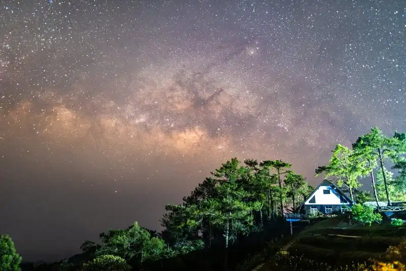
3. Huai Nam Dang National Park, Chiang Mai is a mountainous national park spanning parts of Chiang Mai and Mae Hong Son provinces. One of its principal tourism areas is located in Kuet Chang Subdistrict, Mae Taeng District, Chiang Mai. The park is famous for spectacular morning mist, sunrise views, and extensive mountain panoramas. On clear days, travelers can admire the distinctive silhouette of Doi Luang Chiang Dao in the distance. Its position along the Chiang Mai–Pai route also makes it an appealing destination for mountain travelers exploring northern Thailand.
Highlights: Kiu Lom Viewpoint, early-morning sea of mist, distant views of Doi Luang Chiang Dao, mountain forests, cool highland weather, nature trails, and overnight experiences within the national park area.
Huai Nam Dang is distinguished by its mountain ranges and deep valleys. Kiu Lom Viewpoint is one of the park's principal locations for watching a sea of mist in the early morning. When temperatures and humidity are favorable, mist collects in the valleys below, creating a broad white layer surrounded by mountain ridges. In clear weather, visitors can see multiple layers of peaks extending toward the horizon, making the viewpoint especially attractive for landscape photography.
A particularly striking feature is the mountain backdrop, especially Doi Luang Chiang Dao, whose recognizable shape can be seen when visibility is good. When a sea of mist forms beneath the higher mountains, the first sunlight creates depth and contrast between the mist and the exposed peaks. This constantly changing interplay of clouds, light, and mountain silhouettes is one of the most rewarding parts of an early-morning visit.
Huai Nam Dang National Park also plays an important role in conserving mountain forests and headwater ecosystems within the Thanon Thong Chai Range. These forests help maintain moisture and provide habitat for various species. A visit offers an opportunity to appreciate the relationships between forests, mountain topography, and atmospheric conditions that contribute to the formation of morning mist. Travelers should stay on designated nature trails and use viewpoints authorized by park officials.
The transition from the rainy season to the cool season and the winter months are particularly popular times to visit. Travelers hoping to photograph the morning mist should stay near the park or arrange to reach the viewpoint before sunrise, subject to access regulations. Warm clothing and a flashlight are useful because temperatures can be low and strong winds may occur on exposed ridges. Dense fog can also reduce visibility along mountain roads.
Huai Nam Dang can be included in an itinerary with Pai District in Mae Hong Son Province. The main road from Chiang Mai passes through Mae Taeng and continues across the mountains toward Pai. With two or three days available, visitors can stay near the national park, enjoy its morning scenery, and travel onward to Yun Lai Viewpoint above Pai, where the landscape and cultural atmosphere are noticeably different from those inside the forested national park.
Families should choose easily accessible viewpoints and avoid steep paths unsuitable for young children or older travelers. Photographers may prefer to remain at a single viewpoint for an extended period to capture changing light and mist rather than rushing between several locations in one morning.
Open Days: Generally daily
Opening Hours: Generally 08:00 – 18:00; access to viewpoints before dawn depends on current national park regulations.
Getting There: From Chiang Mai city, take Highway 107 toward Mae Taeng District, then turn onto Highway 1095, the Chiang Mai–Pai road. Follow the signs to Huai Nam Dang National Park. The route includes numerous bends and steep sections, so vehicles should be in good condition and extra travel time allowed, especially when heading to the mountains before sunrise.

4. Yun Lai Viewpoint, Mae Hong Son is one of the most famous sea-of-mist viewpoints in Pai District, Mae Hong Son Province. Located on a hill above Santichon Village in Wiang Tai Subdistrict, it offers panoramic views of the surrounding mountain valleys and rolling hills. The viewpoint is particularly popular at sunrise, when layers of white mist may gather across Pai Valley. Its natural beauty is complemented by the distinctive Yunnanese Chinese cultural atmosphere of the nearby community, making it a memorable destination for travelers seeking both scenic mountain landscapes and local cultural experiences.
Highlights: Yun Lai sea-of-mist viewpoint, sunrise over Pai Valley, panoramic mountain scenery, traditional red lantern decorations, the Yunnanese Chinese atmosphere of Santichon Village, and local food and cultural experiences.
Yun Lai Viewpoint occupies an elevated position overlooking the broad valley surrounding Pai. During cool mornings, moisture in the lower landscape may condense into layers of mist that spread across the valley floor, creating the appearance of a vast white sea beneath the surrounding mountains. The viewpoint provides an excellent perspective for observing this natural phenomenon, particularly as the first sunlight gradually changes the colors of the sky and illuminates the ridges in the distance.
One of the distinguishing features of Yun Lai is its relationship with Santichon Village, a community known for its Yunnanese Chinese heritage. The village reflects the history of Chinese settlement in the highlands of northern Thailand, with traditional food, cultural influences, and architectural decorations contributing to its character. Red lanterns and other Chinese-inspired decorative elements around the tourist area add a recognizable cultural atmosphere to the mountain landscape.
The most popular visiting period is shortly before sunrise, particularly around 06:00–07:00, when travelers hope to see mist covering the valley. However, the density and appearance of the mist vary according to temperature, humidity, wind, and rainfall. On clear mornings without substantial mist, the viewpoint remains worthwhile for its extensive views of Pai and the surrounding mountains. Visitors can observe how the landscape changes as daylight increases and details of the valley gradually become visible.
Staying overnight in Pai is the most practical option for travelers wishing to experience Yun Lai at sunrise. Although the viewpoint is not particularly far from Santichon Village, the access road includes steep sections that require careful driving. Visitors should use a suitable vehicle and check local transportation arrangements before setting out, especially during wet weather or when fog reduces visibility. Those unfamiliar with mountain roads can inquire about local transport services through their accommodation or operators in the village.
After enjoying the sunrise, visitors can return to Santichon Village for breakfast and explore its cultural attractions, food stalls, and community businesses. The rest of the day can be spent discovering Pai town and nearby destinations. For a longer northern Thailand itinerary, Yun Lai can be combined with Huai Nam Dang National Park along the Chiang Mai–Pai route, offering two very different sea-of-mist experiences: one overlooking forested national park mountains and the other associated with a culturally distinctive highland village.
Yun Lai Viewpoint is especially suitable for couples, groups of friends, and landscape photographers. Its combination of mountain silhouettes, sunrise colors, valley mist, and Yunnanese Chinese cultural influences makes it one of Pai's most atmospheric early-morning destinations. Visitors should respect local rules, dispose of waste responsibly, avoid disturbing others, and support community-operated businesses whenever possible.
Open Days: Daily
Opening Hours: 06:00 – 18:00
Getting There: From Pai town, travel toward Santichon Village in Wiang Tai Subdistrict, then continue uphill to Yun Lai Viewpoint. The final section of the road includes steep gradients, so visitors should check current road conditions and use suitable transportation. For those who prefer not to drive, local transport services may be arranged through accommodation providers or businesses in Santichon Village.
Map (GPS):Get Directions to Yun Lai Viewpoint

5. Khao Kho Sea of Mist, Phetchabun is one of the most celebrated highland attractions in Phetchabun Province. Located within Khao Kho District, the destination is characterized by overlapping mountains, extensive valleys, and elevated viewpoints that provide opportunities to watch layers of mist spreading across the landscape. When humidity is high and temperatures fall overnight, mist can accumulate in the lower valleys, forming broad white blankets surrounded by mountain ridges. The phenomenon is particularly popular during the transition from the rainy season into the cool season and throughout the winter tourism period.
Highlights: Sea of mist over Khao Kho's valleys, successive mountain ranges, early-morning sunlight, elevated viewpoints, highland resorts, cool weather, and scenic routes through Phetchabun's mountain landscapes.
Khao Kho's geography consists of numerous mountain ridges separated by valleys at different elevations. As temperatures decline during the night, moisture in the air may condense and settle over the lower terrain. Visitors staying above the valley floor can then look down upon a seemingly endless layer of white mist, with exposed mountain peaks and ridgelines rising above it. This distinctive scenery has become one of the defining images of Khao Kho tourism.
Early morning is generally the most rewarding time to observe the mist, as the atmosphere remains relatively cool and the fog may persist before the sun begins warming the valley. Once sunlight reaches the mountains, the shape and density of the mist can change quickly. On some mornings, it remains low and concentrated between the ridges, while on others it rises toward the viewpoints and temporarily obscures the scenery. These variations make every visit different and provide continuously changing opportunities for photography.
Khao Kho is more than a location for watching morning mist. It is also a popular highland retreat with a range of accommodation, restaurants, and recreational facilities. Travelers can choose a resort overlooking a valley, wake up to mountain scenery near their accommodation, or travel to a public viewpoint along the established tourist routes. Staying near the intended viewing location is particularly convenient, as it reduces the need to drive through mountain roads before dawn.
Landscape photography is one of the most popular activities in Khao Kho. The many layers of mountains, shifting mist, and soft morning light offer opportunities to create panoramic images with considerable visual depth. Photographers may use wide-angle compositions to emphasize the scale of the landscape or focus on isolated ridges emerging from the fog. However, roadside photography should only be undertaken in safe, designated stopping areas. Parking on blind bends or where visibility is restricted can create serious hazards for other road users.
Travelers with two days and one night can arrange an itinerary that includes an overnight stay in Khao Kho, a morning spent watching the mist, and a journey to Phu Thap Boek on the following day if road and weather conditions permit. Although both destinations are famous for misty mountains, they differ in elevation, landforms, and the character of their surrounding communities. Visiting both provides an opportunity to appreciate the geographical variety within Phetchabun Province.
Khao Kho is suitable for couples seeking a scenic mountain getaway, families looking for cool-weather holidays, and photographers attracted to natural light and changing cloud formations. Since the formation of a thick sea of mist cannot be guaranteed, visitors should monitor weather conditions and plan alternative activities. The mountain scenery and relaxed atmosphere remain attractive even on clear mornings.
Open Days: Daily
Opening Hours: General natural viewpoints may be accessible throughout the day; individual attractions, resorts, and businesses have their own operating hours.
Getting There: From Phetchabun town, travel toward Khao Kho District using the main roads connecting the mountain area, including routes accessed from Highway 21 or Highway 12 depending on the starting point. Visitors should select their intended viewpoint or accommodation in advance because the Khao Kho sea-of-mist area includes numerous valleys and elevated locations rather than a single observation point.
Map (GPS):Get Directions to Khao Kho Sea of Mist

6. Phu Thap Boek, Phetchabun is one of the most famous highland destinations in Phetchabun Province, located in Wang Ban Subdistrict, Lom Kao District. Rising approximately 1,768 meters above sea level, it is among the province's most prominent elevated landscapes. Phu Thap Boek is renowned for its sea of mist, cold weather, panoramic mountain views, and agricultural communities, particularly the extensive cabbage fields cultivated by local Hmong residents. These farms have become one of the most recognizable features of the mountain.
Highlights: Phu Thap Boek sea of mist, sunrise above mountain ridges, expansive highland scenery, seasonal cabbage fields, cold winter temperatures, and the traditional agricultural way of life of the Hmong community.
Phu Thap Boek occupies a high mountain landscape overlooking valleys and successive ridges. When the air contains sufficient moisture and nighttime temperatures decrease, mist can gather across the lower terrain and produce an extensive white layer below the higher slopes. At certain times, the mist rises to the level of the roads and accommodation areas, temporarily surrounding visitors in clouds. The scenery continually changes as wind moves the mist and sunlight gradually becomes stronger.
The transition from the rainy season into the cool season can provide favorable moisture conditions for the formation of mist, while winter offers distinctly cool temperatures that attract travelers seeking a mountain holiday. The difference between daytime and nighttime conditions is often noticeable. Visitors planning to watch the sunrise should bring warm clothing, particularly for the early morning, and allow sufficient time to reach a safe viewpoint before the first light appears.
Cabbage cultivation is another essential part of Phu Thap Boek's identity. Agricultural plots extend across the mountain slopes and are closely connected to the livelihoods of local Hmong communities. The planting and harvesting cycles vary by season, meaning the appearance of the fields changes throughout the year. Visitors should respect these working landscapes, avoid entering cultivated plots without permission, and consider supporting locally produced agricultural products and community services.
Photographers will notice that Phu Thap Boek differs from Khao Kho in both elevation and landscape character. Its winding mountain roads pass through ridges, deep valleys, cultivated hillsides, and settlements built on steep terrain. These features create numerous memorable views, but the roads also include tight bends and significant gradients. Drivers should stop only at designated areas and never obstruct the road simply to take photographs.
An overnight stay on Phu Thap Boek allows visitors to experience the cool mountain atmosphere and watch the mist in the morning without making a long predawn journey. The destination can also be combined with Khao Kho and Phu Hin Rong Kla National Park, provided the itinerary allows sufficient time for mountain driving and changing road conditions. Choosing accommodation near the principal viewpoint is often more practical than traveling between distant locations at night.
Phu Thap Boek appeals to couples, groups of friends, and families who enjoy mountain landscapes and cool-weather travel. However, a safe journey requires a well-maintained vehicle and an experienced driver, especially on steep sections and during busy holiday periods. Brakes and tires should be checked before the ascent. When dense fog reduces visibility, drivers must slow down, maintain a safe distance from other vehicles, and avoid stopping in dangerous locations.
Open Days: Daily
Opening Hours: General tourism areas are accessible throughout the day according to the destination information; individual viewpoints and accommodation providers may impose separate restrictions.
Getting There: From Phetchabun town, travel through Lom Sak District toward Lom Kao District, then follow the mountain road through Wang Ban Subdistrict toward Phu Thap Boek. The route includes numerous steep climbs and sharp bends. Visitors should ensure that their vehicle is in good condition and plan ahead, particularly during long holidays when traffic may be heavy.
Map (GPS):Get Directions to Phu Thap Boek
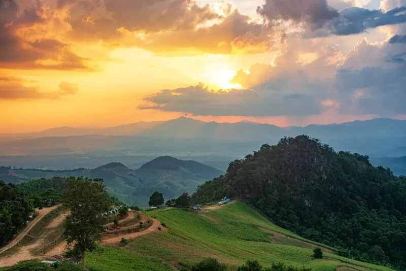
7. Si Nan National Park, Nan is a renowned national park in Nan Province, covering mountainous areas within Wiang Sa, Na Noi, and Na Muen districts. Its most popular attractions include Doi Samer Dao, Pha Chu, and Pha Hua Sing, all associated with panoramic mountain scenery and opportunities to observe sunrise, sunset, or morning mist. The park is also famous for stargazing, particularly during clear nights in the cool season when travelers enjoy camping in the highlands.
Highlights: Sea of mist around Doi Samer Dao and accessible viewpoints, sunrise over mountain ridges, Pha Chu, Pha Hua Sing, extensive valleys, stargazing, camping, and the natural landscapes of Si Nan National Park.
The geography of Si Nan National Park includes mountain ranges, cliffs, ridgelines, and several types of forest. Some areas are relatively open and offer sweeping views of the surrounding valleys. When temperatures fall overnight and moisture accumulates in lower terrain, mist may cover the valleys and create a sea of clouds visible from higher viewpoints. The contrast between the mist and the mountain ridges is particularly attractive during the soft light of early morning.
Doi Samer Dao is one of the park's best-known attractions because of its expansive sky views, sunrise panoramas, and opportunities for stargazing. On clear nights, visitors may enjoy views of the stars, although visibility depends on cloud cover, moonlight, and nearby artificial lighting. Travelers wishing to camp should check booking procedures, designated camping areas, and any limits on visitor numbers before arriving.
Pha Chu and Pha Hua Sing provide different landscape experiences from Doi Samer Dao, particularly because of their cliffs and distinctive rock formations. These locations offer dramatic viewpoints, but some sections may involve significant drop-offs or uneven ground. Visitors must remain within authorized viewing areas and avoid approaching cliff edges, especially when thick mist or poor visibility makes the surrounding terrain difficult to judge.
Beyond its scenic appeal, Si Nan National Park plays an important role in conserving forests and headwater resources associated with the Nan River basin. Its varied mountain environments contribute to ecological diversity and support wildlife habitats. Travelers should follow national park regulations, use designated camping areas, avoid lighting fires outside authorized locations, and remove all waste to help protect the environment.
Different seasons provide different experiences. Periods of high humidity can produce spectacular mist, while clear and cool evenings may be especially suitable for stargazing. Travelers should therefore choose their dates according to the activities they most wish to enjoy rather than focusing entirely on the possibility of seeing thick morning fog.
Visitors traveling from Nan town can arrange an excursion toward Na Noi District to explore Doi Samer Dao and Pha Chu, then continue to other attractions if their schedule permits. Staying close to the national park is particularly convenient for travelers planning to watch sunrise, as it avoids the need for a long journey from Nan town before dawn.
Si Nan National Park is suitable for landscape photographers, campers, couples, and travelers interested in mountain ecosystems. However, individual viewpoints and camping areas may operate under different access arrangements. Because the park covers a large geographical area, visitors should enter the specific destination they intend to reach, rather than assuming that the national park headquarters and Doi Samer Dao share the same location.
Open Days: Daily, subject to national park regulations
Opening Hours: Approximately 05:00 – 20:00 according to the destination information; camping and access to individual sites are subject to separate regulations.
Getting There: From Nan town, travel toward Na Noi District and follow the signs to Si Nan National Park. Travelers specifically interested in the sea of mist at Doi Samer Dao should select Doi Samer Dao as their final destination, as the park includes several separate attractions with different access roads and travel distances.
Map (GPS):Get Directions to Si Nan National Park
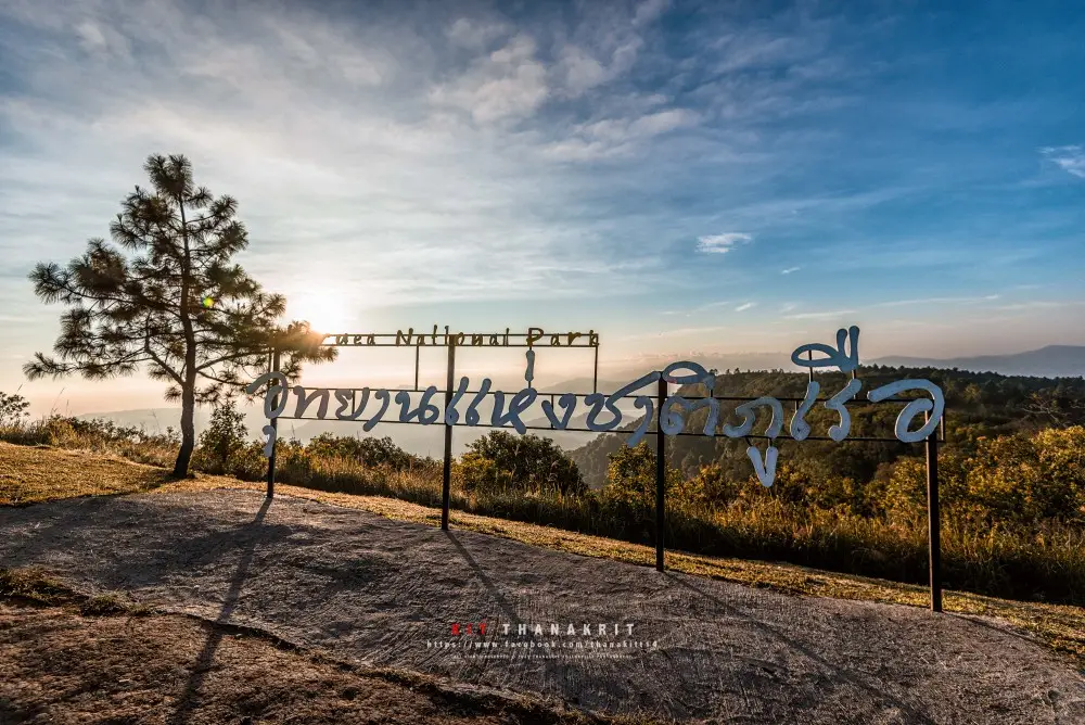
8. Phu Ruea National Park, Loei is one of the best-known mountain destinations in northeastern Thailand, located in Nong Bua Subdistrict, Phu Ruea District, Loei Province, with additional park areas extending into Tha Li District. The park is renowned for its cold winter climate, scenic sunrise viewpoints, mountain forests, and occasional sea-of-mist formations when atmospheric conditions are favorable. Parts of the mountain resemble the bow of a large sailing vessel, an appearance associated with the name Phu Ruea, meaning Boat Mountain.
Highlights: Phu Ruea summit, mountain sunrise viewpoints, sea of mist above surrounding valleys, pine forests, highland vegetation, cold winter weather, and panoramas of the mountain ranges near the Thai–Lao border.
The summit area is a major attraction because of its extensive views over neighboring mountains. On mornings when temperatures are low and sufficient moisture remains in the valleys, layers of mist may form below the higher ridges. As sunrise approaches, the changing light gradually reveals the outlines of the surrounding mountains and forests. This process provides a particularly memorable experience for visitors arriving before dawn.
Loei Province contains numerous mountains and elevated landscapes, giving Phu Ruea a noticeably cooler climate than many lowland destinations, especially during winter. On particularly cold mornings, temperatures may fall sufficiently for frost to form under suitable conditions. Known locally as mae khaning, this phenomenon attracts considerable interest, although it occurs only under specific weather conditions and cannot be expected every day. Warm clothing is essential for an early-morning visit during the coldest period.
Phu Ruea National Park contains several forest types and plant communities adapted to highland conditions. Pine forests, ridge vegetation, and moisture-dependent mountain plants contribute to its ecological diversity. Visitors can explore authorized nature trails and observe how altitude, humidity, and temperature influence the types of vegetation growing within the park.
Photographers should arrive at a safe viewpoint before sunrise to take advantage of the early light. On mornings when dense fog initially conceals the scenery, the landscape may become visible gradually as the sun rises and air movement disperses the mist. The temporary appearance of mountain ridges through the clouds creates attractive opportunities for landscape photography, even when the weather does not provide an uninterrupted panoramic view.
Phu Ruea can also be included in a wider itinerary through Loei Province. Travelers with two or three days available may stay near Phu Ruea to watch the sunrise, then continue to Chiang Khan and explore the traditional riverside community along the Mekong River. Such an itinerary provides a combination of mountain scenery and cultural experiences within the same province.
The national park is suitable for families, couples, photographers, and nature enthusiasts. Visitors should respect park regulations, avoid feeding wildlife, carry their waste out of natural areas, and exercise particular caution on steep paths or near cliffs. Thick fog can significantly reduce visibility, making it especially important to remain within designated public areas.
Open Days: Daily
Opening Hours: 05:00 – 20:00
Getting There: From Loei town, follow Highway 203 toward Phu Ruea District, then take the signed access road into Phu Ruea National Park. Visitors planning to watch the sunrise should consider accommodation in Phu Ruea District or nearby areas and check road conditions before driving uphill in the early morning.
Map (GPS):Get Directions to Phu Ruea National Park

9. Pang Ung, Mae Hong Son is one of northern Thailand's most atmospheric natural retreats, celebrated for its mountain reservoir, pine forests, and delicate layers of morning mist drifting across the water. Located near Ban Ruam Thai in Mok Cham Pae Subdistrict, Mueang Mae Hong Son District, the area is associated with the Pang Tong Royal Development Project. Its mountainous surroundings, evergreen vegetation, and tranquil reservoir create a distinctive landscape that is particularly appealing during the cool season.
Highlights: Mist floating above the reservoir, pine forests lining the water, reflections of trees and mountains, soft morning sunlight, peaceful highland scenery, and the opportunity to combine a visit with Ban Rak Thai.
Unlike mountain viewpoints where visitors look down upon mist covering entire valleys, Pang Ung is renowned for fog that often forms directly above the reservoir and drifts between the surrounding pine trees. When temperatures fall overnight and moisture levels remain high, a thin layer of mist may appear above the surface of the water in the early morning. On calm days, reflections of the trees and hills become visible, creating a tranquil scene in which the water, fog, and forest seem to merge.
Watching the mist at Pang Ung is an experience that rewards patience and quiet observation. Visitors can walk along authorized sections of the reservoir shoreline and photograph the changing scenery as the first light reaches the water. During the period before sunrise and immediately afterward, the mist may change shape and position as temperatures and wind conditions shift, giving photographers new compositions within a relatively small area.
The importance of Pang Ung extends beyond tourism. The area is associated with forest restoration and the management of natural resources in the highlands. The Pang Tong Royal Development Project has contributed to environmental conservation and efforts to improve the livelihoods of local communities. Tourism in the area is therefore connected with broader themes of forest protection, water resource management, and responsible use of highland landscapes.
Travelers hoping to enjoy the morning mist should stay overnight in an authorized accommodation or camping area, or choose lodging nearby. It is important to check current camping procedures, reservations, and entry regulations before traveling. The road from Mae Hong Son town passes through mountain terrain with many curves and some steep sections, requiring particular care during darkness or when fog reduces visibility.
Pang Ung is well suited to a combined trip with Ban Rak Thai because both destinations lie within Mueang Mae Hong Son District and feature mountain landscapes surrounding bodies of water. Nevertheless, their characters differ. Pang Ung is primarily associated with its reservoir and pine forests, while Ban Rak Thai is known for its Yunnanese Chinese village atmosphere, tea culture, and local cuisine. Visiting both provides a rewarding combination of natural scenery and cultural experiences.
Pang Ung is particularly appealing to couples, families, and photographers seeking gentle morning fog reflected on water rather than an elevated sea-of-mist panorama. Visitors should preserve the quiet atmosphere, keep the reservoir shoreline and forests clean, avoid feeding animals without authorization, and follow all regulations governing the protected area.
Open Days: Daily, subject to current access regulations
Opening Hours: 08:00 – 17:00 according to the destination information; overnight stays and access for early-morning mist viewing are governed by separate arrangements.
Getting There: From Mae Hong Son town, follow the mountain roads toward Mok Cham Pae Subdistrict and Ban Ruam Thai, then continue to Pang Ung. Some sections have steep gradients and numerous bends. Visitors should check the condition of their vehicle and confirm entry requirements, especially when planning an overnight stay or arriving before regular operating hours.
Map (GPS):Get Directions to Pang Ung

10. Phu Langka – Fin Ja Boh, Phayao is a popular mountain destination in Pha Chang Noi Subdistrict, Pong District, Phayao Province. Situated within the Phi Pan Nam mountain range, the area is characterized by elevated ridges, deep valleys, and extensive forested landscapes. Its reputation comes from panoramic viewpoints overlooking mountains covered by morning mist, especially during the transition from the rainy season into the cool season and throughout the winter months when moisture and low temperatures may combine to produce a sea of clouds.
Highlights: Sea of mist above Phu Langka's valleys, dramatic layers of mountain ridges, Fin Ja Boh viewpoints, morning sunlight, highland community life, and the forested landscape of Pong District.
The Phu Langka area encompasses high mountains, montane forests, bamboo woodland, grassland, and rocky ridgelines. This varied terrain provides expansive views of valleys at different elevations. When humid air cools sufficiently overnight, mist may settle between the surrounding mountains, creating white layers beneath exposed peaks. The phenomenon is especially appealing to travelers interested in mountain landscapes and the changing atmosphere of early morning.
Fin Ja Boh is associated with popular scenic viewpoints and accommodation overlooking the mountain valleys. The opportunity to wake up close to the viewpoint is an important part of the area's appeal, especially for visitors hoping to watch morning mist from near their lodging. When clouds and sunrise occur together, the overlapping ridges take on a remarkable sense of depth while the colors of the landscape change continuously with the light.
Traveling to Phu Langka also offers an opportunity to experience a quieter side of highland tourism. Roads pass through small communities, agricultural areas, and natural mountain scenery. Visitors can stay with local accommodation providers and spend time appreciating the surroundings rather than making only a brief stop for photographs. The relationship between mountain agriculture and natural landscapes is an important part of the area's character.
Photographers should choose viewpoints that open toward broad valleys and distant ridges. For images containing several layers of mist, it is worthwhile to arrive before sunrise and remain until later in the morning, as the appearance of clouds can change quickly with wind and increasing temperatures. Particular care is necessary on damp paths or near steep slopes, and visitors should remain within safe public viewing areas.
Phu Langka is also valuable as a destination for learning about the relationship between forests, mountains, and highland communities. The Phi Pan Nam Range plays an important role in watershed conservation and the surrounding ecosystem. Responsible tourism should include proper waste disposal, consideration for local residents, and respect for agricultural fields and private land.
For a two-day, one-night trip, travelers can stay near a Phu Langka viewpoint, enjoy the mountain scenery in the evening, and watch the morning mist before continuing to other attractions in Pong District or Phayao Province. Those planning a longer multi-province itinerary should carefully consider driving times and mountain road conditions rather than scheduling too many distant destinations in a single day.
Phu Langka – Fin Ja Boh is particularly suitable for couples, nature photographers, and travelers seeking a peaceful mountain retreat. Staying overnight provides a better opportunity to experience the changing morning scenery than making a short daytime visit, although the presence of a thick sea of mist always depends on natural weather conditions.
Open Days: Daily
Opening Hours: 08:00 – 17:00 according to the destination information; individual viewpoints and accommodation providers may operate at different hours.
Getting There: From Phayao town, travel toward Pong District and follow the roads into Pha Chang Noi Subdistrict, continuing to the Phu Langka and Fin Ja Boh area. Check the condition of the mountain roads and confirm the precise location of the intended accommodation or viewpoint, as scenic places are distributed across several hillside locations. Staying near the chosen viewpoint is recommended for sunrise visitors.

11. Phu Chi Dao, Chiang Rai is a sea-of-mist viewpoint along the Thai–Lao border mountain range, located near Ban Rom Pho Ngoen, Village 11, Po Subdistrict, Wiang Kaen District, Chiang Rai Province. It is known for its elevated ridgeline and expansive views over surrounding valleys and layered mountain ranges. Phu Chi Dao is part of a celebrated group of mountain viewpoints in Wiang Kaen District, together with Phu Chi Fa, Phu Chi Duean, and Doi Pha Tang. However, its distinctive ridge and open panoramic scenery give it a character of its own, making it especially attractive to travelers interested in nature walks and sunrise photography.
Highlights: Sea of mist above mountain valleys, the prominent Phu Chi Dao ridgeline, sunrise, panoramic scenery along the Thai–Lao border, highland viewpoints, and the peaceful atmosphere of the surrounding mountains.
The defining feature of Phu Chi Dao is its exposed mountain ridge rising above the valleys below. When cool temperatures and sufficient humidity combine during the early morning, mist may settle over the lower landscape and create an extensive blanket of clouds. Visitors standing at the viewpoint can see individual peaks and mountain ridges emerging from the white mist, producing a panorama that changes with atmospheric conditions and the movement of sunlight.
The period before sunrise is particularly rewarding for landscape photography. The sky gradually changes from darkness to shades of orange and gold, and as sunlight reaches the valleys, the shape of the mountains becomes increasingly visible. Sometimes thick mist temporarily conceals the landscape, while on other mornings the sky is clear enough to provide extensive views even without a dense sea of clouds. These changes make the viewpoint interesting throughout the early morning.
Access to Phu Chi Dao requires careful attention to the mountain roads and the suitability of the chosen vehicle. Travelers should check whether local transport services or specific vehicle arrangements are required at the time of their visit. The final approach to the viewing area may also involve walking along an exposed ridge with narrow or steep sections. Visitors should follow the instructions of local operators and remain on approved paths.
Wiang Kaen District is home to highland communities whose cultural traditions and livelihoods are closely connected to the mountainous border landscape. Visiting Phu Chi Dao offers opportunities to experience local hospitality, traditional food, and accommodation operated by community businesses. Supporting these services contributes to the local economy and encourages tourism that is compatible with environmental conservation.
Travelers with two days and one night can combine Phu Chi Dao with Phu Chi Fa or Phu Chi Duean because the viewpoints lie along the same general mountain range. However, visiting several summits for sunrise in the same morning is not practical because each may require different transport arrangements and walking times. A better plan is to select one principal sunrise location and visit other viewpoints later in the day, subject to access and weather conditions.
Visitors should bring warm clothing, suitable walking shoes, a flashlight, and drinking water, especially during the cool season when temperatures can be low and winds strong along the ridge. Approaching cliff edges for photographs is dangerous, particularly when thick mist restricts visibility. Remaining within safe areas and allowing adequate time for the ascent are essential parts of a responsible visit.
Phu Chi Dao is ideal for nature enthusiasts and travelers wishing to photograph a sea of mist from a distinctive mountain ridgeline. Staying near the viewpoint and allowing sufficient time for changing light conditions make the experience considerably more rewarding than a rushed visit.
Open Days: Daily
Opening Hours: 05:00 – 18:00
Getting There: From Chiang Rai town, travel through Thoeng District toward Po Subdistrict in Wiang Kaen District. Continue to Ban Rom Pho Ngoen and follow the signs to Phu Chi Dao. Before ascending, check road conditions and local transport services, as some mountain sections may not be suitable for all types of vehicles.
Map (GPS):Get Directions to Phu Chi Dao

12. Phu Chi Duean, Chiang Rai is a scenic sea-of-mist viewpoint located near Ban Rom Fa Luang, Village 12, Po Subdistrict, Wiang Kaen District, Chiang Rai Province, along the mountain range bordering Laos. The elevated viewpoint overlooks broad valleys and distant mountain ridges, providing opportunities to watch the sunrise and morning mist. Although Phu Chi Duean is less widely known than Phu Chi Fa, it offers a distinctive highland atmosphere and attracts travelers interested in exploring several mountain viewpoints within the same border region.
Highlights: Early-morning sea of mist, sunrise over mountain ridges, Phu Chi Duean viewpoint, expansive views along the Thai–Lao border, highland landscapes, and the possibility of combining the destination with Phu Chi Dao and Phu Chi Fa.
Phu Chi Duean is characterized by an elevated ridgeline and sloping mountain terrain overlooking valleys at lower elevations. Under suitable conditions, cool humid air allows mist to gather in these valleys, forming a broad white layer between the surrounding peaks. As the sky begins to brighten, visitors can watch the mountain silhouettes emerge from the mist while the colors of the morning light gradually transform the landscape.
The viewpoint is particularly appealing because of the simplicity of its natural setting. Large buildings and elaborate structures are not essential to the experience; instead, the main attraction is the uninterrupted view across the ridges and valleys. Travelers can spend time observing the changing shape of the mist and the interplay between sunlight, mountain slopes, and clouds. The constantly evolving scenery rewards a relaxed visit rather than a brief stop.
The cool season is a popular time for visiting Phu Chi Duean, especially among travelers exploring the group of viewpoints that includes Phu Chi Fa and Phu Chi Dao. However, the number of visitors and access arrangements may vary depending on road conditions and local management. It is advisable to check current information with local operators before making the journey, rather than assuming that every access route is always available.
Those hoping to watch the sunrise should reach the viewpoint before the first light appears. Warm clothing, a flashlight, and shoes suitable for mountain terrain are important, particularly where ridges are steep or the ground is damp. Visitors should avoid leaving designated paths or approaching exposed cliff edges, especially when thick mist makes it difficult to judge the gradient of the surrounding terrain.
Phu Chi Duean can be included in a multi-day itinerary with Phu Chi Fa and Phu Chi Dao. Travelers should choose accommodation close to the viewpoint they intend to visit at sunrise and schedule other summits according to driving times, access restrictions, and physical readiness. Separating the visits allows more time to enjoy each location and reduces the need to rush along mountain roads before dawn.
The destination also has value as a community-based natural attraction connected to highland villages. Travelers should support local accommodation and transport providers where appropriate, respect private land, and help preserve the mountain environment by removing waste and avoiding damage to vegetation. Following community regulations is essential for keeping the area safe and accessible.
Phu Chi Duean is an appealing choice for nature photographers and travelers who want to experience sea-of-mist scenery along the Thai–Lao border in a relatively simple mountain setting. Its exposed ridges, broad panoramas, and changing early-morning light give it a distinctive atmosphere among Chiang Rai's highland viewpoints.
Open Days: Daily
Opening Hours: The viewpoint is generally accessible throughout the day according to the destination information, subject to local access arrangements.
Getting There: From Chiang Rai, travel through Thoeng District toward Po Subdistrict in Wiang Kaen District, then follow the route to Ban Rom Fa Luang and Phu Chi Duean. Visitors should check the designated parking area, local transport arrangements, and road conditions before ascending, as some sections are steep or may restrict access by ordinary vehicles.
Map (GPS):Get Directions to Phu Chi Duean
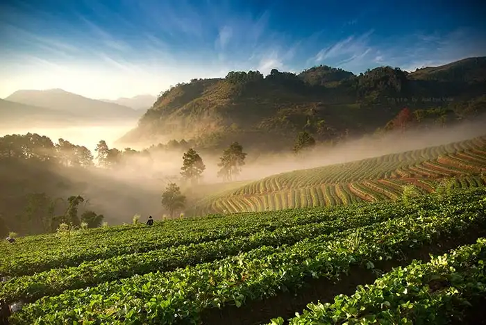
13. Doi Ang Khang, Chiang Mai is a famous highland destination in Mae Ngon Subdistrict, Fang District, Chiang Mai Province, situated approximately 1,400 meters above sea level. Known for its cool mountain climate, extensive highland scenery, and agricultural development associated with the Royal Agricultural Station Angkhang, the area has long been a popular winter destination in northern Thailand. Besides its temperate-climate plants and scenic agricultural landscapes, visitors may encounter morning mist drifting through the surrounding valleys when weather conditions are favorable.
Highlights: Morning mist over mountain valleys, panoramic highland landscapes, Royal Agricultural Station Angkhang, temperate-climate flowers and crops, mountain agriculture, and the distinctive culture of nearby highland communities.
Doi Ang Khang is especially appealing because of the combination of natural mountain scenery and cultivated highland landscapes. The surrounding ridges and valleys create differences in humidity and temperature throughout the day. As the atmosphere cools overnight, mist may accumulate in the lower valleys and drift across mountain slopes in the morning, creating an atmosphere that differs from the dramatic cliff-top seas of clouds found at other northern viewpoints.
The Royal Agricultural Station Angkhang is a significant attraction associated with the development of highland agriculture and the promotion of sustainable livelihoods for local communities. Visitors can learn about the cultivation of temperate-climate crops, agricultural techniques suitable for mountainous environments, and the adaptation of plant species to cool conditions. A journey to Doi Ang Khang therefore combines scenic tourism with an educational perspective on agriculture and rural development.
Winter is particularly popular because the mountain climate becomes pleasantly cool and seasonal plants create attractive scenery in several areas. Although the appearance of mist depends on atmospheric conditions, even a thin layer drifting above the valleys or cultivated slopes can lend the landscape a distinctive beauty. Unlike viewpoints where dense clouds conceal entire valleys, Doi Ang Khang often appeals through a more varied combination of mountain scenery, agriculture, and occasional mist.
Photographers will find numerous subjects at Doi Ang Khang, including mountain ridges, temperate-climate agricultural plots, winding roads, and highland villages. Early morning is suitable for soft light and potential mist, while the daytime allows visitors to explore the agricultural station and educational areas that are open to the public. Travelers should follow the regulations of individual facilities and avoid entering restricted agricultural plots.
The surrounding highland communities have diverse cultural traditions and livelihoods closely connected to the mountainous environment. Visitors can stay in nearby accommodation, experience the cooler evening air, enjoy local food, and purchase agricultural products sold in the area. Respecting community spaces and the working areas of farmers is an important part of responsible tourism.
For a two-day, one-night trip, travelers can ascend Doi Ang Khang during daylight, explore the Royal Agricultural Station and accessible viewpoints, then stay overnight to experience the cool climate and watch for mist the following morning. A relaxed itinerary is preferable to rushing because the mountain roads contain numerous bends and steep sections that require careful driving.
Travelers should pay particular attention to vehicle condition before ascending Doi Ang Khang. Brakes, tires, and fuel levels should be checked, especially when fog or rain may reduce visibility. Visitors must also follow the operating rules of the agricultural station and other attractions, as access conditions may differ between individual destinations within the mountain area.
Open Days: Daily
Opening Hours: November – March: 07:00 – 18:00; April – October: 08:00 – 17:00, according to the destination information.
Getting There: From Chiang Mai city, follow Highway 107 toward Fang District, then continue along the signed mountain route to Doi Ang Khang. The roads include numerous bends and steep gradients, so a well-maintained vehicle and cautious driving are essential. Visitors should choose their precise destination before ascending because viewpoints, agricultural facilities, and community attractions are located in different parts of the mountain.
Map (GPS):Get Directions to Doi Ang Khang
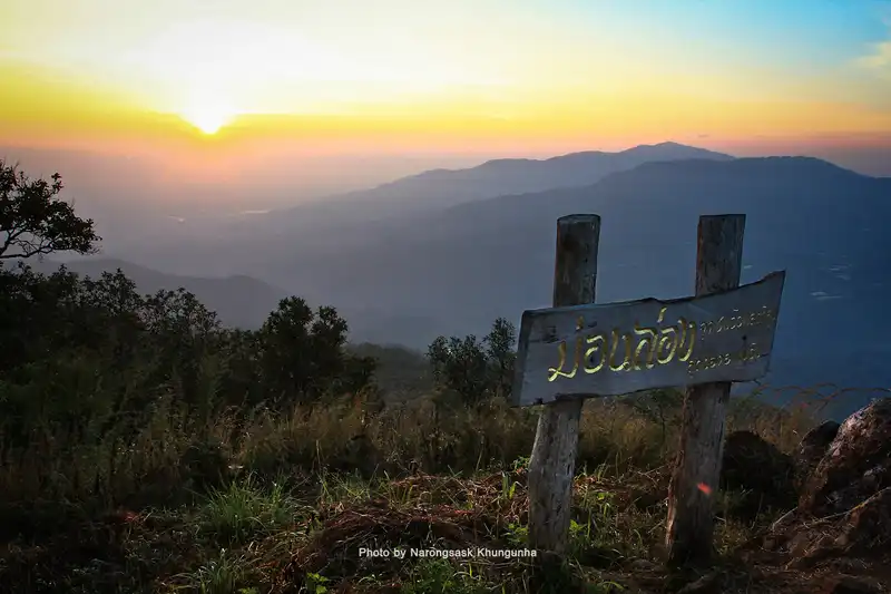
14. Doi Mon Long, Chiang Mai, also known as Mon Kwam Long, is a mountain ridge viewpoint in Pong Yaeng Subdistrict, Mae Rim District, Chiang Mai Province. Its principal attractions are the wide-ranging views of overlapping mountain ridges, forested valleys, and highland landscapes. On mornings when humidity and temperatures are favorable, drifting mist may gather in the valleys or pass along the ridgelines, creating memorable scenery for visitors interested in mountain photography and nature-based excursions within reach of Chiang Mai city.
Highlights: Doi Mon Long ridgeline viewpoints, successive mountain ranges, early-morning mist, panoramic highland landscapes, mountain communities, and opportunities to combine a visit with the Mon Jam area.
Doi Mon Long is particularly appealing because of its elevated ridge, from which travelers can observe the contours of several mountain ranges. When cool air and moisture combine overnight, mist may settle between the lower slopes, producing a contrast between the clearly defined ridges and the white layers covering the valleys. The appearance of this landscape changes continually according to wind, temperature, and the direction of sunlight.
Early morning and late afternoon are rewarding times for landscape photography. The softer light helps emphasize the shapes of the mountains and the differences in elevation between the ridges. When mist occurs, it adds depth and atmosphere to the panorama, although travelers should not expect a dense sea of clouds every day. Even during clear conditions, the expansive views remain a principal attraction.
The surrounding highlands are associated with agricultural communities whose livelihoods depend on the mountain environment. Visitors can observe the relationship between the slopes, cultivated areas, and settlements scattered through the landscape. Agricultural land remains an important working environment, so visitors should respect private property and avoid entering fields without permission.
Doi Mon Long can be included in an excursion through Mae Rim District alongside Mon Jam and other mountain attractions. However, some access roads are narrow or steep, and travel times may be longer than expected. A practical itinerary should concentrate on a few nearby locations rather than attempting to visit every viewpoint in a single morning.
Photographers can use the exposed ridges and open grassy areas as foreground elements when photographing the distant mountains. Panoramic compositions are particularly effective because the ranges extend across a wide horizon. During misty conditions, the separation between successive ridges becomes more pronounced, while sunset light can reveal details that are less visible in the morning.
The weather can be substantially cooler than in central Chiang Mai, especially during the winter months and before dawn. Travelers should prepare a jacket, suitable walking shoes, and drinking water. Road access and visitor arrangements should be checked before departure, particularly during the rainy season when some sections may become slippery.
Doi Mon Long is an appealing option for visitors seeking a peaceful mountain experience that focuses on broad natural scenery rather than heavily developed attractions. Its combination of ridgelines, occasional morning mist, and highland community landscapes makes it a worthwhile addition to a Mae Rim nature itinerary.
Open Days: Generally daily, subject to local area management and weather conditions.
Getting There: From Chiang Mai city, travel toward Mae Rim District, then continue into Pong Yaeng Subdistrict and the Doi Mon Long area using the designated mountain roads. Check road conditions, parking locations, and the suitability of your vehicle, especially when traveling before sunrise or during wet weather.
Map (GPS):Get Directions to Doi Mon Long
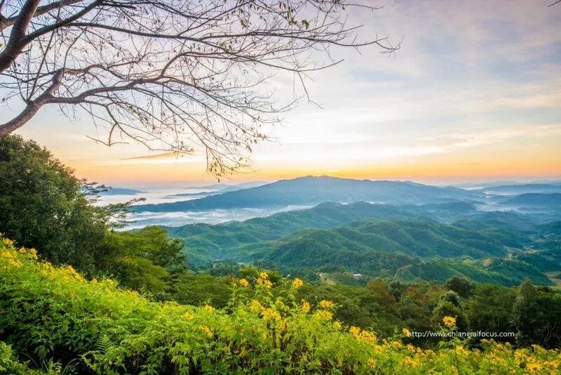
15. Doi Hua Mae Kham, Chiang Rai is a scenic highland destination in Mae Salong Nai Subdistrict, Mae Fa Luang District, Chiang Rai Province. Located near the mountainous Thai–Myanmar border, the area is especially well known for its seasonal fields of golden Mexican sunflowers, highland communities, and expansive mountain panoramas. During favorable weather, visitors may also see morning mist spreading across the valleys, making Doi Hua Mae Kham an appealing destination for travelers interested in both natural landscapes and local culture.
Highlights: Mountain scenery along the border, morning sea-of-mist views, seasonal Mexican sunflower fields, traditional highland communities, photography, and the cool-season atmosphere of northern Chiang Rai.
The landscape of Doi Hua Mae Kham consists of high mountains, ridges, and steep-sided valleys. When temperatures fall overnight and sufficient humidity remains in the atmosphere, mist may collect between the mountains and cover the lower terrain. From elevated locations, visitors can observe the layers of mist and surrounding ridges, while clear weather provides extensive views over forested mountains and scattered highland settlements.
One of the area's most recognizable attractions is its golden Mexican sunflower display. During the flowering period, bright yellow blossoms spread across the mountain slopes, creating a striking contrast with the surrounding green vegetation and distant ridgelines. The flowering season is influenced by rainfall, temperature, and other natural conditions, so the exact timing and intensity of the display can differ from year to year.
Doi Hua Mae Kham is also notable for its ethnic and cultural diversity. Communities in the area maintain distinct traditions relating to clothing, food, agriculture, and everyday life on the mountains. Visitors can gain an appreciation of these cultures by exploring community areas respectfully and supporting local services. Permission should be requested before photographing residents, private houses, or agricultural activities.
Early morning is the most promising period for observing mist because temperatures are generally lower and moisture may remain concentrated in the valleys. Travelers staying overnight in the surrounding highlands have greater flexibility to experience sunrise and choose photography locations according to the weather. Driving in daylight and remaining near the destination overnight is also more practical than navigating unfamiliar mountain roads before dawn.
For travelers interested in cultural exploration, Doi Hua Mae Kham can form part of a wider journey through Mae Fa Luang District. The area offers opportunities to appreciate highland agriculture, mountain scenery, and community traditions. Choosing locally operated accommodation, food services, or products can help distribute tourism income among the people who live in the mountains.
Access roads may be winding, steep, or affected by rain and fog, particularly in the cooler months. Drivers should check the condition of their vehicle and allow enough time for the journey. Areas near the international border may also have restrictions, making it important to remain on established public routes.
Doi Hua Mae Kham is ideal for travelers who appreciate mountain scenery, ethnic community culture, and seasonal flower displays. A sea of mist is a rewarding possibility when conditions are suitable, but the principal appeal of the destination also includes its golden sunflower landscapes and distinctive highland heritage.
Open Days: Daily, subject to local access conditions.
Getting There: From Chiang Rai city, travel toward Mae Fa Luang District and Mae Salong Nai Subdistrict, then follow the mountain route to Doi Hua Mae Kham. Check local road conditions and the flowering season before traveling, particularly when planning an early-morning visit.
Map (GPS):Get Directions to Doi Hua Mae Kham
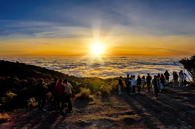
16. Doi Inthanon National Park, Chiang Mai is one of Thailand's most celebrated natural destinations, located in Chiang Mai Province with important visitor areas in Ban Luang Subdistrict, Chom Thong District. The park is home to Doi Inthanon, the country's highest mountain at approximately 2,565 meters above sea level. Its landscape encompasses cloud forests, waterfalls, highland nature trails, and mountain viewpoints where visitors may encounter drifting mist when atmospheric conditions are suitable.
Highlights: Mountain mist and accessible highland viewpoints, Kew Mae Pan Nature Trail, Doi Inthanon summit, the twin royal pagodas of Naphamethanidon and Naphaphonphumisiri, Ang Ka Nature Trail, and the diversity of mountain forests.
One of Doi Inthanon's most remarkable features is the way its ecosystems change with elevation. As travelers ascend from the lower slopes toward the summit, vegetation and atmospheric conditions gradually change. The upper mountain supports moisture-rich evergreen forests where temperatures are significantly lower than in the plains. These habitats are important for ecological research and provide opportunities to understand how altitude influences Thailand's mountain biodiversity.
The misty scenery varies considerably between different parts of the park. On some days, fog drifts through the cloud forest, creating a mysterious atmosphere among moss-covered trees and dense vegetation. From certain open ridges, visitors may see mist filling valleys below when visibility permits. It is important to distinguish these experiences: being surrounded by fog in the forest is different from watching an extensive sea of clouds from a higher viewpoint.
Kew Mae Pan Nature Trail is one of the park's best-known highland walking routes. It passes through montane forest and open grassland areas along the ridgeline, with designated points offering far-reaching mountain views. Access is regulated according to the season, and local guides may be required under national park rules. Visitors should confirm the trail's current opening dates and entry arrangements before planning their itinerary.
The twin royal pagodas are another major attraction, located amid high mountain scenery and gardens featuring plants adapted to cooler conditions. Travelers can appreciate the religious architecture while enjoying the surrounding landscape from designated viewing areas. As individual attractions may have different opening arrangements, it is advisable to plan the itinerary around confirmed access times.
During the winter months, the upper mountain can become extremely cold in the early morning, and under suitable conditions frost may form. Travelers should prepare warm clothing, gloves, and footwear with a good grip, especially when visiting forest trails or exposed viewpoints. Dense mist can also reduce visibility considerably on the winding mountain road.
Doi Inthanon can be visited as a day trip from Chiang Mai city, although spending longer in the area allows more time to explore the summit, ecological trails, pagodas, and waterfalls without rushing. Visitors focused on early-morning scenery may prefer accommodation near the park, avoiding a lengthy drive from the city before sunrise.
The park is particularly rewarding for visitors interested in mountain forests, ecological diversity, cool-weather travel, and photography. Mist is only one element of the experience; the transition between forest types and the remarkable environment surrounding Thailand's highest summit make Doi Inthanon an important natural destination throughout the year.
Open Days: Daily
Opening Hours: Generally 05:30 – 18:30, subject to official announcements and seasonal restrictions on individual trails.
Getting There: From Chiang Mai city, take Highway 108 toward Chom Thong District, then turn onto Highway 1009 to ascend Doi Inthanon National Park. The road includes steep sections and numerous bends, so drivers should ensure their vehicle is in good condition and allow additional time during busy holidays.

17. Ban Rak Thai, Mae Hong Son is a distinctive highland village in Mok Cham Pae Subdistrict, Mueang Mae Hong Son District, Mae Hong Son Province. Famous for its Yunnanese Chinese heritage, Ban Rak Thai occupies a mountain valley surrounding a scenic reservoir. Traditional-style houses, tea shops, restaurants, and cultivated slopes contribute to its memorable atmosphere. During cool mornings, delicate layers of mist may drift across the water, making the village a popular destination for couples, photographers, and travelers seeking a peaceful cultural retreat.
Highlights: Morning mist above Ban Rak Thai Reservoir, mountains surrounding the village, Yunnanese-style buildings, tea culture, traditional food, sunrise scenery, and the opportunity to visit Pang Ung during the same trip.
Ban Rak Thai's position within a sheltered mountain valley creates a particularly attractive setting for observing early-morning mist. When temperatures fall overnight and humidity is sufficiently high, a thin layer of fog may form over the reservoir. As sunlight reaches the valley, the changing mist reveals reflections of the surrounding buildings and mountains, producing a distinctive landscape that combines nature with village architecture.
The village's history is closely connected to the settlement of Yunnanese Chinese communities in the highlands of Mae Hong Son. Migrants brought culinary traditions, language, tea culture, and ways of life that gradually became part of the area's cultural identity. Today, these influences remain visible in local cuisine, signs, architecture, and everyday community activities.
Tea is an especially important aspect of a visit to Ban Rak Thai. Travelers can stop at tea shops to sample locally offered varieties and learn about the culture surrounding tea drinking. Yunnanese food is another defining experience, reflecting recipes and preparation methods maintained within the community. Walking through the village and enjoying a meal beside the reservoir allow visitors to appreciate more than its scenic appearance alone.
Travelers hoping to photograph morning mist should stay overnight in the village or nearby. Mist may appear for only a short period, so being close to the reservoir provides a practical advantage. On some mornings, thick fog creates a dreamlike atmosphere over the water; on others, clear conditions reveal the surrounding mountains and village buildings. Both offer attractive photographic opportunities.
Ban Rak Thai can be combined with Pang Ung because the destinations are relatively close within Mueang Mae Hong Son District and both feature bodies of water surrounded by mountains. Their characters are different, however: Ban Rak Thai is distinguished by its Yunnanese Chinese community and tea culture, while Pang Ung emphasizes pine forests and a more natural reservoir setting. Visiting both provides a rich combination of landscape and culture.
Ban Rak Thai is also a living residential community. Visitors should respect the privacy of local residents, avoid excessive noise during the early morning and at night, and ask permission before photographing homes or individuals. Supporting community restaurants, tea shops, and accommodation contributes to the local economy.
For couples and families, Ban Rak Thai offers a comparatively relaxed way to experience misty mountain scenery without a difficult summit trek. Its blend of architecture, food traditions, mountain surroundings, and tranquil waterfront views gives it a distinctive place among Thailand's atmospheric highland destinations.
Open Days: Daily
Opening Hours: The village is accessible throughout the day; individual shops, boat operators, restaurants, and accommodation providers have separate operating hours.
Getting There: From Mae Hong Son town, follow the roads toward Mok Cham Pae Subdistrict and Ban Rak Thai. The journey passes through mountainous terrain with numerous bends and steep sections. Staying overnight near the reservoir is recommended for travelers hoping to see morning mist without driving along the mountain route before dawn.
Map (GPS):Get Directions to Ban Rak Thai
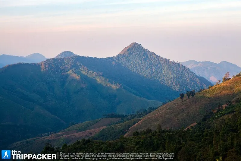
18. Doi Phu Kha National Park, Nan is an extensive protected mountain landscape in Nan Province, with important visitor facilities in Phu Kha Subdistrict, Pua District. The national park extends across several districts and encompasses diverse habitats, including evergreen mountain forests, mixed forests, natural pine stands, and grasslands. It is particularly celebrated for its rare plants, mountain viewpoints, watershed ecosystems, and opportunities to experience misty forest scenery during favorable weather.
Highlights: Highland viewpoints, morning mist over mountain valleys, evergreen forests, natural pine stands, the rare Chomphu Phu Kha tree, nature trails, and scenic routes between Pua and Bo Kluea districts.
Doi Phu Kha is distinguished by its rugged terrain and considerable variation in elevation. These conditions support several forest ecosystems, each influenced by different combinations of temperature, moisture, and altitude. Traveling through the park allows visitors to observe changes in vegetation as the road ascends from lower forests toward cooler mountain environments.
When morning temperatures are low and moisture is concentrated in the valleys, fog may gather below the ridgelines or drift through higher forests. From suitable elevated viewpoints, travelers may observe the mist and surrounding mountains when visibility is clear. However, Doi Phu Kha covers a large geographical area, and different viewpoints offer different conditions. Visitors should identify a particular viewpoint rather than assuming that all locations within the park provide the same sea-of-mist scenery.
One of the park's most important botanical attractions is Chomphu Phu Kha, a rare flowering tree of considerable scientific and conservation interest. Its seasonal blossoms are among the distinctive features associated with the park, although flowering depends on the time of year and local environmental conditions. Visitors should remain on designated paths and never remove flowers or other plant material from protected areas.
Beyond its scenery, the park offers opportunities to understand mountain ecology. The different types of forest, variations in understory vegetation, and changes in humidity provide valuable insights into how mountain environments function. Travelers should observe park regulations and avoid entering zones that are closed for habitat restoration or protection.
The scenic mountain routes connecting Pua and Bo Kluea are a valuable part of the wider experience of traveling through Nan Province. Visitors with two or three days available can stay in Pua, explore accessible areas of Doi Phu Kha, and continue toward Bo Kluea to discover the culture and natural landscapes of the surrounding highlands.
Driving requires care because many sections of the mountain roads have sharp bends and steep gradients. Dense fog can significantly reduce visibility, and parking for photographs should be limited to designated stopping areas. Visitors should also check whether individual attractions and trails are accessible during their intended travel period.
Doi Phu Kha National Park is particularly attractive to travelers interested in forests, mountain ecosystems, rare plants, and scenic driving routes. A sea of mist may provide an unforgettable addition to the visit, but the park's wider ecological and botanical importance makes it worthwhile even when the weather is clear.
Open Days: Daily, subject to national park management.
Getting There: From Nan town, travel toward Pua District, then continue along the mountain route toward Phu Kha Subdistrict and Doi Phu Kha National Park. Visitors specifically wishing to see mist should confirm the location and accessibility of appropriate viewpoints with park staff before driving into the highlands.
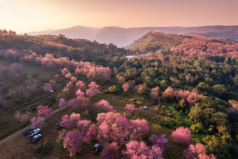
19. Phu Hin Rong Kla National Park, Phitsanulok is a remarkable national park located along the mountain ranges where Phitsanulok, Phetchabun, and Loei provinces meet. Its principal tourist areas are in Nakhon Thai District, Phitsanulok Province. The park is distinguished by unusual rock formations, highland forests, pine trees, cliffs, and an important chapter in Thailand's modern political history. During the cool season, visitors may encounter fog drifting through the mountains or gathering over the surrounding valleys, adding another dimension to a landscape already celebrated for its natural and historical significance.
Highlights: Misty mountain scenery, Lan Hin Pum, Lan Hin Taek, Pha Chu Thong, pine forests, panoramic highland landscapes, and historical sites within the national park.
Phu Hin Rong Kla is particularly famous for its unusual rocky terrain, formed through geological weathering and erosion. Lan Hin Pum contains naturally raised stone formations scattered across the ground, while Lan Hin Taek is characterized by distinctive cracks and fissures. These features create striking landscapes and provide opportunities to learn about the geological processes that have shaped the mountain over long periods.
Some elevated viewpoints within the park overlook broad valleys and successive ridgelines. When cool air combines with sufficient humidity, mist may settle in the lower terrain or drift across the mountains in the morning. Visitors may then see layers of clouds between the ridges, creating a distinctive view that differs from the mountain landscape in clear daylight. Travelers should confirm which viewpoints are accessible and check the weather before visiting.
The park also preserves evidence of Thailand's modern political history. The mountainous area once played an important role in the conflict involving the Communist Party of Thailand. After the political situation changed, the region was developed as a national park, while several historical locations were retained as places of learning. These sites provide insight into the lives and experiences of people involved in that period of Thai history.
Visitors can therefore experience more than mountain views. Walking through the unusual stone fields offers an opportunity to study geology, while historical areas provide information about the political and social changes associated with the region. A well-planned visit should allow enough time for both aspects, taking account of the walking distances and uneven terrain at individual attractions.
The cool season is particularly pleasant for exploring the national park, although mist, wind, and low temperatures may occasionally affect visibility and comfort. Warm clothing, sturdy walking shoes, drinking water, and a flashlight are useful items, especially for visitors planning an early start. Extra care is required around cliff edges, exposed rocks, and natural cracks in the ground.
Phu Hin Rong Kla can be included in a mountain itinerary connecting Phitsanulok and Phetchabun, with other destinations such as Phu Thap Boek and Khao Kho. However, travel between these locations involves mountain roads and varying driving times. Visitors should not attempt to combine too many sunrise viewpoints in a single morning.
The national park is particularly suitable for travelers interested in geology, nature, modern history, and mountain photography. Mist may provide an additional attraction in favorable weather, but the park's distinctive rock formations, forests, and historical landmarks remain compelling reasons to visit throughout the year.
Open Days: Daily
Opening Hours: 06:00 – 18:00
Getting There: From Phitsanulok town, travel toward Nakhon Thai District and follow the signs to Phu Hin Rong Kla National Park. Alternatively, access is available from the Phetchabun side through designated mountain roads. Visitors should verify road conditions and opening arrangements before heading into the mountains.

20. Phanoen Thung, Phetchaburi is one of the most famous sea-of-mist viewpoints within Kaeng Krachan National Park in Phetchaburi Province. Located in the mountainous area of Huai Mae Phriang Subdistrict, Kaeng Krachan District, it provides extensive views over a vast landscape of forests, valleys, and mountain ranges. Phanoen Thung is particularly attractive when early-morning mist accumulates above the forest canopy, creating a white layer through which the surrounding ridges emerge. The destination appeals to nature enthusiasts, birdwatchers, and photographers seeking a mountain landscape dominated by relatively undisturbed forest.
Highlights: Sea of mist above forest canopies, Phanoen Thung viewpoints, mountain panoramas, sunrise, the natural forests of Kaeng Krachan National Park, and birdwatching.
The most striking aspect of Phanoen Thung is the view over an extensive forest landscape. When cool temperatures and high humidity produce mist across the valleys, a white layer may spread above the treetops, with higher ridges visible in the distance. The scenery differs from viewpoints overlooking settlements or cultivated fields because the dominant visual feature is a broad expanse of natural forest.
Phanoen Thung lies within Kaeng Krachan National Park, an important protected area recognized for its biodiversity, forest ecosystems, and watershed resources. The surrounding landscape supports many species of wildlife and plants. A visit to the viewpoint offers an opportunity to appreciate the relationship between forest cover, humidity, and the formation of mountain mist.
Early morning is generally the most promising time to observe the sea of mist. As sunlight reaches the valleys, the cloud layer gradually changes shape and color. Sometimes the mist remains thick and conceals much of the forest; at other times it breaks apart to reveal successive mountain ranges. These changes create rewarding photography conditions, especially for those willing to spend time watching the landscape rather than taking only a brief photograph.
Access to Phanoen Thung is regulated because the mountain road includes narrow, steep, and challenging sections. Travelers must check current national park announcements concerning the permitted vehicles, road conditions, and scheduled ascent and descent periods. A suitable four-wheel-drive vehicle or an authorized local transport service may be necessary. Visitors should not attempt to enter the route outside the permitted hours.
Staying overnight in an authorized camping area or nearby accommodation can make it easier to follow the park's access schedule and enjoy the morning scenery. Visitors should arrange transport and accommodation in advance, particularly during busy travel periods. Warm clothing, a flashlight, drinking water, and suitable footwear are recommended for the mountain environment.
Kaeng Krachan is also an important destination for birdwatching and ecological exploration. Visitors may encounter birds or other wildlife during their journey, but sightings cannot be guaranteed. Animals should be observed from an appropriate distance, and feeding wildlife is prohibited. Quiet behavior and respect for protected habitats contribute to a better experience for both visitors and wildlife.
Phanoen Thung is especially suitable for travelers who want to experience a sea of mist above a large natural forest. Its remote mountain setting offers a different atmosphere from more commercial highland destinations, but the journey requires careful preparation and strict adherence to national park regulations.
Open Days: Subject to national park access announcements and seasonal restrictions.
Getting There: From Bangkok, travel to Phetchaburi Province and continue toward Kaeng Krachan District and Kaeng Krachan National Park. From the park's designated access point, proceed toward Phanoen Thung only during authorized time windows and with a suitable vehicle. Confirm road and camping arrangements before departure.
Map (GPS):View Phanoen Thung on Google Maps
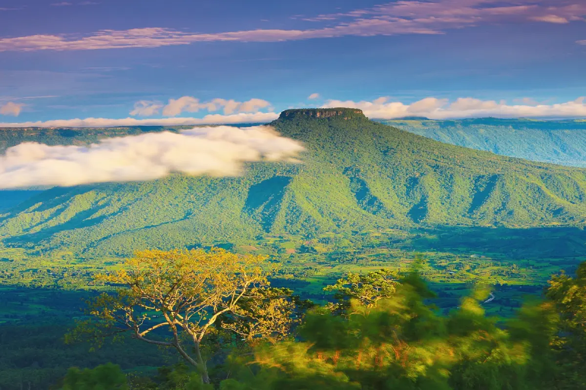
21. Phu Pa Po (Fuji of Loei), Loei is a distinctive community-based mountain viewpoint located in Ban Pha Wai, Village 3, Puan Phu Subdistrict, Nong Hin District, Loei Province. Situated at an elevation of more than 900 meters above sea level, the viewpoint is famous for its remarkable perspective of Phu Ho, a mountain with a broad, relatively flat summit and slopes that resemble the outline of Japan's Mount Fuji. When morning mist gathers around the mountain's lower slopes, Phu Ho appears to rise above a white sea of clouds, inspiring the popular nickname Fuji of Loei.
Highlights: Morning mist around Phu Ho, the Fuji of Loei panorama, extensive mountain viewpoints, sunrise and sunset, traditional E-Taek tractor transport operated by the local community, and nearby Suan Hin Pha Ngam.
Phu Pa Po occupies elevated terrain with panoramic views extending toward surrounding mountains in several directions. Its main attraction is Phu Ho, whose distinctive silhouette provides a recognizable focal point for landscape photography. Unlike sharply pointed peaks, Phu Ho has a broad summit and slopes that create an unusual outline. Mist gathering around its base can make the mountain appear isolated above the clouds.
Early morning is the most popular period for observing mist and sunrise. As the light gradually reaches Phu Ho and the surrounding landscape, the mountain's profile becomes more pronounced, and the cloud layer may change color from cool white to warmer shades. Late afternoon offers a different photographic atmosphere, particularly for those who remain in the area to watch the sunset over the ridges.
A distinctive aspect of tourism at Phu Pa Po is the locally managed transportation system. Visitors normally park their private vehicles at the community visitor center and use E-Taek tractor-style vehicles operated by local residents to reach the upper viewpoint areas. These traditional agricultural vehicles have become an important part of the visitor experience and create income opportunities for the community. Travelers should follow the transport rules rather than attempting to drive private cars uphill.
Phu Pa Po also represents an example of community-based ecotourism. Parts of the surrounding landscape have been associated with forest restoration and improved land management, with local residents participating in the development and operation of the viewpoint. The transport service, viewing areas, and sale of community products help connect environmental protection with local economic opportunities.
Visitors can combine Phu Pa Po with Suan Hin Pha Ngam, sometimes called the Kunming of Loei, which is also located in Nong Hin District. While Phu Pa Po emphasizes elevated views, mist, and the distinctive silhouette of Phu Ho, Suan Hin Pha Ngam is famous for limestone formations and unusual geological scenery. Exploring both provides contrasting perspectives on the province's mountain environments.
Travelers should follow the instructions of E-Taek drivers and remain seated while the vehicles are moving. Children and older visitors should be supervised carefully, particularly on walking paths near steep slopes. Warm clothing is useful before sunrise, and visitors should avoid approaching exposed viewpoints where the ground is unstable or visibility is restricted by fog.
Phu Pa Po is an excellent choice for travelers seeking a sea-of-mist experience with an unusual mountain backdrop. The recognizable shape of Phu Ho and the community-operated transport service distinguish it from many other mountain viewpoints in Thailand.
Open Days: Daily
Opening Hours: 05:00 – 18:00
Getting There: From Loei town, travel toward Nong Hin District, then continue to Puan Phu Subdistrict and Ban Pha Wai, following the signs for Phu Pa Po or the Kunming of Loei. Park at the community visitor center and take the local E-Taek service to the viewpoints. Travelers interested in sunrise should confirm the earliest transport arrangements in advance.
Map (GPS):Get Directions to Phu Pa Po
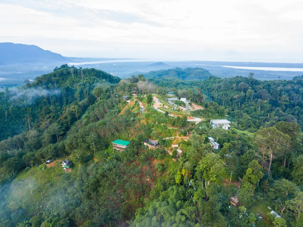
22. Khao Khai Nui Sea of Mist, Phang Nga is one of southern Thailand's most distinctive morning mist viewpoints, located near Ban Fai Tha, Village 3, Thung Maphrao Subdistrict, Thai Mueang District, Phang Nga Province. The hill overlooks green valleys and surrounding mountains, with distant views toward the Andaman Sea in clear weather. Its special appeal is the opportunity to see a sea of mist close to the coast, demonstrating that dramatic morning cloud formations are not limited to the high mountains of northern Thailand.
Highlights: Morning sea of mist, sunrise, mountain valleys, distant Andaman Sea views, rubber plantations, the rural atmosphere of Ban Fai Tha, and community-operated accommodation and uphill transport.
Khao Khai Nui rises approximately 200 meters above sea level, considerably lower than many celebrated northern mountain viewpoints. However, the surrounding valleys, mountain slopes, and humid coastal atmosphere can create conditions favorable for the formation of morning mist. From the viewpoint, visitors may see white layers of fog spreading across the green valleys, while distant mountain ridges and the coastal landscape provide a dramatic backdrop.
The most popular viewing period is before sunrise through approximately 08:00. Travelers generally ascend before dawn to watch the sky gradually brighten and the first sunlight illuminate the mist. The appearance and density of the clouds vary according to weather conditions. In some mornings, the fog may be dense and expansive, while at other times the views are clearer and the landscape itself becomes the main attraction.
The development of Khao Khai Nui as a tourist destination is closely connected to the local community and the surrounding agricultural landscape. The hill was traditionally associated with land used by local residents, including rubber cultivation. As the scenic potential of the viewpoint became more widely recognized, local tourism services developed, including transport, simple accommodation, and facilities for visitors.
Ban Fai Tha reflects a rural environment where agriculture and natural resources continue to shape local life. Travelers who stay nearby can experience a quieter side of Phang Nga, different from its major coastal resorts. Supporting local accommodation and transport services helps the community benefit from tourism while encouraging responsible management of the mountain environment.
The road ascending Khao Khai Nui includes steep sections and may be unsuitable for ordinary passenger cars, particularly after rainfall. Visitors should check with local accommodation providers or community operators about uphill transport. Arranging a suitable vehicle beforehand is especially important for those hoping to reach the viewpoint before sunrise.
Khao Khai Nui can be combined with other attractions in the Thai Mueang and Khao Lak areas. Travelers may spend the early morning watching the mist and the remainder of the day enjoying coastal scenery, local communities, or nearby nature destinations. This combination of mountain and seaside experiences is one of the area's most attractive travel possibilities.
Visitors should respect agricultural land and private property, remain on designated tracks, and avoid leaving waste on the hillside. Extra caution is required after rain, when access roads and walking areas can become slippery. Responsible travel helps preserve the scenic quality that makes Khao Khai Nui special.
Open Days: Generally daily, subject to local access and weather conditions.
Best Viewing Time: Approximately 05:00 – 08:00, depending on weather and local transport arrangements.
Getting There: From Phang Nga town or Khao Lak, travel toward Thung Maphrao Subdistrict in Thai Mueang District and continue to Ban Fai Tha, Village 3. From the village, the road climbs toward Khao Khai Nui. Visitors should arrange a suitable local vehicle or confirm that their transport is appropriate for the uphill route, especially before dawn or after rain.

23. Doi Kad Phi Forest Park, Chiang Rai is a protected mountain destination near Ban Huai Chomphu in Huai Chomphu Subdistrict, Mueang Chiang Rai District, Chiang Rai Province. It lies within the forest reserve areas associated with Pa Mae Lao Fang Sai and Pa Mae Kok Fang Khwa. Covering approximately 6,250 rai, the park is characterized by steep mountain terrain, natural forests, and elevated viewpoints overlooking surrounding ridges and valleys. It is particularly appealing to nature lovers seeking a relatively peaceful mountain landscape with opportunities to observe morning mist.
Highlights: Sea of mist above mountain valleys, the Doi Kad Phi summit viewpoint, extensive forested ridges, mixed deciduous forests, cool mountain weather, and simple nature-based recreation in Chiang Rai.
Doi Kad Phi Forest Park was officially established on September 29, 2006. The terrain ranges in elevation from approximately 800 to 1,113 meters above sea level, creating extensive views across surrounding mountain ranges. These changes in elevation and the presence of deep valleys can provide suitable conditions for mist to accumulate when nighttime temperatures fall and humidity is sufficiently high.
The park is particularly attractive when white layers of mist drift between forested ridges in the morning. The landscape may change gradually as the sunlight grows stronger, revealing different portions of the mountains and valleys. Unlike viewpoints overlooking villages or agricultural areas, Doi Kad Phi offers scenery dominated by forests and natural highland terrain.
The forest park has significant conservation value. Its protected forests help maintain mountain ecosystems, moisture, and watershed resources. The area contains mixed deciduous vegetation and other plant communities that contribute to local biodiversity. Exploring the park offers opportunities to learn how forest environments and mountainous terrain influence local weather and natural habitats.
Landscape photographers may appreciate the open summit scenery, layered mountain ranges, and natural foreground of grasses, shrubs, and trees. Early morning is especially appealing for mist photography, while late afternoon offers a different atmosphere as softer light reaches the ridges. The park's relatively quiet setting allows visitors to spend time observing the landscape without rushing.
Travelers interested in overnight nature experiences should check the latest camping arrangements with the park's management. Facilities may be limited, and visitors should not assume that rental accommodation is available. If camping is permitted, essential equipment includes a tent, drinking water, food, warm clothing, and appropriate weather protection.
Access roads pass through mountainous terrain and may be steep or affected by seasonal conditions. Visitors should confirm whether the road is open and suitable for their vehicle, particularly during the rainy season. Anyone planning an early-morning ascent should also verify access arrangements and avoid entering restricted or closed sections of the forest park.
Visitors should follow designated routes, avoid disturbing wildlife, and carry their waste out of the area. Open fires must not be lit outside authorized locations. Responsible travel is especially important because the forest park protects both scenic mountain landscapes and ecologically valuable habitats.
Doi Kad Phi Forest Park is a rewarding destination for nature enthusiasts who appreciate cool weather, expansive mountain views, and the possibility of a sea of mist in a less commercialized setting. Its conservation importance and peaceful forest environment provide reasons to visit even when the weather does not produce a thick cloud layer.
Open Days: During the regular tourism season, subject to forest park announcements.
Getting There: From Chiang Rai city, travel toward the Huai Chomphu highlands and follow the designated route to Doi Kad Phi Forest Park. Confirm the current access road, its suitability for your vehicle, and whether camping or sunrise visits are permitted. Mountain road conditions may change significantly with rainfall.

24. Phu Thok, Loei is one of the most popular sea-of-mist viewpoints in Chiang Khan District, Loei Province. Located near the historic riverside town of Chiang Khan and the Mekong River, this relatively small mountain offers an impressive panoramic view of the surrounding valleys, the town, the river, and the mountains on the Lao side of the border. Its principal attraction is the opportunity to observe morning mist gathering over the lower landscape and the Mekong River, creating a memorable scene for travelers staying in Chiang Khan.
Highlights: Sea of mist above Chiang Khan, panoramic Mekong River views, sunrise over distant mountains, the Lao border landscape, the summit viewpoint, and convenient access to Chiang Khan Walking Street and its historic riverside community.
Phu Thok is distinguished by its elevated position overlooking both the Mekong River and the surrounding mountain terrain. When the air cools overnight and moisture accumulates near the river and valley floor, mist may form across the lower landscape. From the summit, visitors can watch the white cloud-like layer spread over parts of Chiang Khan and the river, producing a very different perspective from the views available along the riverside streets.
The early morning is the most popular time to ascend Phu Thok. As daylight gradually appears above the Lao mountains, the sky changes color while the mist moves slowly over the river and surrounding countryside. On clear mornings, visitors can see the winding Mekong River and the mountain landscape stretching across the international border. Even when a dense sea of mist does not develop, the summit remains an attractive place to enjoy sunrise and panoramic views.
Access to Phu Thok is organized through local transportation services. Visitors should park their private vehicles in the designated lower parking area and use the locally operated songthaew shuttle to travel to the summit. This arrangement helps manage traffic on the steep mountain access road and supports local businesses. Travelers should check current shuttle arrangements and follow instructions from the service operators rather than attempting to drive private vehicles to the summit.
Phu Thok is particularly convenient for visitors staying overnight in Chiang Khan. Travelers can spend the previous evening exploring the traditional wooden houses, riverside atmosphere, and Chiang Khan Walking Street before setting out for the viewpoint the next morning. After watching sunrise, they can return to town for breakfast, visit temples, or enjoy a leisurely walk beside the Mekong River.
The landscape surrounding Phu Thok also reflects the close relationship between Chiang Khan's community and the Mekong River. For generations, the river has influenced settlement patterns, transportation, commerce, and everyday life. Observing the town and river from above helps visitors appreciate the geographical setting of this historic border community.
During the cool season, temperatures at the summit may be low before sunrise, particularly when winds are strong. Visitors should bring a light jacket or warmer clothing as appropriate, wear comfortable footwear, and remain inside designated viewing areas. Care is especially important near steep sections when dense mist reduces visibility.
Phu Thok is suitable for couples, families, photographers, and travelers seeking an accessible sea-of-mist experience close to Chiang Khan. Its combination of sunrise, river scenery, highland views, and local cultural attractions makes it one of Loei Province's most appealing morning destinations.
Open Days: Daily
Opening Hours: 05:00 – 18:00
Getting There: From Loei town, follow Highway 201 toward Chiang Khan District. Once in Chiang Khan, follow the signs to Phu Thok and park at the lower visitor service area. Take the local songthaew shuttle to the viewpoint. Travelers hoping to see sunrise should arrive early enough to allow time for the shuttle and the short walk to the viewing area.
Map (GPS):Get Directions to Phu Thok, Chiang Khan
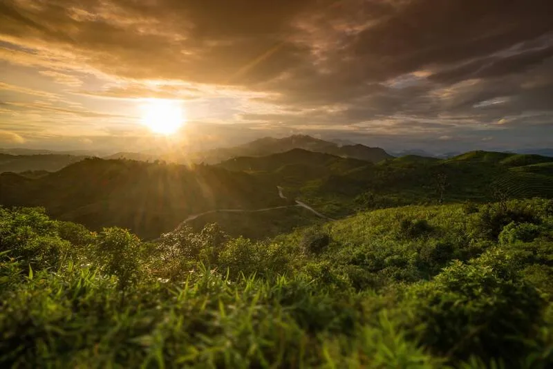
25. Noen Chang Suek, Kanchanaburi is a scenic mountain viewpoint in Pilok Subdistrict, Thong Pha Phum District, Kanchanaburi Province, situated close to Ban E Tong, a historic settlement near the Thai–Myanmar border. The viewpoint is celebrated for its broad views of border mountain ranges, sunrise, sunset, and mist drifting through the valleys when weather conditions are favorable. Its proximity to Ban E Tong adds a historical and cultural dimension to the experience, as the village is known for its former mining activities and peaceful highland atmosphere.
Highlights: Morning mist above mountain ridges, Noen Chang Suek panoramic viewpoint, sunrise and sunset, Thai–Myanmar border scenery, cool mountain weather, and excursions to the former mining village of Ban E Tong.
Noen Chang Suek occupies an exposed mountain ridge offering extensive views over the surrounding valleys and successive mountain ranges. The open setting allows travelers to appreciate changes in the sky and sunlight throughout the day. Under favorable atmospheric conditions, mist may accumulate in the lower valleys or drift across the ridgeline, producing soft layers of white cloud against the darker forested mountains.
The transition from the rainy season into the cool season and the winter months are particularly attractive periods for visiting the mountain. Cool mornings may offer opportunities to observe mist, while late-afternoon light can create long shadows across the ridges. However, highland weather changes quickly, and the viewpoint may occasionally become enclosed in clouds that limit visibility. Visitors should allow flexibility in their plans rather than expecting an uninterrupted panorama.
Noen Chang Suek is closely associated with Ban E Tong, which once formed part of an important mining district. The surrounding region experienced periods of mineral extraction, commercial activity, and settlement before developing into a quieter tourism destination. Today, the village attracts travelers with its traditional buildings, small streets, mountain atmosphere, and stories of the mining era.
One of the most interesting ways to experience the area is to combine a visit to the viewpoint with time in Ban E Tong. Travelers can explore the village, learn about its mining heritage, sample local food, and stay overnight before visiting the mountain in the early morning or late afternoon. This approach provides a more complete understanding of the area's landscape and history.
Reaching Pilok requires driving along mountain roads with numerous sharp bends, especially on the route from Thong Pha Phum toward the national park area and Ban E Tong. Travelers should inspect their vehicle's brakes and tires before departure, ensure sufficient fuel, and allow extra time for the journey. Driving with excessive speed is particularly dangerous on wet roads or when fog reduces visibility.
For a two-day, one-night itinerary, visitors can stay in Ban E Tong and arrange a visit to Noen Chang Suek according to the weather and local access arrangements. Staying nearby reduces the need for lengthy night driving and allows more time to appreciate the border mountain environment.
Visitors should observe all access and safety regulations, particularly because parts of the area are associated with the international border. When paths are wet or visibility is poor, exposed ridges and sloping terrain may become hazardous. Travelers should remain in authorized public areas and avoid approaching cliff edges for photography.
Noen Chang Suek is an excellent destination for nature photographers and travelers who want to combine mountain scenery with the distinctive history of a former mining community in western Thailand. Its scenery and cultural context make it much more than a simple viewpoint stop.
Open Days: Generally daily, subject to local access restrictions and the instructions of responsible authorities.
Getting There: From Kanchanaburi town, travel toward Thong Pha Phum District, then follow the winding mountain road toward Pilok Subdistrict and Ban E Tong. The access road to Noen Chang Suek branches from the mountain route near the village. Check whether private vehicles are permitted or local transport arrangements are required before proceeding uphill.
Map (GPS):Get Directions to Noen Chang Suek

26. Doi Sa Ngo, Chiang Rai is an elevated mountain viewpoint in Si Don Mun Subdistrict, Chiang Saen District, Chiang Rai Province. It is famous for its panoramic views across the border region where Thailand, Laos, and Myanmar meet. The viewpoint overlooks mountain ranges and landscapes associated with the Golden Triangle and the Mekong River. Sunrise and early-morning mist are among its principal attractions, making Doi Sa Ngo a rewarding destination for photographers and nature enthusiasts exploring northern Chiang Rai.
Highlights: Sea of mist at sunrise, panoramic mountain scenery, views toward the Golden Triangle, the Mekong River landscape, highland community surroundings, and extensive views of the border region.
The geographical setting of Doi Sa Ngo is particularly appealing because its elevated position opens toward the northernmost landscapes of Chiang Rai. When cool temperatures and sufficient humidity combine, mist may gather across the valleys and lower terrain. From the ridge, travelers can see white layers appearing between the mountains, with the rising sun gradually revealing the colors and contours of the surrounding landscape.
Doi Sa Ngo is also closely associated with the Golden Triangle, the famous region near the meeting point of the Ruak and Mekong rivers where Thailand, Laos, and Myanmar converge. This international geographical setting adds interest to the viewpoint, allowing travelers to appreciate how rivers, mountains, and borders have shaped the development of the region.
Early morning is the best period for visitors hoping to enjoy the sea of mist and sunrise. The air is generally cooler before daylight, and fog may remain concentrated in valleys. As the sun rises, the mist often changes appearance and begins to disperse. On mornings when fog is absent, the open landscape still provides impressive views of the border mountains and surrounding countryside.
The communities around Doi Sa Ngo are connected to highland agriculture and tourism in Chiang Saen District. Visitors can support locally operated accommodation, food services, and agricultural products while gaining a better understanding of everyday life in the northern border region. Community-based tourism also encourages local participation in caring for the mountain environment.
With two days and one night available, visitors can stay near Doi Sa Ngo to enjoy sunrise before spending the remainder of their journey exploring the Golden Triangle and the historical attractions of Chiang Saen. This combination offers mountain scenery, riverside geography, and regional history within a relatively compact travel area.
Travelers should check road and weather conditions before ascending the mountain, particularly during periods of heavy rain or dense fog. Careful driving is necessary on exposed mountain roads, and visitors should avoid standing on steep or unstable ground while taking photographs.
Doi Sa Ngo is suitable for travelers who want to combine a sea-of-mist viewpoint with the international landscape and cultural history of the Golden Triangle. Its panoramic position makes it one of Chiang Rai's distinctive locations for sunrise photography.
Open Days: Daily
Opening Hours: 05:00 – 18:30
Getting There: From Chiang Rai city, travel toward Chiang Saen District, then continue into Si Don Mun Subdistrict and follow the road signs to Doi Sa Ngo. A private vehicle is convenient for exploring the surrounding area, but travelers should confirm mountain road conditions and current access arrangements before ascending.
Map (GPS):Get Directions to Doi Sa Ngo

27. Doi Mae U Kho Bua Tong Fields, Mae Hong Son is one of northern Thailand's famous seasonal highland attractions, located in Mae U Kho Subdistrict, Khun Yuam District, Mae Hong Son Province. The mountain is celebrated for its extensive fields of golden Mexican sunflowers that bloom across the slopes during their flowering season. Its elevated terrain also provides extensive mountain and valley views, while cool mornings with suitable humidity may occasionally bring mist over the lower landscape. This combination of flowers, mountains, and atmospheric scenery makes Doi Mae U Kho an appealing destination during the transition into the cool season.
Highlights: Seasonal golden Mexican sunflower fields, extensive mountain landscapes, occasional morning mist, elevated viewpoints, highland community scenery, and nature photography during the flowering period.
Doi Mae U Kho features open mountain slopes that become covered with golden Mexican sunflower blossoms when the plants flower at approximately the same time. The bright yellow landscape contrasts with the green hills and surrounding mountain ridges, creating one of Mae Hong Son's best-known seasonal panoramas. The viewpoint also allows visitors to appreciate the shape and scale of the mountain ranges beyond the flower fields.
Mist may appear around Doi Mae U Kho when sufficient moisture remains in the valleys and temperatures fall overnight. Under favorable conditions, white layers drift among the mountains or settle across lower slopes. However, a dense sea of clouds is not the destination's principal attraction or a guaranteed daily phenomenon. The extensive flower fields and broad mountain scenery remain its defining features.
The flowering season generally occurs toward the end of the rainy season and the beginning of the cool season. Its exact timing varies with temperature, rainfall, and growing conditions. Travelers wishing to see the slopes at their most colorful should check the current flowering situation before setting out. Outside the bloom period, the landscape may look substantially different from photographs taken during peak flowering.
Doi Mae U Kho is connected to the agricultural and community life of Khun Yuam District. Seasonal tourism supports local food stalls, accommodation, and small businesses while helping visitors learn about the landscape and communities of Mae Hong Son's highlands. Travelers should respect agricultural activities and avoid entering areas where access is restricted.
Landscape photographers can capture broad golden hillsides framed by distant ridges. When morning mist occurs, it adds contrast and depth to the scene, while the softer light of late afternoon is also suitable for photographing flowers and mountain contours. Visitors should use designated paths and viewing areas to avoid damaging vegetation.
The journey to Doi Mae U Kho can be combined with attractions in Khun Yuam District and other parts of Mae Hong Son Province. A two-day, one-night itinerary allows visitors to stay near the mountain and appreciate the scenery in different lighting conditions. Mountain roads can be steep and winding, making a well-maintained vehicle and careful time planning important.
Doi Mae U Kho is best suited to travelers interested in seasonal flower landscapes, mountain photography, and quiet highland scenery. Morning mist is an added attraction when atmospheric conditions permit, while the golden sunflower display provides its distinctive seasonal character.
Open Days: Daily
Opening Hours: 06:00 – 18:00
Getting There: From Mae Hong Son town, follow Highway 108 toward Khun Yuam District, then continue into Mae U Kho Subdistrict along the signed mountain road to the Bua Tong fields. Check the current flowering season and road conditions before traveling, especially if planning to arrive in the early morning.
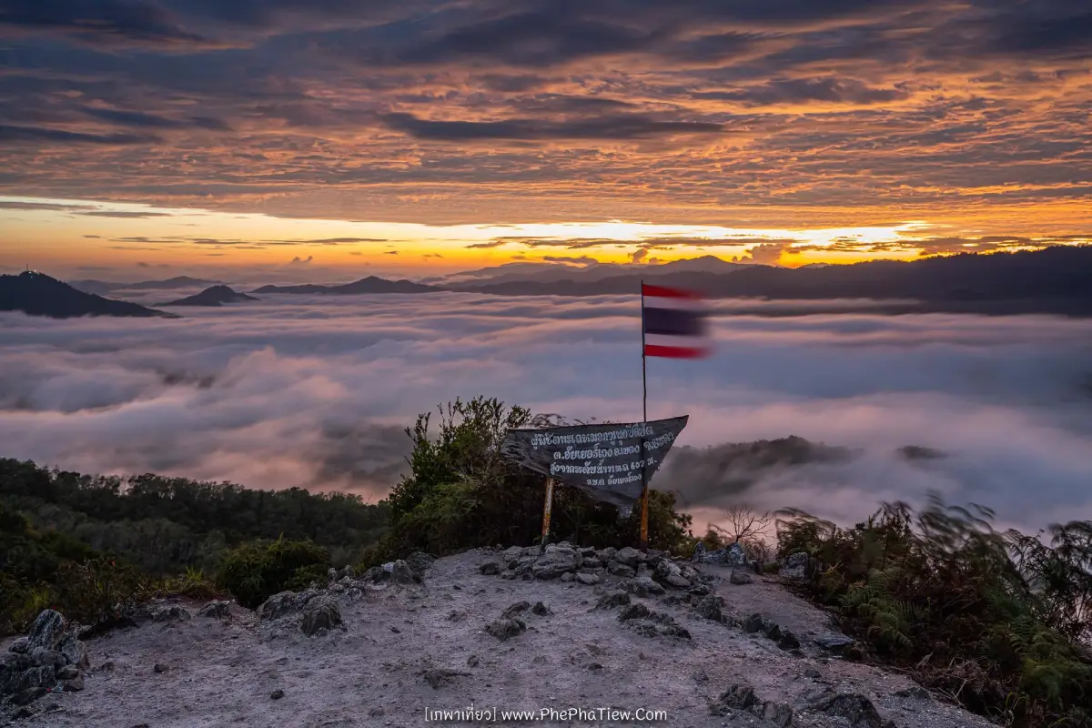
28. Gunung Silipat Sea of Mist, Yala is an outstanding mountain viewpoint in Aiyerweng Subdistrict, Betong District, Yala Province, near Thailand's southern border. It is known for spectacular views of mist-covered valleys, layered green mountains, and the sunrise above the humid tropical forest landscape. Unlike many viewpoints accessible directly by car, Gunung Silipat is also a nature trekking destination, making it particularly appealing to travelers who want to experience the mountain environment at close range.
Highlights: Sea of mist over Betong's mountain valleys, panoramic summit scenery, early-morning sunrise, tropical rainforest landscapes, hiking, and local community tourism around Aiyerweng.
Gunung Silipat rises above the forested terrain of Betong, where high humidity and the shape of the valleys create favorable conditions for the formation of morning mist. When the air cools overnight, clouds may gather across the lower slopes and spread between the mountain ridges. From the summit, travelers can observe layers of white mist extending above dense green vegetation, a landscape strongly associated with the tropical climate of southern Thailand.
One of the attractions of sea-of-mist tourism in Betong is that suitable conditions can occur outside the traditional northern Thai winter season. The region receives abundant moisture, and the mountains remain green through much of the year. Nevertheless, the amount of fog changes with rainfall, wind, humidity, and temperature. Some mornings bring extensive cloud layers, while others reveal clearer views of the surrounding forest and mountain terrain.
Visiting Gunung Silipat requires more preparation than visiting an easily accessible roadside viewpoint. The route may involve local transport followed by hiking along soil tracks, forest paths, rocky terrain, and steep slopes. Some sections can become slippery after rain, making appropriate shoes, a headlamp, and suitable rain protection important. Travelers should use an experienced local guide or authorized operator and confirm the route before departure.
Those interested in landscape photography should protect cameras and electronic equipment against moisture. The rainforest climate can bring sudden rainfall or damp fog, even when temperatures are not particularly cold. Sunrise provides attractive lighting over the mountain ridges, but visitors should remain on the designated trail and avoid approaching exposed slopes when visibility is limited.
The wider Betong region is known for its cultural diversity, local cuisine, and mountain communities. A visit to Gunung Silipat can form part of a longer itinerary exploring Aiyerweng and Betong, with locally operated guiding services providing opportunities to learn about the area's natural environment and support community livelihoods.
Environmental responsibility is particularly important in this mountainous landscape. Visitors should carry all waste out of the area, remain on established trails, avoid disturbing wildlife, and refrain from damaging vegetation or unofficially widening paths. Following the instructions of local guides helps protect both travelers and the surrounding forest ecosystem.
Gunung Silipat is best suited to nature enthusiasts who are comfortable with a mountain hike and wish to experience one of southern Thailand's memorable sea-of-mist panoramas. The combination of humid rainforest, sunrise, green ridges, and community-led access gives the destination a distinctive identity.
Open Days: Subject to local tour schedules, weather conditions, and trail access arrangements.
Best Viewing Time: Approximately 05:30 – 07:00, depending on weather conditions.
Getting There: From Betong town, travel toward Aiyerweng Subdistrict and the Ban Km. 28 area, then continue toward the local access routes near Gunung Silipat. Contact a local tour operator or experienced guide before departure to confirm the starting point, available transport, hiking distance, and route conditions. Do not attempt to enter unfamiliar mountain trails alone before dawn.

29. Kia Forest (Mae Taman), Chiang Mai is a scenic highland forest destination in Mueang Na Subdistrict, Chiang Dao District, Chiang Mai Province. It is particularly known for its pine forests and mountain viewpoints offering impressive views toward Doi Luang Chiang Dao. On favorable mornings, mist may drift through the surrounding valleys or between the pine trees, creating a peaceful atmosphere for nature enthusiasts and landscape photographers. The area is associated with highland conservation and watershed management, giving it a quieter character than many heavily developed tourist destinations.
Highlights: Mountain pine forests, morning mist above forested valleys, distant views of Doi Luang Chiang Dao, sunrise scenery, cool highland weather, and nature-based experiences in the Mae Taman area.
Kia Forest is distinguished by its elevated terrain, pine trees, and surrounding mountain ranges. The combination of forest vegetation and broad views toward Doi Luang Chiang Dao creates an attractive landscape throughout the day. When atmospheric conditions are favorable, mist may form across the valleys or drift through the trees, softening the outlines of distant mountains and giving the scenery a distinctive early-morning atmosphere.
The view toward Doi Luang Chiang Dao is one of the area's defining features. The recognizable mountain rises above the surrounding landscape and creates a dramatic background for photography. When mist develops in the lower valleys, the combination of pine trees, mountain silhouettes, and white cloud layers produces considerable depth. The same viewpoint can offer very different appearances depending on visibility, wind, and sunlight.
Kia Forest and the Mae Taman highlands are connected to conservation and watershed management activities. Access to certain areas, accommodation, and overnight facilities may therefore be controlled by the responsible organizations. Travelers should confirm whether advance booking or permission is necessary rather than assuming that all areas are open for unrestricted public access.
The mountain access roads may include steep, rough, or unpaved sections. Ordinary passenger vehicles may not be suitable for every part of the route, especially after rainfall. Visitors should check road conditions before traveling and ask the responsible management unit whether a four-wheel-drive vehicle or another transport arrangement is recommended.
For travelers interested in forests, the surrounding landscape offers opportunities to observe highland vegetation, changes in temperature, and the effects of moisture on mountain ecosystems. The pine forest provides a distinctive setting, while the nearby ridges and valleys demonstrate how topography contributes to the formation and movement of morning mist.
A visit can be combined with other destinations in Chiang Dao District if sufficient time is available. Staying overnight in an authorized facility or nearby accommodation may help travelers reach the viewpoint before sunrise. However, camping and overnight arrangements should always be confirmed with the responsible authorities before making the journey.
Visitors should help preserve the area's natural character by keeping noise levels low, removing all waste, avoiding unauthorized fires, and staying on established tracks. Watershed forests are environmentally important, and damage to soil, vegetation, or water resources can have effects beyond the immediate visitor area.
Kia Forest is particularly suitable for travelers who appreciate quiet mountain landscapes, pine forests, and the possibility of seeing mist with Doi Luang Chiang Dao in the background. Its combination of natural scenery and conservation importance makes it a rewarding destination for thoughtful nature travel.
Open Days: Subject to area management, access permissions, and current conditions.
Getting There: From Chiang Mai city, travel toward Chiang Dao District, then continue into Mueang Na Subdistrict and the Mae Taman highlands. Contact the responsible watershed management unit or local area operator to confirm the authorized entrance, the condition of the final mountain road, and any permission or accommodation requirements. A map coordinate alone should not be treated as confirmation that the route is suitable for an ordinary vehicle.

30. Mon Kio Lom, Tak is a famous mountain viewpoint within Mae Moei National Park, Mae Song Subdistrict, Tha Song Yang District, Tak Province. Known for its extensive views over forested mountain ranges and opportunities to observe a sea of mist above the valleys, it is one of the most appealing natural attractions in western Thailand. The viewpoint is especially popular among travelers who enjoy camping, sunrise photography, cool mountain weather, and relatively peaceful forest environments near the Thai–Myanmar border.
Highlights: Sea of mist above mountain valleys, Mon Kio Lom viewpoint, sunrise, extensive forest panoramas, camping, highland weather, and connections to the other mountain viewpoints of Mae Moei National Park.
Mon Kio Lom occupies an elevated ridge that overlooks forested valleys and successive mountain ranges. When temperatures decrease overnight and humidity remains high, mist can collect in the lower terrain and create a broad white layer beneath the viewpoint. The surrounding forest provides a natural setting with relatively few urban features, allowing visitors to experience the atmosphere of the mountains at dawn.
Watching sunrise is one of the principal activities at Mon Kio Lom. Before daylight, the valleys may be hidden beneath a layer of white mist. As the sun rises, the cloud layer changes color and slowly reveals the mountain ridges below. The movement of the mist and the variation in light create rewarding conditions for photographers, although the density of the sea of clouds varies from day to day.
Mae Moei National Park also contains other attractive viewpoints, including Mon Khruba Sai and Mon Phunsuda. Each provides a different perspective over the surrounding forest and mountain scenery. Travelers with sufficient time can explore several authorized viewpoints, but should confirm distances, road conditions, and current access arrangements before setting out.
The national park is an important area for conserving forests and watershed resources along the western mountain ranges. Its natural landscape supports biodiversity and contributes to the environmental health of the surrounding region. Visitors should remain on authorized trails and viewing areas, avoid disturbing wildlife, and refrain from activities that could damage vegetation or forest habitats.
Access to Mon Kio Lom involves mountain roads with curves and steep sections. Drivers should check their vehicle before departure and allow sufficient time to reach the national park. During the rainy season, roads and walking paths can become slippery, while fog may reduce visibility. Traveling carefully and following park announcements are particularly important in these conditions.
For those wishing to experience the sea of mist at sunrise, staying overnight in an authorized camping area or nearby accommodation can be convenient. Visitors should confirm the availability of camping facilities and any booking requirements in advance. Warm clothing, a flashlight, drinking water, and suitable footwear are recommended, especially during the cool season.
Mon Kio Lom is suitable for photographers, campers, families interested in nature, and travelers seeking mountain scenery away from heavily developed tourist areas. The opportunity to observe mist above extensive forested valleys makes it one of the distinctive natural viewpoints of Tak Province.
Open Days: Subject to national park regulations and any temporary access restrictions.
Getting There: From Tak town or Mae Sot, travel toward Tha Song Yang District along Highway 105. At the Mae Salit Luang junction, follow Highway 1267 toward Mae Moei National Park and continue to Mon Kio Lom on the designated internal park road. Check opening conditions, road access, and camping arrangements with park officials before traveling.
Map (GPS):Get Directions to Mon Kio Lom

31. Doi Mon Lan, Chiang Mai is a mountain viewpoint and nature destination in the highlands of Phrao District, Chiang Mai Province. The area is characterized by forested mountains, peaceful valleys, and elevated ridges offering wide panoramic views. When humidity and temperature conditions are suitable, mist may gather across the valleys below, producing an attractive sea of clouds. Doi Mon Lan is particularly appealing to travelers seeking a quieter mountain experience away from the busiest tourist destinations around Chiang Mai city.
Highlights: Sea of mist over mountain valleys, extensive views across Phrao District's highlands, sunrise, cool weather, mountain forests, and nature-based travel in a relatively peaceful environment.
The geography of Doi Mon Lan consists of elevated ridges and valleys surrounded by mountain forests. As temperatures decrease overnight, moisture can condense in the lower landscape, allowing mist to develop between the mountains. Travelers standing above the valleys may see the cloud layer extending beneath the ridges while the first morning light illuminates the distant mountain slopes.
The viewpoint is especially attractive for its broad natural panorama. On certain mornings, thick mist fills the lower valleys and leaves only the higher peaks visible. On clearer days, visitors can appreciate the forest canopy, ridgeline contours, and mountain settlements in the distance. Both conditions offer opportunities for landscape photography and an appreciation of the area's geography.
Doi Mon Lan is associated with mountainous watershed forests that help retain moisture and support local ecological systems. Visitors should remain on designated access routes and avoid activities that could damage the forest or disturb wildlife. As with many highland environments, excessive disturbance of vegetation and soil can increase erosion and affect watershed conditions.
The transition from the rainy season to winter can provide favorable conditions for morning mist. However, visitor access may be controlled seasonally by the authorities responsible for the area. Some routes or camping locations may close for environmental recovery or safety, meaning that travelers should verify the latest entry status before planning a visit.
Photographers should allow time to observe the changing interaction between mist, sunlight, and the mountain ridges. Warm clothing, a headlamp or flashlight, suitable footwear, and drinking water are important for early-morning visits. Thick mist and wet paths can make walking more difficult, so care should be taken when visibility is limited.
Travelers can stay in Phrao District or an authorized nearby accommodation area before visiting Doi Mon Lan. A relaxed itinerary may also include rural communities and other nature attractions in the district. Careful travel planning is preferable to attempting a difficult early-morning mountain journey from Chiang Mai city without knowing the road conditions.
Doi Mon Lan is a suitable destination for nature enthusiasts and photographers interested in quiet mountain scenery. Its natural appeal comes from the forested ridges, open views, seasonal mist, and the experience of spending time in a highland environment.
Open Days: Seasonally, subject to current access announcements.
Getting There: From Chiang Mai city, travel toward Phrao District and continue into the mountain area using the currently authorized access route. Confirm whether the viewpoint, hiking trail, and any camping facilities are open, and check whether a special vehicle or permit is necessary. Access arrangements may change with the season.
Map (GPS):View Doi Mon Lan on Google Maps
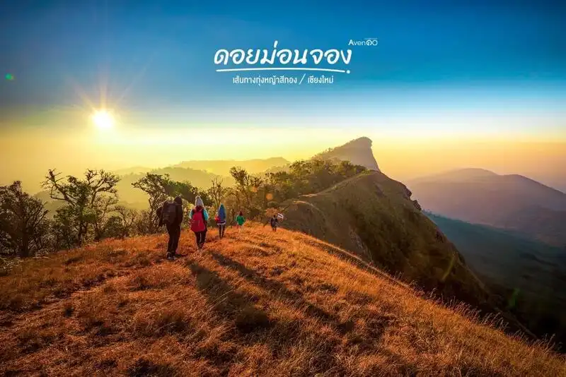
32. Doi Mon Chong Mountain, Chiang Mai is a renowned highland trekking destination within Omkoi Wildlife Sanctuary in Chiang Mai Province, with access associated with Omkoi District and the mountain area near the border with Tak Province. The mountain is celebrated for its dramatic ridgelines, open grasslands, and expansive views across successive mountain ranges. During favorable weather, mist may cover the valleys below, creating a spectacular sea-of-clouds landscape. Unlike roadside viewpoints, reaching Doi Mon Chong requires physical preparation and travel arrangements that comply with wildlife sanctuary regulations.
Highlights: Dramatic Doi Mon Chong ridgeline, highland grasslands, sunrise and sunset, sea of mist over mountain valleys, trekking, and the ecosystems of Omkoi Wildlife Sanctuary.
One of Doi Mon Chong's most recognizable features is its distinctive ridgeline, with steep mountain slopes on one side and open grassland extending along parts of the summit. The exposed terrain offers expansive views of distant mountains, creating an entirely different atmosphere from the dense forest landscapes found at lower elevations. As travelers reach the open ridge, the mountain horizon becomes increasingly visible in several directions.
When temperatures and humidity create favorable conditions, mist may settle into the surrounding valleys and form white layers beneath the summit. Early sunlight gradually reveals the contours of the ridgeline and the mountains beyond. Late afternoon provides a different experience as golden light reaches the grassland and creates long shadows across the slopes.
The mountain is located within an important wildlife conservation area. As a result, trekking is regulated and cannot be undertaken freely throughout the year. Visitors must check official announcements about seasonal openings, reservations, permits, guides, and limits on visitor numbers. These measures are important for both safety and the protection of sensitive habitats.
Reaching the mountain requires considerably more physical effort than visiting a viewpoint accessible by car. Trekking routes may include steep ascents, uneven ground, and exposed sections affected by wind or changing weather. Participants should assess their fitness, bring appropriate footwear, and prepare suitable warm clothing, rain protection, drinking water, and essential supplies.
The surrounding landscape contains forests and highland grasslands that form habitats for various species. Responsible trekking involves remaining with the authorized group, not collecting plants, avoiding wildlife disturbance, and removing all waste. These precautions are especially important in a wildlife sanctuary where conservation takes priority over tourism convenience.
Travel planning should allow time to reach Omkoi District, continue to the designated trekking starting point, and complete the authorized walking route. Visitors should not treat Doi Mon Chong as an ordinary day-trip viewpoint reached by private car. The length and structure of the itinerary must follow the available tour arrangements and the regulations in force.
Doi Mon Chong is particularly suitable for experienced hikers and travelers who appreciate mountain wilderness. Its exposed grasslands, dramatic ridgeline, and potential sea of mist offer an unforgettable experience, provided the journey is organized responsibly and undertaken only when the sanctuary permits entry.
Open Days: Seasonally, according to Omkoi Wildlife Sanctuary announcements and permitted trekking programs.
Getting There: From Chiang Mai city, travel toward Omkoi District and contact the responsible wildlife sanctuary officials or authorized organizers regarding access to Doi Mon Chong. Confirm the meeting point, permitted trekking route, guide requirements, and available dates. The GPS location is a geographic reference and not a road route to the summit.
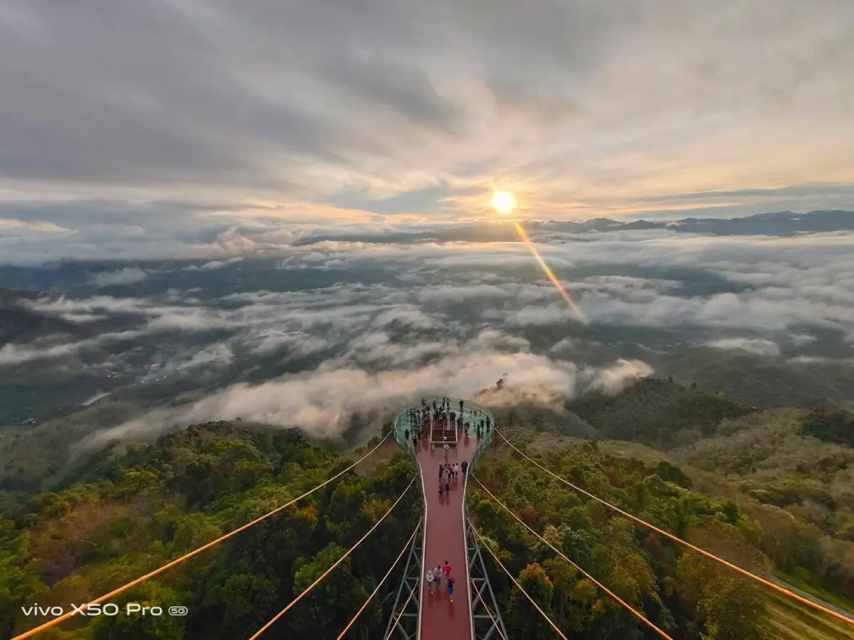
33. Khao Microwave Viewpoint (Khao Micro), Yala is one of southern Thailand's most important sea-of-mist viewpoints, located near Ban Than Mali in Aiyerweng Subdistrict, Betong District, Yala Province. The mountain is associated with the famous Aiyerweng Sea of Mist and the Aiyerweng Skywalk, making it one of the best-known mountain attractions in the southern border region. From its elevated position, visitors can see extensive forested valleys and mountain ridges covered by white mist when weather conditions are suitable.
Highlights: Aiyerweng Sea of Mist, sunrise over mountain valleys, tropical rainforest panoramas, Aiyerweng Skywalk, elevated viewpoints, and excursions to other attractions in Betong District.
The geography around Khao Microwave consists of mountain ranges and valleys within the humid tropical environment of southern Thailand. When air temperatures fall overnight and the atmosphere contains abundant moisture, mist may develop over the lower valleys and create broad white layers between the forested mountains. This scenery is particularly impressive when viewed from an elevated platform as sunrise begins illuminating the landscape.
One of the special characteristics of Aiyerweng is the possibility of mist forming during different periods of the year, rather than only during the northern winter season. The surrounding forests remain green, and humidity is often high. However, the formation and thickness of the mist still depend on rainfall, temperature, wind, and atmospheric conditions, so the appearance of an extensive cloud layer cannot be guaranteed every morning.
The most popular period for visiting is before sunrise, when travelers gather at the viewpoint to watch the sky brighten above the mountains. As sunlight reaches the valleys, the white mist gradually changes shape and color, sometimes revealing forested ridges stretching toward the horizon. Elevated viewing facilities and the nearby skywalk provide opportunities to appreciate this mountain landscape from different perspectives.
Khao Microwave is also associated with the development of tourism infrastructure in Aiyerweng. The mountain viewpoint and skywalk have become important attractions within Betong's visitor economy. The area supports local food businesses, transport services, accommodation, and other tourism activities, connecting nature-based travel with community livelihoods.
The Aiyerweng community reflects the cultural diversity of Thailand's southern border region. A visit can be combined with traditional food, local community experiences, and other attractions in Betong District. Travelers using local accommodation and authorized transport services help support residents while benefiting from their knowledge of the area and its weather conditions.
Travelers coming from Betong town should allow enough time to reach the mountain area before dawn. The access roads include mountain sections where mist or rain may affect visibility. Visitors should check the latest parking arrangements, shuttle services if applicable, and specific rules for accessing the skywalk and observation areas.
Photography is one of the most popular activities at Khao Microwave. Travelers should protect cameras against moisture and follow safety rules on observation platforms, especially during wet weather or strong winds. On crowded mornings, they should avoid obstructing other visitors and remain behind safety barriers.
Khao Microwave is particularly suitable for travelers seeking a memorable sea-of-mist experience in southern Thailand without necessarily undertaking a demanding summit trek. Its combination of tropical rainforest, sunrise scenery, accessible viewpoint facilities, and local cultural attractions makes it one of Betong's principal nature destinations.
Open Days: Daily, subject to weather and local operating arrangements.
Opening Hours: 05:30 – 09:30 for the sea-of-mist and skywalk visiting period listed on the destination page.
Getting There: From Betong town, travel along Highway 410 toward Aiyerweng Subdistrict and Ban Than Mali, then follow the mountain access road toward Khao Microwave and the Aiyerweng viewpoints. Confirm the current parking, transport, and skywalk entry arrangements before traveling, particularly during holidays and periods of heavy rain.

34. Doi Chang Mub, Chiang Rai is a scenic mountain viewpoint in Mae Fa Luang District, Chiang Rai Province, located along the Phra That Doi Tung–Ban Pha Mi road. The viewpoint overlooks extensive mountain ranges and border landscapes, providing opportunities to appreciate cool highland weather and occasional morning mist. Its position within the Doi Tung mountain area makes it a convenient addition to an itinerary combining natural scenery, highland communities, and important attractions associated with the Doi Tung Development Project.
Highlights: Doi Chang Mub mountain viewpoint, panoramic border mountain scenery, cool highland weather, occasional drifting mist, the Chang Mub Stupa, nature photography, and excursions to Doi Tung and Ban Pha Mi.
The appeal of Doi Chang Mub lies in its exposed elevated setting, which offers wide views across several layers of mountains. When nighttime temperatures fall and humidity accumulates in the valleys, mist may drift over the ridges or settle above the lower terrain. As sunlight reaches the mountains, the appearance of the landscape changes gradually, revealing the contours of distant slopes and valleys. Although a dense sea of mist cannot be expected every day, the natural panorama remains impressive under clear conditions.
The viewpoint is closely connected to the Doi Tung tourism route, where visitors can explore a combination of natural and cultural attractions. The Doi Tung area is well known for community development initiatives, highland agriculture, conservation, and the transformation of local livelihoods. Including Doi Chang Mub in a visit to the area allows travelers to appreciate the mountainous geography that has shaped these activities.
A distinctive landmark is the Chang Mub Stupa, which stands on a natural rock formation associated with the image of a crouching elephant. The religious structure adds a cultural dimension to the viewpoint and distinguishes it from mountain locations valued solely for their natural scenery. Visitors should respect the site and follow any local guidance concerning access and appropriate behavior.
The changing character of the landscape makes different times of day worthwhile. Early morning may offer cooler weather and drifting mist, while clearer conditions later in the day can reveal the surrounding mountain ranges in greater detail. Photographers can take advantage of the layered ridges and natural light to produce panoramic images of the northern border landscape.
Travelers can combine Doi Chang Mub with Doi Tung Royal Villa, Mae Fah Luang Garden, and nearby highland communities, including Ban Pha Mi. These attractions have different characteristics, ranging from landscaped gardens and cultural heritage to traditional community life and mountain viewpoints. A day trip can be planned around the main Doi Tung road without requiring extensive trekking.
Drivers should exercise caution because the roads include mountain bends and slopes, particularly when wet weather or fog reduces visibility. Visitors must use authorized stopping areas and should not park on narrow bends to take photographs. Comfortable footwear and a light jacket are useful, especially during the cool season.
Doi Chang Mub is particularly suitable for travelers who enjoy scenic drives and mountain photography but do not wish to undertake a long hike. Its combination of extensive highland views, occasional mist, and the cultural setting of Doi Tung makes it a worthwhile stop in Mae Fa Luang District.
Open Days: Daily
Opening Hours: 07:00 – 17:00
Getting There: From Chiang Rai city, travel toward Mae Fa Luang District and the Doi Tung area, then continue along the Phra That Doi Tung–Ban Pha Mi road. The viewpoint lies approximately 4 kilometers from the Wat Noi Doi Tung junction. Drivers should pay attention to road bends and changing mountain weather.
Map (GPS):Get Directions to Doi Chang Mub
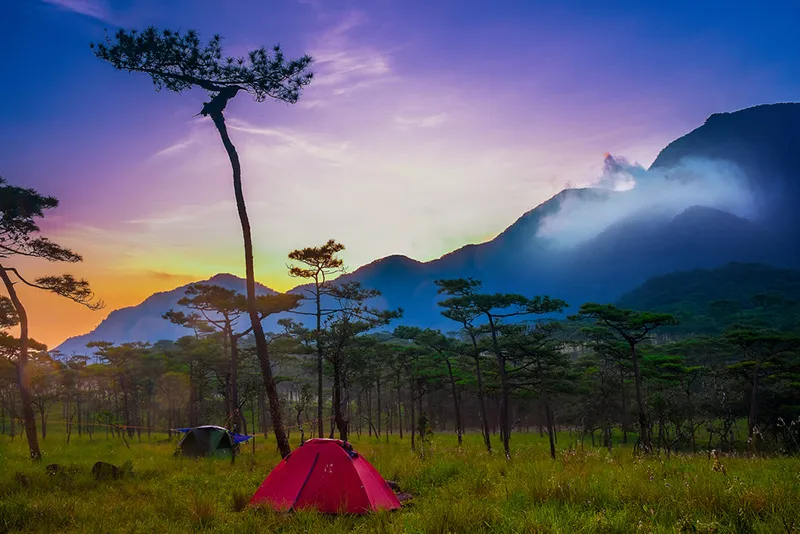
35. Phu Soi Dao National Park, Uttaradit is an important protected highland area near the Thai–Lao border, covering parts of Uttaradit and Phitsanulok provinces. Its principal visitor access is associated with Huai Mun Subdistrict, Nam Pat District, Uttaradit Province. The park is famous for the Three-Needle Pine Plateau, seasonal wildflowers, waterfalls, mountain forests, and challenging hiking routes. When weather conditions are favorable, visitors may encounter mist drifting across the ridges and valleys, adding to the atmosphere of this remote mountain environment.
Highlights: Three-Needle Pine Plateau, mountain mist, seasonal Murdannia gigantea wildflowers, Phu Soi Dao Waterfall, Sai Thip Waterfall, forest trekking, highland camping, and diverse mountain ecosystems.
Phu Soi Dao is distinguished by its mountainous terrain and the variation in vegetation found at different elevations. The park contains forests, ridges, grasslands, and elevated pine-covered areas that provide contrasting scenery throughout a journey. Travelers ascending toward the high plateau experience changes in temperature and vegetation, helping them appreciate the environmental differences between lower mountain forests and exposed highlands.
The highest summit of Phu Soi Dao reaches approximately 2,102 meters above sea level, while the famous Three-Needle Pine Plateau lies at about 1,633 meters. The plateau contains natural pine trees, grassland, and open mountain scenery, making it an important destination for camping and nature photography. In the morning, mist may drift between pine trunks or spread across the nearby valleys, creating a different atmosphere from a sea of clouds viewed from a cliff.
The Three-Needle Pine Plateau is reached by a demanding hiking route of approximately 6.5 kilometers from the designated trailhead near Phu Soi Dao Waterfall. The trail passes through forested terrain and several steep sections. Visitors should be in suitable physical condition, prepare appropriate trekking equipment, and follow the park's registration arrangements. This is not a viewpoint that can be reached directly by ordinary passenger car.
One of the park's most recognizable seasonal features is the flowering of Murdannia gigantea, known in Thai as dok ngon nak. These delicate purple-blue flowers can appear across suitable parts of the plateau during the rainy season. Their flowering period depends on rainfall and local growing conditions, so the display varies from year to year. Visitors should remain on marked paths and avoid trampling the fragile plants.
The waterfalls add another dimension to the park's natural appeal. Phu Soi Dao Waterfall is accessible in the lower visitor area, while Sai Thip Waterfall is associated with the higher mountain landscape. Their forest environments offer opportunities to observe streams, moss-covered rocks, and moisture-dependent vegetation. Travelers should check the accessibility of individual routes before attempting to visit them.
The plateau and trekking routes operate under seasonal management. Although the national park itself may provide services throughout the year, the highland camping area does not necessarily remain open continuously. Travelers must check the latest announcements regarding trekking periods, reservations, porter services, and overnight stays. Seasonal closures help protect vegetation and allow ecosystems to recover.
Hikers should prepare sturdy footwear, rain protection, warm clothing, sufficient water, and basic camping equipment where required. Mountain weather can change quickly, and paths may become muddy or slippery after rain. Visitors should travel with their group, follow official instructions, and avoid leaving designated trails.
Environmental responsibility is essential because the pine plateau and wildflower areas are sensitive to disturbance. Visitors should carry all waste back down, avoid collecting plants, and refrain from creating fires in unauthorized areas. These precautions help conserve the landscape for future visitors.
Phu Soi Dao National Park is especially suitable for hikers and travelers who want to experience mountain forests through a physically demanding outdoor journey. The combination of pine trees, wildflower fields, waterfalls, highland weather, and occasional mist makes it a rewarding destination beyond conventional sightseeing.
Open Days: Park areas operate according to national park announcements; the pine plateau opens seasonally.
Getting There: From Uttaradit town, travel toward Nam Pat District and Huai Mun Subdistrict, continuing to the national park entrance and designated trekking trailhead. Another approach is available from the Phitsanulok side through Chat Trakan District. Visitors planning to trek to the pine plateau must register and confirm the permitted dates and hiking arrangements before traveling.

36. Doi Mon Jam, Chiang Mai is a popular mountain destination in Mae Rim District, Chiang Mai Province. Known for its panoramic highland scenery, cool weather, vegetable gardens, and viewpoints overlooking deep valleys, the area attracts visitors who want to experience the atmosphere of the mountains without traveling far from Chiang Mai city. On mornings when temperature and humidity conditions are favorable, mist may gather between the surrounding ridges and add a beautiful layer to the landscape.
Highlights: Panoramic Mae Rim mountain scenery, occasional morning mist, elevated viewpoints, highland agricultural landscapes, cool weather, and accommodation overlooking the surrounding valleys.
Doi Mon Jam occupies an elevated ridge overlooking a landscape of mountains and valleys. When air temperatures decrease during the night and moisture accumulates in lower areas, mist may develop between the ridges. Visitors staying on higher slopes can sometimes observe these white layers in the morning, while clear weather reveals the green mountains and agricultural plots across the hillsides.
A defining characteristic of Doi Mon Jam is its combination of natural scenery and highland agriculture. The surrounding slopes support crops suited to cooler mountain conditions, and the geometric patterns of cultivated fields contribute to the area's distinctive appearance. The landscape reflects the relationship between agricultural livelihoods, highland geography, and the changing seasons.
Early morning is particularly attractive for the soft light and the possibility of mist, while late afternoon offers a different atmosphere for relaxation and photography. Several viewpoints and tourism businesses operate in the wider area, each with its own access arrangements. Visitors should therefore confirm the location and operating hours of their intended viewpoint or accommodation rather than assuming the entire mountain functions as a single managed attraction.
An overnight stay near Doi Mon Jam allows visitors to experience the cooler evening climate and wake up to mountain views without driving uphill before sunrise. Accommodation ranges across different types of properties, and travelers should choose providers that operate responsibly, particularly regarding waste disposal, water management, and the protection of the mountain environment.
Doi Mon Jam can be combined with other attractions in Mae Rim District, including mountain viewpoints and agricultural tourism sites. However, weekends and holidays may bring heavy traffic along narrow mountain roads. Concentrating on two or three nearby attractions generally provides a more comfortable experience than attempting to visit too many locations.
Visitors should respect working agricultural plots and never enter cultivated fields without permission. Vehicles must be parked in authorized spaces rather than on narrow bends or roadsides that obstruct traffic. These precautions are particularly important in the morning when mist may limit visibility.
Doi Mon Jam is well suited to couples, families, and travelers seeking a comfortable mountain escape close to Chiang Mai. Mist is a seasonal possibility rather than a guaranteed daily spectacle, while its broad mountain views and agricultural landscape remain appealing throughout a visit.
Open Days: Generally daily, depending on individual attractions and accommodation providers.
Getting There: From Chiang Mai city, travel north along Highway 107 toward Mae Rim District, then follow the signed mountain road to Doi Mon Jam. Confirm the exact location of the accommodation or viewpoint you intend to visit because attractions are distributed across the surrounding highland area.
Map (GPS):Get Directions to Doi Mon Jam
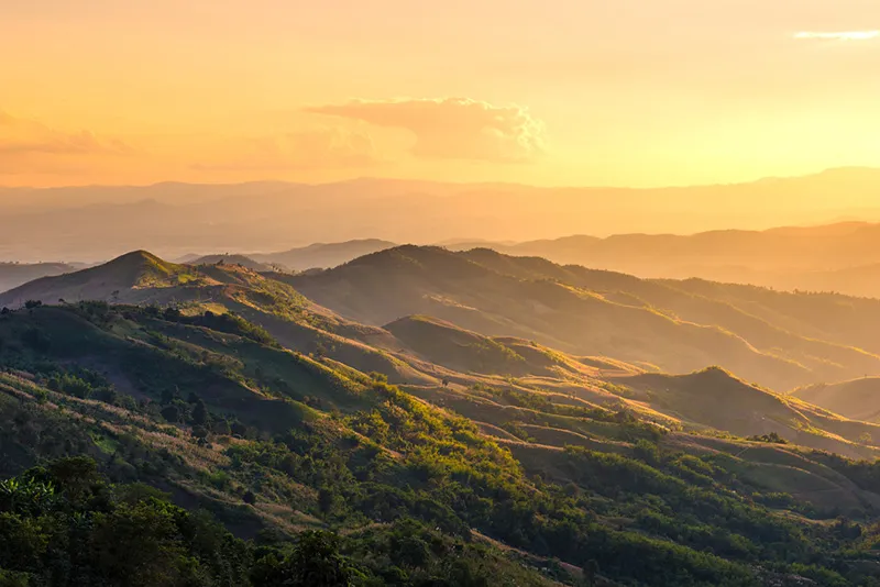
37. Doi Chang, Chiang Rai is a well-known highland destination in Wa Wi Subdistrict, Mae Suai District, Chiang Rai Province. The mountain is famous for its Arabica coffee cultivation, agricultural communities, and cool highland climate. Its landscape consists of steep hillsides, coffee farms, and villages surrounded by mountain ridges. During favorable early-morning weather, mist may drift through the valleys or settle above the coffee plantations, adding to the area's appeal as a nature and agricultural tourism destination.
Highlights: Morning mist above coffee plantations, panoramic Doi Chang mountain scenery, locally grown Arabica coffee, cool weather, highland community life, and scenic viewpoints across cultivated hillsides.
Doi Chang's geography is characterized by steep mountains and slopes cultivated with coffee. When temperatures decrease overnight and humidity remains high, mist may develop in the valleys and move slowly past agricultural fields and villages. This creates a landscape unlike that of protected mountain viewpoints, where natural forests dominate the scenery. Here, agriculture and human settlement form an essential part of the visual character.
Coffee is central to Doi Chang's economic and cultural identity. The area is widely associated with the production of Arabica coffee grown in highland conditions. Its relatively cool climate and elevation contribute to suitable growing conditions. Visitors can enjoy coffee from the producing area and learn about cultivation and processing from farms, cafés, or businesses that welcome visitors.
The mountain is also home to culturally diverse communities whose livelihoods and traditions are closely connected to agriculture. Traveling through Doi Chang offers opportunities to appreciate these relationships and support local businesses through accommodation, food, and coffee purchases. Respecting working farms and village privacy is essential.
For travelers who want to observe mist, staying overnight on the mountain or nearby is usually more practical than ascending from a distant town before sunrise. The mist may not be particularly thick every day, but the coffee farms, mountain contours, and villages offer attractive scenery in both misty and clear conditions.
Photography opportunities include coffee plantations, terraced slopes, village buildings, and successive mountain ridges. Morning light can create a particularly soft atmosphere, while layers of mist provide additional depth to the landscape when they occur. Visitors should request permission before entering privately owned farms or photographing people at work.
The mountain access roads include steep sections and winding bends. Drivers should check their brakes and tires before traveling, especially during rain or dense fog. Anyone planning to visit several farms and viewpoints should organize the route around their actual locations to avoid unnecessary journeys along mountain roads.
Doi Chang is particularly suitable for coffee enthusiasts, couples, and photographers who enjoy mountain agriculture and local culture. Its distinctive appeal lies in the combination of Arabica coffee, highland communities, and occasional mist drifting across the ridges.
Open Days: Generally daily; individual farms, cafés, and viewpoints have separate opening arrangements.
Getting There: From Chiang Rai city, travel toward Mae Suai District, then follow the mountain road into Wa Wi Subdistrict and Doi Chang. Select a particular café, farm, accommodation, or viewpoint as your final destination because attractions are spread across different parts of the mountain.
Map (GPS):Get Directions to Doi Chang
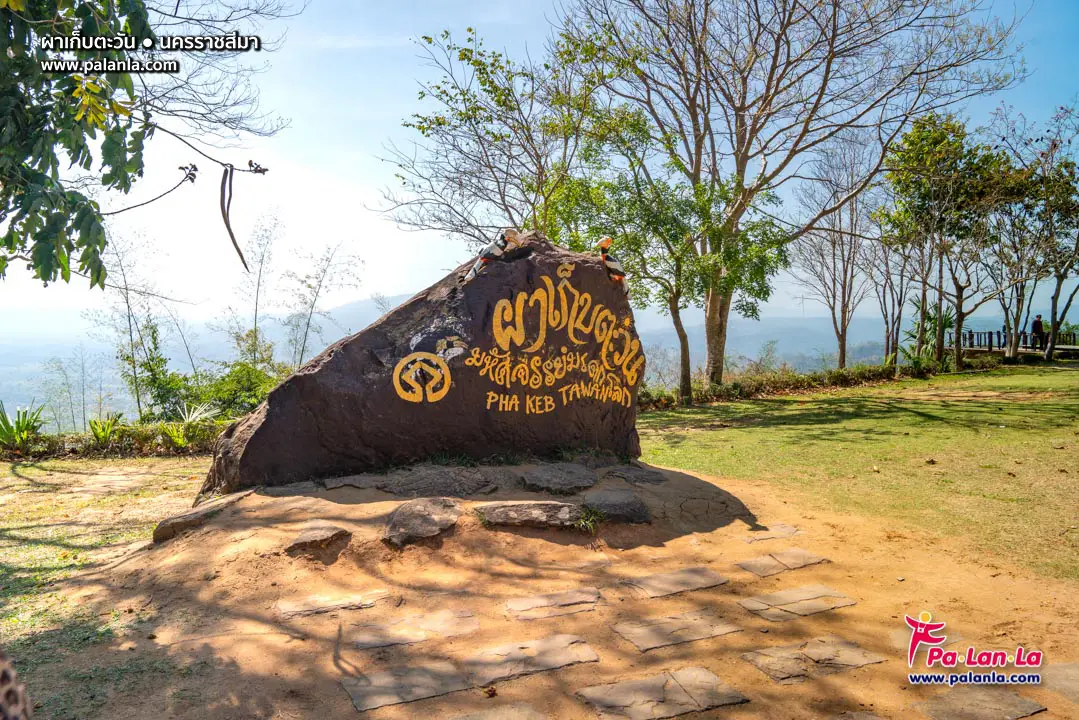
38. Pha Kep Tawan, Nakhon Ratchasima is a scenic viewpoint in Thai Samakkhi Subdistrict, Wang Nam Khiao District, Nakhon Ratchasima Province, within the landscape of Thap Lan National Park. The location is famous for its extensive views of forested mountains and its beautiful sunset scenery, which inspired its name, commonly understood as a place for catching the last light of the sun. Although morning mist may occasionally appear above nearby valleys, the viewpoint's principal attraction is the landscape and the changing colors of the evening sky.
Highlights: Pha Kep Tawan viewpoint, sunset over mountain ridges, panoramic forest scenery, cool weather in Wang Nam Khiao, occasional morning mist, and nature-based recreation in Thap Lan National Park.
Pha Kep Tawan overlooks an extensive landscape of mountains and forests. Successive ridgelines create an attractive panorama that becomes particularly striking in the late afternoon, when low sunlight produces golden and orange tones across the hills. This setting has made the viewpoint a well-known stop for travelers exploring the Wang Nam Khiao highlands.
Although the destination is associated primarily with sunsets, mist may occasionally develop in the valleys during cooler and more humid mornings. Under favorable atmospheric conditions, the cloud layer can create additional depth between the surrounding ridges. However, travelers whose main goal is to photograph a dense sea of mist should recognize that this is not the location's most reliable or defining feature.
The viewpoint is situated within the wider natural environment of Thap Lan National Park, which forms part of an important protected forest landscape in northeastern Thailand. The forests contribute to watershed conservation and provide habitats for many species. Visitors should remain within authorized areas and avoid activities that could damage vegetation or disturb wildlife.
Wang Nam Khiao is popular for cool-weather holidays, countryside accommodation, and agricultural attractions. Visitors can combine Pha Kep Tawan with other nearby nature destinations, allowing time for local food, scenery, and relaxation before arriving at the viewpoint in the late afternoon. A well-planned itinerary makes it possible to enjoy the surrounding district without rushing.
Landscape photographers should choose safe viewing positions that do not obstruct others. Approaching cliff edges or crossing barriers for unusual camera angles can be dangerous, particularly in low light or thick mist. Visitors should also confirm the time at which the viewpoint closes rather than remaining after authorized access hours.
Families can enjoy the viewpoint as part of a relaxed excursion through Wang Nam Khiao, provided they remain on maintained paths and prepare for outdoor conditions. The area is best appreciated for its forest panorama and sunset, with seasonal mist offering an occasional additional experience.
Pha Kep Tawan is suitable for travelers who appreciate panoramic mountain scenery, the changing colors of sunset, and the natural environment of Thap Lan National Park. Its value lies in the opportunity to appreciate a broad forested landscape rather than in the certainty of seeing an extensive sea of mist.
Open Days: Daily, subject to national park announcements.
Opening Hours: 08:00 – 18:00
Getting There: From Nakhon Ratchasima or Kabin Buri, take Highway 304 toward Wang Nam Khiao, then turn into Thai Samakkhi Subdistrict and follow the signs to Pha Kep Tawan. The viewpoint lies approximately 12 kilometers from Highway 304. Check current access conditions and opening hours before visiting.
Map (GPS):Get Directions to Pha Kep Tawan
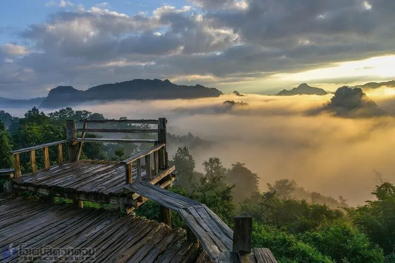
39. Ban Jabo, Mae Hong Son is a highland village in Pang Mapha Subdistrict, Pang Mapha District, Mae Hong Son Province. The community is known for its Lahu cultural heritage and panoramic views of mountain ranges surrounding the village. During mornings when weather conditions are favorable, a sea of mist may cover the valleys below, creating striking scenery from viewpoints around the settlement. Ban Jabo attracts visitors who want to experience traditional community life, local food, and mountain landscapes in a relatively peaceful environment.
Highlights: Morning sea of mist overlooking Ban Jabo, panoramic Pang Mapha mountain scenery, Lahu community traditions, noodle restaurants with spectacular valley views, cool mountain weather, and community-based tourism.
Ban Jabo occupies a mountainous landscape characterized by deep valleys and ridges at different elevations. When temperatures fall overnight and the atmosphere contains sufficient moisture, mist may accumulate across the valleys, forming a broad white layer beneath the village. From elevated viewpoints, visitors can observe mountain peaks emerging above the clouds while the sky gradually changes color with the arrival of sunlight.
One of the village's most recognizable experiences is enjoying a meal while overlooking the mountains. Local noodle restaurants have become popular for their elevated seating areas and expansive valley views. Visitors can appreciate the scenery during breakfast without undertaking a difficult summit trek. However, they should follow the safety rules of individual businesses and remain within properly maintained viewing areas.
Ban Jabo has considerable cultural significance as a Lahu community. Residents maintain traditions associated with their language, food, clothing, and everyday life. Community-based tourism gives travelers an opportunity to appreciate this heritage while supporting local enterprises such as restaurants, accommodation, and the sale of village products. Visitors should approach cultural experiences respectfully rather than treating the community simply as a photography location.
Travelers hoping to see morning mist should stay in Pang Mapha District or nearby. The highway between Pai and Mae Hong Son contains numerous winding mountain sections, and a long journey before sunrise may be tiring and hazardous when visibility is reduced. Choosing accommodation close to Ban Jabo provides a more relaxed way to experience the early-morning scenery.
Ban Jabo can be combined with other attractions in Pang Mapha District, especially caves and sites associated with the area's limestone geography. Visitors with two days and one night available can spend time in the village, enjoy the morning viewpoint, and continue to other natural attractions according to road conditions and available time.
Respect for community privacy is essential. Travelers should not enter residential property without permission and should ask before photographing residents, especially children and older people. Purchasing food and using locally operated services provides a direct way to support the community without disrupting everyday life.
Ban Jabo is a particularly appealing destination for visitors who want to combine mountain mist with an understanding of Lahu culture. Its scenic restaurant viewpoints and village atmosphere offer a different experience from remote national park summits.
Open Days: Daily
Getting There: From Pai or Mae Hong Son town, follow Highway 1095 toward Pang Mapha District, then take the signed road to Ban Jabo. The highway has numerous bends and steep sections, so drive cautiously, particularly in rain or fog. Use designated parking areas when visiting restaurants and community viewpoints.
Map (GPS):Get Directions to Ban Jabo

40. Doi Langka Luang, Chiang Rai is a high mountain trekking destination within Khun Chae National Park, Wiang Pa Pao District, Chiang Rai Province. It lies along a mountain range connecting the landscapes of Chiang Rai, Chiang Mai, and Lampang. Known for its evergreen mountain forests, pine trees, open ridgelines, and extensive mountain panoramas, Doi Langka Luang offers opportunities to observe morning mist above the valleys when weather conditions are favorable. The destination is particularly attractive to experienced hikers seeking a demanding journey through relatively remote natural surroundings.
Highlights: Sea of mist over mountain ridges, panoramic views from Doi Langka Luang, evergreen forests, pine woodland, highland grasslands, long-distance trekking, and natural ecosystems within Khun Chae National Park.
Doi Langka Luang is characterized by its elevated terrain and variation in forest ecosystems. The trekking route passes through moisture-rich mountain forests, areas of pine woodland, and more exposed sections along the ridgelines. As hikers ascend, they can observe changes in vegetation and temperature, which reflect the influence of altitude on the mountain environment.
When temperatures fall overnight and moisture accumulates in the lower valleys, layers of mist may develop beneath the mountain ridges. From elevated viewpoints, hikers can observe the cloud-like surface extending between successive peaks. As sunrise illuminates the mountain range, the mist and forested slopes gradually take on different colors, creating rewarding conditions for landscape photography.
The importance of Doi Langka Luang extends beyond its scenery. It forms part of a protected mountain forest landscape that contributes to watershed conservation and ecological connectivity across several northern provinces. The evergreen and pine forests support plants and wildlife adapted to cooler, moisture-rich mountain conditions, making the area valuable for studying highland ecosystems.
The trek to Doi Langka Luang is not comparable to visiting a mountain viewpoint accessible by car. It involves a substantial walking distance, changes in elevation, and possible overnight arrangements. Travelers should assess their physical fitness and confirm the length, difficulty, and availability of the approved route with Khun Chae National Park before organizing a trip.
Access is subject to national park regulations. The permitted trekking season, reservation requirements, guide arrangements, and camping locations may change according to conservation needs and weather conditions. Visitors must use the officially authorized route and should not enter closed trails even if an alternative path appears accessible.
Essential preparations include sturdy trekking footwear, warm clothing, rain protection, drinking water, and suitable overnight equipment when required. Mountain weather can change rapidly, especially on exposed ridges where strong winds or dense fog may reduce visibility. Hikers should remain with their group and follow the instructions of park officials or authorized guides.
Visitors should avoid collecting plants, disturbing wildlife, lighting unauthorized fires, or leaving rubbish behind. Responsible trekking is particularly important in remote protected forests where damaged vegetation and soil may require considerable time to recover.
Doi Langka Luang is an excellent choice for experienced hikers who want to experience mist-covered mountains and forest wilderness through an extended outdoor adventure. The ecological diversity, ridgelines, and challenging trail are central to the destination's appeal, regardless of whether a dense sea of mist appears during the visit.
Open Days: According to seasonal trekking permits and Khun Chae National Park regulations.
Getting There: From Chiang Rai, travel toward Wiang Pa Pao District and contact Khun Chae National Park to confirm the official trekking starting point, route availability, registration process, and guide requirements. The GPS position is a geographical reference and should not be interpreted as a road-accessible destination.
Map (GPS):View Doi Langka Luang on Google Maps
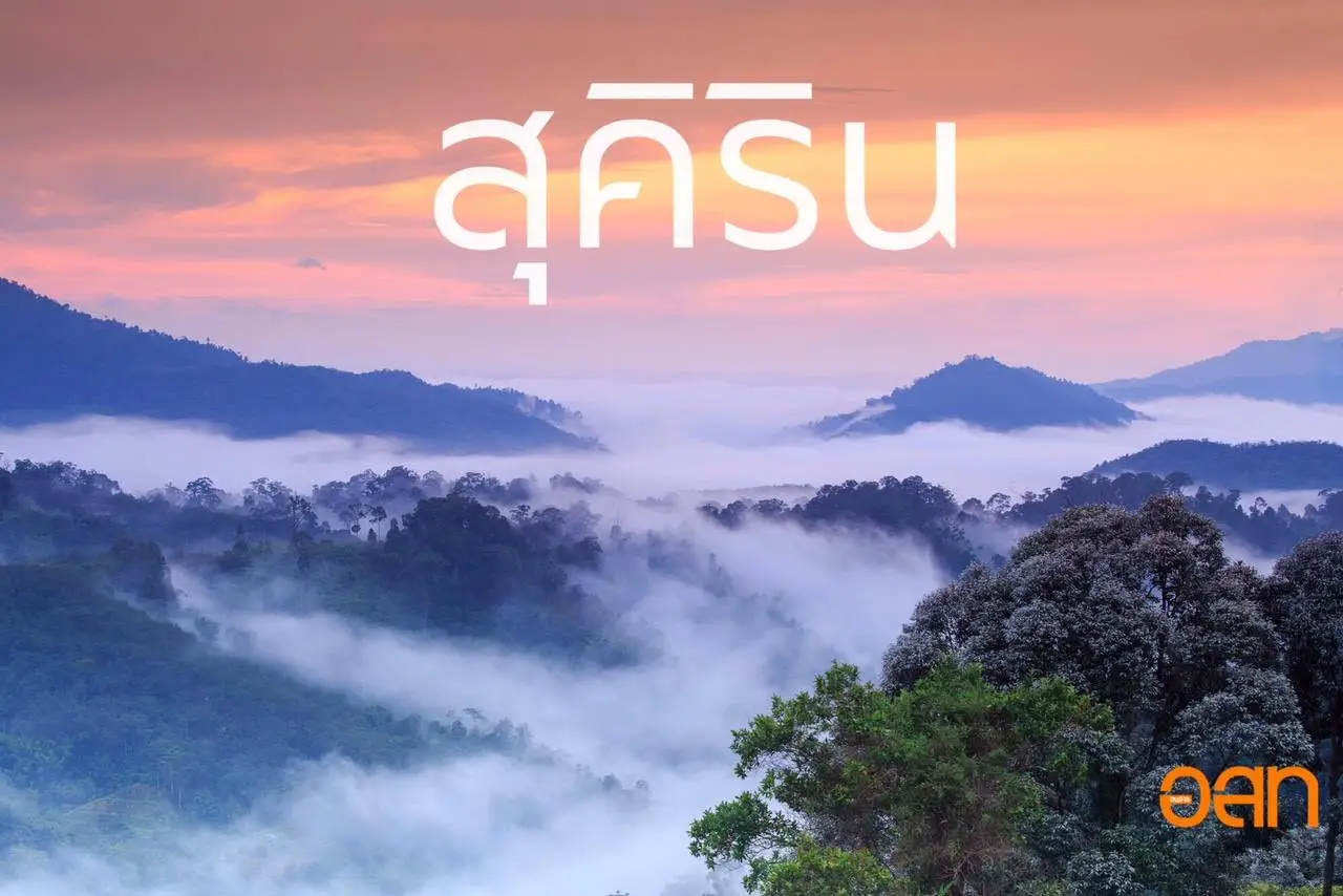
41. Ban Phu Khao Thong Sea of Mist, Narathiwat is a nature tourism destination in Phu Khao Thong Subdistrict, Sukhirin District, Narathiwat Province. It is known for the extensive mountain scenery of Thailand's southern border region, where evergreen forests and valleys provide opportunities to observe morning sea-of-mist formations. Local attractions are associated with Ban Phu Khao Thong, Wat Phra That Phu Khao Thong, and natural viewpoints around the Sukhirin highlands. The destination offers a combination of tropical mountain landscapes, local history, and community life.
Highlights: Sea of mist above Sukhirin valleys, Wat Phra That Phu Khao Thong viewpoint, Khao Nam Sai, tropical mountain forests, Ban Phu Khao Thong community, and the history of the former To Mo gold mining area.
The sea of mist at Ban Phu Khao Thong is associated with the region's mountainous geography and high atmospheric humidity. When temperatures decrease overnight, moisture may condense into fog that settles over the lower valleys. Visitors standing at elevated viewpoints can sometimes see extensive white layers drifting between dark green forested mountains, creating a distinctive tropical landscape.
The viewpoint associated with Wat Phra That Phu Khao Thong combines natural scenery with a religious atmosphere. Other locations, including Khao Nam Sai and community-managed mountain viewpoints, may have different access arrangements. Travelers should identify the particular location they intend to visit and confirm whether suitable vehicles, guides, or advance coordination are required.
Phu Khao Thong also has connections with the historical gold mining industry of Sukhirin District. The To Mo mining area forms part of the region's history of mineral extraction, settlement, and changing economic activities. Visitors interested in local heritage can combine mountain sightseeing with learning about this historical background from appropriate community sources and places of interest.
Early morning generally offers the best opportunity for sea-of-mist photography because the air remains relatively cool and moisture may still be concentrated in the valleys. However, the tropical climate can produce heavy rain and rapidly changing cloud conditions. Travelers should check forecasts and avoid ascending steep or slippery routes when rain or visibility makes conditions unsafe.
Landscape photographers can capture mist rising from green mountain valleys and the contrast between forested ridges and white clouds. As the sun emerges, the shapes of the mountains become gradually clearer. Visitors should use authorized viewpoints and avoid entering private land or exposed locations merely to obtain a different photographic angle.
With two days and one night available, visitors can stay near the Phu Khao Thong community, enjoy the early-morning viewpoint, and spend time exploring local religious landmarks or sites associated with the district's history. Choosing community accommodation and food services can support residents while providing a more complete understanding of the area.
Ban Phu Khao Thong Sea of Mist is particularly suitable for travelers who wish to experience the tropical highlands of southern Thailand beyond the country's better-known coastal destinations. Forests, mountain geography, community history, and the potential for dramatic morning mist all contribute to its appeal.
Open Days: Subject to the arrangements of individual viewpoints and local community operators.
Getting There: From Narathiwat town, travel toward Sukhirin District, then continue to Phu Khao Thong Subdistrict using Highway 4062 and the local community roads. Select the intended viewpoint before departure and check its access arrangements, as different mountain sites may require separate transport or local guidance.
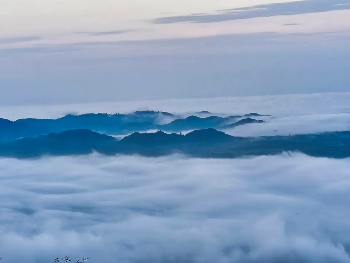
42. Nong Thong Sea of Mist, Phatthalung, also associated with Pha Mai Kaen Viewpoint, is a natural mountain attraction in Village 1, Nong Thong Subdistrict, Pa Bon District, Phatthalung Province. The area lies along the Banthat mountain range, an important forested watershed region in southern Thailand. Its principal attractions are extensive green mountain scenery and the possibility of seeing a sea of mist covering the valleys in the early morning, offering travelers a different perspective on Phatthalung beyond the famous wetlands around Songkhla Lake.
Highlights: Nong Thong Sea of Mist, Pha Mai Kaen Viewpoint, the Banthat mountain range, sunrise over valleys, watershed forests, and the natural surroundings of Pa Bon District.
Nong Thong's mountain landscape consists of ridges, forested slopes, and valleys where moisture can accumulate overnight. As temperatures decrease, water vapor may condense into fine droplets that settle above the lower terrain. Under favorable conditions, visitors at elevated viewpoints can observe a broad white layer stretching between the green mountain ridges.
Pha Mai Kaen Viewpoint is especially attractive for its relatively natural setting and extensive views of the surrounding mountains. Visitors who reach the viewpoint before sunrise can observe how the sky gradually brightens and the first sunlight reaches the valleys. As the fog changes shape and density, parts of the forested landscape may emerge from beneath the cloud layer.
The Banthat mountain range is environmentally important because its forests help retain moisture and contribute to the headwaters of rivers and streams flowing into agricultural areas and the wider Songkhla Lake basin. A visit therefore provides an opportunity to understand how mountain forests, rainfall, and local communities are connected through the region's watershed system.
Periods of high humidity may provide opportunities for mist, particularly when overnight temperatures are low enough for condensation to occur. However, southern Thailand's climate is strongly influenced by seasonal rainfall and changing winds. Heavy rain can make hillside trails slippery and potentially unsafe, so travelers should check conditions before starting an early-morning ascent.
Visitors interested in sunrise photography should arrange their journey with local operators or residents familiar with the route. Depending on the current state of the access path, the trip may require walking through natural terrain where facilities are limited. Suitable shoes, drinking water, rain protection, and a flashlight are useful for the journey.
Nong Thong can be included in a nature-focused visit to Pa Bon District. Travelers may combine the viewpoint with learning about watershed forests and community life near the mountains, provided the itinerary respects the area's environmental conditions and local access arrangements.
The destination is best suited to visitors who appreciate relatively simple nature tourism and are prepared for potentially damp mountain conditions. Using community guidance, avoiding damage to vegetation, and carrying all waste out of the area help preserve the landscape.
Open Days: Subject to trail conditions and local community arrangements.
Getting There: From Phatthalung town, travel toward Pa Bon District and Nong Thong Subdistrict, then continue to Village 1 and the access route to Pha Mai Kaen Viewpoint. Before ascending, contact local authorities or a knowledgeable community guide to confirm the current trail, transport arrangements, and safety conditions.
Map (GPS):Get Directions to Nong Thong Sea of Mist
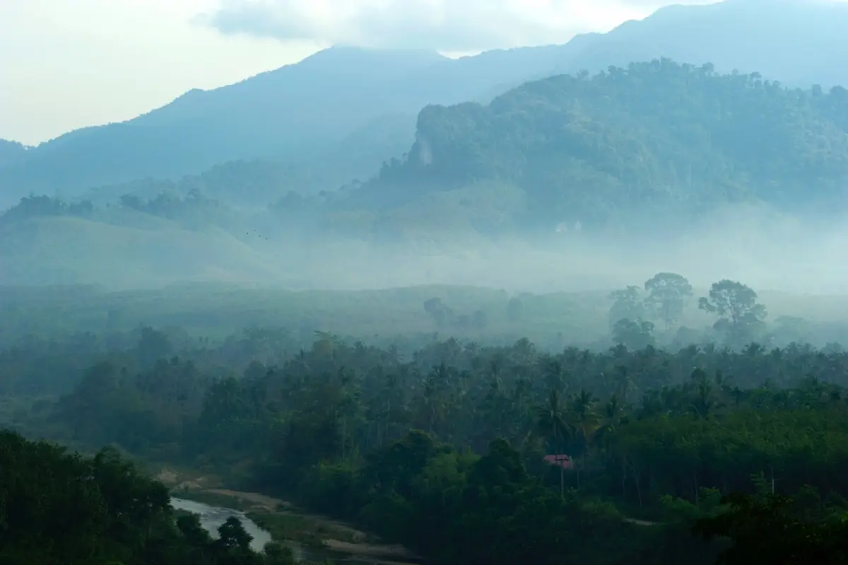
43. Krung Ching Sea of Mist Community, Nakhon Si Thammarat is a community-based nature tourism destination at Ban Bang Nop, Village 1, Krung Ching Subdistrict, Nopphitam District, Nakhon Si Thammarat Province. The area is famous for its viewpoints overlooking tropical forests, mountains, and valleys where morning mist may form under favorable conditions. Krung Ching also has important natural, historical, and community attractions, making it an appealing destination for travelers interested in more than mountain scenery alone.
Highlights: Krung Ching Sea of Mist, sunrise over mountain valleys, Ban Bang Nop community viewpoints, tropical evergreen forests, Krung Ching Waterfall, and community-operated nature tourism activities.
The mountainous terrain around Krung Ching is characterized by high humidity and extensive tropical forest cover. When temperatures fall overnight, mist may accumulate across the valleys or drift through the ridges during the early morning. On some days, the fog forms a dense white layer stretching across the landscape; on others, thin clouds float between forested mountains. These variations offer photographers different views of the same natural environment.
A distinctive feature of the Krung Ching sea-of-mist experience is the role of the local community. Residents participate in tourism services, which may include transport, guiding, and information about the surrounding environment. Using community-operated services allows visitors to learn more about daily life, agriculture, and the relationship between local livelihoods and the region's forests.
Krung Ching is associated with an important natural landscape of southern Thailand. Its forests help conserve watershed resources, while attractions such as Krung Ching Waterfall demonstrate the close relationship between rainfall, forest cover, and flowing streams. Visitors with more than one day available can combine sunrise sightseeing with forest walks or waterfall excursions where routes are officially open.
The area also has historical significance connected to social and political events in southern Thailand. Learning from local residents and community heritage resources can provide a broader understanding of how geography and forest environments have influenced settlement and regional history over time.
Visitors hoping to observe mist should arrange an early-morning trip to an authorized viewpoint. The access roads may include steep sections or surfaces unsuitable for ordinary vehicles. Contacting the community beforehand helps travelers determine the appropriate departure time, transport method, and meeting point.
Landscape photographers will appreciate the contrast between dense green forest and white mist above the valleys. Morning sunlight gradually reveals the succession of mountain ridges and changes the color of the scene. Visitors should remain within safe viewing areas, particularly after rain when slopes and walking surfaces may be slippery.
Krung Ching is well suited to a two-day, one-night nature trip. Travelers can stay in the surrounding community, arrange a sunrise viewpoint visit, and explore other attractions in Nopphitam District afterward. Supporting local food, guiding, and accommodation services contributes to the community economy and encourages responsible tourism.
Krung Ching Sea of Mist Community is particularly attractive to travelers who want to combine tropical mountain scenery with community experiences, forest conservation, and local history. Its combination of misty valleys, waterfalls, and cultural connections makes it an interesting nature destination in Nakhon Si Thammarat Province.
Open Days: According to community tourism arrangements and weather conditions.
Getting There: From Nakhon Si Thammarat town, travel toward Nopphitam District and continue into Krung Ching Subdistrict. Head to Ban Bang Nop and contact the community viewpoint service to confirm uphill transportation and access before sunrise. Advance coordination is advisable when planning a morning sea-of-mist excursion.
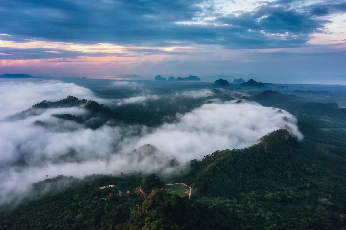
44. Wang Pha Mek, Trang is a community-based ecotourism destination at Ban Thung Luang, Village 7, Wang Maprang Subdistrict, Wang Wiset District, Trang Province. The area is particularly recognized for its elevated mountain viewpoint overlooking forested valleys and surrounding hills. During suitable weather, mist may form over the lower landscape in the early morning, creating a remarkable panorama that differs from the coastal attractions for which Trang is better known. Wang Pha Mek is also an example of community participation in developing nature tourism while encouraging the protection of the local environment.
Highlights: Wang Pha Mek sea of mist, panoramic sunrise, mountain landscapes of Wang Wiset District, community-based ecotourism, Ban Thung Luang village life, and locally organized uphill transportation.
The landscape surrounding Wang Pha Mek consists of mountains, valleys, and tropical vegetation influenced by the humid climate of southern Thailand. When temperatures decrease sufficiently overnight, moisture in the air may condense into mist across the lower terrain. From the mountain viewpoint, travelers can see white layers spreading between green hills, with the scenery gradually changing as morning sunlight illuminates the surrounding ridges.
One of the most rewarding experiences is arriving before sunrise to watch the sky brighten above the mountain landscape. As the first light reaches the valleys, the mist may change shape and gradually disperse, revealing different layers of hills. The appearance of the sea of mist depends on humidity, temperature, wind, and rainfall, making every morning different. A spectacular cloud layer cannot be guaranteed, but the natural panorama remains the defining attraction.
Wang Pha Mek has developed through community involvement in nature-based tourism. Local residents help manage the attraction, organize transportation, and provide visitor services. This model offers economic opportunities for the village while encouraging residents and visitors to recognize the value of maintaining the surrounding forest and mountain environment.
Early-morning services may operate at times different from the site's ordinary daytime visiting hours. Travelers hoping to see sunrise should contact the responsible local operators beforehand to confirm transport arrangements and the earliest available departure. Mountain access may involve steep or uneven tracks where an ordinary passenger car is unsuitable, especially during periods of heavy rain.
Visitors should prepare suitable walking shoes, drinking water, a flashlight, and protection against rain and moisture. The tropical climate may create slippery ground even when temperatures are relatively warm. Following the instructions of guides or local operators is important, particularly on narrow mountain paths or at exposed viewing areas.
Wang Pha Mek can be incorporated into a two-day, one-night trip through Trang Province. Travelers can stay in Wang Wiset District or a nearby area and arrange their sunrise visit with the community before continuing to other natural or cultural attractions during the daytime. The journey offers an opportunity to appreciate a quieter inland side of Trang, away from the province's famous beaches and islands.
Landscape photographers will find the mountain ridges, white mist, and changing sunlight attractive subjects. Photographing from the designated viewpoint helps preserve the natural environment and reduces the risk of accidents. Visitors should avoid walking outside approved routes, disturbing residents, or leaving rubbish behind.
Wang Pha Mek is particularly suitable for travelers who want a southern Thai sea-of-mist experience connected to local community tourism. Its mountain scenery, early-morning atmosphere, and community-led visitor services make it a distinctive destination in Trang Province.
Open Days: According to local tourism arrangements and weather conditions.
Opening Hours: 08:00 – 17:00 for general visiting according to the destination information; early-morning mist-viewing services may begin around 04:30 by prior arrangement.
Getting There: From Trang town, travel toward Wang Wiset District, then continue to Wang Maprang Subdistrict and Ban Thung Luang, Village 7. Follow the signs to Wang Pha Mek and contact local operators to confirm uphill transportation, the departure time for sunrise viewing, and road conditions.
Map (GPS):Get Directions to Wang Pha Mek
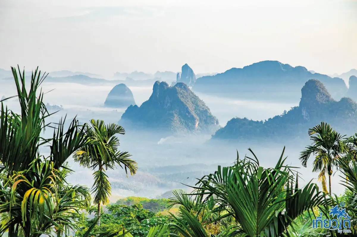
45. Doi Ta Pang, Chumphon is a renowned sea-of-mist viewpoint near Ban Bon Doi, Village 7, Khao Thalu Subdistrict, Sawi District, Chumphon Province. The destination is particularly famous for its early-morning mountain panorama featuring Khao Thalu, a distinctive mountain recognized for a natural opening through its rocky formation. During suitable atmospheric conditions, white layers of mist spread across the surrounding valleys, creating striking scenery as sunrise gradually illuminates the mountain peaks.
Highlights: Doi Ta Pang sea of mist, sunrise, Khao Thalu mountain, panoramic views of Sawi District, natural mountain scenery, and the rural environment of Ban Bon Doi.
Doi Ta Pang overlooks a landscape of mountains and valleys where the recognizable shape of Khao Thalu provides a dramatic natural landmark. When sufficient moisture gathers in the lower terrain and temperatures decrease overnight, a sea of mist may form between the ridges. The resulting cloud layer provides a striking backdrop for Khao Thalu, making the scenery especially appealing to landscape photographers.
What distinguishes this viewpoint from many other sea-of-mist destinations is the presence of Khao Thalu's unusual rock formation. The mountain has a natural opening that can be recognized from a distance and is an important symbol of the surrounding locality. Its distinctive silhouette creates a memorable composition even on clear mornings when dense mist does not appear.
The tropical climate of Chumphon provides substantial humidity, creating opportunities for mist to develop when local temperature and wind conditions are suitable. Travelers should nevertheless check the weather forecast because heavy rain, strong winds, or low cloud cover may affect both visibility and safe access to the viewpoint.
The surrounding communities are closely connected to agriculture and natural resources. Visiting Doi Ta Pang provides an opportunity to experience an inland mountain landscape that differs from Chumphon's coastal attractions. Community-operated services and local businesses contribute to the visitor experience and provide economic benefits for residents.
Travelers hoping to observe the mist should arrive before sunrise and allow sufficient time to reach the viewpoint safely. A flashlight, suitable walking shoes, drinking water, and lightweight rain protection are useful. The hillside can become slippery after rainfall, so visitors should use designated access routes and avoid exposed or unstable ground.
A two-day, one-night itinerary can include accommodation in Sawi District followed by an early-morning trip to Doi Ta Pang. The remainder of the visit can focus on nearby community attractions or Chumphon's other natural landscapes, provided road conditions and travel times allow.
Photographers may wish to capture the natural opening in Khao Thalu together with the mist and sunrise. The layers of mountain ridges create additional depth, while the changing light provides different colors and contrasts. Safety is essential when selecting camera positions, especially in low light or on damp terrain.
Doi Ta Pang is an appealing destination for travelers seeking a sea of mist in southern Thailand, especially those interested in mountain landscapes featuring distinctive geological formations. The view of Khao Thalu provides a memorable experience even when the mist is light.
Open Days: According to local area arrangements and weather conditions.
Best Viewing Time: From approximately 05:00 onward, subject to current access and local visitor services.
Getting There: From Chumphon town, travel toward Sawi District and Khao Thalu Subdistrict, then continue to Ban Bon Doi, Village 7, following the signs to Doi Ta Pang. Confirm the road condition and whether local transport is required before making a predawn ascent.
Map (GPS):Get Directions to Doi Ta Pang

46. Doi Kio Fin, Lampang is a scenic highland viewpoint within Chae Son National Park, Chae Son Subdistrict, Mueang Pan District, Lampang Province. Situated along a mountain range connecting the landscapes of Lampang and Chiang Mai, it is known for sunrise views, forested ridges, and the possibility of seeing mist gathered in the valleys below. The viewpoint is particularly attractive during the cool season, when early mornings offer lower temperatures and mountain scenery illuminated by the first sunlight.
Highlights: Early-morning sea of mist, Doi Kio Fin viewpoint, sunrise, panoramic mountain scenery across the Lampang–Chiang Mai highlands, cool weather, and the natural environment of Chae Son National Park.
Doi Kio Fin occupies an elevated mountain ridgeline overlooking successive forested slopes. During suitable weather, mist may accumulate in the lower valleys as temperatures decrease overnight. From the viewpoint, visitors may see a broad layer of white clouds beneath the exposed peaks, with the colors of the landscape changing as sunrise approaches.
Early morning is particularly popular for photography because the cool atmosphere may allow mist to remain over the valleys for a short period. As sunlight reaches the ridges, the cloud layer changes shape and gradually reveals details of the surrounding forest. On mornings without significant mist, the extensive mountain panorama remains the principal attraction.
Doi Kio Fin lies within the wider conservation landscape of Chae Son National Park, an area known for mountain forests, waterfalls, hot springs, and watershed resources. The surrounding forests play an important role in conserving water and supporting biodiversity. A visit provides opportunities to appreciate the relationship between mountain ecology and atmospheric conditions.
Travelers can include Doi Kio Fin in a nature-focused itinerary through Lampang Province, combining sunrise sightseeing with other authorized attractions within Chae Son National Park. Those wishing to reach the viewpoint before dawn should select nearby accommodation and confirm whether early access is permitted under the current national park rules.
Photographers can use mountain ridges as natural leading lines and capture the successive peaks as the light changes. Wide-angle compositions emphasize the scale of the landscape, while the white mist provides contrast against the darker forested terrain. Visitors should photograph from stable, designated locations and avoid exposed slopes.
During winter, temperatures at the viewpoint may be considerably cooler than in Lampang town. Warm clothing, sturdy footwear, drinking water, and a flashlight are recommended for early visits. Drivers should ensure that brakes and tires are in good condition before using steep mountain roads.
Doi Kio Fin is particularly suitable for travelers who appreciate peaceful mountain scenery and sunrise photography. Its relatively natural setting and connection to Chae Son National Park make it a rewarding alternative to more heavily visited northern viewpoints.
Open Days: Subject to current national park access regulations.
Opening Hours: 06:00 – 18:00 according to the destination information.
Getting There: From Lampang town, travel toward Mueang Pan District and Chae Son Subdistrict, then follow the designated mountain route to Doi Kio Fin. Before departure, check the status of the road and whether access is permitted at the time you wish to visit, particularly for sunrise.
Map (GPS):Get Directions to Doi Kio Fin

47. Phu Kho Viewpoint, Phetchabun is a scenic roadside mountain viewpoint near kilometer 46 of Highway 12 along the Lom Sak–Chum Phae route, within Nam Nao District, Phetchabun Province. It provides extensive views over mountain ranges and, on clear days, distant landmarks such as Phu Kradueng and Phu Pha Chit. The viewpoint is an appealing stop for travelers crossing the highlands between northern and northeastern Thailand, particularly those interested in mountain photography and cool-weather scenery.
Highlights: Phu Kho Viewpoint, sunrise, distant views toward Phu Kradueng and Phu Pha Chit, extensive mountain ridges, occasional morning mist, and scenic driving along Highway 12.
Phu Kho is located at an elevated position overlooking several layers of mountain terrain. When air temperatures fall and moisture accumulates in lower valleys, mist may form between the ridges, creating a soft white contrast against the surrounding hills. On clear days, the viewpoint offers an unobstructed perspective of the mountainous landscape and its distant peaks.
A distinctive feature of Phu Kho is its accessibility from a major highway. Highway 12 passes through mountainous terrain connecting the Lom Sak and Chum Phae areas. Stopping at Phu Kho gives travelers an opportunity to rest, appreciate the landscape, and observe the geographical transition between different parts of Thailand.
The early morning can be rewarding for photography because cooler conditions may favor the formation of mist in the valleys. Nevertheless, Phu Kho is primarily a panoramic mountain viewpoint rather than a destination where dense clouds are guaranteed. Travelers should value its extensive scenery and sunrise opportunities alongside the possibility of mist.
Photographers can use the successive mountain ridges to create images with considerable depth. Morning light emphasizes the separation between peaks, while mist can soften the landscape and highlight differences in elevation. All photography should take place from safe stopping areas. Parking on blind curves or narrow shoulders is dangerous on this mountain highway.
Nam Nao District is associated with forested mountain environments and natural landscapes influenced by the higher terrain of the Phetchabun Range. A stop at Phu Kho can be combined with other nature attractions nearby, provided travelers allow sufficient time for mountain driving and avoid rushing between destinations.
Visitors planning to see sunrise may wish to stay in Nam Nao District or another conveniently located area. Those simply traveling along Highway 12 can enjoy Phu Kho as a scenic stop without arranging an extended visit. Road and weather conditions should guide the decision, especially when fog limits visibility.
Phu Kho Viewpoint is suitable for road-trip travelers, landscape photographers, and visitors who enjoy highland scenery. Its main strength lies in the broad view across mountain ranges and its convenient location on one of the region's important scenic roads.
Open Days: According to local access and road conditions.
Getting There: From Lom Sak District, follow Highway 12 toward Nam Nao and Chum Phae, then stop at the designated viewpoint near kilometer 46. Use only authorized parking areas and do not stop on mountain road bends to take photographs.
Map (GPS):Get Directions to Phu Kho Viewpoint
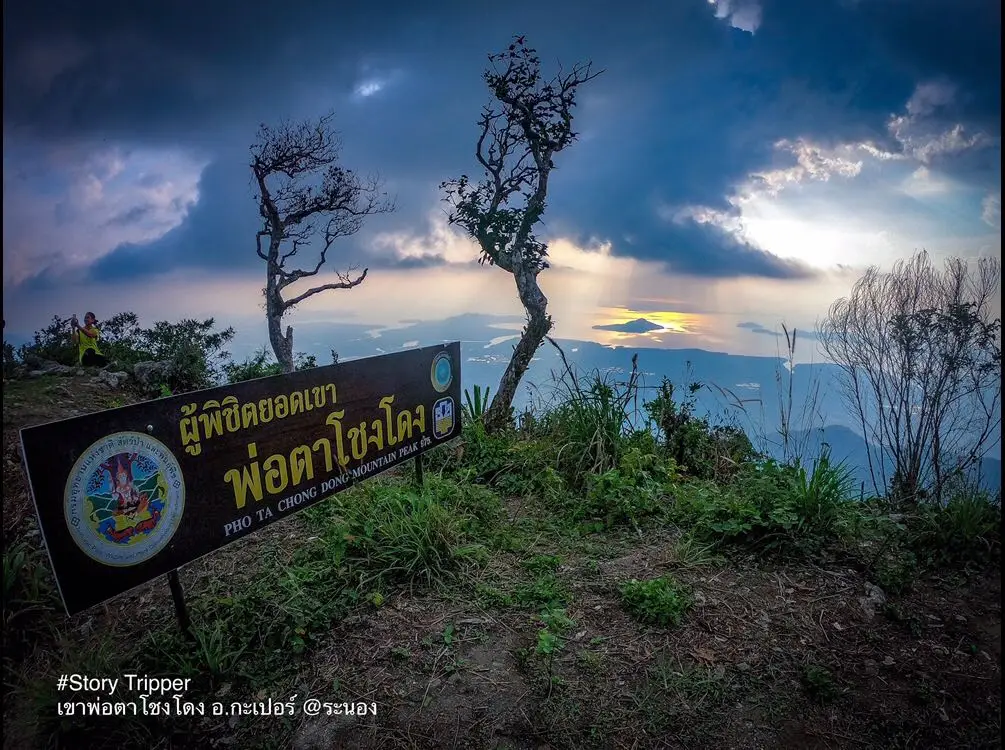
48. Khao Pho Ta Chong Dong, Ranong is a mountain nature destination in Village 9, Kapoe Subdistrict, Kapoe District, Ranong Province. Known for its forested highlands and challenging natural terrain, the area appeals particularly to travelers interested in trekking and exploring the tropical mountain environments of Thailand's Andaman coast. On suitable mornings, mist may drift through the surrounding valleys or across the ridgelines, adding atmosphere to an already striking landscape.
Highlights: Forested mountain scenery in Kapoe District, tropical highland ecosystems, occasional morning mist, trekking, panoramic ridgelines, and opportunities to learn about the natural environment of Ranong Province.
Khao Pho Ta Chong Dong consists of rugged mountain terrain covered with humid tropical forest. Moist air influenced by the Andaman coastal climate can contribute to mist formation when temperatures decrease sufficiently overnight. From elevated ridges, hikers may observe layers of mountains and clouds extending across the surrounding landscape. However, the appearance of dense mist depends on local weather conditions and cannot be guaranteed.
The destination is particularly attractive to travelers seeking a more demanding outdoor experience rather than a conventional roadside viewpoint. Reaching suitable viewing areas may require trekking through forest terrain, with steep or uneven sections along the route. Visitors should assess their fitness and confirm the correct access route with knowledgeable local guides or authorities before traveling.
Ranong is known for its humid climate and extensive natural forests. The mountain landscape supports plant communities influenced by rainfall, elevation, and soil conditions. Trekking in the area offers opportunities to observe tropical vegetation and understand the importance of mountain forests in conserving water and supporting biodiversity.
For landscape photography, the mountain ridges and extensive forest cover provide attractive compositions. Mist appearing above the valleys may create contrast between white cloud layers and deep green vegetation. Nevertheless, taking photographs should never require leaving an approved route or approaching dangerous slopes. Safety must take priority over obtaining an unusual viewpoint.
Rainfall is a major consideration when planning a trip to Ranong's mountains. Heavy or prolonged rain can make trails slippery and may increase the risk of unstable ground or rapidly flowing streams. Travelers should monitor forecasts, follow the advice of experienced local guides, and cancel or change their route if conditions become unsafe.
A visit should allow enough time for travel to Kapoe District, reaching the designated starting point, and completing the hike. Attempting to combine a demanding mountain excursion with several distant attractions in the same day may create unnecessary pressure. A slower itinerary allows visitors to appreciate the forest environment and travel more safely.
All visitors should minimize environmental impacts by carrying out their waste, remaining on established trails, avoiding unnecessary noise, and not collecting plants. These practices are especially important in humid forests where ecosystems can be sensitive to disturbance.
Khao Pho Ta Chong Dong is best suited to experienced nature travelers and hikers who want to explore Ranong's mountainous landscape. Occasional mist is part of its appeal, but the principal experience is the opportunity to discover tropical forest ecosystems in a challenging natural setting.
Open Days: Access should be arranged according to local guidance and current trail conditions.
Getting There: From Ranong town, take Highway 4 toward Kapoe District, then continue into Kapoe Subdistrict and the access area for Khao Pho Ta Chong Dong. Before departure, arrange local guidance and confirm the trekking starting point, route conditions, and whether any restrictions apply. The GPS position is a geographical reference, not a road-accessible summit.
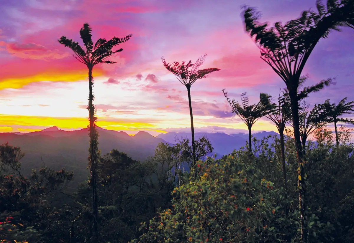
49. Khao Ram Rom, Nakhon Si Thammarat is a forested mountain destination in Ron Phibun District, Nakhon Si Thammarat Province, located within the wider protected landscape of Namtok Yong National Park. The area is characterized by tropical evergreen forest, elevated ridges, and extensive mountain terrain. Under favorable conditions, mist may drift through the forest or gather in the valleys, creating a distinctive atmosphere for travelers interested in mountain ecology and nature exploration.
Highlights: Khao Ram Rom mountain scenery, mist drifting through tropical rainforest, natural forest ecosystems, Namtok Yong National Park, nature trails, and highland botanical diversity.
Khao Ram Rom is part of a mountain landscape covered with moisture-rich tropical forest. Vegetation changes with elevation, and the high humidity supports numerous plant species adapted to the forest environment. When cooler conditions allow water vapor to condense, mist may develop among the trees or above lower valleys, creating a dramatic but weather-dependent natural scene.
The destination is important not only for its scenery but also for its ecological significance. The forests associated with Namtok Yong National Park help protect watershed resources and provide habitats for wildlife and diverse plant communities. Observing the mountain environment offers opportunities to understand the role of tropical forests in regulating moisture and maintaining ecological balance.
Access to the higher mountain areas may be restricted according to national park management. Certain trails or natural areas may require permission, authorized guides, or seasonal access arrangements. Travelers should never assume that the opening hours of the national park headquarters also apply to all mountain trails and viewpoints.
The destination information has included a seasonal closure announcement for Namtok Yong National Park tourism and camping areas from July 1 to November 30, 2026. Because restrictions can apply to specific locations within the national park, visitors must check the current official announcement before traveling and should never enter a closed route or restricted area.
Photographers interested in tropical mountain forests may appreciate the shifting light and occasional mist among the trees. However, dense forest, steep terrain, and poor visibility can make unofficial exploration dangerous. Visitors should photograph from authorized locations and avoid entering remote forest areas without proper guidance.
The experience is most suitable for nature enthusiasts who wish to appreciate highland forest ecosystems rather than simply visit an easily accessible sunrise viewpoint. Sturdy walking shoes, weather-appropriate clothing, drinking water, and essential hiking equipment may be required, depending on the officially permitted route.
Khao Ram Rom offers an opportunity to understand the ecological value of southern Thailand's mountainous rainforests. Mist is an atmospheric feature that may enhance the experience, while the forest itself remains the principal attraction. Responsible travel and compliance with conservation regulations are fundamental to visiting the area.
Open Days: According to Namtok Yong National Park announcements and access restrictions.
Getting There: From Nakhon Si Thammarat town, travel toward Ron Phibun District and the designated access area of Namtok Yong National Park. Contact park officials before planning a visit to Khao Ram Rom to confirm the route, required permissions, and whether the area is open to visitors.
Map (GPS):View Khao Ram Rom on Google Maps

50. Sea of Mist Viewpoint (Km 31–33), Phetchaburi is a scenic mountain viewpoint along the road through Kaeng Krachan National Park, near kilometers 31–33 in Kaeng Krachan District, Phetchaburi Province. The location is recognized for its elevated views over extensive forested mountains and valleys. During suitable early-morning weather, white mist may gather across the lower landscape, creating a beautiful sea-of-clouds panorama surrounded by the mountain ranges of western Thailand.
Highlights: Sea of mist above Kaeng Krachan's forests, the Km 31–33 mountain viewpoint, layered mountain ridges, sunrise, biodiversity-rich western forests, and nature sightseeing within Kaeng Krachan National Park.
The attraction of the Km 31–33 viewpoint lies in its perspective over a broad landscape of forested valleys. When the atmosphere cools sufficiently overnight, mist may collect over the lower terrain and form an extensive layer between the mountains. Higher forested ridges emerge above the clouds, producing a striking scene dominated by natural vegetation rather than urban development or agricultural fields.
Early morning offers the greatest opportunity to watch the mist while temperatures remain relatively low. As sunlight reaches the landscape, the cloud layer gradually changes color and begins to move. Some mornings provide extensive, thick layers of fog, while on others the mist quickly disperses and reveals the surrounding mountains. These variations create different photographic opportunities throughout the early hours.
Kaeng Krachan National Park is one of Thailand's most important protected natural areas and forms part of the Kaeng Krachan Forest Complex, recognized as a UNESCO World Heritage Site. Its ecosystems support a high diversity of plants and animals and play an important role in conserving watersheds. The sea-of-mist experience offers an opportunity to appreciate the relationship between forests, mountains, moisture, and local weather conditions.
Reaching the viewpoint requires compliance with the national park's road regulations. Certain sections of the mountain route can be steep, narrow, or affected by weather, and scheduled ascent and descent periods may apply. Travelers must check the latest restrictions regarding authorized vehicles, road access, and visiting times. They should not enter the route outside official operating periods, even when the natural mist is most likely to occur before sunrise.
Visitors hoping to photograph the mist should arrange accommodation in a permitted camping area or a nearby location and plan their journey according to the approved access schedule. On arrival, they should remain within safe viewing areas, avoid approaching cliff edges, and allow sufficient time to enjoy the changing scenery without rushing.
The surrounding park offers opportunities for birdwatching and nature education at authorized locations. Wildlife should be observed quietly and from an appropriate distance. Feeding animals, disturbing vegetation, or leaving waste in the forest can have negative effects on the protected environment.
A two-day, one-night itinerary can include staying near Kaeng Krachan, visiting an authorized sea-of-mist viewpoint in the morning, and spending the remainder of the day exploring other available natural attractions. Travelers should not schedule the excursion solely on the assumption that access is permitted at the hour when mist usually forms.
The Km 31–33 Sea of Mist Viewpoint is particularly suitable for visitors seeking extensive forest panoramas in western Thailand. Its scenery is closely connected to the ecosystem of Kaeng Krachan National Park, making responsible tourism and adherence to park regulations essential parts of the experience.
Open Days: Subject to Kaeng Krachan National Park announcements and permitted access arrangements.
Getting There: From Bangkok, travel toward Phetchaburi Province and continue to Kaeng Krachan District and the authorized entrance to Kaeng Krachan National Park. Proceed along the internal mountain road toward the Km 31–33 viewpoint only when the route is officially open and according to the park's ascent and descent schedules. Confirm whether the chosen vehicle is suitable or a designated transport service is required.
Summary Table: 50 Best Sea of Mist Destinations in Thailand
| No. / Destination | Province | Highlights |
| 1. Phu Chi Fa Forest Park | Chiang Rai | Dramatic cliff, border mountains and sunrise above a sea of mist |
| 2. Doi Pha Tang | Chiang Rai | Hill 102, Hill 103, mist-covered valleys and Yunnanese heritage |
| 3. Huai Nam Dang National Park | Chiang Mai / Mae Hong Son | Kiu Lom Viewpoint and views toward Doi Luang Chiang Dao |
| 4. Yun Lai Viewpoint | Mae Hong Son | Pai Valley sunrise and Yunnanese village atmosphere |
| 5. Khao Kho Sea of Mist | Phetchabun | Misty valleys, mountain resorts and accessible scenic viewpoints |
| 6. Phu Thap Boek | Phetchabun | High mountain mist, cabbage fields and Hmong agriculture |
| 7. Si Nan National Park | Nan | Doi Samer Dao, dramatic viewpoints, stargazing and sunrise |
| 8. Phu Ruea National Park | Loei | Cold-weather summit, mountain sunrise and occasional sea of mist |
| 9. Pang Ung | Mae Hong Son | Morning mist floating above a pine-lined reservoir |
| 10. Phu Langka – Fin Ja Boh | Phayao | Layered mountain ridges and valley mist near hillside accommodation |
| 11. Phu Chi Dao | Chiang Rai | Exposed ridgeline and sunrise above border mountain valleys |
| 12. Phu Chi Duean | Chiang Rai | Quiet ridge-top scenery and morning sea-of-mist opportunities |
| 13. Doi Ang Khang | Chiang Mai | Cool climate, highland agriculture and drifting mountain mist |
| 14. Doi Mon Long | Chiang Mai | Mountain ridges, open panoramas and occasional morning mist |
| 15. Doi Hua Mae Kham | Chiang Rai | Mexican sunflower fields, border mountains and seasonal mist |
| 16. Doi Inthanon National Park | Chiang Mai | Thailand's highest summit, cloud forests and nature trails |
| 17. Ban Rak Thai | Mae Hong Son | Reservoir mist, tea culture and Yunnanese Chinese village scenery |
| 18. Doi Phu Kha National Park | Nan | Rare plants, highland forests and mist above mountain valleys |
| 19. Phu Hin Rong Kla National Park | Phitsanulok | Rock formations, mountain forests and modern history |
| 20. Phanoen Thung | Phetchaburi | Sea of mist above extensive forests in Kaeng Krachan National Park |
| 21. Phu Pa Po (Fuji of Loei) | Loei | Distinctive Phu Ho mountain silhouette and E-Taek community transport |
| 22. Khao Khai Nui Sea of Mist | Phang Nga | Tropical morning mist close to the Andaman coast |
| 23. Doi Kad Phi Forest Park | Chiang Rai | Forested ridges, quiet viewpoints and morning mist |
| 24. Phu Thok | Loei | Mist overlooking Chiang Khan town and the Mekong River |
| 25. Noen Chang Suek | Kanchanaburi | Border mountain scenery near Ban E Tong and the Pilok mining heritage |
| 26. Doi Sa Ngo | Chiang Rai | Sunrise and mountain panoramas around the Golden Triangle |
| 27. Doi Mae U Kho Bua Tong Fields | Mae Hong Son | Golden seasonal flowers and misty mountain slopes |
| 28. Gunung Silipat Sea of Mist | Yala | Tropical rainforest trekking and mist-covered valleys near Betong |
| 29. Kia Forest (Mae Taman) | Chiang Mai | Pine forests, mist and views of Doi Luang Chiang Dao |
| 30. Mon Kio Lom | Tak | Sea of mist above forests in Mae Moei National Park |
| 31. Doi Mon Lan | Chiang Mai | Peaceful mountain ridges and mist above Phrao valleys |
| 32. Doi Mon Chong Mountain | Chiang Mai | Trekking, highland grasslands and impressive ridgeline scenery |
| 33. Khao Microwave Viewpoint | Yala | Aiyerweng Sea of Mist and the nearby skywalk |
| 34. Doi Chang Mub | Chiang Rai | Doi Tung mountain scenery and a culturally significant stupa |
| 35. Phu Soi Dao National Park | Uttaradit | Pine plateau, seasonal wildflowers and trekking |
| 36. Doi Mon Jam | Chiang Mai | Mountain agriculture, valley views and occasional mist |
| 37. Doi Chang | Chiang Rai | Arabica coffee plantations and drifting highland mist |
| 38. Pha Kep Tawan | Nakhon Ratchasima | Forested mountain sunset and occasional morning mist |
| 39. Ban Jabo | Mae Hong Son | Lahu community, scenic noodle restaurants and misty valleys |
| 40. Doi Langka Luang | Chiang Rai | Long-distance forest trekking and highland mist |
| 41. Ban Phu Khao Thong Sea of Mist | Narathiwat | Sukhirin valley mist and local gold-mining history |
| 42. Nong Thong Sea of Mist | Phatthalung | Pha Mai Kaen Viewpoint and the Banthat Range |
| 43. Krung Ching Sea of Mist Community | Nakhon Si Thammarat | Community-managed mist viewpoints and tropical watershed forests |
| 44. Wang Pha Mek | Trang | Community ecotourism and sunrise above misty valleys |
| 45. Doi Ta Pang | Chumphon | Morning mist and distinctive Khao Thalu rock formations |
| 46. Doi Kio Fin | Lampang | Sunrise over ridges in Chae Son National Park |
| 47. Phu Kho Viewpoint | Phetchabun | Highway 12 mountain panoramas and distant views toward Phu Kradueng |
| 48. Khao Pho Ta Chong Dong | Ranong | Rainforest trekking and mist above tropical highlands |
| 49. Khao Ram Rom | Nakhon Si Thammarat | Rainforest ecosystems and occasional mountain mist |
| 50. Sea of Mist Viewpoint (Km 31–33) | Phetchaburi | Forest panoramas within Kaeng Krachan National Park |
Recommended Sea of Mist Itineraries in Thailand
| Trip Duration / Destination | Suggested Itinerary |
| 1 Day — Phu Ruea, Loei | Stay in Phu Ruea District the previous night, then travel to an authorized sunrise viewpoint in the morning. Enjoy the mountain scenery and explore accessible nature trails later in the day. This plan is most convenient for travelers already staying in Loei Province. |
| 1 Day — Phu Thok, Chiang Khan | Depart from Chiang Khan before sunrise and use the designated local shuttle to reach Phu Thok. Watch the mist above the Mekong River, return to town for breakfast, and explore the traditional riverside community. |
| 2 Days, 1 Night — Phu Chi Fa and Doi Pha Tang | Day 1: Travel to Wiang Kaen District, Chiang Rai, explore the surrounding communities and stay near Phu Chi Fa. Day 2: Watch sunrise and the sea of mist at Phu Chi Fa, then continue to Doi Pha Tang later in the day when road and access conditions permit. |
| 2 Days, 1 Night — Khao Kho and Phu Thap Boek | Day 1: Explore Khao Kho and stay in a highland accommodation. Day 2: Watch the morning mist near your accommodation before continuing toward Phu Thap Boek. Allow adequate time for steep mountain roads and changing visibility. |
| 2 Days, 1 Night — Pang Ung and Ban Rak Thai | Day 1: Visit Ban Rak Thai and enjoy its Yunnanese Chinese tea and food culture. Day 2: Watch mist above Pang Ung Reservoir or Ban Rak Thai Reservoir according to your accommodation and access arrangements. The two destinations offer different lakeside mountain experiences. |
| 2 Days, 1 Night — Khao Khai Nui, Phang Nga | Day 1: Travel to Thai Mueang or Khao Lak. Day 2: Join a locally arranged early-morning trip to Khao Khai Nui, then enjoy the coastal scenery of Phang Nga later in the day. |
| 2 Days, 1 Night — Krung Ching, Nakhon Si Thammarat | Day 1: Arrive in Krung Ching and arrange transportation to the community viewpoint. Day 2: Watch sunrise and the sea of mist before exploring Krung Ching Waterfall or other accessible natural attractions, depending on conditions. |
| 3 Days, 2 Nights — Huai Nam Dang and Pai | Day 1: Travel from Chiang Mai to the Huai Nam Dang area. Day 2: Enjoy the early-morning viewpoint, then continue to Pai. Day 3: Visit Yun Lai Viewpoint for sunrise, explore Santichon Village, and return along the mountain road with sufficient travel time. |
| 3 Days, 2 Nights — Phu Langka, Phayao | Day 1: Travel to Pong District. Day 2: Enjoy the landscapes around Phu Langka and Fin Ja Boh while exploring nearby communities. Day 3: Watch the morning mist before departing. This is a relaxed itinerary for mountain photography. |
| 3 Days, 2 Nights — Betong, Yala | Day 1: Arrive in Betong. Day 2: Visit Khao Microwave and the Aiyerweng Sea of Mist, subject to visiting hours and weather conditions. Day 3: Explore other Betong attractions, or arrange a separate guided trekking excursion to Gunung Silipat when permitted. |
| 3 Days, 2 Nights — Phu Pa Po and Chiang Khan | Day 1: Travel to Nong Hin District. Day 2: Visit Phu Pa Po using the community's E-Taek transport, then travel to Chiang Khan. Day 3: Watch sunrise at Phu Thok and explore the Mekong riverside town. |
| Specialized Trek — Doi Mon Chong | Plan the route according to Omkoi Wildlife Sanctuary's authorized trekking period. Check permits, guides, overnight arrangements, equipment requirements, and the fitness level needed for the trail. |
| Specialized Trek — Doi Langka Luang | Arrange the hike with Khun Chae National Park, allowing enough time for the approved trekking route and overnight stay when required. The destination is appropriate for experienced hikers, not a standard drive-up excursion. |
| Western Forest Trip — Kaeng Krachan | Select Phanoen Thung or the Km 31–33 viewpoint according to current park access. Check vehicle requirements, road-opening periods, and permitted ascent and descent times before arranging transport or accommodation. |
Frequently Asked Questions (FAQ)
Q: Where are the best places to see a sea of mist in Thailand?
A: Popular destinations include Phu Chi Fa, Doi Pha Tang and Phu Chi Dao in Chiang Rai; Huai Nam Dang in Chiang Mai; Khao Kho and Phu Thap Boek in Phetchabun; Phu Thok in Loei; and Phu Langka in Phayao. In southern Thailand, notable locations include Khao Khai Nui in Phang Nga, Khao Microwave in Yala, and Krung Ching in Nakhon Si Thammarat. Each offers a different landscape and visitor experience.
Q: What is the best month to see a sea of mist in Thailand?
A: November through February is a popular period for mountain tourism in northern and northeastern Thailand because of the cooler weather. The transition from the rainy season into the cool season can also provide favorable humidity. Some destinations in southern Thailand may experience morning mist at other times of the year, depending on rainfall, temperature and wind.
Q: What time should I arrive at a sea-of-mist viewpoint?
A: In general, aim to reach the viewpoint before sunrise and remain through the early morning, when temperatures are lower and mist may still be concentrated in the valleys. However, the best natural viewing period is not necessarily the site's permitted entry time. Always check official opening hours and access regulations first.
Q: Why might there be no sea of mist when I visit?
A: Mist formation depends on humidity, temperature, wind, rainfall, cloud cover and local topography. Dry air or strong winds may prevent fog from forming, while thick low clouds may obscure a mountain viewpoint entirely. No destination can guarantee a sea of mist every morning.
Q: What is the difference between a sea of mist and fog floating above a reservoir?
A: A sea of mist usually refers to an extensive layer of fog covering valleys or low ground, observed from a higher position such as Phu Chi Fa or Phu Thok. At Pang Ung and Ban Rak Thai, visitors often see mist drifting directly above the water, creating a closer, more intimate scene with reflections of trees, mountains and buildings.
Q: Can I see a sea of mist in southern Thailand?
A: Yes. Southern destinations include Khao Khai Nui in Phang Nga, Khao Microwave and Gunung Silipat in Yala, Ban Phu Khao Thong in Narathiwat, Nong Thong in Phatthalung, Wang Pha Mek in Trang, Krung Ching in Nakhon Si Thammarat, and Doi Ta Pang in Chumphon. Humid tropical mountain conditions can support mist formation when temperatures and weather patterns are suitable.
Q: Which sea-of-mist destinations require little or no trekking?
A: Consider certain viewpoints in Khao Kho and Mon Jam, or locations with managed transport such as Phu Thok and Phu Pa Po in Loei. Access arrangements vary: some places have nearby parking, while others use community shuttles or require short uphill walks. Check the terrain and current transport arrangements before selecting a destination.
Q: Which sea-of-mist destinations are suitable for couples?
A: Pang Ung and Ban Rak Thai in Mae Hong Son offer romantic waterside scenery and morning mist. Khao Kho and Phu Thap Boek in Phetchabun are popular for cool-weather mountain accommodation. Phu Langka in Phayao and Yun Lai Viewpoint in Pai provide additional opportunities to enjoy sunrise and scenic highland surroundings.
Q: Where can families or older travelers enjoy mountain mist?
A: Choose locations with well-maintained roads, short walking distances and accessible viewpoints, such as selected areas of Khao Kho, Mon Jam or viewpoints with community shuttle services. Accessibility varies within each destination, so confirm the gradient, walking surface, seating availability and transport arrangements beforehand.
Q: Which destinations are best for hiking and trekking?
A: Doi Mon Chong in Chiang Mai, Doi Langka Luang in Chiang Rai, and Phu Soi Dao in Uttaradit are notable trekking destinations. They require more physical preparation than ordinary viewpoints and may have seasonal restrictions, advance booking procedures, authorized guiding arrangements or camping rules.
Q: How does sea-of-mist scenery differ between northern and southern Thailand?
A: Northern mountain destinations often experience a pronounced cool season and include high ridges, pine forests and alpine-like grasslands. Southern destinations are generally influenced by humid tropical weather, rainforest vegetation and seasonal monsoons. Both regions can produce mist above valleys, but their ecological surroundings and travel seasons differ.
Q: Can I drive directly to every sea-of-mist viewpoint?
A: No. Phu Pa Po uses community-operated E-Taek transport, while some viewpoints within Kaeng Krachan National Park have restrictions on vehicle type and ascent times. Destinations such as Doi Mon Chong and Doi Langka Luang require authorized trekking. Always confirm the actual route rather than relying only on the GPS coordinate.
Q: What should I bring for sea-of-mist photography?
A: Useful items include a camera or smartphone suitable for low-light photography, spare batteries, a lens cloth and protection against moisture. A stable tripod can help when permitted and when it does not obstruct other visitors. Arrive before sunrise to capture changing sky colors, but never compromise safety by approaching cliffs or unstable slopes.
Q: What safety precautions should I take when driving to mountain viewpoints?
A: Check the vehicle's brakes, tires, lights and fuel before traveling. Research steep or winding sections, reduce speed in fog, and never stop on blind bends for photographs. Travelers unfamiliar with mountain driving should consider staying near the viewpoint or using an experienced local driver.
Q: How can I enjoy sea-of-mist tourism responsibly?
A: Stay on authorized trails, carry out all rubbish, avoid collecting plants or flowers, and never feed wild animals. Keep noise levels low during early-morning visits, respect residential areas and farms, and use responsible local tourism services whenever possible. Following conservation regulations helps protect these mountain landscapes and the communities surrounding them.
 Category: ●Travel Articles, Recipes
 Group: ●Travel Review, Food Review
Last Update : 1 DayAgo
 Last Update : 1 DayAgo
Recommend

 Art, Culture and Heritage
 Historical Sites and Monuments(8)
 Landmarks and Memorials(5)
 Royal Palace(2)
 Art, Craft Centres, Tradition(43)
 Museums(24)
 Educational Places
 Museum for Study(2)
 Educational Gardens, Farm(5)
 Training Center(1)
 Places of Worship
 Temple(79)
 Mosque(2)
 Other Sacred Sites(17)
 Research and Development
 Royal Project(45)
 Suburban Living
 Village, Community(41)
 Local Market(14)
 Nature and Wildlife
 National Parks and Marine Reserves(18)
 Mountain (Doi)(21)
 Dam, Reservoir, Lake(26)
 Waterfalls(43)
 Hot Springs(12)
 Caves(11)
 River, Canal(6)
 Other natural attractions(14)
 Entertainment and Agricultural
 Zoos and Aquariums(3)
 Animal camps and shows(3)
 Stadium(1)
 Farms, Parks and Ecotourism(19)
 Waterpark(2)
 Theater(1)
 Outdoor and Adventure Activities(10)
 Shopping
 Shopping and Night Market(6)
 Restaurant
 Michelin Star(1)
 Michelin Guide(23)
 Call Customer Service in Tourism
 Call Customer Service in Tourism(1)
Travel Review, Food Review(24)
 Food Menu, North Recipes(30)
 Thai Desserts, North Recipes(17)


