
lovethailand home >South Travel Attractions >Ranong Travel Attractions >Ka Poe >Ka Poe > Khao Pho Ta Chong Dong
TL;DR: Khao Pho Ta Chong Dong is located at Moo 9, Kapoe Subdistrict, Kapoe District, Ranong Province 85120, open Daily, hours 08.00 – 17.00.
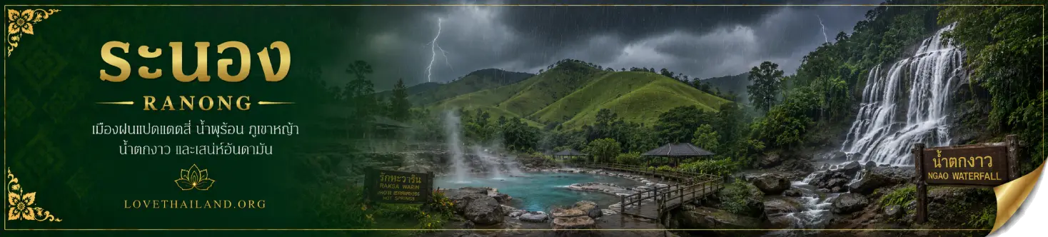
Khao Pho Ta Chong Dong
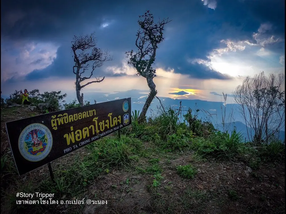
Open Days: Daily
Opening Hours: 08.00 – 17.00
Khao Pho Ta Chong Dong in Ranong Province is an important mountain destination in Kapoe District, located around Moo 9, Kapoe Subdistrict. It is widely known as the highest mountain peak in Ranong, rising to about 975 metres above sea level. The main appeal of this mountain is not only the summit itself, but the complete southern rainforest hiking experience along the way: humid evergreen forest, wildflowers, ferns, mosses, steep ridgelines, a small summit camping area, morning mist and a wide view over the Andaman Sea. For travelers who want to experience Ranong beyond beaches, islands and hot springs, Khao Pho Ta Chong Dong offers one of the province’s most meaningful mountain routes.
The character of Khao Pho Ta Chong Dong is natural, quiet and still relatively raw. The hike to the summit usually takes about 2–3 hours, depending on physical condition, weather, group pace and trail surface. The route passes through humid southern forest where visitors may see forest plants, wildflowers, ferns, mosses and thick undergrowth. As the trail climbs higher, the air becomes cooler, the wind becomes stronger and wider views gradually begin to appear before the final summit area.
The local explanation of the word “Chong Dong” is often connected with the idea of a ship’s mast, because the mountain stands high and allows wide views in many directions. This interpretation matches the feeling at the summit. From the top, visitors can look across forested ridges, lower communities, misty valleys and the Andaman coastline. On clear days, the sea view stretches far into the west, making the summit one of the best elevated viewpoints in Kapoe District.
The trail is suitable for hikers who want a compact but rewarding forest route. A day trip is possible when starting early and walking with someone who knows the trail, but the most complete experience is an overnight trip. Staying on the summit allows visitors to enjoy sunset light, night wind, early morning mist and the quiet atmosphere before descending. The camping area on the summit is limited, so groups should plan the number of participants, tents or hammocks, drinking water, food, headlamps, rain protection and waste management carefully.
The best period for visiting is from January to March, when the summit weather is cooler, mist is more likely and trail conditions are generally easier than during heavy rain periods. Ranong is one of Thailand’s wettest provinces, so humid forest conditions are common throughout the year. Visitors should always check the weather before hiking. After heavy rain, the trail may become slippery, leeches and insects may be more active, and the final decision to hike should be based on local guidance and safety conditions.
The summit viewpoint is the highlight of the journey. The top has a summit sign and an open area where visitors can appreciate wide natural views. When the sky is clear, the Andaman Sea and the coastal landscape of Ranong can be seen from above. In the early morning, if humidity and wind conditions are right, mist may drift across the valleys and forested slopes. This makes Khao Pho Ta Chong Dong a strong reminder that Ranong is not only a province of islands, mangroves, waterfalls and hot springs, but also a mountainous rainforest province with dramatic highland scenery.
The route requires preparation. Although the walking distance is not as long as many major trekking routes, the gradient, humidity, slippery ground and tropical forest climate can make the hike demanding. Visitors should wear shoes with good grip, breathable clothing, rain protection, a light wind layer, and bring drinking water, electrolyte salts, personal medication, a headlamp, waterproof bags and a rubbish bag. Every visitor should carry personal waste back down from the mountain.
Hikers should contact local guides or responsible local offices before the trip, especially for overnight stays. The route is a natural forest trail where local knowledge matters. A guide helps reduce the risk of getting lost, selects suitable rest points, checks weather and trail conditions, and manages the pace of the group. Groups should coordinate in advance and provide the number of participants clearly so that local transport, guides and porters can be arranged properly.
Ecologically, Khao Pho Ta Chong Dong is connected with the humid forest landscape of southern Ranong and the conservation context of Khuan Mae Yai Mon Wildlife Sanctuary. The forested mountains in this area function as headwater landscapes, supporting streams, wildlife, local communities and the broader Kapoe ecosystem. The richness of the forest gives the trail its humid atmosphere, plant diversity and natural soundscape. Visitors should therefore treat the mountain as a living protected landscape, not simply as a summit checkpoint.
The surrounding area connects with several natural and community attractions in Kapoe and Ranong. Ton Phet Waterfall is especially related to the mountain because its headwater comes from the Pho Ta Chong Dong range. Sai Rung La-ong Dao Waterfall is another deep-forest trekking destination in Kapoe. Wang Matcha Park, Wat Pathumthararam, Baan Rai I Arun, Hat Bang Ben, Laem Son National Park and the Kam Islands can also be combined with a Kapoe-based itinerary. This makes the area suitable for routes that include mountain forest, waterfalls, community food, farm stays and the Andaman coast.
Ton Phet Waterfall adds an important watershed dimension to a Khao Pho Ta Chong Dong trip. The waterfall is located in Ratchakrut Subdistrict and receives water from the Pho Ta Chong Dong mountain range. Its multi-level cascade runs through evergreen forest and rocky channels. When viewed together, the mountain and the waterfall show that Khao Pho Ta Chong Dong is not an isolated viewpoint, but part of a living headwater system that supports downstream landscapes.
Sai Rung La-ong Dao Waterfall is a more demanding deep-forest route in Kapoe District, located in Khlong Naka Wildlife Sanctuary. It is known for a large waterfall in dense forest and requires stronger trekking preparation, often including overnight arrangements. Compared with that route, Khao Pho Ta Chong Dong is more compact and more suitable for hikers who want to begin experiencing southern forest trails without committing to a long expedition.
Baan Rai I Arun is a good stop for travelers who want to combine mountain travel with a quieter farm-stay atmosphere. It offers accommodation, food and a garden setting in Kapoe District. Travelers can use it as a rest point before or after hiking, or continue onward to Hat Bang Ben and Laem Son National Park for a sea-and-island extension.
A practical 2-day, 1-night itinerary can begin in Kapoe town, where visitors prepare supplies and meet the local guide in the morning. The group can hike up Khao Pho Ta Chong Dong during the late morning, spend the afternoon on the summit, watch sunset, stay overnight and enjoy the morning mist before descending the next day. After the hike, travelers can continue to Wang Matcha Park, Baan Rai I Arun, Hat Bang Ben or other Kapoe attractions.
Getting There is easiest by private car, rental car or local hired transport. From Ranong town, take Highway 4 south toward Kapoe District. Once in Kapoe Subdistrict, coordinate the exact trailhead with a local guide or local authority before entering the hiking route. The summit must be reached on foot, and the walk usually takes about 2–3 hours. Travelers from Bangkok can follow Highway 4 through Chumphon into Ranong, while those arriving by air can land at Ranong Airport and continue by rental car or local transport to Kapoe District.
Important precautions include avoiding the hike without someone who knows the trail, not starting too late on a day trip, carrying all rubbish back down, keeping noise low, avoiding disturbance to wildlife and never collecting wildflowers, plants, stones or natural objects. Overnight groups must manage food, water and waste carefully because summit areas are fragile and recover slowly. A successful visit to Khao Pho Ta Chong Dong is not only about reaching the top, but also about leaving the mountain undamaged.
Overall, Khao Pho Ta Chong Dong is one of Ranong’s most distinctive mountain destinations. It combines a high summit, southern evergreen forest, wildflowers, a compact but rewarding hike, misty mornings, Andaman Sea views and a connection with the watershed landscape of Kapoe. For travelers who want to understand Ranong more deeply, this mountain offers a perspective that beaches and hot springs alone cannot provide. With proper preparation, local guidance and responsible conduct, it can become one of the most memorable nature experiences in the province.
| Name | Khao Pho Ta Chong Dong |
| Other Names | Khao Pho Ta Jong Dong / Pho Ta Chong Dong Summit |
| Place Type | Mountain, Forest Trail, Viewpoint, Mist-Watching Spot And Nature Destination In Kapoe District |
| Location | Moo 9, Kapoe Subdistrict, Kapoe District, Ranong Province 85120 |
| Reference Coordinates | 9.68583, 98.61531 |
| Elevation | About 975 Metres Above Sea Level |
| Related Conservation Area | Humid Evergreen Forest And Conservation Landscape Connected With Khuan Mae Yai Mon Wildlife Sanctuary |
| Local Contact Offices | Kapoe Subdistrict Administrative Organization, Tel. 077-843-299 / Kapoe Subdistrict Municipality, Tel. 0-7789-7015 |
| Highlights | Ranong’s High Mountain Summit, Southern Evergreen Forest, Wildflowers, Summit Camping Area, Morning Mist, Sunset And High Andaman Sea View |
| Best Season | January – March, When Summit Weather Is Cooler, Mist Is More Likely And Hiking Conditions Are Easier Than During Heavy Rain |
| Hiking Time | About 2–3 Hours To The Summit, Depending On Fitness, Weather And Group Pace |
| Main Zones | Trailhead Area, Evergreen Forest Trail, Rest Points, Open Ridgeline, Summit Rest Area And Andaman Sea Viewpoint |
| Recommended Activities | Hiking, Mist Viewing, Sunset Viewing, Overnight Camping, Nature Photography, Wild Plant Observation And Southern Rainforest Learning |
| Current Status | Open As A Natural Trail And Viewpoint In Kapoe District. Local Guidance Or Advance Coordination Is Recommended Before Hiking. |
| Open Days | Daily |
| Opening Hours | 08.00 – 17.00 For Day Visits / Overnight Trips Should Be Arranged In Advance |
| Trip Costs | Costs Depend On Local Guide, Transfer, Porter And Group Trip Arrangement |
| Facilities | Summit Rest Area, Natural Rest Points, And Local Guide/Porter Services When Arranged In Advance |
| Visitor Etiquette | Do Not Hike Without Someone Who Knows The Trail, Do Not Litter, Do Not Collect Wild Plants, Avoid Loud Noise, Do Not Disturb Wildlife And Prepare Proper Hiking Gear. |
| Travel Information | From Ranong town, take Highway 4 south toward Kapoe District, then coordinate the trailhead with a local guide or local office. The summit is reached on foot in about 2–3 hours. |
| Nearby Tourist Attractions | 1. Wang Matcha Park And Wat Pathumthararam, about 10 km 2. Baan Rai I Arun, about 12 km 3. Ton Phet Waterfall, about 25 km 4. Sai Rung La-ong Dao Waterfall, about 30 km 5. Laem Son National Park And Hat Bang Ben, about 30 km 6. Hat Ao Khoei, about 35 km 7. Kam Islands, continuing by seasonal boat from the coastal area |
| Nearby Restaurants | 1. Nong May Restaurant Kapoe, about 8 km, Tel. 080-695-1778, 077-897-240 2. Baan Rai I Arun, about 12 km, Tel. 096-938-2981 3. Yadda Chim Kon Prung Hat Bang Ben, about 30 km, Tel. 085-796-2374, 081-788-7096 4. Krua Suk Samran, about 35 km, Tel. 077-893-186 5. Restaurant At Ranong Resort And Laguna, about 20 km 6. Local Restaurants In Kapoe Town And Along Phetkasem Road, about 8–15 km |
| Nearby Accommodations | 1. Baan Rai I Arun, about 12 km, Tel. 096-938-2981 2. SS Kapoe Resort, about 14 km, Tel. 085-797-4746 3. DD Resort Kapoe, about 15 km, Tel. 080-610-1733, 082-808-9951 4. Ranong Resort And Laguna, about 20 km, Tel. 095-656-5955 5. Wasana Resort Bang Ben Beach Ranong, about 32 km, Tel. 077-861-434 6. I-In Resort Suk Samran, about 35 km, Tel. 077-844-040 |
Frequently Asked Questions (FAQ)
Q: Where is Khao Pho Ta Chong Dong located?
A: Khao Pho Ta Chong Dong is located around Moo 9, Kapoe Subdistrict, Kapoe District, Ranong Province. It is a natural mountain summit reached by hiking.
Q: How high is Khao Pho Ta Chong Dong?
A: Khao Pho Ta Chong Dong rises to about 975 metres above sea level and is widely known as an important high mountain summit of Ranong Province.
Q: How long does the hike to the summit take?
A: The hike usually takes about 2–3 hours, depending on fitness, weather, trail conditions and group pace.
Q: When is the best time to visit Khao Pho Ta Chong Dong?
A: January to March is the best period because the summit weather is cooler, mist is more likely and the trail is generally easier than during heavy rain periods.
Q: Can visitors stay overnight on Khao Pho Ta Chong Dong?
A: Overnight trips can be arranged with local guides or local contacts in advance. The summit rest area is limited, so group size and camping equipment should be planned carefully.
Q: Is a local guide necessary?
A: A local guide is strongly recommended because the route is a natural forest trail with steep, humid and potentially slippery sections.
Q: What are the main highlights of Khao Pho Ta Chong Dong?
A: The highlights include the high summit, Andaman Sea view, morning mist, sunset light, southern evergreen forest, wildflowers and a quiet natural hiking atmosphere.
Q: What should hikers prepare?
A: Hikers should bring grippy hiking shoes, drinking water, trail food, rain or wind protection, a headlamp, personal medication, waterproof bags, insect protection and a rubbish bag for carrying all waste back down.
 Category: ●Nature and Wildlife
 Group: ●Mountain (Doi)
Last Update : 2 MonthAgo
 Last Update : 2 MonthAgo
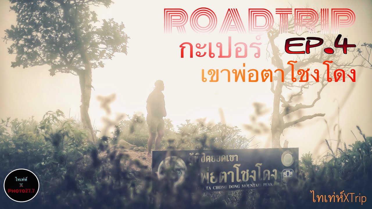
 Click to Access the Navigation Map GPS
Khao Pho Ta Chong Dong Map
Recommend

 Art, Culture and Heritage
 Historical Sites and Monuments(4)
 Landmarks and Memorials(1)
 Royal Palace(1)
 Art, Craft Centres, Tradition(4)
 Educational Places
 Educational Gardens, Farm(1)
 Places of Worship
 Temple(12)
 Other Sacred Sites(2)
 Suburban Living
 Village, Community(2)
 National Parks and Marine Reserves(6)
Mountain (Doi)(4)
 Waterfalls(15)
 Hot Springs(3)
 Caves(4)
 River, Canal(2)
 Bays and Beaches(10)
 Islands(8)
 Other natural attractions(3)
 Travel Articles, Recipes
 Travel Review, Food Review(1)


