
lovethailand home >South Travel Attractions >Trang Travel Attractions > 20 Best Places to Visit in Trang Southern Thailand
TL;DR: 20 Best Places to Visit in Trang Southern Thailand.
20 Best Places to Visit in Trang Southern Thailand
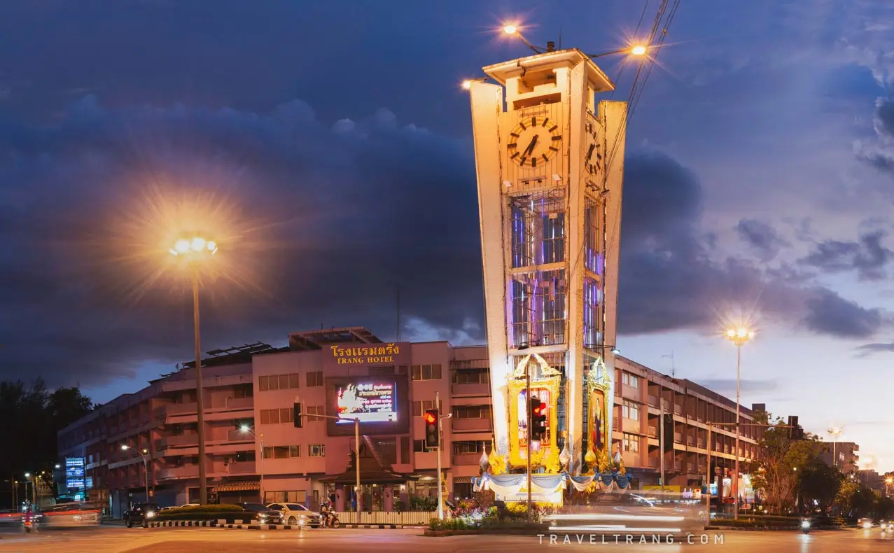
20 Best Places to Visit in Trang, Southern Thailand Trang is a province on Thailand’s Andaman coast with an impressive mix of islands, sandy beaches, coral reefs, water caves, waterfalls, tropical rainforest, historic communities, maritime heritage, and one of Southern Thailand’s strongest food cultures. Many travelers know Trang for Emerald Cave, Koh Kradan, and its clear blue sea, but a deeper journey through the province reveals many other dimensions, from historic Kantang, once an important center of trade and transportation, to Tham Khao Kop, where visitors lie flat in a boat to pass beneath a limestone mountain, the traditional weaving community of Na Muen Si, waterfalls in the Banthat Mountain Range, and the morning lifestyle of Thap Thiang, where coffee, roast pork, and dim sum remain part of everyday local culture.
For first-time visitors, the essential highlights are Koh Mook–Emerald Cave, Koh Kradan, Pak Meng Beach, Tham Khao Kop, Phraya Ratsadanupradit Mahisorn Phakdi Museum, Kantang Railway Station, Koh Libong, Sai Rung Waterfall, Rajamangala Beach Trang, and Sa Kaphang Surin. Travelers with 4–5 days can add Hat Chao Mai National Park, Thailand’s First Rubber Tree, Peninsular Botanic Garden–Thung Khai, Na Muen Si Weaving Group, Kew Ong Ia Shrine, Kantang Hot Spring Forest Park, Yong Ling–San Beach, Ton Te Waterfall, Wat Mongkhon Sathan, and Koh Chueak–Koh Waen for a broader experience of Trang’s sea, forest, history, religion, and local communities.
Trang’s geography is far more diverse than its famous beach images suggest. The eastern side connects with the Banthat Mountain Range and contains tropical rainforest, streams, waterfalls, and limestone mountains. The western side opens toward the Andaman Sea, with an extensive coastline, mangrove forest, seagrass meadows, coral reefs, and numerous islands extending from Sikao and Kantang to Palian. This geographical variety makes it possible to spend one day exploring the sea and the next visiting caves, waterfalls, forests, or traditional communities without leaving the province.
Trang’s coast is also an ecologically important part of the lower Andaman region. The extensive seagrass meadows around Koh Libong provide essential feeding grounds for dugongs, while coral reefs surround Koh Kradan, Koh Chueak, Koh Waen, Koh Mook, and other islands within Hat Chao Mai National Park. Marine travel in Trang is therefore closely connected with monsoon seasons, temporary conservation closures, and regulations designed to protect coral reefs, seagrass, and marine wildlife.
The history of Trang has long been connected with maritime trade and the Malay Peninsula. During the early Rattanakosin period, the administrative center was located around Khuan Thani. In the reign of King Rama V, the town center was moved to Kantang, whose location was well suited to maritime commerce and transportation. During the reign of King Rama VI, the administrative center was moved again to Thap Thiang, which later developed into present-day Trang city.
One of the most important figures in Trang’s history is Phraya Ratsadanupradit Mahisorn Phakdi, also known as Khaw Sim Bee Na Ranong. He played an important role in developing roads, transportation, education, agriculture, and local administration, while also promoting rubber cultivation in Southern Thailand. These developments transformed the economy of Trang and the wider South and can still be explored today through the Phraya Ratsadanupradit Museum, Kantang Railway Station, and Thailand’s First Rubber Tree.
Trang’s culture reflects the coexistence of Thai Buddhist, Thai-Chinese, and Muslim communities along the coast. The province therefore has temples, Chinese shrines, mosques, distinctive foods, and a wide range of traditions. The Vegetarian Festival is especially important among Trang’s Chinese communities, with shrines organizing religious ceremonies, deity processions, vegetarian kitchens, and other activities according to the Chinese lunar calendar.
Another important Buddhist tradition is the Sat Duan Sip Festival, or Southern Thailand’s Tenth Lunar Month merit-making tradition. Families make merit for deceased ancestors and relatives by bringing food and traditional sweets to temples. The festival also brings family members and communities together at the same period each year.
Trang is also well known for the Underwater Wedding Ceremony, which combines the province’s Andaman marine identity with underwater marriage activities. The event helped establish Trang’s reputation as a romantic travel destination in Thailand and abroad, while Koh Kradan and the Trang Sea became closely associated with this distinctive modern tradition.
Among the province’s most important forms of local craftsmanship is Na Muen Si woven cloth from Na Yong District. Its patterns, weaving techniques, and use of color reflect craftsmanship, local beliefs, and community life. The continued revival and adaptation of the textiles into contemporary products has helped preserve this heritage while creating income for local weavers.
Trang’s local food is another major reason travelers return to the province. Its best-known specialty is Trang roast pork, famous for crisp skin, tender meat, and a subtly sweet aroma from its seasoning. Local people often enjoy it for breakfast with coffee, tea, dim sum, or Chinese-style fried dough, creating a morning dining culture that is as much about social life as it is about food.
Beyond roast pork, Trang is known for khanom chin, khao yam, Southern Thai curries, Hokkien-Chinese dishes, traditional sweets, and fresh seafood from the Andaman coast. Trang city and Kantang have many long-established breakfast restaurants, while Pak Meng, Kantang, and coastal communities are ideal places to enjoy fresh fish, shrimp, crab, squid, and other local seafood with sea views.
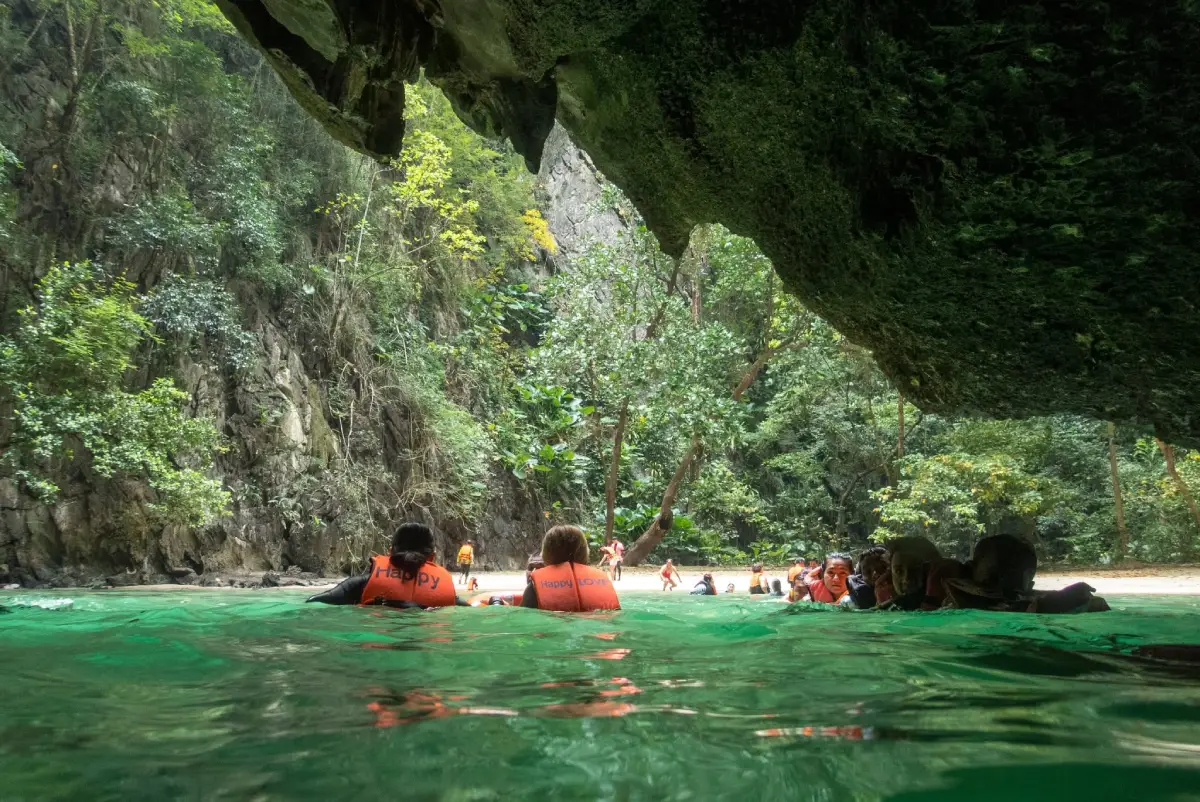
1. Koh Mook–Emerald Cave is one of the attractions most strongly associated with Trang. Located in Ko Libong Subdistrict, Kantang District, within Hat Chao Mai National Park, its main highlight is Emerald Cave on the western side of Koh Mook. Visitors travel by boat to the cave entrance, then swim or float through a dark passage before emerging into a hidden lagoon and beach enclosed by towering limestone cliffs.
When sunlight reflects through the seawater around the cave entrance, the water takes on an emerald-green appearance that gave the cave its name. Part of the route inside is very dark, so visitors should enter with an experienced guide or boat crew and wear a life jacket throughout the passage. Access depends heavily on tide level, waves, wind, and national park announcements, and the cave should never be entered independently when sea conditions are unsuitable.
Koh Mook offers much more than Emerald Cave. The eastern side of the island has a local community, pier, accommodation, restaurants, and beaches, making it suitable for an overnight stay. Travelers with more time can use local transport to explore the island and experience community life beyond the main boat-tour route.
Koh Mook is also a convenient base for visiting Koh Kradan, Koh Chueak, Koh Waen, and other snorkeling sites in the Trang Sea. Spending 1–2 nights on the island offers a very different experience from a day trip, particularly during the quieter morning and evening hours after excursion boats have departed.
Getting There: Boats are available from Khuan Tung Ku Pier in Kantang District, while island-tour programs also depart from Pak Meng and other local operators. Boat schedules and journey times depend on the type of vessel, season, and sea conditions.
Map (GPS): https://maps.app.goo.gl/Mi8xXspEhVJr5WMK9
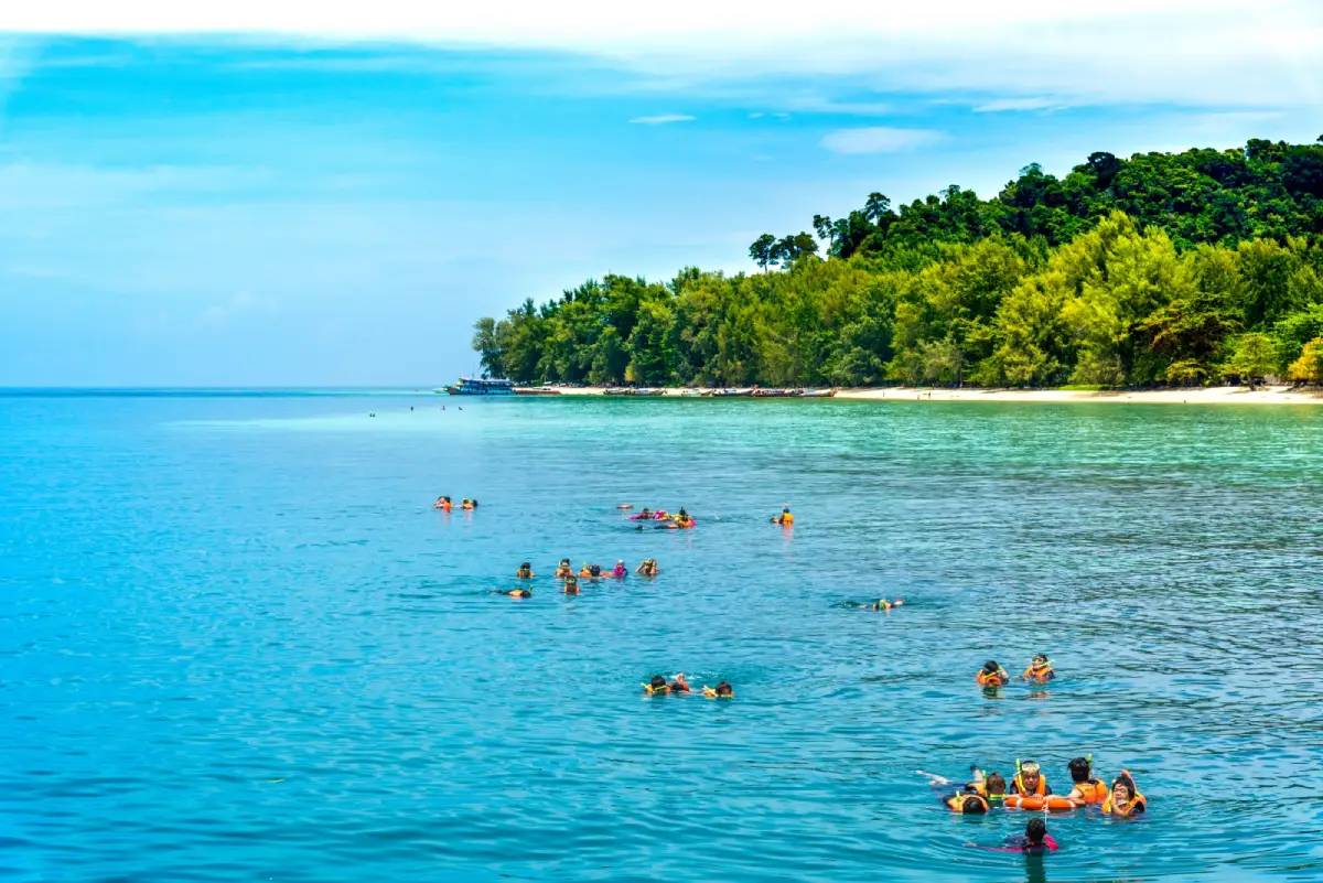
2. Koh Kradan is located in Ko Libong Subdistrict, Kantang District, and is one of the best-known islands in the Trang Sea. Most of the island lies within Hat Chao Mai National Park. Its main attractions are fine white sand, exceptionally clear water, and shallow coral reefs located close to the beach.
The eastern beach is the island’s best-known landscape, with a long stretch of pale sand and seawater that shifts from light blue to turquoise as the depth increases. When the sea is calm, visitors can swim and snorkel directly from the beach to see coral and colorful fish without needing to travel far offshore.
A walking route crosses the island toward the western coast, where the atmosphere is quieter and sunset views are particularly attractive. Travelers who stay overnight can experience Koh Kradan after most day-tour boats have departed, making the island considerably more peaceful in the early morning and late afternoon.
Koh Kradan is also associated with Trang’s famous Underwater Wedding Ceremony, giving the island a romantic travel identity in addition to its reputation for snorkeling and beach holidays. Parts of the island may close seasonally for visitor safety and ecological recovery.
Getting There: Boats operate from Pak Meng or Khuan Tung Ku Pier. Long-tail boats generally take longer than speedboats. Travelers should check boat schedules, national park announcements, and sea conditions before departure.
Map (GPS): https://maps.app.goo.gl/nEqY4rFrdXCVdHC2A
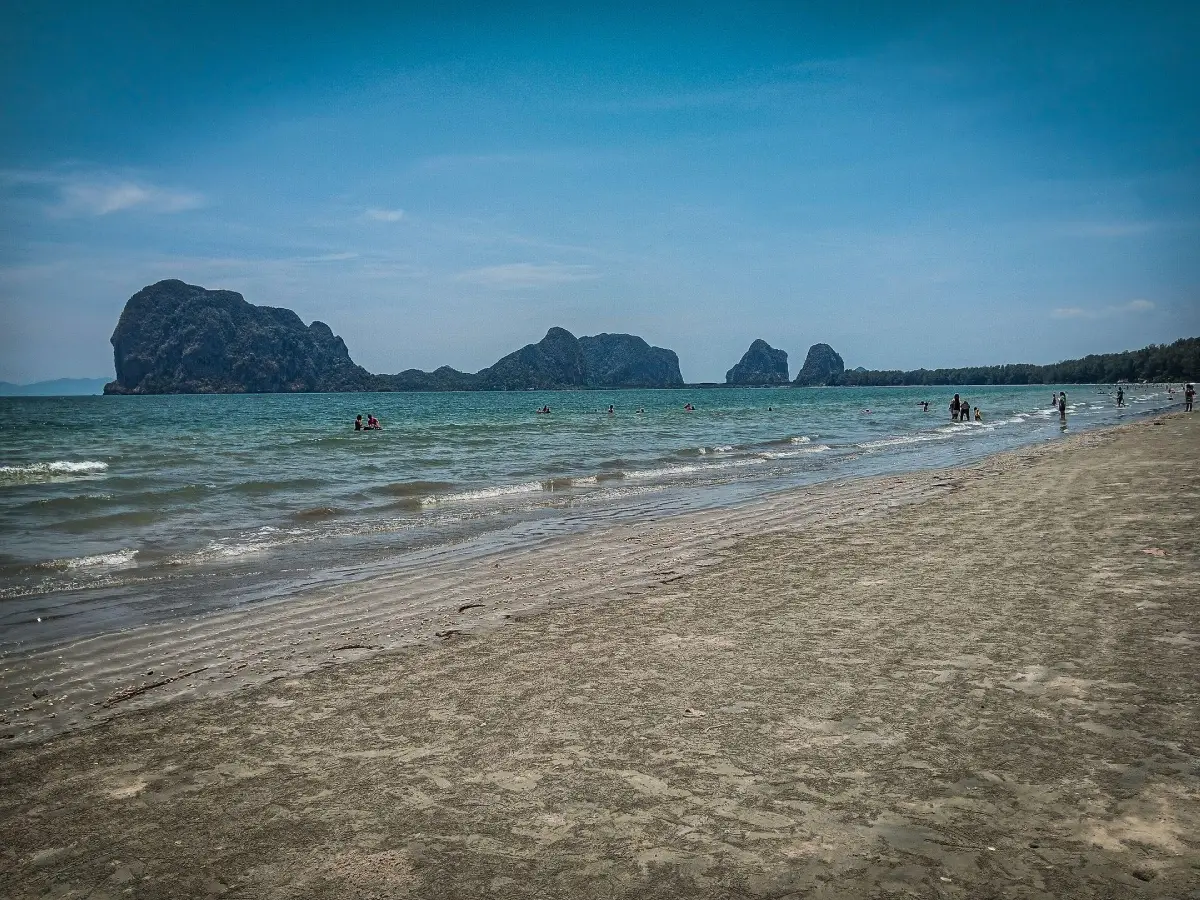
3. Pak Meng Beach is located in Mai Fat Subdistrict, Sikao District. It is the main mainland beach in Trang and an important gateway for boat trips to the province’s offshore islands. The beach forms a long curved shoreline of approximately 5 kilometers, lined with casuarina trees and facing distinctive limestone islands on the horizon.
Pak Meng combines seafood restaurants, accommodation, shops, and marine transport facilities, giving it a different character from a beach used mainly for swimming and relaxation. Many travelers stay here before departing for Koh Mook, Koh Kradan, Koh Chueak, Koh Waen, and other islands in the Trang Sea.
Late afternoon is particularly popular because the coast faces the Andaman Sea and provides broad sunset views. At low tide, the exposed sandy area becomes much wider, making it ideal for walking and photography.
Pak Meng is suitable for families, older travelers, and visitors who prefer to enjoy the sea without taking a boat. At the same time, it remains one of the most convenient starting points for travelers planning an island trip the following day.
Getting There: From Trang city, follow the Trang–Sikao–Pak Meng route for approximately 38–40 kilometers. A private or rental car is the most convenient option.
Map (GPS): https://maps.app.goo.gl/6YLgsfRpWMH5u2zCA
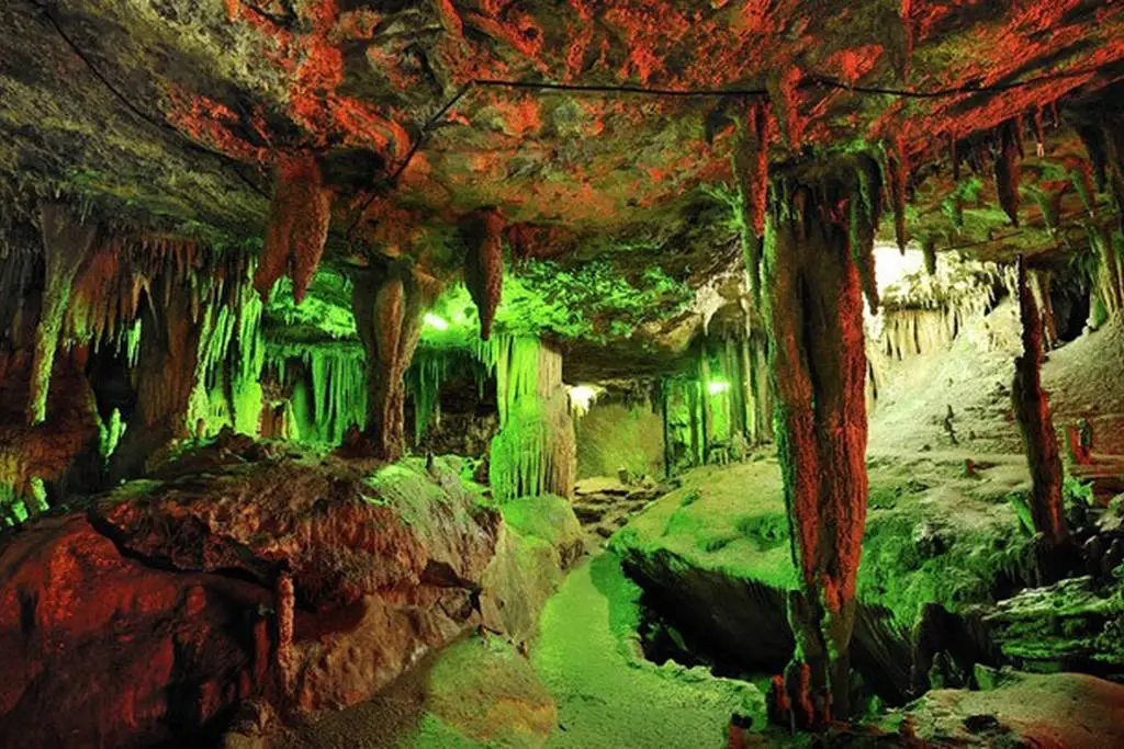
4. Tham Khao Kop (Khao Kop Cave) is located at Moo 1, Khao Kop Subdistrict, Huai Yot District. It is a limestone cave with a stream flowing through the mountain, and visitors explore it by community-operated paddle boat, creating a very different experience from conventional walk-in caves.
Several cave chambers lie along the route, including areas known locally as Tham Chao Sao, Tham Rak Sai, and Tham Khonthan. The most famous section is the “Dragon’s Belly,” where the cave ceiling becomes so low that passengers must lie flat inside the boat while the boatmen carefully guide it through the narrow limestone passage.
Along the way, visitors can see stalactites, stalagmites, tree roots, and limestone formations produced by natural processes over a very long period. The cave therefore combines adventure, geology, and community-based tourism in a single experience.
Travelers with severe claustrophobia, breathing difficulties, or physical conditions that make lying flat uncomfortable should consider carefully before taking the full route. Boat services may also be suspended temporarily when water levels become unsafe.
Getting There: From Trang city or Huai Yot, continue toward Khao Kop Subdistrict and follow signs to the community cave-tour area. Boat services operate from the local visitor point and are best used during daylight hours.
Map (GPS): https://maps.app.goo.gl/EUbGCqs7My6oJ96F9
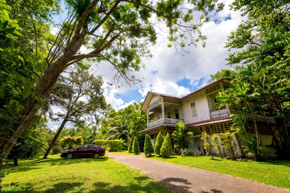
5. Phraya Ratsadanupradit Mahisorn Phakdi Museum is located in Kantang District in the former residence of Phraya Ratsadanupradit Mahisorn Phakdi, also known as Khaw Sim Bee Na Ranong, one of the most influential figures in Trang’s development during the late reign of King Rama V.
The museum occupies a 2-storey wooden house containing bedrooms, a reception room, working areas, historic photographs, documents, household objects, and other exhibits that help visitors understand both the daily life and administrative ideas of Trang’s former governor.
Phraya Ratsadanupradit played an important role in road construction, transportation, education, and economic development, particularly the expansion of rubber cultivation. A visit to the museum helps explain why Kantang once became an important port and center of provincial development.
Kantang Railway Station, historic buildings, and Thailand’s First Rubber Tree are all located within the wider Kantang area, allowing travelers to create a half-day or full-day heritage route without long transfers between sites.
Getting There: From Trang city, follow the Trang–Kantang route for approximately 25 kilometers. The museum is located within Kantang town near the municipal area.
Map (GPS): https://maps.app.goo.gl/qdybpcBFKhpygogm7
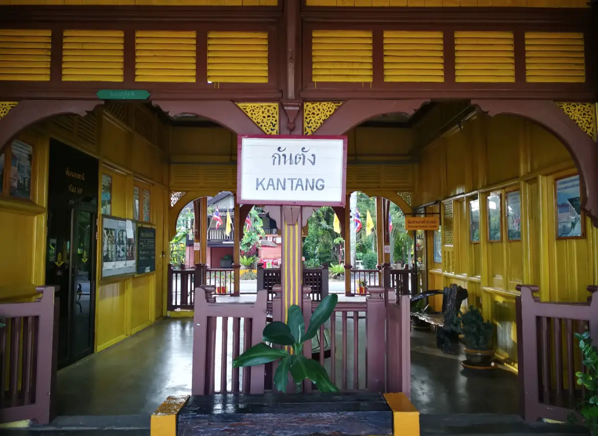
6. Kantang Railway Station is the terminal station of the Thung Song Junction–Kantang railway line and one of Southern Thailand’s most distinctive historic railway buildings. The single-storey wooden structure, painted mustard yellow with brown details, still preserves much of the atmosphere of the railway era during the reign of King Rama VI.
Kantang was once an important port town, and the arrival of the railway connected goods and passengers from the Andaman coast with Thailand’s wider transport network. The station therefore remains valuable evidence of a period when Kantang played a major economic role in the province.
Today, the station functions both as a transport facility and a heritage attraction. Details such as the old station sign, platform, wooden construction, and overall architectural proportions preserve the historical atmosphere and make the site popular for photography.
The station is best visited together with the Phraya Ratsadanupradit Museum, Thailand’s First Rubber Tree, and other historic parts of Kantang to gain a fuller understanding of trade, transportation, and urban development during the same period.
Getting There: The station is located in central Kantang District and can be reached from Trang city by road or by train according to the current railway timetable.
Map (GPS): https://maps.app.goo.gl/ZZV8WJ3qfDdiKUiQ8
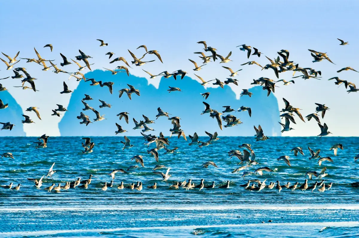
7. Koh Libong is the largest island in the Trang Sea, located in Kantang District. It is important for its ecology, conservation value, and community way of life. The island contains mangrove forests, inland woodland, beaches, fishing villages, and extensive seagrass meadows.
The seagrass around Koh Libong provides essential feeding habitat for dugongs, one of Thailand’s rare marine mammals and an important symbol of marine conservation in Trang. Visitors can learn about dugongs through local communities, viewpoints, and conservation-based activities without chasing or approaching the animals too closely.
Koh Libong also offers viewpoints, coastal scenery, fishing villages, and local seafood, making it ideal for travelers who want to experience an inhabited island rather than a resort-focused destination. Fishing remains an important livelihood, and community life is closely connected with coastal resources.
Responsible travel is especially important here. Boats should not chase dugongs, visitors should maintain a respectful distance from marine animals, waste should never be left behind, and seagrass areas should be protected from unnecessary disturbance.
Getting There: Local boats operate from the Kantang-side mainland pier to the island according to schedule and sea conditions. Local vehicles and community transport services are available for getting around Koh Libong.
Map (GPS): https://maps.app.goo.gl/hxTLFvtEDd7EDwkJA
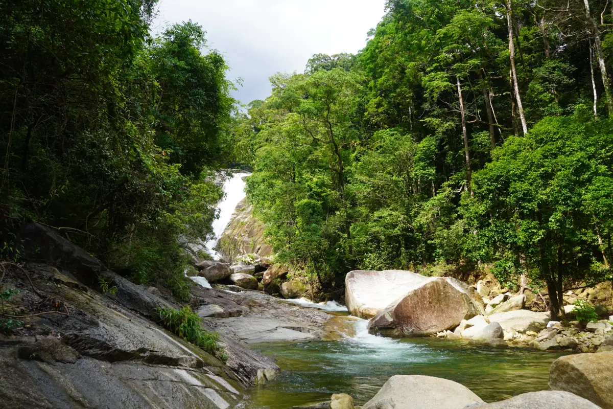
8. Sai Rung Waterfall is located in Na Chum Het Subdistrict, Yan Ta Khao District, within the Khao Banthat Wildlife Sanctuary. The waterfall drops from a high cliff into a pool below, and when sunlight strikes the mist at the right angle, rainbow-like colors may appear, giving the waterfall its name.
The surrounding environment is humid tropical forest with dense vegetation and cooler conditions than the lowland city areas. The site is suitable for relaxation, photography, nature walks, and swimming in areas where conditions are safe.
Sai Rung Waterfall is not primarily known for having many tiers. Its main character comes from the high falling stream and fine mist in front of the cliff, which becomes especially attractive when both sunlight and water volume are favorable.
After heavy rainfall, visitors should be alert for flash floods, strong currents, and slippery rocks. Swimming should be avoided whenever water rises unusually quickly, becomes muddy, or flows more strongly than normal.
Getting There: From Trang city, travel toward Yan Ta Khao District and Na Chum Het Subdistrict, then follow local signs to the waterfall. A private or rental car is the most convenient option.
Map (GPS): https://maps.app.goo.gl/YxistkSeyLa7vQV86
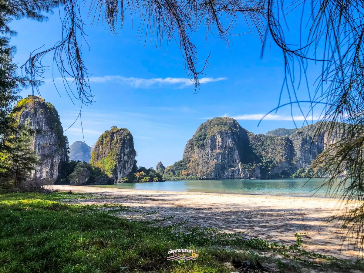
9. Rajamangala Beach Trang is located within Rajamangala University of Technology Srivijaya, Trang Campus, in Mai Fat Subdistrict, Sikao District. It is a peaceful beach lined with shady casuarina trees and surrounded by an educational environment associated with marine studies.
At low tide, the exposed beach becomes wider, making it suitable for walking, exercise, and photography. The view opens toward the Andaman Sea and offers a quieter atmosphere than Pak Meng, where restaurants and marine transport create a more active environment.
Marine learning facilities and university activities are located nearby, making the area suitable for families, students, and travelers who want a calm beach experience combined with educational opportunities.
The beach has also been associated with provincial tourism activities, including the Underwater Wedding Ceremony and marine conservation programs. Visitors should follow university access hours and regulations when entering the campus area.
Getting There: Follow the Trang–Sikao–Pak Meng route toward Rajamangala University of Technology Srivijaya, Trang Campus.
Map (GPS): https://maps.app.goo.gl/xkrZMQEkktUfLyXW9
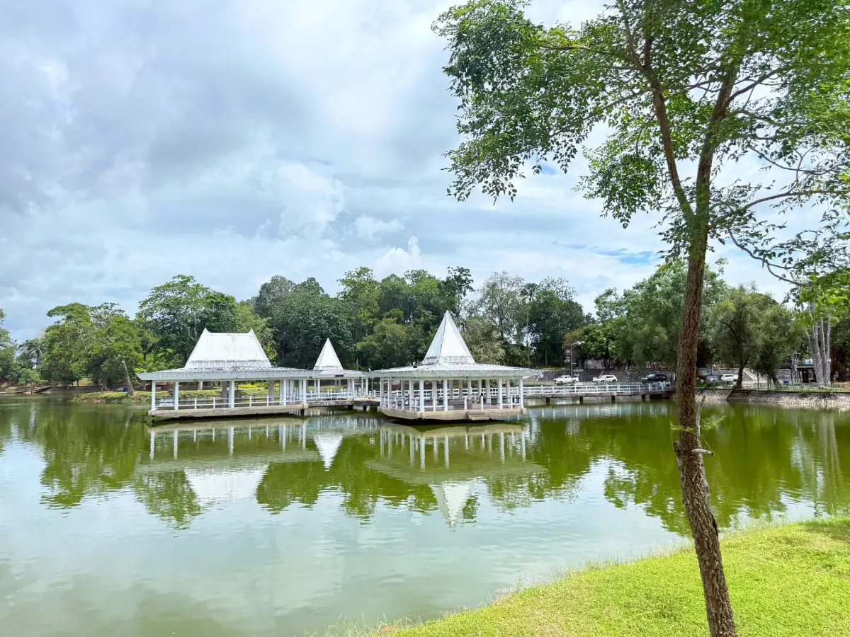
10. Sa Kaphang Surin is a large public park and pond in Thap Thiang Subdistrict, Mueang Trang District. Covering approximately 50 rai, it has long served as one of the city’s important recreation spaces.
The park contains walking paths, a pavilion over the water, bridges, green spaces, and mature shade trees. It is suitable for walking, exercise, relaxation, and observing everyday life in Trang without leaving the urban area.
The name Kaphang Surin is associated with Phraya Surintharacha, who played a role in developing the area as a public space for the town. The park therefore has both landscape value and local historical significance.
Travelers staying in Trang city can easily combine the park with local breakfast restaurants, Trang Railway Station, Kew Ong Ia Shrine, and other parts of Thap Thiang. It is particularly convenient as an early-morning or evening stop.
Getting There: Sa Kaphang Surin is located in central Trang in Thap Thiang Subdistrict and can be reached conveniently by car, motorcycle, local transport, or bicycle.
Map (GPS): https://maps.app.goo.gl/zX28pXe3TR5Fos4G9
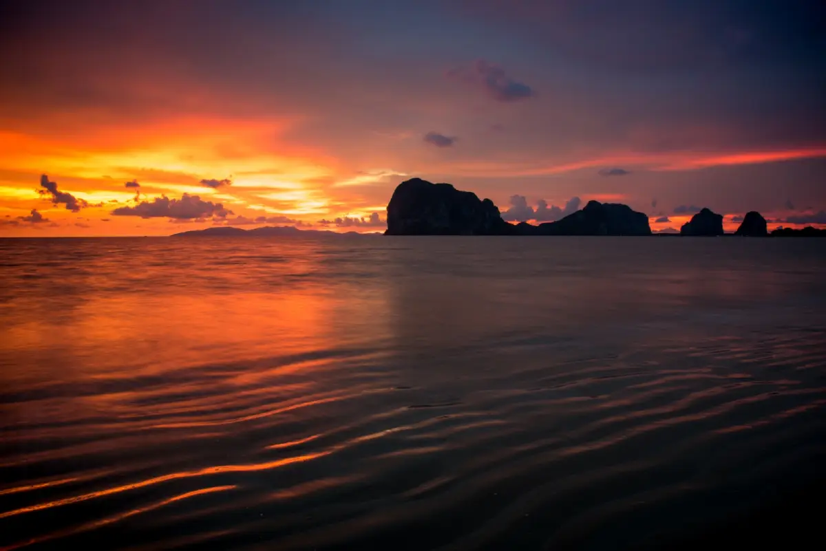
11. Hat Chao Mai National Park is one of Trang’s most important marine national parks, covering both mainland coastline and offshore islands across Sikao and Kantang districts. Its landscapes include sandy beaches, mangrove forests, seagrass meadows, limestone cliffs, coral reefs, and several islands within protected marine areas.
Many of Trang’s best-known destinations are located within or closely connected with the park, including Koh Mook, Emerald Cave, Koh Kradan, Koh Chueak, Koh Waen, Yong Ling Beach, and Chang Lang Beach. The national park therefore forms the ecological and geographical core of much of Trang’s coastal tourism.
Visitors who prefer to remain on the mainland can explore Pak Meng, Chang Lang, Yong Ling, and other coastal areas without taking a boat. Those planning snorkeling or island trips need to travel by boat and should check sea conditions carefully before departure.
Some parts of the national park close seasonally for ecological recovery and visitor safety. Closure dates may differ between individual islands and marine sites, so travelers should always check the latest national park announcements before arranging boat programs.
Getting There: From Trang city, follow the Trang–Sikao–Pak Meng route and continue toward the national park office and coastal visitor areas. A private or rental car is the most convenient option for mainland sites.
Map (GPS): https://maps.app.goo.gl/t9ksJ2rPewvBeQ6C8
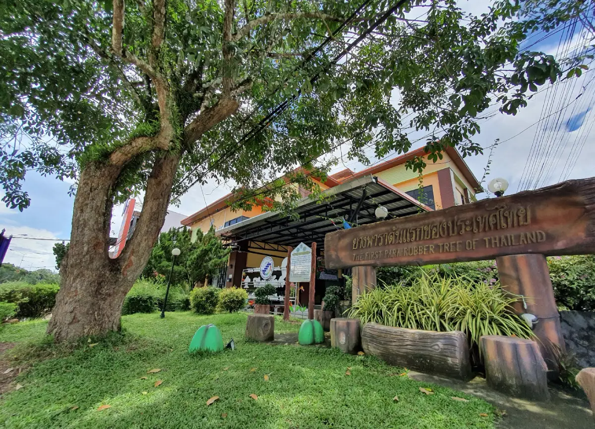
12. The First Rubber Tree in Thailand stands along Trangkhaphum Road before entering central Kantang District. The site is directly connected with the economic history of Southern Thailand and the introduction of commercial rubber cultivation to the country.
Phraya Ratsadanupradit Mahisorn Phakdi played a major role in introducing and promoting rubber cultivation in Trang during the late 19th century. From these early plantings, rubber spread to other southern provinces and eventually became one of the region’s most important agricultural crops.
The attraction itself is relatively small compared with Trang’s marine destinations, but its historical significance is substantial. It illustrates how a single agricultural innovation transformed livelihoods, farming patterns, and the economy of Southern Thailand for generations.
The site combines particularly well with the Phraya Ratsadanupradit Museum and Kantang Railway Station. Together, the 3 attractions tell a connected story of Kantang’s economic development, transportation network, and modernization.
Getting There: The site is located along Trangkhaphum Road before entering Kantang town, near the Kantang Agricultural Cooperative area.
Map (GPS): https://maps.app.goo.gl/oEup1do1bG62pkRa8
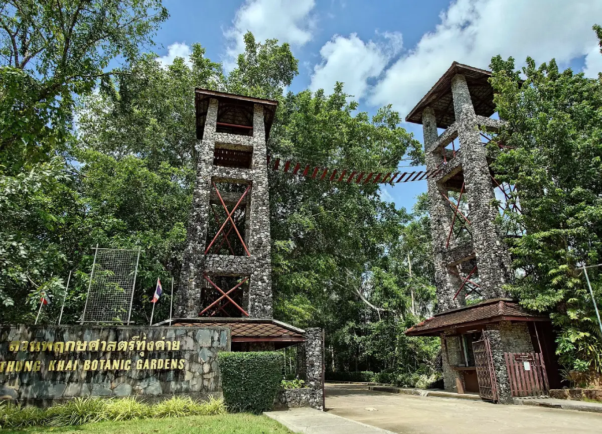
13. Peninsular Botanical Garden (Thung Khai) is located in Thung Khai Subdistrict, Yan Ta Khao District. It is an important learning center for Southern Thai plant life and tropical forest ecosystems and is close enough to Trang city for an easy half-day nature trip.
The garden contains collections of native and cultivated plants, forest areas, nature-study trails, and educational zones focusing on tropical ecology. One of its best-known activities is the elevated canopy walkway, which allows visitors to observe the forest from a perspective very different from ground level.
Walking through the garden reveals several layers of the forest, from the forest floor and shrubs to larger trees and the canopy above. The area is suitable for visitors interested in botany, wildlife photography, birdwatching, and quiet nature walks.
The botanical garden is also a reminder that Trang is not defined only by its marine attractions. Inland forests play an important role in watershed protection and in maintaining the province’s biodiversity.
Getting There: From Trang city, take Highway 404 toward Yan Ta Khao District. The garden is located in Thung Khai Subdistrict, approximately 13 kilometers from the city center.
Map (GPS): https://maps.app.goo.gl/9a9LoV57PMhBnZ1s5
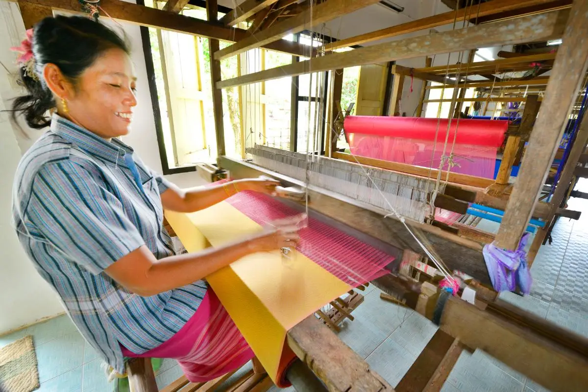
14. Na Muen Si Weaving Group is located in Na Muen Si Subdistrict, Na Yong District, and is one of Southern Thailand’s most important traditional weaving communities. It provides a clear example of how craftsmanship, local identity, and community life remain closely connected in Trang.
Na Muen Si textiles include cotton, silk, and blended fabrics. Intricate supplementary-weft techniques and carefully arranged patterns require considerable skill, while many designs have been passed down through generations and retain distinctive local characteristics.
Today, the textiles have been developed into clothing, bags, household items, and souvenirs, allowing traditional weaving knowledge to coexist with contemporary design. Purchasing directly from the community also helps support local weavers and households.
Visitors can learn about several stages of production, from preparing thread and setting up the loom to weaving and pattern design. The community is particularly suitable for travelers interested in handicrafts, cultural heritage, and community-based tourism.
Getting There: From Trang city, travel toward Na Yong District and Na Muen Si Subdistrict, then follow local signs to the weaving community. A private or rental car is the most convenient option.
Map (GPS): https://maps.app.goo.gl/TzfLHwthzFHG428G9
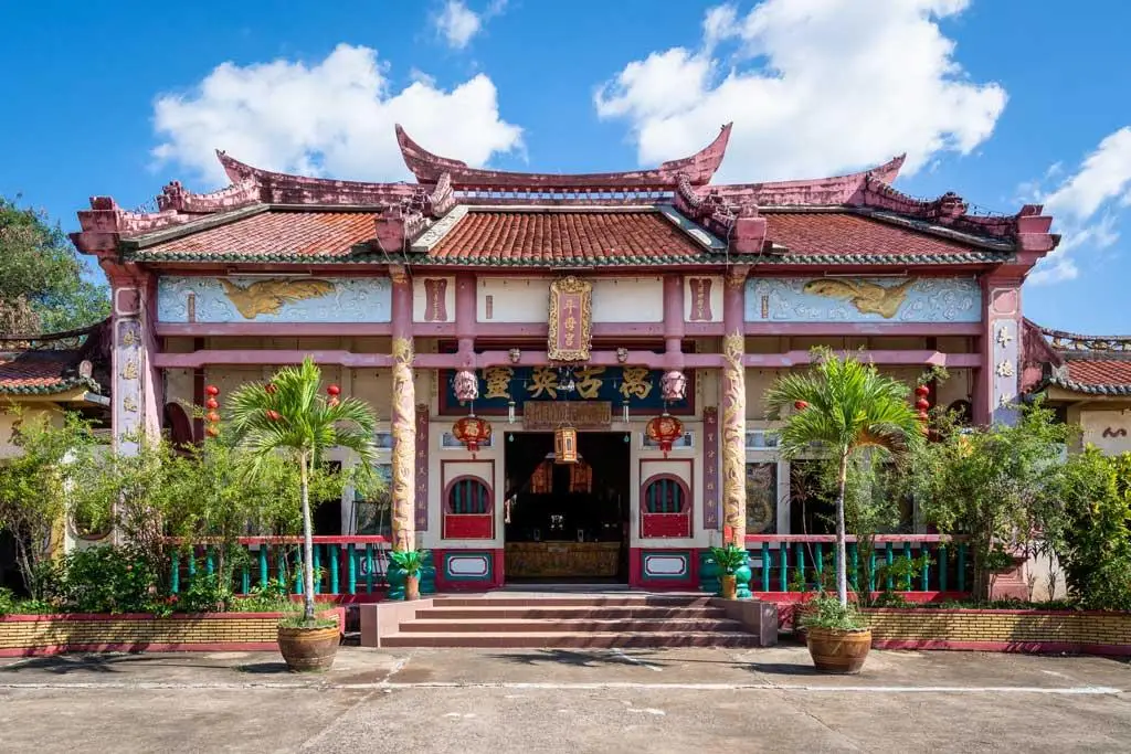
15. Kiw Ong Eia Shrine is located on Tha Klang Road in Thap Thiang Subdistrict, Mueang Trang District. It is an old Hokkien Chinese shrine and an important religious center for Trang’s Thai-Chinese community.
The shrine features traditional Chinese roof forms, red-and-gold decoration, Chinese inscriptions, lanterns, and several deity altars. Its architecture reflects the cultural traditions brought by Southern Chinese settlers who became deeply involved in trade and urban life across Trang.
Kiw Ong Eia Shrine plays an especially important role during Trang’s Vegetarian Festival, when ceremonies, deity processions, religious rituals, and vegetarian food services attract worshippers from many areas.
Beyond its religious importance, the shrine helps explain the Chinese cultural roots visible in Trang’s cuisine, language, historic architecture, and commercial traditions. Visitors should dress respectfully and avoid disturbing ceremonies or worshippers.
Getting There: The shrine is located on Tha Klang Road in central Thap Thiang and can be combined easily with Trang Railway Station, local restaurants, and Sa Kaphang Surin.
Map (GPS): https://maps.app.goo.gl/JsHnTo9MWq3FKb4DA
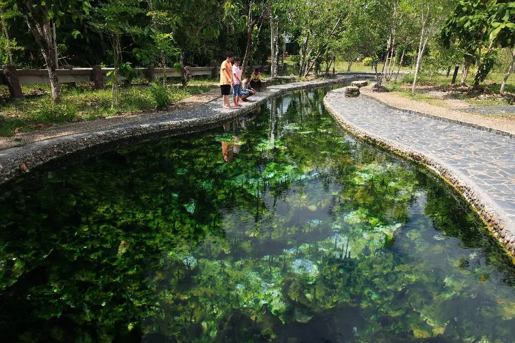
16. Kantang Hot Spring, also known locally as Khuan Khaeng Hot Spring, is located at Ban Khuan Khaeng in Bo Nam Ron Subdistrict, Kantang District. It is a natural hot-spring area surrounded by forest and wetland vegetation, revealing another side of Kantang beyond its historic town and coastline.
Hot water rises naturally from underground and feeds several areas with different temperatures. The site has been developed for relaxation and educational visits while preserving much of the surrounding forest setting.
Visitors should always test the water temperature before soaking, avoid pools that feel excessively hot, and limit the amount of time spent in hot water. Travelers with certain medical conditions should exercise particular caution.
The hot spring can be combined with Kantang Railway Station, the Phraya Ratsadanupradit Museum, and Thailand’s First Rubber Tree, creating a full-day route that combines local history with natural attractions.
Getting There: From Trang city, follow the Trang–Kantang route, then continue toward Bo Nam Ron Subdistrict and Ban Khuan Khaeng following signs for the hot spring.
Map (GPS): https://maps.app.goo.gl/D6YSXiZH59CZcGvy6
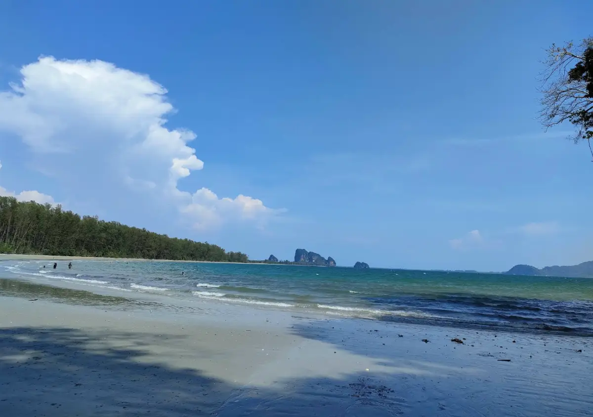
17. Yong Ling Beach and Hat San are located at Moo 6 in Ko Libong Subdistrict, Kantang District, within Hat Chao Mai National Park. The area features a graceful curved beach, casuarina trees, limestone mountains, and naturally eroded rock openings.
At low tide, more of the sandy beach and rock cavities near the end of the shoreline become visible, creating photographic scenes that differ from those of an open, uninterrupted beach. The surrounding limestone formations also create the feeling of a small bay enclosed by nature.
The beach is suitable for relaxing, walking, and swimming when sea conditions are calm. Visitors should avoid approaching cliffs or rocky areas during rough seas and should check tide levels before walking into rock openings or along exposed coastal sections.
Yong Ling Beach fits naturally into a coastal route with Hat Chao Mai National Park, Pak Meng Beach, and other parts of the Sikao–Kantang coastline, making it a good option for travelers who want to enjoy Trang’s sea without taking a boat.
Getting There: Follow the road into the Hat Chao Mai National Park area in Kantang District. A private car is the most convenient option for combining several beaches in one day.
Map (GPS): https://maps.app.goo.gl/2JwdZ1tCbd3tggXX9
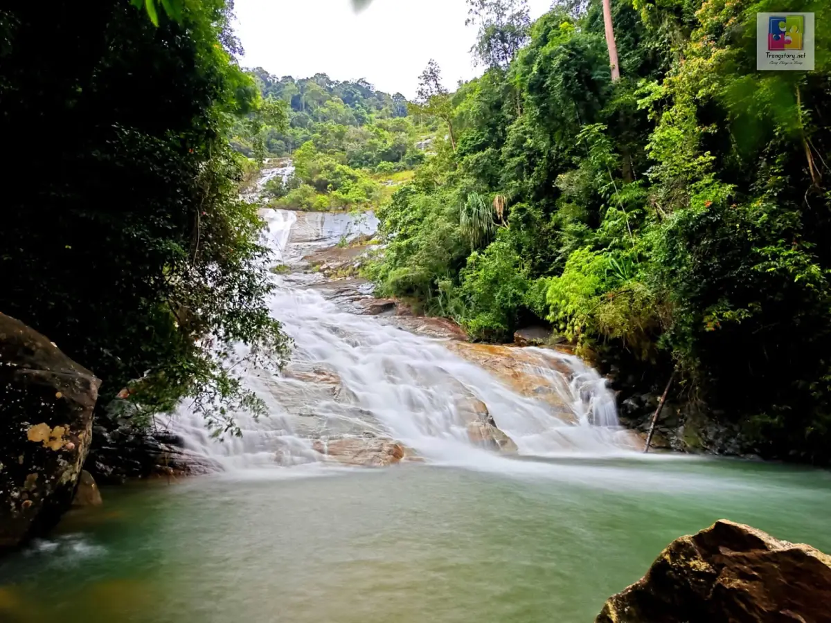
18. Ton Te Waterfall is located in Palian Subdistrict, Palian District, within the Khao Banthat Wildlife Sanctuary. It is a large waterfall fed by streams from the Banthat Mountain Range, cascading down cliffs and rocky slopes over a considerable distance.
The waterfall drops for several hundred meters in total and appears as a long white ribbon against the surrounding tropical forest, making it one of Trang’s most visually striking inland natural attractions. Streams and forest areas around the lower sections provide places for visitors to enjoy the landscape.
The Banthat Mountain Range is an important watershed for Southern Thailand, and a visit to Ton Te Waterfall offers a clear contrast with Trang’s marine landscapes by revealing the province’s humid inland mountain environment.
Access depends on wildlife-sanctuary regulations and weather conditions. During the rainy season, visitors must be alert for flash floods, slippery paths, and strong water flow and should never enter restricted areas.
Getting There: From Trang city, travel toward Palian District and continue along the route leading into the Khao Banthat Wildlife Sanctuary and Ton Te Waterfall.
Map (GPS): https://maps.app.goo.gl/Lsdiqy9QbQHUhcCm7
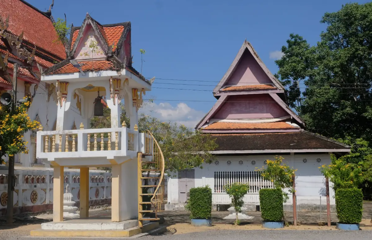
19. Wat Mongkhon Sathan (Wat Lamor) is located in Lamor Subdistrict, Na Yong District. It is an old community Buddhist temple with particular value for its Southern Thai vernacular architecture, especially its historic ordination hall.
The old ubosot is relatively restrained in decoration compared with many central Thai temples. It does not emphasize elaborate chofa, bai raka, or hang hong roof ornaments but instead stands out through its proportions, openings, and local craftsmanship.
A visit to Wat Lamor adds a religious and architectural dimension to a journey through Na Yong District, which is otherwise well known for the Na Muen Si weaving community, agricultural landscapes, and rural life.
The temple remains an active religious site for the local community. Visitors should dress modestly, remain quiet, and avoid disturbing monks or local residents during religious activities.
Getting There: From Trang city, travel toward Na Yong District and Lamor Subdistrict. The temple can be combined conveniently with a visit to the Na Muen Si weaving community.
Map (GPS): https://maps.app.goo.gl/cQgZEaLwFXgHerFe9
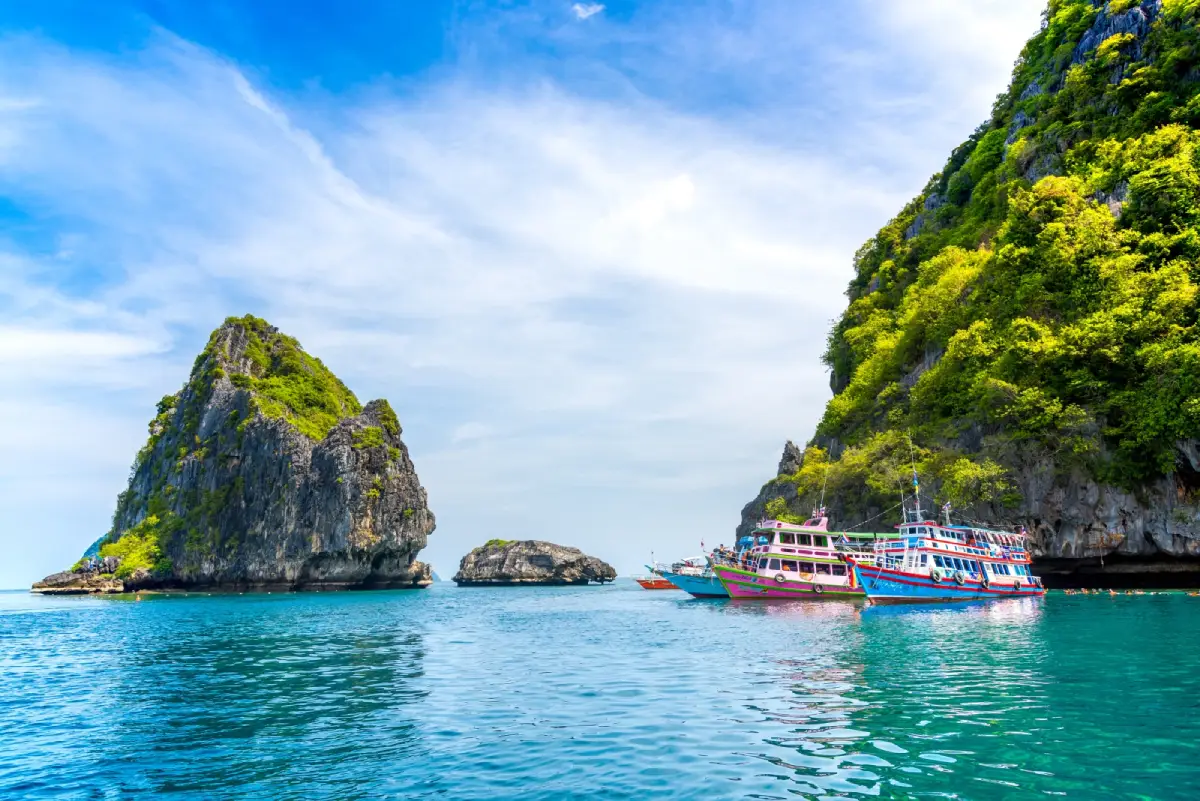
20. Ko Chueak–Ko Waen are small offshore islands within Hat Chao Mai National Park, known for clear water, rocky marine scenery, coral reefs, and snorkeling opportunities.
Neither island has a large permanent community or the overnight facilities found on Koh Mook or Koh Kradan. Instead, they are usually visited as snorkeling stops during day tours, with the amount of time spent in the area depending on currents, sea conditions, and boat schedules.
The surrounding waters contain coral, schools of fish, and varied underwater terrain. Currents can be strong at certain times, so visitors should wear life jackets and follow the instructions of guides and boat crews carefully.
The islands may close seasonally for ecological recovery. Visitors should avoid touching or standing on coral, feeding fish, or leaving any waste in the sea in order to protect the quality of these snorkeling sites.
Getting There: Join a boat-tour program from Pak Meng or another operating pier in the Trang Sea. Routes and stops depend on season, weather, sea conditions, and national park announcements.
Map (GPS): https://maps.app.goo.gl/7D5cSaKoW23rbrYY8
| Topic | Details |
| Province | Trang is an Andaman coastal province in Southern Thailand known for islands, sandy beaches, coral reefs, seagrass meadows, mangrove forests, caves, waterfalls, the Banthat Mountain Range, historic towns, and traditional communities. |
| Top 10 Attractions | 1. Koh Mook–Emerald Cave 2. Koh Kradan 3. Pak Meng Beach 4. Tham Khao Kop 5. Phraya Ratsadanupradit Mahisorn Phakdi Museum 6. Kantang Railway Station 7. Koh Libong 8. Sai Rung Waterfall 9. Rajamangala Beach Trang 10. Sa Kaphang Surin |
| Sea and Islands | Koh Mook–Emerald Cave, Koh Kradan, Koh Libong, Ko Chueak–Ko Waen, and the marine areas of Hat Chao Mai National Park are among Trang’s main island and snorkeling destinations. |
| Beaches | Pak Meng Beach, Rajamangala Beach Trang, and Yong Ling Beach–Hat San offer a mix of popular mainland coastline, quieter recreation areas, and beaches protected within the national park. |
| Caves and Adventure | Tham Khao Kop is famous for its boat journey through a limestone cave and the narrow “Dragon’s Belly” passage, while Emerald Cave is a marine cave that can be entered only when tide, waves, and sea conditions are suitable. |
| Waterfalls and Forests | Sai Rung Waterfall, Ton Te Waterfall, and Peninsular Botanical Garden (Thung Khai) are good choices for experiencing Trang’s humid tropical forest and inland ecosystems. |
| History | Phraya Ratsadanupradit Mahisorn Phakdi Museum, Kantang Railway Station, and the First Rubber Tree in Thailand help explain the historical development of Kantang, Trang, transportation, trade, and Thailand’s rubber economy. |
| Culture and Religion | Kiw Ong Eia Shrine, Wat Mongkhon Sathan, and Na Muen Si Weaving Group represent Trang’s Chinese cultural heritage, Buddhist traditions, and long-established community craftsmanship. |
| Local Food | Trang roast pork, dim sum, local coffee, khanom chin, khao yam, Southern Thai curries, Hokkien-Chinese dishes, and fresh Andaman seafood are among the foods visitors should try. |
| Important Traditions | The Vegetarian Festival, Sat Duan Sip or Tenth Lunar Month merit-making tradition, Trang Roast Pork Festival, and the Underwater Wedding Ceremony are among the province’s best-known cultural events. |
| Mueang Trang District | 1. Sa Kaphang Surin 2. Kiw Ong Eia Shrine The district is suitable for exploring Trang city, local food culture, Chinese heritage, and everyday urban life. |
| Kantang District | 1. Koh Mook–Emerald Cave 2. Koh Kradan 3. Phraya Ratsadanupradit Mahisorn Phakdi Museum 4. Kantang Railway Station 5. Koh Libong 6. The First Rubber Tree in Thailand 7. Kantang Hot Spring 8. Yong Ling Beach–Hat San 9. Ko Chueak–Ko Waen |
| Sikao District | 1. Pak Meng Beach 2. Rajamangala Beach Trang 3. Hat Chao Mai National Park |
| Huai Yot District | Tham Khao Kop is the district’s best-known attraction and combines limestone geology, underground waterways, and community-based tourism. |
| Yan Ta Khao District | 1. Sai Rung Waterfall 2. Peninsular Botanical Garden (Thung Khai) |
| Na Yong District | 1. Na Muen Si Weaving Group 2. Wat Mongkhon Sathan (Wat Lamor) |
| Palian District | Ton Te Waterfall is one of the district’s major natural attractions and lies within the forested landscape of the Banthat Mountain Range. |
| Top Activities | Island-hopping, snorkeling, swimming through Emerald Cave, boating through Tham Khao Kop, relaxing on beaches, learning about dugong conservation, forest walks, waterfall trips, hot-spring visits, historic-town exploration, traditional weaving, and local food experiences. |
| Getting to Trang | Trang can be reached by air through Trang Airport, by train through Trang Railway Station, or by road using Southern Thailand’s highway network. |
| Getting Around Trang | A private or rental car is convenient for mainland attractions. Islands and Emerald Cave require boat transport according to seasonal schedules, sea conditions, and national park regulations. |
| 1-Day Itinerary | Morning: Trang breakfast – Sa Kaphang Surin Late Morning: Phraya Ratsadanupradit Museum – Kantang Railway Station Afternoon: The First Rubber Tree in Thailand Evening: Pak Meng Beach |
| 2-Day Itinerary | Day 1: Trang city – Kantang – Pak Meng Day 2: Koh Mook–Emerald Cave or Koh Kradan, depending on sea conditions |
| 3-Day Itinerary | Day 1: Trang city – Kantang Day 2: Emerald Cave – Koh Kradan – Ko Chueak/Ko Waen Day 3: Tham Khao Kop – Na Muen Si, or Peninsular Botanical Garden (Thung Khai) |
| 4–5 Day Itinerary | Add Koh Libong, Sai Rung Waterfall, Ton Te Waterfall, Yong Ling Beach, Kantang Hot Spring, and Na Yong’s cultural route for a more complete Trang experience covering sea, forest, history, and traditional communities. |
| For Sea Lovers | Koh Mook–Emerald Cave, Koh Kradan, Pak Meng Beach, Koh Libong, Yong Ling Beach, and Ko Chueak–Ko Waen. |
| For Nature Lovers | Sai Rung Waterfall, Ton Te Waterfall, Peninsular Botanical Garden (Thung Khai), and Hat Chao Mai National Park. |
| For History Lovers | Phraya Ratsadanupradit Mahisorn Phakdi Museum, Kantang Railway Station, and the First Rubber Tree in Thailand. |
| For Culture Lovers | Na Muen Si Weaving Group, Kiw Ong Eia Shrine, Wat Mongkhon Sathan, and Trang’s traditional breakfast culture. |
| Best Season for Sea Travel | Generally, November through April is more suitable for island trips, snorkeling, and marine activities. Travelers should still check national park announcements, wave conditions, and seasonal closure periods before departure. |
| Safety Notes | Check seasonal closures for islands and Emerald Cave, watch for flash floods near waterfalls, do not enter Tham Khao Kop when water levels are unsafe, keep a respectful distance from dugongs, and never step on coral or damage seagrass meadows. |
| Responsible Travel | Reduce single-use plastic, do not collect coral or marine life, maintain a safe distance from dugongs, support local community products, and follow all rules in national parks and protected areas. |
Frequently Asked Questions (FAQ)
Q: Where should first-time visitors start when traveling to Trang?
A: If the main focus is the sea, start with Koh Mook–Emerald Cave, Koh Kradan, and Pak Meng Beach. For a more complete introduction to Trang, add Kantang, Tham Khao Kop, and Trang city.
Q: How many days are recommended for a Trang trip?
A: 3 days is a good minimum for Trang city, Kantang, and 1 full day at sea. Travelers who want to add Koh Libong, Tham Khao Kop, waterfalls, and cultural communities should plan 4–5 days.
Q: Are Emerald Cave and Koh Mook the same place?
A: Emerald Cave is located on the western side of Koh Mook. Travelers can stay overnight on Koh Mook or visit the cave as part of a day trip from the Trang mainland.
Q: Is Koh Kradan better for an overnight stay or a day trip?
A: Both are possible. Day visitors can combine Koh Kradan with Emerald Cave and nearby islands, while overnight visitors can enjoy the beach early in the morning and late in the afternoon after most excursion boats have departed.
Q: What is the best time to visit the Trang Sea?
A: Generally, November through April is more suitable for island trips and snorkeling. However, each island or national park site may have its own seasonal closure period, so current park announcements and boat schedules should always be checked before travel.
Q: Is Tham Khao Kop suitable for everyone?
A: No. The narrow “Dragon’s Belly” section requires passengers to lie flat in the boat beneath a very low cave ceiling. Travelers with severe claustrophobia, breathing problems, or mobility limitations should consider carefully before taking the full route.
Q: Can visitors see dugongs around Koh Libong?
A: Koh Libong is surrounded by important seagrass habitat used by dugongs, but sightings depend entirely on natural conditions. Boats should never chase or approach dugongs closely for photographs.
Q: What food should visitors try in Trang?
A: Trang roast pork is the province’s signature dish and is commonly eaten for breakfast with coffee or dim sum. Other good choices include seafood, khanom chin, khao yam, Southern Thai curries, and local Chinese dishes.
Q: Why is Trang important in the history of rubber cultivation in Thailand?
A: Trang was one of the pioneering areas for rubber cultivation in Thailand. Phraya Ratsadanupradit Mahisorn Phakdi played a major role in introducing and promoting rubber until it became one of Southern Thailand’s most important economic crops.
Q: What can travelers do in Trang if they are not interested in beaches?
A: Good alternatives include Tham Khao Kop, Phraya Ratsadanupradit Museum, Kantang Railway Station, the First Rubber Tree in Thailand, Peninsular Botanical Garden (Thung Khai), Na Muen Si Weaving Group, Sai Rung Waterfall, Ton Te Waterfall, Kiw Ong Eia Shrine, and Wat Mongkhon Sathan.
 Category: ●Travel Articles, Recipes
 Group: ●Travel Review, Food Review
Last Update : 3 WeekAgo
 Last Update : 3 WeekAgo
Recommend

 Art, Culture and Heritage
 Historical Sites and Monuments(1)
 Landmarks and Memorials(2)
 Art, Craft Centres, Tradition(3)
 Museums(2)
 Places of Worship
 Temple(15)
 Mosque(1)
 Other Sacred Sites(7)
 Research and Development
 Royal Project(1)
 Suburban Living
 Village, Community(5)
 Nature and Wildlife
 National Parks and Marine Reserves(6)
 Mountain (Doi)(8)
 Dam, Reservoir, Lake(1)
 Waterfalls(20)
 Hot Springs(1)
 Caves(11)
 Bays and Beaches(11)
 Islands(12)
 Other natural attractions(3)
 Entertainment and Agricultural
 Farms, Parks and Ecotourism(8)
 Outdoor and Adventure Activities(1)
Travel Review, Food Review(1)
 Southern Food Menu, Southern Food Recipes(1)


