
lovethailand home >South Travel Attractions >Trang Travel Attractions >Kan Trang >Koh Libong > Yong Ling Beach and Hat San
TL;DR: Yong Ling Beach and Hat San is located at Mu 6, Ko Libong Subdistrict, Kantang District, Trang Province 92110, Thailand, open Daily, hours 08.00 – 17.00.
Yong Ling Beach and Hat San
Open Days: Daily
Opening Hours: 08.00 – 17.00
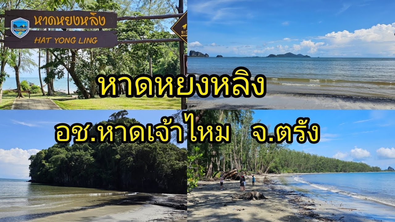
Yong Ling Beach and Hat San in Trang Province are coastal attractions within Hat Chao Mai National Park, in Ko Libong Subdistrict, Kantang District. The area is known for its curved sandy beach, large sea-pine grove, limestone hill, sea cave openings, rocky formations, and a small sandy cove framed by natural stone walls. It is suitable for beach relaxation, walking, photography, swimming when the sea is calm, and experiencing the quieter side of Trang’s Andaman coastline.
Yong Ling Beach is located at Ranger Station 2 of Hat Chao Mai National Park, commonly associated with the Yong Ling Beach unit, in Ban Chao Mai, Mu 6, Ko Libong Subdistrict, Kantang District, Trang Province. This coastal area forms part of Trang’s Andaman landscape, where beaches, sea-pine forests, limestone formations, sea caves, and island routes are closely connected. Yong Ling Beach is therefore more than a simple seaside stop; it is one of the best places to see the natural coastal character of Kantang District.
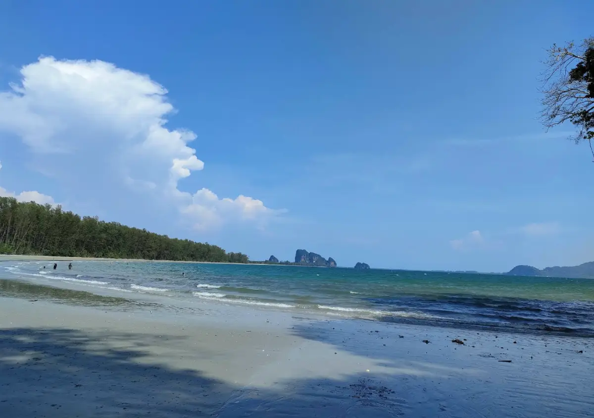
The beach has a graceful curved shoreline running parallel to a line of large sea pines. As visitors walk from the entrance toward the sand, the atmosphere becomes shaded, calm, and open to the sea breeze. The beach is wide enough for slow walking and quiet relaxation, while the end of the beach is defined by a limestone hill with cave openings and rock formations. The combination of greenish sea water, pine trees, pale sand, and limestone cliffs gives Yong Ling Beach a stronger sense of place than many ordinary beaches.
Hat San is a nearby beach area closely associated with Yong Ling Beach. The two are often mentioned together because they share the same coastal landscape of curved sand, limestone caves, and rocky edges. Hat San has a smaller, more enclosed character, with a sandy area framed by rocks and seaside cliffs. Travelers visiting Yong Ling Beach should spend time near the end of the beach and the adjacent limestone zone to appreciate how the two areas connect visually and geographically.
The cave openings and rock formations at the end of the beach are the main highlight of Yong Ling Beach and Hat San. When the tide is low and conditions are safe, visitors can approach the sea cave area and see natural passages that open toward the seaward side. Beyond the cave opening, the landscape reveals rocks, cliff faces, and a small sandy space that feels like a hidden coastal pocket. This view is especially attractive for nature photography because the cave mouth creates a natural frame looking out toward the sea.
Visitors should treat the cave area with caution. The surface can include wet rock, sand, and seawater, which makes it slippery. Conditions change with the tide, wind, and waves. During high tide or rough seas, the cave and rocky edge are not suitable for exploration. Travelers should ask park staff or local people before walking into the far end of the beach, especially when traveling with children, older visitors, or anyone unfamiliar with sea caves. A safe visit depends on real-time sea conditions, not only on photographs seen before arrival.
Swimming is possible when the sea is calm. The water at Yong Ling Beach is known for its clear green tone, and the setting is inviting during good weather. However, Trang’s Andaman coast changes significantly with the seasons. During the monsoon period, waves and rain can make some water activities unsuitable. Visitors should check warning flags, signs, and staff advice before entering the water. Children should stay under close supervision, and swimmers should avoid going too close to rocks or cave openings.
Beyond swimming, Yong Ling Beach is excellent for walking and photography. Good photo spots include the curved beach with the sea-pine grove behind it, the limestone hill at the end of the shore, the cave entrance facing the sea, and the sandy area enclosed by rock formations. Morning visits provide softer light and cooler weather, while late afternoon is good for resting under the pine trees and photographing the coastline. On clear days, the color of the sea and the shape of the limestone cliffs become especially vivid.
Yong Ling Beach lies within Hat Chao Mai National Park, a marine national park that includes both mainland coastal areas and islands in the Trang Sea. Important places within the wider park area include Pak Meng Beach, Chang Lang Beach, Hat Yao, Yong Ling Beach, Hat San, Chao Mai Beach, Chao Mai Cave, Ko Mook, Ko Kradan, Ko Chueak, Ko Waen, Ko Meng, and Ko Chao Mai. This wider context makes Yong Ling Beach part of an ecological and travel network rather than an isolated attraction.
The ecosystem of Hat Chao Mai National Park is important to Trang’s marine environment, especially the seagrass areas that support dugongs and the coastal habitats used by various marine species. A visit to Yong Ling Beach should therefore be responsible and low-impact. Visitors should not leave trash, feed wildlife, disturb animals, collect shells or marine life, or climb dangerous rocks. Keeping the beach clean helps protect the area for local communities, wildlife, and future travelers.
The beach area has park staff, a welfare shop, toilets, and basic visitor facilities. Travelers who plan to spend several hours at the beach should bring drinking water, sun protection, suitable footwear, and a personal trash bag. These facilities make Yong Ling Beach practical for families and small groups, while the cave and rocky areas still require care because they remain natural spaces affected by tide and weather.
Camping is possible only when the national park opens the camping area and allows overnight stays. Travelers planning to camp should contact the park before arrival because camping status can change according to season, water supply, weather, and park announcements. Yong Ling Beach has a natural setting suited to overnight beach experiences, but camping inside a national park requires strict respect for rules on fire, waste, noise, and shared public space.
The best time to visit Yong Ling Beach and Hat San is during Trang’s main sea-travel season, especially from the late-year dry period until before the monsoon. During this period the sea is usually calmer, the sky is clearer, and conditions are better for walking, photography, and swimming. Morning visits are useful for avoiding strong heat and allowing enough time to explore the beach safely. Travelers who want to approach the cave should plan around low tide and speak with park staff first.
Yong Ling Beach can be combined with several nearby attractions. Hat Yao is close by and serves as a useful route toward Hat Yao Pier, Ko Libong, and other Trang Sea destinations. Chao Mai Beach and Chang Lang Beach are on the same coastal travel corridor. Chao Mai Cave is suitable for travelers interested in limestone formations, while Ko Libong is significant for its seagrass ecosystem and dugongs. A half-day trip can include Yong Ling Beach, Hat Yao, and Chao Mai Beach, while a full-day plan can add Hat Yao Pier or other coastal stops in Kantang District.
The name Yong Ling is linked with local coastal stories. Some explanations connect “yong” with a cape or projecting coastal landform, while “ling” is associated with sailors or seafarers. This interpretation fits the rocky headland and maritime setting of the beach. Although the name origin is best understood as local storytelling rather than formal historical documentation, it adds cultural character to the landscape and reflects the area’s long relationship with the sea.
Getting There from Trang town is possible by following Highway 4046 toward Sikao, then Highway 4162 toward Pak Meng Beach. From Pak Meng Beach, turn left and continue along the coastal road for about 10 km, then enter the Ban Nam Rap–Hat Chao Mai road for about 6 km. A side road then leads about 2 km to Yong Ling Beach. This route works well by private car or rental car because it allows travelers to visit several coastal attractions in one day.
Travelers without a private vehicle can take the Trang–Hat Yao public van, which passes the Yong Ling Beach and Hat San area. Vans can be boarded in Trang town around Tha Klang Road. Public transport is useful for budget travelers, but return times should be checked before departure, especially in the evening or on quieter weekdays. The coast is far enough from Trang town that leaving return planning until the last moment can cause inconvenience.
The beach is inside Hat Chao Mai National Park’s fee system. The verified fee found for the park is 40 baht for Thai adults, 20 baht for Thai children, 200 baht for foreign adults, and 100 baht for foreign children. Additional services such as boat trips, food, accommodation, and guided activities are charged separately by local providers or the relevant service operators.
Before traveling, visitors should check announcements from Hat Chao Mai National Park, especially during the monsoon period and during seasonal closures of some marine attractions. Some island areas and sea activities close periodically for natural recovery and safety. Mainland beach areas operate under park supervision and current safety conditions. Checking before departure helps travelers plan Yong Ling Beach, Hat San, and nearby attractions more accurately.
In summary, Yong Ling Beach and Hat San combine a curved sandy shore, sea-pine shade, limestone cliffs, sea cave openings, and a naturally framed sandy cove. The area is ideal for travelers who want a quieter Trang beach with distinctive scenery and strong natural character. With proper timing, respect for park rules, and attention to tide and weather, a visit to this beach can become one of the most memorable coastal experiences in Kantang District.
| Name | Yong Ling Beach And Hat San |
| Location | Mu 6, Ko Libong Subdistrict, Kantang District, Trang Province 92110, Thailand |
| Address | Ranger Station 2, Hat Chao Mai National Park, Yong Ling Beach Area, Ko Libong Subdistrict, Kantang District, Trang Province 92110, Thailand |
| Coordinates | Approximately 7.34122, 99.37313 / Plus Code 89RF+8JC |
| Highlights | Curved sandy beach, sea-pine grove, limestone hill, sea cave openings, rocky formations, and natural photography spots along Trang’s coast |
| Distinctive Features | Quiet shaded beach suitable for relaxing, swimming in calm sea conditions, beach walking, photography, and visiting the cave area at low tide |
| Name Origin | The name Yong Ling is linked with local coastal stories about a headland, sailors, and maritime travel; Hat San reflects the smaller nearby beach area |
| Travel Information | Follow Highway 4046–4162 to Pak Meng Beach, turn left along the coastal road for about 10 km, continue on the Ban Nam Rap–Hat Chao Mai road for about 6 km, then take the side road to Yong Ling Beach for about 2 km. Trang–Hat Yao public vans from Tha Klang Road also pass the beach area. |
| Current Status | Open as a beach attraction within Hat Chao Mai National Park. Water activities, camping, and some marine attractions depend on park announcements and weather conditions. |
| Open Days | Daily |
| Opening Hours | 08.00 – 17.00 |
| Fees | Thai Adults 40 Baht, Thai Children 20 Baht / Foreign Adults 200 Baht, Foreign Children 100 Baht |
| Facilities | Park staff, welfare shop, toilets, beach resting area, and camping area when permitted by the national park |
| Main Areas / Zones | Yong Ling Beach, sea-pine grove, limestone hill, sea cave area, Hat San, and Ranger Station 2 area |
| Caretaker | Hat Chao Mai National Park, Department Of National Parks, Wildlife And Plant Conservation |
| Main Contact Number | Hat Chao Mai National Park Office, Tel. 075-829-967 / Visitor Centre, Tel. 080-572-2583 / Yong Ling Beach Area, Tel. 093-180-4612 |
| Nearby Tourist Attractions | 1. Hat San, about 1 km 2. Yong Ling Cave, about 1 km 3. Hat Yao, about 5 km 4. Hat Yao Pier, about 6 km 5. Chao Mai Beach, about 7 km 6. Chang Lang Beach, about 13 km 7. Ko Libong, about 14 km including road and boat transfer |
| Nearby Restaurants | 1. Yong Ling Beach Welfare Shop, about 1 km, Tel. 093-180-4612 2. Pee Ying Yong Ling Restaurant, about 1 km, Tel. 085-786-7012 3. Hat Yao Seafood, about 6 km, Tel. 098-267-0936 4. GongGang Cafe Hat Yao Seafood, about 6 km 5. Cha Ba @ Hua Saphan Chang Lang, about 13 km, Tel. 093-776-0581 6. Yai Cheay Seafood Kantang, about 31 km, Tel. 087-620-4452 |
| Nearby Accommodations | 1. Hat Yao Seaview Beach Room, about 5 km, Tel. 063-163-6383 2. Baan Chao Mai Beach House, about 5 km, Tel. 099-312-8181 3. Hat Yao Nature Resort, about 5 km 4. Sinchai Resort, about 5 km 5. Kruetontoey Guest House, about 6 km 6. Koh Mook Sivalai Beach Resort, about 18 km including road and boat transfer, Tel. 088-765-0991 |
Frequently Asked Questions (FAQ)
Q: Where are Yong Ling Beach and Hat San located?
A: Yong Ling Beach and Hat San are located in Mu 6, Ko Libong Subdistrict, Kantang District, Trang Province, within Hat Chao Mai National Park near Ranger Station 2.
Q: What makes Yong Ling Beach and Hat San special?
A: The area is known for its curved sandy beach, sea-pine grove, limestone hill, sea cave openings, and a small sandy cove surrounded by natural rock formations.
Q: Can travelers swim at Yong Ling Beach?
A: Swimming is suitable when the sea is calm. Visitors should check warning signs, flags, and park staff advice before entering the water.
Q: Is there an admission fee for Yong Ling Beach?
A: Yes. The beach is inside Hat Chao Mai National Park. The verified fee is 40 baht for Thai adults, 20 baht for Thai children, 200 baht for foreign adults, and 100 baht for foreign children.
Q: Can travelers camp at Yong Ling Beach?
A: Camping is possible only when the national park opens the camping area and allows overnight stays. Visitors should contact the park before traveling.
Q: How do travelers get from Trang town to Yong Ling Beach?
A: Travelers can drive via Highway 4046 and Highway 4162 toward Pak Meng Beach, then continue along the coastal road and the Ban Nam Rap–Hat Chao Mai road. Public Trang–Hat Yao vans from Tha Klang Road also pass the area.
Q: When is the best time to visit Yong Ling Beach and Hat San?
A: The best period is during Trang’s main sea-travel season from the late-year dry period until before the monsoon, when the sea is calmer and conditions are better for walking, photography, and swimming.
Q: Are there restaurants and accommodations near Yong Ling Beach?
A: Yes. There are welfare shops, local restaurants, seafood restaurants, and private accommodations around Yong Ling Beach, Hat Yao, Ban Chao Mai, and nearby coastal areas.
 Category: ●Nature and Wildlife
 Group: ●Bays and Beaches
Last Update : 2 MonthAgo
 Last Update : 2 MonthAgo
 Click to Access the Navigation Map GPS
Yong Ling Beach and Hat San Map
Recommend

 Art, Culture and Heritage
 Historical Sites and Monuments(1)
 Landmarks and Memorials(2)
 Art, Craft Centres, Tradition(3)
 Museums(2)
 Places of Worship
 Temple(15)
 Mosque(1)
 Other Sacred Sites(7)
 Research and Development
 Royal Project(1)
 Suburban Living
 Village, Community(5)
 National Parks and Marine Reserves(6)
 Mountain (Doi)(8)
 Dam, Reservoir, Lake(1)
 Waterfalls(20)
 Hot Springs(1)
 Caves(11)
Bays and Beaches(11)
 Islands(12)
 Other natural attractions(3)
 Entertainment and Agricultural
 Farms, Parks and Ecotourism(8)
 Outdoor and Adventure Activities(1)
 Travel Articles, Recipes
 Travel Review, Food Review(1)
 Southern Food Menu, Southern Food Recipes(1)


