
lovethailand home >Eastern Travel Attractions >Trat Travel Attractions > 50 Best Places to Visit in Trat Updated for 2027
TL;DR: 50 Best Places to Visit in Trat Updated for 2027.
50 Best Places to Visit in Trat Updated for 2027
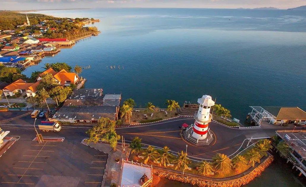
50 Best Places to Visit in Trat — Updated for 2027 Trat is one of eastern Thailand’s leading seaside destinations, offering far more than island holidays alone. The province brings together tropical islands in the Gulf of Thailand, beaches, evergreen forests, waterfalls, mangroves, fishing communities, an old provincial town, naval history, and the Thai–Cambodian border. Travelers can plan anything from a relaxed 2–3 day beach escape to a 5–7 day journey combining Koh Chang, Koh Kood, Koh Mak, Trat town, Laem Ngop, and Khlong Yai.
The best-known image of Trat is the Mu Ko Chang archipelago, a large group of islands centered on Koh Chang and surrounded by many smaller islands. The area combines beaches, evergreen forest, waterfalls, coral reefs, fishing communities, and natural bays. Travelers can stay on Koh Chang and take boat trips to Koh Wai, Koh Ngam, and nearby islands, while also visiting White Sand Beach, Kai Bae Beach, Khlong Plu Waterfall, Than Mayom Waterfall, Ban Salak Phet, and Ban Salak Khok during the same trip.
Farther south in the waters of Trat are Koh Kood and Koh Mak, each offering a very different atmosphere from Koh Chang. Koh Kood is known for clear blue water, quiet beaches, forest waterfalls, and fishing villages. Koh Mak has flatter terrain and a peaceful character that is well suited to cycling, slow travel, and relaxing, while also serving as a convenient base for trips to Koh Kham, Mu Ko Rang, Mu Ko Rayang, and Koh Kradad.
On the mainland, Trat offers attractions that add important cultural and historical dimensions to a coastal holiday. Laem Ngop is an old seaside port closely connected with the history of the Battle of Ko Chang, while Ban Nam Chiao reflects the coexistence of different religious and cultural communities through canal-side houses, local cuisine, handicrafts, and fishing traditions. Trat town itself has the Trat City Pillar Shrine, historic temples, and old buildings that reveal the roots of the province before travelers continue toward the islands.
In southern Trat, the Khlong Yai–Hat Lek route has a character of its own. The coastal road runs between the sea and the Banthat mountain range before reaching the Thai–Cambodian frontier at Ban Hat Lek Border Market. This route allows travelers to combine coastal scenery, local communities, refugee history, and the atmosphere of an international border within a single journey.
The most favorable period for sea travel in Trat is generally from the end of the rainy season through the dry and early summer months, particularly from around November to April or May, when sea conditions are often calmer than during the monsoon. This is usually the better period for island hopping, snorkeling, diving, and other marine activities. During the rainy season, forests become especially lush and waterfalls carry more water, but travelers should check sea conditions, boat schedules, and current announcements from national parks or transport operators before setting out.
For a first trip to Trat with 3–4 days available, a straightforward plan is to stay on Koh Chang for 2 nights, then return to the mainland for Laem Ngop and Ban Nam Chiao before exploring Trat town. Travelers with 5–7 days can add another 2–3 nights on Koh Kood or Koh Mak. Choosing one main island to match your travel style is usually better than trying to move between several islands in a single day, because ferry schedules and sea conditions have a direct impact on travel time.
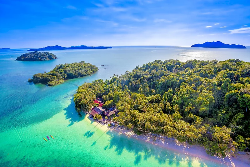
1. Mu Ko Chang National Park is a major marine conservation area in Trat Province covering Koh Chang and numerous surrounding islands, together with extensive sea, evergreen forest, beaches, waterfalls, and coral reefs. It forms the natural heart of marine tourism in Trat.
Highlights: Koh Chang and surrounding islands, tropical evergreen forest, waterfalls, beaches, coral reefs, snorkeling and diving, island-hopping trips, and the history of the Battle of Ko Chang.
Much of Koh Chang is mountainous and covered by well-preserved evergreen forest. Streams descending from the mountains form several important waterfalls, including Khlong Plu Waterfall, Than Mayom Waterfall, Khlong Nonsi Waterfall, Khiri Phet Waterfall, and Khlong Nueng Waterfall. The island’s western coast, meanwhile, contains its best-known beaches and main accommodation areas.
Beyond Koh Chang itself, the national park is connected with Koh Wai, Koh Ngam, Mu Ko Rang, and other islands suited to snorkeling, diving, and boat trips. Travelers planning to visit smaller islands should check boat schedules and sea conditions on the day of travel, particularly during the monsoon when some routes may be restricted.
Getting There: From Trat town, travel to the ferry piers on the mainland for the crossing to Koh Chang. After arriving on the island, local transport connects the piers with major beaches and attractions. Access to individual national park areas and offshore islands depends on the areas and periods designated by the park, so current announcements should be checked before visiting natural sites or smaller islands.

2. Koh Kood is a large island in the southern waters of Trat, famous for clear blue seas, peaceful beaches, natural forest, and a relaxed atmosphere that remains quieter than many larger resort destinations. The island is well suited to couples, families, and travelers looking for a slower style of island travel.
Highlights: Clear sea, quiet beaches, Khlong Chao Waterfall, Khlong Yai Kee Waterfall, Huang Nam Keaw Waterfall, Ao Salad Fishing Village, Ao Yai Fishing Village, and the island’s inland forests.
One of Koh Kood’s greatest attractions is the way beaches, forest, and freshwater environments come together within the same island. Travelers can spend the morning by the sea, visit a waterfall or giant trees in the forest during the afternoon, and finish the day at a fishing village for seafood and a glimpse of local life.
At least 2–3 nights are recommended because attractions are distributed across several parts of the island. Staying longer also reduces the pressure of coordinating arrival and departure boats. When the sea is calm, Koh Kood is particularly suitable for swimming, kayaking, snorkeling, and boat trips to nearby islands.
Getting There: Travel from Trat town to Laem Sok Pier, then continue by passenger boat or speedboat to Koh Kood. Boat schedules depend on the season, operator, and sea conditions, so travelers should confirm departures before the travel date.
Map (GPS):Open Directions to Koh Kood

3. Koh Mak is a peaceful island in Koh Kood District, located between Koh Chang and Koh Kood. Much of the island is relatively flat, making it well suited to cycling and motorcycle exploration, while its uncrowded atmosphere appeals to travelers looking for a slower island experience.
Highlights: Peaceful island atmosphere, clear sea, beaches, Slow Life travel, coconut plantations, cycling, and boat connections to Koh Kham, Mu Ko Rang, Mu Ko Rayang, and Koh Kradad.
Koh Mak differs from mountainous Koh Chang because much of its landscape is flatter and more open, making travel around the island relatively easy. Visitors can spend their time moving between beaches, cafés, coconut plantations, and local communities without needing a tightly packed itinerary.
Koh Mak is also an important base for boat trips to nearby islands, particularly Koh Kham and Mu Ko Rang. It is therefore an excellent choice for travelers who prefer staying on a quiet island while adding snorkeling or island-hopping day trips.
Getting There: Passenger boats and speedboats operate from mainland Trat according to operator schedules. Seasonal connections may also operate between Koh Mak, Koh Chang, and Koh Kood. Always confirm boat schedules before traveling.
Map (GPS):Open Directions to Koh Mak
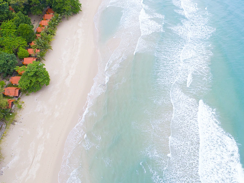
4. White Sand Beach is one of the most popular beaches on the western coast of Koh Chang. Its long shoreline is surrounded by a well-developed tourism area with accommodation, restaurants, shops, and travel services, making it especially convenient for first-time visitors to the island.
Highlights: Popular Koh Chang beach, swimming, sunset views, wide choice of accommodation, restaurants and services, and convenient access to other west-coast attractions.
During the day, visitors can swim, relax on the beach, or walk along the shoreline. In the evening, the west-facing location makes White Sand Beach a popular place to watch the sunset. Accommodation ranges from beachfront resorts to smaller properties.
White Sand Beach is also a practical base for exploring Koh Chang because it is relatively close to the northern ferry area and connects easily by road with Khlong Prao, Kai Bae Beach, Khlong Plu Waterfall, and destinations farther south.
Getting There: After arriving by ferry on Koh Chang, follow the main road along the island’s western coast. White Sand Beach appears early along the main tourist route. The beach itself is naturally open throughout the day, but swimming should be avoided during strong waves or when warning flags are displayed.
Map (GPS):Open Directions to White Sand Beach

5. Khlong Plu Waterfall is one of the best-known and most visited waterfalls on Koh Chang. Located within Mu Ko Chang National Park and not far from the Khlong Prao area, it offers an easy change of scenery from the island’s beaches to tropical forest and freshwater streams.
Highlights: Forest waterfall, natural pool, short forest walk, tropical evergreen vegetation, and convenient access from the western beaches of Koh Chang.
From the entrance, visitors follow a nature trail through forest and alongside streams before reaching the waterfall. Water descends from the rocky cliff into a pool below, with the volume of water changing significantly according to the season.
During the rainy season, the waterfall is usually fuller and the surrounding forest especially green, although trails can become slippery and water levels can rise rapidly. Visitors should follow park staff instructions and avoid entering the water whenever safety warnings are in place.
Getting There: From the Khlong Prao area, follow the access road toward Khlong Plu Waterfall and continue on foot along the nature trail. The waterfall is generally open daily from around 08:00–16:30, although access may be restricted because of weather or safety conditions.
Map (GPS):Open Directions to Khlong Plu Waterfall
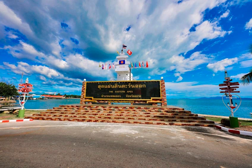
6. Laem Ngop is an old coastal port area of Trat with a long connection to maritime travel, local history, and seaside communities. Located within easy reach of Trat town, it can be combined conveniently with Ban Nam Chiao and the Yuttanavi Memorial Monument at Ko Chang.
Highlights: Historic coastal port, views over the Trat sea, sunset scenery, connections with offshore islands, and a location closely linked to the history of the Battle of Ko Chang.
Laem Ngop historically played an important role as a maritime transport point connecting the mainland with islands in the waters of Trat. Although modern ferry systems have changed the way travelers move through the province, the atmosphere of an old coastal town and its sea views remain central to the area’s appeal.
Late afternoon is a particularly pleasant time for coastal views and sunset scenery. From Laem Ngop, travelers can continue naturally to Ban Nam Chiao, Ao Tan Khu, or back toward Trat town without excessive backtracking.
Getting There: From Trat town, follow the road toward Laem Ngop District. The journey is straightforward by private vehicle, and the coastal area can generally be visited throughout the day.
Map (GPS):Open Directions to Laem Ngop

7. Ban Nam Chiao is a canal-side community in Laem Ngop District known for the coexistence of people from different religious and cultural backgrounds. The community combines fishing traditions, waterside houses, local food, handicrafts, and community-based tourism activities.
Highlights: Two religions and three cultural traditions, canal-side community life, the well-known local bridge, traditional food, Nam Chiao woven hats, and community-based tourism.
The appeal of Ban Nam Chiao lies in experiencing and learning about the community rather than simply stopping for photographs. Visitors can walk through the village, learn about local products and handicrafts, sample traditional food and snacks, and discover fishing and mangrove-related livelihoods near the mouth of the canal.
Ban Nam Chiao works well in the same day as Laem Ngop and the Yuttanavi Memorial Monument at Ko Chang. Travelers interested in community activities or local meals should allow several hours rather than treating it as a brief stop.
Getting There: From Trat town, travel toward Laem Ngop District and continue into Nam Chiao Subdistrict. Private vehicles provide easy access. The community can be visited daily, with approximately 08:00–17:00 being the most practical period for community activities and sightseeing.
Map (GPS):Open Directions to Ban Nam Chiao
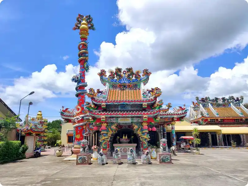
8. Trat City Pillar Shrine is located on Lak Mueang Road in central Trat and serves as an important spiritual center for local residents. It is also an excellent starting point for exploring the historic town before continuing to Wat Yothanimit, Wat Phai Lom, and nearby heritage sites.
Highlights: Chinese-influenced city pillar shrine, local beliefs, central location, and a convenient starting point for exploring the cultural and historical attractions of Trat town.
The shrine’s architecture differs from many Thai-style city pillar shrines elsewhere in the country, reflecting the influence of the Chinese community that has played an important role in Trat’s economy and society for generations.
Visitors can spend time paying respects and observing the shrine’s architectural details before continuing to temples and historical attractions nearby. Several of these sites are close enough to combine into a half-day town itinerary.
Getting There: The shrine is located on Lak Mueang Road in Bang Phra Subdistrict, Mueang Trat District, near Wat Yothanimit. It is generally open daily from around 05:00–21:00.

9. Yuttanavi Memorial Monument at Ko Chang stands on the coast at Laem Ngop and commemorates the naval battle fought in the waters around Ko Chang on January 17, 1941, one of the most significant episodes in the history of the Royal Thai Navy.
Highlights: History of the Battle of Ko Chang, naval memorial, educational area about the maritime conflict, and coastal views around Laem Ngop.
The Battle of Ko Chang took place during the Franco–Thai War and involved a naval engagement between Thai and French forces in the waters of Trat. The event remains an important part of Thailand’s modern naval history and continues to be commemorated.
A visit to the memorial adds an important historical dimension to a Trat itinerary. It can easily be combined with Laem Ngop and Ban Nam Chiao in the same day and is particularly suitable for families, students, and travelers interested in modern Thai history.
Getting There: The memorial is located along Sukhaphiban 3 Road in Laem Ngop Subdistrict, Laem Ngop District, near the coast and not far from the old port area. It is easily reached by road from Trat town.
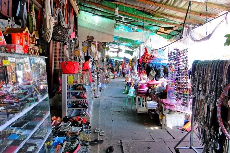
10. Ban Hat Lek Border Market is located at the Thai–Cambodian border in Khlong Yai District. It marks the southern end of Trat’s coastal route and serves as a lively trading area connecting communities on the Thai side with Koh Kong in Cambodia.
Highlights: Thai–Cambodian border market, local and cross-border goods, border-community life, and the final major stop on the Khlong Yai–Hat Lek coastal route.
Ban Hat Lek Border Market reflects Trat’s role as an international border province as well as a major marine tourism destination. Visitors can observe shops, goods transport, and everyday commercial activity connected with communities across the border in Cambodia’s Koh Kong Province.
The market can be combined with a drive along the Khlong Yai coastal road, the Rachakarun Centre of the Thai Red Cross Society at Khao Lan, and the Narrowest Part of Thailand, making the southern part of Trat suitable for a full-day road trip from Trat town.
Getting There: From Trat town, follow Highway 318 through Khlong Yai District and continue south to Hat Lek Subdistrict and the border area. Travelers planning to cross into Cambodia should check the latest checkpoint announcements, immigration requirements, and entry regulations before traveling.
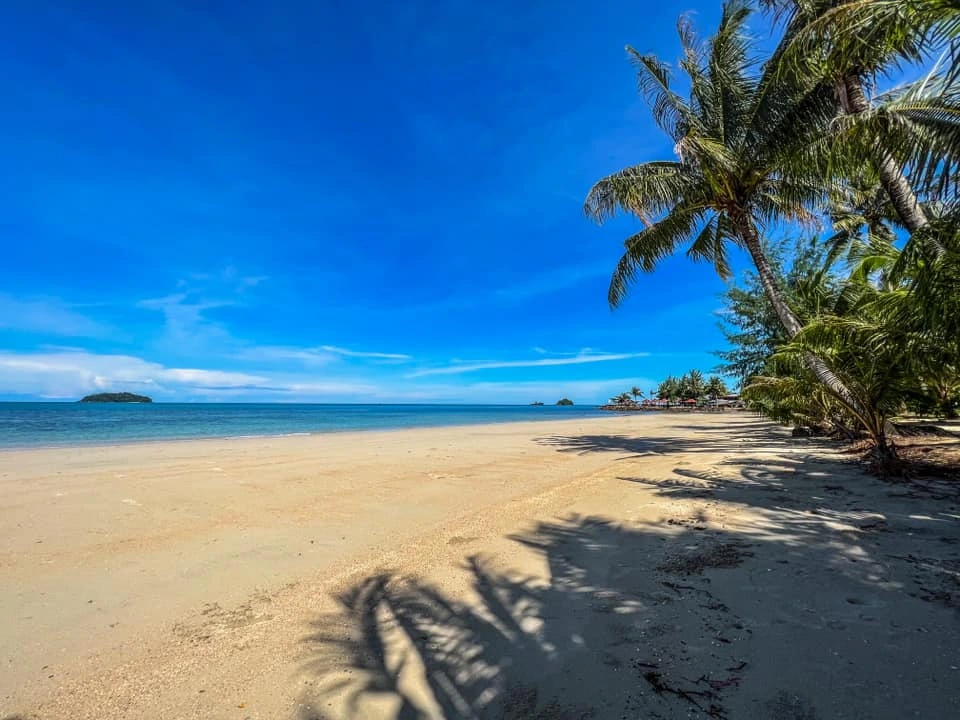
11. Kai Bae Beach is a popular beach on the western coast of Koh Chang, located south of the Khlong Prao area. It offers a good balance between convenience and a more relaxed atmosphere, making it suitable for couples, families, and travelers who want to stay close to restaurants, accommodation, and boat departure points for nearby islands.
Highlights: West-coast beach on Koh Chang, views of small offshore islands, sunset scenery, convenient accommodation and dining, and easy access to island-hopping trips.
Kai Bae Beach slopes gradually toward the sea and is suitable for swimming when conditions are calm. One of its most attractive features is the view of several small islands offshore, making late afternoon an especially appealing time for sunset watching and photography.
The surrounding area has resorts, cafés, restaurants, and travel services. It suits travelers who prefer somewhere quieter than White Sand Beach while still having convenient road access to Khlong Plu Waterfall, other west-coast beaches, and the southern part of Koh Chang.
Getting There: From the northern ferry piers on Koh Chang, follow the main road along the western coast past White Sand Beach and Khlong Prao toward the southern part of the island. The beach is naturally open every day, but swimming should be avoided when waves are strong or warning flags are displayed.
Map (GPS):Open Directions to Kai Bae Beach
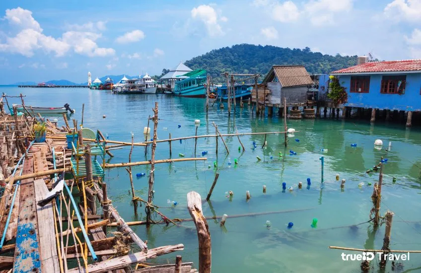
12. Ban Khlong Bang Pao is a seaside fishing community on Koh Chang where houses extend over the water and walkways connect different parts of the village. The settlement reflects a way of life closely tied to the sea, fishing, and local trade.
Highlights: Fishing village, wooden houses over the sea, village walkways, seafood restaurants, local fishing culture, and a traditional coastal-community atmosphere.
Ban Khlong Bang Pao is a good place to experience another side of Koh Chang beyond beaches and resorts. The village has seafood restaurants, souvenir shops, and viewpoints over the bay while still preserving the visual character of a community built around life on the water.
Visitors should walk through the area at a relaxed pace and respect residents’ private spaces because this remains a living community rather than simply a commercial tourist attraction.
Getting There: From the western side of Koh Chang, continue south along the island’s main road toward the Bang Pao area. The community is best visited during daylight hours, when visitors can explore the walkways and enjoy local seafood.
Map (GPS):Open Directions to Ban Khlong Bang Pao
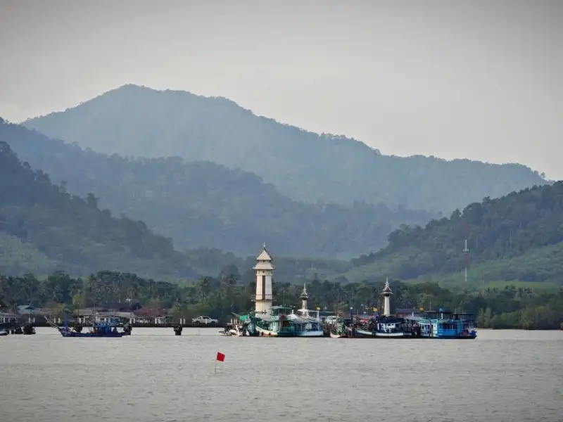
13. Ban Salak Phet (Ban Rong Than) lies on the southeastern side of Koh Chang around Salak Phet Bay. This long-established community has close connections with fishing, fruit orchards, and maritime travel, and its overall atmosphere is noticeably quieter than the island’s western tourist coast.
Highlights: Historic bayside community, fishing lifestyle, fruit orchards, Salak Phet Bay, mountain and sea scenery, and the quieter eastern side of Koh Chang.
Salak Phet Bay is a large sheltered bay surrounded by mountains and offshore islands, giving it long-standing importance for boats and fishing communities. The area also provides access toward Khiri Phet Waterfall, Ban Salak Khok, and natural attractions in the southern part of Koh Chang.
Travelers staying on the western coast can plan a half-day or full-day journey to the eastern and southern sides of the island, where the atmosphere is more community-oriented and less dominated by beach resorts.
Getting There: From the ferry area on Koh Chang, follow the eastern road south toward Koh Chang Tai Subdistrict and Salak Phet Bay. Parts of the route are winding and distances from the western beaches can be considerable, so allow sufficient travel time.
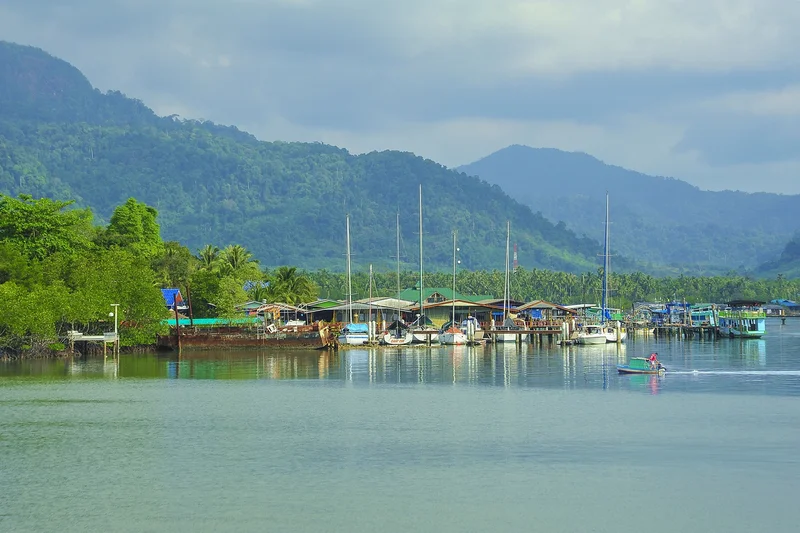
14. Ban Salak Khok is an ecotourism community on the eastern side of Koh Chang, surrounded by mangrove forest and a sheltered bay. The area is known for tourism activities connected with the local community and the coastal ecosystem.
Highlights: Fishing community, mangrove forest, Salak Khok Bay, community-based water activities, local lifestyle, and a peaceful natural setting.
Salak Khok Bay is enclosed by mountains and mangroves, helping keep the water relatively calm under normal weather conditions. This makes the area particularly suitable for observing nature and learning about mangrove ecosystems.
Ban Salak Khok demonstrates that Koh Chang is not only a destination of resorts and beaches. It is also home to communities working to preserve natural resources and traditional livelihoods alongside tourism.
Getting There: Ban Salak Khok is located in Moo 5, Koh Chang Tai Subdistrict, Koh Chang District. Follow the eastern road south toward the lower part of the island. The community can generally be visited during the day, while some community activities may require advance arrangements.
Map (GPS):Open Directions to Ban Salak Khok
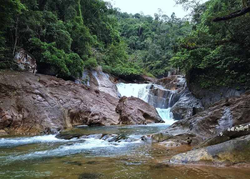
15. Than Mayom Waterfall is an important waterfall on the eastern side of Koh Chang, close to the headquarters of Mu Ko Chang National Park. It is significant for both its natural beauty and its historical associations with visits by Thai monarchs.
Highlights: Multi-tiered waterfall, tropical evergreen forest, royal initials carved into rock, historical royal visits, and a convenient location near Koh Chang’s eastern coast.
Than Mayom Waterfall has several levels reached through shaded forest and natural streams. What distinguishes it from many other waterfalls on the island is its historical evidence connected with King Chulalongkorn, Rama V, and later royal visits.
Travelers interested in history can therefore combine cultural heritage and nature in one location. During the rainy season, the waterfall generally carries more water, but trails can become slippery and water levels may change rapidly.
Getting There: The waterfall is located on the eastern side of Koh Chang near Mu Ko Chang National Park headquarters. It is generally open daily from around 08:00–16:30, although access may be restricted because of weather or safety conditions.
Map (GPS):Open Directions to Than Mayom Waterfall
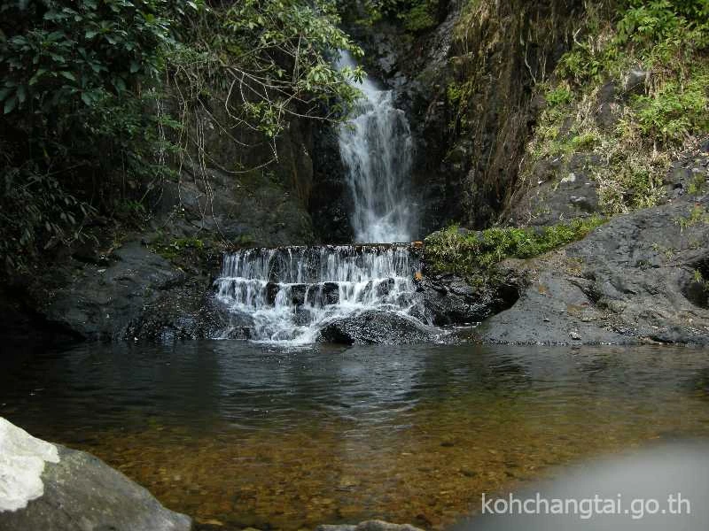
16. Khiri Phet Waterfall is a natural waterfall near Ban Salak Phet in southern Koh Chang. Surrounded by forest, it is a good choice for travelers who want to leave the main beach areas and experience the quieter natural environment of the southern part of the island.
Highlights: Forest waterfall, nature trail, peaceful atmosphere, location near Ban Salak Phet, and a convenient stop on an eastern and southern Koh Chang itinerary.
The volume of water varies by season. After periods of regular rainfall, the waterfall is generally more impressive and the surrounding forest especially lush, while water flow may decrease during drier periods.
Khiri Phet Waterfall can be combined with Ban Salak Phet, Salak Phet Bay, and Ban Salak Khok, creating a route that brings together waterfalls, local communities, and the landscape of eastern Koh Chang.
Getting There: The waterfall is located near Ban Salak Phet in Koh Chang Tai Subdistrict. From the main road, visitors continue on foot along a natural trail. It is generally open daily from around 08:00–16:30, and trail conditions should be checked during the rainy season.
Map (GPS):Open Directions to Khiri Phet Waterfall
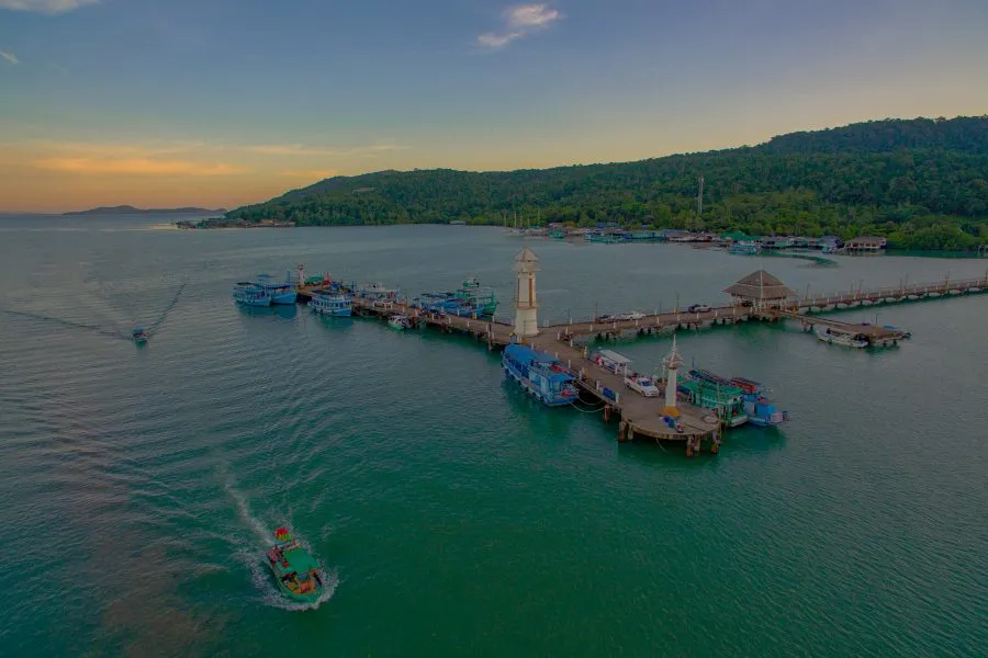
17. Salak Phet Bay is a large bay on the southeastern side of Koh Chang, surrounded by mountains, small islands, mangrove forest, and fishing communities. It is one of the best places to appreciate the distinctive maritime landscape of southern Koh Chang.
Highlights: Large sheltered bay, mountain and sea views, fishing communities, mangrove forest, boat access, and the peaceful atmosphere of southern Koh Chang.
The shape of the bay and its surrounding mountains and islands provide shelter from strong waves in many conditions, which has made the area important to fishing communities and boats for generations. Today, it also serves as a starting point for marine activities and trips to nearby islands.
Salak Phet Bay is particularly appealing to landscape photographers and travelers looking for a quieter side of the island. It can be combined naturally with Ban Salak Phet, Khiri Phet Waterfall, and Ban Salak Khok.
Getting There: Follow the eastern road of Koh Chang south toward Koh Chang Tai Subdistrict and Salak Phet Bay. Cars and motorcycles are the most practical forms of transport, but travelers should allow extra time for winding roads and the distance from the western beach areas.
Map (GPS):Open Directions to Salak Phet Bay
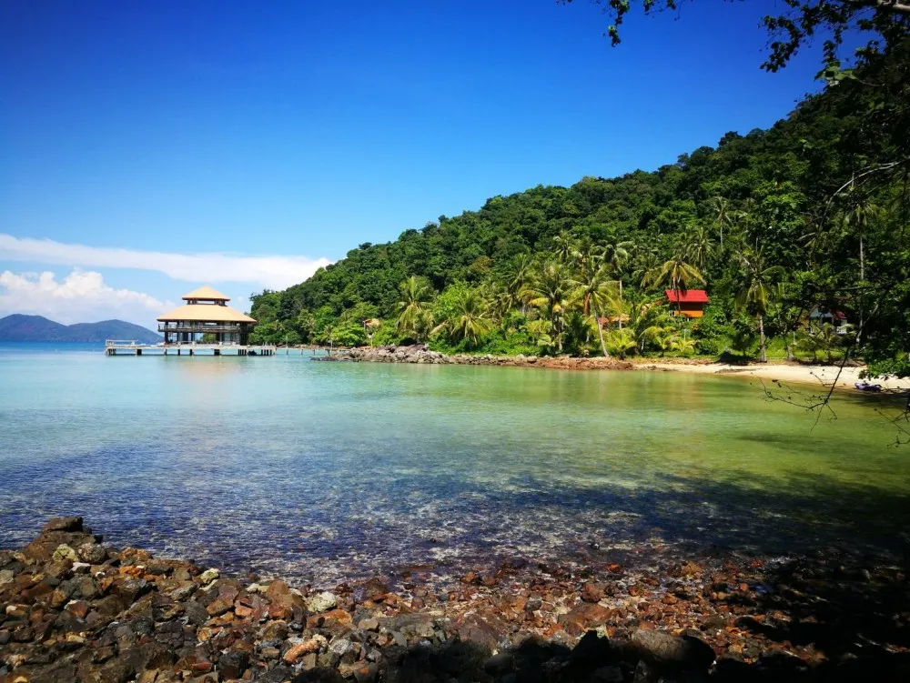
18. Koh Wai is a small island in the waters south of Koh Chang within Mu Ko Chang National Park. It is known for clear sea, quiet beaches, and coral reefs suitable for snorkeling.
Highlights: Clear water, sandy beaches, peaceful atmosphere, snorkeling, coral reefs, and convenient inclusion in boat trips from Koh Chang and nearby islands.
Koh Wai is ideal for travelers who want to leave the larger beaches behind and spend time in a simpler island setting. Some snorkeling areas lie close to shore, allowing visitors to see marine life and coral when the sea is calm and underwater visibility is good.
During the monsoon, waves can become stronger and boat schedules may change. Travelers should therefore confirm boat services before departure and avoid sea travel whenever warnings are issued by authorities or operators.
Getting There: Koh Wai is reached by boat from Koh Chang or as part of island-hopping trips in the Trat archipelago. Routes and schedules depend on the season and sea conditions.
Map (GPS):Open Directions to Koh Wai
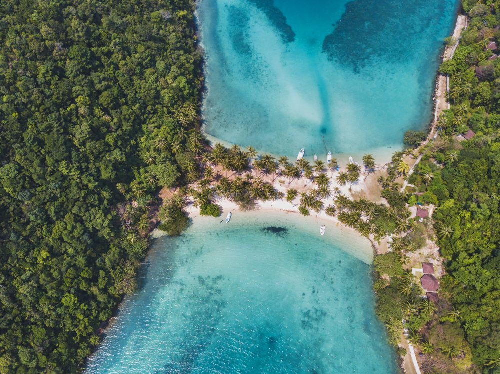
19. Koh Ngam is a small island south of Koh Chang, distinguished by two rocky hills connected by a narrow sandbar. This unusual landform gives the island a distinctive appearance and makes it an attractive photography stop in the waters of Trat.
Highlights: Twin-hill island, connecting sandbar, sheltered bay, scenic photography, and natural surroundings close to Koh Chang.
Seen from the sea, Koh Ngam has a shape unlike many of the surrounding islands. The inner bay can be relatively calm in favorable weather, making it suitable for boat stops, sightseeing, and marine activities.
Most visitors reach Koh Ngam on organized boat trips or private charters. It is therefore practical to combine the island with Koh Wai or other islands south of Koh Chang to make the most of travel time on the water.
Getting There: Travel by boat from Koh Chang or with a marine-tour operator. Landing and activities depend on sea conditions and any access requirements in effect at the time.
Map (GPS):Open Directions to Koh Ngam
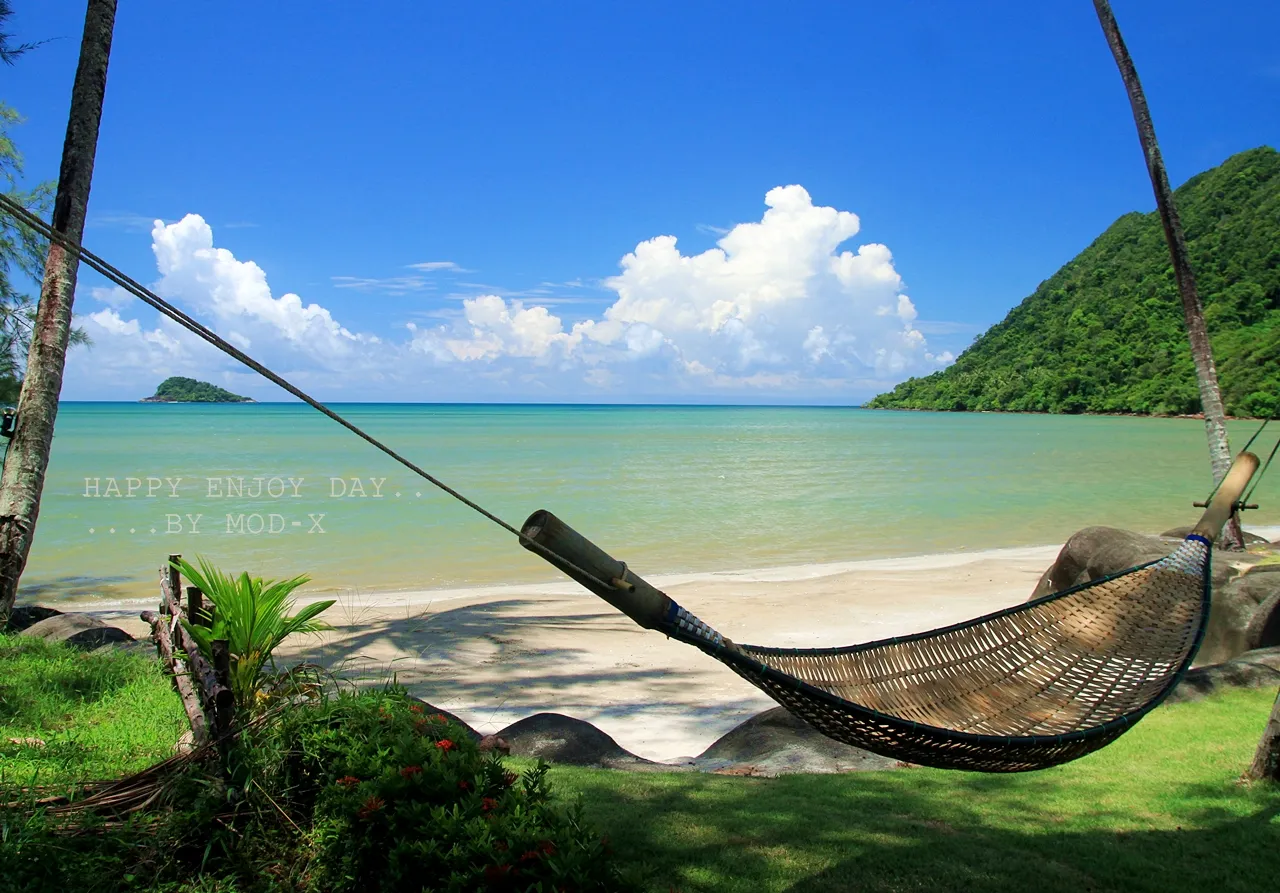
20. Klong Son Bay is located at the northern end of Koh Chang. The bay and surrounding community are close to the island’s ferry piers, making the area convenient for travelers who want a quieter base while retaining easy access to and from the mainland.
Highlights: Northern Koh Chang bay, beach, Klong Son community, mountain scenery, proximity to ferry piers, and a quieter atmosphere than the island’s main western beaches.
The Klong Son area combines coastline, forested hills, mountains, and a long-established local community. Its atmosphere differs from the busier White Sand Beach and Kai Bae areas, making it suitable for travelers seeking a quieter setting or those with limited time on Koh Chang.
From Klong Son Bay, travelers can reach the ferry piers, White Sand Beach, and northern parts of the island relatively easily. This can reduce travel time for visitors catching an early ferry back to the mainland or arriving on Koh Chang later in the day.
Getting There: After arriving by ferry on Koh Chang, continue into the Klong Son area in the northern part of the island. The bay and beach area are naturally open every day and are best explored during daylight hours.
Map (GPS):Open Directions to Klong Son Bay
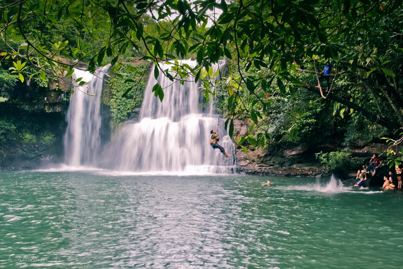
21. Khlong Chao Waterfall (Than Sanuk Waterfall) is one of the most important waterfalls on Koh Kood. Surrounded by natural forest, it shows that the island’s appeal extends far beyond beaches and the sea to include freshwater streams, forest ecosystems, and lush inland scenery.
Highlights: Forest waterfall, natural swimming pool, shaded surroundings, nature trail, and one of the best-known waterfalls on Koh Kood.
Khlong Chao Waterfall is formed by freshwater streams flowing from the island’s interior before dropping into a natural pool surrounded by rocks and dense greenery. When water levels are good, the waterfall is especially attractive and makes a refreshing change after spending several hours along the coast.
One advantage of visiting Khlong Chao Waterfall is that it can easily be combined with beaches and communities elsewhere on Koh Kood in the same day. During or after heavy rain, visitors should take extra care because rocks can become slippery and water levels may change quickly.
Getting There: The waterfall is located in Koh Kood Subdistrict, Koh Kood District. It can be reached by motorcycle or local transport on the island, followed by a short walk from the parking area. It is generally open daily from around 06:00–18:00.
Map (GPS):Open Directions to Khlong Chao Waterfall
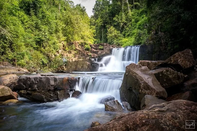
22. Khlong Yai Kee Waterfall is another natural waterfall on Koh Kood and generally offers a quieter atmosphere than Khlong Chao Waterfall. Located in a forested area in the northern part of the island, it suits travelers looking for an unhurried nature stop away from busier tourist areas.
Highlights: Two-tier waterfall, shaded forest, natural pool, peaceful atmosphere, and convenient inclusion in a northern Koh Kood itinerary.
Khlong Yai Kee Waterfall flows over rocky levels into a pool below. The surrounding area retains a strong natural character, and after periods of regular rainfall the water flow becomes more impressive.
Travelers looking for a quieter side of Koh Kood can combine Khlong Yai Kee Waterfall with attractions in the northern part of the island. Trail conditions should be checked during the rainy season, when surfaces may become slippery.
Getting There: The waterfall is located in Koh Kood Subdistrict, Koh Kood District. It can be reached by motorcycle or local transport on the island and is generally open daily from around 08:00–17:00.
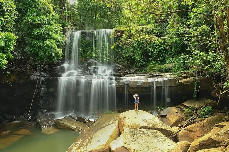
23. Huang Nam Keaw Waterfall is another forest waterfall on Koh Kood, surrounded by lush vegetation and a quiet inland landscape. It is well suited to travelers who want a break from the coast and a chance to experience the island’s freshwater environment.
Highlights: Forest stream and waterfall, natural pool, peaceful atmosphere, and another example of Koh Kood’s rich inland environment.
The forest around the waterfall provides shade and a noticeably cooler atmosphere than the coast. When water levels are higher, the sound of flowing water becomes more pronounced and the surrounding vegetation is especially green.
During the rainy season, visitors should wear footwear suitable for wet surfaces and avoid entering the water when currents are strong or after prolonged heavy rainfall.
Getting There: Huang Nam Keaw Waterfall is located in Koh Kood Subdistrict, Koh Kood District. Follow the island roads toward the inland area and continue along the local access route. It is generally open daily from around 08:00–17:00.
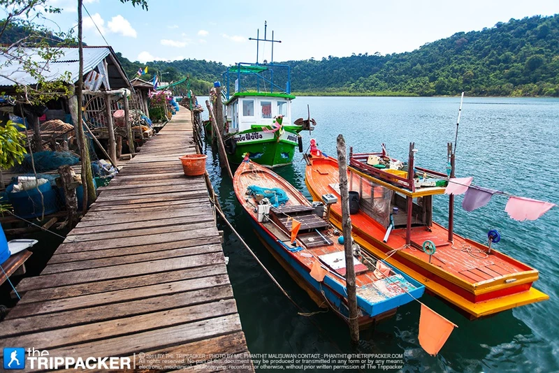
24. Ao Salad Fishing Village is a fishing community in the northern part of Koh Kood where houses line the waterfront and traditional livelihoods remain closely connected with the sea. It adds an important community dimension to a trip otherwise focused on beaches and waterfalls.
Highlights: Fishing village, waterfront houses, wooden walkways, fresh seafood, local fishing culture, and the atmosphere of northern Koh Kood.
Many houses stand along the bay and are connected by walkways, allowing visitors to observe fishing boats, equipment, and everyday community activity at close range. Visitors should avoid entering private spaces or interfering with areas where residents are working.
Ao Salad is also a good place to enjoy seafood and experience a side of Koh Kood that feels very different from a beachfront resort. It can be combined conveniently with other attractions in the northern part of the island.
Getting There: Ao Salad Fishing Village is located at Ban Ao Salad, Moo 6, Koh Kood Subdistrict, Koh Kood District. It can be reached by motorcycle or local transport and is open to visitors during the day.

25. Ao Yai Fishing Village lies on the eastern side of Koh Kood and is a long-established fishing community where homes and seafood restaurants follow the coastline and lower slopes above a wide bay filled with fishing boats.
Highlights: Traditional fishing community, views across Ao Yai, fresh seafood, waterfront houses, and the quieter eastern side of Koh Kood.
Ao Yai reveals a very different side of the island from its beaches. The area functions as a residential community, boat anchorage, and seafood center, allowing visitors to enjoy views across the bay while seeing fishing boats and local maritime life.
Because this is an active community rather than a purpose-built attraction, visitors should remain on public walkways and avoid disturbing homes or working areas, particularly around spaces used for unloading seafood.
Getting There: The village is located at Ban Ao Yai, Koh Kood Subdistrict, Koh Kood District. It can be reached by motorcycle or local transport along the island roads and is best visited during daylight hours.
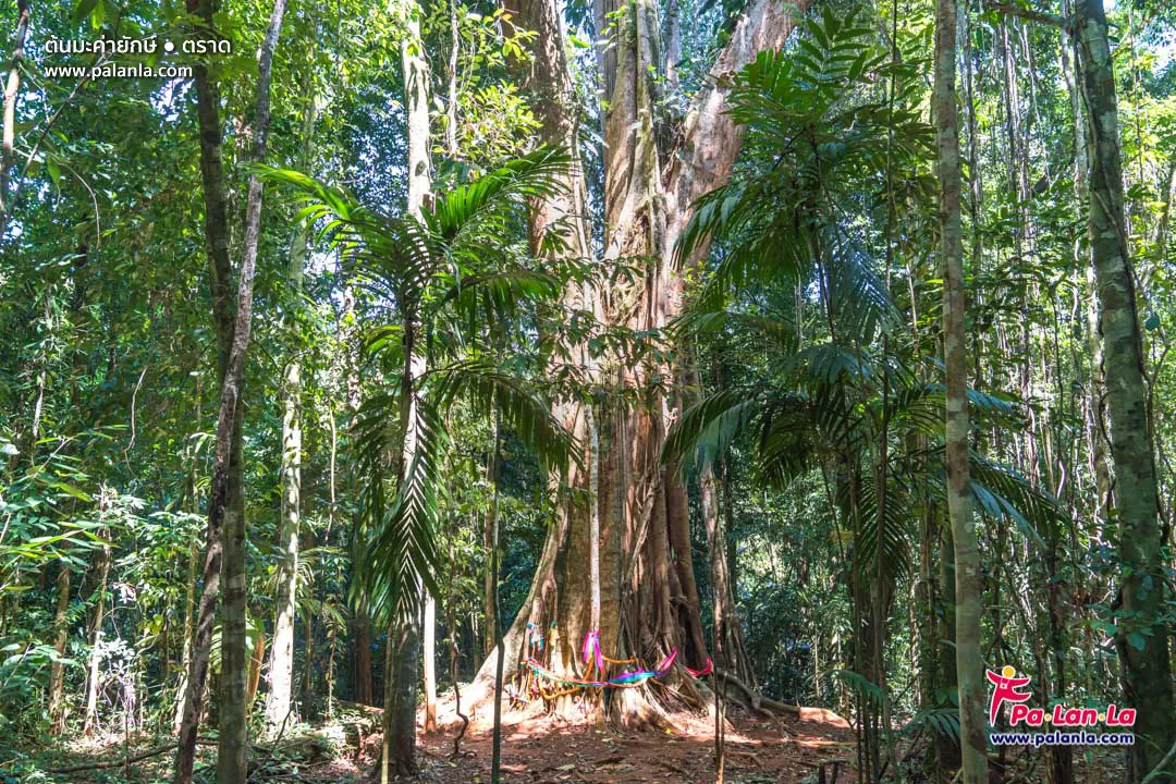
26. 500-Year-Old Maca Tree and Giant Banyan is an inland nature attraction on Koh Kood known for its enormous old trees and surrounding forest. It reveals the ecological richness of the island beyond the beaches and marine scenery.
Highlights: Large old maca tree, giant banyan, natural forest, shaded surroundings, and an opportunity to learn about Koh Kood’s inland ecosystem.
These giant trees demonstrate that parts of Koh Kood’s interior still contain mature and diverse forest. Standing beneath their broad canopies gives visitors a sense of scale very different from the open landscapes along the coast.
Visitors should not carve into the trees, climb them, or damage exposed roots. Staying on established paths helps reduce impact on the surrounding forest floor.
Getting There: The trees are located in the Khao Din Daeng forest area of Koh Kood Subdistrict, Koh Kood District. They can be reached by motorcycle or local transport followed by a short walk into the natural area. The site can generally be visited during the day.
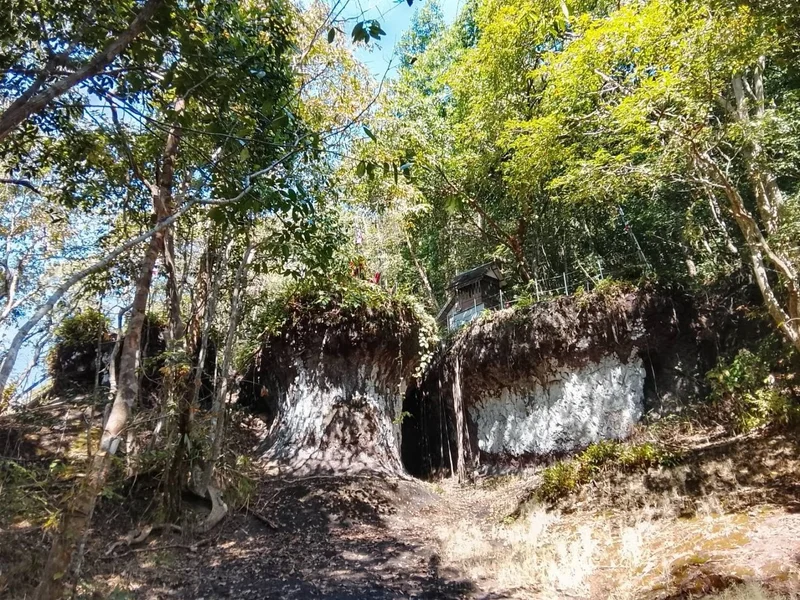
27. Khao Ruea Rop is located near Ban Ngam Kho on Koh Kood. This natural attraction is associated with distinctive rock formations and local stories connected with the shape and character of the landscape.
Highlights: Unusual rock formations, inland nature, forest setting, local beliefs and stories, and a peaceful atmosphere away from the island’s main beaches.
A visit to Khao Ruea Rop reveals another dimension of Koh Kood, where the interior landscape includes forest, hills, and natural rock formations rather than only beaches and sea.
Access conditions can vary by season, particularly after rainfall. Visitors should wear suitable footwear for natural terrain and remain on established paths.
Getting There: Khao Ruea Rop is located at Ban Ngam Kho, Koh Kood Subdistrict, Koh Kood District. Follow the island road and continue toward the natural area. Access depends on ground conditions and any local requirements in effect at the time.
Map (GPS):Open Directions to Khao Ruea Rop
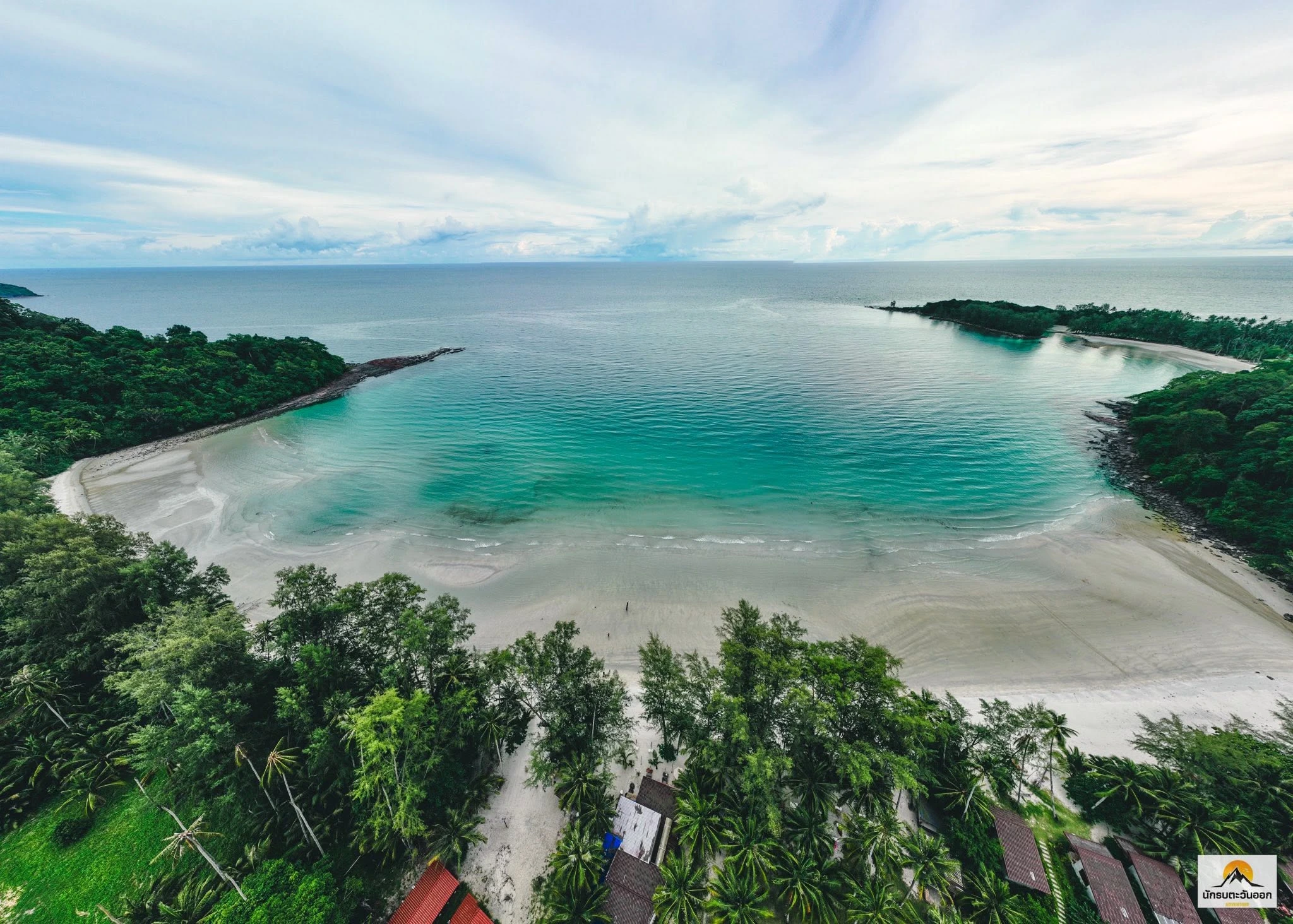
28. Khlong Hin Beach is a quiet beach on the southwestern side of Koh Kood near Laem Khlong Hin and Ao Phrao. Its peaceful and relatively private atmosphere makes it well suited to travelers looking for a slower beach experience away from the island’s busiest areas.
Highlights: Peaceful beach, clear water, private atmosphere, sunset views, and a convenient location near Ao Phrao and southern Koh Kood.
The beach remains surrounded by natural scenery and is noticeably quieter than the Khlong Chao area. It is suitable for walking, relaxing, and enjoying the sea during the morning or evening. Swimming is possible in safe areas when sea conditions are calm.
Travelers staying in southern Koh Kood can combine Khlong Hin Beach with Ao Jark, Ao Yai, and other nearby coastal stops, reducing unnecessary travel across the island.
Getting There: Khlong Hin Beach is located on the southwestern side of Koh Kood near Laem Khlong Hin and Ao Phrao. Motorcycle or local transport is the most convenient way to reach the area.
Map (GPS):Open Directions to Khlong Hin Beach
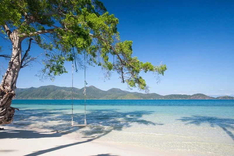
29. Ao Jark is a quiet bay and beach on Koh Kood with white sand, clear sea, and coconut-growing areas nearby. It suits travelers who prefer to stay away from the island’s more developed resort zones and main beaches.
Highlights: White sandy beach, clear water, peaceful atmosphere, coconut plantations, and a convenient location for combining Ao Phrao, Ao Yai, and Khlong Hin Beach.
The beach is long enough for a relaxed walk and wide coastal views. Swimming can be enjoyable when conditions are calm, although travelers should always assess waves and currents before entering the sea.
Ao Jark’s appeal lies in its simplicity. The area has fewer shops and commercial activities than the island’s main tourism zones, making it more suitable for travelers who prioritize quiet surroundings and nature.
Getting There: Ao Jark is located on Koh Kood in Koh Kood District. It can be reached by motorcycle or local transport. The beach is naturally open and is most suitable for visiting during daylight hours.
Map (GPS):Open Directions to Ao Jark
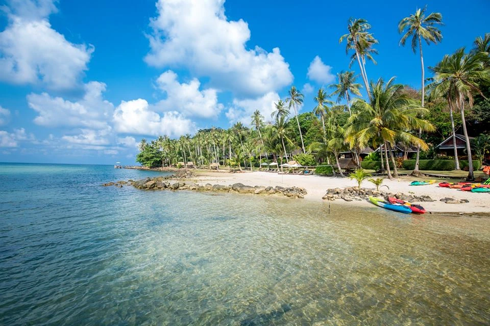
30. Ao Yai Koet is a bay on the eastern side of Koh Kood near Ao Kluai and Laem Ta Tui. Its shoreline curves in a broad semicircle and remains relatively quiet, making it suitable for travelers interested in exploring a less-visited part of the island.
Highlights: Semicircular bay, sandy and rocky shoreline, peaceful atmosphere, natural coastal scenery, and a route through the quieter eastern side of Koh Kood.
The bay includes both sandy sections and rocky coastal areas, creating scenery that differs from the island’s better-known western beaches. It is a good place for walking, photography, and relaxing when sea conditions are favorable.
Because the area is quieter and services are more limited than in the main tourism zones, independent travelers should bring drinking water and any basic supplies they may need, particularly if planning to stay for several hours.
Getting There: Ao Yai Koet is located on the eastern side of Koh Kood near Ao Kluai and Laem Ta Tui. Follow the island roads and local access routes toward the bay. Motorcycle travel is the most practical option.
Map (GPS):Open Directions to Ao Yai Koet
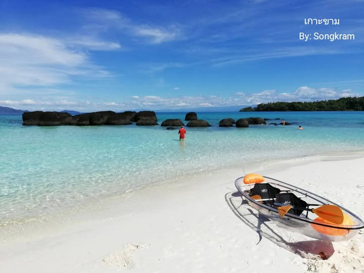
31. Koh Kham is a small island near Koh Mak, known for clear water, clean beaches, and a peaceful atmosphere. It is well suited to a short excursion from Koh Mak for swimming, relaxing, and enjoying the marine scenery.
Highlights: Clear sea, sandy beach, coral reefs, peaceful atmosphere, and convenient access from Koh Mak when sea conditions are suitable.
Koh Kham is relatively small, making it ideal for a half-day visit or as one stop on a wider boat trip. Its appeal lies in the color of the water and the compact island landscape, which can feel more private than the larger beaches on nearby islands.
When underwater visibility is good, visitors can snorkel around coral areas near the island. Coral should never be stepped on or collected, and travelers should follow any local access or conservation rules in effect.
Getting There: Koh Kham is reached by local boat or tour boat from Koh Mak. Travel time depends on the departure point and sea conditions, while services may vary by season.
Map (GPS):Open Directions to Koh Kham
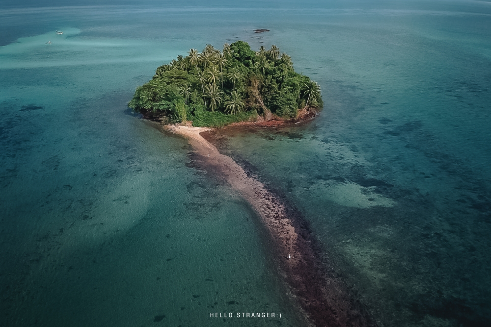
32. Koh Kradad lies northeast of Koh Mak and is notable for its relatively flat landscape, which differs from many of the mountainous islands in Trat. The island’s name is associated with its broad, flat appearance, often compared to a sheet of paper.
Highlights: Broad flat island, beaches, simple natural scenery, peaceful atmosphere, and distinctive terrain compared with other islands in Trat.
The charm of Koh Kradad comes from its open landscape and tranquil setting. It suits travelers who want a break from the busier islands and prefer spending time in a quieter, more natural environment.
Because services are limited and access depends mainly on boat transport, travelers should plan their transfer arrangements in advance, especially during periods of uncertain sea conditions.
Getting There: Koh Kradad is reached by boat from Koh Mak or through local operators. Access depends on boat schedules, the season, and sea conditions on the day of travel.
Map (GPS):Open Directions to Koh Kradad
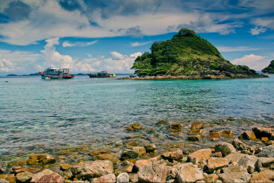
33. Mu Ko Rang is a group of islands within Mu Ko Chang National Park, located west of Koh Mak. It is one of the best-known snorkeling and diving areas in the Trat archipelago because of its clear water and rich underwater environment.
Highlights: Snorkeling, scuba diving, coral reefs, clear water, several small islands, and marine day trips from Koh Mak or Koh Chang.
The waters around Mu Ko Rang contain several diving and snorkeling sites where fish and coral can be observed when sea conditions and underwater visibility are favorable. The islands are therefore a major destination for boat trips departing from Koh Mak and Koh Chang.
Diving and snorkeling should be arranged with operators that provide appropriate safety equipment and choose entry points according to current conditions. Travelers with limited sea experience should remain close to guides or supervising staff throughout the activity.
Getting There: Travel by boat from Koh Mak, Koh Chang, or through a diving and snorkeling tour operating in the Trat archipelago. Access and routes depend on the season and sea conditions.
Map (GPS):Open Directions to Mu Ko Rang
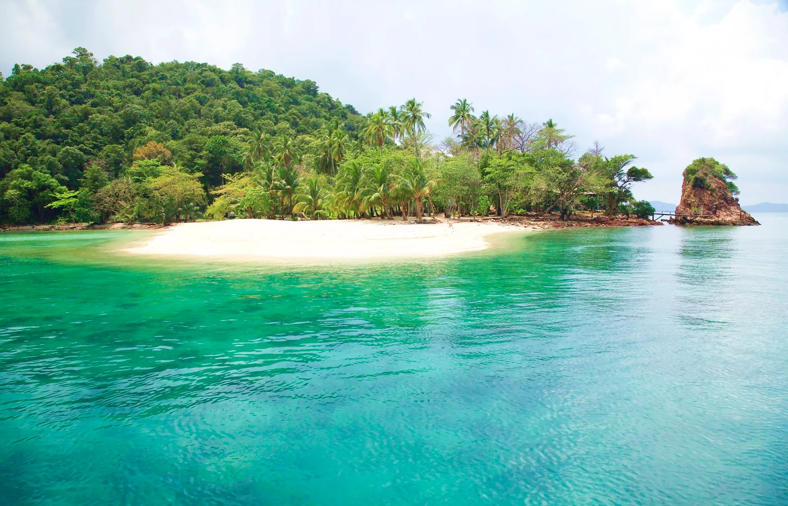
34. Mu Ko Rayang is a small group of islands near Koh Mak, surrounded by clear sea and a quiet natural setting. It is suitable for travelers who want to leave the main beaches of Koh Mak and experience smaller islands with a more secluded atmosphere.
Highlights: Small islands near Koh Mak, clear water, quiet beaches, snorkeling, and short-distance boat trips.
The marine environment around Mu Ko Rayang is well suited to relaxing and water activities when conditions are calm. The islands can be included in the same trip as Koh Kham or other small islands around Koh Mak.
Visitors should treat the islands carefully by taking all rubbish away, avoiding disturbance to marine life, and never collecting coral, shells, or other natural materials.
Getting There: Travel by boat from Koh Mak through local boat operators or island-tour services. Routes and availability depend on the season and weather conditions.
Map (GPS):Open Directions to Mu Ko Rayang
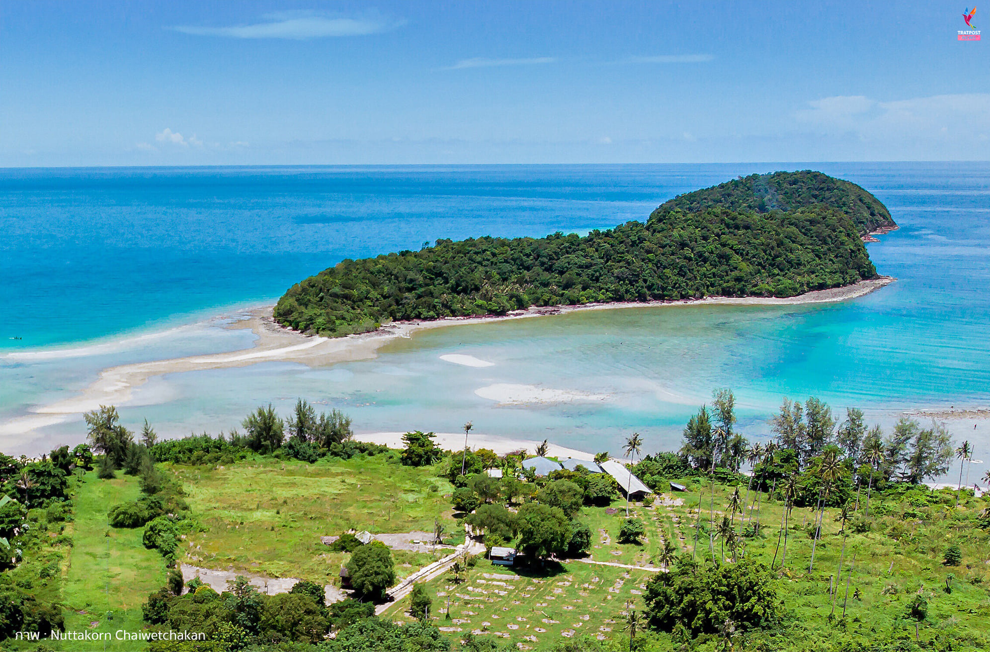
35. Ko Rayang Nok is a small island close to Koh Mak with clear water, a peaceful setting, and a strong sense of seclusion. It is suitable for travelers who want to relax in a quieter marine environment away from larger tourist areas.
Highlights: Small peaceful island, beach, clear water, open sea views, and an atmosphere similar to a private-island retreat.
The island is well suited to slow travel, including walking along the beach, swimming when conditions are favorable, and enjoying sunset views. All marine activities should be adjusted to the sea conditions on the day.
Travelers staying around Koh Mak can use Ko Rayang Nok as an additional stop on a local boat itinerary without needing to travel as far as Mu Ko Rang or more distant islands.
Getting There: Travel by boat from Koh Mak or with a local operator. Boat schedules and sea conditions should be checked before departure.
Map (GPS):Open Directions to Ko Rayang Nok
36. Laem Sok is a coastal area in Ao Yai Subdistrict, Mueang Trat District, and an important gateway for boat travel to Koh Kood and nearby islands. It also offers sea views and a glimpse of coastal community life within easy reach of Trat town.
Highlights: Laem Sok coastline, departure point for Koh Kood, sea views, Ao Yai community, local spiritual sites, and a strategic connection between Trat town and the southern islands.
Laem Sok has both transport and tourism importance because many travelers heading to Koh Kood pass through the area. Those who allow extra time can also experience the coastal community and sea views rather than treating it only as a transit point.
The area works well as a stop before boarding a boat or after returning from the islands. It can also be combined with Ban Tha Ranae, Ban Pred Nai Mangrove Forest, or attractions in Trat town.
Getting There: From Trat town, follow the road toward Ao Yai Subdistrict and Laem Sok. Private vehicles provide convenient access. The coastal area can generally be visited throughout the day, while boat departures operate according to individual service schedules.
Map (GPS):Open Directions to Laem Sok

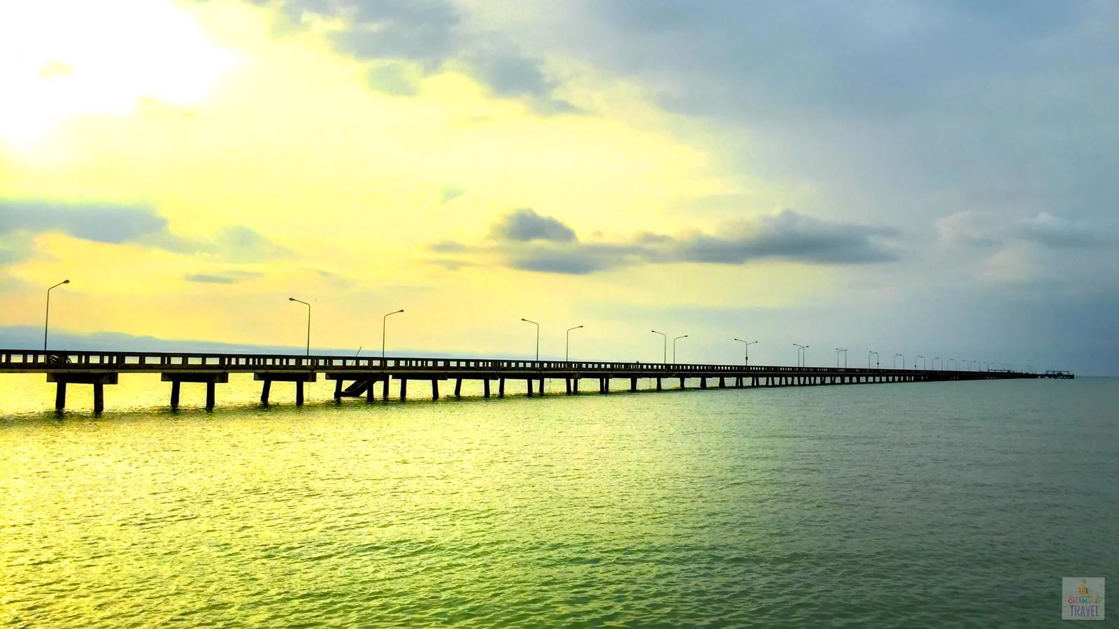
37. Ban Laem Sok Pier Bridge is an important coastal structure in Ao Yai Subdistrict, Mueang Trat District. It connects mainland travelers with boat services to Koh Kood and nearby islands while offering broad views across the waters of Trat and the surrounding mountain landscape.
Highlights: Pier for Koh Kood transport, bridge extending toward the sea, wide coastal views, views toward the Banthat mountain range, and the maritime atmosphere of Laem Sok.
Although its main function is maritime transport, the pier area also provides a clear sense of Trat’s coastal geography. On clear days, distant islands and mountain ridges may be visible across the water.
Passengers traveling to the islands should arrive before their scheduled departure and confirm luggage, check-in, and transfer arrangements directly with their operator, because departure times may change with weather and seasonal operating conditions.
Getting There: The pier is located in Moo 6, Ao Yai Subdistrict, Mueang Trat District. Travel from Trat town toward Laem Sok and confirm current boat schedules with the relevant operator before departure.
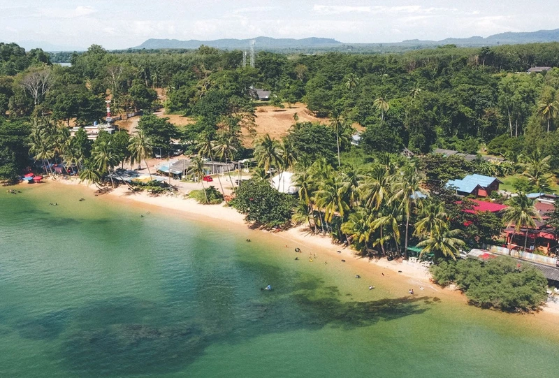
38. Ao Tan Khu is a mainland beach in Bang Pit Subdistrict, Laem Ngop District. Its peaceful atmosphere makes it a good choice for travelers who want to enjoy the Trat coast without taking a ferry to one of the islands.
Highlights: Mainland beach in Trat, peaceful atmosphere, sea views, relaxed seaside stop, and a convenient location on a Laem Ngop itinerary.
Ao Tan Khu is suitable for sitting by the sea, walking along the shore, and enjoying the view during the morning or late afternoon. Its atmosphere differs from the resort beaches of Koh Chang because the area retains a stronger sense of a local mainland coastal community.
Travelers visiting Laem Ngop, Ban Nam Chiao, or the Yuttanavi Memorial Monument can include Ao Tan Khu as a seaside break without making a major detour.
Getting There: Ao Tan Khu is located in Bang Pit Subdistrict, Laem Ngop District. It can be reached easily by road from Trat town or Laem Ngop, and the beach area is generally accessible throughout the day.
Map (GPS):Open Directions to Ao Tan Khu
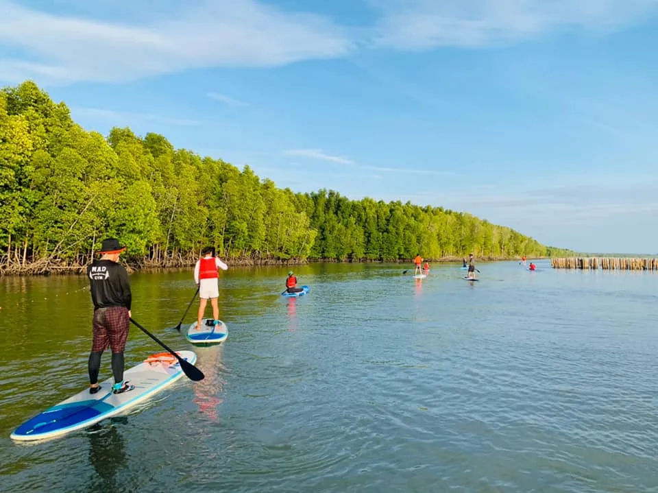
39. Ban Pred Nai Mangrove Forest is located in Huang Nam Khao Subdistrict, Mueang Trat District. It is an important coastal mangrove ecosystem and a strong example of community-based natural resource management linking conservation with local livelihoods.
Highlights: Mangrove forest, coastal ecosystem, community life, environmental learning, and conservation-based tourism activities.
Mangrove forests serve as nursery grounds for aquatic life, help reduce coastal erosion, and support high biological diversity. A visit is especially valuable for travelers interested in understanding the relationship between local communities and coastal resources.
Visits and community-based activities should be arranged in advance so that routes and timing can be organized appropriately while reducing unnecessary disturbance to conservation areas.
Getting There: Ban Pred Nai Mangrove Forest is located in Moo 2, Huang Nam Khao Subdistrict, Mueang Trat District. Visitors should contact the local community in advance before planning activities in the area.
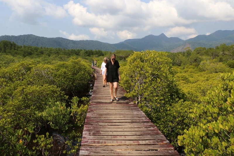
40. Trat Mangrove Study Center is an environmental learning area focused on the coastal ecosystems of Trat. It is connected with mangrove forests and fishing communities around Laem Ngop and nearby coastal areas, making it suitable for families, students, and nature-oriented travelers.
Highlights: Mangrove ecology, coastal plant life, juvenile aquatic species, local fishing communities, and the role of mangroves in protecting the shoreline.
Walking through a mangrove-learning area helps visitors understand that mangroves are far more than stands of coastal trees. They form an ecosystem connecting land, freshwater, and sea, while providing feeding and shelter areas for many species.
This type of attraction is best experienced as a learning visit rather than simply a photo stop. Travelers should read interpretive information, remain on designated routes, and avoid disturbing wildlife or removing natural materials from the area.
Getting There: The center is associated with the mangrove and fishing-community areas along the Trat coast and can be combined with Laem Ngop and nearby mangrove destinations. Current access arrangements should be checked before visiting.
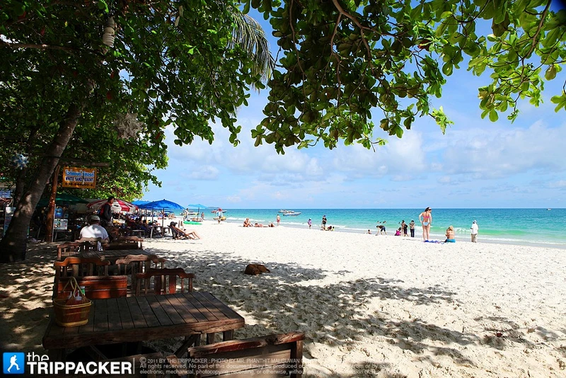
41. Hat Mook Kaew and Hat Sai Kaew are mainland beaches in Laem Klat Subdistrict, Mueang Trat District. They are suitable for travelers who want to experience the coast of Trat without taking a boat to the islands, offering a generally quiet and natural atmosphere compared with larger resort beaches.
Highlights: Mainland beaches in Trat, peaceful surroundings, open coastal views, relaxed seaside atmosphere, and a convenient stop along the route from Trat town toward Khlong Yai.
Hat Mook Kaew and Hat Sai Kaew are well suited to walking, enjoying the sea, taking photographs, and relaxing during the morning or late afternoon. Their main appeal is simplicity and a strong sense of local coastal scenery rather than a concentration of commercial activities.
Travelers continuing toward Khlong Yai or Hat Lek can use these beaches as a coastal break along the route. Those planning to spend several hours here should bring drinking water and other basic supplies.
Getting There: The beaches are located in Laem Klat Subdistrict, Mueang Trat District. They can be reached by road from Trat town when traveling south toward the coast. The beach areas are generally accessible throughout the day.
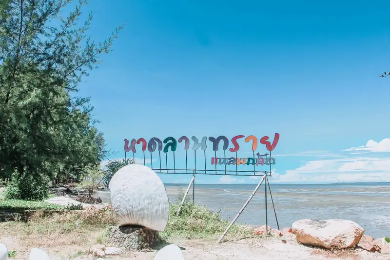
42. Hat Lan Sai is another mainland beach in Laem Klat Subdistrict, Mueang Trat District. Its quiet and uncrowded atmosphere makes it a pleasant stop for travelers driving along the southern coast of Trat.
Highlights: Quiet beach, Gulf of Thailand views, relaxed coastal stop, and convenient continuation toward Khlong Yai and other mainland attractions.
Hat Lan Sai is particularly suitable for travelers who appreciate simple coastal places without large crowds or extensive tourist development. Visitors can walk along the beach, sit by the sea, or photograph the surrounding landscape without needing to travel to an island.
Morning and late afternoon are usually the most comfortable periods to visit because temperatures are lower and the natural light is better suited to coastal photography.
Getting There: Hat Lan Sai is located in Laem Klat Subdistrict, Mueang Trat District. Private vehicles provide the easiest access from Trat town, and the beach is generally accessible throughout the day.
Map (GPS):Open Directions to Hat Lan Sai
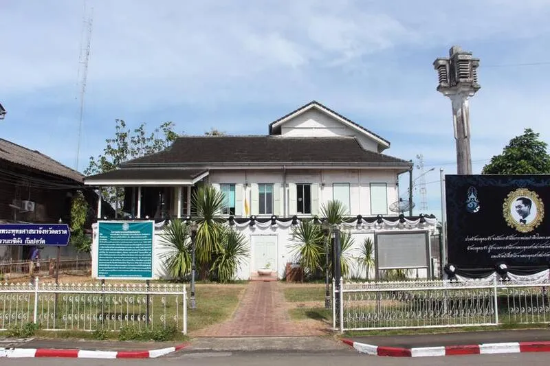
43. Residanggamport Residence is a historic building on Lak Mueang Road in the old town area of Trat. It reflects an important period in the province’s history and the wider political changes that affected eastern Thailand and Indochina during the late 19th and early 20th centuries.
Highlights: Historic building in Trat town, colonial-era architectural influence, border history of eastern Thailand, and a location near the Trat City Pillar Shrine and old town area.
Residanggamport Residence is important for understanding Trat during a period when European colonial powers were competing for influence across Indochina. Visiting the site adds an important historical dimension to a province otherwise widely associated with beaches and islands.
The residence can be combined conveniently with the Trat City Pillar Shrine, Wat Yothanimit, Wat Phai Lom, and Wat Buppharam in a half-day or full-day route through Trat town.
Getting There: The historic site is located on Lak Mueang Road in Bang Phra Subdistrict, Mueang Trat District, close to the old town and several other cultural attractions. It can be reached by car or included in a walking route through the central area.
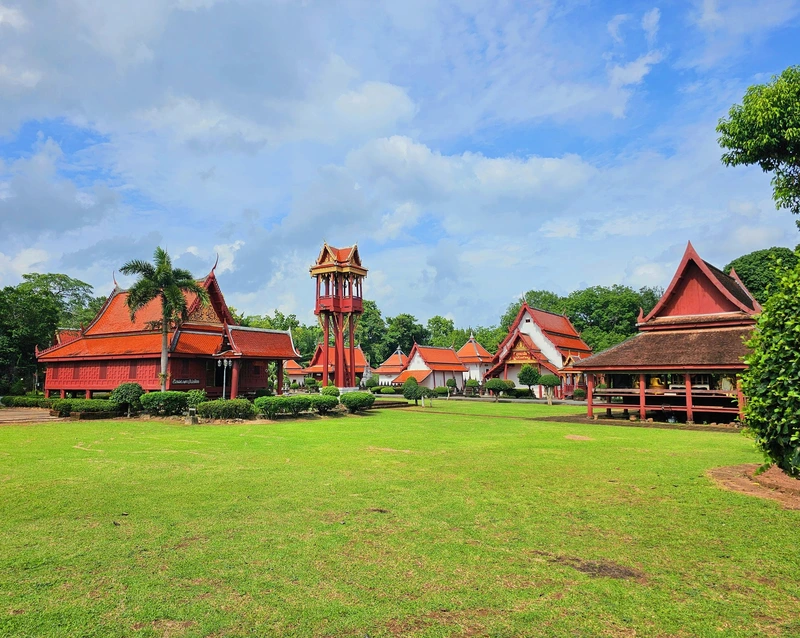
44. Wat Buppharam is an important historic temple in Wang Krachae Subdistrict, Mueang Trat District. The temple has religious, historical, and artistic significance and is one of the best places to explore the cultural roots of Trat town.
Highlights: Historic Buddhist temple, religious art and architecture, Buddha images and antiquities, and the atmosphere of an important temple serving the local community.
Wat Buppharam has been closely associated with the Trat community for generations. Its buildings and religious objects reflect the development of Buddhism and local craftsmanship in Thailand’s eastern coastal region.
The temple can be included in the same itinerary as Wat Phai Lom, Wat Yothanimit, and the Trat City Pillar Shrine, creating a town route that covers Buddhist heritage, art, and local history.
Getting There: Wat Buppharam is located at Ban Plai Khlong, Moo 3, Phatthanakan Plai Khlong Road, Wang Krachae Subdistrict, Mueang Trat District. It is generally open daily from around 08:00–17:00. Visitors should dress respectfully and behave appropriately within the temple grounds.
Map (GPS):Open Directions to Wat Buppharam
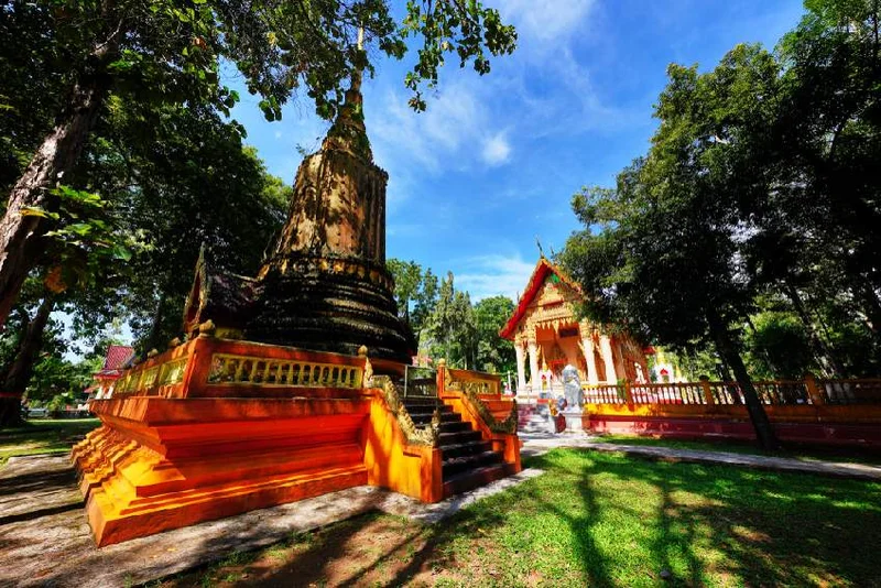
45. Wat Yothanimit is an important Buddhist temple in central Trat, located in Wang Krachae Subdistrict. It is connected with the history of the town and the development of Buddhism in the province, making it a worthwhile stop on a cultural route through old Trat.
Highlights: Important urban temple, historic religious site, local history, and a convenient location near the Trat City Pillar Shrine and other cultural attractions.
Despite its location near the town center, the temple maintains a calm atmosphere suitable for worship and for learning about the role Buddhist temples have played in the religious, ceremonial, and community life of Trat.
Wat Yothanimit is best combined with nearby attractions to make efficient use of travel time, particularly the Trat City Pillar Shrine, Residanggamport Residence, and Wat Phai Lom.
Getting There: Wat Yothanimit is located in Moo 1 on Thetsaban 4 Road, Wang Krachae Subdistrict, Mueang Trat District. It is generally open to visitors during the daytime. Respectful clothing and consideration for ongoing religious activities are recommended.
Map (GPS):Open Directions to Wat Yothanimit
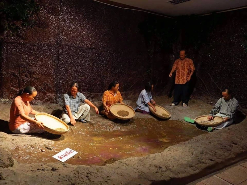
46. Gem City Museum is located in Bo Phloi Subdistrict, Bo Rai District. It presents the history of gemstones and the local way of life in Bo Rai, an area once widely known for gem mining and trading in eastern Thailand.
Highlights: History of the gem-mining town, gemstones, geology, traditional gem-mining livelihoods, and the local economic history of Bo Rai District.
Bo Rai was once an important center for gemstone extraction, and gems played a significant role in the local economy. The museum helps preserve the story of the mining era, including tools, techniques, and local knowledge associated with finding and trading gemstones.
Travelers interested in economic history or attractions beyond the coast should consider adding Bo Rai to their itinerary. The district reveals a different side of Trat shaped by inland landscapes, communities, and underground natural resources.
Getting There: The Gem City Museum is located in Bo Phloi Subdistrict, Bo Rai District, Trat. It is generally open Tuesday–Sunday from around 09:00–16:30.
Map (GPS):Open Directions to Gem City Museum

47. Rachakarun Centre of the Thai Red Cross Society is located at Ban Khao Lan in Mai Rut Subdistrict, Khlong Yai District. It is an important humanitarian-history site connected with assistance provided to refugees affected by conflicts in the Indochina region.
Highlights: Refugee history, humanitarian work of the Thai Red Cross Society, interpretation of border history, and the natural surroundings of Khao Lan.
The Khao Lan area once played an important role in receiving large numbers of refugees who entered Thailand during periods of conflict in neighboring countries. The center therefore has value both as a place of remembrance and as an educational site focused on humanitarian history.
A visit is particularly meaningful for travelers interested in understanding the Trat border region beyond trade and international crossings. The center can be combined with the Khlong Yai–Hat Lek route.
Getting There: The center is located at Ban Khao Lan, Mai Rut Subdistrict, Khlong Yai District. From Trat town, follow Highway 318 toward Khlong Yai and continue to the Khao Lan area. Current visitor-access information should be checked before traveling.
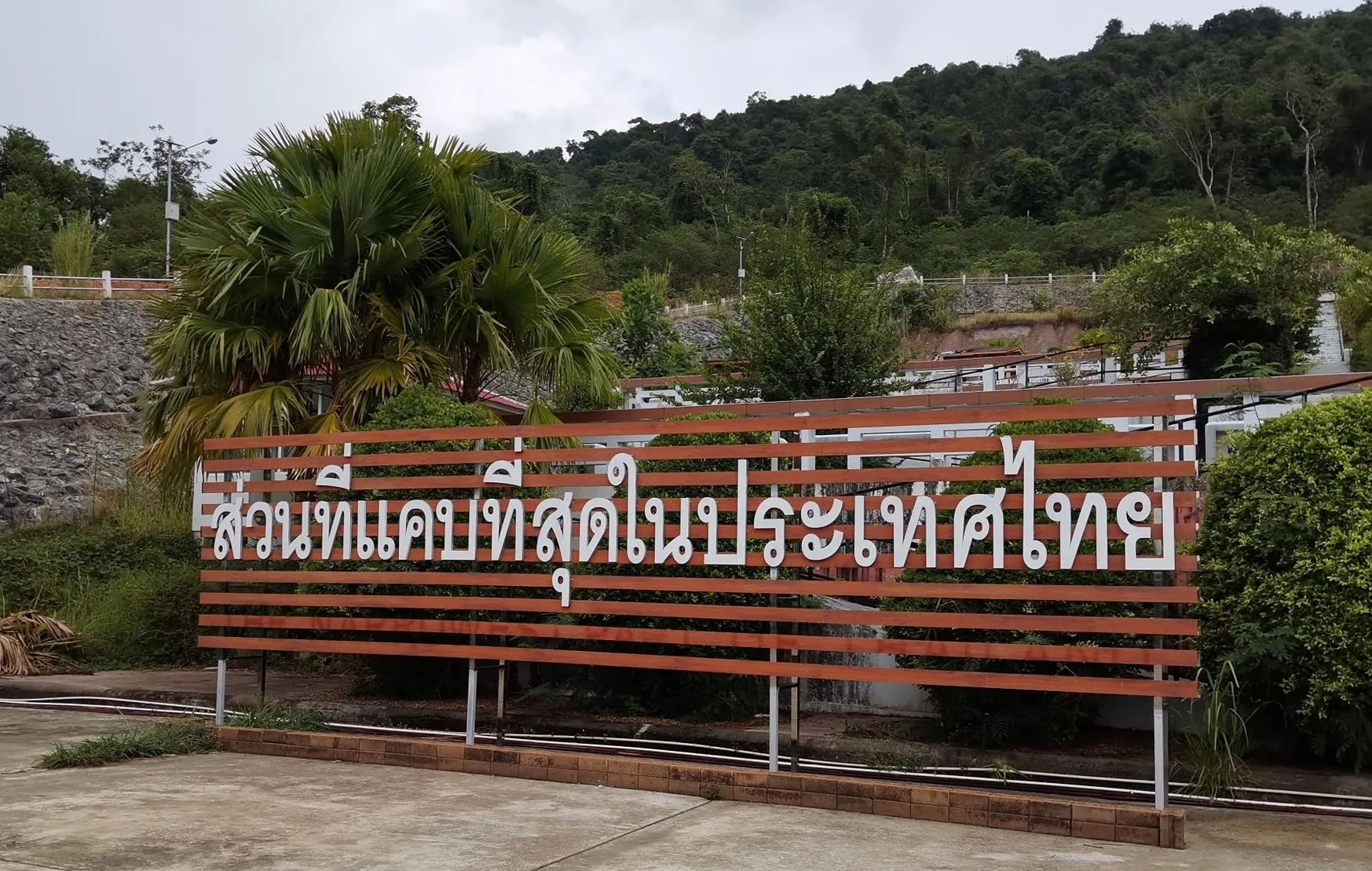
48. Narrowest Part of Thailand is located around Ban Khot Sai in Hat Lek Subdistrict, Khlong Yai District. Here, the distance between the coastline and the Thai–Cambodian border becomes exceptionally narrow, creating one of the most distinctive geographical points in Trat Province.
Highlights: Distinctive geographical point, road corridor between the sea and the Banthat mountain range, border-region scenery, and a convenient stop on the Khlong Yai–Hat Lek route.
Traveling through this area provides a clear view of the geography of southern Trat. The sea lies on one side of the route, while the international border and mountain range are close on the other, creating an unusually narrow strip of Thai territory.
This is best treated as a short stop while traveling to or from Ban Hat Lek Border Market. Although it does not require much time, it adds an interesting geographical element to a road trip through Trat.
Getting There: The site is located at Ban Khot Sai, Moo 2, Hat Lek Subdistrict, Khlong Yai District. Follow Highway 318 south toward Ban Hat Lek and the Cambodian border. The route is accessible throughout the day.
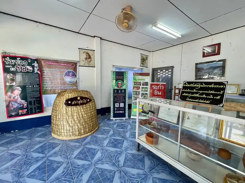
49. Chong Chang Thun Eco-Cultural Museum is located in Chang Thun Subdistrict, Bo Rai District. It is a learning center focused on Chong ethnic culture, local knowledge, natural resources, and the relationship between forest environments and community life in inland Trat.
Highlights: Chong culture, community knowledge, ethnic history, traditional use of forest resources, and eco-cultural tourism.
The Chong are an indigenous ethnic group of eastern Thailand with their own language and traditional knowledge related to forests, medicinal plants, and local livelihoods. Learning about Chong culture at Chang Thun broadens the image of Trat beyond its better-known identity as a marine tourism province.
The museum is particularly suitable for travelers interested in community tourism and cultural heritage. Visitors gain more from taking time to learn through exhibits and local activities than from treating the site only as a photo stop.
Getting There: The museum is located in Chang Thun Subdistrict, Bo Rai District, Trat. It is generally open daily from around 08:30–16:30. Travelers interested in specific community activities should check arrangements in advance.

50. Wat Phai Lom is an important Buddhist temple in central Trat, located on Lak Mueang Road in Bang Phra Subdistrict. The temple has played significant roles in Buddhism, education, local history, and meditation practice within the province.
Highlights: Three Venerable Masters Museum Chedi, Buddhist meditation garden, educational history of Trat, important urban religious site, and a peaceful atmosphere for worship and meditation.
Wat Phai Lom is closely associated with Phra Wimon Methachan, Woranayanurak, Sangkhapramok, a senior monk who played an important role in the development of education in Trat. This gives the temple significance beyond its religious functions, linking it with the educational and social history of the town.
The temple grounds include a Buddhist meditation garden and the Three Venerable Masters Museum Chedi, making the site suitable for visitors interested in Buddhism, important local religious figures, and quiet contemplation. It can be combined with the Trat City Pillar Shrine, Wat Yothanimit, and the old town area.
Getting There: Wat Phai Lom is located at 236 Lak Mueang Road, Bang Phra Subdistrict, Mueang Trat District. It is generally open daily from around 08:00–17:00. Visitors should dress respectfully and maintain appropriate behavior within the temple grounds.
Map (GPS):Open Directions to Wat Phai Lom
| Category | Details |
| Koh Chang Zone | 1. Mu Ko Chang National Park 2. White Sand Beach 3. Khlong Plu Waterfall 4. Kai Bae Beach 5. Ban Khlong Bang Pao 6. Ban Salak Phet (Ban Rong Than) 7. Ban Salak Khok 8. Than Mayom Waterfall 9. Khiri Phet Waterfall 10. Salak Phet Bay 11. Klong Son Bay Best for a 2–4 day trip combining beaches, waterfalls, tropical forest, fishing communities, and both the western and eastern sides of Koh Chang. |
| Islands Around Koh Chang | 1. Koh Wai 2. Koh Ngam Best for boat trips, snorkeling, swimming, and visiting smaller islands when sea conditions are calm. |
| Koh Kood Zone | 1. Koh Kood 2. Khlong Chao Waterfall (Than Sanuk Waterfall) 3. Khlong Yai Kee Waterfall 4. Huang Nam Keaw Waterfall 5. Ao Salad Fishing Village 6. Ao Yai Fishing Village 7. 500-Year-Old Maca Tree and Giant Banyan 8. Khao Ruea Rop 9. Khlong Hin Beach 10. Ao Jark 11. Ao Yai Koet Allow at least 2–3 nights to explore beaches, waterfalls, inland forest, and fishing villages without rushing. |
| Koh Mak and Nearby Islands | 1. Koh Mak 2. Koh Kham 3. Koh Kradad 4. Mu Ko Rang 5. Mu Ko Rayang 6. Ko Rayang Nok Best for travelers who prefer quiet islands, cycling, snorkeling, and boat trips to smaller islands. |
| Laem Ngop – Ban Nam Chiao Zone | 1. Laem Ngop 2. Ban Nam Chiao 3. Yuttanavi Memorial Monument at Ko Chang 4. Ao Tan Khu 5. Trat Mangrove Study Center Suitable for a one-day route combining history, community life, seaside scenery, and coastal ecosystems. |
| Trat Town Zone | 1. Trat City Pillar Shrine 2. Residanggamport Residence 3. Wat Buppharam 4. Wat Yothanimit 5. Wat Phai Lom Suitable for a half-day to full-day cultural route focused on religion, old-town heritage, architecture, and local history. |
| Laem Sok – Ao Yai Zone | 1. Laem Sok 2. Ban Laem Sok Pier Bridge 3. Ban Pred Nai Mangrove Forest Best for coastal-community travel, mangrove learning, and onward boat connections to Koh Kood. |
| Mainland Coast – Laem Klat Zone | 1. Hat Mook Kaew and Hat Sai Kaew 2. Hat Lan Sai Suitable for travelers who want to enjoy the Trat coastline without taking a ferry to the islands. |
| Bo Rai Zone | 1. Gem City Museum 2. Chong Chang Thun Eco-Cultural Museum Best for travelers interested in gemstone-mining history, Chong culture, forest knowledge, and community tourism. |
| Khlong Yai – Hat Lek Zone | 1. Ban Hat Lek Border Market 2. Rachakarun Centre of the Thai Red Cross Society 3. Narrowest Part of Thailand Suitable for a southern Trat road trip combining border history, geography, coastal scenery, and international trade. |
| Best for Beach and Island Lovers | Koh Chang, Koh Kood, Koh Mak, White Sand Beach, Kai Bae Beach, Koh Wai, Koh Ngam, Koh Kham, Koh Kradad, Mu Ko Rang, Mu Ko Rayang, Ko Rayang Nok, Khlong Hin Beach, Ao Jark, and Ao Yai Koet. |
| Best for Snorkeling and Diving | Mu Ko Rang, Koh Wai, Koh Kham, Mu Ko Rayang, and smaller islands within Mu Ko Chang National Park. Choose days with calm sea conditions and use operators with appropriate safety equipment. |
| Best for Nature | Mu Ko Chang National Park, Khlong Plu Waterfall, Than Mayom Waterfall, Khiri Phet Waterfall, Khlong Chao Waterfall, Khlong Yai Kee Waterfall, Huang Nam Keaw Waterfall, Ban Pred Nai Mangrove Forest, and the 500-Year-Old Maca Tree and Giant Banyan. |
| Best for Community Tourism | Ban Nam Chiao, Ban Khlong Bang Pao, Ban Salak Phet, Ban Salak Khok, Ao Salad Fishing Village, Ao Yai Fishing Village, and Chong Chang Thun Eco-Cultural Museum. |
| Best for History and Culture | Yuttanavi Memorial Monument at Ko Chang, Trat City Pillar Shrine, Residanggamport Residence, Wat Buppharam, Wat Yothanimit, Wat Phai Lom, Gem City Museum, and Rachakarun Centre of the Thai Red Cross Society. |
| 1 Day in Trat Town | Morning: Trat City Pillar Shrine – Wat Yothanimit – Residanggamport Residence Afternoon: Wat Phai Lom – Wat Buppharam Evening: Dinner and overnight stay in Trat town |
| 1 Day in Laem Ngop | Morning: Ban Nam Chiao Midday: Laem Ngop – Yuttanavi Memorial Monument at Ko Chang Evening: Ao Tan Khu for a relaxed seaside stop |
| Koh Chang 3 Days 2 Nights | Day 1: Klong Son Bay – White Sand Beach – Kai Bae Beach Day 2: Khlong Plu Waterfall – Ban Khlong Bang Pao – sunset Day 3: Than Mayom Waterfall – Ban Salak Khok – Ban Salak Phet – Salak Phet Bay |
| Koh Kood 3 Days 2 Nights | Day 1: Beach relaxation – Khlong Chao Waterfall Day 2: Khlong Yai Kee Waterfall – 500-Year-Old Maca Tree and Giant Banyan – Ao Salad Fishing Village Day 3: Khlong Hin Beach – Ao Jark – Ao Yai Fishing Village |
| Koh Mak 3 Days 2 Nights | Day 1: Explore Koh Mak and relax by the sea Day 2: Koh Kham – Mu Ko Rayang Day 3: Choose a Mu Ko Rang or Koh Kradad trip according to sea conditions and boat schedules |
| Trat 5 Days 4 Nights | Day 1: Trat town – Ban Nam Chiao – Laem Ngop Day 2: Western Koh Chang Day 3: Eastern and southern Koh Chang Day 4: Koh Mak or Koh Kood Day 5: Return to the mainland and visit Laem Sok or Ban Pred Nai Mangrove Forest |
| Trat 7 Days 6 Nights | A practical plan is to spend 2–3 nights on Koh Chang, followed by 2–3 nights on either Koh Kood or Koh Mak, then use the final day for Trat town or Laem Ngop. Avoid trying to cover every island in a short period because boat schedules and sea conditions can strongly affect the itinerary. |
| Best Time for Sea Travel | The period from around November to April or May generally offers a better chance of calmer sea conditions than the monsoon season, making it more suitable for island travel, diving, snorkeling, and boat trips. Weather and marine announcements should still be checked before departure. |
| Travel During the Rainy Season | Forests become especially lush and waterfalls often carry more water, but sea conditions can be rougher. Boat services to smaller islands may be reduced or temporarily suspended, and marine activities should be avoided whenever warnings are issued. |
| Getting Around Trat | On the mainland, a private car or rental vehicle is generally the most convenient option. Koh Chang, Koh Kood, and Koh Mak each have different local transport systems, so travelers should check available transfers, shared vehicles, motorcycles, and boat schedules according to where they stay. |
| Driving Safety on Koh Chang | Some roads are steep and winding, especially along parts of the western and southern routes. Motorcycle riders should use extra caution in rain, control their speed, and avoid riding beyond their experience level. |
| Border Travel | Travelers visiting Ban Hat Lek Border Market or planning to continue into Cambodia should confirm current border-opening times, travel-document requirements, and entry regulations with the relevant authorities before departure. |
| Responsible Travel | Do not leave rubbish in the sea or forests, avoid touching or stepping on coral, do not feed wildlife, respect private areas within local communities, and support tourism operators that actively protect natural resources. |
Frequently Asked Questions (FAQ)
Q: What are the best places to visit in Trat for first-time travelers?
A: For a first trip, some of the best choices are Mu Ko Chang National Park, White Sand Beach, Khlong Plu Waterfall, Koh Kood, Koh Mak, Ban Nam Chiao, Laem Ngop, and Trat City Pillar Shrine. Together they provide a broad introduction to Trat’s islands, beaches, forests, communities, and history.
Q: How many days should I spend in Trat?
A: If you are visiting only Koh Chang, at least 3 days and 2 nights is recommended. If you also want to include Koh Kood or Koh Mak, around 5–7 days is more practical and leaves enough time to work around ferry schedules.
Q: Which is better for me: Koh Chang, Koh Kood, or Koh Mak?
A: Koh Chang is best for travelers who want convenient facilities and a wide range of activities. Koh Kood suits visitors looking for beautiful beaches, waterfalls, and a quieter atmosphere. Koh Mak is ideal for Slow Travel, cycling, peaceful beaches, and short boat trips to nearby islands.
Q: When is the best time to visit the islands of Trat?
A: Sea travel is generally most convenient from around November to April or May, when conditions are often calmer than during the monsoon. Weather can still change quickly, so always check forecasts and current boat announcements before traveling.
Q: Are there places to visit in Trat without taking a ferry?
A: Yes. Mainland attractions include Ban Nam Chiao, Laem Ngop, Yuttanavi Memorial Monument at Ko Chang, Trat City Pillar Shrine, Wat Phai Lom, Wat Buppharam, Laem Sok, Ban Pred Nai Mangrove Forest, Hat Mook Kaew and Hat Sai Kaew, and the Khlong Yai–Hat Lek coastal route.
Q: Where are the best snorkeling and diving areas in Trat?
A: Mu Ko Rang is one of the main snorkeling and diving zones in the Trat archipelago. Koh Wai, Koh Kham, Mu Ko Rayang, and smaller islands within Mu Ko Chang National Park are also popular options. Choose reputable operators with suitable safety equipment and travel only when sea conditions are appropriate.
Q: Can I visit Koh Chang, Koh Kood, and Koh Mak in the same trip?
A: Yes, if you have several days and suitable boat connections are operating. However, the itinerary should not be too tightly scheduled because inter-island services can vary by season and sea conditions. With only 3–4 days, it is usually better to choose one main island.
Q: Is Trat worth visiting during the rainy season?
A: Yes. Trat town, local communities, forests, and waterfalls can still be rewarding during the rainy season, and the landscape becomes especially green. However, marine activities and boats to smaller islands may be affected by monsoon conditions, while waterfall trails can become slippery after heavy rain.
 Category: ●Travel Articles, Recipes
 Group: ●Travel Review, Food Review
Last Update : 3 WeekAgo
 Last Update : 3 WeekAgo
Recommend

 Art, Culture and Heritage
 Historical Sites and Monuments(1)
 Landmarks and Memorials(1)
 Art, Craft Centres, Tradition(3)
 Museums(2)
 Educational Places
 Museum for Study(1)
 Educational Gardens, Farm(2)
 Places of Worship
 Temple(11)
 Mosque(2)
 Other Sacred Sites(2)
 Suburban Living
 Village, Community(6)
 Local Market(2)
 Nature and Wildlife
 National Parks and Marine Reserves(2)
 Mountain (Doi)(1)
 Dam, Reservoir, Lake(3)
 Waterfalls(15)
 River, Canal(1)
 Bays and Beaches(21)
 Islands(19)
 Other natural attractions(12)
 Entertainment and Agricultural
 Outdoor and Adventure Activities(1)
 Shopping
 Shopping and Night Market(1)
Travel Review, Food Review(1)


