
lovethailand home >Central Travel Attractions >Bangkok Travel Attractions >Phra Nakhon >Wang Burapha Phirom > Chao Phraya Sky Park
TL;DR: Chao Phraya Sky Park is located at Phra Pok Klao Bridge, Phra Pok Klao Road, Wang Burapha Phirom Subdistrict, Phra Nakhon District, Bangkok 10200, Thailand, Connecting with, open Daily, hours 5:00 AM – 8:00 PM.
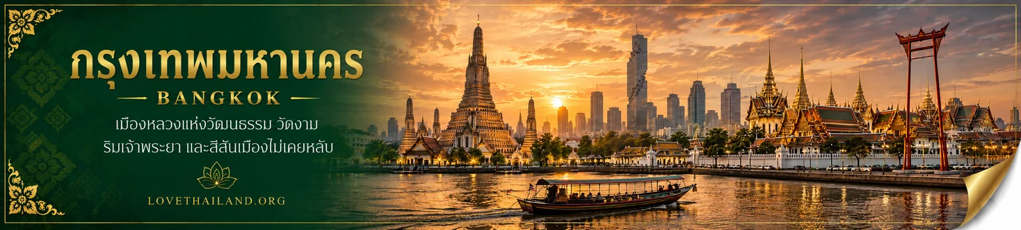
Chao Phraya Sky Park
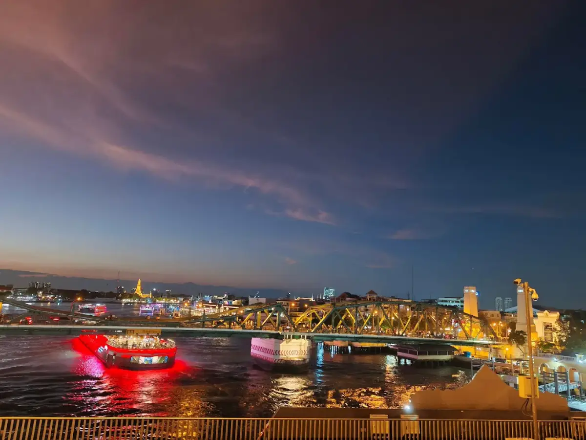
Open Days: Daily
Opening Hours: 5:00 AM – 8:00 PM
Admission Fee: Free Admission
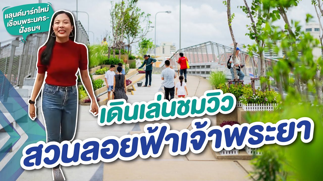
Chao Phraya Sky Park, Bangkok, Thailand, is a remarkable elevated public park and pedestrian viewpoint above the Chao Phraya River. Built on the central structure of Phra Pok Klao Bridge, it connects the historic Phra Nakhon district with the Thonburi side of Bangkok. One entrance is located near Phra Pok Klao Road in Wang Burapha Phirom Subdistrict, Phra Nakhon District, Bangkok 10200, while the opposite end connects with the riverside areas of Khlong San. The park features a landscaped pedestrian and cycling route approximately 280 meters long and 8.5 meters wide, with planted greenery, multi-level walkways, seating areas, and three distinctive viewpoints. Visitors can admire the Chao Phraya River, Memorial Bridge, historic temples, traditional riverside neighborhoods, and the Bangkok skyline from a panoramic elevated perspective. Officially opened to the public on June 24, 2020, Chao Phraya Sky Park operates daily from 5:00 AM to 8:00 PM, offers free admission, and is managed by the Bangkok Metropolitan Administration.
The significance of Chao Phraya Sky Park extends far beyond the creation of a green space above the river. The park represents the successful transformation of an abandoned bridge structure into a meaningful public facility. Its central viaduct was originally associated with an elevated railway project that was never completed. Decades later, the Bangkok Metropolitan Administration collaborated with urban development organizations to convert the unused structure into an accessible pedestrian route and recreational space. The project is therefore important not only as a scenic attraction but also as an example of architecture, landscape architecture, historic urban regeneration, and pedestrian connectivity between communities on opposite sides of the Chao Phraya River.
Chao Phraya Sky Park differs from conventional ground-level public gardens because the entire landscaped route occupies an elevated structure between the vehicle carriageways of Phra Pok Klao Bridge. Walking through the park creates the unusual sensation of being in a garden suspended above a major river, with flowing water below and city scenery extending in several directions. The route has been designed for leisurely walking, sightseeing, and cycling in designated areas. At the same time, it serves as a practical pedestrian connection between two historic neighborhoods rather than simply a viewing platform where visitors must return to their original starting point.
The park occupies a historically important part of Bangkok, where communities developed along both banks of the Chao Phraya River. On the Phra Nakhon side, it connects with Pak Khlong Talat, Chak Phet Road, Phra Pok Klao Road, and the area surrounding Memorial Bridge. On the Thonburi side, it provides access toward Kudi Chin, Khlong San, Wat Prayurawongsawat, and long-established riverside communities with rich commercial and multicultural histories. Walking across the park therefore offers more than a river crossing. It provides a connection between two parts of Bangkok whose distinctive historical identities have always been linked by the Chao Phraya.
The Chao Phraya River has been central to transportation, trade, and the livelihoods of Bangkok's residents since before the foundation of the Rattanakosin Kingdom. Many settlements developed beside the river because boats provided convenient transportation and water was essential for everyday activities. As Bangkok expanded and roads and bridges became increasingly important, the relationship between neighborhoods and the river gradually changed. Chao Phraya Sky Park is an example of urban development that allows people to reconnect with this historic waterway from a perspective entirely different from traveling by boat or walking at river level.
Phra Pok Klao Bridge stands close to Phra Phutthayotfa Bridge, commonly known as Memorial Bridge, which opened in 1932 to commemorate the 150th anniversary of the founding of Bangkok as the capital. Memorial Bridge has long played an important role in transportation between Phra Nakhon and Thonburi and is particularly recognizable for its steel structure. As Bangkok's traffic increased, Phra Pok Klao Bridge was constructed to provide additional road capacity. The presence of these two neighboring bridges makes the area an excellent place to observe changes in Bangkok's transportation infrastructure over different historical periods.
Phra Pok Klao Bridge opened in 1984. Its structure accommodated motor vehicles, while the central section was associated with plans for a future rail transit connection. The bridge was named in honor of King Prajadhipok, Rama VII, whose reign was associated with the construction of nearby Memorial Bridge. The position of Phra Pok Klao Bridge beside the older crossing reflects both the expansion of Bangkok's transport network and the historical continuity of efforts to connect the two banks of the Chao Phraya River.
The central structure of Phra Pok Klao Bridge, which later became Chao Phraya Sky Park, was associated with the Lavalin Skytrain project, an early attempt to develop an elevated urban rail system in Bangkok before the introduction of the city's modern mass-transit networks. A contract for the project was signed in 1990, but the scheme was not completed and was abandoned in the early 1990s. As a result, part of the intended railway structure remained unused for decades. Local people became familiar with the unfinished viaduct and sometimes referred to it as Saphan Duan, meaning the unfinished or truncated bridge, because it had no functioning railway connection.
For many years, the unused central viaduct represented infrastructure that had never fulfilled its original purpose. Although the bridge stood above the river in a location with considerable potential for connecting communities, the public could not make meaningful use of the abandoned section. Converting it into an elevated park gave the structure an entirely new role. What had once been a reminder of an unsuccessful transport project became a useful pedestrian corridor and recreational destination serving residents and visitors on both banks of the river.
The concept behind Chao Phraya Sky Park was closely connected with the regeneration of the historic Kudi Chin–Khlong San district and efforts to create better links between riverside public spaces. The project involved cooperation among the Bangkok Metropolitan Administration, the Department of Rural Roads, and the Urban Design and Development Center, which contributed expertise in urban research and design. The development focused on reusing the existing bridge structure while introducing pedestrian walkways, cycling facilities, greenery, and features intended to make the area accessible to people of different ages and abilities.
The project also formed part of a broader effort to improve pedestrian connectivity within Bangkok's historic riverside districts. In the past, major roads and bridges were designed primarily to accommodate motor vehicles, while pedestrians frequently had to follow indirect or inconvenient routes. Transforming the central bridge structure into a landscaped walkway created a new public connection across the river. It demonstrated how infrastructure originally intended for rail transportation could serve modern urban priorities involving walking, cycling, recreation, and improved access to public space.
Chao Phraya Sky Park officially opened on June 24, 2020, during a ceremony attended by representatives of the national government and Bangkok Metropolitan Administration. Following the opening, residents and tourists gained access to the pedestrian crossing and its viewpoints during designated operating hours. The park emerged at a time when cities were placing increasing importance on public space and urban greenery. It attracted attention as a creative example of how unused infrastructure could be repurposed to deliver social and environmental benefits.
Chao Phraya Sky Park has been presented as Thailand's first elevated public garden crossing a river. Its distinctive feature is the transformation of an unused bridge viaduct into a landscaped route that serves as a practical connection between two urban districts. This concept differs from ordinary rooftop gardens or elevated parks because the site stands above a major waterway and accommodates movement between neighborhoods. Tourists can enjoy the scenery while continuing their journey toward attractions on either bank without needing to retrace their steps.
The design makes efficient use of the approximately 280-meter-long and 8.5-meter-wide former viaduct. Pedestrian routes change elevation gradually in certain sections, with connecting paths and seating areas distributed along the structure. Planters introduce continuous greenery, softening the appearance of concrete and metal. At the same time, the planting arrangement preserves open views toward the river and the city, ensuring that vegetation enhances rather than obscures the park's main attraction.
The walking route is not simply a straight, uniformly level path. Some sections divide into pathways at different elevations before reconnecting. This arrangement creates a variety of perspectives, allowing visitors to see the river, bridges, and surrounding buildings from slightly different heights. The changes in level also make the landscape architecture more visually engaging without requiring the extensive land area available to conventional urban parks.
The multi-level walkways create opportunities for stepped seating and places to pause while enjoying the river views. Built-in seating allows visitors to observe passing boats and the surroundings without occupying the main pedestrian route for long periods. From certain positions, the steel structure of Memorial Bridge can be seen running beside Phra Pok Klao Bridge, creating an appealing contrast between historic bridge engineering and contemporary landscape design.
Protective railings have been installed along the exposed edges of Chao Phraya Sky Park. They are designed to provide protection while allowing visitors to appreciate the river views from designated positions. Since the park is elevated above the Chao Phraya and lies between active vehicle carriageways, visitors should use the authorized viewpoints and seating areas. Climbing railings or standing on planter edges for photographs is unsafe and unnecessary.
Creating greenery on a bridge requires different considerations from landscaping an ordinary ground-level garden. The structure is exposed to direct sunlight, wind, and restrictions on soil depth and planting weight. Selected plants must therefore tolerate the conditions of elevated planters while remaining practical to maintain. Species suited to Bangkok's climate and the structural limitations of the site help ensure that the garden can remain attractive without relying on very large trees requiring deep root systems.
The vegetation includes appropriately sized trees, shrubs, and groundcover plants. Water olive is among the principal tree species used in the landscaping. Other plants mentioned in the design information include cha khoi, bai tang rian, cat's whiskers, oleander, orchid tree, ruellia, and spiral ginger. Using different plant forms creates variety in leaf color, shape, and height while introducing a natural character into a setting dominated by bridges, roads, and urban buildings.
Although the planting areas are modest compared with those in a large public park, they play an important role in making the walkway more pleasant and welcoming. Green foliage reduces the visual hardness of concrete surfaces, metal railings, and nearby traffic lanes. Leaves, flowers, and groundcover also introduce seasonal and gradual changes as the plants grow, ensuring that the park retains a living character rather than appearing as a purely engineered pedestrian bridge.
The garden also contributes to the urban environment by offering small habitats and feeding opportunities for insects associated with flowers and other plants. Although the park cannot function like an extensive natural forest, it forms part of a wider network of urban greenery in a district containing dense buildings and roads. The planting therefore has ecological as well as visual value, illustrating how relatively small green spaces can contribute to the environmental diversity of a city.
Chao Phraya Sky Park contains three principal viewpoints: Lan Arun Rung, Lan Jai Chao Phraya, and Lan Tawan Ron. These locations provide different perspectives throughout the bridge and are associated with the changing light, the direction of the river, and the surrounding cityscape. Having several viewpoints encourages visitors to move through the entire park and provides opportunities for resting and observing rather than concentrating everyone at one location.
Lan Arun Rung is situated toward the Phra Nakhon side and is associated with the atmosphere of early morning. It is a natural starting point for visitors entering the park from the Pak Khlong Talat area. The viewpoint offers perspectives of the river, nearby buildings, and the bridge stretching across the water. As visitors move from the streets and market toward the elevated garden, the changing scenery creates a striking transition from the dense historic city to the broad open river.
Lan Jai Chao Phraya occupies a central position along the park and is especially notable for its panoramic views above the river. From this area, visitors can look along the Chao Phraya, observe Memorial Bridge, and watch boats moving below. Standing near the middle of the crossing feels different from viewing the river from a pier because water extends in several directions and both the Phra Nakhon and Thonburi banks can be appreciated simultaneously. This makes it one of the park's most rewarding locations for landscape photography and observing Bangkok's riverside environment.
Lan Tawan Ron is situated toward the Thonburi side and is associated with the late-afternoon and evening atmosphere. From this part of the park, visitors can look back toward Phra Nakhon and the bridge structures while appreciating the historic neighborhoods along the western bank. Changing positions along the walkway reveals different perspectives of the river and city, making sunset viewing an experience shaped by both the natural setting and the design of the elevated park.
The three viewpoints are not separate attractions requiring individual access. They are connected by the park's pathways and planting areas, allowing visitors to explore the entire length of the structure. Some may prefer positions with unobstructed views of Memorial Bridge, while others may be interested in temples, older riverside communities, or the flow of the Chao Phraya. The variety of perspectives makes walking through the complete park more rewarding than stopping for a single photograph.
From Chao Phraya Sky Park, visitors can enjoy wide views of Bangkok, including the Chao Phraya River, Memorial Bridge, passenger ferries, sightseeing boats, historic riverfront buildings, and modern structures farther away. On clear days, the outlines of temples and prominent buildings are visible in several directions, although the degree of visibility depends on the viewpoint and weather conditions. These diverse elements give the park considerable photographic appeal by combining natural water scenery with the architectural character of the city.
Memorial Bridge is one of the most recognizable landmarks visible from Chao Phraya Sky Park. Its steel structure runs close to the elevated garden, allowing visitors to compare two generations of bridge infrastructure. From the park, the historic bridge can be observed from angles that are difficult to appreciate while walking at street level. This perspective adds an educational dimension to the visit, revealing how the bridges were designed and how Bangkok's transportation network developed over time.
Watching the variety of boats passing along the Chao Phraya is another rewarding activity. Passenger vessels, ferries, tourist boats, and service craft use the waterway for different purposes. From above, visitors can clearly see their movements across the river, providing a perspective unavailable from most riverside pavements. Observing the boats also illustrates how the Chao Phraya remains an active transportation corridor in contemporary Bangkok.
The Phra Nakhon riverbank contains numerous buildings and commercial districts connected with the old city's history. Pak Khlong Talat, one of the most important nearby neighborhoods, is famous for its flower trade and its shops supplying flowers for ceremonies, decorations, and everyday use. From the elevated park, visitors can observe rooflines and roads leading toward the river. Exploring the market at street level afterward provides a closer understanding of its commercial atmosphere.
The Thonburi bank includes the historic Kudi Chin community, one of Bangkok's most culturally diverse riverside neighborhoods. The area is associated with Thai, Chinese, and Thai-Portuguese communities and contains religious buildings and homes reflecting different cultural traditions. Walking across the park from Phra Nakhon provides access to this historically rich neighborhood, allowing visitors to experience the social and cultural connections between communities on the two sides of the Chao Phraya.
Morning visits to Chao Phraya Sky Park offer a different atmosphere from those made in the evening because sunlight changes direction and intensity throughout the day. Visitors arriving shortly after opening can experience the cooler morning air and watch boats beginning their daily journeys. On clear mornings, sunlight may reflect across the river and filter through the surrounding skyline. This makes the early hours suitable for gentle exercise and photography before Bangkok's daytime heat becomes more intense.
Late morning and midday can be considerably warmer because the elevated park receives direct sunlight and does not have a continuous canopy of large trees. Although planters and seating areas provide a pleasant setting, the amount of shade remains limited compared with a ground-level park filled with mature trees. Visitors at these times may experience considerable exposure to sunlight and heat from paved surfaces, particularly on days with little wind across the river.
Late afternoon and early evening are particularly appealing because the sunlight becomes softer and the river reflects the changing colors of the sky. As boats move beneath the bridges, the water and shadows of nearby buildings create a continually changing scene. This is an excellent time for walking and photographing Bangkok from the middle of the river, particularly for visitors interested in the relationship between Memorial Bridge, the river, and the surrounding historic skyline.
Sunset viewing is one of the park's most popular experiences. The elevated setting and relatively open views provide opportunities to observe the changing sky. As the sun approaches the horizon, colors may shift from blue toward orange and gold before the lights of the city become more visible. The exact position of the setting sun varies with the season, and buildings may partially obscure it from certain viewpoints. The experience is therefore best understood as enjoying the evening colors over Bangkok rather than expecting the sun to set directly above the center of the river every day.
The period immediately after sunset offers another appealing atmosphere as natural light fades and the illumination of bridges and riverside buildings becomes more noticeable. Boats continue passing beneath the sky park, creating moving points of light across the water. Photographers can capture the river and illuminated cityscape before the park closes at 8:00 PM. The park's operating hours should not be confused with the road bridge's traffic arrangements, which are managed separately.
Photography at Chao Phraya Sky Park is especially interesting because of its architectural elements. Pathways, planters, protective railings, and the bridge structure create lines that draw attention toward the river and city skyline. The changes in walkway elevation allow photographers to combine nearby vegetation with more distant urban scenery. These compositions communicate the park's identity as a green public space embedded within Bangkok's transportation infrastructure.
Views incorporating Memorial Bridge are another defining photographic feature. The older bridge's distinctive steel structure can be captured alongside the modern elevated garden. Such images illustrate the development of Bangkok through infrastructure built during different periods. For people interested in architecture and urban history, the park is therefore an excellent place to study the contrasting design characteristics of two neighboring bridges.
Portrait photographs can use the walkways and greenery as foreground elements, with the Chao Phraya and Bangkok skyline forming the background. Visitors should choose spacious areas or designated viewpoints where taking photographs will not obstruct other park users. Climbing onto railings or planter edges is unnecessary and dangerous because the garden is elevated above the river and lies beside active road traffic. Memorable photographs can be created from safe positions.
People interested in documentary photography can use the park to observe boats and daily activities along the river. Photographs of passenger vessels passing beneath the bridge or tourist boats navigating the waterway reveal aspects of Bangkok's transportation system beyond its famous temples and landmarks. Such images can record the living character of the Chao Phraya and the relationship between the river and the surrounding communities.
Chao Phraya Sky Park is suitable for leisurely walking and light exercise because it provides a continuous elevated route connected to public spaces on both riverbanks. Local residents can incorporate it into their daily walks, while tourists can use it as part of an itinerary connecting Phra Nakhon and Kudi Chin. Its practical function as a pedestrian route means that the park contributes to everyday urban life rather than serving only as a sightseeing destination during weekends.
The cycling route forms part of the park's short river crossing, extending approximately 280 meters along the structure. Cyclists must share the environment considerately with other visitors, especially around viewpoints where people stop for photographs or rest. Appropriate speeds and giving priority to pedestrians help maintain safety in a space that is considerably narrower than a purpose-built cycling road.
Another important feature is the park's accessibility design. Elevators and connecting routes were incorporated to improve access for older visitors and wheelchair users. These facilities reflect the intention to create a public space that can serve people of different ages and physical abilities rather than only those comfortable climbing stairs. However, lift availability depends on operating conditions, and some pedestrian approaches outside the park contain road crossings or pavement features requiring additional care.
On the Phra Nakhon side, visitors can approach the park through the area of King Prajadhipok Park near Phra Pok Klao Bridge and Memorial Bridge. This ground-level green space provides a place to pause before ascending the elevated walkway and is connected with the roads leading toward Pak Khlong Talat. Travelers arriving from the flower market or Sanam Chai MRT Station can use the surrounding pavements to reach the park entrance. Road crossings should be made at designated points rather than by attempting to enter the bridge through active traffic lanes.
King Prajadhipok Park functions as an important green area at the Phra Nakhon end of the crossing. Its proximity to the sky park allows visitors to experience public landscapes at two different levels. The ground-level garden provides the beginning of the route, while the elevated park offers wide views over the river. Moving between them demonstrates the differences between planting in ordinary soil and creating a garden in containers on a bridge structure.
The Thonburi entrance connects with the commemorative forest park area near the western approach to Phra Pok Klao Bridge and the historic neighborhood around Wat Prayurawongsawat. Roads and walking routes continue toward Kudi Chin, Wat Kalayanamit, and other riverside communities. Visitors who cross from Phra Nakhon can therefore continue exploring the cultural attractions of Thonburi without having to walk back across the bridge immediately.
The contrast between the two banks is particularly interesting. Phra Nakhon contains Pak Khlong Talat, Phahurat, and Ban Mo, districts historically associated with different forms of commerce. Thonburi includes Kudi Chin and several religious communities reflecting the settlement of people with different cultural backgrounds. Walking across Chao Phraya Sky Park makes it possible to move between these historic environments within a relatively short distance.
The MRT is a convenient transport option for visitors who prefer not to bring a car into Phra Nakhon. Sanam Chai Station provides access to the old-town area, from which travelers can walk through Pak Khlong Talat and along Chak Phet Road toward the park. The route passes flower shops, commercial buildings, and busy local streets. Using the metro and walking allows the flower market and the elevated river viewpoint to become part of the same urban exploration.
Visitors traveling by bus can use services passing Memorial Bridge, Phra Pok Klao Road, or the Pak Khlong Talat area according to the routes currently operating. Since bus route numbers and stops may change as Bangkok's public transport network develops, the Memorial Bridge stop is a useful geographical reference. After disembarking, visitors can walk toward the designated park entrances. Care is necessary at crossings near the bridge approaches, where traffic is continuous and some roads carry vehicles at relatively high speeds.
River transportation can also be incorporated into a visit. Depending on operating boat routes, travelers can use piers around Memorial Bridge or Pak Khlong Talat and continue on foot to the Phra Nakhon entrance. Arriving by boat provides an opportunity to experience the Chao Phraya at water level before ascending to the elevated viewpoint. Boat routes, pier locations, and service schedules differ, so the selected landing point must correspond to the service being used.
Visitors arriving by private car can approach the area through Phra Pok Klao Road and surrounding streets. However, Chao Phraya Sky Park does not provide private car parking on the elevated structure itself. Drivers must use authorized parking facilities nearby and walk to the designated entrance. The surrounding historic district contains narrow streets and different parking restrictions, making appropriate parking arrangements important for avoiding traffic obstruction and unnecessary detours.
Chao Phraya Sky Park is open every day from 5:00 AM to 8:00 PM. These hours apply to the public garden and are separate from the operation of vehicle traffic on Phra Pok Klao Bridge. Visitors should not assume they can enter the park throughout the night simply because cars continue using the neighboring road lanes. The distinction is important for park management and public safety.
The park is managed by the Environment Department of the Bangkok Metropolitan Administration. Rommaneenart Park Office serves as the published contact office responsible for the area. Management responsibilities include maintaining cleanliness, caring for plants, regulating public use, and coordinating safety arrangements. People seeking information or wishing to contact the responsible authority can reach Rommaneenart Park Office at +66 2 221 5181.
Park regulations are particularly important because Chao Phraya Sky Park occupies an elevated bridge shared by different users. The Bangkok Metropolitan Administration prohibits activities including smoking, drinking alcoholic beverages, gambling, damaging vegetation, and unauthorized commercial trading. These rules help maintain order and ensure that the park remains suitable for recreation and public access.
Flying drones over the park is not permitted under the Bangkok Metropolitan Administration's published rules. The location is close to vehicle traffic and functions as a public pedestrian route above the river. Visitors therefore cannot operate unmanned aircraft freely for aerial photography. The elevated viewpoints already offer a variety of panoramic compositions without needing airborne equipment.
Walking through the park requires awareness of the narrow, linear environment above the river. Even with protective railings and seating areas, running or pushing others near exposed edges and changes in elevation is inappropriate. Families with children and groups accompanying older visitors should be particularly careful. People taking photographs should avoid blocking the principal route because the walkway also serves pedestrians crossing between the two banks and cyclists using the designated path.
Rain can make paved surfaces and stepped sections slippery, while the elevated bridge is directly exposed to winds moving along the river. Visitors should take additional care during wet or stormy conditions. Strong winds may also make umbrellas or loose belongings difficult to control. Avoiding exposed edges during severe weather is sensible because the park does not have a continuous roof protecting the entire route from rain or wind.
Chao Phraya Sky Park is suitable for family outings because entry is free and visitors can walk at their own pace. The route is short enough for a relaxed visit, although families may wish to allow additional time for rest stops and photography. Adults should supervise young children closely and prevent them from climbing railings or planters, as the park is elevated above the river and situated between active traffic lanes.
Older visitors can enjoy the park for walking and sightseeing. Seating areas are available at different points, and elevators were included in the design to improve access. Walking speed can be adjusted to individual needs, with breaks taken when appropriate. Although the park itself is relatively short, its changes in level and exposure to sunlight may affect comfort, so using a suitable entrance and the available rest areas can make the visit more enjoyable.
For wheelchair users, the park was designed with elevators and accessible connections in certain areas. This reflects an effort to make public spaces available to a wider range of people. Nevertheless, the complete journey also depends on the condition of pavements and crossings outside the park, as well as the operational status of the elevators on the day of the visit. Choosing the most suitable entrance can reduce difficulties associated with stairs and uneven street-level approaches.
Visitors interested in urban development can view Chao Phraya Sky Park as an example of giving existing infrastructure a new purpose. Large cities often contain structures that have become redundant or were never used as originally intended. Adapting such spaces for public recreation can reduce the need to find entirely new land while improving pedestrian mobility and the urban landscape. The transformation demonstrates how infrastructure reuse can provide several public benefits at once.
Reusing an abandoned structure also preserves part of the city's historical memory. The garden still occupies the central bridge viaduct associated with the unsuccessful Lavalin Skytrain project. Walking across it therefore introduces visitors to two periods of urban development: an earlier era focused on establishing rail-based mass transportation, and a later period emphasizing green public spaces, walkability, and improved access to the river.
Chao Phraya Sky Park contributes to pedestrian mobility by providing a route across the river that does not always require a private car or ferry. Walking allows residents and visitors to move between nearby communities and attractions using their own physical effort. More convenient pedestrian infrastructure expands the range of transport choices available within the city and encourages short local journeys to be made on foot.
The connection between Phra Nakhon and Thonburi also creates more opportunities for cultural sightseeing. Travelers can begin at Pak Khlong Talat, cross the elevated garden, and continue into Kudi Chin without needing a ferry for that particular crossing. The route links markets, traditional restaurants, religious buildings, and riverside public spaces. Walking between them allows visitors to observe the character of the city directly and understand how its historical neighborhoods relate to one another.
Pak Khlong Talat is one of the most important attractions near the Phra Nakhon entrance. The market is famous for fresh flowers, artificial flowers, garlands, and supplies for floral arrangements. Many businesses serve religious ceremonies, events, and the everyday floral needs of Bangkok residents. Exploring the market reveals an extraordinary range of colors and fragrances before visitors continue toward the open-air atmosphere of Chao Phraya Sky Park.
Commercial activity at Pak Khlong Talat changes throughout the day because flower deliveries and purchasing patterns vary among retailers and wholesale customers. Some businesses operate late at night or early in the morning, while others cater to daytime visitors. Combining a market visit with Chao Phraya Sky Park therefore provides an opportunity to experience both Bangkok's working commercial environment and its public recreational spaces.
Yodpiman River Walk is another nearby riverside development close to Pak Khlong Talat. It contains restaurants, retail spaces, and a promenade with architectural features distinct from those of Chao Phraya Sky Park. Visitors can enjoy river views from near water level before walking up to the elevated garden. Comparing the two perspectives reveals differences in the appearance of boats, buildings, and bridges, particularly when late-afternoon sunlight reflects across the river.
Phra Phutthayotfa Bridge, or Memorial Bridge, is a historic attraction immediately beside Chao Phraya Sky Park. Its steel architecture and long-standing role in connecting Phra Nakhon with Thonburi make it an important landmark in Bangkok's transportation history. Walking around the bridge area allows visitors to appreciate its engineering details, while the sky park provides broader views of the structure. The two attractions therefore complement each other as examples of bridge construction from different periods.
The King Rama I Memorial stands near the Phra Nakhon approach to Memorial Bridge. The monument commemorates King Buddha Yodfa Chulaloke, the founder of the Chakri dynasty and the first king of the Rattanakosin Kingdom. Visiting the monument alongside the bridge adds a historical dimension to the riverside experience, connecting transportation infrastructure with the founding of modern Bangkok.
Wat Ratchaburana Ratchaworawihan, also known as Wat Liap, is an important Buddhist temple in Phra Nakhon near Memorial Bridge. It is associated with the history of the Rattanakosin period and the surrounding historic communities. The temple grounds contain religious buildings and spaces used for Buddhist activities. Combining a visit with Chao Phraya Sky Park allows travelers to experience traditional religious architecture and a contemporary urban park within the same neighborhood.
Wat Prayurawongsawat Worawihan is an important temple on the Thonburi side near the sky park's western entrance. Its most recognizable feature is a large white chedi known as Phra Borommathat Maha Chedi. The temple has considerable historical and cultural significance within the Kudi Chin area. Walking from the park to the temple allows visitors to combine river scenery with Buddhist architecture and an introduction to the cultural heritage of the Thonburi communities.
The white chedi at Wat Prayurawongsawat is a striking landmark that can be recognized from the surrounding neighborhood. Visiting the temple provides an opportunity to appreciate historic religious architecture and understand how Buddhist institutions function within Bangkok's older urban communities. The temple also contains museum and heritage spaces associated with its history, adding educational value to a walking itinerary that includes the sky park and Kudi Chin.
Kudi Chin is a historic neighborhood distinguished by the coexistence of different cultural traditions. Buddhist temples, a Christian church, and Chinese religious sites are located within a relatively compact area. The neighborhood contains narrow lanes, traditional homes, and local food businesses reflecting its heritage. Exploring Kudi Chin after crossing the sky park offers a meaningful introduction to the multicultural identity of old Thonburi.
Santa Cruz Church is an important Catholic landmark in Kudi Chin. It is associated with the Thai-Portuguese community that settled in the area during the Thonburi period. The church has distinctive architectural features and is an important part of the neighborhood's cultural landscape. Visitors should respect religious activities and observe any restrictions on access, particularly during services and private events.
Wat Kalayanamit Woramahawihan is another important Buddhist temple on the Thonburi bank, near the mouth of Khlong Bangkok Yai and the Chao Phraya River. It is known for its large seated Buddha image and architectural elements reflecting Thai and Chinese influences. Visiting the temple after exploring the sky park and Kudi Chin reveals connections among Buddhist traditions, Chinese communities, and the historic commercial activity of Bangkok's river and canal districts.
Kian Un Keng Shrine is a Chinese religious site within Kudi Chin, notable for its architecture, decoration, and community history. Its presence near Santa Cruz Church and Wat Kalayanamit illustrates the area's diversity of religious traditions. Travelers beginning at Chao Phraya Sky Park can explore these sites on foot and gain an understanding of how different communities have lived alongside one another in Bangkok over generations.
Museum Siam is an important learning destination that can be connected with a visit to the sky park. Located on Sanam Chai Road near Sanam Chai MRT Station, it presents exhibitions exploring Thai identity, society, and culture through contemporary interpretation and interactive displays. Visiting the museum before or after the elevated park combines cultural education with direct observation of Bangkok's public spaces and historic urban environment.
Wat Phra Chetuphon Wimon Mangkhalaram, commonly known as Wat Pho, can also be included in a sightseeing route from the Phra Nakhon side of the park. Travelers can continue through the Pak Khlong Talat and Sanam Chai areas toward the temple, which is famous for its giant Reclining Buddha, chedis, and important works of Buddhist art. Combining Wat Pho with Chao Phraya Sky Park adds religious and historical depth to a visit centered on the river.
Phahurat, Bangkok's well-known textile and Indian cultural shopping district, lies within reach of the Phra Nakhon side of the sky park. It is known for fabric shops, clothing, spices, and restaurants reflecting the commercial traditions of Thai-Indian communities. Combining Phahurat with Pak Khlong Talat and the sky park introduces visitors to different forms of traditional commerce, local cultural life, and contemporary public-space development within Bangkok's old town.
Restaurants near Chao Phraya Sky Park are concentrated around Pak Khlong Talat, Yodpiman, and Tha Tien. The area offers Thai restaurants, international dining, cafés, and dessert shops within walking distance or a short onward journey. Visitors exploring the park in the morning can stop for a meal after descending toward the flower market, while those visiting in the late afternoon can combine the riverside walk with dinner at an establishment operating in the evening.
Farm to Table, Hideout is a café and dessert destination in Soi Tha Klang near Pak Khlong Talat. Located within the traditional built environment of Phra Nakhon, it offers a quieter atmosphere away from the market's busiest streets. Its menu includes beverages, light meals, and homemade ice cream, with an emphasis on distinctive ingredients and contemporary presentation. The café is suitable for visitors seeking a comfortable break after walking around the flower market and the elevated park.
NAGIYA at Yodpiman River Walk is a Japanese restaurant in a riverside setting. Its menu and dining style are suitable for groups of friends and visitors interested in international cuisine. The surrounding Yodpiman neighborhood connects the flower market with nearby piers and the Chao Phraya River. Dining here after a visit to the sky park provides an opportunity to enjoy the river from a lower perspective, offering a contrast with the elevated views experienced on the bridge.
Ohh Khun Phra is a Thai restaurant in the Pak Khlong Talat and Rachini Road area. It is known for a varied selection of Thai dishes, including preparations inspired by traditional recipes. Dining in this neighborhood allows visitors to experience the atmosphere of Bangkok's old commercial district, where markets and historic shophouses occupy the surrounding streets. It is another suitable option for a substantial meal following a walk across the sky park.
Supanniga Eating Room at Tha Tien is a riverside Thai restaurant offering traditional and contemporary Thai dishes with views toward Wat Arun across the Chao Phraya. Visitors can continue from the Phra Nakhon end of the sky park through Pak Khlong Talat and along Maharaj Road. A meal in Tha Tien introduces another perspective on Bangkok's riverfront, particularly for those interested in views of Wat Arun and the old-town buildings during the evening.
Sala Rattanakosin Eatery and Bar is situated within a riverside hotel in Tha Tien. It offers Thai and international dining in a setting overlooking the Chao Phraya River and Wat Arun. The restaurant is appropriate for visitors seeking a meal accompanied by views of Bangkok's historic riverfront. A journey from the sky park toward Tha Tien can also include Museum Siam and Wat Pho, creating an itinerary combining riverside scenery, heritage attractions, and dining.
Accommodation near Chao Phraya Sky Park includes smaller properties in Phra Nakhon and riverside boutique hotels around Tha Tien. Travelers who want to explore Pak Khlong Talat, Phahurat, and major attractions on Rattanakosin Island can choose accommodation in Phra Nakhon with convenient connections to the MRT and river transportation. Those seeking river views from their rooms can consider properties around Tha Tien, where hotels overlook the Chao Phraya and Wat Arun.
Bangkok Bed and Bike is an accommodation property near the Si Kak Phraya Si intersection and Charoen Krung Road. Its concept is connected with old-town sightseeing and cycling. Guests can use the neighborhood as a base for exploring Pak Khlong Talat, Chao Phraya Sky Park, and important attractions within Phra Nakhon. Its location among traditional streets and commercial districts offers an opportunity to experience daily neighborhood life before walking toward the elevated river viewpoint.
Aurum The River Place is a small boutique hotel in the Tha Tien area near the Chao Phraya River. Its location provides convenient access to Wat Pho, Museum Siam, and nearby river piers. Travelers staying here can combine an exploration of the old town with a visit to Chao Phraya Sky Park, walking from Tha Tien through Pak Khlong Talat toward the Phra Pok Klao Bridge entrance.
Riva Arun Bangkok is a riverside boutique hotel on Maharaj Road, known for its views of Wat Arun across the Chao Phraya. The property offers accommodation and dining facilities within Bangkok's historic district. Guests can explore temples and museums before walking toward Chao Phraya Sky Park through Tha Tien and Pak Khlong Talat, combining several attractions within one convenient sightseeing route.
Sala Rattanakosin Bangkok is another boutique riverside hotel emphasizing views of Wat Arun and the Chao Phraya River. Its dining and recreational spaces contribute to the experience of staying near Bangkok's historic landmarks. The location allows guests to explore Chao Phraya Sky Park and nearby Phra Nakhon attractions without needing to travel from distant commercial districts each day.
Chakrabongse Villas is a riverside property in Tha Tien with historical connections to the Thai royal family and distinctive heritage architecture. Its garden setting creates a peaceful atmosphere within Bangkok's old town. The property's appeal lies in the combination of a private environment with proximity to Wat Pho and other cultural landmarks. Guests can connect a visit to the sky park with an exploration of Pak Khlong Talat and the surrounding historic neighborhoods.
INN A DAY is a small boutique hotel in the Tha Tien neighborhood, located near the Chao Phraya River with views of Wat Arun from certain parts of the property. Its design reflects the character of Bangkok's old-town accommodation scene. Using Tha Tien as a base allows guests to visit Museum Siam, Wat Pho, Pak Khlong Talat, and Chao Phraya Sky Park with considerable flexibility.
Budget-conscious travelers can also find smaller guesthouses and hostels within Phra Nakhon, providing alternatives to higher-priced riverside boutique hotels. The Charoen Krung and Sampheng areas offer connections to MRT stations and the city's main road network. Staying near public transportation makes it easier to explore other parts of Bangkok while keeping Chao Phraya Sky Park accessible as a free sightseeing destination.
A half-day walking itinerary can begin at Sanam Chai MRT Station, continue through Pak Khlong Talat and Yodpiman River Walk, and then reach the Phra Nakhon entrance to Chao Phraya Sky Park. After enjoying the elevated views and crossing the river, visitors can continue to Wat Prayurawongsawat and the Kudi Chin community. This route combines a traditional flower market, contemporary public space, historic bridges, and important religious landmarks within an area connected by pedestrian routes.
For a longer day of sightseeing, visitors can explore Wat Kalayanamit, Santa Cruz Church, and Kian Un Keng Shrine after descending on the Thonburi side. Spending time in Kudi Chin reveals the coexistence of different religious and cultural traditions within the same neighborhood. Travelers can later return across the bridge or use other appropriate transportation. This itinerary allows the sky park to function as a connection between two historic riverside districts rather than merely a brief photography stop.
Visitors interested primarily in photography and dining can begin at Chao Phraya Sky Park in the late afternoon to enjoy the softer light and river scenery. Afterward, they can descend toward Pak Khlong Talat and continue to a restaurant around Yodpiman or Tha Tien. The route captures Bangkok's transition from daylight into the evening, including the changing illumination of Memorial Bridge and the atmosphere of riverside restaurants opening for dinner.
Travelers interested in architecture and urban history can use the sky park as a starting point for learning about Phra Pok Klao Bridge and nearby Memorial Bridge. The route can continue toward the King Rama I Memorial and historic communities on the Thonburi bank. This approach reveals connections among bridge construction, transportation development, and changing uses of riverside land over several decades.
Chao Phraya Sky Park also offers educational value for people interested in landscape architecture. It illustrates how greenery can be introduced onto an existing structure with limitations in area and structural loading. Planters, vegetation suited to elevated conditions, and carefully organized pedestrian routes are all different from conventional ground-level landscaping. Observing the design on site demonstrates how urban greenery and open river views can be integrated into a relatively narrow bridge.
The park's design also illustrates the challenge of accommodating different users within the same public space. Walkers, cyclists, older visitors, families, and tourists stopping for photographs all share the route. Seating areas and changes in walkway level provide places for different activities within the limited space, but successful use also depends on visitors cooperating, giving way to others, keeping the area clean, and respecting park regulations.
From an environmental perspective, Chao Phraya Sky Park adds greenery to a densely developed section of Bangkok. Although the garden is relatively small, transforming an elevated bridge structure into a planted public space introduces natural elements into an area dominated by roads and buildings. It demonstrates how urban green spaces can be created without relying exclusively on large vacant plots of land, provided that the design responds appropriately to existing structural and engineering constraints.
The pleasant pedestrian connection also supports cultural tourism by allowing visitors to travel short distances on foot instead of relying entirely on motor vehicles. Walking makes it easier to notice historic buildings, neighborhood details, and traditional shops along the route. By linking riverside scenery, cultural heritage, and daily community life, the park contributes to a more integrated sightseeing experience.
Chao Phraya Sky Park allows visitors to experience the Chao Phraya River from a perspective unavailable at most ordinary riverside attractions. The elevated viewpoint reveals the river's course and the movements of boats across a broad area, while descending toward Pak Khlong Talat or Kudi Chin provides a closer look at the communities on the banks. Combining both levels helps visitors understand the relationship between Bangkok and its river as a transportation corridor, center of commercial activity, and public recreational environment.
The best time to visit depends on the purpose of the outing. Morning is suitable for light exercise before the weather becomes hot. Late afternoon and evening are popular for photography because the sunlight softens and the colors of the sky change above the river. Travelers combining the park with temples or museums should plan those attractions around their official visiting hours before enjoying the sky park, which remains open until 8:00 PM.
A typical visit to Chao Phraya Sky Park takes approximately 20–40 minutes when walking across the bridge and stopping at the principal viewpoints. Visitors who wish to take photographs or sit and enjoy the river may spend approximately 45–60 minutes or longer. With a route of only about 280 meters, the park does not require several hours of walking. Its value lies in the opportunity to pause, observe the changing river scenery, and experience Bangkok from an unusual elevated position.
Chao Phraya Sky Park is distinctive because it functions simultaneously as a public garden, a pedestrian river crossing, and a panoramic viewpoint. These three roles make it valuable to different groups. People commuting between neighborhoods can use the route for transportation, residents can enjoy a short walk, and tourists can connect the historic attractions of Phra Nakhon with those of Kudi Chin. This diversity of uses gives the park a broader public purpose than a destination designed exclusively for sightseeing.
Although Chao Phraya Sky Park is much smaller than Bangkok's major public parks, its limited dimensions are part of what makes the project interesting. The garden occupies an existing bridge structure with fixed dimensions, requiring every section to be used carefully. Multi-level paths, planted areas, seating, and viewpoints were integrated into this constrained setting. Seeing the formerly unused viaduct filled with visitors illustrates how creative public-space design can transform neglected infrastructure into an attractive urban destination.
Connecting green spaces at both ends of the bridge gives Chao Phraya Sky Park a role within Bangkok's wider public-space network. Walking from King Prajadhipok Park across the elevated garden toward the green space on the Khlong San side creates a continuous recreational route despite the surrounding roads and vehicle bridges. This arrangement highlights the importance of connecting individual parks and pedestrian routes rather than developing isolated public spaces without consideration for how people travel between them.
The views from the park also reveal differences between the urban landscapes on the two banks. Phra Nakhon contains traditional commercial buildings, markets, and landmarks connected with Rattanakosin history. Thonburi includes riverside communities, religious buildings, and neighborhoods that have evolved from earlier settlement patterns. Standing near the middle of the crossing allows visitors to appreciate these contrasting environments simultaneously, with the Chao Phraya River providing the central link between them.
Getting There Chao Phraya Sky Park is located on the central structure of Phra Pok Klao Bridge, Phra Pok Klao Road, Wang Burapha Phirom Subdistrict, Phra Nakhon District, Bangkok 10200, Thailand, and connects with the Khlong San side of the Chao Phraya River. The approximate coordinates of the park's central section are 13.73910, 100.49859. Visitors traveling by MRT can get off at Sanam Chai Station and walk through Pak Khlong Talat toward King Prajadhipok Park and the Phra Nakhon entrance. Bus passengers can use services stopping near Memorial Bridge and continue on foot. Those approaching from Thonburi can reach the western entrance near the Phra Pok Klao Bridge approach, Kudi Chin, and Wat Prayurawongsawat. The park opens daily from 5:00 AM to 8:00 PM, and admission is free. It is managed by the Environment Department of the Bangkok Metropolitan Administration. For further information, contact Rommaneenart Park Office at +66 2 221 5181.
Chao Phraya Sky Park is an outstanding example of transforming unused infrastructure into a valuable public destination. The former bridge structure associated with the abandoned Lavalin Skytrain project has become an elevated garden containing pedestrian and cycling paths, greenery, seating areas, and three panoramic viewpoints above the Chao Phraya River. The park contributes to recreation, exercise, pedestrian connectivity, and public understanding of Bangkok's urban development. With views of Memorial Bridge, access to Pak Khlong Talat, Wat Prayurawongsawat, and the historic Kudi Chin neighborhood, it offers a memorable way to experience the relationship between Bangkok's people, communities, bridges, and river. Chao Phraya Sky Park is therefore not simply a scenic walkway but a meaningful part of the city's evolving public landscape.
| Place Name | Chao Phraya Sky Park, Bangkok, Thailand |
| Other Names | Phra Pok Klao Sky Park, Phra Pok Klao Bridge Sky Garden |
| Type of Attraction | Elevated Public Park, Pedestrian and Cycling River Crossing, Panoramic River and City Viewpoint |
| Address | Phra Pok Klao Bridge, Phra Pok Klao Road, Wang Burapha Phirom Subdistrict, Phra Nakhon District, Bangkok 10200, Thailand, Connecting with the Khlong San Riverbank |
| Central Park Coordinates | 13.73910, 100.49859 |
| Managing Authority | Environment Department, Bangkok Metropolitan Administration, with Rommaneenart Park Office as the Published Contact Office |
| Open Days | Daily |
| Opening Hours | 5:00 AM – 8:00 PM |
| Admission Fee | Free Admission |
| Current Status | Open to the Public During Normal Operating Hours |
| Official Opening Date | June 24, 2020 |
| History | Converted from the Unused Central Viaduct of Phra Pok Klao Bridge, Originally Associated with the Abandoned Lavalin Skytrain Project, into a Landscaped Public Park and Pedestrian River Crossing |
| Project Partners | Bangkok Metropolitan Administration, Department of Rural Roads, and Urban Design and Development Center |
| Walkway Length | Approximately 280 Meters |
| Width | Approximately 8.5 Meters |
| Design Features | Multi-Level Pedestrian and Cycling Routes, Planted Areas, Seating, Protective Railings, Connecting Walkways, and Elevated Viewpoints Over the Chao Phraya River |
| Main Viewpoints | 1. Lan Arun Rung (Morning Light Viewpoint) 2. Lan Jai Chao Phraya (Heart of the Chao Phraya Viewpoint) 3. Lan Tawan Ron (Sunset Viewpoint) |
| Notable Plants | Water Olive, Cha Khoi, Bai Tang Rian, Cat's Whiskers, Oleander, Orchid Tree, Ruellia, and Spiral Ginger |
| Visible Landmarks | Chao Phraya River, Memorial Bridge, Passenger Boats, Historic Phra Nakhon and Thonburi Communities, Old-Town Buildings, and the Bangkok Skyline |
| Activities | Walking, River Viewing, Photography, Light Exercise, Cycling on the Designated Route, and Pedestrian Exploration of Attractions on Both Riverbanks |
| Best Time to Visit | Morning for Walking and Light Exercise; Late Afternoon to Evening for River Views and Photography |
| Recommended Visit Duration | Approximately 20–40 Minutes for a Walk and Main Viewpoints, or 45–60 Minutes Including Photography and Rest Stops |
| Facilities | Pedestrian and Cycling Paths, Protective Railings, Seating, Tiered Viewing Areas, Elevators for Older and Wheelchair-Using Visitors, and Ground-Level Parks Near Both Entrances |
| Prohibited Activities | Drone Flying, Smoking, Alcohol Consumption, Gambling, Unauthorized Trading, and Damaging Plants |
| Phra Nakhon Entrance | Near King Prajadhipok Park, Phra Pok Klao Road, Pak Khlong Talat, and Memorial Bridge |
| Thonburi Entrance | Park Area Near the Western Approach to Phra Pok Klao Bridge, Khlong San, Close to Kudi Chin and Wat Prayurawongsawat |
| Getting There by MRT | Take the MRT Blue Line to Sanam Chai Station, Then Walk Through Pak Khlong Talat Toward the Phra Nakhon Entrance. |
| Getting There by Bus | Use a Bus Serving Memorial Bridge or Phra Pok Klao Road, Then Walk to the Designated Park Entrance. |
| Getting There by Boat | Use an Operating Boat Service Calling at a Pier Near Memorial Bridge or Pak Khlong Talat, Then Continue on Foot to the Phra Nakhon Entrance. |
| Contact Number | Rommaneenart Park Office: +66 2 221 5181 |
| Nearby Tourist Attractions | 1. Phra Phutthayotfa Memorial Bridge, approximately 0.2 km 2. King Prajadhipok Park, Phra Nakhon Bridge Approach, approximately 0.2 km 3. Pak Khlong Talat Flower Market, approximately 0.5 km 4. Yodpiman River Walk, approximately 0.7 km 5. Wat Ratchaburana Ratchaworawihan, approximately 0.6 km 6. Wat Prayurawongsawat Worawihan, Thonburi, approximately 0.7 km 7. Santa Cruz Church, Kudi Chin, approximately 1.3 km, Tel. +66 2 472 0154 8. Wat Kalayanamit Woramahawihan, approximately 1.5 km, Tel. +66 96 362 5354 9. Kian Un Keng Shrine, approximately 1.4 km 10. Museum Siam, approximately 1.6 km, Tel. +66 2 225 2777 |
| Nearby Restaurants and Cafés | 1. Farm to Table, Hideout, Soi Tha Klang, approximately 0.7 km, Tel. +66 2 004 8771 2. NAGIYA, Yodpiman River Walk, approximately 0.8 km, Tel. +66 80 823 7727 3. Ohh Khun Phra, Pak Khlong Talat Area, approximately 1.2 km, Tel. +66 89 897 3278 4. Supanniga Eating Room, Tha Tien, approximately 1.7 km, Tel. +66 92 253 9251 5. Sala Rattanakosin Eatery and Bar, Tha Tien, approximately 1.6 km, Tel. +66 2 622 1388 |
| Nearby Accommodations | 1. Bangkok Bed and Bike, Si Kak Phraya Si Area, approximately 1.1 km, Tel. +66 94 487 8058 2. Aurum The River Place, Tha Tien, approximately 1.5 km, Tel. +66 2 622 2248 3. Riva Arun Bangkok, approximately 1.6 km, Tel. +66 2 221 1188 4. Sala Rattanakosin Bangkok, approximately 1.5 km, Tel. +66 2 622 1388 5. Chakrabongse Villas, Tha Tien, approximately 1.4 km, Tel. +66 2 222 1290 6. INN A DAY, Tha Tien, approximately 1.6 km, Tel. +66 2 221 0577 |
Frequently Asked Questions (FAQ)
Q: Where is Chao Phraya Sky Park, and what makes it special?
A: Chao Phraya Sky Park is located on the central structure of Phra Pok Klao Bridge, Phra Pok Klao Road, Wang Burapha Phirom Subdistrict, Phra Nakhon District, Bangkok, connecting with the Khlong San riverbank. Its highlights include a 280-meter pedestrian and cycling route, greenery above the river, and three panoramic viewpoints overlooking the Chao Phraya, Memorial Bridge, and the historic neighborhoods on both banks.
Q: Is Chao Phraya Sky Park still open, what are its opening hours, and is admission free?
A: Chao Phraya Sky Park remains open daily from 5:00 AM to 8:00 PM. Admission is free. The park is managed by the Environment Department of the Bangkok Metropolitan Administration. For information, contact Rommaneenart Park Office at +66 2 221 5181.
Q: What is the history of Chao Phraya Sky Park, and when did it open?
A: The park was developed from the unused central viaduct of Phra Pok Klao Bridge, originally associated with the abandoned Lavalin Skytrain project. After the structure remained unused for decades, the Bangkok Metropolitan Administration and its urban development partners converted it into a public garden and pedestrian river crossing. It officially opened on June 24, 2020.
Q: How can visitors reach Chao Phraya Sky Park by MRT or bus?
A: Take the MRT Blue Line to Sanam Chai Station and walk through Pak Khlong Talat toward the Phra Nakhon entrance. Alternatively, use a bus serving the Memorial Bridge area and continue on foot. Visitors approaching from Thonburi can use the entrance near the western end of Phra Pok Klao Bridge, close to Kudi Chin and Wat Prayurawongsawat.
Q: How many viewpoints are there, and can visitors watch the sunset?
A: There are three principal viewpoints: Lan Arun Rung, Lan Jai Chao Phraya, and Lan Tawan Ron. They provide broad views of the Chao Phraya River, Memorial Bridge, and riverside buildings. Late afternoon and early evening are particularly suitable for sunset colors and photography, depending on weather conditions and the sun's position.
Q: Is Chao Phraya Sky Park suitable for older visitors, wheelchair users, and children?
A: The park was designed with elevators to assist older visitors and wheelchair users, along with seating areas at different points. Families can bring children for sightseeing, but adults should supervise them closely because the park stands above the river between traffic lanes. Elevator availability and accessibility along the external pedestrian approaches depend on conditions at each entrance.
Q: How long does a visit take, and is cycling permitted?
A: Walking through the park and visiting its main viewpoints generally takes about 20–40 minutes. Allow approximately 45–60 minutes when including photography and rest stops. The park includes a cycling route approximately 280 meters long. Cyclists should use an appropriate speed and give priority to pedestrians sharing the space.
Q: What attractions, restaurants, and accommodation are available near Chao Phraya Sky Park?
A: Nearby attractions include Memorial Bridge, Pak Khlong Talat, Yodpiman River Walk, Wat Prayurawongsawat, Kudi Chin, Santa Cruz Church, Wat Kalayanamit, and Museum Siam. Dining options include Farm to Table, Hideout, NAGIYA, Ohh Khun Phra, Supanniga Eating Room, and Sala Rattanakosin Eatery and Bar. Accommodation options include Bangkok Bed and Bike, Aurum The River Place, Riva Arun Bangkok, Sala Rattanakosin Bangkok, Chakrabongse Villas, and INN A DAY.
 Category: ●Nature and Wildlife
 Group: ●Other natural attractions
Last Update : 6 DayAgo
 Last Update : 6 DayAgo
 Click to Access the Navigation Map GPS
Chao Phraya Sky Park Map
Recommend

 Art, Culture and Heritage
 Historical Sites and Monuments(3)
 Landmarks and Memorials(25)
 Royal Palace(13)
 Art, Craft Centres, Tradition(36)
 Museums(63)
 Historic Homes and Cities(5)
 Art Gallery(18)
 Educational Places
 Museum for Study(6)
 Library(5)
 University
 Public university(8)
 Autonomous Universities(8)
 Rajamangala University of Technology(6)
 Rajabhat University(6)
 Private University(22)
 Places of Worship
 Temple(73)
 Church(2)
 Mosque(67)
 Other Sacred Sites(9)
 Research and Development
 Royal Project(1)
 Suburban Living
 Village, Community(7)
 Local Market(19)
 Floating Market(4)
 River, Canal(4)
 Bays and Beaches(1)
Other natural attractions(3)
 Entertainment and Agricultural
 Zoos and Aquariums(5)
 Animal camps and shows(5)
 Stadium(9)
 Farms, Parks and Ecotourism(22)
 Amusement Park(2)
 Waterpark(4)
 Theater(7)
 Cinema(1)
 Shopping
 Shopping and Night Market(28)
 Department Store(44)
 Spas and Wellness
 Spas and Wellness(1)
 Restaurant
 Michelin Star(5)
 Accommodation
 Hotel(3)
 Call Customer Service in Tourism
 Call Customer Service in Tourism(1)
 Travel Articles, Recipes
 Travel Review, Food Review(52)
 Royal Thai Desserts and Recipes(56)


