
lovethailand home >North Travel Attractions >Tak Travel Attractions > Western Thailand Map with All 5 Provinces and Majo..
TL;DR: Western Thailand Map with All 5 Provinces and Major Tourist Attractions.
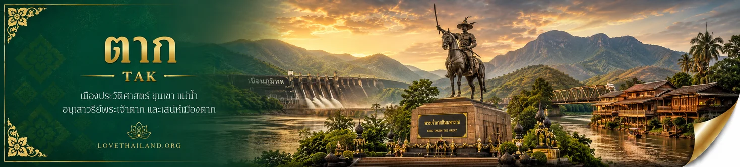
Western Thailand Map with All 5 Provinces and Major Tourist Attractions

Western Thailand Map with All 5 Provinces and Major Tourist Attractions is a guide to understanding provincial locations, geographical characteristics, border areas, river systems, and tourist destinations across western Thailand. Under the country’s six-region geographical classification, Western Thailand comprises five provinces: Tak, Kanchanaburi, Ratchaburi, Phetchaburi, and Prachuap Khiri Khan. The region is characterized by mountains and extensive forests along the Thailand–Myanmar border, river valleys and foothill plains, and the Gulf of Thailand coastline in Phetchaburi and Prachuap Khiri Khan. Reading the map together with information on each province reveals the contrasts between the mountainous north, the historic towns of the central area, and the seaside destinations farther south.
How Many Provinces Are in Western Thailand? Under the geographical classification of the National Geographical Committee, there are five: 1. Tak, 2. Kanchanaburi, 3. Ratchaburi, 4. Phetchaburi, and 5. Prachuap Khiri Khan. Tak occupies the northernmost part of this group, while Prachuap Khiri Khan stretches farther south along the Gulf of Thailand. Listing the provinces from north to south provides a straightforward way to read the map and is helpful when developing travel itineraries or understanding the locations of destinations.
Readers may have encountered maps of Western Thailand showing more than five provinces because different agencies use different regional divisions. Under some economic and social planning systems, Western Thailand comprises eight provinces: Suphan Buri, Kanchanaburi, Nakhon Pathom, Samut Sakhon, Samut Songkhram, Ratchaburi, Phetchaburi, and Prachuap Khiri Khan, while Tak is assigned to the North. This article consistently follows the five-province geographical classification. Explaining the distinction at the outset helps avoid confusion when comparing school maps, travel websites, and government references.
A map of Western Thailand shows a region extending mainly from north to south. Its western side borders Myanmar and contains complicated mountain systems, while its eastern side connects with provinces in Northern and Central Thailand. High mountains and forests form the headwaters of important river basins. Foothill plains and river valleys support towns, farming communities, and transportation routes. Along the Gulf of Thailand, the coastline becomes prominent in Phetchaburi and continues south through Prachuap Khiri Khan. Western Thailand therefore offers a much greater variety of landscapes than the familiar image of waterfalls and forested mountains alone.
The mountains along the Thailand–Myanmar border are associated with the Thanon Thong Chai and Tenasserim ranges, two major geographical features of Western Thailand. Tak and Kanchanaburi contain high mountains, valleys, and extensive forests. Ratchaburi and Phetchaburi combine mountainous areas and plains linked to the wider western forest system, while parts of southern Prachuap Khiri Khan have mountains situated close to the coast. These different landforms influence local climates, vegetation, and transportation conditions. Mountain roads in particular require closer attention to distances, weather, and road conditions than travel along major highways.
Important rivers of Western Thailand include the Ping River in Tak; the Khwae Yai and Khwae Noi rivers in Kanchanaburi, which converge to form the Mae Klong River; the Phachi River in the Ratchaburi area; and the Phetchaburi River, which crosses agricultural plains before reaching the Gulf of Thailand. These waterways have shaped settlement patterns, irrigation, transportation, and community cultures for generations. Their historical influence remains evident in riverside towns, historic bridges, dams, ancient temples, markets, and agricultural landscapes located throughout the different river basins.
Which Provinces in Western Thailand Have a Coastline? Phetchaburi and Prachuap Khiri Khan are the two provinces in this geographical group that directly border the Gulf of Thailand. Phetchaburi has coastal destinations such as Cha-am and Hat Chao Samran. Prachuap Khiri Khan has a long coastline featuring Hua Hin, Ao Manao, Ban Krut, and the coastal areas of Khao Sam Roi Yot National Park. Tak, Kanchanaburi, and Ratchaburi have no seacoast, but offer mountains, waterfalls, historic towns, and agricultural communities. Recognizing this difference is useful when deciding between seaside trips and mountain or forest excursions.
Western Thailand is of exceptional ecological importance, especially its connected border forests, which provide wildlife habitat and protect important watersheds. The Kaeng Krachan Forest Complex, extending into parts of Ratchaburi, Phetchaburi, and Prachuap Khiri Khan, was inscribed on the UNESCO World Heritage List as a natural property in 2021. Its value lies not only in scenic mountains and forests but also in biodiversity, ecological connectivity, and the long-term conservation of natural habitats for future generations. Visits to national parks and wildlife sanctuaries must therefore follow the regulations and access requirements established by their respective management authorities.
Historically, Western Thailand encompasses border towns and routes that have connected the territories of present-day Thailand and Myanmar. Kanchanaburi preserves sites associated with the Thailand–Burma Railway during World War II as well as historic settlements from several earlier periods. Tak has served as an important frontier town and transportation corridor. Ratchaburi has a longstanding history of settlements along the Mae Klong River; Phetchaburi is distinguished by artistic heritage and a hilltop royal palace; and Prachuap Khiri Khan reflects the interaction between coastal towns, maritime trade, and modern tourism. Learning about the history of each province gives the map meaning beyond its administrative boundaries.
Western Thailand has a diverse cultural landscape shaped by communities of many backgrounds, including Thai-Mon communities, Karen and other highland ethnic groups, Thai-Chinese communities in historic trading quarters, and coastal fishing villages. Their ways of life are expressed through languages, clothing, food, handicrafts, religious sites, markets, and local festivals. Travelers should take time to understand community histories and respect local rules, particularly in border communities and protected areas where access arrangements may differ from those at ordinary tourist attractions.
Western Thailand is served by major highways connecting its central and southern provinces with Bangkok, while Tak has routes linking the north with Mae Sot and Umphang. Those interested in wartime history and river communities may organize a multi-day Kanchanaburi–Ratchaburi itinerary. Travelers looking for historic architecture and beaches can continue from Phetchaburi to Prachuap Khiri Khan. Grouping destinations by geography and accessibility gives visitors more time at important places than attempting to cover all five provinces within an unrealistically short trip.
The attractions selected for this article represent the distinctive characteristics of each province rather than popularity alone. They also illustrate the connections between geography, history, and culture. Thi Lo Su Waterfall reveals the importance of the western forests; the Bridge over the River Kwai links wartime history with the river landscape; Damnoen Saduak Floating Market demonstrates canal-based lifestyles; Phra Nakhon Khiri reflects architectural heritage; and Khao Sam Roi Yot National Park brings limestone mountains, wetlands, and coastal environments together in one protected area.
Complete List of the 5 Provinces in Western Thailand, with English Names, Geographical Characteristics and Major Tourist Attractions
| Province | Geography and Location on the Map | Major Tourist Attractions |
| 1. Tak | Northernmost of the five provinces; mountains and forests along the Thailand–Myanmar border, the Ping River, and the towns of Mae Sot and Umphang. | Thi Lo Su Waterfall, Bhumibol Dam, and King Taksin the Great Shrine. |
| 2. Kanchanaburi | River valleys of the Khwae Yai, Khwae Noi and Mae Klong rivers, with border mountains and extensive forests. | Bridge over the River Kwai, Erawan Waterfall, Thailand–Burma Railway, and Sangkhla Buri. |
| 3. Ratchaburi | The Mae Klong River floodplain and western mountain areas, with historic communities and agricultural land. | Damnoen Saduak Floating Market, Khao Ngu Stone Park, Suan Phueng, and Wat Mahathat Worawihan. |
| 4. Phetchaburi | Western mountains and headwater forests, the Phetchaburi River plain, and a Gulf of Thailand coastline. | Phra Nakhon Khiri Historical Park, Kaeng Krachan National Park, Cha-am, and Khao Luang Cave. |
| 5. Prachuap Khiri Khan | A long province along the Gulf of Thailand, with limestone mountains, wetlands, and coastal landscapes. | Khao Sam Roi Yot National Park, Hua Hin, Ao Manao, and Phraya Nakhon Cave. |
The provincial table clearly illustrates the region’s geographical contrasts. Tak and Kanchanaburi are dominated by forests, mountains, and border routes. Ratchaburi forms a transition between the Mae Klong lowlands and the western mountains. Phetchaburi and Prachuap Khiri Khan have both mountainous landscapes and a coastline. Travelers should therefore plan according to geography and actual journey times rather than assuming that provinces in the same region are necessarily close to one another.
Tak Province is situated at the northern end of Western Thailand under the regional classification used in this article. Its landscape includes mountain ranges, valleys, river plains, and extensive forests. The province borders Myanmar to the west, giving it particular importance both as a frontier region and as a transportation link between Northern and Western Thailand. The Ping River is its principal waterway, while Mae Sot, Phop Phra, and Umphang districts feature complex mountainous terrain. When reading a map of Tak, it is important to recognize that the provincial town and many of the major natural attractions are located considerable distances apart.
Tak’s history is closely connected with routes linking inland Thai towns with western frontier areas from ancient times. The province is also associated with King Taksin the Great, whose shrine stands in Tak town. Mae Sot has developed as an international trade and transportation center with a character quite distinct from that of the provincial capital. At the same time, communities in many parts of Tak continue to preserve local and ethnic traditions through language, food, clothing, handicrafts, and festivals. Understanding this cultural diversity reveals why Tak is much more than a stopover on the way to mountain attractions.
One of the province’s outstanding natural attractions is Thi Lo Su Waterfall, located in Umphang Wildlife Sanctuary, Umphang District. This enormous waterfall consists of broad curtains of water cascading down a high, forested escarpment. Its appeal extends beyond the size and beauty of the cascades to the surrounding terrain and ecosystems, which are linked to protected headwater forests and rich biodiversity. A visit to Thi Lo Su is therefore an opportunity to experience and learn about the natural environment, rather than simply making a brief trip for photographs.
Thi Lo Su Waterfall lies within a protected area with specific regulations, and visiting periods are determined by the responsible authorities. Access conditions can change with rainfall, flash-flood risks, and the safety of the approach roads. In 2026, the Department of National Parks, Wildlife and Plant Conservation announced that the visiting season would reopen on September 1 following a rainy-season closure intended to allow the area to recover. Nevertheless, travelers should always check the latest official announcements before departure and should not assume that the opening dates from a previous year remain valid. Access to some road sections and routes depends on current assessments of conditions within the sanctuary.
Other attractions in Tak include Bhumibol Dam, which plays an important role in electricity generation and water management, scenic stretches of the Ping River and the area around the dam, the King Taksin the Great Shrine in the provincial town, natural attractions around Mae Sot and Phop Phra, and nature-oriented travel routes in Umphang. Attempting to visit Tak town, Mae Sot, and Umphang in a single day is not practical because of the considerable distances and sections of mountainous road. It is better to select a main destination area first and design the itinerary around the time available.
Community life in Tak is distinguished by the coexistence of people from different cultural backgrounds. Border areas in particular have markets, cross-border commerce, food traditions, and handicrafts that reflect their local identities. Travelers seeking cultural experiences can explore trading districts in Mae Sot or visit local communities through activities organized with residents. Choosing responsible local tourism operators can help distribute income within the community while supporting the conservation of the natural resources that underpin Tak’s tourism.
Getting to Tak: Travelers can drive via Highway 1 or major roads from Northern and Central Thailand to Tak town. Those continuing to Mae Sot use Highway 12 across the mountains, and Highway 1090 connects Mae Sot with Umphang District. The latter route has numerous bends and requires particularly careful driving. Visitors to Thi Lo Su Waterfall should allow additional time to enter the protected area and confirm access conditions and available services with sanctuary officials or authorized local operators before choosing their travel dates.
Visitors planning to hike, raft, or enter protected natural areas should prepare equipment appropriate to the weather and activities, including non-slip footwear, waterproof bags, rainwear, and personal medication. Extra care is needed around spray from waterfalls and on wet ground. Travelers should follow staff instructions, avoid feeding or disturbing wild animals, take all rubbish away, and remain on designated routes. These practices improve visitor safety and help preserve the western forests, which are among Thailand’s important natural assets.
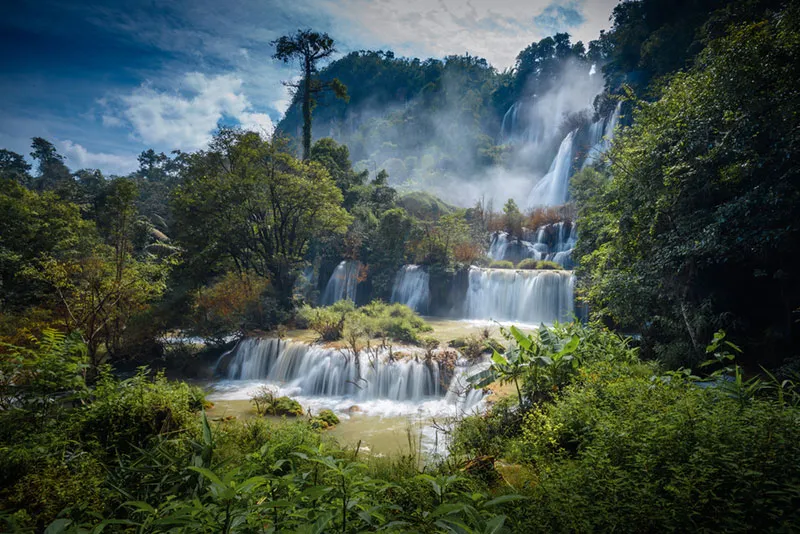
Thi Lo Su Waterfall, Tak Province
Kanchanaburi Province is one of Western Thailand’s largest provinces. Its landscapes include mountain ranges, forests, reservoirs, river plains, and major waterways, particularly the Khwae Yai and Khwae Noi rivers, which join near Kanchanaburi town to form the Mae Klong River. The western part of the province borders Myanmar and contains mountain passes with long historical significance. In its central and eastern areas, towns and communities have developed along rivers and major roads. Kanchanaburi is therefore well suited to journeys exploring both natural geography and the traces of several different periods of history.
Kanchanaburi’s historical heritage ranges from ancient towns and archaeological monuments along the Khwae rivers to World War II, an event that brought the province international attention. The construction of the Thailand–Burma Railway during the war relied on large numbers of prisoners of war and civilian laborers, many of whom endured harsh working and living conditions. Today, numerous sites are preserved as places of education and remembrance for those who died. Their significance goes far beyond photographs of a bridge or railway; they provide an opportunity to understand human suffering and the history of violence during wartime.
One of the province’s best-known attractions is the Bridge over the River Kwai, located in Tha Makham Subdistrict, Mueang Kanchanaburi District. The railway bridge is associated with the Thailand–Burma Railway and World War II. Spanning the Khwae Yai River, the steel structure has become an internationally recognizable symbol of Kanchanaburi. The surrounding area has walking spaces, shops, and historical information. Visitors should appreciate the bridge in its historical context and obey railway safety instructions when near the tracks, particularly when trains are passing.
Visitors wishing to learn more about World War II can continue to museums and Allied war cemeteries in Kanchanaburi town, as well as the railway at Tham Krasae and other locations associated with the Thailand–Burma Railway. Such visits are particularly rewarding for those interested in world history, local history, and rail travel. Each site adds a different dimension to the story, from the construction of the line and its difficult terrain to the memories of people affected by the war. These places should be visited respectfully as sites of remembrance, rather than treated merely as photographic backdrops.
Kanchanaburi also offers major natural attractions, including Erawan National Park and Erawan Waterfall, Sai Yok National Park, Srinagarind Dam, and the forested mountains around Thong Pha Phum and Sangkhla Buri. Limestone formations, forests, and river systems have created waterfalls, caves, and many scenic landscapes. Nature-based visitors should plan according to the season and check weather conditions, water levels, and national park regulations. Opening hours or rules for one attraction should not be assumed to apply to another, because each protected area has its own management arrangements.
The province’s cultural appeal is especially visible among Mon and other local communities around Sangkhla Buri, a district known for its wooden bridge and distinctive waterside lifestyles. Communities of several ethnic backgrounds also live in the frontier areas. Local food, handicrafts, and festivals reveal enduring relationships among people, forests, mountains, and rivers. Visitors should respect community etiquette, ask permission before photographing people, and protect residents’ privacy so that tourism benefits both the travelers and the communities they visit.
Getting to Kanchanaburi: From Bangkok, travelers can drive along Phet Kasem Road and connecting roads to Highway 323, which leads toward Kanchanaburi town. Rail travel is also possible on the Thon Buri–Nam Tok line, subject to the timetable operating on the travel date. The Bridge over the River Kwai and museums near the town can be combined in a short visit, but destinations such as Erawan Waterfall, Sai Yok, Thong Pha Phum, and Sangkhla Buri require more travel time. This is especially true of mountainous areas and locations far from the provincial center.
When interpreting a tourism map of Kanchanaburi, it is helpful to separate destinations into historic-town sites, waterfalls and dams, forest and mountain attractions, and border communities. Distances between these groups can be substantial, and an itinerary that ignores its starting point may involve repeated backtracking. Travelers with only one day should prioritize the bridge and nearby museums, while those hoping to experience Sangkhla Buri and Thong Pha Phum properly should arrange an overnight stay rather than attempt a rushed return journey.

Bridge over the River Kwai, Kanchanaburi Province
Ratchaburi Province lies in the central section of Western Thailand. Part of the province occupies the fertile Mae Klong River floodplain, which has long supported agriculture and permanent settlements, while its western districts contain mountains, forests, and foothill plains stretching toward the Thailand–Myanmar border. This geographical diversity creates a combination of historic towns, trading districts, orchards, floating markets, natural parks, and distinctive ethnic communities. On a map of Ratchaburi, the differences between the urban and Mae Klong river areas and the mountainous districts around Suan Phueng and neighboring areas are particularly evident.
Ratchaburi has a long history of settlement, with archaeological evidence and important communities in the Mae Klong River Basin. Its commercial development was closely linked to river transportation before the arrival of major roads. Local craftsmanship, particularly pottery and the famous dragon-patterned earthenware jars, has become one of the province’s most recognizable cultural symbols. Thai-Mon communities and other cultural groups continue to shape Ratchaburi’s identity through temples, traditions, cuisine, and local knowledge. Traveling within the province therefore offers an opportunity to study the development of urban society alongside traditional rural community life.
A nationally famous attraction is Damnoen Saduak Floating Market, located in Damnoen Saduak District. It is closely associated with the Damnoen Saduak Canal and the wider canal network that has long served as a transportation and trading system for local communities. The familiar sight of paddled boats carrying fruit, food, and locally produced goods illustrates the importance of waterways to the area’s economy and culture. Although the floating market attracts both Thai and international visitors, its significance extends beyond colorful scenes of trading boats. It is also part of the historical development of canal transportation and orchard communities across the lower central plains.
The market is at its liveliest in the morning. According to the destination’s detail page, its usual operating period is approximately 6:00 a.m. to noon. Visitors wishing to experience canal-side trading should time their arrival according to the activities that interest them and clarify boat fares before agreeing to a ride, particularly when hiring a private boat or adding optional activities. Travelers should also help keep the canals clean, avoid throwing litter into the water, and support local food and community products where possible. These choices make the experience more meaningful than a brief shopping or photography stop.
Ratchaburi has numerous other attractions, including Khao Ngu Stone Park, known for its limestone scenery and opportunities to learn about the natural environment; Wat Mahathat Worawihan, which reflects the city’s religious and historical heritage; and Suan Phueng, whose mountains and rural atmosphere are popular with visitors seeking relaxation. Together, these destinations offer a wide range of experiences, from historic-town sightseeing and community learning to agricultural tourism and time in nature. Travelers should group attractions by their location on the map to avoid unnecessary journeys back and forth across the province.
Ratchaburi’s geography is also linked to the Kaeng Krachan Forest Complex. Some of the province’s protected forests form part of the natural World Heritage landscape extending into Phetchaburi and Prachuap Khiri Khan. The western forests are important for biodiversity and for protecting the headwaters of major river systems. Although the well-known city attractions and floating markets occupy very different settings from these conservation areas, both are connected through water resources and land use. Studying a map of the province helps reveal these relationships among mountains, rivers, and communities.
Getting to Ratchaburi: From Bangkok, travelers can follow Phet Kasem Road to Ratchaburi town, or use Rama II Road and connecting highways toward Damnoen Saduak District, depending on their destination. The Southern Railway Line passes through the province, providing another option before continuing by local transport to individual attractions. Those traveling to Suan Phueng should check the route from the town and allow extra driving time into the foothills, since this area is not immediately adjacent to Damnoen Saduak Floating Market.
For a one-day visit, it is best to begin at Damnoen Saduak Floating Market and its nearby communities early in the morning. A trip intended to cover Ratchaburi town and Suan Phueng should be planned separately or include an overnight stay, leaving enough time to explore individual attractions. A geography-led approach helps visitors follow the waterways and settlements that gave rise to historic markets while also appreciating the contrasting mountains and communities on the western side of the province.

Damnoen Saduak Floating Market, Ratchaburi Province
Phetchaburi Province lies between central Western Thailand and the Gulf of Thailand coastline. It has diverse geographical features, from mountains and headwater forests in the west to the Phetchaburi River floodplain in the central area and beaches along the eastern coast. The province is important for agriculture, fishing, trade, religion, and tourism. Phetchaburi town retains numerous historic temples, significant buildings, and artistic traditions connected with several periods of Thai history, while Cha-am and other coastal areas are popular seaside destinations conveniently linked with Bangkok.
Phetchaburi’s history is closely associated with longstanding settlements and urban development along the Phetchaburi River. The city’s prosperity can be seen in historic temples, traditional stucco craftsmanship, mural painting, and distinctive local artistic traditions. The province is also associated with royal history and important building projects during the Rattanakosin period, particularly Phra Nakhon Khiri, built on a hill overlooking the town. Phetchaburi is consequently an attractive destination for travelers interested in both architecture and history, alongside natural environments. Its historic town, archaeological heritage, western forests, and beaches occupy different but connected geographical settings within the same province.
One of Phetchaburi’s defining attractions is Phra Nakhon Khiri Historical Park, commonly known as Khao Wang. Situated on a hill in Mueang Phetchaburi District, this complex of royal buildings is associated with the reign of King Mongkut, or King Rama IV. Its grounds include royal halls, religious buildings, and viewpoints distributed across the hilltops. The arrangement of buildings on elevated ground reflects the relationship between the natural setting, scenic views, and the original functions of the palace. Visitors can explore royal history, architecture, and the layout of Phetchaburi town through a visit to the site.
Phra Nakhon Khiri Historical Park is best explored without rushing, because its grounds contain several types of buildings connected by paths across the hill. The attraction’s detail page lists general visiting hours of 8:30 a.m. to 4:00 p.m. Visitors should check current arrangements before setting out and prepare suitable walking shoes and sun protection, as some sections involve outdoor walking. During their visit, they should follow staff instructions, keep the area clean, and avoid feeding or unnecessarily approaching animals that may be encountered in the grounds.
Other important attractions in Phetchaburi include Wat Mahathat Worawihan, Khao Luang Cave, Mrigadayavan Palace, and the beaches of Cha-am and Hat Chao Samran. These destinations have very different characteristics from Phra Nakhon Khiri Historical Park. Phetchaburi town is suited to exploring traditional art and sampling local desserts, such as khanom mo kaeng, while the coast offers beach recreation and seaside activities. Visitors should select suitable times according to the weather and their interests. With several days available, it is possible to combine historic-town sightseeing, beaches, and agricultural communities into one well-balanced trip.
Western Phetchaburi is particularly important because of Kaeng Krachan National Park and the continuous forests of the Tenasserim Range. The Kaeng Krachan Forest Complex was inscribed on the UNESCO World Heritage List as a natural property in 2021, encompassing parts of Ratchaburi, Phetchaburi, and Prachuap Khiri Khan. Its importance lies in its rich biodiversity, intact forest environments, and role as the source of major rivers. Tourism in the national park and associated protected areas must therefore take account of current access conditions, permitted routes, and conservation regulations announced by the responsible authorities.
Getting to Phetchaburi: Visitors from Bangkok can travel via Phet Kasem Road, or Highway 4, to reach the town and continue toward Cha-am. Rail travelers can use the Southern Railway Line, which passes through the province, before transferring to local transport where necessary. Those planning to explore Phra Nakhon Khiri should begin in central Phetchaburi and allow time to appreciate the palace buildings and hilltop views. Trips to Cha-am or Kaeng Krachan should be planned separately according to their destinations because the areas lie in different directions and involve different travel conditions.
Phetchaburi is also renowned for food traditions and local knowledge associated with regional ingredients, especially palm sugar, traditional Thai desserts, and dishes passed down through generations. Exploring markets and communities in the historic town helps visitors discover more than the province’s famous landmarks alone. Meanwhile, visits to beaches and forest areas should respect local land-use regulations and prioritize services that operate responsibly toward the environment. These practices help preserve Phetchaburi’s cultural and natural heritage for the long term.
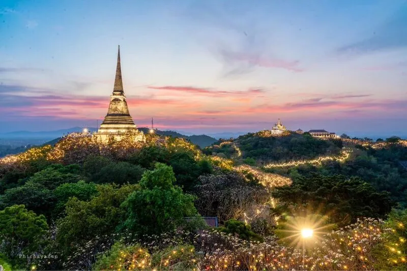
Phra Nakhon Khiri Historical Park (Khao Wang), Phetchaburi Province
Prachuap Khiri Khan Province occupies the southern end of Western Thailand under the five-province geographical classification. It stretches along the Gulf of Thailand coast, with mountains and forests on its western side. Some sections of the province are comparatively narrow between the coast and the Myanmar border, creating a distinctive landscape in which the sea, narrow plains, and mountain ranges lie close together. Prachuap Khiri Khan is home to nationally known seaside destinations such as Hua Hin, along with natural attractions encompassing limestone caves, wetlands, beaches, and mountain forests.
The history of Prachuap Khiri Khan is closely connected with coastal communities, travel along the Thai peninsula, and the development of trading centers and fishing settlements around the Gulf of Thailand. Hua Hin has played a particularly important role in the history of Thai seaside tourism and the development of resort towns during the Rattanakosin era. Prachuap Khiri Khan town and other districts also contain temples, old communities, and fishing traditions that reflect the close relationship between residents and the sea. A map of the province makes it clear that its beach resorts are not concentrated in one location but extend along a long and varied coastline.
One of the province’s most important natural attractions is Khao Sam Roi Yot National Park, which covers areas of Sam Roi Yot and Kui Buri districts. It was Thailand’s first marine national park and is distinguished by dramatic, steep-sided limestone mountains, freshwater marshes and wetlands, caves, and diverse coastal landscapes. The coexistence of several ecosystems makes the park an important destination for learning about geology, plants, birds, and the relationship between freshwater habitats and the sea.
Among the best-known attractions within the park is Phraya Nakhon Cave, where the Kuha Karuhas Pavilion stands inside a cavern illuminated by natural light from an opening above. The Thung Sam Roi Yot wetland is another important area, supporting rich natural ecosystems. Visitors can also explore Khao Daeng Viewpoint and certain coastal areas suited to nature observation. These destinations should be planned separately according to the activity involved. Some require walking uphill or following nature trails, while wetland visits depend on different seasonal conditions and water levels.
Travelers who enjoy the sea will find many other destinations in Prachuap Khiri Khan, including Hua Hin Beach, Ao Manao, beaches around Pran Buri and Ban Krut, and traditional coastal fishing communities. Each offers a different atmosphere and level of facilities. Hua Hin is a well-established tourism center with extensive transportation connections and accommodation, while other parts of the province are quieter and more focused on relaxation near nature. Visitors should choose destinations according to whether they prefer beach holidays, community experiences, or the study of natural ecosystems.
The western part of Prachuap Khiri Khan also connects with the World Heritage-listed Kaeng Krachan forest landscape. This mountainous area contains forests and important headwaters, while the eastern coast supports tourism and fishing communities. The close relationship between mountains and sea creates a wide range of natural resources, but it also calls for precautions concerning waves, heavy rain, flooding, and protected-area access regulations. Visitors should consult the latest information from the responsible authorities before planning trips to natural attractions.
Getting to Prachuap Khiri Khan: Travelers can follow Phet Kasem Road from Bangkok through Phetchaburi to Hua Hin, Pran Buri, Sam Roi Yot, and other districts, or use the Southern Railway Line to a station suitable for their destination. Those wishing to visit Khao Sam Roi Yot National Park can travel from Hua Hin or Pran Buri along local roads to the relevant park area. It is essential to confirm which attraction they intend to see, because the park’s sites are spread across several locations and are not all conveniently accessible from a single entrance.
A trip to Prachuap Khiri Khan should account for the province’s north–south distances, since attractions are distributed from Hua Hin southward to Bang Saphan and beyond. Visitors with one or two days may prefer to focus on Hua Hin, Pran Buri, and Sam Roi Yot, while those interested in coastal communities and beaches farther south should allow additional days. Traveling without rushing provides a better opportunity to appreciate both the coastal geography and the natural heritage that make Prachuap Khiri Khan distinctive.
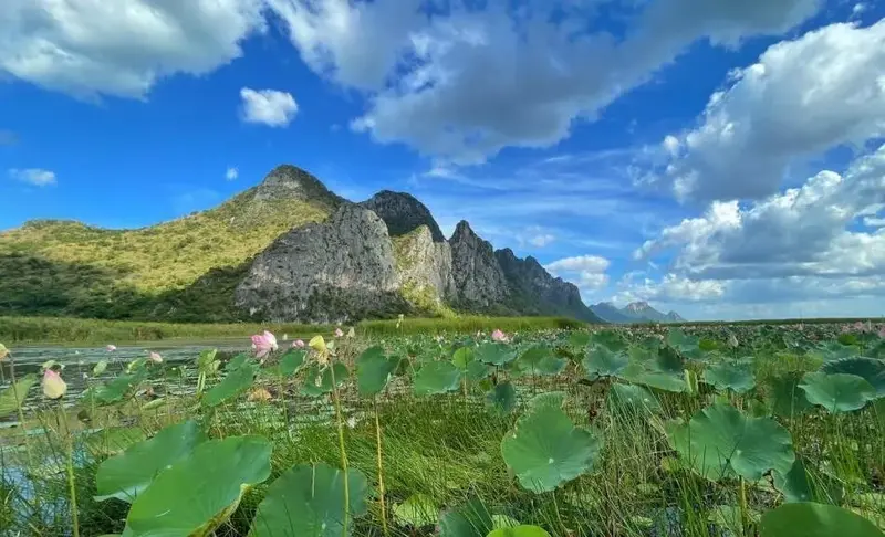
Khao Sam Roi Yot National Park, Prachuap Khiri Khan Province
The relationship between geography and tourism in Western Thailand can be seen in the distribution of attractions across the map. Natural destinations requiring journeys into mountainous terrain are often found along the border and in headwater areas, such as Umphang in Tak and the forested mountains of Kanchanaburi. Historic towns and markets are generally located in more accessible areas, including Kanchanaburi town, Damnoen Saduak Floating Market, and Phetchaburi town. Beaches lie along the Gulf of Thailand in Phetchaburi and Prachuap Khiri Khan. Organizing travel routes around these distinct landscapes reduces unnecessary driving and creates a more coherent sightseeing experience.
Route 1: Historic Towns and the River Kwai. This itinerary is suitable for travelers interested in World War II history and riverside communities. Begin in Kanchanaburi town with the Bridge over the River Kwai and museums covering the Thailand–Burma Railway. Depending on the time available, continue toward the railway at Tham Krasae or nearby natural attractions. Those who wish to visit Thong Pha Phum or Sangkhla Buri should allow additional days, as these mountainous areas are far from the provincial town. Road conditions and local access requirements should be checked before departure.
Route 2: Canal Communities and Historic Western Towns. This route suits visitors interested in markets, local food, and urban history. Begin early at Damnoen Saduak Floating Market in Ratchaburi to experience the canal system and its commercial traditions. Continue to Ratchaburi town to explore temples or cultural learning centers. With more time, travel onward to Phetchaburi town for Phra Nakhon Khiri Historical Park and the city’s traditional craftsmanship. The number of stops should be kept realistic because these towns have attractions that reward more than a quick photo opportunity.
Route 3: Phetchaburi, Prachuap Khiri Khan and the Gulf Coast. From Phetchaburi town, travelers can follow the main roads to Cha-am and continue to Hua Hin, Pran Buri, and Khao Sam Roi Yot National Park. This connected route combines historic towns, beaches, and coastal natural attractions. Those visiting Phraya Nakhon Cave should allow enough time for the uphill and downhill walks, check visiting conditions, and carry drinking water and suitable footwear. Visitors focusing primarily on beaches should check wave conditions and choose times appropriate to their planned activities.
Route 4: Western Forests and Waterfalls. This route is intended for travelers who want to spend time in nature. Visitors can choose natural destinations in Kanchanaburi or organize a separate journey to Umphang in Tak to see the impressive Thi Lo Su Waterfall. These two areas should not be combined into a short trip without careful consideration of distances and mountain-road conditions. Such excursions require advance planning, respect for seasonal restrictions, and compliance with national park or wildlife sanctuary regulations. Safety and conservation take priority over trying to visit every location within a limited time.
Culture and Cuisine of Western Thailand vary with the region’s geography and history of settlement. Visitors may encounter the food and handicrafts of border communities in Tak, Mon heritage and riverside lifestyles in Kanchanaburi, ceramics and Mae Klong river-basin cuisine in Ratchaburi, palm-sugar desserts in Phetchaburi, and seafood and fishing traditions in Prachuap Khiri Khan. These differences are an important part of what a regional map represents: grouping provinces together does not make their cultures identical, but instead reveals both their connections and the diversity found across neighboring areas.
Responsible tourism in Western Thailand involves choosing travel periods appropriate to the season, checking announcements about closures or changes to access arrangements, and taking particular care when visiting Thi Lo Su Waterfall and other protected areas. Travelers should avoid feeding wildlife, refrain from disturbing natural environments, and respect the daily lives of local communities. When visiting places associated with warfare and historical loss, they should behave respectfully toward those who died and those affected. Such consideration makes travel more meaningful for visitors and more beneficial to the places they explore.
Summary of the Western Thailand Map and Its 5 Provinces: Western Thailand comprises Tak, Kanchanaburi, Ratchaburi, Phetchaburi, and Prachuap Khiri Khan. Its defining landforms include mountain ranges and extensive forests, together with major river basins that support settlements and community livelihoods. Phetchaburi and Prachuap Khiri Khan have a Gulf of Thailand coastline, while the other provinces are known for mountains, rivers, historic towns, and local cultural traditions. Combining a map with provincial names and information on major attractions helps travelers design practical routes and develop a richer understanding of the region’s natural geography, history, and communities.
Frequently Asked Questions (FAQ)
Q: How many provinces are in Western Thailand, and what are their names?
A: Under Thailand’s six-region geographical classification, Western Thailand has five provinces: Tak, Kanchanaburi, Ratchaburi, Phetchaburi, and Prachuap Khiri Khan.
Q: Why do some maps show eight provinces in Western Thailand?
A: Different government agencies may use regional classifications for administration or economic development that differ from the geographical system. Some systems include Suphan Buri, Nakhon Pathom, Samut Sakhon, and Samut Songkhram in Western Thailand but assign Tak to Northern Thailand. This article follows the five-province geographical classification.
Q: Which are the northernmost and southernmost provinces of Western Thailand?
A: Among the five provinces in the geographical classification, Tak is the northernmost and Prachuap Khiri Khan is the southernmost.
Q: How many provinces in Western Thailand have a coastline?
A: Two provinces directly border the Gulf of Thailand: Phetchaburi and Prachuap Khiri Khan. Tak, Kanchanaburi, and Ratchaburi have no coastline.
Q: What are the major tourist attractions in Western Thailand?
A: Major attractions include Thi Lo Su Waterfall in Tak, the Bridge over the River Kwai in Kanchanaburi, Damnoen Saduak Floating Market in Ratchaburi, Phra Nakhon Khiri Historical Park in Phetchaburi, and Khao Sam Roi Yot National Park in Prachuap Khiri Khan.
Q: Which province is Thi Lo Su Waterfall in, and is it open year-round?
A: Thi Lo Su Waterfall is in Umphang Wildlife Sanctuary in Tak Province. Access depends on official opening announcements and weather conditions. Visitors should not assume it is accessible throughout the year and should check with the responsible authorities before traveling.
Q: Why is the Bridge over the River Kwai historically significant?
A: It is an important railway bridge in Kanchanaburi associated with the Thailand–Burma Railway and World War II. The site offers opportunities to learn about and commemorate those affected by the war.
Q: Where should visitors start a trip to Ratchaburi?
A: Those interested in riverside communities can begin early at Damnoen Saduak Floating Market. Travelers who prefer history and traditional craftsmanship can explore Ratchaburi town, while mountain enthusiasts should plan a separate journey to the Suan Phueng area.
Q: Where is Phra Nakhon Khiri, or Khao Wang, located?
A: Phra Nakhon Khiri is in Mueang Phetchaburi District, Phetchaburi Province. It is a complex of royal buildings and historic monuments on a hill associated with the reign of King Mongkut, or King Rama IV.
Q: What is there to see at Khao Sam Roi Yot National Park?
A: Highlights include limestone mountains, Phraya Nakhon Cave and the Kuha Karuhas Pavilion, the Thung Sam Roi Yot wetlands, viewpoints, and coastal environments along the Gulf of Thailand. The park is particularly interesting for travelers who enjoy nature and geology.
Q: Does Western Thailand have a UNESCO natural World Heritage Site?
A: Yes. The Kaeng Krachan Forest Complex was inscribed on the UNESCO World Heritage List in 2021. It extends across parts of Ratchaburi, Phetchaburi, and Prachuap Khiri Khan.
Q: How can travelers reach Western Thailand from Bangkok?
A: Kanchanaburi and Ratchaburi can be reached by car on major roads, with onward routes planned according to the destination. Phetchaburi and Prachuap Khiri Khan can be reached via Phet Kasem Road or the Southern Railway Line. Additional travel time should be allocated for Tak and remote mountainous areas.
Q: Which Western Thailand provinces are best for a two- or three-day trip?
A: Travelers interested in history and river communities could combine Kanchanaburi and Ratchaburi. Those seeking historic towns and beaches could choose Phetchaburi and Prachuap Khiri Khan. Umphang and Thi Lo Su Waterfall are better planned as a separate trip with sufficient time.
Q: What is the best season to visit Western Thailand?
A: The best time depends on the planned activities and current access announcements. Check rainfall and road conditions when visiting waterfalls or forests, wave and weather conditions for beach trips, and the latest regulations for national parks and wildlife sanctuaries.
 Category: ●Travel Articles, Recipes
 Group: ●Travel Review, Food Review
Last Update : 1 DayAgo
 Last Update : 1 DayAgo
Recommend

 Art, Culture and Heritage
 Historical Sites and Monuments(2)
 Landmarks and Memorials(3)
 Art, Craft Centres, Tradition(6)
 Historic Homes and Cities(2)
 Educational Places
 Educational Gardens, Farm(2)
 University
 Rajamangala University of Technology(1)
 Places of Worship
 Temple(22)
 Other Sacred Sites(9)
 Research and Development
 Royal Project(1)
 Suburban Living
 Village, Community(5)
 Local Market(3)
 Nature and Wildlife
 National Parks and Marine Reserves(11)
 Mountain (Doi)(9)
 Dam, Reservoir, Lake(14)
 Waterfalls(23)
 Hot Springs(2)
 Caves(6)
 River, Canal(1)
 Bays and Beaches(1)
 Islands(1)
 Other natural attractions(1)
 Entertainment and Agricultural
 Farms, Parks and Ecotourism(5)
 Outdoor and Adventure Activities(4)
Travel Review, Food Review(2)


