
lovethailand home >South Travel Attractions >Pattani Travel Attractions >Ya Ring >Ta Lo Ka Po > Hat Talo Kapo Beach
TL;DR: Hat Talo Kapo Beach is located at Talo Kapo Subdistrict, Yaring District, Pattani Province, open Daily, hours 08.00 – 17.00.

Hat Talo Kapo Beach
Open Days: Daily
Opening Hours: 08.00 – 17.00
Hat Talo Kapo Beach in Pattani Province is one of the most famous natural beaches in Yaring District. Located in Talo Kapo Subdistrict, about 18 km from Pattani city, the beach is known for its clean white sand, long coastal line, rows of traditional Kor Lae fishing boats, sea pines, coconut palms, and local fishing-community atmosphere. It is a meaningful destination for travelers who want to experience Pattani’s coastline through nature, culture, photography, seafood, and the everyday life of coastal communities.
Hat Talo Kapo is not only a scenic beach. It is a place where several layers of Pattani come together: the lower Gulf of Thailand, sediment-rich coastal geography, Malay-influenced place names, traditional fishing boats, mangrove ecology, and the living culture of local fishermen. Visitors who take time to explore the beach will see more than sea and sand. They will see how local people, boats, mangroves, and the beach function as one coastal landscape.
The name “Talo Kapo” comes from the local Malay language. “Talo” means bay, and “Kapo” means lime, so the name can be understood as “Lime Bay.” Local stories connect the name with seashells once collected in the area and burned into white lime for traditional use. This name preserves an older relationship between the community and coastal resources, making the beach a place where language, memory, and geography meet.
Hat Talo Kapo has long been recognized as an important natural attraction in Pattani. It won second place in the natural attraction category of a tourism contest covering the five southern border provinces in 1986. This recognition reflects the beach’s established reputation, based on its white sand, coastal scenery, shade from trees, and the distinctive presence of colorful Kor Lae fishing boats.
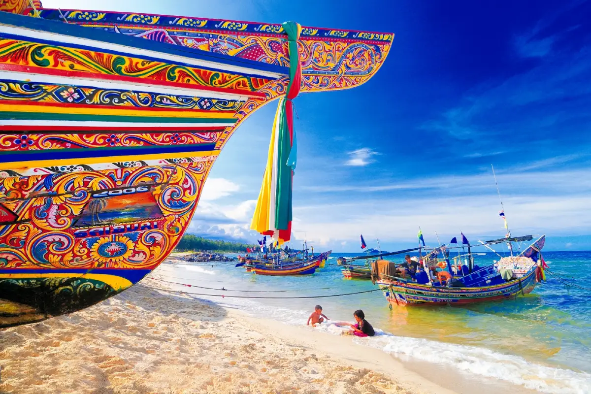
The strongest visual identity of Hat Talo Kapo is the line of Kor Lae boats parked along the shore. These boats are more than fishing vessels. They are expressions of local craftsmanship, decorated with bright colors and patterns that often reflect Malay, Thai, and coastal artistic influences. When the boats sit against white sand, blue sea, and shaded tree lines, the result is one of the most memorable beach scenes in Pattani.
The beach also has a distinctive natural process. Its sandy shoreline continues to extend as currents carry and deposit sediment along the coast. This means the beach is not a fixed landscape. Its sandbar and shoreline can shift gradually with season, tide, and wave patterns. This living coastal movement is part of what makes Hat Talo Kapo different from more static beach destinations.
The atmosphere at Hat Talo Kapo is relaxed and local. Visitors can walk along the sand, sit under sea pines, watch the fishing boats, take photographs, enjoy the sea breeze, and observe community life. The beach is suitable for families, photographers, culture-oriented travelers, and anyone who prefers a meaningful local beach over a heavily commercialized resort environment.
From a cultural point of view, Hat Talo Kapo is one of the clearest places to see Pattani’s traditional fishing life. Many people in the community depend on coastal resources through fishing, crab and shellfish collecting, seafood processing, and local trade. The boats parked along the beach therefore represent not only beauty, but also work, income, heritage, and the community’s relationship with the sea.
The area is also connected with community-based tourism under the local initiative known as Buna Dara. Through this approach, visitors can learn about fishing life, mangrove conservation, local seafood, community food culture, and the mangrove seedling nursery. For travelers who want a deeper experience, Hat Talo Kapo can be the starting point for understanding how natural resources and local culture support one another.
Another important layer is the beach’s connection with Yaring mangrove areas. The route to the beach passes through mangrove landscapes and coastal villages before reaching the sea. This creates a clear ecological sequence: canal, mangrove, fishing village, beach, and Gulf coastline. The mangrove ecosystem supports marine life, protects the coast, and sustains the local fishing economy.
Sea pines and coconut trees line parts of the beach and road, giving the area shade and a softer coastal mood. Morning and late afternoon are the most pleasant times to visit. In the morning, the light is suitable for photographing the boats and observing the fishing community. In the late afternoon, the beach becomes a comfortable place to sit, walk, and enjoy the changing colors of the sky.
Suitable activities at Hat Talo Kapo include beach walking, relaxing under the trees, photographing Kor Lae boats, cycling along the coastal road, eating local seafood, and exploring the nearby mangrove and community route. The best photographs usually include the boats, the beach line, and the sea together because this combination shows the true identity of the destination.
Swimming conditions should be judged carefully on the day of travel. The beach is a natural coastal area and a working fishing space, so some sections may have boats, gear, or changing wave conditions. Visitors should avoid areas where boats enter or leave, should not touch or climb on boats without permission, and should keep children close near the water. Hat Talo Kapo is best enjoyed through scenery, community observation, photography, and relaxed seaside time.
Responsible travel is essential here. The beach is both a tourist attraction and a working place for local fishermen. Visitors should not litter, should not disturb fishing equipment, should ask before photographing people or boats at close range, and should dress respectfully for the local community context. These small practices help keep tourism respectful and beneficial to local residents.
Getting There from Pattani city is straightforward by private car or rental car. Follow Highway 42 on the Pattani–Narathiwat route, turn left toward Yaring District, cross Yamu Canal via the large concrete bridge, pass through mangrove areas and villages, and continue to the beach entrance. The total distance from Pattani city is about 18 km.
A half-day itinerary can start from Pattani city, continue to Hat Talo Kapo for beach views and boat photography, then stop at Yaring Palace before returning. A fuller route can include the Yaring Mangrove Nature Study Center, Laem Ta Chi or Laem Pho, and Talo Kapo community tourism. This creates a balanced trip combining beach, mangrove, history, and fishing-community culture.
Nearby attractions make the area especially rewarding. Laem Ta Chi, also known as Laem Pho, is a distinctive coastal landform and viewpoint in Yaring District. The Yaring Mangrove Nature Study Center is suitable for learning about coastal ecosystems. Yaring Palace gives historical and architectural context. Together, these places make Hat Talo Kapo a strong anchor for a short coastal and cultural trip in Pattani.
Food options are available along the beach and in nearby communities. The area is known for seafood linked to local fishing, and visitors can also find casual restaurants, cafes, and food stops around Talo Kapo and Yaring. On weekends and holidays, the beach may be busier, so travelers should allow extra time for meals and parking.
Accommodation options near the beach include local resorts, villas, and seaside stays around Talo Kapo and nearby coastal communities. Travelers who prefer easier access to hospitals, city restaurants, and wider services can stay in Pattani city and visit Hat Talo Kapo as a day trip, as the distance from the city is manageable.
In summary, Hat Talo Kapo is one of Pattani’s most distinctive coastal destinations. Its white sand, Kor Lae boats, tree-lined beach, local seafood, mangrove connection, and meaning of “Lime Bay” make it more than an ordinary beach. It is a place where travelers can relax, take memorable photographs, learn about fishing communities, and experience the coastal identity of Thailand’s southern border region.
| Name | Hat Talo Kapo Beach |
| Location | Talo Kapo Subdistrict, Yaring District, Pattani Province |
| Address | Rural Road PN 4031, Talo Kapo Subdistrict, Yaring District, Pattani 94150, Thailand |
| Highlights | White sandy beach, traditional Kor Lae fishing boats, sea pines, coconut palms, and local Yaring fishing-community life |
| History / Importance | Won second place in the natural attraction category of the tourism contest for the five southern border provinces in 1986 and remains one of Pattani’s best-known beaches |
| Name Origin | “Talo” means bay and “Kapo” means lime in the local Malay language, referring to a traditional story about seashells burned into white lime |
| Distinctive Features | A sediment-growing sandy beach with rows of colorful Kor Lae boats, shaded tree lines, and a strong fishing-community atmosphere |
| Main Areas / Zones | 1. White Sandy Beach 2. Kor Lae Fishing Boat Area 3. Sea Pine And Coconut Tree Line 4. Seaside Resting And Photography Area 5. Talo Kapo Community And Yaring Mangrove Route |
| Travel Information | From Pattani city, follow Highway 42 on the Pattani–Narathiwat route, turn left toward Yaring District, cross Yamu Canal, pass mangrove areas and villages, and continue to the beach entrance. The distance is about 18 km |
| Current Status | Open as a natural attraction and public beach in Yaring District |
| Open Days | Daily |
| Opening Hours | 08.00 – 17.00 |
| Facilities | Beach walking area, shaded resting area, Kor Lae boat photography spots, restaurants, and accommodation scattered along the beach and nearby communities |
| Caretaker | Talo Kapo Subdistrict Administrative Organization and local agencies in Yaring District |
| Main Contact Number | 073-337-096 |
| Nearby Tourist Attractions | 1. Talo Kapo Community Tourism Area, About 1 km 2. Yaring Mangrove Nature Study Center, About 4 km 3. Laem Ta Chi / Laem Pho, About 5 km 4. Yaring Palace, About 6 km 5. Krue Se Mosque, About 16 km 6. Pattani Central Mosque, About 18 km 7. Lim Ko Niao Shrine, About 20 km |
| Nearby Restaurants | 1. Five Star PTT Talo Kapo, About 4 km, Tel. 081-098-2727 2. Café Amazon Talo Kapo, About 4 km 3. Beach Hut Coffee, About 8 km, Tel. 080-036-2063 4. Phi Um Crab Fried Rice, Yaring Palace Area, About 9 km 5. Roti Suan & Coffee Yaring, About 10 km 6. Capoala Villa & Cafe, About 12 km |
| Nearby Accommodations | 1. Relax De Tuwah Beach Resort, About 6 km 2. Talo Samila Resort, About 7 km 3. Capoala Villa & Cafe, About 12 km 4. Takadum Beach Resort, About 16 km 5. Pattanipirom Boutique Hotel, About 23 km, Tel. 081-698-3877 6. The Wood Pattani Hotel, About 24 km, Tel. 091-479-0666 |
Frequently Asked Questions (FAQ)
Q: Where is Hat Talo Kapo Beach located?
A: Hat Talo Kapo Beach is located in Talo Kapo Subdistrict, Yaring District, Pattani Province, about 18 km from Pattani city.
Q: What makes Hat Talo Kapo Beach special?
A: The beach is known for its clean white sand, colorful Kor Lae fishing boats, sea pines, coconut palms, and strong local fishing-community atmosphere.
Q: What does the name Talo Kapo mean?
A: In the local Malay language, “Talo” means bay and “Kapo” means lime, so the name can be understood as “Lime Bay.”
Q: How can travelers get from Pattani city to Hat Talo Kapo Beach?
A: Follow Highway 42 on the Pattani–Narathiwat route, turn left toward Yaring District, cross Yamu Canal, pass mangrove areas and villages, and continue to the beach entrance. The distance is about 18 km.
Q: What are the opening hours of Hat Talo Kapo Beach?
A: The beach is open daily from 08.00 to 17.00.
Q: What activities are suitable at Hat Talo Kapo Beach?
A: Visitors can walk along the beach, relax under the trees, photograph Kor Lae boats, observe local fishing life, enjoy seafood, and combine the trip with Yaring mangrove attractions.
Q: What should visitors be careful about?
A: Visitors should avoid boat operation areas, should not touch or climb on Kor Lae boats without permission, should keep children close near the water, and should keep the beach clean.
Q: Which nearby places can be visited with Hat Talo Kapo Beach?
A: Nearby places include Talo Kapo community tourism area, Yaring Mangrove Nature Study Center, Laem Ta Chi, Yaring Palace, Krue Se Mosque, Pattani Central Mosque, and Lim Ko Niao Shrine.
 Category: ●Nature and Wildlife
 Group: ●Bays and Beaches
Last Update : 3 MonthAgo
 Last Update : 3 MonthAgo
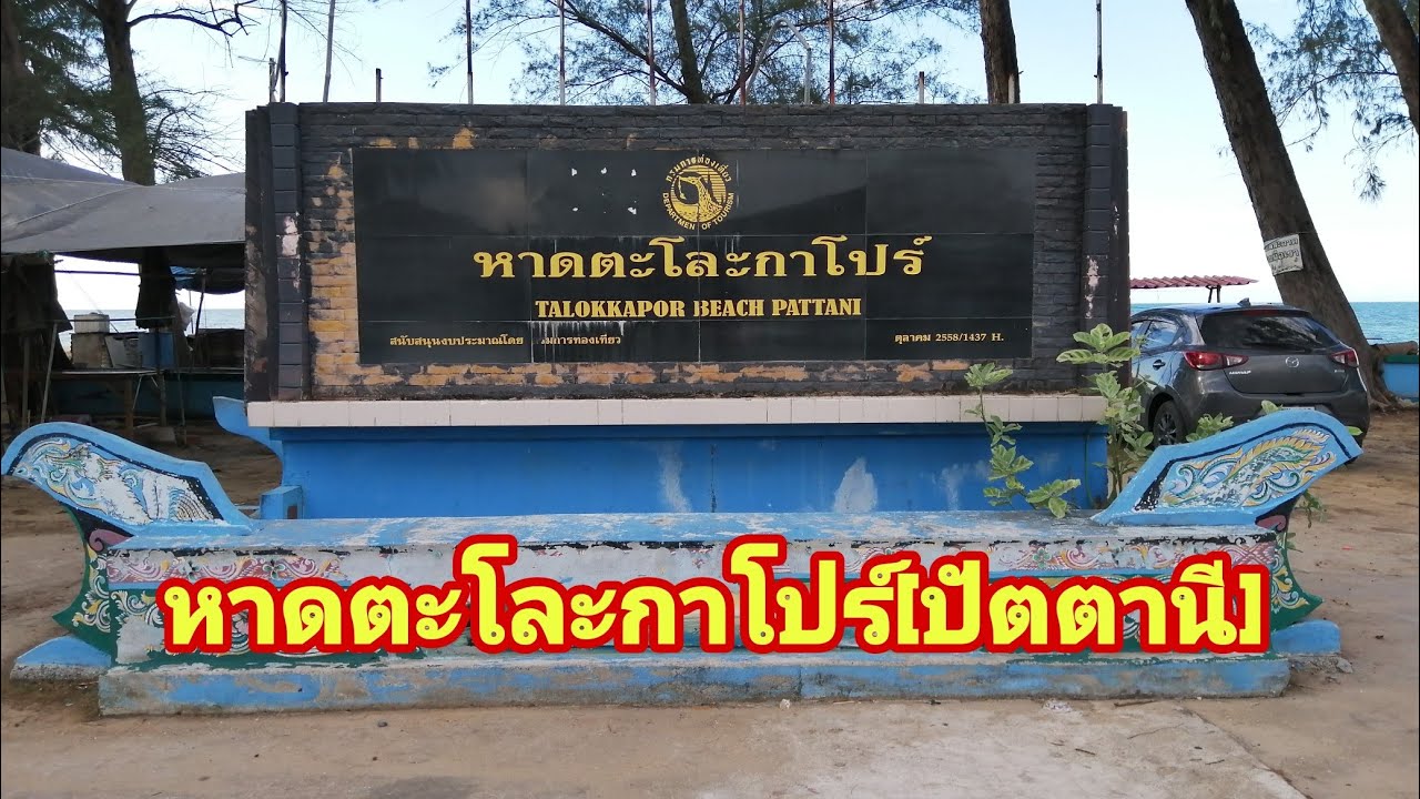
 Click to Access the Navigation Map GPS
Hat Talo Kapo Beach Map

 Art, Culture and Heritage
 Historical Sites and Monuments(3)
 Landmarks and Memorials(7)
 Royal Palace(2)
 Art, Craft Centres, Tradition(7)
 Historic Homes and Cities(1)
 Educational Places
 Museum for Study(1)
 Training Center(1)
 University
 Public university(1)
 Private University(1)
 Places of Worship
 Temple(13)
 Mosque(5)
 Other Sacred Sites(4)
 Research and Development
 Royal Project(2)
 Suburban Living
 Village, Community(5)
 Local Market(2)
 National Parks and Marine Reserves(2)
 Mountain (Doi)(3)
 Waterfalls(3)
 River, Canal(2)
Bays and Beaches(13)
 Islands(2)
 Other natural attractions(1)
 Entertainment and Agricultural
 Farms, Parks and Ecotourism(1)
 Travel Articles, Recipes
 Travel Review, Food Review(1)
 Southern Food Menu, Southern Food Recipes(3)


