
lovethailand home >South Travel Attractions >Ranong Travel Attractions >Muang Ranong >Bang Non > Punyaban Waterfall
TL;DR: Punyaban Waterfall is located at Moo 1, Bang Non Subdistrict, Mueang Ranong District, Ranong Province, beside Highway 4, open Daily During The Open Tourism Season Of Lam Nam Kra Buri National Park, hours 08.30 – 16.30.

Punyaban Waterfall
Open Days: Daily During The Open Tourism Season Of Lam Nam Kra Buri National Park
Opening Hours: 08.30 – 16.30
Last Updated: 2 September 2026
Punyaban Waterfall in Ranong Province is one of the easiest waterfalls to visit in southern Thailand. Located beside Highway 4, also known as Phetkasem Road, it sits within Lam Nam Kra Buri National Park and is only about 15 km from Ranong town. The waterfall has 3 tiers, year-round water, a short nature trail of about 300 m, and basic visitor facilities, making it a convenient stop for travelers driving between Ranong, Kra Buri, and Chumphon.
Punyaban Waterfall was formerly known as Set Takuat Waterfall. It is located in Moo 1, Bang Non Subdistrict, Mueang Ranong District, Ranong Province, along the main road that connects Ranong town with northern Ranong and Chumphon. Its strongest advantage is accessibility. Visitors can see the first tier from the roadside, park nearby, and walk only a short distance to reach the waterfall area. This makes it suitable for travelers who want a quick nature stop without a long forest trek.
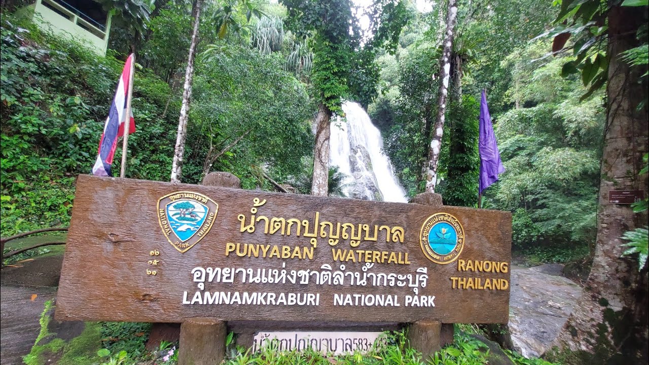
The waterfall is about 15 km from Ranong town, so it can easily fit into a half-day or full-day Ranong itinerary. Travelers coming from Chumphon or Kra Buri can stop here before entering Ranong town, while those leaving Ranong can visit it on the way north. For navigation, use the name “Punyaban Waterfall” and the Highway 4 route in Bang Non Subdistrict. The most practical landmark is around the 597-km marker on Highway 4, where the waterfall entrance and national park signs are located.
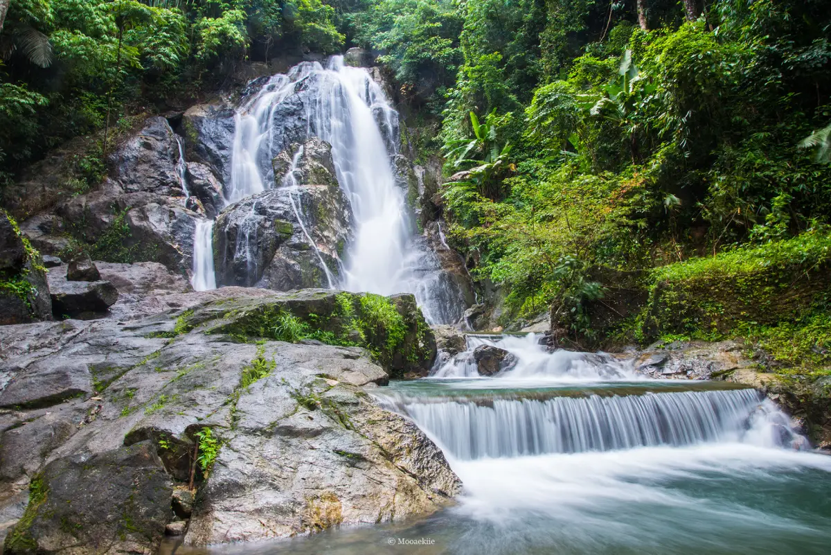
Although Punyaban Waterfall is not a large waterfall, it has a clear natural charm. The water flows from streams in the La-un and Ratchakrut forest areas before dropping over rock ledges into small pools and a narrow stream below. The surrounding rainforest, large trees, moss, ferns, and humid air give the site a genuine Ranong atmosphere. Even though the waterfall is close to the main road, visitors can feel the coolness and greenery of the forest almost immediately after entering the waterfall area.
The first tier is the easiest and most popular part of the waterfall. It is the tier that can be seen from the road and is commonly referred to as Punyaban Waterfall. The water drops from a rocky cliff in a visible curtain, with a height generally described as around 15–20 m depending on the measuring point and season. During the rainy season and after periods of rainfall, the flow becomes stronger and more photogenic. In drier months, the waterfall may be gentler, but the forest setting remains pleasant for a short visit.
Beyond the first tier, the waterfall continues to the second and third tiers, known as Ton Mai Phai Waterfall and Ton Ton Fern Waterfall. A short nature trail of about 300 m connects the lower area with the upper tiers. This trail is suitable for visitors who want a light walk through humid forest rather than a demanding hike. Along the way, travelers can see local plants, the stream system, and the shaded environment that supports the waterfall.
Punyaban Waterfall is valuable because it offers an accessible introduction to Ranong’s rainforest landscape. Ranong is one of Thailand’s wettest provinces, with mountains, forest streams, and lush vegetation. This waterfall gives visitors a compact but meaningful glimpse of that environment without requiring a full-day national park expedition. It is particularly useful for families, road-trip travelers, photographers, and visitors with limited time in Ranong.
The best time to visit is in the morning or before early afternoon. The temperature is more comfortable, the light is better for photography, and there is enough time to walk the nature trail at an unhurried pace. The rainy season and the period after rainfall usually bring a stronger water flow, but the rocks and paths can become slippery. Visitors should wear shoes with good grip, stay on marked paths, and follow national park instructions.
Swimming or playing near the stream should be done only in safe areas. After heavy rain, the current may become stronger and the rocks may be more slippery than they appear. Families with children should supervise them closely. Visitors should avoid climbing wet rocks, entering fast-flowing sections, or stepping outside designated paths. The waterfall is easy to access, but it remains a natural waterfall inside a protected forest area, so safety should always come before photography or water play.
Basic facilities are available around the waterfall area, including parking, toilets, resting areas, and a welfare shop or small food area near the entrance. Travelers who only want to see the first tier and take photos may need around 30 minutes. Those who want to walk the short nature trail, rest by the stream, and enjoy the forest atmosphere should allow 1–2 hours.
Punyaban Waterfall is managed by Lam Nam Kra Buri National Park under Thailand’s Department of National Parks, Wildlife and Plant Conservation. The national park covers parts of Mueang Ranong, Kra Buri, and La-un districts. It includes rainforest, river landscapes, mangrove areas, islands, and the Kra Buri River border zone. Among the park’s attractions, Punyaban Waterfall is one of the most accessible because it is located directly beside Highway 4.
The national park entrance fee for Lam Nam Kra Buri National Park is 20 baht for Thai adults and 10 baht for Thai children. For foreign visitors, the fee is 100 baht for adults and 50 baht for children. Visitors with special eligibility under national park rules should follow the conditions announced at the ticket point.
The waterfall is open to visitors during the national park’s operating hours in the open tourism season. Lam Nam Kra Buri National Park has an annual tourism and overnight-stay closure period from 1 October to 30 November. Travelers planning a trip during that period should choose other attractions in Ranong town or confirm the available areas with the park office before arranging their route.
Getting There is straightforward by private car, rental car, or hired vehicle. From Ranong town, drive north on Highway 4 toward Kra Buri. The waterfall is about 15 km from town and the entrance is beside the road around the 597-km marker. Travelers coming from Chumphon or Kra Buri will reach the waterfall before entering Ranong town, making it a practical stop before continuing into the city.
Public local transport may pass along the Ranong–Kra Buri route, but schedules are less convenient than driving. A rental car or hired vehicle from Ranong town is the better option for travelers who want to combine Punyaban Waterfall with Huai Khangkhao, Khao Koma Viewpoint, Lam Nam Kra Buri National Park, or restaurants and hotels in Ranong town.
Punyaban Waterfall works well for different types of travelers. Families can make a short and easy nature stop. Road-trip travelers can use it as a refreshing break. Photographers can capture a roadside waterfall framed by rainforest. Nature lovers can walk the short trail to see more of the stream and upper tiers. The site is compact, but it delivers a strong sense of Ranong’s wet forest landscape.
A good itinerary is to visit Punyaban Waterfall in the morning, then continue to Huai Khangkhao, Lam Nam Kra Buri National Park, Khao Koma Viewpoint, or return to Ranong town for hot springs, temples, and local restaurants. This route allows travelers to experience both the natural and urban sides of Ranong without spending too much time on the road.
Useful items to bring include shoes suitable for wet surfaces, a towel or spare clothes if you plan to play near the water, a waterproof phone pouch, and drinking water. Visitors should take all rubbish out of the area and avoid leaving food waste or plastic near the stream. Punyaban Waterfall is part of a protected national park ecosystem, and responsible behavior helps keep the site clean, safe, and pleasant for future visitors.
In summary, Punyaban Waterfall is a convenient, scenic, and worthwhile nature stop in Ranong Province. It is close to town, easy to reach from Highway 4, has year-round water, offers a short nature trail, and provides basic facilities. While it is not the largest waterfall in the province, its accessibility, forest atmosphere, and roadside visibility make it one of the most practical waterfall stops on a Ranong travel route.
| Name | Punyaban Waterfall |
| Location | Moo 1, Bang Non Subdistrict, Mueang Ranong District, Ranong Province, beside Highway 4 |
| Address | Lam Nam Kra Buri National Park Area, Highway 4, Bang Non Subdistrict, Mueang Ranong District, Ranong Province |
| Coordinates | 10.06394, 98.67056 |
| Highlights | Roadside waterfall on Highway 4, visible from the road, with year-round water and easy access from Ranong town |
| History / Name Origin | Formerly known as Set Takuat Waterfall, it is now known as Punyaban Waterfall and is part of Lam Nam Kra Buri National Park |
| Distinctive Features | A 3-tier waterfall with the first tier visible from the roadside and a short nature trail of about 300 m to the upper tiers |
| Travel Information | From Ranong town, drive north on Highway 4 toward Kra Buri for about 15 km. The entrance is beside the road around the 597-km marker |
| Current Status | Open during national park operating hours in the open tourism season. The park has an annual tourism and overnight-stay closure from 1 October to 30 November |
| Open Days | Daily during the open tourism season of Lam Nam Kra Buri National Park |
| Opening Hours | 08.30 – 16.30 |
| Fees | Thai Adults 20 Baht, Thai Children 10 Baht / Foreign Adults 100 Baht, Foreign Children 50 Baht |
| Facilities | Parking, toilets, resting areas, welfare shop, and small food area near the entrance |
| Main Areas / Zones | Tier 1: Punyaban Waterfall Tier 2: Ton Mai Phai Waterfall Tier 3: Ton Ton Fern Waterfall Nature trail of about 300 m Roadside viewpoint and resting area |
| Caretaker | Lam Nam Kra Buri National Park, Department Of National Parks, Wildlife And Plant Conservation |
| Main Contact Number | Lam Nam Kra Buri National Park, Tel. 077-989-817 |
| Nearby Tourist Attractions | 1. Huai Khangkhao, About 2 km 2. Lam Nam Kra Buri National Park, About 2 km 3. Khao Koma Viewpoint, About 2 km 4. Wat Waree Banphot, About 6 km 5. Wat Na Yang Rakhang Thong, About 8 km |
| Nearby Restaurants | 1. Punyaban Waterfall Welfare Restaurant, About 80 m 2. Prod Pran, About 900 m 3. Coffee Bar Ranong, About 12 km, Tel. 083-968-4963 4. J&T Restaurant Ranong, About 15 km, Tel. 081-891-5990 5. Khun Lin Restaurant, About 15 km, Tel. 077-822-863 6. Khao Hom Ranong, About 15 km, Tel. 062-928-2924 |
| Nearby Accommodations | 1. Phu Thara Resort, About 7 km, Tel. 084-443-6799 2. The Blue Sky Resort @ Ranong, About 8 km, Tel. 077-873-958 3. Ban Nai Mong, About 10 km, Tel. 093-497-4999 4. Blu Monkey Hub & Hotel Ranong, About 11 km, Tel. 082-369-5929 5. Farmhouse Hotel Ranong, About 12 km, Tel. 077-832-707 6. Sook Hotel Ranong, About 12 km, Tel. 093-581-2500 7. The B Ranong Trend Hotel, About 12 km, Tel. 077-823-111 |
Frequently Asked Questions (FAQ)
Q: Where Is Punyaban Waterfall Located?
A: Punyaban Waterfall is located beside Highway 4 in Bang Non Subdistrict, Mueang Ranong District, Ranong Province, within Lam Nam Kra Buri National Park. It is about 15 km from Ranong town.
Q: What Are The Opening Hours Of Punyaban Waterfall?
A: The waterfall is open during the national park’s open tourism season from 08.30 to 16.30. Lam Nam Kra Buri National Park has an annual tourism and overnight-stay closure from 1 October to 30 November.
Q: Is There An Entrance Fee For Punyaban Waterfall?
A: Yes. The national park fee is 20 baht for Thai adults and 10 baht for Thai children. For foreign visitors, the fee is 100 baht for adults and 50 baht for children.
Q: How Many Tiers Does Punyaban Waterfall Have?
A: Punyaban Waterfall has 3 tiers: Punyaban Waterfall, Ton Mai Phai Waterfall, and Ton Ton Fern Waterfall. A short nature trail of about 300 m links the lower and upper sections.
Q: Can Visitors Swim Or Play In The Water?
A: Visitors can rest near the stream and play in safe areas, but they should follow park instructions, avoid slippery rocks, and stay away from strong currents, especially after heavy rain.
Q: How Do Travelers Get To Punyaban Waterfall?
A: From Ranong town, drive north on Highway 4 toward Kra Buri for about 15 km. The entrance is beside the road around the 597-km marker.
Q: How Long Should Visitors Spend At Punyaban Waterfall?
A: A short photo stop at the first tier takes around 30 minutes. Visitors who want to walk the nature trail and relax by the stream should allow 1–2 hours.
Q: What Attractions Can Be Visited Near Punyaban Waterfall?
A: Nearby places include Huai Khangkhao, Lam Nam Kra Buri National Park, Khao Koma Viewpoint, Wat Waree Banphot, and Wat Na Yang Rakhang Thong.
 Category: ●Nature and Wildlife
 Group: ●Waterfalls
Last Update : 3 MonthAgo
 Last Update : 3 MonthAgo
 Click to Access the Navigation Map GPS
Punyaban Waterfall Map
Recommend

 Art, Culture and Heritage
 Historical Sites and Monuments(4)
 Landmarks and Memorials(1)
 Royal Palace(1)
 Art, Craft Centres, Tradition(4)
 Educational Places
 Educational Gardens, Farm(1)
 Places of Worship
 Temple(12)
 Other Sacred Sites(2)
 Suburban Living
 Village, Community(2)
 National Parks and Marine Reserves(6)
 Mountain (Doi)(4)
Waterfalls(15)
 Hot Springs(3)
 Caves(4)
 River, Canal(2)
 Bays and Beaches(10)
 Islands(8)
 Other natural attractions(3)
 Travel Articles, Recipes
 Travel Review, Food Review(1)


