
lovethailand home >South Travel Attractions >Ranong Travel Attractions >Kra Buri >Nam Chuet > Bok Krai Waterfall
TL;DR: Bok Krai Waterfall is located at Moo 8, Ban Bok Krai, Nam Chuet Subdistrict, Kra Buri District, Ranong Province, open Contact Local Officers Or Nam Chuet Subdistrict Municipality Before Traveling, hours Morning To Early Afternoon Visits Are Recommended.
Bok Krai Waterfall
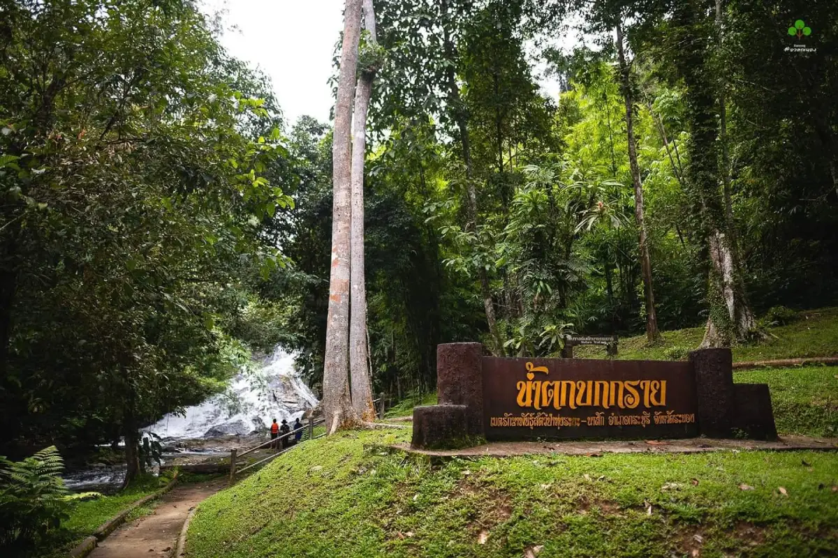
Open Days: Contact Local Officers Or Nam Chuet Subdistrict Municipality Before Traveling
Opening Hours: Morning To Early Afternoon Visits Are Recommended
Last Updated: 2 September 2026
Bok Krai Waterfall is a large natural waterfall in Moo 8, Ban Bok Krai, Nam Chuet Subdistrict, Kra Buri District, Ranong Province. It is connected with the Thung Raya-Nasak Wildlife Sanctuary area, an important rainforest landscape on the Ranong-Chumphon provincial boundary. The waterfall has year-round water flow, 11 levels, shaded forest surroundings, stream terraces, rock slabs, and a natural trail environment that makes it one of the most substantial waterfall experiences in northern Ranong.
The waterfall is located about 54 km from Ranong town along Highway 4 on the Ranong-Chumphon route. Around kilometre markers 556 – 557, a sign points toward Bok Krai Waterfall. From the highway, visitors continue inward for about 13 km, then walk from the end of the road through farming land and moist forest for about 200 m to reach the early waterfall area. This access pattern gives Bok Krai a more adventurous character than roadside waterfalls, and visitors should plan around road condition, weather, and daylight.
The defining feature of Bok Krai Waterfall is its 11-tier structure. The first to third levels are about 200 m from the parking area and are the most accessible for general visitors. These lower tiers form a stream that flows gently over sloping rock platforms and small cascades, making them popular for resting, photography, and water play when conditions are safe. Higher levels become steeper, more winding, and more natural, so visitors who want to explore beyond the lower section should be physically prepared and should coordinate with local officers.
The name Bok Krai is tied to Ban Bok Krai in Nam Chuet Subdistrict. In local interpretation, “bok” suggests land or ground along a watercourse, while “krai” evokes a long riverside or streamside formation. The name reflects a landscape shaped by water, land, forest, and local settlement. Bok Krai Waterfall is therefore not just a scenic cascade but a natural place connected with the community geography of Kra Buri.
Thung Raya-Nasak Wildlife Sanctuary covers forest areas along the boundary of Ranong and Chumphon. It is a humid rainforest ecosystem influenced by the Andaman monsoon climate. The area supports diverse plant life, wildlife habitats, streams, and protected forest. Bok Krai Waterfall is part of this ecological setting, so visitors should approach it as a sensitive natural area rather than an ordinary recreation park.
The forest around the waterfall is shaded and moist, with large trees and rainforest vegetation. Descriptions of the area mention trees such as takhian thong, sae ko, and takhian sai, along with lower plants and streamside vegetation. The sound of flowing water, cool air, and moist earth give the place a strong rainforest atmosphere. Walking along the stream lets visitors observe how the landscape changes from sloping rock terraces and shallow pools to steeper forest sections.
Bok Krai Waterfall also has value as wildlife habitat. The wider sanctuary is associated with many wild animals, including serow, bears, deer, barking deer, binturong, gaur, banteng, tapir, and several bird species. Visitors should keep noise low, avoid feeding animals, carry out all food waste, stay on known routes, and avoid entering deeper forest sections without permission or guidance. Responsible behavior protects both visitors and wildlife.
For most travelers, the lower levels are the most practical part of the visit. They are close to the parking area, have year-round water, and offer gentle cascading stream scenery. This section is suitable for resting by the water, taking photos, and entering the water only where the current is calm and the footing is safe. The higher levels require more time, better physical condition, and greater caution.
The nature trail around Bok Krai Waterfall is about 1 km long, allowing visitors to experience the rainforest environment without committing to a deep jungle trek. Even so, the route remains a natural trail. Wet rocks, roots, slopes, muddy sections, and changing weather can make the walk difficult, especially after rain. Visitors should walk in groups, wear good-grip shoes, and avoid leaving the established route.
The best time to visit is from morning to early afternoon. This gives enough light for the side-road drive, the forest walk, water-condition checks, and a safe return before evening. Ranong is a rainy province, and the waterfall area can be slippery even when the weather appears calm. Starting early also gives travelers time to change plans if road or water conditions are not suitable.
The rainy season gives Bok Krai Waterfall its most powerful scenery. Water volume is higher, the forest is greener, and the atmosphere is cooler and more dramatic. However, the rainy season also requires the most caution. Some access-road sections may become inconvenient, stream flow may become strong, and rock surfaces may be slippery. After heavy continuous rain, visitors should postpone entry or check with local officers before traveling.
Water play should be limited to safe sections only. Visitors should choose areas where the bottom is visible, the water is not deep, and the current is not strong. Do not jump into pools, climb wet rocks, or approach strong-flowing sections after rainfall. Children should be supervised closely at all times, and elderly visitors should remain in stable areas near the lower section.
Visitors who want to explore the higher levels should allow at least half a day and possibly a full day, depending on weather and the number of levels they intend to visit. From the sixth level upward, the route becomes more natural and less clear. It may include roots, vines, slopes, wet surfaces, and narrow sections. Deeper exploration should be coordinated with officers, both for safety and conservation reasons.
Basic preparation is important. Bring drinking water, light snacks, non-slip shoes, a towel, spare clothes, a waterproof phone pouch, mosquito repellent, necessary medication, and a bag for carrying rubbish out. Visitors planning to walk beyond the lower levels should bring additional water and inform local officers or residents before entering deeper sections. Heavy belongings should be avoided because they make wet and sloping paths harder to navigate.
Because the waterfall is connected with a wildlife sanctuary, low-impact travel is essential. Visitors should not collect plants, disturb animals, leave food waste, write on rocks, use soap or shampoo in the stream, or play loud music. Bok Krai remains attractive because of its forest quality and clean water. Keeping the area quiet and clean helps preserve the experience for future visitors.
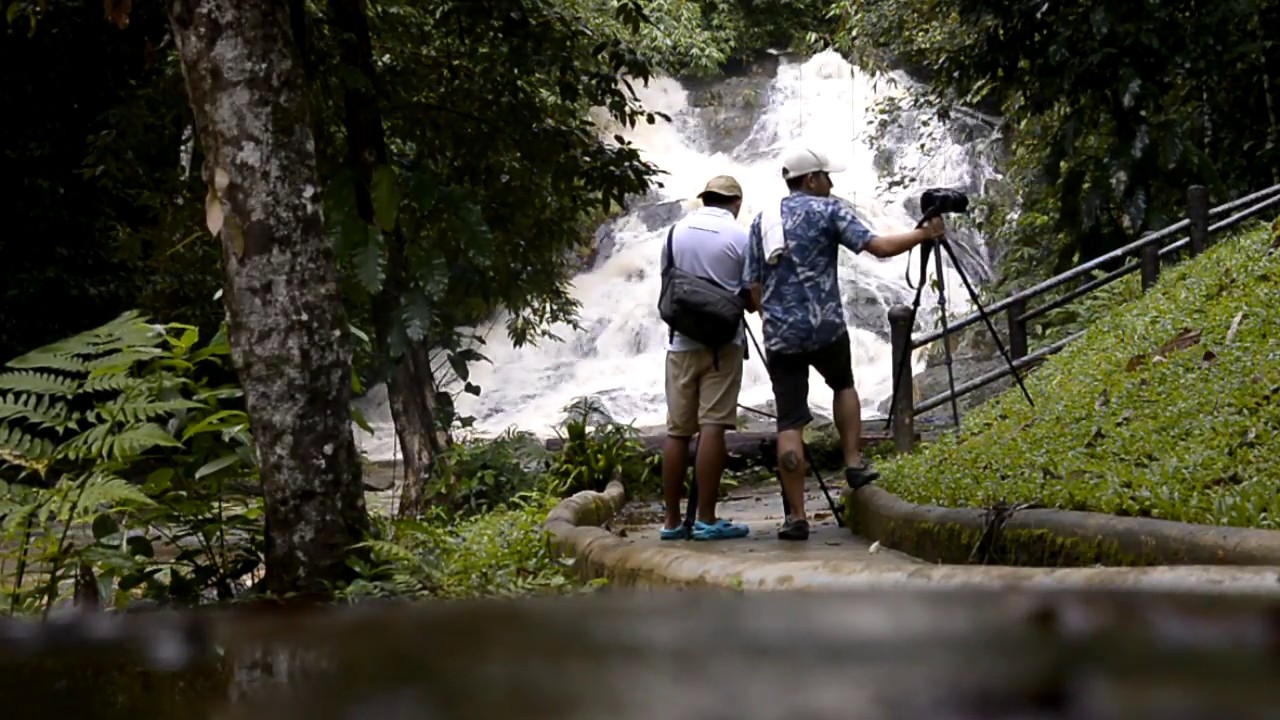
For photography, Bok Krai Waterfall offers many natural compositions: water flowing over rock slabs, clear pools, wet boulders, ferns, moss, large trees, and filtered light through the canopy. Morning or soft daylight is usually best. Photographers should stand on stable ground, avoid blocking trails with tripods, and never climb slippery rocks for a better angle.
Bok Krai Waterfall suits several visitor types, as long as the activity level is chosen carefully. Families can enjoy the lower levels if children are closely supervised. Nature travelers can walk the short trail and photograph the forest stream. More experienced visitors can explore higher levels with proper preparation and local coordination. It is not suitable for careless travel or entering the forest without understanding conditions.
As an itinerary anchor, Bok Krai Waterfall works best as the main morning activity in Kra Buri. The side-road access and walking section require time, so visitors should avoid overloading the day. A practical plan is to visit the waterfall in the morning, then continue to Thap Li Market, Kra Isthmus, local restaurants, or accommodation in Nam Chuet and Nam Chuet Noi in the afternoon.
Nearby places that combine well with Bok Krai include Gong Valley, Kra Isthmus, Thap Li Market, Chum Saeng or Sai Rung Waterfall, Phra Khayang Cave, and Lam Nam Kra Buri National Park. These sites allow travelers to experience agriculture, coffee, geography, local food, caves, waterfalls, and protected forest within the wider Kra Buri route.
Kra Isthmus is one of Kra Buri’s most recognized geographic landmarks, while Thap Li is known for steamed buns and roadside food. Gong Valley adds an agricultural and coffee-based community stop near the Bok Krai area. Combining these places with the waterfall gives the route more variety and makes the trip more practical for travelers who want both nature and local culture.
Getting There from Ranong town is by Highway 4 toward Kra Buri and Chumphon for about 54 km. Around kilometre markers 556 – 557, follow the sign toward Bok Krai Waterfall for about 13 km. From the end of the road, continue on foot for about 200 m through farming land and moist forest to reach the lower waterfall area. Navigation, road signs, local directions, and daylight travel should be used together for the safest access.
Travelers coming from Chumphon can use Highway 4 south toward Kra Buri and watch for the same kilometre markers. A private car, rental car, or hired vehicle is the most suitable transport option because the waterfall is reached by a side road and a final walking section. Public transport is not ideal for this type of destination, especially when weather or road conditions may change.
Before traveling, visitors should check the weather in Kra Buri District and confirm road and stream conditions with local officers or residents. If heavy rain continues, entering the waterfall area should be avoided. This is particularly important for families, elderly travelers, and anyone unfamiliar with wet forest routes. Adjusting plans according to local conditions is part of responsible waterfall travel in Ranong.
In summary, Bok Krai Waterfall is a large 11-tier waterfall in Moo 8, Nam Chuet Subdistrict, Kra Buri District, Ranong Province. It has year-round water, a rainforest setting, a short access walk to the lower levels, and a deeper natural route for physically prepared visitors. Its strengths are flowing water, forest shade, biodiversity, stream terraces, and its connection with Thung Raya-Nasak Wildlife Sanctuary. Visitors should begin early, check weather and road conditions, avoid risky water play after rain, and keep the protected natural area clean and quiet. With proper preparation, Bok Krai Waterfall is one of Kra Buri’s most meaningful rainforest waterfall destinations.
| Name | Bok Krai Waterfall |
| Location | Moo 8, Ban Bok Krai, Nam Chuet Subdistrict, Kra Buri District, Ranong Province |
| Address | Ban Bok Krai, Moo 8, Nam Chuet Subdistrict, Kra Buri District, Ranong Province 85110 |
| Coordinates | 10.37519, 98.85658 |
| Highlights | Large 11-tier waterfall with year-round water flow, located within the wider Thung Raya-Nasak Wildlife Sanctuary landscape |
| Distinctive Features | The first to third levels are about 200 m from the parking area and form a stream flowing over sloping rock terraces. Higher levels are steeper, more winding, and more natural |
| Area Context | Located in humid rainforest connected with Thung Raya-Nasak Wildlife Sanctuary, covering forest areas along the Ranong-Chumphon boundary |
| Nature Trail | Nature study trail of about 1 km, with additional natural routes toward higher waterfall levels for physically prepared visitors who should coordinate with officers |
| Travel Information | From Ranong town, take Highway 4 on the Ranong-Chumphon route for about 54 km to kilometre markers 556 – 557. Follow the Bok Krai Waterfall sign for about 13 km, then walk about 200 m from the end of the road through farming land and moist forest |
| Current Status | Still listed as a natural tourism attraction and part of the Thung Raya-Nasak Wildlife Sanctuary travel landscape. Road and trail conditions should be checked before visiting |
| Open Days | Contact local officers or Nam Chuet Subdistrict Municipality before traveling |
| Opening Hours | Morning to early afternoon visits are recommended |
| Facilities | Parking area, lower-level walking route, some interpretation signs, and resting areas near the waterfall. Visitors should bring drinking water, snacks, good-grip shoes, and personal essentials |
| Main Areas / Zones | 1. Side Road From Highway 4 2. Access Route To Ban Bok Krai And Wildlife Sanctuary Area 3. Parking Area 4. 200 m Walking Section To The Lower Levels 5. Waterfall Levels 1 – 3 6. Nature Study Trail Of About 1 km 7. Natural Route Toward Levels 4 – 11 |
| Caretaker | Thung Raya-Nasak Wildlife Sanctuary, Local Agencies, And Ban Bok Krai Community |
| Main Contact Number | Nam Chuet Subdistrict Municipality, Tel. 077-891-026 |
| Nearby Tourist Attractions | 1. Gong Valley, About 3 km, Tel. 081-078-2865 2. Kra Isthmus, About 18 km 3. Thap Li Market And Community Food Area, About 22 km 4. Chum Saeng Waterfall / Sai Rung Waterfall, About 24 km 5. Phra Khayang Cave, About 25 km 6. Prince Of Chumphon Southern Park Area, About 28 km 7. Lam Nam Kra Buri National Park, About 45 km |
| Nearby Restaurants | 1. Gong Valley, About 3 km, Tel. 081-078-2865 2. Jija@Hua Thanon, About 14 km, Tel. 083-188-9146 3. Rim Khlong Restaurant Kra Buri Ranong, About 18 km, Tel. 086-739-7696 4. Tha Ruea Restaurant, About 19 km, Tel. 077-891-060 5. Oak Seafood Kra Buri Market, About 19 km, Tel. 088-167-8771 6. PunThai Coffee Kra Buri 2, About 20 km, Tel. 092-275-2827 7. Han Yok Yuan Salapao Thap Li, About 22 km, Tel. 077-872-069, 081-891-1900 |
| Nearby Accommodations | 1. Mulberry Resort, About 11 km, Tel. 088-753-9842 2. Pannikar Resort, About 13 km, Tel. 081-628-6196 3. S&T Resort, About 20 km, Tel. 082-808-3668 4. AM Resort Kra Buri, About 22 km, Tel. 077-880-396 5. Khung Nam Resort, About 28 km, Tel. 083-692-6938 6. Junkaew Resort, About 30 km, Tel. 089-292-7454 7. Pure House Resort, About 40 km, Tel. 099-053-6965 |
Frequently Asked Questions (FAQ)
Q: Where Is Bok Krai Waterfall Located?
A: Bok Krai Waterfall is located in Moo 8, Ban Bok Krai, Nam Chuet Subdistrict, Kra Buri District, Ranong Province, within the natural landscape of Thung Raya-Nasak Wildlife Sanctuary.
Q: How Many Levels Does Bok Krai Waterfall Have?
A: Bok Krai Waterfall has 11 levels. The first to third levels are the most accessible from the parking area, while the higher levels are steeper and more natural.
Q: Does Bok Krai Waterfall Flow All Year?
A: Bok Krai Waterfall has year-round water flow, but the water volume and current change by season. Extra caution is needed during and after heavy rain.
Q: How Do Travelers Get To Bok Krai Waterfall?
A: From Ranong town, take Highway 4 toward Kra Buri for about 54 km to kilometre markers 556 – 557. Follow the waterfall sign for about 13 km, then walk about 200 m from the end of the road.
Q: Is Bok Krai Waterfall Suitable For Swimming?
A: Water play is possible only in safe lower-level areas where the current is gentle and the bottom is visible. Avoid entering the water after heavy rain or when the current is strong.
Q: Who Is Bok Krai Waterfall Best For?
A: It is best for travelers who enjoy large waterfalls, rainforest, natural trails, and streamside relaxation. Visitors who want to explore higher levels should be physically prepared and coordinate with officers.
Q: What Should Visitors Bring To Bok Krai Waterfall?
A: Bring drinking water, snacks, non-slip shoes, a towel, spare clothes, a waterproof phone pouch, mosquito repellent, personal medication, and a bag for carrying rubbish back out.
Q: What Nearby Places Can Be Combined With Bok Krai Waterfall?
A: Nearby places include Gong Valley, Kra Isthmus, Thap Li Market, Chum Saeng Waterfall, Phra Khayang Cave, the Prince of Chumphon southern park area, and Lam Nam Kra Buri National Park.
 Category: ●Nature and Wildlife
 Group: ●Waterfalls
Last Update : 3 MonthAgo
 Last Update : 3 MonthAgo
 Click to Access the Navigation Map GPS
Bok Krai Waterfall Map
Recommend

 Art, Culture and Heritage
 Historical Sites and Monuments(4)
 Landmarks and Memorials(1)
 Royal Palace(1)
 Art, Craft Centres, Tradition(4)
 Educational Places
 Educational Gardens, Farm(1)
 Places of Worship
 Temple(12)
 Other Sacred Sites(2)
 Suburban Living
 Village, Community(2)
 National Parks and Marine Reserves(6)
 Mountain (Doi)(4)
Waterfalls(15)
 Hot Springs(3)
 Caves(4)
 River, Canal(2)
 Bays and Beaches(10)
 Islands(8)
 Other natural attractions(3)
 Travel Articles, Recipes
 Travel Review, Food Review(1)


