
lovethailand home >Northeastern Travel Attractions >Ubon Ratchathani Travel Attractions >Si Muang Mai >Na Loen > Pha Luang Waterfall
TL;DR: Pha Luang Waterfall is located at Ban Na Loen, Moo 1, Na Loen Subdistrict, Si Mueang Mai District, Ubon Ratchathani Province, open Daily, hours 08.00 – 17.00.

Pha Luang Waterfall
Open Days: Daily
Opening Hours: 08.00 – 17.00
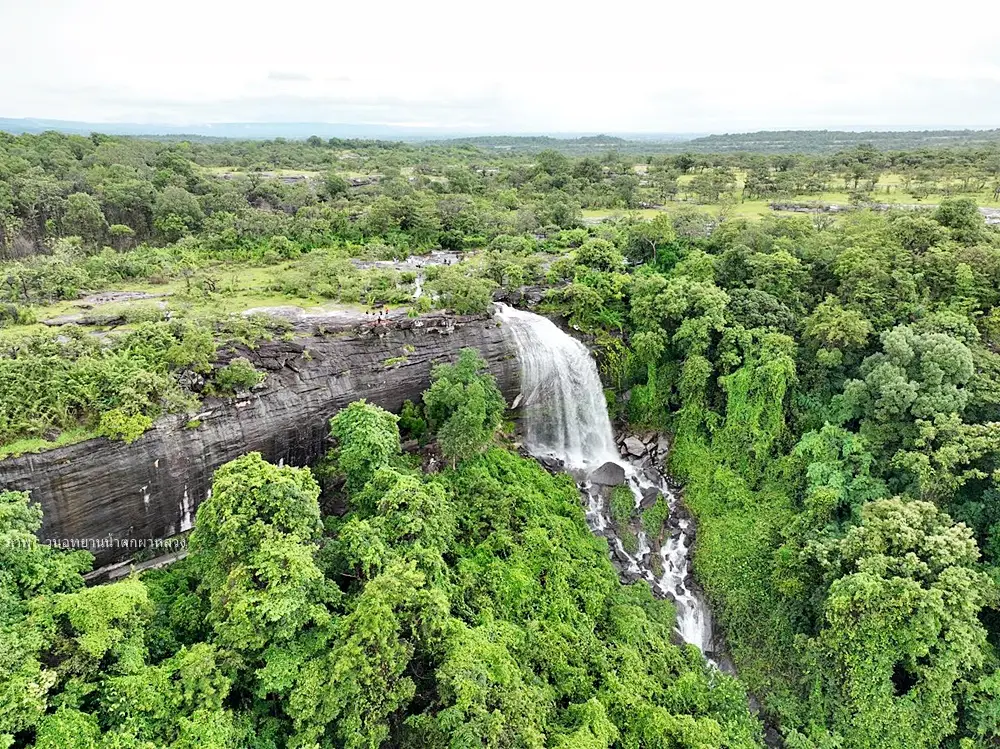
Pha Luang Waterfall in Ubon Ratchathani Province is a seasonal natural waterfall located inside Pha Luang Waterfall Forest Park at Ban Na Loen, Na Loen Subdistrict, Si Mueang Mai District. It is one of the most distinctive nature destinations in northern Ubon Ratchathani, combining a sandstone cliff, a cave-like overhang behind the waterfall, seasonal wildflower fields, unusual rock formations, viewpoints, camping areas, and dark-sky stargazing conditions. Unlike large waterfalls in high mountain regions, Pha Luang Waterfall reflects the landscape of lower northeastern Thailand: low sandstone hills, dry forest, rocky plains, seasonal streams, and rural communities connected with forest and water.
The waterfall is most impressive during the rainy season, when water from the upper part of Phu Luang flows down the sandstone cliff and becomes a broad white curtain in front of the rock face. In the drier months, the water level decreases and the exposed sandstone terraces, rock formations, and open forest become more visible. This seasonal change is part of the charm of Pha Luang Waterfall. Visitors who come during different months will see different versions of the same place: a powerful waterfall in the rainy season, a wildflower landscape in the late rainy season, and a clear rocky plateau suitable for camping and stargazing in the cool season.
The site was formerly known by local people as Pha Sae Waterfall. The word “sae” refers to a water channel or stream line in local usage. The waterfall originates from 3 small watercourses in the upper forest area: Pa Don Bak, Pa Don Chat, and Bok Kop. These channels join together, forming small pools and then a larger body of water before flowing over the cliff. When the volume of water is strong enough, it falls from the rock ledge and becomes the waterfall now known as Pha Luang Waterfall.
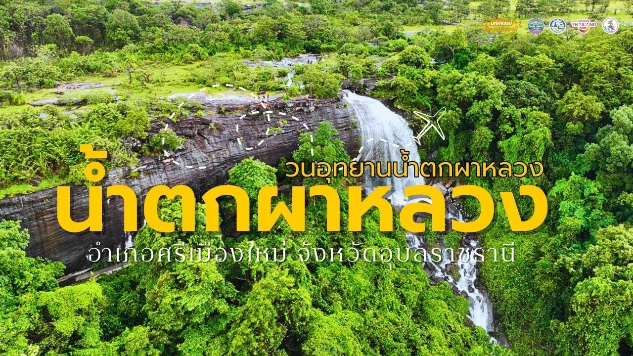
Pha Luang Waterfall is about 20 meters high. The most memorable view is the water dropping from the sandstone cliff in front of a large overhang, creating the impression of a curtain covering the cave-like shelter behind it. Inside this sheltered area is Luang Pho Pha Luang, a revered Buddha image respected by local people and visitors. Local stories connect the site with forest monks who once practiced meditation in the area and with villagers who offered Buddha images to the cave. As a result, the waterfall is not only a scenic natural attraction but also a quiet place of local faith.
The combination of waterfall, cliff, cave, and sacred image gives Pha Luang Waterfall a layered character. Visitors can enjoy the sound of falling water, the cool mist, the shade beneath the overhang, and the calm atmosphere around the Buddha image. This area is particularly attractive in the rainy season, when the waterfall forms a wide curtain and the surrounding forest becomes green and fresh. It is a place where nature and local spirituality exist together without feeling artificial or overly commercial.
Pha Luang Waterfall Forest Park contains more than the main waterfall. Other natural features include Rak Sai Waterfall, Long Pong Waterfall, Yot Nam Thip, rock ledges, cliff viewpoints, sandstone plains, and smaller seasonal water features. These places help visitors understand that the waterfall is part of a larger natural water system, where rainwater, rock cracks, tree roots, and streams create several small but meaningful attractions within the same forest area.
The upper part of the waterfall area contains broad sandstone plains, locally known as lan hin or phlan hin. These rock plains are one of the strongest features of the forest park. During the late rainy season and early cool season, small wildflowers bloom in thin soil layers and cracks on the sandstone surface. The flowers are delicate, but when they spread across the open rock fields, they create a colorful seasonal landscape that is very different from the waterfall scene below.
The wildflower fields of Pha Luang Waterfall are an important seasonal highlight. Visitors may see small native flowers such as Dusita, Saratsachan, Soi Suwanna, Mani Thewa, Thip Keson, Kradum Ngoen, and Dao grass flowers. These plants survive in harsh sandstone environments and bloom when moisture and seasonal conditions are right. The best time for wildflower viewing is usually from the late rainy season into the early cool season, especially from August to October, depending on rainfall.
Sandstone formations are another major attraction in the forest park. Sao Chaliang formations were created from ancient sedimentary layers, weathering, cracking, and long-term erosion by water and wind. These processes left pillar-like rocks with stone slabs on top, creating unusual natural shapes. The formations are not only photo spots but also outdoor examples of geological processes that shaped many parts of Ubon Ratchathani and the lower Isan plateau.
Bok Nok Yung is a group of natural potholes in sandstone. These depressions were formed by water, sand, and small stones rotating repeatedly on the rock surface over a long period of time. As the erosion continued, the holes became wider and deeper. This feature is a clear example of how flowing water can carve hard stone into beautiful shapes. Nearby small stone pillars add more visual interest to the area.
Lan Tao Hin and Lan Chorakhe Hin are groups of sandstone rocks whose shapes resemble turtles and crocodiles. These natural forms make the walk through the rock plain more engaging, especially for travelers who enjoy observing shapes in nature. The landscape encourages visitors to slow down, look carefully, and understand that the beauty of the area lies in small details as much as in dramatic scenery.
Mo Hin Pha Luang Viewpoint is another important zone. From higher ground, visitors can see the surrounding forest, villages, sandstone hills, and the wider terrain of Si Mueang Mai District. This viewpoint helps place the waterfall within its broader geographical context. Pha Luang is not an isolated waterfall; it is part of a landscape made of hills, forests, watercourses, rock plains, and rural communities.
Other interesting natural and cultural points include Plong Chang Lot, Pha Phueng, ancient rock paintings at Pha Thoi, Chet Thewa Waterfall, Sao Chaliang Lang Yen, Tham Wong Lakhon, and Tham Taek. Some of these places require more time and should be visited after checking route conditions with local staff. Together, they show that Pha Luang Waterfall Forest Park is a complex natural area with geology, history, local stories, and forest-based attractions in one destination.
Another special feature of Pha Luang Waterfall Forest Park is its value as a dark-sky site. The camping rock plains are open, relatively far from strong urban light, and suitable for stargazing and astrophotography. Visitors who stay overnight may enjoy a very different experience from daytime sightseeing. After sunset, the waterfall route becomes a quiet forest camping area where the night sky, stars, and Milky Way photography become part of the trip.
Facilities in the forest park include camping areas, some visitor accommodation, toilets, food and drink services in certain periods, visitor service points, parking, and open areas for nature and stargazing activities. Travelers who plan to camp should contact the forest park in advance, especially during the rainy season or after heavy rain, because access and safety conditions can change quickly. Pha Luang is a natural area, so preparation is more important here than at urban attractions.
The walking routes require reasonable physical readiness. Some sections include natural trails, soil paths, wet rocks, slopes, and sandstone surfaces. Visitors should wear shoes with good grip, bring drinking water, prepare sun and rain protection, and carry waterproof protection for phones or cameras. Those who plan to walk to wildflower fields, viewpoints, or upper rock zones should allow enough time and avoid rushing.
Getting There from Ubon Ratchathani city usually involves taking Highway 2050 toward Trakan Phuet Phon and Si Mueang Mai District, then continuing toward Ban Na Loen via the Si Mueang Mai-Na Loen route and local Route UB 2135. The total distance is about 95-100 kilometers depending on the starting point and selected route. Local information describes paved road access to Ban Na Loen and a later section of dirt or natural road leading closer to the waterfall area. A private car or rental car is the most practical option.
Travelers without private transport can first travel from Ubon Ratchathani city to Si Mueang Mai District and then arrange local transport or hire a vehicle to Ban Na Loen and the forest park. This requires planning because public transport into natural attractions is limited. Traveling in a group is easier because a local vehicle can also be used to connect Pha Luang Waterfall with nearby attractions such as Sai Rung Waterfall, Kaeng Chukan, Wat Phu Phra Chao, and other sites in Si Mueang Mai District.
The best time to visit depends on the purpose of the trip. July to September is best for seeing stronger waterfall flow. August to October is suitable for wildflower viewing on the sandstone plains. The cool season is good for camping, walking, stargazing, and enjoying open skies. During heavy rain, visitors should check announcements before traveling because flash floods and difficult access conditions can occur in waterfall areas.
Safety is essential during the rainy season. Visitors should avoid strong currents, wet cliff edges, slippery rocks, and unmarked trails. Do not cross streams when water is rising, do not climb wet rock faces, and do not ignore warning signs. The waterfall is beautiful because it is an active natural system, and that same natural force requires caution and respect.
Families with children or elderly visitors should focus on accessible areas such as the visitor zone, main waterfall viewpoint, resting areas, and easier photo spots. More demanding trails to rock plains, viewpoints, or upper zones should be considered only when everyone in the group is physically ready. This approach makes the trip safer and more enjoyable for mixed-age groups.
Photographers will find Pha Luang Waterfall especially rewarding. The site offers waterfall curtains, sandstone cliffs, cave shadows, a Buddha image, wildflowers, unusual rocks, open viewpoints, and dark night skies. Morning light is good for flowers and rock fields. The rainy season provides strong waterfall scenes, while clear cool-season nights are suitable for stargazing and Milky Way photography.
From a geological perspective, Pha Luang Waterfall is a useful outdoor classroom. The area shows sandstone layers, cliff formation, natural potholes, weathered rocks, seasonal streams, and erosion features. These elements help visitors understand how water, wind, heat, and time shape the Isan landscape. The site proves that Ubon Ratchathani’s natural identity is not limited to the Mekong River or Pha Taem cliffs; it also includes smaller seasonal waterfalls and sandstone ecosystems.
Culturally, the waterfall is closely connected with Ban Na Loen and surrounding communities. The old name Pha Sae, the local water-channel stories, Luang Pho Pha Luang, nearby forest monasteries, and the routes used by local people all show that this is not an isolated tourist site. It is a lived landscape, known and remembered by local communities over time. Visitors should behave respectfully, especially around sacred areas and local village routes.
Nearby religious sites such as Wat Pa Pha Phueng Phu Luang, Wat Phu Kum Khao, and Wat Phu Phra Chao or Wat Tham Phra Chao Kho Kut add a cultural dimension to the nature route. Travelers interested in both nature and local faith can combine these places with a visit to Pha Luang Waterfall. Modest dress and quiet behavior are recommended when visiting religious areas or forest monk sites.
Food options are mostly found in Si Mueang Mai District and along main local routes. Visitors can find Isan food, made-to-order Thai dishes, cafés, grilled food, and simple roadside restaurants. Since services inside natural areas may not always be available, it is practical to eat in the district town or prepare food and drinking water before entering the forest park, especially for those planning to camp or walk longer routes.
Accommodation options include the forest park camping area, limited visitor accommodation, small rooms, resorts, and local guesthouses in Si Mueang Mai District. Camping inside the forest park gives the most natural experience, especially for stargazing. Staying in the district town is more convenient for travelers who need private rooms, easier food access, and a more comfortable overnight stay.
A 1-day trip from Ubon Ratchathani city is possible. Travelers can leave early, reach Si Mueang Mai before midday, continue to Pha Luang Waterfall, spend time at the main waterfall, rock zones, and viewpoints, then return in the evening. Those who want to see wildflower fields, camp, or photograph stars should plan an overnight trip instead of rushing the visit.
A 2-day route can be more rewarding. On the first day, visit Pha Luang Waterfall, walk the nature zones, camp, and enjoy the dark sky. On the second day, continue to nearby places such as Sai Rung Waterfall, Kaeng Chukan, Wat Phu Phra Chao, or extend the journey toward Khong Chiam, Pha Taem National Park, the Two-Color River, and Sam Phan Bok. This creates a deeper Ubon Ratchathani nature itinerary.
For international visitors, Pha Luang Waterfall offers a side of Thailand that is different from beaches, islands, major temples, or urban attractions. It shows the beauty of lower Isan through dry forest, sandstone, seasonal water, wildflowers, local faith, rural access roads, and a dark night sky. With local interpretation, the site can help foreign travelers understand the relationship between landscape, water, culture, and community in northeastern Thailand.
The value of Pha Luang Waterfall should not be judged only by the amount of water. In the rainy season, the waterfall is the main highlight. In the late rainy season, wildflowers and rock plains become important. In the cool season, camping and stargazing stand out. In drier months, the exposed rocks and open landscape reveal the geological structure of the area. Each season has its own reason to visit.
Responsible travel is especially important here. Visitors should not leave litter, remove plants, pick wildflowers, write on rocks, use soap or chemicals in streams, or disturb wildlife and other campers. Sandstone plains and seasonal flowers are fragile. Staying on marked paths and respecting natural surfaces help preserve the landscape for future visitors.
Overall, Pha Luang Waterfall is one of the most complete nature destinations in Si Mueang Mai District. It offers a waterfall, cliff cave, sacred Buddha image, rock plains, wildflower fields, unusual sandstone formations, viewpoints, camping, and stargazing in one place. It remains less crowded than the province’s major tourist sites, making it suitable for travelers who prefer slow, meaningful, and nature-based travel.
Pha Luang Waterfall deserves a place in any deeper Ubon Ratchathani itinerary. It requires more preparation than a city attraction, but it rewards travelers with clear seasonal beauty, quiet forest atmosphere, local cultural meaning, and a rare combination of waterfall, wildflowers, sandstone, and stars. For visitors who want to understand Ubon Ratchathani beyond the usual route, this forest park is a strong and memorable destination.
| Name | Pha Luang Waterfall / Pha Luang Waterfall Forest Park |
| Location | Ban Na Loen, Moo 1, Na Loen Subdistrict, Si Mueang Mai District, Ubon Ratchathani Province |
| Address | Pha Luang Waterfall Forest Park, Ban Na Loen, Na Loen Subdistrict, Si Mueang Mai District, Ubon Ratchathani 34250 |
| Coordinates / Navigation Point | Pha Luang Waterfall Forest Park, Na Loen Subdistrict, Si Mueang Mai District, Ubon Ratchathani; access via the Si Mueang Mai-Na Loen route and local Route UB 2135 |
| Distinctive Features | Seasonal natural waterfall dropping from a sandstone cliff, cave-like overhang, Luang Pho Pha Luang Buddha image, sandstone plains, wildflower fields, Sao Chaliang formations, and dark-sky camping area |
| History | Formerly known locally as Pha Sae Waterfall. The area was established as Pha Luang Waterfall Forest Park on September 4, 1995, with later official designation of forest park area within Pa Dong Phu Lon National Reserved Forest. |
| Name Origin | The name Pha Luang comes from Phu Luang, the source area of the waterfall. The older name Pha Sae is connected with local stream channels called “sae.” |
| Travel Information | From Ubon Ratchathani city, take Highway 2050 toward Si Mueang Mai District, then continue on the Si Mueang Mai-Na Loen route and local Route UB 2135. Total distance is about 95-100 km. Some sections near the forest park are natural or dirt-road access routes. |
| Current Status | Open for tourism and overnight camping as a natural attraction inside Pha Luang Waterfall Forest Park |
| Open Days | Daily |
| Opening Hours | 08.00 – 17.00 |
| Fees | Admission fee: 20 Baht per person Parking fee: 20 Baht Camping fee: 30 Baht per person |
| Facilities | Camping ground, limited visitor accommodation, toilets, visitor service area, food and drink services, parking area, and dark-sky activity area |
| Main Areas / Zones | Pha Luang Waterfall Zone Cave Overhang And Luang Pho Pha Luang Zone Rak Sai Waterfall And Yot Nam Thip Zone Sandstone Plain And Wildflower Zone Sao Chaliang And Bok Nok Yung Zone Lan Tao Hin And Lan Chorakhe Hin Zone Mo Hin Pha Luang Viewpoint Zone Camping And Dark-Sky Zone |
| Caretaker | Pha Luang Waterfall Forest Park under natural-resource and protected-area authorities, with Na Loen Subdistrict Administrative Organization as the local authority in the area |
| Main Contact Number | Pha Luang Waterfall Forest Park, Tel. 080-279-7459 Na Loen SAO, Tel. 045-252574 TAT Ubon Ratchathani Office, Tel. 0-4524-3770, 0-4525-0714 |
| Best Time To Visit | July-September for waterfall flow, August-October for wildflowers, and the cool season for camping, stargazing, and sandstone landscapes |
| Safety Notes | Be careful of slippery trails, wet rocks, flash floods during the rainy season, high cliffs, and natural trail conditions. Check forest park announcements before traveling during heavy rain. |
| Nearby Tourist Attractions | 1. Pha Luang Waterfall And Luang Pho Pha Luang Cave Overhang, 1 km, Tel. 080-279-7459 2. Pha Luang Wildflower Fields, 2 km, Tel. 080-279-7459 3. Sao Chaliang And Bok Nok Yung, 3 km, Tel. 080-279-7459 4. Mo Hin Pha Luang Viewpoint, 4 km, Tel. 080-279-7459 5. Wat Phu Phra Chao / Wat Tham Phra Chao Kho Kut, 15 km 6. Kaeng Chukan, Si Mueang Mai District, 22 km 7. Sai Rung Waterfall, Na Kham Subdistrict, 22 km |
| Nearby Restaurants | 1. Taeng On & Sasikan Made-To-Order Restaurant, 17 km, Tel. 089-699-5943 2. Sabai Phung Si Mueang Mai, 18 km, Tel. 061-954-0245 3. Turbo Nom Sod Si Mueang Mai, 18 km, Tel. 061-689-7546 4. Chaiwan Si Mueang Mai, 18 km, Tel. 085-747-7282 5. Chaiwan Korean BBQ, 18 km, Tel. 084-586-5121 6. KFC PTTOR Si Mueang Mai, 19 km, Tel. 065-729-8603 |
| Nearby Accommodations | 1. Pha Luang Waterfall Forest Park Camping Ground, 0 km, Tel. 080-279-7459 2. Sabai Dee Rooms, 18 km, Tel. 080-473-7555, 086-248-7474 3. Phat Resort, 19 km, Tel. 089-719-1219 4. Phrom Thong Resort Hotel, 19 km, Tel. 099-171-7290 5. Ban Klang Soi Resort Ubon, 20 km, Tel. 081-966-7939 |
Frequently Asked Questions (FAQ)
Q: Where is Pha Luang Waterfall located?
A: Pha Luang Waterfall is located inside Pha Luang Waterfall Forest Park at Ban Na Loen, Moo 1, Na Loen Subdistrict, Si Mueang Mai District, Ubon Ratchathani Province.
Q: What are the opening days and hours?
A: Pha Luang Waterfall is open daily from 08.00 to 17.00.
Q: Is there an entrance fee?
A: Yes. The admission fee is 20 Baht per person. Parking is 20 Baht, and camping is 30 Baht per person.
Q: Does Pha Luang Waterfall have water all year?
A: Pha Luang Waterfall is seasonal. The water is strongest during the rainy season, especially from July to September. In the dry season, water decreases and the sandstone landscape becomes more visible.
Q: What are the main highlights of Pha Luang Waterfall?
A: The highlights are the waterfall curtain, sandstone cliff, cave-like overhang, Luang Pho Pha Luang Buddha image, wildflower fields, Sao Chaliang formations, Bok Nok Yung, viewpoints, camping areas, and dark-sky stargazing conditions.
Q: When is the best time to visit?
A: July to September is best for waterfall views, August to October is best for wildflowers, and the cool season is suitable for camping, walking, and stargazing.
Q: How can travelers get from Ubon Ratchathani city to Pha Luang Waterfall?
A: Take Highway 2050 toward Si Mueang Mai District, then continue on the Si Mueang Mai-Na Loen route and local Route UB 2135. The total distance is about 95-100 km, with some natural or dirt-road sections near the forest park.
Q: What attractions can be visited together with Pha Luang Waterfall?
A: Nearby attractions include the Pha Luang wildflower fields, Sao Chaliang, Bok Nok Yung, Mo Hin Pha Luang Viewpoint, Wat Phu Phra Chao, Kaeng Chukan, and Sai Rung Waterfall.
 Category: ●Nature and Wildlife
 Group: ●Waterfalls
Last Update : 3 MonthAgo
 Last Update : 3 MonthAgo
 Click to Access the Navigation Map GPS
Pha Luang Waterfall Map
Recommend

 Art, Culture and Heritage
 Historical Sites and Monuments(5)
 Landmarks and Memorials(2)
 Royal Palace(1)
 Art, Craft Centres, Tradition(7)
 Museums(3)
 University
 Public university(1)
 Autonomous Universities(1)
 Rajabhat University(1)
 Private University(2)
 Places of Worship
 Temple(38)
 Other Sacred Sites(4)
 Research and Development
 Royal Project(2)
 Suburban Living
 Village, Community(2)
 Local Market(4)
 National Parks and Marine Reserves(5)
 Mountain (Doi)(6)
 Dam, Reservoir, Lake(8)
Waterfalls(12)
 Hot Springs(1)
 Caves(2)
 River, Canal(11)
 Bays and Beaches(8)
 Islands(2)
 Other natural attractions(6)
 Entertainment and Agricultural
 Zoos and Aquariums(2)
 Animal camps and shows(1)
 Farms, Parks and Ecotourism(1)
 Waterpark(1)
 Shopping
 Shopping and Night Market(1)
 Department Store(1)
 Travel Articles, Recipes
 Travel Review, Food Review(1)


