
lovethailand home >Northeastern Travel Attractions >Nakhon Phanom Travel Attractions >Si Song Khram >Si Song Khram > Songkhram River
TL;DR: Songkhram River, open Daily for public riverbanks, viewpoints, and community routes without, hours Public riverfront areas are accessible 24 hours a day. The recommended period.
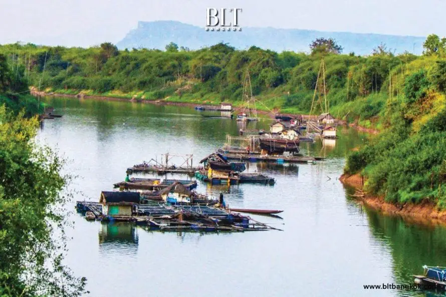
Songkhram River
Open Days: Daily for public riverbanks, viewpoints, and community routes without controlled entrance gates
Opening Hours: Public riverfront areas are accessible 24 hours a day. The recommended period for safe nature viewing is 06:00 – 18:00. Markets, restaurants, accommodation, temples, and community activities operate according to separate schedules.
The Songkhram River is one of the most important rivers of upper northeastern Thailand. It flows for approximately 420 kilometres across the broad Sakon Nakhon Basin before entering the Mekong River at Chai Buri in Tha Uthen District, Nakhon Phanom Province. The river is distinguished by its seasonal flood cycle, extensive tributary network, fish diversity, traditional fisheries, and pa bung pa tham floodplain forests. It is not simply a channel carrying water, but an interconnected ecological and cultural system supporting communities across several provinces.
Essential information The river rises in the Phu Phan mountain region around the Phu Pha Lek ridge and surrounding highlands of Song Dao District, Sakon Nakhon Province. It then follows a long, winding route through areas associated with Sakon Nakhon, Udon Thani, Nong Khai, Bueng Kan, and Nakhon Phanom before reaching the Mekong at Chai Buri. Its upper channel is narrower and steeper, whereas the lower river is extremely flat, slow-moving, and connected with numerous tributaries, ponds, marshes, flooded fields, and seasonally inundated forests.
When the Mekong rises during the rainy season, drainage from the lower Songkhram slows and water is pushed back into the tributary system. Water spreads across low-lying land and temporarily transforms a vast area into a connected freshwater landscape. This flood pulse supports fisheries, transports nutrients, replenishes soil, and creates habitats used by aquatic animals throughout their life cycles.
Public river viewpoints and riverbank areas do not charge an admission fee. Visitors can view the river, photograph the landscape, explore communities, visit the fish market, and dine locally without purchasing an entrance ticket. Boat trips, homestays, guided community activities, food, and privately operated services are charged separately.
The source of the Songkhram River lies in elevated parts of the Phu Phan range, including the Phu Pha Lek area and nearby ridges in Song Dao District. Small forest streams collect rainfall and descend through natural drainage channels before combining into a larger river on the Sakon Nakhon Basin plain. These headwater areas store rainfall, reduce runoff speed, and supply the main river seasonally.
The headwater landscape contains ridges, forest, foothills, agricultural areas, and narrow streams. Rainwater enters soil and moves downslope through surface and underground pathways. The upper gradient creates a faster current than in the lower basin. As the river reaches flatter land, it becomes wider and receives increasing amounts of water, sediment, organic material, and aquatic life from tributaries.
The course of the Songkhram is highly winding and changes direction several times. From the Sakon Nakhon headwaters, the river curves north and northeast through the wider Nong Han and Ban Dung areas before crossing the upper basin connected with Udon Thani, Nong Khai, and Bueng Kan. It later bends south and east through districts including Ban Muang, Wanon Niwat, Akat Amnuai, Phon Charoen, and Seka before entering Si Songkhram District in Nakhon Phanom.
Older documents may identify Phon Charoen and Seka as districts of Nong Khai Province. Under the current administrative structure, both districts are in Bueng Kan Province. From Si Songkhram, the river continues eastward toward Chai Buri in Tha Uthen District, where it completes its journey by joining the Mekong.
The low gradient and soft floodplain sediments produce a meandering channel. The current erodes the outer side of bends and deposits sediment along the inner side, gradually changing the river’s position. This process creates deep pools, shallow bars, sandy banks, abandoned channels, ponds, and wetlands that reconnect during high water.
The upper Songkhram has a narrower channel and a greater gradient. Water moves more quickly after rain and passes through landscapes containing forest, farmland, villages, ponds, and small tributaries. The riverbed may contain sand, gravel, clay, and fine sediment depending on local geology and channel form.
Upper-basin water supports agriculture, household fishing, livestock, and community use. It also transports nutrients, sediment, seeds, plants, and small organisms toward the middle and lower river. Conservation of headwater forest and tributaries therefore affects water quality and ecological conditions throughout the basin.
The lower Songkhram is dramatically flatter. Across a lower section extending for approximately 200 kilometres, the total elevation difference is only around one metre. The current consequently moves very slowly and the river can overflow into surrounding lowlands when rainfall is sustained or the Mekong is high.
The lower channel is broad, sinuous, and connected to extensive wetlands. Rice fields, floodplain forest, ponds, tributaries, marshes, and seasonally used agricultural land occur along both sides. Slow-moving floodwater distributes sediment and nutrients across this landscape, supporting fertile soil, fish production, aquatic organisms, and local livelihoods.
Important tributaries include the Nam Un, Nam Yam, Nam Mao, Huai Ouan, Huai Sang, Huai Khlong, Huai Hi, and numerous smaller streams. Every tributary has its own catchment and carries water, sediment, nutrients, and aquatic organisms into the Songkhram. Together they form a complex network linking the main river with ponds, marshes, and seasonal flood areas.
The Nam Un River is a major tributary flowing through Sakon Nakhon and Nakhon Phanom before entering the Songkhram in Si Songkhram District. The confluence provides an accessible viewpoint where visitors can observe two waterways, the Songkhram bridge, community fisheries, and the surrounding settlement.
The Nam Un confluence and the Songkhram Bridge near Ban Na Phiang provide a practical reference point for travelers. The area is close to the municipal market, restaurants, accommodation, and local roads. It allows visitors to experience the river without entering a boat or traveling deep into a seasonally flooded forest.
The Nam Yam River connects parts of Sakon Nakhon with the lower Songkhram system. During high water, it distributes water into fields and floodplain forests. During the recession period, ponds, channels, and wetlands along the Nam Yam become important fishing and food-gathering areas.
The Nam Mao and smaller tributaries further increase habitat diversity. Some flow through woodland, others through rice-growing areas and villages. Although many are small, they provide migration routes allowing fish and other aquatic animals to move between the main river, ponds, marshes, and flooded land.
Mekong backwater is a defining process in the lower basin. When the Mekong rises during the wet season, water from the Songkhram cannot drain freely into the larger river. The high Mekong slows the current near the mouth and raises the water level throughout the lower tributary.
When backwater coincides with heavy rainfall in the basin, the Songkhram expands into tributaries, marshes, fields, ponds, and floodplain forest. During years of high water, several hundred thousand rai can become part of a connected freshwater landscape for months, resembling a large shallow lake crossed by river channels and forest.
Water levels normally begin rising clearly during June and July, often reach their highest stage in August and September, and gradually fall through October and November. The exact duration and depth vary annually according to rainfall, storms, tributary inflow, and Mekong conditions.
The flood season is not simply a destructive event. It is part of the natural ecological cycle. Floodwater carries nutrients and sediment into pa bung pa tham forest. Fish enter shallow areas to feed, breed, and find shelter among plants, while the soil receives organic material that supports future plant growth.
Communities have adapted farming, livestock, fishing, and food gathering to this cycle. Land used for grazing or vegetation gathering in the dry season may become fishing habitat during high water. Ponds and channels remaining after the flood provide water and refuge for aquatic organisms.
The water-recession season begins when rainfall decreases and the Mekong falls. Water drains gradually from flooded forest and fields into the Songkhram. Fish move through channels toward the main river, creating an important period for community fisheries.
As the ground dries, grasses, herbs, shrubs, and seasonal crops grow rapidly. Plant material accumulating during the dry months becomes organic matter. When water returns, this material supplies nutrients to aquatic microorganisms and supports the wetland food web.
Pa bung pa tham is the local term for seasonally flooded riverine forest and floodplain land. Bung generally refers to low depressions or wet areas flooded for long periods. Tham describes low riverine ground inundated in the wet season and exposed during the dry season. The landscape contains woodland, shrubs, grassland, pools, channels, and agricultural areas within one seasonal system.
The forest is not uniform. Differences in ground elevation, flood duration, soil, and distance from the river create three broad ecological zones: low bung or deeply flooded forest, intermediate tham or transitional floodplain, and higher khok woodland. Each supports different plants, animals, and forms of community use.
Type 1: Low bung and deeply flooded forest occurs beside channels, ponds, depressions, and the lowest ground. It floods early and remains underwater longer than other areas. Plants must tolerate prolonged root inundation. During the wet season, the area becomes habitat for fish, shrimp, snails, aquatic insects, and birds.
Low bung areas function as nurseries because currents are weaker than in the main channel and vegetation provides shelter. Leaves, fruit, seeds, and insects become food. Filling these depressions or blocking their connection with the river directly reduces habitat available for young fish.
Type 2: Tham or transitional floodplain lies slightly higher. It floods during high water but dries earlier than the lowest depressions. Trees, shrubs, grass, vines, food plants, and medicinal species grow together. Communities gather mushrooms, bamboo shoots, vegetables, herbs, fuelwood, and other products when conditions permit.
Tham forest slows floodwater, traps sediment, and stabilizes soil. Roots reduce bank erosion, while branches and vegetation provide shelter for fish. After the flood, the same land becomes feeding habitat for birds, reptiles, insects, and small mammals.
Type 3: Khok or higher woodland stands above normal flood levels and is inundated only during exceptional high water. It supports plants unable to tolerate prolonged submersion and often contains houses, temples, livestock areas, and selected crops. Khok areas provide refuge for people and animals when the lower floodplain is underwater.
Although less frequently flooded, khok woodland remains ecologically connected to bung and tham. Animals move between elevation zones, and trees contribute seeds, leaves, and organic matter to floodwater. Effective conservation must therefore protect the complete elevation sequence rather than only permanently wet areas.
The Lower Songkhram River Wetland was designated a Wetland of International Importance under the Ramsar Convention on 15 May 2019. It is Ramsar Site No. 2,420 globally and Thailand’s 15th Ramsar Site. The designated area covers approximately 5,504.5 hectares, or about 34,403 rai.
Ramsar designation does not automatically prohibit community use. It promotes wise use, maintenance of ecological character, and participation by local residents. Fishing, agriculture, forest-product collection, education, and tourism can continue when they do not destroy waterways, habitats, biodiversity, or seasonal connections.
The important lower-river corridor extends for approximately 92 kilometres from the Pak Yam area in Sam Phong, Si Songkhram District, downstream to Chai Buri in Tha Uthen District. It includes the main channel, tributary mouths, flooded forest, ponds, marshes, fields, and community-use areas.
Si Songkhram Wetland City represents another major achievement. Si Songkhram District received Wetland City Accreditation under the Ramsar Convention in 2022 and became the first accredited Wetland City in Thailand. The recognition reflects cooperation among communities, local authorities, provincial agencies, and conservation networks.
Wetland City management extends beyond forest protection. It includes urban planning, waste, wastewater, fisheries, agriculture, education, flood preparedness, and tourism. The principle recognizes wetlands as infrastructure supporting quality of life and the local economy rather than vacant land awaiting conversion.
Fish diversity is one of the lower basin’s greatest values. Scientific assessments within the Ramsar landscape have recorded more than 120 fish species. Some migrate between the Mekong, Songkhram, tributaries, ponds, and flooded forest. Different habitats support spawning, feeding, shelter, and nursery stages.
The long, connected lower river allows fish to follow seasonal water movement. Barriers, blocked tributary mouths, and permanent conversion of flooded land can interrupt migration and reduce fisheries productivity throughout the system.
Si Songkhram Fish Market makes the relationship between river ecology and the local economy visible. The municipal market sells river fish, wetland fish, vegetables, local food, fermented products, and community goods. It operates daily from early morning into the evening, with the most active period occurring when fishers and traders deliver fresh products.
Species and products change according to season, water level, fishing regulations, and daily catch. Visitors may see fresh fish, dried fish, pla ra, pla som, and other preserved food. Responsible purchases should avoid undersized or protected aquatic species.
Traditional fishing depends on knowledge of season, current, fish behavior, and channel form. Fishers use cast nets, traps, baskets, hook lines, lift nets, and other selective equipment according to local conditions. Compliance with closed seasons and protection of breeding fish are essential for long-term productivity.
Some communities maintain fish-conservation zones, protected pools, and restrictions on particular equipment. Travelers wishing to fish or join a community activity must ask permission and follow local rules rather than entering a working fishing area independently.
Songkhram food culture includes grilled fish, fish soup, spicy fish salad, steamed fish, fish cooked in banana leaves, fried fish, pla som, pla ra, and dishes using seasonal wetland vegetables. Recipes vary according to species, herbs, and community tradition.
Freshwater fish should be fully cooked. Raw fish and inadequately prepared fermented products present health risks. Large fish may be priced by weight, so diners should confirm the size, total price, and preparation method before ordering.
Floodplain plants include trees, shrubs, vines, grasses, aquatic vegetation, edible plants, and medicinal species. Distribution follows elevation and flood duration. Communities gather mushrooms, bamboo shoots, vegetables, fruit, herbs, fuelwood, and weaving materials under local rules.
Sustainable gathering leaves enough of each plant for recovery, avoids uprooting whole populations, and protects large trees. Visitors should not collect plants, fungi, animals, or natural objects without community permission.
Birds and wildlife use the wetland for feeding, resting, and breeding. Flooded areas support aquatic animals and waterbirds, while exposed mud, grassland, and pools attract birds during water recession. Observation should use binoculars and maintain a respectful distance from nests and feeding groups.
Snakes, reptiles, insects, and small animals are normal components of the environment. Closed footwear and long trousers are appropriate for forest routes. Animals should not be touched, chased, or harmed.
Zone 1: Nam Un Confluence and Ban Na Phiang Songkhram Bridge provides the most accessible introduction. Visitors can see the main river, bridge, tributary confluence, fishing activity, and settlement without using a boat. Restaurants, the municipal market, and accommodation are nearby.
Vehicles should be parked without blocking traffic or boat access. Visitors must not climb bridge barriers or stand on cracked riverbanks. Wet-season currents are strong, while recently exposed banks may remain muddy and slippery.
Zone 2: Si Songkhram Fish Market and Food District explains the relationship between wetland resources and the community economy. Morning is the best time for fresh fish, seasonal products, and local food. Photography of traders and goods should be requested politely.
Zone 3: Pa Bung Pa Tham Forest and Community Routes requires coordination with local leaders or guides. Routes change with water levels and may involve driving, walking, or boats. A local guide helps avoid unstable ground, deep channels, private areas, and working fishing zones.
Suitable activities include birdwatching, plant study, fishing-culture interpretation, and observation of floodplain structure. Groups should remain small, avoid loud music, remove all waste, and never collect specimens.
Zone 4: Sam Phong and Pak Yam lies near the upstream edge of the Ramsar landscape. The Songkhram, Nam Yam, bridges, villages, and floodplain habitats meet in this area. Road and water conditions should be confirmed locally before travel.
Zone 5: Chai Buri River Mouth is where the Songkhram enters the Mekong. It is known for the two-colored confluence created by differences in sediment and water characteristics. Restaurants, homestays, fishing culture, and an old Tai Yo community add cultural interest.
The road journey from Si Songkhram to Chai Buri is much longer than a straight river measurement. It is better planned as a full-day trip or overnight stay. Independent boating should not be attempted without an authorized local operator and complete safety equipment.
Zone 6: Temples, Communities, and Cultural Learning Sites includes community temples, the Luang Pu Tue Ajaladhammo Museum at Ban Kha, and local historical places. These sites demonstrate how settlement, religion, merit-making, and river life developed together.
Temple visitors must dress modestly and avoid disturbing ceremonies. Interior museum and temple hours differ from unrestricted public river access and should be confirmed before group travel.
The best season depends on the intended experience. November through February provides cooler weather for markets, community exploration, cycling, and general sightseeing. March through May reveals channel forms, banks, and sandy areas but becomes extremely hot at midday.
June through October is the most informative period for understanding floods, backwater, and pa bung pa tham forest. The landscape becomes green and the river expands, but access to nature areas requires local coordination and close attention to flood warnings.
The best time of day is approximately 06:00–10:00 and 15:30–18:00. Morning provides cooler weather and an active market, while late afternoon is suitable for river photography. Midday sunlight and heat can be severe during the hot season.
Photography should be carried out from bridges, viewpoints, and stable public land. Wide views show river bends, flooded fields, and communities, while telephoto images are useful for boats, birds, and fishing activity. Never climb barriers or descend a wet bank for a photograph.
Drone operation must comply with Thai aviation registration and local requirements. Flights must not disturb wildlife, communities, or private property. Near the Mekong border, a drone must never cross into another country without authorization.
Birdwatching is most rewarding in the morning and during water recession. Binoculars and unobtrusive clothing are recommended. Recorded bird calls should not be used to attract wildlife, and nesting areas must be avoided.
Boat activities must use a knowledgeable community or authorized operator. Every passenger must wear a properly fitted life jacket. Do not stand or change seats while moving, and do not travel during storms, lightning, strong current, or poor visibility.
Wet-season safety requires attention to water level, current, bank erosion, and flooded roads. Do not stand on cracked ground, drive through water of unknown depth, or enter a restricted area. River levels may rise because of rainfall elsewhere even when the viewpoint remains dry.
After floods, mud, debris, branches, waste, and sharp objects may remain. Wait until an area has been inspected and cleaned. Children must remain away from the water’s edge, and alcohol must never be combined with boating.
Dry-season safety remains important. Deep channels and strong currents persist even when water levels are low. Sandbars can conceal mud and unstable deposits. Do not swim or walk onto an isolated bar without local guidance and official approval.
Leave-no-trace travel requires removing all waste. Plastic, foam, fishing line, hooks, and food containers can injure birds and aquatic animals. Hazardous waste should be reported rather than handled without protection.
Soap, shampoo, cooking oil, and chemicals must never be released into the river. Introducing non-native fish or feeding wild fish in large quantities can alter ecological conditions.
Community respect is essential. Boats, nets, traps, fish-drying areas, and river access points are workplaces. Do not touch equipment or photograph people at close range without permission. Unfenced farmland and houses remain private property.
Buying fish products, food, vegetables, and accommodation locally distributes tourism income. Prices should be confirmed clearly and paid fairly.
A two-to-three-hour itinerary begins at the Nam Un confluence and Ban Na Phiang bridge, continues to the municipal fish market, and finishes with a local meal. It suits travelers passing through the district without entering floodplain forest.
A half-day itinerary can combine the morning market, river viewpoint, lunch, and a visit to Pak Siu–Kut Do beach or a nearby community according to water level. A pa bung pa tham visit must be arranged with a local guide.
A full-day itinerary can include the Ramsar landscape around Sam Phong and Pak Yam, a cultural or temple stop, and dinner in Si Songkhram. Nature routes require a suitable vehicle and local coordination.
A Chai Buri extension requires a full day or an overnight stay. Travelers can begin in Si Songkhram and continue by road to the Songkhram–Mekong confluence, eat freshwater fish, and learn about the Tai Yo community.
Travel from Nakhon Phanom city covers approximately 69 kilometres. Follow Highway 212 toward Tha Uthen, turn onto Highway 2032 near the Tha Dok Kaeo junction, and continue to Si Songkhram. Driving normally takes around 1 hour 10 minutes to 1 hour 30 minutes.
Travel from Sakon Nakhon city follows the route through Akat Amnuai to Si Songkhram, covering approximately 60 kilometres. Drivers should watch for motorcycles, agricultural vehicles, pedestrians, and livestock.
Public transportation connects Si Songkhram with Nakhon Phanom and Sakon Nakhon on selected routes, but a local hired vehicle is required for forest, village, and remote river sites. Agree on the fare, return time, meeting point, and driver telephone number in advance.
Recommended equipment includes comfortable footwear, a hat, drinking water, sunscreen, rain protection, personal medication, insect repellent, a camera, and a waste bag. Floodplain routes require closed shoes, long trousers, waterproof storage, and prior notification to a local guide.
A light jacket is useful during cool-season mornings. Hot-season outdoor activity should be reduced from 11:00 to 15:00. Boat passengers need properly fitted life jackets. Phones should be fully charged and offline maps downloaded.
Facilities are concentrated in Si Songkhram town and include a market, restaurants, cafés, accommodation, fuel stations, convenience stores, a hospital, and general services. Facilities are limited in floodplain forest and remote communities, so water, fuel, and toilets should be arranged before departure.
Restaurants near the reference point include river restaurants, Isan food, steak restaurants, cafés, and coffee shops. Freshwater fish availability changes seasonally, so the species and price should be confirmed. Groups should reserve tables in advance.
Accommodation in Si Songkhram consists mainly of small resorts, villas, and locally operated properties around the district center and ring road. Staying overnight provides early access to the market and river. Rooms and breakfast should be confirmed by telephone during festivals, holidays, and the cool season.
Management of the Songkhram River is shared rather than controlled by one institution. Relevant organizations include the Department of Water Resources, Department of Fisheries, Royal Forest Department, Nakhon Phanom Provincial Office of Natural Resources and Environment, provincial and district authorities, local governments, and river communities.
Public areas around the district center and the Nam Un reference point are maintained by Si Songkhram Municipality in cooperation with local agencies. Municipal information is available at 042-599-682. Areas outside the municipality can be discussed with Si Songkhram Subdistrict Administrative Organization at 042-599-496.
The Ramsar landscape is managed through collaboration among environmental, water, fishery, forestry, provincial, local, and community organizations. Access, boating, fishing, and community routes must therefore follow the rules applying at each location and season.
Current status Public river areas, the municipal market, and principal roads remain open. Floodplain routes, boat landings, sandy areas, and individual riverbank sections may close temporarily because of high water, erosion, maintenance, or safety operations.
Current challenges include land conversion, loss of flooded forest, filling of wetlands, agricultural chemicals, waste, wastewater, overfishing, and structures that interrupt water connections. Damage at one location can affect fish, communities, and downstream habitats.
Effective conservation must maintain the main river, tributaries, ponds, marshes, bung, tham, and khok as one connected network. Protecting a single location is insufficient when fish migration is blocked or headwater quality declines. Community rules, monitoring, and knowledge transmission are therefore essential.
Reasons to visit the Songkhram River include the opportunity to observe a landscape transformed by seasonal flood and recession, experience a rare pa bung pa tham ecosystem, and understand the relationship between fish, food, markets, temples, communities, and water.
Experiences range from a short river and market visit to overnight community travel, guided floodplain exploration, birdwatching, and educational boating. Planning according to season and using local services improve safety and direct tourism benefits toward residents.
Getting There The most convenient visitor reference point is the Nam Un confluence and Ban Na Phiang Songkhram Bridge in Si Songkhram Municipality, Nakhon Phanom Province. From Nakhon Phanom city, follow Highway 212 and turn onto Highway 2032 at the Tha Dok Kaeo junction for a journey of approximately 69 kilometres. From Sakon Nakhon, travel through Akat Amnuai for approximately 60 kilometres.
The Songkhram is far more than a 420-kilometre river. It is a network linking mountain headwaters, tributaries, rice fields, ponds, marshes, pa bung pa tham forest, the Mekong, and communities across the upper Northeast. Its flood and recession cycles create food, biodiversity, risk, and a distinctive way of life. Respecting local rules, removing waste, supporting community businesses, and avoiding ecological disturbance will help preserve the river as a food source, internationally important wetland, and natural heritage of the Mekong Basin.
| Name | Songkhram River and Lower Songkhram River Wetlands |
| Type | Mekong tributary and seasonal wetland system |
| Length | Approximately 420 km |
| Source | Phu Phan mountain region around Phu Pha Lek and surrounding highlands, Song Dao District, Sakon Nakhon Province |
| Basin | Sakon Nakhon Basin in upper northeastern Thailand |
| Connected Provinces | Sakon Nakhon, Udon Thani, Nong Khai, Bueng Kan, and Nakhon Phanom |
| Mekong Confluence | Chai Buri, Tha Uthen District, Nakhon Phanom Province |
| Major Tributaries | Nam Un, Nam Yam, Nam Mao, Huai Ouan, Huai Sang, Huai Khlong, Huai Hi, and numerous smaller streams |
| Upper River | Narrower channel, greater gradient, and faster drainage |
| Lower River | Broad, meandering, extremely low gradient, slow-moving, and connected with ponds, marshes, fields, and flooded forest |
| Flood Cycle | Water normally rises from mid-rainy season, often peaks during August–September, and falls through October–November |
| Mekong Backwater | High Mekong levels slow drainage from the Songkhram and raise water across the lower floodplain |
| Floodplain Forest Types | 1. Low Bung / Deeply Flooded Forest 2. Tham / Transitional Floodplain 3. Khok / Higher Woodland |
| Ramsar Status | Ramsar Site No. 2,420 globally and Thailand’s 15th Ramsar Site, designated on 15 May 2019 |
| Ramsar Area | Approximately 5,504.5 hectares or 34,403 rai |
| Important Lower Corridor | Approximately 92 km from Pak Yam in Si Songkhram District to Chai Buri in Tha Uthen District |
| Wetland City | Si Songkhram received Ramsar Wetland City Accreditation in 2022 and became Thailand’s first accredited Wetland City |
| Fish Diversity | More than 120 recorded fish species, with habitats supporting migration, spawning, feeding, and nursery stages |
| Main Visitor Reference Point | Nam Un Confluence and Ban Na Phiang Songkhram Bridge, Si Songkhram Municipality, Nakhon Phanom Province |
| Reference Coordinates | 17.6272, 104.2506 |
| Open Days | Daily for public riverbanks and viewpoints without controlled entrance gates |
| Opening Hours | Accessible 24 hours a day; recommended nature-viewing period 06:00 – 18:00 |
| Admission Fee | Free access to public riverfront areas. Boats, homestays, food, and community services are charged separately. |
| Main Areas / Zones | 1. Nam Un Confluence and Ban Na Phiang Bridge 2. Si Songkhram Fish Market and Food District 3. Pa Bung Pa Tham Forest and Community Routes 4. Sam Phong and Pak Yam 5. Chai Buri River Mouth 6. Temples, Communities, and Cultural Learning Sites |
| Activities | River viewing, photography, birdwatching, fish-market visits, local dining, fishing-culture learning, community boating, and floodplain forest interpretation |
| Best Travel Period | November–February for general travel; June–October for flood-cycle learning with local coordination and safety monitoring |
| Municipal Market Hours | Generally open daily from approximately 04:30 to 18:00, with the freshest fish-market activity in the morning |
| Facilities | Market, restaurants, cafés, accommodation, fuel, convenience stores, hospital, and general services in Si Songkhram town; limited facilities in floodplain forest |
| Travel from Nakhon Phanom | Follow Highway 212 and turn onto Highway 2032 near Tha Dok Kaeo Junction; approximately 69 km |
| Current Status | Public river areas, the market, and principal roads remain open. Individual sites may close temporarily because of flooding, erosion, maintenance, or safety operations. |
| Management Authorities | Department of Water Resources, Department of Fisheries, Royal Forest Department, Nakhon Phanom Provincial Office of Natural Resources and Environment, provincial and local governments, and community networks |
| Local Contact Numbers | Si Songkhram Municipality: 042-599-682 Si Songkhram Subdistrict Administrative Organization: 042-599-496 |
| Safety | Do not swim outside approved areas, travel by boat without a life jacket, enter unstable banks or sandbars, or visit floodplain forest without community coordination. |
| Nearby Tourist Attractions | Approximate route distances from the Nam Un reference point 1. Nam Un Confluence and Ban Na Phiang Songkhram Bridge, 0 km, Local Information Tel. 042-599-682 2. Si Songkhram Municipal Market and Fish Market, 1 km, Tel. 042-599-682 3. Pak Siu–Kut Do Beach Area, 7 km, Local Information Tel. 042-599-682 4. Luang Pu Tue Ajaladhammo Museum at Wat Aranyawiwake, Ban Kha, 12 km, Local Information Tel. 042-599-496 5. Ban Dong Nong Bua–Ban Sam Phong Songkhram Bridge, 18 km, Local Information Tel. 042-599-496 6. Chai Buri Two-Colored River Viewpoint, 73 km, Chai Buri SAO Tel. 042-573-234 |
| Nearby Restaurants | Approximate route distances from the Nam Un reference point 1. Goodview Restaurant Si Songkhram, 2 km, Tel. 083-175-1468 2. PunThai Coffee Rattanamalee Si Songkhram, 2 km, Tel. 080-071-9275 3. Timo Cafe & Bar, 2 km, Tel. 083-208-5520 4. 469 Steak Si Songkhram, 3 km, Tel. 099-181-9199 5. Tam Yam Yua by Kru Pum, 3 km, Tel. 085-757-2012 |
| Nearby Accommodations | Approximate route distances from the Nam Un reference point 1. Sawasdee Si Songkhram, 2 km, Tel. 061-549-7648 2. Baan Suan Inthara Resort, 2 km, Tel. 089-617-7034, 091-861-7591 3. Kasemsuk Home Villa, 2 km, Tel. 096-465-3982 4. Thanapat Resort Si Songkhram, 3 km, Tel. 063-658-9696 5. Laddawan Resort Si Songkhram, 3 km, Tel. 063-171-7277 |
Frequently Asked Questions (FAQ)
Q: Where does the Songkhram River begin and how long is it?
A: The river rises in the Phu Phan mountain region around Phu Pha Lek and nearby highlands of Song Dao District, Sakon Nakhon Province. It flows for approximately 420 kilometres before joining the Mekong at Chai Buri in Nakhon Phanom.
Q: Which provinces are connected with the Songkhram River Basin?
A: The river and basin are connected with Sakon Nakhon, Udon Thani, Nong Khai, Bueng Kan, and Nakhon Phanom. Phon Charoen and Seka districts are currently part of Bueng Kan Province.
Q: What are the opening hours and admission fee?
A: Public riverbanks and viewpoints without gates are accessible daily, 24 hours a day. The recommended sightseeing period is 06:00–18:00. Public access is free, while boats, food, homestays, and community services are charged separately.
Q: Why does the lower Songkhram flood such a large area?
A: The lower river has an extremely low gradient and drains slowly. When the Mekong rises, it delays Songkhram discharge and pushes water into tributaries, ponds, fields, and pa bung pa tham forest for several months.
Q: What is pa bung pa tham and what are its three types?
A: Pa bung pa tham is a seasonally flooded riverine forest and floodplain landscape. Its three broad zones are low bung or deeply flooded forest, tham or transitional floodplain, and khok or higher woodland.
Q: When is the best time to visit?
A: November–February is suitable for general sightseeing, the fish market, and community travel. June–October is useful for learning about floods and flooded forest, but visitors must monitor water conditions and coordinate with local communities.
Q: Can visitors take a boat or fish in the Songkhram?
A: Visitors may join an authorized community activity. Life jackets are mandatory, and all fishing must comply with Thai law, closed seasons, conservation zones, and community rules. Independent boating or fishing in an unfamiliar area is not recommended.
Q: Who manages the river and where can visitors obtain information?
A: Management is shared by water, fisheries, forestry, environmental, provincial, local-government, and community organizations. For the Si Songkhram town area, contact Si Songkhram Municipality at 042-599-682 or Si Songkhram Subdistrict Administrative Organization at 042-599-496.
 Category: ●Nature and Wildlife
 Group: ●River, Canal
Last Update : 2 WeekAgo
 Last Update : 2 WeekAgo
 Click to Access the Navigation Map GPS
 Art, Culture and Heritage
 Historical Sites and Monuments(3)
 Landmarks and Memorials(2)
 Art, Craft Centres, Tradition(3)
 Museums(3)
 Educational Places
 Library(1)
 Places of Worship
 Temple(23)
 Church(1)
 Other Sacred Sites(11)
 Suburban Living
 Village, Community(5)
 National Parks and Marine Reserves(1)
 Dam, Reservoir, Lake(5)
 Waterfalls(2)
River, Canal(3)
Waterfalls(2)
River, Canal(3)
 Bays and Beaches(3)
 Other natural attractions(2)
 Entertainment and Agricultural
 Zoos and Aquariums(1)
 Farms, Parks and Ecotourism(2)
 Shopping
 Shopping and Night Market(1)


