
lovethailand home >North Travel Attractions >Chiang Mai Travel Attractions > 60 Popular Chiang Mai Attractions Northern Thailan..
TL;DR: 60 Popular Chiang Mai Attractions Northern Thailand Latest Update, open Generally daily Opening Hours: Generally 05:30 – 18:30. Some trails may close, hours Generally 09:00 – 18:00.
60 Popular Chiang Mai Attractions Northern Thailand Latest Update
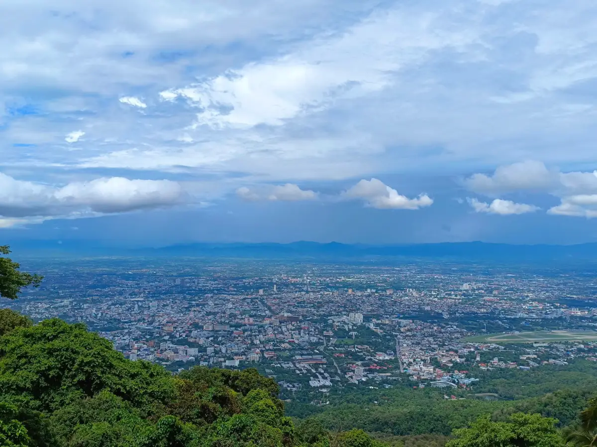
60 Popular Chiang Mai Attractions: Must-Visit Places in Northern Thailand, Latest Update Chiang Mai is one of the most diverse travel destinations in Northern Thailand. In a single trip, visitors can begin the day watching a sea of mist from a mountain summit, hike through nature trails, explore villages tucked into valleys, return to the city to visit Lanna temples and historic sites, then end the day at markets, walking streets, northern Thai restaurants, or evening attractions. The province therefore appeals to nature lovers, culture enthusiasts, families, photographers, couples, food travelers, and anyone who wants to understand Northern Thailand through its history, local ways of life, and traditional knowledge.
Chiang Mai’s landscape is made up of the Ping River basin, where Chiang Mai city is located, together with high mountain ranges that surround the province in several directions. These changes in elevation create clearly different climates and ecosystems, from montane evergreen forest on Doi Inthanon to pine forests, waterfalls, streams, highland communities, and agricultural valleys. This diversity allows Chiang Mai to be visited almost year-round. Winter is the most popular season because of the cool weather and mountain scenery, while the rainy season suits travelers who enjoy lush forests, waterfalls, and rice terraces. The transition from late rainy season into early winter is especially beautiful in many areas.
Historically, Chiang Mai was founded in 1296 by King Mangrai and became an important center of the Lanna Kingdom. Traces of this past remain visible in the moat, city walls, temples, chedis, ancient settlements, and old communities. Lanna art can still be seen in tiered viharn roofs, woodcarving, stucco work, gilded decoration, murals, and Lanna-style Buddha images, all of which continue to shape Chiang Mai’s visual identity today. Walking through the Old City is therefore not simply about visiting temples; it is a journey through an urban landscape that still preserves the structure of a Lanna city and layers of history.
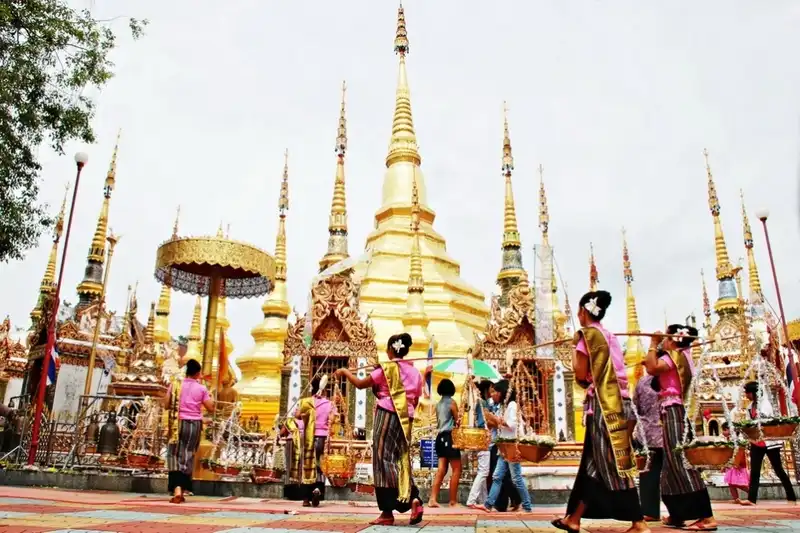
Local culture is another element that distinguishes Chiang Mai from many other tourist provinces. Important traditions include Pii Mai Mueang, Yi Peng, Tan Kuai Salak, the pilgrimage walk up Doi Suthep on Visakha Bucha Day, and community festivals held in different districts. Many communities continue to preserve local dialects, traditional dress, handicrafts, rituals, and ways of life connected to Buddhism, agriculture, and the surrounding landscape. As a result, traveling in Chiang Mai can naturally extend from sightseeing into learning about the culture of local people.
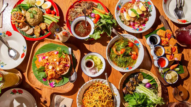
Northern Thai Food is an essential part of the Chiang Mai travel experience, and travelers should set aside time to explore Lanna flavors. One of the best-known dishes is khao soi, made with noodles in a rich curry broth and served with pickled mustard greens, shallots, and lime. Sai ua, northern Thai sausage, has a distinctive aroma of herbs and spices and is commonly eaten with nam phrik num and crispy pork rinds. Gaeng hung lay offers a sweet-savory flavor and fragrant spices that reflect historical cultural exchange between Lanna and neighboring regions.
Other regional dishes include khanom jeen nam ngiao, rice noodles with a tomato-and-spice broth; khao kan jin, rice mixed with pork and blood and steamed in banana leaves; and local dishes such as gaeng khae, gaeng phak chiang da, northern-style larb, jo phak kad, and seasonal foods made from locally available ingredients. Travelers who want to experience everyday local atmosphere should visit fresh markets and community markets such as Warorot Market, Ton Lam Yai Market, Chiang Mai Gate Market, and various neighborhood markets and walking streets. In addition to ready-to-eat food, these markets sell spices, crispy pork rinds, sai ua, chili dips, and Chiang Mai specialties to take home.
Chiang Mai also has a strong coffee culture that has grown alongside highland coffee-growing communities. Travelers can find both contemporary cafés in the city and coffee shops linked to source communities in Mae Kampong, Mae Taeng, Chiang Dao, and other mountain areas. It is therefore easy to plan routes that combine nature, community tourism, and learning about locally grown coffee.
Chiang Mai is equally rich in handicrafts, including woodcarving, Wua Lai silverware, Bo Sang umbrellas, local textiles, mulberry paper, pottery, and products made by highland communities. Travelers can therefore connect major attractions with opportunities to learn about local craftsmanship, buy directly from community producers, and support the local economy. Popular souvenirs range from textiles, silverwork, woodcraft, and decorative items to food products such as sai ua, crispy pork rinds, nam phrik num, tea, coffee, and processed highland produce.
Choosing where to stay in Chiang Mai should depend on the areas you plan to explore because the province is large and major attractions are spread across many districts. If your focus is temples, the Old City, walking streets, and restaurants in town, the Old City and areas around the moat are the most convenient choices, with many sights accessible on foot. Another popular area is Nimmanhemin and Huay Kaew, suitable for travelers who enjoy restaurants, cafés, shopping, and a modern urban atmosphere, while also providing convenient access toward Doi Suthep.
Travelers looking for a quieter, more relaxing atmosphere can stay along the Ping River, where accommodation ranges from small hotels and Lanna-style properties to riverside stays. Mae Rim is another strong option for families, couples, and visitors planning to explore Mon Jam, the botanical garden, farms, and other attractions without driving back from Chiang Mai city every day.
For travelers who want a fuller nature experience, staying overnight in Mae Kampong makes it possible to see the village early in the morning and again after most day-trippers have left. Those visiting Doi Inthanon and Mae Chaem should consider accommodation around Chom Thong, Ban Khun Klang, Ban Mae Klang Luang, or Mae Chaem according to the planned route. Staying in these areas reduces travel time and allows an earlier start for nature-based activities.
Chiang Mai offers a wide range of accommodation, from hostels, guesthouses, and city hotels to mountain resorts, community homestays, and luxury properties. There is no need to stay only in the city. Accommodation should fit the structure of the trip. For a multi-day journey, splitting the stay between two areas—for example, two nights in Chiang Mai city followed by one or two nights in Mae Rim, Mae Kampong, or Doi Inthanon—can reduce time spent in the car and provide a deeper experience of each area than commuting from the city every day.
If Chiang Mai is divided into simple travel zones, the Old City and moat area are best for temples, museums, markets, walking streets, food, and history. The Doi Suthep–Mae Hia–Hang Dong area is suited to mountain temples, viewpoints, gardens, and family activities. Mae Rim–Samoeng is known for mountains, gardens, agriculture, viewpoints, and Mon Jam. Mae On–San Kamphaeng is home to Mae Kampong, hot springs, handicrafts, and community life. Chom Thong–Doi Inthanon–Mae Chaem is a key zone for high mountains, waterfalls, nature trails, highland communities, and rice terraces.
Chiang Dao and the northern part of the province are well suited to travelers who enjoy large mountains, caves, trekking, and a quieter small-town atmosphere than Chiang Mai city. Fang and Mae Ai are better for trips with several days available because they can combine natural attractions, highland communities, mountain temples, and routes toward the far north of the province. Traveling to these areas also reveals that Chiang Mai is much more diverse than the attractions around the moat and Doi Suthep alone.
For travelers with only 1 day, it is best to choose a single zone, such as the Old City and Doi Suthep or a Mae Rim route, rather than spending too much time on the road. With 2–3 days, Mae Kampong, Mon Jam, or Doi Inthanon can be added. A 4–5 day trip allows time to include Mae Chaem, Chiang Dao, or more outlying areas, creating a broader picture of Chiang Mai through its city, culture, mountains, and communities.
With about one week, it is possible to create a route with limited backtracking by starting in Chiang Mai city and Doi Suthep, continuing to Mae Rim–Mon Jam, then choosing either Chiang Dao or Mae Kampong before finishing with Doi Inthanon and Mae Chaem according to your interests. This approach brings together temples, the Old City, food, cafés, communities, mountains, forests, waterfalls, highland agriculture, and different styles of accommodation within a single trip.
The 60 Chiang Mai attractions in this article therefore include temples, mountains, national parks, waterfalls, communities, ancient cities, markets, walking streets, gardens, learning centers, family attractions, and viewpoints. The first 10 are major highlights that most clearly represent Chiang Mai’s identity, while the places that follow expand the route into more districts and more styles of travel, offering a fuller view of the province than a trip limited to the most famous landmarks.

1. Doi Inthanon National Park in Chom Thong District is one of the clearest representations of travel in Chiang Mai because it contains Thailand’s highest peak, rising about 2,565 meters above sea level, while also combining montane evergreen forest, waterfalls, nature trails, viewpoints, Royal Project areas, and highland communities within the same destination.
Highlights: The Highest Point in Thailand, Ang Ka Nature Trail, the King and Queen Pagodas (Phra Mahathat Naphamethanidon and Naphaphonphumisiri), Wachirathan Waterfall, Mae Ya Waterfall, Kew Mae Pan Nature Trail, and cool high-elevation weather.
Doi Inthanon lies within the Thanon Thong Chai Range. The great variation in elevation causes vegetation and weather conditions to change noticeably with altitude. Driving from the foothills toward the summit takes visitors through mixed deciduous forest, evergreen forest, and montane evergreen forest rich in mosses, ferns, and moisture-loving plants.
Thailand’s highest point and the Ang Ka Nature Trail are suitable for short forest walks. Travelers who want a more substantial hike can choose Kew Mae Pan when the trail is open. The area combines montane forest, open ridge grassland, cliffs, and sea-of-mist viewpoints, making it one of Chiang Mai’s best-known nature trails.
Waterfalls are another major feature of the park. Wachirathan Waterfall has a powerful flow and fine spray that fills the surrounding area; Mae Klang Waterfall is easy to reach; and Mae Ya Waterfall spreads broadly down a multi-tiered rock face. Travelers with a full day can build an ascending route that links waterfalls, Royal Project sites, the royal pagodas, and the summit in sequence.
Doi Inthanon is also connected to Karen and Hmong communities as well as highland agricultural development projects. It therefore suits nature lovers, families, birdwatchers, photographers, and travelers interested in educational tourism. The trip can be extended to Mae Klang Luang Village, Pha Dok Siew Waterfall, Royal Agricultural Station Inthanon, and the route onward to Mae Chaem.
Open Days: Generally daily Opening Hours: Generally 05:30 – 18:30. Some trails may close seasonally or according to national park announcements.
Getting There: From Chiang Mai city, take Highway 108 toward Chom Thong District, then turn onto Highway 1009 toward Doi Inthanon. The road is paved throughout but includes steep gradients and many curves, so check the vehicle and weather conditions before traveling.
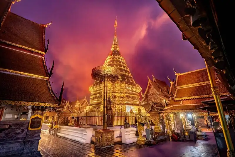
2. Wat Phra That Doi Suthep is one of Chiang Mai’s most revered sacred sites and one of Northern Thailand’s most important landmarks. Located on Doi Suthep west of the city, it is distinguished by its golden chedi, Lanna art, naga staircase, and terrace overlooking Chiang Mai from above.
Highlights: Phra That Doi Suthep, the naga staircase, Lanna viharns, panoramic views over Chiang Mai, and the pilgrimage walk up the mountain on Visakha Bucha Day.
The temple’s history is associated with King Kuena of Lanna and the enshrinement of a sacred Buddha relic on Doi Suthep. The legend of the white elephant that carried the relic up the mountain and stopped at the present temple site is an important story that has connected this temple with Chiang Mai belief and identity for centuries.
The golden chedi stands at the center of the main terrace, surrounded by cloisters, viharns, and worship areas. Visitors should take time to observe the metalwork, carvings, and tiered Lanna roof forms rather than visiting only for the city view.
Another important experience is climbing the naga staircase from the base of the temple to the upper terrace. Although an internal transport option is now available, walking up the stairs remains an iconic part of a Doi Suthep visit, especially in the morning when the weather is cooler and crowds are lighter.
On the night before Visakha Bucha Day, Chiang Mai residents and Buddhist devotees take part in the traditional pilgrimage walk up Doi Suthep to worship the sacred relic. It is one of the city’s most important traditions and clearly expresses the relationship between Chiang Mai, Doi Suthep, and Buddhist faith. A visit can be combined with Wat Pha Lat, Bhubing Rajanives Palace, and viewpoints on Doi Suthep.
Open Days: Daily Opening Hours: 05:00 – 19:30
Getting There: From Chiang Mai city, take Huay Kaew Road past Chiang Mai University and Chiang Mai Zoo, then continue up Sriwichai Road toward Doi Suthep. Travelers without a private vehicle can use red songthaews operating from the base of the mountain or key locations in the city.

3. Mae Kampong Village in Mae On District is a mountain-valley community popular with both Thai and international visitors. Houses line the stream, while cool weather, community life, homestays, cafés, and surrounding forest create the village’s distinctive atmosphere.
Highlights: A mountain-valley community, Mae Kampong stream, wooden houses, homestays, Wat Khantha Phueksa, Mae Kampong Waterfall, miang tea, tea, coffee, and a cool climate.
Mae Kampong lies at an elevation of around 1,300 meters, giving it relatively cool weather throughout the year. The community’s traditional way of life was closely connected to miang tea cultivation and forest resources. It later developed community-based tourism and a homestay system that became an important model for community tourism in Northern Thailand.
The appeal of Mae Kampong does not come from a single check-in point. It comes from walking slowly along the narrow road, looking at village houses, listening to the stream, stopping for local food or coffee, and buying products made by residents. Travelers who stay overnight experience the village after most day-trippers have left.
Wat Khantha Phueksa is located within the community and reflects the village’s relationship with its natural setting. Visitors can also continue to Mae Kampong Waterfall. The area is best suited to travelers who enjoy nature, local culture, photography, and relaxation rather than a fast-paced itinerary.
Visitors should avoid blocking village roads with parked vehicles, keep noise levels low, ask permission before photographing private spaces or residents, and support community-run shops and services directly. The route can be extended to San Kamphaeng Hot Springs, Than Thong Waterfall, Pha Nam Lod, or other Mae On attractions in the same day.
Open Days: Daily Opening Hours: Accessible throughout the day; daytime is most suitable for walking around the community.
Getting There: From Chiang Mai city, head toward San Kamphaeng and Mae On districts, continue to Huai Kaeo Subdistrict, and climb the mountain road to Mae Kampong. The final section is a narrow mountain road through the village. Drive carefully or use local shuttle services during periods of heavy visitor traffic.

4. Mon Jam in Mae Rim District is a mountainous highland farming area known for mountain views, cool weather, flower gardens, hillside accommodation, and numerous viewpoints. It suits both day trips and overnight stays.
Highlights: Panoramic mountain views, cool weather, flower gardens, highland agriculture, mountain accommodation, sunrise viewpoints, and the Mae Rim–Samoeng route.
Mon Jam is part of the mountain landscape around Mae Raem and nearby areas. The area was historically connected with highland agriculture before its scenery and cool climate made it popular as a mountain retreat from Chiang Mai city.
What distinguishes Mon Jam from a simple viewpoint is the combination of landscape, community, agriculture, and tourism activities. Visitors can explore flower plots, eat on the mountain, stop at cafés, or stay at accommodation spread along the slopes. Services and opening hours vary between individual locations.
Morning is best for soft light and, when weather conditions allow, a sea of mist. Late in the year through early in the year is the busiest period. Allow extra travel time on holidays because roads can become congested, especially near junctions and parking areas serving individual attractions.
Mon Jam combines naturally with Queen Sirikit Botanic Garden, Pong Yaeng, and other Mae Rim attractions, making it a strong choice for families, couples, photographers, and travelers who want a mountain experience without traveling as far as Doi Inthanon or Chiang Dao.
Open Days: Daily Opening Hours: Vary by individual site and operator within the Mon Jam area.
Getting There: From Chiang Mai city, take the Chiang Mai–Mae Rim road, then turn onto the Mae Rim–Samoeng route and continue uphill toward Mon Jam. The final section is mountainous, with curves and steep gradients, so use a vehicle in good condition and avoid driving at excessive speed.
Map (GPS):Open Driving Directions to Mon Jam

5. Chiang Mai Night Safari is located in Nong Khwai Subdistrict, Hang Dong District. It is a family attraction centered on viewing animals during both daytime and nighttime, with walking areas as well as safari trams that take visitors through large animal zones.
Highlights: Night Safari tram, Savanna Safari, Predator Prowl, Jaguar Trail, nighttime animal viewing, and family activities.
The experience differs from a conventional zoo because the evening and nighttime periods are central to a visit. Guests can board safari trams to see herbivores and predators in landscaped areas designed to resemble natural environments while learning about animal behavior at times when some species are more active.
The Savanna Safari zone is suited to viewing giraffes, zebras, and various herbivores, while Predator Prowl focuses on predators such as lions and tigers. The two tram routes therefore offer different experiences and are among the main activities chosen by most visitors.
The walking areas also include animal displays and activities suitable for children. Visitors can arrive in the afternoon, explore the walking zones first, and then continue with a nighttime tram ride as daylight fades, allowing them to experience the attraction during two different parts of the day.
Chiang Mai Night Safari is close to Royal Park Rajapruek, Wat Phra That Doi Kham, and the Hang Dong area. It can therefore be planned as a half-day-to-evening trip and is especially suitable for families with children, groups of friends, and travelers looking for activities after sunset without going into remote mountain areas.
Open Days: Daily Opening Hours: 11:00 – 22:00; ticket sales generally close around 21:00.
Getting There: From Chiang Mai city, head toward Mae Hia–Hang Dong, passing the Royal Park Rajapruek area toward Nong Khwai Subdistrict. Private cars, taxis, and ride-hailing services are convenient, particularly for the return journey at night.

6. Queen Sirikit Botanic Garden is located in Mae Raem Subdistrict, Mae Rim District, along the Mae Rim–Samoeng route. This large botanical garden serves conservation, research, education, and tourism functions. It is suitable for visitors who want to experience nature in a way that is more accessible than long forest or mountain hikes. The grounds contain greenhouse complexes, diverse plant collections, nature trails, a reservoir, and green areas spread across the hills.
Highlights: The Glasshouse Complex, Thai orchid collections, plants from different climate zones, nature trails, Mae Sao Warin Reservoir, and a mountain setting along the Mae Rim–Samoeng route.
A key feature of the garden is the organization of areas according to plant types and ecosystems, allowing visitors to understand differences between plant groups in a tangible way. The greenhouse complex is the most popular zone because it gathers plants from very different environments in one place, ranging from humid tropical species and desert plants to species requiring highly specific growing conditions.
Beyond the greenhouses, there are areas dedicated to Thai orchids, plant nurseries, and living collections that reveal plant conservation processes rather than presenting plants only for visual beauty. Nature enthusiasts and families with children can use the garden as a learning site for botany, ecosystems, and conservation at the same time.
The garden includes walking trails of different lengths, including the approximately 0.3-kilometer Waterfall Trail, the 0.6-kilometer Arboretum Trail, a roughly 0.8-kilometer provincial tree trail, and the approximately 2-kilometer Climber Trail. Visitors can therefore choose routes according to available time and physical ability. Older visitors and families with children do not need to walk every trail and can focus instead on the greenhouses and easily accessible main areas.
Winter is the most comfortable season for walking because of the cool weather. During the rainy season, the vegetation becomes especially lush, but visitors should wear footwear suitable for wet surfaces and occasional steep sections. With half a day available, it is easy to combine the botanical garden with Mon Jam or other attractions on the Mae Rim–Samoeng route without significant backtracking.
Photographers will find greenhouse architecture, walkways, large trees, flowers, and mountain landscapes that change with the seasons. Families, meanwhile, can explore at a relaxed pace and stop for breaks as needed. The garden adds another dimension to a Mae Rim itinerary that is often associated mainly with Mon Jam and mountain viewpoints.
Open Days: Generally daily Opening Hours: Generally 08:30 – 16:30
Getting There: From Chiang Mai city, take the Chiang Mai–Mae Rim road toward Mae Rim District, then continue onto the Mae Rim–Samoeng route. The garden is beside the main road before the Mon Jam zone. Access is generally convenient, but allow time for mountain driving and for exploring the garden’s extensive grounds.

7. San Kamphaeng Hot Springs is located in Ban Sahakon Subdistrict, Mae On District. This natural hot spring has been popular for many years and can easily be included in a route through San Kamphaeng, Mae On, and Mae Kampong. Its main features are high-temperature hot spring pools, areas for boiling eggs, mineral-water foot baths, and mineral-water bathing services set within landscaped green surroundings.
Highlights: Geyser-like hot springs, underground temperatures of around 105 degrees Celsius, egg-boiling areas, mineral-water foot baths, mineral bathing services, gardens, and family relaxation areas.
The defining image of San Kamphaeng Hot Springs is hot water rising from the ground and steam drifting above the pools. Visitors can first walk around the main hot spring area before choosing activities ranging from boiling eggs in mineral water and soaking their feet to using dedicated mineral-bath facilities.
Boiling eggs is one of the experiences that distinguishes this attraction from hot springs focused only on bathing. Designated areas allow visitors to use the heat of the spring directly, turning geothermal energy into an easy-to-understand activity in which children can also participate.
Another relaxing zone is the mineral-water stream for foot soaking, especially welcome after several days of travel or a mountain excursion. Green spaces and rest areas make the hot springs suitable for families, older visitors, couples, and groups of friends.
San Kamphaeng Hot Springs can serve as a convenient stop on the Chiang Mai–Mae Kampong route. Travelers leaving the city in the morning can stop here before going uphill to Mae Kampong, or visit Mae Kampong first and return to soak in mineral water in the afternoon. The area also connects with San Kamphaeng handicraft sites and Bo Sang, allowing a one-day route that combines nature, community, and arts and crafts.
Visitors should take care around high-temperature water, especially when traveling with young children, and follow all on-site safety signs. Those using mineral baths should choose services appropriate to their health and avoid soaking for excessively long periods.
Open Days: Daily Opening Hours: 07:00 – 18:00
Getting There: From Chiang Mai city, head toward San Kamphaeng and Mae On districts, then continue to Ban Sahakon Subdistrict. The same route continues onward to Mae Kampong, making the hot springs ideal for a one-day trip in eastern Chiang Mai.
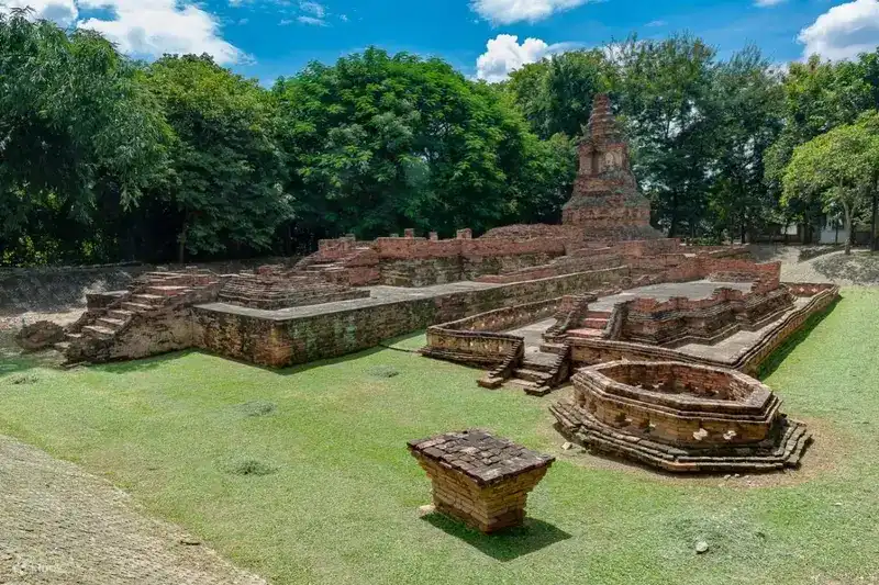
8. Wiang Kum Kam Ancient City is located around Tha Wang Tan Subdistrict, Saraphi District, southeast of Chiang Mai city. It is an important archaeological area for understanding the period before Chiang Mai was founded because Wiang Kum Kam is closely associated with King Mangrai and the development of settlements in the Ping River basin before the political center moved to present-day Chiang Mai.
Highlights: An ancient city that predates Chiang Mai, numerous temples and archaeological sites, Wat Chedi Liam, Wat Chang Kham, traces of Lanna architecture, and historical routes through the Ping River basin.
Visiting Wiang Kum Kam differs from seeing a single ruin because remains of the ancient city are scattered among present-day communities. Travelers therefore encounter layers of past and present at the same time: functioning temples with resident monks, excavated ruins, and modern homes occupied by local residents.
Wiang Kum Kam is important to understanding Chiang Mai’s history because it reflects early Lanna experiments in urban planning and settlement in the river basin before Chiang Mai was established as a new center. Water conditions and the nature of the site played an important role in the city’s history. Over time, sediment covered parts of the settlement, leaving many archaeological remains below the level of the modern community.
One of the highlights is Wat Chedi Liam, with its multi-tiered square chedi that differs from the more common bell-shaped form. Wat Chang Kham and other archaeological groups reveal further variety in the area’s artistic heritage. Exploring several sites in sequence gives a much more complete picture of the ancient city than stopping at only one location.
The area suits travelers interested in history, architecture, and archaeology, as well as visitors who want to understand Chiang Mai beyond the temples inside the moat. Since Wiang Kum Kam is close to the city, it can be explored in half a day before continuing to markets, restaurants, or riverside areas.
Visitors should avoid climbing onto chedi bases or ancient structures because many elements are centuries old and easily damaged. Viewing them from designated walkways helps preserve the site while still allowing the urban layout and architectural remains to be understood clearly.
Getting There: From Chiang Mai city, head toward Saraphi District and Tha Wang Tan Subdistrict. The site is not far from the urban area and can be reached conveniently by private car, taxi, or ride-hailing service. Once in the area, plan the route by archaeological clusters to avoid repeated backtracking.

9. Chiang Mai Sunday Walking Street (Tha Phae) is one of Chiang Mai’s most recognizable night markets and walking streets. It takes place along Ratchadamnoen Road in the Old City, with Tha Phae Gate serving as a popular meeting point before visitors enter a street filled with handicrafts, food, souvenirs, clothing, art, and products from local makers.
Highlights: Ratchadamnoen Road, Tha Phae Gate, Lanna handicrafts, northern Thai food, souvenirs, art, handmade products, and the atmosphere of the Old City at night.
The appeal of the Tha Phae walking street goes beyond shopping. It is a place where contemporary Chiang Mai culture is clearly visible. Many products are connected with northern craftsmanship, including textiles, jewelry, woodwork, leather goods, decorative items, and art made by small-scale producers.
For food travelers, the walking street offers the chance to try many dishes during a single visit, from sai ua, nam phrik num, crispy pork rinds, northern specialties, fried snacks, and local desserts to contemporary food prepared by small vendors. It is better to sample gradually than to buy too much at the beginning because the market extends for a considerable distance and offers many options along the way.
Tha Phae Gate is a convenient starting point for first-time visitors because many temples and Old City attractions are within walking distance. Ratchadamnoen Road passes areas connected with Wat Phan On, Wat Phan Tao, Wat Chedi Luang, and other key parts of the Old City, making it easy to visit temples in the afternoon and continue to the walking street in the evening.
Early evening is better for easier walking and browsing, while the busiest period requires more attention to personal belongings and awareness of pedestrian flow. Families with young children or older travelers should identify rest points and agree on a meeting place because crowds can become dense during the high season.
Public transport or hired vehicles are usually more practical than driving into the market area because some roads are closed and parking around the Old City is limited. Visitors can be dropped near Tha Phae Gate and walk directly into the market.
Open Days: Generally Sunday Opening Hours: Generally 17:00 – 22:00
Getting There: From other areas of Chiang Mai city, use a red songthaew, taxi, ride-hailing service, or walk from accommodation in the Old City to Tha Phae Gate. If driving, park outside the walking-street zone and continue on foot.
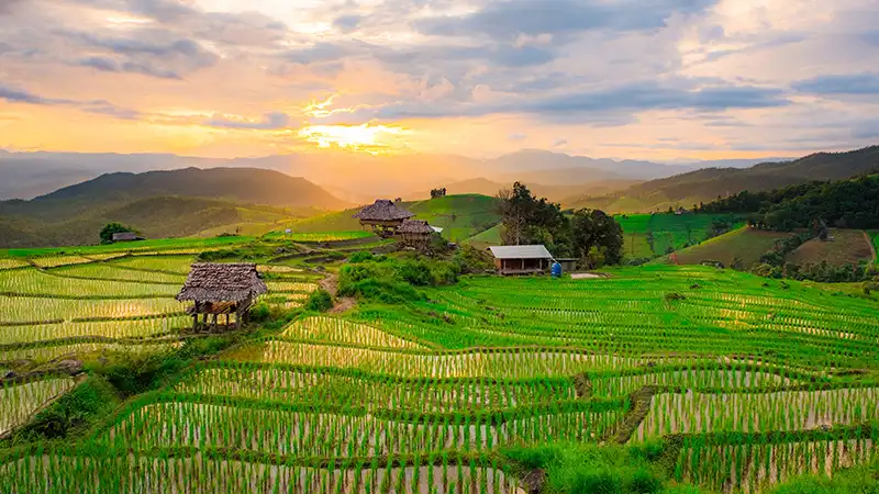
10. Pa Bong Piang Village in Mae Chaem District is a Karen village famous for terraced rice fields that follow the contours of the mountain. The attraction, however, is not only the scenery for photographs. The terraces are part of a living agricultural system, water management practices, and a highland way of life passed down through the community.
Highlights: Rice terraces, mountain views, morning mist, Karen community life, homestays, and a rural Mae Chaem landscape that changes throughout the rice-growing season.
The rice terraces of Pa Bong Piang were created by adapting steep slopes for rice cultivation and water management. Terraced embankments follow the mountain contours, slowing water and retaining moisture. They therefore represent both agricultural knowledge and a distinctive cultural landscape. The curves of the terraces change color and character throughout the season.
At the beginning of the rice-growing season, flooded paddies reflect the sky. As rice plants grow, the mountainside turns vivid green, and before harvest the fields become golden yellow. Each stage produces a different landscape, so travelers should choose their travel dates according to the atmosphere they want rather than expecting green fields throughout the year.
Staying overnight provides a better experience than a rushed day trip because early morning and late afternoon offer softer light, cooler temperatures, and a chance of seeing mist over the mountains. Most community homestays emphasize simplicity and the local environment rather than hotel-style facilities.
Meals at homestays and within the community are often based on local ingredients and seasonal availability. An overnight stay therefore offers more insight into highland life than simply arriving for photographs. Walking along paddy paths, watching the mountains in the morning, and spending time slowly are central parts of the Pa Bong Piang experience.
Because the rice fields are working agricultural land, visitors should follow community-designated paths, avoid stepping into rice plots or damaging terrace embankments for photographs, and ask permission before photographing residents. Keeping noise low and supporting local accommodation and services directly are part of responsible travel.
The road to Pa Bong Piang includes winding mountain sections and may become slippery during the rainy season. Travelers who are not confident driving on mountain roads should use local transport or transfers arranged by their accommodation. Travel during daylight and check the weather before departure.
Getting There: From Mae Chaem town, continue into the Pa Bong Piang area along mountain roads. Some sections are steep and winding, especially during the rainy season, so check road and weather conditions in advance. If staying at a homestay, contact the accommodation beforehand for route information and transfer points.

11. Royal Park Rajapruek is located in Mae Hia Subdistrict, Mueang Chiang Mai District. It is a large landscaped park and horticultural learning center noted for both its gardens and architecture, with plant collections from many regions. The grounds are designed for relaxation, photography, and learning about plants at the same time.
Highlights: Ho Kham Luang Royal Pavilion, international gardens, Thai gardens, greenhouse groups, diverse plant collections, large-scale landscape design, and horticultural learning areas.
Royal Park Rajapruek became widely known as the site of the Royal Flora Ratchaphruek 2006 international horticultural exposition. It was later developed into a year-round tourism and learning destination, becoming more than a temporary event venue and growing into one of Chiang Mai’s major green spaces.
Ho Kham Luang is the park’s architectural symbol, inspired by Lanna art and set among gardens with mountains in the background. It is one of the most photographed places in the park. Visitors should allow time to appreciate details of the building and surrounding landscape rather than stopping only for a photograph at the front.
The international gardens demonstrate different approaches to garden design and plant selection from various countries, while greenhouses and display areas introduce plants adapted to different climates. These features make the park suitable for families, children, students, older visitors, and travelers interested in landscape design.
Because the grounds are extensive, allow at least half a day. A relaxed visit can take 3–5 hours, and hats, umbrellas, or drinking water are useful on hot days. The park combines easily with Chiang Mai Night Safari and Wat Phra That Doi Kham because all three are in the same general area, reducing unnecessary backtracking.
Open Days: Daily Opening Hours: 08:00 – 18:00
Getting There: From Chiang Mai city, take either the Chiang Mai–Hang Dong road or Canal Road toward Mae Hia Subdistrict. The park is close to Chiang Mai Night Safari and Wat Phra That Doi Kham and is easily reached by private car or ride-hailing service.
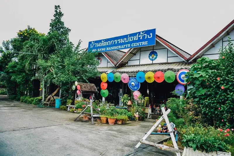
12. Bo Sang Village in Ton Pao Subdistrict, San Kamphaeng District, is a handicraft community famous for traditional umbrellas and mulberry-paper products. Bright colors, floral motifs, and production methods rooted in community craftsmanship have made Bo Sang umbrellas one of Chiang Mai’s best-known symbols.
Highlights: Bo Sang umbrellas, saa-paper umbrellas, cotton umbrellas, hand-painted umbrellas, craft demonstrations, mulberry-paper products, and the artisan community of San Kamphaeng.
Historically, umbrella making was a household occupation. Residents made frames, attached coverings, painted the umbrellas, and dried them in yards around their homes. Rows of colorful umbrellas became characteristic of the community before the craft developed into a local product recognized throughout Thailand and internationally.
Umbrellas found in Bo Sang include silk, cotton, and mulberry-paper varieties, each with different textures and uses. Floral patterns and hand-painted decoration give individual umbrellas a craft quality distinct from mass-produced goods.
Visitors can observe stages of production from frame making and rib assembly to covering and hand painting. The area is therefore suitable for travelers interested in local knowledge, design, and educational family activities. Umbrellas and mulberry-paper products are also popular Chiang Mai souvenirs.
Bo Sang can be combined with other San Kamphaeng handicraft areas, San Kamphaeng Hot Springs, and Mae Kampong. With a full day, travelers can begin with handicrafts in the morning, continue to the hot springs, and then go up to Mae Kampong in the afternoon or stay overnight in the Mae On area.
Getting There: From Chiang Mai city, take the Chiang Mai–San Kamphaeng road toward San Kamphaeng District. Bo Sang is in Ton Pao Subdistrict and is easy to reach from the city by private car, hired vehicle, or as part of a route continuing toward Mae On.

13. Warorot Market (Kad Luang) is one of Chiang Mai’s oldest markets and an important commercial area in the city. It is especially suitable for travelers who want to experience a market used by local residents while shopping for northern Thai food, souvenirs, spices, clothing, local textiles, and products from different districts of Chiang Mai in one place.
Highlights: Sai ua, crispy pork rinds, nam phrik num, northern Thai food, souvenirs, local textiles, spices, regional products, and the atmosphere of a long-established market in central Chiang Mai.
Warorot Market, known locally as “Kad Luang,” is not a market created only for tourists. It remains a shopping area for Chiang Mai residents and local businesses, so its everyday activity reflects real city life more clearly than markets focused solely on souvenirs.
Different floors and zones sell a wide variety of goods, especially dried foods, northern Thai specialties, and gifts. Travelers shopping for sai ua, crispy pork rinds, nam phrik num, nam phrik ong, curry pastes, or other regional foods can compare many vendors within a short walking distance.
The surrounding area connects with Ton Lam Yai Market and commercial districts near the Ping River, allowing visitors to continue toward Chang Moi Road, local shops, and the Wat Ket area. Those staying in the Old City can visit Kad Luang in the morning or afternoon and continue toward riverside areas afterward.
For food travelers, the market is better suited to sampling small portions from several vendors than sitting down at a single restaurant because it offers a wide range of ready-to-eat foods, snacks, desserts, and local ingredients. It is one of the best places to understand Chiang Mai through food.
Open Days: Daily Opening Hours: Generally 08:00 – 17:00; hours may vary by shop and zone.
Getting There: Warorot Market is in central Chiang Mai near the Ping River. It can be reached by red songthaew, ride-hailing service, or on foot from the Night Bazaar and Chang Moi areas. If driving, allow extra time to find parking during busy periods.
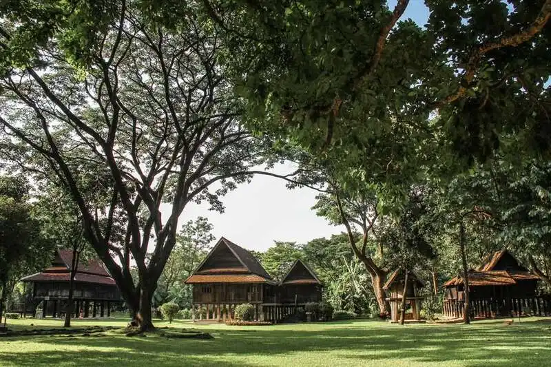
14. Lanna Traditional House Museum is located within Chiang Mai University and brings together several types of traditional Lanna houses in one area. It is suitable for visitors who want a tangible understanding of Lanna architecture, ways of life, and the organization of domestic space.
Highlights: Lanna wooden houses, vernacular houses from different communities, raised-floor construction, timber structures, interior spatial organization, and traditional residential knowledge adapted to Northern Thailand’s climate.
Traditional Lanna houses are more than attractive old wooden buildings. They reflect ideas about family, relationships among household members, and the use of space in everyday life. Courtyards, verandas, bedrooms, kitchens, and underfloor areas each had distinct functions and were designed to suit the climate and lifestyles of the past.
Woodwork details are another important feature to observe, including columns, beams, roofs, timber walls, stairs, and selected decorative elements. These details reveal the skills of local builders and the use of locally available materials. Walking from house to house is therefore like reading Lanna social history through architecture.
The museum suits students, designers, architects, photographers, and travelers interested in Lanna culture. It can be combined in the same day with Chiang Mai University, Nimmanhemin, Wat Suan Dok, or other museums and cultural attractions in the city.
The atmosphere is relatively quiet and rewards an unhurried visit. Those photographing architecture should pay attention to the form of the houses and their relationship with the surrounding space rather than photographing only the façades, because the main value lies in understanding each house as a complete system.
Getting There: The museum is located within Chiang Mai University near Huay Kaew Road and is easily reached from Nimmanhemin and Suthep by red songthaew, ride-hailing service, or private car.

15. Wat Ban Den, also known as Wat Den Sali Si Mueang Kaen, is located in Inthakhin Subdistrict, Mae Taeng District. It is a large temple complex distinguished by contemporary interpretations of Lanna art, with numerous viharns, chedis, religious buildings, and sculptures spread across the grounds.
Highlights: Large-scale Lanna-inspired architecture, multiple viharns, colorful chedis, woodcarving, naga and singha sculptures, and detailed craftsmanship throughout the temple.
The appeal of Wat Ban Den lies in the way Lanna artistic forms are enlarged in scale and enriched with extensive detailing, giving each building its own character. Visitors should allow enough time to walk through the grounds rather than stopping only for photographs at the front of a single viharn.
Roof colors, glass decoration, woodcarving, and Himavanta-creature sculptures create an atmosphere different from ancient temples in Chiang Mai city. Although inspired by Lanna art, the overall composition reflects a contemporary interpretation with monumental scale and vivid color.
The grounds are extensive, so visitors should dress respectfully and allow time for walking. Photographers can explore architectural details, sculpture, and building alignments framed by the landscape around Mueang Kaen, while those interested in Buddhism can worship quietly and appreciate the temple’s religious art.
Wat Ban Den combines well with other Mae Taeng attractions such as Mae Ngat Dam or routes continuing toward Chiang Dao, adding a cultural dimension to an itinerary otherwise focused on mountains and nature.
Open Days: Daily Opening Hours: 06:00 – 18:00
Getting There: From Chiang Mai city, take Highway 107 toward Mae Taeng District, then continue into Inthakhin Subdistrict and the Mueang Kaen area. Roads are generally convenient, and the temple works well as a stop before continuing north to Chiang Dao.
Map (GPS):Open Driving Directions to Wat Ban Den

16. Chiang Dao Cave is located at the foot of Doi Luang Chiang Dao in Chiang Dao District. This limestone cave system contains chambers, stalactites and stalagmites, Buddha images, and sacred areas, giving the site geological, natural, and spiritual dimensions at the same time.
Highlights: Limestone cave chambers, stalactites and stalagmites, Buddha images inside the cave, the setting at the foot of Doi Luang Chiang Dao, and cave routes with different levels of difficulty.
Chiang Dao Cave has a complex interior made up of several chambers. Some sections have walkways and lighting that make access relatively straightforward, while deeper routes require lantern light and people familiar with the cave. Visitors should therefore choose routes according to physical ability and the site regulations in effect that day.
Stalactites and stalagmites form through natural processes that take extremely long periods of time, so visitors should avoid touching or damaging rock surfaces. The cave is humid and some sections of the floor can be slippery, making footwear with good grip important.
Belief and religion are also central to the cave because Buddha images and worship areas are located inside. A visit therefore differs from exploring a purely natural cave. Visitors should remain quiet and follow site rules.
Chiang Dao Cave is well suited to a 1–2 day Chiang Dao trip and can be combined with viewpoints of Doi Luang Chiang Dao, Wat Tham Pha Plong, cafés, and accommodation around the mountain. Travelers continuing to Fang or Ang Khang can also use Chiang Dao as a convenient stopover.
Getting There: From Chiang Mai city, take Highway 107 through Mae Rim and Mae Taeng to Chiang Dao District. From the district center, follow signs toward the foot of the mountain and Chiang Dao Cave. The site is accessible by ordinary cars.

17. Doi Chiang Dao is a massive limestone mountain within Chiang Dao Wildlife Sanctuary in Chiang Dao District. Rising about 2,195 meters above sea level, it is one of Northern Thailand’s most distinctive mountain formations, with large limestone cliffs visible from many locations around Chiang Dao.
Highlights: A limestone peak about 2,195 meters high, massive cliff faces, endemic plants, sea of mist, layered mountain views, and the natural landscape of Chiang Dao.
Doi Chiang Dao is important for its ecosystems and biodiversity. The limestone mountain environment supports plant species adapted to highly specific conditions, making conservation central to the area. Some activities are therefore subject to the regulations of Chiang Dao Wildlife Sanctuary.
General visitors do not need to reach the summit to appreciate Chiang Dao. Viewpoints, accommodation, cafés, and communities around the foothills all provide clear views of the mountain, especially in the morning and during winter when mist may settle around the base.
Travelers interested in hiking should always check the latest access conditions, permits, and regulations before planning a trip. Because the area is important for conservation, not every trail is open throughout the year. Respecting these restrictions helps reduce impacts on the mountain ecosystem.
Chiang Dao is especially suitable for nature lovers, birdwatchers, photographers, and travelers who prefer staying among mountains rather than rushing between check-in points. It combines well with Chiang Dao Cave, Wat Tham Pha Plong, and communities around the foothills.
Getting There: From Chiang Mai city, take Highway 107 through Mae Rim and Mae Taeng to Chiang Dao District. From there, choose a destination around the foothills according to the area you wish to visit, because Doi Chiang Dao is a large mountain area rather than a single tourist point.
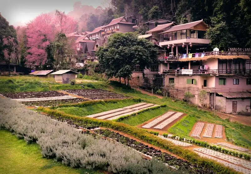
18. Ang Khang Royal Agricultural Station is located in the highlands of Fang District. It is a research and demonstration center for temperate-climate agriculture that has played an important role in developing livelihoods for highland communities and is one of northern Chiang Mai’s best-known winter destinations.
Highlights: Temperate-climate plants, agricultural plots, flower gardens, temperate fruits, mountain scenery, cool weather, and learning about highland farming systems.
Ang Khang Royal Agricultural Station was established around the concept of developing highland areas through research and promotion of crops suited to cool climates. The work helped create alternative livelihoods for communities and reduce agricultural practices that affected forests, giving the station importance far beyond its role as a flower garden for photographs.
The grounds display many kinds of temperate plants, including flowers, vegetables, and seasonal fruits. Ang Khang’s atmosphere changes throughout the year, so travelers visiting in different seasons encounter different landscapes and agricultural activities.
Winter is the most popular period because temperatures drop and temperate plants are at their most distinctive. This popularity also makes travel and accommodation busier, so advance planning is recommended, particularly on holidays and around the end of the year.
Ang Khang is suitable for families, photographers, nature lovers, and people interested in highland agriculture. If time allows, staying overnight in Fang or Ang Khang avoids a rushed return drive to Chiang Mai in the same day and makes it possible to enjoy the morning atmosphere fully.
Open Days: Daily Opening Hours: 06:00 – 18:00
Getting There: From Chiang Mai city, take Highway 107 through Mae Rim, Mae Taeng, Chiang Dao, and Fang before climbing toward Doi Ang Khang. The mountain road is steep and winding, so check the vehicle and avoid driving too fast, especially during dense fog and winter conditions.
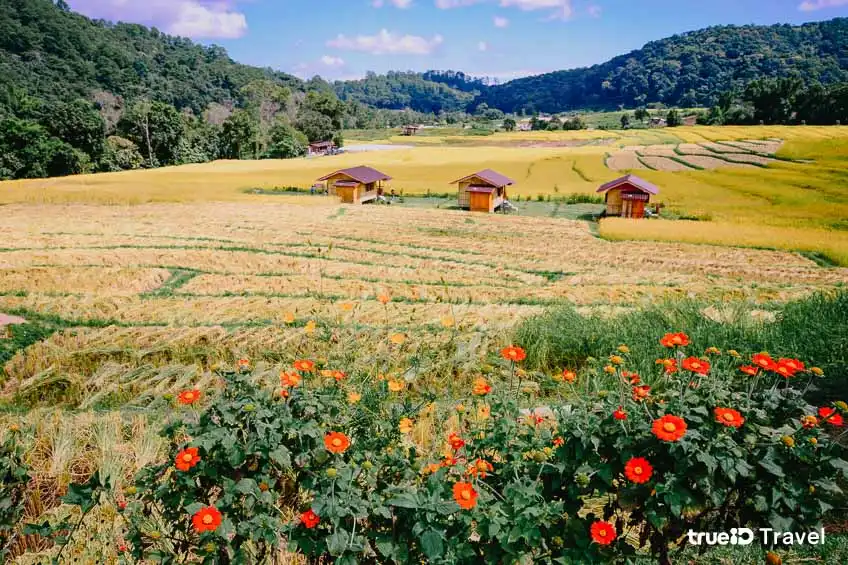
19. Mae Klang Luang Village lies on the road up Doi Inthanon in Chom Thong District. It is a Karen community known for terraced rice fields, agricultural life, local coffee, and a valley setting. Visitors can experience the village without traveling far from the main Doi Inthanon route.
Highlights: Rice terraces, Karen community life, locally grown coffee, the Pha Dok Siew Waterfall trail, mountain views, and community-based highland tourism.
Mae Klang Luang’s rice terraces follow the contours of the landscape and are working agricultural fields used by the community. From around September to mid-October, near the end of the rainy season, the paddies are usually lush green. From late October into early November, they begin turning golden as the rice heads mature.
Coffee is another important part of the Mae Klang Luang experience because the high elevation and climate are suitable for coffee cultivation. Travelers can taste coffee in the community and learn how agriculture, local life, and watershed forest conservation are connected, rather than visiting only to photograph the rice terraces.
Mae Klang Luang also connects with nature routes and Pha Dok Siew Waterfall. From the village, travelers can continue by road to Wachirathan Waterfall, the King and Queen Pagodas, Kew Mae Pan, Ang Ka, and the Doi Inthanon summit, making it an excellent part of a full-day Inthanon itinerary.
Because the rice terraces and homes are active living spaces, visitors should avoid entering fields without permission, avoid blocking residents at work, and support community products, food, coffee, and services directly.
Getting There: From Chiang Mai city, take Highway 108 to Chom Thong District, then Highway 1009 up Doi Inthanon. Mae Klang Luang is located along the mountain route and can easily be combined with the park’s major attractions.

20. Mae Ya Waterfall is located within Doi Inthanon National Park in Chom Thong District. This large waterfall is distinguished by water spreading across a broad, multi-level rock face with an overall height of around 280 meters, creating the appearance of a huge curtain of water in the forest.
Highlights: A waterfall approximately 280 meters high, broad cascading tiers, rich watershed forest, a lower viewing area, and a roughly 200-meter walk from the parking area.
Mae Ya differs from waterfalls that drop in a single stream because the water spreads across the rock face and numerous boulders, giving the cascade both width and depth. During the rainy and late-rainy seasons, when water volume is high, the waterfall appears especially dramatic from the viewing area below.
The surrounding watershed forest is humid and shady, keeping the waterfall area cooler than exposed surroundings. Spray can make surfaces around the viewpoint slippery, so visitors should wear shoes with good grip and take extra care near the stream.
The walk from the parking area to the waterfall is approximately 200 meters. It is not far and the route is relatively clear, making it suitable for general visitors, although older travelers and children should take care when the ground is wet.
Mae Ya Waterfall can be combined with Mae Klang Waterfall, Wat Phra That Si Chom Thong, or a wider Doi Inthanon trip. However, the waterfall branches away from parts of the main summit route, so allow enough time and plan the order of stops in advance to avoid unnecessary backtracking.
Avoid swimming where currents are strong, climbing slippery cliffs or rocks, and ignoring park staff guidance, particularly after heavy rain when water levels and current strength can change quickly.
Open Days: Generally daily Opening Hours: Generally 08:00 – 17:00; access depends on national park announcements and weather conditions.
Getting There: From Chiang Mai city, take Highway 108 toward Chom Thong District and then Highway 1009 toward Doi Inthanon. From the junction to Mae Ya Waterfall, drive approximately 14 kilometers before parking and walking about 200 meters to the falls.
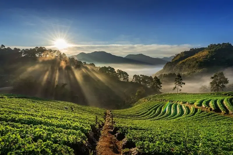
21. Doi Suthep-Pui National Park is an important natural area directly beside Chiang Mai city, covering parts of Mueang Chiang Mai, Mae Rim, and Hang Dong districts. It is therefore one of the province’s most accessible national parks. The area includes montane evergreen forest, waterfalls, viewpoints, highland communities, nature trails, and major religious sites.
Highlights: Doi Suthep-Pui forest, Huay Kaew Waterfall, Monthathan Waterfall, Chiang Mai city viewpoints, Doi Pui, Hmong communities, Wat Phra That Doi Suthep, and mountain nature trails close to the city.
The national park is important to Chiang Mai as a watershed, an urban-adjacent forest, and the mountain landscape forming the backdrop of the city. Doi Suthep is therefore much more than the famous temple; it contains forest ecosystems that change with elevation and a variety of travel routes.
Visitors with half a day can travel from the city to Wat Phra That Doi Suthep and continue to viewpoints and the Doi Pui area. Nature-focused travelers can choose waterfalls or walking trails along the mountain road, while checking route status and regulations before entering.
Winter offers cool weather and is generally the most comfortable season for travel. During the rainy season the forest becomes lush and waterfalls carry more water, but roads can be foggy and slippery in places. Drivers should reduce speed, especially on mountain bends.
Doi Suthep-Pui National Park is ideal for travelers who want to combine nature, temples, viewpoints, and communities in a single day. It is also well suited to people with limited time because it does not require traveling far from Chiang Mai city.
Getting There: From Chiang Mai city, take Huay Kaew Road past Chiang Mai University and Chiang Mai Zoo, then climb Sriwichai Road toward Doi Suthep and Doi Pui. Travelers visiting other parts of the park should plan routes according to the specific destination.
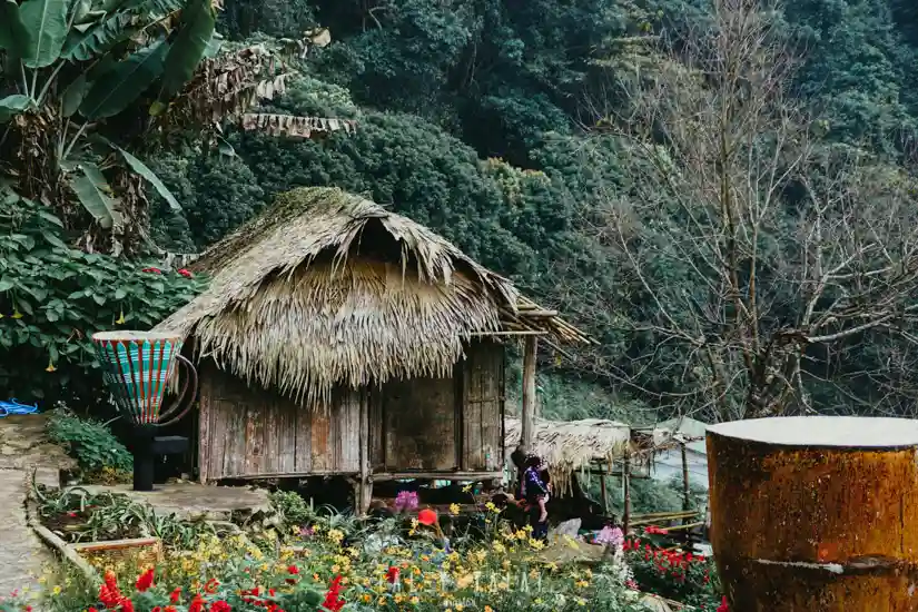
22. Hmong Village, Doi Pui is located along the Doi Suthep–Doi Pui route, beyond Bhubing Rajanives Palace. This highland Hmong community welcomes visitors to experience local life, handicrafts, food, flower gardens, and mountain weather cooler than Chiang Mai city.
Highlights: A Hmong community on Doi Pui, traditional clothing, embroidery and textiles, flower gardens, community products, local food, and a mountain atmosphere close to Chiang Mai city.
A visit should go beyond photographing traditional clothing because this is a living community. Hmong culture appears in language, clothing, textile patterns, handicrafts, food, and the way residents have adapted to tourism on Doi Suthep-Pui.
Markets and shops inside the village sell clothing, embroidered work, decorative items, tea, coffee, and highland agricultural products. Buying directly from community residents helps keep more tourism income within the area.
Winter offers the coolest and most comfortable weather for walking, but it is also the busiest season. Travelers seeking a quieter atmosphere should go up the mountain in the morning. The village can be visited in the same day as Wat Phra That Doi Suthep and other Doi Pui areas.
Visitors should ask permission before photographing people, avoid entering private homes, and avoid treating community culture merely as a backdrop for photographs. Taking time to learn about local life and supporting local products gives the visit greater meaning.
Getting There: Follow the road up Doi Suthep past Wat Phra That Doi Suthep and Bhubing Rajanives Palace, then continue uphill to the Hmong village. The final section is narrow and winding, so drive carefully, particularly on holidays when traffic is heavy.

23. Khun Chang Khian is a Hmong community on Doi Suthep-Pui that becomes especially popular in winter when wild Himalayan cherry trees bloom. Pink flowers lining roads and community areas have made it one of the best-known winter blossom destinations close to Chiang Mai city.
Highlights: Wild Himalayan cherry blossoms, a highland Hmong community, local coffee and produce, mountain views, cool weather, and the Doi Suthep-Pui route.
Khun Chang Khian’s appeal is strongly seasonal because the wild Himalayan cherry does not bloom on exactly the same dates every year. Flowering depends on temperature and weather conditions, so visitors should check bloom updates before traveling. Outside peak bloom, the village and mountain setting remain attractive, but the landscape will not have the same pink appearance.
This is a real community with limited road space. During peak blossom season, traffic can become very heavy. Using shuttle transport or traveling early in the morning can reduce congestion and lessen impacts on local residents.
Beyond the flowers, visitors can experience coffee, highland produce, and aspects of Hmong community life. Keep noise low, avoid obstructive parking, and do not enter agricultural land or private areas without permission.
Khun Chang Khian can be planned after Wat Phra That Doi Suthep, Doi Pui, and the Hmong village, but allow considerably more time during the flowering season because the ascent and descent can take much longer than the distance suggests.
Getting There: Follow the Doi Suthep-Pui route from Chiang Mai city past Wat Phra That Doi Suthep and Doi Pui, then continue toward Khun Chang Khian. Some road sections are narrow and winding, so check road conditions and traffic management before traveling during the high season.

24. Mae Sa Waterfall in Mae Rim District lies along the popular Mae Rim–Samoeng travel route and is not far from Chiang Mai city. Its defining feature is a series of waterfall tiers following the stream through shady forest, making it suitable for nature walks and relaxation during a Mae Rim trip.
Highlights: Multiple waterfall tiers, a walking trail along the stream, shady forest, a natural watercourse, and a location that combines easily with the botanical garden and Mon Jam.
Each waterfall tier has a different atmosphere. Some sections have broad rock platforms, while others feature water flowing around boulders and large trees. Walking uphill along the trail allows the scenery to change gradually and offers more activity than simply resting near the lower levels.
The rainy and late-rainy seasons bring more water and vivid green forest, but trails and rocks become more slippery. Winter is cooler and more comfortable for walking. Families with children or older visitors can choose easily accessible tiers rather than trying to reach every level.
Swimming should be limited to safe areas and visitors should follow staff guidance. Avoid places with strong currents or slippery rocks, especially after heavy rain.
Mae Sa Waterfall suits a half-day or full-day route with Queen Sirikit Botanic Garden, Mon Jam, and other Mae Rim attractions, combining forest, gardens, and viewpoints within one travel corridor.
Getting There: From Chiang Mai city, head toward Mae Rim District and continue onto the Mae Rim–Samoeng route. The waterfall entrance lies along Mae Rim’s main tourism road and is easily reached by private car or rental vehicle.

25. Wat Phra That Si Chom Thong Worawihan stands beside the Chiang Mai–Hot road in Chom Thong District. It is a royal temple and an important center of faith in southern Chiang Mai, connected with sacred Buddha relics, Lanna art, and long-standing local traditions.
Highlights: Sacred Buddha relics, Lanna viharn architecture, historic Buddhist art, the Mai Kham Pho procession, and the temple’s role as an important spiritual center of Chom Thong.
The temple is a key stop for travelers heading to Doi Inthanon because it is located in Chom Thong town before the road climbs toward the mountain. Visitors can stop to worship and view the architecture without making a major detour.
The temple’s art reflects Lanna forms through its viharns, woodwork, and religious elements. Visitors should walk through the temple calmly and dress respectfully because it remains an active place of worship for the local community.
One of Chom Thong’s important traditions is the Mai Kham Pho procession during Pii Mai Mueang, when community members bring beautifully decorated wooden supports to the temple. The tradition symbolizes supporting Buddhism and clearly expresses the relationship between the temple and local community.
Travelers planning a Doi Inthanon trip can stop at the temple in the morning before ascending the mountain or on the return journey before heading back toward Chiang Mai city. It suits cultural travelers, history enthusiasts, and anyone who wants to add a religious dimension to a nature-focused itinerary.
Open Days: Daily Opening Hours: 06:00 – 18:00
Getting There: From Chiang Mai city, take Highway 108 toward Chom Thong District. The temple is in the district center beside the main road before the junction leading to Doi Inthanon.
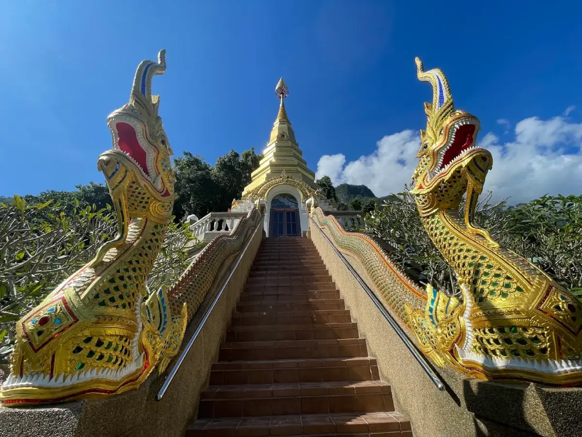
26. Wat Tham Pha Plong in Chiang Dao District is a mountain temple and meditation center known for its peaceful atmosphere. Its main feature is a staircase of about 510 steps climbing through forest toward the cave and religious buildings, making the ascent itself part of both the natural and contemplative experience.
Highlights: Approximately 510 steps, shady forest, a natural cave, meditation areas, a statue of Luang Pu Sim Buddhacaro, and views of the Chiang Dao mountains.
The route gradually climbs through the forest, creating an experience quite different from temples where visitors can drive directly to the main courtyard. Dhamma messages and rest areas appear along the way, encouraging a slow, reflective ascent rather than a hurried climb.
The temple is closely associated with Luang Pu Sim Buddhacaro, a respected meditation monk whose life and practice are strongly connected to the site. Its quiet mountain environment continues to suit meditation and visitors seeking distance from busy surroundings.
Visitors should dress respectfully, keep conversations quiet, and be considerate of people practicing meditation. Anyone with knee problems or difficulty climbing stairs should assess their physical condition before starting because the ascent involves a substantial number of steps.
Wat Tham Pha Plong can be combined in the same day with Chiang Dao Cave and viewpoints of Doi Luang Chiang Dao, giving a Chiang Dao itinerary natural, geological, and religious dimensions without requiring travel in multiple directions.
Getting There: From Chiang Mai city, take Highway 107 to Chiang Dao District, then continue toward the foothills of Doi Chiang Dao and the temple access area. From the parking point, visitors must continue on foot up the staircase to the temple.
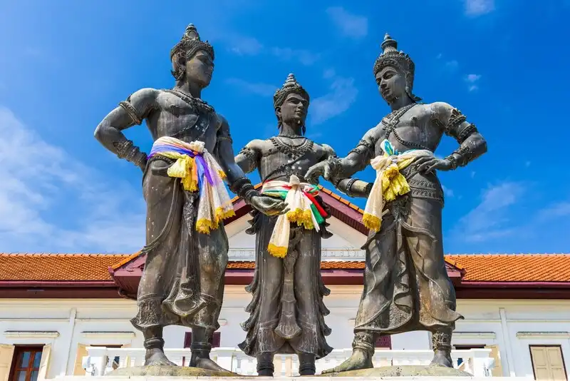
27. Three Kings Monument stands in the heart of Chiang Mai Old City in front of the former Chiang Mai Provincial Hall. The monument commemorates three kings associated with the founding and development of Chiang Mai: King Mangrai, King Ngam Mueang, and King Ramkhamhaeng the Great.
Highlights: The Three Kings Monument, a historic site in the center of the Old City, Chiang Mai City Arts & Cultural Centre, Lanna Folklife Museum, and walking routes connecting nearby temples.
This area is an important starting point for understanding the founding of Chiang Mai because it is closely associated with Lanna urban planning and the story of King Mangrai, who established Chiang Mai in 1296. Beginning an Old City visit here helps provide historical context before walking to temples and other major sites around the moat.
The monument area is within walking distance of Chiang Mai City Arts & Cultural Centre, Lanna Folklife Museum, Wat Inthakhin Sadue Mueang, and Wat Chedi Luang. It therefore works well as part of a half-day walking route without the need for a vehicle.
During important city events, the monument plaza is also used for ceremonies and cultural activities. It is therefore not simply a photo landmark but remains part of contemporary civic and cultural life in Chiang Mai.
Morning is suitable for viewing the surrounding buildings and public space, while evening is convenient for continuing to restaurants, cafés, or walking streets on market days. Staying in the Old City provides the easiest access to this area.
Getting There: The monument is located on Phra Pok Klao Road in the Old City. It can be reached on foot from Wat Chedi Luang and Ratchadamnoen Road, or by red songthaew and hired vehicle to the monument plaza.

28. Grand Canyon Water Park Chiang Mai is located in Hang Dong District. It is an outdoor activity destination and water park developed around a large water-filled excavation, surrounded by exposed earth walls and a landscape that differs from conventional built water parks.
Highlights: Water activities, outdoor play facilities, a large swimming area, activities for groups of friends and families, and the distinctive Chiang Mai Grand Canyon landscape.
The attraction suits travelers who want a change from temples and mountain sightseeing and prefer more energetic activities. It is especially popular with groups of friends and families with older children. Allow several hours so activities do not feel rushed.
Safety is the most important consideration for water activities. Visitors should wear required safety equipment, follow staff instructions, and avoid activities beyond their ability. Children should remain under adult supervision at all times.
Midday can be very hot, so sunscreen, a change of clothes, and drinking water are useful. Visitors who do not enter the water can use rest areas and watch activities, but should check the services available in each zone before traveling.
The Grand Canyon is in the Hang Dong area and can be combined with Ban Tawai, Royal Park Rajapruek, or Chiang Mai Night Safari, making it suitable for a one-day route south of Chiang Mai city.
Opening Hours: Generally 09:00 – 18:00
Getting There: From Chiang Mai city, head toward Hang Dong District, then continue into Nam Phrae Subdistrict following signs toward the Grand Canyon. Private car or ride-hailing service is the most convenient way to travel.

29. Wat Chedi Luang Worawihan is located on Phra Pok Klao Road in Chiang Mai Old City and is one of the most important temples in Lanna history. Its defining feature is the massive Chedi Luang, once one of the city’s tallest structures, and the temple is also connected with both the Emerald Buddha and the Inthakhin city pillar of Chiang Mai.
Highlights: Chedi Luang, the Inthakhin city pillar, Lanna viharns, the history of the Emerald Buddha, ancient architecture, and the annual Inthakhin flower-offering tradition.
Chedi Luang is an archaeological monument that reflects Chiang Mai’s past prosperity. The scale of its base and the surviving structure make it possible to imagine the importance of the temple when Lanna was a major political and religious center.
The temple is also connected with the Emerald Buddha, which was once enshrined at Chedi Luang before being moved elsewhere. This gives the temple significance in regional Buddhist history beyond its status as an old temple.
The Inthakhin city pillar is another core element of Chiang Mai belief. Each year, the Inthakhin flower-offering tradition brings residents to offer flowers for auspiciousness and the stability of the city. The custom reflects the relationship between Buddhism, older belief systems, and Chiang Mai’s civic identity.
The temple stands in the center of the Old City and can be linked on foot with Wat Phan Tao, the Tha Phae walking street, Three Kings Monument, and Wat Phra Singh, making it ideal for a self-guided temple walk without a vehicle.
Open Days: Daily Opening Hours: 06:00 – 17:00
Getting There: The temple is on Phra Pok Klao Road in the Old City and can be reached on foot from Ratchadamnoen Road or Three Kings Monument. Red songthaews and hired vehicles also reach the surrounding area easily.

30. Mae Kampong Waterfall is a natural waterfall near Mae Kampong Village in Mae On District. It can be reached easily from the village and is a convenient way to add a nature activity to a Mae Kampong trip without traveling far from the community.
Highlights: A forest waterfall close to the village, cool air, a natural stream, walking routes along several levels, and the mountain-forest atmosphere of Mae Kampong.
The waterfall flows through humid forest with dense vegetation, making the area noticeably cooler than Chiang Mai city, especially in the morning and during the rainy season. The sound of water and forest atmosphere provide a contrast with the village’s busier main street.
The waterfall route includes several levels and sections. Visitors who continue farther should wear footwear suitable for wet ground because rocks and soil can become slippery after rain. Reaching the highest point is not necessary for everyone; families with children or older travelers can enjoy the more accessible lower sections.
Visitors should avoid littering and keep noise low because the waterfall is part of the stream system that flows through the community below. Maintaining cleanliness therefore directly affects the environmental quality of Mae Kampong Village.
A good plan is to walk through Mae Kampong Village in the morning, visit Wat Khantha Phueksa and local restaurants, continue to the waterfall in the late morning or afternoon, and stay overnight to experience the village after most day visitors have left.
Getting There: From Mae Kampong Village, continue uphill on the road through the community toward the waterfall. Some sections are narrow and steep, so drive carefully and avoid parking in ways that obstruct village traffic.

31. Wat Phra Singh Woramahawihan is one of Chiang Mai’s most important temples, located near Sam Lan Road in the Old City. It is significant for its history, Buddhism, Lanna art, and Chiang Mai traditions. Its best-known treasures are the Phra Buddha Sihing image and Viharn Lai Kham, one of the province’s most celebrated works of Lanna art.
Highlights: Phra Buddha Sihing, Viharn Lai Kham, Lanna murals, the main chedi, scripture library, woodcarving and gilded decoration, and the Pii Mai Mueang tradition of bathing the Phra Buddha Sihing image.
Wat Phra Singh is closely linked with the history of the Mangrai Dynasty and Chiang Mai. Although the temple has been restored in several periods, it retains important Lanna artistic elements, especially Viharn Lai Kham, a relatively small building filled with gilded motifs, woodwork, and wall paintings.
The Phra Buddha Sihing is a highly revered Buddha image in Chiang Mai. During Pii Mai Mueang, the image is brought out so the public can pour scented water over it, forming one of the important ceremonies that continues to connect the temple with the lives of Chiang Mai residents.
The murals in Viharn Lai Kham also reveal aspects of past lifestyles, clothing, society, and culture. Visitors interested in art should spend time observing the scenes and details rather than passing through quickly because much of the temple’s value lies in its fine-scale craftsmanship.
The temple’s location is ideal for walking around the Old City. It can be linked with Wat Chedi Luang, Wat Phan Tao, Three Kings Monument, and Ratchadamnoen Road, making it one of the principal stops on a self-guided Chiang Mai temple route.
Open Days: Daily Opening Hours: 06:00 – 18:30
Getting There: The temple is in the Old City near Sam Lan Road and can be reached on foot from the moat area, by red songthaew, ride-hailing service, or bicycle. Travelers staying in the Old City can easily combine it with nearby major temples.

32. Wat Sri Suphan is located on Wua Lai Road in Hai Ya Subdistrict. The temple is distinguished by the way the silver- and metalworking knowledge of the Wua Lai community has been applied to Buddhist art, producing a silver-colored ubosot covered with details unlike those of most traditional Lanna temples. It has become one of Chiang Mai’s most recognizable architectural images.
Highlights: The Silver Ubosot, repoussé metalwork, Wua Lai silver craftsmanship, contemporary Buddhist motifs, an artisan community, and a location close to the Wua Lai Saturday Walking Street.
The Wua Lai community has a long history of silverwork and metal craftsmanship. These skills are not confined to souvenir shops; they are applied directly to the religious architecture, covering the ubosot with repoussé patterns and narrative imagery worked into metal panels by local artisans.
Seen up close, the decoration includes not only traditional Buddhist motifs but also contemporary interpretations and imagery reflecting the ideas of craftspeople from different periods. The temple is therefore especially interesting for travelers who appreciate art, craftsmanship, and the evolution of local traditions in modern contexts.
The area around the temple connects with the Wua Lai silver community and the Saturday Walking Street. Visitors can explore the temple in the afternoon and continue to the evening market for handicrafts and local food.
As an active religious site, visitors should dress respectfully and follow specific rules in different temple areas, particularly around the ubosot, where entry regulations should be read carefully before entering.
Getting There: Wat Sri Suphan is on Wua Lai Road south of the Old City, close to Chiang Mai Gate. It can be reached by red songthaew, ride-hailing service, or on foot from the southern moat area.
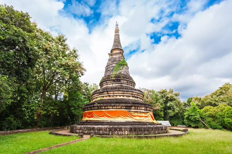
33. Wat Umong, also known as Wat Umong Suan Phutthatham, is located off Suthep Road west of Chiang Mai city. It is known for ancient tunnels built beneath an earthen mound, shady woodland, and meditation areas, giving it a very different atmosphere from major Old City temples centered on open viharns and chedis.
Highlights: Ancient tunnels, a chedi on the mound, Buddhist meditation gardens, urban woodland, Dhamma areas, and a quiet atmosphere for meditation.
The tunnel passages divide into several corridors leading toward Buddha images enshrined inside. Brick walls and intermittent natural light create a calm atmosphere clearly different from the outdoor grounds.
Above the tunnels are the chedi and large trees, while the surrounding area includes garden paths and Dhamma messages at different points. Visitors can therefore walk slowly without needing a single photo-oriented destination.
The temple suits travelers interested in meditation, history, and nature. Morning is best for a quieter atmosphere, and visitors should avoid making noise in areas used for meditation practice.
The temple is not far from Chiang Mai University and the foot of Doi Suthep and can be combined with the Lanna Traditional House Museum, Wat Suan Dok, and the Suthep area without long travel distances.
Open Days: Daily Opening Hours: 05:00 – 18:00
Getting There: From the city, take Suthep Road toward the foothills. A side road leads from the main road to the temple. Private cars, red songthaews, and ride-hailing services can reach the area conveniently.
Map (GPS):Open Driving Directions to Wat Umong
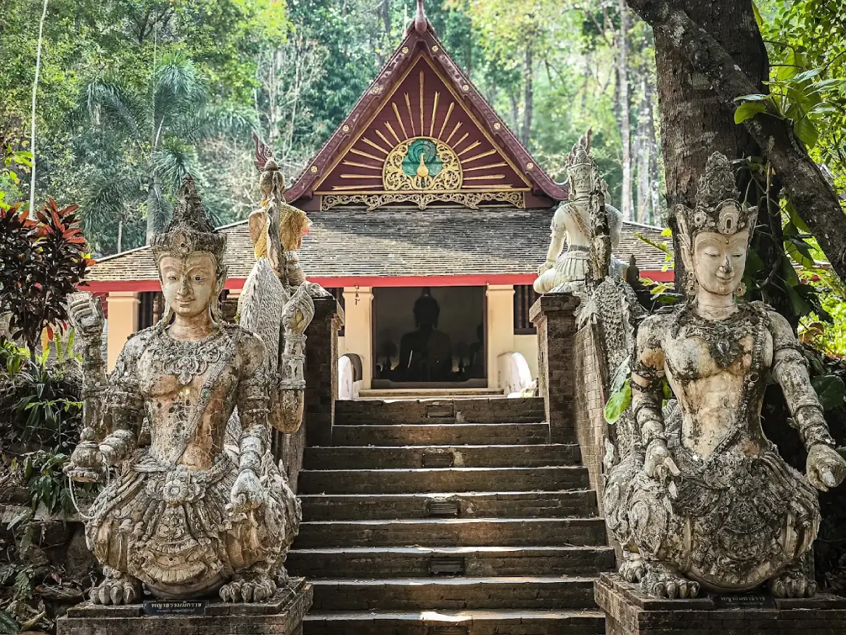
34. Wat Pha Lat is a forest temple on Doi Suthep between Chiang Mai city and Wat Phra That Doi Suthep. Its architecture is tucked among forest, streams, rocks, and large trees, giving the temple a peaceful atmosphere and a strong sense of harmony with nature.
Highlights: A forest temple on Doi Suthep, natural streams, religious structures among trees, old chedis and sculptures, forest paths, and views of Chiang Mai from the wooded mountainside.
Historically, Wat Pha Lat was connected with the route up Doi Suthep and the journeys of pilgrims. The temple therefore resembles a resting place along the ascent more than a monumental city temple. Some structures are integrated directly with rock formations and the slope of the mountain.
The sound of the stream and shade from large trees are essential parts of the experience. Visitors should walk slowly and observe the religious structures scattered through the grounds because some are not immediately visible from the parking area.
Another way to reach the temple is by walking a nature trail from the foothills. This suits travelers in good physical condition who want to combine hiking with a temple visit, though trail conditions should be checked in advance, particularly during the rainy season.
Wat Pha Lat works especially well as a stop before continuing to Wat Phra That Doi Suthep, allowing a single-day route to contrast two forms of temple experience: a quiet forest temple and a major relic temple that serves as a spiritual center of the city.
Open Days: Daily Opening Hours: 06:00 – 18:00
Getting There: Take Sriwichai Road up Doi Suthep from the Chiang Mai Zoo area. The entrance to Wat Pha Lat is before Wat Phra That Doi Suthep. The road is mountainous and winding, so drive carefully.
Map (GPS):Open Driving Directions to Wat Pha Lat

35. Ban Tawai in Hang Dong District is a handicraft community famous for woodcarving, furniture, home décor, art, and products made by local craftspeople. It is one of the clearest places to see Chiang Mai’s long tradition of skilled artisan work.
Highlights: Woodcarving, furniture, artwork, home décor, artisan shops, and handicraft products ranging from small pieces to large decorative items.
Ban Tawai developed from a community skilled in woodworking and handicrafts into a large production and retail area. Shops and workshops offer different styles, allowing visitors to compare materials, patterns, techniques, and workmanship among many producers.
Travelers interested in interior decoration will find much more than ordinary souvenirs, including tables, cabinets, doors, carved panels, Buddha images, decorative objects, and contemporary pieces. General visitors can also choose smaller items that are easier to carry while traveling.
Another interesting aspect is the opportunity in some areas to observe craftspeople at work, showing how a finished piece may pass through wood selection, shaping, carving, sanding, and surface finishing. These processes reflect skills and experience accumulated within the community.
Ban Tawai combines well with Grand Canyon Chiang Mai, Royal Park Rajapruek, and Chiang Mai Night Safari because all are in Hang Dong and the southern side of the city.
Getting There: From Chiang Mai city, take Highway 108 toward Hang Dong District, then continue to Khun Khong Subdistrict and the Ban Tawai area. A private vehicle or hired car is useful for visiting several shops spread around the community.
Map (GPS):Open Driving Directions to Ban Tawai

36. Chiang Mai Zoo is located on Huay Kaew Road at the foot of Doi Suthep. The large zoo uses sloping terrain and green areas to organize animal zones and provides another family-friendly activity close to Chiang Mai city.
Highlights: A wide variety of animals, extensive grounds on the foothills, educational zones about animals and nature, and a location that combines easily with a Doi Suthep trip.
The zoo covers hilly terrain and distances between zones can be significant. Visitors should plan their route in advance and choose activities according to available time, especially when traveling with young children or older adults.
A zoo visit can be used as an opportunity to learn about animals, habitats, and conservation rather than simply viewing animals. Follow site regulations, do not feed animals independently, and do not disturb animals to provoke behavior for photographs.
Its foothill location makes it possible to visit the zoo in the morning and continue to Wat Pha Lat and Wat Phra That Doi Suthep in the afternoon, or return easily to Nimman and Huay Kaew.
Open Days: Daily Opening Hours: Generally 08:00 – 18:00
Getting There: The zoo is at the end of Huay Kaew Road at the foot of Doi Suthep, close to Chiang Mai University. It is easily reached by red songthaew, private car, or ride-hailing service.
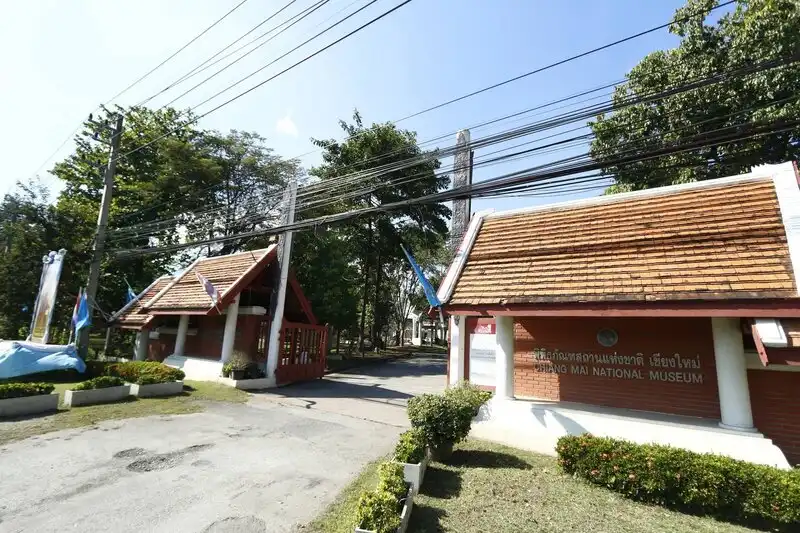
37. Chiang Mai National Museum is located near the Chiang Mai–Lampang Superhighway close to Wat Ched Yot. It houses archaeological objects, works of art, and interpretive information that explain the development of Lanna and Northern Thailand from ancient periods through modern history.
Highlights: Lanna antiquities, Buddha images, Northern Thai art, tools and cultural objects, exhibitions on Chiang Mai history, and archaeological information.
The museum is useful before or after visiting temples because it helps explain the artistic context of objects and architecture seen at religious sites, including styles of Buddha images, chedis, everyday objects, and the development of the Lanna Kingdom.
The exhibitions also connect Chiang Mai with neighboring areas of Northern Thailand, showing that the Lanna Kingdom was not limited to Chiang Mai city but formed a network of cities and cultures linked across the region.
It is suitable for history enthusiasts, students, families, and travelers who want to understand Chiang Mai beyond simply walking through attractions. Spending time in the museum before visiting nearby Wat Ched Yot can make architectural and artistic details easier to recognize.
Getting There: The museum is close to Wat Ched Yot and the Chiang Mai–Lampang Superhighway. It is easily reached by private car, red songthaew, or ride-hailing service.
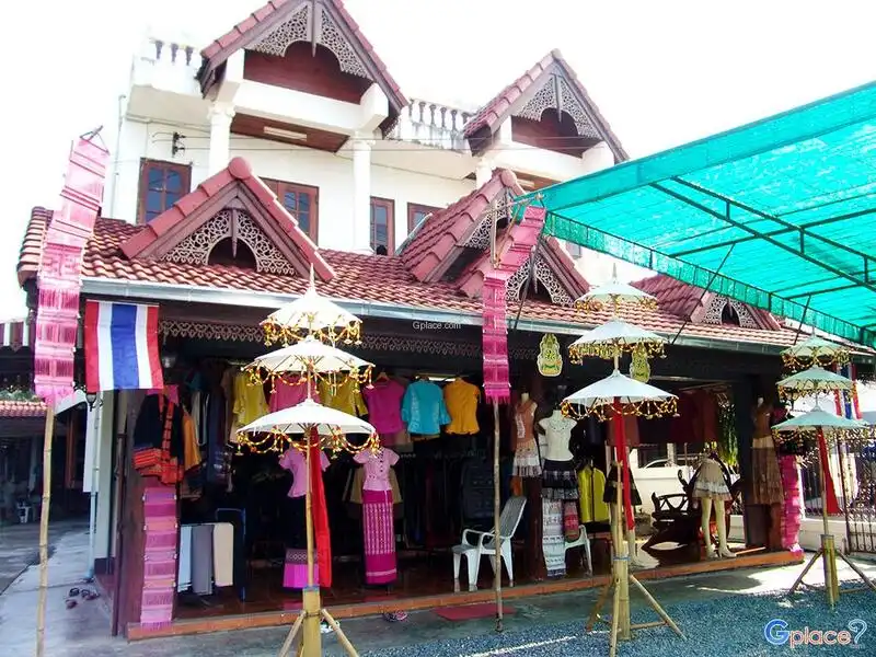
38. Teen Jok Weaving Village in Tha Pha Subdistrict, Mae Chaem District, is a learning center for local textiles, especially the famous “Mae Chaem teen jok sinh,” distinguished by a supplementary-weft technique that creates intricate patterns along the lower border of the skirt. It is one of Chiang Mai’s important textile traditions.
Highlights: Mae Chaem teen jok textiles, the jok weaving technique, hand weaving, traditional patterns, community weavers, and learning textile knowledge directly from local producers.
The “jok” technique requires great precision. Weavers lift and insert threads in selected sections to create complex motifs. A single piece therefore requires time, skill, and detailed knowledge of traditional patterns passed down through generations.
Each pattern has value beyond visual beauty because it is connected to community identity, dress, and traditions in Mae Chaem. Observing the weaving process therefore helps visitors understand culture through textiles that continue to be used in everyday life and ceremonies.
Travelers can buy textiles directly from weavers or community groups, helping income return to producers and supporting the continuation of weaving skills. Visitors who want a detailed demonstration should contact the community in advance because weaving is part of daily work and life, not a performance offered at fixed times every day.
The village combines well with Pa Bong Piang and other areas of Mae Chaem, bringing rice terraces, community life, and traditional handicrafts together within the same trip.
Getting There: The village is in Tha Pha Subdistrict, Mae Chaem District. Travelers coming from Doi Inthanon can descend toward Mae Chaem and continue within the district. A private vehicle or local transport is useful for moving between communities.
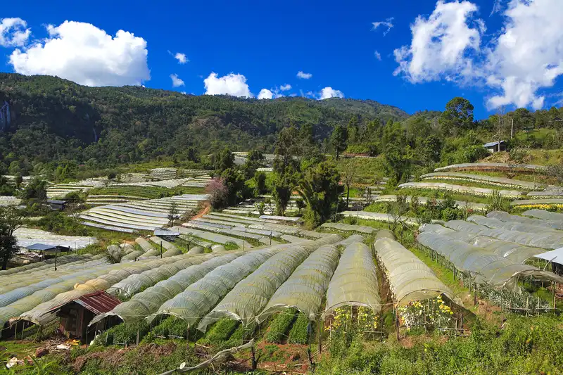
39. Royal Agricultural Station Inthanon is located at Ban Khun Klang in Chom Thong District on the highlands of Doi Inthanon. It is an agricultural research and development center that has contributed to improving quality of life in highland communities while opening selected areas where visitors can learn about temperate-climate plants and farming suited to mountain environments.
Highlights: Temperate-climate plants, experimental and demonstration plots, flowers, highland produce, the Khun Klang landscape, and learning about agricultural development in mountain areas.
The Inthanon area has a much cooler climate and significantly higher elevation than Chiang Mai’s lowlands, making it possible to grow many plants that are unsuitable for the plains. Research and experiments at the station generate knowledge that can be applied by highland communities and farmers.
Visitors can see tourism linked with development rather than simply viewing a flower garden. Behind the attractive landscape are crop trials, water management, and efforts to create livelihoods suited to mountain environments.
Winter is the most popular season for visitors, but other seasons show different plants and agricultural activities. The experience is best approached as learning from the conditions actually present rather than expecting a particular flower species to bloom all year.
The station can be combined with Mae Klang Luang Village, Wachirathan Waterfall, the royal pagodas, Kew Mae Pan, and the Doi Inthanon summit, making it suitable for a full-day Inthanon itinerary that includes agriculture and community life.
Getting There: From Chom Thong District, take Highway 1009 up Doi Inthanon toward Ban Khun Klang. The station lies along the same route as several of the park’s major attractions.
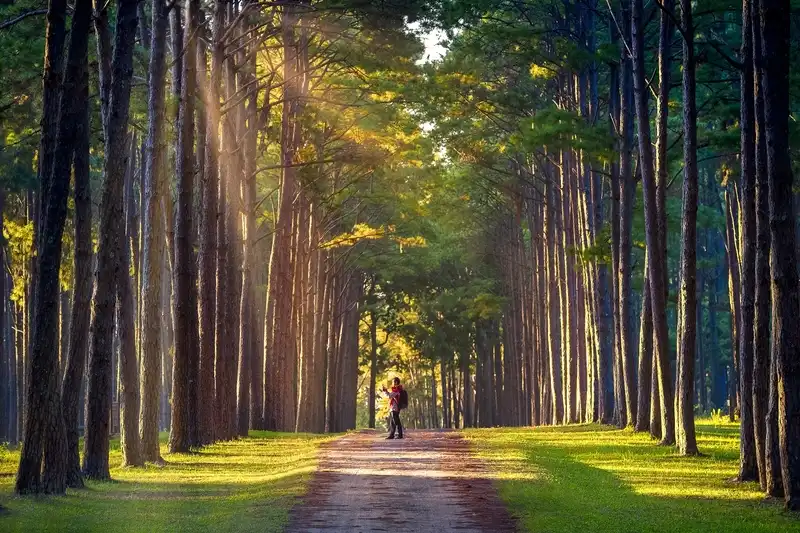
40. Bo Kaeo Silvicultural Research Station (Bo Kaeo Pine Garden) is located beside Highway 108 in Hot District. This silvicultural research area is known for orderly rows of tall pine trees that create a landscape quite different from surrounding natural forest, making it a popular stop on the Chiang Mai–Hot–Mae Sariang route.
Highlights: Tall rows of pine trees, cool winter weather, green scenery beside Highway 108, a quiet atmosphere, and photo settings reminiscent of pine forests in cooler climates.
The site was not originally created as a tourist garden. Its origins are connected to forestry agencies conducting experiments and research on tree species. The extensive pine planting served silvicultural purposes before the resulting landscape attracted travelers.
Morning and winter are especially good times to stop because lower temperatures and light filtering through the pines create depth in photographs. Light mist can add atmosphere on some days, but it should not be expected every day because it depends on weather conditions.
Although the area is popular for photography, visitors should park carefully beside the road, avoid stepping on or damaging research plots, and keep the area clean because its primary function still includes forestry and education.
Bo Kaeo Pine Garden is best treated as a stop for travelers continuing to Hot, Ob Luang, Mae Sariang, or Mae Hong Son rather than as a destination for a dedicated drive from Chiang Mai city. It fits naturally into a road trip through the southern part of the province.
Open Days: Daily Opening Hours: 08:00 – 17:00
Getting There: From Chiang Mai city, take Highway 108 through Hang Dong, San Pa Tong, Chom Thong, and Hot, then continue along the Hot–Mae Sariang road. The station is beside the highway at approximately kilometer 36–37.

41. Ob Luang National Park in Hot District is distinguished by a dramatic gorge where the Mae Chaem River flows between steep rock cliffs. The narrow, deep channel and powerful landscape have made it one of the most memorable natural features on the Chiang Mai–Hot–Mae Sariang route.
Highlights: Ob Luang Gorge, high rock cliffs, the Mae Chaem River, a viewpoint bridge, nature trails, archaeological sites, and distinctive rocky terrain.
In the local language, “ob” refers to a narrow gorge and “luang” means large. Looking from the bridge, visitors can immediately understand the name as the river rushes through a narrow opening between cliffs. The sound of water moving through the gorge adds to the scale and power of the landscape.
Ob Luang is not interesting only for geology. Archaeological evidence in the area shows human use of the landscape in the past, linking natural history, terrain, and human history within the same national park.
Visitors can walk nature trails to view cliffs, forest, and different angles of the gorge. Wear suitable walking shoes and take care near cliff edges and rocky sections, particularly when surfaces are wet after rain.
Ob Luang combines especially well with Bo Kaeo Pine Garden because both lie along the same route. Travelers can continue onward to Hot, Mae Chaem, or Mae Sariang, making the park suitable for those expanding a Chiang Mai trip into the southern part of the province.
Getting There: From Chiang Mai city, take Highway 108 through Hang Dong, San Pa Tong, Chom Thong, and Hot, then continue along the Chiang Mai–Mae Sariang route. The park is directly beside the main road and is convenient to reach by private car.
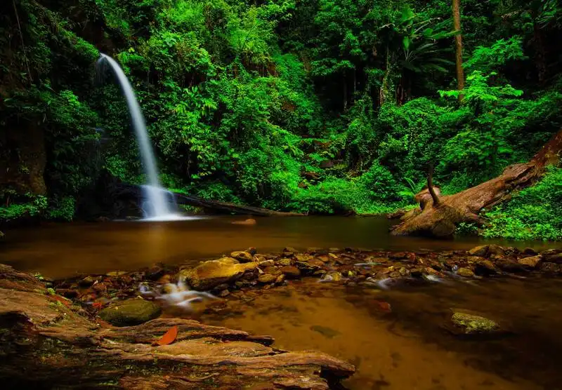
42. Monthathan Waterfall is located within Doi Suthep-Pui National Park near Chiang Mai city. Surrounded by forest, it suits travelers who want to experience the natural side of Doi Suthep in a quieter setting than the major temples and popular viewpoints.
Highlights: A forest waterfall on Doi Suthep, shady woodland, nature trails, streams, and a location close to the city that still retains a mountain-forest atmosphere.
The waterfall area is humid and heavily shaded by trees, making the air cooler than in exposed areas. The waterfall and stream are fuller during the rainy and late-rainy seasons, though trails also become more slippery during this period.
Nature lovers can spend time walking through the forest and around the waterfall without traveling far from Chiang Mai. It suits a half-day trip and can be combined with Wat Pha Lat or Wat Phra That Doi Suthep along the same route.
After heavy rain, visitors should pay close attention to national park announcements because mountain streams can change level quickly. Do not swim or approach areas with strong currents.
Monthathan Waterfall is a good choice for travelers who want to add a nature activity to a Doi Suthep itinerary and for forest photographers, plant enthusiasts, and visitors seeking a quieter alternative to heavily visited attractions.
Getting There: Take Huay Kaew Road and Sriwichai Road up Doi Suthep, then follow park signs at the junction toward Monthathan Waterfall. The mountain road is winding and steep in places, so drive carefully.

43. Ton Lam Yai Market is located in the Chang Moi area beside Warorot Market and not far from the Ping River. This long-established market remains part of everyday life for Chiang Mai residents, especially for fresh flowers, vegetables, fruit, food, and household goods.
Highlights: Flower market, fresh market, local food, fruit, souvenirs, the atmosphere of Chiang Mai’s early-morning market life, and a location directly beside Warorot Market.
Early morning is the most distinctive time to visit because fresh flowers and goods arrive from different areas as vendors set up and local customers begin shopping. The character of the district then changes gradually through the day.
Food-focused travelers can walk directly from Ton Lam Yai Market into Warorot Market to buy northern Thai food, sai ua, chili dips, crispy pork rinds, and souvenirs, allowing both markets to be explored continuously without a vehicle.
The area is also close to Chang Moi, Nawarat Bridge, and the Ping River, making it possible to extend the visit into an urban walking route combining traditional markets, old shops, cafés, and riverside neighborhoods.
For photographers, the morning market offers vivid flower colors, arranged goods, and scenes of everyday life. Avoid blocking commercial activity and ask permission when photographing people at close range.
Open Days: Daily Opening Hours: 04:00 – 19:00
Getting There: The market is directly beside Warorot Market in the Chang Moi area. It can be reached on foot from Warorot Market, Nawarat Bridge, or the Ping River district. Red songthaews and ride-hailing services easily reach the surrounding streets.

44. Chiang Mai Night Bazaar (Anusarn Market) is a long-established evening tourism district along Chang Klan Road, including nearby Anusarn Market. It is suitable for visitors who want to shop, eat, and experience Chiang Mai after sunset.
Highlights: Night markets, handicrafts, souvenirs, clothing, food, shops, restaurants, and the nighttime atmosphere of Chang Klan Road.
The Night Bazaar differs from the Tha Phae walking street because it operates more regularly and functions as a permanent commercial district. Travelers can therefore include it on almost any evening rather than waiting specifically for Sunday.
Goods range from souvenirs, handicrafts, and clothing to home décor and products aimed at travelers. Anusarn Market also offers many restaurants and food options, making the area useful for groups that want to walk through a market and have dinner in the same place.
Chang Klan Road is not far from the Ping River or Tha Phae Gate. Visitors staying in the city can reach it easily on foot or by hired transport, making it a convenient evening destination for travelers without a private vehicle.
Market lovers can compare the Night Bazaar with the Tha Phae walking street because the atmosphere is clearly different. The walking street is a weekly event with many small producers, while the Night Bazaar has the feel of a continuing nighttime commercial district.
Open Days: Daily
Getting There: The area is on Chang Klan Road around the Night Bazaar and Anusarn Market. It can be reached on foot from Tha Phae Gate or conveniently by red songthaew, tuk-tuk, or ride-hailing service.

45. Wat Suan Dok is located on Suthep Road in Mueang Chiang Mai District. This important Lanna temple contains a large principal chedi, a viharn, and a group of white mausoleums holding the ashes of northern royal family members, giving it religious, historical, and dynastic significance.
Highlights: The large chedi, white mausoleums of northern royalty, a large viharn, important Buddha images, and historical connections with King Kuena and the monk Sumana Thera.
Wat Suan Dok was founded during the reign of King Kuena of Lanna. The site had previously been a royal flower garden and became connected with the spread of Sri Lankan Theravada Buddhism in Lanna, giving the temple an important role in Chiang Mai’s religious development.
The cluster of white mausoleums in front of the main chedi is one of the features that most clearly distinguishes Wat Suan Dok. They contain the ashes of several members of northern royal families, directly connecting the site with Chiang Mai’s dynastic history.
The temple grounds are relatively open and provide clear views of the chedi, especially in the late afternoon when light falls across the chedi and white mausoleums. The site is attractive to architecture enthusiasts and photographers, though visitors should respect religious areas and ceremonies.
Wat Suan Dok can be combined with Wat Umong, Chiang Mai University, and the Nimman area along the same route because it is on Suthep Road and not far from the Old City.
Open Days: Daily Opening Hours: 06:00 – 18:00
Getting There: The temple is on Suthep Road west of the Old City and is easily reached by red songthaew, ride-hailing service, bicycle, or private car.
Map (GPS):Open Driving Directions to Wat Suan Dok

46. Wat Lok Moli is located just outside Chiang Mai’s northern moat on Maneenopparat Road. This historic temple is distinguished by a large wooden viharn, a massive brick chedi, and an atmosphere that retains a strong Lanna identity despite its location close to major roads and the city center.
Highlights: Lanna wooden viharn, large brick chedi, woodcarving, history connected with the Mangrai Dynasty, and a convenient location close to Chiang Mai’s moat.
Wat Lok Moli has historical connections with Lanna kings and the royal family and has served religious functions across several periods. The large exposed-brick chedi behind the viharn is a defining feature that gives the temple a different character from temples whose chedis are covered in gold.
The wooden viharn at the front is notable for its tiered roof and extensive carved decoration. At close range, visitors can see details in the doors, gables, columns, and ornamental elements that demonstrate the skill of contemporary Lanna craftspeople.
The temple is close to Chang Phueak Gate and the northern side of the moat, making it easy to visit for travelers staying in the city. It can be added after Wat Phra Singh or other Old City temples.
Morning offers a quiet atmosphere and good light for viewing the woodwork, while in the evening visitors can continue to markets and food areas near Chang Phueak Gate.
Open Days: Daily Opening Hours: 06:00 – 17:00
Getting There: Wat Lok Moli is on Maneenopparat Road just outside the northern moat. It can be reached on foot from Chang Phueak Gate, by red songthaew, or by ride-hailing service.
Map (GPS):Open Driving Directions to Wat Lok Moli
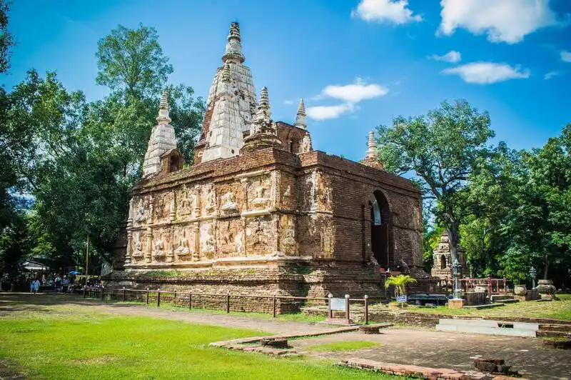
47. Wat Ched Yot, formally Wat Photharam Maha Vihara, is located in the Chang Phueak area near the Chiang Mai–Lampang Superhighway. It is famous for its seven-spired Maha Vihara, influenced by Indian Buddhist architecture, making it one of Chiang Mai’s temples with a form clearly distinct from more typical Lanna temples.
Highlights: The seven-spired Maha Vihara, architecture influenced by the Mahabodhi Temple at Bodh Gaya, historic stucco figures of celestial beings, sacred bodhi trees, and the history of an important Buddhist council in Lanna.
The seven-spired Maha Vihara has a massive base with seven towers rising from the roof. Its overall design was inspired by the Mahabodhi Temple at Bodh Gaya in India, giving the temple importance in both architecture and the history of connections between Lanna Buddhism and the wider Buddhist world.
The exterior walls contain old stucco figures of deities and decorative motifs that are best viewed at close range. Many details have survived for centuries, so visitors should avoid touching ancient surfaces directly.
The temple is also associated with an important Buddhist council held during the Lanna period, giving it religious-historical significance beyond its value as an architectural monument.
Wat Ched Yot can be combined with Chiang Mai National Museum and the Chang Phueak area because they are close together. Visiting both helps connect objects seen in the museum with surviving Lanna architecture in its original setting.
Open Days: Daily Opening Hours: 07:00 – 17:00
Getting There: The temple is close to the Chiang Mai–Lampang Superhighway and Rin Kham Intersection. It is easily reached by red songthaew, ride-hailing service, or private car.
Map (GPS):Open Driving Directions to Wat Ched Yot
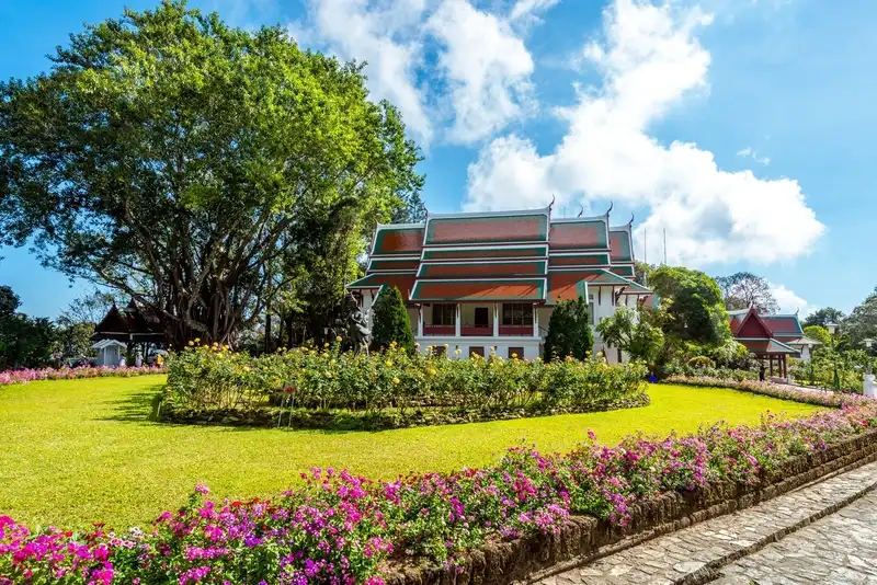
48. Bhubing Rajanives Palace is located on Doi Buak Ha in the Doi Suthep area, about 4 kilometers above Wat Phra That Doi Suthep. The high elevation provides cool weather and carefully maintained landscaped gardens, making it an important stop on the Doi Suthep–Doi Pui route.
Highlights: A royal residence in the highlands, flower gardens, temperate-climate plants, mountain landscaping, and a route that continues to Doi Pui and the Hmong village.
The area around the palace has a cooler climate than Chiang Mai city, allowing a wide variety of flowers and highland plants to grow. The gardens are therefore among the features that attract the most attention, particularly in winter.
Visitors must pay close attention to site regulations concerning dress, areas open to the public, and periods when entry is permitted. All signs and staff instructions should be followed carefully.
The palace location makes it easy to continue from Wat Phra That Doi Suthep to the Hmong Village at Doi Pui in the same day, creating a route that combines religion, gardens, and a highland community.
Morning is the best time to visit because temperatures are cool and there is still ample time to continue to other mountain destinations. On holidays, allow extra time for traffic on the Doi Suthep road.
Getting There: From Chiang Mai city, take Huay Kaew Road and Sriwichai Road up Doi Suthep, pass Wat Phra That Doi Suthep, and continue approximately 4 kilometers along the Doi Pui route.
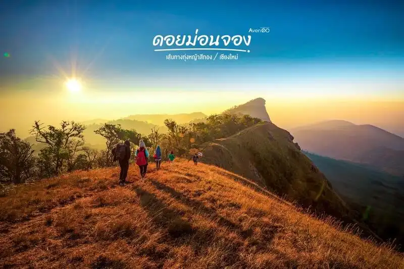
49. Doi Mon Jong lies within Omkoi Wildlife Sanctuary in Omkoi District and is one of Chiang Mai’s best-known mountain trekking routes for travelers who enjoy high ridges and open landscapes. Its defining features are grasslands, layered mountain views, sunrise and sunset scenery, and a remote atmosphere far from urban tourist areas.
Highlights: High mountain ridges, mountain grasslands, layered mountain scenery, sunrise and sunset viewpoints, trekking, and the natural landscapes of Omkoi.
Mon Jong is suitable for travelers who want an experience different from viewpoints accessible directly by car. Reaching the area requires advance planning, walking, and compliance with wildlife sanctuary regulations.
The open ridge landscape provides extensive views across successive mountain ranges. Late rainy season and winter are especially suitable for trekking and grassland scenery, although winds on the ridge can be strong and nighttime temperatures may fall considerably.
Access is seasonal and managed according to wildlife sanctuary policies. Travelers must check opening periods, routes, registration procedures, and required equipment before departure. The area should not be entered without a plan or in violation of conservation rules.
Leave No Trace principles are especially important: carry all waste out, do not collect plants, do not disturb wildlife, and use only designated areas for camping or activities so that Mon Jong’s natural condition can be preserved over the long term.
Getting There: Travel from Chiang Mai city to Omkoi District and then continue to the access point designated by the relevant authorities for trips to Mon Jong. The journey takes considerable time, so a trip of at least two days is appropriate.
Map (GPS):Open Driving Directions to Doi Mon Jong

50. Muang Khong Village in Chiang Dao District is a valley community located behind the Doi Luang Chiang Dao range. Its atmosphere is clearly different from Chiang Dao along the main highway, with rice fields, streams, mountains, and quiet rural life. It is especially suited to travelers who want to slow down rather than rush from one check-in point to another.
Highlights: A valley community, views of Doi Luang Chiang Dao, rice fields, streams, homestays, local food, and a peaceful rural atmosphere.
Muang Khong’s main appeal is its landscape. The community sits among mountains and agricultural land, so during the rice-growing season green fields spread across the valley, while winter brings cool weather well suited to an overnight stay.
The best activities are not about rushing between separate attractions but about walking through the community, cycling, sitting beside rice fields, tasting local food, and spending time with the scenery. Homestay guests can experience the early morning and evening atmosphere, which is noticeably different from a quick day visit.
Because this is a real community, visitors should not enter agricultural land or homes without permission, should keep noise low, and should support local services such as accommodation, food, transfers, and community products.
Muang Khong is best for travelers spending more than one day in Chiang Dao and wanting to see another side of the mountain. After visiting Chiang Dao Cave, Wat Tham Pha Plong, and Doi Luang Chiang Dao viewpoints, staying in Muang Khong adds a strong community-life dimension to the trip.
Open Days: Daily
Getting There: From Chiang Dao District, take the mountain road toward Muang Khong Subdistrict. The road includes winding mountain sections, so travel in daylight, check the vehicle, and ask accommodation providers or local residents for route guidance before departure.

51. Mok Fa Waterfall is located in the Mae Taeng zone of Doi Suthep-Pui National Park along the Mae Malai–Pai road. Hidden within moist, shady forest, it is a useful nature stop between Chiang Mai and Pai or part of a slower Mae Taeng itinerary.
Highlights: A single-drop forest waterfall, fine spray, shady surroundings, a nature walk, and a location on the Mae Malai–Pai route.
Mok Fa Waterfall drops from a cliff into a pool below, surrounded by trees and moisture-loving vegetation. The setting is quieter than waterfalls directly beside major roads because visitors must walk into the natural area before reaching the falls.
Late rainy season into early winter is especially attractive because the forest is lush and the waterfall carries substantial water. During the rainy season, however, water levels may be higher and earth trails slippery, so wear suitable shoes and take care with currents after heavy rain.
The site suits travelers who want a nature walk that is not excessively difficult while still feeling immersed in real forest. Allow time for the walk from the parking area and check trail conditions before setting out, especially during the rainy season.
Mok Fa Waterfall can be combined with Mae Taeng and Mon Ngo, or used as a rest stop on the Chiang Mai–Pai journey, adding variety to a drive that would otherwise continue for several hours without a nature stop.
Open Days: Generally daily, subject to weather conditions and national park announcements.
Getting There: From Chiang Mai city, take Highway 107 toward Mae Taeng. At Mae Malai, turn onto Highway 1095 toward Pai and follow signs to the waterfall junction. From there, an access road and walking section lead to the falls.
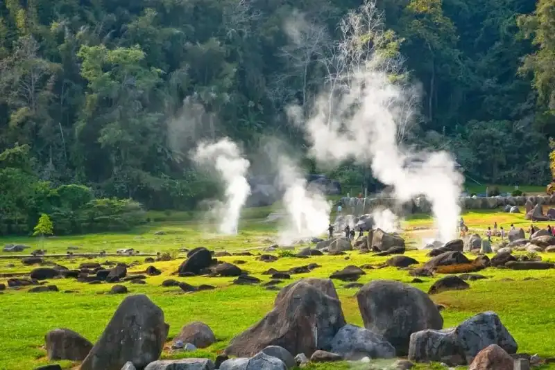
52. Fang Hot Springs is located at Ban Pong Nam Ron in Mon Pin Subdistrict, Fang District, within Doi Pha Hom Pok National Park. It is one of Northern Thailand’s most notable geothermal areas, with many natural hot spring pools spread through forest and mountain surroundings.
Highlights: Numerous natural hot spring pools, steam, sulfurous aromas, egg-boiling areas, foot soaking, mineral-water bathing services, and the natural setting of Fang District.
The area is interesting because visitors can directly observe geothermal processes. Underground water is heated by deep rock layers before rising through fractures, creating hot pools, boiling water, and steam in the same area.
Individual pools have different temperatures, so visitors should not touch water in natural pools directly. Use only areas designated for activities such as foot soaking, egg boiling, or mineral bathing, where conditions are managed more appropriately.
Winter is an especially good time to visit because Fang can be quite cool, making warm-water soaking a different experience from visiting during hot weather. The hot springs can be combined with Doi Pha Hom Pok, Ang Khang Royal Agricultural Station, and other attractions in northern Chiang Mai.
The site is suitable for families, couples, older visitors, and travelers wanting to rest during a mountain journey. People with underlying health conditions should choose hot-water activities appropriate to their own health.
Open Days: Generally daily, subject to announcements by Doi Pha Hom Pok National Park.
Getting There: From Chiang Mai city, take Highway 107 through Mae Rim, Mae Taeng, Chiang Dao, and Chai Prakan to Fang District, then continue to Mon Pin Subdistrict and the hot spring area. The distance is considerable, so an overnight stay in Fang is recommended.
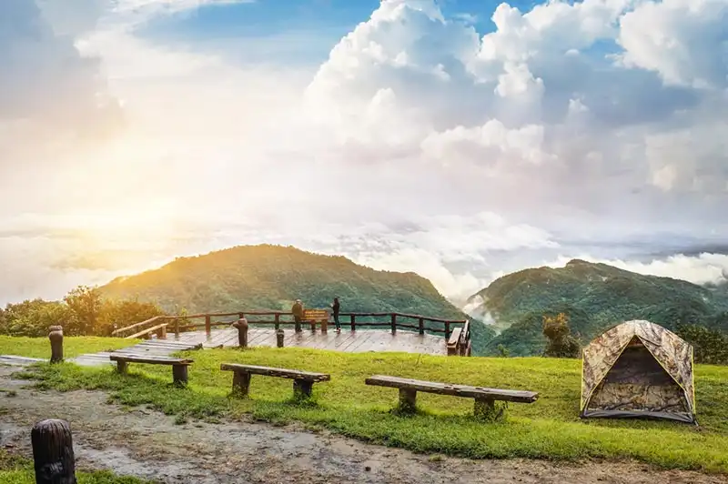
53. Doi Pha Hom Pok National Park, also known for Doi Fa Hom Pok, lies in Fang District. The national park contains high mountains, watershed forest, hot springs, and high-elevation ecosystems. Doi Pha Hom Pok rises to around 2,285 meters above sea level, making it one of Thailand’s highest peaks.
Highlights: A peak approximately 2,285 meters high, sea of mist, montane evergreen forest, trekking routes, sunrise and sunset viewpoints, and Fang Hot Springs.
Doi Pha Hom Pok suits travelers who want to experience Chiang Mai’s nature at elevations very different from the city. Temperatures on the mountain can fall sharply in winter, and forest characteristics change clearly with altitude.
Travel to high areas and summit routes is managed by the national park. Hikers should check seasonal opening dates, registration procedures, overnight points, and current regulations before traveling. Do not rely only on information from previous years because conditions can change according to weather and conservation requirements.
Major activities include viewing the sea of mist and sunrise, as well as exploring montane forest and high-elevation plants. Birdwatchers and biodiversity enthusiasts will find that northern Chiang Mai’s ecosystems differ in many details from those of Doi Suthep and Doi Inthanon.
Prepare warm clothing, suitable hiking shoes, drinking water, and seasonal equipment, especially when staying at high elevations where nighttime temperatures may fall lower than expected.
Getting There: From Chiang Mai, take Highway 107 toward Fang District, then enter the national park through the designated access point. Allow several hours for travel; spending at least one night in the Fang area is recommended.
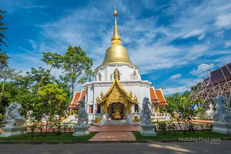
54. Wat Pa Dara Phirom, a royal temple in Mae Rim District, has a peaceful, shady atmosphere and refined Lanna architecture. It is suitable for travelers who want to add religious and artistic depth to a Mae Rim route otherwise known mainly for gardens, mountains, and Mon Jam.
Highlights: Lanna architecture, viharns, carving, chedis, a forest-temple atmosphere, and historical connections with the Mae Rim area.
The temple grounds are orderly and relatively quiet. Buildings display detailed Lanna craftsmanship in tiered roofs, woodwork, decorative patterns, and religious elements, rewarding a slow walk through the complex.
Its forest-temple character gives it a clearly different atmosphere from temples in central Chiang Mai. Trees and green spaces make the religious structures feel calm and support meditation as well as visitors seeking a break from busy tourist routes.
The temple is not far from Mae Rim’s main attractions and can be combined with the botanical garden, Mae Sa Waterfall, and Mon Jam. A practical plan is to visit the temple in the morning before continuing to nature attractions later in the day.
Visitors should dress respectfully, avoid loud noise, and preserve the quiet atmosphere because the temple remains an active religious and meditation site.
Getting There: From Chiang Mai city, take the Chiang Mai–Mae Rim road toward Mae Rim District. The temple is in Rim Tai Subdistrict and can be reached easily by private car or hired vehicle.

55. Wat Phra That Doi Saket is located on a hill in Choeng Doi Subdistrict, Doi Saket District. It is a spiritual center for the local community and a viewpoint over the lowlands of Doi Saket. Its defining features include the sacred relic, Lanna religious buildings, and an elevated setting overlooking the surrounding area.
Highlights: Phra That Doi Saket, Lanna viharns, views across Doi Saket District, Buddha images, and hilltop religious structures.
The hilltop setting gives the temple a strong visual presence and broad views over the plains and communities below, particularly in the morning and evening when the light is softer.
The temple serves as an important center of faith in the district and suits travelers interested in temples outside central Chiang Mai, where the atmosphere differs from moat-area temples surrounded by urban buildings and traffic.
Wat Phra That Doi Saket can be included in a Mae On–Mae Kampong route or used as a stop in eastern Chiang Mai, bringing temples, communities, hot springs, and mountains together in one day.
Visitors should dress respectfully and allow time to walk around the relic terrace and enjoy the surrounding views, especially if interested in photographing the Doi Saket landscape.
Open Days: Daily Opening Hours: 06:00 – 18:00
Getting There: From Chiang Mai city, follow the Chiang Mai–Doi Saket route toward the district center, then continue to Choeng Doi Subdistrict following signs to the temple. Ordinary cars can use the road up the hill.

56. Tha Ton Pier is located on the Kok River in Tha Ton Subdistrict, Mae Ai District. It serves both local transportation and river tourism, with boat journeys along the Kok River toward Chiang Rai, offering a travel experience very different from driving through Northern Thailand.
Highlights: The Kok River, long-tail boats, the Tha Ton–Chiang Rai journey, mountain scenery along the river, Tha Ton community, and riverside ways of life.
The appeal of traveling on the Kok River comes from seeing the landscape from water level, including mountains, communities, and agricultural areas along the banks. The perspective is clearly different from traveling on major roads.
Depending on services operating at the time, both passenger boats and charter boats may be available. Travelers should check boat schedules, river levels, and weather before planning because navigation conditions depend directly on the river.
Tha Ton can serve as either the starting point or the end of a northern Chiang Mai journey, combined with Wat Tha Ton, Fang District, Doi Pha Hom Pok, and Mae Ai before continuing toward Chiang Rai.
Travelers who do not want a long boat trip can still visit the pier to enjoy the Kok River and Tha Ton community atmosphere, particularly in the cooler morning or evening.
Getting There: From Chiang Mai city, take Highway 107 through Chiang Dao and Fang, then continue to Mae Ai District and Tha Ton Subdistrict. The journey takes several hours, so it is better suited to a northern itinerary of at least two days.
Map (GPS):Open Driving Directions to Tha Ton Pier
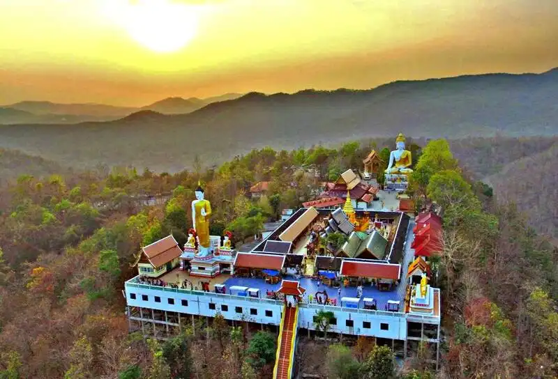
57. Wat Phra That Doi Kham is located on a hill in Mae Hia Subdistrict, Mueang Chiang Mai District. It is an important temple popular with both Chiang Mai residents and visitors for its ancient relic, large Buddha image, city viewpoint, and devotion associated with Luang Pho Than Jai.
Highlights: Phra That Doi Kham, Luang Pho Than Jai, a large Buddha image, Chiang Mai city viewpoints, and the atmosphere of a hilltop temple.
Wat Phra That Doi Kham has a long history and is one of the high-elevation temples closest to the city. Its position allows broad views over Mae Hia, Royal Park Rajapruek, and Chiang Mai from the upper terrace.
Luang Pho Than Jai is a major focus of devotion and attracts many worshippers, especially those who come to pray for wishes and later return according to their beliefs. Visitors should remain orderly and respect those taking part in religious activities.
In addition to worship, visitors should take time to see the relic, Buddhist art, and viewpoints, revealing that the temple’s value extends beyond beliefs associated with making wishes.
The temple is close to Royal Park Rajapruek and Chiang Mai Night Safari, making it suitable for a one-day Mae Hia–Hang Dong route. A practical plan is to worship in the morning and continue to gardens or family activities in the afternoon.
Open Days: Daily Opening Hours: 06:00 – 18:00
Getting There: From Chiang Mai city, head toward Mae Hia Subdistrict and Royal Park Rajapruek, then take the road up Doi Kham. Cars can drive up to the temple area.
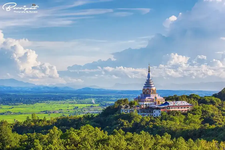
58. Wat Tha Ton (Crystal Pagoda), a royal temple in Mae Ai District, is a mountain temple with religious areas arranged across several elevations. Its most distinctive feature is the Crystal Pagoda and viewpoints overlooking the Kok River, Tha Ton community, and northern mountain ranges.
Highlights: Crystal Pagoda, multi-level religious sites on the mountain, Buddha images, Kok River viewpoints, and views across Mae Ai District.
The temple layout differs from lowland temples because visitors gradually travel upward through several levels. Each level contains different religious structures and views, so exploring the entire temple takes more time than stopping briefly at one worship point.
The Crystal Pagoda is the architectural and visual highlight, visible from a distance and a popular place from which to view the Kok River basin from above.
Morning and evening are more comfortable for viewpoints than midday because the light is softer and temperatures cooler. In winter, mountain scenery may also include mist on some days.
Wat Tha Ton can be combined with Tha Ton Pier and Kok River boat routes, as well as trips onward to Fang and Doi Pha Hom Pok, making it suitable for a multi-day journey through northern Chiang Mai.
Getting There: From Chiang Mai, take Highway 107 through Chiang Dao and Fang to Mae Ai District, then continue to Tha Ton Subdistrict. Roads climb the mountain to the different temple levels.

59. Doi Mon Ngo is located in Mueang Kai Subdistrict, Mae Taeng District. It is a mountain viewpoint popular for sea-of-mist scenery, valleys, and panoramic mountain views, and is connected with the Mon Ngo Royal Project Development Center and highland communities.
Highlights: Sea-of-mist viewpoints, mountain ridges, valley views, sunrise, Hmong communities, and learning about highland agriculture.
Early morning is the most popular time to visit because suitable weather can bring mist flowing through valleys among layers of mountains. However, a sea of mist is a natural phenomenon and cannot be guaranteed every day.
Mon Ngo is more than a viewpoint. The area is also connected to highland agricultural development, Hmong communities, and livelihood promotion suited to mountain environments, making it appropriate for educational travel rather than a quick photo stop.
Visitors can see seasonal produce, tea, coffee, and community products. Buying goods locally helps tourism income reach people in the community directly.
The access road is mountainous and winding, with possible fog and slippery conditions during the rainy season. Travel in daylight and check the vehicle before going uphill.
Open Days: Monday – Friday for the center’s operating schedule Opening Hours: 08:30 – 17:00
Getting There: From Chiang Mai city, take Highway 107 toward Mae Taeng, then continue onto the Mae Malai–Pai road and local roads toward Mueang Kai Subdistrict and the Mon Ngo area.
Map (GPS):Open Driving Directions to Doi Mon Ngo
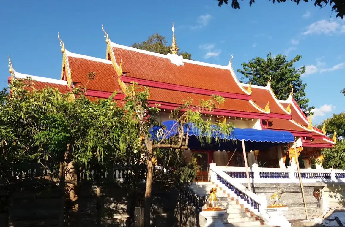
60. Wat San Ton Du (Tha Ton) is located at Ban San Ton Du in Tha Ton Subdistrict, Mae Ai District. This community temple reflects the role of Buddhist religious sites in everyday life in northern Chiang Mai and is suitable for travelers who want to understand Tha Ton through a living local community beyond hilltop temples and the Kok River pier.
Highlights: The community temple of Ban San Ton Du, a simple local atmosphere, merit-making activities, and everyday Buddhist life in the Tha Ton area.
The temple received official permission to be established in 1939 and continues to serve as a spiritual center for residents through Buddhist holy-day merit making, Kathin ceremonies, pha pa offerings, and activities during Buddhist festivals.
Its interest lies in being a genuine community temple rather than a monumental architectural landmark. Travelers can therefore observe the role of a temple in a rural area, which differs from major tourist temples in Chiang Mai city that receive large numbers of visitors throughout the day.
The Tha Ton area includes the Kok River basin, mountains, and multicultural communities. Stopping at Wat San Ton Du therefore adds a community-life dimension to a journey through northern Chiang Mai.
The temple can be combined with Wat Tha Ton, Tha Ton Pier, and the route toward Fang. It suits travelers with several days available who do not want to focus only on major landmarks.
Open Days: Daily Opening Hours: 08:00 – 17:00
Getting There: The temple is in Ban San Ton Du, Tha Ton Subdistrict, Mae Ai District. It can be reached from central Tha Ton by car or local transport and combines easily with attractions along the Kok River.
| Travel Zone | Featured Attractions in This Article | Best For | Main Highlights |
| Chiang Mai Old City | 1. Wat Phra Singh Woramahawihan 2. Wat Chedi Luang Worawihan 3. Three Kings Monument 4. Wat Lok Moli 5. Chiang Mai Sunday Walking Street (Tha Phae) | First-time Chiang Mai visitors, history lovers, cultural travelers, and travelers who enjoy exploring on foot | Lanna temples, the Old City, history, food, walking streets, and major attractions within walking distance of one another |
| Suthep–Huay Kaew–Nimman | 1. Wat Phra That Doi Suthep 2. Wat Pha Lat 3. Wat Umong 4. Chiang Mai Zoo 5. Lanna Traditional House Museum 6. Doi Suthep-Pui National Park | Temple travelers, nature lovers, families, photographers, and visitors staying around Nimman | Mountain temples, forest close to the city, museums, viewpoints, and cafés that can be combined in one route |
| Mae Hia–Hang Dong | 1. Wat Phra That Doi Kham 2. Royal Park Rajapruek 3. Chiang Mai Night Safari 4. Grand Canyon Water Park Chiang Mai 5. Ban Tawai | Families, couples, groups of friends, and travelers who want varied activities | Temples, large gardens, animals, water activities, and handicrafts |
| Mae Rim–Samoeng | 1. Mon Jam 2. Queen Sirikit Botanic Garden 3. Mae Sa Waterfall 4. Wat Pa Dara Phirom | Couples, families, mountain lovers, photographers, and garden enthusiasts | Mountain views, cool weather, flower gardens, waterfalls, temples, and an easy self-drive route |
| Mae On–San Kamphaeng–Doi Saket | 1. Mae Kampong Village 2. Mae Kampong Waterfall 3. San Kamphaeng Hot Springs 4. Bo Sang Village 5. Wat Phra That Doi Saket | Community travelers, café lovers, cultural travelers, nature lovers, and handicraft enthusiasts | A mountain village, waterfall, hot springs, Bo Sang umbrellas, and a hilltop temple |
| Chom Thong–Doi Inthanon | 1. Doi Inthanon National Park 2. Mae Klang Luang Village 3. Royal Agricultural Station Inthanon 4. Mae Ya Waterfall 5. Wat Phra That Si Chom Thong Worawihan | Nature lovers, hikers, birdwatchers, photographers, families, and community travelers | Thailand’s highest mountain, montane evergreen forest, waterfalls, rice terraces, coffee, and highland agriculture |
| Mae Chaem | 1. Pa Bong Piang Village 2. Teen Jok Weaving Village | Community travelers, photographers, textile enthusiasts, and people who enjoy slow travel | Rice terraces, teen jok textiles, Karen ways of life, and Mae Chaem culture |
| Mae Taeng | 1. Wat Ban Den 2. Mok Fa Waterfall 3. Doi Mon Ngo | Temple travelers, mountain lovers, sea-of-mist seekers, and nature travelers | Contemporary Lanna-inspired architecture, waterfalls, mountain roads, and sea-of-mist views |
| Chiang Dao | 1. Doi Chiang Dao 2. Chiang Dao Cave 3. Wat Tham Pha Plong 4. Muang Khong Village | Nature lovers, hikers, mountain travelers, cave explorers, community travelers, and visitors seeking peaceful stays | Limestone mountains, caves, forest temples, mountain views, and a valley community |
| Fang–Ang Khang–Doi Pha Hom Pok | 1. Ang Khang Royal Agricultural Station 2. Fang Hot Springs 3. Doi Pha Hom Pok National Park | Mountain travelers, cool-weather travelers, highland-agriculture enthusiasts, hikers, and nature lovers | High mountains, temperate crops, hot springs, sea of mist, and some of Thailand’s highest peaks |
| Mae Ai–Tha Ton | 1. Wat Tha Ton (Crystal Pagoda) 2. Tha Ton Pier 3. Wat San Ton Du (Tha Ton) | Travelers exploring the far north of Chiang Mai, temples, communities, and onward routes to Chiang Rai | The Kok River, hilltop temples, mountain views, communities, and riverboat routes |
| Hot–Omkoi | 1. Ob Luang National Park 2. Bo Kaeo Pine Garden 3. Doi Mon Jong | Road trippers, hikers, photographers, and travelers exploring outer Chiang Mai | Gorges, pine forest, ridges, grasslands, and nature far from the city |
| Markets and Food in Chiang Mai City | 1. Warorot Market 2. Ton Lam Yai Market 3. Chiang Mai Sunday Walking Street (Tha Phae) 4. Chiang Mai Night Bazaar (Anusarn Market) | Food travelers, shoppers, souvenir hunters, and visitors without a car | Northern Thai food, souvenirs, traditional markets, handicrafts, and Chiang Mai city life from day into night |
1-Day Chiang Mai Itinerary
If you have only one day, do not try to cover several districts because Chiang Mai is geographically large and travel between mountain areas takes considerable time. A suitable route for first-time visitors begins in the morning at Wat Phra That Doi Suthep, with a stop at Wat Pha Lat on the way down. Continue into the Old City to visit Wat Phra Singh Woramahawihan and Wat Chedi Luang Worawihan. In the afternoon, walk to Three Kings Monument before ending the day with northern Thai food and a night market. On Sunday, visit the Chiang Mai Sunday Walking Street (Tha Phae); on other days, choose the Chiang Mai Night Bazaar or Anusarn Market instead.
Another option for families is the Mae Hia–Hang Dong zone. Begin at Wat Phra That Doi Kham, continue to Royal Park Rajapruek, and spend the late afternoon and evening at Chiang Mai Night Safari. This route requires relatively little backtracking and works well for travelers with children or older family members.
2–3 Day Chiang Mai Itinerary
Day 1: Explore the Old City and Doi Suthep. Begin with Wat Phra That Doi Suthep and Wat Pha Lat, then return to the city to visit Wat Phra Singh, Wat Chedi Luang, Three Kings Monument, Warorot Market, and a night market.
Day 2: Choose the Mae Rim route. Begin at Wat Pa Dara Phirom, continue to Mae Sa Waterfall and Queen Sirikit Botanic Garden, then go up to Mon Jam in the afternoon and evening. Travelers who want to stay in the mountains can choose accommodation in Mae Rim or Mon Jam instead of returning to the city.
Day 3: Choose between Mae Kampong and Doi Inthanon. For community life and relaxation, visit Mae Kampong Village, Mae Kampong Waterfall, and San Kamphaeng Hot Springs. For large-scale nature, devote the full day to Doi Inthanon, Mae Klang Luang Village, Royal Agricultural Station Inthanon, and waterfalls.
4–5 Day Chiang Mai Itinerary
A 4–5 day trip allows a more balanced experience than focusing only on the city. Spend the first two days on the Old City, Doi Suthep, and Mae Rim. Use Day 3 for Mae Kampong–San Kamphaeng. On Day 4, travel to Doi Inthanon and stay around Chom Thong, Mae Klang Luang, or Mae Chaem. On Day 5, either continue into Mae Chaem to see teen jok textiles and Pa Bong Piang, or return toward the city for Ban Tawai, Royal Park Rajapruek, and Chiang Mai Night Safari.
If mountains appeal more than city culture, Day 5 can instead become a Chiang Dao route: visit Chiang Dao Cave and Wat Tham Pha Plong, enjoy views of Doi Chiang Dao, and stay in Muang Khong or near the foothills. This gives the trip a combination of the Old City, communities, and major mountain landscapes.
7-Day Chiang Mai Itinerary
Day 1: Chiang Mai Old City – Wat Phra Singh, Wat Chedi Luang, Three Kings Monument, Warorot Market, and a night market.
Day 2: Doi Suthep – Wat Pha Lat, Wat Phra That Doi Suthep, Bhubing Rajanives Palace, and Hmong Village at Doi Pui.
Day 3: Mae Rim – Wat Pa Dara Phirom, Mae Sa Waterfall, Queen Sirikit Botanic Garden, and Mon Jam.
Day 4: Mae Kampong – Bo Sang Village, Wat Phra That Doi Saket, Mae Kampong Village, Mae Kampong Waterfall, and San Kamphaeng Hot Springs.
Day 5: Doi Inthanon – Wat Phra That Si Chom Thong Worawihan, Mae Klang Luang Village, Royal Agricultural Station Inthanon, major mountain attractions, and Mae Ya Waterfall if time allows.
Day 6: Chiang Dao – Wat Ban Den, Chiang Dao Cave, Wat Tham Pha Plong, views of Doi Chiang Dao, and an overnight stay in Chiang Dao or Muang Khong.
Day 7: Choose according to your interests. For an easier day, return to the city and visit Ban Tawai, Royal Park Rajapruek, or Chiang Mai Night Safari. If you have several additional days, extend the route north toward Fang–Doi Pha Hom Pok–Tha Ton. This northern extension should ideally be treated as a separate trip of at least another two days to avoid rushing.
When Is the Best Time to Visit Chiang Mai?
Chiang Mai can be visited throughout the year, but each season has a clearly different atmosphere. Winter, roughly November through February, is ideal for mountains, viewpoints, flower gardens, and high-elevation areas because the weather is cool and comfortable for walking. The rainy season, roughly June through October, suits waterfalls, lush forest, rice terraces, and agricultural communities, especially Mae Chaem, Mae Klang Luang, and Pa Bong Piang. Summer is suitable for temples, museums, markets, water parks, and attractions in the city, although outdoor activities are best planned for morning or evening.
Travelers hoping to see flowers, rice fields, or a sea of mist should check actual conditions before traveling because these depend on seasons and weather. Photographs from previous years should not be used as the sole basis for choosing travel dates.
Which Area of Chiang Mai Is Best for Accommodation?
Old City: Suitable for first-time visitors, travelers without a car, and people focused on temples, history, walking streets, and food. Many attractions are within walking distance.
Nimman–Huay Kaew: Good for cafés, restaurants, lifestyle attractions, and easy access toward Doi Suthep, with accommodation available across many price levels.
Ping River: Suitable for travelers looking for a quieter atmosphere, hotels and resorts with more relaxing space, while still retaining convenient access to the city.
Mae Rim–Mon Jam: Suitable for couples, families, and travelers who want mountain views, gardens, and cool weather without driving back and forth to the city every day.
Mae Kampong: Best for homestays and community experiences, especially for travelers who want to see the village early in the morning and after the number of day visitors decreases.
Chom Thong–Doi Inthanon: Suitable for birdwatchers, nature travelers, and people who want an early start up the mountain. Staying around Chom Thong, Ban Khun Klang, or Mae Klang Luang can significantly reduce travel time.
Chiang Dao: Suitable for mountain travelers and slow travel, with mountain-view accommodation, homestays, and community areas that are quieter than Chiang Mai city.
Fang–Ang Khang–Tha Ton: Best for northern itineraries with at least 2–3 days available because the area is far from Chiang Mai city. Staying locally makes the trip less tiring and avoids long nighttime drives.
Frequently Asked Questions (FAQ)
Q: If this is my first trip to Chiang Mai, which attractions should I visit first?
A: If time is limited, begin with Wat Phra That Doi Suthep, Chiang Mai Old City, Wat Phra Singh, Wat Chedi Luang, and a market or walking street. Then add Mae Rim, Mae Kampong, or Doi Inthanon according to the number of days available because these places collectively represent Chiang Mai’s nature, history, food, and culture most completely.
Q: How many days should I spend in Chiang Mai?
A: Three days is a good starting point for the Old City, Doi Suthep, and one additional area such as Mae Rim, Mae Kampong, or Doi Inthanon. If you also want to visit Chiang Dao, Mae Chaem, Fang, or Tha Ton, plan around 5–7 days or more so most of the trip is not spent in the car.
Q: Can I travel around Chiang Mai without a private car?
A: Yes. The Old City, Nimman, Huay Kaew, Warorot Market, Night Bazaar, and Doi Suthep can generally be reached conveniently by red songthaew, hired vehicle, or ride-hailing service. More distant destinations such as Doi Inthanon, Mae Chaem, Chiang Dao, Fang, and Omkoi are better suited to a rental car, car with driver, or tour service.
Q: When does Chiang Mai have the best weather?
A: November through February has the coolest weather and is the most popular period for mountain travel, but it is also the busiest tourism season. Travelers who enjoy green forests, waterfalls, and rice terraces may prefer the rainy and late-rainy seasons, when many landscapes can be even more vivid than in winter.
Q: Which areas should I choose for nature travel in Chiang Mai?
A: Doi Inthanon offers a complete nature experience with forest, waterfalls, viewpoints, and walking trails. Chiang Dao suits travelers who prefer limestone mountains and a quiet atmosphere. Mae Rim is easy to travel around, while Doi Pha Hom Pok and Mon Jong are better for travelers seeking more serious nature experiences and who have more time to prepare their trips.
Q: What food should I try in Chiang Mai?
A: Recommended dishes include khao soi, sai ua, nam phrik num, crispy pork rinds, gaeng hung lay, khanom jeen nam ngiao, khao kan jin, northern-style larb, gaeng khae, and jo phak kad. For buying souvenirs or tasting several foods in one place, Warorot Market and Ton Lam Yai Market are excellent choices.
Q: Should I stay in Chiang Mai city or in the mountains?
A: For a first visit of only 2–3 days, staying in the Old City or Nimman is most convenient. With more time, divide the stay between at least two zones, such as two nights in Chiang Mai city and another 1–2 nights in Mae Kampong, Mae Rim, Doi Inthanon, or Chiang Dao. This reduces travel time and provides a fuller experience of each area.
Q: How should I dress when visiting temples in Chiang Mai?
A: Wear respectful clothing that covers the shoulders and knees, remove shoes where required, keep conversations quiet, and follow the specific regulations of each temple, particularly around ubosots, viharns, and areas used by monks or meditation practitioners.
 Category: ●Travel Articles, Recipes
 Group: ●Travel Review, Food Review
Last Update : 2 WeekAgo
 Last Update : 2 WeekAgo
Recommend

 Art, Culture and Heritage
 Historical Sites and Monuments(8)
 Landmarks and Memorials(5)
 Royal Palace(2)
 Art, Craft Centres, Tradition(43)
 Museums(24)
 Educational Places
 Museum for Study(2)
 Educational Gardens, Farm(5)
 Training Center(1)
 Places of Worship
 Temple(79)
 Mosque(2)
 Other Sacred Sites(17)
 Research and Development
 Royal Project(45)
 Suburban Living
 Village, Community(41)
 Local Market(14)
 Nature and Wildlife
 National Parks and Marine Reserves(18)
 Mountain (Doi)(21)
 Dam, Reservoir, Lake(26)
 Waterfalls(43)
 Hot Springs(12)
 Caves(11)
 River, Canal(6)
 Other natural attractions(14)
 Entertainment and Agricultural
 Zoos and Aquariums(3)
 Animal camps and shows(3)
 Stadium(1)
 Farms, Parks and Ecotourism(19)
 Waterpark(2)
 Theater(1)
 Outdoor and Adventure Activities(10)
 Shopping
 Shopping and Night Market(6)
 Restaurant
 Michelin Star(1)
 Michelin Guide(23)
 Call Customer Service in Tourism
 Call Customer Service in Tourism(1)
Travel Review, Food Review(25)
 Food Menu, North Recipes(30)
 Thai Desserts, North Recipes(17)


