
lovethailand home >Northeastern Travel Attractions >Chaiyaphum Travel Attractions >Kaeng Khro >Kao Ya Di > Lam Pathao Dam
TL;DR: Lam Pathao Dam is located at Ban Lup Chang Phlai, Kao Ya Di Subdistrict, Kaeng Khro District, Chaiyaphum Province, open Daily, hours 07.00 – 18.00.

Lam Pathao Dam
Open Days: Daily
Opening Hours: 07.00 – 18.00
Lam Pathao Dam, also written as Lam Prathao Dam, is an earth-fill dam system in Chaiyaphum Province. It is located around Ban Lup Chang Phlai in Kao Ya Di Subdistrict, Kaeng Khro District. The dam blocks the Lam Pathao watercourse and consists of two main reservoirs: the upper dam with a storage capacity of approximately 44 million cubic meters and the lower dam with a storage capacity of approximately 14 million cubic meters. The system is used for hydropower generation, agricultural water supply, water support for the Tat Ton Waterfall area, and raw water supply for Chaiyaphum’s provincial waterworks. For this reason, Lam Pathao Dam is not only a scenic local attraction but also an important water infrastructure site for the province.
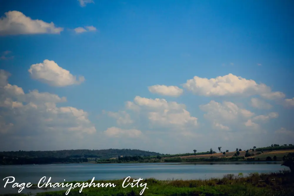
Lam Pathao Dam is well known among local residents as a peaceful nature destination with beautiful reservoir views. The wide water surface sits among hills, forests, farmland, and rural communities. The scenery feels cooler and more mountainous than many lowland reservoirs in northeastern Thailand. When visitors arrive at the dam, they see open water, green slopes, local roads, and lakeside areas that can feel like a freshwater beach in certain parts. In the late afternoon, soft light reflects on the water and the surrounding hills, creating one of the most pleasant times to relax, take photos, and enjoy the landscape.
The importance of Lam Pathao Dam begins with its role in energy and water management. Water stored in the system is used to generate electricity for Kaeng Khro District and Khon Sawan District. It also supports agricultural areas in Kaeng Khro and Mueang Chaiyaphum Districts. In addition, water from the reservoir system is linked with the Tat Ton Waterfall area and with the provincial water supply system. This makes Lam Pathao Dam a practical and essential water resource that serves both rural communities and urban Chaiyaphum.
The two-dam structure gives Lam Pathao Dam a distinctive identity. The upper reservoir is the area most associated with tourism because it has broad water views, a peaceful lakeside atmosphere, and scenic viewpoints. The lower dam and downstream areas play an important role in receiving, controlling, and managing the flow of water. Together, the two reservoirs support water storage, controlled release, power generation, and downstream water use. This makes the site a living example of how engineering, water, energy, farming, and tourism can be connected in one landscape.
Kao Ya Di Subdistrict is located on the Phu Laen Kha mountain range. The landscape includes hills, valleys, highland fields, and agricultural communities. Local residents mainly work in farming, including cassava, sugarcane, orchards, and seasonal fruit cultivation. Lam Pathao Dam strengthens the role of this landscape by adding a major water body to the area. The reservoir is not just a beautiful view; it is part of the system that supports local production, daily life, and rural livelihoods.
For travelers, the charm of Lam Pathao Dam lies in the journey as much as in the destination. The road from Chaiyaphum town passes toward Tat Ton National Park and then turns into the Kao Ya Di route. The scenery gradually changes from town roads to forested and hilly landscapes. Many visitors say that the drive gives the feeling of traveling in northern Thailand because of the cool air, sloping farmland, and mountain views. This makes Lam Pathao Dam suitable for slow travel, photography, and scenic road trips.
The upper dam area offers several lakeside viewpoints for relaxing, walking, and taking photographs. In some parts, fine mountain soil slopes gently toward the reservoir, creating a freshwater beach-like atmosphere. Visitors can sit by the water, enjoy the breeze, and appreciate the quiet setting. Swimming is possible only in suitable and locally used areas, and visitors should always stay within safe zones. Where ropes or warning signs are present, they should be respected because reservoir depth and underwater conditions can change.
Lam Pathao Dam is also connected with local fish culture and food. Fish are raised in cages in the reservoir, and local fish dishes are part of the area’s identity. One dish commonly associated with the reservoir is thot man pla salat, a fish cake often compared with or known more widely as thot man pla krai. This food connection makes the dam more than a scenic place. It links water, local livelihoods, fishing, and community food culture in a way that visitors can experience directly.
Evening is one of the best times to visit Lam Pathao Dam. The sunlight softens, the surface of the reservoir reflects the sky, and the mountains become a calm background. Photographers should arrive before sunset to choose a viewpoint. The best images often include several elements together: open water, the freshwater beach-like bank, lakeside structures, hills, and evening light. This combination gives a stronger sense of place than a simple water view alone.
Recommended activities at Lam Pathao Dam include sightseeing, lakeside relaxation, photography, local food stops, and connecting the route with nearby attractions such as Tat Ton Waterfall, Phra That Chaiyaphum, Wat Tha Hin Ngom, and Mo Hin Khao. A half-day trip is possible from Chaiyaphum town, but a full-day itinerary is better for travelers who want to include waterfalls, temples, viewpoints, and food stops along the way.
The main route from Chaiyaphum town follows Highway 2051 toward Tat Ton National Park. Before reaching the national park fee checkpoint, about 500 meters before the gate, turn left toward Kao Ya Di Subdistrict and the route to Mo Hin Khao. Continue toward Ban Lup Chang Phlai and Lam Pathao Reservoir. The total distance from Chaiyaphum town is about 35 km. The road is paved throughout and passes through attractive mountain and community scenery.
Getting There is easiest by private car or rental car. From Chaiyaphum town, drive toward Tat Ton National Park, turn left before the park checkpoint, and continue toward Kao Ya Di Subdistrict and Ban Lup Chang Phlai. Another route comes from Kaeng Khro District through Khok Kung toward Tha Mafai Wan, which is useful for travelers coming from the Khon Kaen side. Daytime driving is recommended because some sections pass through mountain and local community roads.
Upon arrival, visitors should first choose a safe parking and viewing point. Do not block local roads or community access. If swimming, stay only in suitable areas used by local visitors and avoid going beyond ropes or warning boundaries. Families with children should supervise them closely at all times because reservoir water is not the same as a controlled swimming pool. Water levels, depth, and underwater surfaces can change with season and water management.
Lam Pathao Dam is suitable for family travel. Children can learn about reservoirs, earth dams, hydropower, and the importance of water for agriculture from a real place. Adults can relax, take photos, enjoy the view, and share a simple lakeside meal. Families should bring drinking water, towels, comfortable shoes, sun protection, spare clothes, and bags for taking rubbish out of the area. Responsible travel helps keep the reservoir clean and safe for the next visitors.
Nature lovers will appreciate how the dam reveals the relationship between forest, mountains, water, and human settlement. Lam Pathao is linked with the Phu Laen Kha landscape, and the reservoir shows how water is captured and managed in the highlands before being used downstream. This makes a visit to the dam more meaningful than a simple scenic stop. It shows how natural geography and public infrastructure work together in daily life.
From a photography perspective, Lam Pathao Dam offers dam crests, open water, freshwater beach areas, hills, local food spots, lakeside structures, and warm sunset light. Morning gives a fresh and quiet mood, while late afternoon provides richer colors and reflections. Visitors who want stronger travel photographs should include both wide landscape shots and smaller details such as water edges, local food, warning ropes, and people relaxing by the reservoir.
A lakeside area known as Pine Camp has also helped make the reservoir more familiar to travelers who enjoy cafés and photo spots. Its service schedule may change over time, so visitors who want to go specifically for food or café service should check ahead. Even when individual services change, the reservoir landscape remains attractive for resting, photography, and nature-based travel.
Food options around Lam Pathao Dam include lakeside fish restaurants, northeastern food, cafés, and local restaurants along the Tat Ton – Kao Ya Di route. Nearby choices include Kuk Kik Pla Phao Lam Pathao Dam, Pine Camp Chaiyaphum, Ahan Suan Khonphon, Mahot Cafe Phumet, and Suan Ahan Pornthip. Planning a meal before or after the reservoir visit makes the trip more complete and supports local businesses around the attraction.
Accommodation is available near the dam route and in the wider Tat Ton, Mo Hin Khao, and Chaiyaphum areas. Nearby options include On The Rock Chaiyaphum, Ban Rai Phu Phailin, and Farm Promma. Visitors who want to stay closer to Tat Ton Waterfall can choose accommodation inside or near Tat Ton National Park, while those who want hotel-style convenience can stay in Chaiyaphum town and visit the dam as a day trip.
Safety is the most important point when visiting Lam Pathao Dam. Avoid swimming during heavy rain, strong wind, muddy water, or changing water levels. Do not swim after drinking alcohol, do not leave children alone near the water, and do not cross into deep or restricted areas. Visitors should also avoid entering operational zones and should follow local instructions. A reservoir is both a recreation area and a working water system, so careful behavior is necessary.
Cleanliness is equally important. Lam Pathao Dam supports agriculture, electricity generation, tourism, and water supply. Rubbish left near the reservoir or thrown into the water can affect scenery, water quality, local communities, and wildlife. Visitors should use bins where available and take their waste out of the area when necessary. Keeping the reservoir clean helps protect both the destination and the people who depend on it.
Lam Pathao Dam also gives visitors a practical way to understand Chaiyaphum’s water system. Water stored in the reservoir has many destinations: electricity generation, agriculture, Tat Ton Waterfall, and provincial tap water production. In this sense, the dam is a central point in a larger system that connects the mountains with towns and farms below. Travelers interested in environment, clean energy, and water resources will find this aspect especially meaningful.
Overall, Lam Pathao Dam is one of Chaiyaphum’s meaningful nature-based destinations. It combines mountain scenery, reservoir views, hydropower, agricultural water management, local food, and recreation in one place. Its identity is quiet, practical, and closely tied to real local life. For travelers who want to see Chaiyaphum beyond mainstream attractions, Lam Pathao Dam offers a grounded and rewarding experience.
A good visit to Lam Pathao Dam should be slow, safe, and respectful. Come for the views, stay for the cool air and local food, take photos in the soft light, and keep the area clean. With responsible travel, Lam Pathao Dam can continue to serve as a water source, power resource, agricultural support system, and beloved recreation area for Chaiyaphum residents and visitors.
| Name | Lam Pathao Dam Or Lam Prathao Dam |
| Location | Ban Lup Chang Phlai, Kao Ya Di Subdistrict, Kaeng Khro District, Chaiyaphum Province |
| Address | Ban Lup Chang Phlai, Kao Ya Di Subdistrict, Kaeng Khro District, Chaiyaphum 36150, Thailand |
| Coordinates | Upper Dam Approx. 16.071263, 102.066016 / Downstream Lam Pathao Area Approx. 16.063514, 102.040562 |
| Highlights | An earth-fill dam system in a mountain setting, with upper and lower dams, wide reservoir views, cool air, freshwater beach-like banks, scenic viewpoints, and easy connection to Tat Ton National Park |
| History / Local Role | A multipurpose dam system used for hydropower generation, agricultural water supply, water support for the Tat Ton Waterfall area, and raw water supply for Chaiyaphum’s provincial waterworks |
| Dam Information | The system consists of 2 dams: the upper dam with a storage capacity of about 44 million cubic meters and the lower dam with a storage capacity of about 14 million cubic meters |
| Name Origin | Named after Lam Pathao or Lam Prathao, an important local watercourse connected with Kao Ya Di and the Phu Laen Kha landscape |
| Distinctive Features | Highland reservoir scenery, mountain views, cool local climate, freshwater beach-like banks, local fish culture, scenic road access, and quiet lakeside recreation |
| Travel Information | From Chaiyaphum town, take Highway 2051 toward Tat Ton National Park. About 500 meters before the park fee checkpoint, turn left toward Kao Ya Di Subdistrict and Ban Lup Chang Phlai. Total distance is about 35 km |
| Current Status | A working water resource, hydropower-related dam system, agricultural water source, and local nature-based recreation destination in Chaiyaphum Province |
| Open Days | Daily |
| Opening Hours | 07.00 – 18.00 |
| Fees | No admission fee |
| Best Visiting Time | Morning and late afternoon are best for sightseeing, photography, and lakeside relaxation; daytime is suitable for food stops and swimming only in safe local areas |
| Facilities | Reservoir viewpoints, local parking areas, nearby restaurants and cafés, swimming areas depending on conditions, and paved access roads |
| Main Areas / Zones | 1. Upper Lam Pathao Dam And Main Reservoir Zone 2. Lower Lam Pathao Dam And Downstream Zone 3. Dam Crest And Scenic Viewpoint Zone 4. Freshwater Beach And Safe Swimming Zone 5. Fish Cage And Local Fish Food Zone 6. Route Connecting Tat Ton Waterfall, Mo Hin Khao, And Kao Ya Di Subdistrict |
| Caretaker / Related Authority | State water and energy agencies related to the Lam Pathao Dam project, with Kao Ya Di Subdistrict Administrative Organization as the local authority contact in the area |
| Main Contact Number | Kao Ya Di Subdistrict Administrative Organization, Tel. 044-056-244 Local Tourism Information For Lam Pathao Dam, Tel. 064-421-3030 TAT Nakhon Ratchasima Office, Tel. 044-213030 |
| Official Website / Official Page | Kao Ya Di Subdistrict Administrative Organization, Tourism Authority Of Thailand, CBT Thailand |
| Nearby Tourist Attractions | 1. Wat Tha Hin Ngom, about 4 km 2. Arun Thammasathan Phra That Chaiyaphum, about 5 km 3. Pine Camp Chaiyaphum, about 1 km 4. Tat Ton Waterfall / Tat Ton National Park, about 18 km 5. Tat Fa Waterfall, about 20 km 6. Mo Hin Khao, about 30 km |
| Nearby Restaurants | 1. Kuk Kik Pla Phao Lam Pathao Dam, about 0.1 km 2. Pine Camp Chaiyaphum, about 1 km, Tel. 093-725-4064 3. Ahan Suan Khonphon, about 7 km, Tel. 081-074-6840 4. Mahot Cafe Phumet, about 21 km, Tel. 081-371-0058 5. Suan Ahan Pornthip, about 25 km, Tel. 090-823-7880 |
| Nearby Accommodations | 1. On The Rock Chaiyaphum, about 4 km, Tel. 081-300-3399 2. Ban Rai Phu Phailin, about 7 km, Tel. 081-790-1692 3. Tat Ton National Park Accommodation, about 18 km, Tel. 044-853-293, 044-853-333 4. Farm Promma, about 19 km, Tel. 088-565-2654 5. The Peak Resort Chaiyaphum, about 37 km, Tel. 082-615-5587 6. Ban Rai Ruean Khwan, about 37 km, Tel. 061-828-9159, 061-226-1465 |
Frequently Asked Questions (FAQ)
Q: Where is Lam Pathao Dam located?
A: Lam Pathao Dam is located at Ban Lup Chang Phlai, Kao Ya Di Subdistrict, Kaeng Khro District, Chaiyaphum Province, on a mountain route connected with Tat Ton National Park and Mo Hin Khao.
Q: How many dams are included in the Lam Pathao Dam system?
A: The system includes 2 dams: the upper dam with about 44 million cubic meters of storage capacity and the lower dam with about 14 million cubic meters of storage capacity.
Q: What is Lam Pathao Dam used for?
A: It is used for hydropower generation, agricultural water supply in Kaeng Khro and Mueang Chaiyaphum Districts, water support for Tat Ton Waterfall, and raw water supply for Chaiyaphum’s provincial waterworks.
Q: Can visitors swim at Lam Pathao Dam?
A: Swimming is possible only in suitable local areas. Visitors should stay within safe zones, avoid deep water, follow warning signs or rope boundaries, and supervise children closely.
Q: How do travelers get to Lam Pathao Dam from Chaiyaphum town?
A: Take Highway 2051 toward Tat Ton National Park, turn left about 500 meters before the park fee checkpoint toward Kao Ya Di Subdistrict, and continue to Ban Lup Chang Phlai. The distance from Chaiyaphum town is about 35 km.
Q: Is there an admission fee for Lam Pathao Dam?
A: There is no admission fee for Lam Pathao Dam, but travelers entering Tat Ton National Park on the same route must pay the national park fee.
Q: When is the best time to visit Lam Pathao Dam?
A: Morning and late afternoon are the best times for sightseeing, photography, and relaxation because the weather is more comfortable and the natural light is better.
Q: What nearby attractions can be combined with Lam Pathao Dam?
A: Nearby places include Wat Tha Hin Ngom, Phra That Chaiyaphum, Tat Ton Waterfall, Tat Fa Waterfall, Mo Hin Khao, and the Phu Laen Kha mountain route.
 Category: ●Nature and Wildlife
 Group: ●Dam, Reservoir, Lake
Last Update : 3 MonthAgo
 Last Update : 3 MonthAgo
 Click to Access the Navigation Map GPS
Lam Pathao Dam Map
Recommend

 Art, Culture and Heritage
 Historical Sites and Monuments(1)
 Landmarks and Memorials(3)
 Royal Palace(1)
 Art, Craft Centres, Tradition(3)
 Educational Places
 Educational Gardens, Farm(1)
 Places of Worship
 Temple(141)
 Other Sacred Sites(7)
 Suburban Living
 Village, Community(4)
 National Parks and Marine Reserves(7)
 Mountain (Doi)(5)
Dam, Reservoir, Lake(10)
Mountain (Doi)(5)
Dam, Reservoir, Lake(10)
 Waterfalls(15)
 Caves(5)
 River, Canal(4)
 Other natural attractions(1)
 Entertainment and Agricultural
 Farms, Parks and Ecotourism(2)


