
lovethailand home >South Travel Attractions >Surat Thani Travel Attractions > 40 Places to Visit in Surat Thani Explore Southern..
TL;DR: 40 Places to Visit in Surat Thani Explore Southern Thailand. Highlights include A highly diverse province combining Gulf of Thailand islands, beaches, tropical rainforest, limestone mountains, dams and lakes.
40 Places to Visit in Surat Thani Explore Southern Thailand
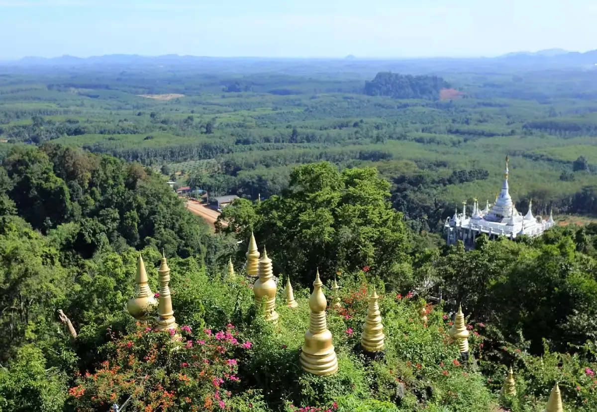
40 Places to Visit in Surat Thani – Explore Southern Thailand Surat Thani is one of Southern Thailand’s most important travel destinations, offering far more than beautiful islands and beaches. The province encompasses islands in the Gulf of Thailand, famous beaches, national parks, tropical rainforests, limestone mountains, large reservoirs, waterfalls, caves, hot springs, traditional communities, important Buddhist temples, historical sites, local markets, and cultural learning destinations. Travelers can experience everything from island holidays on Koh Samui, Koh Phangan, and Koh Tao to rainforest adventures in Khao Sok, boat trips across Cheow Lan Lake, historical journeys through Chaiya, and community-based travel on the mainland.
For travelers searching for the best places to visit in Surat Thani, attractions are spread across many districts and can be divided into several distinct travel zones. Ban Ta Khun–Khao Sok is ideal for mountains, forests, and lake scenery; Koh Samui is known for beaches and resorts; Koh Phangan combines island life with coastal communities; Koh Tao is famous for diving; Chaiya is a major destination for history and Srivijaya heritage; Surat Thani City offers markets and riverside communities; while Ban Na San–Tai Rom Yen is known for rainforest, waterfalls, and mainland nature.
What makes Surat Thani especially attractive is the variety of experiences available within a single province. Travelers can cruise past limestone mountains on Cheow Lan Lake, trek through Khao Sok rainforest, dive around Koh Tao, relax on Koh Samui’s beaches, explore canal communities, visit important Buddhist temples in Chaiya, discover waterfalls, caves, and hot springs, or venture to lesser-known local destinations away from the major tourist routes.
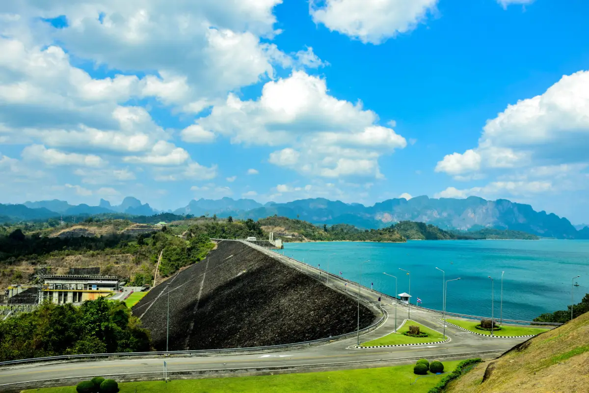
1. Ratchaprapha Dam (Cheow Lan Dam) is located in Khao Phang Subdistrict, Ban Ta Khun District, Surat Thani. It is one of the province’s most famous natural attractions and one of the most recognizable landscapes in Southern Thailand. The vast emerald-green reservoir is surrounded by dramatic limestone mountains rising directly from the water, creating scenery often described as the “Guilin of Thailand.” Cheow Lan Lake is notable not only for its natural beauty but also for its role as a major water-resource development project in Southern Thailand. Ratchaprapha Dam is a rock-fill dam with a clay core constructed across Khlong Saeng. It is approximately 94 meters high and 761 meters long, creating a reservoir covering around 185 square kilometers. In addition to electricity generation, irrigation, flood control, and fisheries, the reservoir has developed into a major national tourism destination.
The signature experience is a boat journey from Ratchaprapha Dam Pier into the lake, passing limestone formations of many different shapes. The most famous landmark is Khao Sam Kloe, or the “Three Brother Rocks,” a group of three limestone peaks standing side by side in the middle of the reservoir. Other attractions include floating raft accommodations, scenic viewpoints, Coral Cave, and nature trails within the Khao Sok National Park area. Staying overnight on a floating raft is one of the most memorable experiences, allowing visitors to wake to morning mist above the lake, kayak across calm water, swim, and enjoy the peaceful surroundings. Travelers with limited time can also enjoy the dam crest, scenic viewpoints, photography spots, and restaurants without joining a boat excursion.
Getting There: From Surat Thani City, take Highway 401 toward Takua Pa and Ban Ta Khun District, then follow signs for Ratchaprapha Dam.
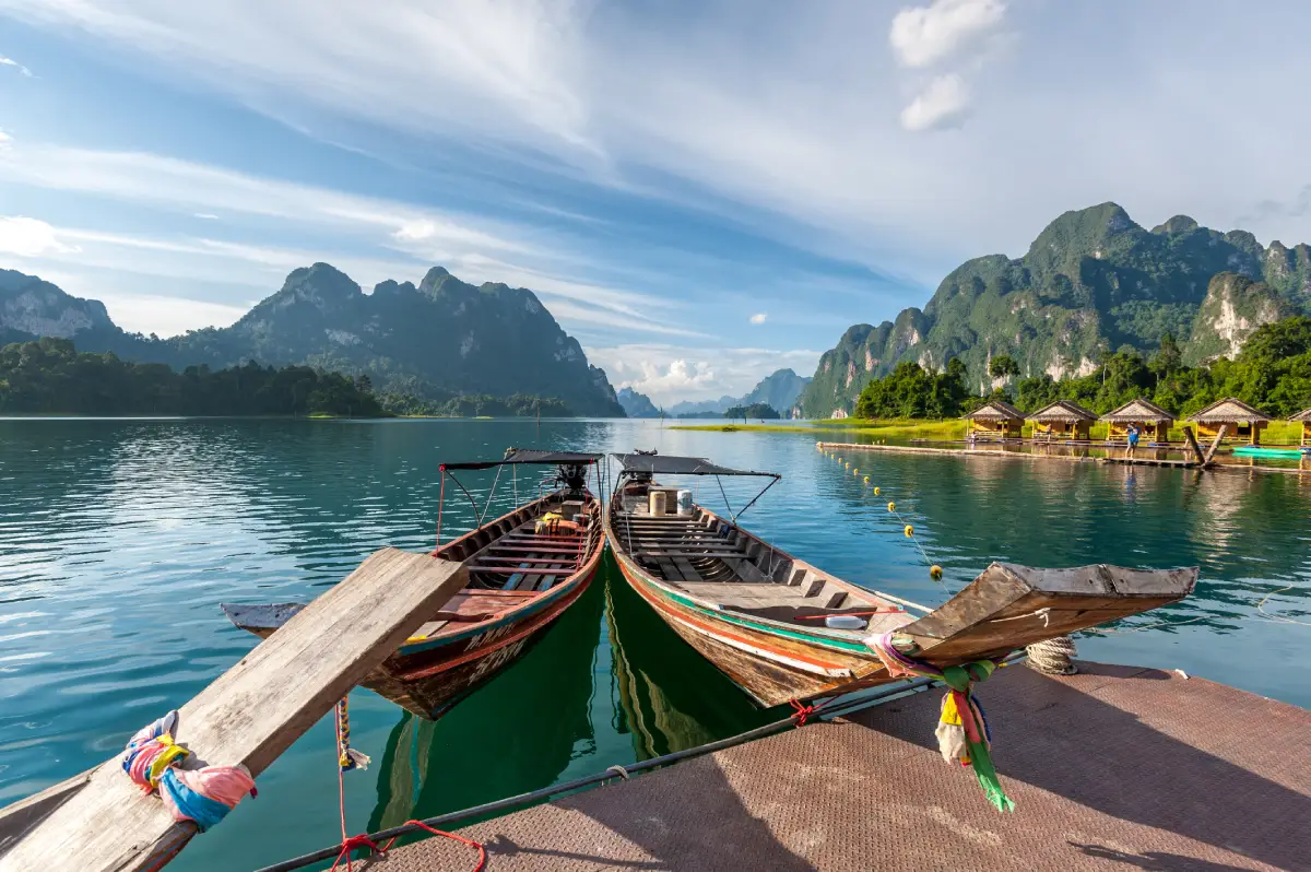
2. Khao Sok National Park is one of the most important natural areas in Surat Thani, covering parts of Phanom, Ban Ta Khun, and Khiri Rat Nikhom districts. Its defining features are extensive tropical rainforest, towering limestone mountains, streams, waterfalls, caves, and highly diverse ecosystems. The rugged landscape is connected with the Ratchaprapha Reservoir, allowing visitors to experience both rainforest trekking and journeys across the lake. The combination of dense forest and steep limestone formations gives Khao Sok a character very different from Thailand’s coastal national parks and makes it one of the best destinations for travelers seeking a genuine tropical rainforest experience in Southern Thailand.
Activities include nature walks, waterfall visits, cave exploration, wildlife observation, canoeing, and trekking. Some routes require experienced guides or park staff. Another distinctive feature of Khao Sok is the rare Rafflesia, locally known as Dok Bua Phut, which produces an exceptionally large flower and can be found in some areas of the forest during its flowering season. Visitors should check trail conditions, weather, and park regulations before traveling, particularly during the rainy season when some trails, caves, or waterfall areas may be temporarily restricted for safety. Khao Sok can easily be combined with Cheow Lan Lake, and travelers who want to experience both the rainforest and the reservoir should allow at least two days.
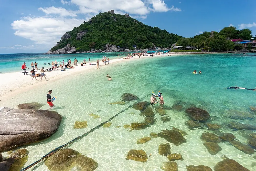
3. Koh Samui is one of the most important islands in the Gulf of Thailand and an internationally recognized destination in Surat Thani. The island offers a broad mix of beaches, resorts, restaurants, cafés, temples, viewpoints, waterfalls, fishing communities, and natural attractions, allowing travelers to spend several days here without leaving the island. Famous beaches include Chaweng Beach, Lamai Beach, Bophut Beach, Taling Ngam Beach, and Choeng Mon Beach. Each area has a different atmosphere, ranging from lively resort zones with restaurants and nightlife to quieter beaches suited to relaxed holidays.
Beyond the beaches, Koh Samui has attractions such as Hin Ta–Hin Yai, the Big Buddha Temple, scenic viewpoints, and Bophut’s old community, which has developed into a popular tourist district. Because attractions are scattered across several parts of the island, renting a car or motorcycle is a common way to explore. Koh Samui is also an important gateway to Koh Phangan and Mu Ko Ang Thong National Park, making it an excellent base for exploring the islands of the Gulf of Thailand.
Getting There: Koh Samui can be reached by direct flight or by ferry from the Surat Thani mainland, including ferry services departing from Don Sak and connections from nearby islands.
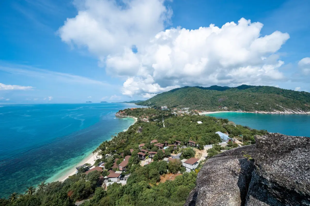
4. Koh Phangan lies north of Koh Samui in the Gulf of Thailand and is a large island with beaches, bays, forests, waterfalls, Buddhist temples, fishing communities, and nature trails. Although internationally known for the Full Moon Party at Haad Rin, much of Koh Phangan is peaceful and better suited to quiet relaxation than many first-time visitors expect. Beaches and bays are distributed around the island, allowing travelers to choose between lively areas and secluded coastal settings with fewer visitors.
Interesting destinations include Chalok Lam Bay, Haad Yao, Koh Ma, Wat Khao Tham, and the forest areas of Than Sadet–Ko Pha-ngan National Park. Activities include snorkeling, kayaking, beach trips, hiking, and visiting local communities. Many roads across the island are hilly and steep, particularly routes leading to more remote bays and beaches, so motorcycle riders should take extra care.
Getting There: Passenger ferries connect Koh Phangan with Koh Samui, Don Sak, and other mainland routes in Surat Thani. Once on the island, visitors can use local taxis or rental vehicles.
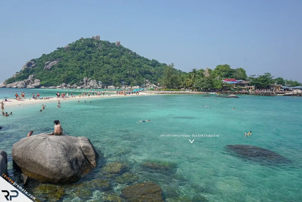
5. Koh Tao is located in Koh Tao Subdistrict, Koh Phangan District, north of Koh Phangan, and is one of Thailand’s best-known diving destinations. The island is distinguished by coral reefs, small bays, clear water, numerous dive schools, and conditions suitable for both snorkeling and scuba diving. Popular areas include Sairee Beach, Ao Leuk, Tanote Bay, Shark Bay, Chalok Baan Kao Bay, and Hin Wong Bay, while several viewpoints provide panoramic views across the coastline and surrounding sea.
Koh Tao also has an interesting history. At Sairee Beach, the King Rama V inscription stone is associated with the monarch’s historic visit to the island. Koh Tao was also used in the past as a detention site for political prisoners. Today, the island combines local communities, diving businesses, accommodation, restaurants, and nature tourism. Many travelers stay for several nights to take diving courses or make trips to nearby Koh Nang Yuan.
Getting There: Koh Tao can be reached by ferry from Chumphon, Koh Samui, Koh Phangan, or the Surat Thani mainland, depending on the schedules operated by individual ferry companies.
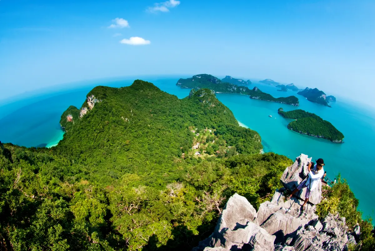
6. Mu Ko Ang Thong National Park is a marine national park in Surat Thani comprising numerous islands scattered across the Gulf of Thailand. The landscape is characterized by limestone mountains rising from the sea, cliffs, small coves, sandy beaches, and an inland saltwater lagoon surrounded by steep limestone formations. The scenery is very different from the open beaches of Koh Samui or Koh Phangan. Most visitors come on a day trip from Koh Samui or nearby islands, with popular activities including boat tours, snorkeling, kayaking, viewpoint hikes, and visits to important islands within the national park.
One of the most famous places is Koh Mae Ko, home to the inland saltwater lagoon known as Thale Nai. Another important island is Koh Wua Talap, where the national park headquarters are located and where a high viewpoint overlooks numerous islands scattered across the sea. The climb to the viewpoint requires a reasonable level of fitness, and some sections are steep, so suitable footwear and drinking water are recommended. Weather and sea conditions directly affect boat operations, and visitors should check the park’s opening status before traveling.
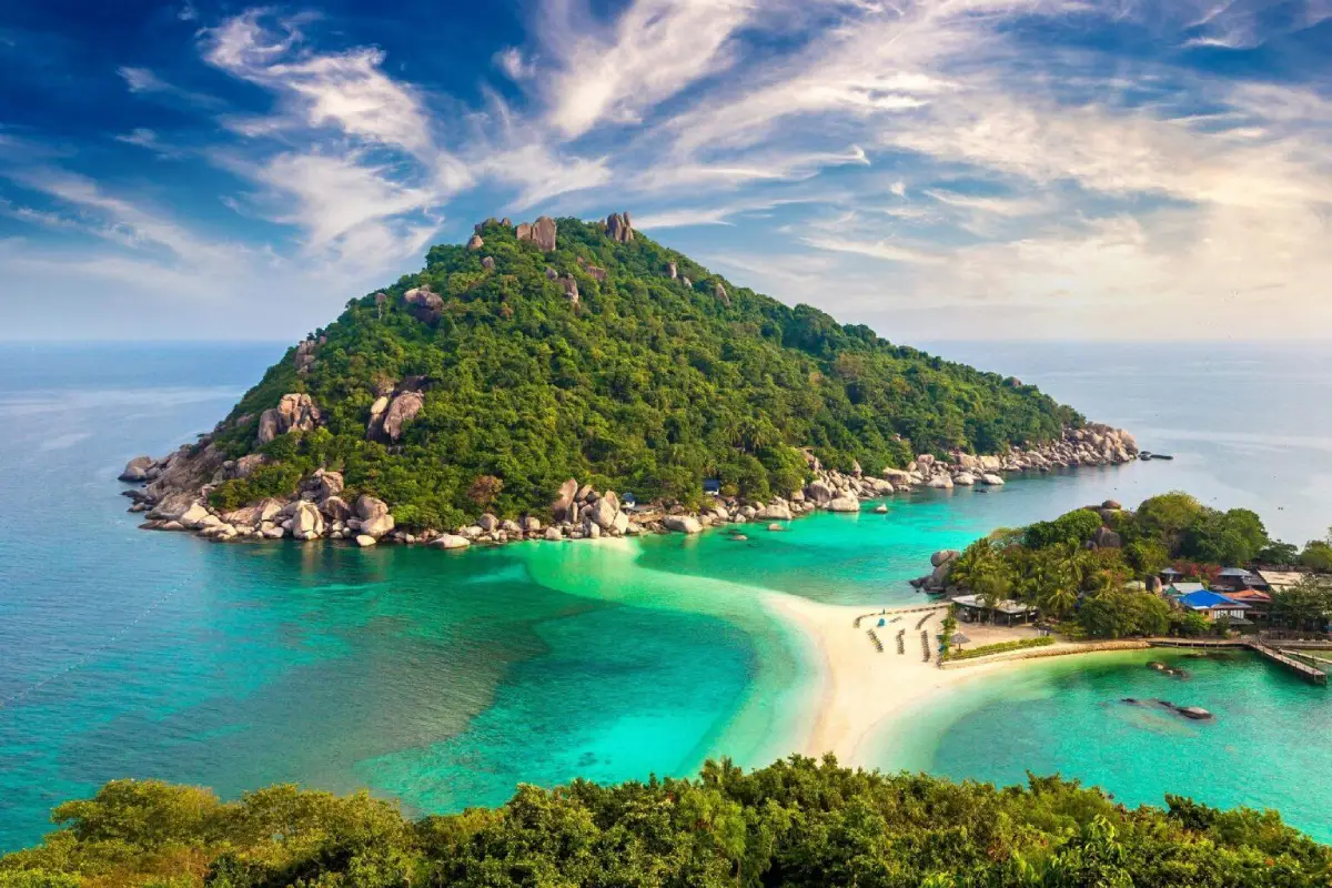
7. Koh Nang Yuan lies northwest of Koh Tao and consists of small islands connected by a distinctive white sandbar. It is one of Surat Thani’s most recognizable island landscapes. From the viewpoint above the island, visitors can clearly see the curving sandbar linking the separate landforms, surrounded by turquoise sea, creating one of the most photographed views in the Gulf of Thailand.
The waters surrounding Koh Nang Yuan are also popular for snorkeling because of their coral reefs and marine life. The island is easily reached from Koh Tao by long-tail boat or excursion boat and is commonly visited on a half-day trip or as part of a snorkeling tour around Koh Tao. Because the island is relatively small and can become busy during peak periods, visitors should minimize waste, avoid stepping on coral, and follow local conservation regulations.
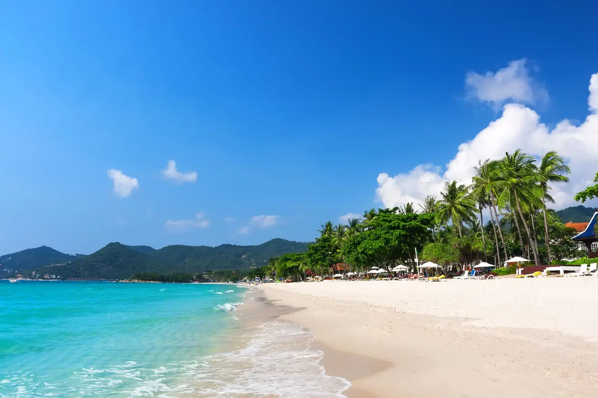
8. Chaweng Beach is located in Bophut Subdistrict, Koh Samui District, and is one of the island’s most famous and lively beaches. Its long stretch of pale sand and generally clear water during favorable weather make it popular for swimming and beach activities. The surrounding area has a large concentration of resorts, restaurants, cafés, shops, and tourism services, making Chaweng particularly suitable for travelers who want convenience and easy access to facilities throughout the day.
During the daytime, visitors can swim, walk along the beach, sunbathe, and join water activities. In the evening, the area becomes a lively dining and entertainment district. First-time visitors to Koh Samui often choose Chaweng as a base because of its extensive services and convenient location. Travelers seeking a quieter atmosphere may prefer beaches such as Taling Ngam or some parts of Lamai. Chaweng is also relatively close to Samui Airport, making it convenient for travelers arriving by air.
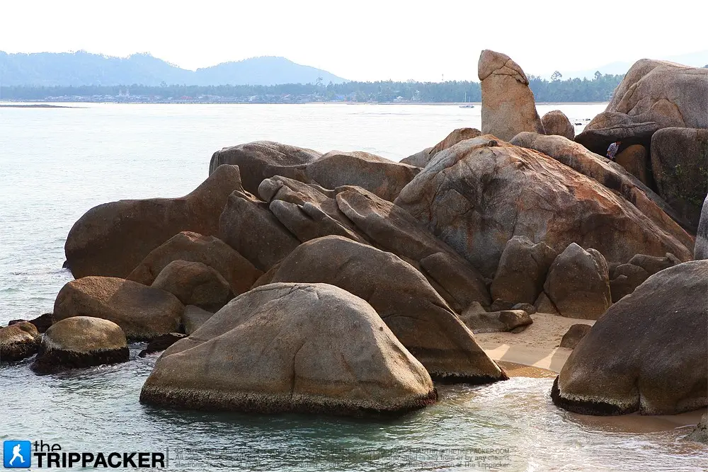
9. Hin Ta – Hin Yai is located around Lamai Bay at the southern end of Lamai Beach in Maret Subdistrict, Koh Samui. This natural attraction consists of granite rock formations shaped by long-term erosion into forms resembling male and female genitalia, giving rise to the names “Hin Ta” and “Hin Yai,” meaning Grandfather Rock and Grandmother Rock. The unusual formations have become one of the island’s best-known landmarks.
In addition to the unusual rock formations, the area offers attractive views of the sea and rocky coastline. It is a popular stop for photography while traveling around Koh Samui. Shops near the entrance sell souvenirs, local snacks, and coconut-based products, reflecting the importance of coconut cultivation on the island. Hin Ta–Hin Yai can easily be combined with Lamai Beach and other attractions in Maret Subdistrict during a half-day trip. The rocks close to the sea may become slippery during rain or rough weather, so visitors should walk carefully.
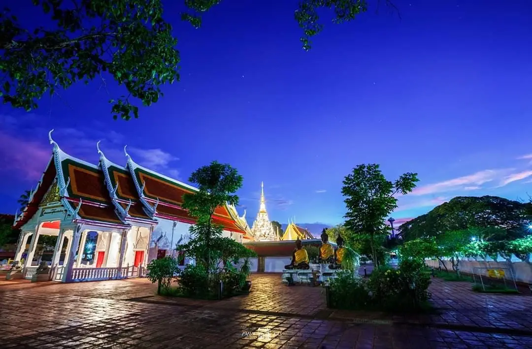
10. Wat Phra Borommathat Chaiya Ratchaworawihan is located in Wiang Subdistrict, Chaiya District, Surat Thani, and is one of the most important Buddhist and archaeological sites in Southern Thailand. It is particularly significant for its history and architecture associated with Srivijaya culture. The Phra Borommathat Chaiya stupa has a distinctive architectural form and serves as important evidence of the historical prosperity of Chaiya, which was once a major center connected with trade, religion, and cultural exchange across the southern peninsula.
The temple complex contains the principal stupa, Buddhist buildings, and a range of historical objects. Nearby sites include Chaiya National Museum, Wat Kaeo, Wat Long, and Suan Mokkhaphalaram, making Chaiya an excellent destination for a full cultural itinerary. Wat Phra Borommathat Chaiya remains an active religious center for the local community and hosts important traditions connected with worship of the sacred relics. Visitors should dress respectfully and allow time to observe the architecture and details of the temple grounds, as Chaiya provides one of the clearest opportunities to understand Surat Thani’s history beyond its famous islands and beaches.
Getting There: From Surat Thani City, take Highway 41 toward Chaiya District, then enter Wiang Subdistrict and follow signs to Wat Phra Borommathat Chaiya. Travelers arriving by train can get off at Chaiya Railway Station and continue by local transport.
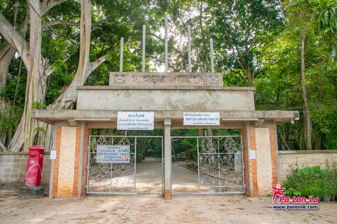
11. Suan Mokkhaphalaram (Wat Than Nam Lai) is located around Khao Phutthong at Ban Khao Phutthong, Moo 6, Lamet Subdistrict, Chaiya District. Commonly known simply as “Suan Mokkh,” it is one of Thailand’s best-known Buddhist meditation centers and is closely associated with Buddhadasa Bhikkhu, an influential Thai Buddhist monk who emphasized understanding the essential principles of Buddhism and applying them directly to daily life. Suan Mokkh was originally established at Phum Riang in 1932 before the center was later developed at Khao Phutthong. The grounds resemble a forest monastery, with large trees, quiet walking paths, Dharma spaces, and areas designed for study and meditation rather than monumental architecture.
Important places within Suan Mokkh include the Spiritual Theatre, where art, symbolism, and moral teachings are used to explain Buddhist ideas; the Curved Stone Court used for Dharma talks and meditation; Nalike Pond; a natural ordination area; Suwan Banphot Pavilion; Tathagata Dhammika Stupa; and areas connected with the preservation and study of Buddhadasa Bhikkhu’s teachings. One of the most distinctive experiences is simply walking slowly through the natural surroundings, reading Dharma messages, and spending time in a calm atmosphere. Suan Mokkh is suitable for visitors interested in Buddhist history, the teachings of Buddhadasa Bhikkhu, meditation, or simply finding a quiet space away from busy tourist areas.
Getting There: Suan Mokkhaphalaram is located beside Highway 41 in Chaiya District. From Surat Thani City, travel north toward Chaiya and Chumphon. The entrance is near Khao Phutthong.
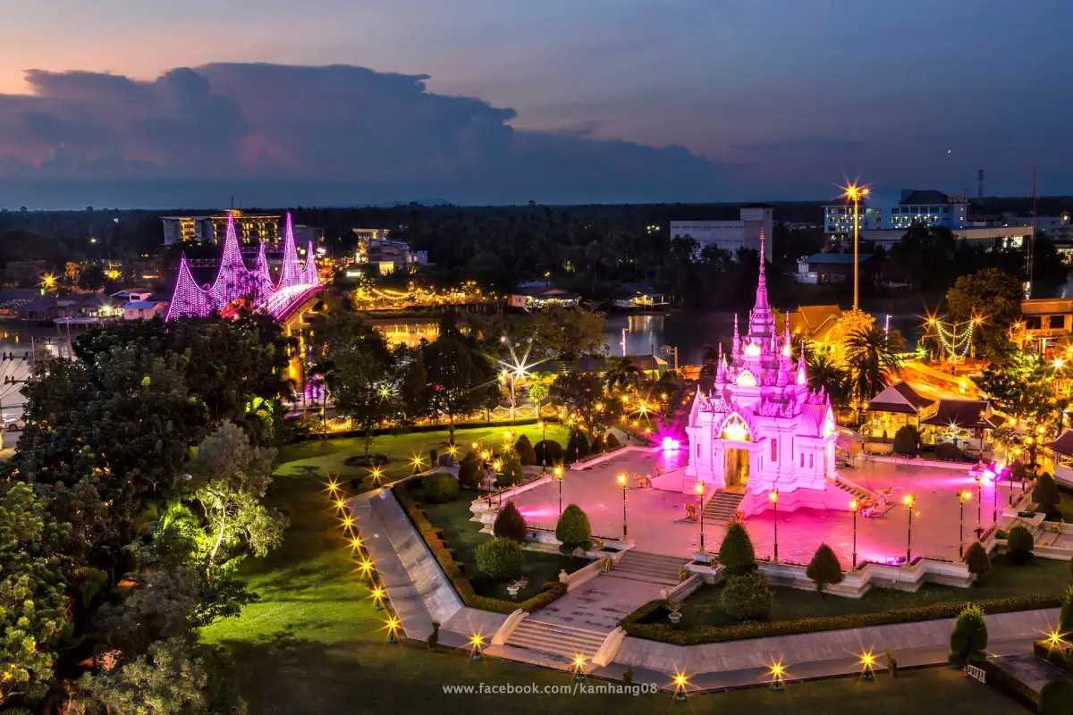
12. Surat Thani City Pillar Shrine is located in Talat Subdistrict, Mueang Surat Thani District. It is an important spiritual landmark for local residents and one of the most recognizable places in the city center. The shrine features distinctive white architecture and stands within an open landscaped area near the Tapi River. The surrounding environment is suitable for worship, walking, and relaxation, especially in the late afternoon when temperatures become more comfortable. The City Pillar Shrine reflects the relationship between the history of the city, local beliefs, and everyday life in modern Surat Thani.
Visitors commonly pay respects at the shrine for good fortune before beginning their journey around the province. Nearby attractions include Ko Lamphu, the Tapi River waterfront, San Chao Market, the old Bandon area, and important streets in the city center. This makes the shrine an easy starting point for an evening walking route. Its central location also makes it convenient for travelers with limited time who want to begin exploring Surat Thani from the heart of the city.
Getting There: From the bus terminal or central Surat Thani, travel along Don Nok Road toward Talat Subdistrict. The shrine is located close to the Tapi River and Ko Lamphu.
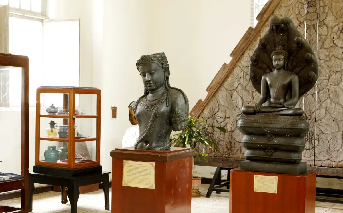
13. Chaiya National Museum is located on Rak Nakhon Kit Road in Wiang Subdistrict, Chaiya District, close to Wat Phra Borommathat Chaiya Ratchaworawihan. It is one of the most important museums for understanding the history of Southern Thailand, particularly the development of Chaiya and the influence of Srivijaya culture. Exhibitions include antiquities, sculptures, Buddha images, religious art, and archaeological evidence from Surat Thani and other parts of the South. Many objects help explain the connections between ancient communities, Buddhism, Hindu traditions, and maritime trading networks across the southern peninsula.
Visiting the museum before or after Wat Phra Borommathat Chaiya helps visitors better understand the artistic and historical details of the surrounding archaeological sites. Other nearby monuments, including Wat Kaeo and Wat Long, are also connected with the broader religious and cultural development of the Chaiya area. The museum is suitable for general travelers, students, and anyone interested in Srivijaya history. Around one to two hours is generally sufficient for a focused visit before continuing through historic Chaiya.
Getting There: The museum is located in Wiang Subdistrict, east of Wat Phra Borommathat Chaiya, and is easily reached from Chaiya Railway Station or the main roads through the district.
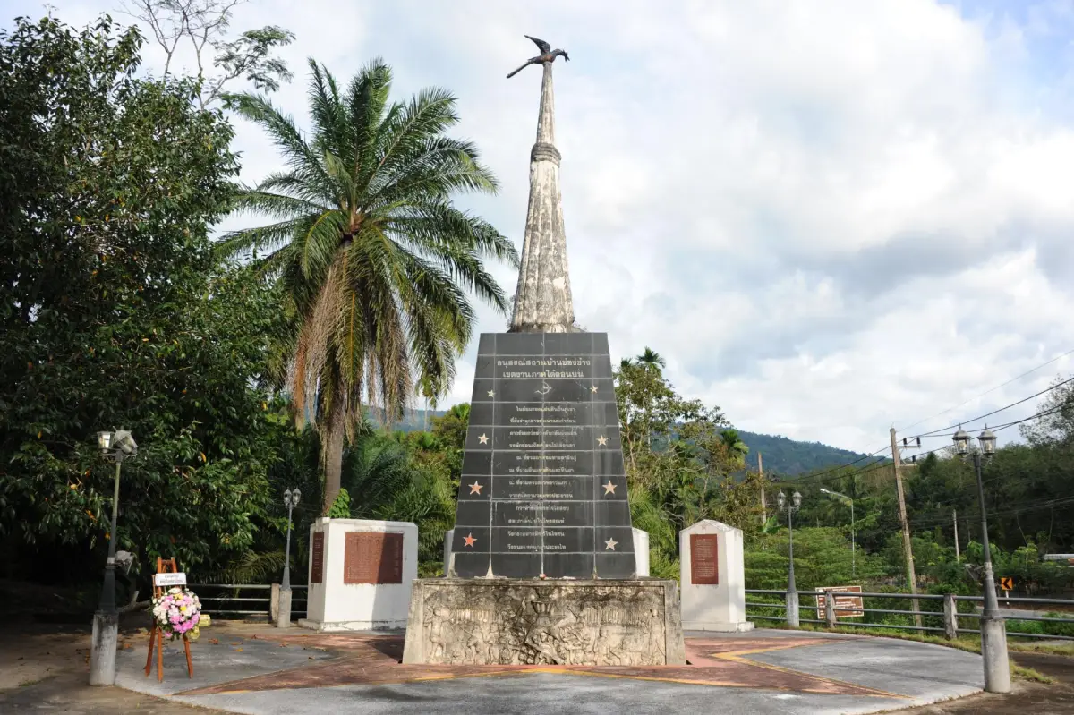
14. Ban Chong Chang Memorial is located in the Ban Chong Chang area of Phru Phi Subdistrict, Ban Na San District. It is a local historical learning site connected with a period of political conflict in Southern Thailand. The surrounding area was associated with the activities of the Communist Party of Thailand and formed part of a wider mountainous and forested region that was once used as an operational base before later becoming a settled community and historical learning area.
Visiting Ban Chong Chang Memorial presents a different side of Surat Thani beyond beaches and natural scenery. It introduces visitors to social and political events that once affected rural communities in the province and shows how the role of the surrounding mountains and forests changed over time. Today, the site has a peaceful atmosphere and is suitable for travelers interested in local history. It can be combined with Ban Na San, Tai Rom Yen National Park, and nearby natural attractions.
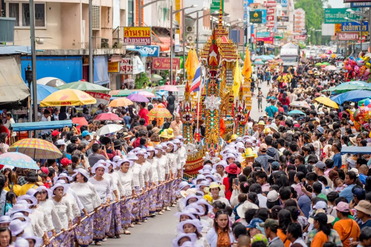
15. Chak Phra Tradition is one of Surat Thani’s most important annual traditions and takes place after the end of Buddhist Lent. It is a major cultural event reflecting Buddhist faith and strong community cooperation in Southern Thailand. Temples decorate elaborate ceremonial floats known as “Ruea Phra” and bring them into the procession area, where local residents collectively pull the floats along designated streets and routes. The festival is filled with Buddhist art, merit-making ceremonies, traditional processions, and cultural activities.
Surat Thani is especially well known for its Chak Phra celebration because numerous temples from across the province bring their decorated floats to participate, transforming the city into a major gathering point during the festival. In addition to the processions, activities include merit-making, competitions, traditional performances, and local food. Chak Phra is therefore more than a religious event: it also showcases craftsmanship, local art, community cooperation, and the cultural identity of Surat Thani. Travelers visiting around the end of Buddhist Lent can experience the province at one of its liveliest and most distinctive times of the year.
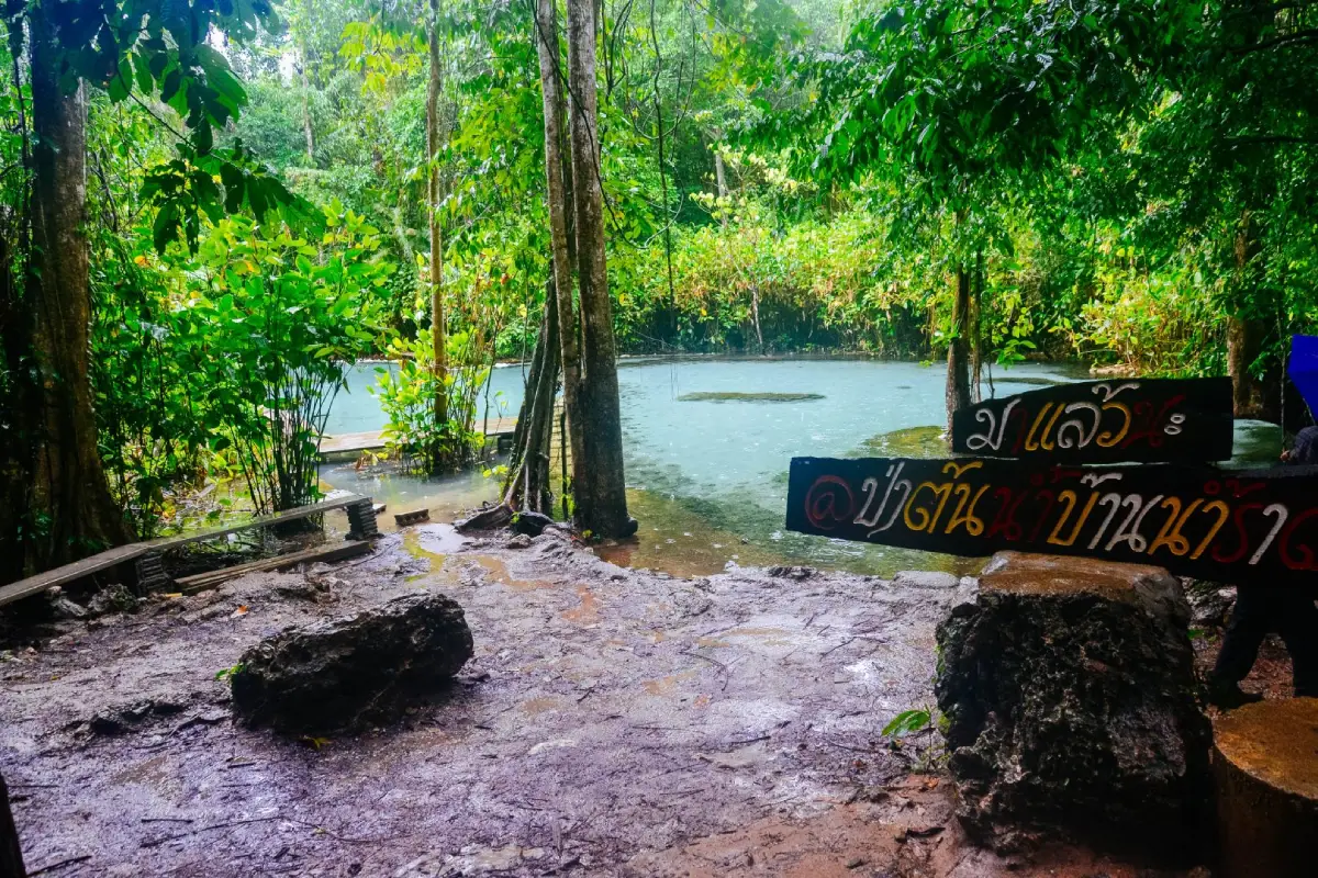
16. Khanthuli Swamp Forest Nature Study Center is located in Khanthuli Subdistrict, Tha Chana District, Surat Thani. It is a natural learning area focused on peat-swamp and wetland ecosystems, which differ significantly from the mountain rainforests found elsewhere in the province. Peat-swamp forests develop in low-lying areas where water remains for long periods and organic matter accumulates in the soil, creating specialized habitats for distinctive plants, animals, and aquatic systems. The center helps visitors understand the importance of wetlands in water storage, biodiversity conservation, and wildlife habitat protection.
The Khanthuli swamp forest is particularly suitable for visitors interested in nature, birdwatching, local plants, and wetland ecology. Exploring the area provides a different perspective on Surat Thani compared with Khao Sok or the province’s marine national parks, especially in terms of the relationship between lowland wetlands, water systems, and nearby communities. Visitors should remain on designated paths and avoid disturbing the environment because peat-swamp ecosystems are sensitive to changes in water levels, fire, and human activity.
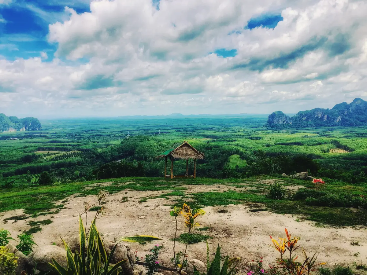
17. Chulabhorn Phatthana 8 Project is located in Lamphun Subdistrict, Ban Na San District, Surat Thani. The project functions as a development and learning area that connects natural-resource conservation with improvements in community quality of life. The surrounding landscape includes mountains, forest, and important watershed areas, making the site suitable for learning about forest protection, sustainable use of natural resources, and the relationship between local communities and the environment.
The project has a peaceful and green atmosphere and is particularly suitable for visitors interested in forestry, agriculture, environmental restoration, and sustainable community development. Ban Na San is also an important gateway to several mainland natural attractions, including Tai Rom Yen National Park, Dad Fa Waterfall, and Khamin Cave. This makes the Chulabhorn Phatthana 8 Project a useful stop on a broader nature itinerary through inland Surat Thani.

18. Khlong Noi Community is located in Khlong Noi Subdistrict, Mueang Surat Thani District, within the area known as Khlong Roi Sai, or the “Hundred Canals.” This network of small waterways connects with the Tapi River and reflects the traditional riverside lifestyle of Surat Thani. Local communities have long depended on coconut orchards, fruit gardens, small-scale fishing, boats, and canals as part of everyday life. Although the area is not far from Surat Thani City, the atmosphere is noticeably different, with dense vegetation, canal-side homes, and a lifestyle that remains closely connected to the water.
Popular activities include boat trips through Khlong Roi Sai, visits to local orchards, learning about coconut-based products, tasting local food, and observing daily life along the waterways. Morning and late afternoon are especially pleasant because temperatures are lower and local activity can be seen more clearly. Khlong Noi is suitable for travelers who want to experience Surat Thani from a local perspective and can be combined with Wat Bang Bai Mai, Bang Bai Mai Floating Market, and the historic Bandon area in a single day.
Getting There: Khlong Noi Community is approximately 12 kilometers from central Surat Thani. Visitors can travel by car to the community and continue by local sightseeing boat from designated departure points.
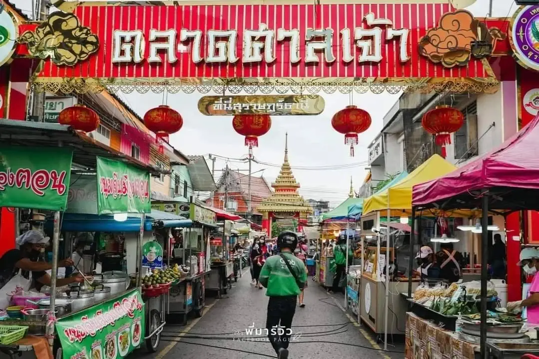
19. San Chao Market is located in the old Bandon district of Talat Subdistrict, Mueang Surat Thani District. It is one of the city’s best-known evening food markets and a popular place to experience local cuisine in a lively atmosphere. As evening approaches, food stalls line the streets around the shrine area, offering savory dishes, snacks, desserts, fruit, drinks, and a wide selection of Southern Thai food.
The appeal of San Chao Market lies in the variety of food available within a compact walking area. Visitors can spend one or two hours sampling dishes from different vendors and then continue to the Bandon area or the Tapi River waterfront nearby. Because the market is active from evening into the night, it works well as the final stop after a day exploring Surat Thani City. Beyond its food, the market also reflects the cultural diversity and commercial history of the old urban center.
Getting There: The market is located in the old Bandon area in central Surat Thani, within easy reach of the City Pillar Shrine and Tapi River waterfront.

20. Tai Rom Yen National Park is a large national park covering parts of Ban Na San, Kanchanadit, and Wiang Sa districts in Surat Thani. The park covers approximately 265,625 rai, or about 425 square kilometers. Its main features include tropical rainforest, mountain ranges, streams, waterfalls, caves, and important watershed areas. The rugged and humid terrain supports rich ecosystems and wildlife such as serow, barking deer, mouse deer, wild boar, elephants, and tapirs.
Important attractions within the park include Dad Fa Waterfall, Mueang Thuat Waterfall, Khamin Cave, Khao Nong, and high-elevation nature trails. Khao Nong rises to around 1,530 meters above sea level and is among the highest areas in Surat Thani. The cooler and wetter summit environment supports montane evergreen forest that differs from vegetation at lower elevations. Khamin Cave is another notable attraction, featuring large limestone chambers, stalactites, and stalagmites.
Tai Rom Yen National Park also has historical significance because some mountain areas were formerly used as bases by the Communist Party of Thailand. Remnants of sites known as Camp 180 and Camp 357 remain part of the area’s historical landscape. As a result, a visit to the park offers not only rainforest scenery and biodiversity but also insights into modern social history. Travelers planning long-distance treks or visits to remote areas should contact park officials in advance because some routes may close seasonally or during severe weather.
Getting There: The main park areas can be reached from Ban Na San District via Lamphun Subdistrict, with separate roads leading toward Dad Fa Waterfall, Khamin Cave, and other natural attractions.
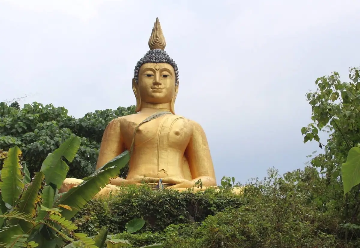
21. Khao Niphan is located in Moo 1, Khao Niphan Subdistrict, Wiang Sa District, Surat Thani. It is both a spiritual destination and a community viewpoint, distinguished by its elevated setting and a large Buddha image on the summit. Visitors climb a staircase from the base of the hill to pay respects at the Buddha image. From the top, views extend across Khao Niphan Subdistrict and the wider Wiang Sa area, including villages, rubber plantations, fruit orchards, agricultural land, and surrounding mountain ranges. The atmosphere is quiet and simple, retaining the character of a local community attraction rather than a heavily commercialized tourist site.
The name Khao Niphan is closely connected with the geography and settlement history of the area. The subdistrict contains plains, elevated land, and several mountains, and the summit visit provides a good overview of this rural landscape. Early morning is the best time to climb because temperatures are cooler and light conditions are suitable for views and photography. Visitors should wear secure footwear, carry drinking water, and avoid climbing during rain because the steps may become slippery. Khao Niphan is ideal for travelers seeking a smaller destination that combines worship, light exercise, and panoramic scenery.
Getting There: From Surat Thani City, travel toward Wiang Sa District and continue into Khao Niphan Subdistrict. Follow local roads to Wat Khao Niphan or the Big Buddha area, then climb the staircase from the base of the hill.
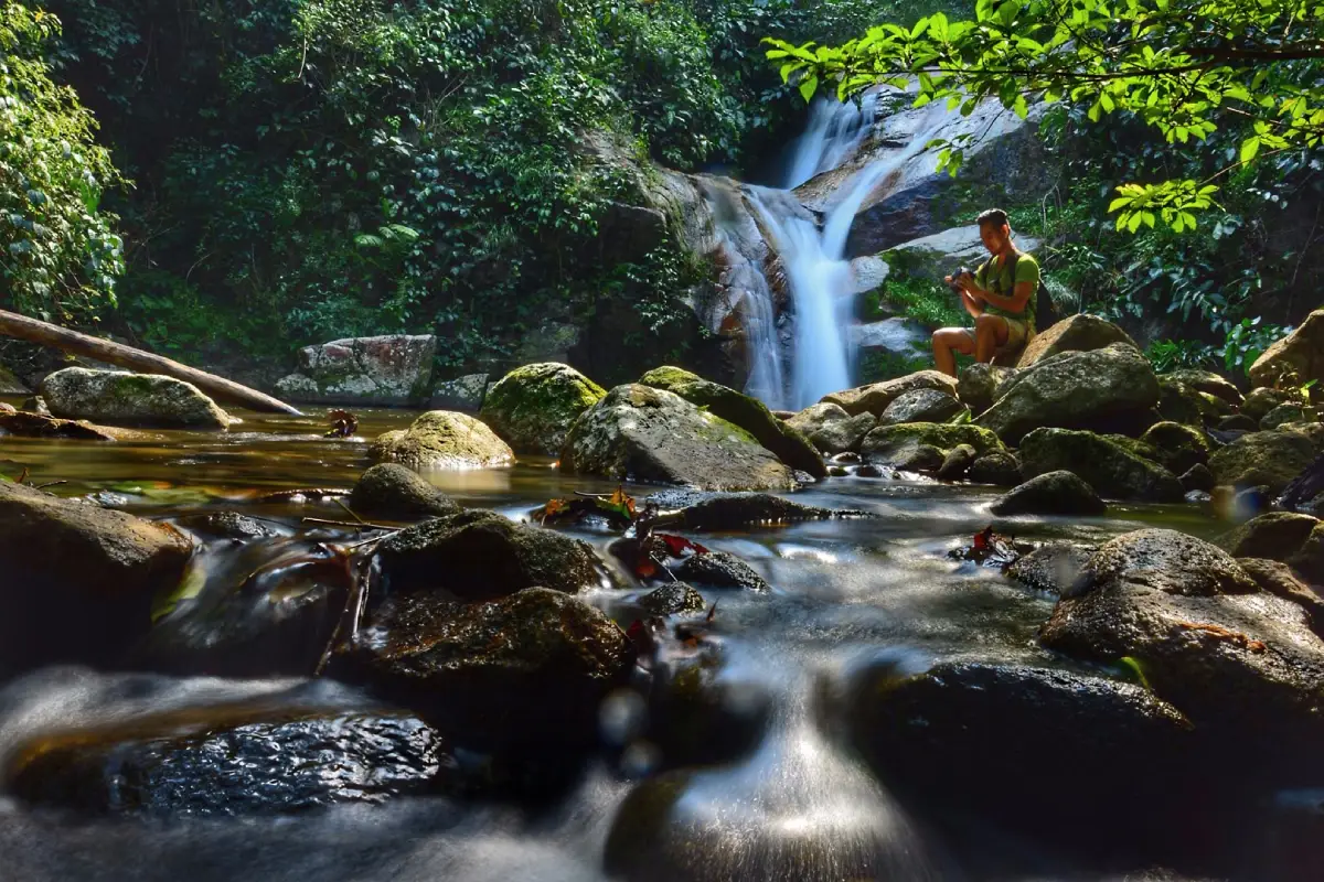
22. Dad Fa Waterfall is located within Tai Rom Yen National Park in Lamphun Subdistrict, Ban Na San District. It is one of the largest and best-known waterfalls in Surat Thani. The waterfall descends through several levels in dense tropical rainforest, with the uppermost section dropping from a cliff approximately 80 meters high. During periods of high water, the flow spreads across the cliff in a broad sheet, giving the impression that the water is falling directly from the sky—an image reflected in the name “Dad Fa.” Large trees, streams, rocks, and the cool, humid forest create an attractive setting for relaxation, nature walks, and rainforest observation.
The waterfall area includes routes ranging from easily accessible lower sections to longer forest trails requiring greater preparation. Casual visitors can explore the lower falls, relax beside streams, and swim only in areas considered safe. Those interested in longer nature trails should contact national park staff in advance because some routes require several hours or overnight stays. The waterfall is especially impressive during the rainy season, but paths may become slippery and flash floods are possible, so weather conditions and park announcements should always be checked before visiting.
Getting There: From Ban Na San District, travel into Lamphun Subdistrict following signs for Tai Rom Yen National Park and then continue toward the Dad Fa Waterfall entrance.
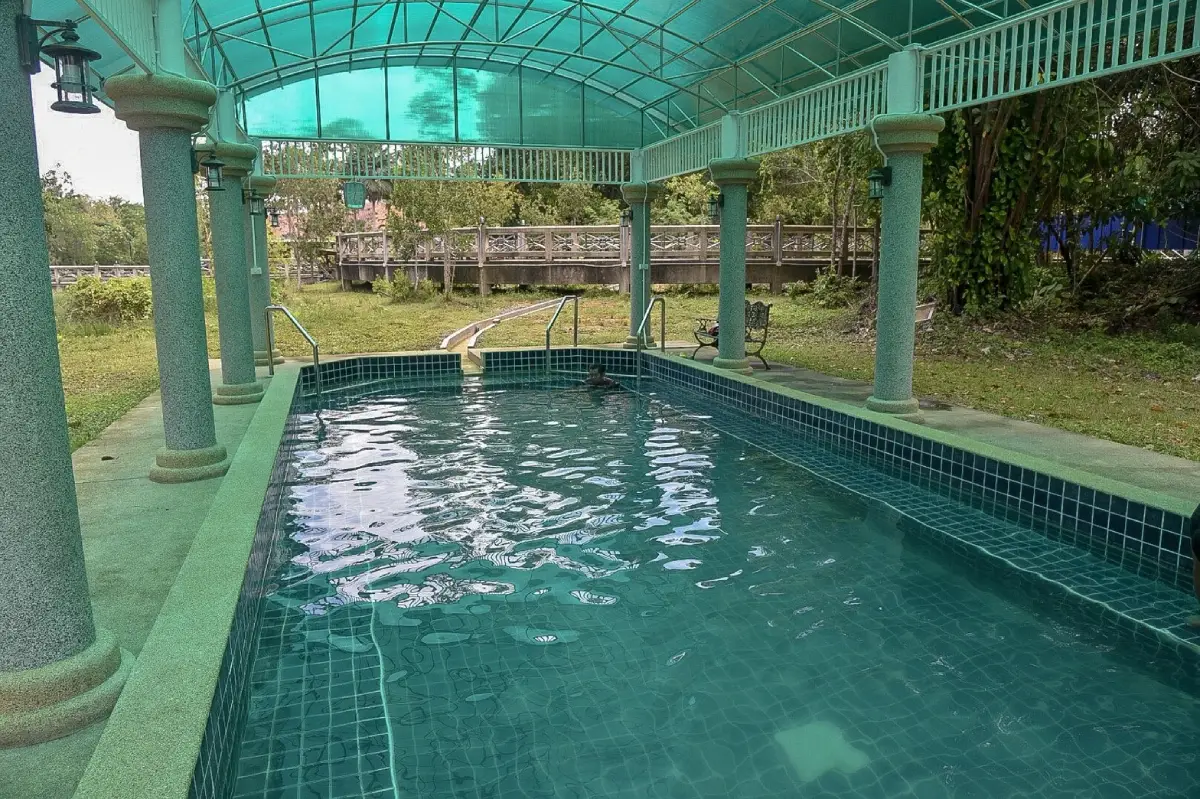
23. Tha Sathon Hot Spring is located in Moo 6, Tha Sathon Subdistrict, Phunphin District. It is a natural hot spring that reflects the geological characteristics of mainland Surat Thani. Hot water rises naturally from beneath the ground and has been developed by the local community for recreation and tourism. The surroundings are calm and offer a very different experience from the province’s beaches and islands, making the hot spring a suitable stop while traveling through Phunphin or exploring inland natural attractions.
Visitors can experience the natural hot-water environment and learn how geothermal processes bring heated groundwater to the surface. Anyone using bathing facilities should follow local regulations and check the water temperature first, especially children, older visitors, and people with health conditions. Tha Sathon Hot Spring adds a wellness and geological dimension to a Surat Thani itinerary without requiring travel to an island or deep forest.
Getting There: From Phunphin District, travel along local roads into Tha Sathon Subdistrict toward Moo 6. The site is accessible by private car or motorcycle.
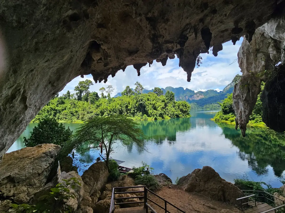
24. Pra Kai Petch Cave is located within the Ratchaprapha Reservoir area of Khao Sok National Park in Khao Phang Subdistrict, Ban Ta Khun District. It is a limestone cave commonly visited as part of a boat trip across Cheow Lan Lake. Inside are stalactites, stalagmites, and mineral-coated rock surfaces formed over long periods. When light reflects from some mineral surfaces, they sparkle, giving rise to the cave’s name, which can be translated as “Diamond Sparkle Cave.” The cave is not as extensive as some adventure caves, making it suitable as a short stop during a lake excursion.
One of the cave’s main attractions is the contrast between cruising through dramatic limestone scenery on the lake and then walking inside the mountain to view its geological formations. Visitors should stay on designated paths and avoid touching stalactites or stalagmites because these formations take extremely long periods to develop. Floors can be damp and slippery, so suitable footwear is recommended. Access should also be confirmed with boat operators or national park staff before traveling.
Getting There: Visitors must travel by boat from Ratchaprapha Dam Pier across Cheow Lan Lake, then disembark at the designated point and walk to the cave entrance.
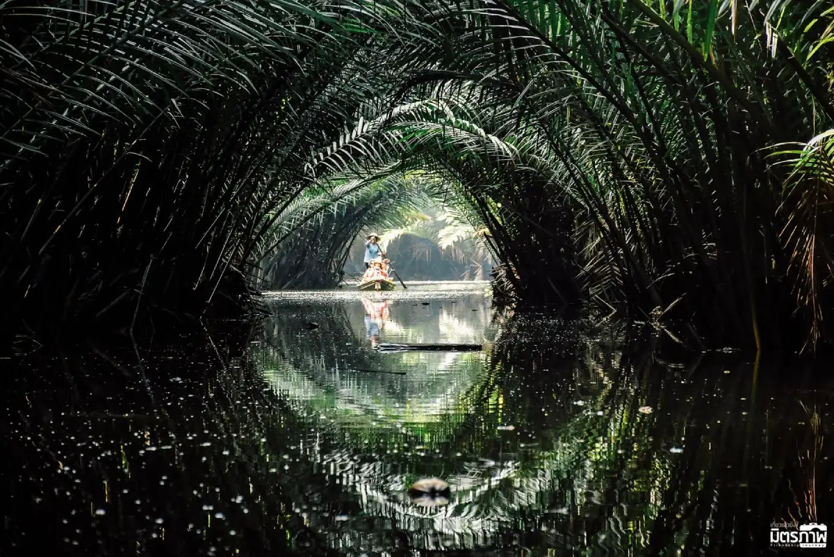
25. Khlong Roi Sai is a network of riverside communities in the Bang Nam Tapi area close to Surat Thani City. Numerous small canals branch from and reconnect with the Tapi River, creating a complex waterway system known locally as “Khlong Roi Sai,” meaning the Hundred Canals. Bang Bai Mai Subdistrict and nearby communities form an important part of this landscape. For generations, local residents have depended on boats, coconut orchards, fruit gardens, fishing, and homes built along the waterways.
The main activity is cruising through the canals to observe riverside communities and the landscape on both banks. Visitors can see coconut plantations, wooden houses, local vegetation, and a lifestyle distinctly different from the city center. Some routes connect with Khlong Noi Community, Wat Bang Bai Mai, and nearby floating-market areas. Khlong Roi Sai is particularly suitable for travelers interested in community-based tourism and the relationship between the Tapi River and local settlement patterns. Morning and late afternoon are especially pleasant for canal trips because temperatures are cooler and the waterways are more peaceful.
Getting There: From Surat Thani City, travel toward Bang Bai Mai or nearby canal-side communities close to the Tapi River, then join a community-operated boat service from the available departure points.
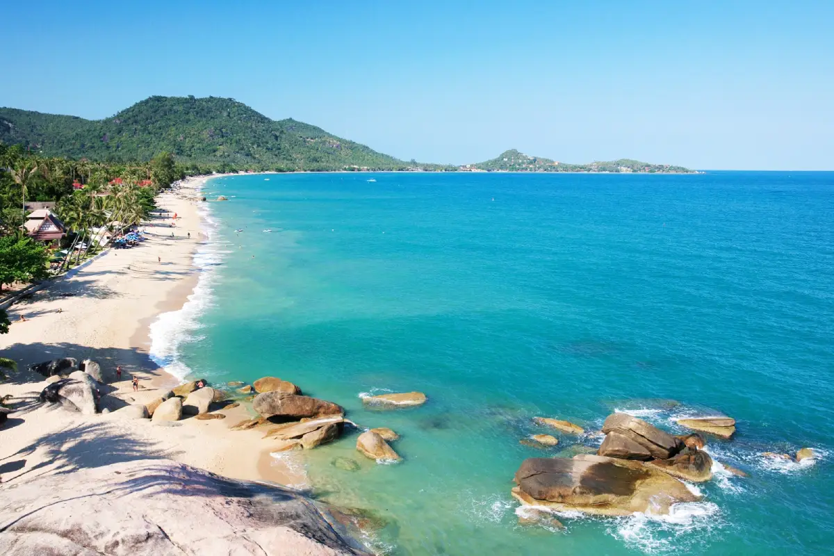
26. Lamai Beach is located in Maret Subdistrict on the southeastern coast of Koh Samui and is one of the island’s major tourism areas after Chaweng. The long beach has fine sand and is suitable for swimming and relaxation during favorable weather. The surrounding neighborhood offers accommodation, restaurants, cafés, shops, and tourism services at a range of price levels, allowing visitors to stay around Lamai for several days with easy access to everyday facilities.
Lamai offers a balance between activity and relaxation. It is generally quieter than Chaweng while still providing enough restaurants and services for most travelers. Daytime is ideal for swimming, walking along the beach, and relaxing by the sea, while evenings are suitable for dining and exploring nearby streets. Hin Ta–Hin Yai is located close to the southern end of Lamai Beach, making it easy to combine both attractions without a long journey.
Getting There: From Samui Airport or Chaweng, follow the island ring road toward Maret Subdistrict and Lamai. Taxis and rental vehicles are widely available around Koh Samui.
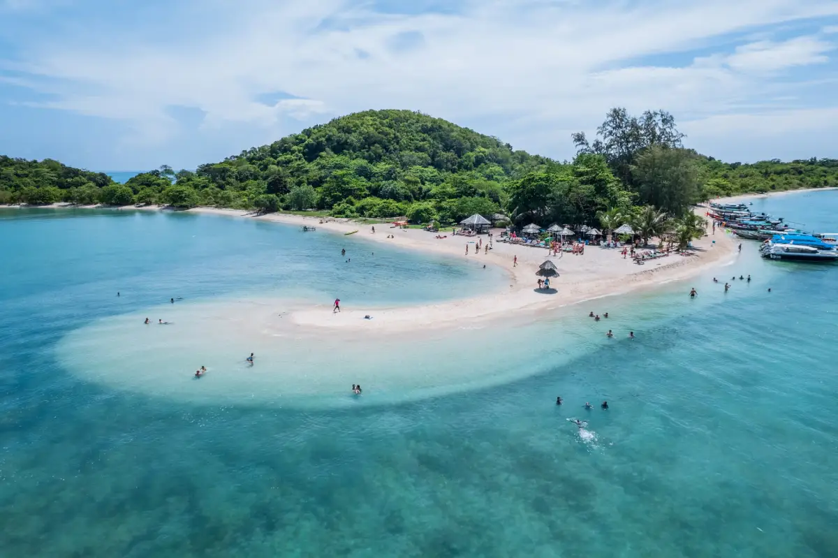
27. Koh Taen is a small island in Taling Ngam Subdistrict, south of Koh Samui. It has a quiet atmosphere and retains much of its natural character. Key features include coral reefs, coastal scenery, mangrove areas, nature trails, and a small local community. Most visitors come on a day trip from southern Koh Samui, particularly from the Thong Krut area and nearby coastal villages.
Popular activities include snorkeling, coral viewing, kayaking, nature walks, and relaxing by the sea. The eastern side of the island contains bays and community areas, while the surrounding coastline provides opportunities to learn about coastal ecosystems. Koh Taen is frequently combined with Koh Madsum on a one-day excursion, allowing visitors to experience both snorkeling and beach relaxation. Visitors should avoid littering, touching coral, or standing on reef areas.
Getting There: Travel to southern Koh Samui, where boats commonly depart from Thong Krut or Taling Ngam. From there, take a long-tail boat or excursion boat to Koh Taen.
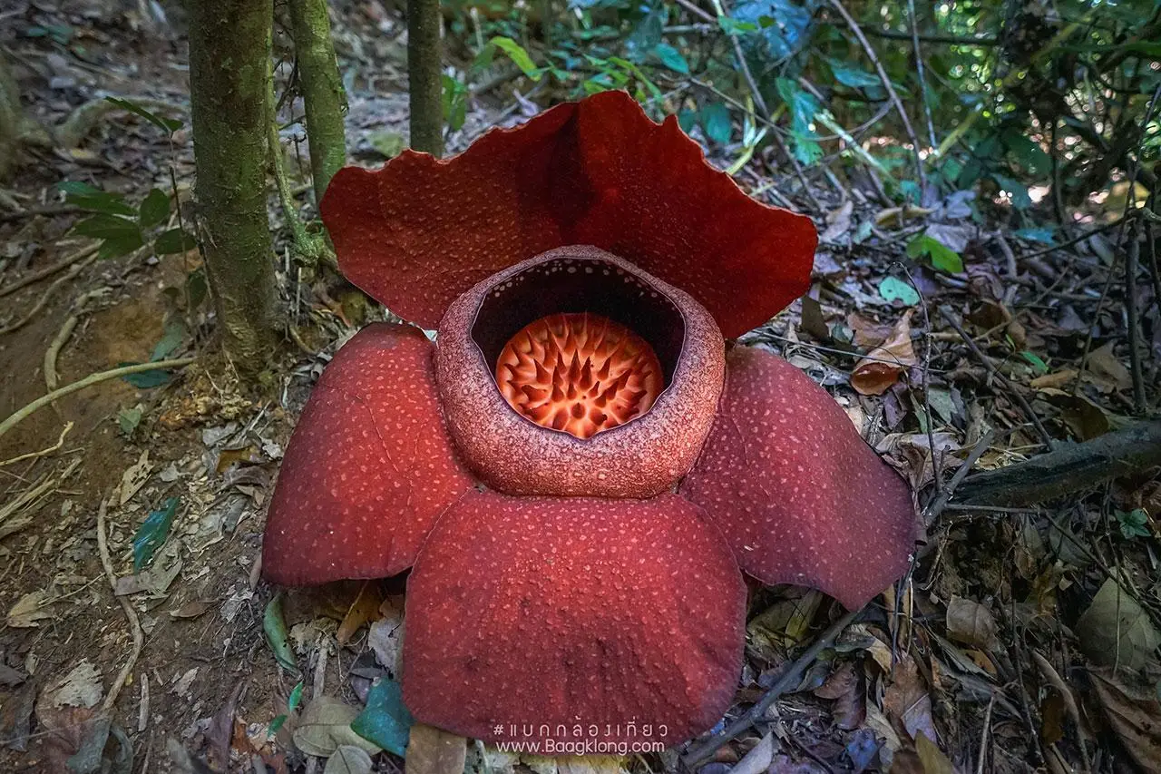
28. Dok Bua Phut is a rare parasitic plant found in the natural forests of Surat Thani, particularly in Phanom District and forest areas around Khao Sok National Park. Its scientific name is Rafflesia kerrii Meijer. The plant is famous for producing an exceptionally large flower with thick, fleshy, dark red petals. It has no ordinary stem, leaves, or roots because it survives within the tissues of a host vine. When fully open, the flower produces a strong odor that attracts insects involved in pollination.
Seeing Dok Bua Phut in the wild is unusual because flowering cannot be predicted throughout the year and each bloom remains open for only a short period. Travelers hoping to see it should check current local information before visiting and remain on designated trails to avoid damaging developing buds or host plants. Encountering a blooming Rafflesia in its natural habitat is a rare experience and an excellent indication of the ecological richness of Southern Thailand’s rainforest.
Getting There: Viewing areas are located in forest zones around Phanom District and Khao Sok. The exact route depends on where flowers are blooming at the time, so visitors should obtain current information from local communities or park officials before traveling.
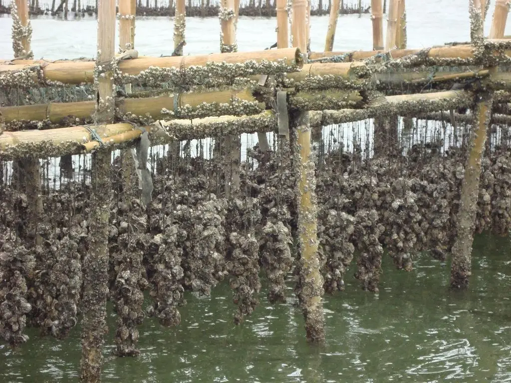
29. Surat Thani Oyster Farms are distributed along the coastline of Kanchanadit District, with important farming areas around Kadae Estuary, Tha Thong Canal, Ao Tha Na, Ao Thong Khao, and Ao Bang Un. Kanchanadit has long been known for oyster cultivation because its coastal waters, currents, and natural food supply provide suitable conditions for shellfish farming. As a result, Surat Thani oysters have become one of the province’s best-known seafood products.
Visiting an oyster farm provides an opportunity to learn about coastal aquaculture rather than simply eating seafood in a restaurant. Across the bays, visitors may see rows of concrete poles or other materials used as surfaces for young oysters to attach to and grow. Successful cultivation depends on water quality, tidal circulation, and healthy coastal ecosystems, linking oyster farming closely with mangrove forests and natural waterways. Some local excursions allow visitors to travel by boat through the farming areas, learn about cultivation methods, and enjoy fresh oysters from Kanchanadit.
Getting There: From Surat Thani City, take Highway 401 toward Kanchanadit District, then continue toward coastal communities and estuaries according to the farm or local tourism service being visited.
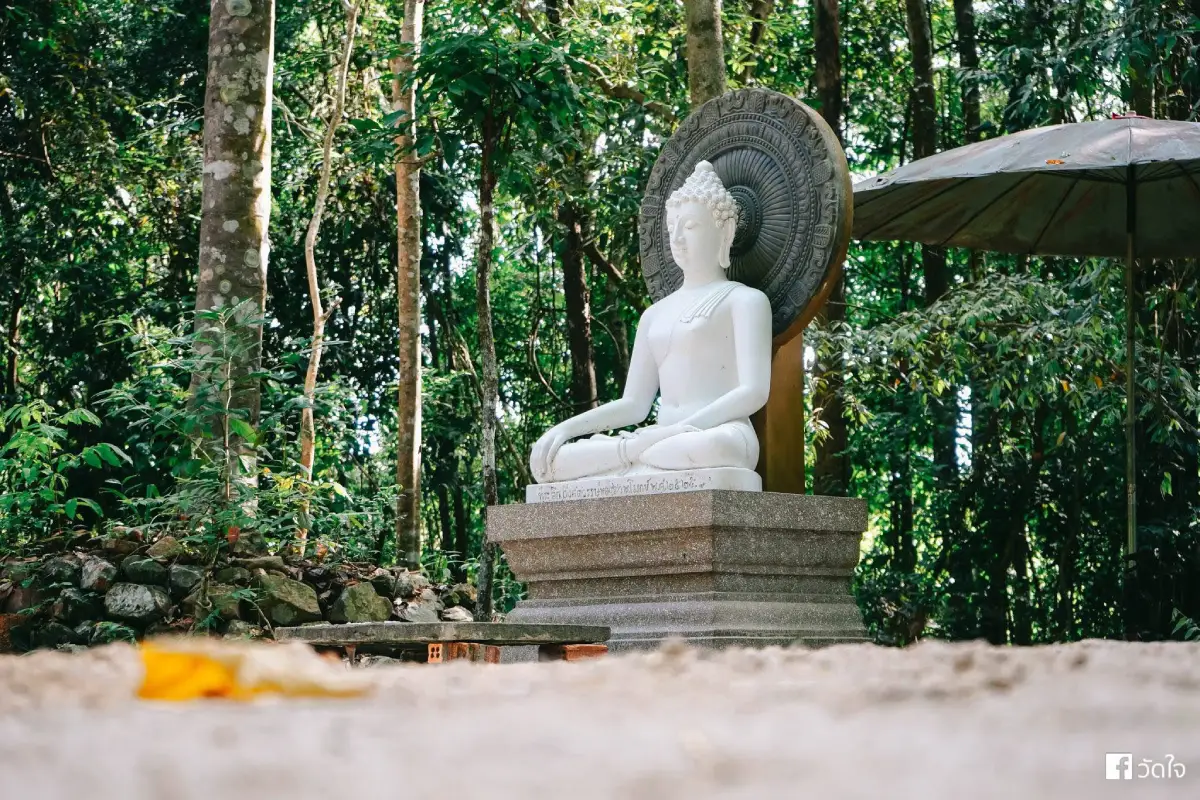
30. Khao Phutthong Arboretum is located in Lamet Subdistrict, Chaiya District, around Khao Phutthong beside Highway 41 and close to Suan Mokkhaphalaram. The arboretum conserves and displays valuable plant species while also serving as a nature-study and recreation area. Established in 1980, it was created to preserve native trees and other important plant species. The site remains green and shaded, retaining much of the natural forest atmosphere around the lower slopes of Khao Phutthong.
Visitors can walk among forest trees, observe understory plants, and learn about the ecosystem of the Khao Phutthong area. The arboretum is suitable for general travelers, students, and educational groups. Its location next to Suan Mokkh is particularly convenient, allowing visitors to combine nature study with Buddhist learning in the same route. From here, travelers can continue to Wat Phra Borommathat Chaiya, Chaiya National Museum, Wat Kaeo, and Wat Long for a full-day nature and historical itinerary around Chaiya.
Getting There: Take Highway 41 toward Chaiya District. The arboretum is located around kilometer marker 134 near Khao Phutthong and Suan Mokkhaphalaram. Travelers arriving by train can get off at Chaiya Railway Station and continue by local transport.
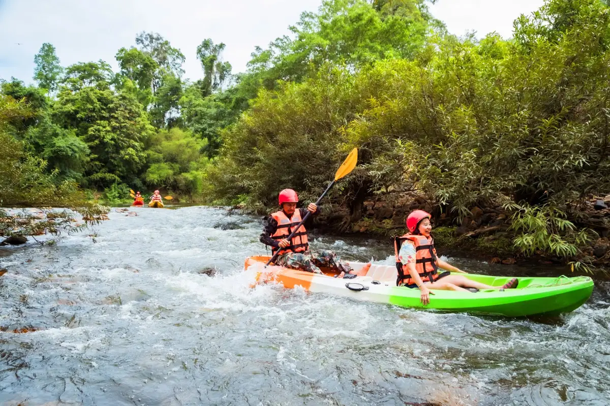
31. Khlong Yan Rafting is an adventure activity in the Kaeng Krung National Park area of Surat Thani. The highlight is rafting along Khlong Yan through lush tropical rainforest, where the river passes natural rapids, clear water, rocky channels, and forested banks. The experience offers a completely different perspective from the islands and beaches most commonly associated with Surat Thani, allowing visitors to encounter the energy of a mountain river and the province’s inland watershed landscape.
Rafting is best suited to travelers who enjoy outdoor adventure and active experiences. Visitors should use an experienced local operator or qualified staff, wear complete safety equipment, and check water levels and weather conditions before entering the river because the strength of the current changes with the season. When water levels are suitable, the route combines excitement with close contact with rainforest scenery. The surrounding Kaeng Krung National Park area is also suitable for nature study and quiet forest-based travel.
Getting There: Travel to the Kaeng Krung National Park area in Vibhavadi District, then coordinate with the local rafting service according to the route and water conditions available at the time of the visit.
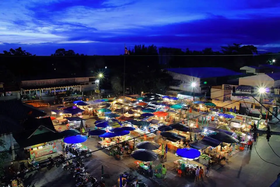
32. Na San Railway Station Market is located in the old community and commercial district of Mueang Na San, Ban Na San District. The market developed alongside the railway station and the surrounding agricultural community. For many years, the station area has served as a transportation hub, trading center, and meeting place for local residents, creating the atmosphere of a small provincial town where the railway, market, and everyday community life remain closely connected.
The market offers cooked food, local snacks, seasonal fruit, agricultural products, and daily necessities. Ban Na San is an important agricultural area of Surat Thani, especially for fruit orchards and other crops, so the market also functions as a distribution point for local produce. Travelers arriving by train or passing through Ban Na San can stop to explore the market, try local food, and experience the town before continuing to Tai Rom Yen National Park, Dad Fa Waterfall, or nearby nature destinations.
Getting There: The market is located directly around Ban Na San Railway Station. Visitors can arrive by train or drive into Mueang Na San and follow signs to the station.

33. Pad Thai Chaiya – Southern Thai Food is a well-known local dish from Chaiya District in Surat Thani and reflects the area’s distinctive food culture. Although the name resembles the Pad Thai found across Thailand, the Chaiya version has a different flavor profile and cooking method. Its sauce is richer and carries the aroma of Southern Thai curry ingredients, with dried chilies, shallots, and shrimp paste playing an important role. The result is a combination of sweet, salty, spicy, and deeply aromatic flavors associated with the cuisine of Chaiya.
Pad Thai Chaiya is a good example of how a familiar Thai dish can be adapted to local ingredients and tastes. Travelers following a Chaiya cultural route—including Wat Phra Borommathat Chaiya, Chaiya National Museum, and Suan Mokkhaphalaram—can add a culinary dimension to the trip by trying Pad Thai Chaiya at local restaurants. The dish is therefore more than a convenient meal; it is part of the food heritage that connects Chaiya’s history, religion, and everyday life.
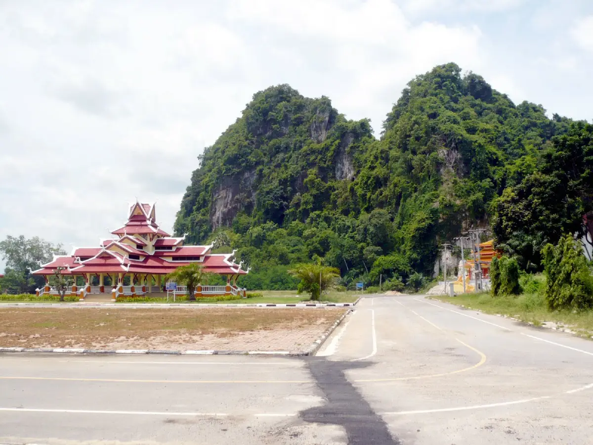
34. Tha Thong Historical Museum (Wat Khao Phra Nim) is located in Kanchanadit District, Surat Thani. The museum preserves stories related to the old town of Tha Thong, local communities, and historical evidence from the Kanchanadit area. Because it is located within the grounds of Wat Khao Phra Nim, visitors can experience both local history and Buddhist culture in the same place.
The museum contains information, documents, photographs, and objects that help explain the development of Tha Thong, an old settlement connected with habitation, transport, and trade along the Gulf of Thailand coast. A visit helps demonstrate that Kanchanadit is not only known for oyster farms and seafood but also has deep historical roots and long-established communities. Travelers interested in old towns and local history can spend time studying the exhibits before exploring the temple grounds and nearby communities.
Getting There: Travel from Surat Thani City toward Kanchanadit District and continue to Wat Khao Phra Nim via local roads. Opening days should be checked before visiting because the museum operates only on selected days.
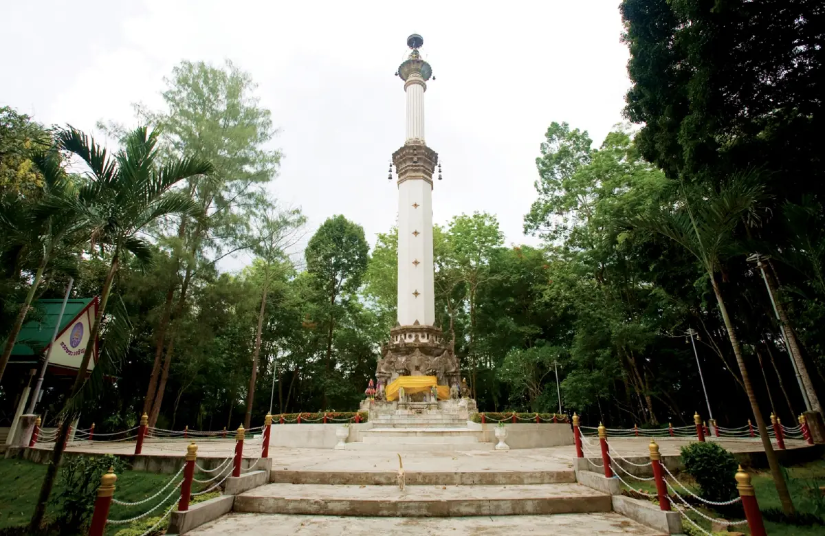
35. Phra That Si Surat, commonly known by local residents as Phra That Khao Tha Phet, is an important Buddhist monument on the summit of Khao Tha Phet in Mueang Surat Thani District. The sacred site is surrounded by natural hill scenery and holds religious, historical, and spiritual importance for local people. The elevated location also provides views across Surat Thani City and the surrounding landscape.
The atmosphere is peaceful and suitable for worship, merit-making, and enjoying the view. Travelers staying in Surat Thani City can combine a visit with the City Pillar Shrine, San Chao Market, and the Tapi River waterfront. In addition to its religious significance, Khao Tha Phet reveals another aspect of the city’s geography, where river plains and elevated forested hills exist close to one another.
Getting There: From central Surat Thani, follow the route toward Khao Tha Phet and then continue along signs leading to Phra That Si Surat at the summit. Vehicles can travel to the upper area using the designated road.
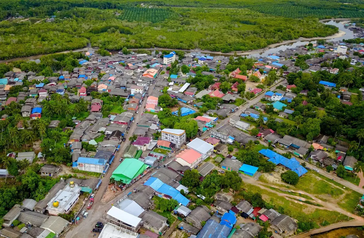
36. Ban Chalok Lam is located in Moo 7, Koh Phangan Subdistrict, Koh Phangan District. It is a coastal community on the northern side of Koh Phangan where visitors can still see elements of traditional fishing life. Chalok Lam has a broad bay, beach, fishing boats, seafood restaurants, and local homes, creating an atmosphere very different from Haad Rin and the party-focused areas for which Koh Phangan is internationally known.
Visitors can walk along the bay, watch fishing boats, enjoy fresh seafood, and use Chalok Lam as a base before continuing to beaches and bays in northern Koh Phangan. What makes the village interesting is the way tourism and everyday community life exist side by side. Shops, restaurants, and tourism services have grown over time, yet the area still retains the character of a working seaside village. Visiting Chalok Lam therefore provides a broader understanding of Koh Phangan beyond its beaches and nightlife.
Getting There: From Thong Sala Pier, follow the main road north across Koh Phangan to Chalok Lam. Local taxis and rental vehicles are available on the island.
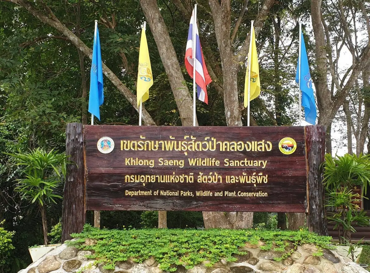
37. Khlong Saeng Wildlife Sanctuary covers areas in Khao Phang Subdistrict, Ban Ta Khun District, as well as connected areas in Vibhavadi District. It is one of Southern Thailand’s important protected forest landscapes and forms part of a larger forest complex linked with Khao Sok and the Khlong Saeng watershed. The landscape includes steep mountains, tropical rainforest, streams, and highly biodiverse forest, providing habitat for many species of wildlife.
Khlong Saeng is primarily a conservation area rather than a conventional tourist attraction. Entry for nature study or access to certain zones must follow the regulations of the responsible authorities. Visitors may have opportunities to learn about rainforest ecology, wildlife, and the role of watershed forests in feeding local streams and the Ratchaprapha Reservoir. Travel in this type of protected area should focus on quiet observation, avoiding wildlife feeding, staying on authorized routes, and minimizing disturbance to natural habitats.
Getting There: Access depends on the specific study area and zones open to visitors. Travelers should contact Khlong Saeng Wildlife Sanctuary or the relevant authorities in advance before planning a visit.
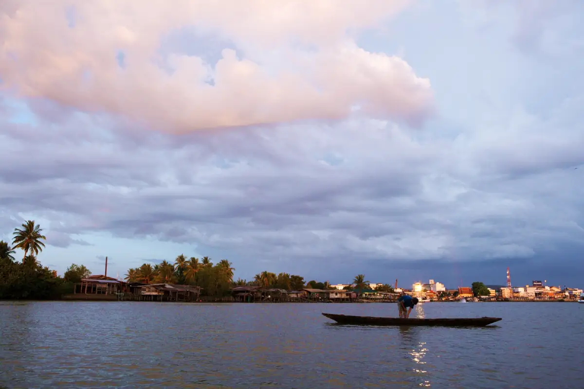
38. Pak Nam Tapi is located in Bang Kung Subdistrict, Mueang Surat Thani District, where the Tapi River reaches the Gulf of Thailand. This estuarine environment forms a transition zone between freshwater and seawater. The surrounding area includes mangrove forests, coastal communities, fishing boats, and seafood restaurants, clearly illustrating the relationship between the river and the daily lives of people in Surat Thani.
The river mouth is particularly attractive in the late afternoon when the light softens and fishing boats begin returning to shore. Visitors can combine coastal views with a seafood meal and observation of local riverside life. Ecologically, the estuary is important as a nursery area for aquatic species and as a transition between the Tapi River and the Gulf of Thailand. Pak Nam Tapi is therefore both a scenic destination and a working coastal environment closely connected with the local economy.
Getting There: From Surat Thani City, travel into Bang Kung Subdistrict and follow local roads toward the mouth of the Tapi River. The area is accessible by car or motorcycle.
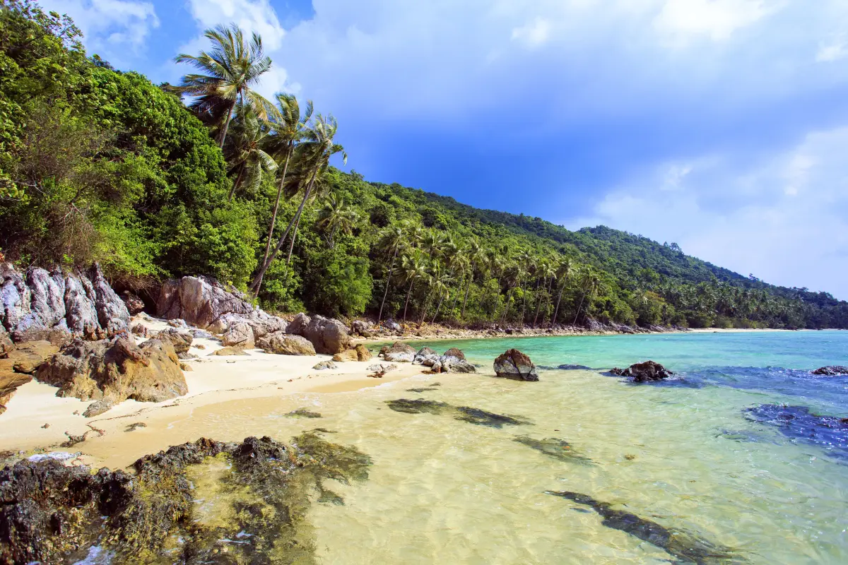
39. Taling Ngam Beach is located on the western coast of Koh Samui and offers a noticeably quieter atmosphere than major tourism areas such as Chaweng and Lamai. Its defining feature is the view across the Gulf of Thailand toward the Ko Si–Ko Ha island group, as well as its reputation as one of Koh Samui’s attractive sunset beaches because the shoreline faces west.
Taling Ngam is well suited to travelers who prefer slow-paced relaxation, walking along the beach, sitting by the sea, or dining along the coast. The atmosphere remains relatively natural and less crowded than the eastern side of Koh Samui. Late afternoon is particularly appealing as the sunset colors the water and the offshore islands become more prominent on the horizon. Taling Ngam can also be included in a southern Koh Samui route with Koh Taen, Wat Chedi Laem Sor, and other attractions around the Taling Ngam area.
Getting There: Follow the Koh Samui ring road toward Taling Ngam Subdistrict on the western side of the island. The beach can be reached by private vehicle, taxi, or rental vehicle from Nathon, Lamai, and other parts of Koh Samui.
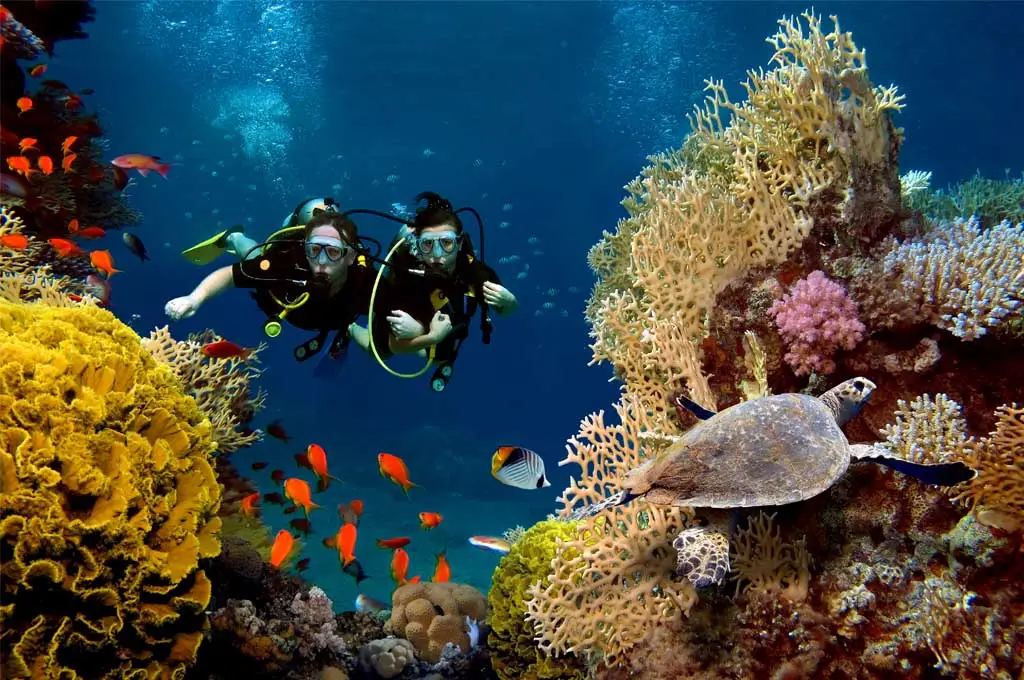
40. Underwater Coral Reefs are found throughout the Gulf of Thailand waters of Surat Thani, with particularly notable reef areas around Koh Tao, Koh Nang Yuan, and nearby islands. Clear water and coral formations provide habitat for numerous fish and other marine organisms. These underwater ecosystems are one of the main reasons Koh Tao has become one of Thailand’s most recognized destinations for snorkeling, scuba diving, and diving education.
Visitors can choose between snorkeling and scuba diving depending on experience level. Some reef areas begin in relatively shallow water, while deeper dive sites require specialized equipment and certified skills. Coral should never be touched, broken, or stepped on, and visitors should avoid chasing or feeding marine animals because reef ecosystems are fragile and recover very slowly after damage. Choosing responsible dive operators that follow conservation practices helps reduce tourism impacts on these important marine habitats.
Getting There: Most major diving areas are located around Koh Tao, Koh Nang Yuan, and nearby islands. Access is by boat from Koh Tao or through organized snorkeling and diving trips offered by local operators.
| Topic | Details |
| Province | Surat Thani, Southern Thailand |
| Highlights | A highly diverse province combining Gulf of Thailand islands, beaches, tropical rainforest, limestone mountains, dams and lakes, waterfalls, caves, hot springs, riverside communities, Buddhist temples, archaeological heritage, museums, local markets, and regional food culture. |
| Top 10 Attractions | 1. Ratchaprapha Dam (Cheow Lan Dam) 2. Khao Sok National Park 3. Koh Samui 4. Koh Phangan 5. Koh Tao 6. Mu Ko Ang Thong National Park 7. Koh Nang Yuan 8. Chaweng Beach 9. Hin Ta – Hin Yai 10. Wat Phra Borommathat Chaiya Ratchaworawihan |
| Ban Ta Khun – Khao Sok Zone | 1. Ratchaprapha Dam (Cheow Lan Dam) 2. Khao Sok National Park 3. Pra Kai Petch Cave 4. Dok Bua Phut 5. Khlong Saeng Wildlife Sanctuary |
| Koh Samui Zone | 1. Koh Samui 2. Mu Ko Ang Thong National Park 3. Chaweng Beach 4. Hin Ta – Hin Yai 5. Lamai Beach 6. Koh Taen 7. Taling Ngam Beach |
| Koh Phangan – Koh Tao Zone | 1. Koh Phangan 2. Ban Chalok Lam 3. Koh Tao 4. Koh Nang Yuan 5. Underwater Coral Reefs |
| Chaiya Zone | 1. Wat Phra Borommathat Chaiya Ratchaworawihan 2. Suan Mokkhaphalaram (Wat Than Nam Lai) 3. Chaiya National Museum 4. Khao Phutthong Arboretum 5. Pad Thai Chaiya |
| Surat Thani City Zone | 1. Surat Thani City Pillar Shrine 2. Chak Phra Tradition 3. Khlong Noi Community 4. San Chao Market 5. Khlong Roi Sai 6. Phra That Si Surat 7. Pak Nam Tapi |
| Ban Na San – Wiang Sa Zone | 1. Ban Chong Chang Memorial 2. Chulabhorn Phatthana 8 Project 3. Tai Rom Yen National Park 4. Khao Niphan 5. Dad Fa Waterfall 6. Na San Railway Station Market |
| Kanchanadit Zone | 1. Surat Thani Oyster Farms 2. Tha Thong Historical Museum (Wat Khao Phra Nim) |
| Phunphin Zone | 1. Tha Sathon Hot Spring |
| Tha Chana Zone | 1. Khanthuli Swamp Forest Nature Study Center |
| Vibhavadi – Kaeng Krung Zone | 1. Khlong Yan Rafting |
| Islands and Beaches | 1. Koh Samui 2. Koh Phangan 3. Koh Tao 4. Mu Ko Ang Thong National Park 5. Koh Nang Yuan 6. Koh Taen 7. Chaweng Beach 8. Lamai Beach 9. Taling Ngam Beach 10. Underwater Coral Reefs |
| Mainland Nature Attractions | 1. Ratchaprapha Dam 2. Khao Sok National Park 3. Tai Rom Yen National Park 4. Dad Fa Waterfall 5. Pra Kai Petch Cave 6. Khao Niphan 7. Khanthuli Swamp Forest Nature Study Center 8. Dok Bua Phut 9. Khlong Saeng Wildlife Sanctuary 10. Khao Phutthong Arboretum |
| History, Religion and Culture | 1. Wat Phra Borommathat Chaiya Ratchaworawihan 2. Suan Mokkhaphalaram 3. Chaiya National Museum 4. Surat Thani City Pillar Shrine 5. Chak Phra Tradition 6. Ban Chong Chang Memorial 7. Tha Thong Historical Museum 8. Phra That Si Surat |
| Community and Local Life | 1. Khlong Noi Community 2. Khlong Roi Sai 3. Ban Chalok Lam 4. Surat Thani Oyster Farms 5. Na San Railway Station Market 6. San Chao Market |
| Popular Activities | Cheow Lan Lake cruises, floating-raft stays, rainforest trekking, waterfall visits, cave exploration, snorkeling, scuba diving, kayaking, beach trips, community canal cruises, Khlong Yan rafting, sunset viewing, peat-swamp nature study, oyster-farm visits, and temple and museum tours. |
| Suitable For | Nature travelers, beach lovers, divers, families, couples, cultural travelers, history enthusiasts, hikers, photographers, and visitors interested in local community experiences. |
| Getting Around the Province | A private or rental vehicle is convenient for mainland destinations. Koh Samui, Koh Phangan, and Koh Tao require ferry or air connections depending on the destination. Smaller islands and dive sites require onward travel by excursion boat or long-tail boat. |
| Trip Planning | Travel is easier when divided into zones such as Surat Thani City, Chaiya, Ban Na San–Wiang Sa, Ban Ta Khun–Khao Sok, Kanchanadit, Koh Samui, Koh Phangan, and Koh Tao because attractions are widely dispersed and some routes require ferry transfers. |
| Before You Travel | Check weather, sea conditions, ferry schedules, national park opening status, trekking-route conditions, rafting water levels, and the current flowering status of Dok Bua Phut before departure. |
Frequently Asked Questions (FAQ)
Q: What are the best places to visit in Surat Thani?
A: Surat Thani offers a wide variety of attractions including Ratchaprapha Dam, Khao Sok National Park, Koh Samui, Koh Phangan, Koh Tao, Mu Ko Ang Thong National Park, Koh Nang Yuan, Wat Phra Borommathat Chaiya, Suan Mokkhaphalaram, Dad Fa Waterfall, Khlong Roi Sai, and many local communities. Travelers can experience beaches, rainforest, history, culture, and community life within a single province.
Q: Where should first-time visitors go in Surat Thani?
A: First-time visitors who want to experience the province’s natural highlights can begin with Ratchaprapha Dam and Khao Sok National Park. Travelers who prefer an island holiday can choose Koh Samui. With additional time, Koh Phangan, Koh Tao, or the historical route through Chaiya can be added to the itinerary.
Q: Can Cheow Lan Lake and Khao Sok National Park be visited on the same trip?
A: Yes. Ratchaprapha Reservoir and Cheow Lan Lake are closely connected with the Khao Sok area. Allowing at least two days makes it easier to divide time between a lake cruise, floating-raft experience, and rainforest exploration without rushing.
Q: Which islands are worth visiting in Surat Thani?
A: The main islands are Koh Samui, Koh Phangan, and Koh Tao. Koh Nang Yuan is known for its sandbar, viewpoint, and snorkeling, while Koh Taen offers a quieter day trip and shallow-water snorkeling. Mu Ko Ang Thong National Park is ideal for boat excursions, kayaking, and panoramic island viewpoints.
Q: What is the difference between Koh Samui, Koh Phangan, and Koh Tao?
A: Koh Samui offers the widest range of accommodation, restaurants, and resort facilities. Koh Phangan combines beaches, forests, communities, and both lively and quiet coastal areas. Koh Tao is particularly famous for snorkeling, scuba diving, and dive training.
Q: Where should nature lovers go in Surat Thani?
A: Nature-focused destinations include Ratchaprapha Dam, Khao Sok National Park, Tai Rom Yen National Park, Dad Fa Waterfall, Pra Kai Petch Cave, Khlong Saeng Wildlife Sanctuary, Khanthuli Swamp Forest Nature Study Center, Khao Niphan, Khao Phutthong Arboretum, and the natural areas of the Gulf islands.
Q: Which places are best for history and culture in Surat Thani?
A: Chaiya is one of the province’s most important cultural zones, with Wat Phra Borommathat Chaiya Ratchaworawihan, Chaiya National Museum, and Suan Mokkhaphalaram. Other significant places include Surat Thani City Pillar Shrine, Phra That Si Surat, Tha Thong Historical Museum, and Ban Chong Chang Memorial.
Q: Where can travelers experience local community life in Surat Thani?
A: Khlong Noi Community and Khlong Roi Sai offer canal trips through traditional Tapi River communities. Ban Chalok Lam on Koh Phangan provides a look at a working fishing village, while the oyster farms of Kanchanadit introduce visitors to coastal aquaculture and local seafood production.
Q: Are there adventure activities in Surat Thani?
A: Yes. Activities include Khlong Yan rafting, rainforest trekking in Khao Sok and Tai Rom Yen national parks, exploring Pra Kai Petch Cave, kayaking on Cheow Lan Lake and in Mu Ko Ang Thong National Park, and both snorkeling and scuba diving around Koh Tao, Koh Nang Yuan, and nearby coral reefs.
Q: How many days are recommended for a trip to Surat Thani?
A: Two to three days can work for a single travel zone. Travelers who want to combine mainland attractions with the islands should allow at least 5–7 days. A sample plan could include two days for Khao Sok and Cheow Lan Lake, two or three days on Koh Samui, and additional days for Koh Phangan, Koh Tao, or Chaiya.
Q: When is a good time to visit the islands of Surat Thani?
A: Weather and sea conditions in the Gulf of Thailand should be considered carefully because they affect ferry operations, diving, and marine activities. Before traveling to Koh Samui, Koh Phangan, Koh Tao, Koh Nang Yuan, or Mu Ko Ang Thong National Park, check the latest weather forecast and boat-operation notices.
Q: Can Surat Thani be explored without a private car?
A: Yes. Surat Thani City is connected by buses, trains, and air services, while passenger ferries connect the major islands. However, mainland destinations farther from the city, such as Khao Sok, Ban Ta Khun, Ban Na San, and national parks, are generally easier to reach by rental car, local transfer, or organized tour.
Q: Where should travelers go in Surat Thani if they do not want a beach-focused trip?
A: A mainland itinerary can combine Ratchaprapha Dam, Khao Sok, Ban Na San, and Chaiya. Highlights include Khao Sok National Park, Dad Fa Waterfall, Tai Rom Yen National Park, Suan Mokkhaphalaram, Wat Phra Borommathat Chaiya, Chaiya National Museum, Khlong Roi Sai, San Chao Market, and local communities without requiring an island trip.
 Category: ●Travel Articles, Recipes
 Group: ●Travel Review, Food Review
Last Update : 3 WeekAgo
 Last Update : 3 WeekAgo
Recommend

 Art, Culture and Heritage
 Landmarks and Memorials(1)
 Art, Craft Centres, Tradition(8)
 Museums(5)
 Educational Places
 Educational Gardens, Farm(1)
 Places of Worship
 Temple(32)
 Other Sacred Sites(8)
 Research and Development
 Royal Project(1)
 Suburban Living
 Village, Community(6)
 Local Market(1)
 Nature and Wildlife
 National Parks and Marine Reserves(8)
 Mountain (Doi)(2)
 Dam, Reservoir, Lake(8)
 Waterfalls(34)
 Hot Springs(7)
 Caves(18)
 River, Canal(11)
 Bays and Beaches(30)
 Islands(16)
 Other natural attractions(10)
 Entertainment and Agricultural
 Animal camps and shows(6)
 Farms, Parks and Ecotourism(7)
 Outdoor and Adventure Activities(2)
 Shopping
 Shopping and Night Market(1)
Travel Review, Food Review(1)
 Southern Food Menu, Southern Food Recipes(1)


