
lovethailand home >Northeastern Travel Attractions >Si Sa Ket Travel Attractions >Kan Thora Rak >Bueng Ma Lu > Prasat Khao Phra Wihan (Preah Vihear)
TL;DR: Prasat Khao Phra Wihan (Preah Vihear), Si Sa Ket attractions : Art, Culture and Heritage, Historical Sites and Monuments.
Prasat Khao Phra Wihan (Preah Vihear)
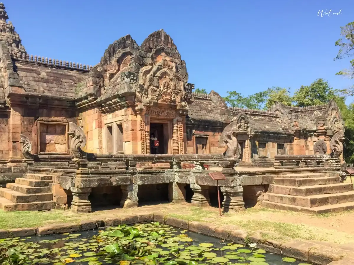
Open Days: Temporarily Closed To General Visitors
Opening Hours: No Public Visiting Hours During The Temporary Closure
Preah Vihear Temple, often known in Thai as Prasat Khao Phra Wihan, is a monumental Khmer sanctuary dedicated to Shiva. It stands on the Dangrek Mountains in Cambodia, directly beside the Thai border near Pha Mo E Daeng in Si Sa Ket Province. The temple is one of Southeast Asia’s most dramatic cliff-top heritage sites, but it is currently not open for general tourism. This article is written as a historical, cultural, and travel-planning guide for readers who want accurate context before visiting the area when official access is restored.
Preah Vihear Temple is one of the most significant Khmer monuments associated with the Thai-Cambodian border region. Although the temple itself is located in Cambodia, many Thai travelers know it through Si Sa Ket Province, especially through Pha Mo E Daeng in Khao Phra Wihan National Park. This dramatic cliff area on the Thai side offers a commanding view over the forested plains below and, when access is officially open, has long been one of the most important viewpoints connected with the temple. For foreign travelers, understanding Preah Vihear requires looking at both the archaeological site and the surrounding geography, because the temple’s meaning is inseparable from the mountain ridge on which it was built.
The temple is dedicated to Shiva, one of the principal deities of Hinduism, and its architectural plan reflects the sacred symbolism of a mountain sanctuary. Unlike many Khmer temples that are organized around a more compact east-west layout, Preah Vihear follows the natural line of the Dangrek Mountains. Its long axial plan rises gradually along the mountain slope, leading visitors through causeways, stairways, stone terraces, and successive entrance pavilions before reaching the main sanctuary near the cliff edge. This makes the journey through the temple feel ceremonial, as if the visitor is moving from the ordinary world toward a sacred summit.
The temple stands on the edge of a high escarpment overlooking the Cambodian plain. This spectacular setting is one reason why Preah Vihear is so different from many other Khmer temples in mainland Southeast Asia. It is not simply a stone monument placed on flat ground; it is a sacred complex designed in dialogue with the mountain itself. The ascent, the open stone walkways, the changing levels, and the sudden views across the landscape all work together to create a powerful sense of elevation. For travelers interested in ancient architecture, this relationship between temple and terrain is one of the site’s most important features.
Historically, the development of Preah Vihear took place over several phases of the Khmer Empire. Important construction activity began around the 10th century and continued through the 11th and 12th centuries. The temple reached a more complete form during the Angkorian period, particularly under royal patronage associated with kings such as Suryavarman II. These centuries were a high point of Khmer architecture, inscriptional culture, religious art, and state-sponsored temple building. Preah Vihear therefore represents not only a place of worship but also a statement of political power, sacred geography, and artistic ambition.
The temple complex stretches for roughly 900 meters along the mountain axis. Its most memorable elements include long stone causeways, naga stairways, multiple gopuras or entrance pavilions, open courtyards, and the main sanctuary. Each section marks a transition to a higher and more sacred level. When the site is open under normal conditions, visitors need time to walk through the complex properly, because the temple is not experienced as a single building. Its meaning is revealed gradually through movement, perspective, and the relationship between architecture and altitude.
The gopuras are among the most important architectural components of Preah Vihear. These entrance pavilions define the ceremonial sequence of the temple and frame the visitor’s movement from one level to the next. Their carved lintels, pediments, doorframes, and stone details reveal the skill of Khmer artisans and the religious imagination of the period. Even where the stone has weathered, the overall plan remains powerful enough to show how carefully the sanctuary was designed. The temple demonstrates how ancient Khmer builders could transform a difficult mountain location into an ordered sacred landscape.
One of the most striking aspects of the site is the way natural rock was incorporated into the route. The ancient builders did not completely separate the temple from the mountain; instead, they shaped existing stone surfaces into walkways and steps. This makes the approach to the main sanctuary feel physically and symbolically connected to the cliff. The higher one moves, the more the landscape opens, reinforcing the temple’s association with sacred elevation and the idea of a divine summit.
The Thai name “Khao Phra Wihan” combines the idea of a mountain with that of a sacred sanctuary, while the Khmer name “Preah Vihear” refers to a holy temple or sacred place. Both names point to the same essential character of the site: a religious monument inseparable from its mountain setting. For this reason, the temple is best understood not only as an archaeological ruin but also as a sacred landscape that reflects ancient beliefs about mountains, divinity, and royal authority.
In modern history, Preah Vihear has also been closely connected with Thai-Cambodian relations. In 1962, the International Court of Justice delivered its judgment in the Temple of Preah Vihear case, placing the temple under Cambodian sovereignty. In 2008, the temple was inscribed on the UNESCO World Heritage List for its Outstanding Universal Value. Because of its location and history, the site should be discussed with care and respect. Its deepest value lies in its cultural, historical, archaeological, and artistic importance, and it remains part of the shared heritage of the wider region.
For travelers on the Thai side, Pha Mo E Daeng is the most closely associated viewpoint. Located within Khao Phra Wihan National Park in Si Sa Ket Province, Pha Mo E Daeng is a red sandstone cliff overlooking the Cambodian plain. In normal periods of public access, visitors come here to see sunrise, mist, forest views, and the cliff-top landscape connected with the temple. The area is also important for its ancient low-relief carvings of three deities on the sandstone cliff face, as well as nearby twin stupas and other archaeological features.
Khao Phra Wihan National Park contains more than one point of interest. In addition to Pha Mo E Daeng, the area includes the low-relief carvings, twin sandstone stupas, Sra Traw, Khun Si Waterfall, Khun Si Cave, nature trails, and Prasat Don Tuan. These features show that the Thai side of the border landscape has its own natural and archaeological significance. The area combines forest, cliffs, water sources, local legends, ancient stone structures, and views across the border terrain. When access is restored, it can serve as an important cultural and nature-based destination in southern Isan.
Travel to the Thai-side area normally begins from Si Sa Ket city or Kantharalak District. From Bangkok, travelers usually drive via Saraburi, Nakhon Ratchasima, Highway 24, and Highway 221 toward Kantharalak before continuing to Khao Phra Wihan National Park. Another route begins from Ubon Ratchathani and passes through Warin Chamrap, Samrong, Benchalak, and Kantharalak. A private car or hired vehicle is the most practical option because the national park and cliff viewpoints are located away from major urban centers.
Getting There currently requires extra caution because the Pha Mo E Daeng area and the border zone are not open for general tourism. Travelers should not attempt to enter closed areas or approach restricted border zones. Before planning any visit, check official announcements from Khao Phra Wihan National Park, Thailand’s Department of National Parks, Si Sa Ket provincial authorities, and relevant security agencies. Until the area is officially reopened, the safest use of this guide is for historical reading, cultural learning, and future travel planning.
The strength of Preah Vihear as a heritage destination lies in the way it combines several layers of meaning. It is a Shiva sanctuary, a cliff-top Khmer architectural masterpiece, a ceremonial mountain route, a viewpoint over a vast landscape, and a site deeply connected with modern regional history. Visitors who study the temple plan before traveling will gain a much richer experience when access is restored, because each pavilion, courtyard, stairway, and terrace forms part of a carefully designed sacred progression.
For photographers and nature-focused travelers, Pha Mo E Daeng is especially memorable when it is open. The cliff, morning light, seasonal mist, forested valleys, and broad views toward the Cambodian plain create a visual identity unlike many other destinations in Thailand. The site also offers a useful way to understand border geography respectfully, as the mountain ridge, cliff line, and lowland plain clearly show how landscape shaped ancient movement, settlement, and temple construction.
Artistically, Preah Vihear shows the ability of Khmer builders to create a monumental stone sanctuary in a challenging environment. The carved lintels, pediments, doorframes, and sanctuary elements reflect Hindu religious symbolism and the high level of craftsmanship associated with the Angkorian world. The main sanctuary near the cliff is not only the highest point of the route in physical terms; it is also the symbolic climax of the temple. The experience of moving upward through the complex is central to understanding its design.
From a contemporary cultural perspective, Preah Vihear is a reminder that heritage sites require careful preservation, responsible interpretation, and respect for historical complexity. The temple is valuable not only to one nation but also to the broader cultural history of Southeast Asia. It preserves evidence of ancient belief systems, political authority, artistic exchange, and mountain-based sacred architecture. Presenting the site responsibly allows readers to appreciate its significance without reducing it to a border issue alone.
When official access is restored in the future, travelers should prepare carefully. Check the latest opening status, entry rules, park fees, border conditions, safety guidance, and transportation options before departure. Do not rely on old travel reviews or outdated fee information, because the status of the area can change according to security conditions. A safe and respectful visit begins with verified information and full compliance with official instructions.
Even while the site remains temporarily closed to general visitors, Preah Vihear continues to be an important subject for anyone interested in Thai-Cambodian history, Khmer civilization, southern Isan, sacred architecture, and UNESCO World Heritage. The temple helps readers understand that border regions are not merely political edges; they are landscapes filled with traces of travel, trade, faith, art, and cultural interaction. Preah Vihear therefore remains one of the most powerful heritage landscapes in mainland Southeast Asia, even when actual travel must wait for official reopening.
| Name | Preah Vihear Temple / Prasat Khao Phra Wihan |
| Location | Cambodia, on the Dangrek Mountains beside the Thai border near Pha Mo E Daeng, Kantharalak District, Si Sa Ket Province, Thailand |
| Address | Preah Vihear Province, Cambodia / Thai-side viewpoint area: Khao Phra Wihan National Park, Sao Thong Chai Subdistrict, Kantharalak District, Si Sa Ket Province |
| Coordinates | Approximately 14.3890, 104.6800 |
| Highlights | A cliff-top Khmer sanctuary about 900 meters long, featuring stone causeways, naga stairways, gopuras, courtyards, and a main sanctuary near the escarpment |
| History | Major development began around the 10th century and continued through the 11th and 12th centuries, reaching a more complete form during the Angkorian period associated with Suryavarman II |
| Name Origin | The Thai name Khao Phra Wihan links the mountain with a sacred sanctuary, while the Khmer name Preah Vihear refers to a holy temple or sacred place |
| Distinctive Features | The temple follows the mountain ridge, using natural rock surfaces as part of its ceremonial route and opening dramatic views over the Cambodian plain |
| Travel Information | From Bangkok, travel via Saraburi, Nakhon Ratchasima, Highway 24, and Highway 221 to Kantharalak. From Ubon Ratchathani, travel via Warin Chamrap, Samrong, Benchalak, and Kantharalak. Continue to Khao Phra Wihan National Park only when official access is reopened |
| Current Status | Temporarily closed to general tourism on both the Cambodian temple side and the Thai-side Pha Mo E Daeng area until official reopening announcements are issued |
| Open Days | Temporarily closed to general visitors |
| Opening Hours | No public visiting hours during the temporary closure |
| Fees | No general public access during the temporary closure. When the Thai national park area reopens, the Group 2 national park fee is Thai adult 40 THB, Thai child 20 THB, foreign adult 200 THB, and foreign child 100 THB |
| Facilities | Under normal operations, the Thai-side national park area has a visitor center, viewpoint, parking area, toilets, community shops, and park facilities. The Pha Mo E Daeng area is currently temporarily closed |
| Main Areas / Zones | Stone causeway and naga stairway, five gopuras, ceremonial courtyards, main sanctuary near the cliff, Pha Mo E Daeng viewpoint, low-relief carvings, twin stupas, Sra Traw, Khun Si Waterfall, Prasat Don Tuan |
| Caretaker | The temple is managed by the National Authority for Preah Vihear (NAPV), Cambodia. The Thai-side Pha Mo E Daeng area is managed by Khao Phra Wihan National Park under Thailand’s Department of National Parks, Wildlife and Plant Conservation |
| Main Contact Number | Khao Phra Wihan National Park, Tel. 045-826045 |
| Official Website / Official Page | https://napv.gov.kh/ and https://www.dnp.go.th/ |
| Nearby Tourist Attractions | 1. Pha Mo E Daeng, about 0 km 2. Pha Mo E Daeng Low-Relief Carvings, about 1 km 3. Twin Sandstone Stupas, about 1 km 4. Prasat Don Tuan, about 9 km 5. Sra Traw, about 2 km 6. Huai Khanun Reservoir, about 25 km |
| Nearby Restaurants | 1. Attalak Coffee, Kantharalak, about 34 km, Tel. 094-525-1926 2. Krua Fa Lang Fon, Kantharalak, about 35 km, Tel. 087-245-5116 3. Cafe Lang Ban, Kantharalak, about 36 km, Tel. 098-093-7878 4. Wasabi Kantharalak, about 36 km, Tel. 062-874-9224 5. Lotus's Eats Kantharalak, about 36 km, Tel. 095-205-4617 |
| Nearby Accommodations | 1. Phulda Resort, about 35 km, Tel. 045-662951 2. Sabaijai Resort Kantharalak, about 37 km, Tel. 081-600-3300 3. Kantharalak Palace / Prasopsuk Ville Hotel, about 36 km, Tel. 045-635-157 4. S.B. Hotel Kantharalak, about 38 km, Tel. 045-663-103 5. RC Resort, about 37 km, Tel. 090-823-6899 6. Katthaleeya Resort, about 36 km |
Frequently Asked Questions (FAQ)
Q: Is Preah Vihear Temple in Thailand or Cambodia?
A: The temple itself is located in Cambodia near the Thai border. The Thai-side viewpoint connected with the temple is Pha Mo E Daeng in Khao Phra Wihan National Park, Si Sa Ket Province.
Q: Is Preah Vihear Temple open to visitors now?
A: No. The temple and the Thai-side Pha Mo E Daeng area are temporarily closed to general tourism. Travelers should wait for official reopening announcements before planning a visit.
Q: Where can travelers view Preah Vihear Temple from the Thai side?
A: The main Thai-side viewpoint is Pha Mo E Daeng in Khao Phra Wihan National Park, Kantharalak District, Si Sa Ket Province, but access depends on official reopening status.
Q: Why is Preah Vihear Temple important?
A: It is a major Khmer Shiva sanctuary with an exceptional mountain-axis layout and was inscribed on the UNESCO World Heritage List in 2008 for its Outstanding Universal Value.
Q: How much is the entrance fee?
A: There is no general public access during the temporary closure. When the Thai national park area reopens, the Group 2 national park fee is 40 THB for Thai adults, 20 THB for Thai children, 200 THB for foreign adults, and 100 THB for foreign children.
Q: When is the best time to visit Pha Mo E Daeng after reopening?
A: Early morning is best for sunrise and cliff views. The rainy season to early cool season may bring mist, but travelers should always check weather and official park announcements first.
Q: How can travelers reach the Thai-side area from Bangkok?
A: Drive from Bangkok via Saraburi, Nakhon Ratchasima, Highway 24, and Highway 221 toward Kantharalak District in Si Sa Ket, then continue to Khao Phra Wihan National Park only when access is officially reopened.
Q: What should travelers prepare before visiting the area?
A: Check the latest official access status, prepare personal documents, wear comfortable walking shoes, bring drinking water, and strictly follow the instructions of park and security officers because the area is located near the border.
 Category: ●Art, Culture and Heritage
 Group: ●Historical Sites and Monuments
Last Update : 2 MonthAgo
 Last Update : 2 MonthAgo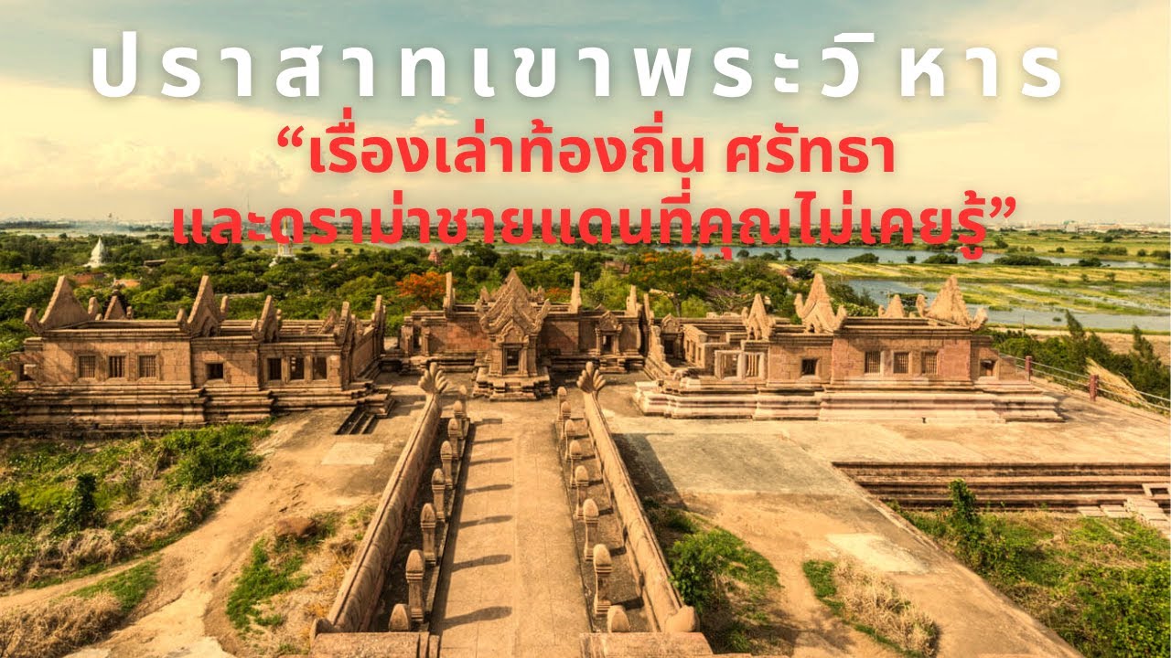
 Click to Access the Navigation Map GPS
Prasat Khao Phra Wihan (Preah Vihear) Map
 Historical Sites and Monuments(12)
 Landmarks and Memorials(1)
 Art, Craft Centres, Tradition(8)
 Places of Worship
 Temple(13)
 Other Sacred Sites(3)
 Suburban Living
 Village, Community(2)
 Nature and Wildlife
 National Parks and Marine Reserves(2)
 Dam, Reservoir, Lake(7)
 Waterfalls(5)
 River, Canal(5)
 Bays and Beaches(2)
 Entertainment and Agricultural
 Zoos and Aquariums(1)
 Farms, Parks and Ecotourism(3)


