
lovethailand home >South Travel Attractions >Ranong Travel Attractions >Muang Ranong >Ngao > Hat Sai Dam
TL;DR: Hat Sai Dam is located at Moo 5, Ban Ko Hat Sai Dam, Ngao Subdistrict, Mueang Ranong District, Ranong Province 85000, Thailand, open Daily, hours 24 Hours.
Hat Sai Dam
Open Days: Daily
Opening Hours: 24 Hours
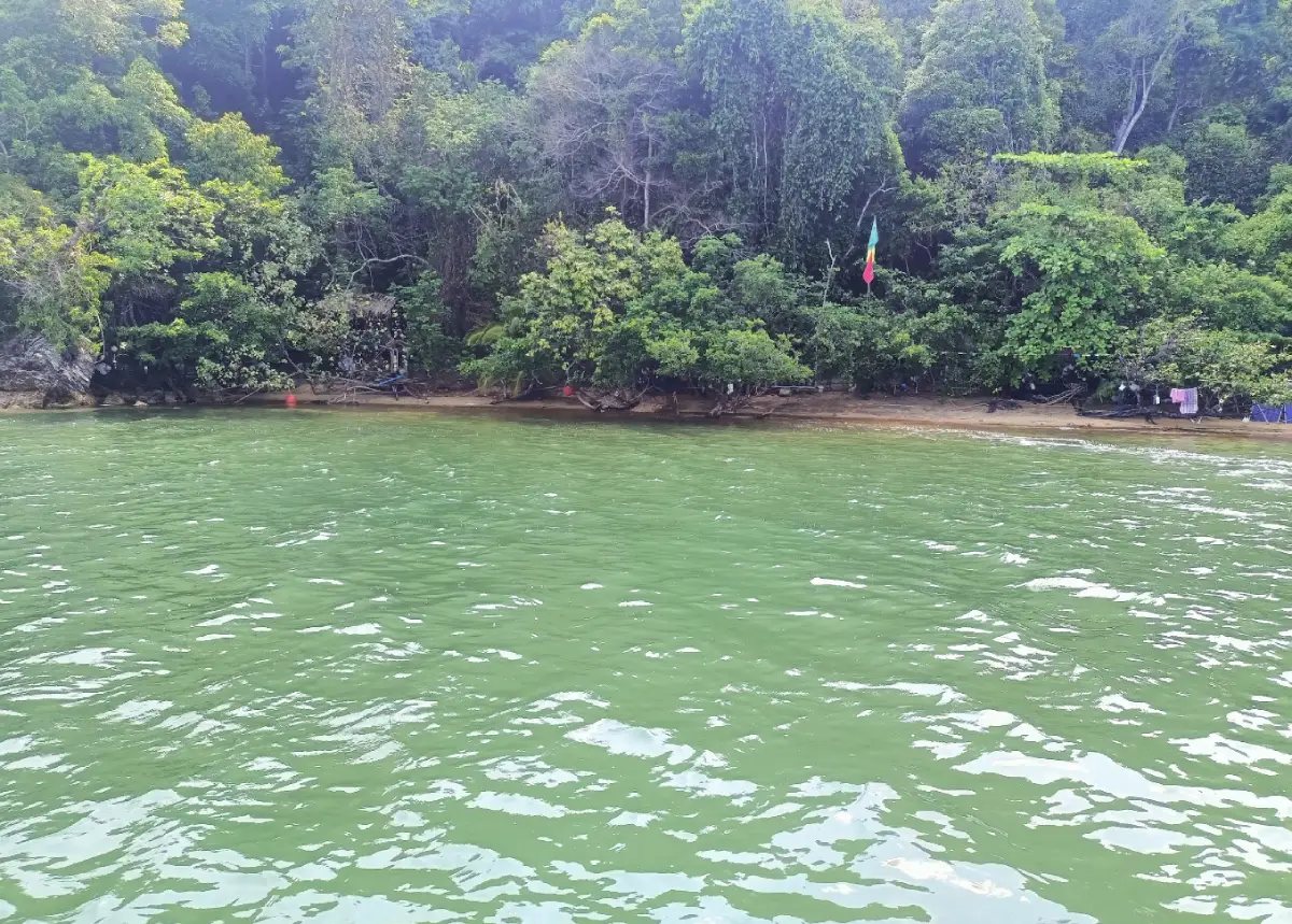
Hat Sai Dam in Ranong Province, also connected with the names Ko Hat Sai Dam and Ko Sai Dam, is a distinctive eco-tourism destination in Ngao Subdistrict, Mueang Ranong District. The site is known for its unusual black shoreline, mangrove ecosystem at Laem Makham, traditional fishing community, coastal waterways, and community-based tourism activities. The black beach was formed by the long-term accumulation of soil, wood fragments, and organic material carried by the sea, creating a broad dark shoreline that looks very different from typical sandy beaches in southern Thailand.
Hat Sai Dam is best understood as a nature and community destination rather than a conventional swimming beach. Visitors come here to walk along the black-sand shoreline, explore mangrove scenery, learn about local fisheries, take a community boat, taste local seafood, and stay in a simple homestay. The strength of the destination is not luxury or heavy development; it is the close relationship between the sea, mangrove forest, tides, and people who have lived with this coastal landscape for generations.
Ko Hat Sai Dam is located at Moo 5, Ngao Subdistrict, Mueang Ranong District, Ranong Province. The island lies on the Andaman coast south of Ranong town, about 25 kilometers from the provincial center. The island contains hills, residential areas, farming plots, mangrove forest, and coastal areas. The local community is a long-established fishing community whose way of life remains closely tied to the sea, boats, tides, and small-scale coastal fisheries.
The black sand is the most visually striking feature of the area. It was created naturally when sediment, soil, wood fragments, and organic matter were carried and deposited along the beach over time. This process changed the character of the shoreline and gave the island its present name. Walking near the beach allows visitors to observe how water movement, tides, and coastal sediment shape a landscape that continues to change slowly through natural processes.
Laem Makham is an important part of Ko Hat Sai Dam. It has a well-preserved mangrove ecosystem and a nature trail of about 4 kilometers. Mangroves function as nursery areas for aquatic animals, feeding grounds for birds and coastal wildlife, and natural protection against waves and erosion. For travelers, the mangrove route offers a direct way to understand how forests, soil, brackish water, and the sea work together in a coastal ecosystem.
Hat Sai Dam is also connected with Mu Ko Ranong National Park and the wider island landscape of Ranong Province. The near-shore island group includes areas such as Ko Bang Chak, Ko Yio, Ko Sai Dam, and Ko Son, while farther islands include Ko Chang, Ko Phayam, Ko Thalu, Ko Ta Khrut, Ko Mo, Ko Pring, Ko Rai, and Ko Fai Mai. This context helps explain why the area is ecologically valuable, with mangroves, islands, reefs, fishing communities, and Andaman coastal habitats existing close together.
The history of Ban Ko Hat Sai Dam community is also significant. Local accounts describe the area as having been discovered before World War II by a Chinese family looking for a place to settle. They found that the island had freshwater sources and abundant marine resources, so they established homes and began coastal fishing. Over time, people from different backgrounds settled on the island, creating a mixed community of Thai Buddhists and Thai Muslims who lived simply and relied on nature.
The island was formerly known locally as Ko Kang. Around several decades ago, soil and wood fragments from the sea accumulated heavily along the shoreline, turning a wide section of the beach black. The community then began calling the place Ko Hat Sai Dam, meaning Black Sand Beach Island. The name preserves both a natural phenomenon and the local memory of coastal change.
Main activities include walking on the black-sand beach, exploring the Laem Makham mangrove route, taking a boat through the coastal waterway, learning about traditional fishing, observing small boat repair, seeing how shrimp paste is made from krill, and eating fresh seafood prepared by the community. Travelers who enjoy slow travel will benefit most from this destination because many of its details appear through observation rather than quick sightseeing.
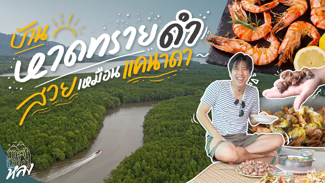
Traditional fishing is central to the identity of Ko Hat Sai Dam. Local people use small-scale methods such as shrimp nets, fish nets, crab nets, fish traps, squid traps, shellfish gathering, and coastal seafood collection. Community tourism allows visitors to learn directly from residents rather than seeing the island only as scenery. Meals on the island are therefore part of the cultural experience, reflecting real ingredients and local knowledge.
Ao Po, on the southern side of the island, is another appealing area. It is a quiet bay with attractive mangrove scenery and a calm coastal atmosphere. Together with Laem Makham, the black beach, and the community area, Ao Po makes the visit more varied. Travelers can experience the beach, forest, fishing life, and sheltered bay within the same island trip.
The surrounding mangrove environment is part of Ranong’s wider ecological importance. Ranong is known for extensive and fertile mangrove systems, with waterways that flow toward the sea and support high biodiversity. Mangroves protect shorelines, trap sediment, serve as nursery grounds for marine life, and sustain local fisheries. A visit to Hat Sai Dam therefore gives travelers a practical understanding of why mangrove conservation matters to coastal communities.
Tides strongly influence the experience at Hat Sai Dam. At low tide, more of the black shoreline, mudflat, small crab traces, shellfish areas, and coastal textures can be observed. At high tide, the sea and mangrove atmosphere become more prominent. Visitors who want to walk the beach, study mangroves, or join fishing-related activities should coordinate with the community in advance so the schedule matches tide and boat conditions.
Nighttime nature activities, including firefly viewing or evening boat trips when available, require advance arrangement with the community. Safety, tides, weather, darkness, and ecological protection must all be considered. Visitors should use only minimal light, avoid loud noise, and never catch insects or disturb wildlife along the mangrove and waterway areas.
To reach Ko Hat Sai Dam, travelers usually start from Ranong town or Ranong Bus Terminal, travel about 14 kilometers to Ban Tha Chang, continue by local vehicle for about 3 kilometers to Tha Ton Son Pier, and then take a community or fishing boat to the island. The boat trip takes about 35 minutes. Advance contact with the community helps arrange the boat, local guide, meals, activities, and homestay stay if needed.
Getting There by private car is practical. From Ranong town, follow the main road toward Ngao Subdistrict and Ban Tha Chang, then continue to Tha Ton Son Pier. From there, take a community boat to Ko Hat Sai Dam. Starting the trip in the morning is recommended so visitors have enough time for the beach, mangrove route, community activities, and return journey without rushing.
Travelers without a private vehicle can use the Ranong – Tha Chang local route, continue by smaller local transport to Tha Ton Son Pier, and then travel by boat to the island. Return transport should be planned in advance because boat and local vehicle availability depends on coordination, tide, weather, and community arrangements. Travelers who want a deeper experience can stay overnight in a community homestay.
Staying overnight on Ko Hat Sai Dam gives visitors a fuller understanding of local life. Homestays are simple and community-oriented, usually centered on local meals and nature-based activities. Visitors may learn about fishing tools, boat work, seafood preparation, tide-based routines, and stories of the island from residents. This kind of stay differs from a resort experience because it is built around real community life.
A day trip is possible if the boat schedule is arranged well. A useful plan is to leave Ranong in the morning, travel to Tha Ton Son Pier, take the boat to Ko Hat Sai Dam, walk the black beach, explore the mangrove area, have a local meal, and return to the mainland in the afternoon or early evening. Travelers who want night nature activities or a slower community experience should stay overnight.
Visitors should bring shoes suitable for wet ground and muddy areas, sun protection, light clothing that dries easily, drinking water, insect repellent, a waterproof bag, and a camera. Those joining fishing or mangrove activities should wear clothes that can get wet or muddy. The trip is more comfortable when visitors prepare for sun, humidity, boat travel, and tide-based activities.
Responsible travel is essential. Visitors should not remove black sand, dig into the beach, disturb small animals, leave waste, or walk outside the route recommended by local guides. The black shoreline and mangroves are sensitive natural systems. Respecting the site helps preserve both the ecosystem and the community-based tourism model.
Hat Sai Dam is suitable for nature lovers, photographers, families, community-based tourism travelers, seafood lovers, and visitors who want to see a deeper side of Ranong beyond hot springs and popular islands. It is not designed for visitors seeking a heavily developed beach resort. Its value lies in its rare black shoreline, mangrove ecology, fishing culture, boat journey, and quiet island atmosphere.
The destination can be combined with the Ranong Mangrove Research and Technology Transfer Center, Phu Khao Ya, Ngao Waterfall, Mu Ko Ranong National Park, Ko Phayam, and Ko Chang Ranong. These nearby places create a broader route that includes mangrove forest, mountains, waterfalls, islands, fishing communities, and Andaman coastal scenery.
Overall, Hat Sai Dam is one of Ranong’s most meaningful eco-tourism destinations. It is not impressive because of large-scale development, but because it preserves a rare black-sand beach, a strong mangrove system, and a fishing community that still lives with the rhythm of the sea. Travelers who want to understand Ranong through ecology and local life should include Ko Hat Sai Dam in their itinerary.
| Name | Hat Sai Dam / Ko Hat Sai Dam |
| Location | Moo 5, Ban Ko Hat Sai Dam, Ngao Subdistrict, Mueang Ranong District, Ranong Province 85000, Thailand |
| Address | Ban Ko Hat Sai Dam community and black-sand beach area on Ko Sai Dam, Ngao Subdistrict, Mueang Ranong District, Ranong Province |
| Reference Coordinates For Travel | 9.76367, 98.51185 near Ban Ko Sai Dam Na Nok |
| Highlights | Black-sand shoreline formed by natural sediment, Laem Makham mangrove forest, community nature trail, traditional fishing life, seafood, and community homestays |
| History | A long-established island fishing community formerly known locally as Ko Kang before becoming widely known as Ko Hat Sai Dam because of its black shoreline |
| Name Origin | The name comes from the black beach created by long-term accumulation of soil, wood fragments, and organic material carried by the sea |
| Distinctive Features | The island has hills, residential areas, farming land, mangrove forest, and a broad black-sand beach connected with local fishing life |
| Travel Information | From Ranong Bus Terminal, travel about 14 km to Ban Tha Chang, continue about 3 km to Tha Ton Son Pier, then take a community boat for about 35 minutes to Ko Hat Sai Dam |
| Current Status | Open as a community-based eco-tourism destination and traditional fishing-life learning area in Ngao Subdistrict |
| Open Days | Daily |
| Opening Hours | 24 Hours; community activities and boat trips should be arranged in advance |
| Fees | Mu Ko Ranong National Park fee: Thai adult 40 THB, Thai child 20 THB; foreign adult 200 THB, foreign child 100 THB |
| Facilities | Community boats, community-guided activities, homestays, local meals, mangrove nature route, and traditional fishing learning activities |
| Main Areas / Zones | 1. Black-sand beach area 2. Ban Ko Hat Sai Dam community 3. Laem Makham mangrove forest 4. Nature trail of about 4 km 5. Ao Po and the southern coastal area of the island |
| Caretaker / Tourism Group | Ban Ko Hat Sai Dam Community-Based Tourism Group, Ngao Subdistrict, Mueang Ranong District, and Mu Ko Ranong National Park |
| Main Contact Number | Ban Ko Hat Sai Dam Community-Based Tourism Group, Tel. 097-005-6188, 096-635-6550; Ban Hat Sai Dam Community, Tel. 081-968-7004; Mu Ko Ranong National Park, Tel. 077-880-438 |
| Official Website / Official Page | Ban Ko Hat Sai Dam Community-Based Tourism Facebook page and Mu Ko Ranong National Park tourism information |
| Nearby Tourist Attractions | 1. Laem Makham, about 1 km 2. Ao Po, about 2 km 3. Ranong Mangrove Research And Technology Transfer Center, about 18 km 4. Phu Khao Ya, about 20 km 5. Ngao Waterfall, about 23 km 6. Ko Phayam, about 25 km |
| Nearby Restaurants | 1. Local Homestay Meals At Ban Ko Hat Sai Dam Community, about 1 km 2. Roti Nisara, Ngao, about 18 km 3. Tin Cafe Ngao, about 19 km, Tel. 065-403-5959 4. Isan Ban Hao Ngao, about 20 km, Tel. 089-170-5147, 065-123-2963 5. Khun Lin Restaurant, about 30 km, Tel. 077-822-863, 081-892-3455 6. FarmHouse Restaurant Ranong, about 31 km, Tel. 087-278-4224 |
| Nearby Accommodations | 1. Ban Ko Hat Sai Dam Community Homestay, about 1 km 2. Mee Farm Sook Hostel, about 18 km, Tel. 085-928-2469 3. The White Village Ranong Resort, about 20 km, Tel. 089-117-9624, 077-828-698, 082-729-9229 4. Siamese Tin Park Ranong, about 20 km, Tel. 062-445-3509 5. Baroque Boutique Resort, about 21 km, Tel. 065-496-2239, 065-493-2642 6. Greenish Hotel Ranong, about 28 km, Tel. 088-995-6359 |
Frequently Asked Questions (FAQ)
Q: Where is Hat Sai Dam in Ranong located?
A: Hat Sai Dam is located at Ban Ko Hat Sai Dam, Moo 5, Ngao Subdistrict, Mueang Ranong District, Ranong Province. It is an island community and eco-tourism destination on the Andaman coast.
Q: Why is Hat Sai Dam special?
A: It is known for its black-sand shoreline formed by natural sediment, Laem Makham mangrove forest, and traditional fishing life of the island community.
Q: How do travelers get to Hat Sai Dam?
A: Travelers can go from Ranong town to Ban Tha Chang, continue to Tha Ton Son Pier, and then take a community boat to Ko Hat Sai Dam. The boat trip takes about 35 minutes.
Q: Is Hat Sai Dam suitable for swimming?
A: Hat Sai Dam is better for nature walks, mangrove study, photography, and community-based tourism than swimming because the area is shaped by tides, mangroves, mudflats, and coastal ecology.
Q: What activities are available at Hat Sai Dam?
A: Visitors can walk along the black beach, explore Laem Makham mangroves, take a boat trip, learn traditional fishing, see shrimp paste production, visit Ao Po, and stay in a community homestay.
Q: Should travelers contact the community before visiting?
A: Yes. Advance contact is recommended for boat arrangements, local guides, meals, tide-based activities, and homestay stays.
Q: What should visitors bring to Hat Sai Dam?
A: Visitors should bring shoes suitable for wet ground, quick-dry clothing, sun protection, drinking water, insect repellent, a waterproof bag, and a camera.
Q: What nearby places can be combined with Hat Sai Dam?
A: Travelers can combine the visit with Laem Makham, Ao Po, the Ranong Mangrove Research And Technology Transfer Center, Phu Khao Ya, Ngao Waterfall, and Ko Phayam.
 Category: ●Nature and Wildlife
 Group: ●Bays and Beaches
Last Update : 2 MonthAgo
 Last Update : 2 MonthAgo
 Click to Access the Navigation Map GPS
Hat Sai Dam Map
Recommend

 Art, Culture and Heritage
 Historical Sites and Monuments(4)
 Landmarks and Memorials(1)
 Royal Palace(1)
 Art, Craft Centres, Tradition(4)
 Educational Places
 Educational Gardens, Farm(1)
 Places of Worship
 Temple(12)
 Other Sacred Sites(2)
 Suburban Living
 Village, Community(2)
 National Parks and Marine Reserves(6)
 Mountain (Doi)(4)
 Waterfalls(15)
 Hot Springs(3)
 Caves(4)
 River, Canal(2)
Bays and Beaches(10)
 Islands(8)
 Other natural attractions(3)
 Travel Articles, Recipes
 Travel Review, Food Review(1)


