
lovethailand home >Eastern Travel Attractions >Sa Kaeo Travel Attractions > 20 Best Places to Visit in Sa Kaeo Updated for 202..
TL;DR: 20 Best Places to Visit in Sa Kaeo Updated for 2027.
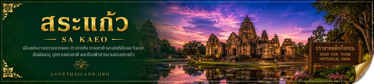
20 Best Places to Visit in Sa Kaeo Updated for 2027
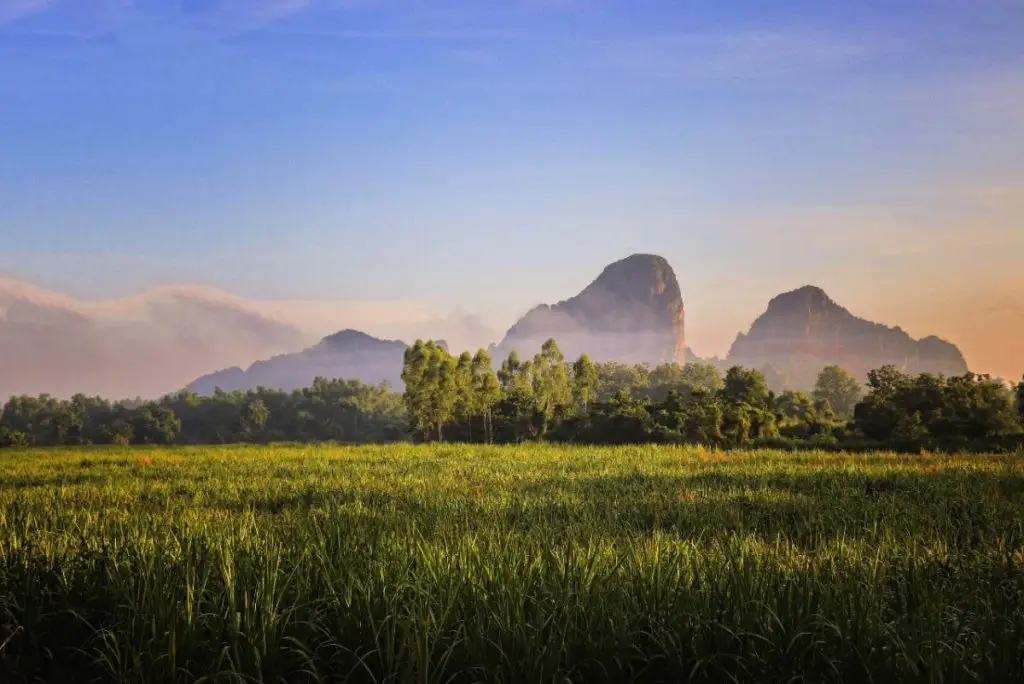
20 Best Places to Visit in Sa Kaeo — Updated for 2027 Sa Kaeo is a border province in eastern Thailand with much more to offer than the familiar image of Rong Kluea Market and the Aranyaprathet border crossing. Within one province, travelers can explore national parks, eastern forests, waterfalls, limestone mountains, reservoirs, Khmer ruins, border towns, important temples, historical sites, and agricultural communities. From Bangkok, Sa Kaeo can be comfortably planned as a 2–3 day trip, while travelers with more time can divide the province into zones and experience its natural, historical, and cross-border cultural character in greater depth.
For a first visit to Sa Kaeo, one of the easiest routes starts in Sa Kaeo town with Sa Kaeo–Sa Khwan, then continues to Tha Krabak Reservoir and Pang Sida National Park. Another route heads through Watthana Nakhon before continuing to Aranyaprathet for Rong Kluea Market, Prasat Khao Noi Si Chomphu, and the atmosphere of Thailand’s eastern border. Travelers with an extra day can add Sdok Kok Thom Sanctuary, Lalu, and Ta Phraya National Park in the northern and eastern parts of the province.
The heart of nature tourism in Sa Kaeo is Pang Sida National Park, a vast forest connected to the wider eastern forest ecosystem. It features waterfalls, nature trails, viewpoints, birdwatching areas, and the seasonal butterfly phenomenon that has become one of the province’s best-known natural attractions. Ta Phraya National Park offers a different landscape, with border forest and terrain associated with the Dongrek mountain system, making it suitable for travelers interested in serious nature exploration and large connected forest ecosystems.
Sa Kaeo is also particularly important for history and archaeology. Several Khmer sites survive across the province, most notably Sdok Kok Thom Sanctuary, one of Thailand’s most important Khmer religious monuments. Prasat Khao Noi Si Chomphu stands on a hill near the border, while Prasat Muang Phai and other archaeological remains show that Sa Kaeo once occupied an important position along ancient routes linking eastern Thailand with the Khmer world.
Aranyaprathet deserves at least half a day to a full day. Rong Kluea Market is both a major shopping area and a place where the Thai–Cambodian border economy can be clearly observed. Its mix of nationalities, merchandise, transport activity, and cross-border trade gives Aranyaprathet an identity very different from an ordinary provincial town.
For travelers looking for unusual natural landscapes, Lalu in Ta Phraya District was formed through the natural erosion of soil, creating earth pillars, cliffs, and distinctive formations. Khao Chakan, meanwhile, is a dramatic limestone mountain rising from the surrounding plain, with Wat Tham Khao Chakan serving as both a religious center and an important nature stop.
Food in Sa Kaeo reflects the character of a border province. Aranyaprathet and the Rong Kluea area offer Thai food, local dishes, and influences from Cambodian and other ethnic communities, while Sa Kaeo town, Watthana Nakhon, and Khao Chakan have local restaurants and family-style dining that work well as stops between forests, historical sites, and border attractions.
Accommodation should be chosen according to the route. Travelers focusing on Pang Sida National Park, Sa Kaeo town, and Tha Krabak Reservoir can reduce driving time by staying in Sa Kaeo town. Those focusing on Rong Kluea Market, Prasat Khao Noi Si Chomphu, and attractions around Aranyaprathet should stay in Aranyaprathet. Trips covering Ta Phraya, Lalu, and Ta Phraya National Park require more travel time because these areas are farther from the provincial center.
The late rainy season through the beginning of the cool season is especially suitable for forests, reservoirs, and outdoor attractions because the landscape is greener and temperatures are more comfortable. Before visiting national parks, waterfalls, caves, or border areas, travelers should check current announcements from the responsible authorities, as weather, water levels, trail conditions, and border regulations can change.

1. Pang Sida National Park is one of the most important watershed forests in eastern Thailand. It extends across several districts of Sa Kaeo Province and continues into neighboring Prachin Buri. The landscape includes evergreen forest, dry dipterocarp forest, mountains, streams, waterfalls, and natural grasslands that support a rich variety of wildlife and bird species.
Highlights: Pang Sida Waterfall, seasonal butterfly gatherings during the early rainy season, nature trails, viewpoints, birdwatching, and the biodiversity of eastern Thailand’s forest ecosystem.
One of Pang Sida’s best-known natural phenomena occurs when large numbers of butterflies gather on moist ground to absorb minerals under suitable weather conditions. This makes the park especially popular with nature photographers and butterfly enthusiasts. The forest is also home to wildlife including wild elephants, gaur, deer, barking deer, and numerous bird species.
Pang Sida Waterfall is located relatively close to the park headquarters and is one of the easiest attractions to reach. Travelers who want to explore farther can follow nature trails, viewpoints, and additional waterfall routes that are opened by the park according to seasonal conditions. Visitors should follow all instructions from park officials when entering natural areas.
Getting There: From Sa Kaeo town, travel toward Tha Yaek Subdistrict and continue to Pang Sida National Park. Private vehicles provide convenient access. The main visitor area is generally open daily from 06:00–16:30, although certain routes may be restricted due to weather or park announcements.

2. Ban Khlong Luek Border Market (Rong Kluea Market) is a major border market in Tha Kham Subdistrict, Aranyaprathet District, close to the Thai–Cambodian border. It is one of the clearest places to experience Sa Kaeo’s role as an important center of cross-border trade.
Highlights: Large border market, clothing and footwear, second-hand goods, household products, souvenirs, food, and the multicultural atmosphere of Thai–Cambodian border commerce.
The name “Rong Kluea,” meaning “salt warehouse,” comes from the area’s earlier use as a storage point for salt before it developed into a major border-trading center. Today the market contains several commercial zones and a large number of shops selling clothing, shoes, bags, household goods, decorative items, dry food, and imported merchandise.
The attraction of Rong Kluea is not limited to shopping. The market also offers a close view of border life, with multiple languages, goods in transit, and people moving between communities on both sides of the frontier. Travelers who want to explore the market properly should allow at least half a day and arrive in the morning.
Getting There: From central Aranyaprathet, follow Highway 33 toward Ban Khlong Luek and the border area for about 6 kilometers. The market operates daily, with many shops opening early in the morning and gradually closing during the afternoon.

3. Sdok Kok Thom Sanctuary is located at Ban Nong Samet in Khok Sung District and is one of the most important Khmer monuments in eastern Thailand. The site provides significant evidence for understanding the history, religion, and political organization of the ancient Khmer Empire.
Highlights: Large Khmer sanctuary, classical Khmer temple layout, central sanctuary tower, libraries, gallery enclosure, moat, and inscriptions of major importance to Khmer historical studies.
The sanctuary was constructed according to Hindu religious concepts. Its buildings are arranged along a principal axis, with the central sanctuary occupying the innermost area and surrounded by associated structures and enclosing walls. Walking from the outer area toward the center reveals the cosmological ideas that shaped Khmer religious architecture.
Sdok Kok Thom is also particularly important because of inscriptions associated with the history of the Khmer royal court and succession of Khmer kings. The site is therefore much more than a photography stop and deserves enough time to explore its architecture, layout, and archaeological context.
Getting There: Travel to Ban Nong Samet, Khok Sung Subdistrict, Khok Sung District. Private vehicles provide convenient access. The sanctuary is open daily from 08:30–16:30.

4. Lalu is located around Ban Noen Kham and Ban Khlong Yang in Thap Rat Subdistrict, Ta Phraya District. This unusual natural landscape was created by the long-term erosion of soil by water, wind, and weather, producing earth pillars, earthen cliffs, and formations of many different shapes.
Highlights: Natural earth formations, unusual soil pillars, erosion landscapes, photography opportunities, and the rural scenery of Ta Phraya District.
The local name “Lalu” refers to the appearance of soil that has eroded or opened apart. The formations continue to change gradually through natural processes, meaning the landscape can look slightly different over time.
Morning and late afternoon are particularly good for photography because side lighting emphasizes the depth and texture of the earth cliffs and pillars. Visitors should avoid climbing on fragile formations or stepping on unstable areas in order to help preserve the landscape.
Getting There: From Ta Phraya District, travel toward Thap Rat Subdistrict and continue to Ban Noen Kham and Ban Khlong Yang. Drive carefully on the final approach, particularly after rainfall when local roads may be more difficult.
Map (GPS):Open Directions to Lalu

5. Wat Tham Khao Chakan is an important religious site at the limestone mountain of Khao Chakan, which rises dramatically from the surrounding plain. Natural caves, limestone cliffs, and large trees give the site both spiritual and natural significance.
Highlights: Limestone mountain, natural caves, sacred areas, hill paths, monkeys, and large flights of bats emerging from the caves in the evening.
The temple area contains several caves and rock openings that are used for religious purposes and worship. Visitors can explore the landscape around Khao Chakan while enjoying the shade of mature trees growing around the base of the mountain.
One of the most distinctive sights at Khao Chakan occurs around dusk, when large numbers of bats leave the caves and form long streams across the evening sky. Visitors who want to see this natural spectacle should plan their timing carefully and avoid disturbing the animals.
Getting There: The temple is located in Khao Chakan District. From Sa Kaeo town, follow Highway 317 toward Wang Nam Yen. It is open daily from 08:30–18:30.
Map (GPS):Open Directions to Wat Tham Khao Chakan

6. Ta Phraya National Park lies around Thap Rat Subdistrict in Ta Phraya District and protects an extensive forest area along the Thai–Cambodian border. It forms part of a larger connected forest landscape of ecological importance to eastern and northeastern Thailand.
Highlights: Border forest, Dongrek mountain landscape, dry dipterocarp forest, natural viewpoints, forest trails, and wildlife diversity.
The park includes forest, upland terrain, mountain ridges, and sections of exposed rock, creating a landscape different from Pang Sida. From the late rainy season into the cool season, the forest is greener, temperatures are more comfortable, and conditions are generally better for nature exploration.
Because parts of the park lie close to the international border, access to some areas may depend on current official announcements and local conditions. Travelers should remain within designated areas and follow all instructions from park officials.
Getting There: The park headquarters is located at Moo 5, Thap Rat Subdistrict, Ta Phraya District. Private vehicles are the most practical way to reach the area. The park is generally open daily from 08:00–16:30.

7. Sa Kaeo (Sa Khwan) is an important landmark in the center of Sa Kaeo town and is directly connected with the name of the province. The site contains two ponds known as Sa Kaeo and Sa Khwan within a public park area.
Highlights: Twin ponds associated with the province’s name, public park, recreation area, and a convenient starting point for discovering Sa Kaeo town.
Sa Kaeo and Sa Khwan form part of local historical tradition and later became associated with the name of Sa Kaeo Province. The site therefore carries symbolic importance beyond its role as an ordinary public park.
The surrounding area is suitable for walking, exercise, and relaxation. It can be used as either the first or final stop on a town itinerary before continuing to Tha Krabak Reservoir, Pang Sida National Park, or other nearby attractions.
Getting There: The ponds are located within Sa Kaeo–Sa Khwan Public Park on Suwannason Road in Sa Kaeo Subdistrict, Mueang Sa Kaeo District. The area is open daily from 06:00–18:00.
Map (GPS):Open Directions to Sa Kaeo (Sa Khwan)

8. Prasat Khao Noi Si Chomphu is an ancient Khmer monument on the summit of Khao Noi Si Chomphu in Khlong Nam Sai Subdistrict, Aranyaprathet District. Located close to the Thai–Cambodian border, it is an important archaeological site illustrating settlement and cultural influence in the Sa Kaeo region since ancient times.
Highlights: Khmer sanctuary on a hilltop, ancient architectural remains, border-region viewpoints, and an archaeological setting surrounded by nature.
The climb to the sanctuary allows visitors to see both the ancient remains and the wider landscape around Aranyaprathet. The site originally consisted of several structures, and surviving remains still allow visitors to study aspects of the architectural design and layout of an ancient religious complex.
The site is especially suitable for travelers interested in Khmer history and can be combined with Rong Kluea Market, Aranyaprathet town, or Prasat Muang Phai in the same day. Visitors should allow enough time for the uphill walk and exploration of the site.
Getting There: Prasat Khao Noi Si Chomphu is located on Khao Noi Si Chomphu in Khlong Nam Sai Subdistrict, Aranyaprathet District. Private vehicles can reach the base area before visitors continue on foot to the archaeological site.

9. Phra Prong Reservoir is located in Chong Kum Subdistrict, Watthana Nakhon District. This large reservoir serves an important irrigation function while also providing a peaceful natural recreation area surrounded by forest and mountains.
Highlights: Large reservoir, mountain views, waterbirds, boating, fishing, sunset views, and a quiet natural setting connected with the wider Pang Sida forest landscape.
The reservoir provides habitat for several species of waterbirds and forest birds, particularly around areas where tree trunks and branches rise above the water. These features create a distinctive landscape that attracts birdwatchers and nature photographers.
Morning and late afternoon are the best times for enjoying the scenery because temperatures are cooler and sunlight reflects beautifully across the water. The reservoir can be included on the same route as Watthana Nakhon or attractions associated with the Pang Sida forest area.
Getting There: Phra Prong Reservoir is located in Chong Kum Subdistrict, Watthana Nakhon District. It can be reached by private vehicle from Watthana Nakhon. The area is open daily from 06:00–18:00.
Map (GPS):Open Directions to Phra Prong Reservoir

10. Tha Krabak Reservoir is located in Tha Yaek Subdistrict, Mueang Sa Kaeo District. This large reservoir was developed as part of a water-resource project supporting agriculture and community water use, while the surrounding area has also become a peaceful place for recreation and enjoying natural scenery.
Highlights: Approximately 720-meter earth dam, broad reservoir views, viewpoints, picnicking, cycling, jogging, and mountain scenery near the Pang Sida area.
From the top of the dam, visitors can enjoy wide views across the reservoir and surrounding mountains. Morning and evening are particularly pleasant for walking or cycling because temperatures are cooler, while mature trees and green areas around the reservoir provide a calm atmosphere for relaxation.
Tha Krabak Reservoir works especially well as a stop before or after visiting Pang Sida National Park because both attractions lie along the same general route. Travelers with only one day can combine Sa Kaeo town, the reservoir, and Pang Sida without excessive backtracking.
Getting There: From Sa Kaeo town, follow Highway 317 toward Wang Nam Yen for about 25 kilometers, then turn onto a local road toward Tha Yaek Subdistrict for approximately another 7 kilometers. The reservoir is open daily from 06:00–18:00.
Map (GPS):Open Directions to Tha Krabak Reservoir

11. Prasat Muang Phai is located at Ban Muang Phai in Muang Phai Subdistrict, Aranyaprathet District. This archaeological site adds another layer to Sa Kaeo’s ancient history beyond Sdok Kok Thom Sanctuary and Prasat Khao Noi Si Chomphu, showing that the Aranyaprathet area once formed part of a wider network of ancient settlements and religious sites influenced by Khmer culture.
Highlights: Khmer archaeological remains in Aranyaprathet, traces of ancient structures, laterite and brick construction, and links to historical routes connecting eastern Thailand with the Khmer world.
Although Prasat Muang Phai is smaller than Sdok Kok Thom, its importance lies in its role as evidence of an ancient settlement network in the border region. Travelers interested in archaeology can combine the site with Prasat Khao Noi Si Chomphu and Rong Kluea Market to see how the Aranyaprathet area developed from an ancient cultural landscape into a modern border town.
Visitors should take time to examine the surviving foundations, construction remains, and surrounding landscape without rushing. Climbing on or touching fragile archaeological structures should be avoided in order to help preserve the site.
Getting There: Prasat Muang Phai is located in Ban Muang Phai, Muang Phai Subdistrict, Aranyaprathet District. It can be reached by private vehicle from central Aranyaprathet. The site is open daily from 08:30–16:00.
Map (GPS):Open Directions to Prasat Muang Phai

12. Aranyaprathet Victory Gate is an important landmark at Ban Khlong Luek in Tha Kham Subdistrict, Aranyaprathet District, close to the Thai–Cambodian border. It lies along the same route as Rong Kluea Market and the Ban Khlong Luek border crossing.
Highlights: Symbolic gateway of the Aranyaprathet border area, distinctive architecture near the frontier, photography stop, and the atmosphere of travel between Thailand and Cambodia.
The area around the Victory Gate reflects Aranyaprathet’s long-standing role as an important gateway for cross-border movement and trade. Travelers visiting Rong Kluea Market can easily include the gate in the same itinerary without making a significant detour.
Because the landmark is close to the international border, visitors should follow official signs and instructions, particularly when continuing toward the border checkpoint. Photography should be avoided in any area where security restrictions apply.
Getting There: From central Aranyaprathet, follow Highway 33 toward Ban Khlong Luek, passing Rong Kluea Market and continuing toward the border area. The location can be reached by private vehicle or local transport.

13. King Naresuan the Great Monument stands within Chaloem Phra Kiat Park beside Highway 33, opposite the Watthana Nakhon District Office. It is an important historical and spiritual landmark for local residents of Sa Kaeo.
Highlights: Monument to King Naresuan the Great, worship area, landscaped public space, and a convenient historical stop on the Sa Kaeo–Watthana Nakhon–Aranyaprathet route.
King Naresuan the Great is one of the most significant monarchs in Thai history. The eastern border region has long been associated with strategic routes and military movements, giving the monument particular historical resonance within the province.
The surrounding area is open and suitable for a short stop to pay respects or rest during a road trip. Its location on the main route makes it especially convenient for travelers driving from Sa Kaeo town toward Aranyaprathet.
Getting There: The monument is located beside Highway 33 in Watthana Nakhon Subdistrict, Watthana Nakhon District, opposite the district office. It can be visited conveniently while traveling between Sa Kaeo town and Aranyaprathet.

14. Phra Siam Thewathirat is enshrined in front of Aranyaprathet Police Station and is an important sacred site respected by local residents and travelers passing through this border town.
Highlights: Replica image of Phra Siam Thewathirat, central Aranyaprathet location, beliefs associated with protecting the nation, and a convenient spiritual stop before continuing toward the border.
Phra Siam Thewathirat is regarded as a protective guardian associated symbolically with the security and well-being of the country. The presence of the replica in a major border town such as Aranyaprathet gives the site both spiritual and local cultural significance.
The site is located within the town and does not require a long visit, making it easy to combine with Rong Kluea Market, Aranyaprathet Victory Gate, or other attractions in the district.
Getting There: The shrine is located in front of Aranyaprathet Police Station and is easily accessible from central Aranyaprathet. It is open daily from 08:00–17:00.
Map (GPS):Open Directions to Phra Siam Thewathirat

15. Father Garden is located at Ban Khlong Nam Khiao in Tha Yaek Subdistrict, Mueang Sa Kaeo District. It serves as a learning center connecting agriculture, responsible resource use, and approaches to rural development that emphasize greater self-reliance.
Highlights: Agricultural learning center, green surroundings, community farming, self-reliance concepts, and a convenient location near the Pang Sida National Park–Tha Krabak Reservoir route.
The site offers travelers another perspective on Sa Kaeo beyond forests, border markets, and archaeological monuments. Its focus is on the relationship between land, water, agriculture, and community livelihoods.
Father Garden can be combined with Tha Krabak Reservoir and Pang Sida National Park because all three lie within the broader Tha Yaek area, allowing a one-day trip to combine nature with agricultural learning.
Getting There: Father Garden is located at Ban Khlong Nam Khiao, Moo 15, Tha Yaek Subdistrict, Mueang Sa Kaeo District. Private vehicles are the most convenient option. It is open daily from 08:00–17:00.
Map (GPS):Open Directions to Father Garden

16. Tham Nam Khao Siwa is located at Ban Khao Chan Daeng in Khlong Hat District. This natural attraction is known for a cave containing flowing water inside the mountain and is better suited to adventurous travelers than to casual sightseeing.
Highlights: Water-filled cave, cave exploration, stalactites and stalagmites, adventurous atmosphere, and the mountainous landscape of Khlong Hat District.
Exploring a water cave is very different from walking through a dry cave because water levels and internal conditions can change with the season. Visitors therefore need suitable equipment and should follow the instructions of local guides carefully.
Travelers should not enter the cave alone, especially during the rainy season or after heavy rainfall, when water levels may change rapidly. The experience is most appropriate for visitors in suitable physical condition who are comfortable with a more demanding nature activity.
Getting There: Tham Nam Khao Siwa is located at Ban Khao Chan Daeng in Khlong Hat District. Visits should take place during daylight hours, and arranging a local guide in advance is recommended. General visiting hours are around 08:00–16:00.
Map (GPS):Open Directions to Tham Nam Khao Siwa

17. 100 Years Botanical Garden Ang Rue Nai Royal Forest Department is a nature-learning area associated with the Ang Rue Nai forest landscape, linking Wang Nam Yen District in Sa Kaeo with the broader Khao Ang Rue Nai Wildlife Sanctuary, one of eastern Thailand’s important wildlife habitats.
Highlights: Eastern forest plant species, forestry learning, Ang Rue Nai ecosystem, nature routes, and a location connected with habitats used by large wildlife.
The Ang Rue Nai forest is part of eastern Thailand’s wider forest complex and supports high biodiversity, including mature trees, understory plants, birds, and wildlife. The botanical garden therefore provides an opportunity to learn about forest plants while also understanding the importance of conservation.
Travelers should respect all forest regulations, avoid feeding wildlife, stay on designated routes, and drive carefully on roads passing through forest areas because wild animals may cross the road.
Getting There: Travel toward the Wang Nam Yen zone and the Khao Ang Rue Nai Wildlife Sanctuary area. A private vehicle is the most practical option, and visits should be made during daylight hours on routes permitted by the responsible authorities.

18. Khao Takrub Waterfall is located near Ban Khlong Takhian Chai in Thung Maha Charoen Subdistrict, Wang Nam Yen District, within the Khao Ang Rue Nai Wildlife Sanctuary. It is a forest waterfall suited to travelers who prefer quiet natural surroundings and less commercialized destinations.
Highlights: Waterfall within the Ang Rue Nai forest, natural stream, lush woodland, nature routes, and a very different atmosphere from Sa Kaeo’s border-town attractions.
When water levels are sufficient, the stream flows over rocks through shaded forest, creating a pleasant setting for nature photography and relaxation. Because the waterfall lies within a wildlife sanctuary, conservation regulations are especially important.
The rainy season brings greener forest and stronger water flow, but trails can become slippery and heavy rain may increase risk. Visitors should check current route conditions and official announcements before traveling.
Getting There: Khao Takrub Waterfall is located at Ban Khlong Takhian Chai, Moo 5, Thung Maha Charoen Subdistrict, Wang Nam Yen District, within the Khao Ang Rue Nai Wildlife Sanctuary. Private vehicles are the most practical option, and visits should be made during daylight hours.
Map (GPS):Open Directions to Khao Takrub Waterfall

19. Khao Sam Sip Reservoir is located at Moo 10 in Khao Sam Sip Subdistrict, Mueang Sa Kaeo District. Surrounded by foothills and natural scenery, it is a peaceful place for relaxing, enjoying reservoir views, and experiencing the quieter rural side of the province.
Highlights: Reservoir surrounded by mountains, quiet atmosphere, sunset views, picnicking, photography, and a community recreation area.
Morning and evening are the most pleasant times to visit because temperatures are lower and the surrounding hills may reflect across the water. The uncrowded setting makes it a useful rest stop on a route between Sa Kaeo town and Khao Chakan.
The main activities are relaxing by the reservoir, enjoying the scenery, and taking photographs rather than using large commercial facilities. Travelers planning to stay for a while should therefore bring drinking water and personal necessities.
Getting There: Khao Sam Sip Reservoir is located at Moo 10, Khao Sam Sip Subdistrict, Mueang Sa Kaeo District, near the foothills of the Khao Chakan area. Traveling by private vehicle is the most convenient option.

20. Thale Khlong Hat is located at Moo 6 in Khlong Hat Subdistrict, behind the Khlong Hat District Office. It is a large reservoir and public recreation area locally known as “Thale Khlong Hat,” or “Khlong Hat Sea,” because of its broad water surface and surrounding mountain scenery.
Highlights: Reservoir covering roughly 250 rai, mountain views, designated swimming areas, picnicking, relaxation, exercise, and sunset scenery.
Despite the word “Thale,” meaning sea, the site is actually a reservoir developed as a public recreation area for the local community. Its atmosphere remains relatively simple, with the focus on open water, natural scenery, and outdoor relaxation rather than large-scale amusement facilities.
Late afternoon is particularly popular because golden light falls across the water and surrounding mountains. Visitors can walk, relax, picnic, or take photographs. Anyone entering the water should use only designated areas and follow local safety instructions.
Getting There: Thale Khlong Hat is located at Moo 6, Khlong Hat Subdistrict, Khlong Hat District, behind the district office. It is easily reached by private vehicle and is open daily from 08:30–16:30.
Map (GPS):Open Directions to Thale Khlong Hat
| Topic | Details |
| Sa Kaeo Town–Tha Yaek–Pang Sida Zone | 1. Pang Sida National Park 2. Sa Kaeo (Sa Khwan) 3. Tha Krabak Reservoir 4. Father Garden 5. Khao Sam Sip Reservoir Best for forests, reservoirs, outdoor recreation, and learning about the origin of the province’s name. These attractions can be combined into a one-day trip from Sa Kaeo town. |
| Aranyaprathet–Border Zone | 1. Ban Khlong Luek Border Market (Rong Kluea Market) 2. Prasat Khao Noi Si Chomphu 3. Prasat Muang Phai 4. Aranyaprathet Victory Gate 5. Phra Siam Thewathirat Best for experiencing border-town life, Thai–Cambodian trade, ancient monuments, and the historical character of Aranyaprathet. |
| Khok Sung–Ta Phraya Zone | 1. Sdok Kok Thom Sanctuary 2. Lalu 3. Ta Phraya National Park A route combining Khmer archaeology, unusual natural landforms, and border forest, suitable for travelers interested in both history and nature. |
| Khao Chakan Zone | 1. Wat Tham Khao Chakan 2. Khao Sam Sip Reservoir Best for limestone scenery, caves, religious sites, evening bat flights, and quiet landscapes around the foothills. |
| Watthana Nakhon Zone | 1. Phra Prong Reservoir 2. King Naresuan the Great Monument A convenient stop between Sa Kaeo town and Aranyaprathet, combining history, worship, and wide reservoir scenery. |
| Khlong Hat Zone | 1. Tham Nam Khao Siwa 2. Thale Khlong Hat Suitable for travelers interested in caves, adventurous outdoor activities, and relaxing by a reservoir surrounded by mountain views. |
| Wang Nam Yen–Ang Rue Nai Zone | 1. 100 Years Botanical Garden Ang Rue Nai Royal Forest Department 2. Khao Takrub Waterfall Best for exploring eastern forests, learning about plant species, visiting waterfalls, and experiencing ecosystems connected with Khao Ang Rue Nai Wildlife Sanctuary. |
| Best for Nature | 1. Pang Sida National Park 2. Ta Phraya National Park 3. Lalu 4. Wat Tham Khao Chakan 5. Phra Prong Reservoir 6. Tha Krabak Reservoir 7. Tham Nam Khao Siwa 8. 100 Years Botanical Garden Ang Rue Nai Royal Forest Department 9. Khao Takrub Waterfall 10. Khao Sam Sip Reservoir 11. Thale Khlong Hat |
| Best for History and Archaeology | 1. Sdok Kok Thom Sanctuary 2. Prasat Khao Noi Si Chomphu 3. Prasat Muang Phai 4. King Naresuan the Great Monument 5. Sa Kaeo (Sa Khwan) |
| Best for Border Culture and Local Life | 1. Ban Khlong Luek Border Market (Rong Kluea Market) 2. Aranyaprathet Victory Gate 3. Phra Siam Thewathirat 4. Prasat Khao Noi Si Chomphu Recommended for travelers who want to experience a Thai border town and better understand Aranyaprathet’s role in connecting Thailand with Cambodia. |
| Recommended for Families | Sa Kaeo (Sa Khwan), Tha Krabak Reservoir, Phra Prong Reservoir, Thale Khlong Hat, Rong Kluea Market, and Sdok Kok Thom Sanctuary are suitable for family trips combining easy sightseeing with a variety of experiences. |
| Recommended for Photography | Lalu, Sdok Kok Thom Sanctuary, Prasat Khao Noi Si Chomphu, Phra Prong Reservoir, Tha Krabak Reservoir, Wat Tham Khao Chakan, and Pang Sida National Park offer distinctive landscapes and especially attractive light in the morning and late afternoon. |
| Recommended for Adventure | Tham Nam Khao Siwa, Pang Sida National Park, Ta Phraya National Park, and Khao Takrub Waterfall are suitable for travelers who enjoy hiking, cave exploration, and more demanding natural environments. |
| 1-Day Trip: Sa Kaeo Town–Pang Sida | Morning: Sa Kaeo (Sa Khwan) – Father Garden Late Morning–Afternoon: Tha Krabak Reservoir – Pang Sida National Park Evening: Return to Sa Kaeo town |
| 1-Day Trip: Aranyaprathet–Border | Morning: Prasat Khao Noi Si Chomphu – Prasat Muang Phai Late Morning–Afternoon: Phra Siam Thewathirat – Rong Kluea Market Evening: Aranyaprathet Victory Gate |
| 2 Days / 1 Night | Day 1: Sa Kaeo town – Tha Krabak Reservoir – Pang Sida National Park – Watthana Nakhon Day 2: Prasat Khao Noi Si Chomphu – Rong Kluea Market – Prasat Muang Phai – Aranyaprathet |
| 3 Days / 2 Nights | Day 1: Sa Kaeo town – Tha Krabak Reservoir – Pang Sida National Park Day 2: Watthana Nakhon – Aranyaprathet – Rong Kluea Market – Prasat Khao Noi Si Chomphu Day 3: Sdok Kok Thom Sanctuary – Lalu – Ta Phraya National Park |
| 4 Days / 3 Nights | Day 1: Sa Kaeo town – Pang Sida National Park Day 2: Khao Chakan – Wang Nam Yen – Ang Rue Nai Day 3: Watthana Nakhon – Aranyaprathet – Rong Kluea Market Day 4: Sdok Kok Thom Sanctuary – Lalu – Ta Phraya |
| Best Overall Travel Period | The late rainy season through the cool season is generally comfortable for outdoor travel because the landscape is green and temperatures are less intense. Historical sites, border markets, and urban attractions can be visited throughout the year. |
| Butterfly Season at Pang Sida | Butterfly numbers depend on rainfall, humidity, sunlight, and other natural conditions each year. The early rainy season often offers a good chance of seeing large numbers, but travelers visiting specifically for butterflies should check current conditions with the national park before traveling. |
| Caves and Waterfalls | Check weather and route conditions before visiting Tham Nam Khao Siwa or Khao Takrub Waterfall, particularly during periods of heavy rain. Do not enter water-filled caves or flood-prone natural areas without a guide or instructions from responsible officials. |
| Getting Around Sa Kaeo | Attractions are spread across several districts and can be far apart. A private car or rental car is therefore the most practical option for travelers planning to visit multiple zones in one trip. Grouping attractions by district helps reduce unnecessary backtracking. |
| Where to Stay: Sa Kaeo Town | A convenient base for Sa Kaeo (Sa Khwan), Tha Krabak Reservoir, Father Garden, Pang Sida National Park, and Khao Chakan, while also providing easy access toward Watthana Nakhon on the following day. |
| Where to Stay: Aranyaprathet | Best for Rong Kluea Market, Aranyaprathet Victory Gate, Phra Siam Thewathirat, Prasat Khao Noi Si Chomphu, and Prasat Muang Phai, as well as travelers planning an early start toward Khok Sung. |
| Border-Area Safety | Follow all instructions from officials around border checkpoints and controlled areas. Avoid entering restricted zones or photographing areas where photography is prohibited. Travelers planning to cross into Cambodia should check the latest border-entry requirements with the relevant authorities. |
| Responsible Travel | Do not leave rubbish in forests, waterfalls, caves, reservoirs, or archaeological sites. Do not feed wildlife, climb ancient structures, or leave designated trails. Supporting local restaurants, community products, and locally operated services helps tourism benefit communities across Sa Kaeo. |
Frequently Asked Questions (FAQ)
Q: What are the must-visit places in Sa Kaeo?
A: For a first trip, consider Pang Sida National Park, Rong Kluea Market, Sdok Kok Thom Sanctuary, Lalu, Wat Tham Khao Chakan, and Prasat Khao Noi Si Chomphu. Together they represent the province’s nature, archaeology, history, and border-town character.
Q: How many days should I spend in Sa Kaeo?
A: Two to three days are enough for the major attractions. Travelers who also want to visit Pang Sida, Aranyaprathet, Sdok Kok Thom, Lalu, Ta Phraya, Khao Chakan, and Wang Nam Yen should allow four days or more.
Q: What is the best Sa Kaeo route for a one-day trip?
A: From Sa Kaeo town, a practical route is Sa Kaeo (Sa Khwan) – Tha Krabak Reservoir – Pang Sida National Park. If staying in Aranyaprathet, combine Prasat Khao Noi Si Chomphu – Rong Kluea Market – Aranyaprathet Victory Gate.
Q: What is Pang Sida National Park famous for?
A: Pang Sida is known for watershed forests, waterfalls, biodiversity, birdwatching, wildlife, and large numbers of butterflies that may gather when weather and moisture conditions are suitable, particularly around the early rainy season.
Q: Where is Rong Kluea Market?
A: Rong Kluea Market is located at Ban Khlong Luek in Tha Kham Subdistrict, Aranyaprathet District, near the Thai–Cambodian border and about 6 kilometers from central Aranyaprathet.
Q: Why is Sdok Kok Thom Sanctuary important?
A: Sdok Kok Thom is a major Khmer archaeological site containing important inscriptions that contribute to the study of Khmer history and royal succession. It is one of the most significant archaeological attractions in Sa Kaeo.
Q: How was Lalu formed?
A: Lalu was created through long-term erosion of soil by water, wind, and weather, leaving behind earth pillars, earthen cliffs, and unusual natural formations.
Q: When should I visit Wat Tham Khao Chakan?
A: The temple and caves can be visited during the day, while travelers hoping to see the evening bat flight should remain until late afternoon or early evening when the bats begin emerging naturally from the caves.
Q: Are there adventure attractions in Sa Kaeo?
A: Yes. Tham Nam Khao Siwa, Pang Sida National Park, Ta Phraya National Park, and Khao Takrub Waterfall are among the better choices for travelers interested in hiking, cave exploration, and more adventurous nature activities.
Q: Does Sa Kaeo have a sea?
A: Sa Kaeo is landlocked and has no coastline. However, Thale Khlong Hat, Phra Prong Reservoir, Tha Krabak Reservoir, and Khao Sam Sip Reservoir offer broad waterside scenery and a lake-like atmosphere surrounded by mountains.
Q: Do I need a private car to travel around Sa Kaeo?
A: Not for every trip, but a private car or rental car is the most convenient option because the province’s attractions are spread across many districts. Public transport between places such as Pang Sida, Ta Phraya, Khlong Hat, and Wang Nam Yen is limited.
Q: Where should I stay when exploring several parts of Sa Kaeo?
A: Sa Kaeo town is a practical base for Pang Sida and central attractions, while Aranyaprathet is better for Rong Kluea Market and the border-area archaeological sites. On a 3–4 day trip, changing accommodation according to the route can significantly reduce unnecessary driving.
 Category: ●Travel Articles, Recipes
 Group: ●Travel Review, Food Review
Last Update : 3 WeekAgo
 Last Update : 3 WeekAgo
Recommend

 Art, Culture and Heritage
 Historical Sites and Monuments(9)
 Landmarks and Memorials(3)
 Art, Craft Centres, Tradition(2)
 Places of Worship
 Temple(8)
 Other Sacred Sites(3)
 Research and Development
 Royal Project(5)
 Suburban Living
 Village, Community(2)
 Local Market(1)
 Nature and Wildlife
 National Parks and Marine Reserves(3)
 Mountain (Doi)(2)
 Dam, Reservoir, Lake(9)
 Waterfalls(3)
 Caves(10)
 Flower Field(1)
 River, Canal(1)
 Other natural attractions(2)
 Entertainment and Agricultural
 Animal camps and shows(1)
 Farms, Parks and Ecotourism(2)
 Waterpark(1)
Travel Review, Food Review(1)


