
lovethailand home >Northeastern Travel Attractions >Nakhon Phanom Travel Attractions >Muang Nakhon Phanom >Tha Kho > Don Kaeo Kong
TL;DR: Don Kaeo Kong is located at The Mekong River near the Thai bank at Ban Nong Chan, Tha Kho Subdistrict, Mueang Nakhon Phanom District, Nakhon Phanom Province, open Daily, hours Open 24 hours; visiting between 06:00 and 18:00 is recommended.
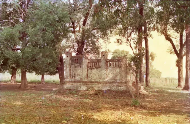
Don Kaeo Kong
Open Days: Daily
Opening Hours: Open 24 hours; visiting between 06:00 and 18:00 is recommended
Don Kaeo Kong, also locally known as Hat Kaeo Kong and Hat Nong Chan, is a small seasonal island and natural sandbar in the Mekong River beside Ban Nong Chan, Tha Kho Subdistrict, Mueang Nakhon Phanom District, Nakhon Phanom Province. The sandbar lies close to the Thai side of the river and becomes most visible during the dry season, when the Mekong water level falls. At that time, the exposed sand stretches northward toward the southern edge of Nakhon Phanom city and appears to extend far into the river in the direction of Thakhek, the capital of Khammouane Province in Laos.
Don Kaeo Kong is not simply a scenic sandbank. It is a landscape of historical memory associated with warfare, political rivalry, migration, and loss across the central Mekong region. Its name is linked to a succession conflict involving the rulers of Si Khotrabun and Marukkhanakhon, a battle fought on a bamboo pontoon bridge in the Mekong, and the deaths of many Vietnamese soldiers. The island is also connected with the violent events at Thakhek in 1946, when civilians attempting to cross the river toward Nakhon Phanom were attacked during the French return to Indochina.
Both narratives share a disturbing central image: the bodies of people killed in conflicts were carried downstream and accumulated around the sandbar near Ban Nong Chan. This connection between two periods of violence transformed Don Kaeo Kong from an ordinary river formation into a place where the history of Nakhon Phanom, Thakhek, Laos, Vietnam, and French Indochina is remembered through the landscape itself.
The physical form of Don Kaeo Kong changes significantly with the Mekong's seasonal water cycle. During the high-water season, most or all of the sandbar may remain below the surface. Visitors may see only the wide river channel and the vegetation along the Thai bank. During the dry season, deposited sediment emerges as long areas of pale sand, wet mud, shallow channels, and small pools. The shape, width, and accessible sections of the sandbar can differ from one year to another because the Mekong continuously reshapes its banks and sediment deposits.
Don Kaeo Kong should therefore be understood as a living river landform rather than a permanent island with fixed boundaries. A path that appears dry and stable on one visit may be separated by a channel on another. Sections of apparently firm sand can become waterlogged or collapse along undercut edges. The presence or absence of a large exposed beach depends on water levels throughout the Mekong basin, not only on local rainfall in Nakhon Phanom.
On a clear day, the view from Ban Nong Chan opens across the river toward Thakhek. Buildings on the Lao side and distant mountain ridges provide a distinctive background to the sandbar. Early morning light creates soft reflections on the water and exposes the texture of the sand, while late afternoon offers warmer colours over the river. Although the exposed sand may appear to reach close to Laos, visitors must not attempt to walk across the international boundary. Legal travel between Thailand and Laos must take place through an authorised immigration checkpoint.
The riverside landscape can be viewed daily because there is no entrance gate or enclosed compound. It is technically accessible at all hours, but visitors should come between 06:00 and 18:00, when the ground, channels, and water conditions can be seen clearly. Entering the sandbar after dark, during heavy rain, when the river is rising, or when the current is strong is unsafe. Shallow water can conceal deep channels, soft mud, or eroded edges.
Don Kaeo Kong is not a developed recreational beach. There are no permanent toilets, visitor buildings, lifeguards, shops, or emergency staff on the sandbar. Most services are found in Ban Nong Chan, elsewhere in Tha Kho Subdistrict, or in central Nakhon Phanom. Visitors should bring drinking water, sun protection, secure footwear, and any personal supplies they need. All rubbish should be removed from the site.
The name Don Kaeo Kong is traditionally explained through three local terms. “Don” refers to raised ground, an island, or a sandbank within a river. “Kaeo,” sometimes romanised as “Kaew,” is an old ethnonym found in regional chronicles and oral traditions for Vietnamese people or people associated with Tonkin. “Kong” means to gather or pile together. In the local explanation, the name therefore refers to a river island where the bodies of Vietnamese soldiers accumulated.
The historical word “Kaeo” should be understood only within the context of the place name and old written or oral records. It can sound inappropriate or derogatory when applied to Vietnamese people today. For this reason, the term is retained here only in the established names Don Kaeo Kong and Hat Kaeo Kong, or when explaining historical language. Modern references to individuals use “Vietnamese people” or “Vietnamese soldiers.”
The first origin narrative is connected with the history of Si Khotrabun, also written as Sri Khotrabun, a major political centre in the central Mekong basin. The city moved and changed its name several times, while its rulers maintained relationships with Vientiane, Champasak, Khamkeut, and communities on both sides of the Mekong. A change of ruler was consequently not only a local matter. It could involve royal appointments, marriage alliances, tribute, and military support from neighbouring territories.
According to the local chronicle, after Phraya Khattiyawongsa Ratchabut Maha Ruechai Traithot Rueadet Chetthaburi Si Khotrabun Luang died, his son Eo Kan succeeded him and received the title Phra Borommaracha Eo Kan. He ruled Si Khotrabun for approximately 24 years. His death created a succession dispute because the person appointed to govern next was not his biological son, but his son-in-law, who had political support from Vientiane.
The ruler of Vientiane appointed Thao Kham Sing, the son-in-law of Phra Borommaracha, as the next ruler. He received the title Phra Nakhon Anurak. The appointment followed the political system of tributary and allied cities at the time, but it angered Thao Ku Kaeo, Phra Borommaracha's son, who believed that he possessed the stronger hereditary right to succeed his father.
After assuming power, Phra Nakhon Anurak recognised that the administrative centre of Si Khotrabun was no longer at the mouth of the Hin Bun River as in an earlier period. It had moved to an area associated with present-day Ban Mueang Kao and the archaeological landscape of Tha Kho Subdistrict. He therefore renamed the city Marukkhanakhon. The change represented the establishment of a new political centre along the Mekong.
Archaeological remains, abandoned religious sites, and traces of ancient settlement around Ban Nong Chan and Ban Mueang Kao remain important for understanding this phase of regional history. They place the Don Kaeo Kong legend within a wider cultural landscape rather than treating it as an isolated story about a sandbank.
At the time of Thao Kham Sing's appointment, Thao Ku Kaeo had been serving as a young page at the court of Champasak since he was about 15 years old. When he learned that his father had died and that Kham Sing had been appointed ruler, he became deeply dissatisfied. From his perspective, the government of his ancestral city had been transferred away from the direct royal line.
Ku Kaeo requested permission to leave Champasak and travelled north. Along the way, he persuaded local leaders, communities, and supporters of the former ruling house to join him. After gathering sufficient manpower, he established a base near Ban Kaeng Lek beside a stream whose name appears in different local texts as Huai Nam Khom or Huai Nam Yom. He created a fortified settlement called Mueang Mahachai Kong Kaeo, with some manuscripts using the variant Mahachai Kop Kaeo.
The establishment of Mueang Mahachai Kong Kaeo was an open act of rebellion against Phra Nakhon Anurak. Ku Kaeo gathered provisions, organised his followers, and constructed a rival centre of power from which he could influence routes connecting inland settlements with the Mekong. When Phra Nakhon Anurak learned of the growing opposition, he realised that the succession dispute could develop into a major war.
Phra Nakhon Anurak first requested military assistance from Vientiane, but he did not receive the forces he needed. He then sought support from the Vietnamese side and was reportedly given approximately 6,000 soldiers. To prevent Ku Kaeo from learning about the reinforcements, the Vietnamese force was ordered to wait at Khamkeut before moving toward Marukkhanakhon.
Information about the reinforcements nevertheless reached Ku Kaeo. He responded with a strategy based on speed, tribute, and deception. Ku Kaeo marched to Khamkeut with his own followers and ceremonial gifts. The size of his force differs between versions of the narrative: one chronicle records approximately 3,000 men, while another local account gives a figure of approximately 4,000. All versions agree that Ku Kaeo reached the Vietnamese commander before Phra Nakhon Anurak did.
Ku Kaeo presented himself as the ruler of Marukkhanakhon who had come to receive the allied troops. He offered tribute in accordance with regional diplomatic custom. The Vietnamese commander, who did not fully understand the internal succession conflict, accepted the claim and joined Ku Kaeo. The soldiers originally requested by Phra Nakhon Anurak were therefore redirected against the city they had been summoned to defend.
The combined force of Ku Kaeo and the Vietnamese army attacked Marukkhanakhon and captured it. Phra Nakhon Anurak could not hold the city. He escaped with his family and supporters, crossed the Mekong, and took refuge in the area known as Dong Seka. The dispute had now expanded from an internal succession struggle into a regional conflict involving military forces from several territories.
From Dong Seka, Phra Nakhon Anurak again appealed to Vientiane. This time, the ruler of Vientiane decided that the conflict threatened the political order and an appointment that Vientiane had formally recognised. Phraya Chiang Sa was appointed commander and sent south with troops to restore Phra Nakhon Anurak's position.
One of Phraya Chiang Sa's principal camps was established at Ban Nong Chan, beside the present location of Don Kaeo Kong. Another camp was placed at Ban That Noi Si Bun Rueang. The two forces formed a wide, wing-like formation intended to control the riverside and surround the forces of Ku Kaeo and the Vietnamese army from several directions.
The choice of Ban Nong Chan demonstrated the strategic value of the area. Troops stationed there could observe movements on the river, protect landing points, and respond to attempts to cross from the Lao side. The same riverside setting that appears peaceful today was once an important military position overlooking one of the principal transport routes of the central Mekong.
The Vietnamese soldiers supporting Ku Kaeo were based on the left bank of the river. When they saw Phraya Chiang Sa's troops established on the right bank, they prepared to cross the Mekong and attack. Moving thousands of soldiers across the river before the construction of permanent bridges was a difficult military operation. They cut large quantities of bamboo, tied the poles into long floating bundles, and connected the bundles to form a pontoon bridge known locally as a phae luk buap.
The bundled bamboo served both as flotation and as a narrow route for soldiers, weapons, and supplies. The plan was to push the leading end of the structure through the current until it reached the Thai bank. Once secured, soldiers could cross continuously along the floating bridge. The operation required strong bindings, careful coordination, and an understanding of the current. Its long connected structure, however, also created a vulnerable target.
Phraya Chiang Sa observed the construction and waited until the floating bridge moved within range. As Vietnamese soldiers began pushing the structure across the river and advancing along it, his forces fired cannon at the connecting sections. The shots broke the bridge into separate pieces. Sections of bamboo drifted apart, soldiers lost their footing, and the planned crossing collapsed into confusion.
The engagement became a battle in the middle of the Mekong. Phraya Chiang Sa's forces attacked with firearms, edged weapons, and boats. Vietnamese soldiers standing on separated sections of bamboo could not maintain an organised formation. Some were shot, others were killed in close combat, and many were swept away or drowned in the river. The Vietnamese force suffered severe losses and retreated.
The bodies of those killed were carried downstream and became trapped around sand deposits, vegetation, and riverbanks near Ban Nong Chan. Local tradition states that the bodies of numerous Vietnamese soldiers accumulated at the island. Residents began calling it Don Kaeo Kong, the island where Vietnamese bodies had gathered in a pile. The name was passed from one generation to the next and preserved the memory of the battle in the landscape.
After the fighting, Phraya Chiang Sa also attempted to negotiate an end to the dispute between Phra Nakhon Anurak and Thao Ku Kaeo. One version of the account states that Phra Nakhon Anurak and his family were relocated to an area south of Vientiane, while Ku Kaeo was allowed to rule again. Although political authority was reorganised, the human cost of the conflict remained encoded in the name of the sandbar.
Minor details vary among chronicles, municipal records, and oral narratives. Differences include the number of troops, the spelling of place names, the name of the stream beside Ku Kaeo's settlement, and the sequence of military movements. The central structure of the story is consistent: a succession dispute between Kham Sing and Ku Kaeo, the involvement of Vietnamese troops, Phraya Chiang Sa's camp at Ban Nong Chan, a bamboo bridge across the Mekong, and a decisive defeat in the river that produced the name Don Kaeo Kong.
Historically, the narrative illustrates the networked political system of the Mekong basin. Cities were connected through marriage, tributary obligations, military support, and recognition by larger courts. A royal succession dispute could therefore draw Vientiane, Champasak, Khamkeut, Vietnamese troops, and communities around Nakhon Phanom into the same conflict. The Mekong was not merely a boundary; it was a transport route, communication corridor, source of food, and battlefield.
The historical meaning of Don Kaeo Kong did not end with the Marukkhanakhon conflict. Near the end of the Second World War, the riverside landscape became connected with another major loss of life. In 1945, Japanese forces took control across French Indochina and disarmed French military and administrative personnel. The collapse of French authority encouraged independence movements in Laos, Cambodia, and Vietnam, where many people opposed a return to the former colonial system.
During the Japanese occupation and the political transition that followed, populations throughout Indochina were displaced. Local accounts state that plans were made to return Vietnamese residents in Laos to Vietnam. Large numbers of people travelled from Luang Prabang, Vientiane, and other areas and gathered in Thakhek. The city became crowded with Vietnamese families, refugees, political activists, soldiers, and civilians awaiting transport or searching for safety.
After Japan surrendered and withdrew, France attempted to re-establish colonial control. Lao and Vietnamese independence forces resisted. Fighting spread through strategic towns and transport corridors. Thakhek, directly opposite Nakhon Phanom, was important because it controlled river movement and routes through central Laos. It consequently became a major objective during the French military campaign.
In March 1946, French forces launched a heavy ground and air assault on Thakhek. The defenders could not withstand the sustained attack. When it became clear that the city would fall, civilians were allowed or encouraged to flee toward the Mekong. People boarded boats, rafts, and other vessels in an attempt to reach Nakhon Phanom on the Thai side.
The refugees included Lao and Vietnamese civilians, families, children, elderly people, wounded individuals, and members of resistance groups. The river between Thakhek and Nakhon Phanom became crowded with vessels of different sizes. Many passengers carried only what they could hold, while others were already exhausted or injured from the fighting in the city.
According to the local record, two French military aircraft circled over the river and repeatedly fired on the boats. Some vessels were damaged by gunfire, some caught fire, and others overturned. Passengers jumped into the Mekong in panic, but many could not swim, were wounded, or were unable to survive the current. The attack caused a major loss of life and became one of the most painful events remembered by communities on both banks.
Many bodies were carried downstream. Some reached the Thai bank or became caught around islands, vegetation, and sand deposits. The Ban Nong Chan narrative states that the bodies of many victims, particularly Vietnamese people, accumulated around Don Kaeo Kong. The 1946 event was consequently interpreted as a tragic repetition of the older battle narrative associated with the same sandbar.
Both episodes should be presented with respect for the dead. Don Kaeo Kong should not be reduced to a frightening place or marketed only through supernatural speculation. Its deeper significance lies in the consequences of warfare, political rivalry, colonial violence, and the vulnerability of civilians. Visiting the site can become an opportunity to remember people of different nationalities whose lives were shaped by events beyond their control.
Today, Don Kaeo Kong remains a natural river landscape and a recognised historical resource of Tha Kho Subdistrict. The exposed beach changes according to water levels and sediment movement. Dry-season visitors may see a wide and clearly defined sandbar, while wet-season visitors may see only the powerful river covering the same area. The temporary disappearance of exposed sand is a normal part of the Mekong's seasonal cycle and does not mean that the site no longer exists.
The dry season offers the best chance of seeing the sandbar, especially after water levels have remained low for several weeks. Nevertheless, Mekong levels are influenced by rainfall, upstream conditions, and water management across several countries. Conditions can change within the same season. Visitors should inspect the river from the bank before entering any exposed area and should not assume that routes shown in photographs from previous years remain safe.
Early morning is generally the most comfortable time to visit. Temperatures are lower, the atmosphere is peaceful, and soft light is suitable for landscape photography. Local residents may already be working beside the river, offering a glimpse of everyday life. Late afternoon provides warmer light and reflections, but visitors should return to stable ground before darkness makes channels and wet sand difficult to see.
Photographers can work with curved lines of sand, river currents, fishing boats, Thakhek's urban skyline, the Lao mountains, and daily activities along the Mekong. A wide-angle lens is useful for the scale of the landscape, while a telephoto lens can capture details across the river without approaching the water. Drone users must check aviation rules, border restrictions, privacy requirements, and local permission before flying.
Swimming or crossing channels around the sandbar is not recommended. Water that appears shallow or calm can conceal strong currents, sudden drops, and deep channels. Eroded sand edges may collapse under a person's weight. Wet areas can also contain deep mud that makes it difficult to return to the bank. Children require close supervision, while elderly visitors and people with limited mobility should enjoy the view from the riverside.
Cars and motorcycles should not be driven onto the sandbar. The surface is unstable, vehicles can become trapped, and tyre movement damages the natural sediment. Fishing equipment, boats, nets, and working areas belonging to local residents should not be touched or obstructed. Visitors should maintain a respectful distance whenever community members are working beside the river.
Historical etiquette is also important. Visitors should avoid posing in ways that mock the deaths associated with the site or producing content that turns the victims into entertainment. Objects should not be removed as souvenirs. When sharing the site online, it is more responsible to explain the river landscape, the Marukkhanakhon succession conflict, and the 1946 Thakhek event together.
Getting There from central Nakhon Phanom is straightforward by following the Mekong riverside route south toward Tha Kho Subdistrict and Ban Nong Chan. Visitors can travel by private car, rental car, motorcycle, or a locally hired vehicle. The coordinates 17.35001, 104.800008 provide a useful reference, but the exact observation point may vary with river conditions. Asking residents about the safest current access point is advisable.
Travellers arriving at Nakhon Phanom Airport can rent a car or hire transport into the city before continuing to Tha Kho. There is no dedicated public transport station at Don Kaeo Kong, so private transport or a vehicle with a driver is the most convenient option. A return pickup should be arranged in advance, particularly for early morning or evening visits.
Vehicles should be parked only in public areas that do not block homes, farm entrances, boat access, or village roads. Parking close to an eroded riverbank or on soft ground should be avoided. Visitors should follow paths commonly used by local residents and should not cross private land without permission. Groups planning organised activities or filming should contact the Tha Kho Subdistrict Administrative Organisation in advance.
A visit can be combined with Wat Tha Nong Chan, a community temple near the Mekong. The temple provides insight into the religious life of Ban Nong Chan and the relationship between the settlement and the river. Visitors should dress respectfully, keep noise low, and request permission before photographing people or religious ceremonies.
The Ban Mueang Kao archaeological area and abandoned temple sites around Ban Nong Chan provide another important extension to the journey. These remains are associated with the relocation of Si Khotrabun and the development of Marukkhanakhon. Visiting the archaeological landscape helps place the Don Kaeo Kong legend within the physical remains of an old city and its religious institutions.
In central Nakhon Phanom, travellers can continue to Wat Mahathat, the Phaya Si Sattanakharat Naga Monument, Sunthon Wichit Road, the historic riverfront district, and the Vietnamese Memorial Clock Tower. Together, these sites introduce Buddhist faith, Naga traditions, cross-river trade, Thai–Lao relations, and the long history of Vietnamese communities in Nakhon Phanom.
Travellers with additional time can develop a cross-border historical route. The journey may begin at Ban Nong Chan and Ban Mueang Kao, continue through Nakhon Phanom, and then cross the Third Thai–Lao Friendship Bridge through formal immigration procedures to visit Thakhek. Seeing both banks helps visitors understand the short physical distance between the city from which refugees fled and the Thai shore they attempted to reach in 1946.
Don Kaeo Kong is particularly suitable for travellers interested in local history, river geography, community life, and places that have not been heavily commercialised. Visitors expecting water sports, extensive restaurants, or resort-style beach facilities will not find them on the sandbar. What the site offers instead is a quiet natural setting with a historical depth that is not immediately visible from its appearance.
Families can use the riverside as a place to explain sediment deposition, seasonal water levels, and community history without taking children onto the sandbar. Elderly visitors can view the landscape from accessible areas near the bank. Anyone walking on exposed sand should select a cooler time of day, wear secure footwear, and limit the walking distance according to physical ability.
Before travelling, visitors should check weather conditions, Mekong water-level reports, and information from the local community. Heavy rain in upstream areas can raise the river even when the weather in Nakhon Phanom appears clear. If channels divide the sandbar, the current is strong, or local residents advise against access, visitors should remain on the bank and continue instead to Wat Tha Nong Chan or attractions in the city.
Midday temperatures during the dry season can be intense, and the exposed sandbar offers almost no shade. Visitors should carry sufficient water, wear a hat, apply sun protection, and rest when necessary. Plastic bottles, food packaging, and other rubbish must not be left behind, as the river can distribute waste throughout the Mekong ecosystem.
Conserving Don Kaeo Kong does not mean attempting to preserve the exact shape of the sandbar, because natural change is fundamental to the river. Conservation means maintaining cleanliness, avoiding unnecessary disturbance of sediment, preventing inappropriate construction, protecting archaeological surroundings, and recording the site's history responsibly.
Culturally, Don Kaeo Kong demonstrates how a place name can preserve historical information even without a monument or large building. Whenever people ask why the island has this name, the stories of Kham Sing, Ku Kaeo, Phraya Chiang Sa, the Vietnamese army, and the 1946 Thakhek tragedy are told again. Language and landscape therefore function together as a community archive.
The site also reveals the close relationship between communities on both sides of the Mekong. Before modern national borders became strictly controlled, people travelled, traded, married, worshipped, and moved between riverside settlements. During conflict, the same river became an escape route and a battlefield. Understanding Don Kaeo Kong consequently requires a perspective wider than the history of Nakhon Phanom Province alone.
For international visitors unfamiliar with central Mekong history, beginning with the physical landscape makes the narrative easier to understand. Standing at Ban Nong Chan and seeing Thakhek across the river demonstrates why troops attempted to construct a bamboo bridge, why refugees in 1946 tried to reach Nakhon Phanom, and how bodies could be carried downstream toward a sandbar on the Thai side.
Although the history of Don Kaeo Kong contains repeated loss, the site should not be understood only through tragedy. Its open landscape, quiet river, community life, and archaeological surroundings create opportunities to learn about nature, political history, migration, and the coexistence of different peoples. Responsible interpretation can transform painful memory into a lesson about the value of peace.
Visitors should allow at least 1–2 hours for viewing the river, walking along the bank, learning the history, and taking photographs. Combining the sandbar with Wat Tha Nong Chan and Ban Mueang Kao requires approximately half a day. A full-day route can continue into Nakhon Phanom city, with Don Kaeo Kong and the archaeological area in the morning and the city temples and riverfront attractions in the afternoon.
Restaurants and accommodation options become more numerous along the Mekong riverside road and in central Nakhon Phanom. Local dining includes northeastern Thai food, Mekong fish dishes, Vietnamese cuisine, and general Thai dishes. Riverside hotels, modern city hotels, and properties in the historic district provide convenient bases. Staying overnight makes it possible to return to Don Kaeo Kong early in the morning, when the weather and light are most favourable.
The Tha Kho Subdistrict Administrative Organisation is the principal local authority for coordination about access, community conditions, and general safety. There is no permanent office or staff station on the sandbar itself. Organised groups, researchers, film crews, and visitors planning activities during uncertain water conditions should contact the local authority before entering the area.
Don Kaeo Kong rewards visitors who spend time understanding it. Beneath the seasonal sand are overlapping narratives of Si Khotrabun, Marukkhanakhon, a royal succession dispute, a military crossing of the Mekong, the defeat of Vietnamese troops, and the flight from Thakhek in 1946. Once these histories are understood, the river in front of the visitor becomes more than a scenic international boundary.
The most meaningful visit is therefore not an attempt to walk as far as possible across the sand. It is an opportunity to observe how geography and human history interact, how a river can connect communities while carrying the consequences of conflict, and how war leaves traces not only in official records but also in place names, local narratives, and the memories of families for generations.
| Name | Don Kaeo Kong, also known as Hat Kaeo Kong and Hat Nong Chan |
| Location | The Mekong River near the Thai bank at Ban Nong Chan, Tha Kho Subdistrict, Mueang Nakhon Phanom District, Nakhon Phanom Province |
| Address | Ban Nong Chan, Tha Kho Subdistrict, Mueang Nakhon Phanom District, Nakhon Phanom 48000, Thailand |
| Coordinates | 17.35001, 104.800008 |
| Highlights | A seasonal Mekong sandbar with views toward Thakhek in Laos and historical narratives associated with two periods of warfare |
| Distinctive Features | A long sand formation that changes with the Mekong water level, including exposed sand, shallow channels, wet sediment, and seasonal pools |
| History | Associated with the conflict between Phra Nakhon Anurak or Thao Kham Sing and Thao Ku Kaeo during the Marukkhanakhon period, and with the 1946 attack and refugee crossing at Thakhek |
| Name Origin | Local tradition states that the bodies of Vietnamese soldiers killed in a Mekong battle accumulated around the island, producing the name Don Kaeo Kong |
| Historical Importance | A community memory landscape connecting Si Khotrabun, Marukkhanakhon, Nakhon Phanom, Thakhek, Vietnam, and the history of French Indochina |
| Travel Information | Follow the Mekong riverside route south from central Nakhon Phanom toward Tha Kho and Ban Nong Chan. Private car, rental car, motorcycle, or locally hired transport is recommended. |
| Current Status | An active natural and historical landscape of Tha Kho Subdistrict. The exposed beach is most visible during the dry season and may be submerged during high water. |
| Open Days | Daily |
| Opening Hours | Open 24 hours; visiting between 06:00 and 18:00 is recommended |
| Fees | Free admission |
| Facilities | Shops and services are available in Ban Nong Chan and central Nakhon Phanom. There are no permanent toilets, visitor buildings, shops, or staff facilities on the sandbar. |
| Main Areas | 1. Ban Nong Chan riverside viewpoint 2. Seasonal exposed sandbar 3. Mekong and Thakhek panoramic viewing area 4. Historical landscape linking Wat Tha Nong Chan and Ban Mueang Kao |
| Best Visiting Period | The dry season when the Mekong water level is low; check current weather and river conditions before travelling |
| Safety | Do not swim, cross water channels, approach eroded sand edges, enter during rising water or heavy rain, visit after dark, or attempt to cross the international border |
| Caretaker and Local Authority | Tha Kho Subdistrict Administrative Organisation, Mueang Nakhon Phanom District |
| Main Contact Number | Tha Kho Subdistrict Administrative Organisation: 042-532567 Disaster Prevention and Mitigation Unit: 042-532491 |
| Official Website | Tha Kho Subdistrict Administrative Organisation |
| Nearby Tourist Attractions | 1. Wat Tha Nong Chan, 1 km 2. Ban Mueang Kao Archaeological Area and Abandoned Temple Sites, 3 km 3. Wat Mahathat Nakhon Phanom, 5 km 4. Phaya Si Sattanakharat Naga Monument, 6 km 5. Vietnamese Memorial Clock Tower and Nakhon Phanom Historic District, 7 km |
| Nearby Restaurants | 1. Nam Mala Isan Tha Kho, 4 km, Tel. 099-025-7273 2. Kitchen Khong The River Front, 4 km, Tel. 085-924-7898 3. Rabiang Khong Restaurant, 6 km, Tel. 092-865-5889 4. View Khong Restaurant at Fortune View Khong Hotel, 7 km, Tel. 042-513564-70 5. Pen Pla Pen Restaurant, 9 km, Tel. 087-634-7467 |
| Nearby Accommodations | 1. The River Hotel Nakhon Phanom, 4 km, Tel. 042-522999 2. VELA Dhi Nakhon Phanom, 4 km, Tel. 042-515-919 3. Fortune River View Hotel Nakhon Phanom, 5 km, Tel. 042-522334 4. Landmark Nakhon Phanom Hotel, 7 km, Tel. 091-740-3001 5. Fortune View Khong Hotel Nakhon Phanom, 7 km, Tel. 083-989-1465 or 042-513564-70 |
Frequently Asked Questions (FAQ)
Q: Where is Don Kaeo Kong located?
A: Don Kaeo Kong is in the Mekong River beside Ban Nong Chan, Tha Kho Subdistrict, Mueang Nakhon Phanom District, Nakhon Phanom Province, at coordinates 17.35001, 104.800008.
Q: When is Don Kaeo Kong open?
A: The natural riverside area is accessible daily and has no entrance gate. Visiting between 06:00 and 18:00 is recommended so that water and ground conditions can be seen clearly.
Q: What is the best time to visit Don Kaeo Kong?
A: The dry season provides the best chance of seeing the exposed sandbar. Visitors should still check current Mekong water levels and weather because the shape and accessibility of the beach change every year.
Q: How did Don Kaeo Kong receive its name?
A: Local tradition states that many Vietnamese soldiers died during a battle on the Mekong and that their bodies accumulated around the island. “Kaeo” is an old historical term used in the region for Vietnamese people.
Q: How is the 1946 Thakhek event connected with Don Kaeo Kong?
A: During the French assault on Thakhek, refugees attempted to cross the Mekong toward Nakhon Phanom. Boats were attacked and many people died. Local accounts state that some bodies drifted downstream and accumulated around Don Kaeo Kong.
Q: Can visitors walk on the sandbar or swim in the river?
A: Visitors should primarily observe the site from the bank. Walking on exposed sand is possible only when conditions are dry and safe, but swimming, crossing channels, and approaching eroded sand edges are not recommended.
Q: Can visitors walk from Don Kaeo Kong to Thakhek in Laos?
A: No. Even when the sand appears to extend toward Thakhek, visitors must not cross the international border. Travel between Thailand and Laos must take place through an authorised immigration checkpoint.
Q: Is there an admission fee or visitor facilities?
A: Admission is free. There are no permanent toilets, visitor buildings, shops, or staff on the sandbar. Services are available in Ban Nong Chan and central Nakhon Phanom.
 Category: ●Art, Culture and Heritage
 Group: ●Historical Sites and Monuments
Last Update : 3 MonthAgo
 Last Update : 3 MonthAgo
 Click to Access the Navigation Map GPS
Don Kaeo Kong Map
Recommend
 Historical Sites and Monuments(3)
 Landmarks and Memorials(2)
 Art, Craft Centres, Tradition(3)
 Museums(3)
 Educational Places
 Library(1)
 Places of Worship
 Temple(23)
 Church(1)
 Other Sacred Sites(11)
 Suburban Living
 Village, Community(5)
 Nature and Wildlife
 National Parks and Marine Reserves(1)
 Dam, Reservoir, Lake(5)
 Waterfalls(2)
 River, Canal(3)
 Bays and Beaches(3)
 Other natural attractions(2)
 Entertainment and Agricultural
 Zoos and Aquariums(1)
 Farms, Parks and Ecotourism(2)
 Shopping
 Shopping and Night Market(1)
 Travel Articles, Recipes
 Travel Review, Food Review(1)


