
lovethailand home >Central Travel Attractions >Bangkok Travel Attractions > 28 National Parks and Nature Destinations in Centr..
TL;DR: 28 National Parks and Nature Destinations in Central, Eastern and Western Thailand.
28 National Parks and Nature Destinations in Central, Eastern and Western Thailand
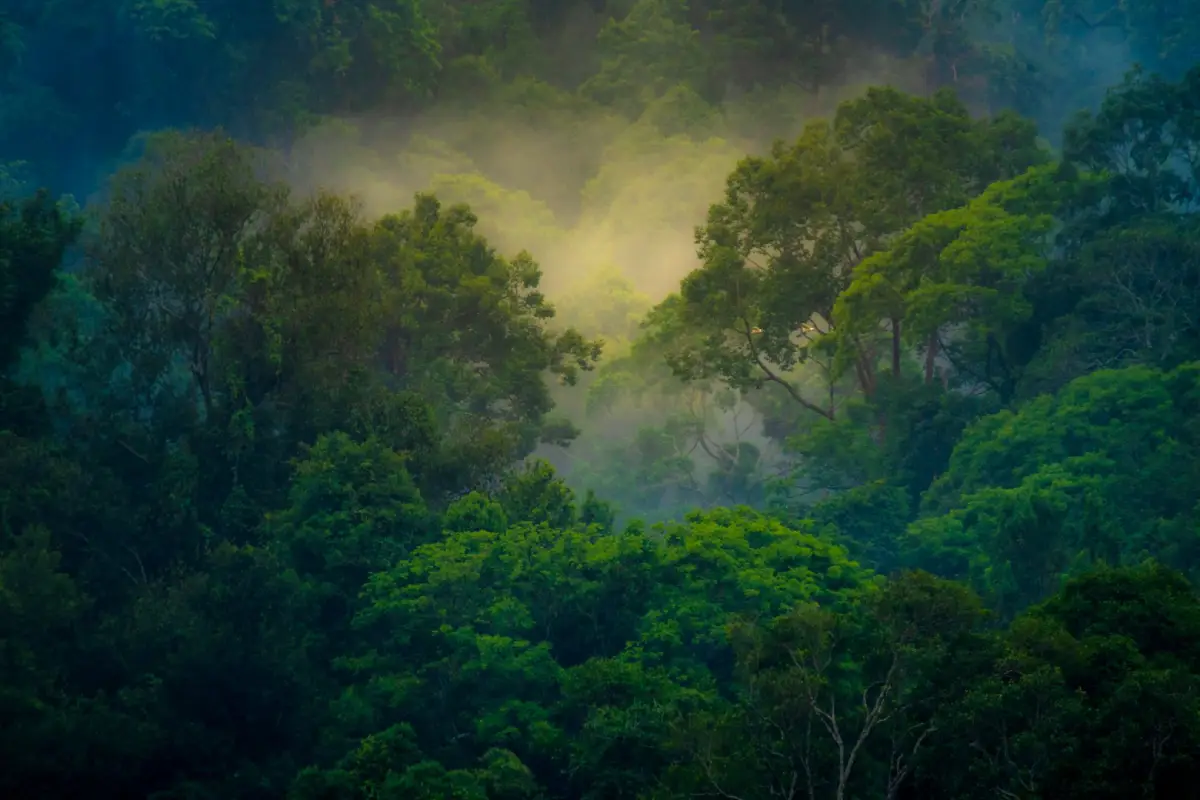
28 National Parks and Nature Destinations in Central, Eastern and Western Thailand bring together some of Thailand’s most remarkable natural landscapes, from the World Heritage forests of Khao Yai and Kaeng Krachan to Erawan’s emerald pools, the limestone mountains of Khao Sam Roi Yot, the Tenasserim Range in Kanchanaburi, and the islands and beaches off Rayong and Trat. These destinations offer forest trails, wildlife watching, birding, waterfalls, camping and marine experiences, whether as day trips from Bangkok or longer nature-focused holidays.
These three regions have distinct landscapes. Central Thailand is associated with the Chao Phraya basin and the surrounding uplands. To the west, the Tenasserim Range extends along the Thailand–Myanmar border, supporting mountain forests, deep valleys and extensive river systems. Eastern Thailand combines mountainous forests, watersheds and humid border ranges with a Gulf of Thailand coastline dotted with islands. The result is an unusually wide variety of habitats within a manageable travel area.
Among the best-known destinations are Khao Yai, Thailand's first national park; Kaeng Krachan, the country's largest national park by area; Erawan, famous for its seven waterfall tiers; Khao Sam Roi Yot, renowned for Phraya Nakhon Cave and limestone scenery; Mu Ko Chang, where mountains meet the sea; Khao Laem Ya–Mu Ko Samet, celebrated for its beaches; and Kui Buri, an important destination for observing wild elephants.
National parks do more than provide recreation. They protect watersheds, native forests, wildlife habitats and the natural resources on which nearby communities rely. Connected forests allow animals to move between feeding and resting areas, while healthy vegetation helps stabilize mountain soils and regulate runoff. Conservation therefore matters far beyond the boundaries of each visitor site.
UNESCO World Natural Heritage adds international significance to this collection. Khao Yai forms part of the Dong Phayayen–Khao Yai Forest Complex, inscribed on the World Heritage List in 2005, while Kaeng Krachan is central to the Kaeng Krachan Forest Complex, inscribed in 2021. Both sites demonstrate the ecological value of extensive protected forests and their importance for biodiversity conservation.
Other parks preserve different ecosystems. The freshwater wetlands and coastal limestone mountains of Khao Sam Roi Yot contrast with the woodland and open feeding areas associated with elephant observation in Kui Buri. Offshore, Mu Ko Chang and Mu Ko Samet contain beaches, reefs and habitats for marine life. Visiting several parks reveals how different landforms and ecosystems coexist within Thailand.
Nature trips near Bangkok are particularly accessible in Saraburi. Namtok Chet Sao Noi provides a relaxed streamside setting, while Khao Yai can be reached through either Pak Chong in Nakhon Ratchasima or the Prachin Buri entrance. Travelers with additional time can continue toward Nakhon Nayok or other nearby destinations, depending on the route and their preferred activities.
Western Thailand is especially appealing for forests and waterfalls. Kanchanaburi is home to Erawan, Sai Yok, Khuean Srinagarindra, Khao Laem, Thong Pha Phum and Lam Khlong Ngu. Some sites are easily reached by road, while others require longer mountain journeys or guided entry. In Phetchaburi, Kaeng Krachan is a favorite for misty views, birdwatching, butterflies and vast protected forest landscapes.
Eastern Thailand combines inland forests and coastal nature. Prachin Buri and Sa Kaeo include protected areas connected with the Dong Phayayen forest system. Chanthaburi is known for humid forests and waterfalls, while Rayong and Trat offer beaches, islands, snorkeling and coastal ecosystems. Fruit-growing communities, fishing villages and regional food traditions add cultural depth to these journeys.
The ideal travel season depends on the destination. Rainy months bring lush vegetation and stronger waterfalls, but trails may close for safety. Cooler periods can be more comfortable for hiking and mountain views. Marine excursions depend on monsoon conditions, sea state and boat services. Opening times for park headquarters should never be assumed to apply to every waterfall, trail, cave or offshore area.
Private cars or rental vehicles serve many mainland parks, although designated shuttles, boats or licensed guides are required at some locations. This is particularly relevant to wildlife-viewing routes, demanding mountain trails and islands. Planning around actual access points helps visitors enjoy the scenery while minimizing disturbance to sensitive environments.
Protected areas also have close connections with neighboring communities, from the riverside settlements of Kanchanaburi and farming districts of Saraburi and Phetchaburi to the fishing villages of Rayong and Trat. Exploring these landscapes is therefore an opportunity to learn about both ecological diversity and the local ways of life that have developed around it.
Across Central, Eastern and Western Thailand, forests, mountains, caves, waterfalls, wetlands, reservoirs and islands create an exceptional range of travel experiences. Each destination has its own conservation role and visitor character. Together they show why protecting natural habitats is essential to the long-term environmental heritage of Thailand.
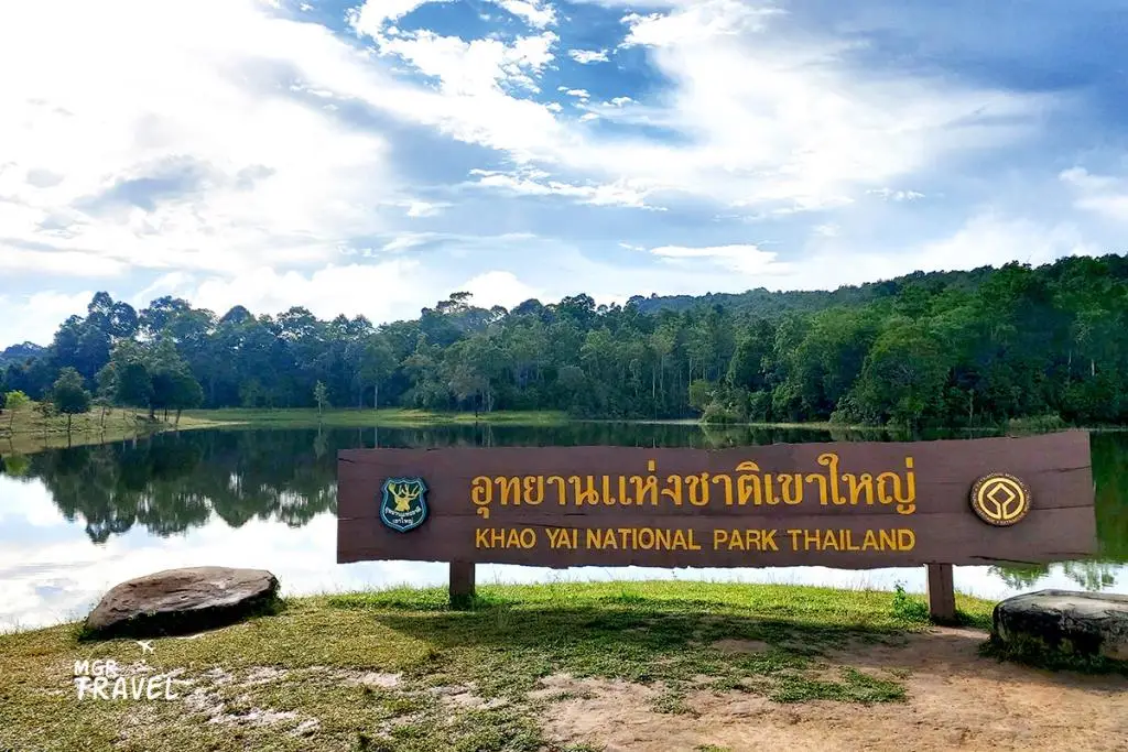
1. Khao Yai National Park Thailand's first national park spans Nakhon Ratchasima, Saraburi, Nakhon Nayok and Prachin Buri. It is celebrated for rugged mountain terrain, tropical forests, open grasslands, waterfalls and wildlife. Visitors can approach through Pak Chong or the Noen Hom entrance on the Prachin Buri side.
Highlights: Haew Suwat Waterfall, Haew Narok Waterfall, Nong Phak Chi wildlife observation tower, Sai Sorn Reservoir, Pha Diao Dai viewpoint, nature trails and wildlife watching.
History: Established on 18 September 1962, Khao Yai was Thailand's first national park and helped establish the country's national park system. It later became part of the Dong Phayayen–Khao Yai Forest Complex, recognized by UNESCO as a World Natural Heritage Site in 2005 for its habitats and rich biodiversity.
Landscape and ecosystems: Elevations range from foothills to cooler mountain environments. Moist evergreen, dry evergreen, hill evergreen and mixed deciduous forests occur alongside grasslands. Elephants, gaurs, deer, gibbons and hornbills are among the park's notable wildlife, illustrating the importance of preserving a large connected landscape.
Waterfalls and attractions: Haew Suwat plunges over a cliff into a pool, while the dramatic Haew Narok waterfall is reached by a designated walking route with steps. Kong Kaeo and Pha Kluai Mai waterfalls offer further scenery and forest settings along the park's stream network. Access conditions differ by trail.
Activities: Nature walks, waterfalls, birdwatching, responsible wildlife observation, photography and authorized camping are popular. Nong Phak Chi offers an opportunity to view open habitats, and Sai Sorn Reservoir is known for its peaceful surroundings. Animal sightings are never guaranteed and vary with the weather and animal behavior.
Conservation: Khao Yai protects headwaters and wildlife corridors between Central and Northeastern Thailand. Drivers should observe speed limits, keep their distance from elephants and other animals, never feed wildlife and use only designated trails and viewing areas.
Opening Days and Hours: Generally open daily, with the main access window listed as 6:00 a.m.–6:00 p.m.; individual areas may have different rules.
Getting There: From Bangkok, take Phahonyothin Road to Saraburi, then Mittraphap Road to Pak Chong and Thanarat Road to the main entrance. Alternatively, reach the park via Noen Hom on the Prachin Buri side; select the gate closest to your intended attractions.
Map (GPS):Get directions to Khao Yai National Park

2. Kaeng Krachan National Park Kaeng Krachan, covering parts of Phetchaburi and Prachuap Khiri Khan, is Thailand's largest national park by area. Its extensive Tenasserim Range forests, rivers and valleys are famous for biodiversity, the Kaeng Krachan reservoir, Ban Krang and the misty hill landscapes of Phanoen Thung.
Highlights: Phanoen Thung viewpoint, morning sea of mist, Ban Krang campsite, bird and butterfly watching, Kaeng Krachan Reservoir, Pala-U Waterfall and World Heritage forests.
History: The park was established on 12 June 1981. The Kaeng Krachan Forest Complex received UNESCO World Heritage status in 2021, recognizing the outstanding ecological significance of its tropical forests and wildlife habitats along the western mountain ranges.
Landscape: Mountain ridges, valleys and streams form an important part of the Phetchaburi watershed. Moist evergreen, dry evergreen and hill evergreen forests provide habitat for elephants, gaurs, big cats and many species of birds. Ban Krang is particularly well known to birders and butterfly enthusiasts.
Phanoen Thung and the sea of mist: Under suitable humidity and weather conditions, mist gathers in the valleys beneath forested ridges. The mountain road has special vehicle and travel-time restrictions, so a visit requires more planning than a trip to the reservoir area.
Ban Krang and butterflies: Butterflies often gather on damp soil to obtain minerals, especially when seasonal conditions are favorable. Birdwatching and forest walks are other reasons to visit this area, where camping and trail access are managed by park officials.
Travel seasons and conservation: The reservoir offers a broad waterside landscape, while access to the upper forest areas is more restricted. Ban Krang and Phanoen Thung normally observe a seasonal closure from 1 August to 31 October for restoration and visitor safety.
Visiting Arrangements: Different zones operate under different entry, road and safety rules. Check the open status of the exact destination before travelling.
Getting There: Take Phetkasem Road from Bangkok toward Phetchaburi, then head to Kaeng Krachan district and the park area. Continue on the regulated mountain routes if visiting Ban Krang or Phanoen Thung.
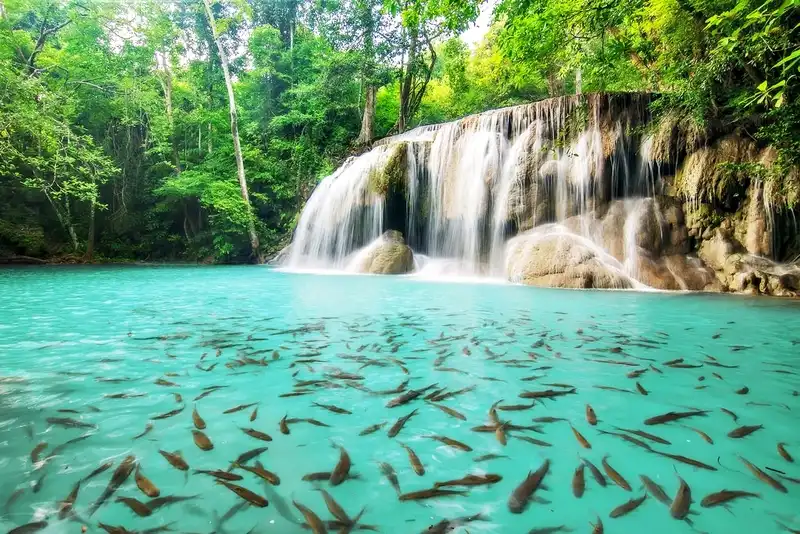
3. Erawan National Park Erawan National Park in Si Sawat district, Kanchanaburi, is renowned for a seven-tier waterfall with clear, often emerald-colored pools. Paths follow the stream through forest, limestone and rocky terrain, with each tier offering a different setting and level of walking difficulty.
Highlights: All seven tiers of Erawan Waterfall, turquoise pools, forest trails, Phra That Cave and scenery near Srinagarindra Dam.
History: Established on 19 June 1975, the park was formerly known as Khao Salop National Park. Its present name refers to a rock formation near the upper waterfall that evokes the mythical three-headed elephant Erawan, linking the landscape to Thai cultural imagery.
The seven waterfall tiers: They are Lai Khuen Rang, Wang Matcha, Pha Nam Tok, Ok Nang Phi Suea, Buea Mai Long, Dong Phrueksa and Phu Pha Erawan. Lower sections are relatively accessible, while upper sections require a longer climb along steps and natural paths.
Limestone landscape and water color: The stream's limestone environment, mineral deposits, light and water clarity all contribute to the striking blue-green appearance of its pools. Rock surfaces and water depth vary across the tiers, so visitors should use only permitted swimming areas.
Activities: Visitors can hike along the falls, photograph forest scenery and swim where park staff allow. Wet limestone, slippery rocks and high flows during heavy rain require particular care.
Nearby excursions: Srinagarindra Dam, Huai Mae Khamin Waterfall and other destinations in Si Sawat can form a multi-day trip combining reservoirs, forests and cascades.
Opening Days and Hours: Normally daily, 8:00 a.m.–4:30 p.m., subject to the park's specific waterfall and trail regulations.
Getting There: From Kanchanaburi town, follow Highway 3199 toward Si Sawat and Srinagarindra Dam, then continue to Erawan's visitor area. The trail to the first waterfall begins near the main parking facilities.
Map (GPS):Get directions to Erawan National Park
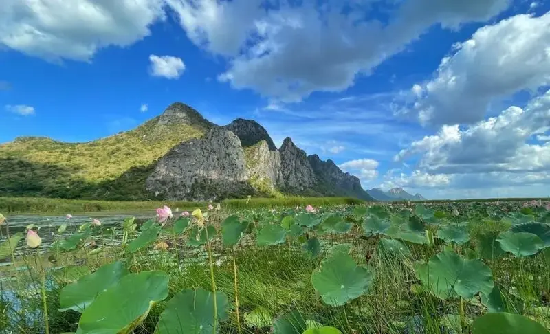
4. Khao Sam Roi Yot National Park Khao Sam Roi Yot in Prachuap Khiri Khan encompasses limestone mountains, caves, beaches and extensive freshwater wetlands in Sam Roi Yot and Kui Buri districts. It is Thailand's first marine national park and is distinguished by limestone peaks rising above coastal plains.
Highlights: Phraya Nakhon Cave, the Kuha Karuhas Pavilion, Thung Sam Roi Yot wetlands, Khao Daeng viewpoint, Laem Sala Beach and wetland birdwatching.
History: Established on 28 June 1966, this protected area conserves an unusual meeting of limestone hills, mangroves, wetlands, caves and Gulf of Thailand coastline. Its habitats are particularly important for birds and other wetland species.
Phraya Nakhon Cave: The cavern contains the historic Kuha Karuhas Pavilion, built during the reign of King Chulalongkorn (Rama V). Sunlight filtering through a natural roof opening creates one of the country's best-known cave scenes.
Wetlands: Thung Sam Roi Yot is an internationally important freshwater wetland, recognized under the Ramsar Convention. Seasonal water plants and lotus flowers surround a nature boardwalk, with limestone mountains forming a striking backdrop and habitat for waterbirds.
Khao Daeng viewpoint: The steep trail rewards hikers with views of limestone hills, wetlands and the coastline. Sunrise photography is popular when conditions are suitable, although the climb calls for adequate fitness and appropriate footwear.
Coastal excursions: Laem Sala Beach lies near the route to Phraya Nakhon Cave. Depending on conditions, visitors may walk over the headland or take a locally operated boat from the Bang Pu area before continuing on foot.
Opening Days and Hours: Generally daily, with a typical service window of 8:00 a.m.–4:30 p.m.; specific sites operate their own access arrangements.
Getting There: Travel south along Phetkasem Road and branch toward Sam Roi Yot or Kui Buri depending on the chosen attraction. Phraya Nakhon Cave, the wetland and Khao Daeng use separate access roads.
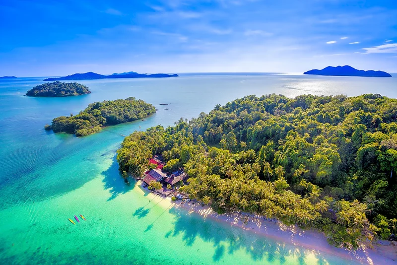
5. Mu Ko Chang National Park Mu Ko Chang National Park protects landscapes on Ko Chang and nearby islands in Trat province. Much of the main island consists of steep forested mountains, while beaches and fishing settlements follow the shoreline. Waterfalls, coral reefs and smaller offshore islands make this a distinctive land-and-sea destination.
Highlights: Khlong Phlu and Than Mayom waterfalls, Khiri Phet Waterfall, Ko Chang beaches, the Mu Ko Rang island group, Ko Wai, Ko Ngam and snorkeling areas.
History: Established on 31 December 1982, the marine park protects island watersheds, tropical forests, beaches, coral communities and marine habitats. Its inland freshwater systems are particularly significant because they support the communities and wildlife of a mountainous island.
Landscape and beaches: Forests cover the interior, feeding streams and cascades that descend toward the coast. White Sand Beach, Khlong Prao Beach and Kai Bae Beach offer different shoreline settings, while smaller islands can have clear water and reef habitats under suitable conditions.
Khlong Phlu and Than Mayom waterfalls: Khlong Phlu is reached by a forest walk from the visitor area. Than Mayom lies on the island's eastern side and has associations with visits by Thai monarchs, adding historical interest to its wooded stream landscape.
Mu Ko Rang and snorkeling: The offshore island group is popular for exploring reef fish and coral habitats. Boats depart from authorized locations when sea conditions permit; visitors should avoid standing on coral or disturbing marine animals.
Island communities: Salak Phet and Salak Khok are among the settlements that retain fishing traditions and a close relationship with the surrounding marine environment. Local boat journeys and village visits add cultural context to nature excursions.
Visiting Arrangements: Waterfall visitor sites have specific hours, and marine activities depend on weather, waves and local access rules.
Getting There: Drive from Bangkok toward Trat on the eastern road network and take a ferry from the mainland to Ko Chang. Use the island roads to reach individual beaches and waterfalls; outlying islands require a separate boat service.

6. Khao Laem Ya–Mu Ko Samet National Park Khao Laem Ya–Mu Ko Samet National Park in Rayong protects a varied coastal landscape of rocky headlands, beaches and islands. Khao Laem Ya is known for its grassy seaside hill, while Ko Samet and nearby islands are popular for white sand, ocean views and marine life.
Highlights: Khao Laem Ya coastal nature trail, Mae Ramphueng Beach, Ko Samet, Ko Kudi, Ko Thalu, sea-view viewpoints and designated snorkeling sites.
History: Established on 1 October 1981, the park protects coastal habitats including sandy beaches, beach forest, grass-covered headlands, rocky shores, coral reefs and the associated marine ecosystem.
Khao Laem Ya: This low coastal headland extends toward the Gulf of Thailand and has grassy slopes that change appearance with the seasons. Footpaths and viewpoints reveal the Rayong shoreline and islands beyond, offering an open landscape unlike a typical tropical beach.
Ko Samet and beaches: Ko Samet is widely known for beaches such as Sai Kaew, Ao Wong Duean and Ao Phrao. Visitors can combine swimming and beach walks with island exploration and boat trips, subject to the rules of each area.
Ko Kudi and Ko Thalu: The smaller offshore islands support marine environments and coral communities. Some zones permit snorkeling and nature study when weather conditions are favorable. Avoid touching coral or stepping on the seabed where reefs are present.
Coastal ecosystems: Beach forests, rocky shorelines and reefs provide complementary habitats for coastal plants, birds, small animals and fish. Responsible waste disposal and low-impact water activities help protect these environments.
Opening Days and Hours: The Khao Laem Ya visitor area generally lists daily access from 6:00 a.m. to 6:00 p.m.; island services follow separate schedules.
Getting There: From Bangkok, travel toward Rayong via Sukhumvit Road or Highway 36, then continue toward Ban Phe and Mae Ramphueng Beach. Boats to Ko Samet operate from Ban Phe; select the landing point that serves your chosen beach.
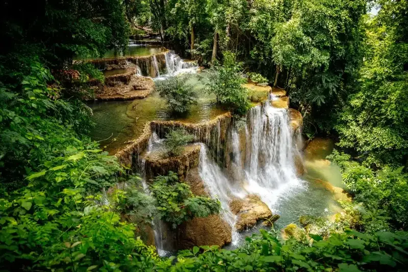
7. Sai Yok National Park Sai Yok National Park in Kanchanaburi combines limestone hills, caves, waterfalls and the Khwae Noi River. It is especially famous for Sai Yok Yai Waterfall, where water spills directly toward the river, against a backdrop of wooded slopes and dramatic limestone terrain.
Highlights: Sai Yok Yai, Sai Yok Noi, Lawa Cave, Daowadueng Cave, Khwae Noi River, forest paths and riverside scenery.
History: Established on 27 October 1980, the park protects forest and water resources in the Khwae Noi basin. The area is also connected with the historical river transport routes, communities and railway history of Kanchanaburi province.
Sai Yok Yai Waterfall: Also known as Khao Chon Waterfall, it flows over natural rock formations into the Khwae Noi River. The unusual combination of waterfall and major river makes it one of the park's most recognizable landscapes.
Lawa and Daowadueng caves: Limestone caverns contain chambers, stalactites and stalagmites developed over long periods. Follow marked paths and visitor rules to protect delicate formations and avoid hazardous sections.
River and forests: The Khwae Noi winds between wooded mountains, cliffs and tributary streams, creating important riparian habitats and attractive river scenery. Some visitor sites are accessible by land, while others may involve river travel.
Activities: Visitors come for waterfall viewing, nature walks, cave trips, river scenery and related historical excursions. All recreational activities should follow park restrictions and safety advice.
Opening Days and Hours: Generally daily, around 8:00 a.m.–4:30 p.m. at the main visitor facilities.
Getting There: From Kanchanaburi, follow Highway 323 toward Sai Yok district and then signs to the national park. Individual waterfalls, caves and visitor areas are reached by different side roads.
Map (GPS):Get directions to Sai Yok National Park

8. Namtok Chet Sao Noi National Park Namtok Chet Sao Noi National Park in Muak Lek district, Saraburi, is an accessible nature destination near Bangkok. Its namesake waterfall flows over seven relatively low rock steps, forming a succession of streamside pools and shaded areas suitable for relaxed walks and family visits.
Highlights: Seven waterfall tiers, smooth riverside rocks, permitted swimming areas, short nature paths and a leafy setting in Muak Lek.
History: The waterfall was managed as a forest park before becoming Namtok Chet Sao Noi National Park on 26 December 2016. Its name is associated with the seven levels of water flowing across the natural stone terraces.
Waterfall landscape: Unlike many steep mountain cascades, Chet Sao Noi spreads gently across shallow steps and broad rock shelves. The appearance and swimming conditions of each pool vary with the river level and season.
Relaxation and swimming: Designated streamside areas are popular for resting and paddling. Visitors must avoid deep pools and fast-flowing sections, particularly after heavy rain upstream.
Freshwater ecosystems: Streambank vegetation stabilizes soils and creates habitats for small animals. Protecting water quality and keeping litter out of the river are important responsibilities at this frequently visited site.
Nearby excursions: Muak Lek Waterfall and other natural attractions in Saraburi and neighboring Nakhon Ratchasima can be combined into a day trip or family weekend.
Opening Days and Hours: Generally daily, 8:00 a.m.–5:00 p.m. in the main visitor area.
Getting There: From Bangkok, follow Phahonyothin Road to Saraburi, then Mittraphap Road toward Muak Lek and local signs to the national park.
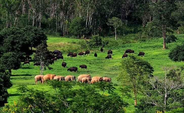
9. Kui Buri National Park Kui Buri National Park in Prachuap Khiri Khan is one of Thailand's best-known destinations for observing wild elephants and gaurs in their natural habitat. The mountainous Tenasserim landscape includes forests, grassland clearings and water sources used by wildlife. Visits to the wildlife-viewing area are organized rather than unrestricted.
Highlights: Wild elephant and gaur watching near the Huai Luek protection unit, forested hills, wildlife observation points and the park's important watershed habitats.
History: Established on 25 March 1999, Kui Buri protects wildlife habitats and forest resources in western Prachuap Khiri Khan. Management has also focused on restoring wildlife feeding areas and addressing the relationship between protected forests and neighboring settlements.
Wildlife viewing: Organized vehicles take visitors to designated observation areas near Huai Luek. Elephants and gaurs may emerge into grasslands and other open spaces, but appearances depend entirely on the animals, weather and seasonal conditions. No sighting can be promised.
Habitats and connected forest: Forest types vary by elevation and moisture, supporting a large network of feeding, drinking and resting sites. Maintaining connections between these habitats is important for large mammals and the health of the watershed.
Food-source restoration: Managed grassland and open feeding areas may provide forage for large herbivores. Visitor activities are planned to avoid disrupting elephant movements and feeding patterns.
Safety: Visitors must remain in permitted vehicles and follow the instructions of guides and rangers. Do not leave the vehicle in restricted zones, feed animals or make loud noises. Wild elephants and gaurs are powerful animals requiring respectful distance.
Visiting Arrangements: General park access and guided wildlife-viewing sessions operate separately, with specific routes and schedules for Huai Luek.
Getting There: Travel south along Phetkasem Road to Kui Buri district, then use the local access road to the Huai Luek wildlife-viewing area. It is distinct from the park headquarters, so the destination should be selected carefully.
Map (GPS):Get directions to Kui Buri National Park
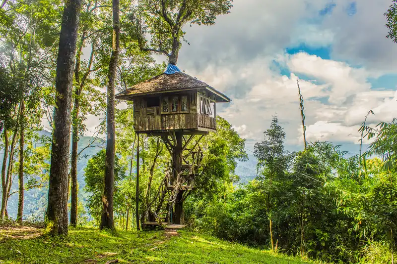
10. Thong Pha Phum National Park Thong Pha Phum National Park lies in the highlands of Kanchanaburi near the Thailand–Myanmar border. Mountain forests, cool-season mist, viewpoints and the Pilok area make it a favorite for those seeking a quieter mountain experience.
Highlights: Khao Chang Phueak, Noen Kut Doi viewpoint, sea-of-mist landscapes, Pilok, Ban E-Tong village, Jok Kradin Waterfall and forest trails.
History: Established on 23 December 2009, the park protects forests around Huai Khayeng and Khao Chang Phueak in the Tenasserim Range. Its mountain watersheds are important to western Thailand's ecological systems.
Khao Chang Phueak: This famous ridge walk is known for exposed, narrow sections and sweeping views. The Knife-Edge Ridge section requires particular care. Access is controlled, usually seasonal, and only suitable for hikers with adequate fitness and authorization.
Noen Kut Doi viewpoint: The viewpoint looks across layered mountains and valleys, sometimes filled with morning mist. Its atmosphere makes it a popular stop near permitted camping and visitor areas.
Ban E-Tong and mining heritage: This Pilok village grew in connection with former tin and tungsten mining activities. As mining declined, the area developed a distinctive mountain-tourism character while retaining memories of its borderland history.
Jok Kradin Waterfall: A waterfall descending from a rock face into a forested pool, reached along a winding mountain-road route in the Pilok area.
Seasonal conditions: Cooler months can bring mist and pleasant temperatures; rain makes forest roads wet and sometimes reduces visibility. Trekking routes open only when the park permits access.
Opening Days and Hours: Main visitor services commonly operate daily around 8:00 a.m.–4:30 p.m.; Khao Chang Phueak uses separate seasonal rules.
Getting There: From Kanchanaburi, take Highway 323 to Thong Pha Phum and Highway 3272 toward Pilok. The mountain road is steep and winding and requires cautious driving.
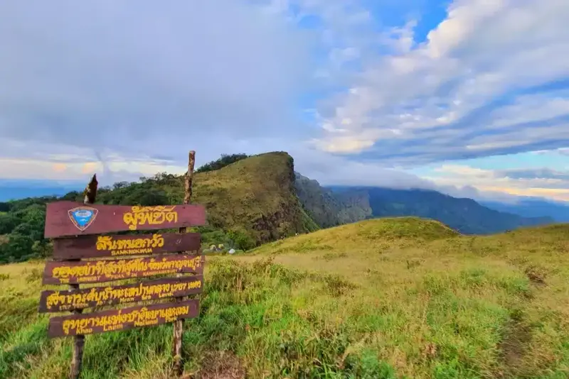
11. Khao Laem National Park Khao Laem National Park covers forested areas of Sangkhla Buri and Thong Pha Phum in Kanchanaburi. Mountains, waterfalls and expansive views across Vajiralongkorn Reservoir create a distinctive landscape where protected forest meets a broad artificial lake. The park is also closely linked with the cultural diversity of nearby Sangkhla Buri communities.
Highlights: Kroeng Krawia Waterfall, Dai Chong Thong Waterfall, Krateng Cheng Waterfall, Pom Pi viewpoint, Vajiralongkorn Reservoir and the Tenasserim Range forests.
History: Established on 5 December 1987, the park conserves wildlife, headwaters and forest resources in Kanchanaburi. It forms part of the wider western forest landscape, which is important for biodiversity and habitat connectivity along the mountain ranges.
Landscape and ecosystems: Mountain ridges, valleys and numerous streams support moist and dry evergreen as well as mixed deciduous forests. These interconnected habitats are essential for wildlife movement, water storage and environmental stability.
Kroeng Krawia Waterfall: This accessible cascade runs over large rocks amid trees near the main road between Thong Pha Phum and Sangkhla Buri. Its appearance changes with the flow of the stream and the amount of rainfall upstream.
Pom Pi viewpoint: A favorite sunset viewpoint over Vajiralongkorn Reservoir, where the evening light reflects across open water and silhouettes surrounding hills. The peaceful lakeside setting is particularly appealing for landscape photography.
Nearby cultural excursions: Travelers can combine Khao Laem with Uttamanusorn Bridge, Wat Wang Wiwekaram and Mon community attractions in Sangkhla Buri, creating a trip that brings together waterways, forest and local culture.
Opening Days and Hours: One published visitor-service window is 9:00 a.m.–4:00 p.m., but individual attractions follow their own schedules.
Getting There: Follow Highway 323 from Kanchanaburi through Sai Yok and Thong Pha Phum toward Sangkhla Buri. The headquarters, Kroeng Krawia Waterfall and Pom Pi viewpoint are separate stops along the route.
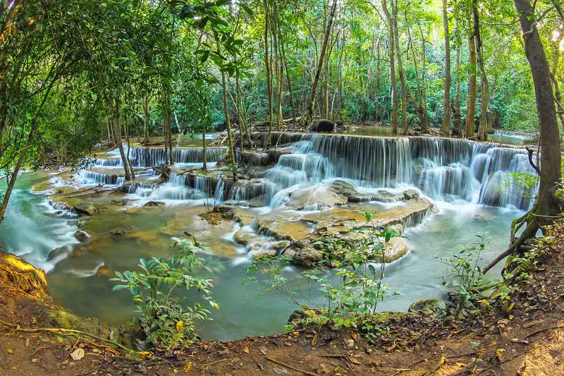
12. Khuean Srinagarindra National Park Khuean Srinagarindra National Park in Kanchanaburi protects extensive mountain forests and streams around Si Sawat. Its most celebrated attraction is Huai Mae Khamin Waterfall, where water flows over a sequence of limestone terraces. Wooded hills and the wide Srinagarindra Reservoir complete the setting.
Highlights: The seven levels of Huai Mae Khamin Waterfall, Srinagarindra Reservoir, Pha Sawan Waterfall, nature trails, western forest scenery and designated camping areas.
History: Established on 23 December 1981, the park conserves forests and watersheds connected to the Khwae Yai basin and the Srinagarindra reservoir area.
Landscape and forests: Mountain slopes and valleys hold streams and mixed deciduous, dry evergreen and moist evergreen forest. Limestone formations create the distinctive steps and cascades seen at several waterfalls, while the forest supports wildlife and freshwater systems.
Huai Mae Khamin Waterfall: Its seven tiers are Dong Wan, Man Khamin, Wang Na Pha, Chat Kaeo, Lai Chon Long, Dong Phi Suea and Rom Klao. Visitors can explore sections along marked natural paths; the pale limestone surfaces and curtain-like streams make each level visually distinctive.
Reservoir scenery: Srinagarindra Reservoir extends between wooded mountain ridges, forming attractive lake-and-forest views. Some permitted lakeside areas support camping and other regulated recreation, alongside local communities that have adapted to the reservoir environment.
Outdoor activities: Waterfall walks, nature study, photography and authorized camping are popular. Sloping trails, slick rock and sudden water-level changes during rainfall require care.
Related attractions: Srinagarindra Dam, Erawan National Park and other Si Sawat nature sites can be visited on a longer Kanchanaburi itinerary, but access roads and travel times vary.
Visiting Arrangements: Visitor areas and trails follow location-specific rules, with possible seasonal restrictions on forest routes.
Getting There: Take Highway 3199 from Kanchanaburi toward Srinagarindra Dam and Si Sawat, then follow the designated approach to Huai Mae Khamin or the chosen park destination.

13. Pang Sida National Park Pang Sida National Park lies in Sa Kaeo and parts of Prachin Buri. Its humid forests, waterfalls and unusually rich butterfly diversity make it an important nature destination and a component of the UNESCO-listed Dong Phayayen–Khao Yai Forest Complex.
Highlights: Pang Sida Waterfall, the Km 25 viewpoint, butterfly observation areas, forest trails and seasonal butterfly activities.
History: Established on 22 February 1982, Pang Sida protects forests and headwaters in eastern Thailand. Its inclusion in the Dong Phayayen–Khao Yai World Heritage complex, recognized in 2005, adds international importance to the park's biodiversity.
Landscape and habitats: Mountainous terrain supports moist evergreen, dry evergreen and mixed deciduous forest, along with many streams and waterfalls. Different moisture conditions create habitats for birds, insects, butterflies and other wildlife.
Pang Sida Waterfall: The main cascade flows over a cliff and rocky surfaces surrounded by forest. It is reached by a designated route from the visitor area and changes noticeably between wetter and drier months.
Butterflies and seasonal events: Numerous butterfly species congregate near damp streams and exposed soil, often to obtain minerals. This natural behavior underpins the local butterfly-watching festival, which helps raise awareness of the park's insect biodiversity.
Viewpoints and nature study: The Km 25 viewpoint is known for broad forest and mountain panoramas. Access on some higher, unpaved routes may be affected by heavy rain, road conditions and ranger restrictions.
Opening Days and Hours: A general service period of 6:00 a.m.–4:30 p.m. is listed for accessible zones, with exceptions for particular trails and seasonal conditions.
Getting There: Travel from Bangkok toward Sa Kaeo via Prachin Buri, then follow local roads north of Sa Kaeo town to Pang Sida National Park.

14. Thap Lan National Park Thap Lan National Park spans Prachin Buri and Nakhon Ratchasima and is notable for its natural stands of fan palms, diverse forests and connected mountain habitats. It is an important part of the Dong Phayayen–Khao Yai World Heritage landscape.
Highlights: Natural fan-palm forests, mountain viewpoints, nature trails and extensive World Heritage woodland. Khao Phaeng Ma is a notable attraction in the wider region, although it should not be mistaken for a site inside every section of Thap Lan.
History: Established on 23 December 1981, the park was created to protect forests and natural resources on the boundary between Prachin Buri and Nakhon Ratchasima. It became a component of the World Heritage forest complex inscribed in 2005.
Fan palms: The large-leaved lan palm is a botanically interesting species with a long life cycle. Natural palm stands help distinguish Thap Lan from more conventional evergreen or deciduous forest landscapes and provide opportunities for plant interpretation.
Landscape and wildlife habitats: Mountains, valleys and forests are connected with other protected areas such as Khao Yai and Pang Sida. Keeping these corridors intact allows large mammals to move between feeding and drinking areas without being isolated in fragmented forest patches.
Touring the park: Viewpoints, roads and forest attractions are scattered across a broad area. Some sites can be appreciated from established routes, while others require specific permits or a controlled walking route.
Conservation: Preserving the palm stands is only one objective. The park also protects water sources, biodiversity and the continuity of a forest complex with recognized international value.
Visiting Arrangements: Each visitor zone has its own conditions; entry to protected forest or restricted trails requires permission.
Getting There: Highway 304 connects the Bangkok area with Prachin Buri and Na Di, while alternative approaches are possible from Wang Nam Khiao in Nakhon Ratchasima. Choose the entrance that serves your intended attraction.
Map (GPS):Get directions to Thap Lan National Park

15. Namtok Phliu National Park Namtok Phliu National Park in Chanthaburi combines a shaded waterfall and clear stream habitats with places of historical significance from the reign of King Chulalongkorn. Visitors are especially drawn to the many freshwater fish seen in the pools, together with the park's distinctive royal memorials.
Highlights: Phliu Waterfall, freshwater fish, Alongkon Chedi, the Queen Sunandha memorial pyramid, forest paths and the lush Khao Sa Bap mountain environment.
History: Established on 2 May 1975, the park was originally called Khao Sa Bap National Park and later renamed for its best-known waterfall. It protects an important forest watershed close to Chanthaburi town.
Waterfall and freshwater fish: The waterfall flows between forested rocks and into pools inhabited by freshwater fish commonly known locally as pla phluang. Watching fish is a memorable part of the visit, but visitors must keep the stream clean and comply with park regulations.
Alongkon Chedi: This historical monument commemorates royal visits associated with King Chulalongkorn (Rama V), adding a cultural and historical dimension to the natural site.
Queen Sunandha memorial pyramid: King Chulalongkorn commissioned this pyramid-shaped memorial in remembrance of Queen Sunandha Kumariratana, who died in a royal boat accident. The monument stands among the trees and is one of the area's most important historical landmarks.
Forests and watershed: The Khao Sa Bap mountains support tropical forest and many streams. Vegetation helps regulate runoff, stabilize soil and sustain the humid habitats surrounding the waterfall.
Nearby excursions: Visitors can combine Phliu Waterfall with historic Chanthaboon Riverside Community, temples in Chanthaburi and attractions toward Laem Sing, depending on their travel plan.
Opening Days and Hours: Generally daily, 8:30 a.m.–5:30 p.m.
Getting There: From Chanthaburi town, take Sukhumvit Road toward Khlung and follow the signed road to Phliu Waterfall, roughly 14 kilometers from town.

16. Khao Khitchakut National Park Khao Khitchakut National Park in Chanthaburi protects forested mountains in Khao Khitchakut and Makham districts. It is well known for Khao Phra Bat Phluang, a sacred mountain pilgrimage destination, as well as Krathing Waterfall and important upland water sources.
Highlights: The sacred Buddha footprint at Phra Bat Phluang, the annual pilgrimage, Krathing Waterfall, Khlong Chang Se Waterfall and mountain forest scenery.
History: Established on 4 May 1977, the park protects upland forest and watersheds. The mountain also has long-standing religious significance associated with the annual ascent to pay respects to the Buddha footprint.
Phra Bat Phluang pilgrimage: Devotees travel to the revered footprint during an officially designated annual period. Reaching the mountain involves regulated shuttle transport and some walking, with safety arrangements for large numbers of pilgrims. This route is not a freely accessible year-round hiking trail.
Annual religious tradition: The pilgrimage remains an important expression of Buddhist faith in Chanthaburi and attracts people from many provinces. Organizers announce dates and entry rules for each year, linking the spiritual life of local communities with the landscape of the protected mountain.
Krathing Waterfall: A series of waterfalls and rocky streambeds lies amid moist forest. Walking conditions and gradients differ between tiers; the stream network illustrates the ecological value of mountain watershed forests.
Forest and headwaters: Moist evergreen, upland evergreen and other forest communities support wildlife, birds and native plants, while the higher terrain supplies water to Chanthaburi's river systems.
Nearby attractions: Krathing Waterfall, Wat Phluang and local Khao Khitchakut attractions can be included on a trip, with different arrangements depending on whether the visit is a pilgrimage or a nature outing.
Visiting Arrangements: The waterfall and general park zones have their own opening hours; the Buddha-footprint route is open only during the announced pilgrimage season.
Getting There: Travel from Chanthaburi to Khao Khitchakut district and Phluang subdistrict. Use the signed route to Krathing Waterfall or the designated pilgrimage shuttle boarding area according to your purpose.

17. Hat Wanakon National Park Hat Wanakon National Park in Thap Sakae, Prachuap Khiri Khan, is a peaceful marine park known for its long sandy beach and rows of casuarina trees. Its relatively quiet atmosphere makes it suitable for seaside relaxation, sunrise viewing and permitted camping.
Highlights: Wanakon Beach, coastal casuarina groves, Ko Chan, Ko Thai Tri, seasonal snorkeling and the wide sunrise horizon.
History: Established on 30 December 1992, Hat Wanakon protects a coastal landscape of beaches, coastal vegetation and nearby marine habitats while providing carefully managed recreational areas.
Beach and casuarina forest: A long shoreline and groves of wind-shaped trees create shade and a pleasant walking environment. On clear mornings the beach offers unobstructed views of sunrise over the Gulf of Thailand.
Ko Chan and Ko Thai Tri: These small offshore islands contribute to the marine park's coastal habitats. Any boat trips or reef-related activities depend on sea conditions and current permissions, and marine life should not be disturbed.
Activities: Walking, landscape photography, seaside relaxation and camping in designated areas are common reasons to visit. Compared with highly developed resorts, the park emphasizes simple contact with nature.
Coastal ecology: Salt-tolerant plants and beach forest species help stabilize the shoreline and support birds and smaller animals. Protecting native vegetation maintains the park's distinctive coastal character.
Related excursions: Hat Wanakon can be paired with Namtok Huai Yang National Park and other Thap Sakae attractions, contrasting mountain streams with the Gulf coast.
Visiting Arrangements: Beach access follows park rules; boats and offshore visits depend on favorable seas and official authorization.
Getting There: Travel south along Phetkasem Road to Thap Sakae, south of Prachuap Khiri Khan town, then follow signs from the main highway to the park's beach and visitor area.
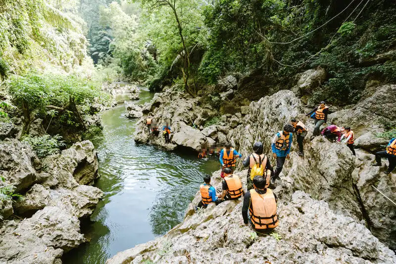
18. Lam Khlong Ngu National Park Lam Khlong Ngu National Park in Thong Pha Phum, Kanchanaburi, is known for exceptional limestone caves and a stream that runs through underground passages. Unlike ordinary sightseeing caves, several attractions involve challenging guided routes with water, rocks and confined sections.
Highlights: Tham Sao Hin, Tham Nok Nang Aen, Tham Nam Tok, Tham Ti Phu Che and guided exploration of the Lam Khlong Ngu cave system.
History: Established on 25 December 2009, the park protects limestone mountain forests, streams and cave environments. Its name comes from the Lam Khlong Ngu watercourse, which has shaped the local underground karst landscape.
Tham Sao Hin: This celebrated cave features a massive natural limestone column formed over a long period as stalactite and stalagmite deposits gradually joined. The cave is an important geological feature and a remarkable destination for qualified cave visitors.
Tham Nok Nang Aen: Large underground chambers and stream passages create a demanding environment that can involve wet rocks, slopes and moving through water. Visitors must use approved safety equipment and experienced park supervision.
Cave geology: Water gradually dissolves limestone along fractures, enlarging cavities and passages. In other areas, minerals precipitate to form stalactites, stalagmites and columns, preserving evidence of geological changes over long time spans.
Guided cave activities: Adventures may require helmets, flotation devices, physical stamina and the ability to follow specialized instructions. They are not suitable for every visitor, especially those with mobility limitations or inadequate preparation.
Season and safety: Flash floods are a serious risk in underground streams. Guided entry is limited to announced seasonal periods and ranger-controlled bookings based on water conditions and safety assessments.
Visiting Arrangements: The visitor area and adventure caves do not share the same unrestricted access rules. Advance registration is needed for organized cave visits.
Getting There: Take Highway 323 from Kanchanaburi through Sai Yok to Thong Pha Phum, then proceed toward Chalae subdistrict and the park headquarters. Specific caves require further ranger-organized travel.

19. Namtok Sam Lan National Park Namtok Sam Lan National Park in Mueang Saraburi district protects wooded hills and attractive waterfalls close to Bangkok. Its main waterfall runs over broad rock terraces, while several other streams, trails and viewpoints provide additional nature experiences within a short journey of Saraburi town.
Highlights: Sam Lan Waterfall, Pho Hin Dat Waterfall, Ton Rak Sai Waterfall, Khao Khrok viewpoint and streamside walking routes.
History: The park was established on 2 June 1981 under the name Phra Phutthachai National Park before later being renamed Namtok Sam Lan National Park. Its protection helps conserve forest, streams and green space near the provincial center.
Sam Lan Waterfall: Water descends across wide rock platforms when sufficient rain feeds the stream. Trees surround the cascade, and designated walking areas make the main waterfall accessible without a long wilderness trek.
Other waterfalls: Pho Hin Dat and Ton Rak Sai illustrate the variety of tributaries in the park. Access varies with the season, stream flow and the condition of the paths.
Khao Khrok viewpoint: The uphill route offers a different perspective over hills and forest than the streamside visitor areas. Use only accessible trails and prepare for natural slopes.
Ecosystems: Vegetation across the hills stabilizes soils, supports small wildlife and helps protect local freshwater systems, an important function for a protected area near built-up communities.
Related attractions: Wat Phra Phutthachai and other Saraburi landmarks can be combined with a visit, making the park suitable for a day trip or a stop during a longer journey.
Opening Days and Hours: Generally daily, 8:00 a.m.–6:00 p.m. at the main visitor area.
Getting There: Take Phahonyothin Road toward Saraburi, then use the local road toward Wat Phra Phutthachai and Namtok Sam Lan National Park.

20. Chaloem Rattanakosin National Park Chaloem Rattanakosin National Park, also called Tham Than Lot National Park, is a limestone-forest destination in Si Sawat, Kanchanaburi. Its best-known trail passes through Tham Than Lot Noi and Tham Than Lot Yai, showcasing caverns, flowing streams and the geological character of the western hills.
Highlights: Tham Than Lot Noi, Tham Than Lot Yai, Trai Trueng Waterfall, limestone streams and cave-linked nature trails.
History: Established on 12 February 1980, the park is relatively small compared with other protected areas in Kanchanaburi but holds important geological and forest habitats.
Tham Than Lot Noi: A stream flows through this limestone cave, reached by a designated walking path. Cavities, walls and mineral formations reveal how flowing water has shaped rock over long periods. Visitors should watch for wet, slippery surfaces.
Tham Than Lot Yai: This large cavern has a high ceiling and natural openings that let daylight enter some sections. Its impressive spaces and rock formations are highlights of the nature trail.
Trai Trueng Waterfall: Water runs over rocks through humid forest, providing another example of the area's connected streams and limestone landforms. Flow levels vary according to rainfall.
Limestone ecosystems: Specialized plants survive on thin soils and rocky slopes, while cave habitats shelter animals adapted to damp conditions and reduced light. Staying on marked paths helps protect these environments.
Walking safety: Routes include level stretches, slopes and uneven natural terrain. Shoes with secure grip are important, particularly after rain when streams rise and rocks become slippery.
Opening Days and Hours: Visitor facilities generally operate daily, 8:00 a.m.–4:30 p.m., while cave routes may close for safety.
Getting There: From Kanchanaburi, travel toward Si Sawat, then follow local signs to Chaloem Rattanakosin National Park. The visitor area is an important starting point for the Than Lot cave trail.

21. Ta Phraya National Park Ta Phraya National Park protects forested landscapes along the Thailand–Cambodia border in Sa Kaeo and Buri Ram. Hills, headwater streams and woodland associated with the Phanom Dong Rak range make the park important for biodiversity as well as the cultural and historical story of the borderlands.
Highlights: Ta Phraya forests, mountain landscapes of the Phanom Dong Rak range, Khao Phran Nut and officially accessible nature-study routes.
History: Established on 22 November 1996 as Thailand's 82nd national park, Ta Phraya occupies a region shaped by border history, including periods of conflict and population movement during the 1970s and 1980s. Conservation management now protects part of this sensitive frontier landscape.
Landscape: Rugged hills and mountain ridges form important headwaters for streams descending toward settlements and agricultural land. Forest habitats change with elevation, soil and moisture conditions.
Wildlife and forest ecology: Protected vegetation sustains birds, mammals and many smaller forest species. Keeping the forest connected with neighboring habitats is essential for wildlife movement and biodiversity protection.
Historical significance: The border setting provides a reminder that the region has experienced changing patterns of security, settlement and movement. The park's landscape therefore holds historical interest beyond its natural character.
Visitor restrictions: Some areas are subject to border-security controls, and not all forest routes are open to independent travelers. Remain within routes explicitly authorized by staff and never enter restricted border forest.
Getting There: From Bangkok, travel toward Sa Kaeo on Highway 33, continue to Ta Phraya district and use local roads leading to authorized visitor areas. Access arrangements depend on the security and conservation requirements of each zone.

22. Khao Chamao–Khao Wong National Park Khao Chamao–Khao Wong National Park spans Rayong and Chanthaburi and is valued for moist evergreen forests, multi-level waterfalls and limestone caves. The main Khao Chamao waterfall is reached by a forest trail with several named stream pools, while the Khao Wong section offers a different karst landscape.
Highlights: Khao Chamao Waterfall, Khlong Nam Sai Waterfall, Wang Nueng, Wang Matcha, Pha Kluai Mai, Wang Morakot, Khao Wong caves and forest nature trails.
History: Established on 31 December 1975, the park protects forest watersheds in eastern Thailand. It has developed into a well-known conservation tourism destination, combining waterfall trails and limestone geology.
Khao Chamao Waterfall: The stream descends through a succession of rocky pools with names such as Wang Nueng, Wang Matcha, Pha Kluai Mai and Wang Morakot. A trail follows the wooded stream, revealing large trees and lush understory vegetation.
Wang Matcha and the stream: This natural pool is known for freshwater fish. Visitors should avoid disturbing fish or polluting the water; protection of the stream system helps preserve the whole waterfall environment.
Khao Wong caves: Limestone hills contain natural caves with cavities and mineral formations created as groundwater gradually dissolved rock and deposits formed stalactites and stalagmites. These systems also shelter organisms adapted to low-light environments.
Forests and wildlife: Dense evergreen vegetation supports birds, insects and other wildlife characteristic of eastern Thailand's humid climate. The forest canopy helps regulate humidity, protect streams and create valuable habitats.
Opening Days and Hours: A waterfall visiting window of approximately 8:30 a.m.–4:00 p.m. is published; check separate cave and trail conditions.
Getting There: From Rayong town, head toward Klaeng and Khao Chamao districts, then follow park signs. The main waterfall and the Khao Wong cave area have different approach roads.

23. Khao Sip Ha Chan National Park Khao Sip Ha Chan National Park in Kaeng Hang Maeo district, Chanthaburi, protects forested mountain landscapes, natural waterfalls and headwaters. It appeals to travelers interested in quieter nature experiences, forest walks and seasonal camping away from large tourism centers.
Highlights: Khao Sip Ha Chan Waterfall, Khlong Saba Waterfall, I Kek Waterfall, Noen Pradu camping area and forest study routes.
Landscape: The mountain system extends broadly north–south, with Khao Sip Ha Chan rising to approximately 802 meters above sea level. Streams descend through valleys toward lower-lying parts of Chanthaburi, sustained by humid forest vegetation.
Khao Sip Ha Chan Waterfall: A natural waterfall reached by a forest-study trail of approximately 4.8 kilometers from the service area. Walking through forest and streams provides an opportunity to observe the important relationship between upland vegetation and water resources.
Khlong Saba Waterfall: This medium-sized waterfall has approximately six levels and lies about 6 kilometers from the park headquarters along the relevant route. Water originates in the surrounding mountain system and flows through a forested catchment.
Noen Pradu: This elevated site is associated with forest scenery and camping under suitable seasonal conditions. On clear nights the mountain environment can offer attractive sky views, while all overnight visits remain subject to park arrangements.
Forest ecology: Streams such as Khlong Tanot and Khlong Saba, together with smaller tributaries, form an important watershed network. Protecting the forests helps maintain water quality and supports diverse plants and wildlife.
Getting There: Travel from Chanthaburi town to Kaeng Hang Maeo district, then follow local roads toward Khun Song subdistrict and the park headquarters. Individual waterfall trips may require further driving or hiking on designated routes.
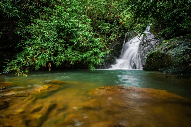
24. Namtok Khlong Kaeo National Park Namtok Khlong Kaeo National Park lies in Trat province, particularly around Bo Rai district. Mountain slopes, tropical evergreen forest and several waterfalls distinguish it from Trat's better-known island destinations. The park protects inland forests and headwaters in the eastern border region.
Highlights: Khlong Kaeo Waterfall, Salat Dai Waterfall, Khlong Chai Waterfall, Khlong Thai Waterfall and forest nature-study routes where access is permitted.
Landscape and watersheds: Hills and valleys support many streams. Forest soils and vegetation retain moisture, feeding waterfalls and watercourses that continue toward agricultural and inhabited areas.
Khlong Kaeo Waterfall: Water flows over rocky steps amid dense tropical forest. The shaded and humid stream environment illustrates the character of the province's inland ecosystem and creates appealing scenery for walkers and nature photographers.
Other waterfalls and streams: A number of waterfalls occur across the protected forest. Some require longer walks or special permission, and visitors should be alert to slippery rocks, fast currents and the risk of getting lost.
Biodiversity: Evergreen forests provide habitats for birds, insects, reptiles and other wildlife. Conditions vary with slope, elevation and moisture, supporting a wide range of native vegetation.
Responsible tourism: Remaining on designated routes, avoiding wildlife disturbance and keeping streams clean are central to maintaining the park's natural character.
Opening Days and Hours: The general visitor area commonly operates daily, 8:00 a.m.–4:30 p.m., with possible route-specific restrictions.
Getting There: From Trat town, travel toward Bo Rai district and use local signs to Namtok Khlong Kaeo National Park. Certain waterfall trails begin beyond the main parking area.

25. Chaloem Phrakiat Thai Prachan National Park Chaloem Phrakiat Thai Prachan National Park in Ratchaburi conserves forest landscapes associated with the Phachi River watershed and the Tenasserim mountains. Hills, valleys, streams and rural communities characterize this less heavily visited natural area near Pak Tho district.
Highlights: Thai Prachan forest, the Phachi watershed, Tenasserim mountain terrain, natural streams, forest study and nearby rural communities.
History: Established on 24 January 2012 as Thailand's 124th national park, the protected area covers approximately 205,463 rai, or 328.74 square kilometers. Its designation followed surveys of forests on the left bank of the Phachi River that demonstrated their importance for Ratchaburi's natural environment.
Landscape: Forested mountain slopes and valleys feed streams flowing into the Phachi River system. Vegetation helps hold soil, store rainfall and regulate runoff for downstream communities.
Forests and biodiversity: Different forest conditions occur with changing elevation and moisture levels. These habitats support wild animals, native plants and the broader ecological connections of western Thailand.
Natural streams and the watershed: Tributaries from the Tenasserim Range are essential to the Phachi system. Maintaining upstream forest cover reduces erosion and helps safeguard natural waterways used by surrounding settlements.
Local communities and visitors: The park has links with rural and agricultural communities in Ratchaburi. Visiting permitted areas offers opportunities to appreciate mountain scenery and learn how natural resources relate to local livelihoods.
Getting There: Travel from Ratchaburi town toward Pak Tho district and follow local access routes to the Thai Prachan area. Entry into deeper forest zones is restricted to authorized routes.

26. Phu Toei National Park Phu Toei National Park in Dan Chang district is Suphan Buri's only national park. Its landscape contains high mountains, pine forest, streams and forest communities. Khao Thewada and Karen settlements around Taphoen Khi add natural and cultural interest, while a memorial recalls a notable event in Thailand's aviation history.
Highlights: Khao Thewada summit, two-needle pine forest, Taphoen Khi Karen village and waterfall, Taphoen Ngern, Taphoen Thong and Taphoen Phet caves, and the Lauda Air memorial.
History: Established on 30 September 1998, the park covers roughly 198,422 rai. Its mountain forests are important to the province's headwaters. Phu Toei is also associated with the crash of a Lauda Air passenger flight on 26 May 1991, an important event in Thailand's aviation history.
Khao Thewada: This high summit is valued for mountain and forest views. Access involves steep forest walking and requires both physical fitness and compliance with ranger instructions and current trail-opening arrangements.
Pine forest: Natural stands of two-needle pine grow in suitable mountain environments, creating a distinct forest landscape different from lower-elevation deciduous forest. These trees contribute to the park's botanical importance.
Taphoen Khi community: The Karen settlement preserves cultural practices and ways of life shaped by the mountains, local agriculture and the surrounding forest. Responsible cultural visits help travelers understand the human history of the landscape.
Lauda Air memorial: The area preserves a reminder of the aircraft disaster of 26 May 1991. This memorial gives the park a historical dimension beyond its waterfalls and mountain views.
Access status: A temporary closure of tourism and overnight stays was announced from 8 April 2026 due to wildfire and haze conditions. Reopening must be confirmed through an official notice; the earlier closure should not be presented as a permanent closure.
Getting There: From Bangkok, take Highway 340 toward Suphan Buri and continue to Dan Chang. Mountain access roads include approaches through Ban Plak Pradu and Ban Wang Khan; road suitability and current access must be checked.
Map (GPS):Get directions to Phu Toei National Park
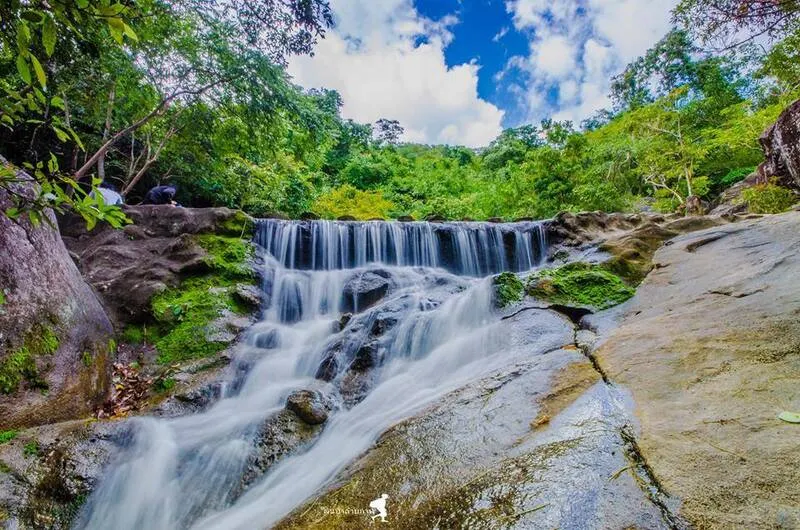
27. Namtok Huai Yang National Park Namtok Huai Yang National Park in Prachuap Khiri Khan protects forests and streams along the Tenasserim Range in Thap Sakae and Bang Saphan districts. Its centerpiece is Huai Yang Waterfall, a multi-level cascade amid humid woodland, offering a mountain-and-stream contrast to the province's beaches.
Highlights: Huai Yang Waterfall, multiple waterfall levels, forest trails, Tenasserim watershed habitats and shaded mountain streams.
History: Established on 8 December 1991 as Thailand's 70th national park, it covers approximately 100,625 rai. Protection of the forests helps maintain water resources and habitats in southern Prachuap Khiri Khan.
Huai Yang Waterfall: The stream runs down rocky slopes through forest and includes several levels with paths to selected sections. Cascading water, large rocks and tall trees create a cool, scenic environment for walking and photography.
Forest and watershed: A range of forest habitats occurs at different elevations and moisture conditions. This vegetation supports mountain wildlife and regulates freshwater streams flowing to lowland communities.
Nature walks: The trails reveal local plants, forest streams and geological features. Exposed roots, uneven rocks and steep segments can be slippery after rainfall, so secure footwear is important.
Related excursions: The park can be visited alongside Hat Wanakon National Park and other Thap Sakae coastal attractions, combining forest waterfalls and seaside landscapes in a single journey.
Opening Days and Hours: The general service area commonly operates daily from 8:00 a.m. to 4:30 p.m.
Getting There: Follow Phetkasem Road south from Bangkok toward Thap Sakae district, then take signed local roads to the waterfall and park visitor area.
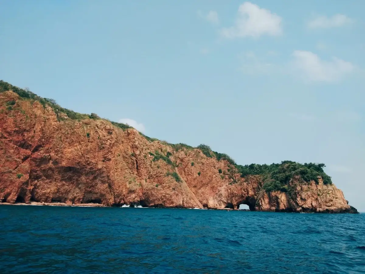
28. Ao Siam National Park (Proposed) Ao Siam National Park (Proposed) is a conservation area in Prachuap Khiri Khan involving important habitats in Bang Saphan and Bang Saphan Noi districts. Forests, swamp woodland, wetlands, coastal waters and islands are brought together within the proposed protected landscape. Key places include Pa Klang Ao, Pa Mae Ramphueng, Ko Thalu, Ko Sing and Ko Sang. Its official administrative status remains a national park under preparation, not a fully designated national park.
Highlights: Ancient yang-na trees in Pa Klang Ao, wetlands at Pa Mae Ramphueng, Ko Thalu, Ko Sing, Ko Sang, coral reefs, hawksbill turtle nesting habitat, Ao Thian, Ao Nai Hup and nature walks through lowland forest.
Historical background: Conservation efforts focus on the forest habitats and marine resources of Bang Saphan and Bang Saphan Noi. Pa Klang Ao is also remembered locally for a royal visit by King Bhumibol Adulyadej, Queen Sirikit and members of the royal family on 20 May 1977.
Proposed national park: Surveys and administrative work have considered an area of about 8,021 rai, including Pa Klang Ao, Khlong Mae Ramphueng forest areas and parts of Ko Thalu, Ko Sing, Ko Sang and surrounding waters. Local participation is part of the effort to balance nature protection and the livelihoods of fishing communities.
Pa Klang Ao and mature yang-na trees: This lowland forest close to the sea contains tall mature dipterocarp trees and a shaded canopy. Its botanical character differs from that of typical beach forest or mangrove vegetation. Other large native trees and understory plants contribute to a complex living environment.
Yang-na forest ecology: Broad tree crowns cool the forest floor, while root systems help stabilize soils and retain moisture. Nature walks introduce visitors to the relationship between vegetation, wildlife, water and soil in a distinctive coastal lowland forest.
Pa Mae Ramphueng wetlands: The area's swamp and wetland habitats support plants adapted to waterlogged soils, including melaleuca trees. Wetlands play important roles in water storage and in providing habitat for freshwater and coastal species.
Ko Thalu: Famous for the natural opening through a coastal rock formation, the island is one of Bang Saphan Noi's best-known marine landmarks. Wave erosion shaped the opening over time. Nearby reef environments are important for marine biodiversity.
Hawksbill turtle conservation: Ko Thalu has value as nesting habitat for hawksbill sea turtles, a protected marine species. Maintaining natural beaches, managing litter and limiting disturbance supports turtle conservation and the broader health of the island environment.
Ko Sing and Ko Sang: These small islands form part of the local marine ecosystem, with rocky shores and nearby waters linked ecologically to Ko Thalu and surrounding reefs. Conserving the group requires considering the complete island-and-water habitat rather than a single beach.
Coral reefs and marine wildlife: Coral structures provide shelter, feeding areas and breeding habitats for a variety of fish and invertebrates. Their protection matters to biodiversity and traditional fishing communities.
Marine excursions: Authorized boats visit Ko Thalu and neighboring islands for scenery and snorkeling when conditions permit. Places such as Ao Thian and Ao Nai Hup add coastal interest. Visitors should avoid contact with reefs and respect all conservation rules.
Fishing communities: Villages in Bang Saphan and Bang Saphan Noi have long depended on seasonal seas and marine resources. Community participation in conservation helps reconcile ecological protection with local livelihoods.
Environmental restoration: Marine litter collection, habitat care and cooperation with tourism operators form part of local efforts to protect Ko Thalu and its surrounding waters, including habitats used by sea turtles.
Related excursions: Travelers can combine Pa Klang Ao forest walks with mainland beaches or a boat excursion to Ko Thalu. Mainland forest sites are reached by road; islands require appropriate boats and favorable sea conditions.
Legal status: The area operates under the name Ao Siam National Park (in preparation) under the Department of National Parks, Wildlife and Plant Conservation. It must not be counted as an already gazetted national park.
Getting There: Take Phetkasem Road south through Prachuap Khiri Khan toward Bang Saphan. Local roads lead to Pa Klang Ao in Mae Ramphueng subdistrict. For Ko Thalu and nearby islands, continue to Bang Saphan Noi and use an operating boat service.
| Article Title | 28 National Parks and Nature Destinations in Central, Eastern and Western Thailand | |||
| Number of Destinations | 28 destinations in this article: 27 gazetted national parks and Ao Siam, which remains under preparation. This is not a complete official register of every national park in these regions. | |||
| Regions Covered | Central, Eastern and Western Thailand, including some national parks extending into Northeastern Thailand. | |||
| Types of Attractions | Forests, mountains, waterfalls, caves, wetlands, reservoirs, beaches, islands and coral reefs. | |||
| Activities | Nature walks, birdwatching, wildlife observation, waterfalls, sea-of-mist viewpoints, camping, caves and snorkeling in areas open to visitors. | |||
| World Natural Heritage Sites | Dong Phayayen–Khao Yai Forest Complex and Kaeng Krachan Forest Complex. | |||
| Best Seasons | Cooler months for forest and mountain travel; wetter months for lush waterfalls, with some trail closures; marine trips depend on monsoon winds and sea conditions. | |||
| Transport | Private car or rental vehicle for many mainland sites; boats for islands; approved shuttle services or guides for some locations. | |||
| Opening Days and Hours | Opening times vary by national park and visitor site. Confirm the specific destination before travelling. | |||
| Responsible Agency | Department of National Parks, Wildlife and Plant Conservation (DNP), Thailand. | |||
| No. | National Park / Province | Highlights & Activities | Visiting Arrangements | Map (GPS) |
| 1 | Khao Yai National Park Nakhon Ratchasima, Saraburi, Nakhon Nayok, Prachin Buri | Waterfalls, wildlife watching and nature trails | Some trails and wildlife-viewing areas have restrictions. | Directions |
| 2 | Kaeng Krachan National Park Phetchaburi and Prachuap Khiri Khan | Sea of mist, birdwatching and butterflies | Ban Krang and Phanoen Thung are seasonally closed. | Directions |
| 3 | Erawan National Park Kanchanaburi | Seven waterfall tiers and hiking | Follow opening times for the designated waterfall route. | Directions |
| 4 | Khao Sam Roi Yot National Park Prachuap Khiri Khan | Phraya Nakhon Cave, wetlands and birdwatching | Individual cave, wetland and viewpoint areas operate separately. | Directions |
| 5 | Mu Ko Chang National Park Trat | Waterfalls, island excursions and snorkeling | Boat service depends on waves and weather. | Directions |
| 6 | Khao Laem Ya–Mu Ko Samet National Park Rayong | Beaches, snorkeling and viewpoints | Island attractions require boats. | Directions |
| 7 | Sai Yok National Park Kanchanaburi | Riverside waterfalls and caves | Different waterfalls and caves use separate access routes. | Directions |
| 8 | Namtok Chet Sao Noi National Park Saraburi | Seven-tier waterfall and streamside recreation | Swim only in approved areas. | Directions |
| 9 | Kui Buri National Park Prachuap Khiri Khan | Wild elephant and gaur viewing | Wildlife viewing follows organized vehicle sessions. | Directions |
| 10 | Thong Pha Phum National Park Kanchanaburi | Mountain viewpoints and seasonal trekking | The Khao Chang Phueak trail requires seasonal permission. | Directions |
| 11 | Khao Laem National Park Kanchanaburi | Kroeng Krawia Waterfall and Pom Pi viewpoint | Individual sites have specific opening arrangements. | Directions |
| 12 | Khuean Srinagarindra National Park Kanchanaburi | Huai Mae Khamin Waterfall and reservoir scenery | Remote forest trails may be restricted seasonally. | Directions |
| 13 | Pang Sida National Park Sa Kaeo and Prachin Buri | Pang Sida Waterfall and butterflies | Mountain routes may close during heavy rain. | Directions |
| 14 | Thap Lan National Park Prachin Buri and Nakhon Ratchasima | Natural fan-palm forest and mountain habitats | Restricted forest zones require ranger permission. | Directions |
| 15 | Namtok Phliu National Park Chanthaburi | Phliu Waterfall, fish and royal memorials | Follow waterfall visiting hours and park rules. | Directions |
| 16 | Khao Khitchakut National Park Chanthaburi | Buddha footprint pilgrimage and Krathing Waterfall | Buddha-footprint pilgrimage operates only in its announced annual period. | Directions |
| 17 | Hat Wanakon National Park Prachuap Khiri Khan | Beach, casuarina groves and camping | Offshore trips depend on sea conditions and authorization. | Directions |
| 18 | Lam Khlong Ngu National Park Kanchanaburi | Guided cave expeditions and rock formations | Adventure caves require advance booking and ranger supervision. | Directions |
| 19 | Namtok Sam Lan National Park Saraburi | Sam Lan Waterfall and nature walks | Use the trails open on the day of travel. | Directions |
| 20 | Chaloem Rattanakosin National Park Kanchanaburi | Than Lot caves and limestone forests | Cave trails can close due to stream conditions. | Directions |
| 21 | Ta Phraya National Park Sa Kaeo and Buri Ram | Border forest and mountain ecosystems | Security restrictions apply to some border areas. | Directions |
| 22 | Khao Chamao–Khao Wong National Park Rayong and Chanthaburi | Khao Chamao Waterfall and Khao Wong caves | Waterfall and cave zones have different access arrangements. | Directions |
| 23 | Khao Sip Ha Chan National Park Chanthaburi | Forest trails, waterfalls and camping | Check trail and camping permissions. | Directions |
| 24 | Namtok Khlong Kaeo National Park Trat | Waterfalls and tropical rainforest | Some waterfalls need ranger permission or further hiking. | Directions |
| 25 | Chaloem Phrakiat Thai Prachan National Park Ratchaburi | Phachi watershed and forest scenery | Follow authorized forest routes. | Directions |
| 26 | Phu Toei National Park Suphan Buri | Khao Thewada, pine forests and heritage | Tourism and overnight stays were temporarily closed from 8 April 2026; confirm reopening. | Directions |
| 27 | Namtok Huai Yang National Park Prachuap Khiri Khan | Huai Yang Waterfall and mountain trails | Waterfall routes may vary with conditions. | Directions |
| 28 | Ao Siam National Park (Proposed) Prachuap Khiri Khan | Pa Klang Ao forest, Ko Thalu and marine conservation | Proposed park area, not a fully gazetted national park; follow local access rules. | Directions |
Frequently Asked Questions (FAQ)
Q: How many national parks in Central, Eastern and Western Thailand are included in this article?
A: This guide presents 28 destinations in the three regions: 27 officially established national parks and the proposed Ao Siam National Park area. The number refers to the editorial selection in this guide, not an official complete count of every national park in these regions.
Q: Which national parks are convenient for trips from Bangkok?
A: Namtok Sam Lan and Namtok Chet Sao Noi in Saraburi are suitable for day trips because they have relatively accessible visitor areas. Khao Yai is another popular choice for waterfalls, forest walks and wildlife watching, with routes via Saraburi or Prachin Buri.
Q: Which national parks have attractive waterfalls?
A: Erawan National Park has seven tiers and emerald-colored pools. Khuean Srinagarindra features the seven-tier Huai Mae Khamin Waterfall. Namtok Chet Sao Noi has low cascading rock terraces and relaxing streamside areas, while Namtok Phliu in Chanthaburi is known for its forest waterfall and freshwater fish. Always swim only where permitted.
Q: Where can visitors observe wildlife in its natural habitat?
A: Kui Buri is known for guided wild-elephant and gaur observation in designated areas. Khao Yai supports elephants, gaurs, deer, gibbons and hornbills. Kaeng Krachan attracts birdwatchers and butterfly enthusiasts. As these are wild animals, sightings cannot be guaranteed.
Q: Which marine national parks are worth visiting?
A: Mu Ko Chang in Trat offers island forests, beaches, waterfalls and snorkeling around the Ko Rang group. Khao Laem Ya–Mu Ko Samet in Rayong is known for Ko Samet beaches and coastal viewpoints. Hat Wanakon and Khao Sam Roi Yot offer distinct coastal scenery in Prachuap Khiri Khan. The Ao Siam area includes Ko Thalu, Ko Sing and Ko Sang but remains a proposed national park.
Q: What is the best time to visit national parks in these regions?
A: Cooler months are often comfortable for forest walks, mountain views and trips to Thong Pha Phum or Kaeng Krachan. Rain brings greener forests and fuller waterfalls but may also cause closures due to flooding and landslides. Island travel is best planned around calm seas and operating boat services. Individual parks publish their own seasonal arrangements.
Q: What should visitors prepare before entering a national park?
A: Check current opening announcements, the precise entrance and the weather. Bring suitable shoes, drinking water and activity-specific equipment. Guided cave and mountain routes require advance arrangements. Keep clear of wildlife, never feed animals and follow warnings about streams, waves and weather. Staying on authorized routes protects visitors and ecosystems alike.
Q: Has Ao Siam National Park been officially established?
A: Ao Siam in Prachuap Khiri Khan continues to be administered as a national park area under preparation by the Department of National Parks, Wildlife and Plant Conservation. The area includes Pa Klang Ao, Pa Mae Ramphueng, Ko Thalu, Ko Sing and Ko Sang, and protects forests, wetlands, reefs and marine wildlife habitats. Visitor access depends on the rules of the responsible agencies and local service operators.
 Category: ●Travel Articles, Recipes
 Group: ●Travel Review, Food Review
Last Update : 1 DayAgo
 Last Update : 1 DayAgo
Recommend

 Art, Culture and Heritage
 Historical Sites and Monuments(3)
 Landmarks and Memorials(23)
 Royal Palace(13)
 Art, Craft Centres, Tradition(35)
 Museums(59)
 Historic Homes and Cities(3)
 Art Gallery(16)
 Educational Places
 Museum for Study(6)
 Library(4)
 Places of Worship
 Temple(72)
 Church(2)
 Mosque(67)
 Other Sacred Sites(8)
 Research and Development
 Royal Project(1)
 Suburban Living
 Village, Community(5)
 Local Market(9)
 Floating Market(2)
 Nature and Wildlife
 River, Canal(3)
 Bays and Beaches(1)
 Other natural attractions(1)
 Entertainment and Agricultural
 Zoos and Aquariums(5)
 Animal camps and shows(5)
 Stadium(9)
 Farms, Parks and Ecotourism(20)
 Amusement Park(1)
 Waterpark(4)
 Theater(7)
 Cinema(1)
 Shopping
 Shopping and Night Market(20)
 Department Store(7)
 Spas and Wellness
 Spas and Wellness(1)
 Restaurant
 Michelin Star(5)
 Accommodation
 Hotel(3)
 Call Customer Service in Tourism
 Call Customer Service in Tourism(1)
Travel Review, Food Review(41)
 Royal Thai Desserts and Recipes(56)


