
lovethailand home >Northeastern Travel Attractions >Roi Et Travel Attractions >Suwannaphum >Thung Luang > Thung Kula Rong Hai
TL;DR: Thung Kula Rong Hai, open Daily, hours 08.30 – 16.30. Highlights include Legendary Kula Merchant Plain, Soil Development Learning Area, Major Hom Mali Jasmine Rice Region, Green Rice Fields And Golden Harvest.
Thung Kula Rong Hai
Open Days: Daily
Opening Hours: 08.30 – 16.30
Thung Kula Rong Hai in Roi Et Province is one of the most meaningful landscapes in northeastern Thailand. Covering approximately 2,107,681 rai across five provinces, namely Roi Et, Surin, Buriram, Yasothon, and Maha Sarakham, this vast plain is deeply connected with history, local legend, soil development, rice cultivation, and the identity of Isan agriculture. Around three-fifths of the entire Thung Kula Rong Hai area lies within Roi Et Province, especially in Pathum Rat, Kaset Wisai, Suwannaphum, and Phon Sai districts. The landscape is not just an open plain. It is a place where hardship, survival, farming knowledge, and the transformation of the land can be understood together.
For visitors, one of the clearest reference points in Roi Et is the area around Suwannaphum District, near the Thung Kula Rong Hai Land Development Center under the Land Development Department. The location is about 6 km from Suwannaphum District Office, about 200 meters beyond Ku Phra Kona, and opposite Sophaphitthayaphon School. This area represents the modern side of Thung Kula Rong Hai: a place where the once-difficult landscape is now associated with land improvement, agricultural learning, soil management, and the development of one of Thailand’s most famous jasmine rice regions.
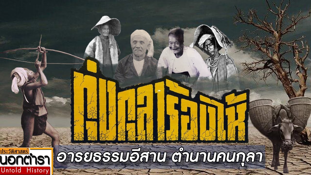
The name Thung Kula Rong Hai carries a powerful story. Kula refers to traveling merchants in the past, people known for endurance, strength, and the ability to move between towns through difficult routes. According to local legend, when these Kula merchants crossed this vast plain, they suffered so severely that even these strong travelers cried. The land was wide, dry, exposed, and without enough water or large trees for shade. In the dry season, the soil cracked under the heat. The journey felt endless. This hardship gave the place the name Thung Kula Rong Hai, meaning the field where the Kula cried.
In the past, the area was known for dryness, saline soil, sandy soil, limited water, and harsh travel conditions. It was an open plain with few large trees and little natural shelter. Travelers needed water, food, and strong determination to cross it. The name became a symbol of difficulty in local memory and oral tradition. Even today, the story remains important because it explains how people in the region remembered the landscape before modern agricultural development changed it.
Although the name sounds sorrowful, the present-day Thung Kula Rong Hai tells a story of transformation. What was once remembered as a difficult and dry plain has become a major agricultural region, especially for high-quality Thai Hom Mali jasmine rice. This transformation came from land development, water management, farmer knowledge, rice cultivation techniques, and long-term agricultural improvement. The landscape now represents resilience rather than only hardship.
Roi Et Province is central to the identity of Thung Kula Rong Hai because much of the plain lies within the province. Pathum Rat, Kaset Wisai, Suwannaphum, and Phon Sai districts all form part of this agricultural landscape. These areas include rice fields, rural communities, temples, historical remains, markets, local roads, and agricultural learning sites. Visiting the Roi Et side of Thung Kula Rong Hai helps travelers understand the relationship between land, water, rice, and rural life in the Isan region.
The northern part of the plain includes the Roi Et districts of Pathum Rat, Kaset Wisai, Suwannaphum, and Phon Sai. To the south, the Mun River stretches through Chumphon Buri and Tha Tum districts in Surin Province. To the west, the landscape connects with Phutthaisong District in Buriram, Maha Chana Chai District in Yasothon, and Phayakkhaphum Phisai District in Maha Sarakham. This wide boundary shows that Thung Kula Rong Hai is not a single tourist spot. It is a regional landscape that must be understood through both the map and specific access points.
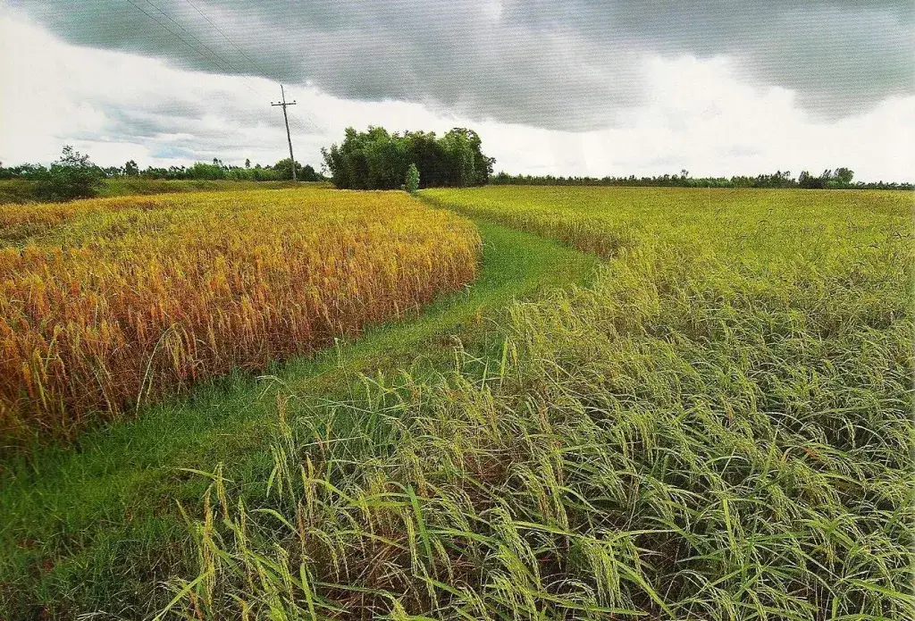
The beauty of Thung Kula Rong Hai today is found in its wide rice fields. During the growing season, the fields turn green and stretch toward the horizon. Before harvest, the rice fields become golden and create one of the most beautiful agricultural landscapes in northeastern Thailand. Morning and late afternoon light make the plain especially attractive for photography. Visitors can clearly see the contrast between the old story of dryness and the modern image of rice cultivation and rural productivity.
The best time to visit depends on the experience visitors want. The rainy season into the early cool season is suitable for seeing green rice fields. The harvest period is suitable for golden fields and agricultural scenery. The dry season gives a clearer sense of the older landscape that shaped the name Thung Kula Rong Hai. Each season tells a different story of the same plain.
The Thung Kula Rong Hai Land Development Center area is suitable for travelers interested in soil, agriculture, water management, and land restoration. The center reflects the work of land development in transforming difficult soil and dry land into productive agricultural areas. It is especially meaningful for students, agricultural visitors, researchers, and travelers who want to understand how knowledge and long-term development can change a landscape.
The plain is strongly connected with Thai Hom Mali jasmine rice. The specific soil, climate, water conditions, and farming practices of the area contribute to the quality and reputation of rice grown here. For visitors, seeing the rice fields in Thung Kula Rong Hai helps connect the food on the table with the land, farmers, and history behind it. A grain of rice from this region represents more than agriculture. It represents geography, endurance, and rural knowledge.
Getting There to the Roi Et reference point is straightforward by private car, motorcycle, or local hired vehicle. From Suwannaphum District Office, travel toward Ku Phra Kona. Continue about 200 meters beyond Ku Phra Kona to reach the area associated with the Thung Kula Rong Hai Land Development Center, opposite Sophaphitthayaphon School. The distance from Suwannaphum District Office is about 6 km.
From Roi Et city, visitors can travel toward Suwannaphum District and combine Thung Kula Rong Hai with Ku Phra Kona. With more time, the route can extend to Kaset Wisai, Pathum Rat, or Phon Sai to see different parts of the plain. This type of route helps visitors understand that Thung Kula Rong Hai is not limited to one viewpoint. It is a broad agricultural region made up of many districts, communities, and fields.
The general landscape area is open daily from 08.30 to 16.30. The general area has no admission fee. For land-development learning activities, group visits, or official training programs, visitors should use normal operating hours and follow the responsible agency’s conditions. General travelers can view the fields, rural scenery, and nearby areas according to local access and appropriate behavior.
The main areas for experiencing Thung Kula Rong Hai in Roi Et include the Thung Kula Rong Hai Land Development Center zone, Suwannaphum rice-field landscape zone, Ku Phra Kona historical zone, Kaset Wisai rice-field zone, Pathum Rat rice-field zone, Phon Sai rice-field zone, Hom Mali rice route zone, and soil-water-agriculture learning zone. Each area gives a different perspective on the plain, from ancient history to modern farming.
Recommended activities include viewing rice fields, photographing wide landscapes, learning the legend of Thung Kula Rong Hai, studying soil and agricultural development, visiting Ku Phra Kona, observing rural farming communities, buying Hom Mali rice and local agricultural products, and connecting Suwannaphum, Kaset Wisai, Pathum Rat, and Phon Sai districts in one route. The rice-growing and harvest seasons are the most visually rewarding periods.
For photographers, Thung Kula Rong Hai offers wide and layered compositions: roads through the fields, green rice fields, golden rice fields, cloud shadows, farmers, cattle, agricultural machines, morning light, and evening light stretching across the plain. Photography should be respectful. Visitors should not step into rice fields, drive into private farmland, photograph people at close range without permission, or disturb farmers at work.
For families, the plain is an excellent place to learn about history, landscape, and rice. Children can understand how a place once remembered for hardship became a productive rice-growing region. Parents can explain the Kula merchant legend, dry-season land, saline soil, jasmine rice, and the role of farmers in adapting to nature. A visit here gives both scenery and a meaningful life lesson.
For international visitors, Thung Kula Rong Hai can be described as a legendary rice plain of northeastern Thailand. It is a landscape where ancient travel hardship, dry land, soil improvement, and world-famous jasmine rice come together. Visiting the Roi Et side gives foreign travelers a deeper understanding of Thai rice culture beyond restaurants, markets, and packaged rice. It connects food directly with land and people.
Because the area is broad, visitors should plan travel time carefully. For a short route, the Suwannaphum reference point and Ku Phra Kona are practical. For a deeper route, visitors can include Kaset Wisai, Pathum Rat, or Phon Sai. A private vehicle is the most convenient option because it allows stops for photography and flexible movement across rural roads.
Food options near the Suwannaphum reference point are mostly found around Ku Phra Kona, Sophaphitthayaphon School, and Suwannaphum town. Visitors can find local Isan restaurants, made-to-order food, noodle shops, cafes, and simple local food. More choices are available in Suwannaphum town and along the route toward Kaset Wisai.
Accommodation options are available in Suwannaphum District, Kaset Wisai District, and Roi Et city. Visitors focusing on Thung Kula Rong Hai and Ku Phra Kona can stay in Suwannaphum. Visitors who want broader hotel choices and city services can stay in Roi Et city and make a day trip. Staying closer to the plain is useful for sunrise and sunset photography.
In summary, Thung Kula Rong Hai in Roi Et Province is a vast legendary plain with major historical, agricultural, and cultural meaning. Covering five provinces and with much of its area in Roi Et, it is especially connected with Pathum Rat, Kaset Wisai, Suwannaphum, and Phon Sai districts. The Suwannaphum reference point near Ku Phra Kona and the Thung Kula Rong Hai Land Development Center is suitable for visitors who want to experience the landscape directly. Open daily from 08.30 to 16.30 with no admission fee for the general area, the site is ideal for learning about the Kula legend, rice fields, soil development, Hom Mali jasmine rice, and the agricultural heart of Isan.
| Name | Thung Kula Rong Hai |
| Related Name / Type | Thung Kula Rong Hai / Vast Isan Plain / Hom Mali Jasmine Rice Region / Historical Landscape / Soil And Agricultural Learning Area |
| Main Location In Roi Et | Pathum Rat, Kaset Wisai, Suwannaphum, And Phon Sai Districts, Roi Et Province |
| Visitor Reference Point | Thung Kula Rong Hai Land Development Center Area, Suwannaphum District, Roi Et Province, About 200 Meters Beyond Ku Phra Kona And Opposite Sophaphitthayaphon School |
| Approximate Area | About 2,107,681 Rai Across Five Provinces, With Around Three-Fifths In Roi Et Province |
| Related Provinces | Roi Et, Surin, Buriram, Yasothon, And Maha Sarakham |
| Highlights | Legendary Kula Merchant Plain, Soil Development Learning Area, Major Hom Mali Jasmine Rice Region, Green Rice Fields And Golden Harvest Landscapes By Season |
| Importance | A major landscape of travel history, soil, water, agriculture, Hom Mali rice, and land-resource development in northeastern Thailand |
| Name Origin | The name comes from the legend of Kula merchants who crossed the dry, treeless, water-scarce plain and suffered so severely that they cried. |
| Past Landscape | A vast dry plain with cracked soil in the dry season, little shade, little water, and difficult travel conditions |
| Present Landscape | A large agricultural plain with rice fields, farming communities, Hom Mali jasmine rice production, and soil-water-agriculture learning areas |
| Recommended Activities | Rice-Field Viewing, Wide Landscape Photography, Learning The Thung Kula Rong Hai Legend, Studying Soil Development, Visiting Ku Phra Kona, Buying Hom Mali Rice And Agricultural Products, And Connecting Suwannaphum, Kaset Wisai, Pathum Rat, And Phon Sai Routes |
| Travel Information | From Suwannaphum District, travel toward Ku Phra Kona. Continue about 200 meters beyond Ku Phra Kona to reach the Thung Kula Rong Hai reference area and the Land Development Center area opposite Sophaphitthayaphon School. |
| Distance From Suwannaphum District Office | About 6 km |
| Current Status | Open For General Visits And Still Associated With The Thung Kula Rong Hai Land Development Center Under The Land Development Department |
| Open Days | Daily For The General Landscape Area |
| Opening Hours | 08.30 – 16.30 |
| Fees | No Admission Fee For The General Area |
| Facilities | Road Access, Rice-Field Viewpoints, Thung Kula Rong Hai Land Development Center Area, Agricultural Learning Areas, Nearby Communities, Restaurants And Basic Services In Suwannaphum District |
| Main Areas / Zones | 1. Thung Kula Rong Hai Land Development Center Zone 2. Suwannaphum Rice-Field Landscape Zone 3. Ku Phra Kona And Nearby Historical Site Zone 4. Kaset Wisai Rice-Field Zone 5. Pathum Rat Rice-Field Zone 6. Phon Sai Rice-Field Zone 7. Hom Mali Jasmine Rice Route Zone 8. Soil, Water, And Agriculture Learning Zone |
| Responsible / Related Organizations | Land Development Department, Thung Kula Rong Hai Land Development Center, Local Agricultural Agencies, Local Administrative Organizations In Suwannaphum, Kaset Wisai, Pathum Rat, And Phon Sai Districts, And Farming Communities In The Thung Kula Rong Hai Area |
| Best Visiting Time | Rice-Growing Season For Green Fields, Harvest Season For Golden Fields, And Dry Season For Understanding The Historical Harshness Of The Plain |
| Visitor Etiquette | Do Not Step Into Rice Fields, Do Not Drive Into Private Farmland, Do Not Litter, Do Not Disturb Farmers At Work, Ask Permission Before Photographing People Or Private Areas, And Use Community Roads Carefully |
| Nearby Tourist Attractions | 1. Thung Kula Rong Hai Land Development Center, About 0 km 2. Ku Phra Kona, About 0 km 3. Sophaphitthayaphon School And Nearby Community Area, About 0 km 4. Suwannaphum Market And Suwannaphum Town Area, About 6 km 5. Temples And Old Communities In Suwannaphum District, About 6 km 6. Kaset Wisai Rice-Field Area, About 25 km 7. Ku Ka Sing, Kaset Wisai District, About 35 km 8. Pathum Rat District And Eastern Thung Kula Rong Hai Area, About 45 km 9. Bueng Kluea Isan Sea, Selaphum District, About 85 km |
| Nearby Restaurants | 1. Local Food Shops Near Ku Phra Kona And Thung Kula Rong Hai Land Development Center, About 0 – 3 km 2. Made-To-Order Food Shops Around Sophaphitthayaphon School, About 0 – 2 km 3. Isan Restaurants In Suwannaphum Town, About 6 km 4. Noodle And Local Food Shops Around Suwannaphum Market, About 6 km 5. Cafes And Coffee Shops In Suwannaphum District, About 6 – 8 km 6. Restaurants On The Suwannaphum – Kaset Wisai Route, About 10 – 25 km |
| Nearby Accommodations | 1. Daily Accommodation And Local Resorts In Suwannaphum Town, About 6 – 8 km 2. Small Hotels In Suwannaphum District, About 6 – 10 km 3. Resorts Along The Suwannaphum – Kaset Wisai Route, About 10 – 25 km 4. Daily Accommodation In Kaset Wisai District, About 25 – 35 km 5. Hotels In Mueang Roi Et District, About 70 – 80 km |
Frequently Asked Questions (FAQ)
Q: Where is Thung Kula Rong Hai located?
A: Thung Kula Rong Hai is a broad plain covering five provinces: Roi Et, Surin, Buriram, Yasothon, and Maha Sarakham. In Roi Et, the main area includes Pathum Rat, Kaset Wisai, Suwannaphum, and Phon Sai districts.
Q: Where is the main visitor reference point in Roi Et?
A: A practical reference point is around the Thung Kula Rong Hai Land Development Center in Suwannaphum District, about 200 meters beyond Ku Phra Kona and opposite Sophaphitthayaphon School, about 6 km from Suwannaphum District Office.
Q: What are the opening days and opening hours of Thung Kula Rong Hai?
A: The general landscape area is open daily from 08.30 to 16.30. Official learning areas or government-related activities should be visited during appropriate working hours.
Q: Is there an admission fee to visit Thung Kula Rong Hai?
A: No. The general area has no admission fee. Visitors can view the landscape, rice fields, and nearby public areas according to local access conditions.
Q: Why is it called Thung Kula Rong Hai?
A: The name comes from the legend of Kula merchants who crossed the vast dry plain with little water or shade and suffered so much that they cried.
Q: What is the main highlight of Thung Kula Rong Hai?
A: The highlights are its legendary open plain, Hom Mali jasmine rice landscape, soil-development learning value, and the connection between history, agriculture, and Isan rural life.
Q: When is the best time to visit Thung Kula Rong Hai?
A: The rice-growing season is best for green fields, the harvest season is best for golden fields, and the dry season helps visitors understand the historical landscape behind the name.
Q: What nearby places can be visited with Thung Kula Rong Hai?
A: Nearby and connected places include Ku Phra Kona, Suwannaphum Market, Kaset Wisai rice-field areas, Ku Ka Sing, Pathum Rat District, and other Hom Mali rice routes in Roi Et Province.
 Category: ●Nature and Wildlife
 Group: ●Flower Field
Last Update : 3 MonthAgo
 Last Update : 3 MonthAgo
 Click to Access the Navigation Map GPS
Thung Kula Rong Hai Map
Recommend

 Art, Culture and Heritage
 Historical Sites and Monuments(3)
 Landmarks and Memorials(5)
 Art, Craft Centres, Tradition(2)
 Museums(1)
 Educational Places
 Educational Gardens, Farm(3)
 Places of Worship
 Temple(35)
 Other Sacred Sites(6)
 Suburban Living
 Village, Community(1)
 Local Market(1)
 National Parks and Marine Reserves(1)
 Mountain (Doi)(2)
 Dam, Reservoir, Lake(8)
 Waterfalls(1)
Flower Field(1)
 River, Canal(4)
 Entertainment and Agricultural
 Zoos and Aquariums(1)
 Stadium(1)
 Farms, Parks and Ecotourism(5)
 Shopping
 Shopping and Night Market(1)
 Travel Articles, Recipes
 Travel Review, Food Review(1)


