
lovethailand home >Northeastern Travel Attractions >Nakhon Ratchasima Travel Attractions >Sung Noen >Se Ma > Mueang Sema Ancient Town
TL;DR: Mueang Sema Ancient Town is located at Sema Subdistrict, Sung Noen District, Nakhon Ratchasima Province 30170, Thailand, open Daily, hours 09.00 – 16.00.
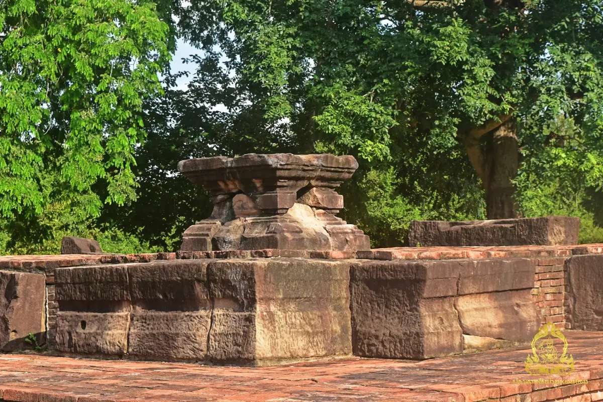
Mueang Sema Ancient Town
Open Days: Daily
Opening Hours: 09.00 – 16.00
Mueang Sema Ancient Town, located in Sema Subdistrict, Sung Noen District, Nakhon Ratchasima Province, is one of the most important archaeological settlements for understanding the development of Dvaravati culture in the upper Mun River basin. The site preserves evidence of human occupation from the late prehistoric period, followed by the growth of a large moated urban community with religious monuments, earthen ramparts, water-management systems, inscriptions, sculptures, and extensive settlement areas. Khmer cultural influence later transformed the town’s religion, artistic traditions, language, and political connections. Mueang Sema is therefore not simply a collection of ruined brick foundations. It is an archaeological landscape documenting more than 1,300 years of social and cultural change in northeastern Thailand.
The ancient town lies approximately 37 kilometers west of central Nakhon Ratchasima and about 5 kilometers from Sung Noen Market. The traditional approach crosses the railway line and turns left through Ban Hin Tang before reaching the archaeological area. The surrounding landscape remains largely rural, with agricultural fields, villages, temples, roads, and patches of open woodland. As travelers approach the protected zone, portions of the ancient moat and earthen rampart become visible. To an untrained observer, they may resemble ordinary drainage channels or natural mounds, but they are major components of the original town plan and evidence of organized communal labor.
Older tourism descriptions sometimes state that the oval town measured approximately 3 kilometers across and 4 kilometers long, referring broadly to the urban landscape and associated archaeological areas. The Fine Arts Department describes the surviving moat and rampart system as two connected oval enclosures measuring approximately 1,700 meters from north to south and 1,500 meters from east to west. An archaeological survey conducted in 1959 recorded dimensions of approximately 1,400 by 2,000 meters. The variation reflects different survey boundaries and the condition of visible remains, but every measurement confirms that Mueang Sema was a major urban settlement.
The registered archaeological zone covers approximately 2,475 rai. The town consists of an inner and an outer enclosure linked within an elongated oval plan. The inner town covers approximately 360 rai, while the outer town covers about 1,150 rai. Two moat lines and one large earthen embankment define the principal urban boundary. Surviving moat sections are approximately 10–20 meters wide, while the rampart can rise between 3 and 5 meters. Constructing earthworks of this scale required a substantial workforce, centralized planning, food supplies, tools, and long-term maintenance.
Huai Phai stream runs along the southern side of the ancient town, while Lam Takhong lies approximately 3 kilometers away and connects with the wider Mun River system. Access to water was fundamental to settlement, agriculture, animal husbandry, transportation, and religious activity. River corridors also connected Mueang Sema with other communities across the Khorat Plateau. The founders selected terrain that offered reliable access to water while providing suitable ground for habitation and monumental construction.
Human occupation in Sung Noen began long before Mueang Sema became a Dvaravati town. Archaeological sites throughout the district preserve evidence from the Neolithic and Iron Age periods, dating between approximately 4,000 and 1,500 years ago. Excavations in and around Mueang Sema uncovered pottery, iron tools, glass beads, bronze rings, worked bone, burials, and grave goods. These discoveries reveal agricultural communities with metalworking knowledge and beliefs concerning death and the continued needs of the deceased.
Eleven excavation units opened in 2001, both inside and outside the ancient enclosure, produced widespread late prehistoric evidence. The land later occupied by the Dvaravati town was therefore already home to a substantial community. As trade and communication networks expanded, local residents adopted religious ideas, writing systems, artistic forms, and technologies from other regions. This process involved local adaptation rather than the complete replacement of the earlier population.
From around the 6th century onward, the upper Mun basin became an important transport junction connecting northeastern Thailand with the central plains through routes near Dan Khun Thot and Chai Badan. Merchants, monks, craftsmen, political representatives, and travelers moved through these corridors. Mueang Sema developed in a strategic position capable of benefiting from regional movement and exchange.
Buddhism formed the principal religious foundation of Dvaravati culture at Mueang Sema. Archaeological evidence includes religious buildings, stupas, Buddha images, votive tablets, stone Dharma wheels, recumbent deer sculptures, boundary stones, and ritual objects. Buddhist traditions spreading from central Thailand and ultimately influenced by India were combined with local customs of erecting large stones to mark sacred areas. This interaction produced the large stone sema tradition that became a defining feature of Dvaravati Buddhism in northeastern Thailand.
The name Mueang Sema is connected with the stone boundary markers found in and around the ancient town. In Buddhist practice, sema stones define consecrated areas used for monastic ceremonies. At Ban Hin Tang and other locations near the town, archaeologists recorded groups of large standing stones enclosing ritual spaces. These markers demonstrate that sacred geography was carefully organized. Religious meaning extended beyond the building itself to the entire surrounding landscape.
Mueang Sema flourished most clearly between the 8th and 11th centuries, corresponding approximately to the 13th–16th Buddhist centuries in Thai chronology. Some tourism accounts begin the settlement’s history in the 12th Buddhist century and continue its development into the 16th or 17th century. Archaeological evidence presents a broader sequence: late prehistoric occupation preceded the town, Dvaravati urban culture reached its height between the 13th and 16th Buddhist centuries, and Khmer influence continued to reshape the region afterward.
Approximately 22 archaeological locations have been identified in Sema Subdistrict and its immediate surroundings. They include religious buildings, sema-stone groups, habitation areas, burial sites, and artifact scatters. Numbered monuments make the large landscape easier to document and manage. Monuments 2–6 stand within the inner town, while monuments 7–9 are in the outer town. Monument 1, associated with the Bo I Ka area, is another major location where Buddhist, Hindu, and inscriptional evidence was discovered.
The inner town contains the greatest concentration of Buddhist monuments. This density suggests that it functioned as a ritual, administrative, or elite center. Most structures survive only as brick, laterite, and sandstone foundations. Some have square plans, while others preserve stupa bases and related buildings. Although their upper walls and roofs have disappeared, the foundations reveal the organization of ceremonial space and movement within the town.
Fragments of sandstone Dharma wheels were discovered at Monument 2. The Dharma wheel represents the proclamation of Buddhist teaching and the metaphorical turning of the Wheel of the Law. In early Buddhist art, the wheel could symbolize the Buddha without depicting him in human form. Its presence at Mueang Sema demonstrates the town’s importance as a Buddhist center and its participation in artistic traditions shared across the Dvaravati world.
Recumbent deer sculptures found with Dharma-wheel imagery refer to the Deer Park at Sarnath, where the Buddha delivered his first sermon. The combination allowed worshippers to recognize the event through visual symbols. Such imagery indicates that patrons and craftsmen understood Buddhist narratives and could express complex religious meaning through sculpture rather than written explanation.
Monument 4 and other structures in the inner town have been excavated and landscaped so that their plans can be examined. Visitors should observe brick courses, platform dimensions, entrance orientation, and relationships between buildings and open areas. A single foundation may seem modest, but viewing several monuments together reveals the scale of a former religious center containing multiple buildings and ceremonial functions.
The outer town covers a much larger area and contains Monuments 7–9. Its designation as “outer” does not imply that it was unimportant. It may have accommodated residential neighborhoods, food production, crafts, roads, and religious institutions serving different communities. The inner town provided a central focus, while the outer town supported the wider urban population and economy.
The moat and rampart system served several purposes. It stored and controlled water, defined the urban boundary, influenced access, and separated the managed town from the surrounding countryside. The embankment may also have functioned as a route around the settlement. Symbolically, the water boundary distinguished the ordered urban and sacred landscape from the exterior environment. Digging and maintaining the moats required coordinated communal labor.
The ancient earthworks are not equally visible today. Some sections remain clear as water channels and high embankments, while others are obscured by sediment, vegetation, roads, agriculture, or later land use. Travelers should not expect masonry defensive walls like those of later Ayutthaya-period cities. Mueang Sema’s defenses and boundaries were formed principally from earth excavated from the moat, a construction method suited to local materials and terrain.
The Bo I Ka inscription is one of the most important historical discoveries from Mueang Sema. Carved on red sandstone, it refers to a ruler of Sri Canasa, donations of livestock and people to Buddhist monks, praise of Shiva, and the creation of a golden linga in 868 CE, corresponding to 1411 BE. The inscription’s two sides document the interaction and transition between Buddhism and Hinduism, while also showing the ability of rulers to allocate labor and resources to religious institutions.
The name Sri Canasa appears in inscriptions associated with a polity described as lying outside Kambujadesa. A second inscription found in Ayutthaya Province refers to Canasapura and lists rulers including Bhagabhatti, Sundaravarman, Narapatisimhavarman, and Mangalavarman. Together, the inscriptions show that the upper Mun region possessed local political institutions and royal lineages before Angkorian authority became dominant. Mueang Sema is therefore central to the study of regional state formation.
Early Mueang Sema was strongly Buddhist, but Khmer cultural influence and Shaiva Hinduism increased during the 9th and 10th centuries. Inscriptions referring to Shiva, linga fragments, and Khmer-style architecture document this change. Dvaravati traditions did not disappear immediately. Buddhist, Hindu, local, and Khmer elements overlapped, and some religious areas were adapted to new political and ritual circumstances.
Between the 10th and 11th centuries, Angkorian officials and rulers gained increasing influence in the Sung Noen region. Inscriptions and monuments reflect the authority of Khmer kings such as Sri Isanavarman II and Jayavarman V. Khmer sanctuaries were constructed inside and outside the wider Mueang Sema landscape, including Prasat Mueang Khaek, Prasat Non Ku, Prasat Ban Non Tako, Prasat Hin Sa Phleng, and Prang Ban Bu Yai. Political and ceremonial activity gradually shifted toward the area now called Tambon Khorat or Old Khorat Town.
The movement of political focus did not cause Mueang Sema to become empty immediately. Portions of the town continued to be occupied and used for ritual, burial, and settlement. Archaeological layers show repeated modification and reuse. Ancient towns were living environments rather than static constructions; buildings, roads, beliefs, and residential patterns changed as populations and political systems evolved.
South of the ancient enclosure stands Wat Dhammachak Semaram, home to the monumental sandstone Reclining Buddha of Mueang Sema. The image was assembled from large blocks of red sandstone and measures approximately 13.30 meters long and 2.80 meters high. Its head faces south, and the facial features combine Dvaravati artistic conventions with regional craftsmanship. It is one of Thailand’s most important surviving Dvaravati sandstone reclining Buddhas and the best-known cultural landmark associated with Mueang Sema.
The Reclining Buddha was not carved from one stone. Separate sandstone blocks form the head, body, arms, feet, robe, and other components. In some rear sections, stone was used as a structural core, covered with brick and finished with lime plaster. The construction reveals sophisticated planning and an ability to manage large, heavy materials. Conservation must therefore address sandstone, brick, mortar, moisture, structural movement, and conditions within the protective pavilion.
Wat Dhammachak Semaram also preserves a sandstone Dharma wheel and a local museum containing artifacts from the surrounding area. Displays include Buddha-image fragments, votive tablets, metal objects, beads, and ritual materials. Other significant objects from Mueang Sema are conserved at Phimai National Museum. Visiting the archaeological town, the temple museum, and the national museum allows travelers to connect foundations in the landscape with the sculptures and objects once used inside the buildings.
Excavations around the Reclining Buddha and other parts of Mueang Sema uncovered seated and standing Buddha images, bodhisattva figures, embossed silver plaques depicting Buddhas, votive tablets, molds, miniature stupa finials, rosary beads, glass beads, pottery, lotus-base fragments, and personal ornaments. These finds reflect many forms of devotion, ranging from public ceremonies and royal patronage to private worship and the local production of votive objects.
Bodhisattva figures and other objects demonstrate that religious life was not identical in every period. Theravada Buddhism formed a major Dvaravati foundation, while Mahayana ideas and Hindu worship were also incorporated as regional connections expanded. The population selected and combined beliefs rather than following a single unchanged system for centuries.
Wat Kaen Thao stands approximately 300 meters west of the ancient town and represents another important religious location. Dvaravati objects found there include Buddha images, votive tablets, and carved stone panels. The discoveries show that ritual activity extended beyond the moated enclosure into surrounding communities and religious sites.
East of the ancient town at Ban Hin Tang are several groups of large sema stones. Nine marked ritual areas have been recorded. Some may have defined ordination halls or monastic ceremonial spaces, while others continued older traditions of using standing stones to identify sacred ground. Their distribution reveals a network of communities and religious areas surrounding the town.
Mueang Sema’s importance also derives from its geographical position between central Thailand and the Khorat Plateau. Routes from the Pa Sak and Chai Badan basins could cross upland passes into Nakhon Ratchasima, while Lam Takhong and the Mun River system provided connections toward the east. Control of these corridors brought access to goods, raw materials, technology, travelers, and religious ideas.
Glass beads, metal ornaments, pottery traditions, and objects produced from materials not commonly available locally demonstrate long-distance exchange. Mueang Sema may have collected and redistributed goods to surrounding communities while supplying agricultural produce, metalwork, and regional products to broader networks. Its growth was therefore economic and political as well as religious.
The town’s administration was more complex than that of an ordinary village. Building large moats, numerous monuments, inscriptions, and sandstone sculpture required leadership capable of organizing workers, food, craftsmen, transport, and long-term projects. Inscriptions recording royal donations confirm the ruler’s economic and political authority. Religious institutions served as centers of faith and as symbols legitimizing political leadership.
Travelers can learn about construction technology by comparing brick, laterite, and sandstone. Dvaravati bricks differ in size and proportion from modern bricks and were often laid with extremely narrow joints. Some platforms use recessed corners or molded courses to support superstructures. Sandstone was selected for Dharma wheels, boundary stones, sculpture, door components, and details requiring strength or fine carving.
Laterite has a porous reddish-brown surface. It can be cut while relatively soft and hardens after exposure to air, making it suitable for structural foundations. Observing the different materials helps visitors understand that ancient builders selected each stone or brick according to its function rather than using one material throughout a monument.
Centuries of rainfall, groundwater, temperature change, vegetation, soil movement, and human activity caused the monuments to collapse. Most now survive only at foundation level. Archaeological conservation does not reconstruct missing towers without evidence. Instead, it stabilizes original masonry, controls water and vegetation, preserves plans, and allows visitors to understand the remains without creating a misleading modern replica.
The French explorer Étienne Aymonier recorded archaeological sites in the region in 1901. The Fine Arts Department later conducted a systematic survey in 1959, preparing a plan and identifying monuments. Subsequent work included excavation, architectural conservation, stratigraphic study, artifact registration, and the establishment of a protected boundary. These projects transformed understanding of Mueang Sema from scattered ruins and local accounts into a documented archaeological sequence.
The protected area covers a wide zone because archaeological information remains beneath the ground between the visible monuments. Possible traces include houses, roads, workshops, kilns, burials, production areas, and other cultural layers. Uncontrolled construction or digging could destroy evidence that has never been studied. Protection is therefore not limited to the excavated brick platforms.
The 10th Regional Office of Fine Arts, Nakhon Ratchasima, is the principal caretaker responsible for conservation, vegetation clearance, cleaning of the moat and rampart, signage, and site monitoring. Work is coordinated with local authorities, temples, communities, and residents. In June 2026, officials cleared vegetation, cleaned sections of the moat and rampart, and installed additional ancient-monument signs, confirming that Mueang Sema remains actively maintained and open as a cultural learning site.
A practical visit should begin with Monuments 2–6 in the inner town, where several foundations can be viewed in sequence. Continue to Monuments 7–9 in the outer town and observe sections of the moat and rampart along the route. Travelers with sufficient time can include Bo I Ka, Wat Kaen Thao, and the standing-stone areas before finishing at Wat Dhammachak Semaram to see the Reclining Buddha, Dharma wheel, and museum.
The monuments are distributed over a broad landscape rather than contained within one fenced archaeological park. Private transport is therefore the most convenient option. Use a navigation system together with local signs, drive slowly through villages and agricultural roads, and expect to park before walking over grass or earth at some locations.
The published visiting hours for the archaeological monuments are 09.00–16.00 daily, and admission is free. The town is an open archaeological landscape without controlled gates along every boundary, but visiting within the published period is safer and consistent with site management. Wat Dhammachak Semaram and its museum are also open daily; the museum publishes hours of 07.00–17.00 and does not charge admission.
The most comfortable times are between 09.00 and 11.00 or after 15.00. Angled sunlight reveals the texture of brick, laterite, and earthworks more clearly than midday light. The cool season from November to February is ideal for visiting several places in one day. The rainy season produces green scenery but slippery ground, while hot-season travelers should carry water, hats, umbrellas, and sun protection.
Wear closed or supportive footwear suitable for uneven terrain. Grass, roots, gravel, holes, and soft soil occur throughout the site. Do not climb monument bases, sit on brick alignments, stand on laterite blocks, or touch loose architectural fragments. Repeated pressure from visitors accelerates erosion and can destabilize fragile masonry.
Never remove pottery, brick, stone, beads, or other materials. An object that appears insignificant can be archaeologically valuable in its original context. If anything unusual is found, photograph it without moving it, record the location, and inform the site authorities. Archaeologists determine age and activity by studying the relationship between objects, soil layers, and nearby structures.
Drone operation, commercial filming, organized events, and entry into temporarily restricted conservation areas require advance permission. Ordinary photography is permitted when it does not disturb the monuments or other visitors. Tripods and equipment should never be placed on ancient masonry.
Mueang Sema is an excellent outdoor learning site for families. Children can compare brick, laterite, sandstone, moats, and ramparts and learn the difference between the inner and outer town. Adults should supervise children closely and prevent running or climbing on archaeological remains.
Older visitors and travelers with limited mobility can see some remains from roads and level areas, but many locations lack continuous paved paths or ramps. Assistance may be needed on grass, earth, steps, and uneven surfaces. Focus on accessible inner-town monuments, Wat Dhammachak Semaram, and visible earthwork sections.
Facilities within the ancient town are basic because the monuments are dispersed and the original landscape is preserved. Carry drinking water, medication, and sun protection. Toilets, refreshments, and more developed visitor facilities are available around Wat Dhammachak Semaram, Ban Hin Tang, and Sung Noen town. All rubbish should be removed from the archaeological area.
Wat Dhammachak Semaram remains an active Buddhist temple. Dress respectfully, speak quietly, and follow temple instructions when viewing the Reclining Buddha and museum. The historical importance of the site does not replace its continuing religious function for monks and the local community.
The annual tradition honoring the thousand-year-old Reclining Buddha brings Buddhist ceremonies, regional performances, local food, and community activities to Wat Dhammachak Semaram. Dates vary each year. The event demonstrates that the Reclining Buddha and Mueang Sema continue to serve as a living center of identity and faith.
Mueang Sema can be combined with Prasat Mueang Khaek, Prasat Non Ku, and Prasat Mueang Kao in Old Khorat Town. The three Khmer monuments represent Hindu and Mahayana Buddhist traditions. Visiting both archaeological landscapes reveals the transition from a Dvaravati moated town to regional centers connected with Angkorian political and religious networks.
Prasat Mueang Khaek and Prasat Non Ku were built around the 10th century, during the period when Khmer influence increased around Mueang Sema. Both use sandstone and brick and are associated with Hindu worship. Prasat Mueang Kao is a later Arogayasala sanctuary from the reign of King Jayavarman VII. Together, the monuments provide a continuous history of Sung Noen across several centuries.
The Sung Noen Black Bridge near the railway station represents a later stage of transport history. Adding the bridge to the route helps travelers compare ancient river and overland networks with the modern railway and road systems that reshaped the district.
Khao Chan Ngam rock-art site lies approximately 13 kilometers from Mueang Sema. Red paintings depict human figures, animals, and geometric forms on a rock shelter. Visiting both sites creates a long historical sequence from prehistoric communities to Dvaravati urbanism and later Khmer influence.
A half-day itinerary should include the inner-town monuments, visible earthworks, and Wat Dhammachak Semaram. A full-day route can add the outer town, Bo I Ka, Wat Kaen Thao, Prasat Mueang Khaek, Prasat Non Ku, and the Black Bridge. Allow at least 2–3 hours for Mueang Sema itself when reading signs and examining architectural details.
From central Nakhon Ratchasima, follow Highway 2 or Mittraphap Road toward Sung Noen. Enter the district center and continue toward Sung Noen Market. Cross the railway line, turn left through Ban Hin Tang, and travel approximately 5 kilometers to the ancient town. Signs may use the names Mueang Sema Ancient Town, Wat Dhammachak Semaram, Ban Khlong Khwang, or Ban Hin Tang, so saving the main destinations in advance is advisable.
Getting There from Bangkok, follow Phahonyothin Road to Saraburi and continue on Mittraphap Road through Muak Lek, Pak Chong, Sikhio, and Sung Noen. Leave the main highway for Sung Noen town and follow the local route through the market and Ban Hin Tang. Travel time depends on traffic, particularly through the Muak Lek–Pak Chong mountain section and during long holidays.
Rail travelers can disembark at Sung Noen Railway Station and hire a local vehicle. The archaeological locations are several kilometers from the station and widely dispersed, so arrange for the driver to wait or return at an agreed time. A hired vehicle is particularly useful when combining Mueang Sema with Wat Dhammachak Semaram and the Old Khorat Town monuments.
Restaurants and accommodations are concentrated in Sung Noen town, along Mittraphap Road, and near industrial communities. Eat or purchase drinks before entering the archaeological zone or return to town afterward. Local choices include northeastern Thai cuisine, Thai-Chinese dishes, cafés, and inexpensive meals, while accommodation ranges from budget hotels to small resorts.
Mueang Sema is best suited to travelers interested in archaeology, Dvaravati art, Buddhism, historical landscapes, and regional culture. Its value is found in the relationship between scattered remains and the original terrain rather than in commercial entertainment. Understanding that each brick foundation and mound belonged to a functioning town transforms the experience.
Basic preparation improves the visit. Learn the meaning of the inner town, outer town, moat, rampart, Dharma wheel, sema stone, and Dvaravati culture before arriving. On site, compare the published plan with surviving features and read interpretive signs where available.
The town also illustrates human adaptation to the environment. Its location near Huai Phai and Lam Takhong, its water-control earthworks, and the distribution of religious areas demonstrate systematic landscape management. Urban growth depended on food, water, agriculture, and labor as much as religion and art.
Mueang Sema represents cultural diversity and continuity. It grew from prehistoric communities, adopted Dvaravati Buddhism from interregional networks, combined Buddhism with local standing-stone traditions, became connected with Sri Canasa, and later absorbed Hindu and Khmer artistic influence. Each phase left traces rather than completely erasing the one before it.
Walking among the foundations and earthworks means crossing spaces where people once built homes, cultivated crops, produced metal tools, exchanged goods, worshipped, and communicated with other towns. Everyday pottery, tools, and graves are as important to understanding the population as royal inscriptions and monumental sculpture.
Preserving Mueang Sema requires cooperation among the Fine Arts Department, local government, temples, communities, land users, and visitors. Keeping the site clean, respecting the moat and rampart, avoiding unauthorized digging, and reporting damage protect evidence that cannot be replaced.
Mueang Sema Ancient Town brings together late prehistoric settlement, Dvaravati urbanism, Sri Canasa inscriptions, Khmer influence, Buddhist monuments, sema stones, Dharma wheels, and the monumental sandstone Reclining Buddha within one cultural landscape. Its importance comes not only from age, but from the exceptional continuity of evidence showing how communities, beliefs, political systems, and regional connections changed across many centuries.
| Name | Mueang Sema Ancient Town |
| Location | Sema Subdistrict, Sung Noen District, Nakhon Ratchasima Province 30170, Thailand |
| Reference Coordinates | Approximately 14.922000, 101.798320 |
| Distance from Nakhon Ratchasima | Approximately 37 km |
| Highlights | A major Dvaravati moated town with inner and outer enclosures, Monuments 1–9, the Bo I Ka inscription, sema-stone sites, Dharma-wheel remains, and the sandstone Reclining Buddha at Wat Dhammachak Semaram |
| Registered Area | Approximately 2,475 rai |
| Town Plan | Two connected oval enclosures measuring approximately 1,700 meters north–south and 1,500 meters east–west, surrounded by two moat lines and one earthen rampart |
| History and Period | Late prehistoric occupation preceded major Dvaravati development between the 8th and 11th centuries, followed by increasing Khmer cultural influence from the 9th to 11th centuries |
| Important Evidence | Moats, ramparts, religious foundations, Dharma wheels, deer sculptures, sema stones, Buddha images, votive tablets, the Bo I Ka inscription, pottery, iron tools, glass beads, and burials |
| Connection with Sri Canasa | The Bo I Ka inscription refers to a ruler of Sri Canasa, donations to Buddhist monks, praise of Shiva, and the creation of a golden linga in 868 CE |
| Main Areas / Zones | 1. Inner Town, approximately 360 rai, containing Monuments 2–6 2. Outer Town, approximately 1,150 rai, containing Monuments 7–9 3. Monument 1 and Bo I Ka area 4. Moat and earthen-rampart zone 5. Ban Hin Tang sema-stone sites 6. Wat Dhammachak Semaram and the Reclining Buddha 7. Wat Kaen Thao and associated exterior archaeological areas |
| Open Days | Daily |
| Opening Hours | 09.00 – 16.00 |
| Admission Fee | Free admission |
| Current Status | Open as an archaeological learning and tourism site, with continuing vegetation control, moat and rampart maintenance, and official signage |
| Caretaker | Fine Arts Department through the 10th Regional Office of Fine Arts, Nakhon Ratchasima |
| Main Contact Numbers | 044-471518, 044-481024 |
| Facilities | Interpretive signs at selected locations, parking areas near access points, and outdoor walking routes. Additional facilities are available at Wat Dhammachak Semaram and nearby communities. |
| Travel Information | From Nakhon Ratchasima, follow Mittraphap Road to Sung Noen, enter the district market area, cross the railway line, turn left through Ban Hin Tang, and continue approximately 5 km to Mueang Sema. |
| Recommended Visit Duration | Approximately 2–3 hours, or a full day when combined with Wat Dhammachak Semaram and the Old Khorat Town monuments |
| Nearby Tourist Attractions | 1. Wat Kaen Thao, approximately 1 km 2. Wat Dhammachak Semaram and the Sandstone Reclining Buddha, approximately 3 km 3. Sung Noen Black Bridge, approximately 5 km 4. Prasat Non Ku, approximately 6 km 5. Prasat Mueang Khaek, approximately 7 km 6. Prasat Mueang Kao, approximately 9 km 7. Khao Chan Ngam Rock-Art Site, approximately 13 km |
| Nearby Restaurants | 1. Combo5 Café, approximately 8 km, Tel. 094-287-9876 2. Jae Tu Lab Ped, approximately 8 km, Tel. 089-719-1690 3. LanLao, approximately 9 km, Tel. 080-004-0925 4. Chan Mit Han Phalo, approximately 10 km, Tel. 044-419-595, 044-419-342 5. Tor Mai Restaurant, approximately 12 km, Tel. 080-155-1511 |
| Nearby Accommodations | 1. Sema Nakhon Hotel, approximately 8 km, Tel. 086-262-7985 2. Phuwarin Resort, approximately 9 km, Tel. 089-783-3403 3. High Hill Fresh Resort, approximately 10 km, Tel. 081-777-1712 4. The Lofts Eco Resort, approximately 10 km, Tel. 081-987-1518 5. Baan Sakulpetch Hotel, approximately 11 km, Tel. 088-079-4650 6. Wanarom Resort, approximately 12 km, Tel. 081-924-1667 |
Frequently Asked Questions (FAQ)
Q: Where is Mueang Sema Ancient Town located?
A: It is located in Sema Subdistrict, Sung Noen District, Nakhon Ratchasima Province, approximately 37 km from central Nakhon Ratchasima and 5 km from Sung Noen Market.
Q: What days and hours is Mueang Sema open?
A: The archaeological monuments are open daily from 09.00 to 16.00.
Q: Is there an admission fee?
A: No. Admission to the Mueang Sema archaeological area is free.
Q: Which historical period does Mueang Sema belong to?
A: The area was occupied in the late prehistoric period, developed into a major Dvaravati town between the 8th and 11th centuries, and later received increasing Khmer cultural influence.
Q: What are the principal areas inside Mueang Sema?
A: The main areas include the inner town, outer town, Monuments 1–9, the moat and rampart, Bo I Ka, Ban Hin Tang sema-stone sites, Wat Kaen Thao, and Wat Dhammachak Semaram.
Q: Is the Sandstone Reclining Buddha inside the ancient town?
A: The Reclining Buddha is located at Wat Dhammachak Semaram, south of and outside the principal ancient-town enclosure, approximately 3 km from the main monuments.
Q: How much time should travelers allow for Mueang Sema?
A: Allow at least 2–3 hours. A full day is recommended when combining the site with Wat Dhammachak Semaram, Prasat Mueang Khaek, Prasat Non Ku, and Prasat Mueang Kao.
Q: Can Mueang Sema be reached by train?
A: Yes. Travelers can disembark at Sung Noen Railway Station and hire local transport. Arrange a vehicle in advance because the monuments are dispersed and several kilometers from the station.
 Category: ●Art, Culture and Heritage
 Group: ●Historical Sites and Monuments
Last Update : 3 MonthAgo
 Last Update : 3 MonthAgo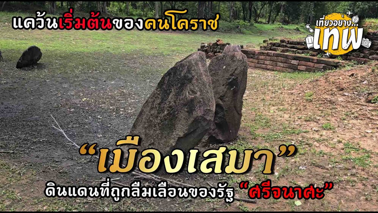
 Click to Access the Navigation Map GPS
Mueang Sema Ancient Town Map
Recommend
 Historical Sites and Monuments(20)
 Landmarks and Memorials(5)
 Art, Craft Centres, Tradition(7)
 Museums(6)
 Art Gallery(1)
 Educational Places
 Educational Gardens, Farm(4)
 Places of Worship
 Temple(29)
 Mosque(1)
 Other Sacred Sites(6)
 Research and Development
 Royal Project(3)
 Suburban Living
 Village, Community(6)
 Local Market(4)
 Floating Market(1)
 Nature and Wildlife
 National Parks and Marine Reserves(3)
 Mountain (Doi)(5)
 Dam, Reservoir, Lake(8)
 Waterfalls(9)
 Hot Springs(1)
 Caves(2)
 Flower Field(1)
 River, Canal(8)
 Bays and Beaches(2)
 Other natural attractions(3)
 Entertainment and Agricultural
 Zoos and Aquariums(2)
 Animal camps and shows(1)
 Farms, Parks and Ecotourism(21)
 Waterpark(4)
 Outdoor and Adventure Activities(6)
 Shopping
 Shopping and Night Market(2)
 Travel Articles, Recipes
 Travel Review, Food Review(6)


