
lovethailand home >Northeastern Travel Attractions >Yasothon Travel Attractions >Maha Chana Chai >Bueng Kae > Ban Bueng Kae Archaeological Site
TL;DR: Ban Bueng Kae Archaeological Site is located at Ban Bueng Kae, Bueng Kae Subdistrict, Maha Chana Chai District, Yasothon Province, open Daily, hours 08.00 – 17.00.
Ban Bueng Kae Archaeological Site
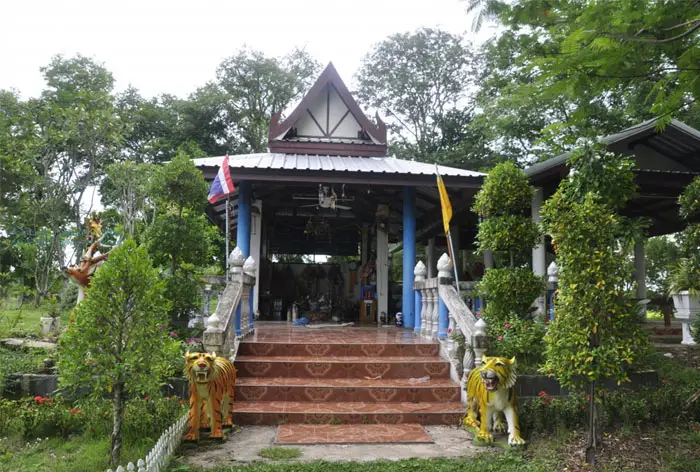
Open Days: Daily
Opening Hours: 08.00 – 17.00
Ban Bueng Kae Archaeological Site in Yasothon Province is an important ancient community and early town in Maha Chana Chai District. Located at Ban Bueng Kae, Bueng Kae Subdistrict, the site stands on a slightly oval mound surrounded by moats and earthen embankments. Archaeological evidence includes sema boundary stones, sandstone Buddha images, stone bases, pottery fragments with various decorative techniques, and the Non Sang inscription written in Khmer or post-Pallava script in Sanskrit. The community was occupied from the prehistoric period through the Dvaravati and Khmer cultural phases, around 2,000 to 1,000 years ago. It is a valuable destination for travelers interested in archaeology, Isan history, ancient settlements, and local cultural landscapes in Yasothon.
Ban Bueng Kae Archaeological Site in Yasothon Province is one of the important ancient communities in the lower Chi River basin. It is located at Ban Bueng Kae, Bueng Kae Subdistrict, Maha Chana Chai District, Yasothon Province. The site preserves traces of an early settlement within the present-day village landscape. Although parts of the ancient embankments and moats have been altered by farming, roads, and residential development, the remaining evidence still reveals the form of an ancient town with a clearly organized landscape, water system, sacred areas, and long cultural continuity.
Ban Bueng Kae is situated on a slightly oval mound. The mound measures approximately 450 meters from east to west and about 650 meters from north to south. The inner area within the ancient moat covers about 30 rai. This landscape shows that the ancient community was established on raised ground surrounded by water. Such a settlement pattern is common among ancient communities in northeastern Thailand, where people chose slightly elevated land near water sources for long-term habitation, agriculture, ritual activity, and protection from seasonal flooding.
The moat and embankment system at Ban Bueng Kae is particularly significant. On the northern side, there were 3 embankment lines, each about 3 meters wide and around 2.5 meters high. On the western side, there were 2 embankments, while the southern side retains 1 embankment. The moat system had 2 layers. On the northern side, the inner moat was about 30 meters wide and the outer moat about 55 meters wide. This outer water body is known locally as Bueng Chao Pu. On the eastern side, a large rectangular water body is known as Bueng Wa. On the western side, Bueng Khua and Bueng Nat still hold water, while many parts of the outer moat have become rice fields.
The combination of moats, embankments, and water bodies shows that Ban Bueng Kae was not merely an old village with scattered artifacts. It was an organized ancient community with a complex relationship between settlement, water, agriculture, and sacred space. Bueng Chao Pu, Bueng Wa, Bueng Khua, and Bueng Nat are not only local water names; they preserve the memory of the old town layout. These water features supported daily life, farming, movement across the settlement, and ritual meaning within the community landscape.
Several types of archaeological objects have been found within Ban Bueng Kae. These include sema boundary stones, sandstone Buddha images, stone bases, and low-fired pottery fragments. The pottery ranges from coarse-textured to fine-textured wares and includes surfaces decorated with cord-marked patterns, appliqué decoration, incised patterns, red painted designs, and white painted designs. This variety of pottery provides insight into domestic life, food storage, cooking, ritual practices, craftsmanship, and cultural interaction in the ancient community.
The pottery fragments from Ban Bueng Kae are important because they help explain the development of the community from the prehistoric period into the Dvaravati phase. Coarse pottery and cord-marked surfaces are associated with everyday use in agricultural communities, while incised, appliqué, and painted decoration indicate more developed craft traditions and aesthetic choices. The presence of both red and white painted designs shows that the community had knowledge of surface decoration and belonged to a broader cultural environment in the lower Northeast.
The sema stones found in Ban Bueng Kae are among the most important pieces of evidence. Sema stones were used to mark sacred Buddhist ritual boundaries. Their presence indicates that the community had adopted Buddhist practices and was part of the Dvaravati cultural sphere. Information from the conservation database identifies sema stones at Wat Pho Kanchanaram within the community, showing that Ban Bueng Kae was not only an agricultural settlement but also a sacred Buddhist area during the Dvaravati period.
The sandstone Buddha images and stone bases found in the village further support the religious importance of the site. Sandstone Buddha images reflect the creation of Buddhist icons, while stone bases may have been used for enshrining sacred objects or supporting ritual structures. These objects, together with sema stones and pottery, show that Ban Bueng Kae functioned as a place of habitation, production, worship, and community identity.
Another highly important piece of evidence is the Non Sang inscription. It was found at a mound in the middle of a rice field known as Non Sang, about 800 meters from Ban Bueng Kae. The inscription is written in Khmer or post-Pallava script and uses Sanskrit. This connects Ban Bueng Kae with the wider cultural world of early historic mainland Southeast Asia, where Sanskrit inscriptions and Indianized religious concepts spread through Khmer and related cultural networks. The presence of this inscription shows that Ban Bueng Kae was not an isolated village but part of a larger sphere of religion, patronage, and regional cultural exchange.
The Non Sang inscription is dated to the Khmer Angkorian cultural period, around the 15th Buddhist century. Its content relates to religious merit-making, donation, offerings of precious objects, forest dedication, and important figures associated with Khmer history, including King Indravarman I and King Somaditya. The inscription is valuable not simply because it is ancient writing, but because it reveals the relationship between the local community and broader systems of religious patronage, sacred land, and political-cultural authority in the lower Northeast.
Chronologically, Ban Bueng Kae was occupied from the prehistoric period through the Dvaravati period and into Khmer cultural influence, with an estimated age of around 2,000 to 1,000 years. This makes the site important for understanding the development of ancient communities in Yasothon. It reflects a transition from an agricultural settlement using pottery and living near water sources into a community that adopted Buddhism, used sema stones, created sandstone Buddha images, and later became connected with Khmer inscriptions and Sanskrit religious culture.
In the broader context of Maha Chana Chai District, Ban Bueng Kae helps reveal the deep historical roots of southern Yasothon. The district is associated with the Chi River, old settlements, local traditions, and cultural routes. Ban Bueng Kae shows that this area was significant long before modern administrative history. Communities in the lower Chi River basin had already developed settlement systems, water management, sacred spaces, craft production, and religious networks over many centuries.
The name Ban Bueng Kae reflects the landscape and local plant life. Local accounts explain that the village was surrounded by ponds and old moats, and that kae trees once grew along the embankments around the village. The name therefore records both the water-based landscape and the vegetation that shaped the memory of the place. Even today, the name helps connect people, water, plants, and the ancient settlement into a single cultural identity.
Local memory also preserves the idea of Ban Bueng Kae as an old town. Community accounts refer to moats, ponds, raised land, and old entry routes into the village. Some of these routes were once crossed by wooden bridges known by local names such as Khua Yai, Khua Noi, Khua Ka Moi, and Khua Ka Yom. These names show how the ancient water system continued to shape daily movement and place identity in later village life.
The community’s religious life also links the past with the present. Local devotion to Phra Yai Ming Mongkhon Non Sala and annual merit-making activities on important occasions such as Songkran and New Year show that the ancient landscape remains meaningful to the present-day community. Ban Bueng Kae is therefore more than an archaeological site in a technical sense. It is a living cultural landscape where ancient earthworks, Buddhist objects, local belief, community memory, and present-day village life remain connected.
Ban Bueng Kae also functions as an OTOP Nawatwithi tourism community in Maha Chana Chai District. Local activities include learning experiences connected with handmade products, coin-purse sewing, weaving, and community crafts. This adds another layer to the visitor experience. Travelers can understand the archaeological past of the settlement while also seeing how local people continue to preserve skills, occupations, and community identity in the present.
A meaningful visit to Ban Bueng Kae should begin with the overall town layout. Visitors should observe the oval mound, the remains of the northern embankments, Bueng Chao Pu, Bueng Wa, Bueng Khua, Bueng Nat, and the village landscape inside the former ancient town. The area of Wat Pho Kanchanaram and the location associated with sema stones help explain the sacred Buddhist layer of the site. Non Sang, located about 800 meters away, connects the settlement with the inscription and Khmer-period cultural history.
As a travel destination, Ban Bueng Kae is best suited for people who enjoy quiet places, local history, and learning from real landscapes. It is not a large historical park with monumental ruins. Its value lies in the ability to read the landscape: the mound, moats, embankments, old water names, sacred objects, inscription evidence, and the way the present village continues to occupy the ancient town area. For archaeology enthusiasts, it provides a clear example of how ancient communities can remain visible within modern village and farming landscapes.
The best time to visit is in the morning or late afternoon, when the weather is more comfortable for walking. Visitors should bring drinking water, a hat, or an umbrella, especially during the hot season. During periods when water remains in the ponds, the relationship between the settlement and the water system is easier to understand. During the rice-growing season, the surrounding fields show how parts of the outer moat and ancient landscape have been adapted into agricultural use.
Visitors should respect both the archaeological site and the local community. Do not collect pottery fragments, stones, or any archaeological objects. Do not enter rice fields or private land without permission. Do not leave rubbish, and keep noise at a respectful level. Since the site is part of a living village, travelers who want detailed guidance should contact Bueng Kae Subdistrict Administrative Organization or local community leaders before exploring specific areas.
Getting There from Yasothon city is most convenient by traveling toward Maha Chana Chai District, then continuing to Bueng Kae Subdistrict and Ban Bueng Kae. The route is suitable for private cars, rental cars, and local hired vehicles. From Maha Chana Chai District center, Ban Bueng Kae is not far and can be included in a half-day cultural trip. The site can also be combined with Wat Phra Phutthabat Yasothon, local community destinations, and riverside areas along the Chi River.
For a deeper itinerary, visitors can begin at Ban Bueng Kae Archaeological Site to understand the ancient town plan, then continue to Wat Pho Kanchanaram and Phra Yai Ming Mongkhon Non Sala, before visiting community learning points or local craft groups in Bueng Kae Subdistrict. This route allows travelers to see the continuity from ancient moats, sema stones, inscription evidence, and Buddhist objects to present-day community life and local craftsmanship.
For those interested in inscriptions and Khmer-period history, the Non Sang inscription is especially important. It connects Ban Bueng Kae with Sanskrit, Khmer or post-Pallava script, religious donation, and sacred landscape management. The inscription shows that the area was part of a larger cultural network rather than a small isolated settlement. It provides evidence of how religious ideas, political authority, and patronage systems reached local communities in the lower Chi River basin.
Ban Bueng Kae Archaeological Site therefore offers a complete learning experience. The moats and embankments reveal ancient land and water management. The sema stones and sandstone Buddha images reveal Buddhist practice. The pottery fragments reveal daily life and craft traditions. The Non Sang inscription reveals connections with Khmer and Sanskrit cultural worlds. Together, these elements make Ban Bueng Kae one of the most meaningful archaeological landscapes in Yasothon Province.
In summary, Ban Bueng Kae Archaeological Site is a historical landscape worth visiting and preserving. It is an ancient community with a clear town plan, multi-layered moat-and-embankment system, surrounding water bodies, diverse archaeological objects, Buddhist evidence, and an inscription linked to Khmer-period cultural networks. Although parts of the site have been adapted for village life and farming, the remaining traces still tell the story of Ban Bueng Kae with strong historical clarity. For travelers who want to understand Yasothon beyond festivals and city landmarks, Ban Bueng Kae opens a deeper view into the ancient communities of the Chi River basin.
| Name | Ban Bueng Kae Archaeological Site |
| Related Names | Bueng Kae Ancient Community, Ban Bueng Kae, Bueng Kae Ancient Settlement, Non Sang Inscription, Wat Pho Kanchanaram |
| Location | Ban Bueng Kae, Bueng Kae Subdistrict, Maha Chana Chai District, Yasothon Province |
| Address | Bueng Kae Subdistrict, Maha Chana Chai District, Yasothon Province 35130, Thailand |
| Coordinates | 15.5190423102, 104.339478781 |
| Highlights | Slightly oval ancient settlement with multi-layered moats and embankments, sema stones, sandstone Buddha images, stone bases, decorated pottery fragments, and the Non Sang inscription in Khmer or post-Pallava script and Sanskrit |
| History | Occupied from the prehistoric period through the Dvaravati and Khmer cultural phases, around 2,000 to 1,000 years ago. The Non Sang inscription dates to around the 15th Buddhist century. |
| Key Evidence | Sema stones, sandstone Buddha images, stone bases, coarse and fine pottery fragments, cord-marked pottery, appliqué decoration, incised decoration, red and white painted pottery, and the Non Sang inscription |
| Name Origin | The name Ban Bueng Kae is connected with the old landscape of ponds surrounding the village and kae trees that once grew along the ancient embankments. |
| Distinctive Features | Slightly oval mound about 450 meters wide and 650 meters long, covering about 30 rai inside the ancient moat. The northern side had 3 embankments, with an inner moat about 30 meters wide and an outer moat about 55 meters wide. |
| Main Areas / Zones | 1. Ban Bueng Kae Ancient Mound 2. Northern 3-Layer Embankment Area 3. Bueng Chao Pu On The Northern Side 4. Bueng Wa On The Eastern Side 5. Bueng Khua And Bueng Nat On The Western Side 6. Wat Pho Kanchanaram And Sema Stone Area 7. Non Sang, The Location Of The Non Sang Inscription, About 800 Meters From Ban Bueng Kae 8. Ban Bueng Kae OTOP Nawatwithi Tourism Community |
| Caretaker | Bueng Kae Subdistrict Administrative Organization And Yasothon Local Natural And Cultural Environment Conservation Unit |
| Travel Information | From Yasothon city, travel toward Maha Chana Chai District, then continue to Bueng Kae Subdistrict and Ban Bueng Kae. The route is suitable for private cars, rental cars, and local hired vehicles. |
| Current Status | Open to visitors as an ancient community, ancient settlement, and archaeological learning site in Bueng Kae Subdistrict, Maha Chana Chai District, Yasothon Province |
| Open Days | Daily |
| Opening Hours | 08.00 – 17.00 |
| Facilities | Community access roads, parking areas within the village and temple area, restaurants in Maha Chana Chai District, and accommodations in Yasothon city |
| Main Contact Number | Bueng Kae Subdistrict Administrative Organization Tel. 045-581567 Yasothon Local Natural And Cultural Environment Conservation Unit Tel. 0-4571-1655-6 |
| Official Website / Official Page | Bueng Kae Subdistrict Administrative Organization: www.buengkae.go.th |
| Nearby Tourist Attractions | 1. Wat Pho Kanchanaram, within Ban Bueng Kae community 2. Non Sang Inscription Site, about 1 km 3. Ban Bueng Kae OTOP Nawatwithi Tourism Community, within the same area 4. Wat Phra Phutthabat Yasothon, about 18 km 5. Phaya Thaen Public Park And Toad Museum, about 35 km 6. Wat Mahathat Yasothon, about 35 km 7. Ban Sing Tha Old Community, about 35 km |
| Nearby Restaurants | 1. Sri Charoen Café Maha Chana Chai Yasothon, about 12 km, Tel. 083-662-4663 2. Lert Coffee Maha Chana Chai 2486, about 12 km, Tel. 081-725-6607 3. Pern Ancient Coffee Maha Chana Chai, about 12 km, Tel. 090-351-1510 4. Café Nai Khum By AB, about 12 km, Tel. 098-989-7861 5. Madam Bubble Milk Tea 19 Baht, about 13 km, Tel. 083-224-6166 |
| Nearby Accommodations | 1. Chang Yai Jai Dee Hotel Yasothon, about 35 km, Tel. 045-711-123 2. The Zen Hotel Yasothon, about 36 km, Tel. 045-711-455 3. B.M. Grand Hotel, about 36 km, Tel. 045-712-333 4. JP Emerald Hotel, about 37 km, Tel. 045-714-456 5. The Green Park Grand Yasothon, about 37 km, Tel. 045-714-700-1 |
Frequently Asked Questions (FAQ)
Q: Where is Ban Bueng Kae Archaeological Site located?
A: It is located at Ban Bueng Kae, Bueng Kae Subdistrict, Maha Chana Chai District, Yasothon Province. The coordinates are 15.5190423102, 104.339478781.
Q: Why is Ban Bueng Kae Archaeological Site important?
A: It is an ancient community and settlement with moats and embankments, sema stones, sandstone Buddha images, pottery fragments, and the Non Sang inscription, showing occupation from the prehistoric period through the Dvaravati and Khmer cultural phases.
Q: What are the opening days and hours?
A: The site is open daily from 08.00 to 17.00.
Q: What should visitors see at Ban Bueng Kae?
A: Key places include the moat and embankment traces, Bueng Chao Pu, Bueng Wa, Bueng Khua, Bueng Nat, Wat Pho Kanchanaram, the sema stone area, and Non Sang, where the Non Sang inscription was found.
Q: What is the Non Sang inscription?
A: The Non Sang inscription is a stone inscription found on a mound in a rice field about 800 meters from Ban Bueng Kae. It is written in Khmer or post-Pallava script and Sanskrit, and is important evidence linking the site with Khmer-period religious and cultural networks.
Q: How can travelers get to Ban Bueng Kae?
A: From Yasothon city, travel toward Maha Chana Chai District, then continue to Bueng Kae Subdistrict and Ban Bueng Kae. Private cars, rental cars, and local hired vehicles are suitable options.
Q: Who is this destination suitable for?
A: It is suitable for travelers interested in archaeology, Isan history, Dvaravati culture, Khmer cultural influence, ancient settlements, and local community-based travel.
Q: What nearby attractions can be combined with this visit?
A: Travelers can combine the trip with Wat Pho Kanchanaram, Ban Bueng Kae OTOP Nawatwithi Tourism Community, Wat Phra Phutthabat Yasothon, Phaya Thaen Public Park, Wat Mahathat Yasothon, and Ban Sing Tha Old Community.
 Category: ●Art, Culture and Heritage
 Group: ●Historical Sites and Monuments
Last Update : 2 MonthAgo
 Last Update : 2 MonthAgo
 Click to Access the Navigation Map GPS
Ban Bueng Kae Archaeological Site Map
 Historical Sites and Monuments(6)
 Landmarks and Memorials(1)
 Art, Craft Centres, Tradition(4)
 Museums(1)
 Historic Homes and Cities(1)
 Places of Worship
 Temple(22)
 Church(1)
 Other Sacred Sites(9)
 Research and Development
 Royal Project(2)
 Suburban Living
 Village, Community(3)
 Local Market(1)
 Nature and Wildlife
 National Parks and Marine Reserves(2)
 Mountain (Doi)(2)
 Dam, Reservoir, Lake(7)
 River, Canal(2)
 Bays and Beaches(1)
 Other natural attractions(2)
 Entertainment and Agricultural
 Farms, Parks and Ecotourism(1)


