
lovethailand home >Northeastern Travel Attractions >Surin Travel Attractions >Samrong Thap >Pradu > Lam Huai Thap Than
TL;DR: Lam Huai Thap Than is located at Moo 8, Ban Si Racha, Pradu Subdistrict, Samrong Thap District, Surin Province, open Daily, hours 08.00 – 17.00.

Lam Huai Thap Than
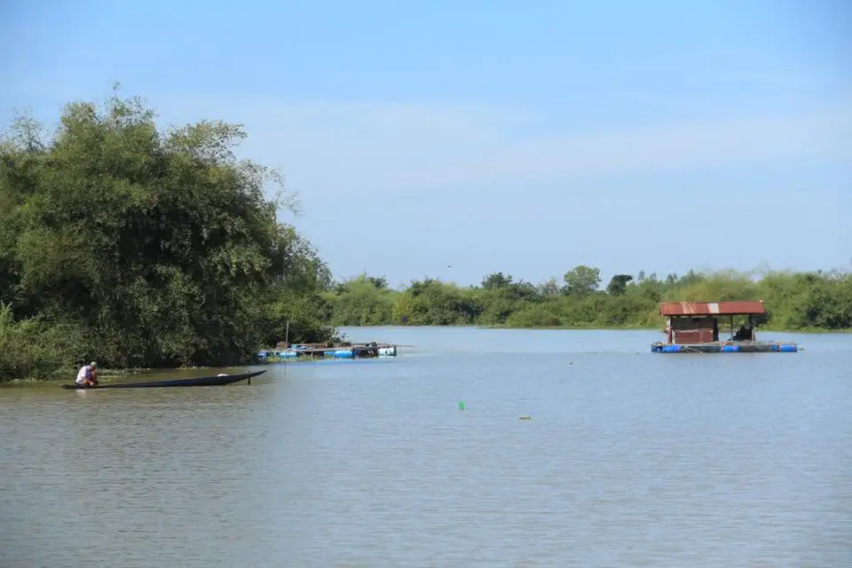
Open Days: Daily
Opening Hours: 08.00 – 17.00
Lam Huai Thap Than in Surin is a small natural stream attraction located at Moo 8, Ban Si Racha, Pradu Subdistrict, Samrong Thap District, Surin Province. The stream flows through Ban Si Racha and creates a seasonal riverside landscape that changes clearly between the rainy season and the dry season. During the rainy season, the water level rises and can block the natural crossing between Samrong Thap District in Surin and Huai Thap Than District in Si Sa Ket. During the dry season, the water level drops, revealing a small stream, sandy ground, and a natural crossing area. This makes Lam Huai Thap Than suitable for quiet nature visits, family relaxation, photography, and learning about a local landscape at the border area between Surin and Si Sa Ket.
Lam Huai Thap Than is important to the Samrong Thap area because it functions as a natural watercourse, a seasonal crossing, and a landscape feature connected with local life. Ban Si Racha is one of the villages in Pradu Subdistrict that has a direct relationship with this stream. The presence of the stream brings both beauty and natural limitations. In the rainy season, strong water flow requires caution. In the dry season, the stream becomes more accessible, and the surrounding sandy ground offers a quieter place for local people and visitors to observe the natural environment closely.
The attraction of Lam Huai Thap Than does not come from large tourist facilities or commercial activities. Its value lies in the real landscape of rural southern Isan: a local stream, sandy descent paths, seasonal water flow, a natural crossing, farmland, village scenery, and a route connecting two provinces. Visitors will experience the stream as part of daily community life rather than as a staged tourist attraction. This direct connection with local geography is what gives the site its identity.
Ban Si Racha in Pradu Subdistrict is located northeast of Samrong Thap town and close to Huai Thap Than District of Si Sa Ket Province. This geographical position gives Lam Huai Thap Than a special role as a local connection between 2 sides of the area. In the dry season, when the water is low, villagers can cross toward Huai Thap Than more easily. In the rainy season, the same place becomes a natural water barrier. The stream therefore shows how seasons, water, and local mobility are closely linked in rural communities.
The name “Huai Thap Than” is connected with local stories from Huai Thap Than District in Si Sa Ket. The word “Thap Than” is associated with a story of military groups meeting or catching up at the stream area, which later became the name of the stream and district. This gives Lam Huai Thap Than a cultural dimension. It is not only a natural stream but also a place name connected with local memory, storytelling, and the geography of 2 neighboring provinces.
The descent from Ban Si Racha to the stream is a narrow local path with sandy soil. It feels more like a community route than a fully developed tourist road. Walking is the most suitable way to reach the lower stream area. Motorcycles may be used only when the ground is dry and the path condition is suitable. This practical feature makes a visit to Lam Huai Thap Than feel like entering a local natural area rather than a commercial sightseeing spot.
The sandy path is an important part of the landscape. It clearly shows how the area changes by season. In the dry season, the path is easier to walk, the stream becomes shallower, and the riverbank structure is more visible. In the rainy season, the same sandy path may become wet, slippery, and affected by fast-moving water. Visitors should observe the real condition of the path on the day of travel because this is a natural and community-based site.
During the rainy season, Lam Huai Thap Than becomes a stronger waterway. Water flowing through Ban Si Racha can rise enough to block the crossing between Samrong Thap and Huai Thap Than. This seasonal scene shows the power of local drainage systems in the southern Isan lowlands. A stream that appears small in the dry season can become an important water route during heavy rain. In this period, the best activity is to observe the landscape from a safe riverside area rather than approaching or crossing the stream.
During the dry season, the scene changes completely. The water level drops, and visitors can see a gentler stream, sandy banks, and shallow areas that can be crossed in suitable conditions. The surrounding atmosphere becomes calmer and more suitable for family relaxation, light walking, and photography. The dry-season view reveals the structure of the bank, the sandy route, and the natural crossing that local people use when water levels allow.
This clear seasonal difference is the main charm of Lam Huai Thap Than. The rainy season reveals the force and importance of the stream as a watercourse. The dry season reveals a softer landscape with a small stream and an open riverside area. Understanding this change makes the visit more meaningful than a brief scenic stop. Travelers can see how the same natural site performs different roles throughout the year.
The overall atmosphere of Lam Huai Thap Than at Ban Si Racha is suitable for travelers who enjoy simple, unpolished nature. There are no luxury facilities, no dense commercial attractions, and no large-scale activity zones. Instead, the place offers a real stream, a sandy path, village surroundings, and a quiet rural landscape. Visitors who enjoy slow travel will appreciate the calmness and authenticity of the area.
The riverside area is suitable for family relaxation when the water level is low and the ground is safe. The breeze from the stream, the open space, and the rural surroundings make the atmosphere peaceful. Visitors can spend a short time resting, taking photographs, and experiencing the rural side of Samrong Thap District. The site is best used as a local nature stop along a broader route rather than as a full-day standalone attraction.
For travelers interested in local geography, Lam Huai Thap Than clearly explains the relationship between streams, communities, and rural transportation. In the dry season, the stream can become a crossing and a connection. In the rainy season, the same stream becomes a natural barrier that shapes movement. This illustrates how nature continues to influence the daily life of Ban Si Racha and nearby border communities.
Walking in the stream area should be done with attention to the ground condition. The descent path may change after rain, water flow, or motorcycle tracks. Some sandy sections may be soft or unstable. Walking offers better control than bringing a vehicle close to the stream, especially after rainfall. The site remains a natural community area, so movement should match the actual condition of the terrain.
Another charm of Lam Huai Thap Than is that it allows visitors to see Ban Si Racha closely. The village is not large, and the rural setting gives the stream area a very local character. This is different from Samrong Thap town, where shops, public offices, markets, and restaurants are more concentrated. Visiting the stream helps travelers experience both the natural and community sides of the district in one trip.
Pradu Subdistrict has clear local administrative information, and Ban Si Racha is Moo 8 of the subdistrict. The office of Pradu Subdistrict Administrative Organization is also located in Ban Si Racha. This makes the local authority an important contact point for visitors who want updated information on routes, seasonal water conditions, or access to the stream area. Local information is especially useful during the rainy season.
Lam Huai Thap Than is also suitable for rural landscape photography. The sandy descent path, dry-season stream, riverbank, natural crossing, and village atmosphere provide images that differ from the main tourist symbols of Surin Province. Morning and late afternoon are the best times for photography because the light is softer, and the sandy riverside surface has more natural depth and shadow.
For family travel, the stream can be used as a place for children to learn about water, seasons, and rural ecosystems. Children can see how the same stream changes from a strong waterway in the rainy season to a small stream in the dry season. This helps them understand that natural places are not fixed. They change with rain, water level, soil, and time. Children should always be supervised because banks, sand, and water levels can change quickly.
Travelers coming from Surin city can combine Lam Huai Thap Than with other local places around Samrong Thap. Possible stops include the Four Tribes Market, Wat Pa Thammanuson, Wat Takhian, Wat Ko Kaeo, and the route toward Huai Thap Than District in Si Sa Ket. This type of route creates a varied trip that includes nature, community life, temples, markets, and the border landscape between provinces.
The Four Tribes Market in Samrong Thap town is a meaningful community attraction to combine with the stream. It reflects the identity of Samrong Thap and the cultural diversity of the district. Travelers can begin at the market or the district center, then continue to Ban Si Racha to see Lam Huai Thap Than. They can also visit the stream first and return to town for food, coffee, and rest.
Wat Pa Thammanuson is another suitable stop for visitors interested in quiet religious places. Although the temple and the stream offer different experiences, both reflect the calm atmosphere of rural Surin. A slow travel route can include a temple visit, quiet rest, and a late afternoon stop at the stream when the light is softer and the temperature is more comfortable.
Safety is important at Lam Huai Thap Than. During the rainy season and periods of continuous rain, the stream may have fast-moving water and a higher water level. Approaching the water or attempting to cross during high water is not suitable for visitors. In the dry season, the area appears safer, but sandy ground, uneven surfaces, and unstable banks still require caution.
Visitors who want to walk down to the stream should use shoes suitable for sandy ground and natural terrain. The area does not have a standardized walkway throughout. Practical clothing and footwear make walking easier, especially for visitors who want to photograph the area or explore the riverside for a longer time.
Facilities directly at the stream are limited. There is no confirmed full tourist service zone such as a visitor center, restaurant, or public toilet directly at the stream. Food, cafes, shops, and major services are easier to find in Samrong Thap town or nearby communities before entering Ban Si Racha. Planning food and rest stops in advance makes the visit smoother, especially for families and travelers coming from other districts.
Although Lam Huai Thap Than is a small natural place, it has clear value as a local learning site. It shows the relationship between floodwater, dry season, natural crossings, community life, and the geography of a provincial border area. It is suitable for local documentary photography, rural travel writing, and understanding Surin beyond elephants, silk, and Khmer ruins.
The most convenient way to visit is by private car or motorcycle. From Samrong Thap town, travel toward Pradu Subdistrict and Ban Si Racha, about 10 km from the district center. The main route to the subdistrict is accessible, but the final descent from the village to the stream is a narrow sandy path. Walking is the most suitable method when approaching the stream.
Getting There from Surin city involves traveling to Samrong Thap District, then continuing to Pradu Subdistrict and Ban Si Racha. From Samrong Thap town, head toward Pradu, which is about 10 km from the district center. Once in Ban Si Racha, use the local community route to descend toward the stream. The final section is narrow and sandy, so walking is the safest and most suitable option. Motorcycles are practical only when the ground is dry and local conditions allow.
Travelers coming from Si Sa Ket or Huai Thap Than District can understand this area as a seasonal connection to the Surin side. When water levels are low and the natural crossing is usable, movement across the stream is easier. During the rainy season, the crossing is not suitable for general travel because fast water can block the route. Checking local conditions before travel is important for this route.
The Ban Si Racha area is a living rural community. Visitors should keep noise low, avoid leaving trash by the stream, avoid driving into soft sand, avoid disturbing farms or homes, and avoid risky activities near the water. Respectful behavior helps keep the area clean, safe, and welcoming for both residents and visitors.
Lam Huai Thap Than is best visited as a half-day stop. Travelers can visit in the morning or late afternoon, then continue to the Four Tribes Market, cafes, restaurants, or accommodation in Samrong Thap. Visitors who stay overnight in the district can also extend the trip toward Huai Thap Than District in Si Sa Ket or return to Surin city the next day.
In the rainy season, Lam Huai Thap Than presents a strong image of a local watercourse. In the dry season, the same place becomes a quieter stream with sandy ground and a natural crossing. This seasonal change is the heart of the place. Visiting in different seasons gives different experiences and helps travelers understand how water shapes rural landscapes.
For foreign travelers, Lam Huai Thap Than offers a real view of rural Thailand outside the main tourist trail. It is not a commercial attraction, but a local natural and community landscape. A rental car or car with driver is the most practical way to visit. Combining the stream with Samrong Thap town, local temples, the Four Tribes Market, and Huai Thap Than District will make the route more meaningful.
In summary, Lam Huai Thap Than in Surin is a quiet natural stream attraction at Ban Si Racha, Pradu Subdistrict, Samrong Thap District. It is valuable because of its seasonal character. The rainy season brings strong water flow that can block the crossing between Samrong Thap and Huai Thap Than. The dry season reveals a smaller stream, sandy paths, and a natural crossing. The descent from the village is narrow and sandy, preserving the local character of the site. It is suitable for family relaxation, rural landscape photography, and learning about the relationship between water, community, and seasonal life in southern Isan.
| Name | Lam Huai Thap Than, Surin |
| Location | Moo 8, Ban Si Racha, Pradu Subdistrict, Samrong Thap District, Surin Province |
| Address | Ban Si Racha, Moo 8, Pradu Subdistrict, Samrong Thap District, Surin 32170, Thailand |
| Coordinates | Ban Si Racha / Pradu Subdistrict Administrative Organization area: 15.084880526323468, 103.9922509750991 |
| Highlights | A seasonal natural stream. In the rainy season, floodwater can block the crossing between Samrong Thap and Huai Thap Than. In the dry season, the water level drops and reveals a small stream and natural crossing. |
| History | A local natural stream connected with the border landscape between Surin and Si Sa Ket, seasonal transportation, and community life at Ban Si Racha in Pradu Subdistrict |
| Name Origin | The name Huai Thap Than is connected with local stories from Huai Thap Than District, where “Thap Than” refers to the story of military groups meeting at the stream area. |
| Distinctive Features | A narrow sandy path leads from the village down to the stream, making it suitable for walking and viewing the local riverside landscape. |
| Travel Information | Travel from Surin city to Samrong Thap District, then continue to Pradu Subdistrict and Ban Si Racha. From the village, walk down the sandy local path to the stream area. |
| Current Status | Open to visitors as a natural stream and local community landscape |
| Open Days | Daily |
| Opening Hours | 08.00 – 17.00 |
| Facilities | Natural stream area, community access path, open resting area, with restaurants and main services available in Samrong Thap town |
| Main Areas / Zones | 1. Descent path from Ban Si Racha 2. Sandy riverside area 3. Lam Huai Thap Than stream line 4. Dry-season natural crossing 5. Ban Si Racha community area 6. Route connection toward Huai Thap Than District |
| Caretaker / Related Authority | Pradu Subdistrict Administrative Organization, Samrong Thap District, Surin Province |
| Main Contact Number | Pradu Subdistrict Administrative Organization Tel. 0-4406-9785 |
| Official Website / Official Page | Pradu Subdistrict Administrative Organization, Surin Province |
| Nearby Tourist Attractions | 1. Wat Ban Si Racha, 1 km 2. Four Tribes Market, Samrong Thap, 10 km 3. Wat Pa Thammanuson, 14 km 4. Wat Takhian (Pho Sitaram), 12 km 5. Wat Ko Kaeo, 18 km 6. Nong Khu Pine Forest Park, 30 km |
| Nearby Restaurants | 1. Kaokan Cafe, Samrong Thap, 12 km, Tel. 093-487-6290 2. Jungle Cafe Samrong Thap Surin Branch, 12 km, Tel. 099-367-0241 3. Naikon Boat Noodle 341 Surin-Samrong Thap, 12 km, Tel. 080-073-1956 4. Phet Lamphu Mookata Samrong Thap Branch, 12 km, Tel. 044-569-470 5. Pratumpon, 12 km, Tel. 082-368-8971 6. N’Joy Coffee Thu, 12 km, Tel. 082-449-5254 |
| Nearby Accommodations | 1. Huaisaengchan Resort, 12 km, Tel. 083-371-1987, 044-569-375 2. Meechai Smart Resort, 12 km, Tel. 098-280-7099, 098-280-7100 3. RT House Resort, 18 km 4. Baan Suan Apisara & DD Resort, 20 km 5. Rueang Si Resort, 22 km 6. Chomdao Resort Sisaket, 30 km |
Frequently Asked Questions (FAQ)
Q: Where is Lam Huai Thap Than in Surin located?
A: It is located at Moo 8, Ban Si Racha, Pradu Subdistrict, Samrong Thap District, Surin Province, close to the route connecting with Huai Thap Than District in Si Sa Ket.
Q: What are the opening days and hours of Lam Huai Thap Than?
A: It is open daily from 08.00 to 17.00.
Q: Is there an admission fee for Lam Huai Thap Than?
A: There is no confirmed admission fee for the natural stream area. Main travel costs are transportation, food, and accommodation depending on the visitor’s route.
Q: When is the best time to visit Lam Huai Thap Than?
A: The dry season is suitable for seeing the small stream, sandy ground, and natural crossing. The rainy season is suitable for viewing the stronger water flow from a safe riverside area.
Q: What makes Lam Huai Thap Than interesting?
A: Its highlights include a seasonal stream, a sandy local access path, a dry-season natural crossing, and the quiet rural atmosphere of Ban Si Racha.
Q: How can travelers get to Lam Huai Thap Than?
A: Travel from Surin city to Samrong Thap District, continue to Pradu Subdistrict and Ban Si Racha, then walk down the narrow sandy local path toward the stream.
Q: What should visitors be careful about?
A: Visitors should be careful of floodwater in the rainy season, slippery or unstable sandy ground after rain, and should not attempt to cross the stream when water levels are high or the current is strong.
Q: What nearby places can be visited with Lam Huai Thap Than?
A: Nearby places include the Four Tribes Market, Wat Pa Thammanuson, Wat Takhian, Wat Ko Kaeo, Nong Khu Pine Forest Park, and routes toward Huai Thap Than District in Si Sa Ket.
 Category: ●Nature and Wildlife
 Group: ●River, Canal
Last Update : 2 MonthAgo
 Last Update : 2 MonthAgo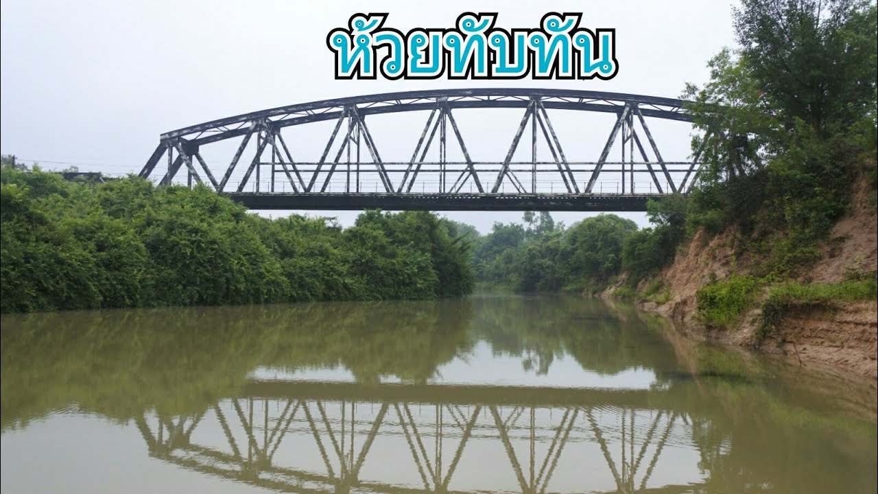
 Click to Access the Navigation Map GPS
Lam Huai Thap Than Map
Recommend

 Art, Culture and Heritage
 Historical Sites and Monuments(11)
 Landmarks and Memorials(2)
 Art, Craft Centres, Tradition(5)
 Museums(1)
 Places of Worship
 Temple(15)
 Other Sacred Sites(1)
 Suburban Living
 Village, Community(9)
 Local Market(1)
 National Parks and Marine Reserves(2)
 Mountain (Doi)(2)
 Dam, Reservoir, Lake(6)
 Waterfalls(1)
River, Canal(2)
Waterfalls(1)
River, Canal(2)
 Other natural attractions(4)
 Entertainment and Agricultural
 Farms, Parks and Ecotourism(2)


