
lovethailand home >Northeastern Travel Attractions >Yasothon Travel Attractions >Kho Wang >Nam Om > Ban Nam Om Archaeological Site
TL;DR: Ban Nam Om Archaeological Site is located at Ban Nam Om, Nam Om Subdistrict, Kho Wang District, Yasothon Province, open Daily, hours 08.00 – 17.00.

Ban Nam Om Archaeological Site
Open Days: Daily
Opening Hours: 08.00 – 17.00
Ban Nam Om Archaeological Site in Yasothon Province is an important ancient community in Nam Om Subdistrict, Kho Wang District. The site is located on a nearly circular mound surrounded by a moat about 30 – 40 meters wide. Large quantities of prehistoric pottery fragments have been found, including coarse sandy wares mixed with gravel and plant remains, both handmade and wheel-made, in orange and pale tones. These remains show continuous habitation from the prehistoric period to the Dvaravati period, around 2,500 – 1,000 years ago. Today, Ban Nam Om is a community-based archaeological landscape suitable for travelers interested in ancient settlements, moated communities, Dvaravati culture, and the lower Chi River basin.
Ban Nam Om Archaeological Site in Yasothon Province is one of the important ancient communities of Kho Wang District. It is located at Ban Nam Om, Nam Om Subdistrict, Yasothon Province. The site preserves evidence of long-term settlement in the lower Chi River basin, from the prehistoric period to the Dvaravati period. Its main feature is a nearly circular mound surrounded by a moat, set within a present-day rural village and rice-field landscape. Although parts of the moat have changed through later use, the overall setting still reveals the relationship between an ancient settlement, water management, agriculture, and local community life.
The ancient mound at Ban Nam Om is about 500 meters in diameter and rises approximately 1.80 to 2 meters above the surrounding plain. The area is surrounded by rice fields and lies about 121 meters above mean sea level. Around the mound is a moat about 30 to 40 meters wide. This type of settlement pattern is significant in northeastern Thailand because it shows how ancient communities selected slightly raised land near water sources, then organized their settlement with a surrounding water system. The moat helped define the community boundary, supported water use, and reflected a more organized form of settlement during the transition into the early historic period.
The moat around Ban Nam Om is more than a physical feature. It is a key element for understanding the ancient townscape. Today, some sections of the moat are broken, while other parts have been re-excavated as public water sources for the village. This shows that the archaeological landscape remains connected with present-day community life. The ancient moat is not separated from the village; it continues to function within the local landscape as part of water storage, agricultural memory, and community identity.
Important nearby water sources include Bueng Paep, about 1.3 kilometers to the northwest, and the Chi River, about 5 kilometers to the north. These water sources help explain why the ancient community developed here. Water was essential for settlement, rice cultivation, livestock, movement, and contact with other communities in the region. Ban Nam Om was therefore part of a broader network of ancient communities that formed around water sources, fertile fields, and slightly elevated land in Yasothon.
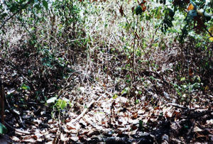
The most important archaeological evidence from Ban Nam Om is the large quantity of pottery fragments found at the exposed soil layers along the western edge of the mound. These fragments are coarse sandy pottery mixed with gravel and plant remains. They include both handmade pottery and wheel-made pottery, with orange and pale surfaces. Such evidence reflects local pottery technology, the use of available raw materials, and domestic activities such as cooking, food storage, water storage, and household use.
Pottery fragments are valuable archaeological evidence because they preserve the everyday life of ancient people. Broken vessels left in settlement layers help archaeologists understand technology, clay selection, firing methods, forming techniques, and patterns of domestic life. At Ban Nam Om, the presence of both handmade and wheel-made pottery suggests technological continuity and change over a long period. The site therefore helps explain the development of pottery production and community life from the prehistoric period into the Dvaravati period.
The prehistoric pottery found at Ban Nam Om shows that the settlement began as an agricultural community. Late prehistoric communities in northeastern Thailand commonly lived near water, used pottery in daily life, cultivated crops, and organized their living areas around raised ground. The large amount of pottery at Ban Nam Om indicates continuous habitation rather than temporary use. The mound itself was formed by repeated human activity over many generations, including occupation, cooking, waste disposal, building activity, and daily household life.
As the community entered the early historic period, Ban Nam Om developed the surrounding moat system associated with Dvaravati-period settlement patterns in the Northeast. A moated settlement indicates more complex spatial organization. It shows that the community had clear boundaries, water management, and possibly sacred or communal areas within or near the settlement. Ban Nam Om is therefore an important example of a community that developed from prehistoric habitation into a moated early historic settlement.
The importance of Ban Nam Om lies in this continuity. It represents the transition from prehistoric settlement to early historic community organization. In local historical terms, the site helps complete the picture of Yasothon as a province rich in ancient settlements, not only major monuments or temples. Ban Nam Om shows that smaller communities also played an important role in the development of the lower Chi River basin, with organized land use, pottery technology, water systems, and long-term occupation.
The mound itself is meaningful because such raised land often results from long periods of settlement accumulation. Soil layers in ancient mounds usually contain pottery fragments, ash, building debris, household remains, and other traces of human activity. At Ban Nam Om, the discovery of many pottery fragments along the western edge of the mound indicates that cultural layers are still visible in the landscape. This makes the site useful for understanding how ordinary communities lived, used materials, and gradually shaped their environment.
The name Ban Nam Om also reflects the close relationship between people and water. The word suggests a landscape associated with water surrounding or embracing the community. When considered together with the moat, Bueng Paep, the Chi River, and the rice-field environment, the name fits the character of the site. Ban Nam Om was a water-based settlement landscape where the ancient community depended on nearby water sources for agriculture, daily life, and long-term survival.
Today, Ban Nam Om remains a living community. The archaeological features are embedded within the village, rice fields, water sources, and community roads. This makes the site different from a formal historical park. Visitors need to read the landscape carefully: the mound, the moat, the surrounding fields, and the nearby water sources all work together as evidence of the ancient settlement. The value of Ban Nam Om lies in its quiet authenticity and the way the ancient town remains part of present-day rural life.
Visitors who come to Ban Nam Om should focus on the overall landscape rather than expecting large standing monuments. The key features to observe are the shape of the mound, the moat around it, the western edge where pottery fragments were found, the surrounding rice fields, Bueng Paep to the northwest, and the relationship with the Chi River to the north. Understanding these features allows visitors to see how ancient people chose their settlement location, organized water, used local clay, and developed a stable community over many centuries.
Within the broader history of Yasothon, Ban Nam Om belongs to a network of ancient communities in the lower Chi River basin and nearby districts such as Kho Wang and Maha Chana Chai. These communities were established near water and fertile land, and many developed moats and embankments. The evidence from Ban Nam Om shows that Yasothon has deep cultural roots beyond its modern town history. It preserves the story of ordinary communities that lived, farmed, made pottery, and adapted to their environment from the prehistoric period into the Dvaravati period.
Ban Nam Om also connects well with cultural travel in Kho Wang District. Another nearby historical attraction is Don Phra That in Ban Phi Phuan, a local ancient monument under the care of the community and local authority. Travelers can combine Ban Nam Om with Don Phra That to understand both moated ancient settlement and religious heritage in the same district. This route gives a clearer view of Kho Wang’s cultural landscape, where ancient settlement, local belief, and rural community identity exist together.
For a broader route, visitors can continue to Wat Phra Phutthabat Yasothon in Maha Chana Chai District or travel toward Yasothon city to visit Phaya Thaen Public Park, the Toad Museum, Wat Mahathat, and the old Ban Sing Tha community. These destinations connect small-scale archaeological landscapes with major cultural, religious, and urban heritage sites of the province. They help travelers understand Yasothon from several angles: prehistoric settlement, Dvaravati culture, Buddhist faith, local traditions, and modern community life.
The best time to visit Ban Nam Om is in the morning or late afternoon, when the weather is more comfortable for walking. During the rainy season or when water remains in the moat and nearby ponds, the relationship between the settlement and water system becomes easier to understand. During the rice-growing season, visitors can see how the ancient landscape continues to be used as part of the agricultural environment. Travelers should bring drinking water, a hat, or an umbrella and wear suitable shoes for walking in rural areas.
Visitors should respect both the archaeological site and the local community. Do not collect pottery fragments, stones, or any old materials from the site. Do not enter rice fields or private land without permission. Do not dig, disturb exposed soil layers, or leave rubbish. Since Ban Nam Om is part of a living village, respectful travel helps protect the site and allows the community to preserve it as a local learning resource for future generations.
Getting There to Ban Nam Om Archaeological Site can be done via the road between Maha Chana Chai District and Kho Wang District, then turning west onto a local road for about 3 kilometers. The site is currently located in Nam Om Subdistrict, Kho Wang District. From Yasothon city, travelers can head toward Kho Wang District, continue to Nam Om Subdistrict, and enter Ban Nam Om. The route is suitable for private cars, rental cars, and local hired vehicles. Visitors who want to explore the area carefully should allow at least 1 to 2 hours.
For a deeper visit, travelers should first check the location of Ban Nam Om on a map, then observe the mound, moat, surrounding fields, and accessible community areas without entering private land. The relationship between the mound, Bueng Paep, the Chi River, and the local agricultural landscape is central to understanding the site. This approach turns the visit into an experience of reading an ancient landscape still visible within a modern village.
In summary, Ban Nam Om Archaeological Site is a valuable historical landscape in Yasothon Province. It preserves a raised ancient mound, a surrounding moat, nearby water sources, large quantities of prehistoric pottery, and evidence of development into the Dvaravati period. Although it does not have large standing monuments, it offers deep insight into settlement, water management, pottery technology, and the long history of communities in the lower Chi River basin. Ban Nam Om is a meaningful destination for travelers who want to understand Yasothon beyond its main city attractions and festivals.
| Name | Ban Nam Om Archaeological Site |
| Related Names | Ban Nam Om Ancient Community, Ban Nam Om Ancient Settlement, Ban Nam Om, Ban Nam Om Cultural Heritage Site |
| Location | Ban Nam Om, Nam Om Subdistrict, Kho Wang District, Yasothon Province |
| Address | Nam Om Subdistrict, Kho Wang District, Yasothon Province 35160, Thailand |
| Coordinates | 15.3932694727, 104.29727227 |
| Highlights | Nearly circular ancient mound, surrounding moat about 30 – 40 meters wide, large quantities of prehistoric pottery fragments, and a living community landscape |
| History | Occupied from the prehistoric period through the Dvaravati period, around 2,500 – 1,000 years ago |
| Key Evidence | Coarse sandy pottery fragments mixed with gravel and plant remains, both handmade and wheel-made, with orange and pale surfaces, found mainly along the western edge of the mound |
| Name Origin | The name Ban Nam Om reflects a water-related landscape, matching the site’s surrounding moat and nearby water sources. |
| Distinctive Features | Nearly circular mound about 500 meters in diameter, about 1.80 to 2 meters above the surrounding plain, covering over 60 rai, with a single moat about 30 – 40 meters wide |
| Main Areas / Zones | 1. Ban Nam Om Ancient Mound 2. Surrounding Moat 3. Western Edge Of The Mound Where Many Pottery Fragments Were Found 4. Re-Excavated Moat Sections Used As Village Water Sources 5. Bueng Paep To The Northwest 6. Surrounding Rice Fields 7. Route Linking Ban Nam Om With Kho Wang And Maha Chana Chai Districts |
| Caretaker | Yasothon Local Natural And Cultural Environment Conservation Unit And Local Administrative Authorities In Kho Wang District |
| Travel Information | Use the road between Maha Chana Chai District and Kho Wang District, then turn west onto a local road for about 3 km. From Yasothon city, travel toward Kho Wang District, continue to Nam Om Subdistrict, and enter Ban Nam Om. |
| Current Status | Open to visitors as an ancient community, ancient settlement, and archaeological learning site in Kho Wang District, Yasothon Province |
| Open Days | Daily |
| Opening Hours | 08.00 – 17.00 |
| Admission Fee | No Admission Fee |
| Facilities | Community access roads, village water areas, local parking points, restaurants in Kho Wang District, and accommodations in Kho Wang District or Yasothon city |
| Main Contact Number | Yasothon Local Natural And Cultural Environment Conservation Unit Tel. 0-4571-1655-6 Kho Wang Subdistrict Administrative Organization Tel. 045-979768 |
| Official Website / Official Page | Kho Wang Subdistrict Administrative Organization: khowang.go.th |
| Nearby Tourist Attractions | 1. Bueng Paep, about 1 km 2. Chi River, about 5 km 3. Don Phra That Ancient Monument, Ban Phi Phuan, Kho Wang District, about 8 km 4. Wat Phra Phutthabat Yasothon, about 20 km 5. Maha Chana Chai District And Chi River Area, about 20 km 6. Phaya Thaen Public Park And Toad Museum, about 45 km 7. Wat Mahathat Yasothon, about 45 km 8. Ban Sing Tha Old Community, about 45 km |
| Nearby Restaurants | 1. Lap Thai Amnat Restaurant, Kho Wang District, about 3 km, Tel. 088-040-1008 2. Made-To-Order Food Shop, Kho Wang District, about 6 km, Tel. 098-097-1672 3. 365 Americano Tea Bar, Kho Wang, about 8 km, Tel. 096-195-2297 4. Jungle Cafe Kho Wang Branch, about 8 km 5. Restaurants And Cafés In Kho Wang District Center, about 6 – 10 km |
| Nearby Accommodations | 1. Hom Krai Resort, Kho Wang District, about 8 km, Tel. 081-976-6776 2. Chang Yai Jai Dee Hotel Yasothon, about 45 km, Tel. 045-711-123 3. The Zen Hotel Yasothon, about 46 km, Tel. 045-711-455 4. B.M. Grand Hotel, about 46 km, Tel. 045-712-333 5. JP Emerald Hotel, about 47 km, Tel. 045-714-456 6. The Green Park Grand Yasothon, about 47 km, Tel. 045-714-700-1 |
Frequently Asked Questions (FAQ)
Q: Where is Ban Nam Om Archaeological Site located?
A: It is located at Ban Nam Om, Nam Om Subdistrict, Kho Wang District, Yasothon Province. The coordinates are 15.3932694727, 104.29727227.
Q: Why is Ban Nam Om Archaeological Site important?
A: It is an ancient community with a raised mound, surrounding moat, and large quantities of prehistoric pottery. The evidence shows continuous occupation from the prehistoric period to the Dvaravati period, around 2,500 – 1,000 years ago.
Q: What are the opening days and hours?
A: The site is open daily from 08.00 to 17.00.
Q: Is there an admission fee?
A: No. Visitors can view the ancient mound, moat landscape, and surrounding community area without an admission fee.
Q: What archaeological evidence has been found at Ban Nam Om?
A: The most important evidence is a large quantity of coarse sandy pottery fragments mixed with gravel and plant remains, including both handmade and wheel-made pottery in orange and pale tones.
Q: How is Ban Nam Om related to the Dvaravati period?
A: Ban Nam Om developed from a prehistoric settlement into a moated community associated with the Dvaravati period, a key phase of early historic settlement in northeastern Thailand.
Q: How can travelers get to Ban Nam Om?
A: Travelers can use the road between Maha Chana Chai District and Kho Wang District, then turn west onto a local road for about 3 km. From Yasothon city, travel toward Kho Wang District, continue to Nam Om Subdistrict, and enter Ban Nam Om.
Q: What nearby attractions can be combined with this visit?
A: Nearby attractions include Bueng Paep, the Chi River, Don Phra That Ancient Monument, Wat Phra Phutthabat Yasothon, Phaya Thaen Public Park, Wat Mahathat Yasothon, and Ban Sing Tha Old Community.
 Category: ●Art, Culture and Heritage
 Group: ●Historical Sites and Monuments
Last Update : 2 MonthAgo
 Last Update : 2 MonthAgo
 Click to Access the Navigation Map GPS
Ban Nam Om Archaeological Site Map
 Historical Sites and Monuments(6)
 Landmarks and Memorials(1)
 Art, Craft Centres, Tradition(4)
 Museums(1)
 Historic Homes and Cities(1)
 Places of Worship
 Temple(22)
 Church(1)
 Other Sacred Sites(9)
 Research and Development
 Royal Project(2)
 Suburban Living
 Village, Community(3)
 Local Market(1)
 Nature and Wildlife
 National Parks and Marine Reserves(2)
 Mountain (Doi)(2)
 Dam, Reservoir, Lake(7)
 River, Canal(2)
 Bays and Beaches(1)
 Other natural attractions(2)
 Entertainment and Agricultural
 Farms, Parks and Ecotourism(1)


