
lovethailand home >North Travel Attractions >Tak Travel Attractions >Prop Phra >Khiri Rat > Romklao 3 Reservoir
TL;DR: Romklao 3 Reservoir is located at Ban Um Piam, Village No. 1, Khiri Rat Subdistrict, Phop Phra District, Tak Province, open Public reservoir area, suitable for daily daytime visits, hours Best visited during daytime and late afternoon before sunset.
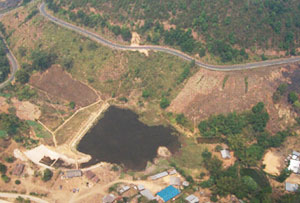
Romklao 3 Reservoir
Open Days: Public reservoir area, suitable for daily daytime visits
Opening Hours: Best visited during daytime and late afternoon before sunset
Romklao 3 Reservoir in Tak Province is a medium-sized reservoir located at Ban Um Piam, Village No. 1, Khiri Rat Subdistrict, Phop Phra District, Tak Province. It lies within the Salween River Basin and is part of the highland landscape along the Mae Sot-Phop Phra-Umphang route. Originally connected with a security-development project along this important mountain route, the reservoir now serves as a local water source that supports domestic use, community water needs, and an estimated benefited area of about 2,000 rai. Although modest in size, Romklao 3 Reservoir is meaningful as a local infrastructure site and a quiet nature stop for travelers exploring western Tak.
The reservoir is suitable for visitors who appreciate peaceful, simple, and less crowded places. It is not a large commercial tourist attraction with extensive facilities. Instead, its charm comes from the calm water surface, the compact earth-dam structure, the rural highland setting, and the surrounding community atmosphere of Ban Um Piam and Khiri Rat Subdistrict. Travelers can stop here to enjoy the scenery, take photographs, rest from the mountain road, and observe how a local reservoir supports everyday life in a highland border area.
Khiri Rat Subdistrict is located along the Mae Sot-Umphang route and has a varied landscape of mountain communities, farmland, water resources, and rural roads. Romklao 3 Reservoir sits within this broader setting, where water infrastructure is closely tied to local settlement, agriculture, and travel routes. The reservoir is therefore not only a water-storage structure but also part of the story of how communities along the western border of Tak Province developed through roads, water resources, and agricultural support.
Romklao 3 Reservoir was constructed in 1983. Its background is associated with development for security along the Mae Sot-Umphang route, a region that historically required infrastructure to strengthen local communities and improve living conditions. The reservoir helped provide a more stable water source for residents and supported the surrounding benefited area. In this sense, the site has value beyond scenery. It represents one layer of development history in the highland borderlands of Tak Province.
The reservoir is an earth dam with a crest height of 7.10 meters and a crest length of 87.00 meters. Its storage capacity is approximately 0.040 million cubic meters. It has no separate canal or pipeline water-distribution system. Instead, water is released into the original natural stream, helping support domestic use and local community needs. This simple operating pattern reflects a reservoir designed to work with the natural watercourse rather than a large artificial distribution network.
This makes Romklao 3 Reservoir an interesting example of a local water project adapted to highland terrain. Some reservoirs use long canal systems or extensive pipeline networks, while Romklao 3 relies on water release into the existing stream. This approach fits the area’s landscape and community needs. For visitors, understanding this function adds depth to the view. The small body of water, earth dam, and outlet into the natural stream together form a working system that supports people downstream.
The atmosphere around Romklao 3 Reservoir is best enjoyed slowly. Morning visits offer cool air, quiet surroundings, and soft light over the water. Late afternoon is suitable for resting, photography, and taking a break before continuing along the Phop Phra or Umphang route. The area is generally quiet, with a rural character that differs from busier tourist areas in Mae Sot. During the cool season or after the rainy season, the highland landscape can be especially pleasant, with fresher air and greener surroundings.
Phop Phra District is known for highland nature, agricultural landscapes, waterfalls, and the route leading toward Umphang. Romklao 3 Reservoir can be included as a short stop on this journey. Travelers driving from Mae Sot toward Phop Phra or onward to Umphang can stop for a brief rest, look across the water, take photos, and continue to destinations such as Pa Wai Waterfall, Namtok Pha Charoen National Park, Pha Charoen Waterfall, Mon Mok Tawan, or farther routes toward Umphang. It is especially suitable for travelers who enjoy quiet local places rather than only famous attractions.
For those interested in irrigation and water resources, Romklao 3 Reservoir shows that water projects can be small but highly relevant to local life. The reservoir does not have a complicated distribution system, yet it helps support community use by releasing water to the natural stream. This demonstrates a form of water management based on local geography and practical needs. It also shows the diversity of water-resource projects in Tak Province, from large national dams to small and medium reservoirs serving specific communities.
From a community perspective, the reservoir is more important as a water source than as a tourist attraction. It helps support domestic use and an estimated benefited area of about 2,000 rai. Visitors should therefore treat the place with respect. They should avoid littering, entering unsafe areas, disturbing local residents, or going too close to water-release areas. The reservoir’s value depends on keeping the water and surrounding area clean, safe, and useful for the people who rely on it.
For photography, Romklao 3 Reservoir is best suited to natural and documentary-style images. Interesting compositions include the compact water surface, the earth-dam crest, the original stream area, surrounding farmland, open sky, and mountain scenery. Morning light gives a calm feeling, while late afternoon light can create warm tones over the water. Visitors should photograph respectfully and avoid entering operational or risky areas just to get a better angle.
Travelers should prepare for a simple local outdoor setting. The reservoir is not a fully serviced tourist park, so visitors should bring drinking water, sun protection, comfortable shoes, and a small trash bag. If they plan to sit for a while, a mat or folding chair may be useful. They should choose safe areas away from the water edge, steep slopes, or water-release points. After rain, the ground may be slippery, so extra care is needed.
Getting There is most convenient by private car or rental car. From Mae Sot, drive toward Phop Phra District on the Mae Sot-Umphang route, then continue to Khiri Rat Subdistrict and Ban Um Piam, Village No. 1. Some parts of the route are mountainous or rural, so drivers should check vehicle condition, use appropriate speed, and be careful during rain, fog, or low visibility. Travelers unfamiliar with the area should use map navigation and travel during daylight.
Travelers coming from Tak town should first drive through the Tak-Mae Sot mountain route before continuing toward Phop Phra and Khiri Rat. This makes the overall journey longer and requires more planning. The roads include curves, hills, local traffic, agricultural vehicles, and changing weather conditions. For those continuing toward Umphang, Romklao 3 Reservoir can be used as a quiet stop along the way, but travel time should be managed carefully because the route beyond Phop Phra remains long and demanding.
The best time to visit is in the morning or late afternoon, especially during the late rainy season and cool season. Midday can be hot and some areas may have limited shade. If visitors want photographs and a relaxed atmosphere, softer light is preferable. Those continuing to waterfalls or Umphang should avoid staying too late, as mountain roads require careful driving and good visibility.
A one-day itinerary from Mae Sot can begin with breakfast or a café stop on the way to Phop Phra, followed by a short visit to Romklao 3 Reservoir, then continue to Pa Wai Waterfall or Pha Charoen Waterfall depending on season and time. A slower trip may include an overnight stay in Phop Phra, allowing more time to explore highland farms, cafés, waterfalls, and quieter local places. This route is suitable for travelers who enjoy mountain roads and rural nature.
Food options are mostly found in Phop Phra District and along the main route rather than directly at the reservoir. Travelers can plan meals at local restaurants or cafés such as Hey Captain Jack, Ban Rai Un Rak, Rocha Cafe, Yada Cafe Phop Phra, and other cafés in the district. Bringing drinking water and light snacks is useful, especially for travelers planning to continue farther toward Umphang.
Accommodation options are available in Phop Phra and Mae Sot. Staying in Phop Phra is convenient for travelers who want to explore Romklao 3 Reservoir, waterfalls, and highland attractions without returning immediately to Mae Sot. Options include Baan Suan Resort Phop Phra, rooms near Phop Phra Hospital, Ma-L Homestay, and other local lodgings. Staying in Mae Sot provides more hotel choices, restaurants, markets, and transport services, but involves a longer drive to the reservoir.
Visitors should always keep the area clean. Because the reservoir helps support local domestic use and nearby benefited areas, rubbish should never be left near the water or stream. Plastic bags, food containers, bottles, and food waste can affect water quality and damage the quiet character of the place. Taking all waste back is the simplest way to respect both the environment and local communities.
Compared with better-known Tak attractions such as Thi Lo Su Waterfall, Pha Charoen Waterfall, or Rim Moei Market, Romklao 3 Reservoir is much quieter and more local. That is exactly its value. It lets travelers see a working community water resource, understand a small part of the Mae Sot-Umphang development corridor, and experience the highland landscape without crowds. It is not a destination for entertainment, but for rest, observation, and deeper travel.
Overall, Romklao 3 Reservoir in Tak Province is a modest but meaningful medium-sized reservoir at Ban Um Piam in Khiri Rat Subdistrict. Built in 1983 as part of development along the Mae Sot-Umphang route, it is an earth dam 7.10 meters high and 87.00 meters long, with a storage capacity of 0.040 million cubic meters. It releases water into the original stream and helps support domestic use and an estimated benefited area of about 2,000 rai. For travelers, it is a quiet stop for scenery, photography, and a clearer understanding of how small reservoirs support life in the highlands of western Tak.
| Name | Romklao 3 Reservoir |
| Location | Ban Um Piam, Village No. 1, Khiri Rat Subdistrict, Phop Phra District, Tak Province |
| Address | Ban Um Piam, Village No. 1, Khiri Rat Subdistrict, Phop Phra District, Tak Province 63160 |
| Highlights | A peaceful medium-sized highland reservoir in Phop Phra, suitable for scenery, short rests, photography, and travel breaks on the Mae Sot-Phop Phra-Umphang route |
| History | Built in 1983 and originally associated with a security-development project along the Mae Sot-Umphang route |
| Distinctive Features | Earth dam, 7.10 meters high, 87.00 meters long, with a storage capacity of 0.040 million cubic meters |
| Water-Distribution System | No separate canal or pipeline distribution system; water is released into the original natural stream to support local domestic use |
| Benefited Area | About 2,000 rai |
| River Basin | Salween River Basin |
| Recommended Activities | Sightseeing, walking, photography, relaxing by the water, and taking a short break while traveling on the Mae Sot-Phop Phra-Umphang route |
| Travel Information | Best accessed by private car or rental car from Mae Sot toward Phop Phra District, then to Khiri Rat Subdistrict and Ban Um Piam |
| Current Status | A reservoir in Khiri Rat Subdistrict, Phop Phra District, under local irrigation management |
| Open Days | Public reservoir area, suitable for daily daytime visits |
| Opening Hours | Best visited during daytime and late afternoon before sunset |
| Facilities | Reservoir viewpoints, earth-dam embankment, suitable parking areas, and local shops or restaurants along the Phop Phra route |
| Main Areas / Zones | Earth dam crest, reservoir edge, water-view area, and water-release area to the original stream |
| Caretaker | Royal Irrigation Department, Ministry of Agriculture and Cooperatives, through Tak Irrigation Project, Water Delivery and Maintenance Division 4 |
| Official Website / Official Page | Tak Irrigation Project website: tak.rid.go.th and Tak Irrigation Project official page |
| Nearby Tourist Attractions | 1. Pa Wai Waterfall, about 18 km 2. Namtok Pha Charoen National Park, about 28 km 3. Pha Charoen Waterfall, about 28 km 4. Mon Mok Tawan, about 32 km 5. Doi Hua Mot, Umphang District, about 90 km 6. Rim Moei Market, Mae Sot, about 56 km 7. Thai-Myanmar Friendship Bridge No. 1, about 57 km |
| Nearby Restaurants | 1. Hey Captain Jack, about 22 km, Tel. 082-225-1147 2. Ban Rai Un Rak, about 27 km 3. Rocha Cafe, about 24 km 4. Yada Cafe Phop Phra, about 24 km 5. 3t:mes Cafe Phop Phra, about 32 km 6. Lemon Valley Cafe&Cocktail, about 26 km |
| Nearby Accommodations | 1. Baan Suan Resort Phop Phra, about 24 km, Tel. 093-223-3886 2. Rooms Near Phop Phra Hospital, about 24 km, Tel. 097-136-7073 3. Ma-L Homestay Phop Phra, about 26 km, Tel. 099-638-3889 4. Flora Cottages Phop Phra, about 26 km 5. Swiss Hill View Phop Phra, about 29 km 6. Hotels in Mae Sot town, about 54 km |
Frequently Asked Questions (FAQ)
Q: Where is Romklao 3 Reservoir located?
A: Romklao 3 Reservoir is located at Ban Um Piam, Village No. 1, Khiri Rat Subdistrict, Phop Phra District, Tak Province, along the Mae Sot-Phop Phra-Umphang route.
Q: Why is Romklao 3 Reservoir important?
A: It is a medium-sized reservoir in the Salween River Basin, originally linked with a security-development project and supporting domestic use for a benefited area of about 2,000 rai.
Q: When was Romklao 3 Reservoir built?
A: Romklao 3 Reservoir was built in 1983 to support water-resource development along the Mae Sot-Umphang route.
Q: Does Romklao 3 Reservoir have a water-distribution system?
A: No. It does not have a separate canal or pipeline distribution system. Water is released into the original natural stream to support local domestic use.
Q: What activities are suitable at Romklao 3 Reservoir?
A: Visitors can enjoy sightseeing, walking, photography, relaxing by the water, and taking a short rest while traveling through Phop Phra.
Q: How can visitors get to Romklao 3 Reservoir?
A: The most convenient way is by private car or rental car from Mae Sot toward Phop Phra District, then to Khiri Rat Subdistrict and Ban Um Piam.
Q: What is the best time to visit Romklao 3 Reservoir?
A: Morning and late afternoon are the best times because the weather is more comfortable and the light is suitable for photography.
Q: What should visitors be careful about at Romklao 3 Reservoir?
A: Visitors should be careful near the water’s edge, sloping ground, and water-release areas, and should take all rubbish back with them.
 Category: ●Nature and Wildlife
 Group: ●Dam, Reservoir, Lake
Last Update : 4 MonthAgo
 Last Update : 4 MonthAgo
 Click to Access the Navigation Map GPS
Romklao 3 Reservoir Map
Recommend

 Art, Culture and Heritage
 Historical Sites and Monuments(2)
 Landmarks and Memorials(3)
 Art, Craft Centres, Tradition(6)
 Historic Homes and Cities(2)
 Educational Places
 Educational Gardens, Farm(2)
 Places of Worship
 Temple(22)
 Other Sacred Sites(9)
 Suburban Living
 Village, Community(5)
 Local Market(3)
 National Parks and Marine Reserves(9)
 Mountain (Doi)(9)
Dam, Reservoir, Lake(14)
Mountain (Doi)(9)
Dam, Reservoir, Lake(14)
 Waterfalls(23)
 Hot Springs(2)
 Caves(6)
 River, Canal(1)
 Bays and Beaches(1)
 Islands(1)
 Other natural attractions(1)
 Entertainment and Agricultural
 Farms, Parks and Ecotourism(5)
 Outdoor and Adventure Activities(4)


