lovethailand home >North Travel Attractions >Tak Travel Attractions >Tha Song Yang >Tha Song Yang > Mon Klui
TL;DR: Mon Klui, Tak attractions : Nature and Wildlife, Mountain (Doi).

Mon Klui

Open Days: Contact Tha Song Yang Subdistrict Administrative Organization or local route managers before visiting
Opening Hours: Daytime travel is recommended, and advance coordination is required before driving up or camping
Mon Klui in Tak Province, also known as Doi Mon Klui, is a mountain grassland viewpoint and camping destination in Tha Song Yang District. The area is known for open highland grassland, dwarf forest, cool mountain air, sunrise, sunset, and sea mist on both sides of the ridge. At about 1,100 metres above sea level, Mon Klui offers wide views over the Moei River valley to the west and the Ngao River valley to the east, creating a distinctive mist-viewing experience that feels different from many other mountain viewpoints in Thailand.
The geography of Mon Klui is its strongest feature. The mountain is open and exposed, with grassland spread across the ridge and scattered dwarf trees across the landscape. To the west, the view looks toward the Moei River valley, a natural border area between Thailand and Myanmar. To the east, the mist is associated with the Ngao River, which separates Tha Song Yang District in Tak Province from Omkoi District in Chiang Mai Province. Because mist can form from both river systems, the morning scenery at Mon Klui can appear layered, wide, and unusually dramatic.
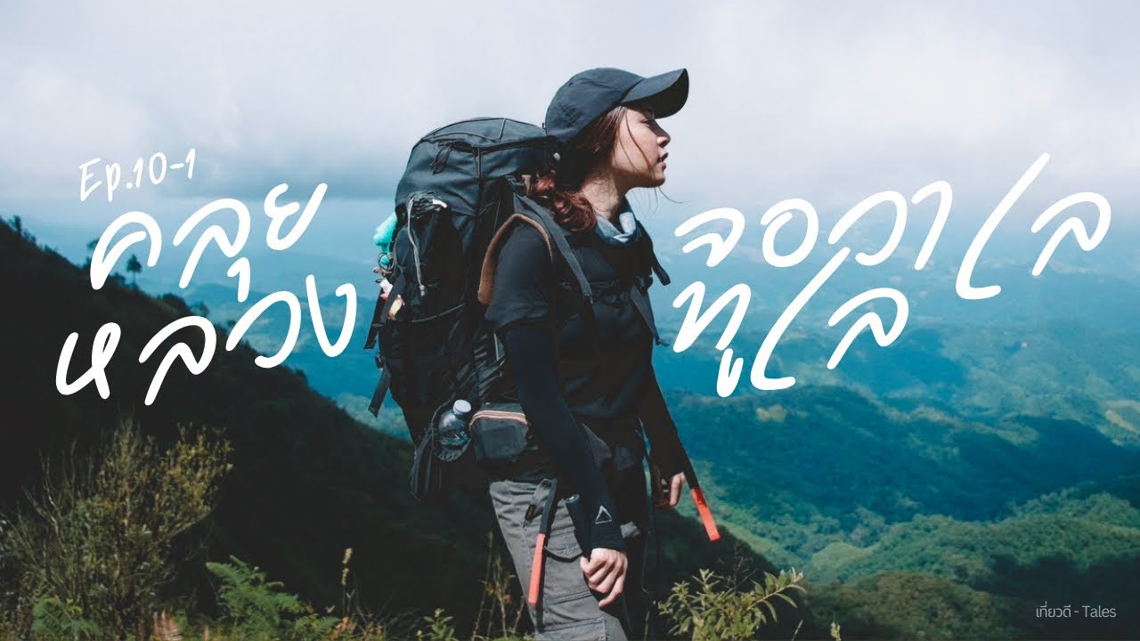
Mon Klui is not a resort-style destination. It is a natural camping area for travelers who enjoy open mountain landscapes, cool weather, and simple outdoor living. The attraction of this place lies in watching nature change slowly throughout the day: morning mist, golden light across the grassland, strong wind along the ridge, sunset over the western mountains, and a quiet night sky above the campsite. Travelers who stay overnight will understand the mountain more deeply than those who visit only briefly.
The camping areas at Mon Klui are spread across several open grassland spots, especially near the western viewpoint overlooking the Moei River valley. These areas allow visitors to set up tents and enjoy broad views from the campsite. In the morning, mist often spreads along the Mae Moei river basin below, while the eastern and northern sides reveal overlapping mountain ridges, grass-covered hills, and the striking form of Doi Mon Thu Le in the distance. This combination of views makes Mon Klui a strong destination for campers and landscape photographers.
Mon Klui is closely linked with the Doi Thu Le trekking route. Travelers can walk from Mon Thu Le to Mon Klui as part of a 3-day, 2-night trekking trip that follows mountain ridges, grassland, and scenic viewpoints. This route is suitable for hikers who want more than a drive-up camping experience. It includes uphill sections, ridge walking, natural viewpoints, and overnight camping. Proper physical preparation and local guidance are important for anyone planning this longer trekking route.
For travelers arriving by vehicle, the route begins from Tha Song Yang District along Highway 105 toward Mae Sariang. After about 79 km, at around kilometre 158+100, turn right onto a dirt road for about 7.5 km to reach the Mon Klui area. The final section is a dirt and mountain road, so visitors should use a suitable vehicle, check road conditions before departure, and avoid driving up in poor weather or at night. During the rainy season or after heavy rain, the road may be slippery or unsuitable for some vehicles.
The best visiting period depends on the experience travelers want. Local travel information highlights sea mist and golden grassland from around May to January, while the late rainy season and cool season are especially attractive for mist and camping. During the late rainy season, the landscape may be greener and more humid. During the cool and dry period, the grassland turns golden and the sky is often clearer. Travelers should check local conditions before setting out because mountain weather can change quickly.
Mon Klui is a good place to watch both sunrise and sunset. Before sunrise, visitors should wake up early and prepare warm clothing, a flashlight, and a camera. As the sky brightens, mist begins to reveal the valleys and ridgelines below. In the evening, the western viewpoint becomes the best place to watch sunset over the Moei River side. The grassland, wind, and changing light create a calm and atmospheric end to the day.
The open grassland and dwarf forest create a unique visual identity. Unlike dense forest trails, Mon Klui allows visitors to see far across mountains and sky almost all the time. This openness is beautiful but also exposed to wind and weather. Campers should choose tent positions carefully, secure tents well, and prepare for strong wind and cold temperatures. The vegetation in the area is also sensitive, so tents should be set up only in appropriate areas recommended by local caretakers.
Basic facilities on Mon Klui include a pavilion and toilets, which make camping more practical than deep backcountry camping. However, visitors should still travel as self-sufficiently as possible. Important items include drinking water, food, a wind-resistant tent, sleeping bag, warm clothing, flashlight, power bank, rubbish bags, and waterproof bags for phones or cameras. The presence of basic facilities does not remove the need for careful mountain preparation.
Advance coordination is important before visiting Mon Klui. Road conditions, access rules, camping areas, toilets, pavilion readiness, and waste management may vary by season. Contacting Tha Song Yang Subdistrict Administrative Organization or local route managers before departure helps travelers plan more safely and reduces the risk of arriving when conditions are unsuitable. This is especially important for groups, family travelers, and visitors unfamiliar with mountain dirt roads.
The two-river geography gives Mon Klui a special mist pattern. The Ngao River on the eastern side and the Moei River on the western side influence humidity and valley mist. When mist forms along the river basins and rises toward the ridge, the landscape appears layered, with white mist below and mountain silhouettes above. This is one of the reasons Mon Klui is considered a memorable sea-of-mist viewpoint in Tak Province.
To the north and east, visitors can see overlapping mountains and multiple grassland hills. Some angles also reveal Doi Mon Thu Le standing prominently in the distance. These views make the area highly suitable for landscape photography. Visitors should remain cautious near slopes and avoid walking too close to edges, especially when fog reduces visibility or the ground is wet.
For photography, Mon Klui offers many strong scenes: pre-dawn mist, sunrise light, golden grassland, sunset over the western ridge, tents in the highland grassland, and night sky views. Wide-angle lenses are useful for capturing the open landscape, while medium or telephoto lenses can isolate layers of mountains and mist. Because morning humidity may affect camera lenses and phones, a lens cloth and waterproof storage are useful.
Travelers who connect Mon Thu Le and Mon Klui in a 3-day, 2-night trek should prepare for a more demanding journey. The route includes mountain walking and ridge travel, so hikers should have suitable fitness, proper trekking shoes, a light backpack, water, food, warm clothing, and guidance from people familiar with the route. Anyone with medical conditions should inform companions and guides before the trek.
Mon Klui is connected with local communities in Tha Song Yang District. Responsible travel helps support local management and reduces environmental pressure. Visitors should use local services where appropriate, respect community rules, and communicate politely with local people. This kind of travel helps maintain the balance between tourism, community income, and natural conservation.
Waste management is especially important at Mon Klui. Since the landscape is open, litter is highly visible and can directly damage the natural atmosphere. Visitors should take all rubbish back down, including plastic bottles, food packaging, cans, and food waste. Leaving no rubbish behind is a basic responsibility for all campers and trekkers in mountain areas.
The main precautions at Mon Klui are changing weather, strong wind, fog, and dirt-road access. Drivers should check tires, brakes, and vehicle suitability before traveling. Campers should secure tents and avoid exposed edges during strong wind. Travelers should avoid night driving and should not attempt the dirt road during unsuitable weather if they are unsure of road conditions.
Mon Klui is therefore ideal for travelers who want a different kind of sea-of-mist destination. Its 1,100-metre elevation, grassland ridge, views toward two river basins, camping areas, sunrise, and sunset make it one of the distinctive natural viewpoints in Tha Song Yang District. It is especially suitable for travelers who already enjoy Doi Thu Le-style trekking and want to explore more of Tak’s highland landscapes.
A visit to Mon Klui should not be rushed. The best experience comes from staying long enough to watch the place change from morning mist to daytime grassland, from golden sunset to cool night sky. With proper preparation and respect for the area, Mon Klui offers a quiet, spacious, and memorable mountain experience in western Thailand.
| Name | Mon Klui / Doi Mon Klui |
| Location | Tha Song Yang District, Tak Province, around the boundary area between Tha Song Yang Subdistrict and Mae Wa Luang Subdistrict |
| Address | Highway 105, Tha Song Yang Subdistrict, Tha Song Yang District, Tak 63150 |
| Coordinates / Reference Point | Highway 105 around kilometre 158+100, then continue on a dirt road for about 7.5 km to the Mon Klui area |
| Highlights | Mountain grassland, two-sided sea mist, sunrise, sunset, Moei River views, Ngao River mist, and natural camping areas |
| History | A natural mountain viewpoint and camping destination in Tha Song Yang District, connected with the Doi Thu Le, Doi Jawale, and Mon Klui Luang trekking route group. |
| Name Origin | Mon Klui is the local name used for this mountain grassland viewpoint and camping area in Tha Song Yang District. |
| Distinctive Features | Open grassland ridge mixed with dwarf forest, about 1,100 metres above sea level, with several camping spots and sea-mist views on both eastern and western sides. |
| Travel Information | From Tha Song Yang District, follow Highway 105 toward Mae Sariang for about 79 km to kilometre 158+100, then turn right onto a dirt road for about 7.5 km. Check road conditions before traveling. |
| Current Status | A natural viewpoint and camping area in Tha Song Yang District. Visitors should coordinate with Tha Song Yang Subdistrict Administrative Organization or local caretakers before traveling. |
| Open Days | Contact Tha Song Yang Subdistrict Administrative Organization or local route managers before visiting. |
| Opening Hours | Daytime travel is recommended, and advance coordination is required before driving up or camping. |
| Facilities | Several camping areas, a pavilion, toilets, and mountain viewpoints |
| Main Areas / Zones | 1. Access Point at Km 158+100 2. Dirt Road to Mon Klui 3. Grassland Camping Area 4. Western Viewpoint toward the Moei River Valley 5. Eastern Viewpoint toward the Ngao River Basin 6. Doi Mon Thu Le Viewpoint 7. Mon Thu Le-Mon Klui Connecting Trail |
| Caretaker / Area Authority | Tha Song Yang Subdistrict Administrative Organization and local authorities in Tha Song Yang District |
| Main Contact Number | Tha Song Yang Subdistrict Administrative Organization Tel. 0-5503-0358, 055-039927, 081-1815820 |
| Official Website / Official Page | Tourism Authority of Thailand travel information and Tha Song Yang Subdistrict Administrative Organization |
| Nearby Tourist Attractions | 1. Mon Thu Le / Doi Thu Le, about 10 km by trekking route 2. Doi Jawale, about 12 km by trekking route 3. Mon Klui Luang, about 5 km by mountain route 4. Moei River, about 8 km from the mountain area 5. Mae Moei National Park, about 70 km by road from Mon Klui area |
| Nearby Restaurants | 1. Local restaurants and shops in Tha Song Yang town area, about 80 km 2. Cozy House Cafe & Bistro, Tha Song Yang, about 80 km, Tel. 092-575-7289 3. Krua Chaba Kaew, Tha Song Yang, about 80 km, Tel. 098-564-9466 4. New Mae Salit Guest House, about 70 km, Tel. 055-531409, 055-546121, 055-546122 5. Restaurants around Mae Salit Luang area, about 65 km |
| Nearby Accommodations | 1. Mon Klui Camping Area, within Mon Klui area, contact Tha Song Yang Subdistrict Administrative Organization Tel. 0-5503-0358 2. Mon Thu Le-Mon Klui Trekking Campsite, about 10 km by trekking route, contact local route managers 3. New Mae Salit Guest House, about 70 km, Tel. 081-9715592 4. Wasan Guest House, Tha Song Yang, about 80 km, Tel. 082-8828292 5. Accommodation in Tha Song Yang town area, about 80 km |
Frequently Asked Questions (FAQ)
Q: Where is Mon Klui located?
A: Mon Klui is located in Tha Song Yang District, Tak Province, around the boundary area between Tha Song Yang Subdistrict and Mae Wa Luang Subdistrict.
Q: How high is Mon Klui?
A: Mon Klui is about 1,100 metres above sea level and is known as a mountain viewpoint and camping area.
Q: What is special about Mon Klui?
A: It is known for open mountain grassland, dwarf forest, sea mist from both the Ngao River and Moei River sides, sunrise, sunset, and natural camping areas.
Q: How do travelers get to Mon Klui?
A: From Tha Song Yang District, follow Highway 105 toward Mae Sariang to around kilometre 158+100, then turn onto a dirt road for about 7.5 km. Road conditions should be checked before traveling.
Q: Can visitors camp at Mon Klui?
A: Yes. Mon Klui has several grassland camping areas, a pavilion, and toilets, but visitors should coordinate with local authorities before traveling.
Q: When is the best time to visit Mon Klui?
A: The late rainy season and cool season are best for sea mist and camping, while the golden grassland period is ideal for landscape photography.
Q: What nearby places can be visited with Mon Klui?
A: Nearby places include Mon Thu Le, Doi Jawale, Mon Klui Luang, the Moei River, and natural routes in Tha Song Yang District.
![]() Category: ●Nature and Wildlife
Category: ●Nature and Wildlife
![]() Group: ●Mountain (Doi)
Group: ●Mountain (Doi)
Last Update : 1 MonthAgo
Mon Klui Map
Gellery
Recommend


