
lovethailand home >North Travel Attractions >Tak Travel Attractions >Tha Song Yang >Mae La > Ao Kee Waterfall
TL;DR: Ao Kee Waterfall, Tak attractions : Nature and Wildlife, Waterfalls.
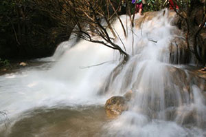
Ao Kee Waterfall
Open Days: Contact Mae Hla Subdistrict Administrative Organization before visiting
Opening Hours: Contact Mae Hla Subdistrict Administrative Organization before visiting
Ao Kee Waterfall, also locally known as Cho Kee Waterfall in Tak Province, is a natural waterfall associated with the Ban Cho Kee and Ban Kama Pha Do area in Mae Hla Subdistrict, Tha Song Yang District, Tak Province. It is surrounded by mountain forest, local highland communities, and a peaceful natural atmosphere. The waterfall is suitable for travelers who enjoy quiet forest waterfalls, short nature walks, and conservation-minded travel away from crowded tourist routes.
The charm of Ao Kee or Cho Kee Waterfall lies in its natural setting. Water flows down from the mountain through rocky levels and forested slopes, forming a refreshing waterfall environment shaded by large trees and streamside vegetation. The area feels calm and uncommercialized, making it ideal for visitors who want to experience a more local and natural side of Tak Province.
Mae Hla Subdistrict is part of the mountainous landscape of Tha Song Yang District. The area is shaped by the Mae Sot – Mae Sariang route, local villages, forest streams, and highland communities. A trip to this waterfall is therefore not only a visit to a scenic water source, but also a chance to understand the natural and community landscape of western Tak. Visitors may pass small villages, agricultural areas, forest edges, and mountain roads along the way.
The waterfall is best suited for eco-tourism and responsible nature travel. It is not a heavily developed tourist attraction with full facilities. The route includes local roads, unpaved sections, and a natural walking path. Travelers should contact Mae Hla Subdistrict Administrative Organization or local residents before visiting in order to confirm road conditions, weather, parking points, and current access conditions.
Local travel information for the waterfall area around Ban Kama Pha Do and Ban Cho Kee indicates that visitors can drive from Highway 105, the Mae Sot – Mae Sariang route, through Ban Pa Sak and Ban Kama Pha Do. From there, the route continues along an unpaved road toward the Ban Cho Kee junction. Visitors then park and walk along a natural trail to reach the waterfall. The walking distance is about 800 meters from the parking point, depending on the exact route used.
The waterfall environment is humid, green, and refreshing. Water flows through the forest, creating cool air and a calm soundscape of running water, birds, insects, and wind moving through the trees. Some shallow areas may be suitable for resting or cooling the feet, but swimming should be done only in safe areas and never during or after heavy rain. Mountain streams can change quickly, especially in the rainy season.
For photography, Ao Kee or Cho Kee Waterfall offers natural compositions such as falling water, wet rocks, stream pools, forest shade, and green vegetation. Morning light or soft daylight is often best for capturing the water and forest details. Visitors should protect cameras and phones from moisture and should be careful when walking on wet rocks or streamside areas.
As a natural learning site, the waterfall helps visitors understand the relationship between mountains, forest, streams, and local communities. A healthy forest stores moisture and supports water flow, while streams and waterfalls sustain local ecosystems. A visit here can therefore become more than a scenic stop; it can be a short lesson in watershed conservation and responsible travel in highland communities.
Getting There is most practical by private car or a vehicle suitable for rural and mountain roads. Travel along Highway 105, the Mae Sot – Mae Sariang route, into Mae Hla Subdistrict. Continue through Ban Pa Sak and Ban Kama Pha Do, then follow the local unpaved route toward Ban Cho Kee. From the parking point, walk along the natural trail for about 800 meters to the waterfall. Visitors should ask local authorities or residents for updated route information before traveling.
Visitors should prepare properly. Recommended items include closed shoes or hiking shoes, drinking water, light food, long-sleeved clothing, insect repellent, waterproof bags for electronics, and a trash bag for carrying waste back out. Since the waterfall is a natural community-area site, visitors should avoid littering, making loud noise, using soap or chemicals in streams, cutting plants, collecting stones, or disturbing wildlife.
The rainy season offers a lush and refreshing atmosphere, but it also requires extra caution. Trails may become slippery, unpaved roads may be muddy, and water levels can rise quickly. Visitors should avoid climbing wet rocks, entering strong-flowing water, or continuing the trip during heavy rain. Safety should always come before reaching the destination.
Ao Kee or Cho Kee Waterfall can be combined with other natural and community attractions in Tha Song Yang District, such as Ban Cho Kee, Ban Kama Pha Do, Mae Hla Le or Kama Pha Do Waterfall, Le Kho Waterfall, Tha Song Yang town, and Mae Moei National Park. Travelers with limited time should focus on Mae Hla Subdistrict and start early. Those with more time can stay in Tha Song Yang and extend the trip to Mae Moei National Park and nearby viewpoints.
In summary, Ao Kee Waterfall, also known locally as Cho Kee Waterfall, is a peaceful natural waterfall in Mae Hla Subdistrict, Tha Song Yang District, Tak Province. It is best suited for travelers who enjoy forest waterfalls, short trekking, local routes, and conservation-oriented travel. With proper preparation, local guidance, and respect for the natural environment, this waterfall offers a refreshing and meaningful nature experience in western Tak.
| Name | Ao Kee Waterfall / Cho Kee Waterfall |
| Location | Ban Cho Kee / Ban Kama Pha Do area, Mae Hla Subdistrict, Tha Song Yang District, Tak Province |
| Address | Mae Hla Subdistrict, Tha Song Yang District, Tak Province 63150, Thailand |
| Highlights | Natural medium-sized waterfall in a forested mountain area, reached by local road and a short natural walking trail |
| Distinctive Features | Green forest surroundings, stream pools, rocky waterfall levels, and a peaceful community-based natural atmosphere |
| History / Area Context | Located in the natural and community landscape of Mae Hla Subdistrict, linked with the Ban Kama Pha Do and Ban Cho Kee route in Tha Song Yang District |
| Name Origin | Known locally as Cho Kee Waterfall after the Ban Cho Kee area; some local tourism information links the area with Mae Hla Le or Kama Pha Do Waterfall |
| Travel Information | Use Highway 105, pass Ban Pa Sak and Ban Kama Pha Do, continue toward Ban Cho Kee, then walk about 800 meters from the parking point to the waterfall |
| Current Status | Natural community-area waterfall; visitors should contact local authorities before traveling to confirm route, weather, and safety conditions |
| Caretaker / Local Authority | Mae Hla Subdistrict Administrative Organization and local authorities in Mae Hla Subdistrict |
| Main Contact Number | Mae Hla Subdistrict Administrative Organization, Tel. 055-030-579 |
| Official Website / Official Page | www.maehla.go.th |
| Nearby Tourist Attractions | 1. Ban Cho Kee, about 3 km 2. Ban Kama Pha Do, about 6 km 3. Mae Hla Le / Kama Pha Do Waterfall, about 8 km 4. Le Kho Waterfall, Mae Hla Subdistrict, about 35 km 5. Tha Song Yang Town, about 50 km 6. Mae Moei National Park, about 80 km |
| Nearby Restaurants | 1. Local restaurants in Ban Cho Kee, about 3 km 2. Local restaurants in Ban Kama Pha Do, about 6 km 3. Restaurants in Mae Hla Subdistrict, about 25 km 4. Krua Khwan Khao, Tha Song Yang, about 50 km, Tel. 082-742-4945, 082-742-4951 5. T-SY Cafe, Tha Song Yang, about 50 km, Tel. 065-419-7200 |
| Nearby Accommodations | 1. Ban Suan Charoenrat, Tha Song Yang, about 50 km, Tel. 098-750-4776, 088-127-9672 2. Tha Song Yang Hill Resort, about 50 km, Tel. 055-589-088, 082-882-8292 3. Ban Suan Sornphet Resort, about 55 km, Tel. 089-267-1298 4. Ozone Guest House, Tha Song Yang, about 55 km, Tel. 081-041-9029 5. Mae Moei National Park Accommodation and Camping Area, about 80 km, Tel. 088-290-7964 |
Frequently Asked Questions (FAQ)
Q: Where is Ao Kee or Cho Kee Waterfall located?
A: It is located in the Mae Hla Subdistrict area of Tha Song Yang District, Tak Province, linked with the Ban Kama Pha Do and Ban Cho Kee route.
Q: How do visitors get to Ao Kee Waterfall?
A: Visitors can use Highway 105, pass Ban Pa Sak and Ban Kama Pha Do, continue toward Ban Cho Kee, then walk along a natural trail to the waterfall.
Q: How far is the walk to the waterfall?
A: Local route information for the Ban Cho Kee waterfall area indicates a natural walking distance of about 800 meters from the parking point.
Q: What type of traveler is this waterfall suitable for?
A: It is suitable for nature lovers, short-trail hikers, eco-tourism travelers, and visitors who enjoy quiet forest waterfalls.
Q: What should visitors bring?
A: Visitors should bring hiking shoes or closed shoes, drinking water, light food, long-sleeved clothing, insect repellent, waterproof bags, and a trash bag.
Q: Can visitors swim at Ao Kee Waterfall?
A: Swimming is possible only in safe areas where the water is calm. Visitors should avoid swimming during or after heavy rain.
Q: Who should visitors contact before traveling?
A: Visitors should contact Mae Hla Subdistrict Administrative Organization or local residents to confirm road conditions, parking points, and safety advice.
Q: What nearby places can be combined with this trip?
A: Nearby places include Ban Cho Kee, Ban Kama Pha Do, Mae Hla Le or Kama Pha Do Waterfall, Le Kho Waterfall, Tha Song Yang town, and Mae Moei National Park.
 Category: ●Nature and Wildlife
 Group: ●Waterfalls
Last Update : 3 MonthAgo
 Last Update : 3 MonthAgo
 Click to Access the Navigation Map GPS
 Art, Culture and Heritage
 Historical Sites and Monuments(2)
 Landmarks and Memorials(3)
 Art, Craft Centres, Tradition(6)
 Historic Homes and Cities(2)
 Educational Places
 Educational Gardens, Farm(2)
 Places of Worship
 Temple(22)
 Other Sacred Sites(9)
 Suburban Living
 Village, Community(5)
 Local Market(3)
 National Parks and Marine Reserves(9)
 Mountain (Doi)(9)
 Dam, Reservoir, Lake(14)
Waterfalls(23)
Dam, Reservoir, Lake(14)
Waterfalls(23)
 Hot Springs(2)
 Caves(6)
 River, Canal(1)
 Bays and Beaches(1)
 Islands(1)
 Other natural attractions(1)
 Entertainment and Agricultural
 Farms, Parks and Ecotourism(5)
 Outdoor and Adventure Activities(4)


