


Rating: 3.8/5 (6 votes)
Kanchanaburi attractions
Attractions in Thailand
Open Days: Daily (access may depend on on-site authorities and local management)
Opening Hours: Recommended viewing times: 05.00 – 08.00 and 16.30 – 18.30 (best light in the morning and late afternoon)
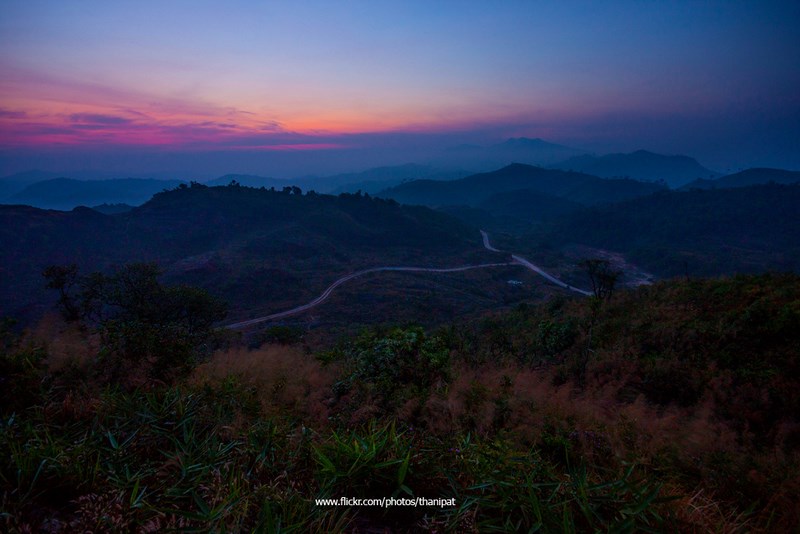
Noen Chang Suek is one of the most talked-about viewpoints on the Thong Pha Phum side in recent years, because it offers a sweeping “big picture” of the border mountains in a single glance. On many days, you can also catch a sea of mist from pre-dawn until the morning light fully opens. What makes Noen Chang Suek different from typical viewpoints is that it is not only a photo spot, but a place deeply tied to border stories, memories of the mining era, and Thailand’s security presence in a very tangible way. That is why standing on this ridge and looking out often feels like experiencing layers of meaning that sit alongside the beauty of the landscape.
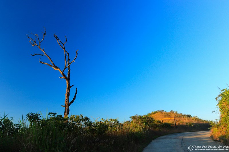
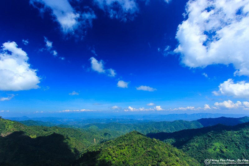
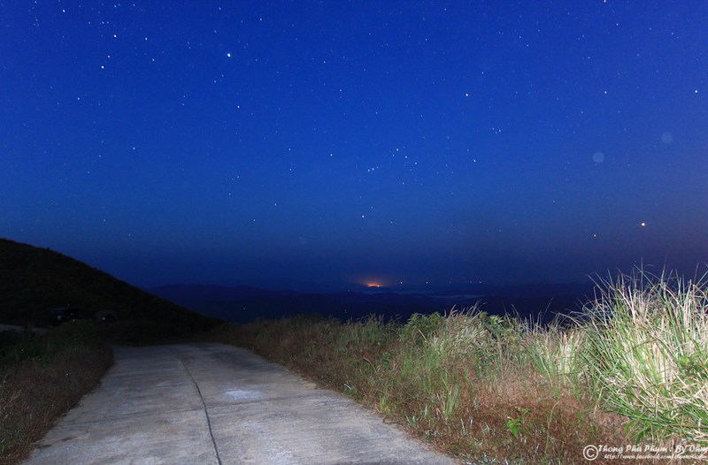
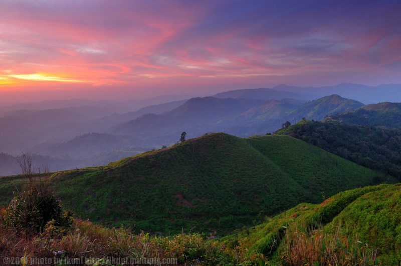
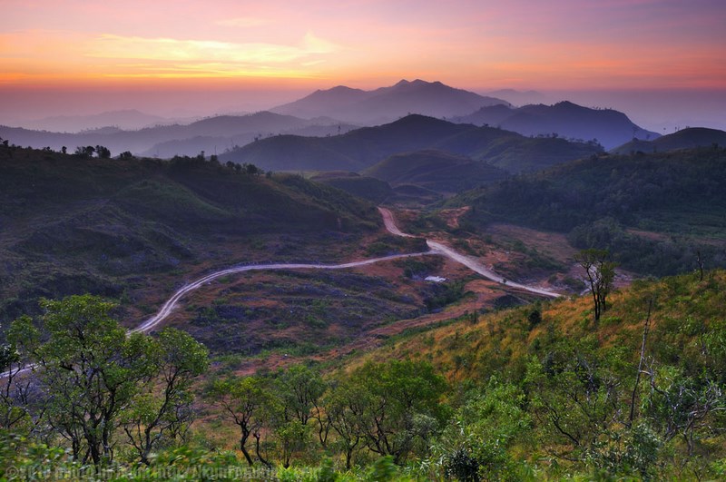
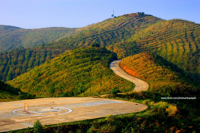
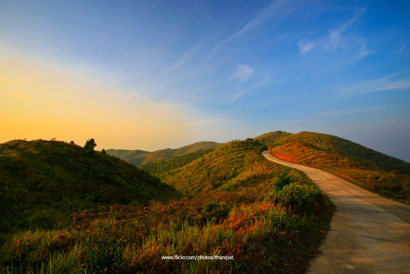
From a landscape perspective, Noen Chang Suek is a high-altitude viewpoint with 360-degree panoramas. Mornings are known for mist and soft light that makes the mountain ranges appear in layered depth, while late afternoons are defined by sunsets and a color palette that gradually shifts from warm tones to cooler hues. On clear days, you can see the Tenasserim ridge stretching far into the distance. The overall feeling of the view here is both “wide” and “open,” making it ideal for travelers who want a quick check-in and also for those who prefer to sit quietly and watch the mountains long enough to slow down to their rhythm.
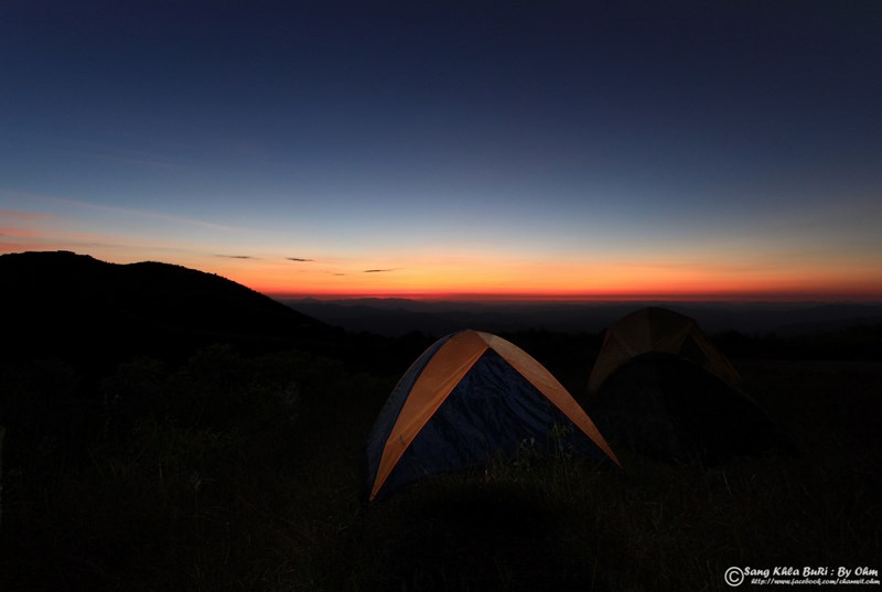
Another reason Noen Chang Suek has become an important new attraction in Thong Pha Phum is its popularity as a camping and overnight tenting spot. The reason is simple: “great views and great air,” especially in the cool season when breezes are crisp and temperatures drop noticeably. Camping on the ridge and waking up to wait for first light is an experience many visitors remember for a long time. This is what turns Noen Chang Suek from a standard viewpoint into “an overnight place with a story,” perfectly aligned with today’s slow-travel and camping culture.
To fully understand Noen Chang Suek, it helps to know that this area carries a history far more intense than that of a typical viewpoint. Noen Chang Suek once sat within the context of tin and tungsten mining under the Department of Mineral Resources operations, considered a large mine with one of the region’s richest ore veins. Mining began in 1940 and continued through 1985. During that period, Thong Pha Phum and the Pilok area developed as a border town whose economy depended heavily on mining and the movement of people—laborers, traders, and surrounding communities that gradually formed in step with the mine-driven economy.
As time passed, the Thai–Myanmar border became increasingly complex in terms of security. In one historical period, parts of the border area were inhabited by minority groups such as Karen and Mon communities, who established livelihoods that included collecting passage fees from Myanmar traders conducting commerce with Thai people. Later, military operations along the border led to crackdowns and the seizure of strategic positions. This context resulted in clashes and the use of heavy weapons in certain border areas, affecting the safety of nearby Thai communities and causing damage to local homes at the time.
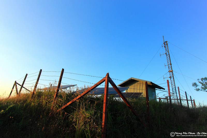
After the situation eased and forces withdrew, key ridge areas became places the Thai state needed to prioritize for border security. Border Patrol Police established an operational base, and an area formerly remembered in the context of “Noen Sao Thong” within the border conflict narrative shifted roles and came to be known as “Noen Chang Suek” today. This was not merely a change of name, but a change in meaning: the area became a defensive position for border oversight. Over time, this strategic point gradually welcomed visitors as a distinctive and scenic viewpoint, eventually becoming a landmark many travelers want to experience for themselves.
Today, Noen Chang Suek is the location of Border Patrol Police Base 135 and is regarded as one strategic point along the Thai–Myanmar border. At the same time, it also functions as a high-elevation viewpoint that continues to grow in popularity, especially among travelers visiting Ban I-Tong and the Pilok mining area. Because Noen Chang Suek is close to the village and the trip up to the viewpoint does not take long, it is often seen as a “high-value stop” within an itinerary that may not have much extra time.
Getting There If you start from Mueang Kanchanaburi District, the commonly used route is to head toward the Kaeng Sian intersection and continue along the Kanchanaburi–Thong Pha Phum road (Highway 323). Drive through Sai Yok District and continue to a signalized T-junction, then turn left onto Route 3272 (turning right would take you toward Sangkhlaburi). Upon reaching Thong Pha Phum, continue toward the Vajiralongkorn Dam route (Khao Laem Dam) and enter the Ban Rai area for about 30 kilometers. From Ban Rai, continue for another roughly 30 kilometers along the mountain road famously known as the “399 curves” until you reach Ban I-Tong in Pilok Subdistrict. The turnoff to Noen Chang Suek is on the left about 900 meters before entering Ban I-Tong village, and the uphill access to the viewpoint is approximately 1.8 kilometers. The route alternates between dirt/gravel and concrete, with steep sections. Drive with extra caution, especially when fog is heavy or the road surface is slippery.
If you travel by public bus, there are Thong Pha Phum–Sangkhlaburi services from the Kanchanaburi bus terminal with departures throughout the day, generally from morning to early evening. After that, you would continue by local transport or a hired vehicle up to Ban I-Tong. Many travelers choose to hire a songthaew or pickup truck with a driver and fuel included, typically arranged at transport hubs or designated pickup points. This option is well suited for groups of friends or families who want convenience and flexibility to stop for photos along the way. No matter which method you choose, the Pilok route is a mountain road with continuous curves, so it is important to allow sufficient travel time and ensure both drivers and passengers are well prepared.
The most popular times to visit Noen Chang Suek are from pre-dawn into the morning to catch mist and first light, and in the late afternoon before sunset to watch the final light sweep across the ridgelines. If you plan to camp, it is best to arrive before dark so you can choose a good pitching spot, set up your gear, and assess wind conditions. High-elevation areas can be windy, especially in the cool season, so windproof layers, a flashlight or headlamp, and proper cold-weather gear are essential. Cleanliness and waste management are also extremely important: the ridge is open and windy, so litter can easily blow into the environment and immediately affect the overall condition of the site.
If you want a trip that delivers multiple dimensions in one go, a common approach is to use Noen Chang Suek as a “trip opener” by going up early to see the mist, then heading down to check in at Ban I-Tong, stroll through the village, and enjoy local food and coffee. After that, continue to nearby spots such as Jokkradin Waterfall or learning points related to the Pilok mining area. Later, you can return to watch the sunset or camp on Noen Chang Suek again. This kind of itinerary gives you both panoramic landscapes and the distinctive atmosphere of a border community—the core charm of Pilok that makes many visitors come back more than once.
| Overview | Noen Chang Suek is a high-elevation viewpoint in Pilok Subdistrict, Thong Pha Phum District, Kanchanaburi Province. It offers 360-degree mountain panoramas, making it ideal for morning mist and evening sunsets, as well as camping. The area is tied to the region’s mining-era history and border-security context. Today it is the location of Border Patrol Police Base 135 and continues to grow in popularity as a scenic landmark. |
| Key Highlights | 1) 360-degree border-mountain panoramas 2) Beautiful mist and soft morning light (often with a sea of fog) 3) Excellent sunsets and evening lights 4) A popular camping and tenting spot 5) Rich local history from the mining era and border narratives, adding meaning beyond photography |
| Address | Pilok Subdistrict, Thong Pha Phum District, Kanchanaburi Province (a signed turnoff to Noen Chang Suek appears before reaching Ban I-Tong village) |
| Getting There | From Mueang Kanchanaburi, take Highway 323 to Thong Pha Phum, then follow the Ban Rai route and the “399 curves” road to Ban I-Tong. The Noen Chang Suek turnoff is about 0.9 km before entering the village, and the uphill access to the viewpoint is about 1.8 km (steep, mixed gravel and concrete; drive carefully). |
| Open Days | Daily (access may depend on on-site authorities and local management) |
| Opening Hours | Recommended: 05.00 – 08.00 and 16.30 – 18.30 (best viewing periods) |
| Fees | Generally no entrance fee (conditions may change depending on site management and seasonal activities) |
| Contacts (For On-Site Inquiries) | Border Patrol Police Base 135: 034-599118 |
| Nearby Attractions (Approx. Road Distance) | 1) Ban I-Tong Village – 1 km 2) Pilok Mine Viewpoint / Mining Learning Spots – 3 km 3) Jokkradin Waterfall – 15 km 4) Vajiralongkorn Dam (Khao Laem Dam) – 70 km 5) Thong Pha Phum Town Area (Markets & Main Food Zone) – 100 km |
| Nearby Restaurants (Approx. Road Distance + Phone) | 1) Krua Je Nee, Ban I-Tong – 2 km – 089-515-3528 2) Krua View Sud Daen – 2 km – 095-606-4606 3) Nong Atom Moo Jum, Ban I-Tong – 2 km – 092-529-0870 4) Chao Mueang Shop, Pilok Cake – 3 km – 098-381-5999 5) Roti Baan Chan, Pilok – 2 km – 087-003-3885 |
| Nearby Accommodations (Approx. Road Distance + Phone) | 1) Pilok Homestay, Ban I-Tong – 2 km – 086-798-5863 2) I-Tong Homestay – 2 km – 092-249-1915 3) Arm Homestay (Ban I-Tong) – 2 km – 086-170-3410 4) Pilok Tok Taek Homestay – 2 km – 080-778-8315 5) Pilok Mining Homestay – 3 km – 062-363-9128 |
Frequently Asked Questions (FAQ)
Q: What is the best time to visit Noen Chang Suek?
A: For the best chance of mist and soft light, visit before dawn through early morning. Late afternoon is ideal for sunsets and evening ambiance, and it is always recommended to check weather conditions before going up.
Q: Can I drive up to Noen Chang Suek, and how difficult is the road?
A: Yes, you can drive up, but the road is a mix of gravel and concrete with steep sections. Drive slowly, use low gear, and be especially cautious when fog is heavy or the surface is slippery.
Q: How far is Noen Chang Suek from Ban I-Tong?
A: The turnoff is about 0.9 km before entering Ban I-Tong village, and the uphill access to the viewpoint is about 1.8 km (approximate road distance).
Q: What should I prepare if I want to camp at Noen Chang Suek?
A: Bring windproof and warm clothing, a flashlight or headlamp, secure your tent with strong tie-downs, carry enough drinking water, and take all trash back with you, as the area is open and often windy.
Q: Why is Noen Chang Suek historically significant in terms of the border area?
A: The area is connected to the tin and tungsten mining era under Department of Mineral Resources operations (1940–1985) and to border-security events in the past. It was therefore positioned as a strategic area and became the site of a Border Patrol Police base before evolving into an accessible viewpoint for travelers today.
 Category:
 ") Group:
Group: Comment
Photo Gellery(15) 
|
|
|
|
|
|
 | ● Photographer: Chanwit Ohm ● Link: facebook.com/chanwit.ohm ● Ref: pixpros.net |
|
|
|
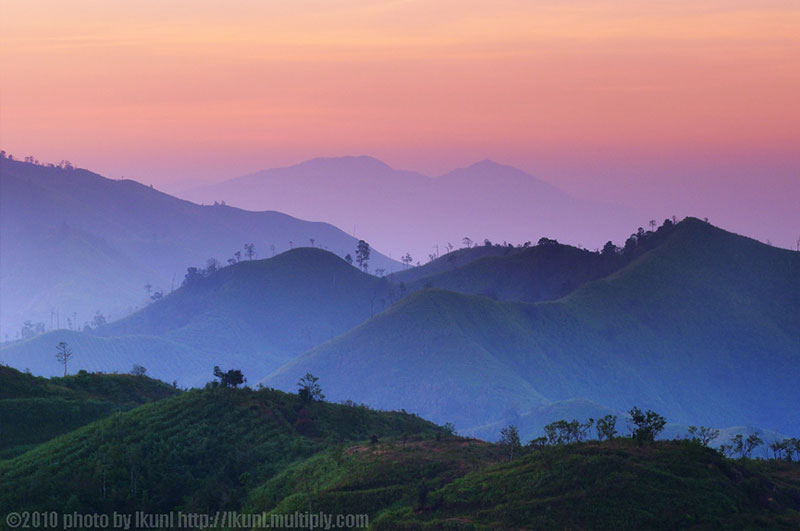
 | ● Photographer: Lkunl ● Link: facebook.com/lkunl ● Ref: shutterstock.com/g/lkunl |
|
|
|
|
|
|
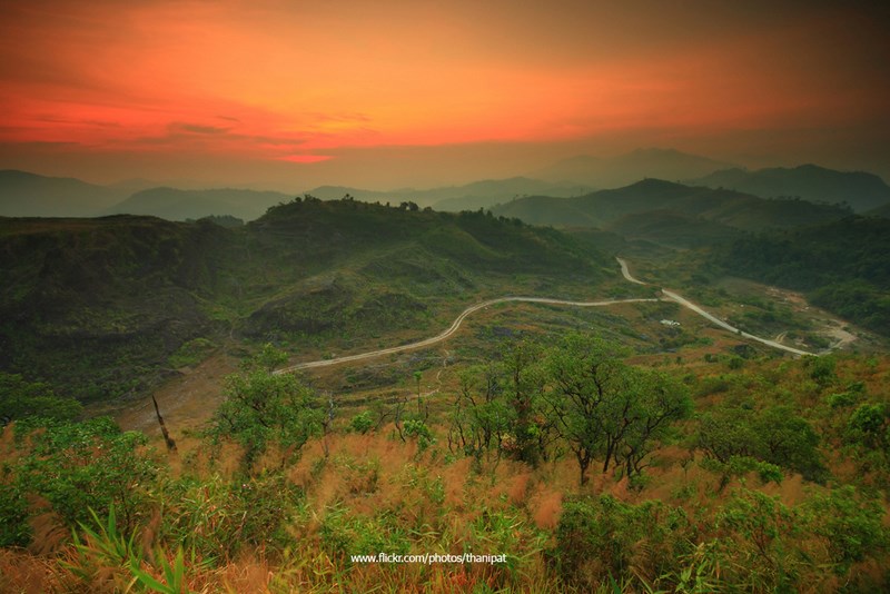
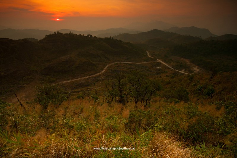
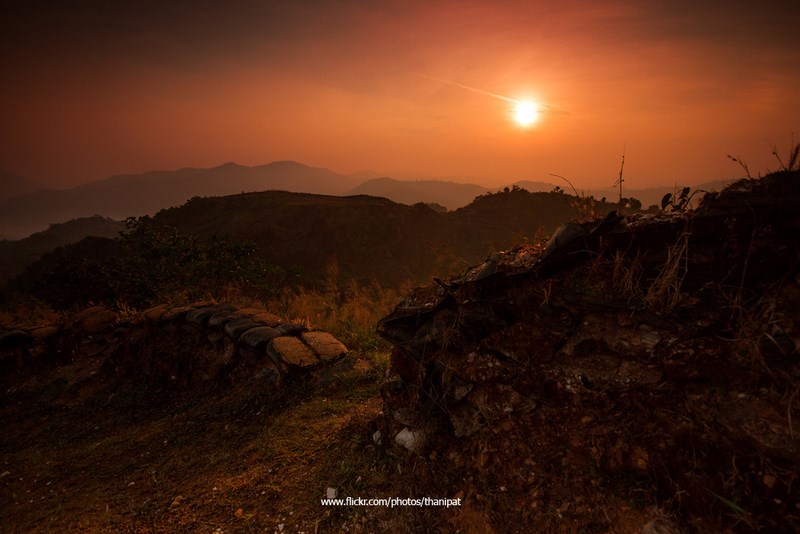
 | ● Photographer: Thanipat Peeramatukorn ● Link: facebook.com/thanipat.peeramatuko ● Ref: thanipat.tumblr.com |
● Copyright Photography. (800*500)
● View full size images from the photographer.
● View full size images from the photographer.
| Keyword (Advance) |
 Facebook Fanpage
 Art, Culture and Heritage
 Historical Sites and Monuments(
 Landmarks and Memorials(
 Art, Craft Centres, Tradition(
 Museums(
 Art Gallery(
 University
 Places of Worship
 Temple(
 Church(
 Other religious and spiritural sites(
 Research and Development
 Royal Project(
 Suburban Living
 Village, Community(
 Local Market(
 National Parks and Marine Reserves(
 Dam, Reservoir, Lake(
 Waterfalls(
 Hot Springs(
 Caves(
 River, Canal(
 Other natural attractions(
 Entertainment and Agricultural
 Zoos and Aquariums(
 Animal camps and shows(
 Farm, Parks, Gardens and Ecotourism(
 Cinema(
 Outdoor and Adventure Activities(
 Travel Articles, Recipes
 Travel Review, Food Review(