


Rating: 3.4/5 (21 votes)
Chiang Mai attractions
Attractions in Thailand
Open Days: Daily
Opening Hours: Generally 05:30 – 18:30 (hours/conditions may change depending on official announcements and season)
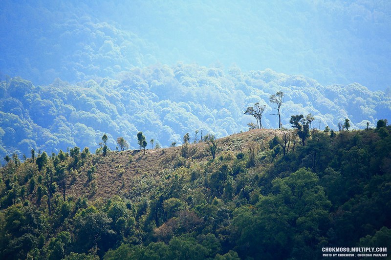
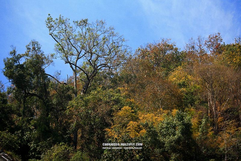
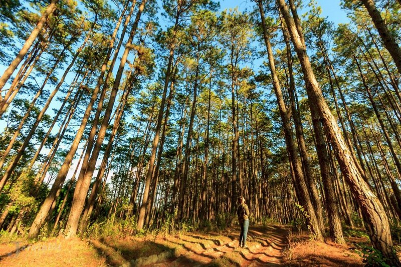
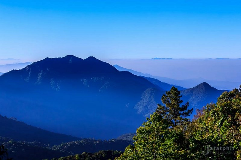
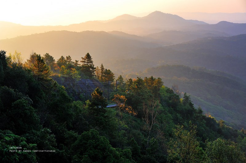
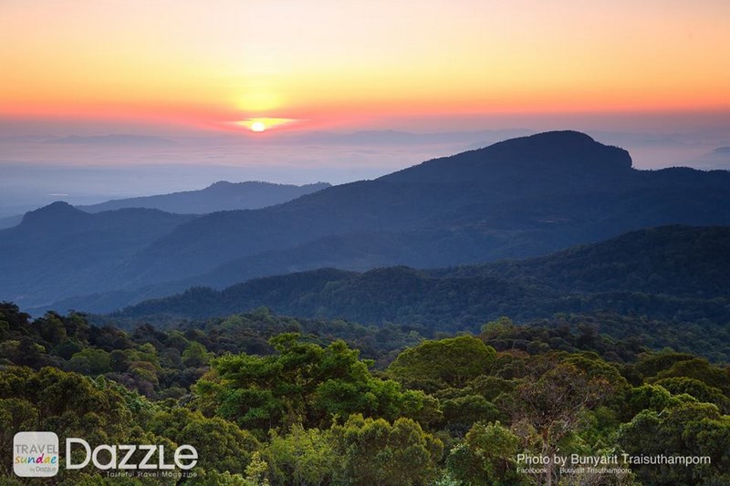
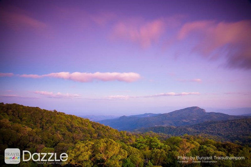
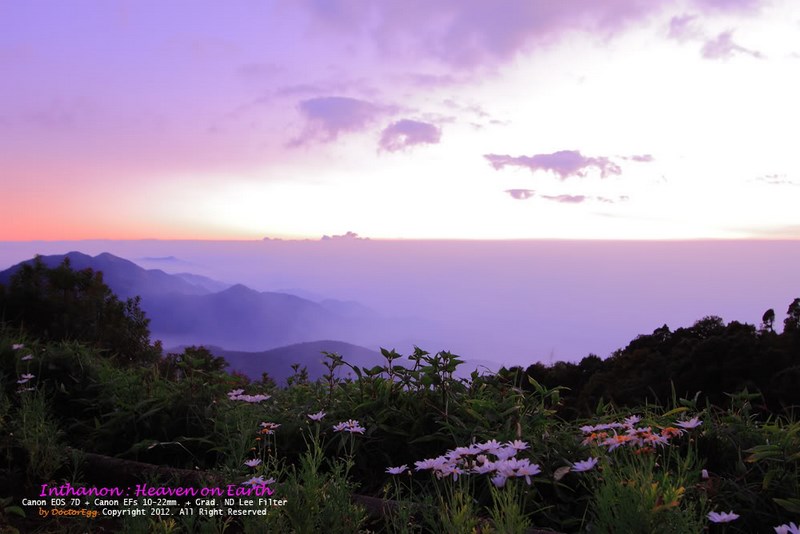
Doi Inthanon National Park is a destination many people describe as “a one-day trip that gives you more than just views.” Yes, it’s home to Thailand’s highest point at 2,565 meters above sea level, but the real charm is how much landscape and forest diversity is packed into one place—from dense evergreen areas to pine stands and mixed deciduous forest, up to high-elevation cloud-forest zones where cool humidity and drifting mist can linger for much of the day. In the cold season, there are even times when dew becomes frost. That’s why “going up Inthanon” isn’t only about ticking off the country’s highest peak; it’s also about watching nature shift in layers as altitude and time quietly do their work.
Before it became widely known as “Doi Inthanon,” this mountain was once called “Doi Luang,” meaning a great or large mountain. It also carried another name, “Doi Ang Ka,” tied to a local story: about 300 meters to the west there was said to be a pond shaped like a basin, and in the past flocks of crows used to gather there to bathe. People called it “Ang Ka” (the crow basin), and the name later expanded into “Doi Ang Ka.” Stories like this make place-names feel less like signage and more like shared memory—a small doorway back to how the mountain was once seen and lived with.
Geographically, Doi Inthanon sits along the Thanon Thong Chai mountain range, a high and rugged spine of peaks. The park spans elevations from roughly 400 meters up to 2,565 meters, and that dramatic vertical range is what creates “many worlds in one place”—different plants, different air, and different moisture patterns that change in clear steps as you climb. Doi Inthanon is also an important headwater area for multiple streams and rivers, including Mae Klang, Mae Ya, Mae Chaem, Mae Tiae, and others that support communities across several Chiang Mai districts before feeding into the Ping River basin. Conservation here isn’t abstract; it is directly connected to water, food, and daily life throughout the watershed.
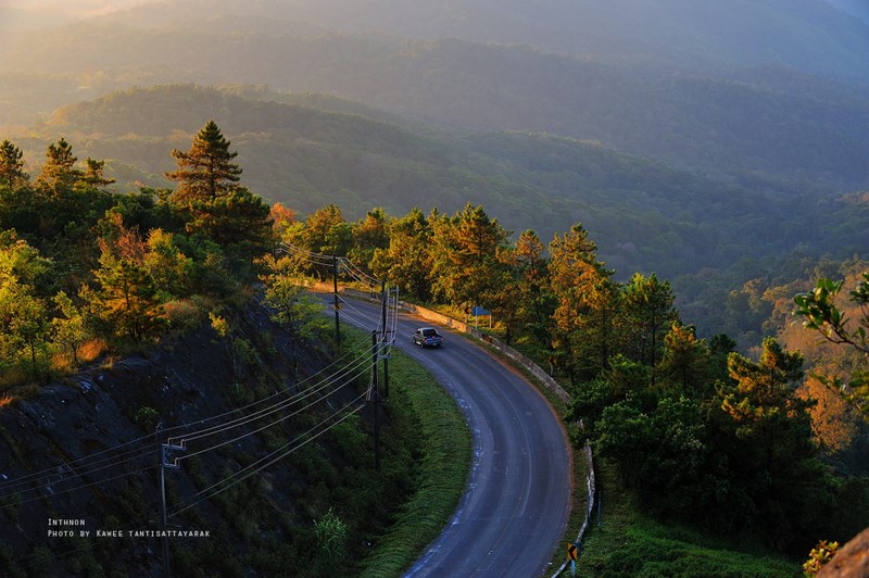
Getting There If you drive from Chiang Mai city to the summit of Doi Inthanon, the total distance is roughly 106 kilometers. The common route is Highway 108 (Chiang Mai–Chom Thong), then turn onto Highway 1009 (Chom Thong–Inthanon) and continue climbing to the top. The road is paved and generally in good condition, but it is steep with many curves, so your vehicle should be in solid shape—check brakes, tires, and fluid levels beforehand. This matters even more in the rainy season when roads can be slick and fog may be thick in some sections. If you don’t have a private car, you can travel by public transport to Chom Thong and then continue by local songthaew/taxi-style pickup or a hired vehicle to various points inside the park. Some waterfalls and viewpoints still require short-to-moderate walks, so comfortable, non-slip footwear is worth bringing.
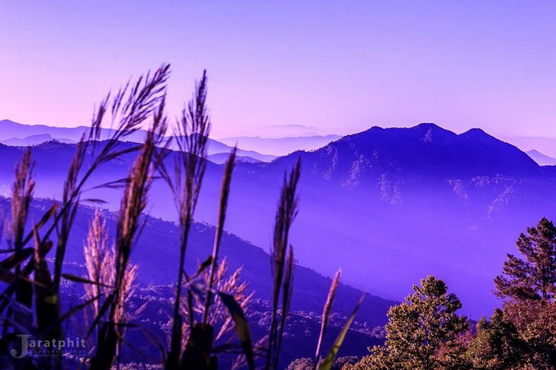
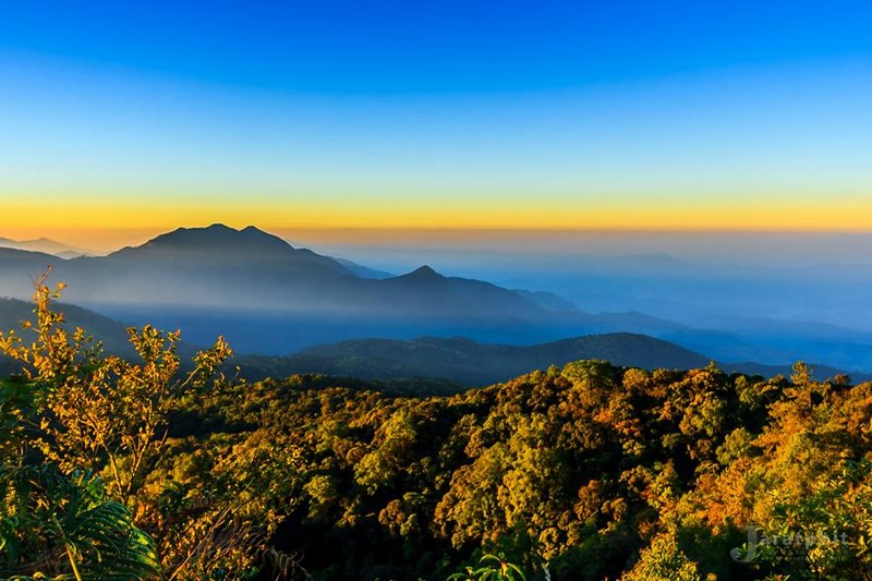
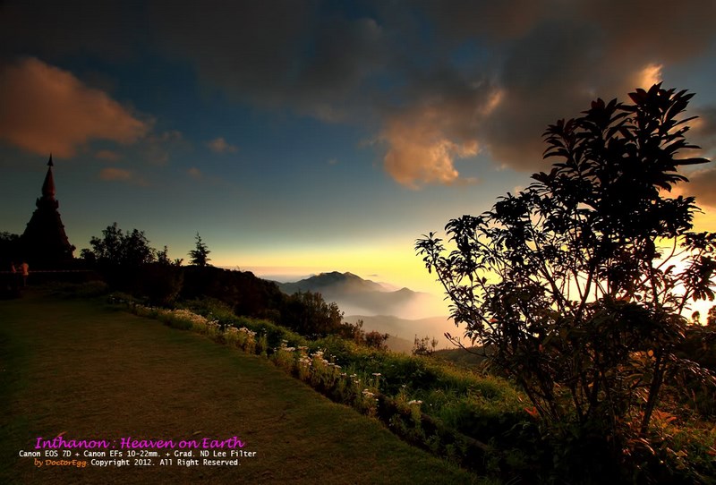
As you gain elevation, the atmosphere gradually shifts from “foothill” to “true mountain.” You’ll feel the temperature drop, the moisture rise, and fog appear in waves. The most rewarding way to visit Inthanon is to let altitude and time do their job rather than rushing it—choose stops where nature performs at full volume, like the powerful Wachirathan Waterfall, or take a quiet nature walk where the forest scent becomes unmistakable, or head for the summit zone to experience a kind of coolness that feels sharply different from the city within only a few hours.
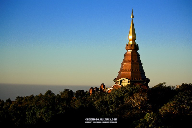
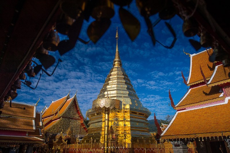
The place many visitors aim for is the “Inthanon Summit,” the end point of Highway 1009 and Thailand’s highest peak. The summit stays cool year-round and is also home to a stupa enshrining part of the ashes of Chao Inthawichayanon, the last ruler of Chiang Mai, who deeply valued the forests and wanted this mountain protected for future generations. Standing there, what you take in isn’t only a view; it’s also the sense that this forest has long been loved enough for someone to leave a promise behind for those who come later.
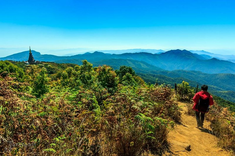
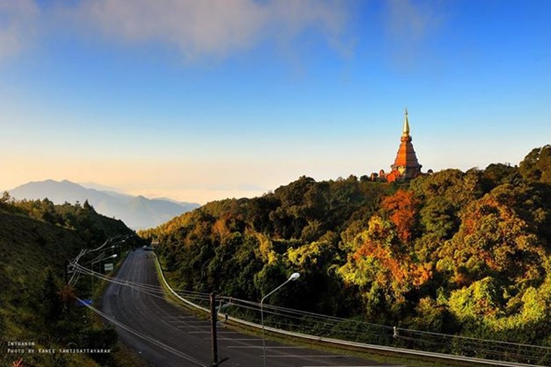
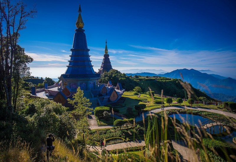
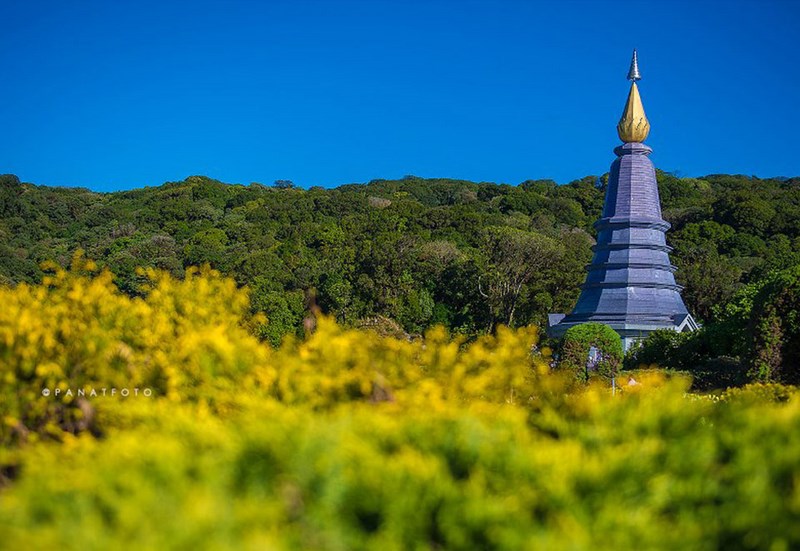
Another signature landmark of Inthanon is the paired royal pagodas: Phra Mahathat Naphamethanidon and Phra Mahathat Naphaphonphumisiri. The two structures share a similar design with a 12-sided base and surrounding terraces, set on a high ridge that opens wide mountain panoramas. Many people come for the cool gardens and photos, but if you look a little deeper, you’ll see how faith and architecture become “mountain markers”—visible anchors that connect the city below with the highlands above in a quietly powerful way.
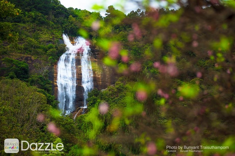
Waterfalls are another main artery of the Inthanon experience. Mae Ya Waterfall stands out for its steep 280-meter drop, where water tumbles over rock tiers like a curtain before gathering in a pool below, creating a clean, refreshing atmosphere in a relatively calm forest setting with visitor information nearby. Mae Klang Waterfall is a large single-tier fall with water flowing year-round and easy access, making it a good “gentle start” for many visitors. Wachirathan Waterfall is famous for its forceful plunge and cool mist that sprays across the area—especially dramatic when water levels are high. Siri Phum Waterfall, often described as a twin waterfall, can be seen from certain angles near the park headquarters area; it’s beautiful without trying, though you’ll still need to walk further to reach the lower viewing area.
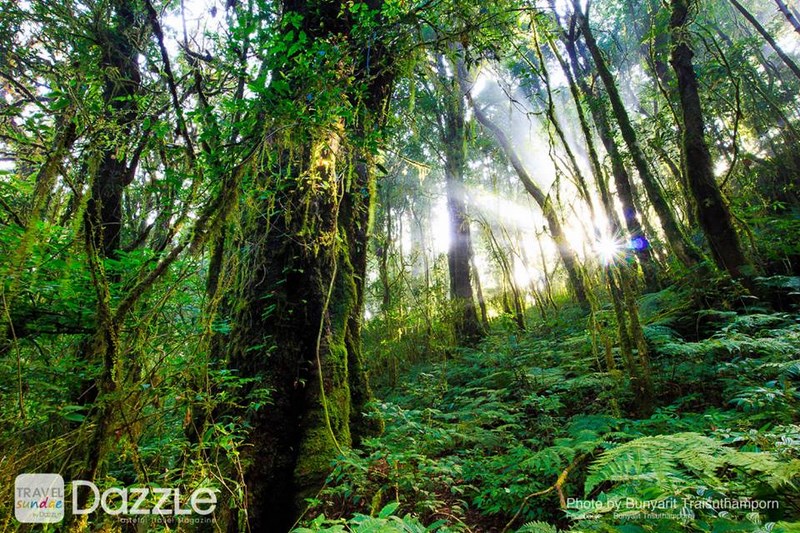
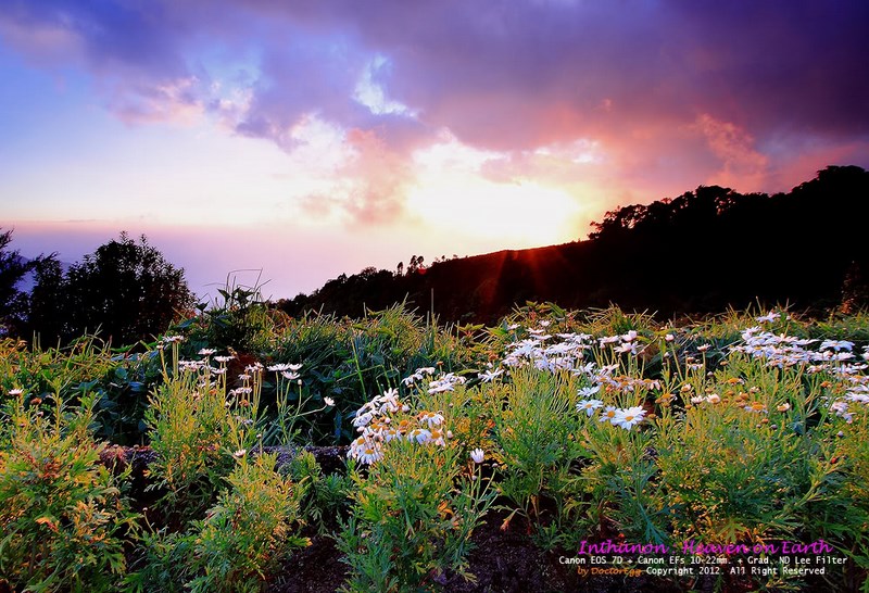
For hikers or anyone wanting a “deeper Inthanon” experience, the highlight nature trail is Kew Mae Pan. The walk is about 3 kilometers and typically takes around 3 hours. It showcases the transition from high-elevation evergreen forest to open ridgelines, with mist sliding along cliff edges; in the right season, you may also see rhododendrons in bloom. One key point: the trail has an annual closure period during the rainy season to allow nature to recover, so checking the latest official announcement before you go will save you from disappointment and helps keep the forest breathing.
Another trail with a different mood is Ang Ka Luang, a roughly 1,800-meter walkway through a basin wetland and high-elevation cloud forest. The standout features are the cool, damp atmosphere, specialized plant life, and a quietness that naturally slows your pace. If you like small details—epiphytes, moss, ferns, or subtle temperature changes under different canopy layers—Ang Ka Luang is a perfect fit.
On Doi Inthanon, nature also connects clearly with development through the Royal Project Doi Inthanon. The work here supports highland agriculture and research—from ornamental flowers and cool-climate crops to various fruits—and promotes approaches that help farming coexist with mountains and forests more sustainably. Many visitors enjoy stopping by because it’s tangible: you can see real produce, feel the mountain-farm atmosphere, and understand that “Royal Project” isn’t just a tourist stop but a broader system that has helped highland communities build more stable livelihoods. At the same time, the Inthanon area also carries local wisdom and cultural traditions, such as terraced rice farming among Karen communities and cultural practices within Hmong communities in the region. If we visit respectfully—without disturbing daily life or treating communities as photo backdrops—the experience becomes deeper and more memorable in the best way.
One more activity that gives Inthanon its distinctive character is birdwatching. The park has records of a large number of bird species, and many birders stop at multiple points from the lower checkpoints all the way up to the summit zone. Even if you’re not a hardcore birder, a small pair of binoculars and a little extra time in the early morning or late afternoon can be enough to make it genuinely fun. On nights with clearer skies and manageable humidity, some areas can also be suitable for stargazing—especially if you stay overnight in designated accommodation or camping zones.
If you want Inthanon to feel “easy and worth it” without exhausting yourself, a simple approach is to plan either from the farthest points and flow downward, or start from the lower areas and climb gradually—choosing based on time and weather. A one-day trip might cover 1–2 waterfalls plus the twin pagodas and the summit. If you stay overnight, you’ll have time to walk Kew Mae Pan or Ang Ka Luang without rushing and enjoy the quieter morning hours when Inthanon feels beautiful without the crowd pressure.
Finally, Inthanon is a natural area that receives many visitors. How long its beauty lasts depends on small choices each person makes: stay on designated paths, don’t litter, don’t feed wildlife, keep noise low in nature-trail zones, and respect highland communities as someone else’s home—not our set. If we can do that, this trip becomes good for you and good for the mountain at the same time.
| Name | Doi Inthanon National Park (Thailand) |
| Location | Ban Luang Subdistrict, Chom Thong District, Chiang Mai (park area spans multiple districts in Chiang Mai) |
| Key Characteristics | Thailand’s highest peak (2,565 m), diverse forests by elevation, multiple major waterfalls, nature study trails, twin royal pagodas viewpoint |
| Period / Significance | Established as a national park (official history and boundaries are published by Thailand’s Department of National Parks) |
| Key Evidence / Highlights | Inthanon Summit, Chao Inthawichayanon Stupa, Twin Royal Pagodas, Wachirathan Waterfall, Kew Mae Pan Trail, Ang Ka Luang Nature Trail |
| Name Origin | Former names “Doi Luang” / “Doi Ang Ka” (local story of a basin-like pond where crows gathered, hence “Ang Ka”) |
| Travel | From Chiang Mai city: Highway 108 to Chom Thong, then Highway 1009 up the mountain (steep, use a well-maintained vehicle). No private car: travel to Chom Thong, then continue by local songthaew/hired vehicle. |
| Current Status | Open to visitors (check for trail closures and weather advisories before traveling) |
| Contact Number | 053-286-728, 053-286-729 |
| Fees | Thai: Adult 60 THB, Child 30 THB; Foreigners: Adult 300 THB, Child 150 THB; Car 30 THB (fees may change per official regulations/announcements) |
| Facilities | Visitor information center, parking areas, service points at major attractions, on-site shops (opening times may vary by location) |
| Nearby Tourist Attractions with Distance | Mae Klang Waterfall (~8 km from the Highway 1009 junction) | Wachirathan Waterfall (~21 km) | Siri Phum Waterfall (~31 km) | Twin Royal Pagodas (~41.5 km) | Kew Mae Pan Trail (~42 km) | Inthanon Summit (~48 km) | Ang Ka Luang Nature Trail (~48 km) |
| Popular Restaurants Nearby (Distance & Phone) | Inthanon Coffee Road (~39 km from the Highway 1009 junction) Tel. 081-952-2493 | 091-078-6598 Rakkhao Inthanon Cafe (~31 km) Tel. 093-331-4069 | 064-897-3329 Inthanon Highland (~29 km) Tel. 053-802-222 Mae Klang Luang Riverside Inthanon (~32 km) Tel. 083-469-8948 | 061-457-4735 Touch Star Resort (foothill zone) (~15 km) Tel. 092-419-4142 | 053-033-595 |
| Popular Accommodations Nearby (Distance & Phone) | Touch Star Resort (~15 km from the Highway 1009 junction) Tel. 092-419-4142 | 053-033-595 Inthanon Riverside Resort (~10 km) Tel. 081-530-5767 Mae Klang Luang Villa Doi Inthanon (~32 km) Tel. 082-946-6651 | 080-500-5233 Ban Kiang Na Mae Klang Luang (~32 km) Tel. 093-048-8570 Ban Ton Khao Mae Klang Luang (~32 km) Tel. 093-261-7239 |
Frequently Asked Questions (FAQ)
Q: What is the best time of year to visit Doi Inthanon?
A: If you love cool weather and mist, the late rainy season through winter usually feels great. Always check weather conditions and official notices for trail closures before you go.
Q: Is a day trip enough, or should I stay overnight?
A: A day trip is enough for the main highlights (1–2 waterfalls + the twin pagodas + the summit). If you want to walk Kew Mae Pan or enjoy quiet early-morning scenery, staying overnight is more comfortable.
Q: When is the Kew Mae Pan trail closed?
A: It typically closes during the rainy season each year for nature recovery. Check the latest official announcement before traveling.
Q: Which waterfall is suitable for seniors or families?
A: Mae Klang Waterfall is easier to access and family-friendly. Wachirathan is very impressive, but the mist can make surfaces slippery, so wear non-slip shoes and walk carefully.
Q: Do I need a jacket?
A: It’s recommended, especially from late year to early year and for early mornings near the summit where temperatures drop noticeably.
Q: Is it difficult to visit the park without a private car?
A: It’s doable, but attractions are spread out. Plan transfers/hiring transport clearly and allow time for walking in some areas.
Q: Is Doi Inthanon good for birdwatching?
A: Yes. The park is known for high bird diversity, with multiple birding spots from lower elevations up to the summit zone.
Q: How can I travel responsibly to reduce impact on nature and communities?
A: Stay on designated trails, don’t litter, don’t feed wildlife, keep noise low in nature areas, and respect highland communities as homes rather than photo backdrops.
 Category:
  Group:
 Comment
Photo Gellery(27) 
|
|
|
 | ● Photographer: Chok Moso ● Link: facebook.com/CHOKMOSOPIX ● Ref: pixpros.net |
|
|
|
|
|
|
 | ● Photographer: Jaratphit Luangsopaphan ● Link: facebook.com/liang053 ● Ref: pixpros.net |
|
|
|
 | ● Photographer: Kawee Tantisattayarak ● Link: facebook.com/iViewfinder ● Ref: pixpros.net |
|
|
|
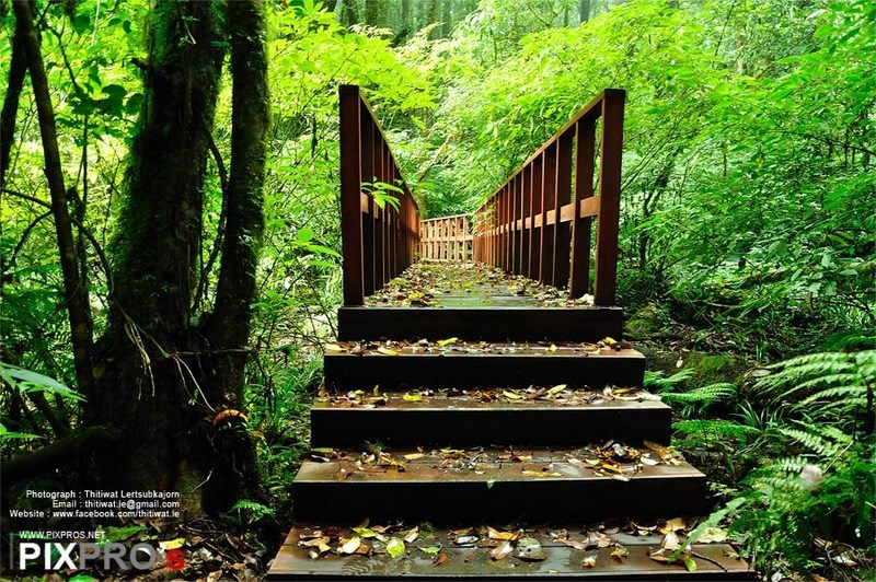
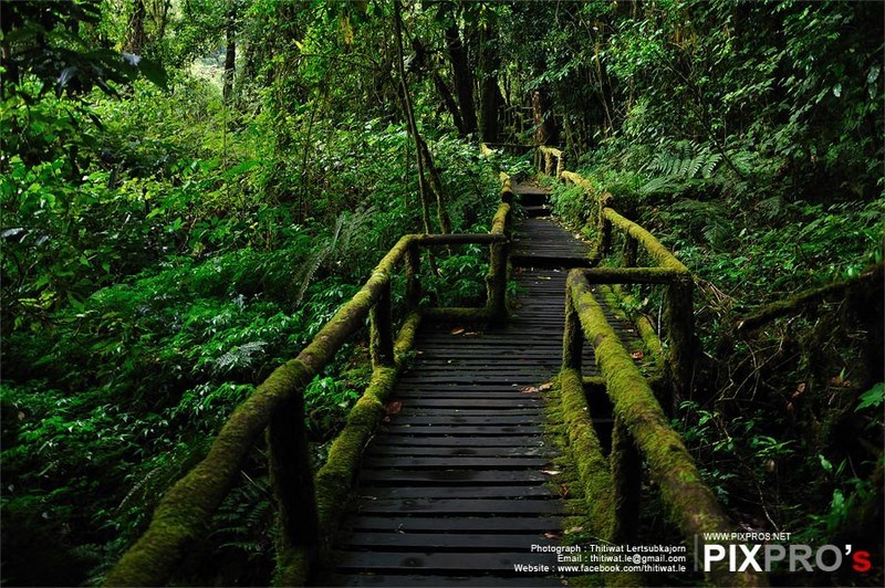
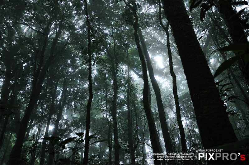
 | ● Photographer: Thitiwat Lertsubkajorn ● Link: facebook.com/thitiwat.le ● Ref: pixpros.net |
|
|
|
|
|
|
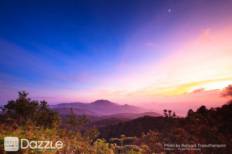
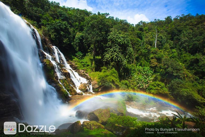
 | ● Photographer: Bunyarit Traisuthamporn ● Link: facebook.com/travelsundae ● Ref: travelsundae.com |
|
|
|
 | ● Photographer: Panatfoto ● Link: facebook.com/Apanatfoto ● Ref: flickr.com/people/panatfoto |
|
|
|
 | ● Photographer: Chatchai Kaigate ● Link: facebook.com/IamDoctorEgg ● Ref: facebook.com/DoctoreggsPix |
● Copyright Photography. (800*500)
● View full size images from the photographer.
● View full size images from the photographer.
| Keyword (Advance) |
 Region
|