


Rating: 4.4/5 (5 votes)
Bangkok attractions
Attractions in Thailand
Open Days: Daily
Opening Hours: You can view the bridge from public viewpoints and surrounding public areas all day (recommended in the morning – evening, and at night for the lights)
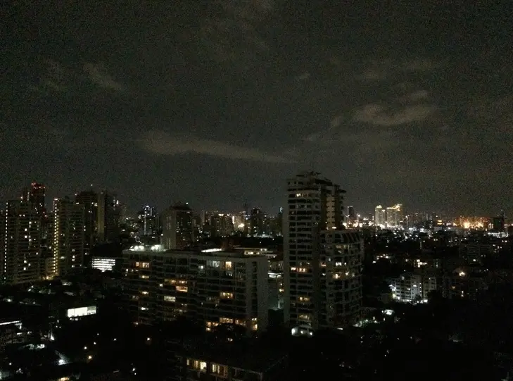
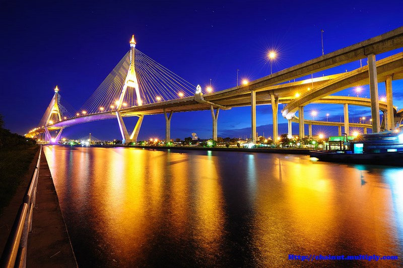
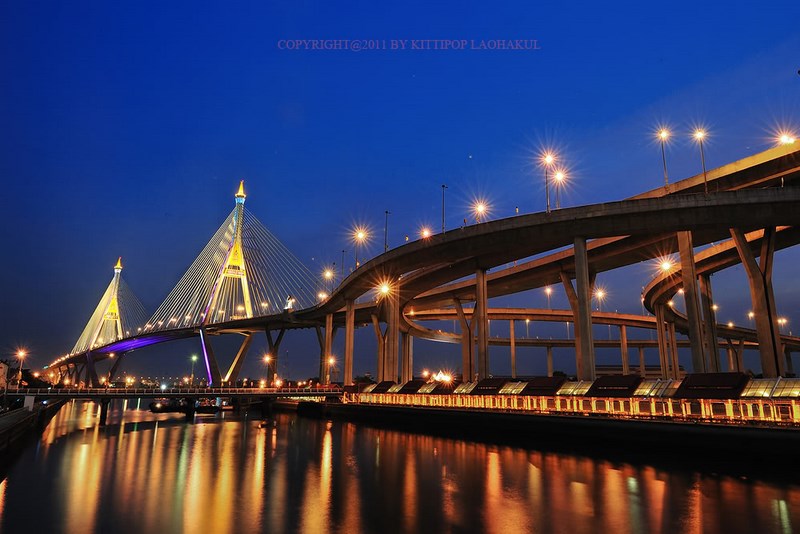
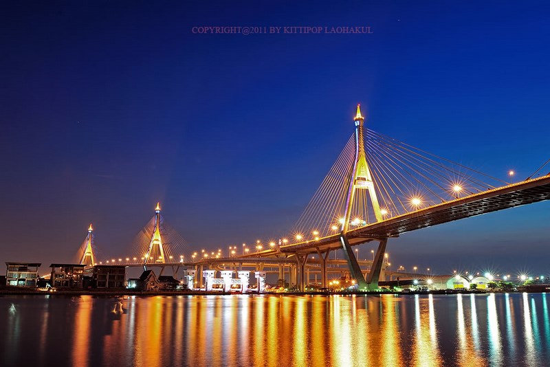
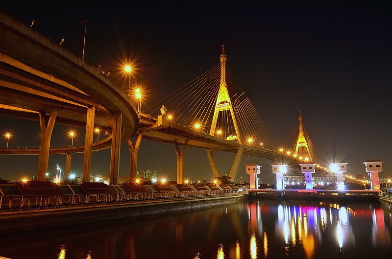
Bhumibol Bridge is the kind of bridge that, even if you didn’t plan to “go bridge-hopping” in the first place, you’ll understand the hype the moment you see it in real life. It isn’t just a way to cross the Chao Phraya River—it’s a bold piece of urban engineering whose clean architectural lines make the city look sharper the instant it lands in your frame. It also plays a major role in the Industrial Ring Road network, keeping traffic flowing between Rama III in Bangkok and Phra Pradaeng in Samut Prakan as one connected system.
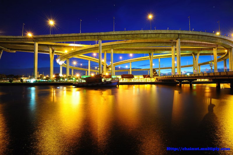
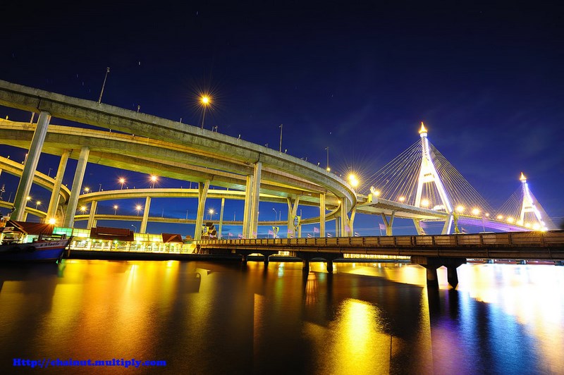
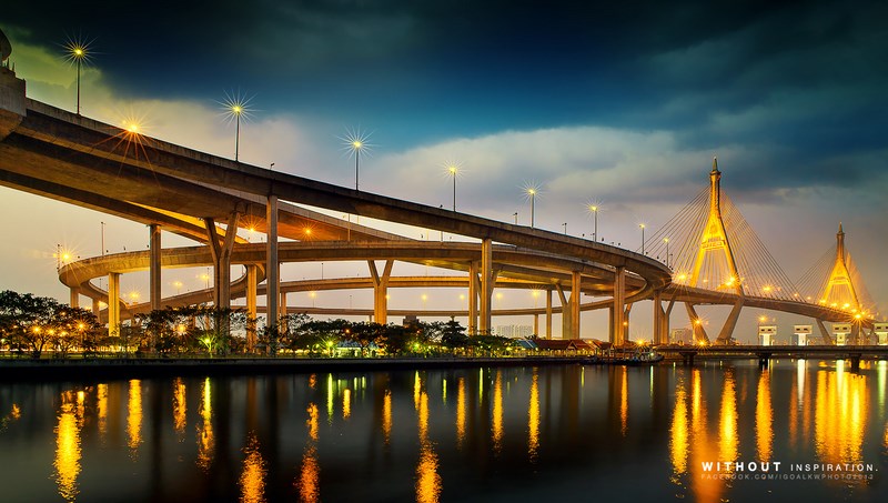
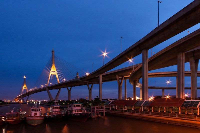
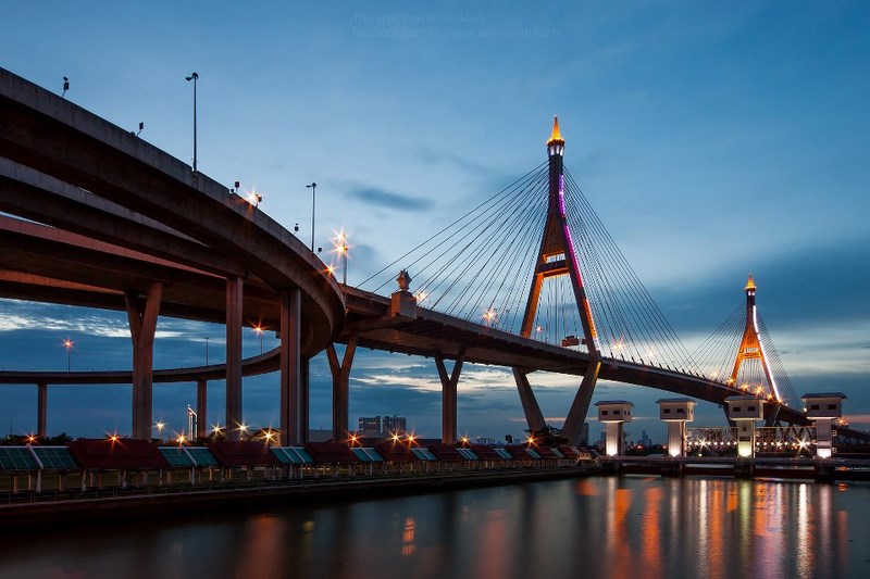
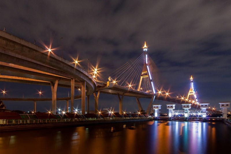
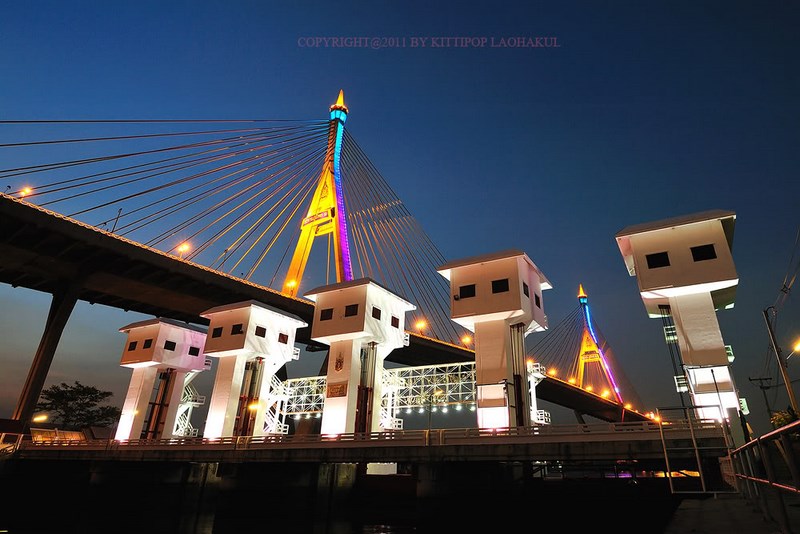
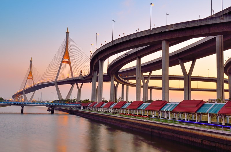
In essence, Bhumibol Bridge is a paired cable-stayed bridge made up of Bhumibol Bridge 1 and Bhumibol Bridge 2 working together like a gateway over the lower bend of the Chao Phraya. Driving across, you might just register it as “a big bridge.” But once you step down to view it from ground level, the details come alive: the pylons and cable arrays are laid out to feel light and open, stretching the visual line of the roadway in a way ordinary beam bridges simply can’t.
What makes it even more interesting is the area around it. This is a true transition zone between Bangkok and Phra Pradaeng—a riverside town with deep community roots, local history, and the green escape of Bang Kachao nearby. That means a Bhumibol Bridge visit doesn’t have to end with a few photos. It can easily become a half-day or full-day route: stop by Khlong Lat Pho Park for river breeze, cross over for cycling in Bang Kachao, then finish with something good to eat around Rama III or Phra Pradaeng.
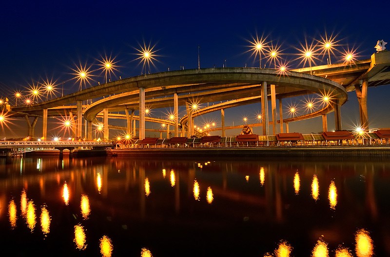
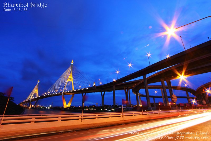
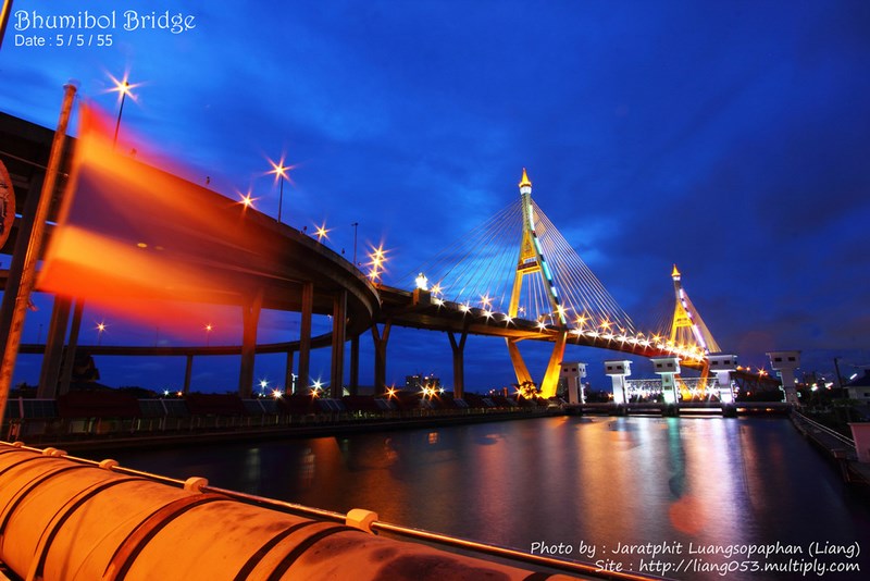
If you want the bridge at its best mood-wise, mornings give you clear skies and crisp lines—perfect for architectural shots. Late afternoon softens the light and blends beautifully with the river tones. Nighttime is the city’s “serious mode”: bridge lighting and road lights add energy, but traffic is heavier and safe viewing spots matter even more. The key here isn’t getting as close as possible—it’s choosing the right viewpoint that feels safe and stress-free.
Getting There For the simplest approach, start around Rama III or Phra Pradaeng and choose a nearby viewpoint or public park as your base, then continue to Bang Kachao (Sri Nakhon Khuean Khan Park) or Khlong Lat Pho Park depending on your plan for the day. Private car and taxi are the most convenient options, but you should allow extra time during rush hours since this corridor is a major traffic artery. Public transport is doable too: use BTS/MRT and connect by taxi/bus into the Rama III or Suksawat area first, then continue to a suitable viewpoint.
A small tip that makes the experience better: treat Bhumibol Bridge as your backdrop, not a place you need to stand “in the middle of.” You’ll get better photos and a better feeling by starting from a safe public space—like a park or riverside walkway—then adjusting your angle with a bit of walking and zooming, instead of trying to find risky spots close to fast traffic. This bridge is built for primary circulation; the speed and on/off ramps aren’t friendly to casual stopping the way a typical tourist site might be.
If you want a “Bangkok that doesn’t feel like the usual Bangkok,” a solid route is “Bhumibol Bridge → Bang Kachao → Bang Nam Phueng Floating Market.” You’ll get both striking city infrastructure and a lush river-bend landscape in one day. Or if you’re into engineering and water-management vibes, continue to Khlong Lat Pho Park and sit by the river to watch the Chao Phraya up close—it feels very different from walking the old-town lanes in Phra Nakhon.
| Name | Bhumibol Bridge |
| Location | Connects Rama III Road (Bangkok) with Phra Pradaeng District (Samut Prakan) along the Industrial Ring Road corridor |
| Key Features | Paired cable-stayed bridges in two main spans (Bhumibol Bridge 1 and 2); a Chao Phraya landmark and a major transport link |
| Period | Opened for traffic in 2006 |
| Key Evidence | A paired bridge complex on the Industrial Ring Road connecting Rama III – Phra Pradaeng, and one of the large cable-stayed structures over the lower Chao Phraya basin |
| Name Origin | Named in honor of His Majesty King Bhumibol Adulyadej |
| Travel | Best by car/taxi by focusing on safe “viewpoints” and nearby public parks, then continuing to Bang Kachao/Phra Pradaeng (public transport: BTS/MRT then connect into Rama III or Suksawat) |
| Current Status | A primary traffic bridge and a popular urban-architecture photo subject when viewed from nearby public areas |
| Contact Number | - |
| Facilities | Nearby viewpoints/public parks and walking areas around Phra Pradaeng – Bang Kachao; restaurants and cafes on the Rama III and Phra Pradaeng sides |
| Fees | No entry fee (viewing from public areas) |
| Nearby Tourist Attractions (Approx. Distance) | Sri Nakhon Khuean Khan Park (Bang Kachao) 6 km (Tel. 02-461-0972) Bang Nam Phueng Floating Market 9 km (Tel. 02-461-3254) Khlong Lat Pho Park 6 km (Tel. 02-461-0979) Erawan Museum 14 km (Tel. 02-371-3135) Muang Boran (Ancient City) 24 km (Tel. 02-026-8800-9) |
| Popular Restaurants Nearby (Approx. Distance) | The Tara Bar & Restaurant (Rama III) 4 km (Tel. 092-523-6236) Buri Tara Riverfest (Rama III) 4 km (Tel. 02-682-9457) Suathao Phochana (near Rama III) 6 km (Tel. 02-672-4391) Baan Bai Bua (near Rama III) 7 km (Tel. 064-973-7738) LOMCHOL Seafood (Suksawat/Phra Pradaeng) 8 km (Tel. 093-892-4996) |
| Popular Accommodations Nearby (Approx. Distance) | Montien Riverside Hotel Bangkok 7 km (Tel. 02-476-0022) Chatrium Hotel Riverside Bangkok 9 km (Tel. 02-307-8888) Avani+ Riverside Bangkok Hotel 10 km (Tel. 02-431-9100) Ramada Plaza by Wyndham Bangkok Menam Riverside 10 km (Tel. 02-688-1000) The Sunreno Hotel Bangkok 8 km (Tel. 02-688-8686) |
Frequently Asked Questions (FAQ)
Q: Where is Bhumibol Bridge?
A: It’s a bridge on the Industrial Ring Road network, crossing the Chao Phraya River to connect Bangkok’s Rama III side with Phra Pradaeng District in Samut Prakan.
Q: What time is best for photos?
A: Morning is best for crisp architectural lines, late afternoon gives softer light and river tones, and nighttime is great for bridge lights and light trails—just choose a safe viewpoint and allow extra travel time.
Q: Can I walk onto the bridge to take photos?
A: The bridge is a major traffic route, not a walking attraction. It’s safer to view and photograph it from nearby parks or public areas instead, without interfering with traffic.
Q: Where should I go next after seeing the bridge?
A: A popular route is Bang Kachao (Sri Nakhon Khuean Khan Park) and then Bang Nam Phueng Floating Market, or Khlong Lat Pho Park for riverside breeze before returning via the Rama III side.
Q: Is it suitable for kids or seniors?
A: Yes, if you focus on safe viewpoints like parks and avoid areas that require crossing major roads multiple times, especially during rush hours.
Q: How much time should I plan?
A: For viewpoints and photos only, about 30–60 minutes. If you add Bang Kachao and the floating market, it easily becomes a half-day to full-day trip.
 Category:
  Group:
 Comment
Photo Gellery(21) 
|
|
|
 | ● Photographer: Chainut ● Link: chainut.multiply.com ● Ref: pixpros.net |
|
|
|
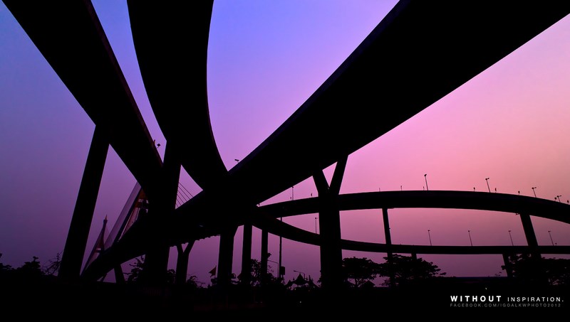
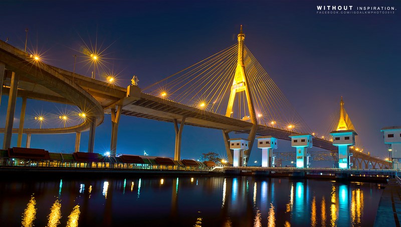
 | ● Photographer: iGoal-kwphoto2012 ● Link: facebook.com/igoalkwphoto2012 ● Ref: fotorelax.com |
|
|
|
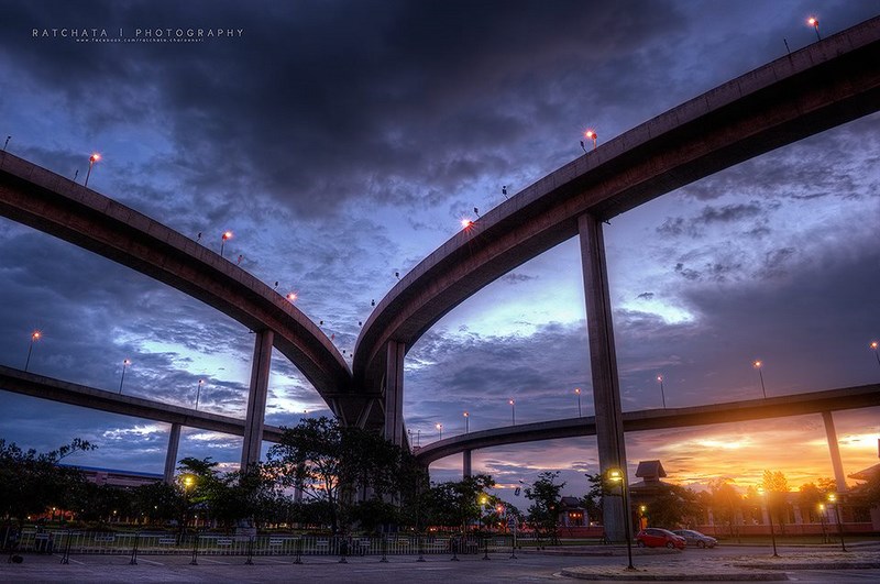
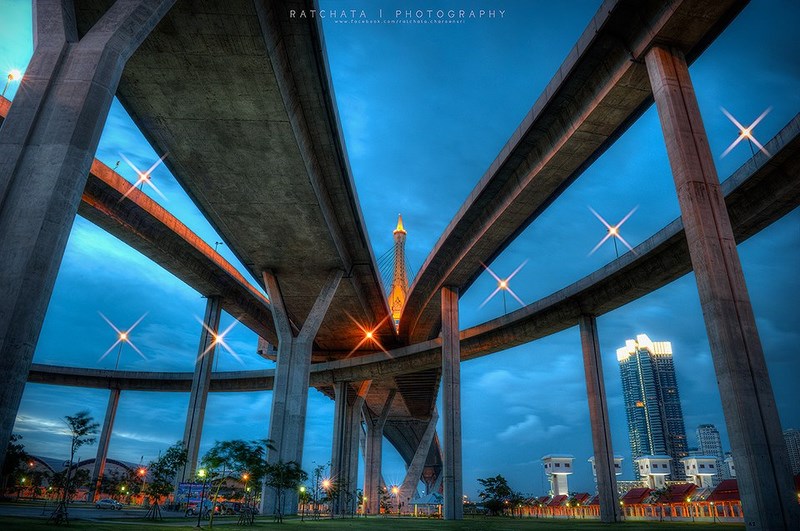
 | ● Photographer: Ratchata Charoensri ● Link: facebook.com/ratchata.charoensri ● Ref: pixpros.net |
|
|
|
 | ● Photographer: Thanipat Peeramatukorn ● Link: facebook.com/thanipat.peeramatuko ● Ref: thanipat.tumblr.com |
|
|
|
 | ● Photographer: Kittipop Laohakul ● Link: pixpros.net/forums/showthread.php ● Ref: pixpros.net |
|
|
|
 | ● Photographer: Narong Karaked ● Link: facebook.com/narong.karaked ● Ref: pixpros.net |
|
|
|
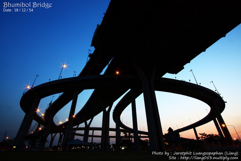
 | ● Photographer: Jaratphit Luangsopaphan ● Link: facebook.com/liang053 ● Ref: pixpros.net |
● Copyright Photography. (800*500)
● View full size images from the photographer.
● View full size images from the photographer.
| Keyword (Advance) |
 Region
|