
lovethailand home >South Travel Attractions >Yala Travel Attractions >Muang Yala >Ban Nang Sareng > Khao Bue Yo Viewpoint
TL;DR: Khao Bue Yo Viewpoint is located at Ban Bannang Buyo, Moo 2, Bannang Sareng Subdistrict, Mueang Yala District, Yala Province, Thailand, open Daily, hours 08.00 - 17.00.

Khao Bue Yo Viewpoint
Open Days: Daily
Opening Hours: 08.00 - 17.00
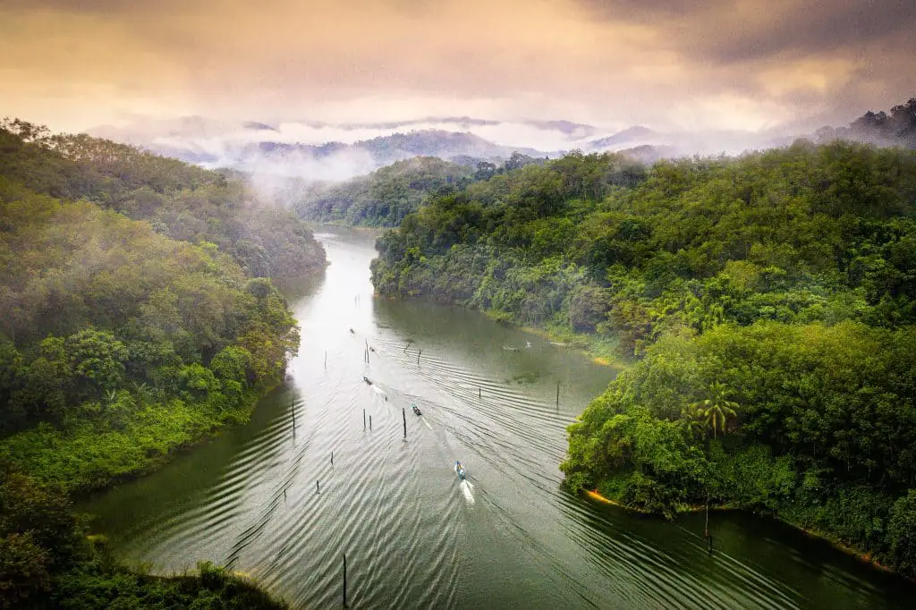
Khao Bue Yo Viewpoint is located around the Royal Thai Army Radio and Television Channel 5 area at Ban Bannang Buyo, Moo 2, Bannang Sareng Subdistrict, Mueang Yala District, Yala Province. It is a natural hill viewpoint near Yala city, suitable for travelers who want to see the city, mountains, forested slopes, and rural landscape of Bannang Sareng from a higher perspective. Khao Bue Yo is an important mountain in the area, forming a forested landscape connected with Bannang Sareng Subdistrict, Krong Pinang Subdistrict, and nearby parts of Raman District. This makes the viewpoint more than a simple photo stop; it is a place where visitors can understand the relationship between Yala city, rural communities, forests, and water sources.
The appeal of Khao Bue Yo Viewpoint lies in its quiet simplicity. Visitors can travel from Yala city in a relatively short time and reach a hill area with open air, forest scenery, and views over Ban Bannang Buyo and Bannang Sareng. The viewpoint is best visited in the morning or late afternoon, when the light is softer and the weather is more comfortable. After rain or during humid periods, light mist may appear along the hills and forested slopes, creating a peaceful atmosphere for photography and slow travel.
Khao Bue Yo is significant in the local geography because it is a high forested mountain on the southwestern side of the Budi municipal area and acts as a natural boundary between several subdistricts. The mountain is associated with several natural canals, including Khlong Bue Yong, Khlong Tue Ngo, Khlong Khu Roh, Khlong To Yo Bukeh Kla, and Khlong Parami Tae. These waterways flow toward Huai Bae Mo and the Pattani River. For this reason, Khao Bue Yo is not only a viewpoint but also part of an important watershed landscape near Yala city.
The location of the viewpoint at Ban Bannang Buyo gives the site a distinctive identity because it sits between community land and forested hills. Around the mountain, visitors can see a landscape made up of village areas, rubber plantations, orchards, rural roads, rice fields, streams, and layered hills. A visit to Khao Bue Yo is therefore suitable for travelers who want to understand Yala’s near-city nature, which differs from both the urban center and large-scale tourist destinations elsewhere in the province.
The name Bannang Sareng also reflects local roots. The word “Bannang” is associated with rice fields, while “Sareng” is connected with the local si reng tree. This background links the community with rice fields, trees, settlement, and agricultural life. When viewed together with Khao Bue Yo, the area shows how mountains, forests, farms, and communities have shaped the identity of Bannang Sareng over time.
Khao Bue Yo Viewpoint is best suited for travelers who prefer quiet places and natural scenery rather than fully commercialized tourist sites. Visitors should not expect large-scale facilities. Its value lies in the calm hill atmosphere, the natural view, and the sense of being close to both forest and village life. The viewpoint works well for short nature trips, photography, and a deeper look at the geography around Yala city.
A visit should be made with respect for both nature and the local community. Do not litter, make loud noise, light fires, collect plants, or drive off suitable routes. If any area is managed by local authorities or community members, visitors should follow local instructions. Responsible travel helps preserve the quiet character of the site and protects the forested watershed around Khao Bue Yo.
The best time to visit is early morning or late afternoon. Morning offers fresh air and a calmer atmosphere after the night’s humidity, while late afternoon gives softer light over the hills and lowland communities. Midday can be hotter and harsher for photography. After rain, visitors should be more careful because roads and walking surfaces may become slippery.
For photographers, Khao Bue Yo offers several visual subjects: hill ridges, distant city views, green forest slopes, the access route, and the surrounding community landscape. A wide-angle lens is useful for capturing the broader terrain, while a medium lens can isolate the layers of villages, plantations, and mountains. Always ask permission before photographing people, especially near houses or community areas.
Khao Bue Yo Viewpoint can be planned together with other attractions in Bannang Sareng and Yala city. Nearby places include Fin Klang Thung @ Bannang Sareng, Kuba Pu Rong On The Beach, Sa Lae Waterfall, Yala City Pillar Shrine, Khwan Mueang Park, Yala Clock Tower, Si Mueang Park, and the Rainbow Buildings near Yala Railway Station. This makes the viewpoint suitable for a half-day or full-day route combining nature, community scenery, and city landmarks.
Fin Klang Thung @ Bannang Sareng is a community photo spot set in a rice-field landscape. It was created by local people as a leisure and check-in area, with a wooden walkway stretching into the fields. Travelers visiting Khao Bue Yo can include this stop before or after the viewpoint to experience another side of Bannang Sareng: rice fields, local food, and rural scenery.
Kuba Pu Rong On The Beach is a riverside leisure area in Bannang Sareng that is popular during hot weather. It is suitable for families and groups who want to sit, eat, relax, and enjoy a community-managed waterside atmosphere. Combining this stop with Khao Bue Yo makes the route more varied because visitors can experience hills, water, food, and community life in one trip.
Sa Lae Waterfall is another natural attraction connected with the Khao Bue Yo landscape. It is a natural waterfall whose water originates from Khao Bue Yo and flows toward the Pattani River. Visiting both the viewpoint and the waterfall helps travelers understand the area from the mountain source to the lower community landscape.
For travelers continuing into Yala city, Yala City Pillar Shrine is an important stop. Located at the roundabout in front of the provincial hall, it is a sacred site respected by local residents and is also connected with Yala’s well-known city planning pattern. From Khao Bue Yo, visitors can continue to the city center to see the shrine, clock tower, and other urban landmarks.
Khwan Mueang Park, also known as Phru Ba Koi, is one of Yala’s main public parks. It covers about 207 rai and features a large lake, artificial beach, pine landscape, sports areas, and a well-known zebra dove singing competition field. It is a good place to rest after visiting Khao Bue Yo, especially for families who want an open city park with walking and relaxing areas.
Yala Clock Tower and the Rainbow Buildings near Yala Railway Station add an urban finish to the route. The clock tower is a central city landmark, while the Rainbow Buildings represent a colorful city-image project in the southern border region. These areas are suitable for photography, walking, and continuing to local restaurants in Yala city.
Getting there is easiest by private car or locally hired vehicle. From Yala city, travel toward Bannang Sareng Subdistrict, then continue to Ban Bannang Buyo, Moo 2, and proceed to Khao Bue Yo Viewpoint around the Channel 5 area. Some parts of the route are rural and may be sloped, so drivers should use low speed, check road conditions, and avoid traveling uphill during heavy rain or poor visibility.
Travelers without private transport should start from Yala city and arrange a local vehicle or contact Bannang Sareng Subdistrict Administrative Organization for route information before group travel. Prior coordination is useful because the viewpoint is not a large commercial attraction with constant public transport access.
A half-day route works well for travelers staying in Yala city. Start in the morning, visit Khao Bue Yo Viewpoint, stop at Fin Klang Thung @ Bannang Sareng or Kuba Pu Rong On The Beach, then return to the city for food and visits to Yala City Pillar Shrine, Khwan Mueang Park, or Yala Clock Tower. This short route offers a good mix of nature, local community, and city landmarks.
A full-day route can cover more of Bannang Sareng’s nature and community attractions. Begin with Khao Bue Yo in the morning, continue to Sa Lae Waterfall or a local leisure area, then return to Yala city in the afternoon for Yala City Pillar Shrine, Khwan Mueang Park, Si Mueang Park, the Rainbow Buildings, and local restaurants. This route gives a broader view of Mueang Yala District from both rural and urban perspectives.
Visitors should travel with practical preparation. Bring drinking water, comfortable shoes, a hat, camera equipment, and a bag for taking personal trash back down. If the road is wet, rain is heavy, or mist reduces visibility, delay the visit for safety. Khao Bue Yo is a nature viewpoint near a community, so careful driving and respectful behavior are essential.
For travelers interested in geography and nature, Khao Bue Yo is a useful place to understand the mountain system near Yala city. The mountain serves as forest and watershed, feeding several canals that flow toward local communities and the Pattani River. Protecting Khao Bue Yo is therefore important for nature, nearby villages, and the wider water system around Yala.
Khao Bue Yo Viewpoint is a worthwhile nature stop close to Yala city. It gives visitors a hilltop view, a sense of local geography, a connection with community life, and easy access to other attractions in Yala. Its beauty does not come from large buildings or heavy development, but from the natural view, quiet atmosphere, and the importance of a forested watershed still connected to surrounding communities.
In summary, Khao Bue Yo Viewpoint at Ban Bannang Buyo is a good destination for travelers who enjoy mountain views, near-city nature, and simple local routes. It shows another side of Yala: not only roads, roundabouts, and city buildings, but also hills, forest, water sources, rice fields, villages, and community landscapes. With careful travel, respect for local people, and responsible use of the area, Khao Bue Yo offers peaceful scenery, good photography opportunities, and a clearer understanding of Yala’s natural setting.
| Name | Khao Bue Yo Viewpoint |
| Related Names | Khao Bue Yo / Khao Bue Yo Channel 5 Viewpoint |
| Location | Ban Bannang Buyo, Moo 2, Bannang Sareng Subdistrict, Mueang Yala District, Yala Province, Thailand |
| Address | Khao Bue Yo Viewpoint, Channel 5 Area, Ban Bannang Buyo, Moo 2, Bannang Sareng Subdistrict, Mueang Yala District, Yala Province 95000, Thailand |
| Coordinates | 6.480235, 101.280524 |
| Highlights | Near-city mountain viewpoint overlooking forested hills, Ban Bannang Buyo, Bannang Sareng, and the surrounding Yala landscape |
| Distinctive Features | Forested mountain landscape forming a natural boundary between Bannang Sareng, Krong Pinang, and nearby areas; connected with several watershed streams |
| Area Significance | A natural viewpoint and watershed landscape showing the connection between hills, forest, communities, streams, and agricultural land |
| Important Water Sources | Associated with the headwaters of Khlong Bue Yong, Khlong Tue Ngo, Khlong Khu Roh, Khlong To Yo Bukeh Kla, and Khlong Parami Tae, which flow toward Huai Bae Mo and the Pattani River |
| Main Areas / Zones | Channel 5 viewpoint area, hill access route, Ban Bannang Buyo, Khao Bue Yo forested ridge, watershed area, and surrounding community landscape |
| Travel Information | From Yala city, travel to Bannang Sareng Subdistrict and enter Ban Bannang Buyo, Moo 2, then continue to Khao Bue Yo Viewpoint around the Channel 5 area. Private car or locally hired vehicle is recommended |
| Current Status | Listed as a natural attraction in the Bannang Sareng Subdistrict Administrative Organization tourism information |
| Open Days | Daily |
| Opening Hours | 08.00 - 17.00 |
| Best Time To Visit | Morning and late afternoon for softer light, cooler weather, and clearer hill views |
| Facilities | Natural viewpoint near a local community. Visitors should bring drinking water, personal supplies, and take all trash back down |
| Management / Local Contact | Bannang Sareng Subdistrict Administrative Organization, Mueang Yala District, Yala Province |
| Main Contact Number | Bannang Sareng Subdistrict Administrative Organization Tel. 073-372-265 |
| Official Website / Official Page | Bannang Sareng Subdistrict Administrative Organization Website |
| Nearby Tourist Attractions | 1. Fin Klang Thung @ Bannang Sareng, about 5 km 2. Sa Lae Waterfall, about 7 km 3. Kuba Pu Rong On The Beach, about 10 km 4. Yala City Pillar Shrine, about 14 km 5. Yala Clock Tower, about 14 km 6. Khwan Mueang Park, about 15 km 7. Rainbow Buildings Near Yala Railway Station, about 15 km |
| Nearby Restaurants | 1. Be Coco, Bannang Sareng Subdistrict, about 10 km, Tel. 093-663-3122 2. Krua Kan Eng, Mueang Yala, about 13 km, Tel. 082-801-5309, 093-061-4762, 063-675-4086 3. He Le Phang Mueang 4, Mueang Yala, about 13 km, Tel. 085-059-6999 4. Veena Kai Zaab, Mueang Yala, about 15 km, Tel. 096-710-8317 5. Burger Taladmai Yala, about 15 km, Tel. 088-254-4740, 098-090-5040 |
| Nearby Accommodations | 1. @INN YRU, about 13 km, Tel. 062-182-2662 2. Park View Hotel Yala, about 15 km, Tel. 073-217-001-5 3. Yala Grand Palace Hotel, about 15 km, Tel. 073-215-711, 073-215-712 4. Yala Rama Hotel, about 15 km, Tel. 073-212-563, 073-212-815, 073-212-841 5. Metro Hotel Yala, about 15 km, Tel. 073-212-175 |
Frequently Asked Questions (FAQ)
Q: Where Is Khao Bue Yo Viewpoint Located?
A: Khao Bue Yo Viewpoint is located around the Channel 5 area at Ban Bannang Buyo, Moo 2, Bannang Sareng Subdistrict, Mueang Yala District, Yala Province.
Q: What Are The Opening Days And Hours?
A: The viewpoint is open daily from 08.00 to 17.00.
Q: When Is The Best Time To Visit Khao Bue Yo Viewpoint?
A: Morning and late afternoon are the best times because the light is softer, the weather is more comfortable, and the hill and city views are easier to enjoy.
Q: Why Is Khao Bue Yo Important?
A: Khao Bue Yo is a forested mountain near Yala city, a viewpoint, and a watershed area connected with several canals that flow toward Huai Bae Mo and the Pattani River.
Q: How Do Travelers Get To Khao Bue Yo Viewpoint?
A: From Yala city, travel toward Bannang Sareng Subdistrict, enter Ban Bannang Buyo, Moo 2, and continue to the Khao Bue Yo Channel 5 viewpoint area. Private car or locally hired vehicle is recommended.
Q: Who Is Khao Bue Yo Viewpoint Suitable For?
A: It is suitable for travelers who enjoy nature, quiet viewpoints, mountain scenery, photography, and community-based local routes near Yala city.
Q: Which Nearby Attractions Can Be Combined With Khao Bue Yo?
A: Nearby places include Fin Klang Thung @ Bannang Sareng, Sa Lae Waterfall, Kuba Pu Rong On The Beach, Yala City Pillar Shrine, Yala Clock Tower, Khwan Mueang Park, and the Rainbow Buildings near Yala Railway Station.
Q: What Should Visitors Prepare Before Going?
A: Visitors should bring drinking water, comfortable shoes, a hat, camera equipment, and a bag for taking trash back down. If the road is wet or visibility is poor, delay the visit for safety.
 Category: ●Nature and Wildlife
 Group: ●Mountain (Doi)
Last Update : 2 WeekAgo
 Last Update : 2 WeekAgo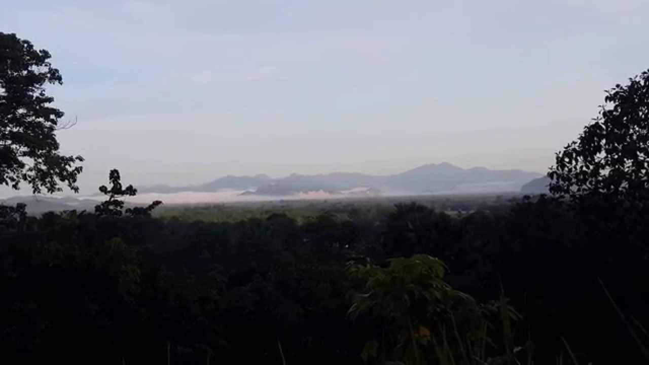
 Click to Access the Navigation Map GPS
Khao Bue Yo Viewpoint Map

 Art, Culture and Heritage
 Landmarks and Memorials(1)
 Art, Craft Centres, Tradition(2)
 Museums(2)
 Educational Places
 Educational Gardens, Farm(1)
 Places of Worship
 Temple(6)
 Mosque(2)
 Other Sacred Sites(3)
 Suburban Living
 Village, Community(4)
 National Parks and Marine Reserves(2)
Mountain (Doi)(5)
National Parks and Marine Reserves(2)
Mountain (Doi)(5)
 Dam, Reservoir, Lake(5)
 Waterfalls(13)
 Hot Springs(2)
 Caves(7)
 River, Canal(4)
 Islands(1)
 Other natural attractions(8)
 Entertainment and Agricultural
 Stadium(1)
 Farms, Parks and Ecotourism(4)
 Outdoor and Adventure Activities(1)
 Travel Articles, Recipes
 Travel Review, Food Review(2)


