
lovethailand home >South Travel Attractions >Yala Travel Attractions >Than To >Mae Wat > Khok Chang Waterfall
TL;DR: Khok Chang Waterfall is located at Along Khok Chang Road, Khok Chang Subdistrict Municipality, Mae Wat Subdistrict, Than To District, Yala Province, open Daily, hours 08.00 – 17.00.

Khok Chang Waterfall
Open Days: Daily
Opening Hours: 08.00 – 17.00
Khok Chang Waterfall in Yala Province is a community waterfall located along Khok Chang Road within Khok Chang Subdistrict Municipality, Mae Wat Subdistrict, Than To District. It is close to the Yala – Betong route and is easier to access than many remote waterfalls in the Hala-Bala forest landscape. The waterfall is known for its local stream, shaded community setting, roadside accessibility, and suitability as a short nature stop for resting, photography, and careful water play. It can be combined with Mae Wat Bridge, Than To Lake, La-ong Rung Waterfall, Than To Waterfall, Bang Lang Dam, and the Aiyoeweng – Betong route.
Khok Chang Waterfall is a local natural attraction in Khok Chang Subdistrict Municipality, Than To District, Yala Province. Unlike remote waterfalls that require long forest access, this waterfall is located close to a community and along Khok Chang Road. Its main appeal is convenience: travelers using the Yala – Betong route can stop for a short break, enjoy the stream, rest under shade, and experience the quieter side of Than To’s mountain-community landscape.
The waterfall lies in Mae Wat Subdistrict, an area shaped by mountains, streams, and the reservoir landscape of Bang Lang Dam. Khok Chang Subdistrict Municipality is a small municipality located about 20 km from Than To District center and about 80 km from Yala city via Highway 410. The area is a foothill plain surrounded by steep mountains, with Khlong Khok Chang flowing through the middle of the community before continuing toward Than To Lake and the Pattani River system near Bang Lang Dam.
This setting gives Khok Chang Waterfall more meaning than a simple roadside cascade. It is part of a local water landscape connected with Khlong Khok Chang, the community, Than To Lake, and Bang Lang Dam. The stream contributes to the identity of Khok Chang and provides a local public area for rest and community use. For travelers, the waterfall offers a small but useful window into the water-and-mountain environment of inland Yala.
The name Khok Chang comes from the area’s local history. People in the community were formerly residents of Ban To who moved after the construction of Bang Lang Dam, which began in 1976. In the past, the Khok Chang area was covered by fertile forest and had many wild elephants. Local elephant handlers once made elephant enclosures around the present Ban To School field area, and the place became known locally as Khok Chang, meaning an elephant enclosure.
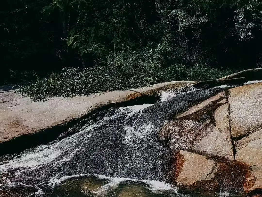
Khok Chang Waterfall is described in local travel sources as a beautiful waterfall along Khok Chang Road. Recent local reporting also describes it as a medium-sized waterfall with about four tiers, located not far from the community access road. The waterfall is therefore suitable for visitors who want a practical stop rather than a long trekking destination. It is best for short relaxation, stream photography, and careful water play in safe sections.
The atmosphere is calm and local. Visitors can enjoy flowing water, stream rocks, shaded trees, and the slower rhythm of a small community. The waterfall may not be as dramatic as major national-park waterfalls, but it has value as a convenient nature stop and community green space. It is especially useful for travelers who want to break up the long mountain-road drive between Yala, Than To, Aiyoeweng, and Betong.
The area has a tropical monsoon climate with high rainfall. Khok Chang receives moisture from both the northeast and southwest monsoons, and the rainy season can be long. This makes the waterfall and stream environment green and fresh, but it also means visitors must be careful with slippery surfaces, stronger flow, and sudden changes after heavy rain. Water safety should guide every visit.
Khok Chang Municipality continues to take care of the waterfall area. Recent municipal activity included volunteer cleaning, tree maintenance, garbage collection, branch trimming, weed removal, and landscape improvement around Khok Chang Waterfall. This confirms the waterfall’s role as a public natural area valued by the community, not only as a visitor attraction but also as a shared local environment.
The best time to visit is during daylight, especially from morning to early afternoon. Visitors have enough light for walking, photography, and safe return to the main route. During rainy periods, the waterfall may look more active, but travelers should avoid entering the stream when water is muddy, fast, or rising. During drier periods, access is generally easier, although water volume may vary naturally.
Water play should be limited to safe, shallow, calm sections. Visitors should avoid wet boulders, strong currents, and unknown pool depths. Children must be supervised closely at all times. Even a small community waterfall can become risky after rain because mountain streams can change quickly.
For photography, good subjects include the flowing stream, natural rock surfaces, shaded trees, roadside community setting, and people resting near the water from a respectful distance. Khok Chang Waterfall is not defined by a huge cliff but by its accessible, intimate, and local character. Visitors should choose stable photo spots and avoid climbing slippery rocks for a risky angle.
The waterfall works best as a short stop on a wider Than To and Yala – Betong itinerary. Travelers may spend about 30 minutes to one and a half hours here, then continue to Mae Wat Bridge, Than To Lake, La-ong Rung Waterfall, Than To Waterfall, Bang Lang Dam, or Aiyoeweng and Betong. This makes the trip more varied without requiring a major detour.
Mae Wat Bridge is one of the most useful nearby scenic stops. It crosses the Bang Lang reservoir landscape and offers views of water and surrounding mountains. Combining the bridge with Khok Chang Waterfall helps travelers understand how the community, streams, reservoir, and dam landscape are connected.
Khok Chang Waterfall also fits into the larger travel identity of Than To District. Than To is known for mountains, forests, waterfalls, streams, Than To Lake, Bang Lang Dam, and the Yala – Betong road. The waterfall adds a community-level nature stop to this broader landscape. It is smaller than Than To Waterfall and La-ong Rung Waterfall, but it is more immediate and easier to access.
Nearby attractions include Mae Wat Bridge, Than To Lake, Bang Lang Dam, La-ong Rung Waterfall, Than To Waterfall, Chaloem Phra Kiat Rama IX Waterfall, and Aiyoeweng Sea of Mist. Each site offers a different travel value: reservoir views, rainforest waterfalls, community landscapes, mountain roads, and mist viewpoints. Khok Chang Waterfall works as a modest but practical link among these places.
Food planning should follow the travel direction. Visitors can look for local restaurants around Ban Hae, Than To, Bang Lang Dam, or Betong town. Services directly beside Khok Chang Waterfall may not be available at all times, so travelers should not rely on finding a full restaurant immediately at the waterfall. Planning a meal stop before or after visiting will make the route smoother.
Accommodation depends on the full itinerary. Travelers focusing on Than To and Bang Lang Dam may stay around Than To, Mae Wat, or the dam area. Travelers who prefer more restaurants and town services can stay in Betong or Yala city and include Khok Chang Waterfall as a route stop. Because the Yala – Betong road is mountainous, actual travel time may feel longer than the distance suggests.
Useful items include non-slip footwear, a change of clothes, towel, waterproof phone pouch, drinking water, personal medicine, a trash bag, and some cash for local purchases. During the rainy season, bring rain protection and check weather conditions before departure.
Visitors should avoid littering, blocking Khok Chang Road, making loud noise near the community, bringing breakable containers into the stream area, climbing wet rocks, and entering the water during heavy rain. A small community waterfall remains attractive only when visitors help keep the area clean and use it responsibly.
Getting There from Yala city: take Highway 410 on the Yala – Betong route toward Than To and Mae Wat for about 80 km, then enter Khok Chang Subdistrict Municipality and follow Khok Chang Road to the waterfall area. From Betong, take Highway 410 toward Aiyoeweng, Than To, and Yala, then watch for the Khok Chang area in Mae Wat Subdistrict. A private car, rental car, or local hired vehicle is recommended for flexible timing and nearby stops.
Overall, Khok Chang Waterfall is a modest but worthwhile community waterfall on the Yala – Betong route. Its strengths are accessibility, local atmosphere, shaded stream scenery, the history of Khok Chang, and its connection with Mae Wat, Than To Lake, Bang Lang Dam, and the wider Than To travel landscape. For travelers who respect community space, visit during safe daylight hours, and keep the area clean, Khok Chang Waterfall is a pleasant local stop in Yala Province.
| Name | Khok Chang Waterfall |
| Location | Along Khok Chang Road, Khok Chang Subdistrict Municipality, Mae Wat Subdistrict, Than To District, Yala Province |
| Address | Moo 7, Mae Wat Subdistrict, Than To District, Yala 95170, Thailand |
| Reference Coordinates | Latitude 6.046636, Longitude 101.175501 |
| Highlights | Community waterfall along Khok Chang Road, easy access, local stream, shaded setting, and a useful nature stop on the Yala – Betong route |
| Distinctive Features | Medium-sized community waterfall with stream rocks, flowing water, shaded surroundings, and safe water-play areas when conditions are suitable |
| Importance | A public nature area for the Khok Chang community and a travel stop connecting Than To, Mae Wat, Aiyoeweng, Betong, Bang Lang Dam, and Than To Lake |
| History / Area Context | Khok Chang community was formed by former Ban To residents who moved after the construction of Bang Lang Dam. The area was once rich in forest and wild elephants, giving rise to the name Khok Chang |
| Name Origin | The name refers to elephant enclosures once associated with the area before becoming the name of the community and municipality |
| Travel Information | From Yala city, take Highway 410 toward Betong for about 80 km to Khok Chang Subdistrict Municipality, then continue along Khok Chang Road to the waterfall area |
| Current Status | Open as a community natural attraction and rest area. Khok Chang Subdistrict Municipality continues cleaning, tree care, and landscape improvement at the waterfall area |
| Open Days | Daily |
| Opening Hours | 08.00 – 17.00 |
| Facilities | Roadside access from Khok Chang Road, streamside rest area, natural water-play areas in safe sections, nearby community space, and basic services within Khok Chang Subdistrict Municipality |
| Main Areas / Zones | Waterfall entrance, Khlong Khok Chang stream, natural pools, stream rocks, shaded rest area, Khok Chang Road, and Talat Khok Chang community area |
| Caretaker / Coordinating Agency | Khok Chang Subdistrict Municipality, Than To District, Yala Province Mayor: Mr. Somsak Chunoonimit |
| Main Contact Number | Khok Chang Subdistrict Municipality Tel. 0-7328-0137 Mayor of Khok Chang Subdistrict Municipality Tel. 086-291-8270 |
| Website / Information Sources | Khok Chang Subdistrict Municipality, LoveThailand.org, Thailand Cultural Encyclopedia, Yala – Betong route travel reports, and public travel databases |
| Nearby Tourist Attractions | 1. Rom Mai Sai Nam Khok Chang Market, about 0.5 km 2. Mae Wat Bridge and Bang Lang Reservoir Viewpoint, about 3 km 3. La-ong Rung Waterfall, Bang Lang National Park, about 10 km 4. Chaloem Phra Kiat Rama IX Waterfall, about 18 km 5. Than To Waterfall, Bang Lang National Park, about 22 km 6. Bang Lang Dam and Than To Lake, about 30 km |
| Nearby Restaurants | 1. Krua Ka Areesah, Ban Hae, about 12 km, Tel. 080-601-2609 2. Sila, Ban Hae, about 12 km, Tel. 089-974-6373 3. Café Amazon, Than To Self-Help Settlement Station, about 22 km, Tel. 095-967-3154 4. Ruen Balae Restaurant, Bang Lang Dam, about 30 km, Tel. 073-281-128 5. Krua Muslim Restaurant, Bang Lang Dam, about 30 km, Tel. 093-606-0667, 084-890-7341 6. Kru_Cup Cafe’ Betong, about 55 km, Tel. 087-298-4286, 093-762-3892 |
| Nearby Accommodations | 1. Resort Ban Saitan 21, about 25 km, Tel. 084-660-1380 2. Khun Saichol Villa, Bang Lang Dam, about 30 km, Tel. 073-281-129 3. Cool Camping Resort, about 35 km, Tel. 073-373-224 4. Rhimtarn The Camping Resort, about 35 km, Tel. 080-709-3891 5. Grand Mandarin Betong Hotel, about 55 km, Tel. 073-235-777 6. Garden View Betong Hotel, about 55 km, Tel. 073-235881-4, 086-488-7190 |
Frequently Asked Questions (FAQ)
Q: Where is Khok Chang Waterfall located?
A: Khok Chang Waterfall is located along Khok Chang Road within Khok Chang Subdistrict Municipality, Mae Wat Subdistrict, Than To District, Yala Province.
Q: What are the opening hours of Khok Chang Waterfall?
A: The waterfall is open daily from 08.00 to 17.00. Daytime visits, especially from morning to early afternoon, are recommended for safer access and water activities.
Q: What makes Khok Chang Waterfall special?
A: Its main value is accessibility. It is a community waterfall near Khok Chang Road, with a shaded stream setting and easy connection to the Yala – Betong travel route.
Q: Can visitors swim at Khok Chang Waterfall?
A: Water play is possible only in safe, shallow, calm sections. Visitors should avoid slippery rocks, strong current, and entering the stream after heavy rain.
Q: What is the origin of the name Khok Chang?
A: The name comes from local history linked to elephant enclosures once made in an area formerly rich in forest and wild elephants, before Khok Chang became the community and municipality name.
Q: How do travelers get to Khok Chang Waterfall?
A: From Yala city, take Highway 410 on the Yala – Betong route for about 80 km to Khok Chang Subdistrict Municipality, then follow Khok Chang Road to the waterfall area.
Q: What nearby attractions can be combined with the waterfall?
A: Good nearby options include Mae Wat Bridge, Than To Lake, La-ong Rung Waterfall, Than To Waterfall, Bang Lang Dam, Chaloem Phra Kiat Rama IX Waterfall, and the Aiyoeweng – Betong route.
Q: What should visitors prepare before going?
A: Bring non-slip footwear, a change of clothes, towel, waterproof phone pouch, drinking water, personal medicine, and a trash bag. During the rainy season, check weather conditions before traveling.
 Category: ●Nature and Wildlife
 Group: ●Waterfalls
Last Update : 2 WeekAgo
 Last Update : 2 WeekAgo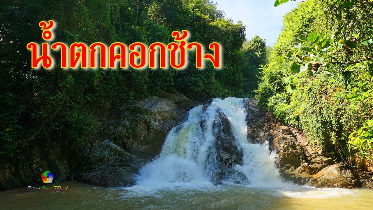
 Click to Access the Navigation Map GPS
Khok Chang Waterfall Map

 Art, Culture and Heritage
 Landmarks and Memorials(1)
 Art, Craft Centres, Tradition(2)
 Museums(2)
 Educational Places
 Educational Gardens, Farm(1)
 Places of Worship
 Temple(6)
 Mosque(2)
 Other Sacred Sites(3)
 Suburban Living
 Village, Community(4)
 National Parks and Marine Reserves(2)
 Mountain (Doi)(5)
 Dam, Reservoir, Lake(5)
Waterfalls(13)
Dam, Reservoir, Lake(5)
Waterfalls(13)
 Hot Springs(2)
 Caves(7)
 River, Canal(4)
 Islands(1)
 Other natural attractions(8)
 Entertainment and Agricultural
 Stadium(1)
 Farms, Parks and Ecotourism(4)
 Outdoor and Adventure Activities(1)
 Travel Articles, Recipes
 Travel Review, Food Review(2)


