
TL;DR: 40 Places to Visit in Yala.

40 Places to Visit in Yala
40 Yala Attractions: Who Says the Deep South Is Scary? It Is Surprisingly Chill Yala is often misunderstood because of old news images and concerns about the southern border provinces. Yet the real Yala is far richer and softer than that narrow perception. This inland province of Southern Thailand is filled with mountains, rainforest, reservoirs, waterfalls, misty viewpoints, cultural communities, Buddhist temples, Islamic landmarks, Chinese shrines, local food, and border-town charm. Because Yala is the only province in the South without a coastline, its landscape feels different from many other southern destinations. Instead of beaches, travelers find cool forests, green hills, calm lakes, hilltop viewpoints, and towns where Thai Buddhist, Thai Muslim, Thai Chinese, and indigenous ways of life meet naturally.
Yala is suitable for travelers who want to experience nature, mountains, sea mist, waterfalls, dams, historic sites, city landmarks, religious architecture, and borderland culture in one route. This guide gathers 40 Yala attractions across Mueang Yala, Betong, Than To, Bannang Sata, Yaha, Krong Pinang, and Aiyerweng, making it easier to plan a first trip or a deeper return journey. Each place offers a different reason to visit, from slow city walks and cultural learning to forest excursions, scenic drives, photography stops, and highland viewpoints.
Yala Province covers about 4,512 square kilometers. Much of the province is mountainous and forested, while the flat areas are used for settlements and agriculture. The dense forests and highland terrain bring frequent rainfall through much of the year, supporting plantations, rivers, streams, and rich biodiversity. This geography is the reason Yala has such a strong identity as a green inland province of the South.
The history of Yala grew alongside Pattani. The area was once part of the old Pattani world and is often linked to the ancient Langkasuka kingdom, one of the oldest historical polities on the Malay Peninsula. In later periods, Yala remained tied to Pattani through regional administration and political change. In 1808, during the reign of King Rama I, Pattani was divided into seven towns, and Yala emerged as a separate town. It later became a province in 1933 after the abolition of the monthon administrative system.
Yala Province is divided into 8 districts: Mueang Yala, Betong, Bannang Sata, Yaha, Raman, Than To, Kabang, and Krong Pinang. For travel planning, visitors often separate the province into several practical zones: the city zone of Mueang Yala, the cultural and community routes around Yaha and Raman, the forest and reservoir route through Bannang Sata and Than To, and the highland border-town route of Aiyerweng and Betong.
Yala is the southernmost province of mainland Thailand. Its attractions combine history, culture, faith, nature, and everyday local life. Mueang Yala is known for its orderly city planning, wide roads, public parks, street art, religious landmarks, and relaxed local atmosphere. Betong adds another layer with cool mountain air, old border-town streets, Chinese-influenced food culture, tunnels, hot springs, museums, and the famous mist viewpoints around Aiyerweng.
What makes Yala especially memorable is the way different communities live side by side. Thai Buddhist temples, mosques, Chinese shrines, local markets, traditional bird-singing culture, forest communities, and mountain villages all help define the province. For travelers who enjoy destinations with real local character rather than only staged tourist scenes, Yala offers a route that is calm, layered, and rewarding.
Getting There: The most flexible way to explore Yala is by private car or rental vehicle because many attractions are spread across different districts. The route from Mueang Yala to Betong is scenic but requires careful driving, especially on mountain sections. Travelers who prefer public transport can reach Yala by train or bus and continue with local vehicles, vans, or arranged transport to Betong, Than To, Aiyerweng, and nearby communities. For a smooth itinerary, it is best to group nearby attractions together instead of moving back and forth across the province.
The following 40 Yala attractions cover nature, viewpoints, city landmarks, religious places, historical sites, community tourism, and soft adventure routes. They are arranged to preserve the original structure while making the English version easier for international readers to understand and use.
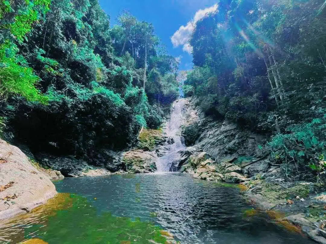
1. Bang Lang National Park covers areas in Bannang Sata, Than To, and Betong districts. The park has an area of 163,125 rai and was declared a national park on 24 February 1999. Part of its landscape connects with the Hala-Bala wildlife area, creating one of the most important rainforest zones in Southern Thailand. The park is dominated by tropical rainforest, watershed forest, rivers, streams, waterfalls, and mountain terrain. It supports rare wildlife and rich plant diversity, including hornbills and many forest species. For travelers, Bang Lang National Park is a strong starting point for understanding Yala as a province of forests rather than beaches. Nearby natural attractions in the wider route include Bang Lang Dam, Than To Waterfall, Hala Sa Waterfall, and La-ong Rung Waterfall.
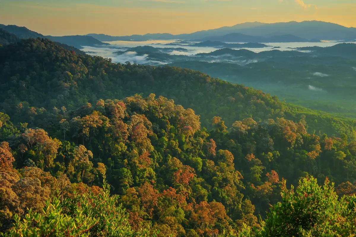
2. Hala-Bala Wildlife Sanctuary / Southern Phra Namma Phithai Forest Park is one of the most important rainforest landscapes in the far South. The forest stretches across the borderland of Yala and Narathiwat and forms an ecological corridor of mountains, streams, trees, birds, and wildlife. This area is closely associated with hornbills, deep forest biodiversity, watershed protection, and the traditional knowledge of indigenous forest communities. Visitors who want to study nature should plan ahead and follow official permission procedures, especially for deeper forest routes. For most travelers, the best way to experience the Hala-Bala atmosphere is through viewpoints, reservoir routes, forest-edge communities, and guided local trips that respect conservation rules.
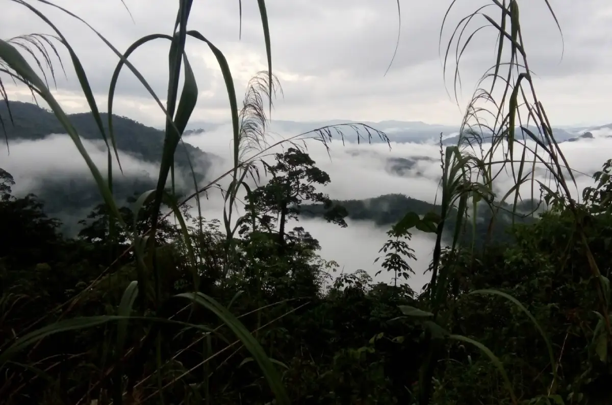
3. Khao Pok Yo is a high mountain in Bannang Sata District and is widely known as one of the highest mountains in Thailand’s southern border region. Rising about 1,095 meters above sea level, the mountain offers cool air, wide views, forest scenery, and a chance to see sea mist when weather conditions are right. The atmosphere is quiet and natural, making it suitable for travelers who enjoy highland viewpoints and less-commercialized routes. Because the terrain is mountainous, visitors should prepare suitable footwear, check local route conditions, and allow enough time for travel.
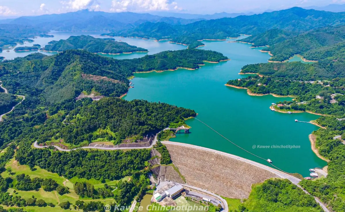
4. Than To Lake is part of the reservoir landscape created by the Bang Lang Dam. The water area extends through Than To District and connects with the wider forested terrain toward Narathiwat. It is known for calm water, surrounding hills, freshwater fish, and nature-based travel. The lake is suitable for slow sightseeing, photography, local boat experiences, and learning how dams and forest watersheds shape life in inland Yala. This is a good stop for visitors moving between Bannang Sata, Than To, Bang Lang Dam, and the road to Betong.
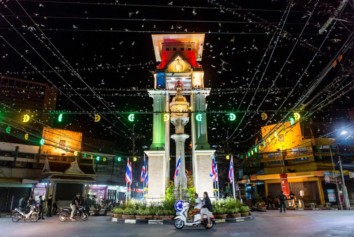
5. Swiftlets in Betong are part of the evening atmosphere in the town center. Around dusk, large numbers of swiftlets can often be seen flying above the buildings and gathering along wires and rooftops, especially near the clock tower area. The sight has become one of Betong’s memorable urban scenes. The birds are associated with seasonal movement and are usually seen in greater numbers from around September to March. For travelers staying overnight in Betong, walking around the clock tower and old town area in the evening is a simple way to experience this local identity.
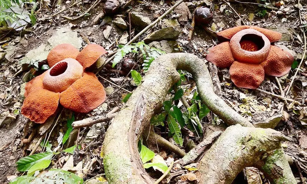
6. Bua Phut Site is a natural area where the rare giant flower known locally as bua phut appears on the Kalo mountain range. The nearest viewing point is about 2 kilometers from the main road, and access depends on the blooming season and local conditions. The route is not only about seeing the flower itself but also about walking through a community forest with diverse plants and natural surroundings. Visitors should treat the area carefully, avoid touching or damaging the plants, and follow local guidance because bua phut is a sensitive natural attraction that can be seen only at certain times.
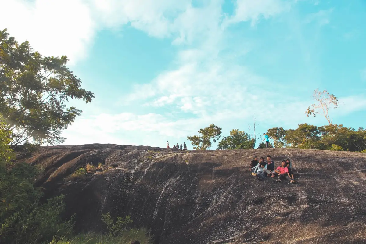
7. Hua Lan Mountain is a distinctive rocky mountain in Ban Siyoh, Ba-ngoi Sinae Subdistrict, Yaha District. The mountain is known for its unusual bald-rock appearance, open summit landscape, and broad views over communities, hills, and the surrounding countryside. It is a popular local sunset viewpoint because the warm evening light makes the rock surface and horizon especially photogenic. During the daytime, the area can be hot and exposed because there are few large shade trees. Travelers should bring drinking water, wear proper shoes, and visit during cooler hours for the best experience.
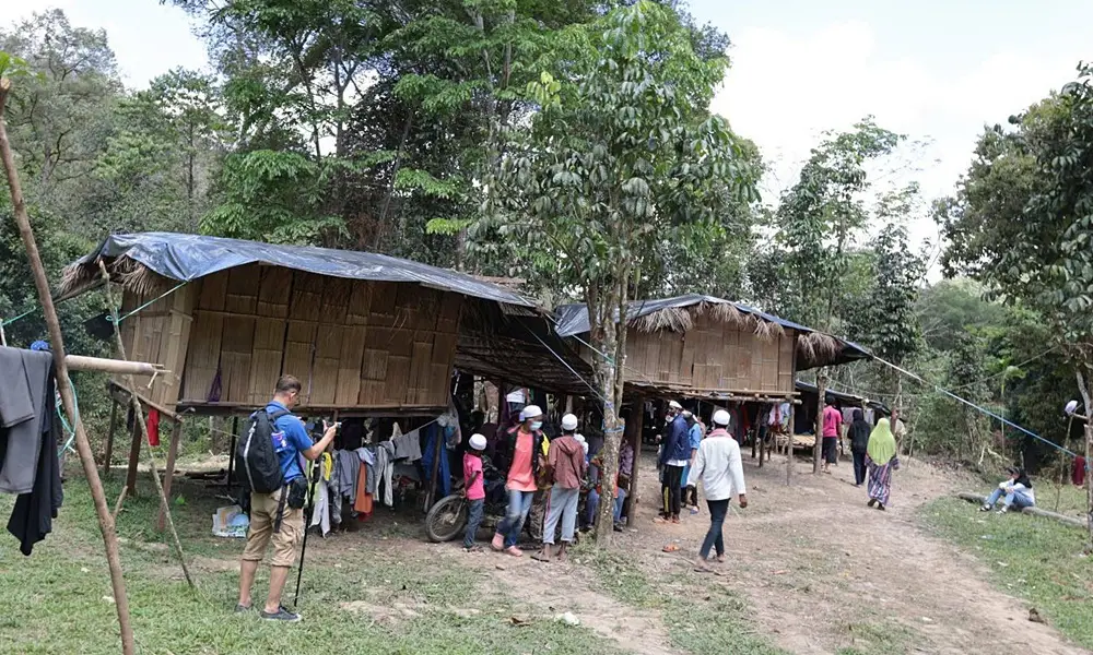
8. Sakai Village in Ban Rae Subdistrict, Than To District, is associated with the indigenous forest people historically known in Thai as Sakai. The village reflects a way of life once closely tied to forest gathering, herbal knowledge, bamboo shelters, and hunting skills such as blowpipe use. Later development brought the community into a more settled village setting, with livelihood support such as rubber plantations. The name “Sri Than To” was granted as a family name through royal benevolence. Today, the village is valuable as a cultural learning destination, but visitors should approach it respectfully, avoiding intrusive photography and treating local people as hosts rather than exhibits.
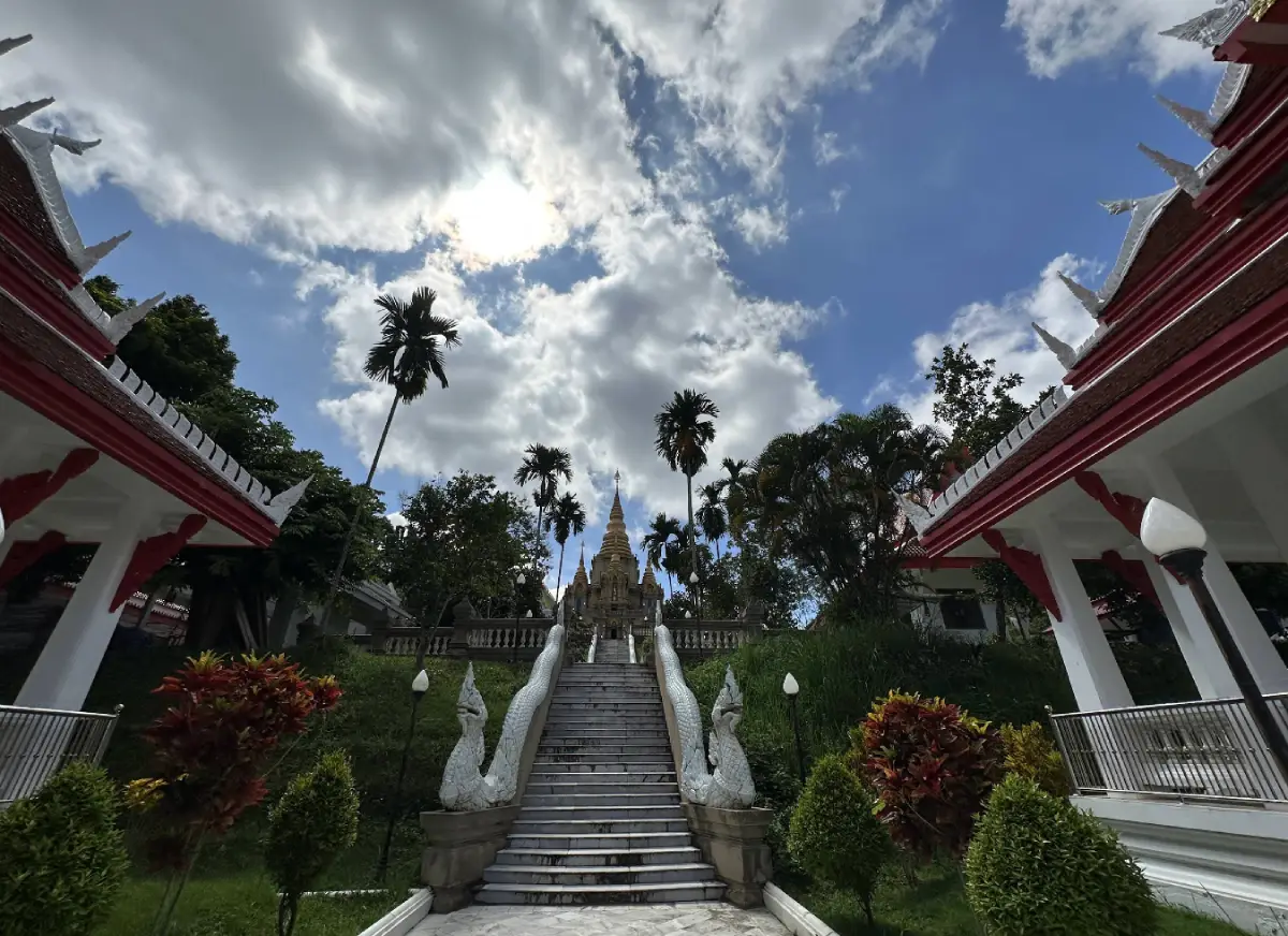
9. Reclining Buddha at Wat Khuhaphimuk (Wat Na Tham) is one of the major Buddhist sacred sites of Southern Thailand. Located in Na Tham Subdistrict, about 8 kilometers from Yala city on the route to Yaha, the temple is set around a limestone cave with a stream, trees, a staircase, guardian figures, and a spacious cavern adapted as a religious site. Inside the cave is a large reclining Buddha image believed to date back to the Srivijaya period. The image measures 81 feet and 1 inch in length. The cave opening allows sunlight to enter at certain angles, creating a quiet and atmospheric setting for worship, photography, and cultural learning.
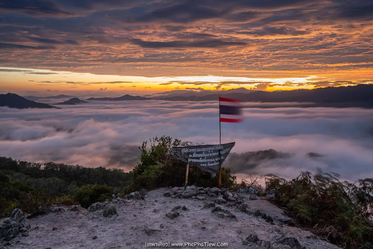
10. Gunung Silipat Sea of Mist is one of Betong’s most striking mist viewpoints. The viewpoint is surrounded by mountains and forest, and the sea mist appears beautifully when weather conditions are suitable. The climb can be steep and physically demanding in some sections, with ropes installed along parts of the route to help visitors ascend and descend. Some travelers choose to camp near the viewpoint to wait for sunrise. This place suits active travelers who want a more adventurous mist-viewing experience than a standard roadside viewpoint. Proper shoes, a flashlight for early-morning travel, and local guidance are recommended.
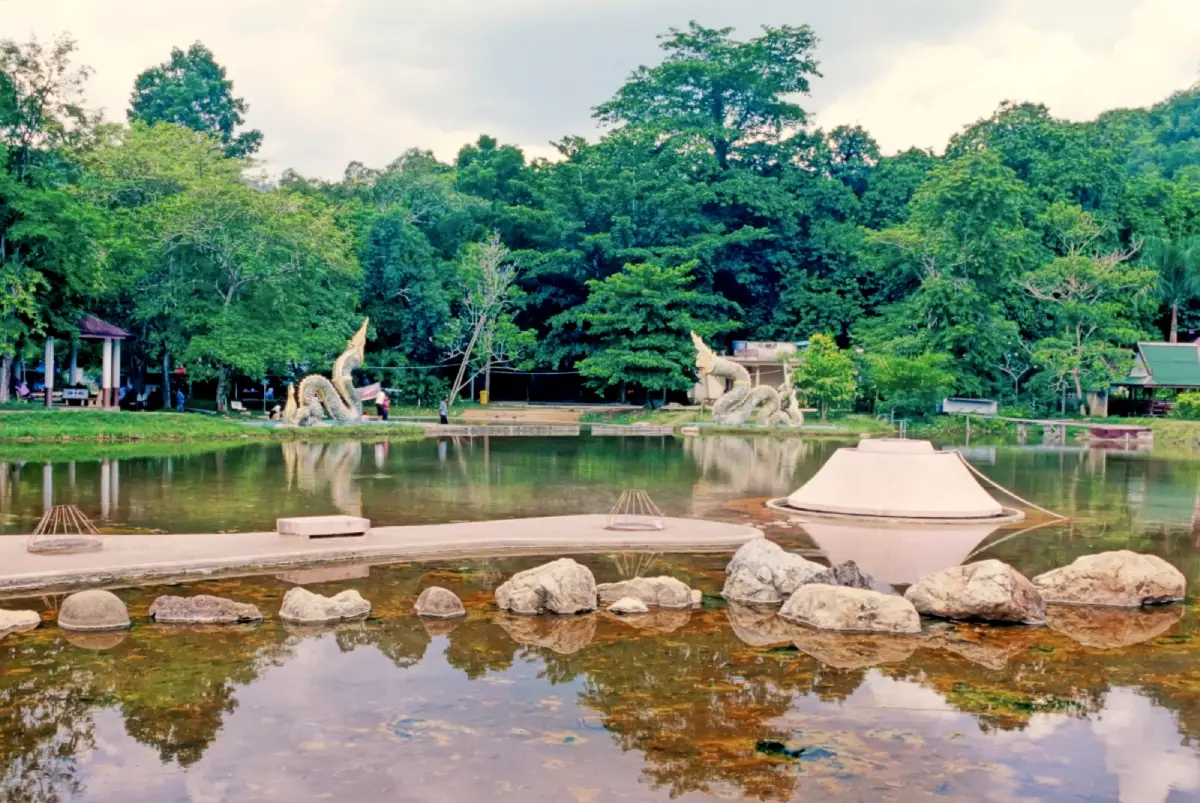
11. Betong Hot Spring is a natural geothermal attraction in Ban Charo Parai, Tano Maero Subdistrict, near the route into Betong. The hot spring is famous for boiling mineral water that can cook eggs in about 7 minutes at the hottest point. The surrounding area has facilities for soaking and bathing in mineral water, and many visitors come to relax after long drives or mountain trips. The hot spring is often combined with Piyamit Tunnel, Inthason Waterfall, Suan Muen Buppha, and other attractions around Betong. It is a good stop for families, older travelers, and anyone who prefers a slower activity between sightseeing points.
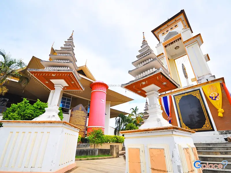
12. Thailand’s Largest Mailbox is one of Betong’s most photographed landmarks. The original large mailbox stands near the clock tower intersection in the heart of Betong and was built in 1924 before the Second World War. Its first purpose was not only postal service but also public communication, as a radio speaker was installed in the upper part to broadcast news to residents. A newer and larger mailbox was later built near the municipal hall area on Suk Yang Road, reaching about 9 meters in height. Both the story and scale of the mailbox make it a playful symbol of Betong’s old-town identity.
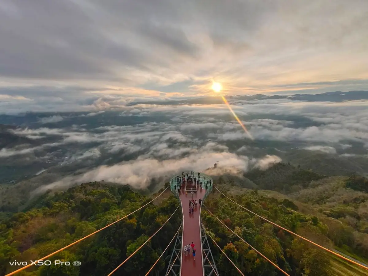
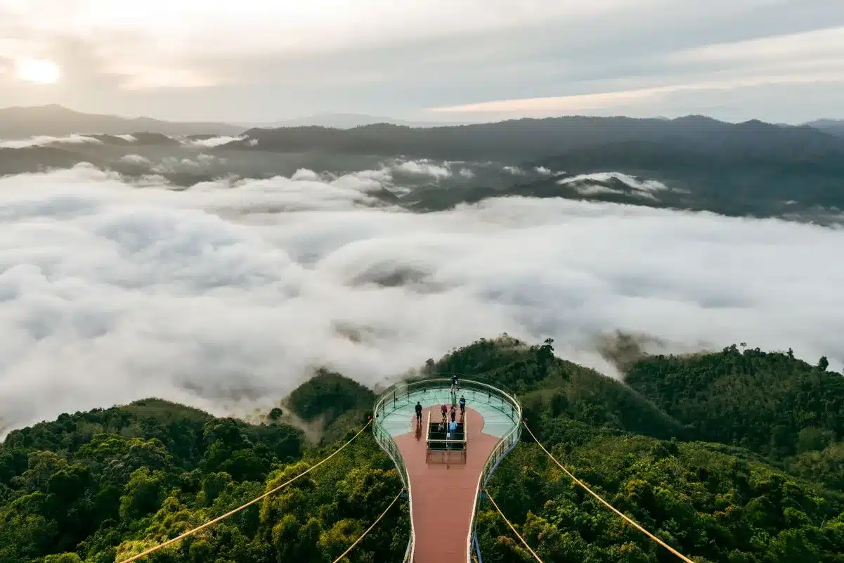
13. Aiyerweng Skywalk and Sea of Mist is one of the most famous attractions in Yala. Located in Aiyerweng, Betong District, the skywalk sits high above the surrounding mountain landscape and offers panoramic views of forested valleys, sunrise, and morning mist. Its transparent glass walkway extends 61 meters, giving visitors a dramatic view down to the ground below. The best time to visit is early morning, when mist often gathers across the valley and the sunrise gradually reveals layers of mountains. This is a key highlight for first-time travelers to Betong and is often placed at the center of a 2-day or 3-day Yala itinerary.
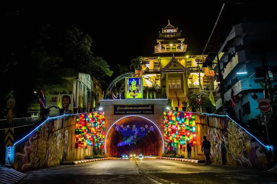
14. Betong Mongkhonrit Tunnel is a vehicle tunnel through a hill in Betong and is often introduced as Thailand’s first mountain road tunnel for cars. At night, the tunnel area is decorated with lights, making it a popular photography spot and city landmark. The tunnel is more than a transport route; it represents Betong’s development as a town surrounded by mountains and narrow roads. Travelers usually combine it with the Betong clock tower, Thailand’s largest mailbox, Betong old town, local restaurants, and nearby city viewpoints.
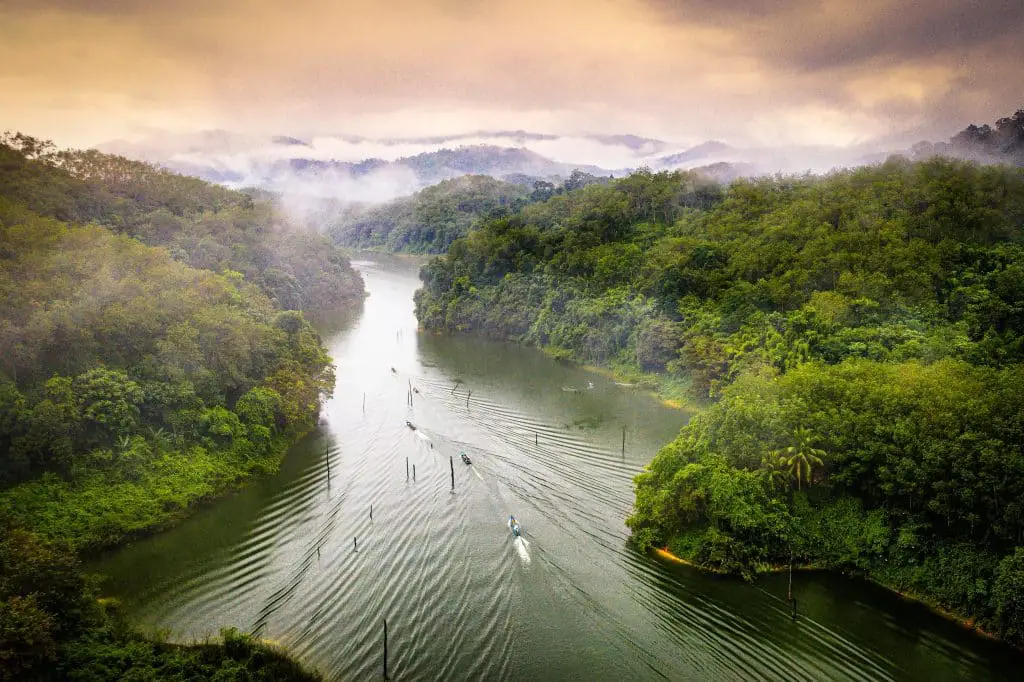
15. Khao Bue Yo Viewpoint is located around the Channel 5 television station area at Ban Bannang Buyo, Moo 2, Bannang Sareng Subdistrict, Mueang Yala District. It is a natural viewpoint close to Yala city and is suitable for travelers who want to see the urban landscape, green hills, forest patches, and surrounding districts from above. Khao Bue Yo is part of the mountain terrain linking Bannang Sareng, Krong Pinang, and nearby areas. The viewpoint helps visitors understand how Yala city sits within a wider landscape of hills, rivers, communities, and forested ridges.
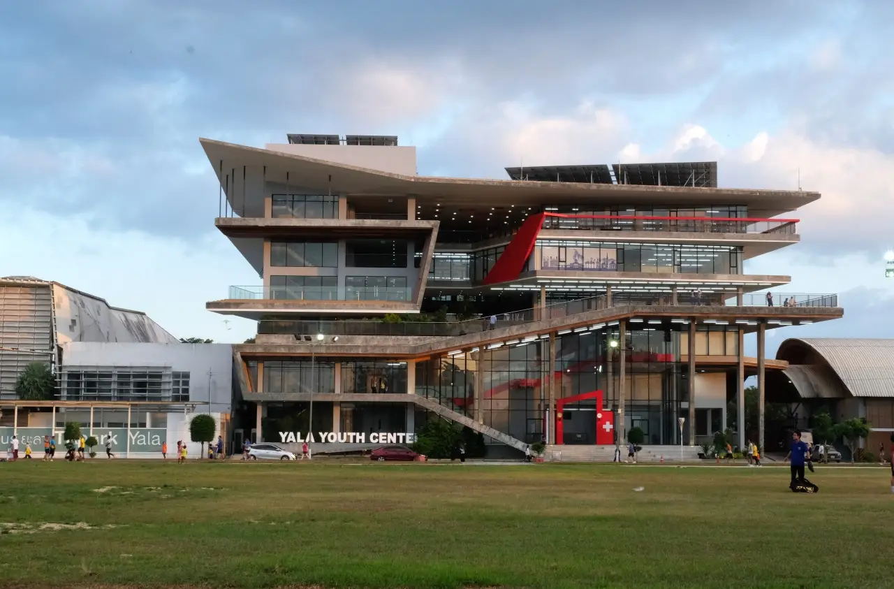
16. Yala Learning Park is located on Suk Yang Road in Mueang Yala District. It was established as a public learning space and became one of the first regional learning parks outside Bangkok’s TK Park model. The building offers a modern and lively atmosphere for children, youth, families, and readers. Its zones include a living library, local books, information resources, internet spaces, a coffee corner, and a prayer room. The park is especially useful for understanding the creative side of Yala city, where education, design, reading culture, and youth activities come together in a contemporary public space.
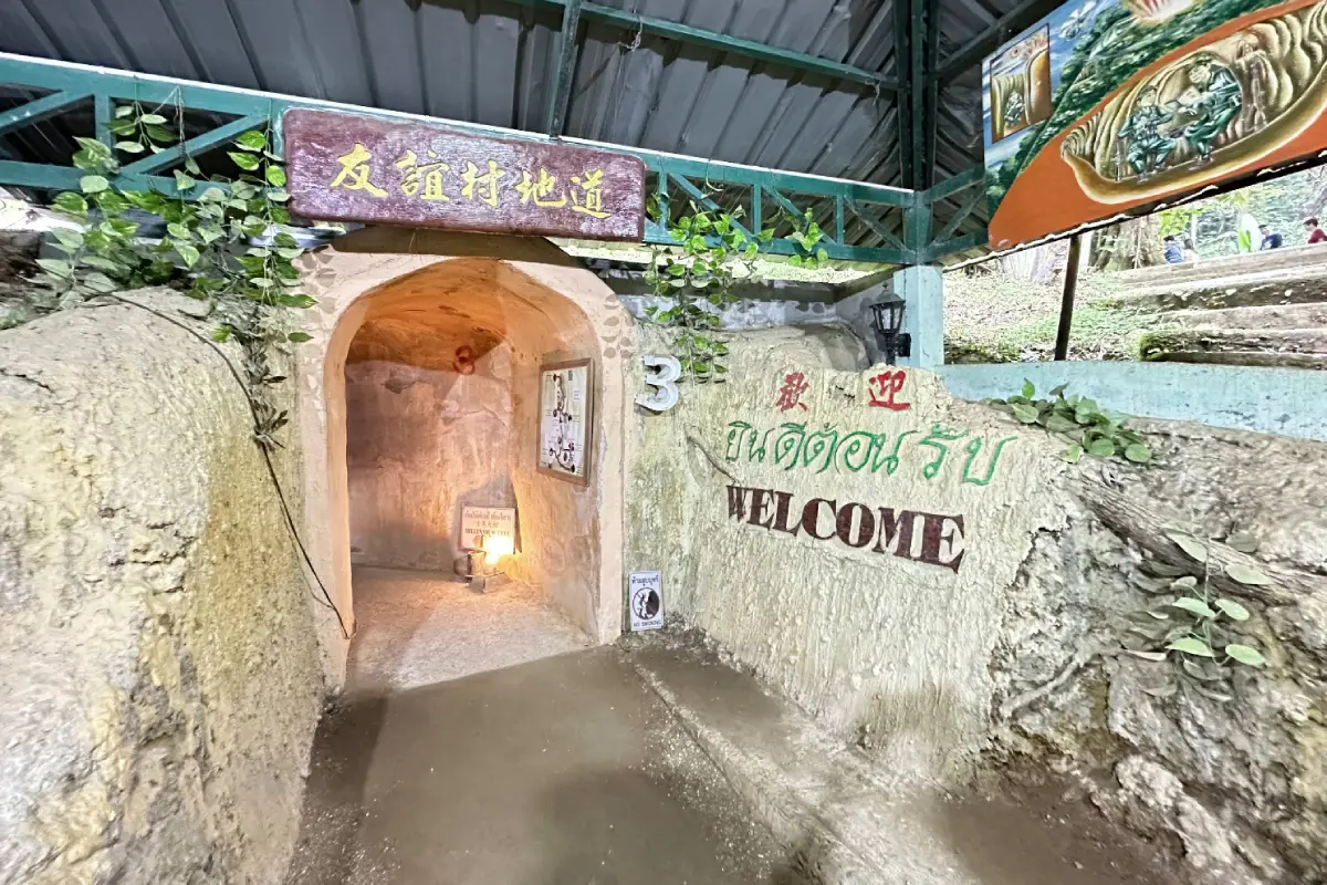
17. Piyamit Tunnel was once a stronghold of the Communist Party of Malaya, Zone 2. The tunnel was built in 1976 and extends for about 1 kilometer through the mountain. It was dug in approximately 3 months and designed with several entrances and exits for shelter, supplies, and wartime movement. Today, the area has historical exhibitions showing photographs, tools, living conditions, and stories of life in the forest. Located at Ban Piyamit 1 in Tano Maero Subdistrict, it is on the same route as Betong Hot Spring and Inthason Waterfall. Piyamit Tunnel is one of the most important historical attractions in Betong.
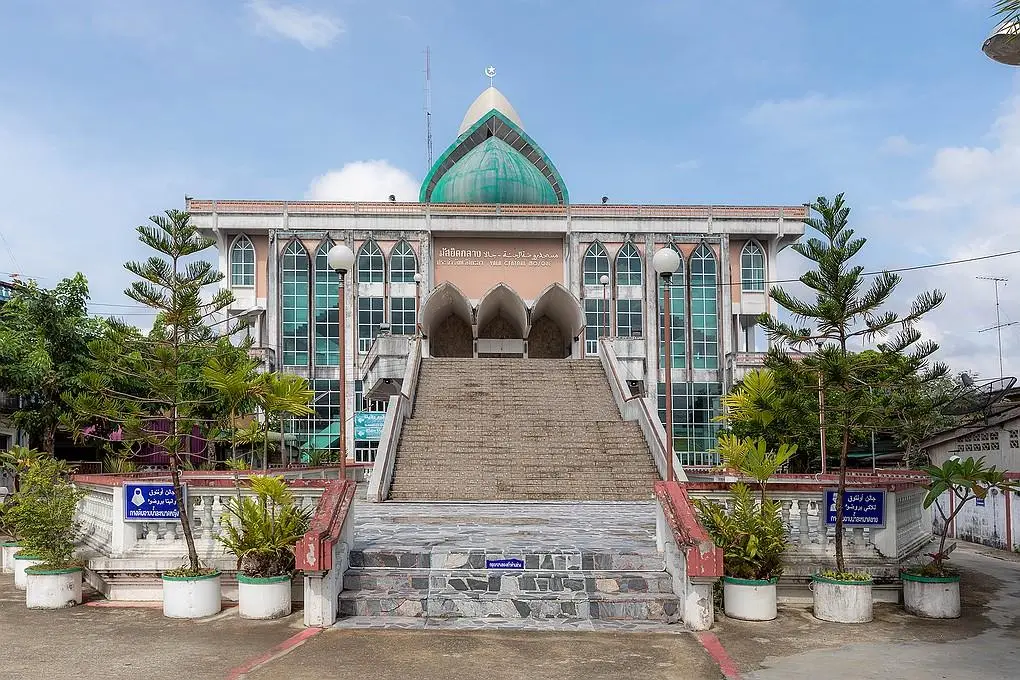
18. Yala Central Mosque, also known as Raudhatul Jannah Mosque, is the main mosque of Yala Province. It is located at 835 Siroros Road, Ban Talat Kao, Sateng Subdistrict, Mueang Yala District. The mosque is significant for religion, architecture, history, and community life. Its large building features a broad front staircase, elevated forecourt, central dome, prominent minaret, and architectural lines that blend Western-style building elements with Islamic forms. For visitors, Yala Central Mosque represents the identity of Yala as a multicultural southern border city. Non-Muslim visitors should dress modestly, behave quietly, and respect prayer times and religious spaces.
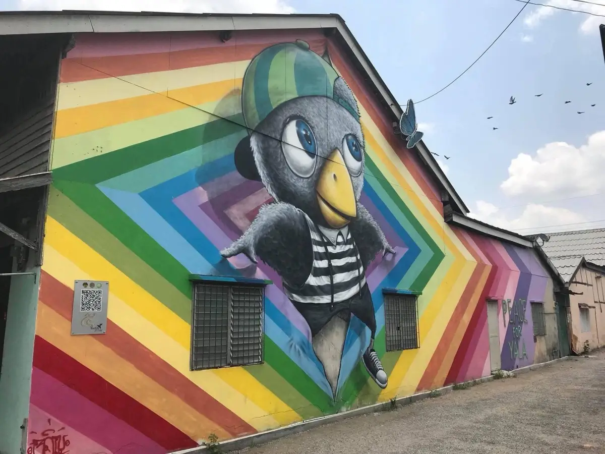
19. Yala Street Art is located around Prachanukul and Nuan Sakul roads in Mueang Yala District. The murals use birds and local symbols of Yala as visual inspiration, including references to the province’s bird-raising culture and famous singing birds. Artists from different parts of Thailand have contributed works in colorful and playful styles. The area is popular for photography, city walks, and short stops between Yala’s public park, mosque, shrine, and market routes. It adds a younger, creative layer to the image of Yala city and makes the old streets feel more approachable for travelers.
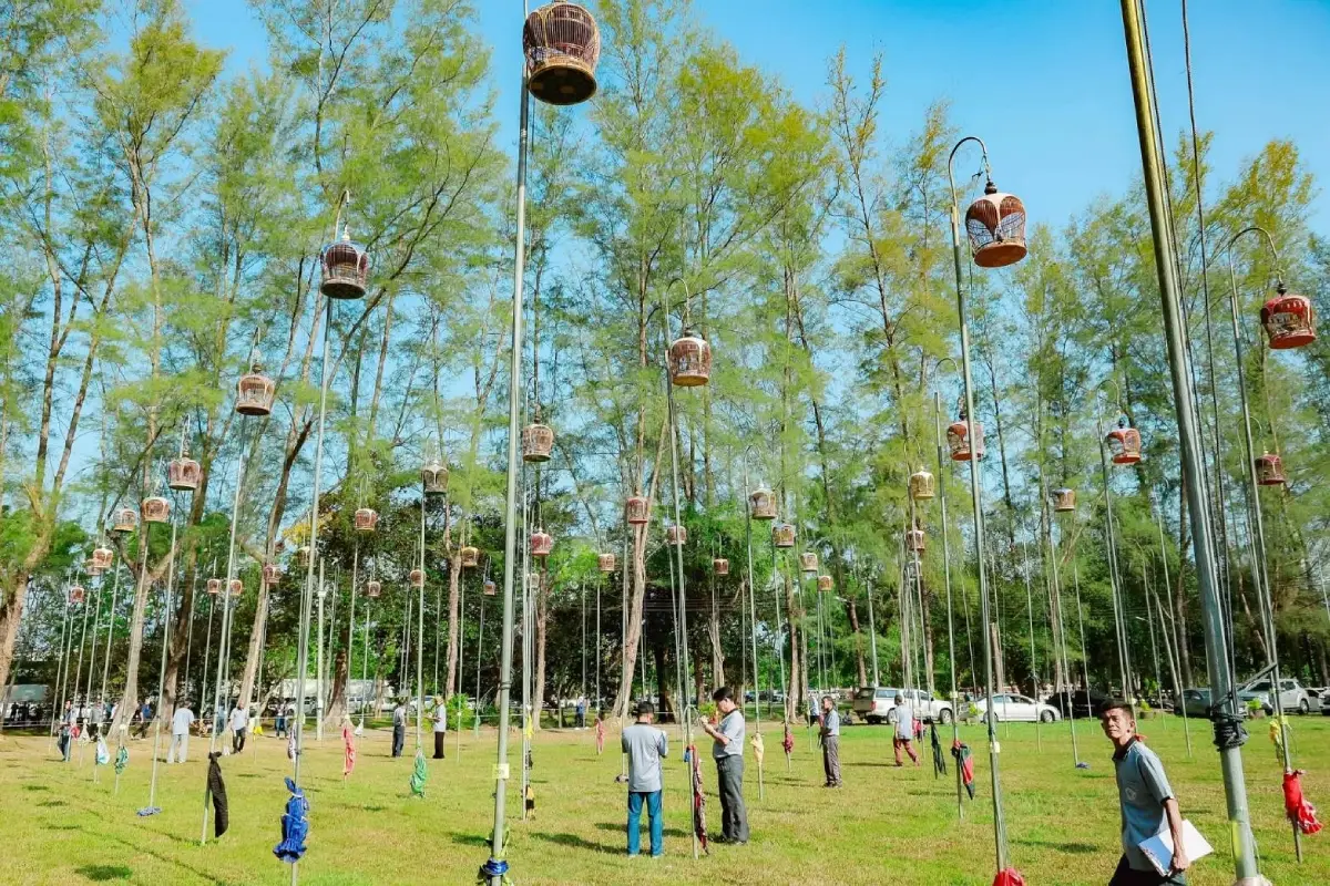
20. ASEAN Zebra Dove Singing Contest reflects a long-standing cultural passion in Southern Thailand and neighboring countries. Thai people have kept and appreciated zebra doves for generations, and bird-singing contests are linked with leisure, skill, listening culture, community gatherings, and cross-border relationships. In the southern border provinces, the culture of zebra dove singing has long connected local people with participants from Malaysia, Indonesia, Singapore, and other nearby areas. The contest is not just a competition; it is a cultural event that shows Yala’s role as a meeting point of regional traditions.
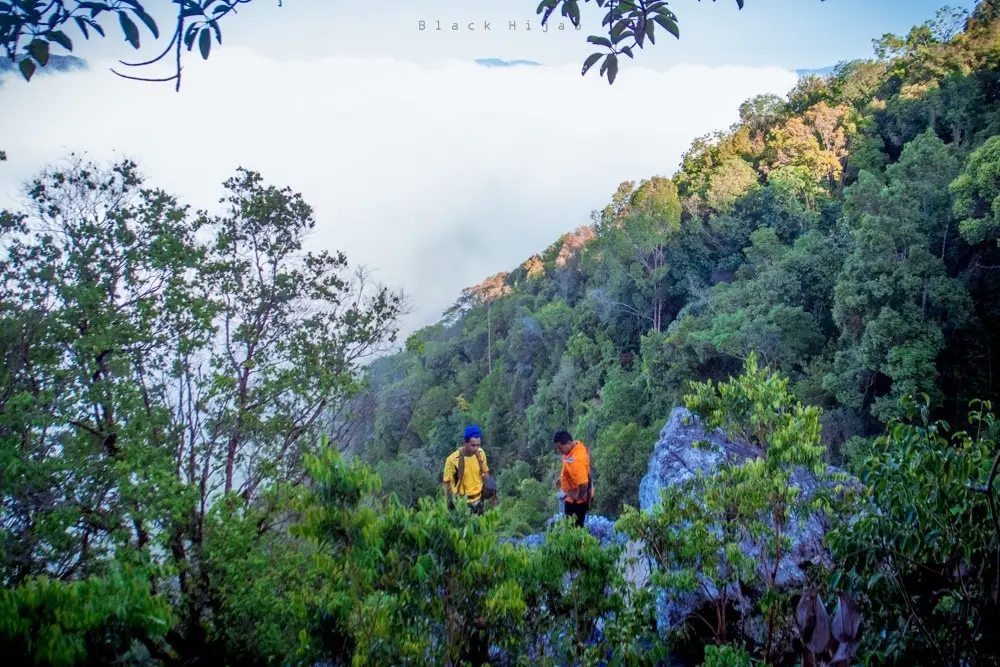
21. Hala-Bala Forest in Aiyerweng Subdistrict, Betong District, is part of the larger forest complex spanning Yala and Narathiwat. Covering about 270,725 rai, the area is made up of steep mountains, deep rainforest, watersheds, and wildlife habitats. It is especially known for hornbills, with more than 10 species associated with the forest. Other notable wildlife includes gaur, elephants, wild boar, serow, tapir, Sumatran rhinoceros in historical accounts, and siamang. The forest is sometimes called the “Amazon of Asia” because of its richness and density. Boat trips and forest-edge routes allow visitors to appreciate the scenery while keeping conservation in mind.
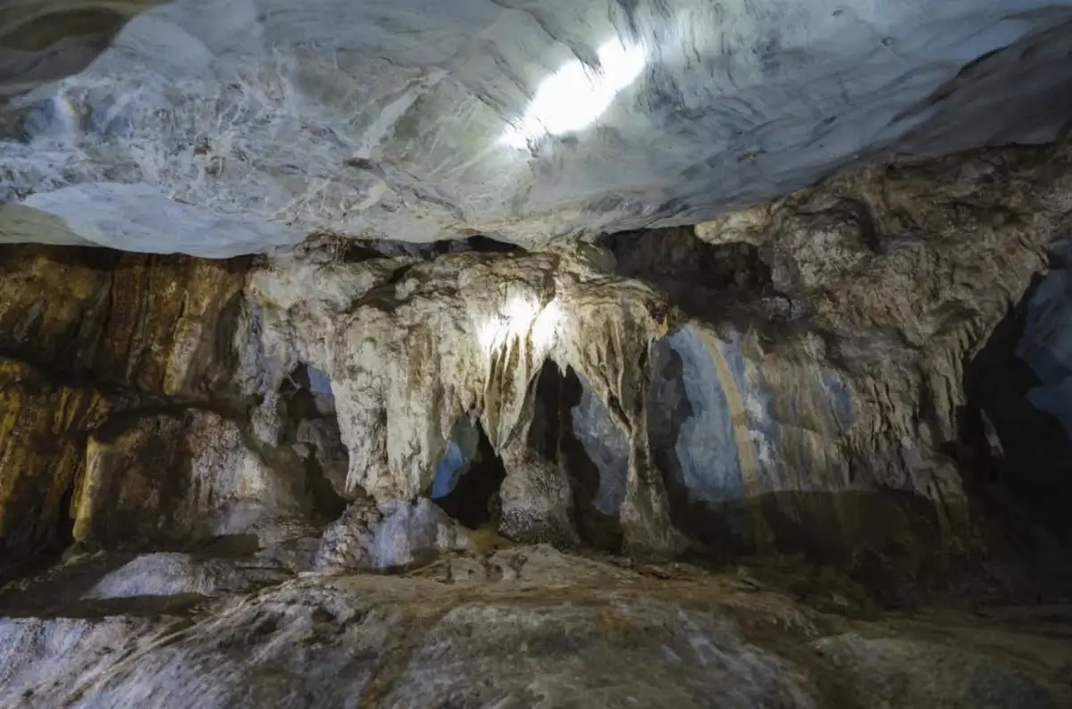
22. Batu Kho Cave is a natural cave and local historical learning site in Huai Krathing Subdistrict, Krong Pinang District. Located at Moo 4, Ban Khuan Langa, the cave is a limestone formation with stalactites, stalagmites, a stream flowing through the interior, blind fish known locally as phaya kong, and rare plants around the area. Batu Kho Cave is valuable not only for its cave landscape but also for its ecosystem and community stories. It suits travelers who enjoy quiet natural places, geology, cave environments, and local routes outside the better-known Betong circuit.
23. Yala Learning Park / TK Park Yala is a public learning center inside the Yala Municipality Youth Center on Suk Yang Road, Sateng Subdistrict, Mueang Yala District. It serves children, youth, families, students, and general visitors by offering books, creative activities, technology, and shared learning spaces. More than a conventional library, it works as a “living library” where reading, discussion, workshops, and community activities take place in a modern setting. For travelers interested in the everyday life of Yala city, this place shows how the province invests in education, creativity, and public space.
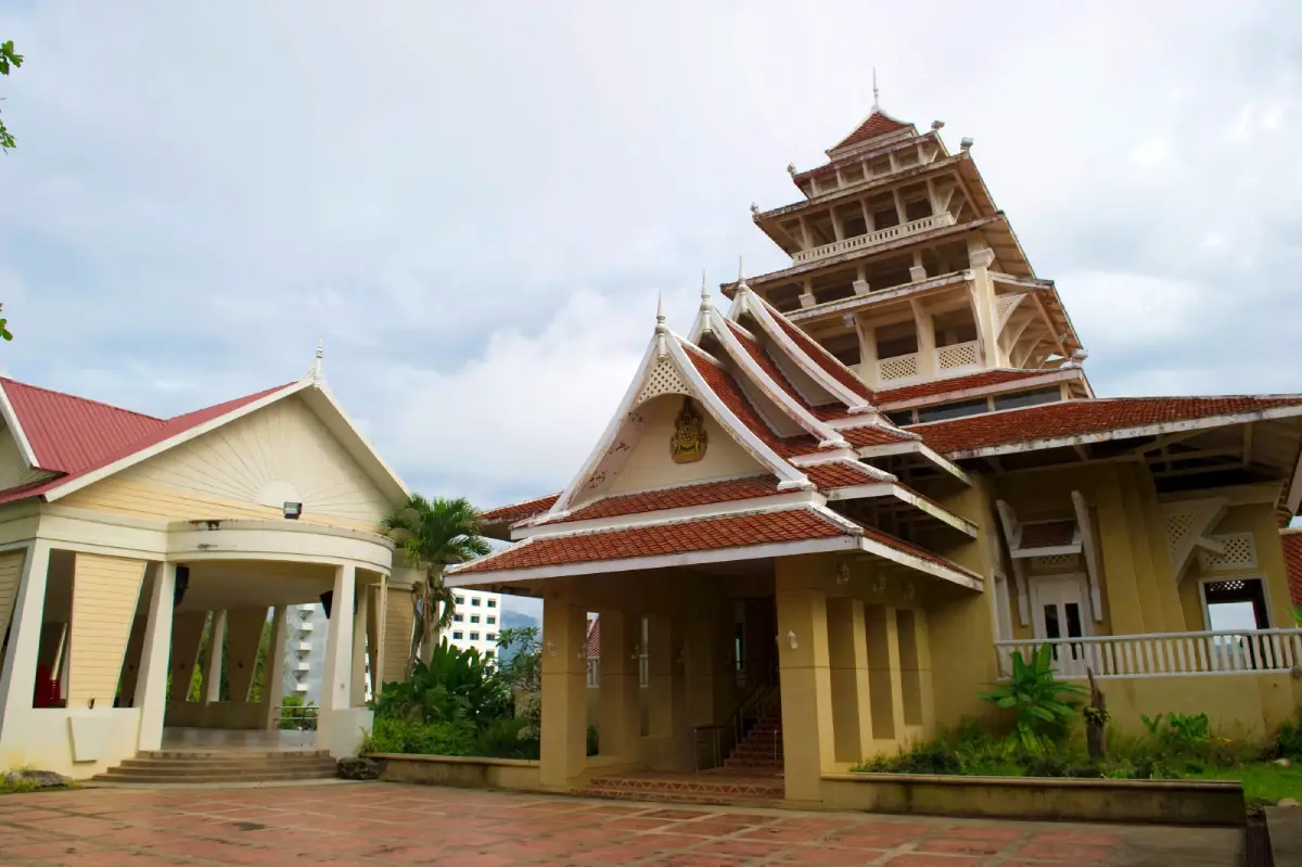
24. Betong City Museum was established in 2005 to preserve the cultural heritage, environment, and local memories of Betong. The museum displays antiques, old tools, household items, photographs, and stories connected with the town’s history. It helps visitors understand Betong beyond its scenic viewpoints by showing how the town developed as a border community with Thai, Chinese, Malay, and local influences. The upper level also offers a viewpoint over Betong town, making the museum useful for both cultural learning and photography. It is a good stop before or after walking around Betong’s old streets.
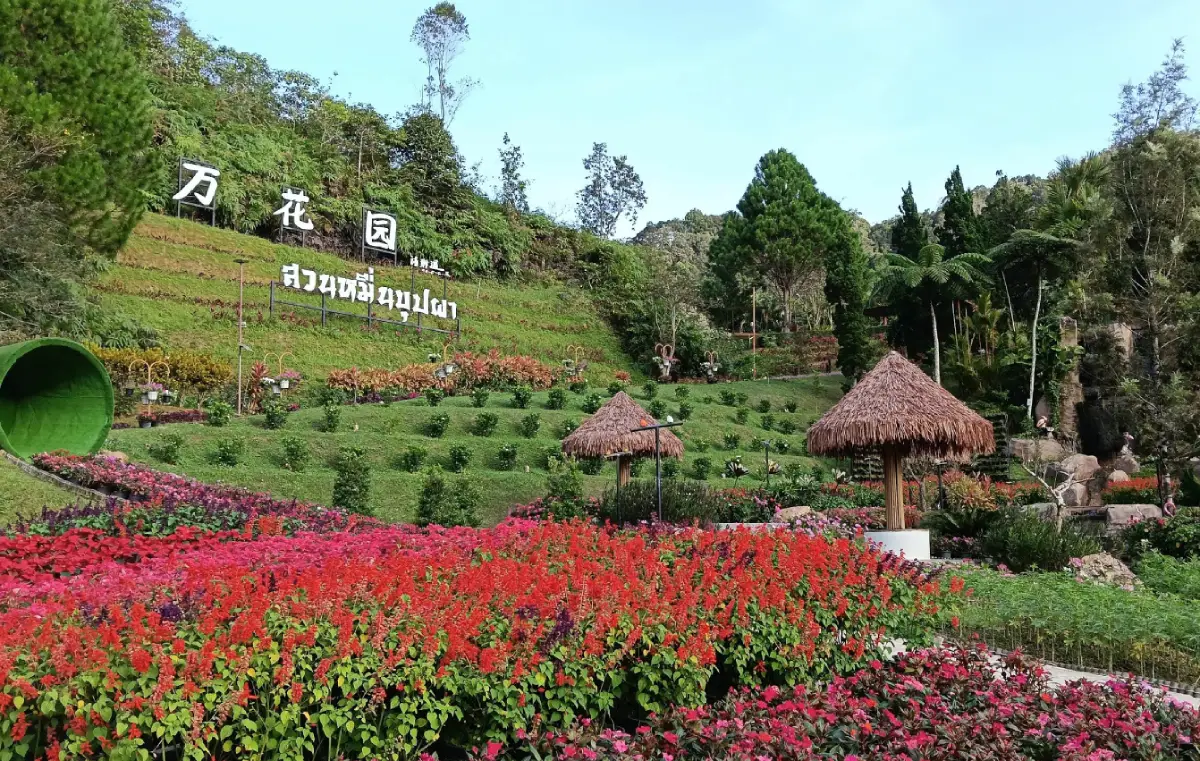
25. Suan Muen Buppha Winter Flower Garden is a cool-climate flower garden in Betong developed under a royal initiative. The garden is known for temperate flowers, landscaped beds, cool air, mountain surroundings, and a slower atmosphere that contrasts with the hotter lowland areas of the South. Visitors can walk through the garden, take photos, enjoy the fresh air, and include the stop in a route with Betong Hot Spring, Piyamit Tunnel, and nearby waterfalls. It is suitable for families, couples, and travelers who want a gentle nature stop without difficult walking.
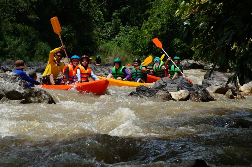
26. Aiyerweng Rafting is an adventure activity on the upper Pattani River in the Aiyerweng area. Visitors can choose rafting experiences by rubber boat or tubing, depending on local service conditions and water levels. The route passes natural bends, rocky sections, forest scenery, and clear flowing water. Operators provide safety equipment and staff support, making the activity accessible to visitors who want soft adventure in Yala’s mountain landscape. Homestays in the area also allow travelers to stay closer to the community and combine rafting with mist viewpoints, local food, and forest routes.
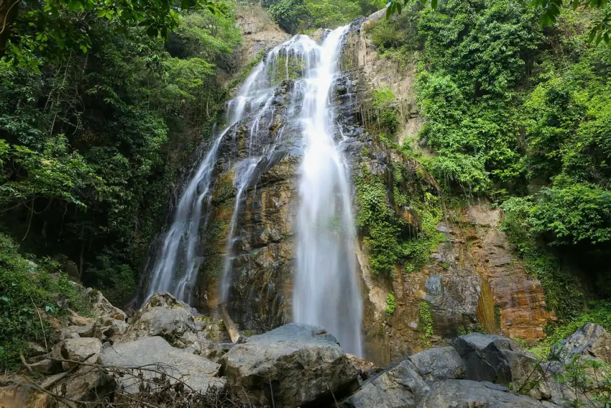
27. Chaloem Phra Kiat Rama IX Waterfall is located in Aiyerweng Subdistrict, Betong District. It is surrounded by forest and diverse plant life, with water dropping through a green and shaded natural setting. The waterfall is about 30 meters high and offers a cool, peaceful atmosphere for relaxation. It is suitable for visitors who enjoy nature photography, gentle walking, and quiet forest scenery. The waterfall can be included in a Betong-Aiyerweng route together with Aiyerweng Skywalk, Hala-Bala Forest, Piyamit Tunnel, and Betong Hot Spring.
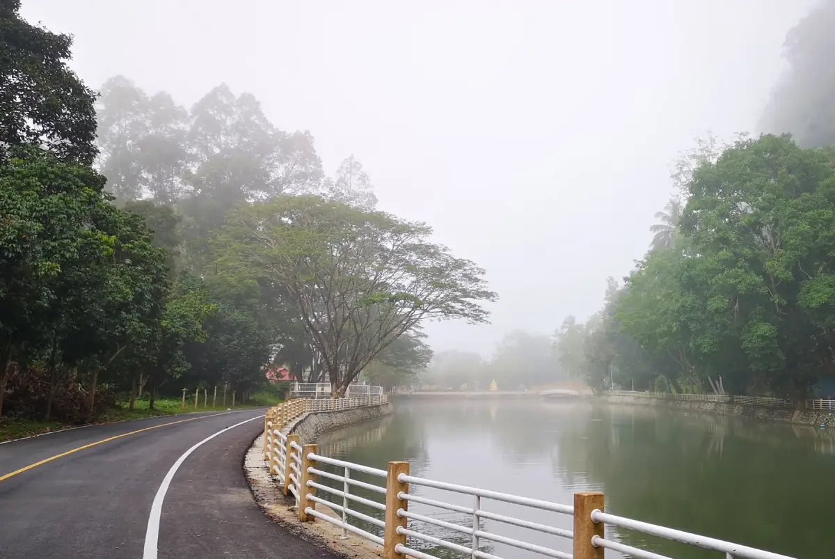
28. Khao Na Tham Foothill Viewpoint is a newer check-in point near Yala city in Na Tham Subdistrict, Mueang Yala District. The area features scenery along the canal and the foothills near the limestone cave landscape. Local residents and the community have prepared recreational activities such as pedal boats, rowing boats, water bicycles, shared bicycles, and a small tourist train route along the canal-side road. The attraction works well for families and visitors who want an easy outdoor stop close to the city, especially when combined with Wat Khuhaphimuk and the Na Tham cave area.
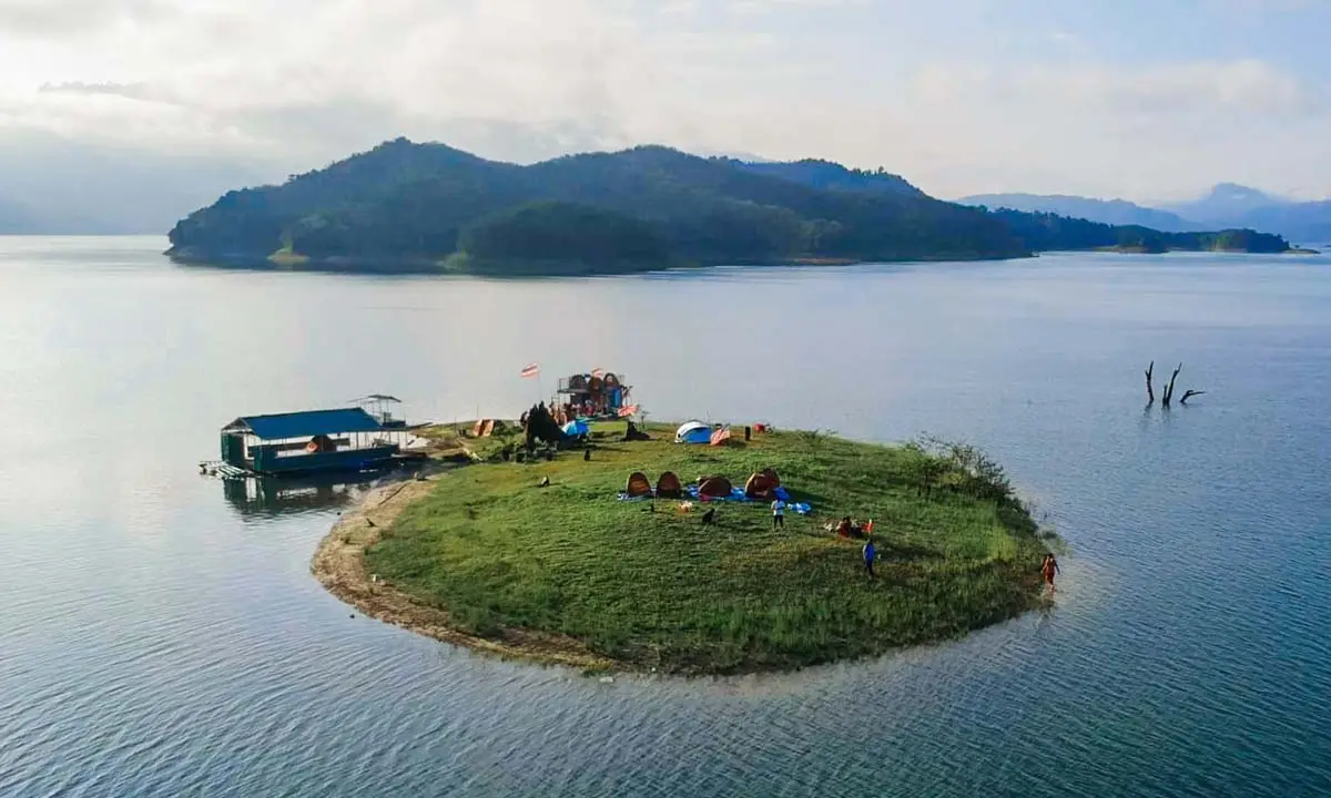
29. Popcorn Island is an island in the Hala-Bala lake landscape. In the past, local villagers came to the island to grow corn, which later inspired the memorable nickname “Popcorn Island.” The area is known for a quiet, open, and natural atmosphere surrounded by water and forested hills. Some visitors come for camping, photography, boating, and simple nature experiences. The charm of Popcorn Island is its informal local character: it feels less like a commercial tourist site and more like a hidden rest point in Yala’s reservoir and forest route.
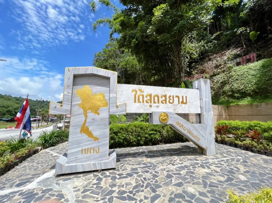
30. Southernmost Point of Siam Sign is a landmark in Betong District marking the boundary area between Thailand and Malaysia. The sign is one of the classic photo stops for travelers reaching the far southern end of Thailand. It gives visitors a clear sense of Betong’s border-town identity and its connection with Malaysia. Many travelers include this stop when exploring Betong old town, local restaurants, tunnels, hot springs, and the wider southern border route. The site is simple, but it has symbolic value as a marker of how far south one has traveled in Thailand.
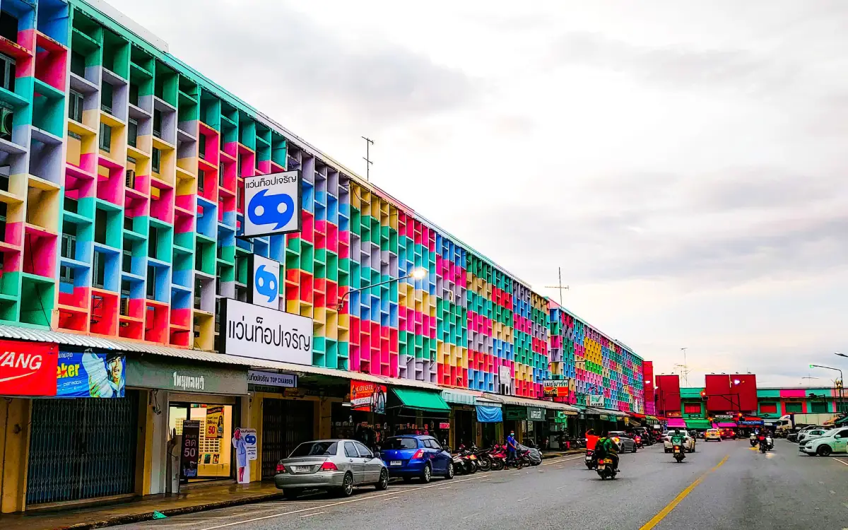
31. Rainbow Building is a colorful landmark near the front of Yala Railway Station. Its bright exterior brings a lively visual identity to the city and has become associated with public activities and festive events, including New Year merit-making traditions. The concept of adding color to urban buildings reflects a broader effort to present the southern border cities in a more vibrant and welcoming way. For travelers arriving by train, the Rainbow Building is an easy first photo stop and a useful gateway into Yala’s city-center route.
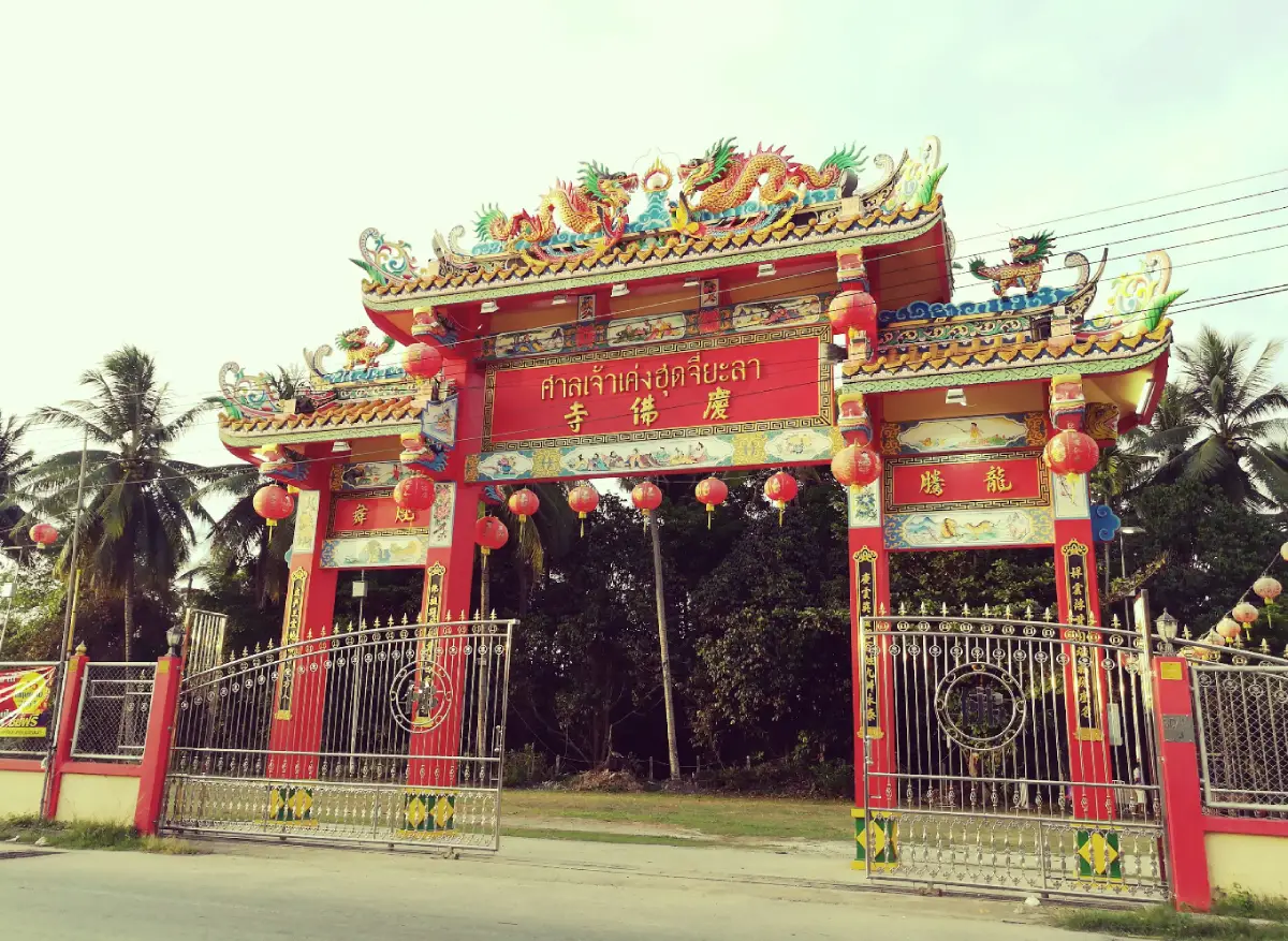
32. Keng Hud Chee Shrine, also known locally as Wat Heng Jia, is an important Chinese shrine in Sateng Nok Subdistrict, Mueang Yala District. It serves as a spiritual center for Thai-Chinese communities in the southern border region. Visitors can pay respect to Tai Sia Hud Jow and other deities, observe Chinese religious architecture, and experience the atmosphere of a long-established urban shrine. The shrine is also associated with the annual fire-walking procession held in April. This attraction helps complete the picture of Yala’s multicultural identity, alongside temples, mosques, markets, and local neighborhoods.
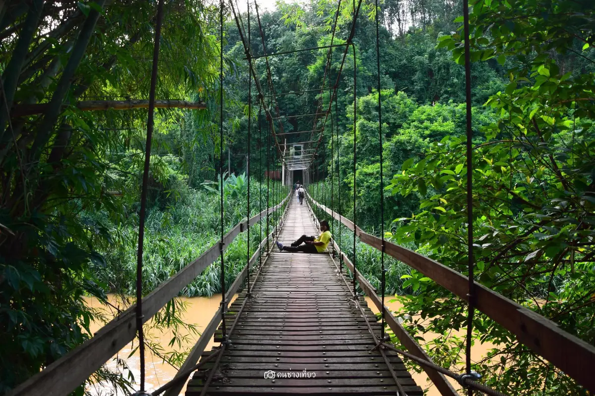
33. Tae Pu Su Bridge is a wooden suspension bridge supported by steel cables and used mainly for motorcycles and pedestrians. It is about 1.8 meters wide and more than 100 meters long, crossing the Pattani River. The bridge is a local landmark because of its simple structure, community function, and photogenic setting over the river. Travelers often stop here for photographs and to observe everyday movement between communities. It is best visited with care, avoiding overcrowding and respecting local traffic across the bridge.
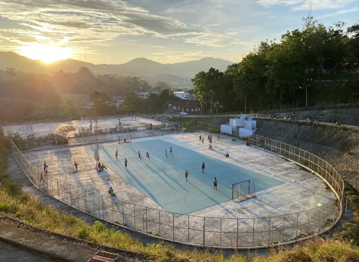
34. Betong Stadium is a large sports and recreation area set among the hills of Betong. Covering more than 120 rai, the stadium area includes sports facilities, health park spaces, and viewpoints over the town and surrounding mountains. Local residents use it for exercise, walking, and recreation, while travelers can visit for a quieter look at daily life in Betong. It is not a conventional tourist attraction, but it adds another angle to the town: a mountain community where public space, health, scenery, and local routines come together.
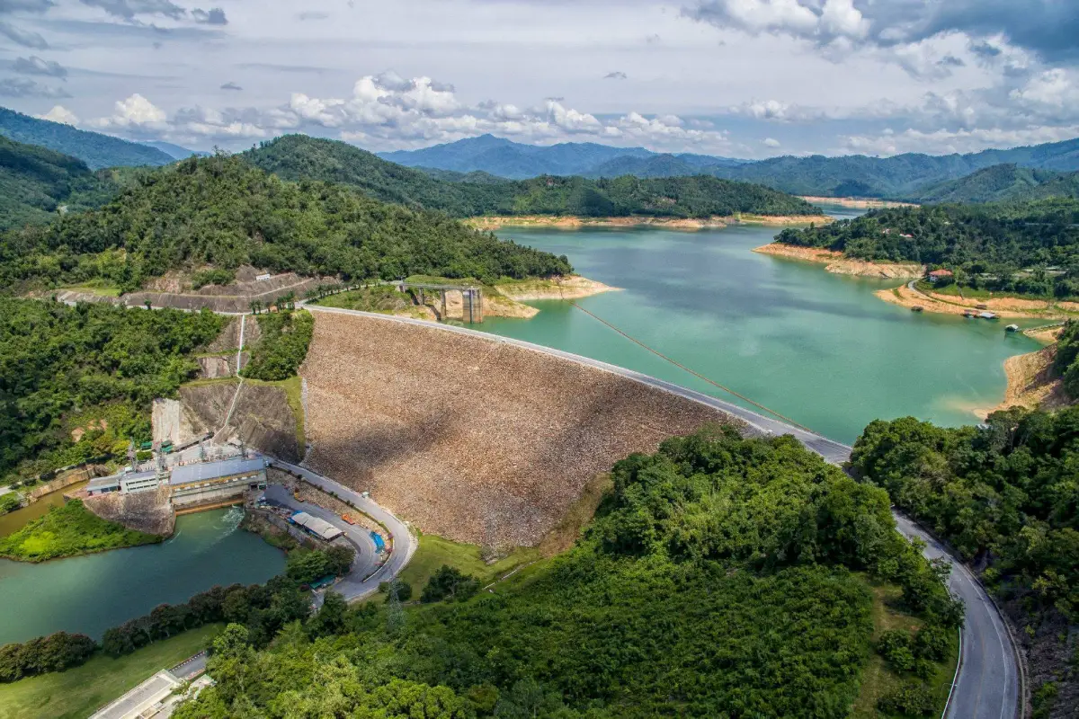
35. Bang Lang Dam is the first multipurpose dam in Southern Thailand. Located at Ban Bang Lang, Khuean Bang Lang Subdistrict, Bannang Sata District, it was built across the Pattani River for electricity generation, irrigation, flood mitigation, and freshwater fisheries. The dam is also a scenic attraction with a large reservoir, mountain views, green forest backdrops, viewing pavilions, guesthouse areas, and boat routes across the lake. For travelers, Bang Lang Dam is one of the clearest places to see how Yala’s forests, rivers, and communities are connected.
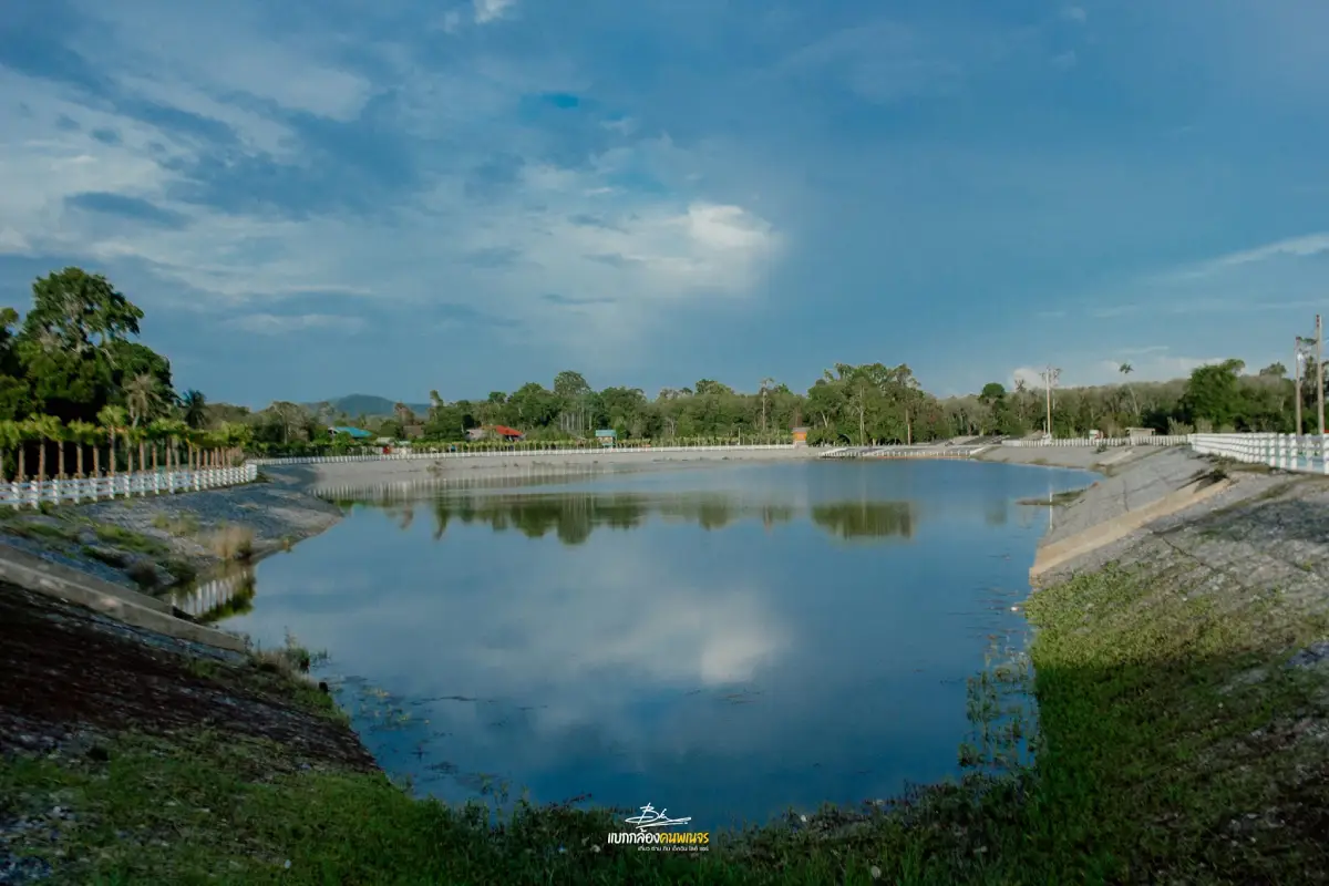
36. Ba Do Lake is a large excavated lake and community water area in Moo 3, Ban Ba Do, Yupo Subdistrict, Mueang Yala District. Its main appeal is the broad water surface set within a local community atmosphere, with open spaces around the lake and natural scenery nearby. Residents use the area for relaxation, exercise, public activities, and community events. Ba Do Lake is gradually becoming a local recreation spot for Yala city residents and visitors who want a simple, quiet place away from busier landmarks.
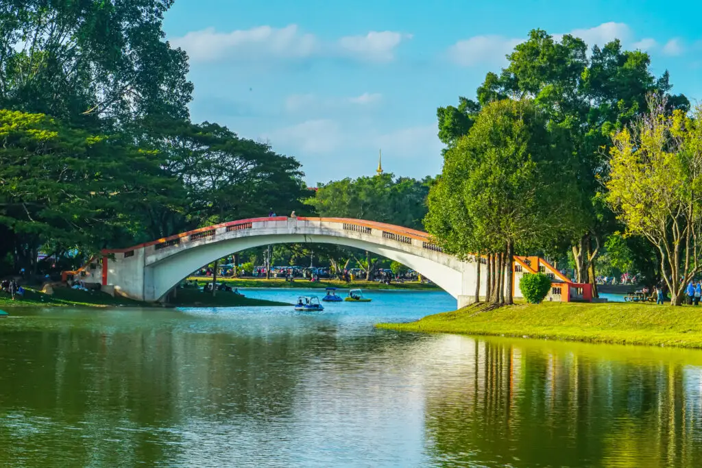
37. Suan Khwan Mueang / Phru Ba Koi is a large public park in the heart of Yala city, located near the Yala City Pillar Shrine. Covering about 207 rai, the park contains a large lake of about 69 rai, landscaped areas, pine trees, sandy edges, sports areas, and family recreation zones. Because Yala has no coastline, the park was designed in part to give residents a seaside-like atmosphere within the city. This “urban beach” feeling makes Suan Khwan Mueang one of the most meaningful public spaces in Yala, suitable for walking, relaxing, exercising, and spending time with family.
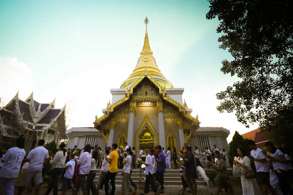
38. Wat Walukaram / Wat Khlong Sai Nai is a Buddhist temple of the Maha Nikaya order located at Ban Khlong Sai Nai, Moo 5, Yupo Subdistrict, Mueang Yala District. It is also known locally as “Wat Tao.” The temple is an important religious site for the Khlong Sai Nai community and reflects the Buddhist side of Yala’s multicultural society. Although it is not a large tourist temple like Wat Khuhaphimuk, it has value as a community temple connected with village life, local faith, agriculture, markets, and long-term Buddhist practice in the southern border region.
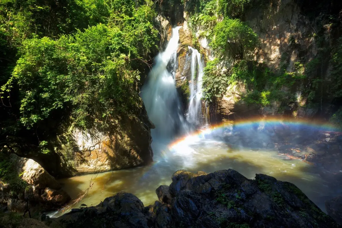
39. La-ong Rung Waterfall is a natural waterfall under the responsibility of Bang Lang National Park. It is located around the route between Than To District and the border-side landscape near Aiyerweng, Betong District, along Highway 410 from Yala to Betong. The waterfall is known for water falling over rock faces and boulders, creating fine spray. When late-morning sunlight passes through the mist, a rainbow-like effect can appear above the pool, giving the waterfall its name. Visitors should walk carefully along the stream and rocks. It fits well into a nature route with Than To Waterfall, Bang Lang Dam, Than To Lake, and Aiyerweng.
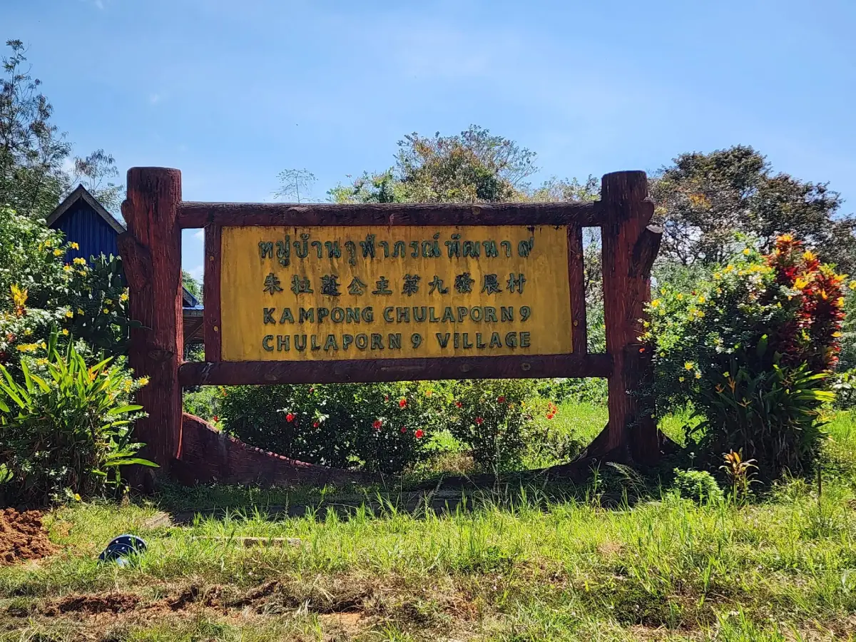
40. Chulabhorn Pattana 9 Village is a community-based attraction in the Hala-Bala forest landscape of Mae Wat Subdistrict, Than To District. The village is known for history, local life, forest scenery, sea mist, waterfalls, streams, a deer farm, camping areas, and community accommodation. Visitors can learn about former Communist Party of Malaya members who became Thai Nation Development Participants, see historical exhibits, old tools, weapons, and memorial sites, and experience a mountain community surrounded by rich forest. The village brings together political history, peace-building, multicultural life, and nature in one meaningful route.
| Article Title | 40 Yala Attractions: Who Says The Deep South Is Scary? It Is Surprisingly Chill |
| Province | Yala Province, Southern Thailand |
| Best For | Nature lovers, cultural travelers, photographers, families, history lovers, slow travelers, and visitors planning a Betong route |
| Main Travel Zones | Mueang Yala, Betong, Aiyerweng, Than To, Bannang Sata, Yaha, Krong Pinang, and nearby forest communities |
| Nature Highlights | Bang Lang National Park, Hala-Bala Forest, Bang Lang Dam, Than To Lake, La-ong Rung Waterfall, Chaloem Phra Kiat Rama IX Waterfall, Bua Phut Site, and Aiyerweng Rafting |
| City And Photo Highlights | Yala Street Art, Rainbow Building, Suan Khwan Mueang, Thailand’s Largest Mailbox, Betong Mongkhonrit Tunnel, Betong Stadium, and Southernmost Point of Siam Sign |
| Cultural And Religious Highlights | Wat Khuhaphimuk, Yala Central Mosque, Keng Hud Chee Shrine, Wat Walukaram, Sakai Village, ASEAN Zebra Dove Singing Contest, and Chulabhorn Pattana 9 Village |
| Suggested 1-Day Route | Mueang Yala route: Wat Khuhaphimuk, Khao Na Tham Foothill Viewpoint, Suan Khwan Mueang, Yala Street Art, Yala Central Mosque, Keng Hud Chee Shrine, and Rainbow Building |
| Suggested 2-Day 1-Night Route | Day 1: Mueang Yala and Than To / Bang Lang route Day 2: Aiyerweng Skywalk, Betong city landmarks, Betong Hot Spring, and Piyamit Tunnel |
| Suggested 3-Day 2-Night Route | Day 1: Mueang Yala cultural and city route Day 2: Bang Lang Dam, Than To Lake, La-ong Rung Waterfall, and Chulabhorn Pattana 9 Village Day 3: Aiyerweng Skywalk, Hala-Bala route, Betong Hot Spring, Piyamit Tunnel, Betong City Museum, and Betong old town |
| Best Time To Visit | Late rainy season to early year is suitable for sea mist, waterfalls, and green mountain scenery. City attractions in Yala and Betong can be visited year-round with proper weather and route planning. |
| Travel Planning Tips | Private car or rental vehicle is the most convenient option because many attractions are spread across different districts. Group nearby places in the same zone and allow extra time for mountain roads, viewpoints, and nature routes. |
| List Of 40 Yala Attractions | 1. Bang Lang National Park 2. Hala-Bala Wildlife Sanctuary / Southern Phra Namma Phithai Forest Park 3. Khao Pok Yo 4. Than To Lake 5. Swiftlets in Betong 6. Bua Phut Site 7. Hua Lan Mountain 8. Sakai Village 9. Reclining Buddha at Wat Khuhaphimuk (Wat Na Tham) 10. Gunung Silipat Sea of Mist 11. Betong Hot Spring 12. Thailand’s Largest Mailbox 13. Aiyerweng Skywalk and Sea of Mist 14. Betong Mongkhonrit Tunnel 15. Khao Bue Yo Viewpoint 16. Yala Learning Park 17. Piyamit Tunnel 18. Yala Central Mosque 19. Yala Street Art 20. ASEAN Zebra Dove Singing Contest 21. Hala-Bala Forest 22. Batu Kho Cave 23. Yala Learning Park / TK Park Yala 24. Betong City Museum 25. Suan Muen Buppha Winter Flower Garden 26. Aiyerweng Rafting 27. Chaloem Phra Kiat Rama IX Waterfall 28. Khao Na Tham Foothill Viewpoint 29. Popcorn Island 30. Southernmost Point of Siam Sign 31. Rainbow Building 32. Keng Hud Chee Shrine 33. Tae Pu Su Bridge 34. Betong Stadium 35. Bang Lang Dam 36. Ba Do Lake 37. Suan Khwan Mueang / Phru Ba Koi 38. Wat Walukaram / Wat Khlong Sai Nai 39. La-ong Rung Waterfall 40. Chulabhorn Pattana 9 Village |
Frequently Asked Questions (FAQ)
Q: What Is Yala Best Known For?
A: Yala is best known for its inland southern landscape of mountains, tropical rainforest, sea mist, waterfalls, reservoirs, city parks, religious landmarks, Betong attractions, and multicultural borderland communities.
Q: Which Yala Attractions Should First-Time Visitors Not Miss?
A: First-time visitors should consider Aiyerweng Skywalk, Piyamit Tunnel, Betong Hot Spring, Bang Lang Dam, Suan Khwan Mueang, Wat Khuhaphimuk, Yala Street Art, Yala Central Mosque, and Hala-Bala Forest.
Q: How Many Days Are Needed To Visit Yala?
A: A short city trip can be done in 1 day, but travelers who want to cover Mueang Yala, Than To, Aiyerweng, and Betong should plan at least 3 days and 2 nights. More time is better for waterfalls, forest routes, and community attractions.
Q: Does Yala Have Beaches?
A: Yala has no coastline and is the only province in Southern Thailand without access to the sea. Its main attractions are mountains, forests, dams, lakes, waterfalls, viewpoints, city landmarks, and cultural sites.
Q: Where Can Visitors See Sea Mist In Yala?
A: The most famous sea mist viewpoint is Aiyerweng Skywalk in Betong District. Gunung Silipat is another impressive viewpoint for active travelers who are comfortable with a steeper route.
Q: What Are The Main Attractions In Betong?
A: Major Betong attractions include Aiyerweng Skywalk, Betong Hot Spring, Piyamit Tunnel, Betong Mongkhonrit Tunnel, Thailand’s Largest Mailbox, Betong City Museum, Suan Muen Buppha, and the Southernmost Point of Siam Sign.
Q: Is Yala Good For Nature Travel?
A: Yes. Yala is excellent for nature travel because it has Bang Lang National Park, Hala-Bala Forest, Bang Lang Dam, Than To Lake, waterfalls, caves, rafting routes, mountain viewpoints, and community forest areas.
Q: What Is The Most Convenient Way To Travel Around Yala?
A: A private car or rental vehicle is the most convenient way to travel around Yala because attractions are spread across several districts and some routes pass through mountain roads or natural areas.
 Category: ●Travel Articles, Recipes
 Group: ●Travel Review, Food Review
Last Update : 6 DayAgo
 Last Update : 6 DayAgo
 Art, Culture and Heritage
 Landmarks and Memorials(1)
 Art, Craft Centres, Tradition(2)
 Museums(2)
 Educational Places
 Educational Gardens, Farm(1)
 Places of Worship
 Temple(6)
 Mosque(2)
 Other Sacred Sites(3)
 Suburban Living
 Village, Community(4)
 Nature and Wildlife
 National Parks and Marine Reserves(2)
 Mountain (Doi)(5)
 Dam, Reservoir, Lake(5)
 Waterfalls(13)
 Hot Springs(2)
 Caves(7)
 River, Canal(4)
 Islands(1)
 Other natural attractions(8)
 Entertainment and Agricultural
 Stadium(1)
 Farms, Parks and Ecotourism(4)
 Outdoor and Adventure Activities(1)
Travel Review, Food Review(2)
Outdoor and Adventure Activities(1)
Travel Review, Food Review(2)


